Seven
FARMS TO FREEWAYS AND TRACTS
This is an era of town building in Southern California, and it is proper that it should be so, for the people are coming to us from the East and from the North and from beyond the sea. . . . For the great multitude whose faces are turned with longing eyes toward this summer land, and who will want homes among us, we must provide places.
—Pasadena Daily Union, 1887
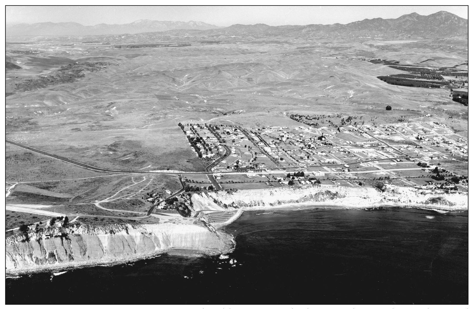
POST-WAR AND PRE-FREEWAY TOWN. The old Dana Point had ventured east only to Selva Road and north only to Street of the Green Lantern. The Dana Point that erupted in the 1950s would extend in all directions except seaward. That growth would come in the next decades. Foothills of the Santa Ana Mountains and farmlands of the Capistrano Valley framed the coastal community when this aerial view was captured in 1957. (Pacific Air Industries photograph.)
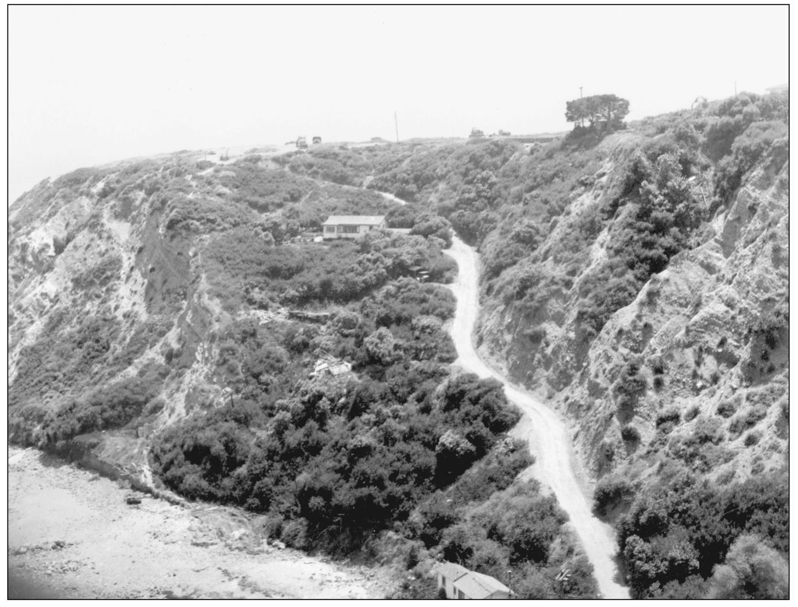
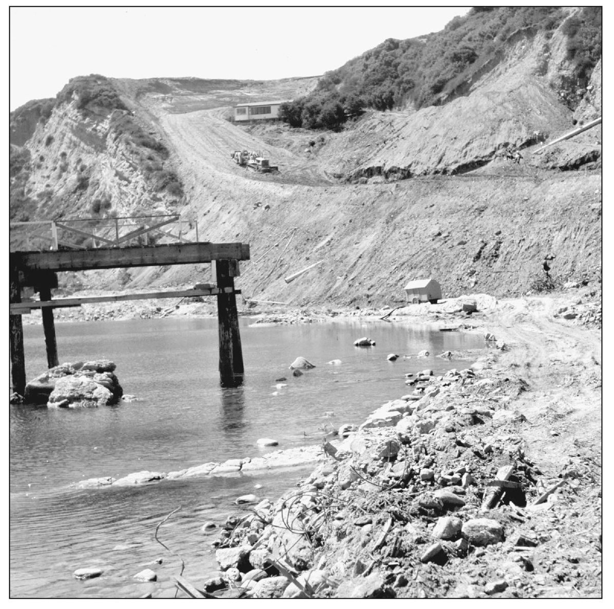
OVERGROWN COVE ACCESS. The Orange County Harbor District began compiling engineering data in the 1950s for the advent of a harbor at Dana Point. In 1956, the county designated Dana Cove as a recreation area. Work began to turn steep Cove Road into a serious entry connecting with Pacific Coast Highway. The old caretaker’s cottage on the hill was preserved to serve another era. The 1920s fishing pier, at lower left, was cut away and demolished. (Both Orange County Archives.)
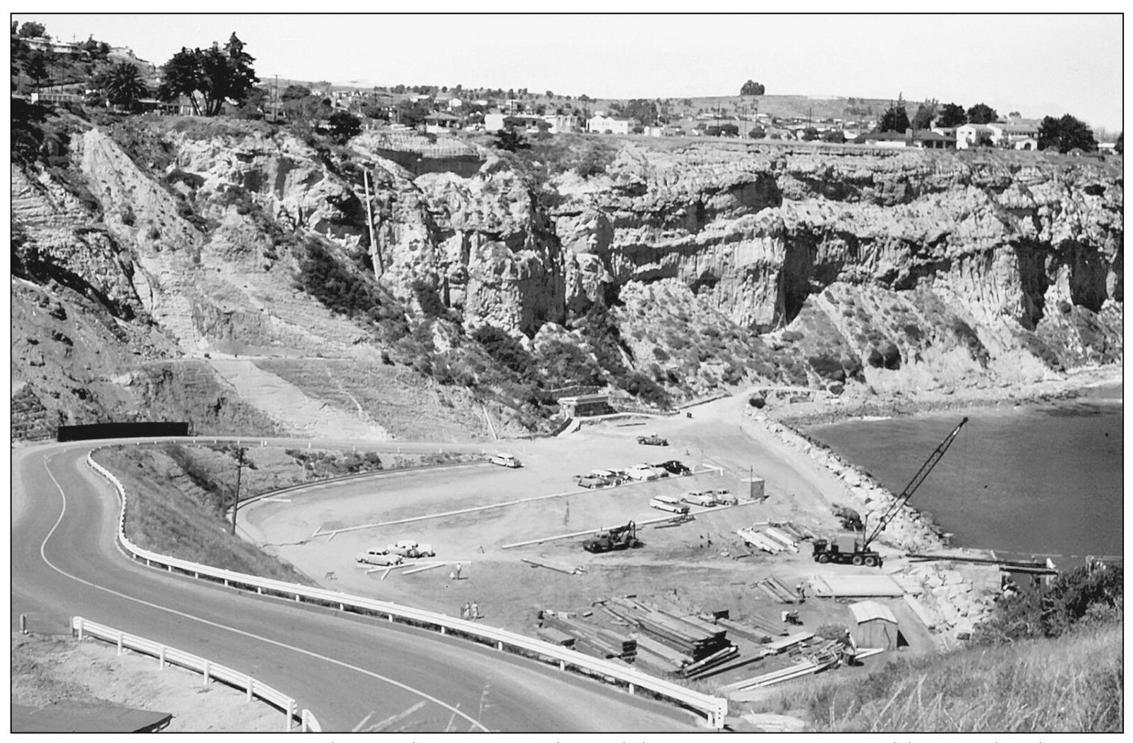
DANA COVE PARK. Once the road was strengthened, heavy equipment could meander down to fill some sea bottom, creating a parking lot and picnic area. It was hailed as the first unit of the proposed small-craft harbor. Proposals starting in the late 1940s suggested that Capistrano Bay was the ideal location for a harbor of refuge. In 1957, a new 300-foot fishing pier replaced the 1920s model. (Courtesy Orange County Archives.)
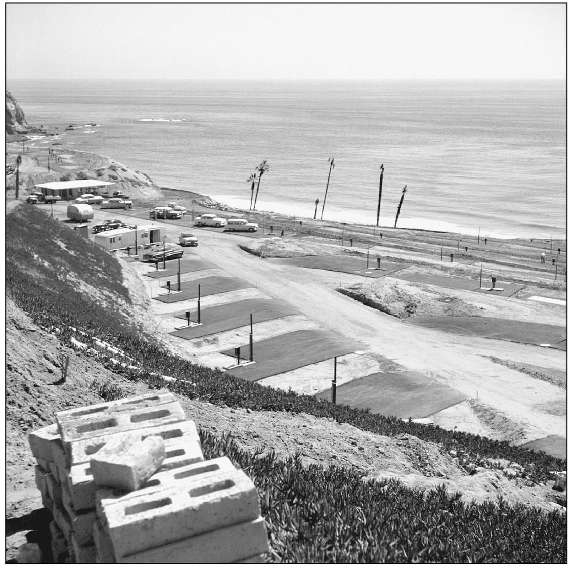
DANA STRAND TRAILER PARK. In the mid-1950s, on this northern edge of the headlands, pads were graded for the weekend trailers of members and guests. The Strand Beach and Tennis Club offered a pool, tennis courts, clubhouse, and a private beach. In 1988, the club was closed. In 2006, this site became the Strand at Headlands, where luxury lots have sold for an average of more than $5 million. (Courtesy Orange County Archives.)
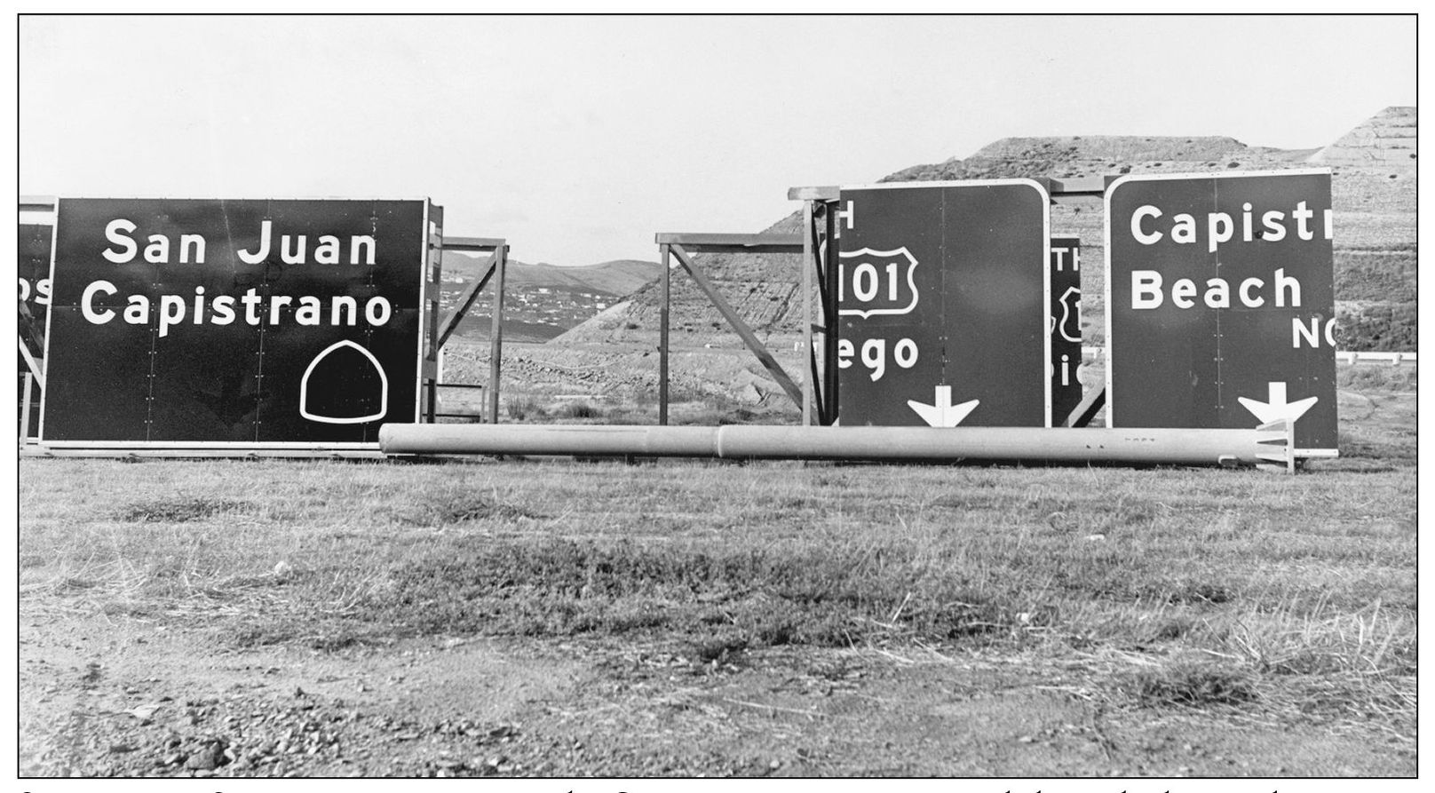
SCRAMBLED SIGNS OF THE TIMES. The San Diego Freeway opened through the south coast in 1958, but it took a while longer for on-ramps and off-ramps and signs to be put in place. At the Capistrano Beach on-ramp, plans were laid for the freeway to connect with yet another freeway running along the coast. Public outcries quelled that project, but it left this unfinished section with an especially complicated intersection. (Photograph by the author.)
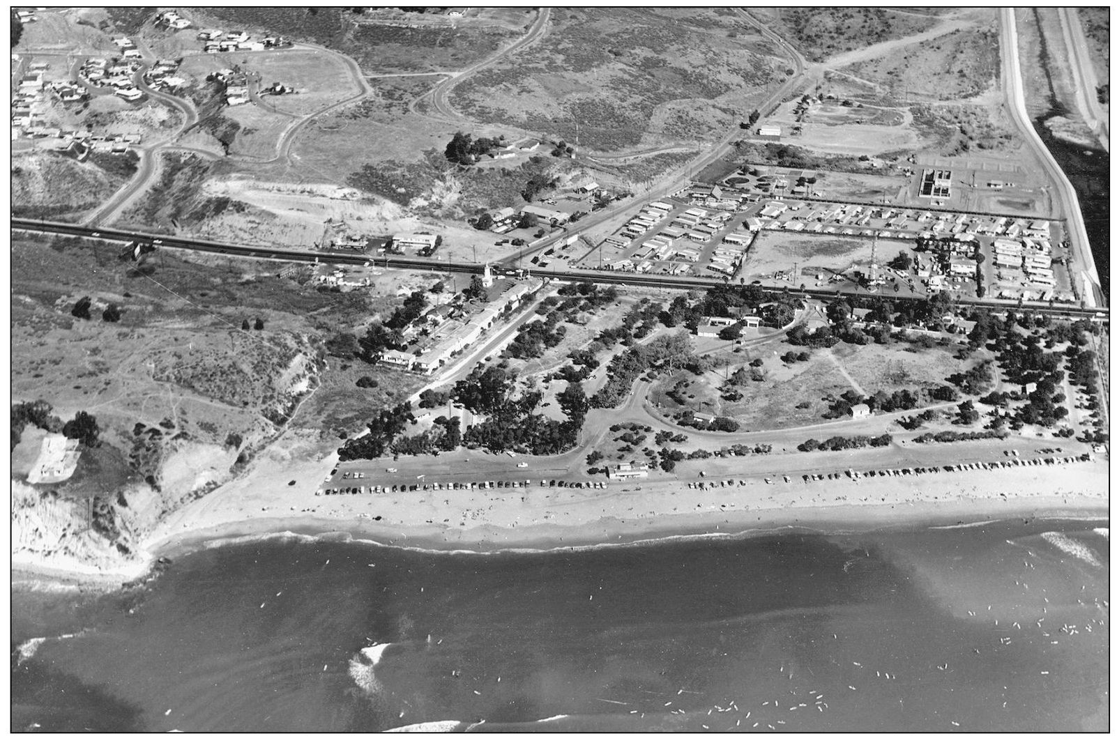
STATE BEACH AND HIGHWAY, 1965. By this time, Doheny Beach Park was well landscaped. Delighted visitors lined its shore when parking was allowed along the beach. A mobile home park had come to surround the Atlantic Richfield tower and service station on Pacific Coast Highway. The Dana Villa (at center) continued to be the town’s best-known hotel accommodation, and its restaurant was popular to those traveling the San Diego Freeway (I-5).
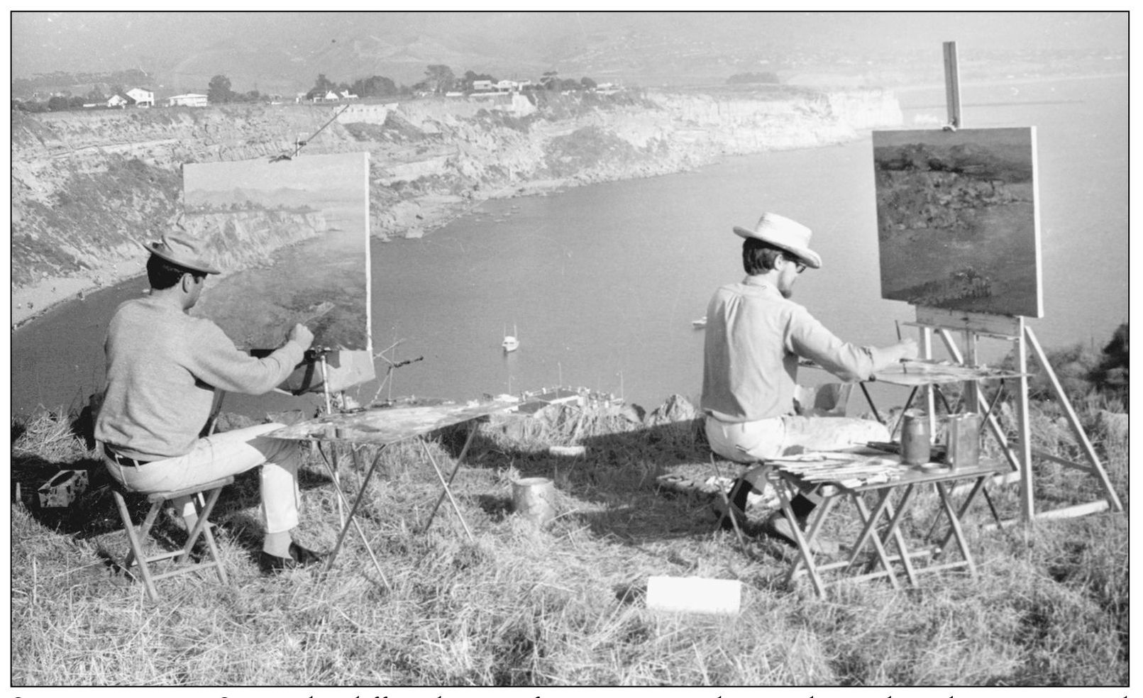
STILL ROMANTIC SPOT. The cliffs and coves of Dana Point in their unchanged condition continued to draw artists through the decades to capture their color and configurations. Dana Point had been the first drawing card for artists in the late 1800s, but because there were no hotel accommodations, the artists’ colony grew at Laguna Beach instead. (Photograph by the author.)
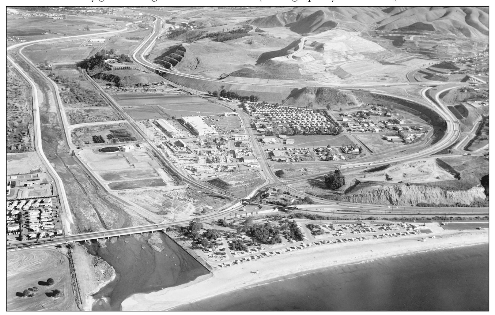
FREEWAY MEETS CAPISTRANO BEACH. South of San Juan Creek, the freeway/highway connection is visible, as is the full house at Doheny State Beach’s campground. Inland beyond the freeway, construction pads for various housing tracts are visible, a sign of the changes in store for this community. Commercial buildings in Capistrano Beach and the school district headquarters and bus yard are visible beside the freeway. (Courtesy Smetona Photo.)
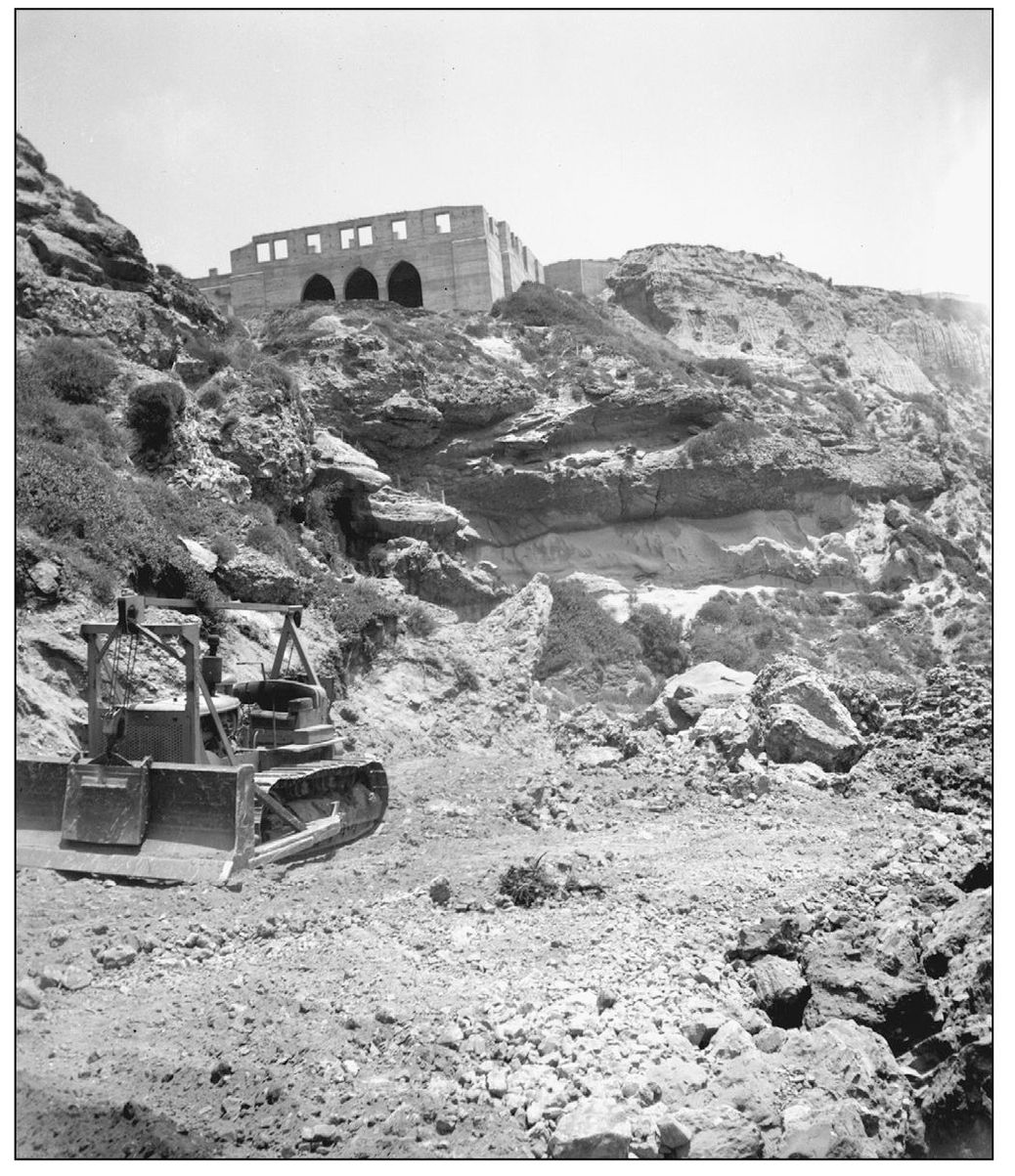
ERA OF TRACTORS. Bulldozers, working in Dana Cove during the 1950s to create a picnic park, moved dangerously near the old Dana Inn’s “three-eyed” remains on the blufftop. By then the arches that were to be a focal point of its architecture had been sealed shut to prevent intrusion by unruly vandals and visitors. (Courtesy Orange County Archives.)
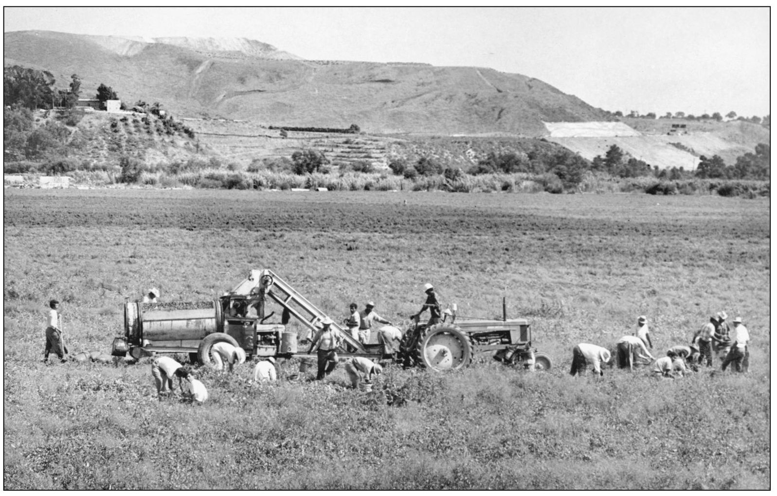
VALLEY FARMLANDS. On the outskirts of Dana Point, the Capistrano Valley was still the scene of farming in the 1960s. After the rancho area, when most of the land had been used for cattle grazing, vegetable crops became a local specialty. After tomatoes were picked by hand, a tractor pulled machinery that pulverized them for canning. (Photograph by the author.)
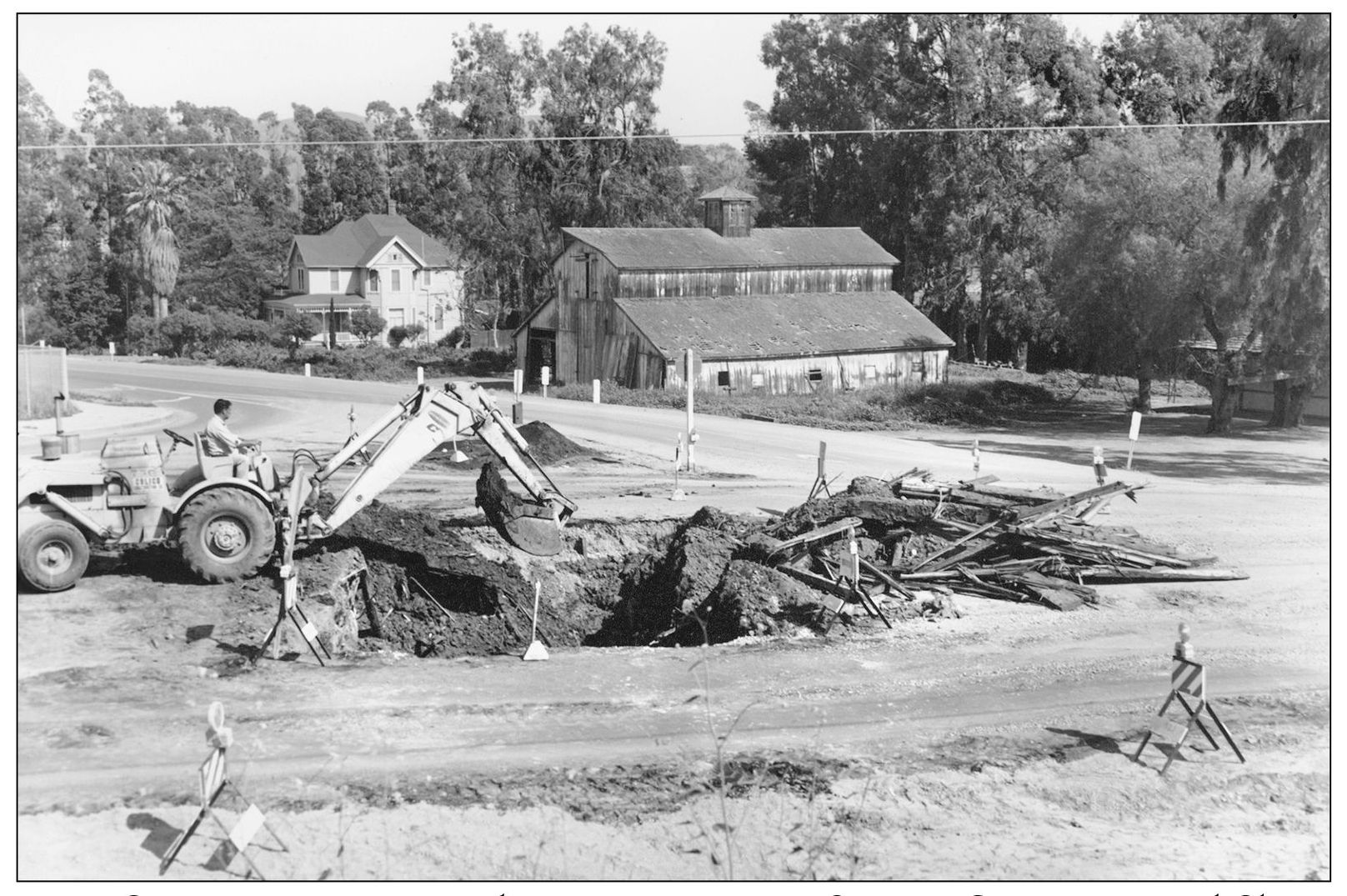
FARMS GIVE WAY TO TRACTS. Where Dana Point meets San Juan Capistrano on Del Obispo Street, farmlands stretched along the valley side of the road. In the mid-1960s, a backhoe excavates a section of Blue Fin Drive during construction of Dana Point’s first housing tract, Dana Point Knolls, across from Remmers’ Mission Bell Ranch. (Photograph by the author.)
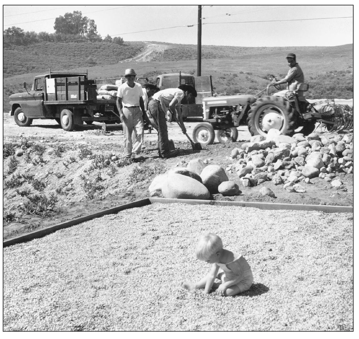
REFINING ROCK USE. Homeowners within new tracts in Dana Point were challenged by adobe soil and an overabundance of rocks. Landscapers like Harry Otsubo and his crew extracted all these boulders from one backyard in 1963, replacing them with lawn. But in one corner, they traded the rocks for tiny river pebbles to create a young resident’s anxiously awaited “rock box.” (Photograph by the author.)
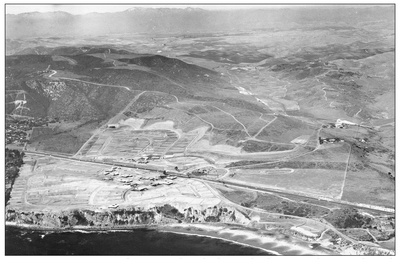
MONARCH BEACH BEGINS. The year 1961 brought the first development of the Monarch Beach section of Dana Point. It began with Monarch Bay and Sea Terrace by the Laguna Niguel Corporation, which acquired another 850 acres on the inland side of the highway, then sold it to Avco Community Developers in 1970 for development of Niguel Shores. This coastal area voted to become part of the new city of Dana Point in 1989.
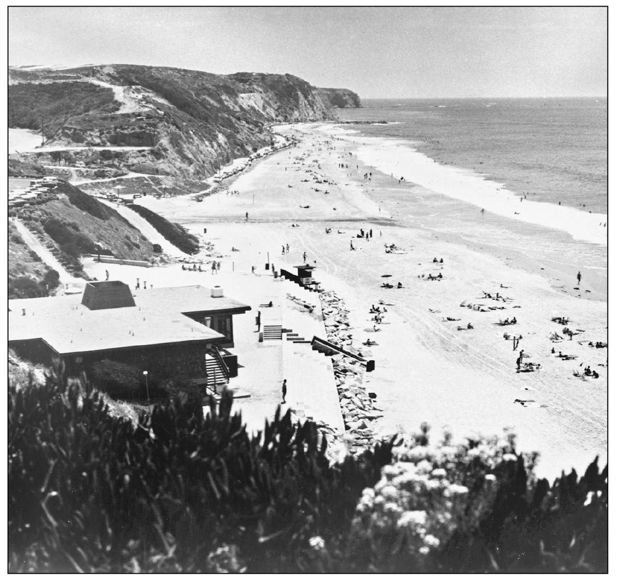
MONARCH BAY CLUB. First this was the beachfront community center for the private Monarch Bay development. The view extends down the coast to the Dana Point promontory. When the St. Regis Hotel was developed during the late 1990s, the Monarch Beach Golf Links and this club became affiliated with it, along with access to one hole taking golfers under the highway and onto an oceanfront green. A tram also runs between the hotel and beach club.
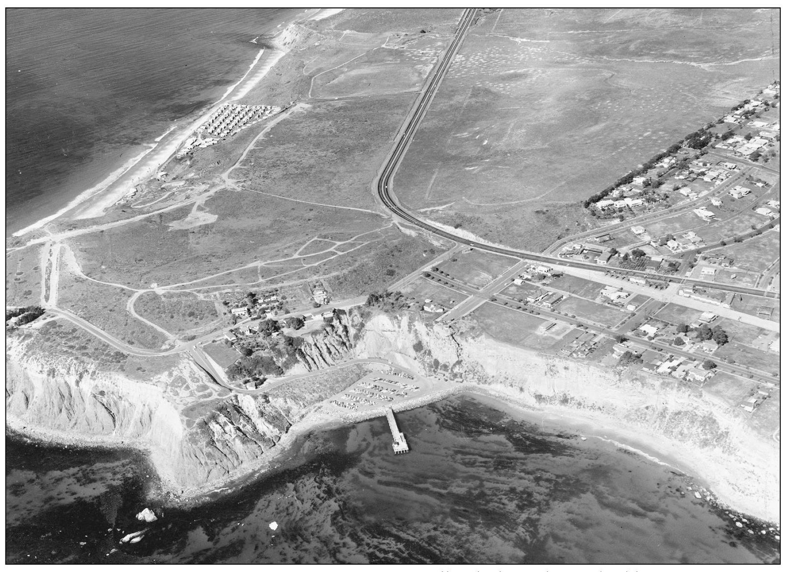
HEADLANDS AERIAL VIEW, C. 1960. Dana Point Headlands showed some building, some fencing, some trails, and Dana Strand Trailer Park (at left). Kite-flying contests, sailboat regattas, and cigarette-boat races became crowd-drawing events on the rest of the windy promontory. The new parking lot in Dana Cove Park was full beside the pier.
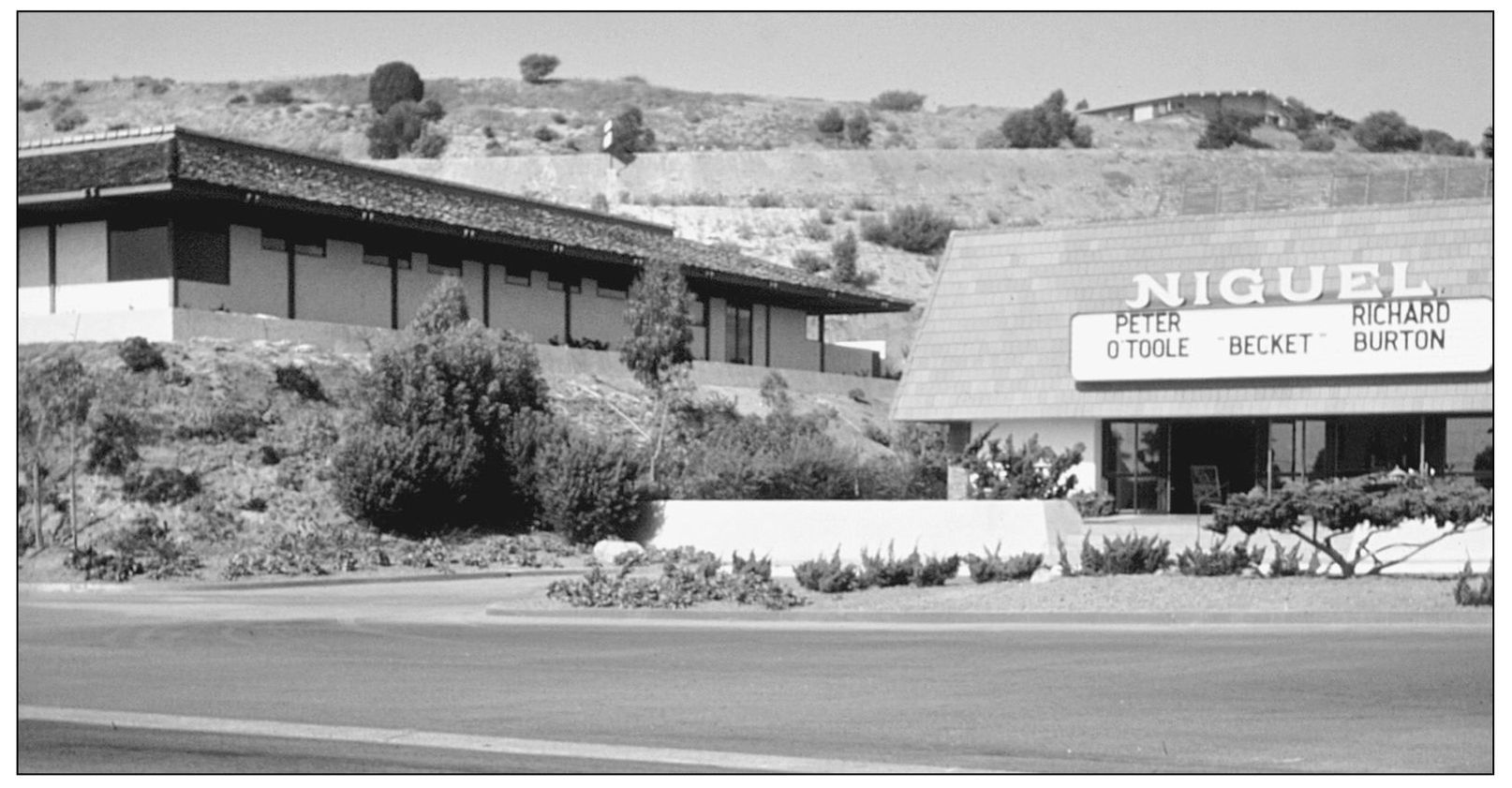
PREVIEWING COMING ATTRACTIONS. The Niguel Theater in Monarch Bay Plaza was owned by the family of actor James Cagney, an investor in the 1920s Dana Point Syndicate. Here, in the mid-1960s, it featured the movie Becket. Archbishop Becket was murdered, then became a saint. This theater flooded so often it was closed to public gatherings. It was eventually demolished to become part of an upscale shopping center. (Courtesy Orange County Archives.)
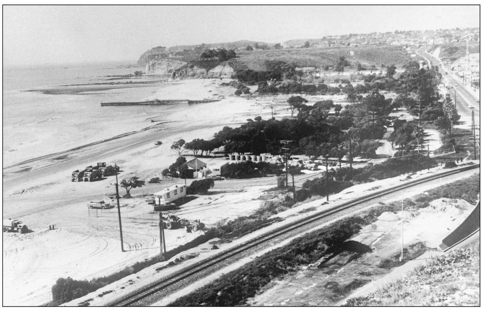
DOHENY BEACH EXPANSION. More land from the Santa Fe was acquired in 1942, and more was acquired from Union Oil in 1957. Then the Doheny Marine Life Refuge was created, and this park became the top revenue earner in the state system. In 1965, 800,000 cubic yards of sand were brought in from Camp Pendleton. By 1968, the popular park introduced advance reservations for camping. “Thor’s Hammer” groins to help lessen sand erosion are visible at upper left.

GREENERY OF THE 1950s. Looking northwest along the Pacific Coast Highway, several landmarks from the 1920s remained, including the Richfield Tower and Dana Villa, the railroad bridge, and the highway itself. The entrance to Doheny Beach was then on Pacific Coast Highway. (Courtesy Doheny State Beach.)
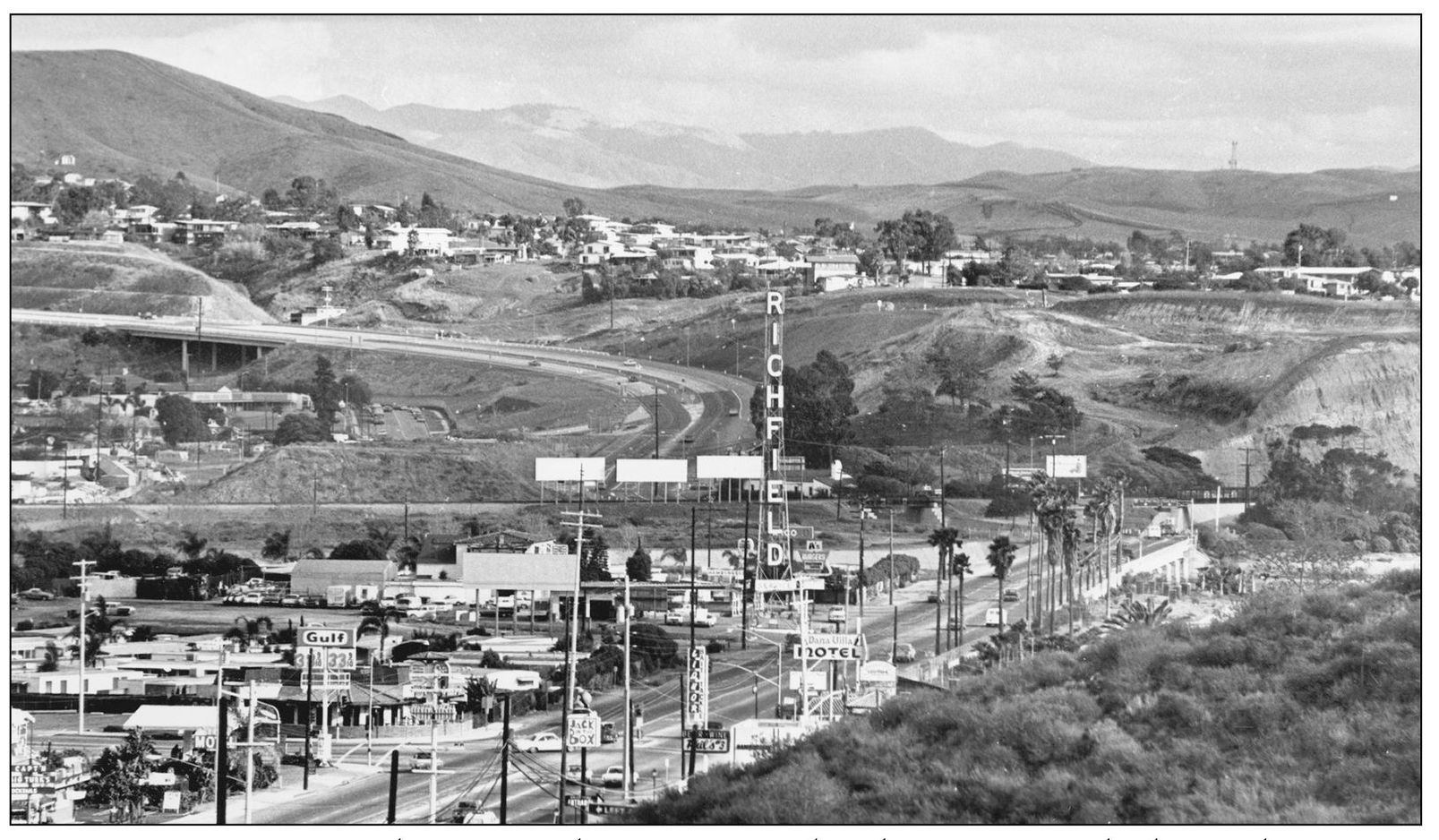
MIX OF THE 1960s. By the 1960s, advertising signs lined Dana Point’s highway, this section located between Del Obispo Street and Doheny Park Road. One competitor (lower left) of the Richfield station was advertising gasoline at 33.9¢ a gallon. The 125-foot-high Richfield tower was dismantled in 1971. Development can be seen surrounding the freeway intersection on all levels. (Photograph by the author.)
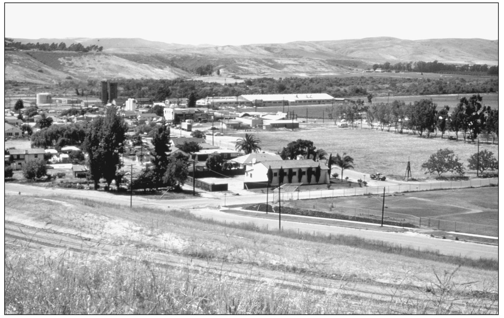
DOWNTOWN CAPISTRANO BEACH. The business section of 1960s Capistrano Beach along Doheny Park Road offered a mix of businesses, including Reeves rubber factory in the background. In the foreground is St. Edward’s Catholic Church. The railroad water towers can be seen in the left background. One train engine exploded there while filling its boilers during that decade. (Courtesy Orange County Archives.)
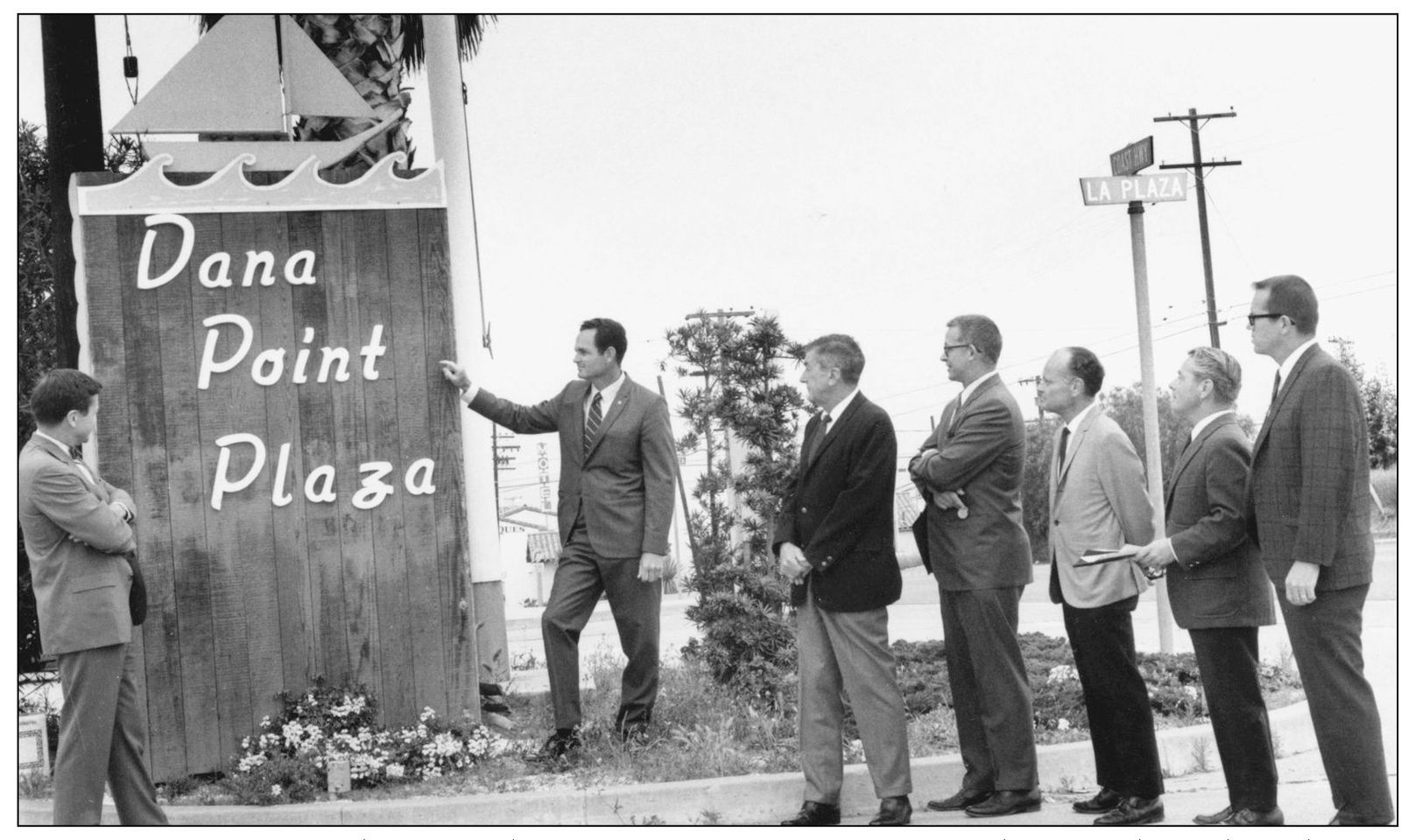
DANA POINT PLAZA. The 1920s plans for Dana Point’s town center designated a U-shaped street above the highway as La Plaza, “the marketplace, a town square.” This 1970s scene saw South Coast Scenic Improvement leaders admiring the sailboat-decked sign. The flagpole that still stands behind it is the mast of a sailing ship that was wrecked on the rocks in pre-harbor days and salvaged by local citizens. (Photograph by the author.)
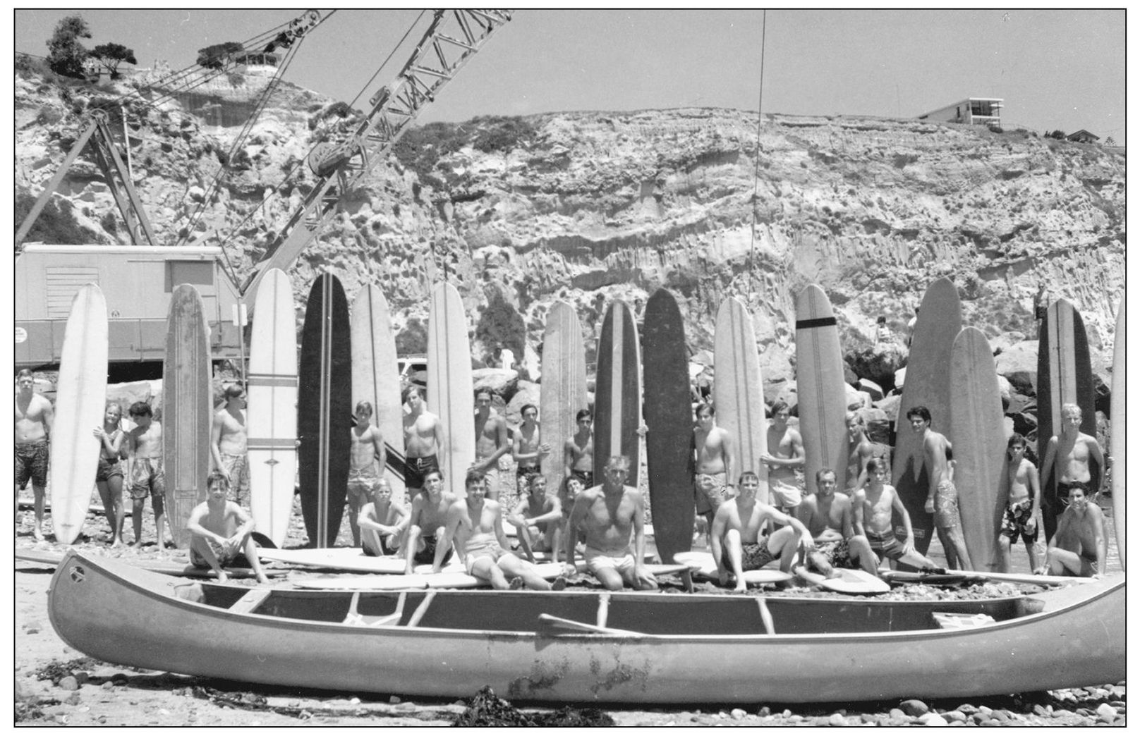
FUNERAL FOR KILLER DANA. Dana Cove, which had become a surfing legend in the 1950s, was closed to water sports in 1966 to facilitate the building of Dana Point Harbor. As a crane prepared to drop the first breakwater boulder, surfers surrounded legendary canoe surfer Ron Drummond of Capistrano Beach to pose at a funeral for Killer Dana.