Eight
NAUTICAL REBIRTH DANA POINT HARBOR
We are dedicating more than a harbor; we are dedicating a facility for the enjoyment of all people, a multi-purpose recreational facility offering educational, historical and scientific opportunities unequaled elsewhere in projects of this type.
—Brig. Gen. F.A. Camm U.S. Army Corps of Engineers, Dedication Day 1971
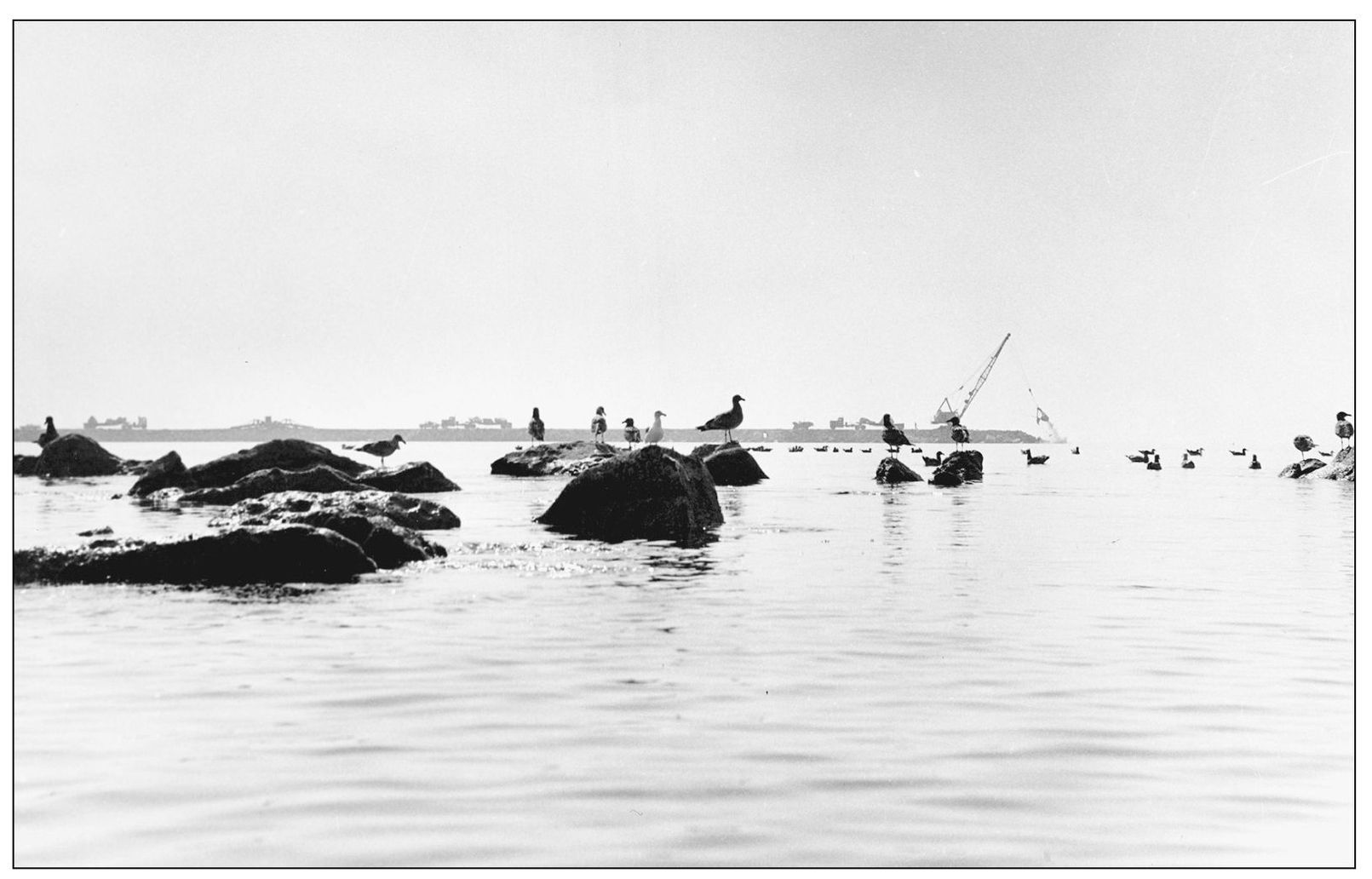
PREVIEW OF CHANGE, 1966. Sea birds that made their home in Dana Cove watch as harbor breakwater construction creates a growing stone wall between them and the open ocean. Synchronized heavy-duty trucks moved back and forth along the two jetties. At the end of each, a crane plucked and placed capstones, each weighing up to 20 tons, into place with precision. (Photograph by the author.)
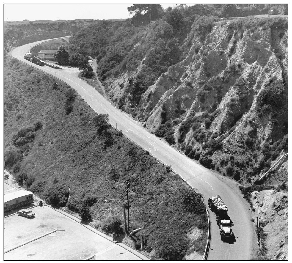
ROCK PARADE. For two years, a total of 27,000 truckloads of huge rocks for the breakwater capstones moved with precision through town along Coast Highway, then down reinforced Cove Road (pictured here) for the west jetty. The east breakwater was reached via a newly created dirt road beside the Dana Villa Motel, later paved to become the entry of Dana Point Harbor Drive. (Photograph by the author.)
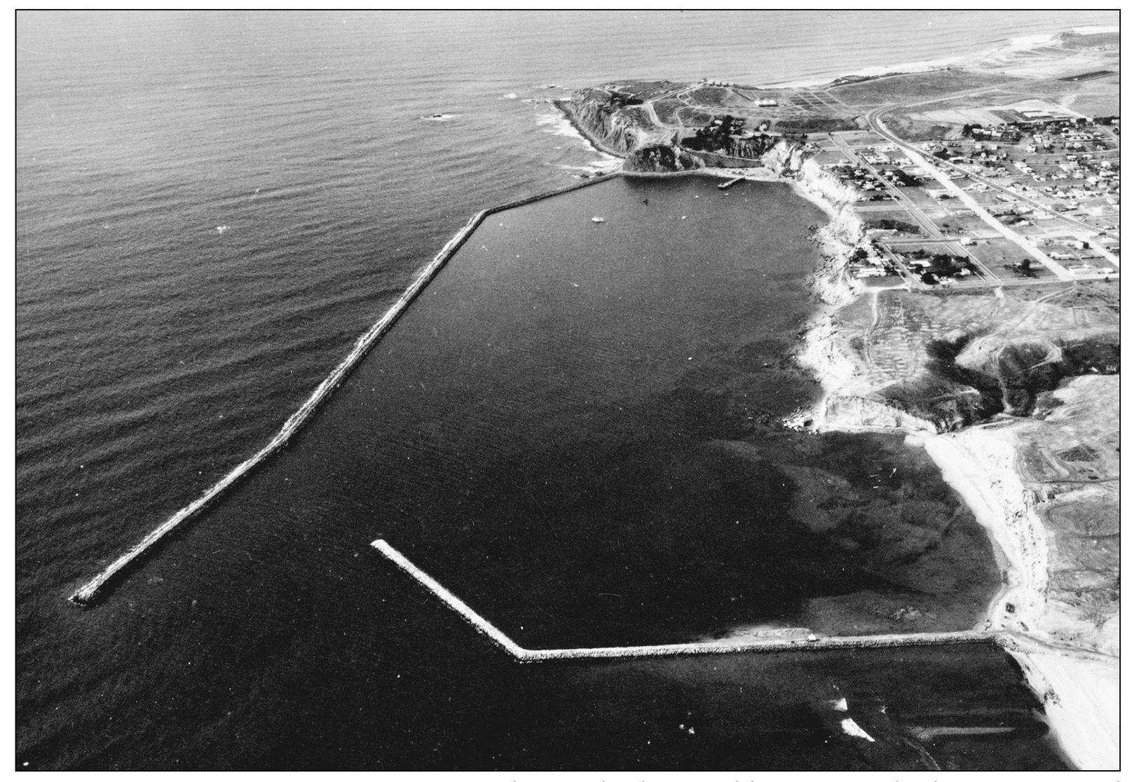
BREAKWATERS DEFINE HARBOR, 1968. The new harbor would encompass both coves pictured here—Dana Cove at the top of the photograph and Fishermen’s, seen beyond San Juan Point. The latter would be cut away and used as fill along the edge of the bluffs and to create a cofferdam. The 1920s promise of a “stillwater bay” had finally been realized.
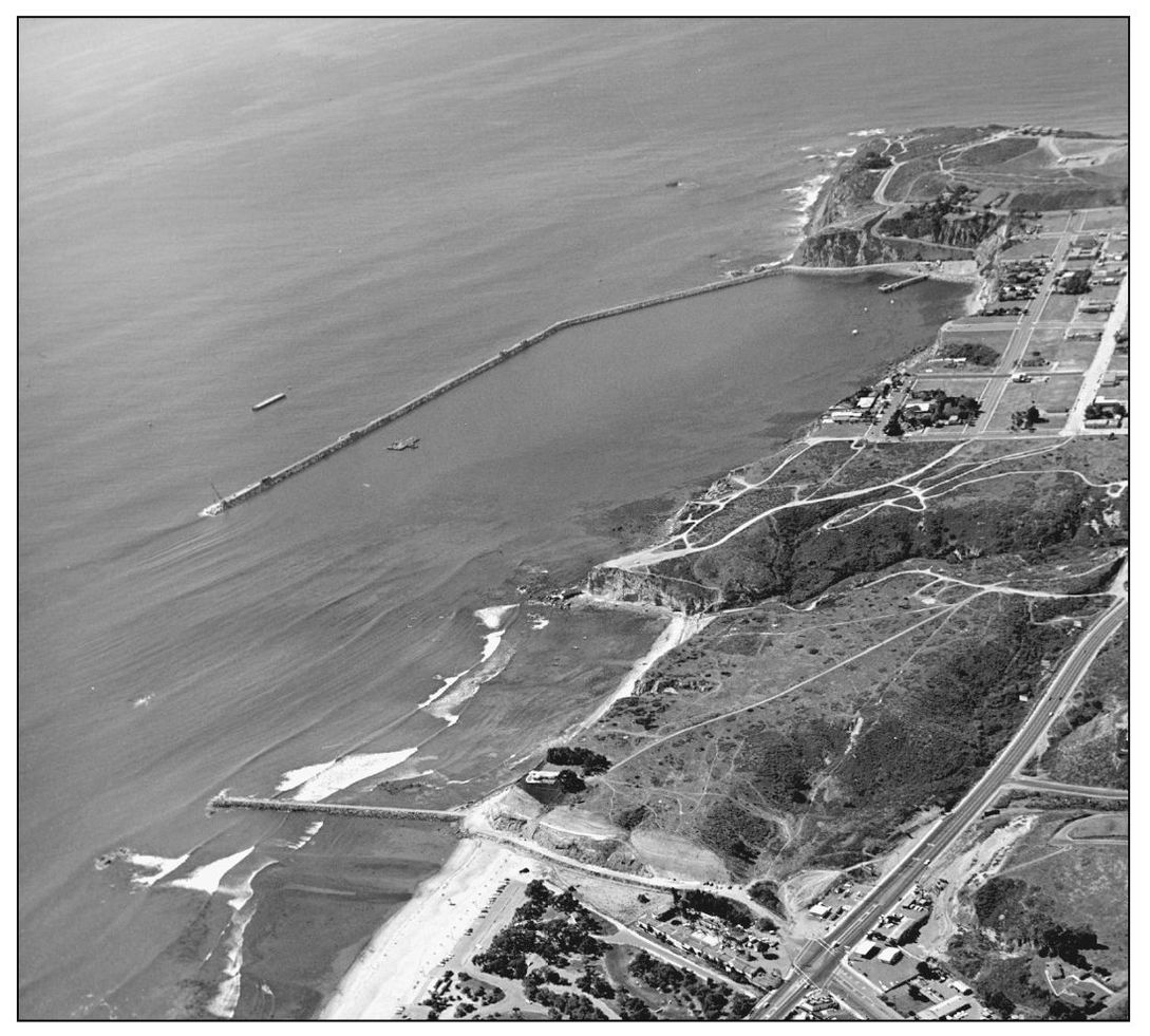
WHOLE AREA TO CHANGE. A last look at San Juan Point, at center between the two breakwaters, is offered in 1968 before earthwork would begin. As Dana Point Harbor construction within the breakwaters was happening, so was major redevelopment of Doheny State Beach. Its main entrance would be diverted from the Pacific Coast Highway to the new road entering the harbor. (Courtesy Smetona Photo.)
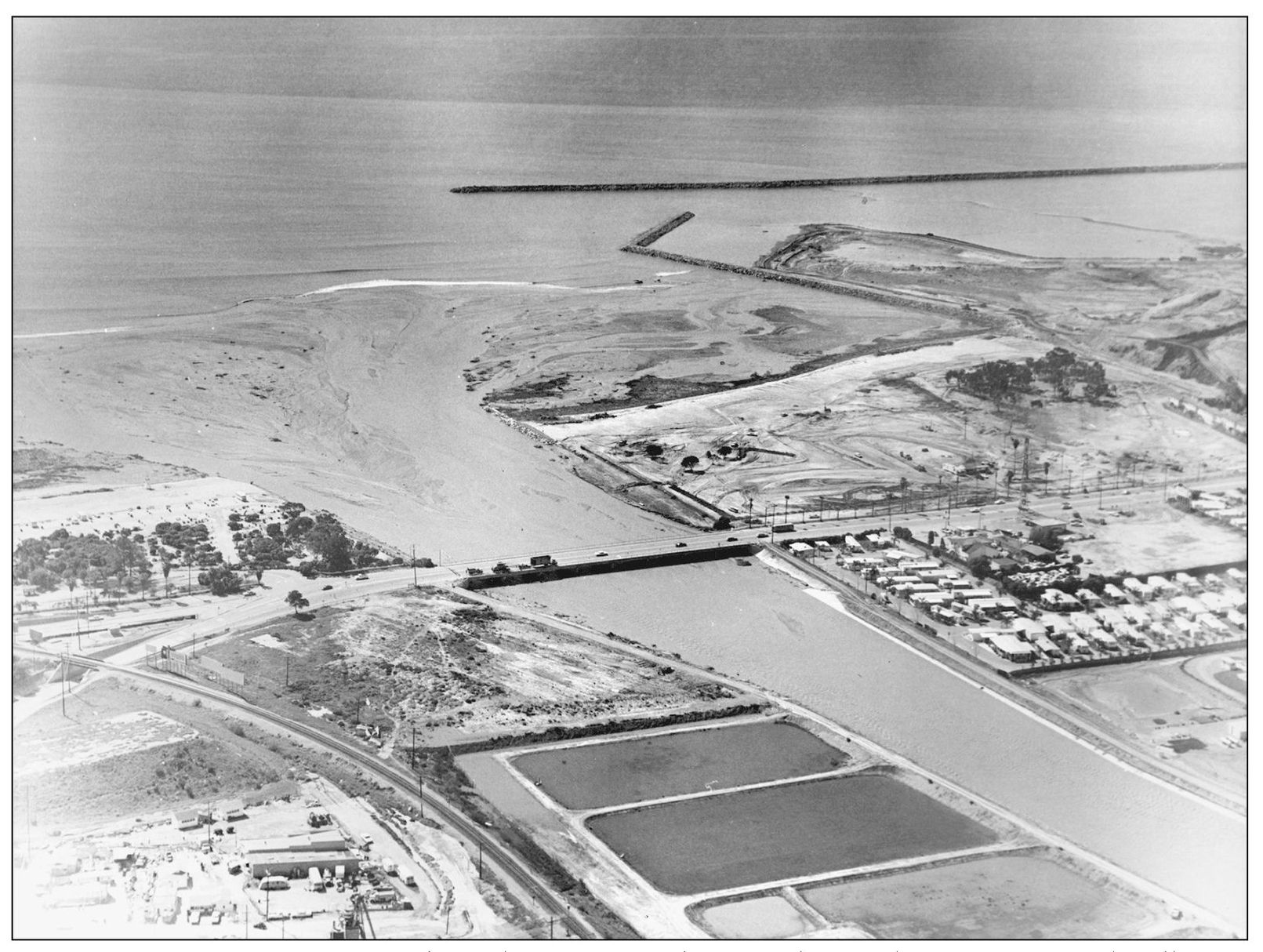
DIRTY WORK ALL AROUND. This February 1969 photograph reveals San Juan Creek full from winter storms, its accumulated silt flowing out to sea. The extensive buildup along Doheny Beach beside Dana Point Harbor’s new breakwater eventually necessitated dredging. Restructuring of the Doheny campground north of the creek was also underway, as was interior “dirty work” within the harbor at top right. The former Dana Point Marina Mobile Home Estates is seen at lower right.
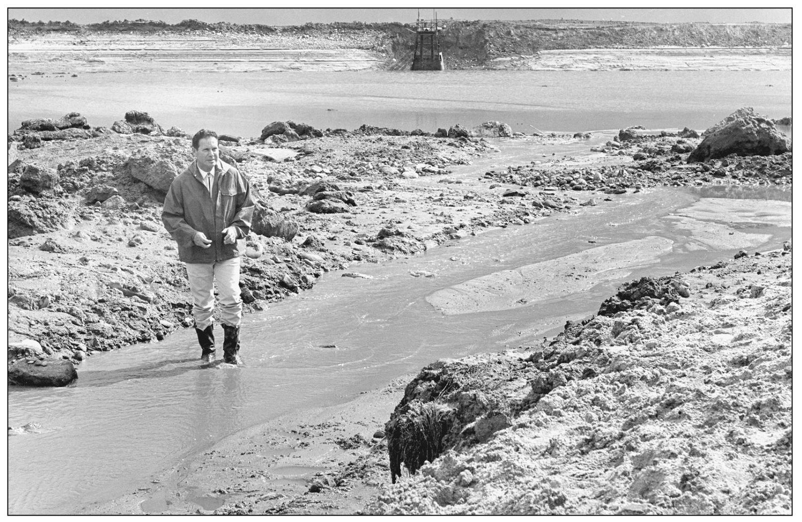
STANDING DEEP. An earthen cofferdam was constructed within the two breakwaters in order to give berthed boats a second protection from wave action. Surveying his “field office,” resident engineer Jack Raines watches the sea bottom emerge as 4,000 gallons of water a minute are being pumped out by a two-story pump, at center back. (Photograph by the author.)

TOPSIDE VIEW OF FUTURE. Local youngster Blair Dana Walker gets his first engineering lesson watching the earthwork of harbor construction during 1969. Land construction vehicles maneuvered throughout the drained and graded areas. The launching ramp basin is visible behind Walker’s head, while heavy equipment refines the landfill to shape roads, business pads, and parks. Beyond them is the empty East Basin. (Photograph by the author.)
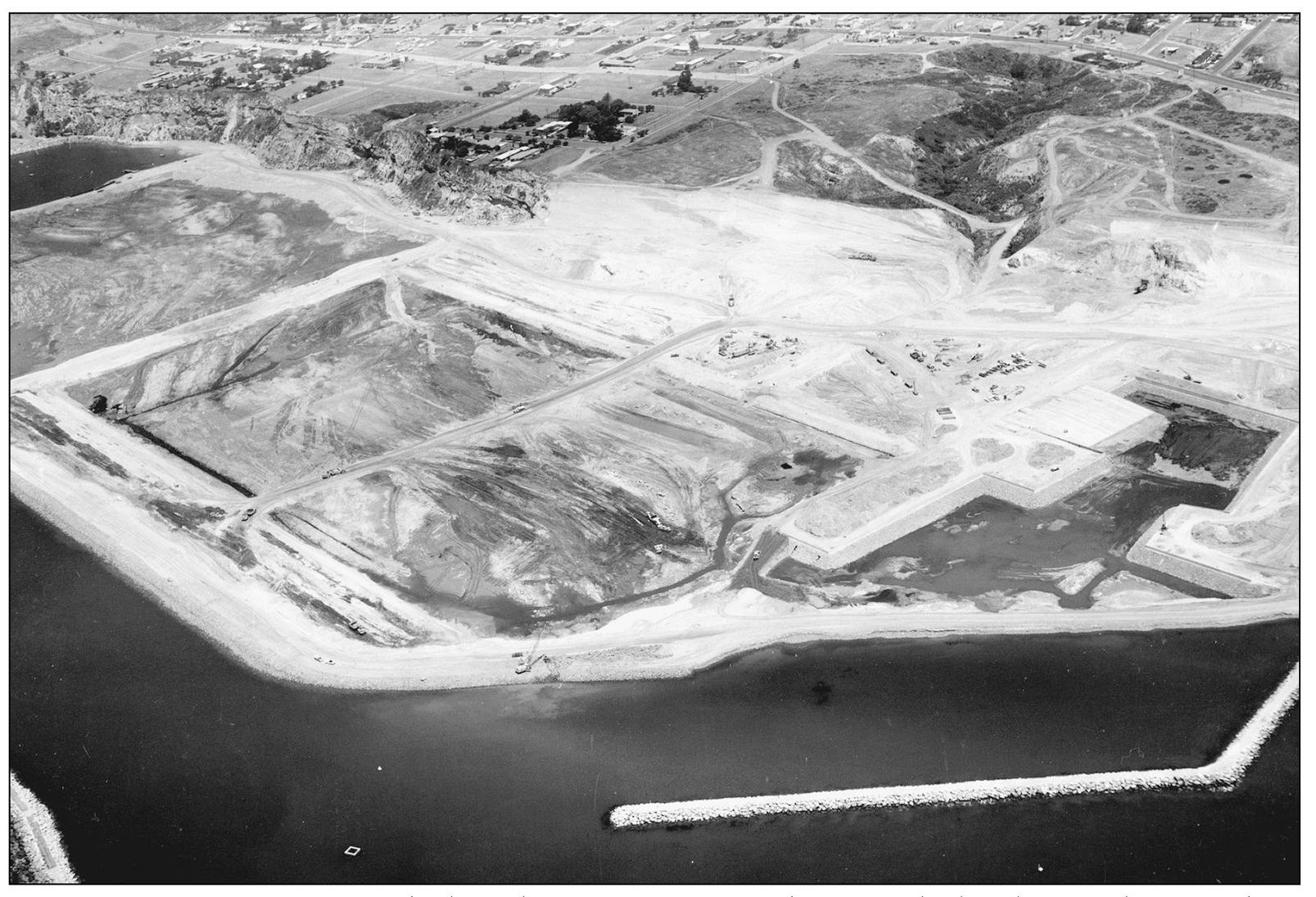
THREE BASINS DEVELOPED. The launching ramps, at far right, await the breaking of the cofferdam, enabling 50 million gallons of seawater to rush back in. The East Basin, at center, would be completed next, followed by the West Basin. Historic San Juan Point was already cut away (see background) and carried out to sea to form the landfill and the cofferdam. (Courtesy Geotronics.)
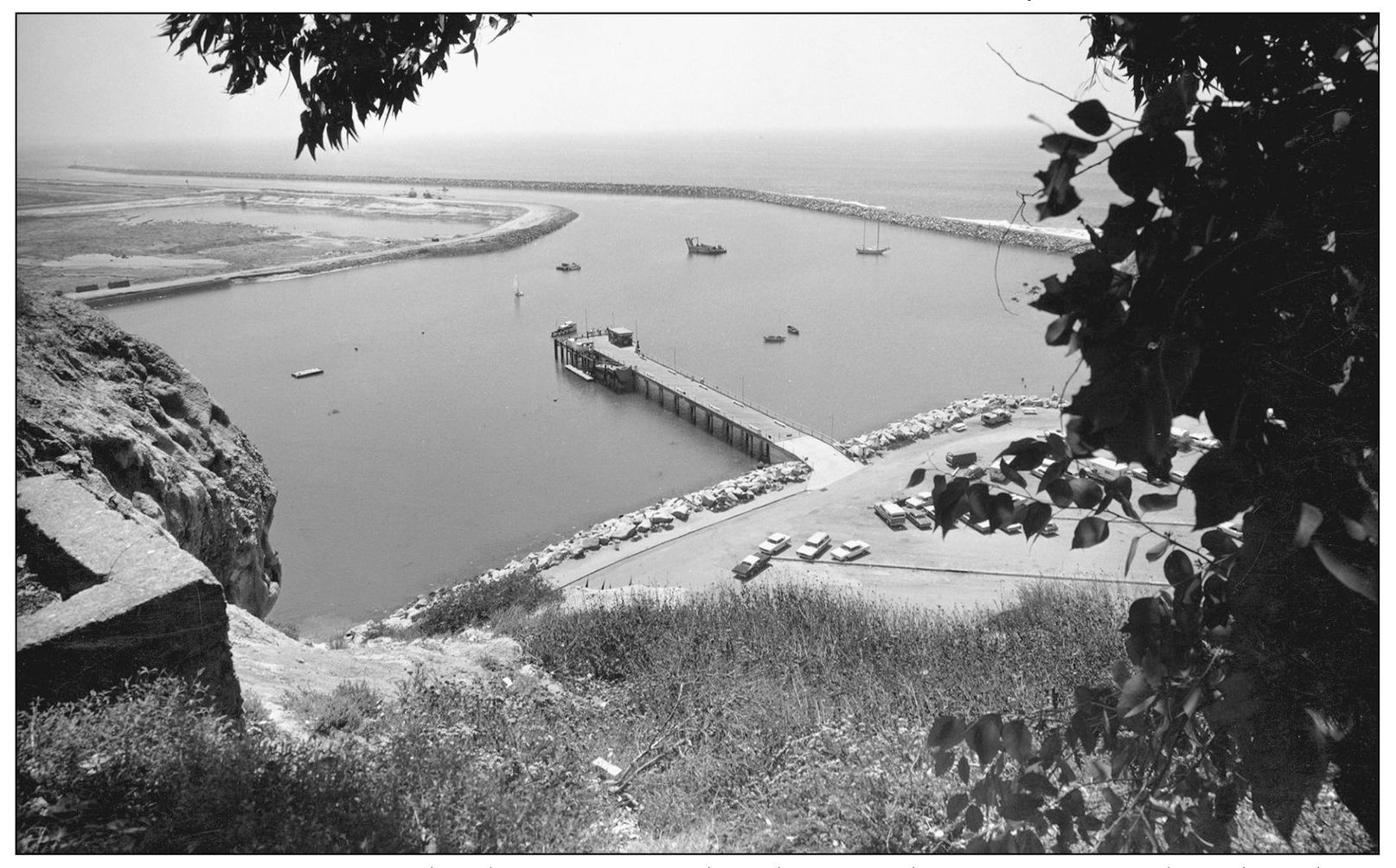
CHANGING VIEW. As groundwork continues within the cofferdam, as seen at far left, the fishing pier, resurrected and restored several times since the 1920s, continues to play its part within the harbor. Fishing can be enjoyed there without a license. (Photograph by the author.)
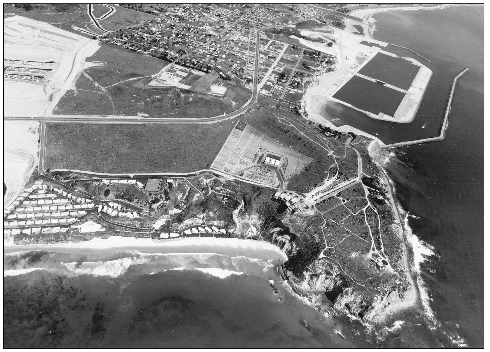
CONCRETE OUTLINES. By 1970, concrete revetment walls had been poured inside and outside the berthing basins. The bridge between them had been built. This aerial view also shows trails along the undeveloped headlands and the nursery of native plants maintained by the Sherman Foundation at the center. (Courtesy Geotronics.)
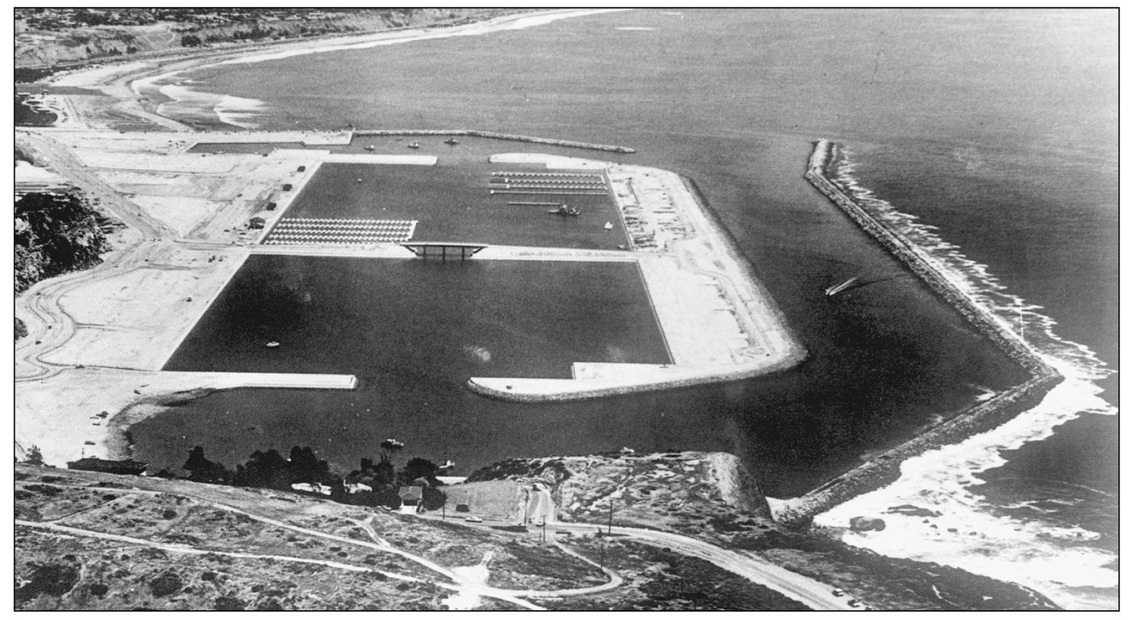
BOAT SLIPS BEGIN. One hundred slips on floating docks had to be ready each month for their new renters. Each month from May 1971 until March 1972, as soon as they were open, the berths were filled to capacity; there are close to 1,500 resident vessels in this East Basin. Eight boater support buildings and two shopping villages were also constructed.
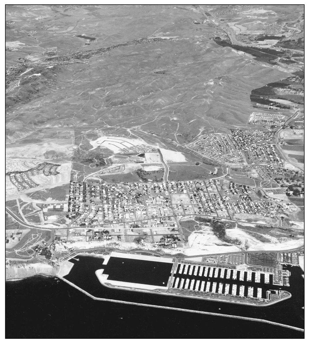
EAST BASIN FULL HOUSE. The harbor’s East Basin continued to have a waiting list of hopeful renters. The area above it was being graded to create the Lantern Bay development. Here in October 1972, new development was extending the town in all directions, including Street of the Golden Lantern and construction of Dana Hills High School. (Courtesy Ace Aerial.)
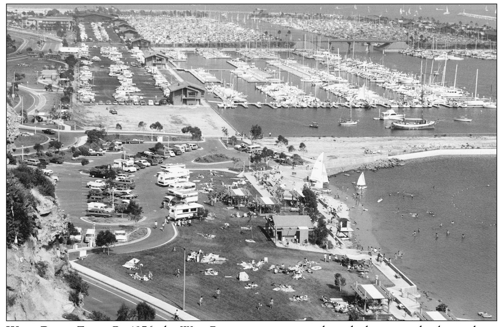
WEST BASIN FILLS. By 1976, the West Basin was constructed, its docks perpendicular to those in the East Basin. Exactly a decade after the first breakwater rocks had been dropped into place, the second berthing basin was dedicated. Its 1,000 slips were filled within months. Park areas at the harbor’s west end were popular with landlubbers. (Photograph by the author.)
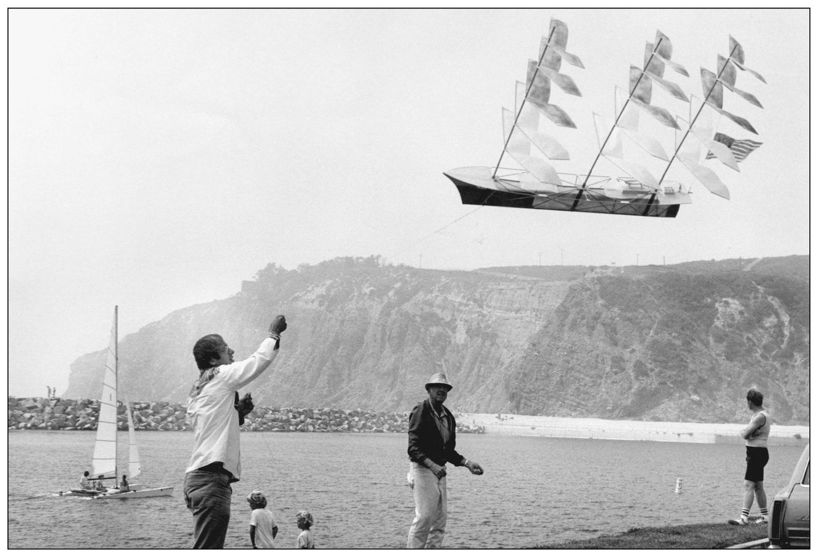
NAUTICAL HISTORY CELEBRATED. A three-masted ship, the Alert, brought Richard Henry Dana into this anchorage on his second visit of 1835. Here it is flown as a specialty kite during a public event held in the namesake’s memory. Dana’s experiences made history in his classic book, Two Years Before the Mast. (Photograph by the author.)
HARBOR LOGO. The official seal of the harbor carries the silhouette of the brig Pilgrim. A full-sized re-creation of the ship that Dana crewed on his first visit here is docked in the harbor at the Ocean Institute. Pilgrim’s two masts are square rigged. The entire ship is maintained by a devoted volunteer crew.
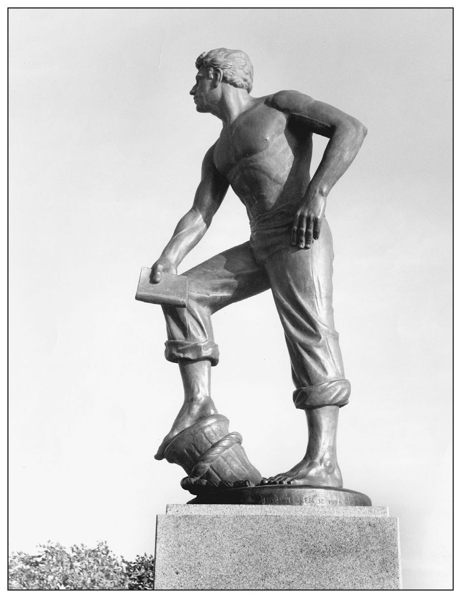
NAMESAKE RETURNS. The man who noted the dramatic setting of Dana Point, Richard Henry Dana, was awarded a permanent place to view its dramatic cliffs. In 1972, when the harbor was new, citizen donations funded a larger-than-life statue of Dana that stands on the island also named for him. He holds a copy of his journal of notes kept while on his voyage to California. (Photograph by the author.)
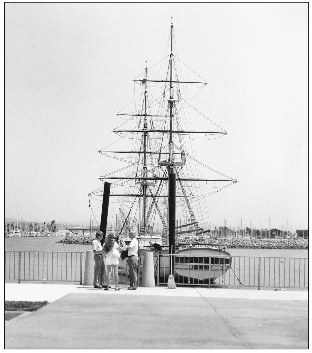
TALL SHIP PORT. Vintage sailing ships from the seven seas have visited Dana Point Harbor during its annual Tall Ship Festival and whenever they make a port call while passing by. Tall masts and yardarms, here on the re-created Pilgrim, have become a common sight in this city, though they always add a special nostalgic touch: in sailing by them, going aboard, or simply standing beside them. (Photograph by the author.)
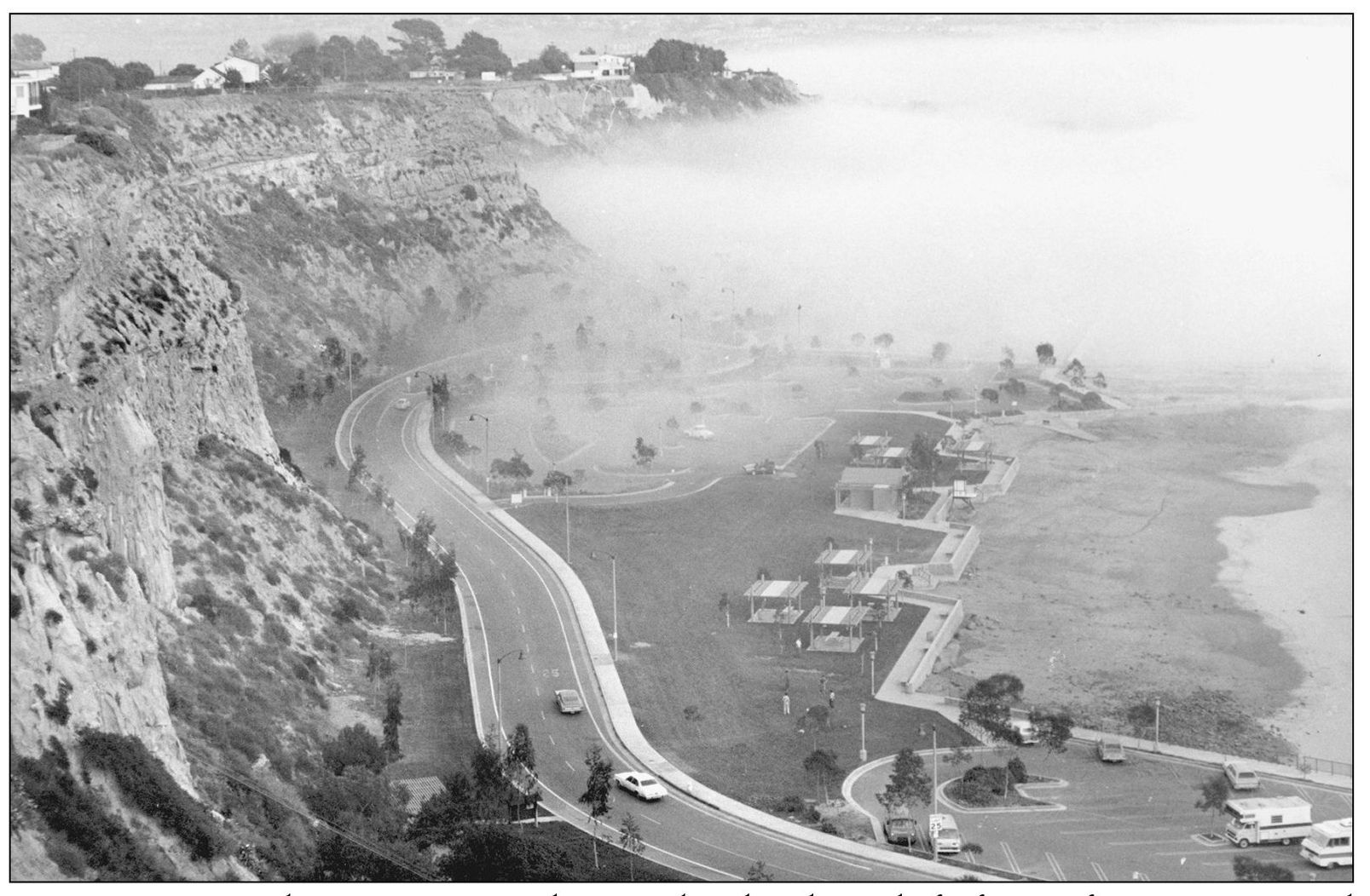
FOG FILTERS IN. Like a stage curtain drawing closed at the end of a fine performance, now and then the fog rolls into an actively used Dana Point Harbor. Visitors and boaters use the facility year-round, and the weather almost always accommodates their activities on land and sea. (Photograph by the author.)
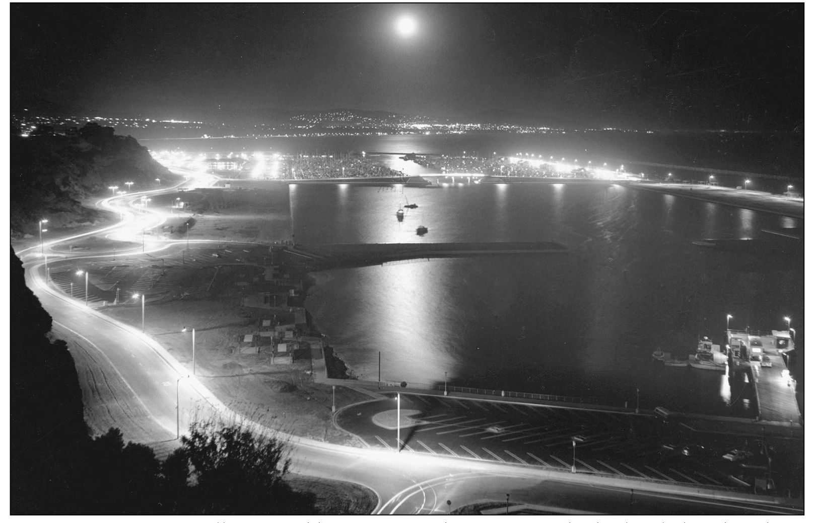
HARBOR LIGHTS. A full moon adds a romantic dimension to the harbor lights that shine throughout the marina areas, casting its reflection in a path through the center of this night scene. (Courtesy Smetona Photo.)