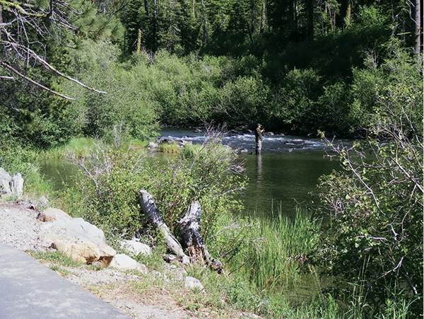
Fishing is just one of the pastimes that visitors to the Truckee River Trail can enjoy.
9
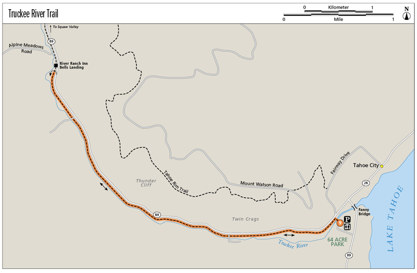
Truckee River Trail
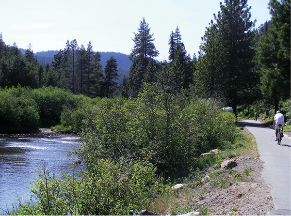
One of the easiest and most popular trails in north Lake Tahoe, this well-maintained paved route traces the Truckee River from Tahoe City to Alpine Meadows Road and beyond. Enjoy views of the sparkling river, the lush riparian habitat that thrives on the riverbanks, the evergreen forest that blankets the valley walls, and the crowds that float the river and enjoy the trail with you.
Start: At the signed trailhead in 64 Acre Park near the junction of CA 89 and CA 28 in Tahoe City
Distance: 7.2 miles out and back
Hiking time: 4 hours
Difficulty: Moderate due only to length
Trail surface: Paved bike path
Best seasons: Spring, summer, and fall
Other trail users: Cyclists, in-line skaters, runners
Trailhead amenities: Parking, restrooms, interpretive signs. Portable restrooms are available along the trail. If you do a shuttle hike, parking is also available at River Ranch. The trail is wheelchair accessible.
Canine compatibility: Leashed dogs permitted
Fees and permits: None
Schedule: Sunrise to sunset daily
Maps: USGS Tahoe City CA; maps available at the Tahoe City Public Utility District office. No map is necessary.
Trail contact: Tahoe City Public Utility District, Parks and Recreation Department, PO Box 5249, Tahoe City, CA 96145; (530) 583-3440 ext. 10; www.tcpud.org
Finding the trailhead: From the signalized intersection of CA 89 and CA 28 in Tahoe City, go 0.2 mile south on CA 89 to a signed right turn into the large trailhead parking area at 64 Acre Park. GPS: N39 9.877' / W120 8.840'
The Hike
On hot summer days, the Truckee River is blanketed with river rafters. The clear water, reflecting the browns and grays of its rocky bottom, is topped by the neon blues, oranges, and yellows of the rafts occupied by boaters in equally colorful swimwear and varying states of repose. This riotous rainbow spills onto the Truckee River Trail, where the bright Lycra of cyclists, runners, and in-line skaters mingles with the pastels worn by babies in strollers and the muted greens, blues, and grays favored by hikers.
It is virtually impossible to get lost on the Truckee River Trail; if you wander into the water or find you are sharing pavement with automobiles, you’ve strayed. Mile markers line the paved path. A broken yellow line down the center of the path separates downstream traffic from those headed upstream. Proximity to the highway precludes any illusion of this being a wilderness hike, but the trail provides the perfect venue for an entertaining family outing.
Fishing is just one of the pastimes that visitors to the Truckee River Trail can enjoy.
The hike begins by crossing the arcing bridge to the north shore of the river, where the trail bears left (west) and occupies a narrow strip of greenbelt between the river and CA 89. At the outset you will pass businesses and cross several driveways on the border of Tahoe City. Then the trail drops waterside, where dense willow sometimes hides the meandering river. The only intersections along the trail for a good long stretch are with the driveways and private bridges of lucky souls whose homes are perched on the riverbanks.
Sandbars in the river offer respite for the rafters; for hikers and other trail users, narrow social paths lead to small rocky or sandy beaches that serve as wonderful viewpoints, picnic sites, or rest and turnaround spots.
You can hike as far as you’d like, but if you have the time and energy, follow the trail all the way to Alpine Meadows Road and the River Ranch resort. The roughest part of this stretch of the river run occurs just above the restaurant at Bells Landing. Rafting the Truckee is far from radical, but the little bit of fast water before the river pools below the restaurant’s outdoor seating area provides a quick thrill for the river rafters, and entertainment for both hikers and diners. Return as you came.
Brook trout were introduced to the Lake Tahoe watershed in 1877, part of an effort to eradicate shrimp that were clogging water pipes in the boomtown of Virginia City.
Miles and Directions
0.0Start by crossing the bridge in 64 Acre Park. Turn left (west) onto the paved path.
0.2Cross the access drive for Tahoe City Lumber.
1.0Pass a mile marker.
2.0Pass another mile marker and a congested area sign.
3.0Pass a third mile marker and a private driveway.
3.4Climb the only hill along the route (it’s short) to the rafters’ staging area.
3.6Reach Bells Landing and the inn at River Ranch. Have a cool drink on the patio, then retrace your steps to the trailhead.
7.2Arrive back at the trailhead.
Options: From River Run you can continue west on the Truckee River Trail to Squaw Valley Road. The total round-trip is 10 miles.
The Truckee River trailhead in Tahoe City also serves as the junction with lakeshore bike paths that head north to Dollar Point and south to Sugar Pine Point State Park.
Hike Information
Local information: Information about businesses, restaurants, and activities in north Lake Tahoe, including Tahoe City, Kings Beach, Brockway, Homewood, and other North and West Shore towns, can be found at www.gotahoenorth.com. The phone number for the clearinghouse is (888) 434-1262. The Tahoe City Visitors Information Center is at 380 North Lake Blvd., Tahoe City, CA 96145; (530) 581-6900.
Another source of information for town residents and visitors is the Tahoe City Downtown Association. Call (530) 583-3348 for more information; www.visittahoecity.org.
Bikers, hikers, skaters, rafters, anglers, swimmers: They all enjoy the long paved stretch of trail that offers easy access to a friendly stretch of the Truckee River.