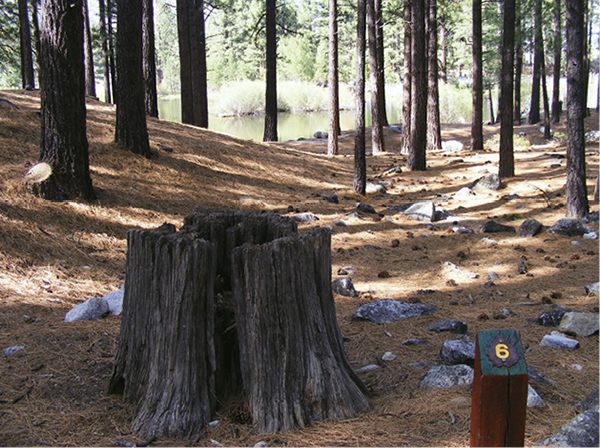
Open yellow pine forest is typical of the lower montane zone outside Reno.
Introduction
We all face challenges. In the grand scheme of things, the dilemma posed by having to select the best hikes in the Reno–Lake Tahoe area is relatively minor. But it has been a challenge nonetheless, given the grandeur of California’s Range of Light and the boundless network of trails that weaves through it.
Then again, how could I go wrong?
The trick has been in the exploration. The Sierra Nevada have been in my soul and under my soles for decades now. I know what I like and I know where to find it. I could have stuck with my old favorites (and they are in this guide), but Sierran hikers are as varied as the terrain, so I broadened my scope. Routes in this guide range from super-short wheelchair-accessible interpretive trails to thigh-burning treks to high-altitude destinations. They ramble through scree fields above treeline, wind into thick yellow pine forests, and climb into desert scrublands. They lead to excellent viewpoints, verdant wildflower fields, calming beaches, historic sites, and awesome summits. They are informed by water, whether by Lake Tahoe itself, or the Truckee River, or smaller streams or lakes. The goal was not to be comprehensive. I hope I’ve selected a tasty sampling, like chocolates in a gift box. But a whole warehouse of deliciousness remains open to the adventurer.
Most trails around Lake Tahoe feature climbing—they are in the Sierra Nevada, after all. But none will bust a gut. You may encounter comparable steepness on tracks in Reno, but the lesser altitude eases the workload. Spectacular mountain backdrops and extremes of weather lend a wildland feel to even the more urban treks around the city.
Routes in this guide are intended to be day hikes, though many of the trails extend farther into the wilderness or link to other paths that reach into remoter regions. With a good map, a little planning, and the right gear, you can use many of these trails to launch weekend backpacking trips or treks lasting a month or more. Climb onto the Pacific Crest Trail and you can head north through the Cascades to Canada, or south to Yosemite, Mount Whitney, and the Mexican border.
Hands-down winner in the beauty contest is Lake Tahoe, vast and blue and rimmed with snowcapped peaks. A mecca for the outdoorsy, the lake boasts a healthy population of year-round residents that swells with visitors on weekends in summer and winter. Summer draws the boaters and hikers; winter brings the skiers and snowboarders. The influx from Sacramento and the San Francisco Bay Area is huge, and residents of Reno head upslope regularly as well. The good news for hikers is that, despite the popularity of Tahoe trails, if you hike in the off-season (especially fall), and during the week, you will miss the crowds.
Reno’s setting is no slouch: The Biggest Little City’s gambling heart is bounded on the west by the same Sierran peaks that embrace Lake Tahoe, and on the east by the stark, imposing high desert ranges of the Great Basin. While its downtown casinos draw tourists year-round, Reno is also a university town, with industry and agriculture fortifying its economic base. The population of more than 220,000 is diverse, but sharing a love of the outdoors is almost universal. Living in the shadow of the Sierra will inspire that, whether you like to hike, fish, hunt, or ride an all-terrain vehicle.
Trails have linked Reno and Tahoe for thousands of years. Washoe Indians abiding in the Truckee Meadows (where Reno would later be established) traveled up through the canyons to summer hunting grounds around Lake Tahoe. The Sierra were a formidable barrier to colonists, both Americans headed west and the Spaniards who established a mission and rancho system in what was then known as Alta California. For nearly a century after “discovery” the trails through the mountains were traversed almost exclusively by natives and by mountain men such as Jedediah Smith.
But the discovery of gold and silver in the mid-nineteenth century changed everything. Trails that had once been passable only in season became year-round travel routes for forty-niners and those who followed them. And new trails were blazed, to facilitate the booming timber and mining industries and to help move the massive quantities of water needed by both. Once the booms went bust wildland lovers moved in—renowned advocates such as John Muir, one of the founders of the Sierra Club—and the trails became paths for modern-day explorers, women and men seeking to rediscover the beauty of the Sierra and their inherent awe of the high country.
To walk in the wilderness is, I believe, to renew the soul. I hope that anyone who embarks on any trail near Reno or Lake Tahoe will find the same peace and sense of well-being that I feel there. Get out, take a hike, and let yourself be stunned, reverent, and healed.
Open yellow pine forest is typical of the lower montane zone outside Reno.
The Nature of Reno and Lake Tahoe
Trails in the Reno-Tahoe region range from rugged and mountainous to flat and paved, and hikes in this guide cover the gamut. Regardless of the trail you choose, knowing a few details about the nature of the region will enhance your explorations.
Flora and Fauna
The Reno-Tahoe region encompasses several ecosystems, each with distinctive flora and fauna.
The high desert surrounding Reno is at the lowest elevation. The sagebrush scrub (or steppe) plant community thrives in the hot, dry climate, with big sagebrush, black sagebrush, and rabbitbrush dominating the landscape. Cactus and wildflowers bloom briefly in early spring, splashing color among the browns, grays, and greens of the landscape.
As you move up in altitude on the mountain slopes, the sage steppe becomes interspersed with junipers, piñon pines, and Jeffrey pines. Wildlife is abundant, including mule deer, coyote, jackrabbits, and cottontail rabbits; songbirds, grouse, and raptors; foxes; a variety of cats including mountain lions; lizards and snakes.
Moving higher, you enter the montane zone. This is a forested ecosystem, reaching from roughly 4,000 feet in elevation to 7,000 feet. The lower montane zone features a mixed evergreen forest composed of Jeffrey and ponderosa pines, white firs, and incense cedars; in the upper montane zone lodgepole pine and red fir are the dominant species. Songbirds thrive in the lower montane zone; wildlife also includes deer, rabbits, squirrels and chipmunks, and black bear. Populations thin in the higher altitudes, though the golden-mantled ground squirrel can often be seen scurrying across trails ahead of hikers. Lake Tahoe, at 6,224 feet, sits square in the montane zone.
The subalpine zone begins near 8,000 feet and reaches to treeline. The forest here, composed of whitebark pine and mountain hemlock, is stunted by wind and snowfall. Wildlife is scarce. But low-growing wildflowers enliven the meadows of the zone.
Finally, at the summits of the peaks along the Sierra crest and the Carson Range, at about 10,000 feet and above treeline, you’ll enter the alpine zone. Here the plants and animals must contend with harsh conditions year-round. Pikas, noisy little creatures, abide in rock fields and chirp warnings to each other. A variety of insects tolerate the extremes of the zone, including bees and crickets. Low-growing flowers and shrubs, including varieties of aster, buckwheat, sorrel, paintbrush, and clover, provide fodder for both bee and pika.

Deposited long ago, this glacial erratic rests on slabs on the trail leading from Glen Alpine to Gilmore Lake and Lake Aloha.
Weather
The hiking season around Lake Tahoe generally stretches from the first of May to the end of October, with trails at lower elevations melting off before those at higher elevations. When a particular trail opens is dependent on the amount of winter snowfall and the speed of the snowmelt. Snowshoe hikers and cross-country skiers can travel into areas traversed by these trails during winter, weather and backcountry skills permitting.
High temperatures in spring and fall range from the low 50s to the mid-70s. In July, August, and September, temperatures jump into the high 70s and 80s, with occasional hot spells. Overnight lows are in the 30s and 40s.
Afternoon thunderstorms are fairly common in the summer months and taper off by autumn. Regardless of the season hikers should be prepared for changeable weather—rain, cold, snow, or heat—by wearing layers and packing waterproof gear.
Reno’s high desert climate is dominated in the hiking season by low humidity and lots of sunshine. Spring and fall, when high temperatures range from the 40s to the 70s, offer the best hiking weather, but with a few caveats, you can hike in Reno year-round.
Rainfall averages 7.5 inches annually, falling mostly in winter and during thunderstorms in spring. Snowfall averages 25 inches annually, mostly in small doses of 1 to 2 inches, and generally melts off quickly. Winter lows plunge into the 20s and 30s, while highs creep into the low 40s. Layers of clothing are a prerequisite for winter hiking.
Summertime temperatures are usually not oppressive, with averages in the high 80s and 90s. Heat waves can drive temps into the 100s. Temperature variations can be extreme, however, with nighttime lows dropping into the 40s and 50s. Hiking in the morning or evening is recommended. These times offer lovely light and a greater opportunity to see wildlife. Midday hiking may also be a poor choice because the combination of heat and low humidity can lead to rapid dehydration.

Lake Tahoe forms the horizon on the descent from Eagle Lake.
Etiquette for Animals
You’ll encounter mostly benign creatures on trails in Reno and around Lake Tahoe, such as squirrels, rabbits, lizards, and a variety of birdlife. More rarely seen are coyotes, deer, and raccoons. Encounters with wildlife that poses a potential threat to hikers are even more rare but are definitely possible, so beware the black bear, mountain lion, and venomous snake.
Black bears are most commonly seen in the Lake Tahoe area, where they’ve learned that yummies can be found in cars, in unsecured garbage cans, and in the kitchens of weekend cabins. Encounters usually involve some kind of food. Bears have been known to remove windshields from automobiles to get at coolers and to stroll through the open doors of homes to rummage in refrigerators.
If you encounter a bear on the trail, do not run. Stand still and make noise, and the bear will most likely scram. Never come between a mama bear and her cubs; if you see cubs, leave the area immediately.
Nevada is home to five species of pit vipers, including the western diamondback and Great Basin rattlesnakes. Snakes generally only strike if they are threatened—you are too big to be dinner, so they typically avoid contact with humans. Keep your distance, and they will keep theirs. If you encounter a snake on the trail, back away slowly. Use caution when climbing over rocks or venturing into caves. Snakes are also known to seek shelter under cars in hot weather.
Mountain lions are most active at dawn and dusk. Like snakes they generally avoid contact with humans, but to further reduce the chances of an encounter, make noise while hiking. Don’t jog or ride a bike in areas where a lion has been sighted, as those activities mimic prey behavior. If you come across a mountain lion, make yourself seem as big as possible and do not run. If you don’t act like or look like prey, you stand a good chance of not being attacked. If the attack comes anyway, fight back.

A fish ladder filters the stream leading into Marlette Lake in the Marlette-Hobart backcountry.
Green Tips
Given the great beauty of the parks, trails, and wildlands in and around Reno and Lake Tahoe, and especially given the heavy use all receive, it’s important that we do all we can to keep them clean, lovely, and healthy. The Green Tips scattered throughout this guide will help you do just that.
Getting Around
Pairing Reno and Lake Tahoe in a guidebook makes good sense, given their proximity. They are separated by 50 to 60 highway miles and a drive of less than two hours (depending on the route you choose). The granite escarpment—a little less than 2,000 feet high—that separates the city from the lake is the biggest impediment to travel, particularly when winter storms descend. But area residents and visitors easily ping-pong between the two destinations, depending on where they choose to play on any particular day.
All hikes in this guide are within an hour’s drive from downtown Reno, or from one of the bigger little towns around Lake Tahoe.
Tahoe City, Incline Village, and South Lake Tahoe/Stateline serve as touchstones for directions to trailheads around the lake. A scenic highway, variously designated CA 89, CA 28, NV 28, and US 50, circumnavigates Tahoe. Most trailhead directions to hikes in the Lake Tahoe area are given from this road. Directions for trails in Donner and Truckee are given from I-80.
Most hikes in the Reno section are located in the Truckee Meadows and adjacent North and South Valleys, but some reach westward into the Sierra foothills and south into the Washoe and Carson River valleys. Two major highways intersect in Reno. I-80 runs east-west and links the city with Lake Tahoe in California. US 395 and I-580 run north-south and connect Reno to Carson City. Trailhead directions for Reno area hikes are given from these highways. McCarran Boulevard circles the metropolitan area, offering easy alternative access to trails.
In addition to I-80, Reno and Tahoe are linked by the Mount Rose Highway (NV 431), which hitches Reno’s southwestern suburbs to Incline Village. US 50 climbs from just south of Carson City over Spooner Summit onto Tahoe’s East Shore. Farther south, the Kingsbury Grade (NV 207) runs between Mottsville and South Lake Tahoe.
Public Transportation
Tahoe Area Regional Transit (TART) provides public transportation for north Lake Tahoe. For information on routes and fares, call (530) 550-1212 or (800) 736-6365, or visit www.placer.ca.gov/departments/works/transit/TART.aspx.
The South Tahoe Area Transit Authority’s BlueGO provides public transportation around Tahoe’s South Shore. For more information call (530) 541-7149 or visit www.bluego.org.
Public transportation for Reno is provided by the Regional Transportation Commission (RTC), which operates a number of bus routes in the city and to outlying communities, including Carson City. Route information is available at rtcwashoe.com. Call (775) 348-RIDE for more information.
Maps
The USGS quad is listed for every hike. If the hike is so short or well defined that no map is necessary, or if an adequate map is provided at the trailhead by the land manager, that is noted in the hike description.
There are several great regional maps available. They include: