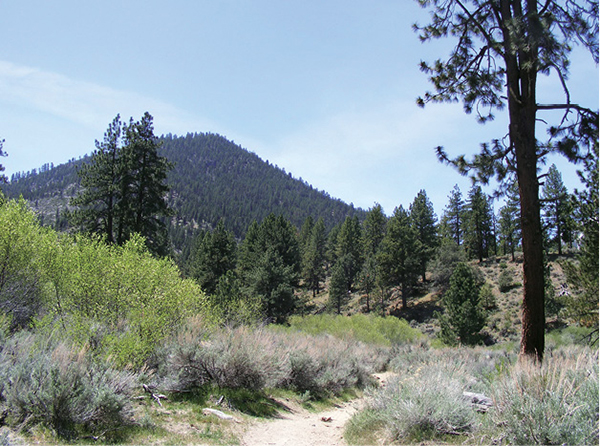
The forested peaks of the high Sierra form a backdrop to the high desert portion of the Fay-Luther Interpretive Loop.
45
Fay-Luther Interpretive Loop
This superlative loop meanders along the lower slopes of Jobs Peak in the Carson River valley, passing from pristine highland desert scrub into shady montane forest and back again.
Start: At the Fay-Luther trailhead off Foothill Road
Distance: 2.8-mile lollipop
Hiking time: 2 hours
Difficulty: More difficult due to steep inclines and trail length
Trail surface: Sand, decomposed granite, dirt singletrack
Best seasons: Spring and fall; avoid heat of the day in summer
Other trail users: Mountain bikers, equestrians
Trailhead amenities: Parking, an information signboard. A trail map and dog waste disposal station are about 50 yards beyond the gate on the Sandy/Jobs Peak Ranch Trails. No restroom is available. Equestrians are asked to clean up after their horses.
Canine compatibility: Dogs permitted year-round, but must be leashed from Oct 15 to Mar 30 to protect mule deer habitat. Also, please pick up after your pet.
Fees and permits: None
Schedule: Sunrise to sunset
Maps: USGS Woodfords CA-NV; an excellent trail map is posted 50 yards from the trailhead and is available online via links at the BLM and Carson Valley Trails Association websites.
Trail contact: Bureau of Land Management, Carson City District/Sierra Front Field Office, 5665 Morgan Mill Rd., Carson City, NV 89701; (775) 885-6000; www.blm.gov/nv/st/en/fo/carson_city_field.html
Finding the trailhead: Heading south on US 395 from Carson City, go right (southwest) on NV 88. Follow NV 88 for 2.1 miles to NV 207 (Waterloo Lane). Turn right (west) on NV 207 and go 3.2 miles to Foothill Road (NV 206). Go left (south) on Foothill Road for 4.4 miles to the signed trailhead parking area on the right (west). GPS: N38 52.216' / W119 48.637'
The Hike
Massive Jobs Peak dominates the mountain front south of Carson City and provides the backdrop for this wonderful trek through high desert and lower montane forest. Views from the trail stretch east across a patchwork of green and brown ranchland to the dry slopes of the Pine Nut Mountains and climb west up the wooded draws of the foothills of the Sierra Nevada.
The Fay-Luther trail system, more than 8 miles of interlocking paths surrounding Luther Creek and rugged Fay Canyon, is a justifiable source of pride for its developers, which include the BLM, the Humboldt-Toiyabe National Forest, the American Land Conservancy, and the Carson Valley Trails Association. The interpretive loop described here is just one of several options showcasing the relatively untouched natural beauty of the area.
The route begins on the high desert, among fragrant big sage, bitterbrush, and desert peach, with unimpeded views in all directions. The Sandy Trail is aptly named, with a surface that melts beneath your boots, but the incline is gentle so the hiking is easy. Keep in mind, however, that this section of desert track is exposed and potentially dehydrating in summer. Pass the doggie waste station, the California National Historic Trail marker (commemorating the route used by emigrants to California’s fabled gold country), and the California/Nevada state border as you climb, staying left (southwest) at junctions with the Jobs Peak Ranch Trail.
The forested peaks of the high Sierra form a backdrop to the high desert portion of the Fay-Luther Interpretive Loop.
A bench in the shade of a massive Jeffrey pine, positioned on the line of transition from the high desert to the montane environment, offers incredible views across the Carson River valley to the Pine Nuts and north up the mountain front. The views continue as the trail traverses a pine-shaded, scrub-scented slope to the junction with the Interpretive Loop; stay left (south) to complete a clockwise circuit. The setting is especially lovely in spring, when the desert blooms yellow and pink, the pastures in the valley are verdant, and the Pine Nut Mountains are painted in shades of green and brown.
Pass the first junction with the Bitter Cherry Trail to Luther Creek. The willow-lined stream accompanies the trail west and uphill toward the mouth of Fay Canyon: Say goodbye to valley views and hello to the steep, gray and evergreen slopes of the Sierra.
Climb more steeply as the trail passes the second junction with the Bitter Cherry Trail, then curves away from the creek. A switchback and traverse lead up a steep slope and past the intersection with the Grand View Loop. Now on the back of a small ridge and heading north on the return leg of the loop, the vistas open again, stretching across the river valley below and up the steely mountain front.
The descent includes switchbacking traverses of forested gullies and several opportunities to contemplate the layered greens and browns of the valley on perfectly placed dedicated benches. Pass two junctions with the Jeffrey Pine Trail before a final drop closes the Interpretive Loop. Retrace your route through the transition zone and the high desert to the trailhead.

Miles and Directions
0.0Start up the Sandy Trail behind the information sign.
0.1Pass junctions with the California National Historic Trail and the Jobs Peak Ranch Trail, then cross the California/Nevada state border, staying straight (southwest) on the obvious Sandy Trail.
0.3At the second junction with the Jobs Peak Trail stay left (southwest) on the Sandy Trail.
0.5Pass the Red Barn Ranch bench in the shade of a giant Jeffrey pine.
0.6Reach the Lonesome Trail junction; stay left (southwest) on the Sandy Trail.
0.7The Sandy Trail ends at the beginning of the Interpretive Loop. Go left (southeast) to complete the route in a clockwise direction.
0.9At the intersection with the Bitter Cherry Trail stay left (southeast). The trail comes parallel with Luther Creek.
1.1At the unsigned junction with a social trail stay right (south) on the Interpretive Loop.
1.2Reach the second Bitter Cherry Trail junction and stay left (south) on the Interpretive Loop.
1.3Stay right (up) and north around the switchback at the unsigned junction.
1.4Arrive at the signed Grand View Loop intersection. Stay left (north) on the Interpretive Loop, passing the Charles Phillips bench and heading down the ridgeback.
1.6Switchback in and out of a gully to the first junction with the Jeffrey Pine Trail. Stay right (northeast) on the Interpretive Loop.
2.0Switchback through a steeper gully to the second Jeffrey Pine Trail intersection. Again, stay right (northeast) on the Interpretive Loop.
2.1Drop to the junction and close the Interpretive Loop. Retrace your steps down the Sandy Trail.
2.8Arrive back at the trailhead.
Options: You can extend your tour of the Fay-Luther area by venturing out on either the Jeffrey Pine Trail or the Grand View Loop. The trail also links to the Jobs Peak Ranch route and trailhead to the north.
Hike Information
Local information: The Carson City Chamber of Commerce provides information for both residents and visitors about amenities in the city and environs, including places to stay and places to eat. For more information contact the chamber at 1900 S. Carson St., Suite 200, Carson City, NV 89701; (775) 882-1565; www.carsoncitychamber.com.
The Carson Valley Chamber also provides information for residents and visitors to Carson City, Minden, Gardnerville, and other valley cities and towns. Contact the chamber at 1477 US 395, Suite A, Gardnerville, NV 89410; (775) 782-8144 or toll free (800) 727-7677; www.carsonvalleynv.org.
Local events/attractions: The historic towns of Minden, Genoa, and Gardnerville lie along the mountain front in the Carson River valley south of Carson City. Each small town offers historic sites, restaurants, lodging, and access to recreational opportunities in the Sierra, including Lake Tahoe. For more information on Minden, contact the Town of Minden, 1604 Esmeralda Ave. Suite 101, Minden, NV 89423; (775) 782-5976; www.townofminden.com. For more information on Genoa, home of the annual Candy Dance Arts and Crafts Faire, an event dating back more than ninety years, contact the Town of Genoa, PO Box 14, Genoa, NV 89411-0014; (775) 782-8696; www.genoanevada.org. For more information on Gardnerville, call the Town of Gardnerville, 1407 US 395 N, Gardnerville, NV 98410; (775) 782-7134; www.gardnerville-nv.gov.
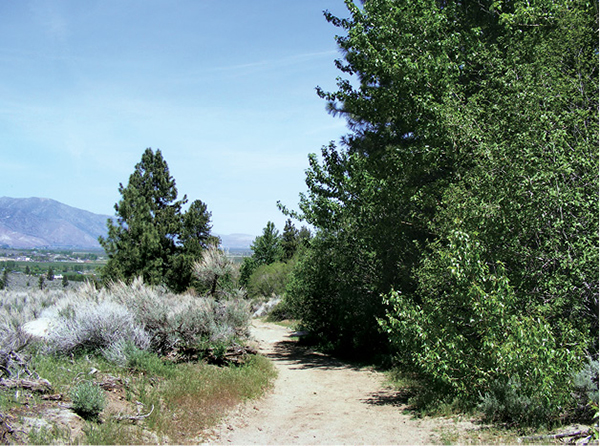
The dry slopes of the Virginia Range are visible from the Fay-Luther Interpretive Trail.