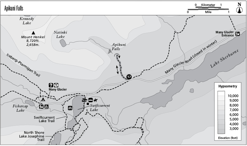
17 Apikuni Falls
Type of hike: Out-and-back
Total distance: 2.0 miles (3.2 km) round-trip
Time required: 1 to 2 hours
Elevation change: 680-foot gain
Finding the trailhead: Trail begins at the Apikuni Falls Trailhead, 3.3 miles west of the Many Glacier Entrance Station.
The Hike
This short, steep trail leads up to the desolate cliffs of Apikuni Mountain to visit a long and slender waterfall. Hikers will get excellent mountain views throughout the trek.
The hike begins on Apikuni Flats, where grassy meadows offer views of the major peaks up the valley: Mount Gould, with its chiseled countenance; the symmetrical pyramid of Grinnell Point to the north of it; and, between them, the Garden Wall, graced with Salamander and Grinnell Glaciers. At the far edge of the flats, the path undertakes a relentless and calf-burning climb, passing through aspen groves and lodgepole pine stands as it ascends to the base of limestone cliffs. Altyn Peak rises west of Apikuni Creek, while the outer bulwarks of Apikuni Mountain (its reddish summit can be seen through the mouth of the hanging valley above) rise to the east.
The path ultimately climbs onto rocky and barren slopes where only a few firs survive, and the bleached and gnarled skeletons of long-dead whitebark pines rise mournfully to the sky. Swiftcurrent Lake and Lake Josephine can now be glimpsed in the valley to the west, while to the south a broad panorama includes Wynn and Allen Mountains arrayed beyond Lake Sherburne. Apikuni Falls can be seen ahead, dropping through a cleft in the limestone walls. The path becomes primitive with steep, uneven footing as it navigates a rocky ravine to reach the base of the falls.
Key Points
0.0 Start at Apikuni Falls trailhead.
1.0 Apikuni Falls. Turn around and retrace steps.
2.0 Arrive back at trailhead.