1 Bowman Lake
Type of hike: Out-and-back
Total distance: Up to 14.2 miles (22.9 km) round-trip
Time required: 1 to 9 hours, depending on length of hike
Elevation change: Minimal
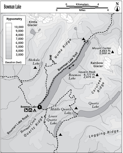
Finding the trailhead: Follow Glacier Route 7 north to its junction with Bowman Lake Road, just north of Polebridge. Take Bowman Lake Road (a narrow but graded gravel road) to its terminus at Bowman Campground. The trail departs from the northeast corner of the campground, near the lakeshore.
The Hike
This trail follows the northwestern shore of Bowman Lake for 7 miles of gentle up-and-down hiking. Use it as a backpack route in itself or as a day hike of any length. The trail winds past Bowman Lake before ascending a U-shaped valley carved by a glacier between rugged peaks. Views across the lake include the glacier-carved summits of Square Peak, Rainbow Peak, and Mount Carter. The lake is prime osprey and bald eagle habitat and is often closed to boating, fishing, and hiking above the upper campground to protect active eagle nests. Loons are frequently sighted on the lake’s surface. The backcountry campsite near the head of the lake is popular with hikers and boaters alike.
Key Points
0.0 Start at trail sign. Trail follows shore of Bowman Lake.
0.7 Junction with Numa Ridge Lookout Trail. Stay right.
7.1 Campground at head of Bowman Lake. Turn around and return the way you came.
14.2 Arrive back at trailhead.