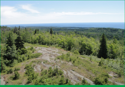
View from Mount Ojibway Lookout Tower
More than 99% of the park is designated wilderness, making Isle Royale and its 165-mile network of trails one of the best hiking regions in the Midwest. Most trails are hidden in the backcountry, far from landing docks, only trafficked by backpackers and overnight paddlers. But there are some extremely rewarding short hikes around Windigo and Rock Harbor where most visitors arrive. Windigo Nature Walk is a great first hike and introduction to the island. Trail guides for the 1.2-mile walk are available at the visitor center. Another pleasant hike near Windigo is the 3.6-mile (roundtrip) trek along Feldtmann Lake Trail to Grace Creek Overlook. The rest of the Feldtmann Lake/Island Mine Trail is seldom hiked, but the first 1.8 miles are a popular destination for day-hikers seeking views of Grace Harbor from this majestic overlook. Adventurous day-hikers may want to try taking Minong Ridge Trail to Minong Ridge Overlook. After hiking up and down over rocky and rugged terrain for 3 miles (one-way) you’ll be rewarded with spectacular vistas of Canada’s shoreline.
Rock Harbor is precariously positioned on a thin slice of land between Tobin Harbor and Lake Superior. There’s more water than land, but you can still find several good hiking trails in the area. Stoll Memorial Trail is just northeast of the dock. It recognizes the time and energy Albert Stoll, a Detroit News journalist, spent in his effort to protect the region. About 2 miles of it are self-guided. In all, it’s nearly 5 miles to the trail’s terminus at Scoville Point and back. You’ll pass craggy cliffs, harbor views, and remnants of ancient mines along the way. Heading southwest from Rock Harbor are Tobin Harbor and Rock Harbor Trails. They run parallel to one another, weaving from shoreline to thick forests as they follow alongside the bodies of water that share their names. Regardless of which trail you choose, you’ll have the opportunity to take a short spur trail to Suzy’s Cave. It’s more of an eroded arch than a cave, but still worth a quick peek. Both of these trails are among the park’s busiest. Rock Harbor is usually the busier of the two because it serves as a direct route to Three Mile and Daisy Farm Campgrounds. Hikers like to beeline to these locations in order to secure a shelter for the night. Raspberry Island, only accessible by boat, has a short interpretive trail to Rock Harbor Lighthouse near Edisen Fishery.
Easy Hiking Trails
Trail Name | Trail Location (# on map) | Length (One-way distances unless loop) | Notes
Tobin Harbor | Near Rock Harbor Seaplane Dock (1) | 3.0 miles | Alternative to Rock Harbor Trail
Stoll (favorite) | Northeast corner of Rock Harbor (1) | 4.2 miles | Two loops cross back and forth from the shorelines of Lake Superior and Tobin Harbor to Scoville Point
Suzy’s Cave | Southwest of Rock Harbor’s Dock (1) | 3.8 miles | Take Rock Harbor Trail to the spur trail to Suzy’s Cave • Loop back to Rock Harbor via Tobin Harbor Trail
Mott Island Circuit | Mott Island Seaplane Dock (3) | 2.6 miles | Short, seldom-hiked loop trail accessible by boat
East Chickenbone | 0.5 miles from McCargoe Cove (7) | 1.6 miles | Connects McCargoe Cove and Greenstone Ridge Trail
Windigo Nature Walk | Up the hill past Windigo Visitor Center (12) | 1.2 miles | Self-guided nature trail through hardwood forest
Moderate Hiking Trails
Rock Harbor and Lake Ritchie | Southwest of Rock Harbor’s Dock (1) | 12.9 miles | Combine Rock Harbor and Lake Ritchie Trails to hike past busy camps at Three Mile and Daisy Farm to more remote locations near the center of the island
Greenstone Ridge (favorite) | Spans from Windigo to Lookout Louise (2, 5) | 42.2 miles | Best known trail on Isle Royale
Mount Franklin | 0.2 miles west of Three Mile Camp (4) | 2.0 miles | Hike between Rock Harbor and Greenstone Ridge to a dramatic view of the Island’s north side
Daisy Farm and Mount Ojibway | Daisy Farm Campground (6) | 5.1 miles | Loop trail starting and ending at Daisy Farm • Passes Mount Ojibway Tower on Greenstone Ridge
Indian Portage and Lake Mason | Spans the island’s width from McCargoe Cove to Chippewa Harbor (8) | 10.6 miles | Isolated trail accessible by The Greenstone and Rock Harbor Trails or by boat at McCargoe Cove and Chippewa Harbor • South section is lightly traveled
Hatchet Lake | Greenstone and Minong Connector (9) | 2.6 miles | Short connecting trail between ridgelines
Huginnin Cove | Near Washington Creek Campground (11) | 9.4 miles | Loop trail that passes ridges, wetlands, and a mine
Feldtmann Lake/Ridge and Island Mine | Near the main dock at Windigo (12) | 23.5 miles | A loop that leads to Grace Creek Overlook, Feldtmann Lake, Siskiwit Bay, Island Mine, and 3 campgrounds, before returning on Greenstone Ridge
Strenuous Hiking Trails
Lookout Louise (favorite) | Northeast terminus of Greenstone Ridge (2) | 1.0 mile | Perhaps the most spectacular view in the park, but the hike is straight uphill to reach it
Lane Cove | Continues north from Mount Franklin (5) | 2.4 miles | Great first destination for hikers leaving Rock Harbor
Minong Ridge (favorite) | Spans from Windigo to McCargoe Cove (7, 11) | 26 miles | Wilder, less maintained and less traveled alternative to The Greenstone • Excellent chances of seeing moose
Ishpeming | Malone Bay Camp to Ishpeming Point (10) | 7.0 miles | Steady climb to the park’s second highest point