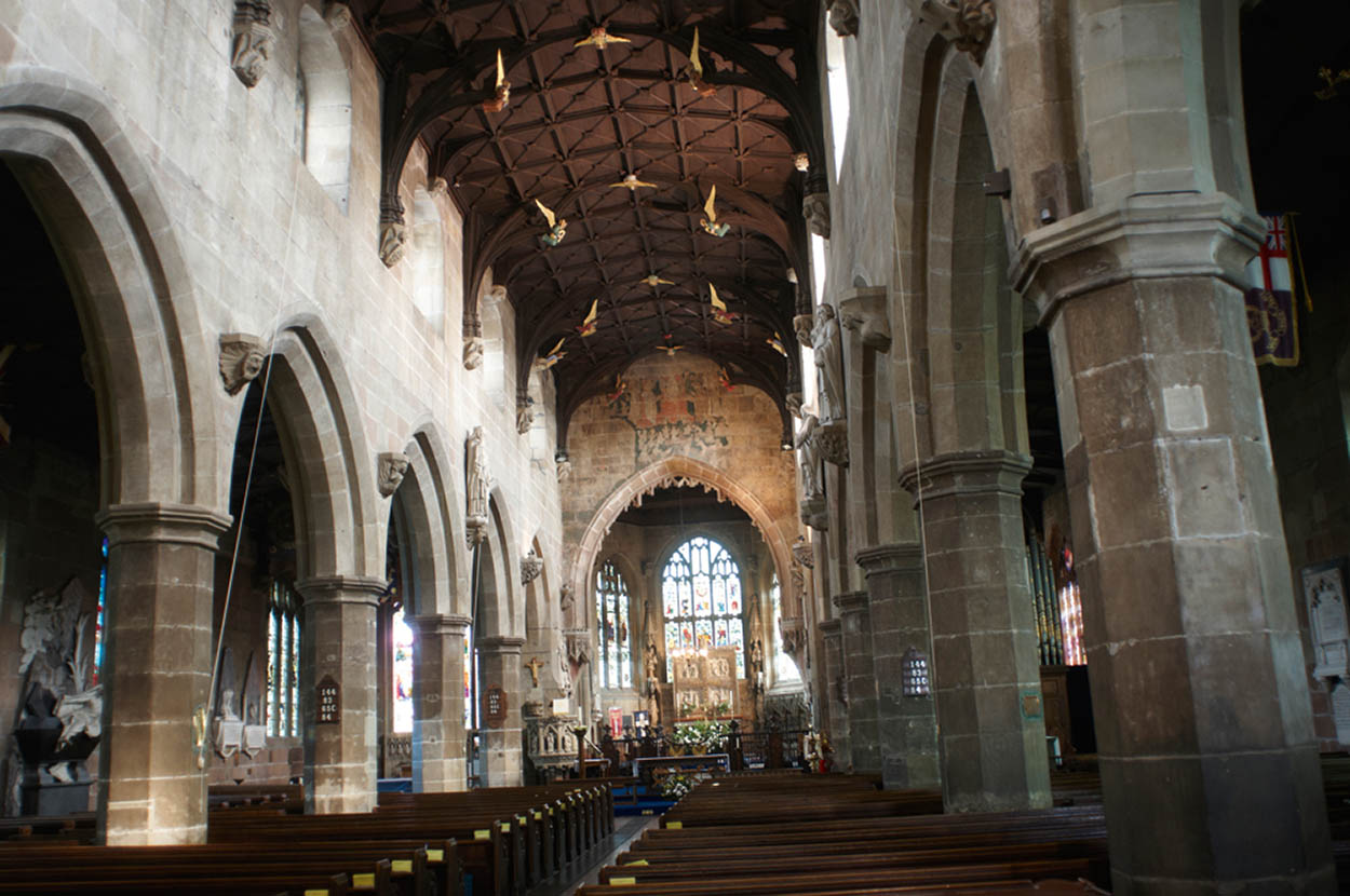
Magnificent masonry and wood carvings within St Giles Church.
William Shaw/Apa Publications
Tour 7: Wrexham to Bala – and Back
This full day’s tour of 116 miles (186km) starts in Wrexham, close to the border with England, then heads to Llangollen and on to the countryside around Bala Lake.
Highlights
Wrexham became prosperous in the eighteenth century when minerals were discovered in the surrounding countryside. It is not on the main tourist trail, but it does boast a fine church, while Llangollen, in contrast, attracts many visitors who come to enjoy the annual International Musical Eisteddfod. This corner of North Wales offers some unexpected scenic beauties, like the gloriously pastoral Ceiriog Valley. Further on, there is an unexpected wildness reminiscent of the northern Pennines of England. Villages and farmsteads cling to the edges of this ‘empty quarter’. Mist often clings to its high ground, adding moisture to an already wet landscape of bog and lakes, of tumbling streams and waterfalls. Exploration on foot is not easy, but a few mountain roads do transect the area, providing an opportunity to experience the roof of Snowdonia from the security of a vehicle.
Magnificent masonry and wood carvings within St Giles Church.
William Shaw/Apa Publications
Wrexham
The tour begins in Wrexham 1 [map] at the town’s most famous landmark, the 136ft (41m) Gothic tower of St Giles Church (Castle Street; www.stgilesparishchurchwrexham.org.uk), which is considered one of the ‘Seven Wonders of Wales’. The interior of the fifteenth-century church contains fine stained glass, including a window attributed to Burne-Jones, and traces of a fifteenth-century wall painting of the Last Judgement. The town also has a museum (www.wrexhamheritage.wales; charge), which is soon to be joined by a Football Museum for Wales. The Clywedog Trail, a 9-mile (14km) waymarked walking trail gives an insight into Wrexham’s industrial past.
Wrexham’s markets
Every Monday in Wrexham there’s a large outdoor market in Queen’s Square, with stalls selling everything from fruit and vegetables to clothes and carpets. Wrexham Country Markets, with its origins in the Women’s Institute, hold a market every Friday (9.30am–2pm) in Wingetts Sale Room, Holt Street, selling home-made cakes, preserves, crafts and plants.
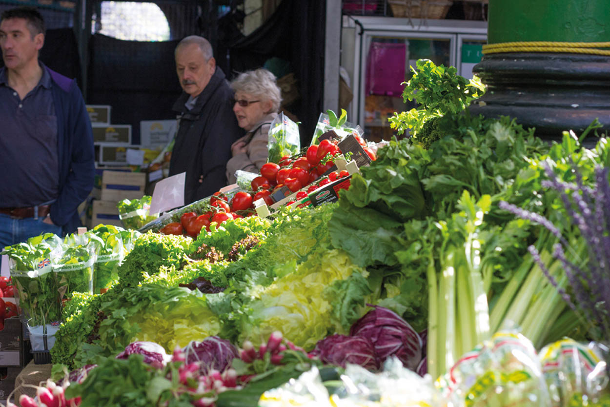
Wrexham is home to North Wales’ largest market.
Fotolia
Erddig Hall
Leave Wrexham in a southerly direction on the A483, exit at junction 3, then follow signposts on minor roads to reach Erddig Hall 2 [map] (www.nationaltrust.org.uk/visit/wales/erddig; charge). This eighteenth-century mansion, set in extensive grounds, offers a fascinating glimpse of the ‘upstairs-downstairs’ aspects of country-house life. In the family’s grand rooms, visitors can see fine furniture, paintings and textiles, which contrast with the servants’ quarters and kitchens ‘below stairs’.
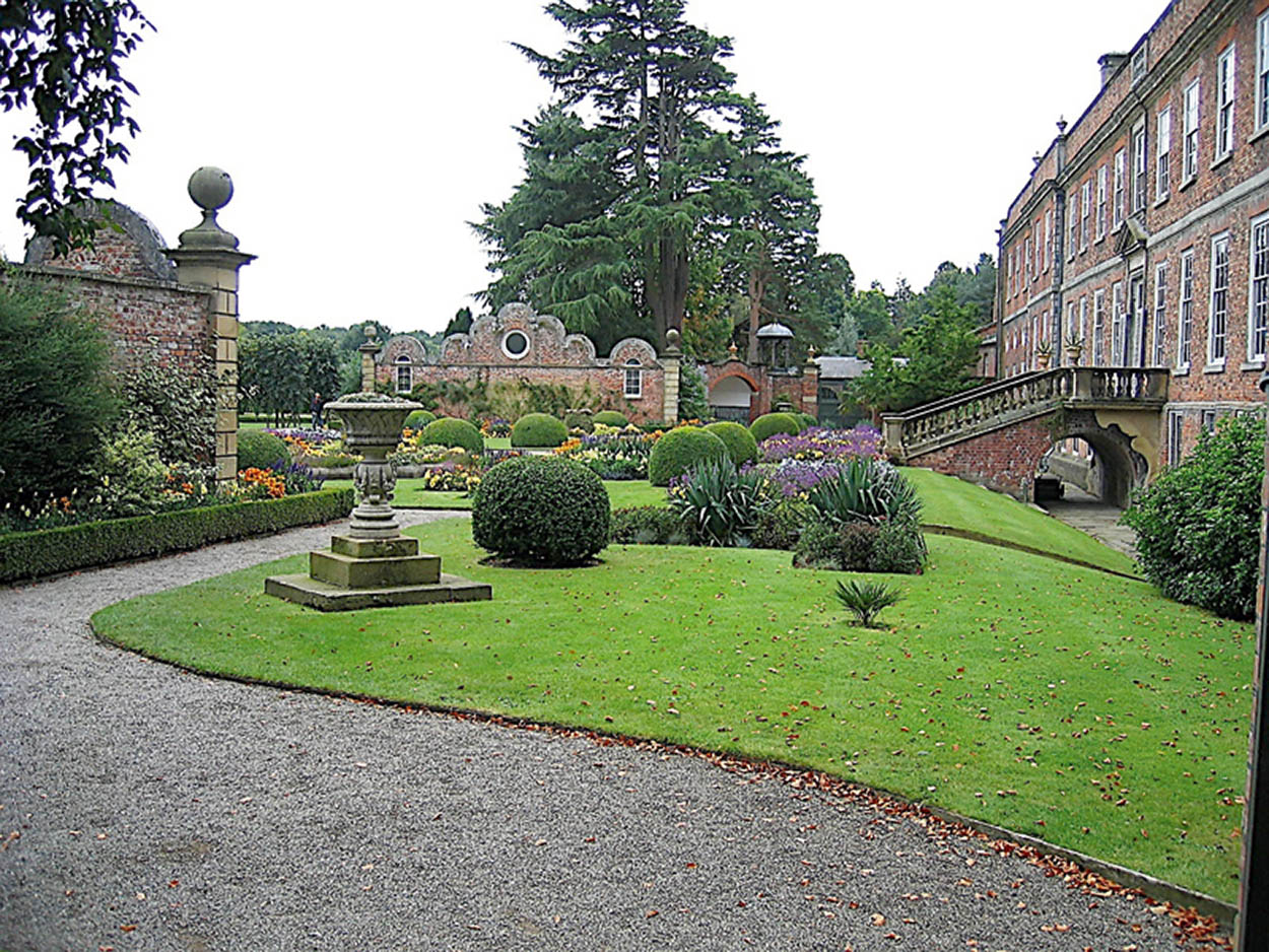
Erddig Hall.
iStock
Chirk and the Ceiriog Valley
Rejoin the A483 and continue heading south. After 7 miles (11km), at a roundabout, join the A5 towards Llangollen, then in a short distance join the B5070 to Chirk. Two miles (3km) west of Chirk, just beyond Chirk Station, is Chirk Castle 3 [map] (www.nationaltrust.org.uk/visit/wales/chirk-castle; charge). It looks like a grand stately home, but was built around 1295, during the reign of Edward I and with his royal approval. Work finished around 1310. The castle changed hands several times until, in 1595, it was purchased by Sir Thomas Myddelton, a London merchant who made it into a comfortable family home. The state rooms boast the fine furniture and paintings you’d expect from a grand house, while the extensive parkland is well worth exploring.
From Chirk, you can opt to make a wonderfully scenic drive along the B4500, which winds through the pastoral countryside of the Ceiriog Valley (Glyn Ceiriog). You can follow the road all the way to Llanarmon Dyffryn Ceiriog (bearing left on an unclassified road at The Hand public house, which includes an attractive inn). It’s about 11 miles (18km) from Chirk. Return the same route to Chirk to rejoin the main drive and go west on the A5 to reach Llangollen.
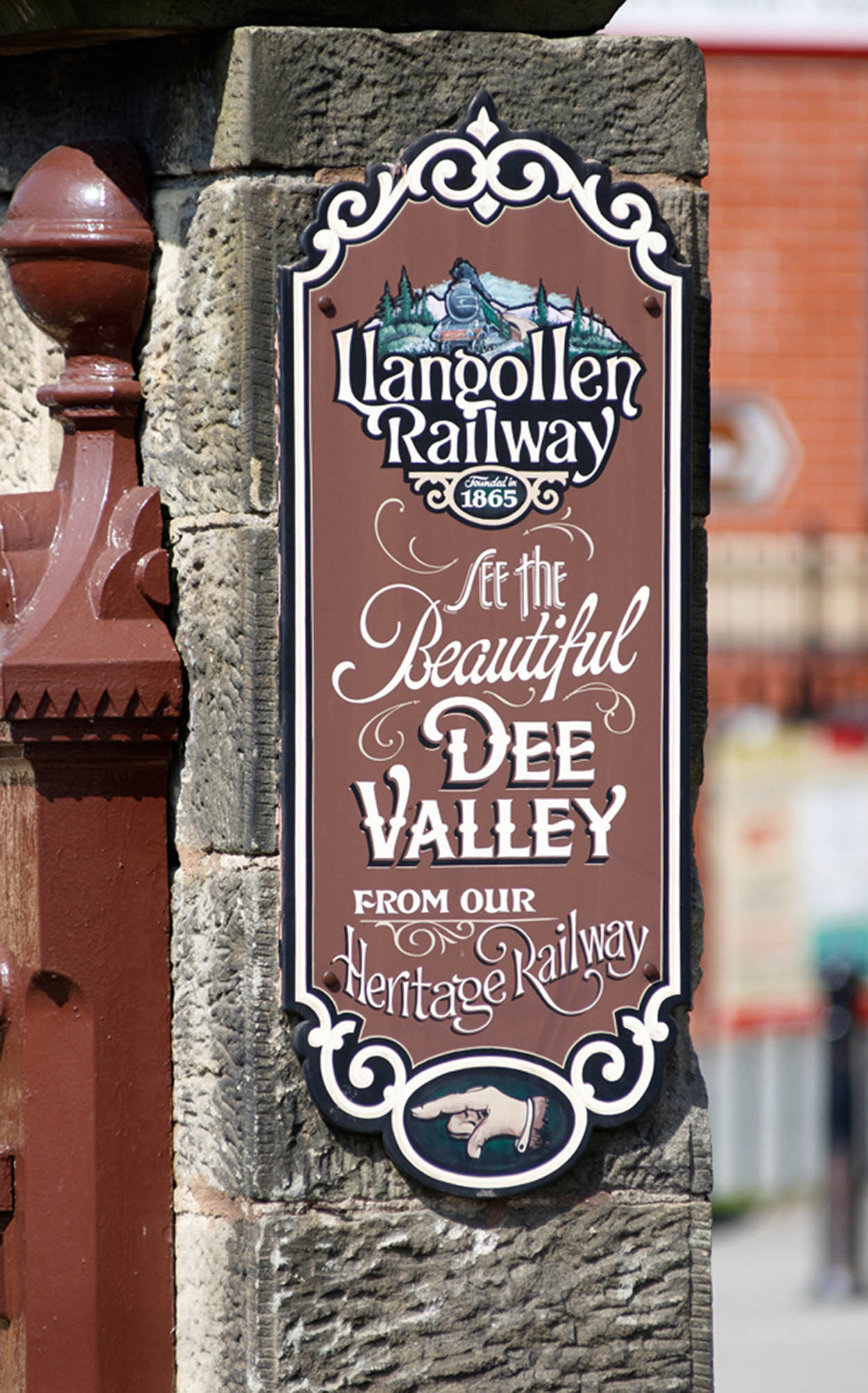
Enthusiasts preserved and reopened the railway after its closure.
William Shaw/Apa Publications
Llangollen
Llangollen 4 [map] is a lively market town on the River Dee, surrounded by picturesque scenery. It’s a popular centre for people on narrow-boat holidays, as the Llangollen Canal runs through town, part of Thomas Telford’s Pontcysyllte Aqueduct. Railway fans will want to take a journey on the Llangollen Railway (www.llangollen-railway.co.uk; charge) a steam railway which runs for 10 miles (16km) from Llangollen station to Corwen, alongside the river.
Wrexham to Bala – and Back

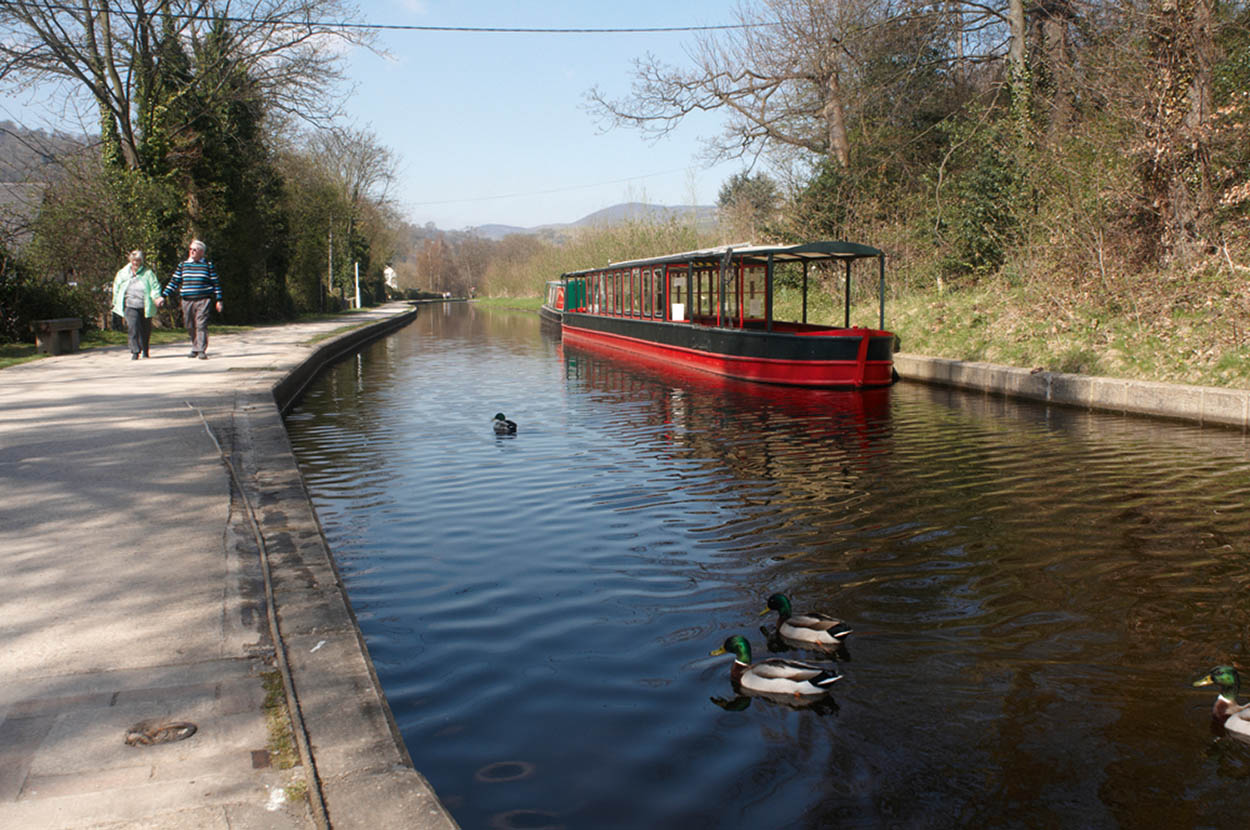
Llangollen Canal.
William Shaw/Apa Publications
Plas Newydd
Llangollen’s most famous sight is Plas Newydd (Hill Street; www.denbighshire.gov.uk; charge), the former home of Sarah Ponsonby and Lady Eleanor Charlotte Butler, an eighteenth-century lesbian couple who eloped together, set up home and became known as the Ladies of Llangollen. They lived together for 50 years and became quite a tourist attraction in their lifetime, receiving distinguished visitors ranging from the Duke of Wellington and Sir Walter Scott to Josiah Wedgwood and William Wordsworth. Their house, a fairly simple cottage when they bought it, was transformed over the years into an overpowering Gothic creation. Inside is an exhibition on their lives, while their bedchamber has been furnished to look much as it did at the end of their lives.
Valle Crucis Abbey
Around 1.5 miles (2.5km) outside Llangollen, on the A542, are the romantic ruins of Valle Crucis Abbey (www.cadw.gov.wales/visit/places-to-visit/valle-crucis-abbey; charge with free entry for disabled persons and companions), a Cistercian house founded in 1201. At that time this would have been an extremely isolated spot, ideal for contemplation. You can still feel the grandeur of the building, which was deserted after the Dissolution in the sixteenth century – and can even see the monks’ fishpond.
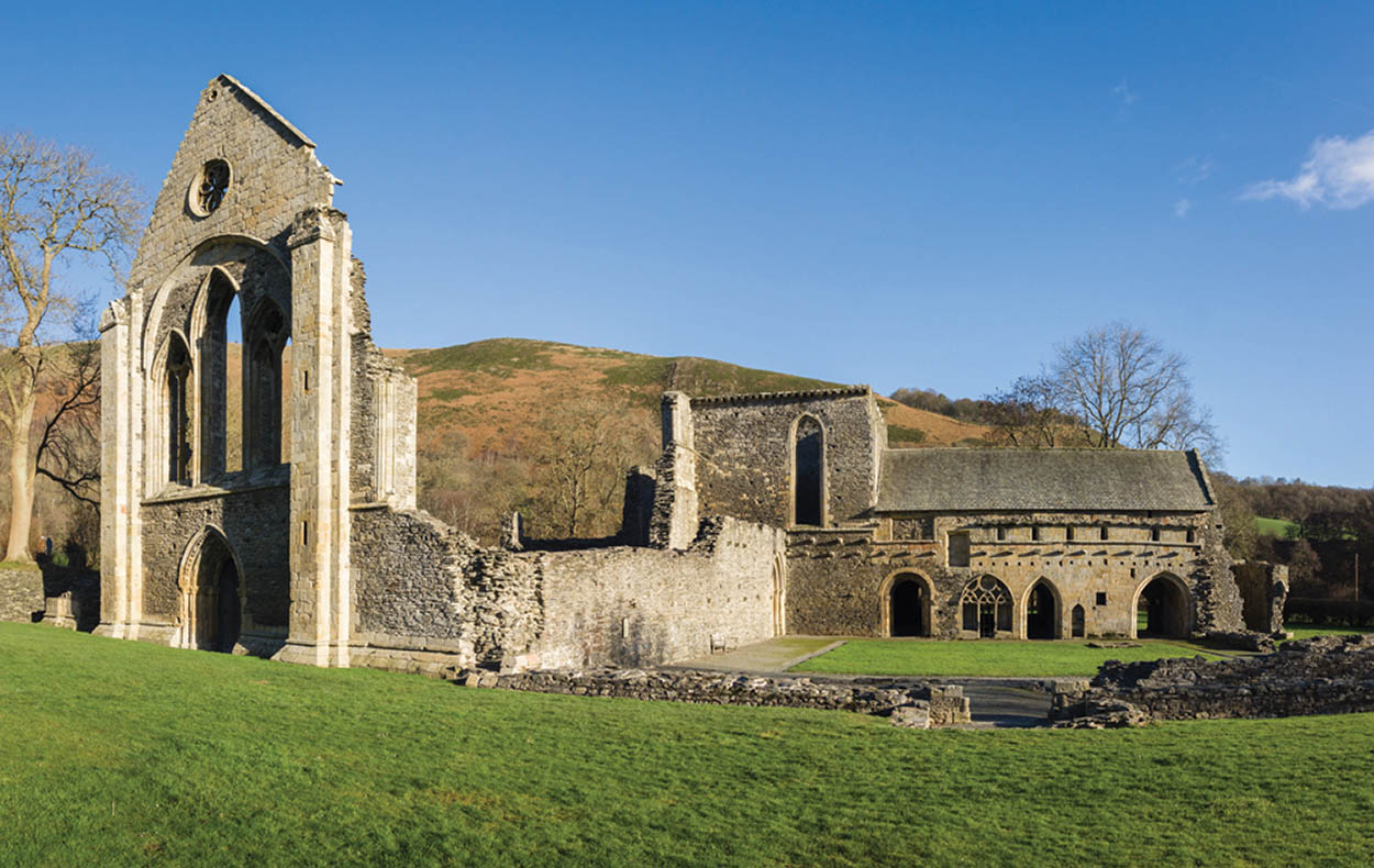
Ruins of Valle Crucis Abbey.
Shutterstock
Bala
Take the A5 from Llangollen, driving through Corwen, shortly after which you turn left to join the A494 to reach Bala 5 [map] , in Snowdonia National Park. Bala was a prosperous centre of the woollen industry prior to the Industrial Revolution. Thomas Pennant wrote of women and children ‘in full employ, knitting along the roads’. But, the town’s reputation as a religious centre proved more enduring. There is a statue to Thomas Charles, pioneer of Welsh Calvinistic Methodism and a leader of the Sunday School movement.
Bala Lake
Bala Lake (Llyn Tegid) constitutes the largest natural area of water in Wales, being about 4 miles (6.4km) long by 0.75 mile (1.2km) wide and with a maximum depth of around 136ft (48m). Because of its situation in the great rift valley extending southwest to Tal-y-lyn and the sea at Tywyn – a natural through-route from the Vale of Chester – many travellers have written of the lake, its prodigious fish population (including the unique alpine gwyniad) and the fine sailing to be had upon its waters.
Hauled by narrow-gauge steam and diesel engines, the Bala Lake Railway (www.bala-lake-railway.co.uk; check timetable) carries visitors for 9 miles (14km) along the scenic eastern shore of the lake between Bala and the village of Llanuwchllyn – the birthplace of Michael Jones, a prominent Welsh Nationalist who initiated Welsh settlement in Patagonia.
To the southeast of Llanuwchllyn, an impressive mountain road climbing to Bwlch y Groes is well worth the detour. This is Wales’s highest road pass at 1790ft (546m), giving access to the mighty Aran Mountains before dropping to Dinas Mawddwy.
From Wales to Patagonia
In the mid-nineteenth century, as the pressure to speak English increased, moves were made to protect the language by moving overseas. A Welsh nationalist non-conformist, Michael D. Jones, who lived near Bala, put forward the idea of establishing a community in Patagonia. He finally got together around 150 Welsh speakers, who left from Liverpool in 1865. The community still exists today.
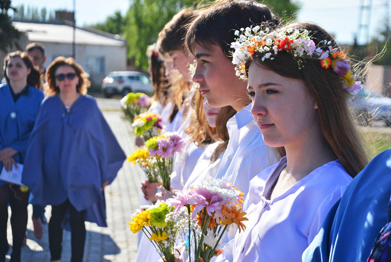
The Eisteddfod in Patagonia celebrates Welsh culture.
Fotolia
National White Water Centre
A much easier road to the west, also joining the A470 near Trawsfynydd, is the A4212 from Bala, via Llyn Celyn, a large reservoir. Just beyond the junction with the B4501 at Frongoch, to the left of the main road, is the National White Water Centre (www.nationalwhitewatercentre.co.uk). Although whitewater rafting is the main course of action here, if you don’t want to then you can enjoy their woodland walking trail, picnic spots or café beside the Afon Tryweryn. The centre also offers canyoning and canoeing.
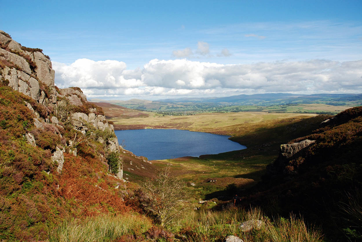
Bala Lake.
Shutterstock

Rhaeadr y Cwm, Rhaeadr Cynfal.
Shutterstock
A drowned village
Not so many years ago Llyn Celyn 6 [map] itself was just a marshy valley containing the long-established community of Capel Celyn and the old railway line from Blaenau Ffestiniog to Bala. During the 1960s – a time of momentous environmental decisions, not least the building of Trawsfynydd nuclear power station – the Afon Tryweryn was dammed to form Llyn Celyn as a holding reservoir for Liverpool Corporation. Despite much public opposition, the village of Capel Celyn, with its school, post office, chapel and farms, was drowned. Many of the community subsequently emigrated to Pennsylvania, and they and the village are remembered by a bronze plaque set on a boulder just beyond the grass-covered dam, and in a restored chapel at the lake’s northwestern end. Continue on the A4212 road to Llyn Trawsfynydd.
Rhaeadr Cynfal
A mile (1.6km) beyond the decommissioned nuclear power station on the shore of Llyn Trawsfynydd, turn right with the A470 towards Llan Ffestiniog 7 [map] , a large village of terraced stone houses situated some way south of the main slate quarries which take its name. Blaenau Ffestiniog lies 3 miles (5km) to the north. Near the old railway station a footpath that leads to Rhaeadr Cynfal, (Cynfal Falls). Another fine waterfall on the Afon Cynfal – Rhaeadr y Cwm – can be reached on foot 1.5 miles (2.5km) upstream from Bont Newydd.
The Migneint
At Llan Ffestiniog turn right onto the B4391, the old, pre-power station road from Porthmadog to Bala. Soon after passing a superb viewpoint into the Cynfal ravine, take a left turn onto the B4407. In every direction the land rolls out into bog and heather moorland. This is the Migneint 8 [map] (Swampy Place). The often-saturated hillsides of reeds and peat hags, where acid ground has encouraged the growth of mat-grass, cotton-grass and deer’s hair-sedge, represent the most significant area of such terrain in Wales. Walkers venturing forth have to contend with pools of black water, very soggy going and in all likelihood the need to navigate by compass in the frequent mists. Little wonder it is so little visited. Nevertheless, the Migneint is extremely important ecologically. Large tracts have been acquired by the National Trust and designated a Site of Special Scientific Interest.
The ribbon of tarmac winds over this desolate, lake-dotted wilderness, home to birds like golden plovers, snipe, grouse and curlew, and in about 3 miles (5km), at Pont ar Conwy, crosses the infant River Conwy not far from its source in Llyn Conwy. To the southeast rises the peak of Arenig Fach (2261ft/689m), while downstream is the sleepy village of Ysbyty Ifan, centre of the National Trust’s large Penrhyn Estate.
Fork right on an unclassified road over the River Conwy, continuing to Pentrefoelas 9 [map] on the A5. After the village of Nebo, the B5421 branches off to Llanrwst, but just beyond this fork in the road is a lay-by offering stunning views down into the Conwy Valley and up to the distant summits of Snowdonia.
Back on the A5, bypass Rhydlydan and continue to Cerrigydrudion. You may wish to extend this tour by turning right onto the B4501 Bala Road 1 mile (1.6km) south of the village. Once across the Afon Ceirw, this climbs over to the Afon Medrad valley before swinging west and south to Frongoch and back to Bala. Otherwise continue on the A5 to return to Llangollen, after which you bear north on the A483 to reach Wrexham again.
Eating out
Nr Wrexham
Pant-yr-Ochain
Old Wrexham Road, Gresford; www.brunningandprice.co.uk/pantyrochain
A lovely sixteenth-century manor house, set in pretty gardens, that is now an inn. The menu features mouthwatering dishes such as hoi sin oyster mushroom bao bun and slow braised lamb ragout, while desserts might include glazed lemon tart or triple chocolate brownie. ££
Nr Chirk
The West Arms Hotel
Llanarmon Dyffyn-Ceiriog; www.thewestarms.com.
Sitting at the heart of the scenic Ceiriog Valley, this inn boasts plenty of atmosphere with log fires, low ceilings and a cosy bar. The lunch menu includes sandwiches and small plates, while evening dishes might include classic comforts like vegan burgers and chef’s pie of the day. They also serve Sunday lunch (noon–2.30pm). Afterwards, wind down at the bar by the crackling fireplace. ££
Llangollen
The Corn Mill
Dee Lane; www.brunningandprice.co.uk/cornmill.
On fine days you can sit outside on the decked area beside the river at this lovely, converted corn mill in Llangollen. The corn mill dates back to the thirteenth century, so it’s a historic site too. As well as a good selection of light meals, you can enjoy mains such as chicken, ham and leek pie, or steak burger, and maybe lemon cheesecake and profiteroles for dessert. ££
Nr Corwen
Tyddan Llan
Llandrillo; www.tyddynllan.co.uk, booking essential.
The menu at this first-rate restaurant, set in the countryside near Corwen, reflects the best of Welsh produce, and changes frequently. There are two- and three-course set menus and an eight-course tasting menu serving delights like griddled scallops with cauliflower purée, and spiced lamb with aubergine and kofta; vegetarians can be catered for with notice. £££