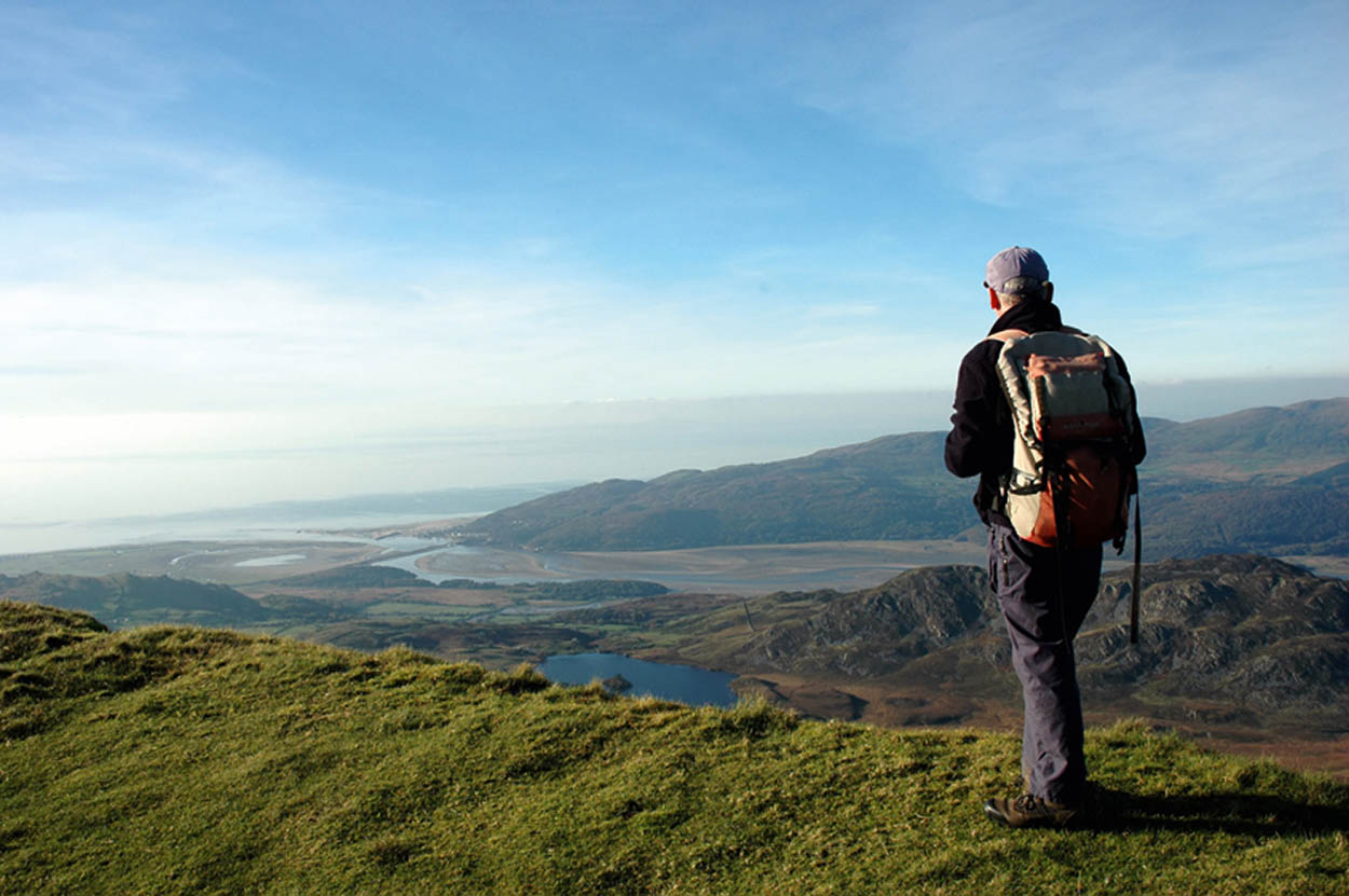
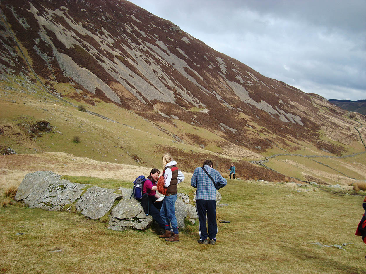
Hiking in the Cadair Idris mountain range.
Fotolia
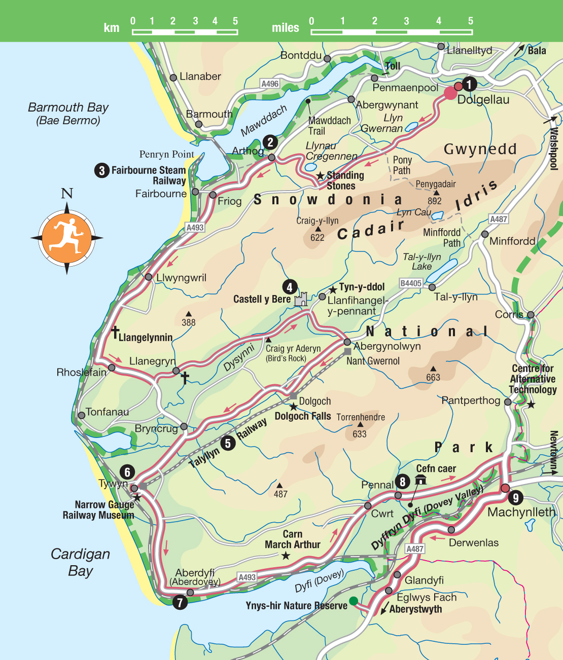
Tour 9: Cadair Idris to Machynlleth
This 48-mile (77km) full-day tour takes you past the peaks of Cadair Idris, then along the Cardigan Coast, before heading back inland to the ancient town of Machynlleth.
Highlights
Between the Mawddach and the Dyfi (Dovey) estuaries lies a bulge of high land rising to Cadair Idris and split through the middle by the Bala–Talyllyn geological fault. Mountain roads probe the heart of this, the Snowdonia National Park’s most southerly outpost with its ancient churches, castle ruins, ‘Great Little Trains’ and links with the legend of King Arthur. At Fairbourne, Tywyn and Aberdyfi, long sandy beaches provide the setting for holiday activities without the razzmatazz of more commercially developed resorts. With the southern flanks of Cadair Idris examined in Tour 8, this route sees what the great mountain has to offer from the north and east, alternating between coast and foothills to arrive, ultimately, at Machynlleth, the southernmost gateway to Snowdonia and a town with a rich Welsh history.
Hiking in the Cadair Idris mountain range.
Fotolia
Cadair Idris
This route starts in Dolgellau 1 [map] . Many come to this attractive town to explore the landscape around Cadair Idris, the mountain range whose craggy northern escarpment dominates the horizon. Some come to climb its peaks, though it can be rough walking. Already by the mid-eighteenth century, guides were leading visitors to the 2927ft (893m) summit of Penygadair, the highest peak on the Cadair Idris range. Nowadays so many tramp up the mountain that footpath erosion is causing serious problems.
Fork left up the old coaching road, a narrow lane which leaves Dolgellau from the west end of Fford Cader Idris (Cadair Idris Street), and in 1 mile (1.6km) turn right to pass roadside Llyn Gwernan. The well-known Fox’s Path up Cadair Idris starts here, but is now so badly eroded that it is no longer recommended. Further on at the Ty Nant car park at Pont Dyffrydan is the official start of the Pony Path over to Cwm Pennant; from the saddle at its highest point (Rhiw Gwredydd), Cadair Idris’s highest peak, Penygadair, is easily reached.

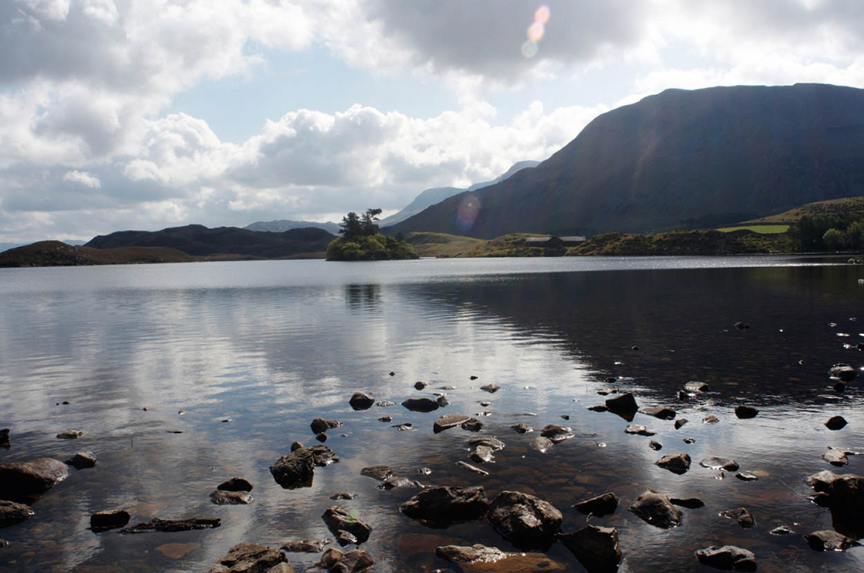
Footpath around Cregennen Lakes.
William Shaw/Apa Publications
Cadair Idris to Machynlleth

Traditional steam trains at Fairbourne Steam Railway, Arthog.
William Shaw/Apa Publications
Cregennen lakes
The road meanders along beneath frowning cliffs rising almost 1500ft (450m) to Craig-las. About 300yds/m after crossing a cattle grid, turn off right to enjoy the two idyllically situated Cregennen lakes (Llynau Cregennen), which are popular with trout fishermen. They occupy part of a 705-acre (285-hectare) National Trust property donated in 1959 by Major C.L. Wynne-Jones in memory of his two sons killed in World War II. Standing stones marked on the Ordnance Survey map date from around 1800 BC; as with others in Snowdonia their exact purpose is unknown, but they might have been deity symbols, or boundary or route markers. The heights of Cadair Idris loom to the east, with the Mawddach estuary stretching below to the west: glorious views of both can be had from the summit of the easily climbed hill immediately to the north of the lakes. The name ‘Cregennen’ is said to derive from ‘crog-gangen’, which means ‘hanging branch’. Criminals were often hung from an oak tree in this area.
Arthog
A tortuous descent ensues to reach Arthog 2 [map] . Waterfalls punctuate the stream flowing down through the village; few would guess that it rises in the tiniest of glacial corrie lakes – Llyn Cyri – high under Cadair Idris’s outlying crags. Passing near Arthog, a 9-mile (15km) -long nature trail, established by the RSPB and the North Wales Naturalists’ Trust, utilises the trackbed of the old Aberystwyth and Welsh Coast Railway (1865–1965). Called the Mawddach Trail, it skirts the estuary’s very shoreline and is suitable for walking or cycling. The route runs between Dolgellau and Barmouth. There is also a circular walk of 9 miles (14km) from Arthog that takes you into the hills. It runs through woodland that is a Site of Special Scientific Interest (SSSI), which has stunning displays of bluebells in spring, and goes past a 200-year-old beech tree and the remains of a twelfth-century courtroom.
Cregennen Lakes.
Shutterstock

Arthur and Merlin receive Excalibur from the Lady of the Lake.
Shutterstock
From Arthog, the road runs to Fairbourne, a settlement of mostly modern bungalows, which is home to the fascinating Fairbourne Steam Railway 3 [map] (www.fairbournerailway.com; check timetable for details). The railway runs for two miles (3.2km) out along a duney sandspit to Penrhyn Point. Dating back to 1895 and horse-drawn until 1916, the railway was originally a narrow-gauge conveyance of building materials. From the route, glorious river and mountain views can be enjoyed and there is a seasonal foot-passenger ferry across to Barmouth.
King Arthur
Was King Arthur a Welshman? Many people think so and claim that his last battle was fought at Camlan in Snowdonia. Others think it was fought on Snowdon itself and that Llyn Llydaw, a lake at the foot of the mountain, was the stretch of water across which the dying king was rowed to reach the island of Avalon. In Welsh, his name, Arth Fawr, means the Great Bear, and some think he was a Celtic god. Others consider it more likely that he was a fifth-century Celtic chieftain who fought against the Saxons.
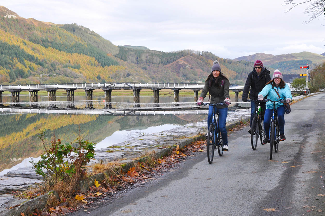
Cyclists on the Mawddach Trail.
Public domain
Walks up Cadair Idris
There are three maintained routes up Cadair Idris. The toughest is the Minffordd Path, which starts from Dol Idris car park after the junction of the A487 and B4405 Dolgellau to Tywyn road. It’s a 6-mile (9.7km) return route. The Pony Path, which is a similar distance, starts from the car park at Ty Nant farm, and is the classic ascent offering the best views. The Llanfihangel-y-pennant Path is the longest route at 10 miles (16km) return, but the easiest walk. It starts in Llanfihangel-y-pennant.
Llwyngwril
One and three-quarter miles (3km) beyond Llwyngwril on the A493 coast road, adjacent to a railway halt, stands Llangelynnin Church. Set just above the shingle beach, this primitive, mainly twelfth-century building is dedicated to a local seventh-century saint, Celynnin, and sits on the site of a much earlier structure. The church features some wall paintings, including the Ten Commandments written in Welsh, and medieval gravestones inscribed in both Welsh and English can be found in the graveyard. Near the church is a Holy Well, the waters of which were once thought to heal sick children.
Llanegryn Church
Heading south, high coastal hills force the A493 inland although the railway manages to squeeze past. In less than 2 miles (3km) bear left to Llanegryn, notable for another little church. This one sits on a hillside half a mile (800m) northwest of the village and reveals a remarkably beautiful rood screen and loft, probably carved by local craftsmen in the fifteenth or early sixteenth centuries, or, as tradition has it, brought there from Cymer Abbey near Dolgellau during the Reformation.
Walking boots, water and waterproof clothing are essential.
Mike Bean
Castell y Bere
The Afon Dysynni is crossed opposite the dramatic, soaring buttress of Craig yr Aderyn (Birds’ Rock), the only inland cormorant nesting site in Britain. Straight over the crossroads, in a wild and romantic setting at the heart of mountainous country and with fabulous views of the western flanks of Cadair Idris, stand the extensive but fragmentary ruins of Castell y Bere 4 [map] (www.cadw.gov.wales/visit/places-to-visit/castell-y-bere; free), an example of a native Welsh (rather than Norman or Edwardian) castle. Started by Llewellyn the Great around 1221, the fortress guarded southern Meirionydd and the mountain route to Dolgellau. During the early part of 1283 Castell y Bere became one of Prince Dafydd ap Gruffydd’s final refuges but was eventually surrendered later that same year to Edward I’s 3000-strong invading army. It was the last Welsh castle to fall, and although it was briefly re-taken, it was eventually destroyed and left to the elements.
The Talyllyn Railway train.
William Shaw/Apa Publications
Llanfihangel-y-Pennant
At the road’s end beyond Llanfihangel-y-pennant, a monument to Mary Jones has been installed in the ruin of her cottage, Tyn-y-ddol. In 1800, aged only 16, she walked barefoot over to Bala (about 26 miles/42km) to buy a Welsh Bible from the Methodist minister there, Thomas Charles. He had none to sell but gave her his own. Mary’s zeal for the scriptures so impressed him that he began a campaign, from which grew the British and Foreign Bible Society. From the adjacent road-end you can join the Pony Path for the classic ascent over the shoulder of Cadair Idris and on to Dolgellau.
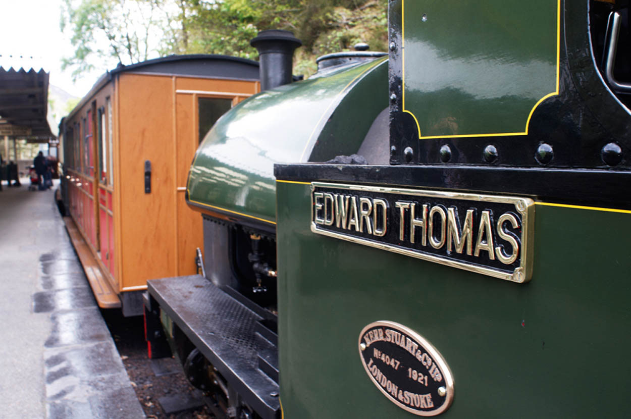
Talyllyn Railway
Return to the crossroads and bear left to Abergynolwyn. Once an important slate quarrying centre, the village nestles in the Dysynni valley surrounded by forestry. Here, short of Tal-y-llyn Lake itself, stands Nant Gwernol Station (forest walks but no road access), northern terminus of the famous 2ft 3in (68cm) narrow-gauge Talyllyn Railway 5 [map] (www.talyllyn.co.uk). The line is the oldest of its kind in the world and one of the best known of Wales’s ‘Great Little Trains’. In continuous service since 1865, originally used to transport slate to the main line at Tywyn down on the coast, its trains now merrily puff the 7.25 miles (11.6km) between Nant Gwernol and Tywyn with cargoes of sightseers. The line was saved from obscurity in 1951 by the Tal-y-llyn Railway Preservation Society, the world’s first such organisation, which has since been emulated by many similar groups. The entire railway journey of an hour each way can be varied by alighting at intermediate stations. A short walk from Dolgoch Station, for example, leads through woods to the attractive Dolgoch Falls; below the falls the line is carried across the little gorge on an impressive viaduct. There are also forest walks in the Nant Gwernol ravine.
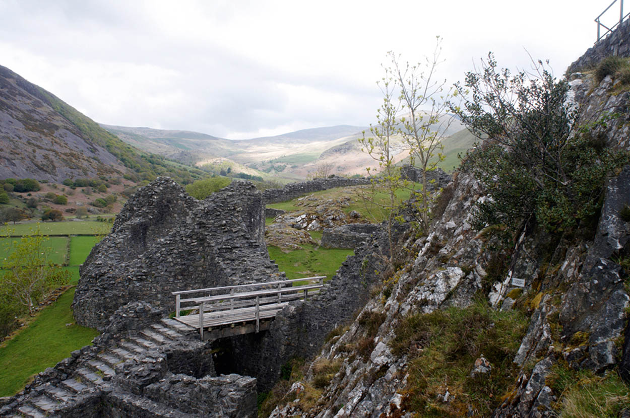
The ruins of Castell y Bere.
William Shaw/Apa Publications

Aberdyfi.
William Shaw/Apa Publications
Tywyn
Running parallel to the railway, the B4405 meets the A493 at Bryncrug, 2 miles (3km) from Tywyn 6 [map] . This is where the railway’s main station is situated, together with the Narrow Gauge Railway Museum (www.narrowgaugerailwaymuseum.org.uk; free but donations welcome), which combines displays of old locomotives with the history of the slate mining industry in North and Mid Wales. The museum has a section devoted to the Rev. W.V. Awdry, the creator of Thomas the Tank Engine. Rev Awdry was once a volunteer on the Talyllyn Railway. Tywyn’s evolution as a seaside resort owed much to John Corbett, a salt baron from Droitwich who built Marine Terrace, the Market Hall and the Assembly Rooms (now a cinema). Adjacent to the latter stands St Cadfan’s Church, in which will be found the seventh-century St Cadfan’s Stone bearing an inscription thought to be the oldest example of written Welsh in existence.

Aberdyfi pier.
William Shaw/Apa Publications

The Owain Glyndwr Centre in Machynlleth.
William Shaw/Apa Publications
Aberdyfi
Dunes seaward of the road and railway extend south to Aberdyfi 7 [map] (Aberdovey – meaning ‘Mouth of the Dovey’), a pleasant resort best known for its golf course and sailing facilities. The Tourist Information Centre on The Wharf (www.aberdyfi-council.wales/aberdovey-tourist-information-centre) provides an accommodation booking service, guide books and maps of local walks. Aberdyfi boasts a major Outward Bound Centre and is popular with windsurfers, kitesurfers and sailors. Aberdyfi is also the starting point for the 108-mile (174km) Dyfi Valley Way exploring countryside on both flanks of the river north to its source under Aran Fawddwy, and crossing the site of King Arthur’s legendary last battle at Camlan. The Dyfi is the traditional frontier between North and South Wales. The Meirionnydd Coast Walk also starts at Aberdyfi, the route passing standing stones and holy wells as it takes you along the coast to Porthmadog. The path is 72 miles (116km) long and can be split into eight easy one-day sections.
Aberdyfi’s profile was raised when Charles Dibdin composed the song The Bells of Aberdovey for his opera Liberty Hall in 1785. Of many stories surrounding the mysteriously pealing bells beneath the sea, the most commonly quoted (and embellished) concerns Cantre’r Gwaelod – the Lowland Hundred. This once fertile low-lying plain was protected from the sea by dykes in the care of Seithennin, a notorious drunkard. One stormy night, while making merry at a feast, he forgot to close the sluices. The Lowland Hundred was inundated and Manua, its principal settlement containing the bells, disappeared forever beneath the waters of Cardigan Bay.
Owain Glyndwr
Owain Glyndwr (c.1350–1416) is a name you will hear wherever you travel in North Wales. Descended from the Princes of Powys, Glyndwr was wealthy and educated, and even served in the English army. When a nobleman in Ruthin appropriated some of his land, Glyndwr appealed to the courts but lost his case: the nobleman was close to Henry IV. Glyndwr gathered supporters and attacked Ruthin, the start of a rebellion against English rule. He took castles, including Harlech, and proclaimed the first Welsh parliament in Machynlleth in 1404. However, by 1408 when Harlech was taken by royal forces, he was forced into hiding somewhere in Snowdonia and vanished into obscurity. No one even knows where he is buried.
Carn March Arthur
From the top of the village an unclassified road climbs to the route of a prehistoric ridgeway. Ten minutes’ walk beyond the farm at the road-end is Carn March Arthur, a rock that is said to bear the hoofprint of King Arthur’s horse, made as he leaped from a cliff to escape advancing Saxons. It’s marked by a stone tablet. A little further on, to the left, lies Llyn Barfog (Bearded Lake), perhaps referring to its covering of water-lilies, or alternatively to tales of hairy monsters associated with Arthurian legend.
Pennal
Tracing the Dyfi’s shoreline (the National Park boundary), the A493 passes Pennal 8 [map] . Pennal is an ancient site, and its church, St Peter ad Vincula, was founded in the sixth century. It was here, in 1406, that Owain Glyndwr is thought to have signed a letter to Charles VI of France asking for help in his rebellion and outlining his plans for an independent Wales, which included establishing Welsh universities, an independent church and a Welsh government. In the letter, known today as the Pennal Letter, Glyndwr offers to recognise Benedict XIII of Avignon as Pope. Today the church holds a facsimile of the letter. At Cefn Caer, 1640ft (500m) to the southeast, the Romans built a fort guarding one of the lowest crossing points on the Dyfi. A medieval hall house stands on the site (tel: 01654 791230; open to visitors by appointment). The house, which was home to Owain Glyndwr for a time, contains many original features. Nearby are the mounds of a Bronze Age tumulus and a medieval motte.

Machynlleth’s clock tower.
William Shaw/Apa Publications
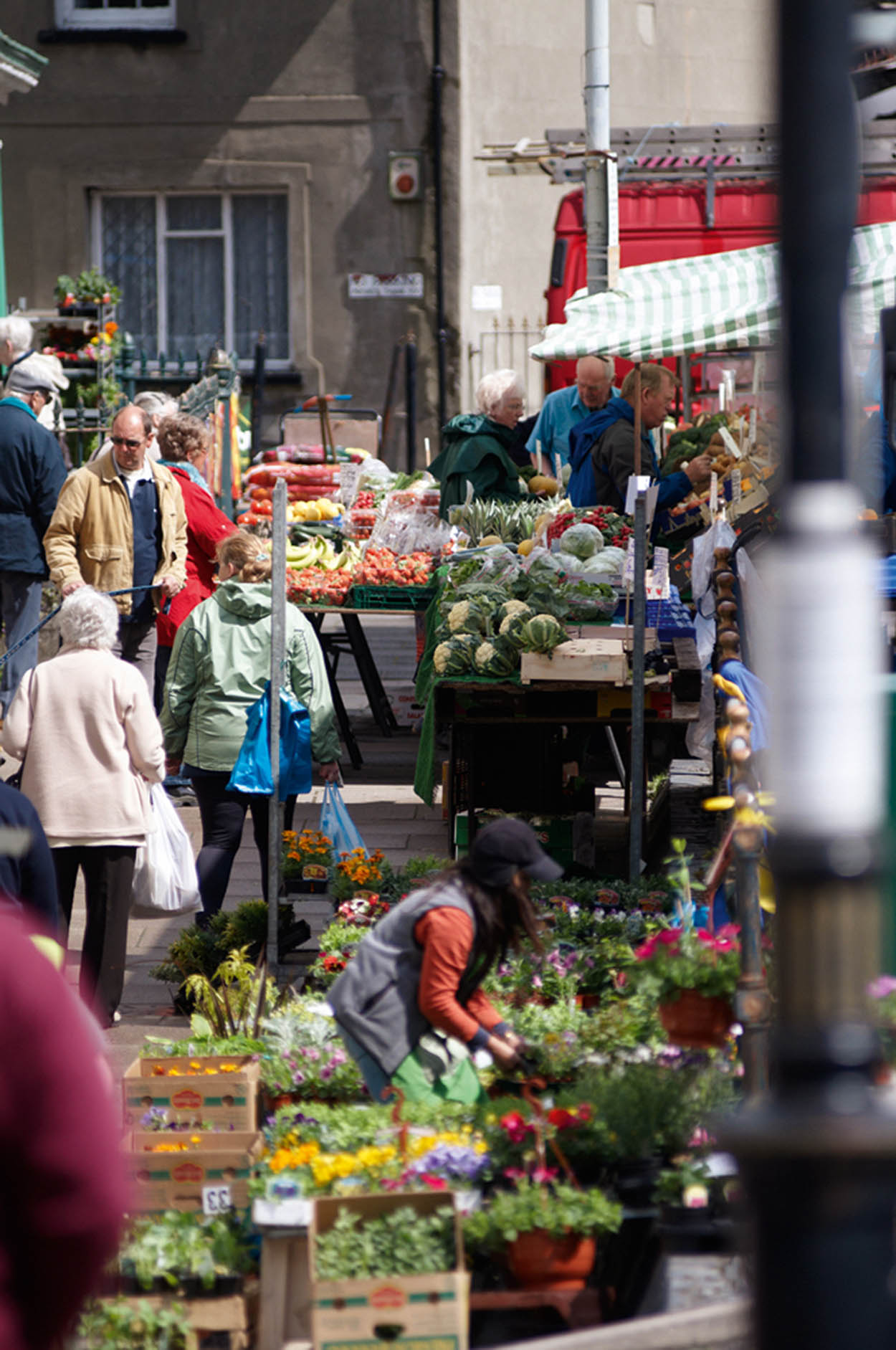
The weekly market in Machynlleth.
William Shaw/Apa Publications
Machynlleth
At Pen-y-bont turn right over the river and beneath the railway line to enter Machynlleth 9 [map] . The town’s centrepiece is a splendid Victorian Clock Tower built in 1873 to commemorate the Marquess of Londonderry’s family who then owned the imposing seventeenth-century Plas Machynlleth, set in parkland to the south.
One of the town’s most historic sites is the late medieval Owain Glyndwr Centre (www.canolfanowainglyndwr.org; free) in the Parliament House. This building incorporates the remains of an earlier structure in which the Welsh people’s hero established the country’s first Parliament in 1404. George Borrow lodged at the town-centre Wynstay Hotel during his tour of Wales in 1854.
The Museum of Modern Art (MOMA) is in The Tabernacle, a former Wesleyan Chapel (www.moma.cymru; free). The museum has a permanent collection of contemporary artworks, primarily from artists living or working in Wales. There are also temporary exhibitions and concerts.
Ynys-hir Nature Reserve
This route ends here but travel just a few miles south-west of Machynlleth to Ynys-hir Nature Reserve (www.rspb.org.uk). This extensive reserve provides a home for a wide range of birds such as egrets, redshanks and wood warblers. There are five hides, two viewpoints and two circular nature trails, making it a great place for the whole family.
Eating out
Nr Dolgellau
Penmaenuchaf Hall
Penmaenpool (1.5 miles/2.4km west of Dolgellau); www.penmaenuchaf.co.uk.
Elegant dining in the garden restaurant of this country hotel combines contemporary features such as Welsh slate floors with white tablecloths and candlelight. A modern British menu features dishes such as curried swede with charred onion, and Rhug Estate organic Welsh lamb. £££
Aberdyfi
Penhelig Arms
Terrace Road; www.penheligarmspubaberdyfi.co.uk.
This seafront hotel offers well-loved classics such as Sunday roasts and sausage and mash. There are also sandwiches, jacket potatoes and two-course set menus (Mon–Fri) on offer. Vegetarian choices also feature. ££
Machynlleth
Tŷ Medi
Heol Maengwyn; www.ty-medi.co.uk.
Formely the Quarry Café, this vegetarian and vegan restaurant serves omelettes, loaded burgers and pastries across their brunch, lunch and afternoon treats menus. Gluten-free options also available. £
Nr Machynlleth
Ynyshir Hall
Eglwysfach (off A487); www.ynyshir.co.uk.
This fabulous restaurant holds two Michelin star and is a serious dining experience, albeit at an eye-watering price. Dishes are meat-focused with a few fish options. Attention to detail is paramount, as is the provenance of the food, which is served as a series of small integrated dishes. £££