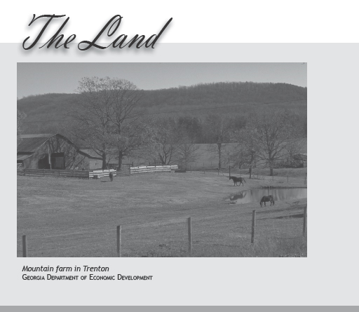
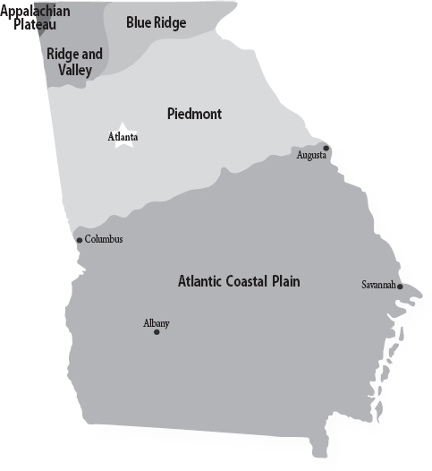
Georgia is known as “the Empire State of the South” for good reason. With an area of 58,930 square miles, it’s the largest state east of the Mississippi River. Geographically, the state is divided into five diverse regions: the Appalachian Plateau, in a tiny northwestern corner; the Ridge and Valley Region, also in the northwest; the Blue Ridge in northeastern Georgia; the Piedmont; and the Atlantic Coastal Plain.
The Appalachian Plateau in Dade County is part of a plateau that begins in New York and ends in Alabama. The adjoining Ridge and Valley Region is the source of much of the coal mined in the United States. As the home of Cloudland Canyon State Park, this area offers some of the state’s most scenic views.
The Blue Ridge gets its name from the blue haze that often surrounds the mountains. The highest peak in the Blue Ridge is Brasstown Bald in Towns County, at 4,796 feet. Rabun Bald in Rabun County and Tray Mountain in Towns and White counties are slightly lower, at 4,694 feet and 4,430 feet, respectively. The Appalachian Trail begins—or ends, depending on where you start—at Springer Mountain, a 3,782-foot peak in Gilmer County. Hikers on the trail face a higher challenge in Union County on Blood Mountain, which measures 4,461 feet.
The Eastern Continental Divide follows the crest of the Blue Ridge Mountains. It serves as the dividing line between rivers and streams that drain into the Gulf of Mexico and those that drain into the Atlantic Ocean. Much of the land in this area is part of the 750,000-acre Chattahoochee National Forest, home to hardwoods, evergreens, rushing mountain streams, pristine lakes, and tumbling waterfalls. Amicalola Falls is the tallest waterfall east of the Mississippi. Other scenic waterfalls include Anna Ruby, Toccoa, and Hiawassee.
Among the rivers in the region, the wild and scenic Chattooga is the most popular among kayakers, canoeists, and whitewater rafters. The Chattooga was made famous—or infamous, depending on your point of view—by James Dickey’s novel Deliverance and the subsequent movie starring Burt Reynolds, Jon Voight, and Ned Beatty.
The Piedmont, south of the Blue Ridge, is an area of gently rolling hills. The state’s most populous cities—Atlanta, Augusta, Athens, Columbus, and Macon—are in the Piedmont. Geographic landmarks include the Savannah River in the east, Lake Lanier in the north, and the Chattahoochee River, which flows through the Piedmont and Atlanta on its way to the Gulf of Mexico. One of the most unusual landmarks is Stone Mountain, a 1,683-foot peak of exposed granite 16 miles from Atlanta.
The Piedmont is separated from the Atlantic Coastal Plain by the fall line, a narrow strip that marks the end of the crystalline rocks of the Piedmont and the sedimentary rocks of what was the coastline millions of years ago.
Georgia’s Coastal Plain includes the Upper Coastal Plain and the Lower Coastal Plain. Both are prime agricultural areas for peanuts, soybeans, cotton, tobacco, pecans, and peaches. Antebellum plantations thrived along the middle and most fertile region, known as the Black Belt. The soil becomes sandier and less desirable for growing crops the closer you get to the coast. Many farms in this area have been turned into pine forests and sold to pulpwood and lumber companies.
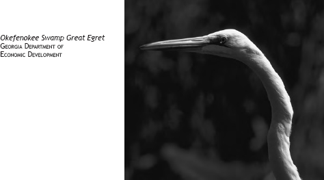
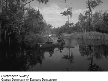
If you keep driving south through the Coastal Plain, you will eventually run into the Okefenokee Swamp, the nation’s largest wildlife refuge. The Okefenokee—“Land of the Trembling Earth” in Seminole—was created when the eastern ridge rose abruptly, isolating a vast pocket of coastal water. Vegetation and cypress trees gradually spread until the area became one gigantic peat bog.
That’s what scientists say. The Seminoles have a more interesting explanation for how the Okefenokee was formed. According to legend, the swamp was created when humans fought beavers over ownership of the land. The beavers, who were poor losers, broke all of their dams, flooded the area, and then left. To this day, the Okefenokee is full of wildlife and waterfowl—but no beavers. The Suwannee River, made famous in Stephen Foster’s song, originates in the Okefenokee.
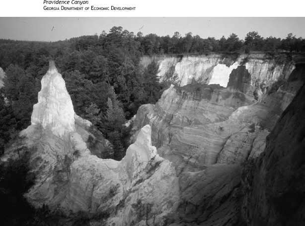
If you head west toward Columbus, you’ll encounter Providence Canyon. Described as “Georgia’s Little Grand Canyon,” Providence has colorful red-and-white walls that descend sharply from a forested area dotted with rare wildflowers.
Georgia’s Lower Coastal Plain includes the Atlantic coast and the barrier islands. Geologists have found a series of prehistoric terraces—former coastlines—formed by rising and falling sea levels during the Ice Age. The coastline is still changing today, thanks to waves, wind, currents, and tides.
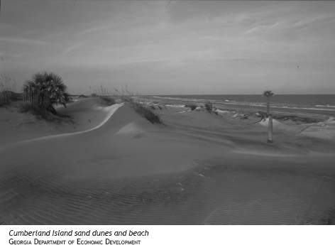
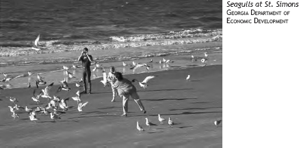
This region is famous for the historic port of Savannah and 100 miles of beaches, marshlands, and barrier islands including St. Simons, Jekyll, Sea Island, and Tybee. While these islands have become popular resort destinations, Cumberland Island is protected by the National Park Service. Wild horses still run free on Cumberland, and loggerhead turtles lay their eggs on the beach. Other barrier islands are Little Tybee, Ossabaw, Wassaw, St. Catherines, Sapelo, Wolf, Blackbeard, Little St. Simons, and Little Cumberland. Sea Island, Jekyll, St. Simons, and Tybee are accessible by bridges, but other islands can be reached only by boat.
Hundreds of years ago, Native Americans farmed and fished on these islands. The Spanish, who established a mission during the 1500s, grew figs, peaches, and citrus crops. Later, plantation owners cultivated rice, sea-island cotton, and indigo. At the end of the 19th century and the beginning of the 20th century, Northern industrialists and millionaires bought some of the islands and turned them into resorts and private playgrounds for themselves and their friends.
There used to be a common saying in Georgia: “If you don’t like the weather, don’t worry, it’ll change pretty soon.” I’m not sure that’s true anymore. For the last few years, North Georgia has been under a severe drought that has dropped lake levels drastically and led to outdoor watering restrictions for homeowners in several counties. Thunderstorms still pop up in the summer, but some parts of the state are 15 inches or more below the normal average amount of rainfall.
Newcomers to Georgia can expect to find very hot and humid weather from June through most of September. Yes, I know what the tourism and chamber of commerce folks say about the average temperature, but you can take those figures with a grain of salt—or a large tumbler of ice water or sweet tea.
The good news is that winters are relatively mild in most parts of the state. The mountain areas get a few snowfalls and an occasional ice storm, but that’s nothing compared to what folks endure in Minnesota or Buffalo, New York.
The great news is that spring and fall are glorious in Georgia. The colors of the leaves in autumn make the landscape look like one giant quilt. And spring is a season of blooming azaleas, dogwoods, apple and peach trees, and uncountable flowers both wild and domestic.
Here, then, is a more detailed description of the weather you can expect from each region.
The climate in the northern, mountainous part of the state varies according to elevation. Summer temperatures generally average in the mid-80s, with a few days in the 90s. Winter temperatures frequently are below freezing, and snowfalls of several inches are not unusual. Annual average temperature in the mountains is in the 50s.
In the Piedmont, the average winter temperature is a little warmer—about 57 degrees—and the summer temperature is a lot warmer—about 89 degrees with high humidity. Snowfalls of one or two inches occur only once or twice a year but generally create massive traffic problems, especially in Atlanta.
You won’t need many sweaters if you live in the Coastal Plain. This area has mild winters and few days below freezing. The annual average temperature is 77 degrees, which sounds ideal until you realize that summer temperatures in the high 90s are not uncommon. Rainfall is heaviest along the coast.
Georgia does occasionally have extreme weather. The lowest recorded temperature was 17 degrees below zero and the highest recorded temperature 112 degrees. Georgia is not as susceptible to tornadoes as the Midwest, but it has been hit by some severe storms. The most recent tornado hit downtown Atlanta on March 14, 2008, damaging the World Congress Center, the Georgia Dome, and several surrounding skyscrapers while thousands of spectators were in the dome watching the Southeastern Conference basketball tournament. No deaths were reported.
Hurricanes are not a major treat for direct hits on the coast, but tropical storms occasionally cause flooding and heavy rains and winds in the middle and southern parts of the state.
Georgia is still a relatively green state, despite the construction of office parks, shopping malls, and subdivisions. Some cities have enacted ordinances requiring approval by an arborist before certain kinds of trees can be cut.
Most of Georgia’s 250 species of trees are grown for commercial purposes. These include pecan, white and yellow pine, white oak, cypress, cedar, hickory, and maple, as well as fruit trees such as peach, pear, and cherry. Other trees in the state are yellow poplar, sycamore, sweet gum, black gum, dogwood, sassafras, and magnolia.
Flowering shrubs include mountain laurel, rhododendron, flowering quince, and yellow jasmine. Spanish moss can be found hanging from live oaks in the Coastal Plain. And kudzu, a vine imported from Japan to control erosion, is rapidly taking over every abandoned barn and junked car in the state.
Georgia has 155 plant species on its protected and endangered lists. These include pink lady’s-slipper, smooth purple coneflower, hummingbird flower, Alabama milkvine, Georgia indigo bush, nutmeg hickory, hairy rattleweed, leather flower, and American barberry. A complete list can be found at the Georgia Department of Natural Resources website, www.gadnr.org. A good place to see many of Georgia’s native plants is the 300-acre State Botanical Garden of Georgia in Athens. Classes are offered in the preservation of native plants and other gardening subjects.

Kudzu
This creepy, crawly, climbing vine from Japan was supposed to save Southern soil from eroding and washing away to the Atlantic Ocean and the Gulf of Mexico.
Introduced by the Japanese at the 1876 Philadelphia Centennial Exposition, it was not planted in Georgia until the 1920s. What began as an invasion of small cuttings spread like, well, kudzu during the 1930s, when the Soil Conservation Service enlisted the Civilian Conservation Corps to plant the vine to help control erosion. The government was so enthusiastic about kudzu that it paid farmers $8 an acre to plant it.
If kudzu had a spokesman, it was Channing Cope, a Covington radio host who wrote a farm column for the Atlanta Journal-Constitution. Cope even started the Kudzu Club. In 1949, he wrote the book Front Page Farming, in which he encouraged farmers to plant their entire acreage in kudzu as food for cows and other livestock.
Little did Cope and agricultural experts realize what they had unleashed. In his poem Kudzu, James Dickey likens it to a Japanese invasion and warns Georgians to keep their bedroom windows closed to prevent the vine from creeping inside while they sleep.
Dickey wasn’t exaggerating much. The plant seemed to grow overnight, climbing trees and covering abandoned houses and barns. The United States Department of Agriculture finally recognized kudzu as a weed in 1972, but it was too late by that time. Kudzu had taken root in Southern culture, as well as in much of its unused farmland.
Although development and overhunting have thinned or eliminated some wildlife, Georgia is still home to more than 90 species of animals, including white-tailed deer, rabbits, opossums, raccoons, black bears, muskrats, minks, foxes, and squirrels.
Gone are the bison, red wolves, and wild cougars that roamed the forests and fields when the first Europeans arrived in the 1500s and 1600s. Species that have declined in number in Georgia’s coastal waters include manatees, right whales, and humpbacks.
The animals that have survived and thrived are the ones most adaptable to their changing habitat. The raccoon population, for example, has increased in Georgia.
More than 130 bird species, including the brown thrasher (the state bird), the mockingbird, the bobwhite quail (the state game bird), and a variety of sparrows can be found in most places in the state. Other native birds are cardinals, ruby-throated hummingbirds, catbirds, wrens, owls, purple martins, whippoorwills (or goatsuckers), hawks, herons, buzzards, bald eagles, snowy egrets, and white ibises.
Georgia’s diverse habitats are attractive to birds that stop and stay awhile before migrating to other places. At one time or another, some 347 species of birds can be seen in the state, particularly in the coastal areas.
Birds in Georgia can be classified as permanent residents, summer breeders that migrate from Central and South America, winter residents, and Neotropical migrants that stop in Georgia in the spring and fall.
Mark Catesby, an ornithologist who arrived in Georgia in 1723, was the first to systematically count and list the birds in the state. John Bartram sighted 215 birds and noted them in his 1791 book, Travels. Later, famous artist John James Audubon included paintings of the birds he found in Georgia in Birds of America. Thomas Burleigh’s 1958 book, Georgia’s Birds, is considered the first comprehensive work on the state’s feathered inhabitants.
Georgia is a great place for bird watching because of its location on the Eastern flyway migration route. More than 350 species, from woodpeckers to blue jays, can be seen throughout the year. One of the best places for bird watchers is Harris Neck National Wildlife Refuge in McIntosh County. Located on an abandoned World War II army airfield, the refuge consists of 2,700 acres of forests, open fields, and saltwater marshes. These different habitats support songbirds, birds of prey, wading birds, and waterfowl. Wood storks and white ibises can be seen most any season, but the best time to see great egrets, snowy egrets, black-crowned night herons, and other waders is in May and June. Painted buntings are most plentiful from late spring through summer.
The state has 42 species of snakes. While you may not like them, they provide a useful service by keeping the rodent population under control. Most snakes are harmless, but beware the following poisonous varieties found in most parts of the state: copperheads, water moccasins, Eastern diamondback rattlesnakes, and pigmy rattlesnakes. Coral snakes usually don’t venture far from the Coastal Plain of Georgia. They are more common in Florida.
Georgia is a fisherman’s paradise whether you’re interested in mountain trout, largemouth bass, flounder, or mullet. The lakes of Georgia teem with catfish, bream, crappie, eel, and shad, while the coastal waters are alive with crabs, turtles, shrimp, oysters, mackerel, and other saltwater fish.
The state is one of the nation’s leaders in the preservation of wildlife and wildlife habitat and was one of the first to pass legislation protecting tidal marshlands. Thousands of acres are protected in national forests. The Georgia Conservancy is also active in preserving natural areas.
Settlement and Environmental Issues
The geography of Georgia influenced how it was settled and what happened to the environment once more people arrived. The Native Americans who first came to what is now known as Georgia more than 10,000 years ago used fire as a tool to clear forests and create fields. Lightning strikes also played a role in burning some forests.
As the Native Americans became less nomadic, they tended to settle in the river valleys, where they built earthen mounds, permanent residences, and stockades. As they set fires to clear more land, different types of vegetation, such as cane, replaced the trees along the rivers and streams.
When the Europeans arrived, they quickly transformed the environment by cutting trees in large numbers, gathering ginseng, and trapping animals for their pelts. By the early 1700s, millions of deer hides and beaver, fox, otter, and elk skins were shipped to Europe. As animals such as buffalo, beaver, and elk became scarce or disappeared, agriculture began to replace trapping as a source of income. Rice plantations sprang up along the coast, and cotton farms were carved out of timberland in the rest of the state.
General James Oglethorpe prohibited the owning of slaves when he founded Georgia, but competition from slave-owning planters in South Carolina and protests from Georgia settlers soon forced him to lift the ban. The introduction of slaves in the 1750s sparked a growth in large plantations in the coastal area. Cotton production in the upcountry and the Piedmont boomed after the invention of Eli Whitney’s cotton gin in 1793. Until then, cotton had to be separated from the seeds by hand. This was not difficult for the long-staple sea-island cotton but was very tedious for the short-staple upland cotton. The cotton gin allowed the expansion of cotton plantations and the addition of more slaves in the northern and western parts of the state.
As fields grew less fertile after repeated crops of cotton, farmers abandoned them to erosion and moved on to better soil. Left barren, the soil eroded into streams. Silt buildup in the streams resulted in flooding. The emancipation of the slaves after the Civil War reduced much of the cotton industry, but the heaviest damage came from the migration of the boll weevil into the Southern states in the 1920s.
Until the Civil War, most logging was done along rivers or large streams that allowed the logs to be floated to ports. The expansion of railroads and the use of portable sawmills after the war drastically changed Georgia’s landscape.
Over the last three decades of the 19th century, timber companies decimated longleaf pine forests and the cypresses in the Okefenokee Swamp. By the 1930s, overcutting, urbanization, and the advent of the automobile drastically reduced much of Georgia’s forests.
Two things helped reverse the trend in the late 1930s: new trees began sprouting on abandoned farmland, and Congress passed the Soil Conservation Act. Under the act, farmers were encouraged to turn some of their fields into pastures, to create terraces and plant kudzu to control erosion, and to practice strip cropping and plant rotation. These efforts, immediately successful, were boosted in 1944 when Congress passed the Flood Control Act to create dams and recreational lakes.
The landscape was changed again when University of Georgia chemist Charles Herty found a way to use young pines to make paper. Tree farming suddenly became more profitable, and much of the abandoned farmland was converted to pine plantations.
More recently, ecology activists such as Janisse Ray, author of Ecology of a Cracker Childhood, have campaigned for the preservation and replanting of longleaf pine forests, particularly in the wire-grass area of the state. Other conservation groups are also engaged in saving the forests and wetlands, and logging companies have reduced or eliminated the practice of clear-cutting.
Several divisions of the Georgia Department of Natural Resources have the missions of conservation and management of development.
The Coastal Resources Division is in charge of the preservation of natural, environmental, archaeological, historic, and recreational resources along the 11-county coastal region. It also monitors water quality.
The Fish and Wildlife Management Division is responsible for enforcing wildlife laws and protecting threatened and endangered species. Individual landowners can obtain help in managing wildlife on their property from this division.
In addition to overseeing state parks, the Parks, Recreation, and Historic Sites Division works to reduce invasive non-native plants so that native plants can benefit. It uses controlled burns to improve natural areas and allows quota hunts to control deer overpopulation.
Unfortunately, wherever you find people, you’ll generally find pollution. With the population of Georgia more than doubling from 4 million in 1960 to over 9 million in 2006, pollution and diminishing water resources are greater problems than ever. A drought that has lasted several years in much of the state has created a major concern about water supplies as urban development continues at a rapid pace.
The water quality of the Chattahoochee River, which provides drinking water for half of all Georgians, continues to be threatened by urban sprawl, runoff from construction sites and farmland, and seepage from septic tanks. Metro Atlanta alone has more than a million septic tanks.
Urban sprawl has resulted in the destruction of some animal habitats and threatens the survival of some native plant species. The 1973 federal Endangered Species Act has helped, as has the 2000 Georgia Community Greenspace Program, created by the state legislature. The program encourages counties to preserve at least 20 percent of their land and water as green space. Counties that voluntarily do this are given extra funds.
Air quality is a major issue in metropolitan Atlanta. The city and neighboring counties have more than 16,000 miles of roads and the fourth-worst traffic congestion in the country. Besides outbursts of road rage by angry commuters, all that traffic produces high ozone levels. The poor air quality has led to an increase in respiratory illnesses, according to the Centers for Disease Control and Prevention.
Georgia has more than 12,000 miles of rivers and streams. These include the Altamaha, Chattahoochee, Chattooga, Conasauga, Coosa, Coosawattee, Etowah, Flint, Ochlockonee, Ocmulgee, Oconee, Ogeechee, Oostanaula, Satilla, Savannah, St. Marys, Suwannee, and Toccoa rivers.
North Georgia is home to a series of lakes created by the Georgia Power Company to produce electricity. The recreational pursuits available at the resulting reservoirs were a bonus.
The creation of Lake Burton in 1919 upset the residents of the village of Burton and other landowners because they had to sell their property and move. Today, the lake’s shoreline is dotted with vacation homes.
Farther down the Tallulah River is the Nacoochee Hydroelectric Plant, which created Lake Seed when the dam was built in 1926. Lake Rabun was completed on the same river in 1915; its generating plant was added farther downstream because the force of the untamed river at Tallulah Falls was so much greater. The Native American name for this area was Talula, which means “the terrible.” The construction of the power plant involved digging a tunnel through the mountain, separate crews starting on opposite sides and meeting in the middle. Fortunately, the calculations were accurate and the tunnels met with less than an inch of difference.
Covering 63 acres, Tallulah Lake is the smallest Georgia Power lake. When the accompanying hydroelectric plant was completed in 1913, it was the third largest in the United States in the production of kilowatts.
Georgia Power’s dam creating Tugalo Lake on the Tugaloo River was completed in 1923, after construction was halted in 1917 following the outbreak of World War I. The Cherokee name Tugalo means “fork of a stream,” apparently in reference to the Tallulah and Chattooga rivers’ joining to form the Tugaloo. It is unknown why the name of the river is spelled differently from the name of the lake.
Lake Yonah is a Georgia Power lake on the Tugaloo River in northeastern Georgia. The Yonah Hydroelectric Plant began operating in 1925. Yonah means “big black bear” in Cherokee.
Lake Trahlyta, a small lake in Vogel State Park, was named for a Cherokee maiden. The state park, however, was named for a German family that set up a tanning company in Milwaukee. The company bought land in North Georgia to acquire bark from hardwood trees to make tannin. The family later donated the land to Georgia for the park.
Where you have mountain streams, you’ll frequently have waterfalls, and Georgia is home to some of the most picturesque. Anna Ruby Falls—twin falls that drop 150 feet and 50 feet to form Smith Creek—is located in the Chattahoochee National Forest. At 729 feet, Amicalola Falls in Dawsonville is the tallest cascading waterfall east of the Mississippi. Amicalola is the Cherokee word for “tumbling waters.” Other scenic waterfalls in the state are Toccoa Falls, Panther Creek Falls, and DeSoto Falls.
Three large lakes have been created on the Savannah River, which forms Georgia’s eastern border with South Carolina. Hartwell Dam, completed in 1963 by the Army Corps of Engineers, is located seven miles below where the Tugaloo and Seneca rivers join to form the Savannah. Hartwell Lake has a shoreline of 962 miles and extends 49 miles up the Tugaloo and 45 miles up the Seneca.
Richard B. Russell Dam and Lake are located 30 miles downstream from Hartwell Dam and 37 miles upstream from the J. Strom Thurmond Dam. The Army Corps of Engineers completed the project in 1983 for flood control, power production, and fish and wildlife management. Named for late United States senator Richard B. Russell of Georgia, Russell Lake covers 26,650 acres.
Clarks Hill/Thurmond Lake, another project of the Army Corps of Engineers, was built between 1946 and 1954. It is one of the 10 most visited lakes in the country. Created by Thurmond Dam (named after late United States senator Strom Thurmond of South Carolina), it is located on the Savannah River 22 miles above Augusta and 239.5 miles from the mouth of the Savannah. The 71,100-acre lake has a shoreline of 1,200 miles.
One of the most picturesque mountain lakes is Lake Blue Ridge. Formed in 1930 when the Toccoa Electric Power Company built the Blue Ridge Dam on the Toccoa River, the reservoir was purchased by the Tennessee Valley Authority in 1939.
Other lakes in North Georgia are Carters Lake on the Coosawattee River near Ellijay; Lake Allatoona, north of Marietta; Lake Acworth, about 30 miles north of Atlanta; and Lake Lanier, a main source of water for Atlanta. Named for poet Sidney Lanier, the 38,000-acre lake was created when Buford Dam was constructed on the Chattahoochee River in 1956. It is also fed by the Chestatee River. The lake is a popular recreational area and location for second homes, but dropping water levels due to a lengthy drought have left many waterfront residences high and dry.
Located east of Atlanta near Greensboro and Eatonton, Lake Oconee was created in 1979 when the Georgia Power Company built Wallace Dam on the Oconee River. Lake Oconee is the second-largest lake in Georgia. Several upscale resort communities have been built at the lake, including Reynolds Plantation and the Ritz-Carlton Lodge. Just down the Oconee River from Lake Oconee is Lake Sinclair, a 15,330-acre lake created in 1953 to provide electricity and recreation for the Milledgeville area. Other lakes near Oconee and Sinclair are Tobesofkee Lake in Bibb County and Jackson Lake in Jasper, Newton, and Butts counties. One of the oldest man-made lakes in Georgia, the 4,750-acre Jackson Lake was created in 1910 when Lloyd Shoals Dam was built. The Yellow, Alcovy, and South rivers form Jackson Lake.
Located on the Georgia-Alabama border, West Point Lake is another Army Corps of Engineers lake. West Point has a shoreline of 535 miles and extends 35 miles along the Chattahoochee River.
Fed by the Chattahoochee and Flint rivers, Lake Seminole is a 37,500-acre lake along the Georgia-Florida border in the southwestern corner of the state.

| Land area | 57,906 square miles |
| Water | 1,522 square miles |
| Total area | 59,428 square miles |
| Persons per square mile | 141.4 |
| Bounded by | Tennessee, South Carolina, North Carolina, Florida, and Alabama |
Here is a list of Georgia cities with populations of at least 30,000 in the 2000 census.
Atlanta The capital of Georgia, Atlanta was initially named Terminus in 1837, when engineers for the Western and Atlantic Railroad staked out a point—a zero milepost—that was to be the end of the line for the railroad they planned to build from Chattanooga, Tennessee. In 1843, the name was changed to Marthasville in honor of former governor Wilson Lumpkin’s daughter. After more rail lines were built to converge in the town, the name was changed again in 1845, to Atlanta. The city’s rapid growth in the 1800s was due to the fact that it was connected by rail to the rest of the state and the Southeast.
Augusta Augusta is the second-oldest city in Georgia, after Savannah. Named for Princess Augusta of Saxe-Gotha, the wife of Frederick, Prince of Wales, Augusta began in 1736 as a trading center after Georgia founder James Oglethorpe reached an agreement with the Creek Indians. Augusta’s location on the Savannah River was ideal for traders and later for industrial growth.
Columbus Founded in 1828, Columbus became an industrial center in the 1800s because of its location on the Chattahoochee River at the fall line. The river proved an easy way to transport cotton and was later harnessed to provide power. The construction of water-powered gristmills, sawmills, and textile mills established Columbus as one of the first mill towns in the South.
Savannah The oldest city in Georgia, Savannah was founded in 1733 by James Oglethorpe as a place for the first British colonists to begin their new lives. Oglethorpe designed Savannah on a London model of central squares. Savannah became the first capital of Georgia after the Revolutionary War and was one of the world’s major cotton-shipping ports.
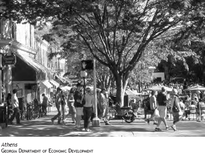
Athens Athens is the result of a 1785 decision by the Georgia legislature to endow a college. In 1801, John Milledge, a future governor and member of the committee sent to find a site, purchased a parcel of 623 acres on the Oconee River and donated it to the trustees of the new university. The site was named Athens after the Greek center of culture, and the University of Georgia was born. Incorporated in 1806, Athens became a university town as well as a center for textile manufacturing.
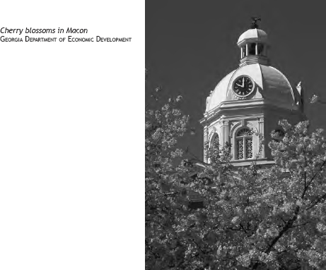
Macon The town of Macon was incorporated in 1823 on the banks of the Ocmulgee River. Lots in the town were laid out and put up for auction, and farmland was distributed by lottery. As cotton farmers brought their bales to Macon to be shipped down the Ocmulgee to Darien, the town prospered. Stores were built to sell goods to the farmers, and banks opened to take their money.
Sandy Springs Located in Fulton County, Sandy Springs is a suburb of Atlanta that voted to incorporate as a city in 2005. The springs for which the town is named are a local historic site. The estimated population of Sandy Springs for 2006 was 85,771.
Roswell The city of Roswell, northwest of Atlanta, began as a cotton mill established in the 1830s by Roswell King. The mill, which used slave labor, was the largest in North Georgia. King invited more coastal planters to start cotton plantations in the area, and mill production soon increased dramatically. So did the residents. In 1854, Roswell was incorporated as a city.
Albany The county seat of Dougharty County was founded in 1836 by land speculator Nelson Tift. Located on the Flint River, Albany was a choice market site for cotton farmers. After the line from Savannah was completed in 1857, Albany soon became the rail center of southwestern Georgia.
Marietta Founded as a chartered village in 1834, Marietta was named in honor of Mary Moore, the widow of United States senator Thomas W. Cobb. The completion of the Western and Atlantic Railroad to Atlanta and Chattanooga, Tennessee, spurred development and tourism. As increasing numbers of wealthy coastal residents spent their summers in Marietta for its relatively mild climate and its spring water, more hotels and stores were built. Marietta officially became a town with a mayor and a council in 1852.
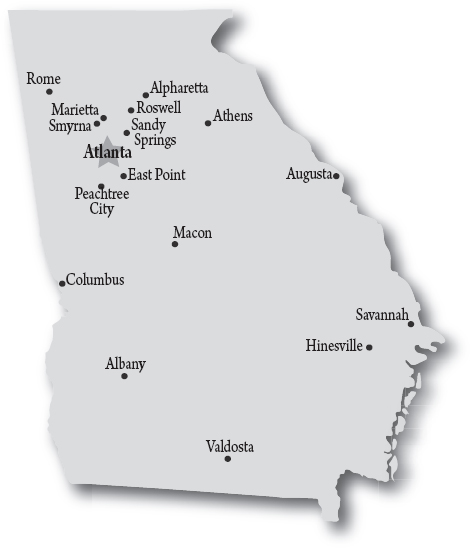
Valdosta The county seat of Lowndes County, Valdosta was incorporated in 1860 at a site about 20 miles from the Florida line. Troupville was the county seat until the Atlantic and Gulf Railroad built its tracks four miles south of the town. Lowndes County residents asked the legislature to construct a new county seat on the rail line, and Valdosta was created. The town is named for former governor George Troup’s plantation, Val d’Aosta.
Smyrna Located in southern Cobb County, Smyrna is a close suburb of Atlanta. The area was popular as the site of Smyrna Camp Ground, a religious encampment established in the late 1830s. The arrival of the Western and Atlantic Railroad in 1842 boosted development even more. The city was incorporated as Smyrna in 1872, after being known as Varner’s Station, Ruff’s Siding, Neal Dow, and Ruff’s Station.
East Point Located in southern Fulton County, East Point got its name because it is at the eastern end of the Atlanta & West Point Railroad. The western point, of course, is called West Point. East Point began in 1870 with a few families that settled near the railroad. Eventually, two gristmills and a government distillery were built. By 1880, the town added a sawmill, a steam gin, and a post office. It also was a popular summer resort.
Rome Like its sister city in Italy, Rome is built on seven hills. It was founded in 1834 by a group of men who decided on the name by putting their written choices into a hat and drawing one out. Colonel Daniel R. Mitchell picked the name Rome because of the hills and the river. After the legislature declared Rome a city in 1835, the county seat was moved there from Livingston. The city soon became a prime cotton market because of its access to the Gulf Coast via steamboats on the Coosa River. Development increased even more with the arrival of the railroads and the removal of the Cherokees.
Alpharetta Located about 25 miles north of Atlanta, the site of Alpharetta was a stopping point for travelers in the 1830s because of the natural springs in the area. In the early 1850s, trading posts were opened, tents were erected, and the community was christened New Prospect Camp Ground. In 1858, Alpharetta was incorporated as the county seat of Milton County. Milton became part of Fulton County in the 1930s.
Peachtree City Considered one of the most successful planned communities in the country, Peachtree City was chartered in Fayette County in 1959. A unique feature of Peachtree City is residents’ use of golf carts to navigate the 70 miles of paved trails around the town.
Hinesville The county seat of Liberty County, Hinesville is home to Fort Stewart. Established in 1837 and named after State Senator Charlton Hines, the town thrived before the Civil War as a center of commerce for farms and plantations producing cotton, indigo, rice, and pine products such as turpentine. Hinesville and much of Liberty County were devastated by General William T. Sherman’s March to the Sea in 1864. The town’s recovery was steady but slow until the opening of Fort Stewart in the 1940s revitalized the economy.
Here’s something you need to know if you’re going to help your kids with their Georgia history homework. How many capitals has Georgia had?
The answer is five: Savannah, Augusta, Louisville, Milledgeville, and Atlanta. Now here’s how that happened.
Savannah was the logical choice as the capital when the nation declared its independence in 1776. After all, Savannah was Georgia’s oldest and largest city. But plans had to be changed when the British captured the city in 1778. Georgia legislators fled and regrouped in Augusta, more than 120 miles up the Savannah River.
After the redcoats captured Augusta, the state government became a moving target. It assembled at Heard’s Fort in 1780 and probably held a meeting in Wilkes County at some point during the next year. In 1782, after the British left Savannah, Georgia officials headed back toward the coast, pausing to make New Ebenezer a temporary, unofficial seat of government until they were sure no British troops were left in Savannah.
Until 1785, Georgia lawmakers alternated meetings between Augusta and Savannah. In 1786, Augusta was once again the chosen site. But some of the new settlers wanted a more centrally located capital. Louisville in Jefferson County was picked, but Augusta continued to operate as the seat of government until 1796. A new capitol building was constructed in Louisville, and the government moved in.
Seven years later, the legislators voted to move the capital yet again, to Milledgeville on the Oconee River. The new capitol building was constructed and ready for occupancy in 1807. Milledgeville served as the capital for 60 years.
In 1877, a vote to determine which city would be the capital was held, and Atlanta was the popular choice. In 1879, the legislature made it official.

Eventually, you newcomers will be able to create your own lists of favorite natural wonders in the state. Until then, here are some suggestions from Charles Seabrook, a nature writer whose “Wild Georgia” column appears in the Atlanta Journal-Constitution.
1. Okefenokee Swamp: World-famous wetland.
2. Marshes of Glynn: These coastal salt marshes inspired poet Sidney Lanier to write his famous poem.
3. Cumberland Island National Seashore: Former president Jimmy Carter called it one of his favorite places on earth.
4. Ossabaw Island: An unspoiled barrier isle.
5. Cabretta Beach, Sapelo Island: One of the Atlantic coast’s most beautiful undeveloped beaches.
6. Woody Pond, Harris Neck National Wildlife Refuge: Thousands of egrets, herons, and endangered wood storks form nesting colonies in this McIntosh County refuge each spring.
7. Ebenezer Creek: This national natural landmark in Effingham County harbors 1,000-year-old bald cypress trees.
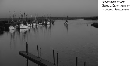
8. Altamaha River: The lower Altamaha is called “Georgia’s Amazon” for the lush, junglelike growth on its banks.
9. Broxton Rocks Ecological Preserve: This rugged sandstone outcrop in Coffee County has been sculpted over the centuries into fissures and shallow ravines that are now havens for rare plants.
10. Ohoopee Dunes State Natural Area: Sometimes called “Georgia’s Desert” because of its dry, sandy soil and scrubby vegetation, this section of Emanuel County is described by biologists as “an enchanting environment.”
11. Wade Tract Preserve: This privately owned 200-acre swath of old-growth longleaf pines and wire grass in Thomas County is one of the few remaining examples of the great longleaf forest that once covered the Coastal Plain.
12. Providence Canyon State Park: This eroded land in Stewart County has been transformed into a place of great beauty. It’s sometimes called Georgia’s “Little Grand Canyon.”
13. Doe Run Pitcher Plant Bog Natural Area: Lush growths of carnivorous pitcher plants emerge in spring in this part of Colquitt County.
14. Pine Mountain: President Franklin D. Roosevelt often came to this place in Harris County to enjoy the scenic views and to picnic and meditate.
15. Warm Springs: Roosevelt came to these bubbling springs in Meriwether County to treat his polio.
16. Oaky Woods Wildlife Management Area: See for yourself why conservationists are intent on saving from development this Houston County place of roaming black bears and rare wildflower habitats.
17. George L. Smith State Park: Bald cypresses growing in this Emanuel County park’s pond are magnificent in the fall, when they take on orange-bronze tints.
18. Sprewell Bluff State Park: This little-known gem on the Flint River in Upson and Talbot counties has a three-mile trail that offers superb views of the river and rocky cliffs.
19. Palisades Unit, Chattahoochee River National Recreation Area: A spectacular green space in the midst of Metro Atlanta.
20. Graves Mountain: Rock hounds from all over the world come to Lincoln County for the amazing array of rocks and minerals.
21. Stone Mountain/Arabia-Davidson Mountain/Panola Mountain: These huge geological wonders sport some of Georgia’s most colorful arrays of wildflowers in spring and fall.
22. Tallulah Gorge: Granite walls form steep cliffs at this Rabun County attraction.
23. Amicalola Falls State Park: The Dawson County falls plunge 729 feet in seven cascades to form the highest waterfall east of the Mississippi River.
24. Richard Russell Scenic Highway: Although it’s not a natural wonder, this 14-mile road winds through some of the most splendid mountain scenery in the Southeast.
25. Cloudland Canyon State Park: One of Georgia’s most scenic state parks, this Dade County attraction features rugged geology and beautiful vistas.
BOOKS AND RESOURCES
New Georgia Encyclopedia. www.georgiaencyclopedia.org.
Ray, Janisse. Ecology of a Cracker Childhood. Minneapolis, Minn.: Milkweed Editions, 1999.
Seabrook, Charles. Cumberland Island: Strong Women, Wild Horses. Winston-Salem, N.C.: John F. Blair, Publisher, 2004.