Parliament Hill and the Plains
Saint-Jean-Baptiste and Saint-Roch
The only fortified city left in North America, Québec City is like no other place on the continent. Constructed on the top of Cap Diamant, a cliff that looks out over the St-Lawrence River, the city is defined by its natural hills and cliffs, though from afar it’s not always easy to notice. Québec City is the cradle of Canadian society, where in 1608 the first settlers arrived. Led by Samuel de Champlain, they built the first habitation on the site that’s now called Place Royale. It was under French rule until 1759, when it fell to the British at the Battle of the Plains of Abraham, but this political feat did not alter the existing French-Canadian culture and way of life. Despite 100 years of British rule and the eventual founding of the Canadian Dominion, the city’s ties to the early settlers remain remarkably intact. It’s this lineage and incredible architectural heritage that give it its own unique (albeit European) feel.
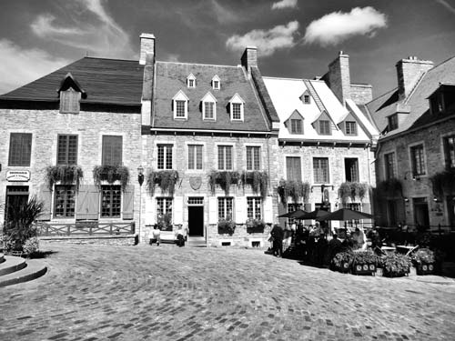
Quebéc City is divided into two main areas, Haute-Ville (Upper Town) and Basse-Ville (Lower Town). They are easy to differentiate thanks to their geography. Upper Town constitutes the area on the top of the cliff, while Lower Town constitutes everything below it. It’s in Upper Town that you’ll find Les Fortifications, the walled defenses that encircle Old Québec’s Upper Town and many of the biggest sights, including Château Frontenac and La Citadelle.

Directly below, between the cliff and the river, is Vieux-Québec’s Basse-Ville (Old Québec’s Lower Town). This is where the first European settlement was established, near Place Royale, and where historic areas like the Vieux-Port (Old Port) and the Quartier du Petit-Champlain are situated. Getting from the lower to the upper part of the city isn’t complicated, provided the winding, hilly streets aren’t sheets of ice. Taking the Escalier Frontenac (Frontenac Stairs) is the easiest way, but the funicular and the brand-new Ecobuses offer some good alternatives.
Though separated by a cliff, Vieux-Québec is quite small and dense, so it’s easy to cover by foot. In fact the best way to get around the city, in winter or summer, is by walking. Expect to get quite a workout, though, thanks to the hilly geography. No matter where you are in the city, if you want to get down or up, there are likely stairs involved, or at the very least, a city bus. Due to the density of the city, even peripheral areas like the Plains (just outside of the walls in Upper Town) and Saint-Roch (the city’s coolest post code, located in Lower Town) are only a 15-minute walk from Vieux-Québec.
Of course, Québec is a vastly different city with a completely different landscape in winter than in summer. Many sites close during the winter or have truncated hours. What constitutes the different seasons, however, is a complicated matter. A good general rule of thumb is the following: Summer hours usually run from June 24, Saint-Jean-Baptiste day and the province’s national holiday, to Labor Day, the first Monday in September. Winter hours, meanwhile, could start as early as Labor Day or Canadian Thanksgiving (the second Monday of October) and run until May or June. Many of these dates fluctuate according to the weather, so make sure to double-check hours if there’s a particular sight you want to visit.
With so many interesting historical sites just about everywhere you turn in Québec City—even a stroll down Faubourg Saint-Jean Baptiste is a lesson in the city’s evolution—there’s no time for a dull moment.
| Vieux-Québec’s Upper Town | Map 1 (tap here) |
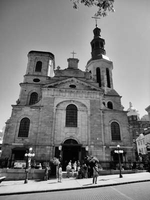
It was on this site, high above the St-Lawrence River, that explorer Samuel de Champlain built Québec’s first church in 1647. Later, in 1664, the Basilique-Cathédrale Notre-Dame-de-Québec became the first parish church in North America. It was given the title of cathedral 10 years later, when the diocese of Québec was established with the arrival of Monsignor de Laval, the first bishop of New France.
Destroyed by fire during the English conquest in 1759, it was entirely reconstructed a few years later, only to be remodeled again in 1843, by Thomas Baillairgé. Inspired by Sainte-Geneviève in Paris, Baillairgé, whose father François designed the church’s interior, gave it a neoclassical facade. That, too, had to be reconstructed when the church was once again ravaged by fire—arsonists used the fire to steal priceless paintings—in 1922. During this rebuilding period, however, the builders tried to stay as true as possible to the original building, working off of François Baillairgé’s original 18th-century drawings for the interior. Despite the fact that it has been rebuilt a number of times, the bell tower and portions of the walls are from the original structure.
Long and narrow, the interior is a soft buttery yellow with a high arched ceiling, lined with windows and intricate moldings. A stunning gold-plated baldaquin stands at the altar, and other items include paintings of the Virgin Mary that date back to the French regime, the bishop’s original throne, and a chancel lamp that was a gift of Louis XIV.
Between 1654 and 1898 over 900 people were buried in the crypt below the church, including 20 bishops and four governors. It’s also rumored that Samuel de Champlain himself is buried nearby; archaeologists have been searching for the grave for over 50 years. Hour-long guided tours of the crypt and basilica are available but must be reserved in advance, so call ahead.
MAP 1: 16 rue de Buade, 418/692-2533, www.notredamedequebec.org; Nov.-Apr. Mon.-Fri. 7:30am-4pm, Sat. 7:30am-6pm, Sun. 8:30am-6pm; May-Oct. Mon.-Fri. 7:30am-5pm, Sat. 7:30am-6pm, Sun. 8:30am-6pm; free
Proudly holding the title of “most photographed hotel in the world,” Château Frontenac is one of the most stunning buildings in Québec. The fortress-like architecture and its location on the top of the Cap Diamant, a bluff overlooking the St-Lawrence, give it an especially majestic feel.
Built in 1893, it is part of a chain of “château style” hotels that were constructed across the country by the Canadian Pacific Railway. Since Québec was one of the North American ports before the long trip across the Atlantic, the hotel was designed to rival any European counterpart and grab the attention of travelers. The building’s architect, Bruce Price, drew from both the Middle Ages and Renaissance and used elements like the turrets found on Scottish castles and the bastion towers of French châteaus.
Named after Louis de Buade de Frontenac, who was governor of New France twice between 1672 and 1698, the hotel sits on the site of what was once Château St-Louis, the official residence of the governor of New France and later home of the British governors. The ruins of the many incarnations of the residence lie just in front of the hotel.
It has been the temporary residence of everyone from Queen Elizabeth II to Charles Lindburgh, as well as the site of Alfred Hitchcock’s I Confess, but the hotel’s proudest moment took place in 1943. It was the site of the Québec Conference of World War II, where U.S. president Franklin D. Roosevelt, British prime minister Winston Churchill, and Canadian prime minister William Lyon Mackenzie King discussed the eventual invasion of France.
MAP 1: 1 rue des Carrières, 866/840-8402, www.fairmont.com/frontenac; daily 24 hours; free
The largest British fortress in North America, La Citadelle is also the largest defense on the continent to have never seen battle. Covering 2.3 square kilometers and perched on the edge of the cape at the highest point in the city, overlooking the St-Lawrence, this strategically placed defense is an imposing figure, standing out along the rolling plains and the copper roofs of Vieux-Québec.
Built under the direction of British officer Lieutenant-Colonel Elias Walker Durnford, the design is entirely French. Modeled in the style of military engineer Vauban, it is shaped like a four-pointed star and as such has no blind spots. Construction on the Citadelle started in 1820, took 30 years to complete, and incorporated two existing buildings from the French regime, the oldest of which is a battery dating back to 1750. The winding gate that is used as entrance into the Citadelle is also the only real gate remaining from the French regime, and is reminiscent of what all gates into the city were once like.
Though it never saw any action, the Citadelle continues to be the official residence of the Royal 22e Régiment, the only Francophone infantry regiment in the Canadian Forces Regular Force. The low stone barracks are a mix of English and French influences with symmetric casement windows and doors and pitched tin roofs. A brand new museum, completed in 2014, commemorates the regiment’s 100th anniversary. Housed in a historic building on the site, the museum is dedicated to the regiment’s distinguished military history. Starting with the early days and Québec’s most important battles, the exhibits continue up to the modern day with the regiment’s tour in Bosnia and other United Nations missions. One exhibit is dedicated to the war heroes of the 22e Régiment who fought in World Wars I and II, summarizing their duties, showing personal artifacts, and in one case showing a spy’s various identity cards.
As early as the 1860s there was talk of tearing down the Citadelle, but then Governor General Lord Dufferin refused, instead pointing to the fortifications’ historical importance. Since that time, his residence became the official residence of the governor general of Canada. It is here too that Georges Vanier, the first French-Canadian governor general and a war hero, was laid to rest in a battery turned chapel.
Since it is still an active military residence, the only way to get inside the Citadelle is to take a tour. Both the regiment and city get equal tour time, and though there’s a lot to see, the most interesting aspects, such as the barracks and doors that lead inside the walls, are off-limits.
MAP 1: 1 Côte de la Citadelle, 418/694-2815, www.lacitadelle.qc.ca; bilingual tours Apr. daily 10am-4pm, May-Sept. daily 9am-5pm, Oct. daily 10am-3pm, Nov.-Mar. daily at 1:30pm; $10 adults, $9 seniors and students, $5.50 children, children 7 and under free
Québec is the only fortified city in North America, and its walls encircle the entirety of Upper Town, covering 4.6 kilometers, which you can walk for free. The Fortifications offer some of the most stunning views of the city and environs and are a great place to hang out in the summer and have a picnic or take a break from sightseeing. One of the best places to start is at the St-Louis Gate on rue St-Louis. As it’s here that you’re mostly likely to recognize the ramparts. As you walk along the walls, every angle of the city can be explored, from the defenses of the Citadelle to the lookouts over the river. Lined with cannons and grass-covered in spots, the stone walls of the Fortifications frame the city in a way that transports visitors back to the days when they were a practical defense against attacks. It’s along this part, surrounding the Citadelle, where you’ll find the best views.
Built in a classic urban style, the Fortifications are characterized by the geometry of flanking and the adaptation of the walls to the city’s topography, which sees the walls grow in height and depth at different parts. Though Québec was a bustling city by 1700, its defense system was inadequate, and the city was a maze of temporary and permanent structures. It wasn’t until the fall of Louisbourg, a fort in Cape Breton off the coast of Nova Scotia, in 1745, that serious consideration was given to the state of the Fortifications. It was Governor Beauharnois who, following Chaussegros de Léry’s designs, authorized a new enceinte that permanently closed the city to the open countryside.
In the late 19th century, citizens complained about the impracticality of the gates, complaining that they stopped circulation and were a nuisance—the gates would close at curfew, and, up until the British troops left, the ramparts were for military and pedestrian use only. Though Lord Dufferin, then governor general of Canada, understood their complaints, he also saw the historical importance of the fortifications—during the summer-long siege of Québec, it was these walls that kept the citizens from British invasion—and instead suggested the gates be dismantled and then rebuilt to make them wider.
The Interpretation Centre of the Fortifications of Québec is located by the St-Louis Gate, beneath the city’s ramparts. It offers information about the history of the city’s defenses as well as exhibits and guided tours, which depart from Terrasse Dufferin.
MAP 1: 2 rue d’Auteuil, 418/648-7016; Interpretation Centre May-Sept. daily 10am-6pm; tours June 1-24 daily 2pm, June 25-Sept. 6 daily 10am and 2pm, Sept. 7-Oct. 11 2pm; Interpretation Centre $4 adults, $3.50 seniors, $2 children; tours $9.80 adults, $7.30 seniors, $4.90 children
Entering the modernized foyer of the museum you’re almost not prepared for the historic chapel that you enter shortly after. Full of green marble pillars, beautiful stained-glasses windows, golden busts of important members of Québec’s history, and a 1753 organ, the most alluring part of this exhibit is the baroque music that is played throughout the day.
After a bit of maze-like wandering—through the chapel, into an elevator, and across an outdoor walkway—you arrive at the building that houses the Musée de l’Amérique Francophone, an old building that once belonged to the Séminaire de Québec. The first exhibit on the ground floor looks at the history of the seminary itself, with artifacts like old keys, chalices, and furniture that once belonged to the seminary.
Moving on to the museum’s permanent collection, visitors get a well-rounded view of the history and trajectory of the Francophone population, not just in Canada but within the whole of the continent. It retraces the roots of Francophone explorers and guides who helped explore the United States and found American cities like Detroit, Pittsburgh, Buffalo, and St. Louis.
The design of the exhibit is modern and easy to navigate, even in high season when there are more crowds. For the most part, however, it’s rarely overcrowded and visitors can wander the exhibits at their leisure.
MAP 1: 2 Côte de la Fabrique, 418/692-2843, www.mcq.org; early Sept.-mid-June Tues.-Sun. 10am-5pm, mid-June-early Sept. daily 9:30am-5pm; $8 adults, $7 seniors, $5.50 students, $2 children, children under 12 free
Founded in 1639 by Marie de l’Incarnation, an Ursuline nun, and Madame Marie-Madeline de Chauvigny de la Peltrie, a rich widow, the Couvent des Ursulines is the oldest school in North America dedicated to the teaching of women. Girls still study at this institution, which now boasts a museum and a chapel alongside the schoolrooms and courtyard playgrounds.
The first Ursuline nuns landed in Québec on August 1, 1639, and soon started teaching, though at the time the French-Canadian population was so small, the majority of their students were First Nations girls. Just outside of the convent’s walls is the Musée des Ursulines de Québec, which tells the story of these pioneer women who were both teachers and students. Newly reopened and renovated, the new permanent collection, The Young Ladies’ Academy, allows visitors into the heart of the boarding school and the daily lives of the nuns and pupils that passed through the convent’s halls. Artifacts from the time of the French regime are also on view, including teaching materials, personal objects, and sacred artwork.
When French governor Montcalm died after the Battle of the Plains of Abraham, he was buried in the convent chapel by night so as not to arouse suspicion. For a long time his skull was part of the museum’s permanent collection, to the delight of visiting schoolchildren.
Despite the simple, austere pews found in the small Ursuline chapel, it has some of the most beautiful sculpted wood in Québec. The carvings were created by master craftsman Pierre-Noël Levasseur between 1723 and 1739, and it was the Ursulines themselves who gilded the carvings, which now adorn the nave of the chapel. The tomb of founder Marie de l’Incarnation can also be found here. The chapel is open to the public from May to October, and entry is free.
MAP 1: 12 rue Donnacona, 418/694-0694, www.museedesursulines.com; May-Sept. Tues.-Sat. 10am-noon and 1pm-5pm, Sun. 1pm-5pm, Oct.-Nov. and Feb.-Apr. Tues.-Sun. 1pm-5pm; $8 adults, $6 seniors and students, $4 children
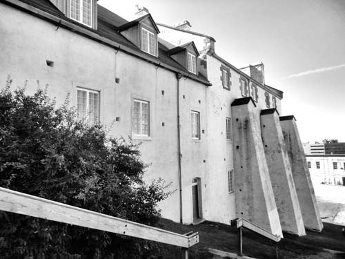
The position of the Parc de l’Artillerie, looking out over the west of the city and across the St-Charles River, has made it a strategic military site since the late 17th century. Four vastly different buildings trace the city’s history from the French regime right up to the 1940s. Of the four buildings that make up the site, the Dauphine Redoubt is the most striking, with massive white supports that plunge down the side of a hill. Built in 1712 and completed in 1748, it was army barracks both before and after the British conquest and eventually became the home of the superintendent. During the summer, characters in period costume bring the barracks to life with demonstrations and tours through the rooms, which have been decorated to reflect various periods in the building’s evolution.
Kitty-corner to the Redoubt is the interpretation center, a former foundry used to make an arsenal for the Canadian military, from the Boer War up to World War I and II, and even the Korean War. The site now holds a 200-year-old scale model of Québec. Constructed in 1806-1808, by draftsman Jean-Baptiste Duberger and John By, a military engineer, it was sent to England in 1810 to convince the British government that the city needed new fortifications. Alongside uncovered ruins, there are artifacts that were found on and around the site, including toothbrushes, children’s toys, and belt buckles.
MAP 1: 2 rue d’Auteuil, 418/648-7016, www.pc.gc.ca; early May-early Sept. daily 10am-6pm, early Sept.-Oct. daily 10am-5pm; $4 adults, $3.50 seniors, $2 children
Clockwise from top left: the Fontaine de Tourny, Parliament Hill; the Funiculaire du Vieux-Québec, Vieux-Québec’s Lower Town; the Séminaire de Québec, Vieux-Québec’s Upper Town.

This tiny little park tucked away at the end of a quiet residential street is one of the city’s best-kept secrets. Passing through the park’s wrought-iron gates, visitors enter onto Mont-Carmel, the spot of an old windmill (moulin in French). Originally a military outpost, the small 1,500-square-meter park was one of the few defenses constructed by the French military in the 17th century. This small defensive outpost was then named “cavalier,” a nod to its solitary position. In 1663, the windmill was erected here and included in the military fortification. By 1700, with the building of the first surrounding walls, le cavalier du moulin was no longer needed.
Nowadays the park acts as a window onto history, allowing visitors to imagine a city that once had nothing but fields beyond this hillock. It’s adorned with a cannon to remind people of its past life as a military defense; the cannon juts out over the hill, directed at the houses and winding streets beyond.
MAP 1: rue Mont-Carmel; daily 24 hours; free
The history of Place d’Armes is the history of Québec. Once situated behind Château St-Louis, which was at the time also a fort, it was in this public square, safely behind the defenses, that the military would perform their various parades and military inspections. When construction of the Citadelle was undertaken in 1820, however, the military moved and the regular parades went with it, moving instead to the Parc de l’Esplanade in front of the fortress and running alongside the city walls.
Though it lost its military importance, the square continued to be a popular meeting place, and in 1915 a monument was erected to the notion of faith. Dedicated to the Récollets, the first religious community to live in New France, the monument today stands in the shadow of the Château Frontenac at the center of a bustling square surrounding by busy restaurants and cafés.
MAP 1: between rue du Trésor and rue du Fort
Established in 1663 by Monsignor François de Laval, the first bishop of New France, to train young men for the priesthood, this seminary was expanded five years later to include the Petit Séminaire, which, in a push to Gallicize the indigenous population, accepted both Indian and French students to study at the Collège des Jésuites. It continued to be the training ground of future priests right up until the conquest, when its connection to the priesthood was somewhat lost. The studies instead began to focus on the liberal arts, and the school began accepting students who didn’t want to become priests. By 1852 the college part of the Séminaire de Québec became the University of Laval.
Laid out according to 17th-century principles, the séminare has various wings, all of which center around interior courtyards (you can enter one through the Musée l’Amérique Francophone). Though the time periods vary there is continuity in the architecture, with stone masonry covered with stucco, casement windows, steep roofs with dormers, and raised firewalls evident in all of the buildings. The bursar’s wing in particular is interesting. Designed from 1678 to 1681 and restored in 1866 after a fire, its vaulted kitchen is still intact, along with the chapel of Monsignor Briand, who was bishop of Québec in 1766-1784.
Today, it remains both a school and seminary, with Laval’s school of architecture located on the site and priests who continue to live here and dedicate their lives to the church.
MAP 1: 1 rue des Remparts, 418/692-3981, www.seminairedequebec.org
Along the front of Château Frontenac, looking out over the St-Lawrence River and across to Lévis, is the wide boardwalk of Terrasse Dufferin. Created in 1879 by the governor general of Canada, Lord Dufferin, the 671-meter-long promenade was designed by Charles Baillairgé, the same designer behind the kiosks and street lamps that line the boardwalk.
It was during his summer stay at the Citadelle, now at the opposite end of the promenade, that Lord Dufferin conceived of the idea to build the boardwalk, a place for residents and visitors to take their daily stroll. The use of wooden planks gives the whole thing an air of summer, even in the middle of winter. Though he left his post in 1879, Dufferin himself inaugurated the project and put down the first stone.
Beneath the terrasse lie the ruins of the former St-Louis Fort and Château, which was destroyed by fire in 1834. Visitors are able to visit the excavation site thanks to a new interpretation center, cleverly hidden by the boardwalk. Only a few steps down and you’re face-to-face with the foundations of the original building and some of the artifacts they uncovered here.
During the winter, a huge slide is built at the Citadelle end of the terrasse and children of all ages line up to take a super-fast ride down les glissades overlooking the frozen river.
MAP 1: Intersection of rue des Carrières and Place d’Armes
| Vieux-Québec’s Lower Town | Map 2 (tap here) |
The oldest stone church in Québec, Église Notre-Dame-des-Victoires was built on Place Royale in 1688, on the site of l’Abitation, Québec’s first building. In the basement of the church you can still see one of the building’s walls, and archaeological digs have uncovered one of the building’s original turrets in the church’s facade. The king’s storehouse also stood on this site, and it was this particular location that attracted François de Laval, the bishop of New France. For years Laval requested a chapel be built on the site of the king’s storehouse, an extension of Upper Town’s Notre-Dame-de-Québec church, but it was his successor, Monsignor de Saint Vallier, who would see the work completed in 1723.
Designed by Claude Baillif, the church was originally named l’Enfant Jesus, but it’s name was changed twice. In 1690 the British admiral Phipps was defeated by Governor Frontenac, and the church was renamed Notre-Dame-de-la-Victoire. In 1711, the city was again saved when the fleet of Admiral Walker, on its way to attack Québec, was shipwrecked in the St. Lawrence. This time the name change was easy; they made it plural. Despite two failed attempts, the British would eventually destroy the church in 1759 during the siege of Québec. The subsequent reconstructions were meticulous and took place in 1762-1766 under the eye of Jean Baillairgé.
The interior itself is rather austere, with a few pews and a tiny, circular staircase leading up to the organ. Designed by students of Thomas Baillairgé, it was constructed in 1854-1857 and features several paintings from the 17th, 18th, and 19th centuries. The oldest part of the church is the tabernacle; originally found in the Sainte-Geneviève Chapel, it dates from 1724. Unique to Québec, the frescos on either side of the main altar retrace the history of the church and city, and were done by local painter and decorator Jean-M. Tardivel. The most striking church accent, however, is the single ex-voto, a model of a vessel that arrived in 1664, transporting the Carignan Regiment and the Marquis de Tracy, which hangs suspended over the pews.
MAP 2: Place Royale, 32 rue Sous-le-Fort, 418/692-1650, www.notredamedequebec.org; daily 9am-5pm; tours May-Oct., reservations required mid-Oct.-Apr.; free
Reaching nearly three stories tall and covering 420 square meters, La Fresque des Québécois is the largest and most historical trompe l’oeil in the city. Unveiled in 1999, it took 12 artists to complete the immense mural that cleverly shows the city’s history and its important figures. Sixteen important Québécois are featured in the painting, including historical figures like Jacques Cartier, Samuel de Champlain, and Lord Dufferin, as well as cultural icons like singer/songwriter Félix Leclerc and politician Louis-Joseph Papineau. Also shown in the mural are typical Québécois buildings through whose windows the important figures peek. One of the gates figures prominently, as do the famous L’Escalier du Casse-Cou and the province’s four seasons.
A popular tourist sight (it’s fun to try and slip yourself in among the historical figures), it kicked off a trompe l’oeil craze around the city, and many buildings are now covered in historically clever murals.
MAP 2: Place Royale
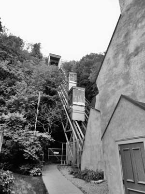
The only funicular of its kind in North America, the Funiculaire du Vieux-Québec was built in 1879 and designed by William Griffith. Wood-covered and steam-powered, it operated six months a year as an alternative to horse and buggy, transporting passengers and merchandise from Lower Town to Upper Town. The arrival of electrical power in 1907 meant it could work year-round, which it did until 1945, when the wooden structure caught fire and was subsequently rebuilt with metal shelters. It lets passengers off and on at Terrasse Dufferin.
Transportation is still its main function, though today it transports more tourists than merchandise since it allows incomparable views of Lower Town, the port, and Lévis, across the water.
The entrance of the funicular is situated in a historical house, built in 1683 by Québec architect Baillif, that once belonged to one of the country’s first European explorers, Louis Jolliet. Jolliet, along with Father Jacques Marquette, was the first European to explore and map the Mississippi River. Jolliet lived here until his death in 1700.
MAP 2: 16 rue du Petit-Champlain, 418/692-1132, www.funiculaire-quebec.com; early Sept.-June 19 daily 7:30am-11pm, June 20-early Sept. daily 7:30am-midnight; $2.25
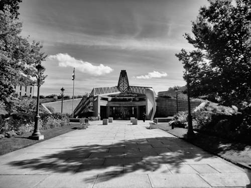
In the heart of the port district, not far from the shores of the St-Lawrence and surrounded by historical buildings, the modern facade of the Museum of Civilization strikes out against its surroundings. Designed by Moshe Safdie, the architect behind Montréal’s Habitat 67, the front of the museum is built into an incline, tucking the museum away and adding a touch of nature, with a glass roof and greenery sprouting from along the sides. Inaugurated in 1988, the museum is dedicated to the history, present, and future of Québec civilization, as well as that of cultures from around the world.
Inside, the harmony with the surroundings continues with a large open lobby, full of glass and light. The three-story building accommodates 10 exhibits simultaneously, 3 of which are permanent exhibits rooted in the region’s history. Le Temps des Québécois is an overview of the history of this nation within a nation, from the first explorers to Expo 67. It’s a fun exhibition with bits of pop culture—like videos of iconic TV presenters and shows from the 1980s and 1990s—placed within context next to religious iconography, old tramway signs, sabers, and World War II ration boxes. Presented in conjunction with the National Film Board of Canada (the NFB), historic films, political speeches, and important cultural events are shown on film here.
With a focus on the province as a whole, Territoires looks at the various regions of the province and the problems the areas, and their inhabitants, face. Not an overly optimistic exhibit, it examines issues like suburban sprawl and the Amerindians’ lost connection to the land, and tries to provide solutions. The breathtaking photos and videos of the regions give visitors a good overview of the expansive province.
Those wanting to learn more about Québec’s First Nations will enjoy Encounter with the First Nations, which looks at the 11 different tribes that inhabit the province and includes videos, artifacts—a birch canoe, a tepee, Inuit sculpture—as well as a look at the history and migration patterns of the particular tribes. Admission is free on Tuesdays November-May.
MAP 2: 85 rue Dalhousie, 418/643-2158, www.mcq.org; mid-June-early Sept. daily 9:30am-6:30pm, early Sept.-mid-June Tues.-Sun. 10am-5pm; $15 adults, $14 seniors, $10 students, $5 children, children 11 and under free
For all intents and purposes this is the birthplace of Canada—or more specifically the birthplace of the French-Canadian civilization. It was here that Samuel de Champlain, founder of Québec, built l’Abitation, the first establishment in Québec, and though the structure itself is long gone, slate stones mark where the building once stood. As early as 1623, the square started to take on a life of its own alongside the settlement’s second habitation. A military parade ground, marketplace, and the surrounding houses burned to the ground during a fire that destroyed Lower Town in 1682. Place Royale got its name in 1686 when Intendant Jean Bochart de Champigny erected a bust of King Louis XIV in its center. As in all towns in France, it was the custom to have a square dedicated to royalty, but unlike in France, there was nothing ceremonious about the square or its surroundings; in fact, the merchants complained that the bust took up valuable space, and so it was removed and placed at the intendant’s house.
Damaged during the Seven Years’ War, the square was gradually rebuilt, and by the 19th century the square was part of an urban complex that included warehouses, two markets, and a number of businesses. Up until the early 20th century many of the buildings went through major transformations; floors were added, roofs were flattened, storefront windows were built on the ground floor. It wasn’t until an economic downturn in the 1960s forced the city to reconsider its purpose that the area was restored.
After restoring a few buildings (the Chevalier hotel, the Maison Fornel, and the Notre-Dame-des-Victoires church), the government decided it wanted to recreate the ambience of the early 17th century and went about completely renovating the buildings to closely resemble how they would have looked during the French regime. Following the detailed plans of the original structures, the buildings were rebuilt using Norman construction with firewalls, stone, spirits to hold up the walls, and ladders on the roofs.
Set on the same square is the Place Royale Interpretation Center. Opened in 1999, it’s in the former home of merchant François Hazeur as well as part of the Smith home next door. Exhibits here include a scale model of the original settlement, which would’ve been situated just outside the modern glass doors. Built against Côte-de-la-Montagne—the steep road established by Samuel de Champlain in 1623—it also houses a public staircase that links the Lower Town with the street above. Admission is free on Tuesdays November-May.
MAP 2: 27 rue Notre-Dame, 418/646-3167, www.mcq.org; mid-June-early Sept. daily 9:30am-5pm, early Sept.-mid-June Tues.-Sun. 10am-5pm; $7 adults, $6 seniors, $5 students, $2 children, children 12 and under free
The charming restaurants, quaint boutiques, and tourist-packed cobblestone streets of this picturesque neighborhood often belie its rich and interesting history. The oldest street in the city, rue du Petit-Champlain in the 17th century was little more than a dirt path down which residents would walk to get their water. Over the next 200 years, the street would grow to become a bustling area full of houses and businesses of many working-class families and men who worked in the port.
In the mid-1800s, the area saw an influx of immigrants. The Irish Potato Famine saw the Irish fleeing the country in boatloads and consequently arriving in Québec, one of the first ports of call. Many of these immigrants stayed, settling on la rue du Cul-de-Sac and la Petit rue Champlain, calling it instead Little Champlain Street. In time, the Francophones adopted the name as well, turning it into rue Petit-Champlain. This was a poor, working-class neighborhood, and the reconstruction of the nearby Place Royale in the 1970s forced a change in Petit-Champlain as well. The low rent meant that many artists had moved into the area, and it was the artists who rejuvenated it, financing renovations themselves and doing much of their own work. Since none of the buildings were entirely destroyed, a walk through this quarter gives visitors a view of the city’s architecture through the ages, with buildings from different eras lovingly preserved.
At one end of rue Petit-Champlain you’ll find L’Escalier du Casse-Cou, or the Breakneck Stairs, a narrow and steep set of steps that are one way to get from Upper Town to Lower Town. First built in 1660, the steps are squished between two buildings and can get icy in winter. The unusual name is rumored to come from American soldiers during their attempted invasion. At the other end of the street, you’ll find La Fresque de Petit Champlain, which represents the life and history of the area, including the 1759 siege and the fires that came with it.
MAP 2: Between rue du Petit-Champlain and Place Royale
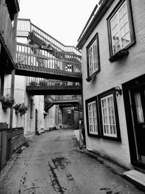
La rue Sous-le-Cap, which means “street beneath the cape,” is unlike any other street in the city and totally enchanting. Wedged between the cliff face and the backs of the houses that face rue St-Paul, it was the only road that pedestrians could use at the beginning of the 19th century to get from their homes in this section of Lower Town to the Côte du Palais, a winding street that would take them to Upper Town. What today are the backs of houses fronting on rue St-Paul used to be front entrances of homes along the waterfront, and during high tide, the roadway would be submerged under water.
The narrow street, which measures three meters across, was also at one time the city’s red-light district, with a number of brothels operating on the street. Characterized by the stairs and walkways that cover almost all of the street, it’s here that you’ll find tiny, slightly crooked houses and some of the prettiest private patios in the city.
MAP 2: Behind rue du Sault-au-Matelot; between rue de la Barricade and rue St-Paul
At the base of Cap Diamant, where the waters of the St-Lawrence and St-Charles Rivers converge, the Vieux-Port de Québec (Old Port) is steeped in history. Lined with buildings that are both old and new, it maintains a connection to the past while looking to the future. The basins that once accommodated large cargo and passenger ships are now marinas docked with pleasure cruisers and sailboats, though the old locks of Louise Basin are still in use.
During its heyday in the 19th century, it was one of the world’s five biggest ports, a hub of activity with commerce and transatlantic voyages. It was and still is a major contributor to the economic development of the region. Ships from here deal in commercial trade with over 60 countries, and the city is a popular cruise destination. On the very outskirts of Petit-Champlain, one of the areas that border the Vieux-Port, are some of the city’s oldest defenses. Low walls, cannons, and a moat are the only remnants of what was once part of the Lower Town’s fortifications. To celebrate the city’s 400th anniversary in 2008, the waterfront was rejuvenated with a number of bike paths that follow the water’s edge and takes cyclists right in to the Old Port. It’s here along the quays and among the docked boats that people stop for an ice cream or a cold drink in the summer and look back at the city that stands, perfectly lit, on the hill. The newly built Vieux-Port Interpretation Centre presents exhibitions related to the timber trade and shipbuilding, and characters in period costumes evoke a sense of history as they tell old-time tales. Guided walking tours of the port are also available.
MAP 2: 100 Quai St-André, 418/648-3300; May-Aug. daily 10am-5pm, Sept.-Oct. daily noon-4pm; free
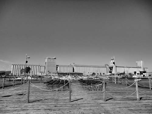
A number of imposing silos occupy the far end of Québec City’s port. Known as the Bunge of Canada (300 rue Dalhousie), these grain silos have been in operation for more than 40 years, enabling Canadian and American shippers to store a massive amount of grain before sending it overseas. They are some of the only silos in the eastern region of the country and a reminder of the city’s history as a bustling and crucial port. The Bunge du Canada remains an important part of the city’s landscape and its economic strength.
| Parliament Hill and the Plains | Map 3 (tap here) |
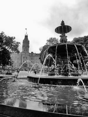
Fontaine de Tourny was a gift from La Maison Simons (one of the oldest department stores in the province) to Québec City for its 400th anniversary in 2008. It came to its place in front of the Parliament by a circuitous route. Created in France in 1854, it won an award at the Universal Exposition in Paris the following year before being installed, in 1857, in the heart of Bordeaux in the Allées de Tourny. By 1960, however, the city no longer wanted the fountain, which was in a state of near disrepair. It was dismantled and stored in the Château Larivière near Bordeaux before being sold to a Parisian antiques dealer at the beginning of the 21st century.
During a trip to Paris in 2003, Peter Simons, president of the department store, discovered it in a flea market and had it shipped to Québec for restoration. Measuring seven meters high and four meters wide, it’s adorned with 43 jets and decorated with statues, by sculptor Mathurin Moreau, of one man and three women symbolizing water, which matches well with the history of the port city. Five other statues were made from the same mold and can be found in cities across Europe, including Geneva in Switzerland and Porto in Portugal.
MAP 3: Ave. Honoré Mercier between La Grande-Allée and blvd. René-Lévesque
Dubbed the “Champs d’Elysées of Québec,” La Grande-Allée is one of the larger boulevards in the city and is the city’s nightlife hot spot. It’s lined with grand Victorian mansions, and the homes have been converted into cafés, restaurants, and nightclubs. Once lined with terraced houses, it was the chichi neighborhood of Québec, but many of those homes were torn down to make way for the Hôtel du Parlement, found on the south end of the allée, just in front of the St-Louis Gate.
It is the Grande-Allée that separates the rest of the city from the Plains of Abraham, which run along its back. The architecture of the strip’s buildings is still stunning, with much of the stonework dating from the late 19th century.
MAP 3: Between Fontaine de Tourny and rue de l’Amérique Française
The Parliament Building, house of the National Assembly of Québec, is one of the most impressive buildings in the province’s capital city. Located on one of the highest spots of Upper Town, just outside the city walls, the quadrilateral building was constructed between 1877 and 1886 by the French architect Eugène-Étienne Taché. Inspired by the Louvre in Paris, the style of building, Second Empire neo-French Renaissance, is unique in North America. The front of the building also features a pantheon representing the province’s rich history.
Incensed by the Durham Report, in which the British Lord said that the French-Canadians could not be civilized because they had no history, Taché included 15 statues depicting important figures in the province’s history, to show that they did indeed have a strong past. Figures include Samuel de Champlain, Louis de Buade de Frontenac, James Wolfe, the Marquis de Montcalm, and, at the very top, an indigenous family. As the province's political life continues to grow, so does the number of statues; there are now 22 in front of the Parliament Building.
Since it is still a functioning government office, the only way to see the interior of the building is to take a free guided tour. At 30 minutes long, the tour provides a great opportunity to appreciate the unique architecture of the building, as well as gain insight into Québec’s history and political scene. Make sure to have a photo I.D. with you, however, otherwise you won’t pass the security check. In the summer, outdoor tours are also given to discover the surrounding gardens, which highlight the many trees and flowers of Québec and also give an overview of the many sculptures. All tours leave from the visitors center.
MAP 3: 1045 rue des Parliamentaires, 866/337-8837, www.assnat.qc.ca; first Tues. of Sept.-June 23 Mon.-Fri. 9am-4:30pm; June 24-first Mon. of Sept. Mon.-Fri. 9am-4:30pm, Sat.-Sun. 10am-4:30pm; free
This iconic piece of Canadiana was destroyed by fire in 2008, and though 90 percent of the museum’s artifacts were saved, only the shell of the historic drill hall remains. Built in 1887, between the Plains of Abraham and the Grande-Allée, the Manège Militaire is home to the Voltigeurs de Québec, a primary reserve regiment founded in 1862. It was designed by Eugène-Étienne Taché, who also designed the Parliament Building, and the architectural style is inspired by the French chateaus of the 14th and 15th centuries, with circular turrets, pointy roofs, and high dormer windows. This particular style, extremely unique in North America, is recreated in countless other important structures in the country. It is one of the most recognized Canadian military buildings in the world.
MAP 3: 805 ave. Wilfrid-Laurier
Located in the middle of the Plains of Abraham, Musée National des Beaux-Arts du Québec holds the largest existing collection of Québec art, with works dating from the 17th century onward. The major focus here is on fine art, and the exhibits rarely revolve around the work of contemporary artists, though plans for a new addition will hopefully change that.
The musuem consists of three distinct structures: the Gérard-Morisset Building, the Charles-Baillairgé building, and the Grand Hall. Each has its own atmosphere and the work exhibited therein reflects that. Inaugurated in 1933, Gérard-Morisset is classical in style. It was designed by architect Wilfrid Lacroix and built in a neo-Italian Renaissance style. The first of the buildings to hold the museum’s collection, it’s full of white marble, wide Victorian steps, sculpted ceilings, and columns, and it’s here that you’ll find permanent collections dedicated to Québécois artists like Emile Bourdos and others.
Clockwise from top left: Basilique-Cathédrale Notre-Dame-de-Québec, Lower Town; the hidden rue Sous-le-Cap, Lower Town; the Musée National des Beaux Arts, Parliament Hill and the Plains.
Much less conventional is the Charles-Baillairgé building, a former prison. It was incorporated into the museum in 1991 but retains a number of cells, which visitors are invited to explore. Opened in 1867, the prison was modeled after the Auburn Penitentiary in New York state and was all about rehabilitation through isolation. Overpopulated from the beginning, it sheltered not only criminals but the poor and needy. Despite its old-fashioned design, it housed inmates until 1970.
The Grand Hall joins these two structures with its pyramid-like glass facade, which adds light and airiness to the entire structure. A monument directly out front of the museum commemorates the place where General James Wolfe was shot and killed.
MAP 3: Parc des Champs-de-Bataille, 418/644-6460, www.mnba.qc.ca; June-Aug. Thurs.-Tues. 10am-6pm, Wed. 10am-9pm, Sept.-May. Tues. and Thurs.-Sun. 10am-5pm, Wed. 10am-9pm; $18 adults, $16 seniors, $10 youth (13-30), children 12 and under free
It might not look like much on the outside, but on the 31st floor of the building is one of the best views of the city. Perfect for a general overview of Québec, at 221 meters high the observatoire is the highest spot in Québec and offers 360-degree views of the city and its environs.
As you look out over the city at various vantage points, you will see important buildings and monuments, pointed out and explained on the easy-to-read plaques that adorn the windows. Sights like the far-off Québec bridge are easily seen, along with the Laurentian mountains and the St-Lawrence River. Alongside points of interest, the Observatoire de la Capitale also gives you information on the province and its history, such as the destruction of Chinatown, which took place to make way for highways to the suburbs. Temporary exhibits, including photographs of local sights, are also on view.
MAP 3: 1037 rue de la Chevrotière, 418/644-9841, www.observatoirecapitale.org; Feb.-Canadian Thanksgiving daily 10am-5pm; $10 adults, $8 seniors and students, children 12 and under free
It was here on the Plains of Abraham on September 13, 1759, that the French fell to the British, forever changing the course of North American history. After Champlain’s arrival in 1608, there were skirmishes on and off with the British, who at the time were fighting for control of the North American colonies against the French, but it wasn’t until 1759 that the real battle took place.
Led by General James Wolfe, the British army advanced up the St-Lawrence in the spring of 1759, setting up camp north of Québec. During that summer, they laid a near constant siege on the city, destroying houses and monuments but not breaking French general Montcalm’s reserve. For all intents and purposes, life continued within the walls of the city amid the bombardments and fires. The siege lasted three long months. With winter approaching, Wolfe discovered the Canadians were awaiting a shipment of supplies from France to arrive on September 13. The supplies never arrived, but Wolfe continued with his plan regardless, maneuvering his men through the hard-to-navigate narrows in rowboats and mounting the cliff by way of a dried-up creek. By the time the Canadians arrived on the battlefield, the British army was already in formation. It was all over in 15 minutes. Wolfe was shot and killed on the spot, but Montcalm was only wounded; he was rushed back inside the city walls, where he was taken to a friend’s house and died the following day. Five days later, Québec capitulated.
The peculiar name Plains of Abraham can be traced as far back as 1635, when Abraham Martin, a pilot of the St-Lawrence and a friend of Samuel de Champlain, was given 12 acres of land in the area and an additional 20 acres 10 years after. Today there is little trace of the battle on the rolling green hills of the plains that border the cliff above the river. The grandiose stone building set back from the Plains houses the interpretation center, which offers a multimedia exhibit of its history, from the battle to its popularity with prostitutes in the 19th century and as a choice spot for duels, hangings, and the Stanley Cup playoffs. The park itself was part of the 300th anniversary celebrations and was designed by Frederick Todd. Many of the cannons that line the park were gifts from other nations to remind people that this was once a battlefield.
If you’re interested in doing more than just strolling and picnicking in the park, you can head to the Discovery Pavillon on the Plains where you can visit the Odyssey exhibit about the battle ($10 adults, $8 seniors and students, 12 and under free).
MAP 3: 835 ave. Wilfrid-Laurier, 418/649-6157, www.theplainsofabraham.ca; daily 10am-5pm; free
In 1807 the United States Congress closed U.S. ports to all exports and restricted imports from Britain because of British and French interference with U.S. merchant ships during the Napoleonic Wars. Dubbed the American-Anglo crisis, it prompted Sir James Craig, then governor in chief of Canada, to increase the city’s fortifications. Built between 1808 and 1812, four Martello towers were constructed around Québec as defenses and were positioned at various points outside of the city walls, mostly along the Plains of Abraham.
Round in shape, with limited openings, the west sides of the towers were built stronger than the east sides, based on the idea that if an attack were to happen, it would likely come from the west. In the event that the Martellos were under siege from the east, the eastern wall could easily be battered down and the men would be able to escape and continue fighting.
The smooth sandstone was cut in such a way that the constructions are perfectly rounded. Each Martello has a single door, placed at 4.5 meters above ground, 2.5 times the height of men at that time. It was originally reached by a ladder.
They became obsolete in the 1860s but continue to stand as monuments of and windows onto the city’s past. Tour Martello 1, located on the Plains of Abraham, hosts an exhibition in summer (mid-June-early Sept.) inviting visitors to discover the military history and examine the lives of the soldiers who occupied the towers. Tour Martello 2, located not far from the Plains on the corner of Taché and Wilfrid-Laurier, invites you to drink beer in 19th-century style while you discuss the appropriate punishment for a British solider with the locals. These are hosted daily July-August and on weekends from late August to early September. An adult must accompany those under 18.
MAP 3: Parc des Champs-de-Bataille, 418/648-5371, www.ccbn-nbc.gc.ca; mid-June-early Sept. daily 10am-5pm; $14 adults, $10 seniors and students, $4 children (included with entrance into Plains of Abraham’s Odyssey tour)
| Saint-Jean-Baptiste and Saint-Roch | Map 4 (tap here) |
Built in 1882, this parish church is one of the most stunning in Québec City. Situated outside of the walls in Saint-Jean-Baptiste, a neighborhood that at the time was home to blue-collar workers of both French-Canadian and Irish origin, it’s now surrounded by shops, restaurants, and residential homes.
A fire destroyed the previous church and much of the neighborhood in 1881, and the job of rebuilding the church was passed on to Joseph-Ferdinand Peachy. Of mixed Québécois (his mother) and Irish (his father) descent, Peachy was an ideal choice for an architect in this region. First learning the craft under Thomas Baillairgé, he started his own architecture firm in 1866. Inspired by both a church built in the 12th century and Église-de-la-Sainte-Trinité in Paris (which was built a mere 10 years earlier), Église Saint-Jean-Baptiste is a combination of very distinct styles: neo-Renaissance, neo-Roman, and Second Empire.
Though the facade is unmistakably Second Empire, and almost a direct copy of the Sainte-Trinité, the interior styles are subtler. The gallery features semicircles under the windows as well as triptychs in the arcade, both neo-Roman elements. Neo-Renaissance, meanwhile, can be seen in the use of blue pastel for the roof and in the placement of the window.
The church opened to the public in 1884, but it wasn’t until 1896 that the church would be completely finished. Staying close to its parish roots, much of the financing for the church came from the public, and many of the church’s embellishments, from the pews to the baldaquin, were made in Québec City, by members of the parish. Only three elements came from outside of the province: the Italian ceramic floor tiles, the paintings of the stations of the cross, and the three types of white marble that are used throughout, on the pillars and for the statues. Even the organ was built by local Napoléon Déry in 1885, though it was reconstructed by the Casavant brothers in 1921.
MAP 4: 400 rue St-Jean, 418/525-7188, www.jeandominique.org; Mon.-Sat. noon-4pm, Sun. 11am-4pm; tours daily; free
Once an empty dirt lot, the Jardin Saint-Roch has become a symbol for the ongoing revitalization of the Saint-Roch (pronounced ROCK) area in the city’s Lower Town. Inaugurated in 1992, it was one of the first places to get a much-needed facelift. With the opening of the park, the centerpiece of which is a waterfall featuring local stone, other businesses came to the area, taking up residence in old warehouses and factories and transforming them into workable, creative environments.
Displayed in the park are busts of René Richard, Alfred Pellan, and Horatio Walker, three important Québécois painters. Though their styles differed wildly, they represent the diversity and the richness of art and culture in Québec. The park is now surrounded by gaming companies, art studios, galleries, and theaters.
MAP 4: Between Côte d’Abraham and blvd. Charest at rue du Parvis and rue de la Couronne; daily 24 hours; free
This section of rue St-Jean, part of the area known as Faubourg Saint-Jean-Baptiste, is a continuation of the St-Jean found within the city’s historic walls. And though these two sides of the street—within and without the walls—are linked by a shared past, their appearance and history are markedly different. The word faubourg refers to ”outskirts” in English, and during the early days of the city, when its gates were opened in the morning and closed in the evening, that’s exactly what Faubourg Saint-Jean Baptiste was, an outskirt with no services or protection available from the city center once the gates were locked.
In the beginning of the 18th century, craftsmen built their workshops and homes along the inside walls of the fortifications. In 1745, however, the defenses were expanded, forcing many to move. This construction pushed them outside of the walls and they quickly established themselves and took their trades to the faubourg, bringing commerce to the area for the first time. In 1845, however, the first of two fires would decimate the area. Two churches, three schools, and 1,300 homes were burned to the ground during the 1845 fire, which subsequently led to the widening of the street. This and other fire prevention measures, such as restrictions on the layout of foyers in homes, were soon put into practice. In 1881 the area was hit with a second fire, and in just seven hours the church went up in flames and 5,000 were left without homes. This time the architectural restrictions were more drastic and wood was banned in construction.
These two disasters and the resulting architectural restrictions, coupled with a meshing of cultures that came later (the working-class Protestants and Catholics), have created the vibrant street today. The faubourg remains a vital part of day-to-day life as one of the busiest commercial streets in a busy residential neighborhood. As you wander along the street, the city’s history is mapped out before you in the various architectural styles and businesses telling the story of each important epoch.
MAP 4: Between Autoroute Dufferin and ave. Salaberry
From the end of the 19th-century until the 1960s, this was one of the most important commercial streets in the city. Akin to Fifth Avenue in New York, it was the chichi shopping district, the home of upscale shops and historic department stores. The construction of large shopping centers on the outskirts of town in the 1950s and ’60s, however, drew consumers out of the downtown core. Soon the stores left too, moving to new digs in the suburban malls, leaving the stores boarded up and the street run-down.
With hopes of luring business and shoppers back to the street, the city decided to turn it into the closest thing they could to a mall. In 1974, they covered the majority of the street with a Plexiglas arcade. Instead of drawing business, however, the new scheme attracted the marginalized and disenfranchised—the arcade was ideal shelter against the elements. Except for department store Laliberté and the Brunet pharmacy next door, who resisted the original exodus, most businesses consisted of cheap cafés and diners and five-and-dime stores.
It was Mayor Jean-Paul L’Allier, who governed for four terms, who would eventually bring business back to the area and the street. His first gamble was convincing Université Laval to move its art school from its campus on the fringes of the city to an old, unoccupied corset factory. The gamble paid off, and slowly but surely other businesses, drawn by incentives, returned to the strip. Sections of the Plexiglas eyesore, however, remained. It was fully removed for the city’s 400th anniversary in 2008, but there are still sections along this diverse and interesting street where you can see where the arcade roof once sat.
MAP 4: Between rue St-Dominique and rue Caron
Distinctly English with its slender steeple and neo-Gothic stonework, reminiscent of medieval English parish churches, St-Matthew Church and Cemetery stands out in an otherwise French-influenced Faubourg St-Jean Baptiste. The first cemetery in the city to exclusively bury Protestants, it encircled the church and was in use from 1772 to 1860. It is the burial place of many of the earliest English settlers in Canada and is the oldest cemetery in Québec City.
The church was originally the city gravedigger’s house. It was only in 1822 with the arrival of French-speaking Protestant immigrants from the Channel Isles that services started to be held in French. By 1827, the services had become so popular, with a French service in the morning and an English one in the evening that the house was modified into a chapel. Destroyed by the great fire of 1845, it was rebuilt into today’s incarnation by John Cliff. The interior, which now houses a public library, maintains its late-19th-century architecture with its exposed beams, rounded moldings at the top of the arcades, and delicate embellishments in the stonework.
Today it is a public library, and visitors can stroll among the bookshelves and admire the preserved interior, which has remained virtually untouched.
MAP 4: 755 rue St-Jean, 418/641-6798, www.bibliothequesdequebec.qc.ca; Mon.-Tues. and Thurs. noon-5:30pm, Wed. noon-8pm, Fri. 10am-5:30pm, Sat.-Sun. 1pm-5pm; free
| Greater Québec City | Map 5 (tap here) |
Staying true to its roots, this aquarium specializes in boreal and arctic wildlife, though over 10,000 animals call this place their home. It’s divided into eight areas, both indoor and outdoor, and the main attraction is the Awesome Ocean, a glass tunnel through a massive seawater tank that allows visitors to get up close and personal with the marine life. Species from Québec wetlands and the St-Lawrence River are also here, along with polar bears, harp seals, and walruses from both coasts in the Arctic display. The newest addition is a tropical exhibition space showcasing jellyfish, stingrays, seahorses, and other southern species.
First opened in 1956 as a marine biology laboratory and research center, it soon attracted visitors eager to see the species that occupied the two aquariums. Continuing its slow growth over the next 40 years, the sight was given a major renovation in 2002 that saw it expand with outdoor gardens and seal and polar bear viewing pools. Located just outside of the city in Sainte-Foy, this is a great attraction for families and has drawn over eight million visitors.
In summertime kids can cool off in the adjoining water park or clamber their way through the Abre-en-Abre pathway adventure.
MAP 5: 1675 ave. des Hôtels, Sainte-Foy, 866/659-5264, www.sepaq.com/aquarium; June-early Sept. daily 10am-5pm, early Sept.-May daily 10am-4pm; $17 adults, $15.50 seniors, $8.50 children 3-17