16 Mount Mitchell Circuit

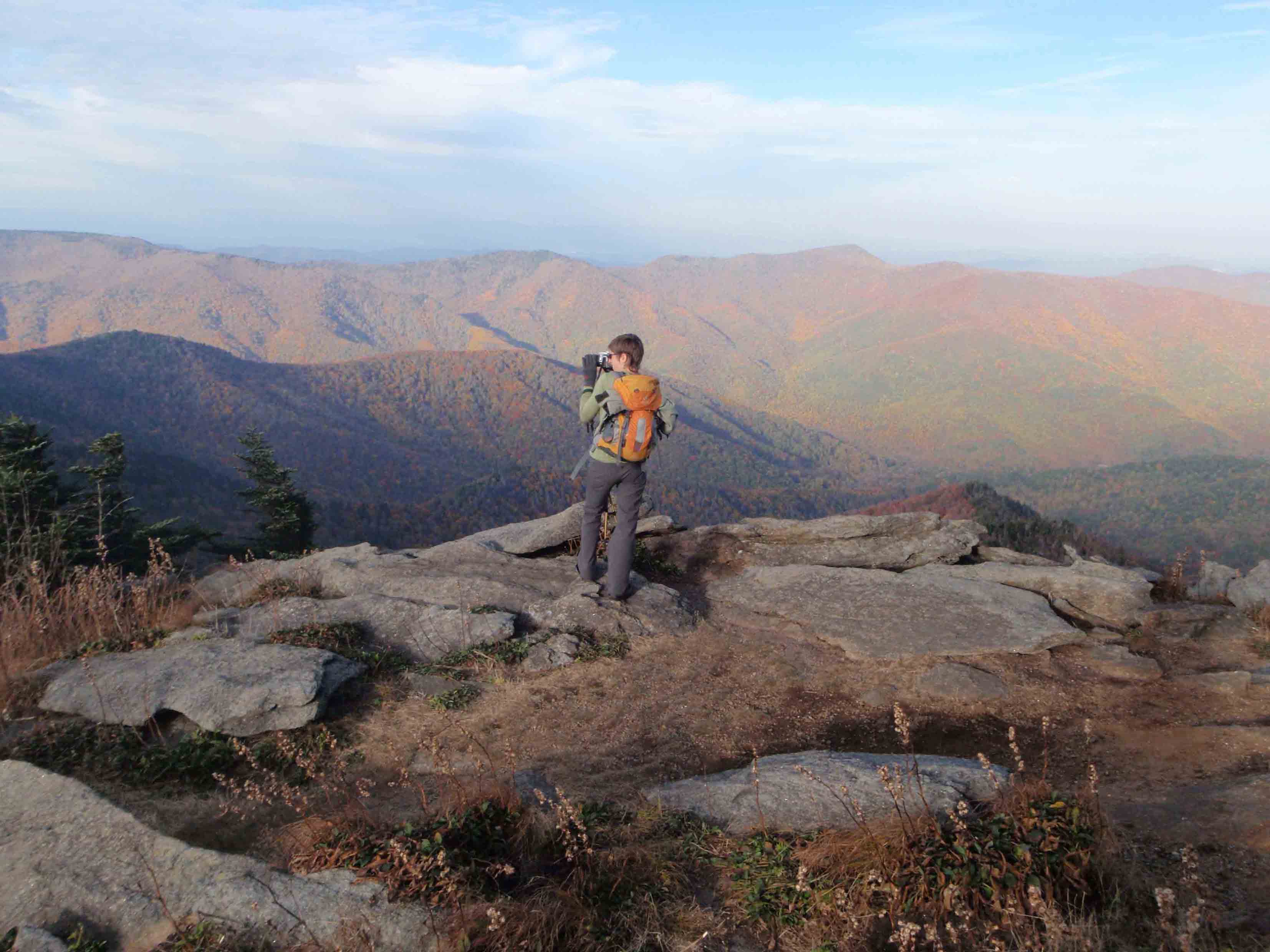
THE BLACK MOUNTAIN CREST TRAIL IS A GREAT PLACE TO TAKE PICTURES.
SCENERY: 
TRAIL CONDITION: 
CHILDREN: 
DIFFICULTY: 
SOLITUDE: 
GPS TRAILHEAD COORDINATES: N35° 45.972' W82° 15.919'
DISTANCE & CONFIGURATION: 10.5-mile balloon
HIKING TIME: 8 hours
HIGHLIGHTS: The varied terrain and trails of Mount Mitchell State Park and the highest mountain east of the Mississippi River
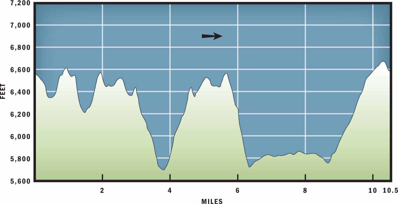
ELEVATION: 5,693 feet at Deep Gap to 6,684 feet on top of Mount Mitchell
ACCESS: Mount Mitchell State Park is open year-round, 8 a.m.–sunset. Vehicle access is limited in winter due to Blue Ridge Parkway closures.
MAPS: USGS Mount Mitchell
FACILITIES: Gift shop, snack bar, and restrooms at the trailhead parking area
WHEELCHAIR ACCESS: Yes, in the facilities, and also on a 0.2-mile trail to the Mount Mitchell summit
COMMENTS: Because weather can change very quickly above 6,000 feet, bring sunscreen, rain gear, and warm clothes for layering up.
CONTACTS: (828) 675-4611; ncparks.gov/Visit/parks/momi


Overview
This hike is not direct, but it is adventurous. This route will not just take you to the top of Mount Mitchell; it will also explore neighboring summits on the Black Mountain Crest Trail, before arriving at Deep Gap. From Deep Gap you will retrace your steps to the base of Big Tom Mountain before veering down to meet the Buncombe Horse Trail. Once on that trail, you will follow an old railroad bed that gently contours the mountain up to Commissary Ridge. One last uphill push on the Mountains to Sea Trail (MST) will lead to the 6,684-foot Mount Mitchell summit.
Route Details
It is worth reiterating that this route is an explorer circuit, designed to expose you to some of the most popular trails and different ecosystems within Mount Mitchell State Park. If you want a moderate and concise hike to the summit of Mount Mitchell, you may prefer the Mount Mitchell High Loop hike. But if you want to take a full day exploring the Black Mountain Range, then this hike is for you.
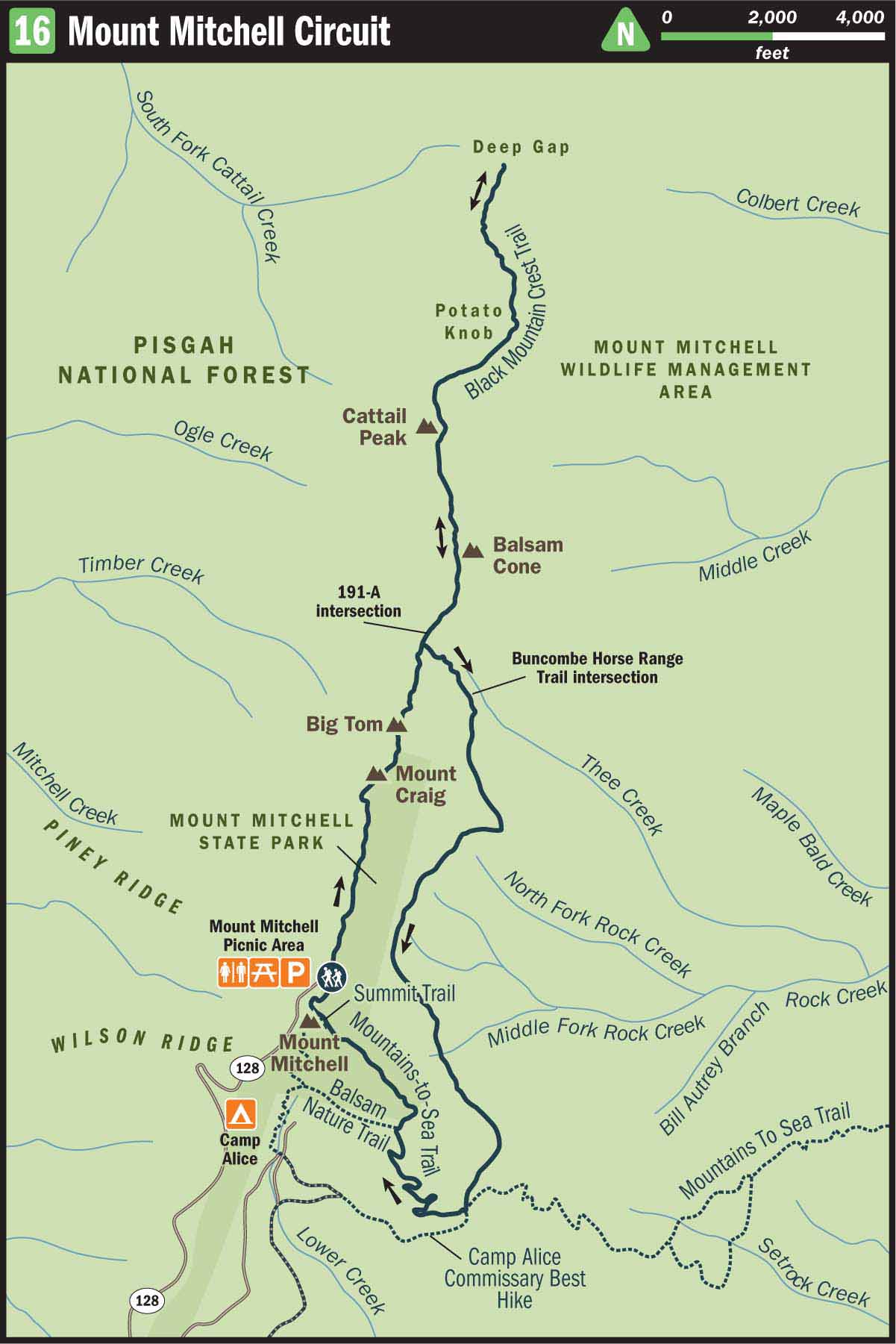
The hike starts at the parking area below the Mount Mitchell summit, near the Mount Mitchell Gift Shop and Snack Bar. From the gift shop, follow the road east out of the main parking lot to reach the Mount Mitchell Picnic Area. This is the start of the Black Mountain Crest Trail. Follow the gravel path beside the picnic pavilion and between scattered picnic tables until it becomes a well-defined cut through the surrounding fir trees.
The Black Mountain Crest Trail will take you over some very prominent peaks on your hike to Deep Gap. The first summit you reach is Mount Craig. At 6,663 feet, Mount Craig is the second-highest mountain in the eastern United States. The peak is named for the North Carolina Governor, Locke Craig, who established Mount Mitchell State Park as North Carolina’s first state park and consequently helped protect the slopes of the Black Mountain Range from further logging.
From Mount Craig you will travel a short descent and then hike back uphill to reach the summit of Big Tom. Big Tom was named for Tom Wilson, a legendary mountaineer and bear hunter in the Black Mountain Range during the 1800s. Past Big Tom, you will once again descend into a neighboring gap, where trail 191-A veers off to the east. If the first 1.7 miles of continuous up-and-down hiking has been more difficult than you expected, you may want to consider shaving a total of 4 miles of undulating hills by going ahead and turning east. However, if you wish to continue on the Black Mountain Crest Trail to reach Deep Gap, then continue hiking north.
The next 2 miles leading to Deep Gap will take you through more of the dense spruce and fir forest that defines the ridgeline. This type of high-elevation evergreen forest is very rare in the southeastern United States; it exists only above 5,500 feet, where the elevation and colder temperatures are too harsh for broadleaf hardwood trees to survive.
Continuing in its up-and-down rhythm, the trail will take you over Balsam Cone, Cattail Peak, and Potato Knob before descending into Deep Gap. Deep Gap is unmarked, but it represents the northern boundary of Mount Mitchell State Park and is riddled with backcountry campsites. Deep Gap is a good place to stop and enjoy a rest and bite of food before backtracking, on the rollercoaster of a ridge, to Trail 191-A.
Once you retrace your steps along the crest to reach Trail 191-A at the base of Big Tom, turn east and follow the trail 0.5 miles downhill to meet Trail 191, the Buncombe Horse Range Trail. As a word of precaution, 191-A can become overgrown, especially during the summer months. Depending on the trail condition, you may have to bushwhack a little bit to reach the Buncombe Horse Range Trail. Be extra cautious to avoid plants with thorns on them, as this section is dotted with blackberry bushes, which might not be such a bad thing in late summer!
Past the weeds and bramble of 191-A, the Buncombe Horse Range Trail opens into a wide and level path that follows the old rail tramway that used to transport tourists to the top of Mount Mitchell. Your legs will appreciate this relatively flat 2.2-mile stretch, but be careful, as the trail does not have a good drainage system in place and can often become very muddy after a heavy rain.
After 8.7 miles of total hiking, you will come to an intersection with the Mountains to Sea Trail. The MST coincides with the Buncombe Horse Range Trail for 200 yards and then veers northwest up Commissary Ridge. Follow the MST up the ridgeline. You will know you are getting closer to the Mount Mitchell summit when the MST joins the Balsam Nature Trail and informational placards appear on the side of the trail. At 10.3 miles the trail exits the woods and joins with a paved trail leading to the nearby Mount Mitchell Summit and Observation Tower. Take this trail to the summit and then follow it 0.2 miles downhill, past the MST, Balsam Nature Trail, Environmental Education Center, and Old Mitchell Trail to complete your hike.
Nearby Attractions
Mount Mitchell’s restaurant, gift shop, and snack bar are open to the public from May to October. The restaurant is 0.6 miles past the park office and is accessible by NC 128 or the Mount Mitchell High Loop. There is also a snack bar and gift shop beneath the Mitchell summit at the end of NC 128.
Directions
Take the Blue Ridge Parkway north from Asheville. At mile marker 355, approximately 30 miles from Asheville, turn left onto NC 128. NC 128 leads into Mount Mitchell State Park. Drive 3 miles on NC 128 until it dead-ends at the Mount Mitchell Summit Parking Area.