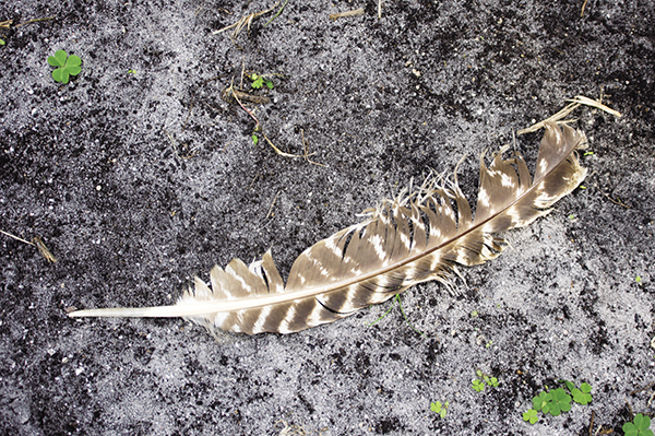
If you keep your eyes peeled, you can often spot treasures like this wild turkey feather lying in the trail. Admire it, then leave it for others to enjoy.
7 Crow Mountain Creek Falls
Balanced! From the base of Crow Mountain Creek Falls, the balance of nature comes to mind. Tucked away deep in the forest, the creek makes its way down the mountainside until finally showing itself like a wonderful unexpected gift.
See map on 6 Falls #2 on Waters Creek
Height: 35 feet
Distance: 1.6 miles out and back
Trail surface: Wide old logging road and narrow hard-packed dirt
Approximate hiking time: 1 hour
Other trail users: Equestrians
Blaze color: No blazes
County: Lumpkin
Land status: National forest
Trail contact: Chattahoochee National Forest, Chattooga Ranger District; (706) 754-6221; www.fs.fed.us
Maps: DeLorme: Georgia Atlas & Gazetteer: Page 15 E7
Finding the trailhead: From the junction of US 19 and US 129 at Turner’s Corner, drive south on US 19 for 0.5 mile. Turn right onto Dicks Creek Road and travel 3.5 miles to a pull-off on the right in front of an old logging road blocked by some dirt mounds.
From the junction of US 19 and GA 60 north, drive north on US 19 for 4.7 miles. Turn left onto Dicks Creek Road and follow the directions above.
The trailhead is located at the foot of the logging road. (Note: Dicks Creek Road becomes FS 34 after 2.2 miles.) GPS: N34 41.201 / W83 56.601
The Hike
Begin by hiking over the mounds and following the old logging road uphill and into the forest. The trail soon brings you across a small tributary and then makes a short detour around some downed trees.
Beyond the downed trees, the trail continues to follow the old roadbed uphill, leading you across a second small tributary. As you continue hiking, the wide trail narrows to a footpath. The trail continues to alternately widen and narrow as it makes its way uphill to a side trail that forks off to the right (east). Bypass this trail and instead head left (north-northwest) and cross a third small tributary.
Continue your ascent a short distance farther to an obscure side trail that leads south to the brink of the falls. From the brink, carefully follow the creek downstream (south-southeast); it soon leads to the base of Crow Mountain Creek Falls.
Crow Mountain Creek flows from Crow Mountain and lies within the heart of the Chestatee Wildlife Management Area. Chestatee comes from the Cherokee word a-tsv-sta-ti-yi, meaning “firelight place.” A popular means of hunting was to set a fire and flush wildlife toward the river, where they could be easily killed. The WMA is still popular with hunters, but nowadays they obviously use different means. Many other recreational activities are enjoyed here, including hiking, birding, horseback riding, and fishing in the superb trout waters of Crow Mountain Creek.
Miles and Directions
0.0From the trailhead, follow the old logging road north-northeast, uphill and into the forest.
0.1Cross a small tributary and continue on a small side trail north-northwest around some downed trees. Once around the trees, continue following the old logging road.
0.2Cross a second small tributary. Continue hiking north, deeper into the forest.
0.6A side trail forks off to the right (east). Bypass this trail and stay left, following the main trail to a third small tributary. Cross it and continue hiking north-northwest.
0.7Reach a side trail that leads south to the brink of the falls. Once at the brink, carefully follow the creek downstream (south-southeast).
0.8Arrive at the base of Crow Mountain Creek Falls (N34 41.623 / W83 56.382). Return the way you came.
1.6Arrive back at the trailhead.
If you keep your eyes peeled, you can often spot treasures like this wild turkey feather lying in the trail. Admire it, then leave it for others to enjoy.