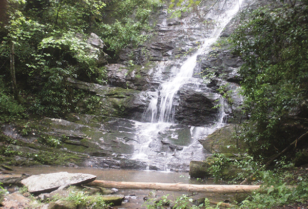
Falls on Reedy Branch are flawless as they flow into their own hidden cove.
38 Falls on Reedy Branch
Mysterious! A gorgeous gazebo alongside the base of the falls makes you wonder who once lived here. It feels as though you are trespassing as you pass through the stone pillars at the trailhead, heading down the driveway to what may have been someone's dream home.
See map on 37 Fall Creek Falls
Height: 60 feet
Distance: 0.4 mile out and back
Trail surface: Wide old roadbed and narrow footpath
Approximate hiking time: 20 minutes
Blaze color: No blazes
County: Oconee
Land status: National forest
Trail contact: Sumter National Forest, Andrew Pickens Ranger District; (864) 638-9568; www.fs.fed.us
Maps: DeLorme: South Carolina Atlas & Gazetteer: Page 22 A1; DeLorme: Georgia Atlas & Gazetteer: Page 16 D4
Finding the trailhead: From the junction of US 76 and US 441 in Clayton, Georgia, drive east on US 76 for 9.8 miles to a pull-off on the right next to a low stone wall. This is the beginning of FS 2751.
From the junction of US 76 and the Chattooga River Bridge (Georgia–South Carolina state line), drive east on US 76 for 1.7 miles to a pull-off on the right next to a low stone wall.
From the junction of US 76 and US 123, drive west on US 76 for 15.5 miles to a pull-off on the left next to a low stone wall.
The trailhead is located at the stone pillars at the south end of the parking area. GPS: N34 48.444 / W83 16.858
The Hike
Begin the hike by going around the stone pillars and following FS 2751 downhill. As you reach the bottom of the hill, you will see a small side trail on the left just before the road crosses a small stone bridge. Take this side trail, following it over a small wooden footbridge. Continue a short distance farther to arrive at the base of the Falls on Reedy Branch.
I was enjoying a cold beverage at the nearby Bonnie Blue Saloon, just east of the trailhead, when a patron shared this one with me. Thanks!
The area surrounding the falls was in the midst of a development project when it was acquired by the Sumter National Forest, leaving that dream home, at least for some, just a dream.
Miles and Directions
0.0From the trailhead, go around the stone pillars and hike south on the old roadbed, making your way downhill.
0.2At the bottom of the hill, come to a side trail on the left before FS 2751 heads over a stone bridge. Go left (south) on this side trail, which crosses a footbridge before quickly leading to the base of Falls on Reedy Branch (N34 48.323 / W83 16.896). Return the way you came.
0.4Arrive back at the trailhead.
Falls on Reedy Branch are flawless as they flow into their own hidden cove.