![]()
Wevertown—Blue Mountain Lake—Old Forge—Herkimer—Oneonta—Kingston; 277.7 m. State 28.
Two- and three-strip concrete or macadam open throughout the year.
New York Central R.R. parallels route between Thendara and Remsen, Oneonta and Kingston.
Hotel and tourist home accommodations May to October; in winter, larger communities only. Several public campsites in Adirondack region.
From the State land of the Adirondack Park to the State land of the Catskill Park, this recreation route starts in the foothills of the upper Hudson and ends in the valley of the lower Hudson. Picking its way across the central mountainous region of the Adirondacks, State 28 follows the Fulton Chain of Lakes, where early lumbermen left desolation behind them. Here woodsmen and trappers, an eccentric lot, catered to the first Adirondack sportsmen, when the region’s inaccessibility lent it a glamour that is missing in the comfortable sportsmen’s lodge of the present time.
South of the Adirondack Park the route follows a straight course across the Mohawk Valley; past spas, not so gay as they were in the 90’s; and along the Susquehanna Valley.
Between Oneonta and Kingston State 28 crosses the rich farmlands of the Delaware Valley. Through the Catskill Park it follows the route of early settlers of the Delaware and Susquehanna Valleys along Esopus Creek.
Section a. WEVERTOWN to BLUE MOUNTAIN LAKE; 35.1 m. State 28
The route climbs toward the highlands of the central Adirondacks, which rise to the north above a forest of spruce, pine, and hemlock.
State 28 branches northwest from State 8 (see Tour 14) at WEVERTOWN, 0 m. (1,040 alt., 225 pop.), settled in 1833 as a tannery site and still the center for small lumbering activities.
NORTH CREEK, 5.7 m. (1,060 alt., 600 pop.), is a winter and summer resort and the center of trade for the scattered residents within a large area. It is told that in a logging camp in the vicinity the mosquitoes were so bad that the lumbering people introduced bumblebees to fight the pests. But their plans went awry; the bumblebees mated with the mosquitoes and produced a swarm of hybrids with stingers at both ends.
At North Creek is the junction with State 28N.
Right on this road to MINERVA, 7.7 m. (1,400 alt., 210 pop.), which caters mostly to hunters and tourists. AIDEN LAIR LODGE (R), 14.3 m., was one of the relay stations in Theodore Roosevelt’s dash to North Creek to take the train to Buffalo to be sworn in as President of the United States.
The BOREAS BRIDGE STATE CAMPSITE (R), 15.6 m., is a three-fireplace clearing along the stream, an ideal overnight stand for anglers.
On the ridge above the Boreas Valley a bronze plaque on a granite boulder (R), 19.7 m., fixes the approximate spot where Theodore Roosevelt was when he automatically became 26th President of the United States upon the death of President McKinley.
At 21.4 m. is the junction with State 73, a dirt road, called the Roosevelt Marcy Highway; right here to TAHAWUS (Ind., he splits the sky, applied to Mount Marcy), 1.9 m. (1,750 alt., 50 pop.). Left at the fork in the road to the junction, 6.8 m., with the entrance to a foot trail; right on this trail (yellow markers) 4.2 m. to the summit of MOUNT MARCY (5,344 alt.), the highest mountain in the State. From State 73 are visible Mounts Marcy, Adams, McIntyre, Santanoni, Skylight, and Colden, which sit in a semicircle to the north.
On the bridge at 24.9 m. State 28N crosses the Hudson River near where it first assumes that name. From its source on Mount Marcy in Lake-Tear-of-the-Clouds, it plunges down the mountain sides and eventually, under the name of Opalescent River, merges with other tributaries to form the Hudson.
The road winds through several posted forest preserves set aside for wild life investigation and forest experimentation by the State College of Forestry at Syracuse University, Finch, Pruyn & Company of Glens Falls, and Cornell University.
At 30 m. is the entrance to the Mount Goodenow foot trail; left on this trail 2 m. to the forest fire observation tower on the summit of MOUNT GOODENOW (2,693 alt.).
LONG LAKE, 40.5 m. (1,660 alt., 225 pop.), is at the junction with State 10 (see Tour 17).
At 50.6 m. is the entrance to the Blue Mountain foot trail; left up this trail 1.8 m. to the forest fire observation tower at the summit of BLUE MOUNTAIN (3,759 alt.).
BLUE MOUNTAIN LAKE, 51.8 m. (1,800 alt., 300 pop.), is at the junction with State 28 (see below).
Along State 28 in isolated clearings are the homes of Adirondack natives, simple frame structures, the poorer ones with tar paper exteriors and sheet metal roofs. The men are guides, lumbermen, road workers, trappers, and hunters; the women add to the family income by managing gasoline stations and catering to tourists.
At 9.9 m. is the junction with a narrow dirt road (steep; chains essential after rain or snow).
Left on this road to the BARTON GARNET MINE (open), 5 m., which produces a basic brownish red mineral suitable as an abrasive. From the mine a foot trail leads straight ahead (10 minutes) to the LEAN-TO OF THE GORE MOUNTAIN SKI CLUB, the start of nine trails. On winter week-ends the mountainside is alive with skiers in bright-colored costumes; a three-link ski-tow hums continuously upward, dragging the unwearied to the lower Skiland slopes. An annex of the North Creek American House offers warmth, the cheering cup, hot meals, and a place for technical ski-talk punctuated by the thumps of thick-soled ski boots.
In NORTH RIVER, 10.5 m. (1,071 alt., 170 pop.), is the junction with a dirt road.
Left on this road 5 m. to THIRTEENTH LAKE (trout fishing), with a scattering of camps on its mountain-bound shores. The HOOPER GARNET MINE, on the flank of Gore Mountain (L), is similar to the Barton Mine (see above).
West of INDIAN LAKE, 23.9 m. (1,650 alt., 400 pop.), is an undeveloped marshy country, a section of which has been posted as a sanctuary for migratory waterfowl.
Dr. Thomas C. Durant (1820–85) and William West Durant (1850–1934), father and son, were early promoters of this section of the Adirondacks. The father, financier and railroad builder, built a railroad from Saratoga to Blue Mountain Lake, and the son expanded his father’s promotional activities. He built elaborate camps and sold them to J.P. Morgan, Alfred G. Vanderbilt, Collis P. Huntington, and others; he used to bring his friends up by railroad and across 40 miles of snow to enjoy Christmas dinner in the mountains.
BLUE MOUNTAIN LAKE (speed boats available, $1 a person), 35.1 m. (1,800 alt., 300 pop.), is a crossroads settlement of some half-dozen small houses of boxlike type and a few hotels, low, hip-roofed structures built to simulate log houses, scattered along the southern shore of the lake named for Blue Mountain.
At Blue Mountain Lake is the western junction with State 28N (see above).
Section b. BLUE MOUNTAIN LAKE to ALDER CREEK; 63.8 m. State 28
West of BLUE MOUNTAIN LAKE, 0 m., State 28 follows the Fulton Chain of lakes, part of a 150-mile canoe route between Old Forge and Loon Lake. This is one of the best hunting and fishing regions of the State; sportsmen rely on native guides, banded together in the Adirondack Guides Association, who plan and direct trips, lay out the schedule, and practically guarantee a full bag of game or string of fish.
The John Brown Tract, 210,000 acres in the Fulton Lake-Big Moose section of the Macomb Purchase, was bought in 1793 for $1 an acre. John Brown (1736–1803), businessman of Providence, Rhode Island, and member of the family instrumental in the establishment of Brown University, lived only long enough to have this waste land surveyed and subdivided into townships, which he named for the eight virtues he most admired—Industry, Enterprise, Perseverance, Unanimity, Sobriety, Frugality, Economy, and Regularity—and to assure himself, through several failures, that settlements could not be established here. After his death, Charles Herreshoff, his son-in-law, failed utterly in his attempt to restore his fortune in this ‘region so barren that a crow would shed tears of sorrow while flying over it.’ From 1819 to 1892, when the railroad opened the country as a resort area, Brown’s Tract was deserted—free land for trappers and hunters, many of whom became the guides of early sportsmen.
EAGLE LAKE (R), 3.1 m., and UTOWANA LAKE (R) are widened portions of the Marion River, which connects Blue Mountain and Raquette Lakes.
GOLDEN BEACH STATE CAMPSITE, 10 m. (free; open May 30–Sept. 30; 65 campsites; picnic grounds), occupies a shaded grove on a bluff overlooking a half-mile sandy beach on Raquette Lake.
At 13.6 m. is the junction with an unnumbered road.
Right on this road to RAQUETTE (Fr., snowshoe) LAKE (boat trips July and Aug., $1 a person), 0.4 m. (1,800 alt., 50 pop.), a hotel resort community at the southwestern tip of the lake of the same name. On Raquette Lake the Durants built Camp Pine Knot, 1877–9, the first elaborate hunting lodge in the Adirondacks and for many years the showplace of the woods. In planning it the younger Durant combined the features of the Adirondack crude log cabin and the Swiss chalet, and so created the modern type of Adirondack lodge. He raised money for building an Episcopal church on an island in the lake, to which worshipers came on Sunday morning in boats.
Most famous of the early guides on Raquette Lake was Alvah Dunning (1816–1902). Alvah killed his first moose at the age of 11 and guided his first party at the age of 12; he claimed to have killed the last Adirondack moose in 1862. He had to leave Piseco Lake (see Tour 14) when he outraged public feeling by beating his wife, who had been unfaithful to him. The rest of his life was a long retreat from civilization. He rebelled against the city people, ‘them city dudes with velvet suits and pop guns, that can’t hit a deer when they see it, and don’t want it if they do hit it’; he rebelled against property laws that would not recognize his squatter’s rights; and he rebelled against the newfangled inventions. The crowning irony was the way he met his death: he was found asphyxiated in his bed in a hotel room in Utica: the gas jet had been leaking all night—he had blown out the light.
Close friend of Alvah Dunning was the Reverend William Henry Harrison (‘Adirondack’) Murray (1840–1904), Boston preacher who press-agented the Adirondacks as a health resort and vacation playground. His first book, Adirondack Tales, is said to have netted Murray $58,000 in royalties. But it was his Adventures in the Wilderness (1869) that started the stampede to the mountains that was called the ‘Murray Rush’; Wendell Phillips said the book ‘has kindled a thousand campfires and taught a thousand pens how to write of nature.’ But there was another side to the picture: Murray had gone off the deep end in painting the attractions of the mountains, especially their health-giving powers; scores of tubercular people flocked to the Adirondacks, and Murray was charged with the murder of those who died there; editors of the day called the book a ‘monstrous hoax’ and referred to those who joined the rush as ‘Murray’s Fools.’
The moose almost completely disappeared from this once great moose-hunting district in the winter of 1854–5, but other game is still plentiful.
EIGHTH LAKE (State-owned; excellent fishing), 17.2 m., is (R) about half a mile from the road. This is the easternmost of the eight lakes known as the Fulton Chain, all of which flow into the middle branch of the Moose River.
At 18.6 m. is the junction with a dirt road.
Right on this road to the EIGHTH LAKE STATE CAMPSITE (free, open May 27–Oct. 15; 25 sites), 0.5 m., in a group of spruce and birch on the south shore of Eighth Lake.
SEVENTH LAKE is about 100 feet below the parking space at 20.2 m. White’s Island in Seventh Lake was the retreat of sullen, hard-drinking Green White, the dread of Indians, whose longest speech was ‘Indians never steal my furs but once.’
INLET, 24.1 m. (1,716 alt., 150 pop.), a resort community of several hotels, churches, and a cluster of frame houses, is at the western tip of Fourth Lake, the largest of the Fulton Chain. East of the village is one-mile-long Sixth Lake, surrounded by private camps. Adjacent and to the southwest is Fifth Lake, the smallest in the group.
At Inlet is the junction with the South Shore Road.
Left on South Shore Rd., an alternate between Inlet and Old Forge, following the south shore of the Fulton Chain, to THIRD LAKE STATE CAMPSITE (free, open May 30–Sept. 30; transient stop-over, four campsites), 6 m.
The South Shore Road continues to Old Forge, 12 m. (see below).
At EAGLE BAY, 25.9 m. (1,740 alt., 25 pop.), a resort colony on Fourth Lake, is the junction with a narrow, winding, hard-surfaced road.
Right on this road through a heavy forest of hemlock, spruce, and yellow birch, to the Big Moose country, a rectangular tract some 50 miles wide. In this locality, once nationally known for its deer-hunting, unsuccessful efforts have been made to propagate Wapiti, a type of elk, and to restock the forest with moose, imported from Canada. (Algonquian, moos, to eat off, is descriptive of the habit of the moose of eating foliage from standing trees.) More successful results came from the liberation of seven beavers in 1904 and 25 more in 1906. Their number had so increased by 1915 that their activities as dam builders made landowners their enemies, and the State Conservation Department was bombarded with demands for relief. A program of periodic legalizing of trapping in 1924 and 1925 made heavy inroads, since beaver pelts were selling for about $30 apiece. Today the beaver is a valuable economic resource.
DART LAKE (L), 4.1 m., is named for William (‘Bill’) Dart, who built his first camp here in 1879 and bought the entire lake shore in 1892 when the railroad went through. The engaging personality of this guide won him a large following among sportsmen, who were transported to his simple camps by a two-seated spring wagon drawn by a ‘gentle red bull.’
Reproduction from J.H. French’s Historical and Statistical Gazetteer of New York State (1860)
Reproduction from J.H. French’s Historical and Statistical Gazetteer of New York State (1860)
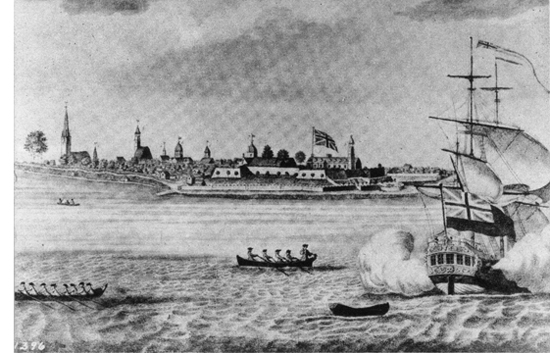
FORT GEORGE AND THE CITY OF NEW YORK (c.1760)
Courtesy of the U.S. Army Signal Corps
Reproduction from an old print published in London
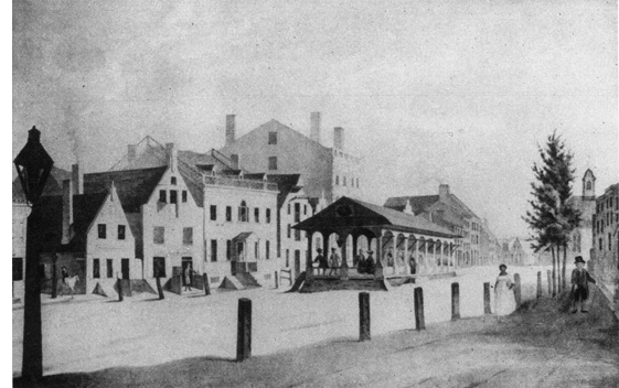
MARKET PLACE, BROADWAY, ALBANY (c.1791)
Courtesy of Ledyard Cogswell, Jr.
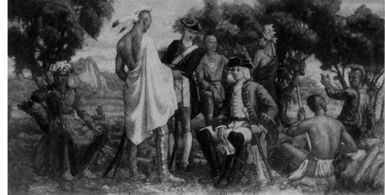
SIR WILLIAM JOHNSON AT AN INDIAN COUNCIL
Courtesy of the Section of Fine Arts, U.S. Treasury Department
Mural by Henry Schnackenburg, Amsterdam Post Office
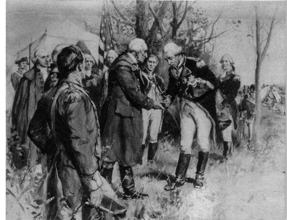
BURGOYNE SURRENDERS TO GATES, OCTOBER 17, 1777
From a painting by F.C. Yohn
Courtesy of the Glens Falls Insurance Co.
Courtesy of the Federal Works Agency, Section of Fine Arts
Detail of mural by Mary Earley, Delhi Post Office
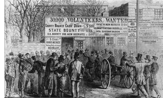
RECRUITING IN CITY HALL PARK, NEW YORK CITY (1864)
Sketch by George Law
Reproduction by courtesy of the U.S. Signal Corps
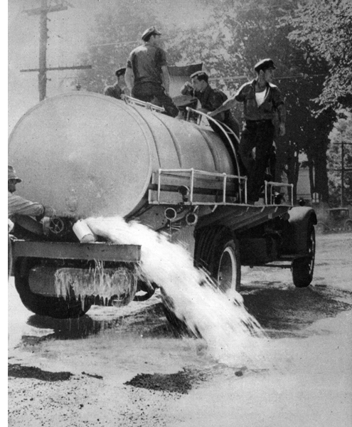
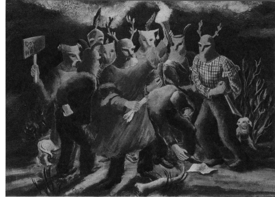
MILK STRIKE, MT. UPTON (AUGUST 1939)
Photograph by courtesy of Pictures Inc.
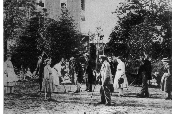
PLAYING CROQUET, ONEIDA COMMUNITY
Reproduced by courtesy of Oneida, Ltd.
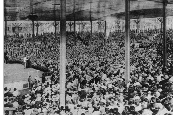
WILLIAM LYON PHELPS ADDRESSING CHAUTAUQUA
Photograph by courtesy of Chautauqua
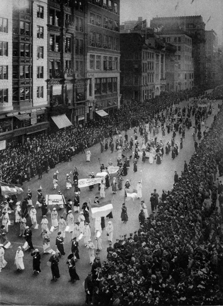
WOMAN SUFFRAGE PARADE, FIFTH AVENUE
Photograph by courtesy of Wide World Photos, Inc.
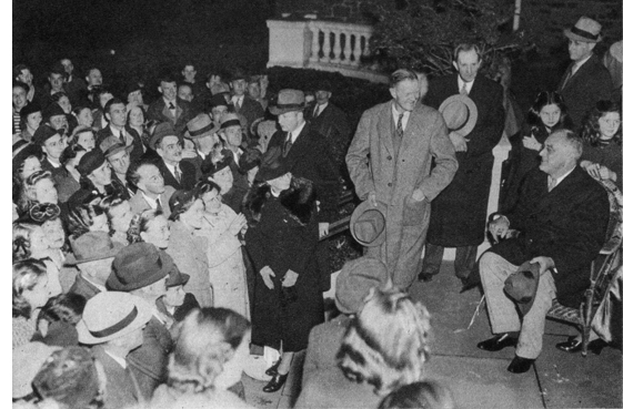
FRANKLIN ROOSEVELT RECEIVES HIS NEIGHBORS’ CONGRATULATIONS ON ELECTION NIGHT
Photograph by courtesy of Wide World Photos, Inc.
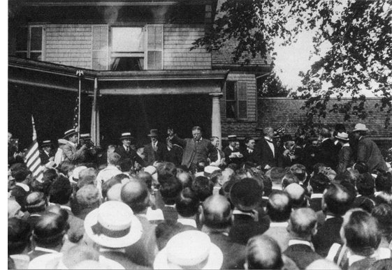
THEODORE ROOSEVELT Addressing Visitors at Sagamore Hill, His Oyster Bay Home (1916)
Photograph by Paul Thompson; courtesy Roosevelt Memorial Association
The first permanent camp at BIG MOOSE LAKE (R), 5.6 m., was built by Edwin L. (‘Jack’) Sheppard, ‘so thin he has to step aside to throw a shadow.’ In this region of rough trappers this student of geology, engineering, botany, and natural history was in great demand as a guide and of invaluable assistance to Verplanck Colvin in his survey of 1872.
At 6.2 m. is a crossroads; right here 0.2 m. to the GLENMORE HOTEL (well-stocked general store; adequate boat landing) on the lake shore.
At 31 m. is the junction with a foot trail.
Right on this trail 600 feet to RONDAXE (BALD) MOUNTAIN; the rocky ledges on the last quarter-mile are provided with stairs and railing. From the fire observation tower at the summit is an excellent view of the Big Moose and Fulton Chain country.
OLD FORGE, 35.3 m. (1,731 alt., 840 pop.), is an Adirondack metropolis of practical frame houses and a shopping district that serves the residents of a large surrounding area and the summer visitors and sportsmen who make this their headquarters. Old Forge is the starting point for short and extensive canoe trips through the Fulton and Raquette Lake regions.
THENDARA, 37.4 m. (1,705 alt., 200 pop.), was once the home of Nat Foster, a dead-shot trapper and guide, who carried spare bullets between his fingers. Otis Arnold, who ran an inn for hunters here, had 11 daughters, timid among human beings but at home on the horses they broke to saddle; his son was known for his terrifying snore.
The route follows the middle branch of the Moose River to its junction with the south branch. Passing several small lakes and resort towns, State 28 crosses the Adirondack State Park boundary in a sandy region of pine and spruce forest.
ALDER CREEK, 63.8 m. (1,200 alt., 150 pop.), is at the junction with State 12 (see Tour 25).
Section c. ALDER CREEK to ONEONTA; 85.9 m. State 28
This popular tourist route between the Adirondacks and the Catskills follows West Canada Creek to the Mohawk Valley, which it crosses at Herkimer, and continues along the Leatherstocking Trail to Lake Otsego, the headwaters of the Susquehanna. Between Lake Otsego and Oneonta the highway follows the widening Susquehanna Valley. The country south of the Mohawk was the wilderness setting for several of James Fenimore Cooper’s Leatherstocking Tales.
South of ALDER CREEK, 0 m., State 28 unites with State 12 (see Tour 25) to TRENTON, 11.6 m. (800 alt., 313 pop.).
At 7.7 m., is the junction with State 46A.
Right here to the STEUBEN MEMORIAL PARK (picnicking), 3.5 m., a wooded tract of about two acres which contains the marked GRAVE OF BARON VON STEUBEN (1730–94), the drillmaster of the Revolution, and a REPRODUCTION OF THE VON STEUBEN CABIN (open; adm. 10¢, children under 16 free), which is being equipped with furniture of the Revolutionary period. The park is part of a 16,000-acre estate granted Baron Steuben by New York State in 1786.
At 13.8 m. is the junction with a macadam road.
Right on this road to TRENTON FALLS, 0.9 m., a series of cascades in West Canada Creek, which, in cutting its way through a limestone gorge, has created ledges and uncovered formations of such geologic importance that the classification Trenton Epoch is applied to the limestone-making era evidenced by them.
At 19.3 m. is the junction with State 8 (see Tour 14), with which State 28 unites to POLAND, 20.9 m. (721 alt., 462 pop.).
At MIDDLEVILLE, 28.9 m. (570 alt., 760 pop.), is the junction with State 29 (see Tour 13).
HERKIMER, 37 m. (406 alt., 10,446 pop.) (see Tour 11), is at the junction with State 5 (see Tour 11).
At 38 m. the route crosses the Mohawk River, part of the State Barge Canal.
MOHAWK, 38.4 m. (410 alt., 2,835 pop.) (see Tour 12), is at the junction with State 5S (see Tour 12).
At 49.3 m. is the junction with US 20 (see Tour 8), with which State 28 unites to RICHFIELD SPRINGS, 49.9 m. (1,300 alt., 1,333 pop.) (see Tour 8).
South of Richfield Springs the route parallels CANADARAGO (Ind., on the lake) LAKE, 51.2 m., which is swampy at its northern and southern ends.
COOPERSTOWN, 63.9 m. (1,240 alt., 2,909 pop.), a parklike residential and summer resort town, extends along the southern shore of Otsego Lake, the headwaters of the Susquehanna River.
The COOPER GROUNDS, Main St. opposite Fair St., is a landscaped two-acre memorial park dominated by a statue in heroic size of James Fenimore Cooper by Victor Salvatore. The monument stands on the SITE OF OTSEGO HALL, built in 1798 by Judge William Cooper, father of the author. In this house James Fenimore Cooper wrote The Deerslayer and several other romantic tales.
William Cooper came to Otsego Lake in 1785 to survey his landholdings and he soon founded the settlement that now bears his name. In 1790 he brought his family to their new home in the wilderness.
CHRIST CHURCH (Episcopal), S. of the Cooper Grounds, was erected in 1810 on land donated by Judge Cooper. Extensive alterations in 1840 were supervised by James Fenimore Cooper, a vestryman of the church, who endeavored to use the Gothic style of architecture he had admired in England.
The GRAVE OF JAMES FENIMORE COOPER (1789–1851) is in the Cooper family plot in the churchyard cemetery. In this wilderness outpost Cooper spent his childhood, developing the pioneer’s independence and absorbing Indian lore that he later wrote into his novels. Following his expulsion from Yale for a college prank, and prior to his marriage in 1811 to Susan A. De Lancy (see Tour 1), Cooper spent a number of years as common seaman on a transatlantic merchant vessel and as midshipman in the U.S. Navy. An independence of spirit which later in life led him into controversial writing and wrangling in court was responsible for his starting to write. His first effort, a failure, was inspired by a dare from his wife when he said that he could write a better book than one they had just read. Further goaded by his own failure, he wrote The Spy and then The Prairie, first of the Leatherstocking Tales, and was at once the center of attention from such contemporaries as Scott, Thackeray, Balzac, and Hugo. Cooper’s fast-moving yarns, especially adaptable to translation, were sold the world over. N.P. Willis described him, in 1848, as ‘a little increased in weight, weighing now two hundred and nine—but feels no other premonition of age. His peculiarly manly and rich voice certainly rings clear as ever, and his pale grey eye . . . sits as bright and steady in its full socket.’ Democratic in principle but aristocratic in sentiment, Cooper won wide personal unpopularity: in England by his outspoken American patriotism; in the United States by his criticism of what he considered native vulgarities. He believed that democracy could not function unless led by a landed aristocracy to set up and maintain social standards.
The CENTRAL QUARTERS OF THE NEW YORK STATE HISTORICAL ASSOCIATION (open, summer 9–6 daily; winter 9–12, 1–5 Mon.–Fri., 9–12 Sat.; adm. adults 25¢, children 10¢, Association members free), NE. corner of Main and Fair Sts., a neoclassic building with a two-story portico across the front, contains John H.I. Brower’s remarkable series of 20 life-mask busts made about 1825 and including six of the first eight Presidents of the United States; a collection of New York State portraits, landscapes, and genre paintings; many items connected with the Cooper family; and printed and manuscript materials relating to Central New York.
The SITE OF THE CLINTON DAM is at the foot of River St. (R), at the outlet of the Susquehanna River. In July 1779, General James Clinton and his army, enroute to join forces with General John Sullivan, camped here. In order to raise the water level of the river to float the supply boats, Clinton had Otsego Lake dammed. On August 8 the dam was broken; the next day 208 heavily laden boats moved down the river, and the army marched along its banks.
COUNCIL ROCK, close by, is submerged except for its rounded top because the river has been dammed for water supply purposes. Here, according to Cooper’s The Deerslayer, Indians came ‘to make their treaties and bury their hatchets.’
Besides the Cooper family, Cooperstown has another claim to fame as the birthplace of baseball.
The NATIONAL BASEBALL MUSEUM (open summer, adults 25¢, children 10¢), Main St. between Fair and Pioneer Sts., an attractive two-story brick building, contains among other relics of the game a homemade baseball used by Abner Doubleday and a print illustrating Union soldiers engaged in a game at Salisbury, North Carolina, in 1863. The series of bronze plaques known as baseball’s Hall of Fame honors retired players who have received votes from 75 per cent of the members of the Baseball Writers’ Association in its annual poll. Among those elected are ‘Ty’ Cobb, ‘Hans’ Wagner, ‘Babe’ Ruth, ‘Christy’ Mathewson, Walter Johnson, ‘Nap’ Lajoie, ‘Tris’ Speaker, and ‘Cy’ Young.
LAKE FRONT PARK, Lake St. between Fair and Pioneer Sts., contains the INDIAN HUNTER, a statue of an Indian hunter and his dog, a replica by J.Q.A. Ward of the one in Central Park, New York City.
DOUBLEDAY FIELD, Main St. W. of Pioneer St., on the site used for the first baseball game, is a modern diamond and athletic field. Throughout the summer of 1939 the centennial of the founding of the game was celebrated by a series of games between teams representing the various leagues.
Baseball grew quite informally from One Old Cat, a favorite boys’ game in Colonial days, played by a thrower, a catcher, and a batter. In 1839 Abner Doubleday, a student in a local military academy, later a major general in the Civil War, limited the number of players to 11, outlined the first diamond-shaped field, and drew up a memorandum of rules for the game which he named baseball.
OTSEGO LAKE, called Glimmerglass in Cooper’s novels, is described in The Deerslayer as ‘a broad sheet of water, so placid and limpid that it resembled a bed of pure mountain atmosphere compressed into a setting of hills and woods.’
North from Cooperstown on a macadam road to the Lakewood Cemetery, 0.8 m.; the LEATHERSTOCKING MONUMENT, a shaft of white Italian marble surmounted by a statue of Natty Bumppo, is a tribute to Cooper’s most famous hero, the legendary site of whose cabin is near by. Farther up the lake shore is NATTY BUMPPO’S CAVE, 2 m., a narrow cleft in the rocks above the eastern lake shore.
South of Cooperstown State 28 parallels the east branch of the upper Susquehanna as it winds past the long ridge of the Crumhorn Mountains (1,900 alt.).
The HARTWICK SEMINARY BUILDINGS (R), 68.4 m., housed the forerunner of the present Hartwick College in Oneonta (see Tour 10). This school for Indians and theological students, the oldest Lutheran school in the United States, was established in 1797 under the provisions of the will of John Christopher Hartwick (1714–96), a Lutheran clergyman.
At COLLIERSVILLE, 80.3 m. (1,119 alt., 100 pop.) (see Tour 10), is the junction with State 7 (see Tour 10), with which the route unites to ONEONTA, 85.9 m. (1,120 alt., 11,649 pop.) (see Tour 10).
Section d. ONEONTA to KINGSTON; 92.9 m. State 28
From the Susquehanna Valley to the Allegheny Plateau and on to the higher Catskills, State 28 follows the steep-walled water courses around the mountain spurs, one of the routes of early nineteenth-century settlers of the Susquehanna Valley.
South of ONEONTA, 0 m., the road climbs to the crest of an S curve at 3.5 m., high above the flood plain of the Susquehanna River.
DELHI, 20.3 m. (1,370 alt., 1,840 pop.), home of a State School of Agriculture, is a neat, modern town. Shortly after the Revolutionary War Ebenezer Foote was so influential locally and as a member of the State legislature that he was nicknamed ‘the Great Mogul.’ At the suggestions of facetious citizens the community was named for Delhi, India, the capital city of the real Great Mogul. At Delhi is the junction with State 10, which follows the valley of the West Branch of the Delaware, locally known as Cat Hollow since 1843. At that time there was a lumber camp operating in the valley that was dominated by an Amazon of a cook. Not only did she knock out the bully who killed her cat but further punished the whole crew by serving the pet in a surprise meat pie.
Near ANDES, 32.4 m. (1,600 alt., 395 pop.), occurred the climax of the 1845 antirent war (see Tour 21) in Delaware County. When under-sheriff Caman N. Steele attempted to evict a farmer for unpaid taxes, his neighbors, dressed as ‘Indians,’ with leather capes over their heads, cowhorns on their caps, and cowtails tied on behind, came to his aid, and in the struggle the sheriff was shot. Arrests were made and several convictions followed, but all sentences were commuted.
At 41.9 m. the route joins State 30 (see Tour 24), with which it runs in common for 3.2 miles.
MARGARETVILLE, 43.9 m. (1,325 alt., 771 pop.), catering to summer residents and tourists, is in a valley between 2,600-foot Pakatakan Mountain on the south and 2,211-foot Kettle Hill on the north, at the western boundary of Catskill State Park.
Right from Margaretville on a foot trail (blue markers) to a side trail, 10 m., which leads 0.2 m. to BALSAM LAKE. At 12.1 m. is the junction with a trail (yellow markers) leading (R) to HARDENBURG (2,200 alt.), 3.6 m. Camps consisting of lean-tos and fireplaces are at various points along the main trail and side trails.
An old wooden covered bridge, 45.8 m., built in 1845, carries the heavy Oneonta-Kingston traffic. It was erected without nails; all the heavy beams are held together by wooden pins.
In ARKVILLE, 45.9 m. (1,367 alt., 625 pop.), is the B.J.HARRISON PLANT (open), Roxbury Rd. A long two-story shingled building equipped with lathes, saws, and other wood-working machinery, it has operated continuously since 1840 as a furniture factory. The company operates its own sawmill, converting logs into lumber for folding chairs, bridge sets, and furniture specialties. The workers are skilled craftsmen, schooled by the early woodworkers in the mountains.
FLEISCHMANNS, 50.6 m. (1,515 alt., 495 pop.), is one of the major summer resort centers of the Catskill region. The town is built around its busy and colorful main street lined with stores and establishments for refreshment and amusement.
South of Fleischmanns State 28 runs through the central Catskills, where the wooded mountain sides are steep and each narrow hollow and valley has its stream, all excellent for trout fishing. Valley towns have become resorts much like Fleischmanns. Almost deserted in winter except for week-end skiers, they are alive in the early spring with sportsmen—flies in their hat bands, and trout as their principal topic of conversation; in summer they teem with gay New York City crowds that fill the porches of hotels and boarding houses, all of which advertise kosher food.
At PINE HILL, 55.1 m. (1,500 alt., 289 pop.), in the valley between Belle Ayr Mountain (3,380 alt.) and Rose Mountain (3,123 alt.), is the beginning of a foot trail.
Right on this foot trail (blue markers), which forms the backbone of a network of mountain trails in the Esopus Creek region to a system of ski trails on BELLE AYR MOUNTAIN, 1.2 m. The trail continues to the summit of EAGLE MOUNTAIN (3,700 alt.), 8.5 m.
At 57.9 m. is the junction with Big Indian-Claryville Road.
Right on this road, from which many hiking trails branch, to the junction, 8 m., with the Slide Mountain Rd.; left here to the summit of SLIDE MOUNTAIN (4,204 alt.), 2.7 m., and the SLIDE MOUNTAIN SKI TRAIL, suitable for novices or intermediates.
From the mouth of the SHANDAKEN TUNNEL (L), 63 m., water from Schoharie Reservoir (see Tour 24) empties into Esopus Creek, which flows into Ashokan Reservoir (see below). This 18-mile tunnel through the mountains is one of the longest subterranean aqueducts in the world.
At 66.1 m. is the junction with a foot trail.
Right on this trail (yellow markers) through Woodland Valley, with a branch (red markers) over SLIDE MOUNTAIN (4,204 alt.), the highest Catskill peak.
In PHOENICIA, 67.4 m. (810 alt., 354 pop.), a crossroads summer resort, is the junction with State 214.
Left on State 214 to CHICHESTER, 1.6 m. (960 alt., 500 pop.), a village that in the summer of 1939 was on the auction block. For more than 100 years the woodworkers of the village earned a living making fine furniture in the community’s one factory and living in the company’s houses. But the firm failed in 1938, and, after a futile effort to revive the industry, the machinery was sold and the whole town was offered for sale.
At 78 m. is the junction with a macadam road.
Right here to the ASHOKAN RESERVOIR, 1.5 m., completed in 1912, the largest of New York City’s 24 reservoirs. For its construction more than 15,000 acres of land were acquired; seven villages were razed and their sites submerged; 32 cemeteries with 2,800 bodies were removed; 64 miles of highway were discontinued and 40 miles of new highway were laid out; 10 bridges were constructed for the new highways; a section of the Delaware & Ulster Railroad was transferred to another route; 2,000 inhabitants of the area were moved elsewhere.
Over 500,000,000 gallons of water flow daily to New York City from this 12-mile-long reservoir that has a water surface of 8,180 acres and an estimated capacity of 130,000,000,000 gallons. The aeration basin for the liberation of noxious gases is a vast fountain display of 1,599 sprays 50 feet high.
At 84.4 m. is the junction with State 375.
Left on State 375 to the junction with State 212, 3 m.; left on State 212 to WOODSTOCK, 3.1 m. (560 alt., 350 pop.), widely known for the last 30 years as an artists’ colony. The central part of the village bears a conventional appearance, with several fine old Colonial homes. The artists’ studios are mainly clustered along the roads leading to the village and in outlying hamlets. Some of them are picturesque, and even eccentric, in their expression of the artists’ personal tastes; many of them indicate the proverbial poverty of the artist. The colony numbers (1940) about 140 painters, sculptors, musicians, writers, and craftsmen. George Bellows was a member of the colony until his death in 1929; his family still lives in the home he built. Prominent residents are John F. Carlson, Eugene Speicher, Judson Smith, the Petershams, Norman Boggs, and John La Gatta. The Woodstock Art Association Art Gallery and the Gallery of the Sawkill Painters hold exhibitions during the summer.
Woodstock has almost all of the sport facilities associated with summer resorts. In recent years ski trails have been laid out on slopes close by the village.
The JOHN F. CARLSON SCHOOL OF LANDSCAPE PAINTING is the outgrowth of a school organized in 1902 by the Art Students League of New York City.
The WOODSTOCK SCHOOL OF MODERN ART, Judson Smith, director, specializes in mural painting.
BYRDCLIFFE, one mile north of the village on the slope of Outlook Mountain, was founded by Ralph Radcliffe Whitehead, who came here from England in 1902 and started Woodstock on its artistic career. The school has grown from a colony housed in one cottage to one of more than 30 buildings.
The truck farming country around WEST HURLEY, 85.2 m. (600 alt., 300 pop.), at the northeast corner of the Ashokan Reservoir, between the Hudson Valley and the Catskill Mountains, does not encourage laziness. Local farmers thought once to reform their Rip Van Winkle by the threat to bury him alive. Neither the threat nor the pine coffin, into which he permitted himself to be lifted, fazed him in the least. At last one soft-hearted neighbor offered two bushels of corn as the start of a new and industrious life. Lying back comfortably in his coffin, the lazy man said, ‘Come on, boys. If it ain’t shelled it ain’t no use.’
State 28 crosses the highly cultivated Esopus Valley to KINGSTON, 92.9 m. (150 alt., 28,541 pop.) (see Tour 21A), at the junction with US 9W (see Tour 21A).