|
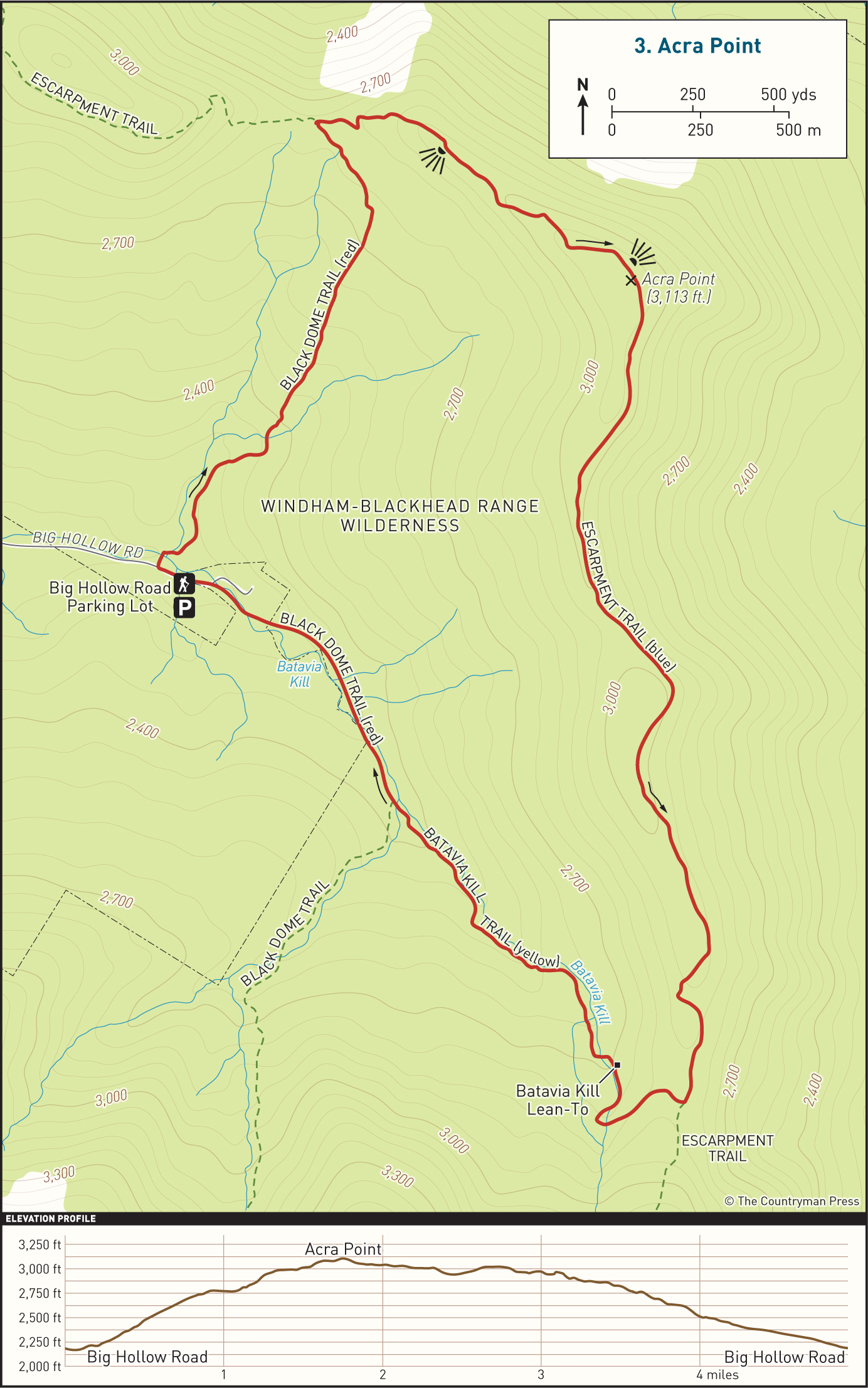
DISTANCE: 5.2 miles TYPE: Loop TOTAL ELEVATION GAIN: 860 feet MAXIMUM ELEVATION: 3,105 feet DIFFICULTY: Easy HIKING TIME: 3 hours |
Attracting hikers with a variety of geographical highlights, the Acra Point loop offers commanding views of the Hudson Valley and the surrounding countryside, in addition to one of the best vistas facing the Blackhead Range. The well-travelled trails are easy to navigate, and the serene 2-mile stretch of the Escarpment Trail south of the peak leads through densely wooded, ancient-feeling forest.
GETTING THERE
Take Exit 20 (Saugerties) from the New York State Thruway, then turn left onto NY-212/NY-32. At the traffic light, take a right onto NY-32 North. In 6 miles, continue straight onto NY-32A. In 1.9 miles, turn left onto Route 23A, and drive up the winding mountain road toward Tannersville. After driving through Tannersville, turn right at the traffic light onto Hill Street (County Route 23C). Head north on NY-23C for 6.1 miles. Turn right onto County Route 40, and follow it until you come to the small town of Maplecrest, about 2 miles farther. Veer right onto Big Hollow Road and drive for 4 miles. The parking area is at the very end of the road. Be aware that the last mile or so of this road is considered seasonal and is not maintained during winter months. During times of heavy snowfall, you may need to park on the side of the road, as the parking area is rarely plowed.
GPS SHORTCUT
Type “Acra Point” into Google Maps and your GPS will navigate you to the appropriate trailhead. The Burnt Knob hike here also begins from this trailhead.
THE TRAIL
On foot, retrace your path down the road on which you arrived for a short distance to reach the trailhead for Acra Point. You will spot a wooden bridge and the Batavia Kill creek. Cross the bridge, followed by a second creek crossing shortly after. Follow the red blazes uphill on the Black Dome Trail.
With Blackhead, Black Dome, and Thomas Cole behind you, hike for 1 mile as the trail winds through hardwood and spruce forest. At the first trail junction, head right toward Acra Point, now following the aqua-green blazes of the Escarpment Trail and the Long Path, a 357-mile long-distance hiking trail that winds throughout New Jersey and New York.
Climb a small hill to reach another junction. A left turn here will bring you to a ledge with an impressive view of the Blackhead Mountain Range—the side trail is short, and the view well worth it. Looking northwest from here, Burnt Knob and Windham High Peak can also be glimpsed.
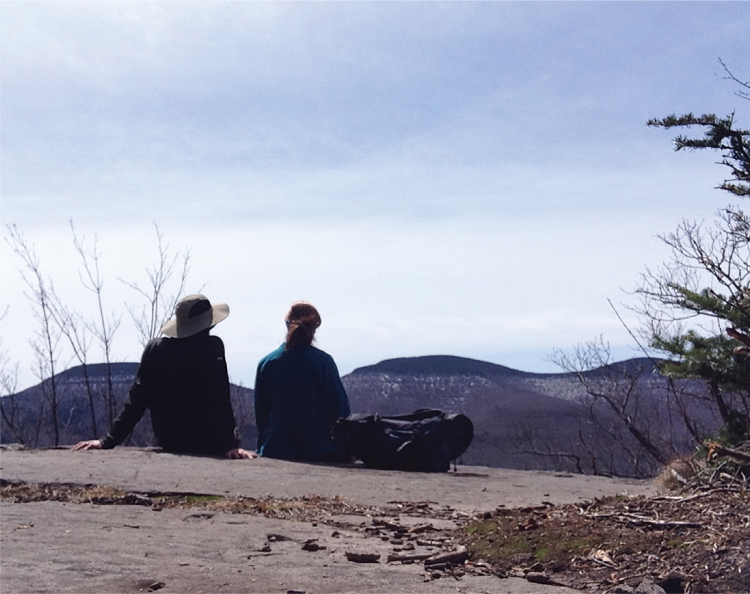
Soon after, you will approach the summit of Acra Point, though the best views, to the south and the west, can be found at the lookout shortly before Acra Point itself. From a rock ledge, enjoy views of the countryside sprawling out below.
Take the Escarpment Trail along a wide ridge with high ledges. Continue for another 1.75 miles. At this intersection, the Escarpment Trail continues up over Blackhead Mountain—a challenging, steep hike—while the Batavia Kill Trail returns to the DEC parking lot. Turn right onto the yellow-blazed Batavia Kill Trail.
Shortly after, you will pass the Batavia Kill Lean-To. Continue until the trail ends at another junction, where a left turn will again send you toward a steep ascent, this time of Black Dome Mountain. Veer to the right and follow the red blazes along the side of Batavia Kill creek for another half mile to return to your car.

LOOKING WEST TOWARD BURNT KNOB FROM ACRA POINT