san juan islands
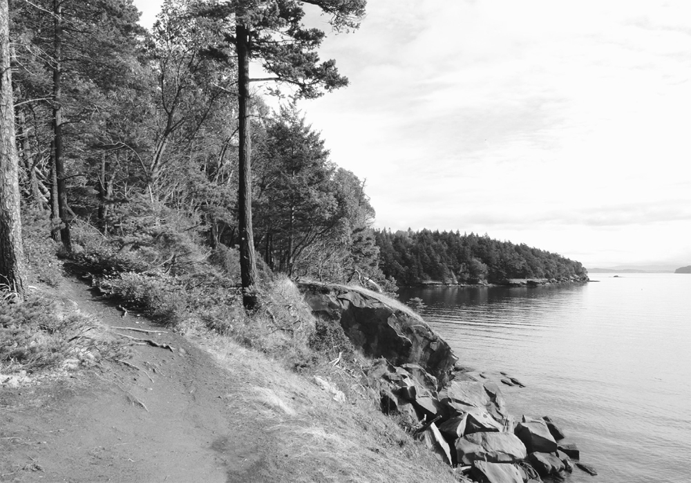
Cattle Point, San Juan Islands National Monument, San Juan Island
Lummi Island is the northeastern-most island within the San Juans archipelago. The 5923-acre (2397-ha) island is part of Whatcom County and is serviced by a small county ferry from Gooseberry Point. The island is named for the Lummi Tribe (whose reservation includes nearby Portage Island but not Lummi Island itself), and about 850 people live there year-round.
The northern half of Lummi contains farms and is pastoral, while the island’s southern half is mountainous and thickly forested. The Washington Department of Fish and Wildlife manages a large tract on the island, and the Lummi Island Heritage Trust manages three preserves open to the public.
Lummi’s proximity to Bellingham and its short ferry crossing makes it conducive for day trips. Except for primitive boat-in-only campsites, there is no camping on the island.
| Otto Preserve |
| RATING/ DIFFICULTY |
LOOP | ELEV GAIN/HIGH POINT |
| **/1 | 1.2 miles (1.9 km) | 130 feet (40 m)/250 feet (76 m) |
Maps: USGS Lummi Island, heritage trust map online; Contact: Lummi Island Heritage Trust, Otto Preserve; Notes: Dogs permitted on-leash; GPS: N4 8 41.885, W 122 40.472
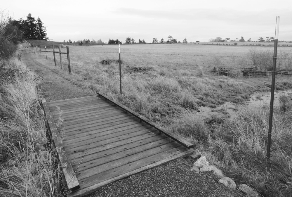
![]() Wander through quiet woods and old farmland in the heart of Lummi Island. The Lummi Island Heritage Trust’s first protected property, the Otto Preserve now totals more than 100 acres (40 ha) and includes the island’s largest wetland complex.
Wander through quiet woods and old farmland in the heart of Lummi Island. The Lummi Island Heritage Trust’s first protected property, the Otto Preserve now totals more than 100 acres (40 ha) and includes the island’s largest wetland complex.
From exit 260 on Interstate 5, follow Slater Road west 3.7 miles (6 km) and turn left onto Haxton Way. Continue 6.6 miles (10.6 km) to the Lummi Island ferry. From the ferry landing on island, head left on South Nugent Road for 1.6 miles (2.6 km). Turn left onto Sunrise Road and drive 0.3 mile (0.5 km) to the preserve and trailhead (elev. 120 ft/37 m).
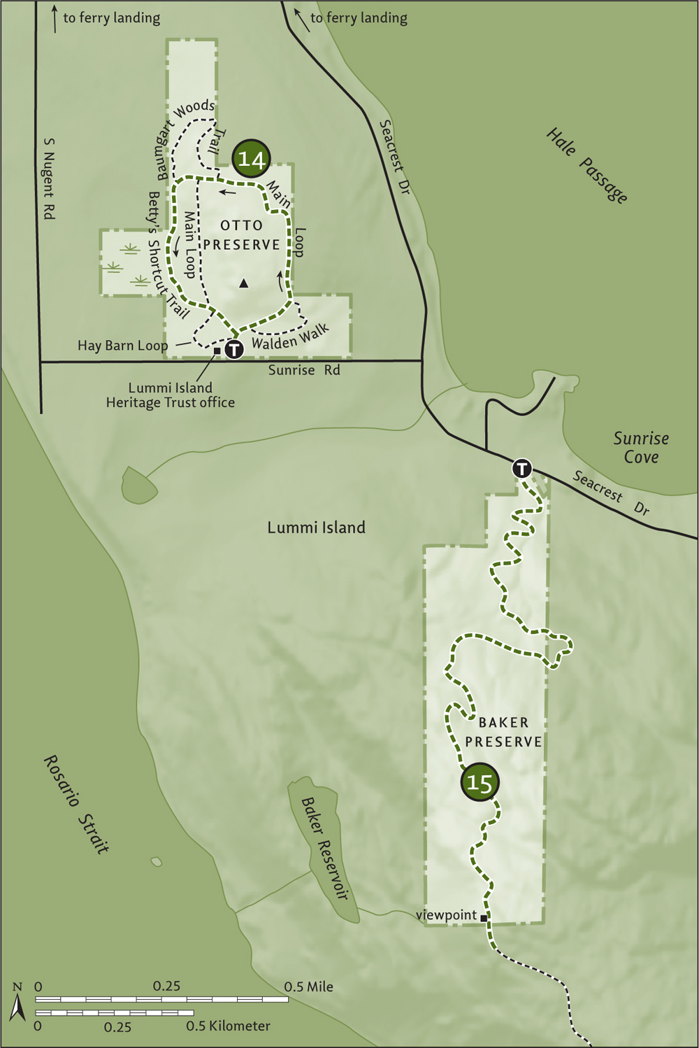
Once a farm used for raising Scottish highland cattle, the preserve still sports many old buildings, including one now used for housing the Lummi Island Heritage Trust’s office. This hike starts by a kiosk northeast of the office.
Follow the old woods road-turned-trail and immediately come to a junction near a dedication rock. You’ll be returning from left, so carry on to the right through a forest of big firs. At 0.1 mile (0.15 km), the 0.2-mile (0.3-km) Walden Walk veers right, passing by a window view of Lummi Peak before rejoining the main trail.
Continue straight, at first steeply, coming to the Walden Walk (elev. 200 ft/61 m) again at 0.2 mile (0.3 km). Now enjoy fairly easy walking, cresting a 250-foot (76-m) hillside before descending. At just over 0.5 mile (0.8 km) come to a junction with the 0.4-mile (0.6-km) Baumgart Woods Trail, which loops through a parcel added to the original preserve.
Continue straight, reaching the other end of the Baumgart Woods Trail at 0.6 mile (1 km). If you want an easy return to the trailhead, continue left for 0.3 mile (0.5 km) on the Main Loop. Otherwise, make a more interesting return by hiking straight a short distance to another junction, and then take the Betty’s Shortcut Trail left. This new trail (built in 2013) skirts a large wetland complex graced with big cedars and birches.
Return to the Main Loop at 1.1 miles (1.8 km). Turn right and immediately come to the Hay Barn Loop. Continue straight 0.1 mile (0.15 km) to complete your loop, or extend it by 0.1 mile (0.15 km) by going right and passing a cedar grove, an old barn, and a pasture before returning to the trailhead.
Combine with a visit to the trust’s nearby Baker Preserve (Hike 15) or the small Curry Preserve, with its nice fields and Mount Baker views.
| Baker Preserve |
| RATING/ DIFFICULTY |
ROUNDTRIP | ELEV GAIN/HIGH POINT |
| ***/3 | 3.6 miles (5.8 km) | 1030 feet (314 m)/1100 feet (335 m) |
Maps: USGS Lummi Island, heritage trust map online; Contact: Lummi Island Heritage Trust, Baker Preserve; Notes: Open daylight hours only. All visitors must sign register. Group size limited to six. Dogs prohibited; GPS: N 48 41.670, W 122 39.698
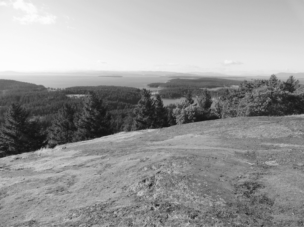
![]() Wind up steep slopes beneath a cloak of greenery to flowered ledges high on Lummi Peak, at more than 1600 feet (488 m) one of the highest summits in the San Juans and until recently off-limits to visitors due to private ownership. Thanks to the Lummi Island Heritage Trust, hikers can now explore a part of this prominent landmark. Watch eagles, hawks, and vultures ride thermals above. And enjoy eagle’s-eye viewing of the islands and the Salish Sea sparkling below.
Wind up steep slopes beneath a cloak of greenery to flowered ledges high on Lummi Peak, at more than 1600 feet (488 m) one of the highest summits in the San Juans and until recently off-limits to visitors due to private ownership. Thanks to the Lummi Island Heritage Trust, hikers can now explore a part of this prominent landmark. Watch eagles, hawks, and vultures ride thermals above. And enjoy eagle’s-eye viewing of the islands and the Salish Sea sparkling below.
From exit 260 on Interstate 5, follow Slater Road west 3.7 miles (6 km) and turn left onto Haxton Way. Continue 6.6 miles (10.6 km) to the Lummi Island ferry. From ferry landing on island, head left on South Nugent Road for 0.6 mile (1 km). Turn left onto Seacrest Drive and drive 1.7 miles (2.7 km) to the preserve and trailhead (elev. 70 ft/21 m).
The 129-acre (52-ha) Baker Preserve abuts the 355-acre (144-ha) Baker Ranch to the north and the 700-acre (283-ha) Washington Department of Fish and Wildlife (WDFW) Lummi Unit to the south, forming a large protected swath on Lummi Peak. The ranch is currently closed to the public, but the WDFW unit can be accessed via this hike.
Following an old skid road, the way starts off steeply up ferny slopes, paralleling a small creek-cradling ravine. Through a uniform forest of maturing second growth, pass big stumps of what once grew here. The grade eventually eases. At 1 mile (1.6 km), the trail bends left onto an old logging road. The walking is fairly pleasant now, as the old track winds up the north shoulder of the peak.
After passing a small swampy pool, begin to catch window views of the islands through the trees. At 1.8 miles (2.9 km), just after leaving the preserve and entering WDFW land, turn right at a signed junction to a ledge-top viewpoint (elev. 1100 ft/335 m), complete with interpretive signs and wooden railings. The latter protect not only you from wandering off the ledge but also rare flowers from being trampled.
You can see Sinclair and Cypress islands from Lummi Peak's lofty ledges.
Enjoy views of Sinclair, Cypress, Orcas, Clark, Matia, Sucia, Patos, and Saturna islands. Frosty Canadian North Shore summits can also be seen. Check snags for eagles and look for peregrine falcons—they nest in Lummi Peak’s precipitous cliffs.
You can continue walking the old road south for another 1 mile (1.6 km) on WDFW land, through attractive forest and by wetlands close to cliff tops. Lummi Peak’s summit is thickly wooded and offers no views—so don’t bother bagging it.
Across the Guemes Channel a mere 0.5 mile (0.8 km) from Anacortes, Guemes Island is easily accessible via a Skagit County ferry. Named for the viceroy of Mexico by the Spanish explorer José María Narváez in 1791, Guemes is also known locally as Dog Island for the large population of Salish wool dogs that once lived here. Pastoral and with a population of about six hundred year-round residents, Guemes is an excellent island for cycling. The Skagit Land Trust has two courtesy bikes available for checkout for a few hours on the island. Get the bikes at Anderson’s General Store (www.guemesislandstore.com; US$50 deposit) located next to the ferry landing. There are no campgrounds on Guemes.
| Guemes Mountain |
| RATING/ DIFFICULTY |
ROUNDTRIP | ELEV GAIN/HIGH POINT |
| ***/2 | 2.4 miles (3.9 km) | 600 feet (183 m)/688 feet (210 m) |
Map: USGS Anacortes North; Contact: Skagit Land Trust, Guemes Mountain; Notes: Dogs permitted on-leash; GPS: N 48 32.594, W 122 35.758
![]() Gentle Guemes Mountain is the centerpiece to 534 acres (216 ha) of public and private protected land, thanks to the Skagit Land Trust, San Juan Preservation Trust, island residents, and hundreds of conservation-minded citizens. Follow a hiker-only path, thanks to the Washington Trails Association, weaving through attractive forest to the broad prairie summit that bursts with wildflowers in the spring and rewards with sublime views of rolling pasture, emerald islands, and snowcapped peaks.
Gentle Guemes Mountain is the centerpiece to 534 acres (216 ha) of public and private protected land, thanks to the Skagit Land Trust, San Juan Preservation Trust, island residents, and hundreds of conservation-minded citizens. Follow a hiker-only path, thanks to the Washington Trails Association, weaving through attractive forest to the broad prairie summit that bursts with wildflowers in the spring and rewards with sublime views of rolling pasture, emerald islands, and snowcapped peaks.
Guemes Mountain offers good views of Guemes’ farmlands and Cypress Island.
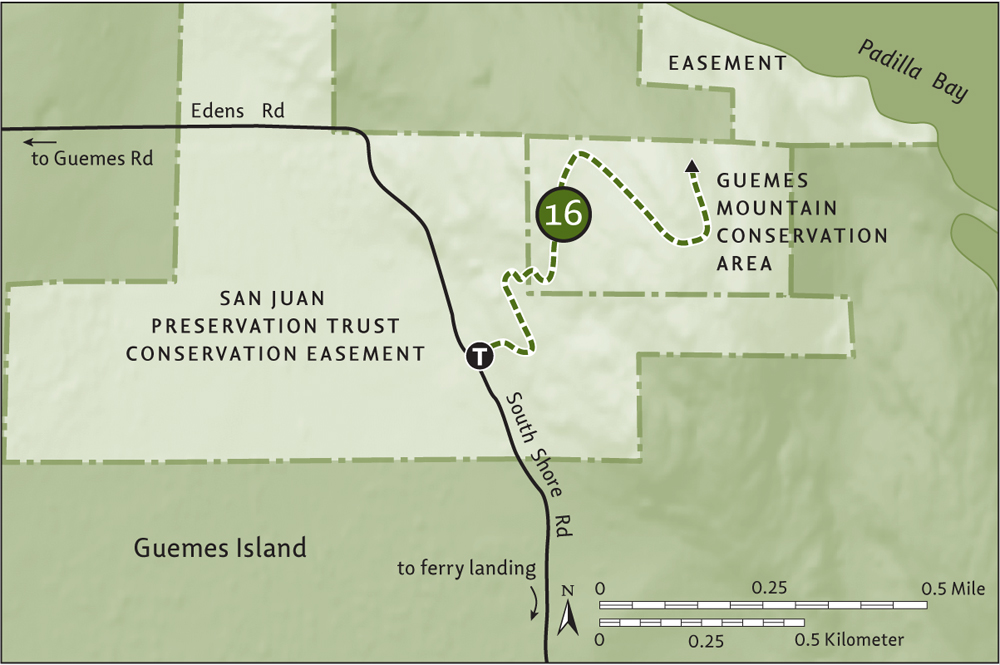
From exit 230 on Interstate 5 in Burlington, follow State Route 20 west for 11.7 miles (18.8 km) to the junction with SR 20-Spur. Continue right on SR 20-Spur for 2.7 miles (4.3 km) to Anacortes, turning right at the traffic circle onto Commercial Avenue (which is still the SR 20-Spur). After 1.3 miles (2.1 km), turn left onto 12th Street (still the SR 20-Spur) and continue for 0.5 mile (0.8 km). Turn right on I Avenue and reach the Guemes Island ferry in 0.4 mile (0.6 km). From the ferry landing on the island, turn right onto South Shore Road and follow it 2.1 miles (3.4 km) (bearing left at 1.7 mi/2.7 km) to the trailhead (elev. 90 ft/27 m). Bike rack available.
Follow the trail through a maturing forest of fir and madrona and across a forest floor of ferns and salal. At 0.5 mile (0.8 km), wind through a cedar grove before entering a stretch of alders that provide teaser views. After crossing a small creek, the way follows an old skid road through a formerly logged area.
Crest the small mountain’s ridge and angle left, ignoring a path right that leads to private property. At 1.2 miles (1.9 km), reach the 688-foot (210-m) summit and views! East it’s Samish Island, the Chuckanut Mountains, and frosty Mount Baker. North it’s little Jack Island, Vendovi Island, Eliza Island, Lummi Island, and a slew of Canadian peaks, with the distinguished Golden Ears calling the most attention. To the west it’s Orcas’s Mount Constitution, Fidalgo’s Mount Erie, Burrows Island, a swath of pasture across Guemes, and wild Cypress Island behind it.
There are several good viewpoints on the mountain, but keep your travels on established paths so as not to disturb sensitive plants growing in this prairie environment.
From Young’s County Park on the northern tip of the island, you can walk 2 miles (3.2 km) of nice public beach around Clark Point. Near the ferry landing is more public beach and the San Juan Preservation Trust’s Peach Preserve, with beautiful sandy beach and upland trails.
Skagit County’s 217-acre (88-ha) Vendovi Island had long been privately owned and off-limits to the public. But in 2012, the San Juan Preservation Trust acquired the island in one of its largest purchases, opening it to public visitation and assuring that it remains in a natural state in perpetuity. There is no camping or moorage on the island.
| Vendovi Island |
| RATING/ DIFFICULTY |
ROUNDTRIP | ELEV GAIN/HIGH POINT |
| *****/2 | 3.2 miles (5.1 km) | 400 feet (122 m)/260 feet (79 m) |
Maps: USGS Anacortes North, preservation trust map online; Contact: San Juan Preservation Trust, Vendovi Island Preserve; Notes: Open 10:00 AM-6:00 PM, May–Sept. All visitors must sign in at kiosk at head of dock. Dogs must be on-leash and pet waste packed out. Obey all posted rules and regulations; GPS: N 48 36.860, W 122 36.769
![]() Vendovi Island was named in 1841 by Commander Wilkes for an imprisoned Fijian chief who killed and cannibalized a whaling crew. It was once one of the largest privately owned undeveloped islands in the San Juans. Thanks to the San Juan Preservation Trust’s purchase of the island in 2012, for half of its appraised value, Vendovi will remain undeveloped—and open to the public. Hike across the island through lush woods to a grassy bluff that bursts with dazzling wildflower blossoms. Walk along a midden beach that sparkles in the evening light. And watch pigeon guillemots nesting in North Cove. Vendovi is a magical and ecologically important island.
Vendovi Island was named in 1841 by Commander Wilkes for an imprisoned Fijian chief who killed and cannibalized a whaling crew. It was once one of the largest privately owned undeveloped islands in the San Juans. Thanks to the San Juan Preservation Trust’s purchase of the island in 2012, for half of its appraised value, Vendovi will remain undeveloped—and open to the public. Hike across the island through lush woods to a grassy bluff that bursts with dazzling wildflower blossoms. Walk along a midden beach that sparkles in the evening light. And watch pigeon guillemots nesting in North Cove. Vendovi is a magical and ecologically important island.
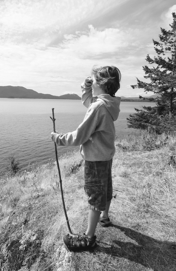
A young hiker surveys the Salish Sea from Jack’s Back Overlook.
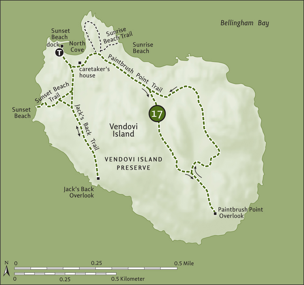
You need a private boat or to arrange for a water taxi to access Vendovi Island. Island Express Water Taxi in Anacortes (www.islandexpresscharters.com) and Leap Frog Water Taxi in Bellingham (www.leapfrogwatertaxi.com) both offer reliable service. The trailhead is at the North Cove dock. Privy available. No water.
Upon arrival at North Cove, look for pigeon guillemots nesting in the breakwater and sign in at the kiosk. Be sure to adhere to all rules and regulations when visiting this ecologically important island. Head 0.1 mile (0.15 km) up to what was once a private residence, now the caretaker’s home. Then continue hiking at 0.2 mile (0.3 km) to a junction (elev. 60 ft/18 m) at the cemetery plot of the former owner of the island.
The trail left goes to a bluff overlooking North Cove and looping back to this junction in 0.2 mile (0.3 km). Another trail from this spot veers 0.1 mile (0.15 km) to beautiful Sunrise Beach, with its weathered logs for sitting on and admiring the view of Eliza Island, the Chuckanut Mountains, and perhaps a seal or two plying the waters. Both trails are worthy side trips.
Follow the Paintbrush Point Trail, an old woods road, up the center of the island. Notice the thick understory along the way, attesting to the lack of deer on the island. Douglas squirrels are the main terrestrial mammal here. At 0.4 mile (0.6 km), come to a trail split (elev. 125 ft/38 m). Go right here and return later on the trail from the left.
Traversing ferny forest, ascend between the island’s two high points, cresting a 260-foot (79-m) hill before descending and coming to a junction (elev. 220 ft/67 m) at 0.8 mile (1.3 km). You’ll be continuing to the left, but first head right for 0.2 mile (0.3 km) to Paintbrush Point (elev. 250 ft/76 m), which is carpeted in springtime with paintbrush and other showy flowers. And what a view! Check out Samish Island, little San Juan Preservation Trust–protected Jack Island, Guemes Island, and Cypress Island. You can see Anacortes and Burrows Island, too, and often oil tankers coming and going to March Point. Perish the thought of the effects of an oil spill on this pristine island.
Now return, veering right at the first junction for a slightly longer trip back to the caretaker’s house at 1 mile (1.6 km). You’re not done hiking yet, though—you have two more destinations to visit. Head left on Jack’s Back Trail, passing the old shop and coming to a junction at 0.1 mile (0.15 km) with the Sunset Beach Trail (elev. 50 ft/15 m). Continue straight, first passing another trail to Sunset Beach and, after a short climb and descent, come to Jack’s Back Overlook in 0.3 mile (0.5 km). Enjoy good views of Jack, Cypress, and Sinclair islands.
Then retrace your steps 0.3 mile (0.5 km) to the last junction and turn left, enjoying some nice tread work thanks to the Washington Trails Association. In 0.15 mile (0.2 km), come to gorgeous Sunset Beach, with its white-shelled midden shoreline. Enjoy the sweeping view of Lummi and Sinclair islands. You’ll have to enjoy the sunset from the water, however, as you need to head back before 6:00 PM—so hike 0.35 mile (0.6 km) back to the dock, content that this gorgeous island will remain a wild and spectacular place for your return trip.
Once known as Cottonwood Island by early pioneers, Skagit County’s 1015-acre (411-ha) Sinclair Island boasts a year-round population of about three. It was once home to a schoolhouse, post office, and a community called Urban. Now the island consists primarily of seasonal residences. Sinclair Island is nearly all privately owned, but two county dirt roads make for peaceful wandering.
| Mary Leach Natural Area |
| RATING/ DIFFICULTY |
ROUNDTRIP | ELEV GAIN/HIGH POINT |
| **/2 | 2.6 miles (4.2 km) | 250 feet (76 m)/140 feet (43 m) |
Map: USGS Cypress Island; Contact: Washington Department of Fish and Wildlife, Mary Leach Natural Area; Notes: Dogs permitted on-leash. The county dock is closed due to 2011 storm damage. You can moor boats south of the dock and walk public tidelands during low tides to reach the public road. Adjacent uplands are privately owned. No potable water; GPS: N 48 37.005, W 122 41.584
![]() Hike across thickly forested, lightly settled Sinclair Island on a county road that’s pretty much a wide trail. Then visit an old farm and the site of the island’s first post office, now a wildlife preserve and rapidly reverting back to a presettlement state.
Hike across thickly forested, lightly settled Sinclair Island on a county road that’s pretty much a wide trail. Then visit an old farm and the site of the island’s first post office, now a wildlife preserve and rapidly reverting back to a presettlement state.
You need a private boat or to arrange for a water taxi to access Sinclair Island. Island Express Water Taxi in Anacortes (www.islandexpresscharters.com) and Leap Frog Water Taxi in Bellingham (www.leapfrogwatertaxi.com) both offer reliable service.
Start from the county dock that protrudes from a grassy and rocky bluff on the island’s southwest shore, but pause for some nice views of nearby Cypress Island before taking to the trail. Then walk up a thickly vegetated path, soon reaching a junction with Jackson Road, a county roadway that’s not much more than a wide trail.
Left leads to the old settlement of Urban, which isn’t urban at all—just seasonal homes. Head right, passing a few homes and a cute little chapel in the woods. Most of the way is through thick jungle-like forest, owing to there being few, if any, deer (foraging) on the island. After gently climbing to about 140 feet (43 m), start a long gentle descent.
At 0.7 mile (1.1 km), come to a junction with another "trail," county-owned Munnings Road, which heads north across the island in a near straight line. Continue straight, coming to another junction at 1.2 miles (1.9 km). The way left is a private drive. Continue straight, the way soon transitioning into a grassy path as it enters the 35-acre (14-ha) Mary Leach Natural Area. Wander around the property, noting old apple trees among the growing-in pasture. Near an old dilapidated homestead surrounded by head-high nettles, find an interpretive sign and memorial to Mary Leach, a first lieutenant in the US Army during World War II. Upon her death she willed this peaceful property to the state. If you don’t mind crashing through some brush, you can reach adjacent public tidelands that make for nice exploring during low tide.
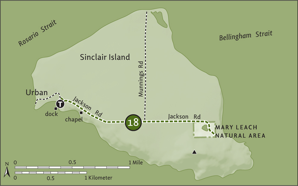
Follow Munnings Road 1 mile (1.6 km) to its end at the shoreline, with an excellent view of Lummi Island. The beach left and right is private, so just admire it from this spot.
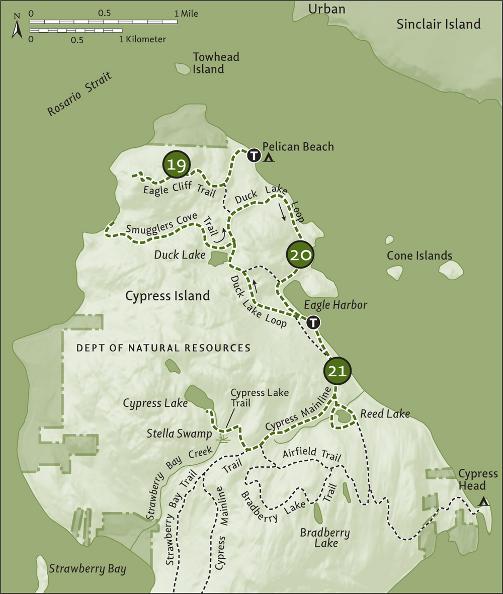
Cypress Island is the largest relatively undeveloped island in the San Juan archipelago—more than 5100 acres (2064 ha) of this 5500-acre (2226-ha) Skagit County island are protected from development, and only a handful of people live here. The Skagit Land Trust owns some conservation easements on the island, but the majority of Cypress is managed as a natural resources conservation area (NRCA) by the Washington Department of Natural Resources (DNR). In the 1980s, Spokane industrialist Raymond Hanson proposed a huge resort and golf course on the island. Organized opposition from residents and conservationists led to Hanson instead selling to the state and many trails now utilize old roads built in preparation for the development. The DNR is currently working on a management plan for the Secret Harbor property it acquired in 2009.
The island is mountainous and heavily forested, with several small lakes. You won't find any cypress trees: Captain George Vancouver mistook the island’s junipers for cypress (which grow in the American southeast) when he mapped the area in 1792. There is no backcountry camping in the island’s interior, but Cypress has two shoreline campgrounds—at Cypress Head and Pelican Beach. Check with the DNR (www.dnr.wa.gov) for camping and island visitation rules and regulations.
| Eagle Cliff |
| RATING/ DIFFICULTY |
ROUNDTRIP | ELEV GAIN/HIGH POINT |
| *****/3 | 2.8 miles (4.5 km) | 752 feet (229 m)/752 feet (229 m) |
Maps: USGS Cypress Island, DNR map online; Contact: Washington Department of Natural Resources (DNR), Northwest District; Notes: Trail closed Feb 1–July 15 to protect threatened, endangered, and sensitive species. Dogs prohibited on Eagle Cliff Trail; GPS: N 48 36.181, W 122 42.223
![]() Stand upon a high grassy, rocky knob that rises abruptly above Rosario Strait, and gaze out to majestic Mount Constitution and Lummi Peak, the loftiest summits in the San Juan Islands. Admire the deep unbroken forests and unscathed hills of Cypress Island before you—a view Captain Vancouver would recognize.
Stand upon a high grassy, rocky knob that rises abruptly above Rosario Strait, and gaze out to majestic Mount Constitution and Lummi Peak, the loftiest summits in the San Juan Islands. Admire the deep unbroken forests and unscathed hills of Cypress Island before you—a view Captain Vancouver would recognize.
You need a private boat or to arrange for a water taxi to access Cypress Island. Island Express Water Taxi in Anacortes (www.islandexpresscharters.com) and Leap Frog Water Taxi in Bellingham (www.leapfrogwatertaxi.com) both offer reliable service. The hike begins from Pelican Beach (moorage, no dock). Privy available.
Starting from Pelican Beach (named not for the bird, but for the Pelican class of sailboats belonging to a local group that meets here), pass prime shorefront campsites and come to a kiosk. Read about the island and then start up a boardwalk to the trail. Steadily climb through a mature forest of Douglas firs and cedars.
At 0.4 mile (0.6 km), reach a junction (elev. 190 ft/58 m). The Pelican Beach Trail continues straight 0.2 mile (0.3 km) to the Duck Lake Loop (Hike 20). Head right instead, ascending through open forest and across grassy balds and mossy ledges. Views emerge as you wind up and around grassy ledges. Some steps help you negotiate one of the steeper ones.
At 1.4 miles (2.3 km), reach the open, rocky 752-foot (229-m) summit graced with a few “cypresses” (junipers). The view is breathtaking: north to Lummi Island and British Columbia’s Golden Ears Mountains and company; west to Blakely, Obstruction, and Orcas islands, with Peavine and Obstruction passes separating them. Look east for a Baker glimpse and south to Lopez Island’s Chadwick Hill and the emerald-cloaked hilly backbone of Cypress. Look in the air too for this cliff’s namesake and for peregrine falcons, which nest on this stunning outcropping.
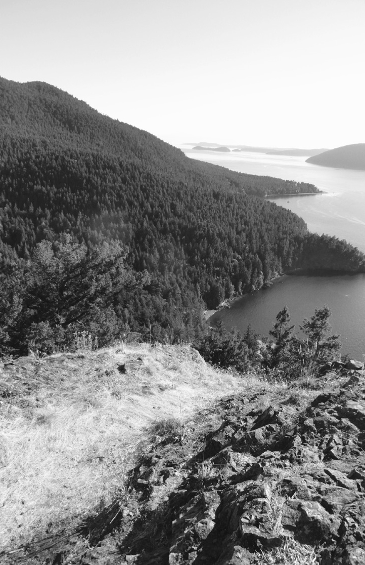
Looking south down Rosario Strait from Eagle Cliff
Combine with a hike to Duck Lake and/or Smugglers Cove (Hike 20). Eagle Cliff can also be accessed from Eagle Harbor.
| Duck Lake and Smugglers Cove |
| RATING/ DIFFICULTY |
ROUNDTRIP | ELEV GAIN/HIGH POINT |
| ***/2 | 5.1 miles (8.2 km) | 720 feet (219 m)/310 feet (94 m) |
Maps: USGS Cypress Island, DNR map online; Contact: Washington Department of Natural Resources (DNR), Northwest District; Notes: Dogs permitted on-leash; GPS: N 48 35.204, W 122 41.723
![]() Follow a gently graded old logging road to a large wetland matted in lily pads and flanked with bulrushes hiding songbirds and waterfowl. Then hike a little-used trail to a small cove beneath the sheer east face of Eagle Cliff once favored by bootleggers and homesteaded by a reclusive, tenacious woman.
Follow a gently graded old logging road to a large wetland matted in lily pads and flanked with bulrushes hiding songbirds and waterfowl. Then hike a little-used trail to a small cove beneath the sheer east face of Eagle Cliff once favored by bootleggers and homesteaded by a reclusive, tenacious woman.
You need a private boat or to arrange for a water taxi to access Cypress Island. Island Express Water Taxi in Anacortes (www.islandexpresscharters.com) and Leap Frog Water Taxi in Bellingham (www.leapfrogwatertaxi.com) both offer reliable service. The hike begins from Eagle Harbor (moorage, no dock). Privy available.
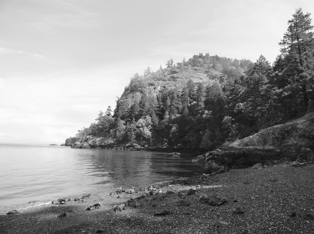
Eagle Cliff hovers over Smugglers Cove.
At the Eagle Harbor landing, take a moment to read the excellent interpretive kiosk. There are a lot of informative trail signs and good trail markings throughout the island. From the landing, the Cypress Mainline leads left (south). Head right instead, coming to a junction (elev. 100 ft/30 m) in 0.1 mile (0.15 km). The grassy path left leads back to the mainline, and the wide path right is your return route. For now, stay straight on the Duck Lake Loop.
Gently ascend on an old logging road. Much of Cypress was logged in the 1930s, but small pockets of old growth remain. At 0.7 mile (1.1 km), stay left at a junction; the trail right returns steeply to Eagle Harbor. The way ahead levels out, reaching Duck Lake. More of a large wetland, Duck Lake is surrounded with thick vegetation and provides excellent wildlife habitat. Look for ducks among the cattails and newts crossing the path.
At 1 mile (1.6 km), come to a junction (elev. 310 ft/94 m). The loop continues right, but first a trip to the left, to Smugglers Cove, is warranted. Soon pass an old homesteader’s cabin rapidly being reclaimed by nature. Then skirt Duck Lake, enjoying nice views from forest openings. After crossing the lake’s outlet stream on a good bridge, begin descending, passing through pockets of big Douglas firs. At 2.2 miles (3.5 km), come to Smugglers Cove, nestled beneath the stark face of Eagle Cliff.
Enjoy good views across Rosario Strait to Orcas Island. When the tide is low, wander the cobblestone beach. A remote location, it was chosen in the 1930s by rugged and reclusive homesteader Zoe Hardy to eke out her farm. Around 1940, Ms. Hardy found out she had cancer, causing her to cut off all contact with others before disappearing.
Retrace your steps 1.2 miles (1.9 km), climbing back to the junction at Duck Lake. Then head left and once again descend, coming to a junction at 3.6 miles (5.8 km) from your start at Eagle Harbor. The way left leads 0.2 mile (0.3 km) to the Eagle Cliff Trail and continues 0.4 mile (0.6 km) to Pelican Beach (an alternative start for this hike). You want to veer right, following the Duck Lake Loop, passing some big maples and cedars as you descend to Eagle Harbor. At low tide, feel free to do some beach exploring.
At 4.7 miles (7.6 km), pass the shortcut trail back toward Duck Lake. Then continue along Eagle Harbor, enjoying excellent views out to the Cone Islands and snowcapped Mount Baker in the distance and climbing back to your first junction at 5 miles (8 km). Your boat or water taxi pickup awaits you 0.1 mile (0.15 km) to the left.
| Reed and Cypress Lakes |
| RATING/ DIFFICULTY |
ROUNDTRIP | ELEV GAIN/HIGH POINT |
| ***/3 | 4.6 miles (7.4 km) | 1045 feet (319 m)/1005 feet (306 m) |
Maps: USGS Cypress Island, DNR map online; Contact: Washington Department of Natural Resources (DNR), Northwest District; Notes: Dogs permitted on-leash at Reed Lake. Dogs prohibited on Cypress Lake Trail; GPS: N 48 35.202, W 122 41.729
![]() Hike to two of the handful of lakes that dot Cypress Island. One was once slated to provide water to a megadevelopment—now it sits quiet except when mating and migrating birds fill the air with song and chatter. The other lake, the largest on the island, sits snuggly along the mountainous backbone of this nearly undeveloped and wild island.
Hike to two of the handful of lakes that dot Cypress Island. One was once slated to provide water to a megadevelopment—now it sits quiet except when mating and migrating birds fill the air with song and chatter. The other lake, the largest on the island, sits snuggly along the mountainous backbone of this nearly undeveloped and wild island.
You need a private boat to access Cypress Island, or arrange a water taxi. Island Express Water Taxi in Anacortes (www.islandexpresscharters.com) and Leap Frog Water Taxi in Bellingham (www.leapfrogwatertaxi.com) both offer reliable service. The hike begins from Eagle Harbor (moorage, no dock). Privy available.
From Eagle Harbor, head left on the Cypress Mainline, a wide old road that Department of Natural Resources staff still occasionally drive for administrative purposes. Steadily climb on the old haul road, coming to a junction in 0.3 mile (0.5 km). The grassy way right leads back to Eagle Harbor. Continue straight, coming to another junction (elev. 390 ft/119 m) at 0.7 mile (1.1 km).
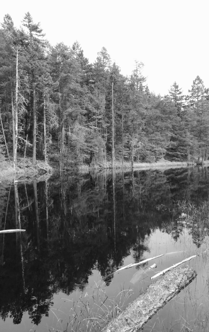
Go left here, passing an old DNR compound, and soon come to an interpretive display about Reed Lake near a junction. You’ll be returning from the right, so stay left, coming to the earthen dam at the lake’s outlet (elev. 350 ft/107 m). Reed Lake is natural but was altered to supply water to a huge development that thankfully never materialized. Look among the bulrushes and lily pads for equally appreciative amphibians and waterfowl.
Cross the dam and bear right at another junction. The trail left leads 0.6 mile (1 km) to the Cypress Head Trail (Hike 23). Circle the pine- and rhododendron-lined lake, wandering past some madronas and big firs too. Soon after rock-hopping across the lake’s inlet stream, close the loop at 1.3 miles (2.1 km). Turn left and hike 0.1 mile (0.15 km) back to the Cypress Mainline. Then head left, steadily climbing through open dry forest and paralleling a tumbling creek. Shortly after crossing the creek, reach a junction at 2.1 miles (3.4 km). The way left leads to the old airstrip and Bradberry Lake (Hike 23). Stay on the mainline and at 2.2 miles (3.5 km), near a gap in the mountainous backbone of the island, come to a junction (elev. 880 ft/268 m), complete with privy.
Take the old road right, noting that dogs are not allowed on this trail due to sensitive wetlands. Round huge Stella Swamp, catching glimpses of this sprawling wetland through the open forest. After crossing Strawberry Bay Creek on a bridge, veer left at a sign and come to Cypress Lake (elev. 1005 feet/306 m) at 2.7 miles (4.3 km). The trail continues a short distance left. Find a nice spot to sit and savor the serenity of this special place.
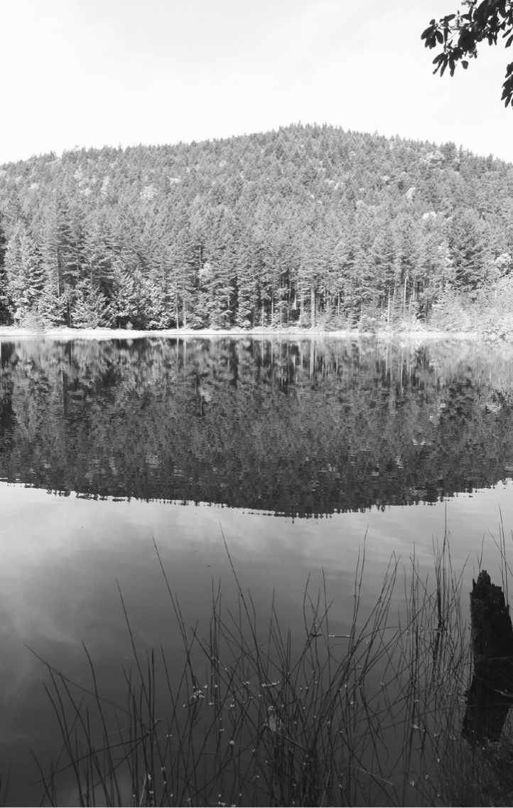
Cypress Lake
When it’s time to head home, retrace your steps 0.5 mile (0.8 km) back to the junction in the gap, and follow the Cypress Mainline 1.4 miles (2.3 km) back to Eagle Harbor.
Instead of returning via the Cypress Mainline, follow the Airfield Trail 1.1 miles (1.7 km) to the connector trail back to Reed Lake.
| Strawberry Bay and Reef Point |
| RATING/ DIFFICULTY |
ROUNDTRIP | ELEV GAIN/HIGH POINT |
| ****/5 | 10 miles (16.1 km) | 2180 feet (664 m)/960 feet (293 m) |
Maps: USGS Cypress Island, DNR map online; Contact: Washington Department of Natural Resources (DNR), Northwest District; Notes: Dogs permitted on-leash; GPS: N 48 35.202, W 122 41.729
![]() Hike up and over the mountainous spine of Cypress Island to a remote beach and a spectacular point that grants sweeping views of an island-dotted sea. Visit an abandoned mine and site of an old reef-fishing operation, letting sea breezes and voices from the past lull you.
Hike up and over the mountainous spine of Cypress Island to a remote beach and a spectacular point that grants sweeping views of an island-dotted sea. Visit an abandoned mine and site of an old reef-fishing operation, letting sea breezes and voices from the past lull you.
You need a private boat or to arrange for a water taxi to access Cypress Island. Island Express Water Taxi in Anacortes (www.islandexpresscharters.com) and Leap Frog Water Taxi in Bellingham (www.leapfrogwatertaxi.com) both offer reliable service. The hike begins from Eagle Harbor (moorage, no dock). Privy available.
From Eagle Harbor, head left on the Cypress Mainline, a wide haul road turned trail, still used occasionally by Department of Natural Resources vehicles. Steadily climbing, stay left at a junction at 0.3 mile (0.5 km) and right at another trail that leads to Reed Lake (Hike 21) at 0.7 mile (1.1 km). Stay right at yet another junction, soon coming to a trail intersection, complete with privy, at 1.4 miles (2.3 km). Cypress Lake (Hike 21) is to the right.
Continue left on the Cypress Mainline, skirting Stella Swamp and going through a broad gap on Cypress’s hilly backbone. Ignore a trail to the right that leads to private property on Strawberry Bay. At 1.8 miles (2.9 km), come to a signed junction (elev. 950 ft/290 m). You’ll be returning from the left, so go right on the Strawberry Bay Trail, on lightly used but discernible tread that steeply descends through open dry forest.
The way eventually utilizes an old road bed, traveling through pine and rhododendron groves and crossing seeps that make the trail muddy in spots. At 3.3 miles (5.3 km), reach a junction (elev. 260 ft/79 m) with the Reef Point Trail. First, an out-and-back 1.2-mile (1.9-km) trip to the right is in order, dropping down to Strawberry Bay. Named in 1792 by Lieutenant William Broughton for its abundant strawberries, this bay, with its wide tidal flats, is a pure joy to walk and explore. Respect private property to the north.
Return to the previous junction and then hike south along a high bluff that grants occasional views out to little Strawberry Island and big Orcas Island. After some easy going, come to a junction at 5.5 miles (8.9 km). You’ll be continuing left, but head right first for 0.1 mile (0.15 km) to gorgeous Reef Point.
From this grassy wildflower-blotched bluff, enjoy sweeping views of Rosario Strait dividing Blakely, James, Decatur, Fidalgo, and Burrows islands. Watch for ferries, orcas, and seals. There’s quite a bit of history here too, from scattered mining debris once used to extract olivine from the 1920s to 1973, to the reef-net fishing operations that once flourished north of here in the late 1800s, capturing migrating Fraser River salmon.
After soaking up sun, scenery, and serenity, begin hiking back to your start. Retrace your steps 0.1 mile (0.15 km) back to the last junction and head right, through a nettle-lined alder tunnel (keep your hands close-by). Reach a junction at 6.1 miles (9.8 km). Right leads to the old Secret Harbor Residential Treatment Center, now being rehabilitated into a natural state.
Head left on the Cypress Mainline on a gentle but long climb across dry, open forested slopes beneath the island’s highest point. Pass some junipers and an old gravel pit before topping out at 960 feet (293 m). Shortly afterward, come to a familiar junction at 8.2 miles (13.2 km). Keep right on the mainline, reaching your starting point in 1.8 miles. It’s all downhill.
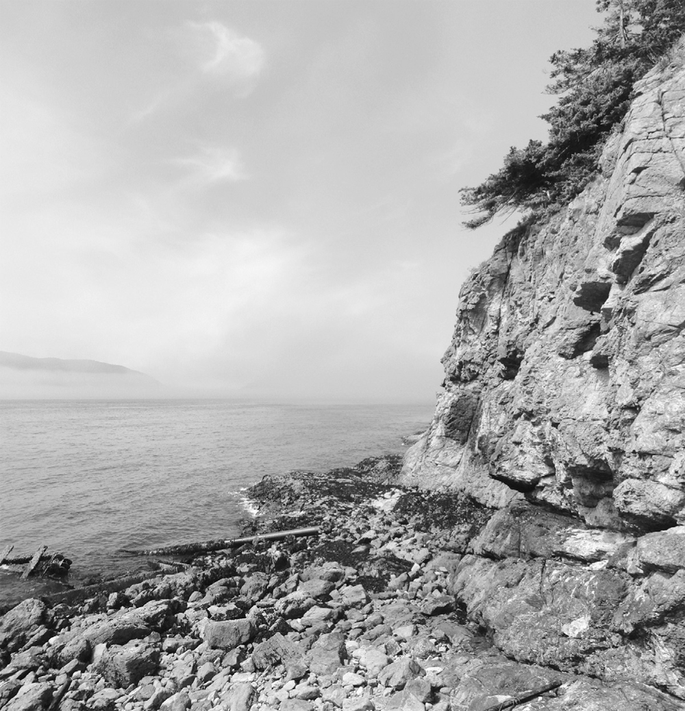
Rugged Reef Point was once the site of a mining operation.
| Bradberry Lake |
| RATING/ DIFFICULTY |
ROUNDTRIP | ELEV GAIN/HIGH POINT |
| ***/4 | 4.8 miles (7.7 km) | 1125 feet (343 m)/1125 feet (343 m) |
Maps: USGS Cypress Island, DNR map online; Contact: Washington Department of Natural Resources (DNR), Northwest District; Notes: Dogs permitted on-leash; GPS: N 48 34.108, W 122 40.260
![]() Hike to a remote lake hidden in the lofty lonely interior of the San Juans’ largest (nearly) undeveloped island. Pass a view-granting ridgeline airstrip, remnant of thankfully abandoned plans for a large golf resort.
Hike to a remote lake hidden in the lofty lonely interior of the San Juans’ largest (nearly) undeveloped island. Pass a view-granting ridgeline airstrip, remnant of thankfully abandoned plans for a large golf resort.
You need a private boat or to arrange for a water taxi to access Cypress Island. Island Express Water Taxi in Anacortes (www.islandexpresscharters.com) and Leap Frog Water Taxi in Bellingham (www.leapfrogwatertaxi.com) both offer reliable service. The hike begins from the Cypress Head Campground (moorage, no dock). Privy available.
Cypress Head is a beautiful headland connected to the rest of Cypress Island by a tombolo. Gorgeous camp and picnic sites tempt you to spend some time here, perhaps on your return. To start your hike, locate the Cypress Head Trail leading right and immediately begin climbing steeply. This trail is much rougher than the others on the island.
The way winds around parcels of private property and crosses a couple of private drives. Stay on the trail and respect the landowners’ privacy. Traverse steep slopes and angle upward; occasional stone steps aid your ascent. At 1.6 miles (2.6 km), come to a junction (elev. 740 feet/226 m). The trail right travels 0.6 mile (1 km) to Reed Lake. Continue left instead, emerging onto an old airstrip (elev. 925 ft/282 m) and reaching a trail junction at 1.9 miles (3.1 km). The airstrip was part of a megaresort development scheme that would have ravaged this remarkable island. In 2010, the Department of Natural Resources planted saplings on the strip, but shallow soil and low rainfall has resulted in slow forest regeneration. Feel free to walk to both ends of the 0.75-mile (1.2-km) airstrip for limited views north and south. A small pond borders the airstrip on the south extension.
Once slated to be surrounded by homes, Bradberry Lake instead remains a peaceful and isolated place.
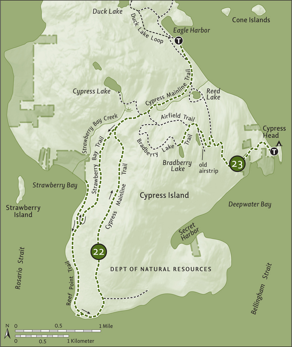
For Bradberry Lake, turn right on the airstrip, walking a short distance before turning left and reaching a junction at 2.1 miles (3.4 km). To the right, the old road, now Airfield Trail, leads 0.7 mile (1.1 km) to the Cypress Mainline. You want to go left instead, climbing steeply 0.3 mile (0.5 km) to the small forest-ringed lake (elev. 1125 feet/343 m). Signs indicate that you can swim here. It’s pretty murky though, and you’ll no doubt be sharing these waters with some critters. Settle for a lakeside picnic instead before heading back.
You can continue beyond the lake on a very lightly used trail that utilizes a winding road built for the megaresort that never came. The trail climbs a little more, traveling near the island’s 1525-foot (465-m) high point and returning to the Airfield Trail in 1 mile (1.6 km). You can then make a lollipop loop back by hiking left 0.3 mile (0.5 km) to the Cypress Mainline and then turning right to return via Reed Lake.
Third-largest of the San Juans, Lopez Island is 29.8 square miles (77.2 sq. km) and has gentler topography than its neighbors. This makes it a favorite destination for bicyclists, but hikers will find much to like too, including a couple of units of the newly established San Juan Islands National Monument.
Home to about 2300 residents, the island is known for its rural charm and friendliness, including the ritual of drivers greeting everyone with a wave (be sure to respond in kind). The island is named for Gonzalo López de Haro, a Spanish naval officer and the first European to “discover” the San Juan Islands archipelago.
Washington State Ferries offers year-round service from Anacortes to Lopez Island, and the short sailing makes the island a good choice for day trips from the mainland. Services include a grocery store at Lopez Village near Fisherman Bay, an easy bike ride from the ferry landing.
Camping options include Spencer Spit State Park (www.parks.wa.gov), Odlin County Park (www.co.san-juan.wa.us/parks), and Lopez Farm Cottages and Tent Camping (www.lopezfarmcottages.com).
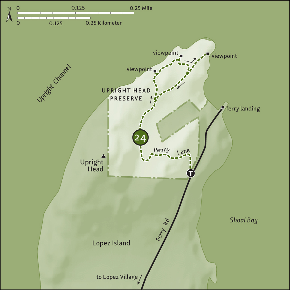
| Upright Head Preserve |
| RATING/ DIFFICULTY |
ROUNDTRIP | ELEV GAIN/HIGH POINT |
| **/1 | 1.2 miles (1.9 km) | 300 feet (91 m)/160 feet (49 m) |
Maps: USGS Shaw Island, land bank map online; Contact: San Juan County Land Bank, Upright Head Preserve; Notes: Dogs permitted on-leash; GPS: N 48 34.131, W 122 53.076
![]() Once slated for a housing development, this small preserve on the rocky northern tip of Lopez Island was protected in 1998 by the San Juan County Land Bank. Occupying a rugged headland jutting into Harney and Upright channels, it’s a wonderful place to watch ferries pass by or to enjoy a short hike while waiting for a ferry.
Once slated for a housing development, this small preserve on the rocky northern tip of Lopez Island was protected in 1998 by the San Juan County Land Bank. Occupying a rugged headland jutting into Harney and Upright channels, it’s a wonderful place to watch ferries pass by or to enjoy a short hike while waiting for a ferry.
From Anacortes, take a Washington State ferry to Lopez Island. Follow Ferry Road for 0.1 mile (0.15 km) and turn left into the ferry parking area. The trail (elev. 60 ft/18 m) starts on west side of road, on a gated road signed “Penny Lane.”
Perhaps with a Beatles tune in your head, start walking up Penny Lane. In about 250 feet (76 m), the pavement ends, but the utilities line keeps going—thirteen homes were slated to be built on this cliffy tip of Lopez Island. The planned subdivision road is now a wide and well-groomed trail. Climb about 100 feet (30 m) through a thick forest understory and then begin gently descending. Ignore unmarked trails that lead to private property.
At 0.3 mile (0.5 km), reach a junction (elev. 110 ft/34 m) marked by a small cairn. Head left—you’ll be returning from the right. Now on real trail, climb to the forested edge of the headland, coming to an observation deck (elev. 140 ft/43 m) at 0.4 mile (0.6 km). The view here of Orcas and Shaw islands is somewhat obscured by vegetation—the next outlook is much better.
Head north and steeply descend, coming to a bench and viewpoint (elev. 20 ft/6 m) just above the water’s edge at 0.5 mile (0.8 km). Here take in a nice view of Entrance Mountain and Buck Bay on Orcas Island—and of several busy channels plied by ferries and pleasure craft.
Continue hiking, climbing back up to the subdivision road-trail (elev. 80 ft/24 m). At 0.6 mile (1 km), come to a junction. You’ll be returning to the right, but first head left 0.1 mile (0.15 km) to another viewpoint at the tip of Upright Head (elev. 50 ft/15 m). Here among madronas, junipers, and, in spring, wildflowers, take in a good view of Blakely Island and Eagle Cliff on Cypress Island. Watch ferries, too, and if you notice the one you’re waiting for pull into the terminal, you’d best make your way back to your vehicle. Just follow the road-trail 0.5 mile (0.8 km) back to the trailhead.
Mount Woolard and Entrance Mountain on Orcas Island seen from Upright Head
| Upright Channel |
| RATING/ DIFFICULTY |
ROUNDTRIP | ELEV GAIN/HIGH POINT |
| ***/1 | 3.4 miles (5.5 km) | Minimal/25 feet (8 m) |
Map: USGS Shaw Island; Contact: San Juan County Parks, Lopez Island; Notes: Dogs permitted on-leash; GPS: N 48 33.390, W 122 53.415
![]() One of the longest beach hikes in the San Juan Islands, this walk along busy Upright Channel to appropriately named Flat Point skirts beneath bluffs of big trees. Admire roosting eagles, bobbing buffle-heads, and darting kingfishers along the way. Look for otters and raccoons in the tidal flats. And watch ferries plying the channel, one of the key transportation routes through the San Juans.
One of the longest beach hikes in the San Juan Islands, this walk along busy Upright Channel to appropriately named Flat Point skirts beneath bluffs of big trees. Admire roosting eagles, bobbing buffle-heads, and darting kingfishers along the way. Look for otters and raccoons in the tidal flats. And watch ferries plying the channel, one of the key transportation routes through the San Juans.
From Anacortes, take a Washington State ferry to Lopez Island. Follow Ferry Road for 1.1 miles (1.8 km) and turn right into Odlin County Park. Proceed 0.2 mile (0.3 km) to the day-use parking area. Privy and bike rack available.
With its campsites, old-growth forest, boat launch, and wide sandy beach, 80-acre (32-ha) Odlin County Park is one of Lopez Island’s most popular places. Situated along Upright Channel just to the west of Upright Point, Odlin provides access to more than 1.5 miles (2.4 km) of public tidelands. While it’s possible to do this hike at both high and low tides, plan it for a low tide to avoid scrambling over and under downed trees.
From the day-use area walk 0.1 mile (0.15 km) to the boat launch. Then hit the sand and walk west across a wide, inviting beach. Pass shoreline campsites, soon coming to coastal bluffs topped with big trees. Look for eagles nesting in them and kingfishers surveying from overhanging limbs.
At about 0.5 mile (0.8 km), round the bluffs and come to another wide sandy beach area. Flat Point can be seen in the distance. Across Upright Channel is a good view to Canoe Island guarding Shaw Island’s Indian Cove. Continue walking, coming to rocky and cobble-strewn sections of beach. Pass some big glacial erratics and staircases, which lead to a handful of homes hidden in the trees (do not trespass).
Pass an old boathouse and a couple more homes before coming to a stretch of smooth sandy beach. At 1.4 miles (2.3 km), reach the small Upright Channel State Park, with its Cascade Marine Trail campsites (for boaters) and a short trail that climbs steeply to Military Road (alternative access, Discover Pass required). Continue walking on a glorious stretch of sandy beach, soon passing homes crowding Flat Point.
Inviting sandy beach along Upright Channel
At 1.7 miles (2.7 km), round the sandy point and take in excellent views across the San Juan Channel to San Juan Island’s Mount Finlayson and the Olympic Mountains beyond. The tidelands become private a short distance south of the point, so turn around and languidly walk back to your start, savoring this sweet saltwater sojourn.
Explore Odlin County Park’s short but delightful trails. From the walk-in camping area, follow the Sunset Trail along the bluffs, returning on Long Lane. Then take Fawn’s Way to the Big Tree Loop through a stately grove of old growth gracing a seasonal creek.
| Spencer Spit |
| RATING/ DIFFICULTY |
ROUNDTRIP | ELEV GAIN/HIGH POINT |
| ***/1 | 1.2 miles (1.9 km) | 60 feet (18 m)/60 feet (18 m) |
Map: USGS Blakely Island; Contact: Washington State Parks, Spencer Spit State Park; Notes: Discover Pass required. Dogs permitted on-leash. Facilities closed late autumn to early spring. If road is gated, park on shoulder and walk 0.4 mile (0.6 km) on park road to trailhead, or take trail that heads right from gate 0.4 mile (0.6 km) to spit; GPS: N 48 32.181, W 122 51.569
![]() Walk along a spit teeming with birdlife. Check out historical structures and admire saltwater views south across Lopez Sound and north across Swifts Bay. This hike is short, but you’ll want to linger long on some of the finest beach in the San Juans.
Walk along a spit teeming with birdlife. Check out historical structures and admire saltwater views south across Lopez Sound and north across Swifts Bay. This hike is short, but you’ll want to linger long on some of the finest beach in the San Juans.
From Anacortes, take a Washington State ferry to Lopez Island. Follow Ferry Road for 1.1 miles (1.8 km) and turn left onto Port Stanley Road. Proceed 2.5 miles (4 km) and turn left onto Bakerview Road to the state park entrance in 0.5 mile (0.8 km). Drive another 0.4 mile (0.6 km) to the day-use area and trailhead (elev. 60 feet/18 m). Privy and bike rack available.

Spencer Spit reaches out to Frost Island.
Start on your short downhill journey to the spit and immediately come to a junction. Left heads to a picnic shelter—go right instead. Soon come to another junction. Left heads to walk-in shoreline campsites (consider spending the night)—continue straight instead, soon coming to a picnic area at the base of the spit at 0.1 mile (0.15 km). The spit was homesteaded in the 1880s by the Spencer and Troxell families. Fruit trees, structures, and other remnants of their tenure grace the environs. So, too, do scores of passive rabbits.
Ready to explore the spit? If the tide is high, stick to the wide trail running its length. Otherwise, scamper over beached logs to the beach. It’s 0.4 mile (0.6 km) to the tip of the spit, where Frost Island teasingly tempts you to touch it. If the spit ever extends enough to Frost, a land formation known as a tombolo will be created. The channel separating these two landforms, however, is deep and swift moving, so the likelihood of this happening is not great.
Check out the log cabin at the tip of the spit. Constructed of driftwood logs, it’s a 1978-built replica of a 1913 structure. When it’s time to move on, either retrace your steps or if you don’t mind getting your feet wet, return via the spit’s north shore. Walking on sandy beach, watch for playful harbor seals and plying ferries. Hone your binoculars on little Flower Island for avian activity and admire Orcas Island’s Mount Constitution rising in the background.
At 0.2 mile (0.3 km) from the cabin, come to a creek draining the spit’s interior lagoon. You’ll need to get your feet wet crossing it, but do not enter the lagoon. It’s a sanctuary for breeding, nesting, and feeding birds. Continue along the beach another 0.2 mile (0.3 km), coming to the walk-in campground. Then turn south, following a lagoon-hugging trail 0.2 mile (0.3 km) back to the picnic area. En route, look for muck-darting herons and shrub-scratching towhees as well as scores of other species. From the picnic area it’s 0.1 mile (0.15 km) back to the trailhead.
A pleasant 1.6-mile (2.6-km) trail travels the park’s periphery. Pick up the trail from the spit picnic area and follow it counterclockwise, crossing the park road near the entrance, and then continue around the appealing campground, terminating near the walk-in sites along the shore.
| Hummel Lake |
| RATING/ DIFFICULTY |
ROUNDTRIP | ELEV GAIN/HIGH POINT |
| **/1 | 2 miles (3.2 km) | 145 feet (44 m)/220 feet (67 m) |
Maps: USGS Shaw Island, land bank map online; Contact: San Juan County Land Bank, Hummel Lake Preserve; Notes: Dogs permitted on-leash; GPS: N 48 31.021, W 122 53.521
![]() A peaceful 80-acre (32-ha) preserve within the heart of Lopez Island; enjoy quiet woodland roaming where you’re more apt to run into deer than fellow hikers. Then saunter across a meadow to a small floating dock and let the resident birds and frogs of the island’s largest freshwater lake serenade you.
A peaceful 80-acre (32-ha) preserve within the heart of Lopez Island; enjoy quiet woodland roaming where you’re more apt to run into deer than fellow hikers. Then saunter across a meadow to a small floating dock and let the resident birds and frogs of the island’s largest freshwater lake serenade you.
From Anacortes, take a Washington State ferry to Lopez Island. Follow Ferry Road for 2.1 miles (3.4 km) and bear left onto Center Road. Continue for 2.2 miles (3.5 km) and turn left into Hummel Lake Preserve (0.3 mi/0.5 km after the Hummel Lake Road junction) to reach the trailhead (elev. 140 ft/43 m). Privy and bike rack available.
Forest walk or lakeshore lounge—which do you prefer first? How about the walk? Locate the trail at the east end of the parking lot and immediately enter a cedar grove. The way climbs, traversing an increasingly dark and mossy forest. Pass a trail on the right, which circles back to the parking lot, before reaching a bench at the trail’s high point (elev. 220 ft/67 m). Then in mature Douglas fir forest, begin descending, coming to an old pasture near some wetlands. The way continues on an old woods road, terminating at 0.8 mile (1.3 km) at Port Stanley Road (elev. 180 ft/55 m).
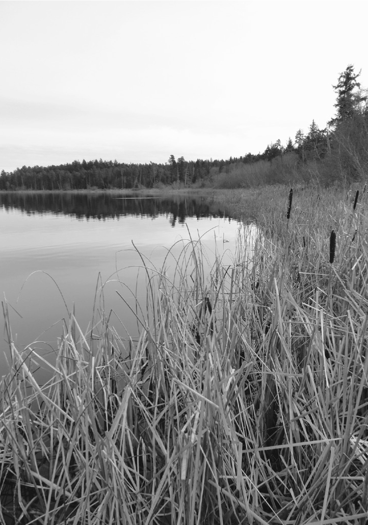
Reeds and bulrushes along Hummel Lake provide excellent habitat for birds and small mammals.
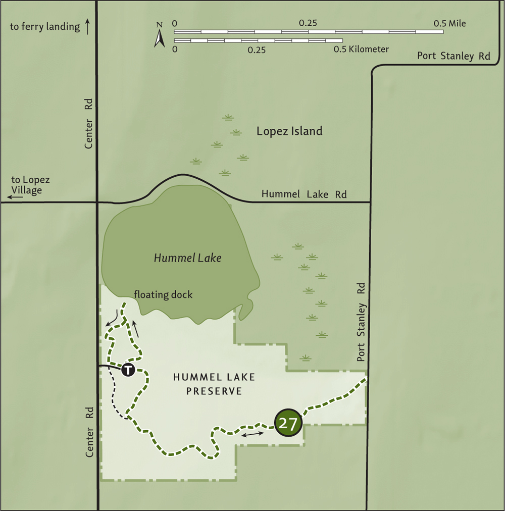
Retrace your steps back to the trailhead and then pick up the 0.4-mile (0.6-km) lake loop at the west end of the parking lot. Follow the wheelchair-accessible trail through a cedar grove and past picnic tables, coming to a delightful meadow. The loop angles back to the access road, but first head over to the floating dock that slices through cattails, allowing you a good look of Hummel Lake. Stay for a while for soothing views and a blackbird symphony. Then follow the west side of the loop back to your vehicle.
| Fisherman Bay Preserve: The Spit |
| RATING/ DIFFICULTY |
ROUNDTRIP | ELEV GAIN/HIGH POINT |
| ***/1 | 1 mile (1.6 km) | Minimal/20 feet (6 m) |
Maps: USGS Shaw Island, land bank map online; Contact: San Juan County Land Bank, Fisherman Bay Preserve; Notes: Dogs permitted on-leash. Stay on trail through dunes to avoid disturbing rare plants; GPS: N 48 31.019, W 122 55.356
![]() Hike across fields, an old orchard, and coastal dunes to a beautiful sandy beach. Then wander along the shore to the tip of a spit at the mouth of Fisherman Bay. Enjoy charming views of Lopez Village on the bay and of Turtleback Mountain rising behind Shaw Island.
Hike across fields, an old orchard, and coastal dunes to a beautiful sandy beach. Then wander along the shore to the tip of a spit at the mouth of Fisherman Bay. Enjoy charming views of Lopez Village on the bay and of Turtleback Mountain rising behind Shaw Island.
From Anacortes, take a Washington State ferry to Lopez Island. Follow Ferry Road 2.1 miles (3.4 km) and bear right onto Fisherman Bay Road. Drive 3.9 miles (6.3 km), passing Lopez Village, and turn right onto Bayshore Road. Proceed 1.4 miles (2.3 km) and turn left onto Peninsula Road. Continue for 0.5 mile (0.8 km) to the end of the county road. Then drive 0.2 mile (0.3 km) on dirt road, turning right in 0.1 mile (0.2 km) (signed for the preserve) to reach the trailhead. Privy and bike rack available.
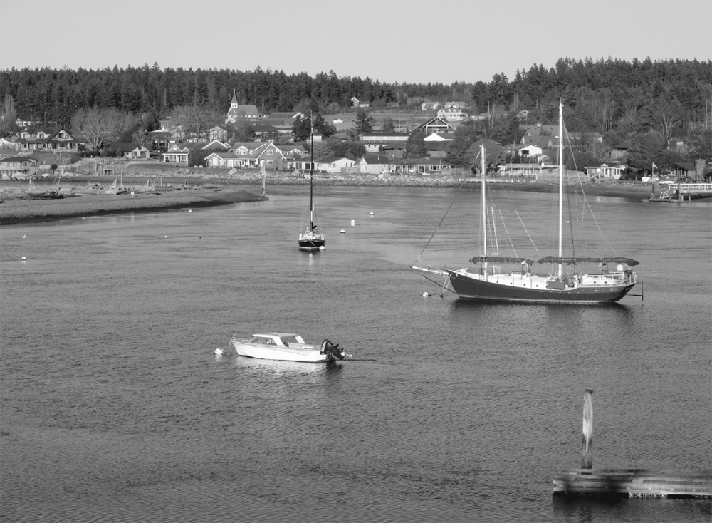
Lopez Village across Fisherman Bay
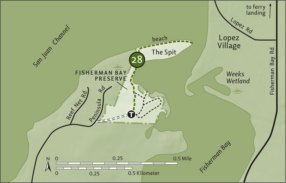
At an old homestead on a grassy upland, three trails diverge from the trailhead. They all interconnect and loop around, traversing field and orchard and affording splendid views of the spit and across Fisherman Bay. Plan on tacking on an extra 0.2 mile (0.3 km) if you care to explore them after your return from the spit.
The most direct path to the spit is the trail heading left. Take it, skirting field and wetlands before dropping down to the spit. Now follow a wide path across low dunes. Do not stray off the path, as the surrounding dune complex—uncommon in the San Juans—harbors fragile and rare plants and provides nesting grounds for a handful of birds.
Reach the beach and turn right, walking the driftwood-lined wide and sandy shoreline. Look for waterfowl and pelagic birds offshore, and watch for passing ferries. Admire views of Shaw Island, with Orcas’s Turtleback Mountain rising behind it. At 0.5 mile (0.8 km), come to the tip of the spit and a boat graveyard. Wave to passing boats still in service and to folks over in the village. Stay for a while before retracing your steps back to the trailhead.
On your drive back to the ferry landing, stop at Otis Perkins County Park and walk 0.6 mile (1 km) on the tombolo, also part of the Fisherman Bay Preserve. At Lopez Village is a third unit of the preserve, the Weeks Wetland, with a short interpretive trail to an observation deck.
| Lopez Hill |
| RATING/ DIFFICULTY |
LOOP | ELEV GAIN/HIGH POINT |
| **/2 | 3.1 miles (5 km) | 300 feet (91 m)/535 feet (163 m) |
Maps: USGS Richardson, USGS Lopez Pass, Friends of Lopez Hill map online; Contact: Friends of Lopez Hill; Notes: Open to mountain bikes, horses, hunting (check seasons). Dogs permitted on-leash; GPS: N 48 28.896, W 122 52.217
![]() Wander aimlessly (or with a purpose) on miles of quiet forested trails on Lopez Island’s highest point. There are no sweeping views here, but you’ll find plenty of solitude, attractive forest groves, mossy flowered ledges, amphibian- and bird-bellowing wetlands, and plenty of surprises—like delightful signposts and a Buddha.
Wander aimlessly (or with a purpose) on miles of quiet forested trails on Lopez Island’s highest point. There are no sweeping views here, but you’ll find plenty of solitude, attractive forest groves, mossy flowered ledges, amphibian- and bird-bellowing wetlands, and plenty of surprises—like delightful signposts and a Buddha.
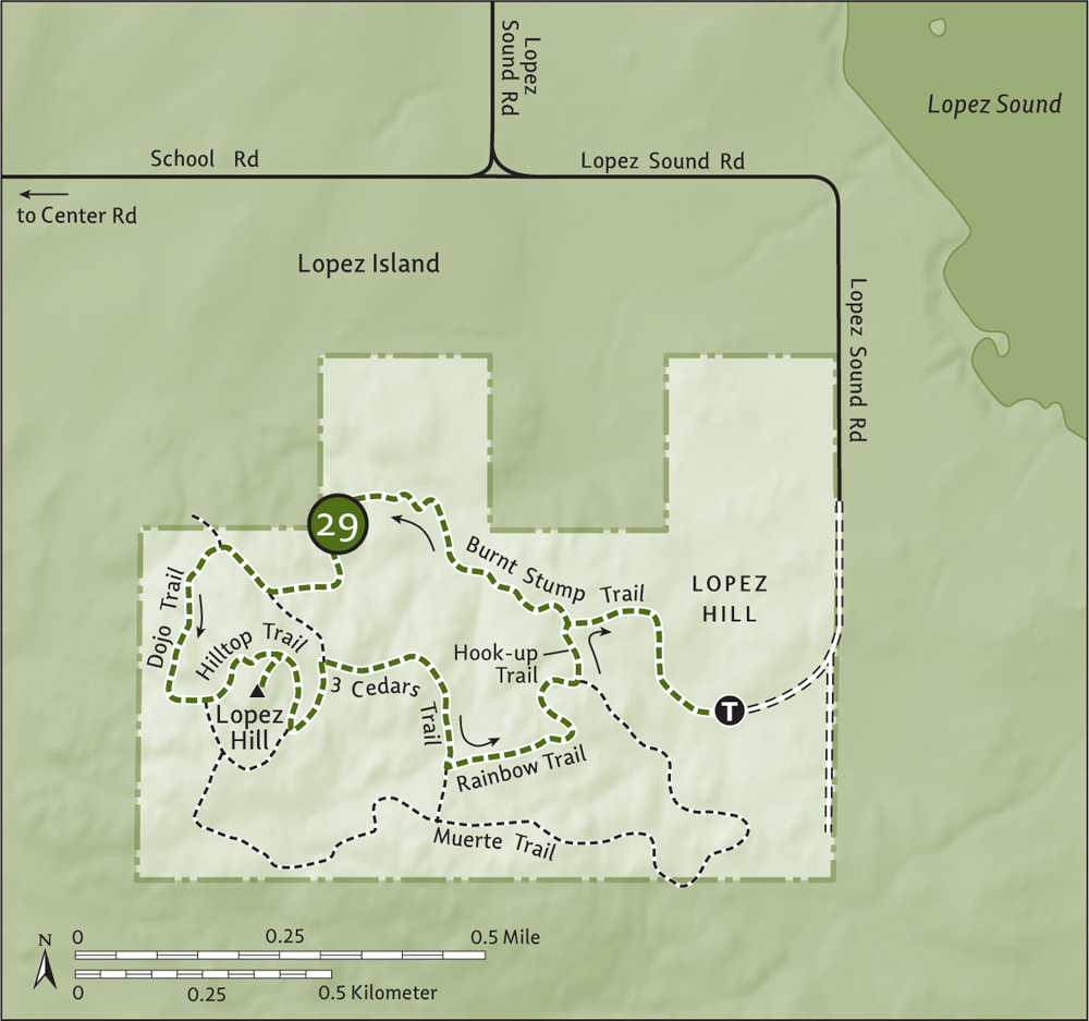
From Anacortes, take a Washington State ferry to Lopez Island. Follow Ferry Road 2.1 miles (3.4 km) and bear left onto Center Road. Continue south for 4 miles (6.4 km) and turn left onto School Road. After 1 mile (1.6 km), bear right onto Lopez Sound Road. Then drive 1.1 miles (1.8 km) (pavement ends after 0.8 mi/1.3 km), turning right onto a dirt road. Continue 0.2 mile (0.3 km) to the trailhead (elev. 270 ft/82 m).
Lopez Hill consists of a 400-acre (162-ha) tract owned by the Department of Natural Resources and managed through a fifty-year lease (signed in 2009) by San Juan County. A very active citizens group, the Friends of Lopez Hill, formed to permanently protect this large undeveloped tract and to develop and promote recreational opportunities on it. The group has built a network of trails, with colorful names and signposts sporting unique pictographs that capture each trail’s name. You’ll enjoy scouting the signposts.
For an introductory loop, follow the Burnt Stump Trail through wetlands and big trees, coming to a junction with the Hook-up Trail in 0.4 mile (0.6 km). You’ll be returning from the left, so continue straight, dropping into a lush creek-cradling ravine after a short climb. Continue through more wetlands and big trees and begin climbing, traversing moss-carpeted ledges to reach the 3 Cedars Trail (elev. 470 ft/143 m) at 1 mile (1.6 km).
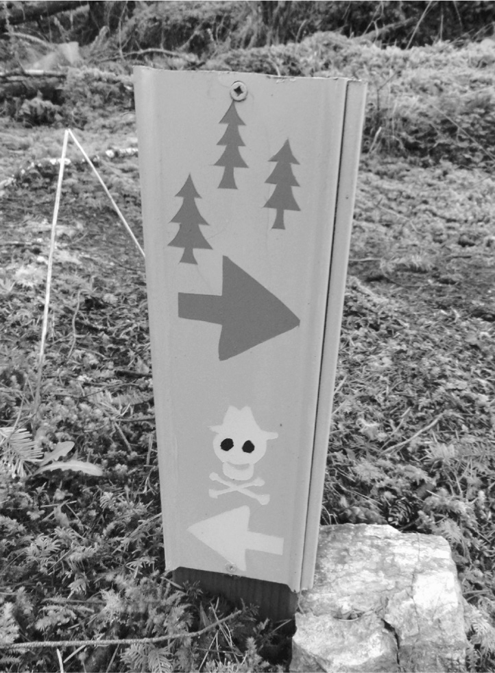
One of Lopez Hill’s colorful trail signs
Head right, slightly descending and soon reaching the Dojo Trail. Right heads to private property, so head left, walking along mossy ledges to a junction with the Hilltop Trail (elev. 480 ft/146 m) at 1.3 miles (2.1 km). Continue left to ascend Lopez’s rooftop, coming to the short summit spur at 1.5 miles (2.4 km). Take its roundtrip 0.1 mi (0.15 km) to Lopez Hill’s 535-foot (163-m) open and grassy but viewless summit. A Buddha and hammock were in place last time I hiked here, and the lovely summit is indeed ideal for meditating and vegetating. Raucous ravens and eagles may disturb the silence.
Return to the Hilltop Trail and turn right. After 0.1 mile (0.15 km), reach a junction. Go left and in another 0.1 mile (0.15 km), reach the 3 Cedars Trail once again. Take this trail right, gradually descending and eventually coming to a creek, the three cedars (actually, there are a few more), and a junction at 2.2 miles (3.5 km). Bear left onto the Rainbow Trail, descending through mossy dark forest to reach a junction with the Hook-up Trail at 2.5 miles (4 km). Follow this trail left, crossing a creek and soon reaching the Burnt Stump Trail at 2.7 miles (4.3 km). The trailhead and your vehicle await you 0.4 mile (0.6 km) to the right.
Hike some of the other Lopez Hill trails and venture if you dare along the Muerte Trail (just the name is ominous). Check out an old log cabin at the eastern end of the Rainbow Trail.
| Shark Reef Sanctuary |
| RATING/ DIFFICULTY |
ROUNDTRIP | ELEV GAIN/HIGH POINT |
| ***/1 | 1 mile (1.6 km) | 40 feet (12 m)/60 feet (18 m) |
Map: USGS Richardson; Contact: San Juan County Parks, Lopez Island; Notes: Dogs permitted on-leash; GPS: N 48 27.760, W 122 56.240
![]() Wander through shoulder-high salal and tall timber to a tight rocky channel teeming with bird and marine life. Watch eagles, cormorants, kingfishers, and oystercatchers dine on seafood. And observe seals basking on channel rocks and swimming in the strong currents. Shark Reef Sanctuary is an excellent destination for children (and adults) seeking outdoor discovery.
Wander through shoulder-high salal and tall timber to a tight rocky channel teeming with bird and marine life. Watch eagles, cormorants, kingfishers, and oystercatchers dine on seafood. And observe seals basking on channel rocks and swimming in the strong currents. Shark Reef Sanctuary is an excellent destination for children (and adults) seeking outdoor discovery.
From Anacortes, take a Washington State ferry to Lopez Island. Follow Ferry Road 2.1 miles (3.4 km) and bear right onto Fisherman Bay Road. Continue for 5 miles (8 km), passing Lopez Village and turning right onto Airport Road. Drive 0.4 mile (0.6 km) and turn left onto Shark Reef Road. Continue for 1.8 miles (2.9 km) to the trailhead, 0.1 mile (0.2 km) beyond the Burt Road junction. Privy and bike rack available.
Mount Finlayson across Middle Channel

Originally a military post, then a Department of Natural Resources tract, the 39-acre (16-ha) Shark Reef Sanctuary was eventually transferred to San Juan County Parks and has become one of Lopez Island’s most popular hiking destinations.
On good trail, set out through thick forest carpeted in salal. Pass a handful of old firs spared the ax and after a short descent, reach the rocky shoreline (elev. 20 feet/6 m). Turn south and walk on ledges along Cattle Pass, its strong currents separating Lopez from San Juan Island.
At 0.5 mile (0.8 km), the trail ends at a rocky and grassy bluff framed by windblown shore pines. Seek a sunny sitting spot and enjoy the scenery. Across the channel, Mount Finlayson rises above the golden lawns of Cattle Point. Dallas Mountain, highest point on San Juan Island, peeks out just to the northwest. Look south to the Olympics, hovering above the Strait of Juan de Fuca, and east to Iceberg Point. Directly in front of you in the channel are Deadman Island and a series of reefs and offshore rocks. At low tide, these areas teem with seals. Shark Reef itself is actually to the north and not visible from this point.
| Iceberg Point |
| RATING/ DIFFICULTY |
ROUNDTRIP | ELEV GAIN/HIGH POINT |
| *****/2 | 3.8 miles (6.1 km) | 380 feet (116 m)/135 feet (41 m) |
Map: USGS Richardson; Contact: San Juan Islands National Monument; Notes: Dogs permitted on-leash. Do not park beyond Agate Beach County Park. Landowners have generously granted access via their private property—stay on trail and do not trespass; GPS: N 48 25.738, W 122 52.623
![]() Take in stunning views of the Olympic Mountains across the sparkling waters of the Strait of Juan de Fuca as you hike through prairie grasses atop coastal bluffs. One of the most breathtaking spots in the San Juans, Iceberg Point will leave you frozen in astonishment.
Take in stunning views of the Olympic Mountains across the sparkling waters of the Strait of Juan de Fuca as you hike through prairie grasses atop coastal bluffs. One of the most breathtaking spots in the San Juans, Iceberg Point will leave you frozen in astonishment.
From Anacortes, take a Washington State ferry to Lopez Island. Follow Ferry Road 2.1 miles (3.4 km) and bear left onto Center Road. Continue for 5.6 miles (9 km) and bear left onto Mud Bay Road. Follow it for 2.8 miles (4.5 km), turning right onto MacKaye Harbor Road. Drive 1.8 miles (2.9 km) to Agate Beach County Park. Park here. Privy available.
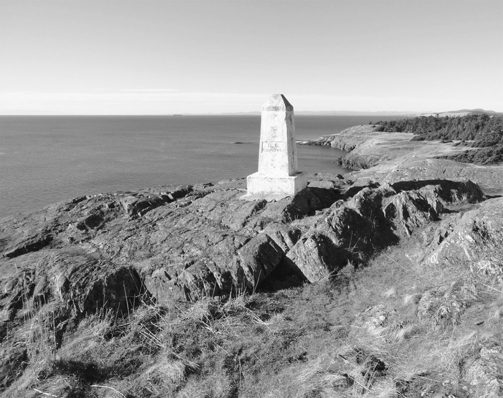
Boundary reference monument at Iceberg Point
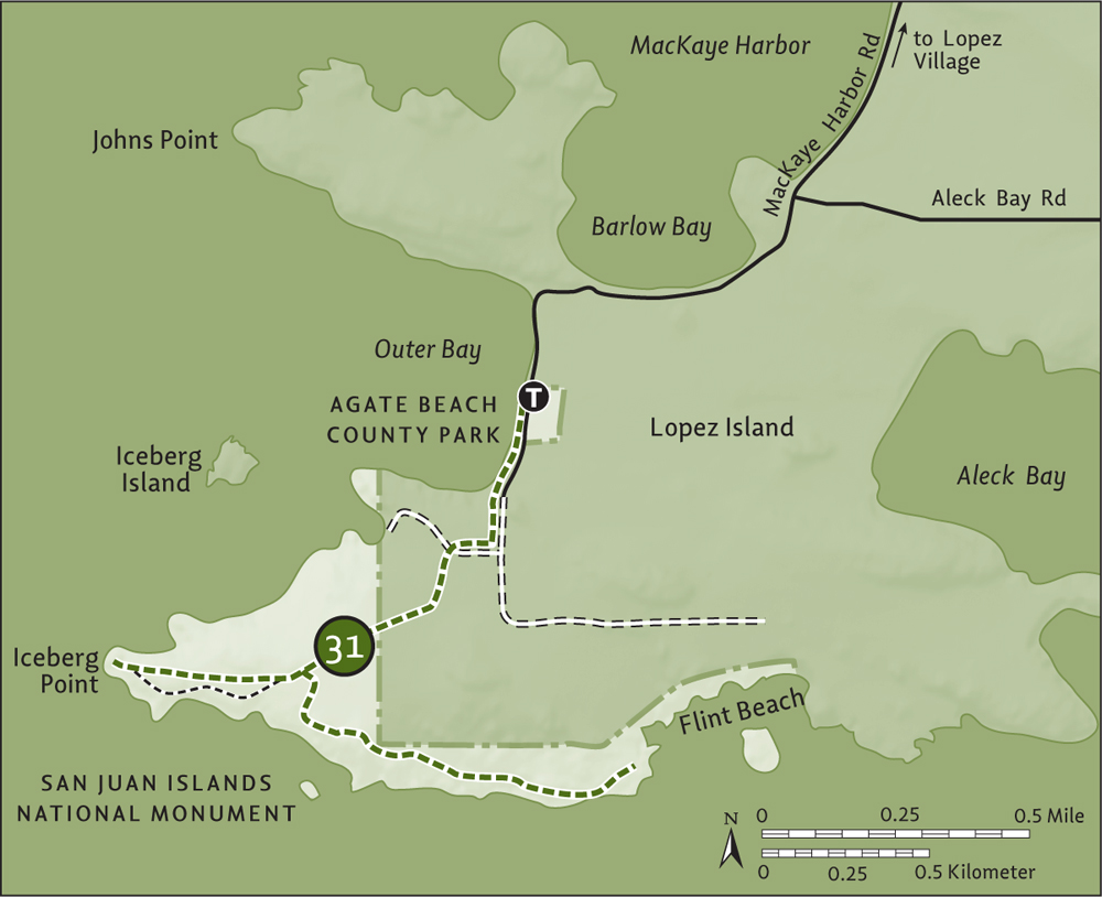
Located at the southern tip of Lopez Island, 76-acre (31-ha) Iceberg Point is one of many small properties in the San Juans administered by the Bureau of Land Management. In 2013, these areas—many containing rare plants and important cultural sites—became protected as a national monument (see “A Monumental Achievement” sidebar). Iceberg Point is one of the larger parcels, and it harbors native fescue grasses, prickly pear cactus, old-growth junipers, and several rare flowers, including a yellow population of chocolate lilies.
Start by hiking south on the county road, soon coming to unpaved private Flint Road. Continue uphill on Flint and at 0.3 mile (0.5 km), turn right at a gated private road with an old saw as a sign, pegged high on a post marking the way to the point. At 0.4 mile (0.6 km), bear left at a green gate (do not trespass onto private property on the right), continuing through mature forest on old road that eventually dwindles into trail.
At 0.6 mile (1 km), reach the national monument (elev. 130 feet/40 m) and a bike rack (no bikes permitted beyond). Keep hiking, passing some big trees, and reach a trail junction at prairie’s edge (elev. 100 feet/31 m) at 0.8 mile (1.3 km). Let the explorations begin. First, continue right, across one of the finest remaining prairies in the San Juans. Soon, reach another junction. Stay right on the main path, skirting wind-contorted firs and pines; or take the path left, running closer to water’s edge and rounding high banks and rocky bluffs. Either way leads 0.4 mile (0.6 km) to Iceberg Point (elev. 20 ft/6 km), a cliffy promontory housing a navigational beacon. You’re a long way from the North Atlantic, so you won’t see any icebergs here. The point was named in 1854 by George Davidson of the US Coast Survey for the copious striations left in the ledges by Ice Age glaciers.
For present-day glaciers, look northeast across Outer Bay to Mount Baker and south across the strait to glacier-covered Mount Rainier and the snowy Olympics. Directly west are the golden slopes of Mount Finlayson and Cattle Point on San Juan Island. The views are mesmerizing.
Next, retrace your steps 0.4 mile (0.6 km) to the junction and head right 0.2 mile (0.3 km), reaching a high rocky knoll (elev. 135 ft/41 m) that sports a large white boundary monument. The view is sweeping. Scan the striated shoreline all the way to Iceberg Point and beyond. Notice the glacial erratics littering the terraced ledges. Notice the birds too—raptors and eagles are prolific here.
Continue 0.5 mile (0.8 km) on a rough-at-times trail, heading east across a landscape reminiscent of Ireland or Scotland. Ignore a side trail leading left to private property, and after passing through a grove of windblown firs, reach the trail’s end at a rocky point, with good views to the islands offshore and of Point Colville. From here, it’s 1.5 miles (2.4 km) back to your vehicle.
Skip the 0.2-mile (0.3-km) trail at Agate Beach, but do take the stairway down to the beach at Outer Bay. The birding, especially in winter, is excellent.
On March 25, 2013, President Barack Obama signed a proclamation designating approximately 1000 acres (405 ha) of Bureau of Land Management (BLM) properties within the San Juan Islands as the San Juan Islands National Monument. This was made possible by the Antiquities Act of 1906, which authorizes the president to set aside public land as parks or conservation areas by executive order; this powerful instrument has been used many times before, by presidents from Theodore Roosevelt (who established the first national monument) to George W. Bush (who established the largest national monument).
While this new national monument in the San Juans is comparatively small, it is historically, culturally, and ecologically significant and had long been sought by many islanders and conservationists. About sixty separate sites make up the monument. Many of the properties are small islets and former lighthouse sites. But several parcels are sizeable, offering excellent hiking. These include Iceberg Point (Hike 31), Chadwick Hill (Hike 32), Watmough Bay (Hike 33), and Point Colville (Hike 34) on Lopez Island; Cattle Point (Hike 52) on San Juan Island; Turn Point (Hike 61) on Stuart Island; and the whole of Patos Island (Hike 62). Aside from protecting beautiful scenery, these parcels also include historical structures, old-growth forest, and several rare and endangered species.
| Chadwick Hill |
| RATING/ DIFFICULTY |
ROUNDTRIP | ELEV GAIN/HIGH POINT |
| ****/3 | 3 mile (4.8 km) | 380 feet (116 m)/460 feet (140 m) |
Maps: USGS Lopez Pass, San Juan County Land Bank Watmough Bay Preserve map online; Contact: San Juan Islands National Monument; Notes: Dogs permitted on-leash; GPS: N 48 25.891, W 122 49.714
![]() Stand atop this 470-foot (143-m) hill on the southern tip of Lopez Island and behold one of the most dramatic views in the San Juans. From Chadwick’s dizzying clifftops, stare straight down to sparkling Watmough Bay wedged between sheer rock faces and steep emerald slopes. Then cast your attention outward to the snowy sentinel, Mount Baker, hovering above shimmering waters.
Stand atop this 470-foot (143-m) hill on the southern tip of Lopez Island and behold one of the most dramatic views in the San Juans. From Chadwick’s dizzying clifftops, stare straight down to sparkling Watmough Bay wedged between sheer rock faces and steep emerald slopes. Then cast your attention outward to the snowy sentinel, Mount Baker, hovering above shimmering waters.
From Anacortes, take a Washington State ferry to Lopez Island. Follow Ferry Road 2.1 miles (3.4 km) and bear left onto Center Road. Continue for 5.6 miles (9 km) and bear left onto Mud Bay Road. Follow it for 4.2 miles (6.8 k), turning right onto Aleck Bay Road. Drive 0.5 mile (0.8 km) and continue straight onto Watmough Head Road. Continue for 0.5 mile (0.8 km) to the unmarked trailhead (elev. 160 ft/49 m) at a gate at the end of a field. There is limited parking on the roadside—do not block adjacent drive.
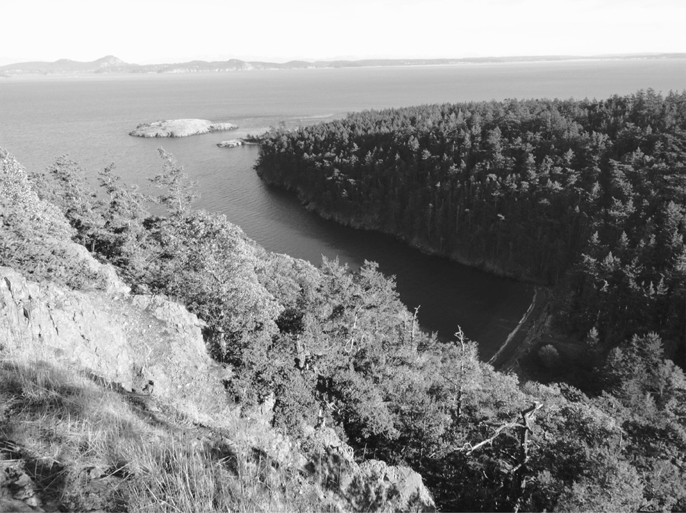
Watmough Bay from Chadwick Hill
Start by walking along the field edge on an old tractor track. At 0.2 mile (0.3 km), come to a gate and enter the largest parcel of the new San Juan Islands National Monument (see “A Monumental Achievement” sidebar). Encompassing Chadwick Hill, Watmough Bay, and Point Colville, this Bureau of Land Management–administered tract, along with adjacent San Juan County Land Bank property, protects more than 400 acres (160 ha) of one of the most stunning landscapes in the San Juans.
Now in cool forest, follow the old track, soon coming to an unmarked junction. The way left leads 0.3 mile (0.5 km) to grassy wetlands teeming with birds. Continue straight instead, and at 0.4 mile (0.6 km) come to another unmarked junction. You’ll be returning from the left, so head right, gradually ascending under a cool canopy of cedars, firs, alders, and madronas. The trail splits in another 0.1 mile (0.15 km)—go either way, as they soon meet up again.
At 1 mile (1.6 km), crest a ridge (elev. 420 feet/128 m) and start descending in thick salal, passing several wetland pools cradled in ledge pockets. After losing 80 feet (24 m) of elevation, start climbing again. Ignore a path to the left at a small knoll, but take note of the trail heading left shortly afterward at 1.3 miles (2.1 km). This will be your return route after hiking to the hilltop and back.
Stay right and climb, crossing mossy ledges. At 1.6 miles (2.6 km), crest Chadwick’s summit ridge (the actual summit is to the north), where open grassy ledges (elev. 460 ft/140 m) greet you. The view over Watmough Bay and out across Rosario Strait is stunning. The drop is downright frightening; keep children and dogs nearby and don’t venture too close to the cliff edge. Find yourself a nice sunny spot and take in the maritime views and the eagles that frequently soar above Chadwick’s craggy south face.
When it’s time to return, retrace your steps 0.3 mile (0.5 km) to the last junction and then head to the right through a grove of mature Douglas firs, coming to the edge of a pasture. The way then turns left on a fairly level grade, reaching the main trail in 0.7 mile (1.1 km). Your vehicle awaits you 0.4 mile (0.6 km) away.
From Chadwick’s summit, do not follow the trails that descend the south face, as one path traverses private property and the other is a dangerous route along ledges and cliffs. Instead, consider the 0.3-mile (0.5-km) side trail near the hike’s beginning, which leads to wetland pools where you can delight in a little bird-watching.
| Watmough Bay |
| RATING/ DIFFICULTY |
ROUNDTRIP | ELEV GAIN/HIGH POINT |
| ***/1 | 1.3 miles (2.1 km) | 190 feet (58 m)/150 feet (46 m) |
Maps: USGS Lopez Pass, land bank map online; Contact: San Juan County Land Bank, Watmough Bay Preserve; Notes: Dogs permitted on-leash; GPS: N 48 25.747, W 122 49.053
![]() This short and easy hike leads to a wedge of a bay beneath steep, stark, towering cliffs. Sit on a polished driftwood log and stare at Mount Baker across Rosario Strait. Then hike up a tall-timbered slope of Watmough Head before finishing up with a stroll around a quiet bird-loving marsh.
This short and easy hike leads to a wedge of a bay beneath steep, stark, towering cliffs. Sit on a polished driftwood log and stare at Mount Baker across Rosario Strait. Then hike up a tall-timbered slope of Watmough Head before finishing up with a stroll around a quiet bird-loving marsh.
From Anacortes, take a Washington State ferry to Lopez Island. Follow Ferry Road 2.1 miles (3.4 km) and bear left onto Center Road. Continue for 5.6 miles (9 km) and bear left onto Mud Bay Road. Follow it for 4.2 miles 6.8 km), turning right onto Aleck Bay Road. Drive 0.5 mile (0.8 km) and continue straight onto Watmough Head Road. In 0.9 mile (1.4 km), turn left into Watmough Bay Preserve and drive 0.1 mile (0.15 km) to the trailhead. Privy and bike rack available.
Watmough Bay sits in the heart of 400-plus acres (160-plus ha) managed by the Bureau of Land Management and the San Juan County Land Bank. This rocky and heavily forested landscape is quite different from the island’s signature pastoral countryside.
Head east on a wide and well-groomed trail down a hollow that’s well shaded thanks to tall trees and steep surrounding slopes. At 0.2 mile (0.3 km), reach gorgeous Watmough Bay, tightly hemmed in by cliffy 470-foot (143-m) Chadwick Hill to the north and thickly timbered 242-foot (74-m) Watmough Head to the south. A cobblestone beach lined with driftwood entices you to the shore. Walk along the surf, enjoying a wonderful view of Mount Baker hovering over Burrows and Fidalgo islands, perfectly framed between Watmough’s sentinel summits.
You can easily spend hours here, but if you want more exercise, that can be arranged too. From the bay follow a trail to the right, steeply climbing 150 feet (46 m) above the surf. Traverse old-growth forest, passing big fire-scarred firs and eventually coming to the trail’s end at 0.3 mile (0.5 km), at a dirt road.
Retrace your steps back to the bay and then walk north along the beach 0.1 mile (0.15 km), picking up trail once again. Now hike west along a quiet marsh, past big cedars and beneath the towering rocky southern façade of Chadwick Hill. Pass a steep and unmarked trail to Chadwick’s summit. It’s a dangerous exposed scramble route that should be ignored. Continue hiking around the marsh, returning to the access road above the trailhead at 0.4 mile (0.6 km) from the beach.
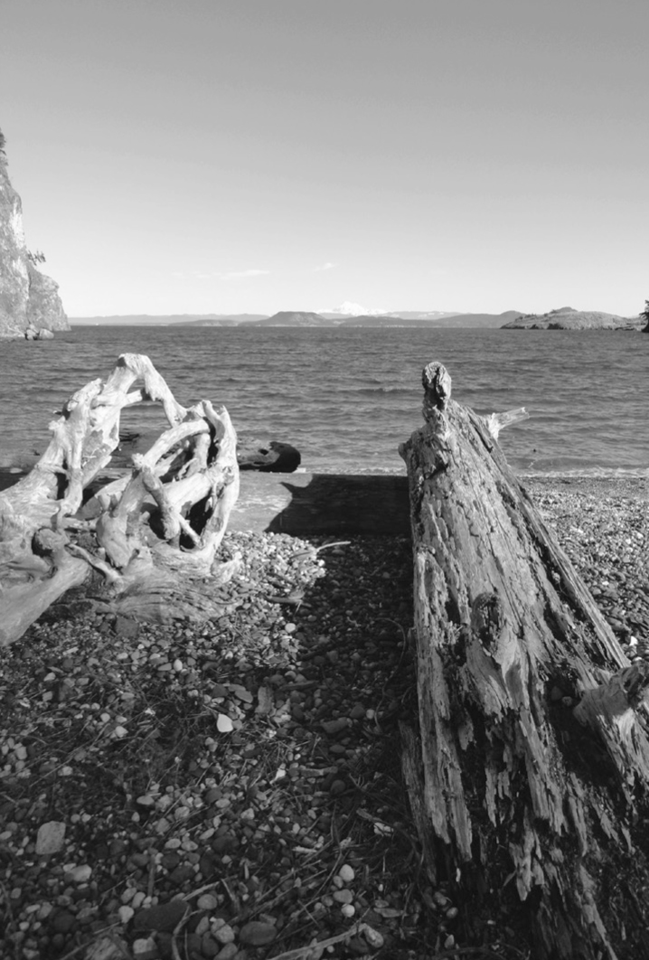
Mount Baker hovers in the distance above Burrows, Allan, and Fidalgo islands.
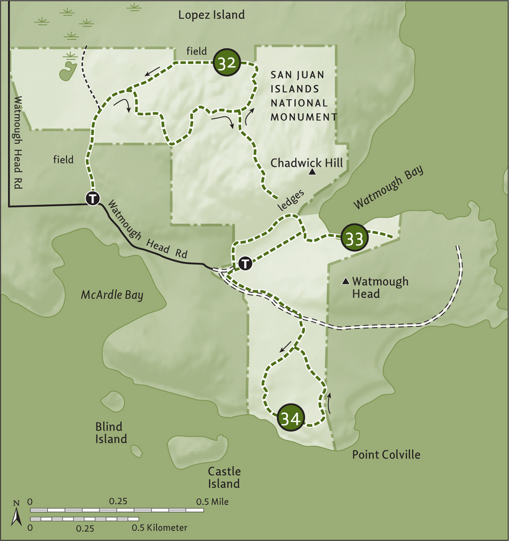
| Point Colville |
| RATING/ DIFFICULTY |
ROUNDTRIP | ELEV GAIN/HIGH POINT |
| ****/2 | 2.2 miles (3.5 km) | 180 feet (55 m)/130 feet (40 m) |
Maps: USGS Lopez Pass, land bank map online; Contact: San Juan Islands National Monument and San Juan County Land Bank, Watmough Bay Preserve; Notes: Dogs permitted on-leash. Coastal cliffs—keep children nearby; GPS: N 48 25.747, W 122 49.053
![]() A spectacular promontory of coastal cliffs, native prairie grasses, and old-growth forest rivaling Iceberg Point in beauty—but not in crowds. On this short hike long on maritime views, watch for marine mammals and pelagic birds on nearby offshore islands. And savor stunning views across Rosario Strait and the Strait of Juan de Fuca to snowy backdrops compliments of the Cascade and Olympic mountains.
A spectacular promontory of coastal cliffs, native prairie grasses, and old-growth forest rivaling Iceberg Point in beauty—but not in crowds. On this short hike long on maritime views, watch for marine mammals and pelagic birds on nearby offshore islands. And savor stunning views across Rosario Strait and the Strait of Juan de Fuca to snowy backdrops compliments of the Cascade and Olympic mountains.
See directions to Hike 33.
The road to Point Colville’s trailhead can be rough and parking can be tight, so it’s best to start this hike from the Watmough Bay Preserve parking area. Walk 0.1 mile (0.15 km) back to Watmough Head Road. Then turn left, following the primitive dirt track through primeval forest to an unsigned trailhead (elev. 130 ft/40 m) at 0.5 mile (0.8 km), in a grove of giant fire-scarred Douglas firs.
Pass a bike rack and a lot of impressive trees, coming to a junction at 0.7 mile (1.1 km). You’ll be returning from the left, so keep right, soon breaking out of forest cover to coastal bluff prairie that harbors rare prickly pear cacti and abundant showy wildflowers come spring. Pass a rough side spur (elev. 40 ft/12 m) that leads to the right to the water, and using caution start angling east across high clifftops around the point.
Castle Island guards the rocky headlands of Point Colville.
Stop frequently to marvel at blocky Castle Island just offshore and Colville Island a little farther out. Binoculars will allow you to see seabird colonies, perhaps even tufted puffins. Take in good views too of Burrows Island, Mount Baker, and Fidalgo’s Mount Erie. Pass a side spur that steeply drops to a secluded beach. Then, after passing near a lone house, traverse a Sitka spruce grove before closing the loop at 1.5 miles (2.4 km). Continue straight to return 0.7 mile (1.1 km) to your vehicle.
Combine with a trip to Watmough Bay (Hike 33).
At 7.7 square miles (20 sq. km), Shaw Island is the smallest of the San Juans serviced by the Washington State Ferries. Shaw is quiet and relatively undeveloped, with a year-round population of about 250. Named by the Wilkes Expedition in 1841 for Captain John D. Shaw, an American hero of the War of 1812, the island is home to two monasteries and one of the last one-room schoolhouses in the state.
While there is very little public land on the island, the University of Washington and the San Juan Preservation Trust own large tracts that permit hiking. The island’s lightly traveled roads are also ideal for walking. Overnight accommodations are limited to vacation rentals, Our Lady of the Rock Monastery (http://olrmonastery.org), and the 11 campsites at the Shaw Island County Park (www.co.san-juan.wa.us/parks).
| Indian Cove |
| RATING/ DIFFICULTY |
ROUNDTRIP | ELEV GAIN/HIGH POINT |
| ****/2 | 5.6 miles (9 km) | 330 feet (101 m)/150 feet (46 m) |
Map: USGS Shaw Island; Contact: San Juan Preservation Trust, Graham Preserve; Notes: Road walk with very little traffic; GPS: N 48 35.056, W 122 55.795
![]() Hike quiet country roads along picturesque Blind Bay to the gorgeous white sandy beach of Indian Cove. Then explore a little peninsula in Squaw Bay before hiking on a peaceful forested trail through a San Juan Preservation Trust preserve.
Hike quiet country roads along picturesque Blind Bay to the gorgeous white sandy beach of Indian Cove. Then explore a little peninsula in Squaw Bay before hiking on a peaceful forested trail through a San Juan Preservation Trust preserve.
Leave your car at the Anacortes ferry terminal and take a Washington State ferry to Shaw Island. The hike begins at the ferry dock.
Walk off the ferry and immediately come to the Shaw General Store, in business since 1898 and a great place to grab a snack for the hike. Now walk along Blind Bay Road, one of the quietest stretches of pavement you’ll ever travel. Orchards and sheep farms line the roadway on the left, while boat-bobbing and bird-bustling Blind Bay hugs it on the right. Turtleback Mountain hovers in the background. The way is level with a few little dips and rises.
At 1.3 miles (2.1 km), come to a junction with Squaw Bay Road at the Shaw Community Center. You’ll be returning on a trail to this point. Turn left and walk the road, coming to the 60-acre (24-ha) Shaw Island County Park at 2 miles (3.2 km). Walk down the park access road through the campground and tall timber, reaching the beach at 2.2 miles (3.5 km). A picnic, nap, or walk on this white sandy beach in Indian Cove—one of the prettiest beaches in the San Juan Islands—is a must. Share views of Canoe, Lopez, and San Juan islands against an Olympic Mountains backdrop with kingfishers, eagles, and oystercatchers.
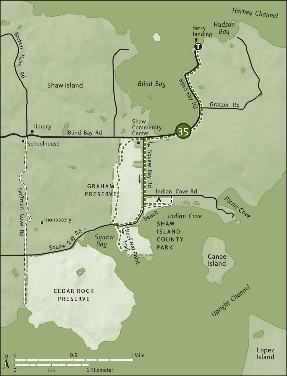
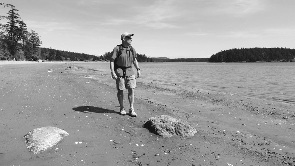
The author admires Indian Cove’s sandy South Beach.
Sated, return 0.2 mile (0.3 km) to Squaw Bay Road and turn left, walking a bluff along a split-rail fence that encloses an old orchard of the 99-acre (40-ha) Graham Preserve, bequeathed to the San Juan Preservation Trust by Ernest and Beverly Graham in 2009. At 2.7 miles (4.3 km), come to the Reef Net Point Trail on your left. Follow it through forest along Squaw Bay, passing an old cabin that once served as the island’s first schoolhouse, and coming to a grassy point at 3 miles (4.8 km). Enjoy the view of the wildlife-rich small bay.
Return 0.3 mile (0.5 km) to Squaw Bay Road, locating a trail across the pavement. Follow this 2013-built trail through the Graham Preserve’s peaceful forest, climbing a small hillside (elev. 150 ft/46 m). Then gently descend to the Shaw Community Center at 4.3 miles (6.9 km). Return to the ferry landing by retracing your steps 1.3 miles (2.1 km) along Blind Bay Road.
From the Reef Net Point Trail continue west on Squaw Bay Road 0.9 mile (1.4 km), turning left on graveled Hoffman Cove Road and walking 0.4 mile (0.6 km) to its end. Then head left on a grassy road-trail (dogs prohibited) to the beautiful 370-acre (150-ha) Cedar Rock Preserve, managed by the University of Washington. One of several properties on Shaw and Lopez islands protecting more than 1400 acres (566 ha) donated by the late Dr. Frederick Ellis and family, this preserve contains 2.3 miles (3.7 km) of stunning undeveloped coastline. Feel free to explore, but stay on established trails.
Consider returning to Blind Bay Road via Hoffman Cove Road, passing Our Lady of the Rock Monastery and climbing a steep, 250-foot (76-m) hill to Shaw’s red one-room schoolhouse and library at 1.6 miles (2.6 km). From here it’s 2.3 miles (3.7 km) to the ferry landing.
Named not for killer whales (Orcinus orca) that live in the surrounding waters but for a Spanish viceroy who sent an exploring expedition here in 1791, Orcas Island is the largest of the San Juans, at 57.3 square miles (148.4 sq. km). With a population of around 5500, Orcas has two huge tracts of public land including Washington’s fourth-largest state park that has some of the best hiking in the islands.
Washington State Ferries offers year-round service from Anacortes to Orcas Landing on Orcas Island. Bicyclists will find good roads and some hilly terrain, especially in the eastern reaches of the island. Eastsound is the island’s commercial center and largest community, offering a wide array of services, including a large grocery store. Moran State Park has 151 campsites. Obstruction Pass State Park has 9 backcountry and paddle-accessible sites (no water). West Beach Resort (www.westbeachresort.com) and Doe Bay Resort (doebay.com) also offer camping.
| Turtleback Mountain Preserve: Ship Peak Loop |
| RATING/ DIFFICULTY |
LOOP | ELEV GAIN/HIGH POINT |
| ****/3 | 2.9 miles (4.7 km) | 860 feet (262 m)/931 feet (284 m) |
Maps: USGS Eastsound, land bank map online; Contact: San Juan County Land Bank, Turtleback Mountain Preserve; Notes: Dogs permitted on-leash; GPS: N 48 38.495, W 122 58.624
![]() From this open summit of Turtleback Mountain, stand starboard and set your sail to the sights of a maritime mélange of islands, harbors, and headlands. There are good terrestrial views too, out across the rolling pastures of the Crow Valley to the emerald hulk of Mount Constitution. In spring and early summer, Ship Peak is decked with quite a floral arrangement.
From this open summit of Turtleback Mountain, stand starboard and set your sail to the sights of a maritime mélange of islands, harbors, and headlands. There are good terrestrial views too, out across the rolling pastures of the Crow Valley to the emerald hulk of Mount Constitution. In spring and early summer, Ship Peak is decked with quite a floral arrangement.
From Anacortes, take a Washington State ferry to Orcas Island. Head north on Orcas Road (Horseshoe Highway) for 2.5 miles (4 km) and turn left onto Deer Harbor Road. Continue for 2.2 miles (3.5 km), passing West Sound, and turn right onto dirt Wildrose Lane. Drive 0.1 mile (0.15 km) to the trailhead (elev. 120 ft/37 m). Privy and bike rack available.
Turtleback Mountain Preserve is one of the largest conservation success stories in the San Juans (see “Saving the Turtle” sidebar), at 1578 acres (639 ha) and growing. Thanks to the folks managing the preserve, the trail system continues to expand. The Lost Oak and Morning Ridge trails are some of the newer paths, allowing for nice loop trips to Ship Peak.
This is a short hike, but it’s steep. You don’t need to be shipshape, but your anchor may drag a little along the way. Start near an old foundation and horse-chestnut tree, following the South Trail into a small ravine and across a creek. Reach an old road in 0.2 mile (0.3 km). Turn right and soon come to a junction with the Lost Oak Trail, on the left. You’ll be returning on that path, so continue full-steam ahead. Under a canopy of Douglas firs, madronas, and Garry oaks, follow the winding woods road upward. At 0.7 mile (1.1 km), reach a bench at a viewpoint down to West Sound. Camas, larkspur, and other blossoms brighten this spot in early season.
In the 1920s prominent ship builder and former Seattle mayor Robert Moran donated more than 3500 acres (1416 ha) of spectacular Orcas Island property to the state to be established as a park. Today, Moran State Park protects more than 5000 acres (2023 ha) of old-growth forest, pristine lakeshore, and scenic mountaintop in one of Washington’s priciest and most-threatened-with-development scenic corners. Fortunately, Moran’s legacy was not the last grand initiative to protect Orcas Island’s rural charm and natural heritage.
In 2006, 1578 acres (638 ha) of Turtleback Mountain were permanently taken off the real-estate listings and added to the public trust, protecting one of the last large undeveloped tracts in the San Juan Islands. And what a tract! But perhaps more impressive than Turtleback’s spectacular vistas is how rapidly concerned citizens mobilized to protect it.
The property was put up for sale in the summer of 2005 by a private foundation. It was immediately eyed by residential and resort developers. To many island residents and visitors alike, the thought of this familiar landmark being marred by homes was unbearable. A partnership of conservation organizations immediately mobilized to raise the funds necessary to purchase the property. Spearheaded by the San Juan Preservation Trust, the Trust for Public Land, and the San Juan County Land Bank, the partnership raised US$18.5 million in just six months. It was the largest fund-raising campaign ever undertaken in San Juan County.
In January 2007 the Turtleback Mountain Conservation Area was officially opened to the public. The San Juan County Land Bank now owns it, while the San Juan Preservation Trust retains a conservation easement on it, ensuring that it remains in a natural state and open to the public in perpetuity. The land bank (www.sjclandbank.org), established in 1990 and funded primarily by a 1 percent real-estate excise tax, continues to protect prime island properties.
The San Juan Preservation Trust (www.sjpt.org), a nationally accredited nonprofit organization established in 1979, continues to protect outstanding island properties too, including the recent acquisition of the Turtleneck Preserve (Hike 37) and Vendovi Island (Hike 17). The trust has permanently protected more than 260 properties, 37 miles of shoreline, and 15,000 acres on twenty islands. Many of these properties are open to hiking and several are highlighted in this book.
Continue climbing on the South Trail (or opt for the new, slightly longer, parallel Morning Ridge Trail that traverses open shrubby slopes reminiscent of a Southern Appalachian bald). The way steepens, slowing you to a turtle’s crawl, giving you more time to enjoy expanding views to Salt Spring, Saturna, Lopez, and San Juan islands—and the Olympic Mountains in the distance. At 1.2 miles (1.9 km), reach the West Overlook (elev. 820 ft/250 m), once the site of a home and now sporting a bench where you can sit among camas lilies and look out across the Salish Sea. Sunsets from this spot are spectacular.
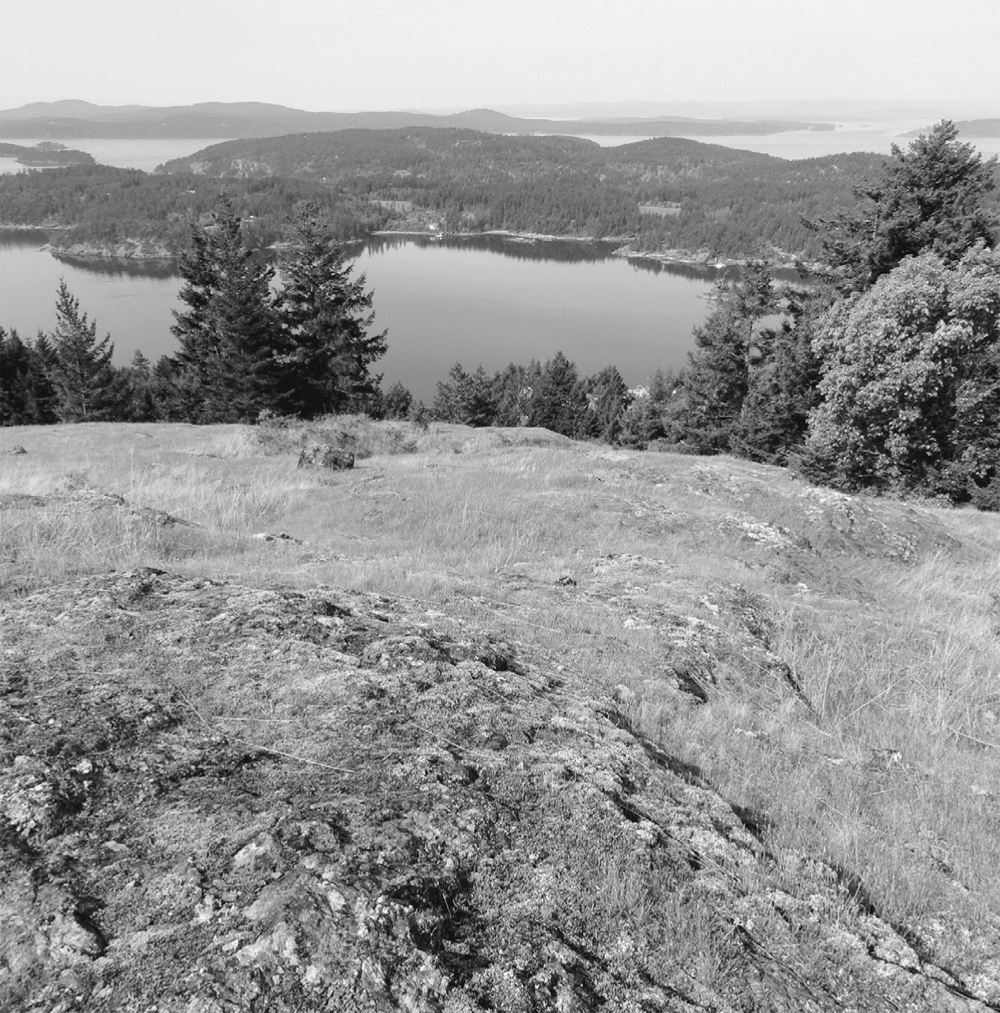
Ship Peak affords territorial views of West Sound.
Continue on single-track trail, dropping about 50 feet (15m) before ascending open mossy ledges adorned with oaks to reach a junction at 1.5 miles (2.4 km). Take the short spur trail right, to the Ship Peak overlook (elev. 931 ft/283 m), and cast your eyes to the horizons. What a view! East Sound, West Sound, and Mount Constitution rising over the rolling pastures of Crow Valley.
Once visually satisfied, retrace your steps to the last junction and hike to the right 0.4 mile (0.6 km), gradually descending (and bearing right at an unmarked junction) to a signed junction (elev. 825 ft/251 m) with the Lost Oak Trail. Here, in mature open forest, head left and continue descending. Pass an old fence line and several wolf trees (large individual trees with spreading crowns, the result of growing in open areas), evidence that this was once pasture. Pass some sunny ledges and locate the lost oak. Then steeply descend into thick dark forest, reaching the South Trail at 2.6 miles (4.2 km) at a familiar junction. Turn right and reach the trailhead in 0.3 mile (0.5 km).
Combine with trails in the northern half of Turtleback Mountain Preserve (Hike 37). From the Lost Oak Trail junction, head right on the Ridge Trail 0.4 mile (0.6 km) to the Center Loop Trail. An old skid road through selectively cut forest, the Center Loop Trail lacks views but makes for good trail running.
| Turtleback Mountain Preserve: Turtlehead Summit |
| RATING/ DIFFICULTY |
ROUNDTRIP | ELEV GAIN/HIGH POINT |
| *****/3 | 5.7 miles (9.2 km) | 1295 feet (395 m)/1025 feet (312 m) |
Maps: USGS Eastsound, land bank map online; Contact: San Juan County Land Bank, Turtleback Mountain Preserve; Notes: Partly open to bicycles (even days) and horses (odd days). Dogs permitted on-leash; GPS: N 48 40.036, W 122 56.811
![]() Stand atop Turtleback Mountain’s head for one shell of a view—one of the best in the San Juans. Thanks to a recent land acquisition, the prominent and well-recognized Turtlehead peak is now connected to its namesake preserve and open to hikers. En route, be sure to stop at the Waldron Overlook for a look at that reclusive island’s impressive cliffs, with golden-faced Saturna Island in the distance.
Stand atop Turtleback Mountain’s head for one shell of a view—one of the best in the San Juans. Thanks to a recent land acquisition, the prominent and well-recognized Turtlehead peak is now connected to its namesake preserve and open to hikers. En route, be sure to stop at the Waldron Overlook for a look at that reclusive island’s impressive cliffs, with golden-faced Saturna Island in the distance.
From Anacortes, take a Washington State ferry to Orcas Island. Head north on Orcas Road (Horseshoe Highway) for 3.5 miles (5.6 km), turning left onto Nordstrom Lane. Continue for 0.6 mile (1 km) to Crow Valley Road and turn right. Drive 1.6 miles (2.6 km) to the trailhead (elev. 260 ft/79 m). Privy available.
Follow an old skid road, now multiuse trail, that almost became a private drive to showy ridgetop homes. Thanks to conservation groups and individuals, this road to 1519-ft (463-m) Turtleback Mountain and the 1719 acres (696 ha) surrounding it have become one of the largest protected parcels in the San Juan Islands (see “Saving the Turtle” sidebar).
Follow what is now officially the North Trail. After 0.5 mile (8 km) of gentle climbing, come to a junction. The short spur right leads 0.15 mile (0.25 km) to the camas-blossoming, madrona-fringed North Valley Overlook (elev. 550 ft/168 m). Consider the detour for a nice view of Orcas’s Mount Constitution, Entrance Mountain, and Mount Woolard.
The North Trail steadily climbs, winding through mature timber and passing a huge Douglas fir. The grade eases as the trail brushes up along a grassy wetland, fragranced with skunk cabbage. At 1.6 miles (2.6 km), come to a junction (elev. 1025 feet/312 m) with a spur to the Waldron Overlook. Follow it right a short distance (0.1 mi/0.15 km roundtrip) to a clifftop promontory with a stunning view of Waldron Island’s impressive Point Disney cliffs across President Channel. Keep children and dogs close-by, as it’s a sheer drop behind the split-rail fence. Containing one of the largest intact Garry oak forests in the San Juans, Point Disney was protected from development by the Nature Conservancy and the San Juan Preservation Trust.
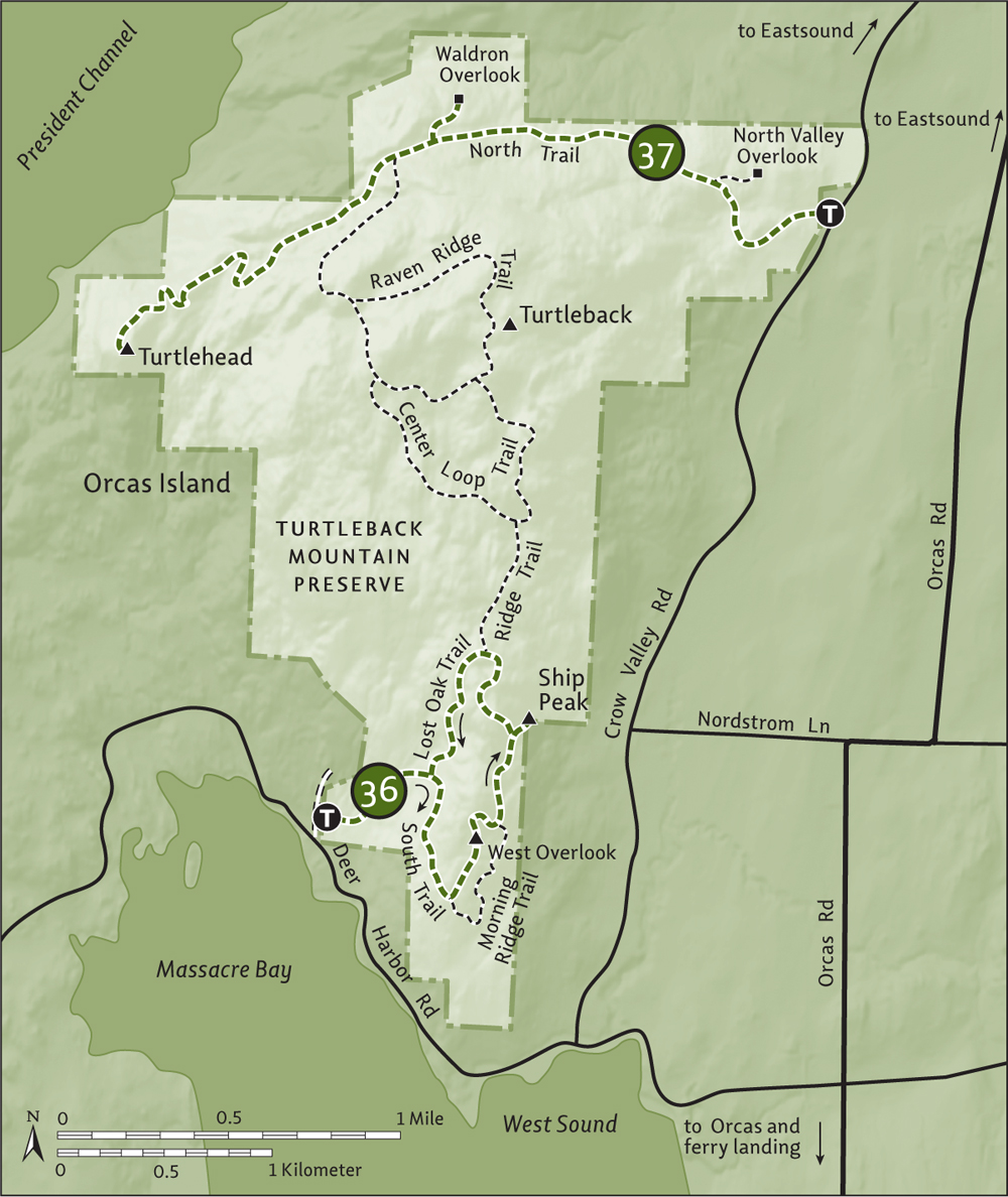
When done viewing, return to the junction and head out on the Turtlehead Trail. Opened in 2013 and built by a consortium of folks, including the Washington Trail Association, Washington Conservation Corps, and Orcas Island Youth Conservation Corp, the trail traverses the recently acquired 111-acre (45-ha) Turtleneck Preserve to the 30-acre (12-ha) Turtlehead (aka Orcas Knob) property.
Follow the well-graded trail through a cedar grove, gently descending to a 750-ft (229-m) gap. Then regain lost elevation, winding around ledges and through attractive forest to emerge on the grassy, rocky 1005-foot (306-m) bald at 2.9 miles (4.7 km). The views from this prominent landmark are simply sublime. Stare out at San Juan, Shaw, Jones, Spieden, and Stuart islands. Salt Spring, Moresby, Sidney and Vancouver islands too! Don’t forget to look back at the Turtleback. Return the way you came, and come back in spring when wildflowers make this a painted turtle.
You can easily spend all day hiking on Turtleback Mountain, though many of its trails are old roads, which may be more appealing for mountain biking or trail running. From the Turtlehead Trail junction, follow the North Trail 0.7 mile (1.1 km) to a wetland and the Raven Ridge Trail (double-track), which leads to a 1.6-mile (2.6-km) loop over Turtleback’s 1519-foot (463-m) summit—no views, but plenty of quiet forest and a small grassy bald. Want more? Continue right at the Raven Ridge junction and hike 0.2 mile (0.3 km) to the Center Loop Trail. Take it 1 mile (1.6 km) to a junction. Continue on the loop left for 0.6 mile (1 km) to the Raven Ridge Trail, or hike 0.4 mile (0.6 km) right on the Ridge Trail to access trails leading to Ship Peak and the southern trailhead (Hike 36).
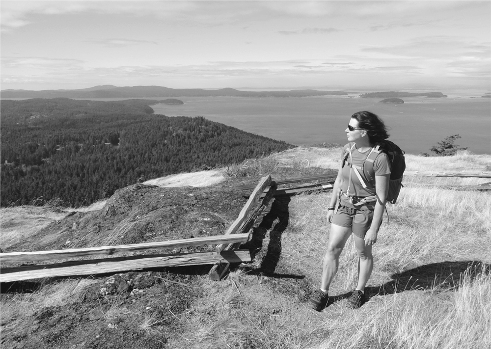
The Turtlehead offers sweeping views of the San Juan Islands.
| Judd Cove Preserve |
| RATING/ DIFFICULTY |
LOOP | ELEV GAIN/HIGH POINT |
| **/1 | 0.6 mile (1 km) | 125 feet (38 m)/125 feet (38 m) |
Maps: USGS Eastsound, land bank map online; Contact: San Juan County Land Bank, Judd Cove Preserve; Notes: Dogs permitted on-leash. Do not disturb marine life. Do not trespass onto adjacent private property; GPS: N 48 41.086, W 122 55.613
![]() Amble down a peaceful country path to a beautifully restored nineteenth-century limekiln overlooking a secluded bay on East Sound. Scout the stony shoreline for shorebirds, waterfowl, and small mammals, while a small cascade provides background water music. Then take a trail traversing the old limestone quarry, now put to rest beneath a quilt of greenery.
Amble down a peaceful country path to a beautifully restored nineteenth-century limekiln overlooking a secluded bay on East Sound. Scout the stony shoreline for shorebirds, waterfowl, and small mammals, while a small cascade provides background water music. Then take a trail traversing the old limestone quarry, now put to rest beneath a quilt of greenery.
From Anacortes, take a Washington State ferry to Orcas Island. Head north on Orcas Road (Horseshoe Highway) for 6.9 miles (11.1 km) to a junction with Crow Valley Road. Bear right and immediately turn right onto graveled Fowlers Way. Drive 400 feet (120 m) to the trailhead (elev. 80 ft/24 m).
A small preserve managed by the San Juan County Land Bank, Judd Cove packs quite of bit of history and scenery within its 14.5 acres (6 ha). Opened to the public in 2009, it remains one of Orcas Island’s best-kept secrets.
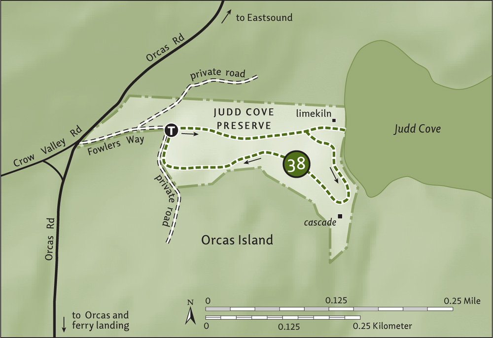
Start on an old road and descend to the cove. Pass by a monstrous maple tree before coming to a trail junction (your return) at 0.15 mile (0.25 km). Continue straight to the Greggs limekiln on the edge of a pasture, above Judd Cove. Built in the 1880s, this kiln was one of many that fueled the San Juan Islands’ economy in the early twentieth century.
Next, stroll down to the cove. Admire the view across East Sound to Mount Constitution. Imagine one hundred years ago the ships coming to port here to haul away barrels of refined lime, a key ingredient in concrete. Except for raucous gulls and a small cascade hidden by big trees, the cove is a quiet place these days.
Return up the bluff on the 0.4-mile (0.6-km) trail, above the cove and rounding some big boulders, stumps, and standing firs and cedars. After skirting an old limestone quarry and private residence, reach Fowlers Way just south of the trailhead and your start.
| Crescent Beach Preserve |
| RATING/ DIFFICULTY |
ROUNDTRIP | ELEV GAIN/HIGH POINT |
| */1 | 1.5 miles (2.4 km) | 40 feet (12 m)/60 feet (18 m) |
Maps: USGS Eastsound, land bank map online; Contact: San Juan County Land Bank, Crescent Beach Preserve; Notes: Open to bicycles. Dogs permitted on-leash; GPS: N 48 41.757, W 122 53.494
![]() Enjoy a quiet woodland walk just upland from Crescent Beach’s oyster-spawning waters and outside of bustling Eastsound, the cultural and commercial hub of Orcas Island. This preserve’s draw is the beach, leaving the trail a lightly used byway favored mainly by locals and resident deer.
Enjoy a quiet woodland walk just upland from Crescent Beach’s oyster-spawning waters and outside of bustling Eastsound, the cultural and commercial hub of Orcas Island. This preserve’s draw is the beach, leaving the trail a lightly used byway favored mainly by locals and resident deer.
From Anacortes, take a Washington State ferry to Orcas Island. Head north on Orcas Road (Horseshoe Highway) for 8.1 miles (13 km), turning right onto Main Street. Proceed through Eastsound on Main Street (which becomes Crescent Beach Drive), driving 0.9 mile (1.4 km) to a parking lot on the left and the trailhead.
Acquired by the San Juan County Land Bank around the turn of the recent century, the beautiful and ecologically important Crescent Beach area is finally open to the public. From a bluff above the beach, follow the Woodland Trail through forest, wetland, and an old orchard.
The way heads north through a big fir grove choked in salal and raspberry bushes. The way then bends west, crossing a small section of an extensive wetland that includes a bulrush marsh. Resuming its course north, the trail skirts old orchard and pasture. The near-level path then passes through a mixed forest of pine, fir, and madrona. Look for aspens too—easy to spot in autumn with their golden foliage. A large stand of them grows in the preserve.
Eventually the trail reaches an old skid road, which leads to a northern trailhead (elev. 60 ft/18 m) on the Mount Baker Road (an alternative starting point). Turn around and enjoy the trip back to the beach.
From the northern trailhead, you can walk east along the Mount Baker Road and then north on Terrill Beach Road, alongside the Stonebridge-Terrill Preserve, to an access point into an old farm. And by all means, walk the more than 2000 feet (600 m) of Crescent Beach, admiring the view of East Sound. Respect private property (leased oyster-farm beds) on the beach’s east end.
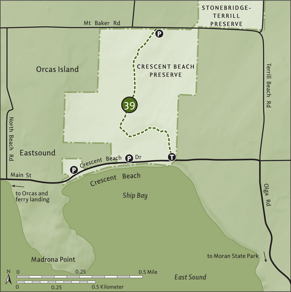
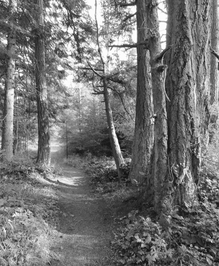
Tranquil woods can be found away from Crescent Beach.
| Cascade Lake |
| RATING/ DIFFICULTY |
LOOP | ELEV GAIN/HIGH POINT |
| ***/2 | 2.9 miles (4.7 km) | 200 feet (61 m)/480 feet (146 m) |
Maps: USGS Mount Constitution, park map online; Contact: Washington State Parks, Moran State Park; Notes: Discover Pass required. Partly open to bicycles. Dogs permitted on-leash; GPS: N 48 39.374, W 122 51.288
![]() With its three campgrounds, shaded picnic area, paddle-boat concession, and inviting beaches, Cascade Lake is a hub of outdoor activity in sprawling Moran State Park. An attractive trail circles this body of water, tying together the busy campgrounds, quiet coves, and pretty lakeside bluffs. An excellent evening hike if you’re camping at the park, this loop is one children will love no matter the time of day.
With its three campgrounds, shaded picnic area, paddle-boat concession, and inviting beaches, Cascade Lake is a hub of outdoor activity in sprawling Moran State Park. An attractive trail circles this body of water, tying together the busy campgrounds, quiet coves, and pretty lakeside bluffs. An excellent evening hike if you’re camping at the park, this loop is one children will love no matter the time of day.
From Anacortes, take a Washington State ferry to Orcas Island. Head north on Orcas Road (Horseshoe Highway) for 8.1 miles (13 km), turning right onto Main Street (alternatively, follow the truck route that bypasses the village). Proceed through Eastsound on Main Street (which becomes Crescent Beach Drive), driving 1.2 miles (1.9 km) to Olga Road. Turn right and drive 3.6 miles (5.8 km), passing through the Moran State Park entrance gate, to the Cascade Lake day-use area and trailhead (elev. 360 ft/110 m). Privy available.
Start near the rustic picnic shelter, a legacy of the 1930s Civilian Conservation Corps. Head counterclockwise, crossing Morgan Creek in a stand of big ol’ cedars. Hugging the lakeshore, the delightful trail passes through marshy areas and over ledges, teetering on the water’s edge. Ignore a right-hand trail that leads to the ranger station at 0.3 mile (0.5 km). At 0.5 mile (0.8 km), a trail leads downhill to the right, to the Rosario Resort, former home of Robert Moran (see “Shipbuilder’s Legacy” sidebar) and now on the National Register of Historic Places.
Continue left across ledges that offer excellent views over the lake and its sloping green surroundings. Be sure to stop at a well-photographed “bonsai” Douglas fir. At 0.9 mile (1.4 km), the Lagoon Trail veers right, circling Rosario Lagoon on a 0.75-mile (1.2-km) brushy and muddy route. Head straight instead, crossing an attractive bridge. Meet back up with the Lagoon Trail and carry on left, on an up-and-down course through tall timber.
At 1.6 miles (2.6 km), come to a junction with the Sunrise Rock Trail (Hike 41), and shortly afterward reach the South End Campground. Walk the road 0.2 mile (0.3 km), picking up trail again near campsite number 1. Hug the lakeshore once more and then start climbing away from it, following a paved path to the camp access road. Cross it and shortly afterward cross Olga Road (use caution), and come to a junction (elev. 480 ft/146 m) at 2.2 miles (3.5 km).
The trail right leads to Cascade Falls (Hike 42). Head left to close the loop, following the waterline and then steeply descending to a service road. Skirting the Midway Campground, climb a small rise. Then meander through big firs and cedars, taking in window views of the lake. Cross Cold Creek and arrive back at your start at 2.9 miles (4.7 km).
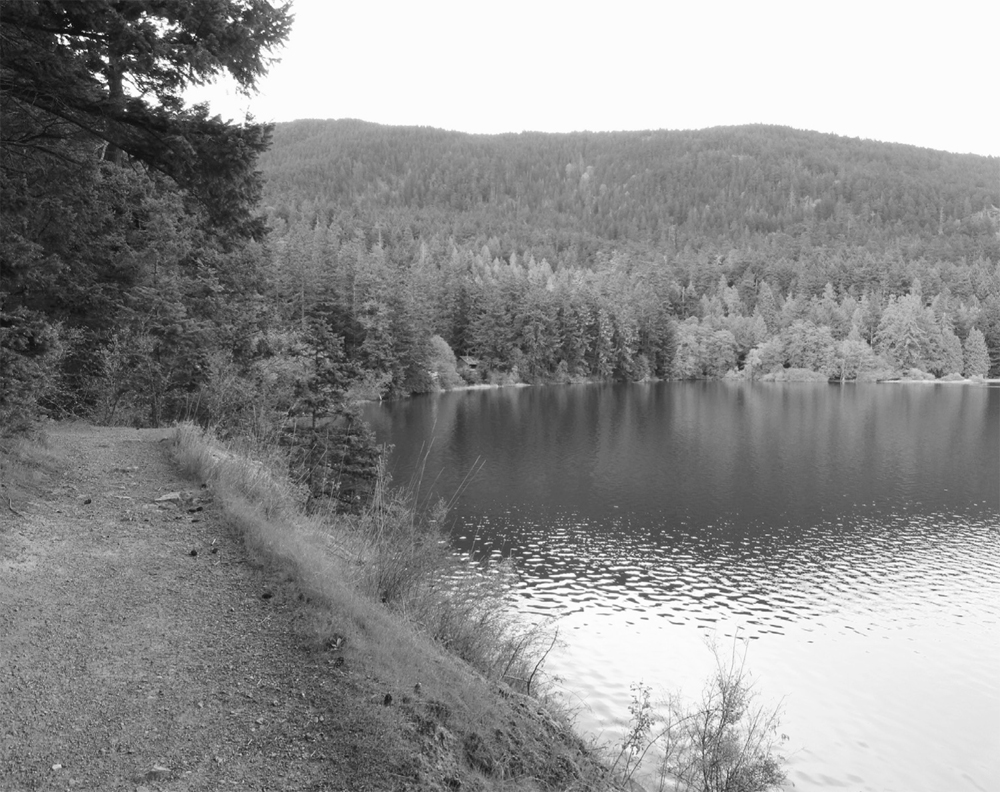
The loop hike around Cascade Lake includes plenty of bluffs for viewing.
In 1875, Robert Moran arrived in Seattle from New York City without a dollar to his name. But the enterprising Moran would go on to become the city’s mayor, a prominent shipbuilder, and quite wealthy to boot. He acquired a significant amount of land on Orcas Island and built his Rosario mansion there, where he would retire. Through encounters and writings with John Muir, Moran became a conservationist, prompting him to donate 2700 acres (1092 ha) of his land to form a new state park.
In 1921, Moran State Park opened and through purchases has since grown to more than 5250 acres (2125 ha,) making it the second-largest tract of public land in the San Juans. The park protects old-growth forest, several lakes, and the San Juan Islands’ highest summit, 2409-foot (734-m) Mount Constitution. Moran State Park contains more than 30 miles (50 km) of trails, several campgrounds, shelters, and other structures, including a stone tower on Mount Constitution—most of these built in the 1930s by the Civilian Conservation Corps. In 1905, Robert Moran was given a grim prognosis and told he had a year to live. He died in 1943 after living an industrious and charitable life. His gift of Moran State Park is an incredible legacy.
Combine with hikes to Rosario Lagoon, Sunrise Rock (Hike 41), and/or Cascade Falls (Hike 42).
| Sunrise Rock |
| RATING/ DIFFICULTY |
ROUNDTRIP | ELEV GAIN/HIGH POINT |
| **/2 | 1.4 miles (2.3 km) | 280 feet (85 m)/660 feet (201 m) |
Maps: USGS Mount Constitution, park map online; Contact: Washington State Parks, Moran State Park; Notes: Discover Pass required. Dogs permitted on-leash; GPS: N 48 38.881, W 122 50.761
![]() Climb through dense forest to a sunny open ledge overlooking Cascade Lake. A nice hike for sunrise, time it so you sit and savor the morning light twinkling on the lake below and kissing the meadows on Little Summit above. Sunsets are also rewarding from this spot, whence you can watch creeping shadows on the placid waters below.
Climb through dense forest to a sunny open ledge overlooking Cascade Lake. A nice hike for sunrise, time it so you sit and savor the morning light twinkling on the lake below and kissing the meadows on Little Summit above. Sunsets are also rewarding from this spot, whence you can watch creeping shadows on the placid waters below.
From Anacortes, take a Washington State ferry to Orcas Island. Head north on Orcas Road (Horseshoe Highway) for 8.1 miles (13 km), turning right onto Main Street (alternatively, follow the truck route that bypasses the village). Proceed through Eastsound on Main Street (which becomes Crescent Beach Drive), driving 1.2 miles (1.9 km) to Olga Road. Turn right and drive 4.2 miles (6.8 km), passing through the Moran State Park entrance gate, and turn right onto the South End Campground access road. Proceed 0.1 mile (0.15 km) to the day-use parking area (elev. 380 ft/116 m). Privy available.
The trail begins from the end of the campground road, but limited trailhead parking necessitates that you start at the day-use lot. Walk the road 0.3 mile (0.5 km) to the trailhead, located near a restroom building. Into old forest you go, in just steps coming to a junction marked by one of Moran’s signature rustic yet eloquent signposts. Right leads around Cascade Lake (Hike 40). Instead, head left uphill and reach another junction at 0.4 mile (0.6 km). The trail left journeys to Cascade Falls (Hike 42). Sunrise Rock is to the right.
Through a forest of towering cedars and firs bearing scars from fires long past, begin a short and steep climb. Switchback beneath big rocky ledges, and then continue climbing via a couple of tight switchbacks. The way becomes rocky and rooty, but not for long. At 0.7 mile (1.1 km), emerge atop the mossy open Sunrise Rock (elev. 660 ft/201 m) and behold Cascade Lake glistening below. Break out the thermos of coffee and let the day begin!
Combine with a walk around Cascade Lake (Hike 40) or a trip to Cascade Falls (Hike 42).
| Cascade Falls |
| RATING/ DIFFICULTY |
LOOP | ELEV GAIN/HIGH POINT |
| **/2 | 3.1 miles (5 km) | 420 feet (128 m)/690 feet (210 m) |
Maps: USGS Mount Constitution, state park map online; Contact: Washington State Parks, Moran State Park; Notes: Discover Pass required. Partly open to bicycles. Dogs permitted on-leash; GPS: N 48 38.881, W 122 50.761
![]() Tumbling 40 feet (12 m) into a small ravine shaded by old-growth giants, Cascade Falls is a pretty sight. The largest falls in the San Juan Islands, it’s also surrounded by some of the archipelago’s largest trees. This hike takes you along Cascade Creek through primeval forest to not only Cascade Falls but two other waterfalls as well.
Tumbling 40 feet (12 m) into a small ravine shaded by old-growth giants, Cascade Falls is a pretty sight. The largest falls in the San Juan Islands, it’s also surrounded by some of the archipelago’s largest trees. This hike takes you along Cascade Creek through primeval forest to not only Cascade Falls but two other waterfalls as well.
From Anacortes, take a Washington State ferry to Orcas Island. Head north on Orcas Road (Horseshoe Highway) for 8.1 miles (13 km), turning right onto Main Street (alternatively, follow the truck route that bypasses the village). Proceed through Eastsound on Main Street (which becomes Crescent Beach Drive), driving 1.2 miles (1.9 km) to Olga Road. Turn right and drive 4.2 miles (6.8 km), passing through the Moran State Park entrance gate, and turn right onto the South End Campground access road. Proceed 0.1 mile (0.15 km) to the day-use parking area (elev. 650 ft/ 198 m). Privy available.
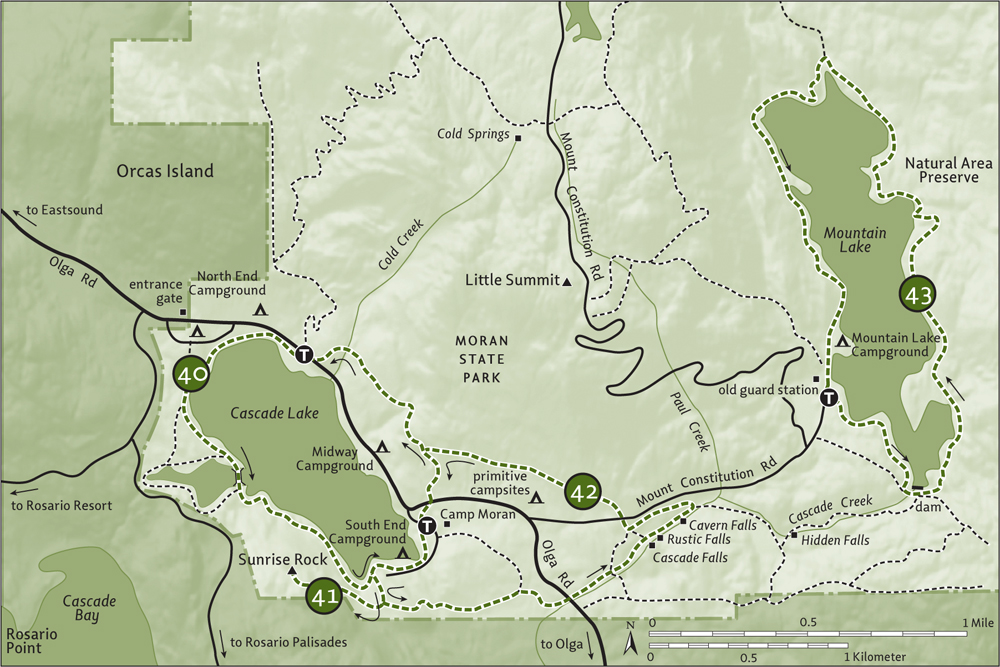
Alternately, for shorter access to the falls, stay on Olga Road another 0.3 mile (0.5 km) and turn left onto Mount Constitution Road. Drive 0.4 mile (0.6 km) to the falls trailhead and day-use parking area (elev. 650 ft/ 198 m). Privy available.
Cascades Falls can easily be reached from the Mount Constitution Road on a 0.2-mile (0.3-km) trail. But if you’re interested in a half-day hike incorporating three cascades and magnificent primeval forest, then you’ll love this longer approach via the South End Campground.
Walk the campground road 0.3 mile (0.5 km) to its end and the trailhead (no parking). Within a few steps, come to a junction. Head left to reach another junction at 0.4 mile (0.6 km). The trail right leads to Sunrise Rock (Hike 41). Head left instead, climbing over a small bald (elev. 500 ft/152 m) before steeply dropping to cross a creek (elev. 390 ft/119 m). Soon afterward cross an old water-diversion ditch and continue on a fairly level course through magnificent ancient forest. Admire gargantuan Douglas firs and monstrous Sitka spruces, some of the largest trees in the San Juans.
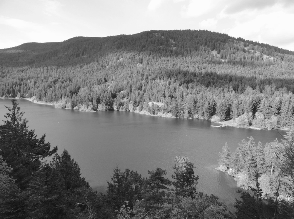
Find an excellent view of Cascade Lake from Sunrise Rock.
At 1 mile (1.6 km), stay right at a junction (left leads to Camp Moran), soon coming to Olga Road near the west arch (elev. 460 ft/140 m). Cross the road and follow a wide trail through big timber alongside Cascade Creek. At 1.3 miles (2.1 km), reach a major junction (elev. 545 ft/166 m). The wide trail veering left continues 0.2 mile (0.3 km) to the Mount Constitution Road trailhead. The single-track trail straight ahead is your route—but only after you take in good views of fanning Cascade Falls plummeting into a small ravine cloaked in old growth. To do that follow the trail right (which connects to the Southeast Boundary Trail), dropping 40 feet (12 m) in 100 yards (90 m) to a small bridge over Cascade Creek. Look for river otters and dippers while you’re there.
Backtrack to the creekside trail and resume hiking, passing the lip of the falls and coming to another junction at 1.5 miles (2.4 km) at small but pretty Rustic Falls. The trail left leads to the Mount Constitution Road. Keep hiking straight along the creek, coming to Cavern Falls gushing through a tight chasm. Shortly afterward, at 1.8 miles (2.9 km), reach a junction (elev. 690 feet/210 m).
Unless you want to first make a 0.3-mile (0.5-km) side trip to Hidden Falls, to the right at a bridged creek crossing, head left here to reach the Mount Constitution Road trailhead (elev. 650 ft/198 m) at 2.1 miles (3.4 km). Cross the road and follow a quiet rose-lined trail through big open timber, skirting a primitive campground and reaching a junction (elev. 460 ft/140 m) at 2.8 miles (4.5 km). Turn left to cross Olga Road and close the loop at 3.1 miles (5 km).
Combine with the Cascade Lake loop (Hike 40) for a 5-mile (8-km) roundtrip.
| Mountain Lake |
| RATING/ DIFFICULTY |
LOOP | ELEV GAIN/HIGH POINT |
| ***/2 | 3.9 miles (6.3 km) | 165 feet (50 m)/1035 feet (315 m) |
Maps: USGS Mount Constitution, state park map online; Contact: Washington State Parks, Moran State Park; Notes: Discover Pass required. Partly open to bicycles Sept 15–May 15. Dogs permitted on-leash; GPS: N 48 39.275, W 122 49.133
![]() Enjoy an easy, near-level journey around one of the largest lakes in the San Juans. Free from outboard motors, the waters are peaceful, except perhaps for the cackling geese and shrilling eagles. Along the way, admire old-growth giants and impressive views of Mount Constitution’s sheer and stony eastern face.
Enjoy an easy, near-level journey around one of the largest lakes in the San Juans. Free from outboard motors, the waters are peaceful, except perhaps for the cackling geese and shrilling eagles. Along the way, admire old-growth giants and impressive views of Mount Constitution’s sheer and stony eastern face.
From Anacortes, take a Washington State ferry to Orcas Island. Head north on Orcas Road (Horseshoe Highway) for 8.1 miles (13 km), turning right onto Main Street (alternatively, follow the truck route that bypasses the village). Proceed through Eastsound on Main Street (which becomes Crescent Beach Drive), driving 1.2 miles (1.9 km) to Olga Road. Turn right and drive 4.5 miles (7.2 km), passing through the Moran State Park entrance gate, and turn left onto Mount Constitution Road. Continue 1 mile (1.6 km) and turn right. Drive 0.3 mile (0.5 km) to the trailhead (elev. 925 ft/282 m) near the old guard station. Privy available.
Hike this loop counterclockwise to face views of Mount Constitution and bask in its bulky and cliffy presence. Start by heading southeast along a wooded bluff above the large lake. Pass the bicycle-access trail and shortly afterward cross the lake’s outlet (elev. 900 ft/274 m) below a dam, reaching a junction at 0.5 mile (0.8 km). Right heads 1.3 miles (2.1 km) to Cascade Falls (Hike 42). Head left and then left again at another junction, lest you venture up Mount Pickett (Hike 44)
Catch your first glimpses of Mount Constitution across a quiet cove. The mountain’s well-worn rocky façade above the deeply forested lake looks like a scene out of the Appalachian Mountains. After bypassing a small peninsula, the trail hugs the lake’s eastern shoreline on a rolling course through groves of big trees. Look for eagles in those towering giants, particularly in the shoreline snags. Enjoy good views of Constitution too, with its signature stone tower now in view.
Pass monster Douglas firs and gradually ascend, cresting a 1035-foot (315-m) bluff at about 1.7 miles (2.7 km). Then pass through a “fir arch” and descend via switchbacks into a cool ravine, crossing a creek (elev. 935 ft/285 m) and rounding a point graced with pines. Cross a couple more creeks and reach a junction (elev. 965 ft/294 m) at 2.5 miles (4 km).
Right heads to the Twin Lakes (Hike 44). Your way is left, back to the trailhead at the Mountain Lake landing. Drop back to lake level, passing through alder flats and groves of big firs. A small island comes into view before the trail cuts across a big-timbered peninsula. Skirt the placid shoreline once again, keeping eyes open and ears tuned for woodpeckers, eagles, ducks, and osprey.
Pass a memorial for Bonnie Sliger, a popular Youth Conservation Corps supervisor, before reaching the boat launch at 3.7 miles (6 km). Turn right and walk the dirt road 0.2 mile (0.3 km) back to your vehicle.
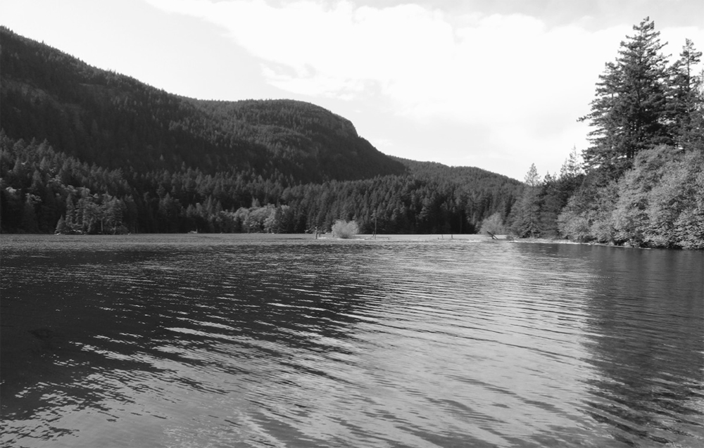
Mount Constitution provides an impressive backdrop to Mountain Lake.
Combine with a trip up Mount Constitution (Hike 45) or to Mount Pickett and the Twin Lakes (Hike 44).
| Twin Lakes and Mount Pickett |
| RATING/ DIFFICULTY |
LOOP | ELEV GAIN/HIGH POINT |
| ***/3 | 7.6 miles (12.2 km) | 915 feet (279 m)/1749 feet (533 m) |
Maps: USGS Mount Constitution, state park map online; Contact: Washington State Parks, Moran State Park; Notes: Discover Pass required. Open to bicycles Sept 15–May 15. Dogs permitted on-leash; GPS: N 48 39.302, W 122 49.130
![]() Hike to a pair of small lakes tucked beneath the cliffs of Mount Constitution on a ridge high above the sea. Then charge up Mount Pickett through one of the largest tracts of ancient forest in the Puget Trough—there are no views, but you'll find solitude, a nice alternative to busy Mount Constitution.
Hike to a pair of small lakes tucked beneath the cliffs of Mount Constitution on a ridge high above the sea. Then charge up Mount Pickett through one of the largest tracts of ancient forest in the Puget Trough—there are no views, but you'll find solitude, a nice alternative to busy Mount Constitution.
See directions to Hike 43.
Start by hiking north 0.3 mile (0.5 km) on the gravel road leading to a handful of campsites on a small peninsula jutting into Mountain Lake. Pick up trail near the boat launch and hug the 200-acre (80-ha) lake’s western shoreline on a near-level journey. Eventually round a 40-foot (12 m) rise at the lake’s north end, where at 1.4 miles (2.3 km), beside a creek, you’ll find a junction (elev. 925 feet/282 m).
Continue left on the Twin Lakes Trail, up a lush draw that harbors impressive cedars and hemlocks. Upon crossing a creek, notice some Sitka spruce, trees better adapted to the foggy and mist-shrouded Pacific coastline. At 2.3 miles (3.7 km), reach a junction (elev. 1100 ft/335 m). Left goes to Mount Constitution and the North Trail (Hikes 45 and 46). Right leads to Mount Pickett. But you want to head straight to circle the Twin Lakes first.
Follow this less-trodden path 0.5 mile (0.8 km) around the larger lake, passing big cedars and small feeder creeks and entering the YMCA’s Camp Orkila. Don’t be surprised if there are some happy campers by the lakeshore. The trail gets rougher, climbing about 50 feet (15 m) up and over steep ledges (be careful), with excellent views across the lake to Mount Constitution.
Reenter the park, coming to a junction at a creek connecting the two lakes at 2.8 miles (4.5 km). Right heads back to the main trail. If you’ve had enough, the trip to this point is satisfying on its own. Or to continue, head left to circle the smaller lake. Cross its outlet stream and peer through trees out to the Salish Sea. Wander through pines and spruce and reach the Mount Pickett Trail at 3.1 miles (5 km). Now turn left, gradually ascending a ridge carpeted in moss. At 3.6 miles (5.8 km), the trail becomes an old fire road.
Wander through groves of stately firs and by wetland pools humming with insect, bird, and amphibian activity. At 4.7 miles (7.6 km), crest Mount Pickett’s 1749-foot (533-m) summit. The peak is named for General George Pickett, who garrisoned troops at American Camp on San Juan Island during the Pig War. He is best known for his futile charge for the Confederacy in the Battle of Gettysburg during the American Civil War.

Mount Constitution and its tower can be seen from the Twin Lakes’ shoreline.
Shortly afterward, reach a junction with the Southeast Boundary Trail (Hike 47). Bear right, staying on the old fire road that snakes along the ridge. At 5.5 miles (8.9 km), stay straight at a junction (left drops steeply to the Southeast Boundary Trail), passing a big wetland pool. Gradually descend through impressive ancient forest, bearing right at another junction at 6.4 miles (10.3 km).
In an impressive old-growth Douglas fir grove, bear right at yet another Southeast Boundary Trail connector. Soon afterward come to another junction (elev. 1000 ft/305 m) at 6.8 miles (10.9 km). The Mount Pickett Trail continues straight for 1 mile (1.6 km) to the Cascade Falls trailhead. You want to head right on another old fire road, dropping to the Mountain Lake loop at 7 miles (11.3 km). Bear left and then right, crossing the outlet stream and returning to the trailhead at the Mountain Lake landing at 7.6 miles (12.2 km).
Combine with the Southeast Boundary Trail (Hike 47) for a quiet all-day journey. Or make it a lake day, combining a trip to Twin Lakes with a hike around Mountain Lake (Hike 43).
| Mount Constitution |
| RATING/ DIFFICULTY |
LOOP | ELEV GAIN/HIGH POINT |
| *****/4 | 7.1 miles (11.4 km) | 1640 feet (500 m)/2409 feet (734 m) |
Maps: USGS Mount Constitution, state park map online; Contact: Washington State Parks, Moran State Park; Notes: Discover Pass required. Open to bicycles Sept 15–May 15. dogs permitted on-leash; GPS: N 48 39.309, W 122 49.150
![]() Why drive to the highest summit in the San Juan Islands when you can hike to it instead? Trek through windblown pines along precipitous ledges to Mount Constitution’s open summit. Then climb its stone tower, savoring stunning views of emerald islands sparkling in the Salish Sea, all against a backdrop of snowcapped peaks from Garibaldi to Rainier. You’ll hike past three lakes too, on this invigorating loop.
Why drive to the highest summit in the San Juan Islands when you can hike to it instead? Trek through windblown pines along precipitous ledges to Mount Constitution’s open summit. Then climb its stone tower, savoring stunning views of emerald islands sparkling in the Salish Sea, all against a backdrop of snowcapped peaks from Garibaldi to Rainier. You’ll hike past three lakes too, on this invigorating loop.
See directions to Hike 43.
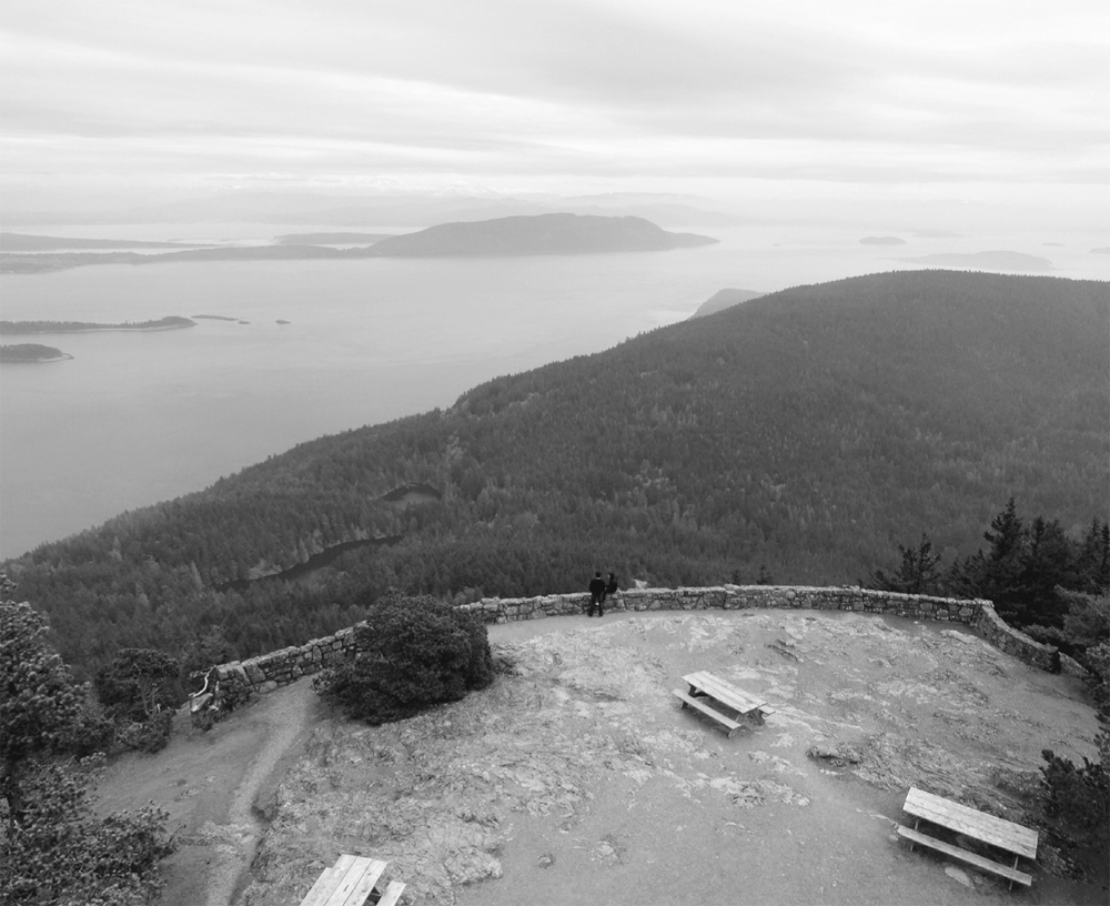
Sweeping views of the Salish Sea from the “rooftop of the San Juans”
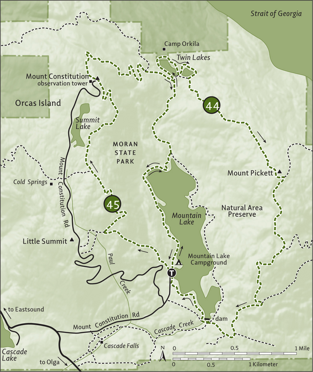
Locate the Little Summit Trail near a Civilian Conservation Corps (CCC) shelter by the group camp entrance. Then prepare to break a sweat, climbing steeply and with a purpose. Briefly skirt the Mount Constitution Road and continue relentlessly upward. After crossing a creek, pass by big old trees brandishing fire scars and younger trees replacing the old ones that went up in flames. At 1.3 miles (2.1 km), reach a junction (elev. 1925 ft/587 m).
The trail to the left follows an old road 0.3 mile (0.5 km) to Little Summit (elev. 2035 ft/620 m) with its sweeping views to Cypress, Fidalgo, Blakely, and Lopez islands and Orcas’s Entrance Mountain.
The way to Constitution continues north along a lofty ridge. Soon reach the first of many east-facing view-granting ledges. Then traverse a forest of windblown, stunted lodgepole pine, cresting a 2250-foot (686-m) knoll before coming to a junction at 2.1 miles (3.4 km).
The trail left heads 0.3 mile (0.5 km) through big trees to the Cold Springs trailhead (Hike 46). Continue straight instead, soon crossing a creek (elev. 2150 ft/655 m) below an old rock dam that impounds Summit Lake. Then travel along the edge of the ridge, undulating between pine groves and sheer clifftops (use caution) before reaching Mount Constitution’s 2409-foot (734-m) broad summit at 3.2 miles (5.2 km).
Join the throngs who drove to the summit and head up Constitution’s unique stone tower. Constructed in 1936 from locally quarried sandstone by CCC crews, it’s a facsimile of a twelfth-century Caucasus Mountains military fortification. From this rooftop of the San Juans, enjoy an unobstructed view of islands, mountains, sounds, and straits. Look out over Mountain Lake and Mount Pickett. Pick out the prominent Mount Baker and British Columbia’s Golden Ears—and Patos, Sucia, Matia, Clark, Barnes, Lummi, Vendovi, and Cypress islands. Be sure to read the historical displays in the tower.
Walk 0.1 mile (0.15 km) to the summit parking lot and pick up the Twin Lakes Trail. Prep your knees for a steep 1300-foot (396-m) descent. Via short switchbacks, weave downward in deep timber beneath a series of ledges. Pass an abandoned trail that veers right. Soon afterward reach a junction with the North Trail at 4.5 miles (7.2 km). Continue straight in old growth, reaching a junction at the Twin Lakes (elev. 1100 ft/335 m) at 4.8 miles (7.7 km).
Complete your loop (or visit the Twin Lakes first, Hike 44) by hiking right 0.9 mile (1.4 km) to the Mountain Lake Trail. Then turn right and hike another 1.4 miles (2.3 km) back to the trailhead.
| Cold Springs and North Trail Loop |
| RATING/ DIFFICULTY |
LOOP | ELEV GAIN/HIGH POINT |
| *****/5 | 11.4 miles (18.3 km) | 2940 feet (896 m)/2409 feet (734 m) |
Maps: USGS Mount Constitution, state park map online; Contact: Washington State Parks, Moran State Park; Notes: Discover Pass required. Open to bicycles Sept 15–May 15. Dogs permitted on-leash; GPS: N 48 39.367, W 122 51.311

Ancient forest along the North Trail
![]() Looking for a challenging hike to Mount Constitution? Do you delight in going where few hikers have gone before? Want some big trees with your views? Then you'll love this loop that ascends the San Juan Islands’ highest summit and travels through some of the park’s loneliest reaches.
Looking for a challenging hike to Mount Constitution? Do you delight in going where few hikers have gone before? Want some big trees with your views? Then you'll love this loop that ascends the San Juan Islands’ highest summit and travels through some of the park’s loneliest reaches.
See directions to Hike 40.
This is a lollipop loop and a strenuous one. The hike can be shortened and made considerably easier by just doing the loop part from the Cold Springs trailhead on Mount Constitution Road, 3.7 miles (6 km) from the Olga Road turnoff.
For the full experience from Cascade Lake, follow the Cold Springs Trail up a deep ravine. Pass a trail leading left to North End Campground. Pass a monstrous cedar too. Cross the creek and begin climbing in earnest. At 0.6 mile (1 km), bear right. The trail left, the West Boundary Trail, is 2.5 miles (4 km) of lightly used, difficult, steep tread leading to the North Trail. Consider it as a possible return variation.
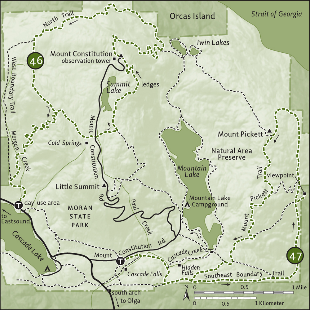
Upward, bound through old growth and cross Morgan Creek once more. Start switch-backing, crossing many creek tributaries before traversing an open grassy, ledgy area. Look for an old mine in the hillside. Stop too for teaser views through the trees out to the sea. At 2.6 miles (4.2 km), the relentless climbing stops as you reach a junction (elev. 2090 feet/637 m) with the North Trail on Hidden Ridge.
You’ll be returning from the left, so head right on a fairly level path through old-growth forest and by large grassy wetlands. At 3.2 miles (5.1 km), just after passing the old gazebo at Cold Springs and a picnic shelter, reach the Mount Constitution Road trailhead (elev. 2090 feet/637 m). This is the alternative start if you’re interested in just doing the loop.
Cross the road and a creek and come to a junction (elev. 2250 ft/686 m) at 3.5 miles (5.6 km.) Turn left, dropping 100 feet (30 m) before gradually ascending Mount Constitution’s broad pine-covered and ledge-dotted south ridge. Views are sweeping and the hike is exhilarating. At 4.6 miles (7.4 km), crest Mount Constitution’s 2409-foot (734-m) summit. Take time to scale its tower to savor far-reaching views, from British Columbia’s Coast Range to the Olympic Mountains and scores of emerald islands in between.
Then walk 0.1 mile (0.15 km) to the summit parking lot and pick up the Twin Lakes Trail. Steeply descend, reaching a junction (elev. 1300 ft/396 m) with the North Trail at 5.9 miles (9.5 km). Now prepare for a lonesome journey through Moran’s hinterlands, home to some of the most impressive trees on the islands.
Wind upward through groves of magnificent old growth, crossing trickling creeks and listening to serenading birdsong. Under a thick canopy high above the Salish Sea, gradually angle around Mount Constitution’s northern slopes. Notice the nice stonework in places along the tread. Cross a service road that accesses communication towers on the mountain. Shortly afterward, come to a junction (elev. 2000/610 m) at 8 miles (12.9 km) with the West Boundary Trail (follow it for a shorter, albeit less interesting and more difficult, return).
Continue straight, skirting a small pond before commencing a short steep climb. Pass a boundary marker and return to a familiar junction with the Cold Springs Trail (elev. 2090 ft/637 m) at 8.8 miles (14.2 km). Turn right for a familiar 2.6-mile (4.2-km) trip to the trailhead—except this time it’s all downhill!
Combine with the Mount Pickett Trail (Hikes 44 and 47) for a grand loop of Moran’s high country.
| Southeast Boundary Trail |
| RATING/ DIFFICULTY |
LOOP | ELEV GAIN/HIGH POINT |
| ***/4 | 8.7 miles (14 km) | 1665 feet (507 m)/1730 feet (527 m) |
Maps: USGS Mount Constitution, state park map online; Contact: Washington State Parks, Moran State Park; Notes: Discover Pass required. Partly open to horses. Open to bicycles Sept 15–May 15. Dogs permitted on-leash; GPS: N 48 38.904, W 122 49.960
![]() Seekers of solitude will enjoy this challenging trail along the southeast periphery of Moran State Park. Although mountain bikers and equestrians play here at times, it’s often just you and the deer. Most of the way is through luxurious old-growth forest, but there is a secret viewpoint—and it’s a good one.
Seekers of solitude will enjoy this challenging trail along the southeast periphery of Moran State Park. Although mountain bikers and equestrians play here at times, it’s often just you and the deer. Most of the way is through luxurious old-growth forest, but there is a secret viewpoint—and it’s a good one.
From Anacortes, take a Washington State ferry to Orcas Island. Head north on Orcas Road (Horseshoe Highway) for 8.1 miles (13 km), turning right onto Main Street (alternatively, follow the truck route that bypasses the village). Proceed through Eastsound on Main Street (which becomes Crescent Beach Drive), driving 1.2 miles (1.9 km) to Olga Road. Turn right and drive 4.5 miles (7.2 km), passing through the Moran State Park entrance gate, and turn left onto Mount Constitution Road. Drive 0.4 mile (0.6 km) to the Cascade Falls trailhead (elev. 650 ft/198 m).
The Southeast Boundary Trail actually begins on Olga Road by the park’s south arch. However, a lack of parking there warrants beginning from either the Cascade Falls or Mountain Lake trailhead. You’ll bypass the lower 0.9 mile (1.4 km) of the boundary trail, but you can easily tack that on if you like.
From the Cascade Falls trailhead, start with a warm-up on a gently graded old fire road. At 0.3 mile (0.5 km), pass the Cascade Falls Trail. At 0.5 mile (0.8 km), continue right at a junction. The trail left crosses Cascade Creek above Hidden Falls (check it out), heading 0.7 mile (1.1 km) to Mountain Lake. Your route takes you through a large field that doubles as a picnic-table and fire-grate graveyard.
At 0.8 mile (1.3 km), your route merges with the Southeast Boundary Trail (elev. 770 ft/235 m) coming from Olga Road. Stay left on the fire road another 0.4 mile (0.6 km); it straddles the park boundary and passes wetlands and Sitka spruce. Just after crossing a water pipeline, the trails diverge. You’ll be returning from straight ahead, so bear right and follow the lightly traveled Southeast Boundary Trail through dark forest and by wetlands. After crossing a bridge (elev. 985 ft/300 m), steadily and steeply descend through a forest of fire-scarred firs. At 2.2 miles (3.5 km), reach a junction in an alder flat (elev. 720 ft/219 m). The trail left climbs 250 feet (76 m) in 0.5 mile (0.8 km) through old growth to connect with the Mount Pickett Trail. It makes for a shorter loop option.
The Southeast Boundary Trail continues straight, passing a side trail leading to private property before dropping steeply. The way then turns north, straddling the park boundary, brushing by a yurt (respect private property), and coming to a trail (elev. 400 ft/122 m) that leads to Winter Falls Lane (private) at 2.8 miles (4.5 km).
Now steeply climb, reaching an unsigned junction (elev. 920 ft/280 m) at 3.5 miles (5.6 km). The trail left travels 0.7 mile (1.1 km) and climbs 200 feet (61 m), passing some viewpoints on its way to the Mount Pickett Trail—another shorter loop option. Continue straight, crossing a creek and coming to another unsigned junction in 0.1 mile (0.15 km). Take this absolute-must side trip for 300 feet (90 m), leaving forest and the park for a grassy open hillside in the San Juan Preservation Trust’s Hogback Preserve. Stay awhile—the view is stunning out to Cypress, Lummi, Sinclair, and Vendovi islands—Mount Baker, too.
Back on the Southeast Boundary Trail, continue climbing and reach yet another trail junction (elev. 1100 ft/335 m) and another loop option at 3.9 miles (6.3 km). The trail left steeply climbs 500 feet (152 m), meeting the Mount Pickett Trail in 0.5 mile (0.8 km). The Southeast Boundary Trail, now hiker-only, continues straight and climbs steeply too. Following mossy tread, be sure to veer left (west) at 4.7 miles (7.6 km) (ignoring a track straight). Reach the Mount Pickett Trail (elev. 1730 ft/527 m) just below Pickett’s thickly forested summit at 5.2 miles (8.4 km).
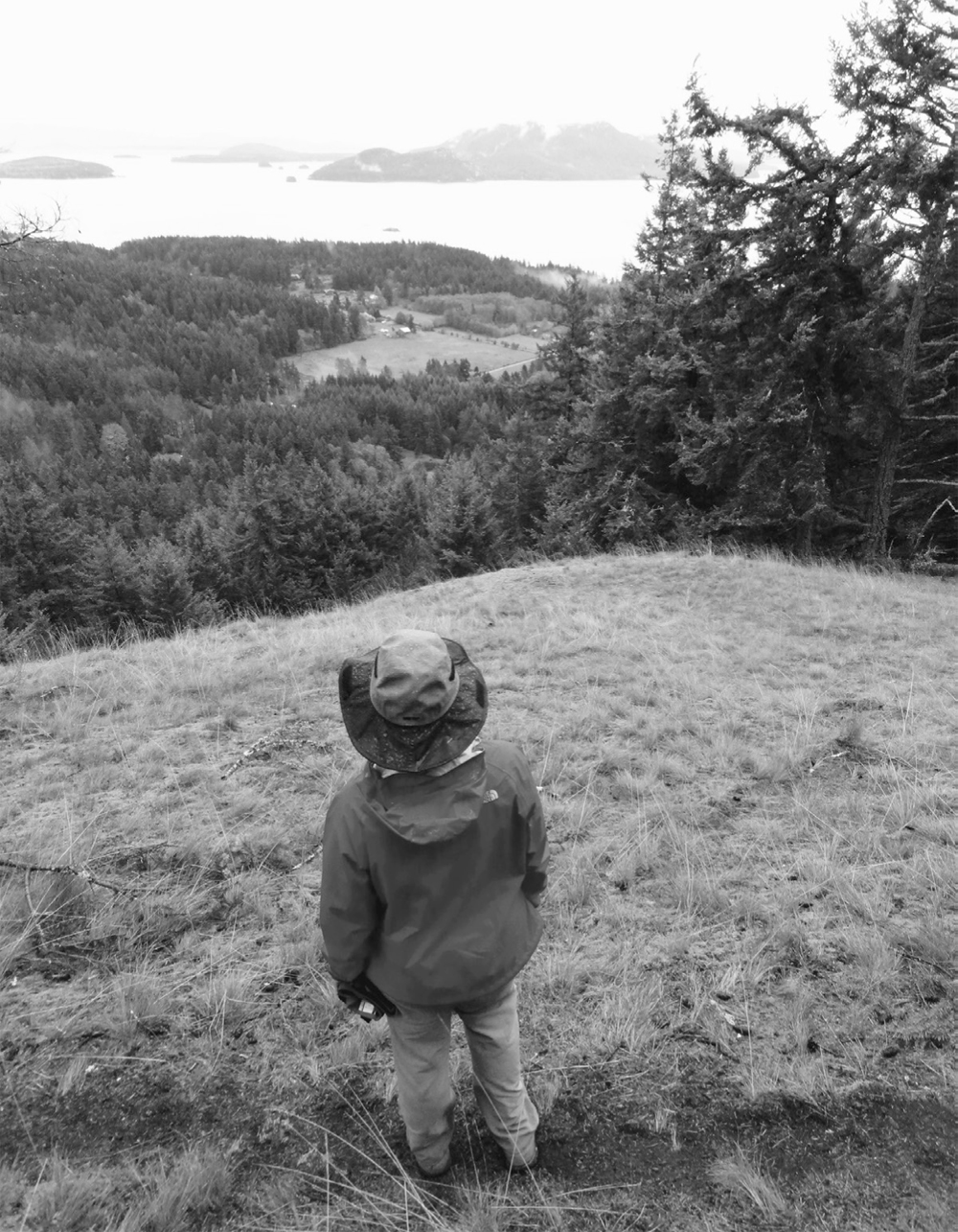
Open hillside in the San Juan Preservation Trust’s Hogback Preserve
Now return via the Mount Pickett Trail, an easy grade along an old fire road. Near a big wetland pool, reach a junction (elev. 1625 ft/495 m) at 5.9 miles (9.5 km) with a connector trail to the Southeast Boundary Trail. Continue straight, gradually descending through impressive ancient forest and bearing right at another junction (elev. 1100 ft/335 m) at 6.8 miles (10.9 km). Reach yet another Southeast Boundary Trail connector junction (elev. 1000 ft/305 m) at 7.1 miles (11.4 km). In another 0.1 mile (0.15 km), reach a junction with a trail dropping 0.2 mile (0.3 km) to Mountain Lake. Follow it and the Cascade Creek Trail for a shorter route back to the trailhead.
Otherwise, stay straight and once again reach the Southeast Boundary Trail at 7.5 miles (12.1 km). Now retrace your steps on the Mount Pickett Trail 1.2 miles (1.9 km) to the trailhead.
If you’re compelled to hike the entire Southeast Boundary Trail, start by following the Cascade Falls Trail 0.5 mile (0.8k) to Olga Road (elev. 400 ft/122 m). Then cross Cascade Creek, walk through the park’s south arch, and pick up the trail there and head north.
| Obstruction Pass State Park |
| RATING/ DIFFICULTY |
LOOP | ELEV GAIN/HIGH POINT |
| ***/2 | 1.9 miles (3.1 km) | 305 feet (93 m)/225 feet (69 m) |
Maps: USGS Blakely Island, state park map online; Contact: Washington State Parks, Moran State Park; Notes: Discover Pass required. Dogs permitted on-leash; GPS: N 48 36.509, W 122 49.584
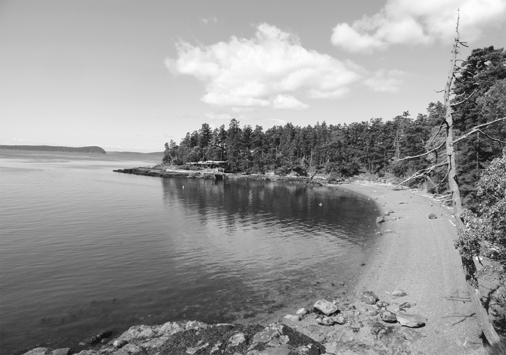
Find a gorgeous beach at trail’s end.
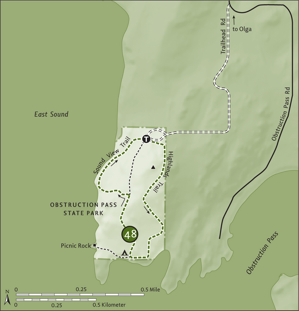
![]() Wander through an open forest of firs, cedars, and madronas to a secluded sandy beach on Obstruction Pass at the mouth of East Sound. Then while away the time skipping stones, identifying birds, napping on polished driftwood logs, or just staring out at emerald islands and passing ferries. Consider spending the night at this peaceful park.
Wander through an open forest of firs, cedars, and madronas to a secluded sandy beach on Obstruction Pass at the mouth of East Sound. Then while away the time skipping stones, identifying birds, napping on polished driftwood logs, or just staring out at emerald islands and passing ferries. Consider spending the night at this peaceful park.
From Anacortes, take a Washington State ferry to Orcas Island. Head north on Orcas Road (Horseshoe Highway) for 8.1 miles (13 km), turning right onto Main Street (alternatively, follow the truck route that bypasses the village). Proceed through Eastsound on Main Street (which becomes Crescent Beach Drive), driving 1.2 miles (1.9 km) to Olga Road. Turn right and drive 6.6 miles (10.6 km) to Olga, turning left onto Point Lawrence Road. After 0.5 mile (0.8 km), bear right onto Obstruction Pass Road and follow it for 0.9 mile (1.4 km). Turn right onto gravel Trailhead Road and continue 0.9 mile (1.4 km) to the trailhead (elev.125 ft/38 m). Privy and bike rack available.
Although it's only 80 acres (32 ha), Obstruction Pass State Park packs a lot in—three trails, nine backcountry campsites, and a mile of beautiful shoreline. You can make a beeline for the beach by taking the 0.6-mile (1-km) main trail. For more of a hike take this loop, complete with interpretive signs.
Pass through a stile and immediately come to a junction. The main trail to the beach heads straight, and you’ll be returning on the Sound View Trail from the right. So head left now on the fairly new Highlands Trail through open forest, ignoring several side trails that lead to private property. Crest a 225-foot (69-m) knoll before traversing a small bald and then descending to a madrona- and pine-lined bluff above the beach. Look for white-blotched black-tailed deer along the way. There are a handful of these oddities in the area.
At 1.1 miles (1.8 km), come to a junction with the main trail at the backcountry camping area (privy, no water). By all means take the stairway down to the gorgeous sandy beach. And consider following an unmarked trail 0.15 mile (0.25 km) west to Picnic Rock, which serves delectable views of East Sound and Entrance Mountain.
Once you’re ready to return, follow the main trail 0.3 mile (0.5 km) through open forest and along bluffs to a junction (elev. 80 ft/24 m). Then head left on the Sound View Trail, descending to a picnic area along the water with excellent views of Buck Bay. After passing a huge cedar, start climbing and return to the trailhead at 1.9 miles (3.1 km). Head-high stinging nettles will keep you from wandering off the trail.
San Juan Island National Historical Park commemorates the Pig War, a boundary dispute between the United States and Great Britain in which the only casualty was a Hudson’s Bay Company hog. American and British forces had both taken up occupancy on San Juan Island from 1859 until 1872, nearly going to war until the international border was established through arbitration, on Haro Strait, granting American sovereignty over the San Juan Islands.
The 2072-acre (839-ha) park is divided into two sections, American Camp and English Camp. Along with its historical significance, the park protects some important habitat, including one of the few surviving native grasslands along the Strait of Juan de Fuca. In springtime these grasslands burst with lupine, chocolate lily, blue-eyed Mary, and more. Look for the rare island marble butterfly, endemic to a few of the San Juan and Gulf islands and once thought extinct. And of course enjoy miles of some of the best hiking within the San Juans.
San Juan Island is the most populated of the San Juan archipelago, with about seven thousand people. It’s also the second-largest island in area, at 55 square miles (143 sq. km), with the islands’ only incorporated town, Friday Harbor, the county seat. Friday Harbor is a bustling place (especially in summer), with many eating and lodging establishments. This town of 2200 has a hospital and a Washington State Ferries terminal, with year-round service to Anacortes and the San Juan islands and seasonal service to Sidney, British Columbia.
The island contains large tracts of national park land (San Juan Island National Historical Park), a state park, and several county parks and land bank properties, as well as a large private preserve open to hiking. Bicyclists will find good roads to these areas and agreeable terrain (much less hilly than Orcas Island, for example). Camping is limited to San Juan County Park’s (www.co.san-juan.wa.us/parks/sanjuan.aspx) 20 sites, Lakedale Resort (www.lakedale.com), Sweet Earth Farm (sweetearthfarm.com), and the county fairgrounds (sjcfair.org)
| American Camp and South Beach |
| RATING/ DIFFICULTY |
LOOP | ELEV GAIN/HIGH POINT |
| *****/2 | 2.8 miles (4.5 km) | 180 feet (55 m)/180 feet (55 m) |
Maps: USGS False Bay, park map at visitors center; Contact: San Juan Island National Historical Park; Notes: Dogs permitted on-leash; GPS: N 48 27.874, W 123 01.427
![]() Who says war is hell? Hell, if the Pig War had never happened (see “Hogging History” sidebar), we would not have the longest stretch of public beach in the San Juan Islands. Once the site of an American military encampment, American Camp offers plenty of natural splendors with its historical relics. Wander through the old compound after hiking across native prairie and golden bluffs. And stop frequently to marvel at the snowcapped Olympic Mountains across the glistening Strait of Juan de Fuca.
Who says war is hell? Hell, if the Pig War had never happened (see “Hogging History” sidebar), we would not have the longest stretch of public beach in the San Juan Islands. Once the site of an American military encampment, American Camp offers plenty of natural splendors with its historical relics. Wander through the old compound after hiking across native prairie and golden bluffs. And stop frequently to marvel at the snowcapped Olympic Mountains across the glistening Strait of Juan de Fuca.
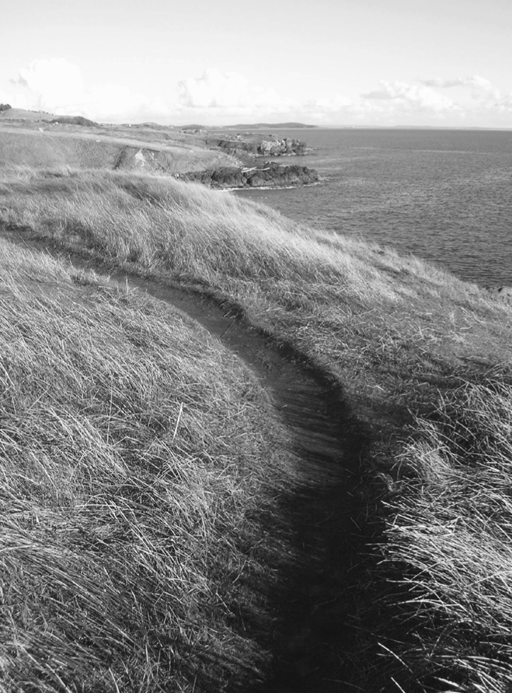
American Camp protects one of the largest stretches of undeveloped coastline in the San Juans.
From Anacortes, take a Washington State ferry to Friday Harbor on San Juan Island. Follow Spring Street 0.5 mile (0.8 km) through town. Turn left onto Mullis Street (which becomes Cattle Point Road) and follow it for 5.3 miles (8.5 km). Turn right into American Camp and drive 0.2 mile (0.3 km) to the visitors center and trailhead (elev. 140 ft/43 m). Privy and bike racks available.
From the main trailhead—the start of several trails—follow the path to Grandmas Cove. You’ll be returning via the History Walk, which travels through the American Camp compound. At 0.1 mile (0.15 km), stay left where a trail diverts right to Eagle Cove Drive. Your route bends south to skirt the compound, soon intersecting with the History Walk. Briefly follow it south, and then continue straight where the History Walk angles east.
Now gradually descend, walking across grassy slopes punctuated with snowberry and hawthorn, which provide excellent forage for resident birds. Gone are the more than two thousand sheep that grazed here in the mid-1800s as part of the Hudson’s Bay Company’s Belle Vue Sheep Farm. At 0.4 mile (0.6 km), come to a junction (elev. 50 ft/15 m). Detour to visit (0.1-mi/0.15-km roundtrip) log-lined, bluff-enclosed Grandmas Cove.
After paying a visit to Grandma, continue hiking east across grassy headlands, enjoying sweeping views of the coastline out to Cattle Point. Ignore side trails leading to headlands. Pass an intriguing stone post (origin unknown) and come to a junction at 0.8 mile (1.3 km). The trail left leads 0.25 mile (0.4 km) back to the History Walk at the redoubt, which will shorten your loop. Otherwise continue forward on a path that’s easy to lose at times, coming to a junction with the wide and fairly new South Beach Trail at the South Beach Picnic Area at 1.3 miles (2.1 km).
Your hike continues via the South Beach Trail. But by all means first walk the more than 1 mile (1.6 km) of sandy beach if you like. Otherwise start hiking westward and upward, reaching a four-way junction at 1.9 miles (3.1 km). The way left heads back to the coast, passing some big glacial erratics. The way right leads a short distance to the redoubt (a small fortified position within the compound). Continue straight 0.1 mile (0.15 km) to the History Walk. Left leads 0.4 mile (0.6 km) to the trailhead. But right is more interesting, following the History Walk interpretive trail for 0.7 mile (1.1 km) back to the trailhead, visiting the redoubt (elev. 180 ft/55 m), officers’ quarters, and other historical sites along the way.
Fourth of July Beach on Griffin Bay is accessible via a short trail from Cattle Point Road. Eagle Cove can be reached by hiking from the historical park to Eagle Cove Drive and then picking up trail again after a short road walk.
| Frazer Homestead Preserve |
| RATING/ DIFFICULTY |
ROUNDTRIP | ELEV GAIN/HIGH POINT |
| **/1 | 2.6 miles (4.2 km) | 80 feet (24 m)/210 feet (64 m) |
Maps: USGS False Bay, land bank map online; Contact: San Juan Island National Historical Park and San Juan County Land Bank, Frazer Homestead Preserve; Notes: Active farming area. Dogs must be on-leash; GPS: N 48 27.874, W 123 01.427
![]() Explore quiet woodlands within the San Juan National Historical Park and an old homestead still actively farmed. Enjoy pastoral views of rolling countryside against a backdrop of Griffin Bay and Mount Baker. And wander near the site of the Pig War’s only casualty—the pig.
Explore quiet woodlands within the San Juan National Historical Park and an old homestead still actively farmed. Enjoy pastoral views of rolling countryside against a backdrop of Griffin Bay and Mount Baker. And wander near the site of the Pig War’s only casualty—the pig.
See directions to Hike 49.
Locate the trail on the north side of the national historical park’s visitors center. Then begin your journey by traversing meadows, coming to Cattle Point Road in 0.2 mile (0.3 km). Carefully cross the road and resume your hike. Cross a boardwalk and then undulate between evergreen tunnels and field pockets. Contrast the greenness of this trail to the golden slopes of the nearby prairies.
At 0.7 mile (1.1 km), enter the San Juan Land Bank’s Frazer Homestead Preserve, which not only preserves a historical landscape but also still allows for the land to be worked by local farmers. Not too far to the east (not accessible by trail) is the site of the Cutlar Farm. It was here on June 15, 1859, that American farmer Lyman Cutlar shot and killed a pig—that belonged to the Hudson’s Bay Company—in his potato patch. The incident sparked the so-called Pig War, which nearly brought the United States and Great Britain to blows. The end result was a settled boundary dispute, establishing Haro instead of Rosario Strait as the international border.
The way eventually parallels Cattle Point Road, following alongside a fence line. Catch glimpses of farming activity and good views out to Griffin Bay, Lopez Island, Mount Finlayson and Mount Baker. At 1.3 miles (2.1 km), come to Rosler Road (elev. 210 ft/64 m). This is a good spot to turn around.
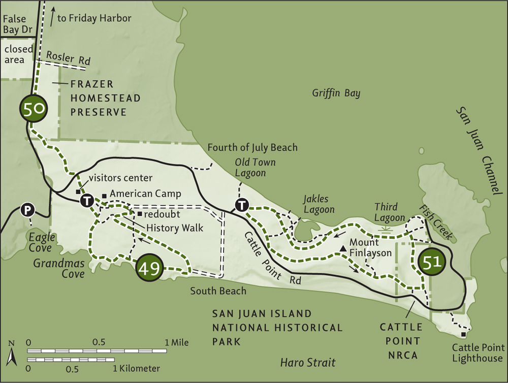
In 2013, the San Juan Island Trails Committee extended this trail by 6 miles (9.7 km), all the way to Friday Harbor.
| Mount Finlayson |
| RATING/ DIFFICULTY |
LOOP | ELEV GAIN/HIGH POINT |
| *****/2 | 3.5 miles (5.6 km) | 350 feet (107 m)/290 feet (88 m) |
Maps: USGS False Bay, USGS Richardson, park map at visitors center; Contact: San Juan Island National Historical Park; Notes: Dogs permitted on-leash; GPS: N 48 27.822, W 122 59.947
![]() Unlike British Columbia’s Mount Finlayson, this one is gentle and inviting. Stroll across golden lawns lined with windblown firs and marvel at the undeveloped and dramatic coastline spread out below you. Stare out across the Strait of Juan de Fuca to the Olympic Peninsula. Then, on your return, explore a couple of quiet lagoons on Griffin Bay rife with birdlife. This is one of the finest hiking areas within the entire San Juans chain.
Unlike British Columbia’s Mount Finlayson, this one is gentle and inviting. Stroll across golden lawns lined with windblown firs and marvel at the undeveloped and dramatic coastline spread out below you. Stare out across the Strait of Juan de Fuca to the Olympic Peninsula. Then, on your return, explore a couple of quiet lagoons on Griffin Bay rife with birdlife. This is one of the finest hiking areas within the entire San Juans chain.
From Anacortes, take a Washington State ferry to Friday Harbor on San Juan Island. Follow Spring Street 0.5 mile (0.8 km) through town. Turn left onto Mullis Street (which becomes Cattle Point Road) and follow it for 6.9 miles (11.1 km) to the trailhead (elev. 100 ft/30 m), signed “Jakle’s Lagoon.”
Take the Jakles Lagoon Loop to the right—you’ll be returning from the left. The wide trail parallels Cattle Point Road and gradually climbs, cutting a swath across golden grasslands lined by wind-blasted, contorted firs. In springtime this rare island prairie environment is awash in beautiful blossoms. Maritime views grow with each step. At 0.3 mile (0.5 km), the Nature Trail loop heads left, offering your first alternative route.
Continue forward through a clump of trees and then begin climbing more steeply, cresting the long ridge of Mount Finlayson. Roderick Finlayson of the Hudson’s Bay Company was a founder of Victoria, British Columbia, and its onetime mayor. You can see his higher and rockier namesake Canadian peak from this trail.
Carry on along the windswept ridge, mouth agape at the astonishing views, from the snowcapped Olympic Mountains to the bluffs of Whidbey Island. Scan the choppy strait for whales and the sky for eagles. After cresting Mount Finlayson’s gentle 290-foot (107-m) summit, slightly descend to a junction at 1.3 miles (2.1 km). Here, a 0.4-mile (0.6-km) trail leads left into a cluster of large firs, steeply descending to the Lagoon Loop, offering a shorter loop option. Keep hiking forward, cresting Finlayson’s eastern summit and taking in the classic view of Cattle Point below against a backdrop of rocky islets and Lopez Island’s Iceberg Point.
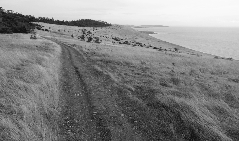
Mount Finlayson’s sprawling prairie offers sweeping views.
Now begin steeply descending, entering the Cattle Point Natural Resources Conservation Area and reaching a junction and kiosk at 1.6 miles (2.6 km). The trail right leads a short way to Cattle Point Road. Head left instead, and after 0.1 mile (0.15 km) come to an old road turned trail. Right heads to Cattle Point Road. You want to hike left, entering thick forest, skirting wetlands, ignoring side trails (follow signs), and reaching a junction (elev. 10 ft/3 m) at 2.1 miles (3.4 km).
Trails straight and right can be followed for a 0.4-mile (0.6-km) loop to Fish Creek. The way back to the trailhead is via an old woods road along Third Lagoon and around Jakles Lagoon. Reach the trail that comes down from Finlayson at 2.3 miles (3.7 km). Continue on the old woods road, passing or taking several side trails to Third and Jakles lagoons. At 2.7 miles (4.3 km), the road splits—either way will bring you back to the trailhead at 3.5 miles (5.6 km), after a short drop and climb.
Options abound for shortening or lengthening this hike at various trail junctions. At low tide, it’s also possible to walk the beach from Jakles Lagoon to Old Town Lagoon. Views are great of Mount Constitution and Turtleback Mountain across Griffin Bay.
| Cattle Point |
| RATING/ DIFFICULTY |
ROUNDTRIP | ELEV GAIN/HIGH POINT |
| ***/1 | 1.4 miles (2.3 km) | Minimal/20 feet (6 m) |
Maps: USGS Richardson, DNR map online; Contact: Washington Department of Natural Resources (DNR), Northwest District; Notes: Discover Pass required. Dogs permitted on-leash; GPS: N 48 27.263, W 122 57.767
![]() Enjoy this easy and family-friendly hike along the San Juan Channel—a bird and marine mammal hotspot—to a picturesque lighthouse within the new San Juan Islands National Monument. This area was once part of a Hudson’s Bay Company ranch, but you won’t have any beef hiking this beautiful spot. Gone are the cattle and sheep, but plenty of deer prance around this point.
Enjoy this easy and family-friendly hike along the San Juan Channel—a bird and marine mammal hotspot—to a picturesque lighthouse within the new San Juan Islands National Monument. This area was once part of a Hudson’s Bay Company ranch, but you won’t have any beef hiking this beautiful spot. Gone are the cattle and sheep, but plenty of deer prance around this point.
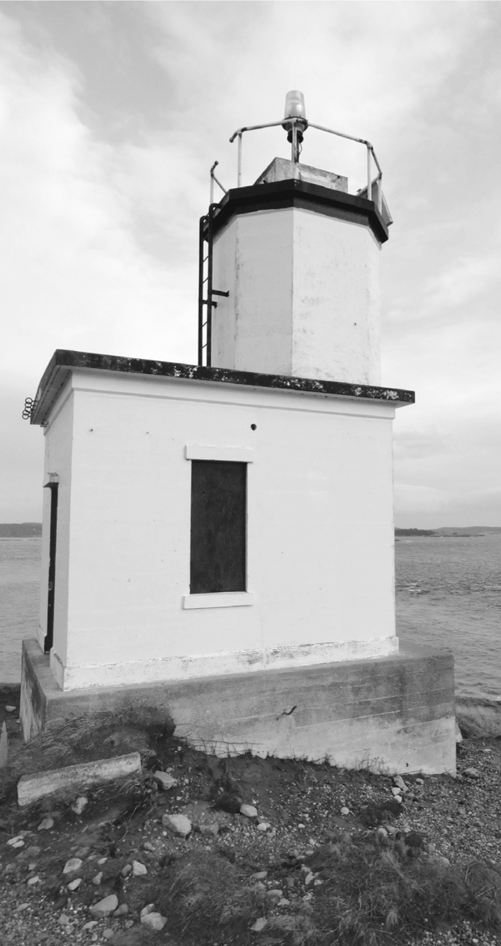
Cattle Point Lighthouse
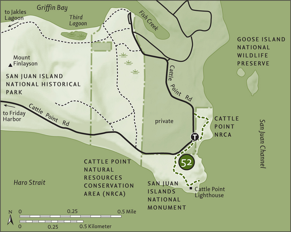
From Anacortes, take a Washington State ferry to Friday Harbor on San Juan Island. Follow Spring Street 0.5 mile (0.8 km) through town. Turn left onto Mullis Street (which will become Cattle Point Road) and follow it for 8.9 mile (14.3 km) to the trailhead at the Cattle Point Interpretive Area. Privy available.
Start by visiting the interpretive displays housed in a former US Navy Radio Compass Station. The structure is rather ugly—but the natural surroundings aren’t! Formed by glaciations, Cattle Point consists of striated ledges and cobbled, sandy, gravelly deposits.
Now walk north on the short 0.2-mile (0.3-km) trail along the grassy bluff overlooking San Juan Channel. Scope the rocky islets (protected as a national wildlife refuge) for pelagic birds, seals, and sea lions.
Retrace your steps and then walk south 0.2 mile (0.3 km) on the lightly traveled Cattle Point Road to the Cattle Point Lighthouse trailhead. Note there is no parking here. Follow the 0.3-mile (0.5-km) interpretive trail through national monument land to the lighthouse and out onto the grassy, rocky point. A lighthouse was built here in 1888 with former American Camp soldier George Jakle its first keeper. The current structure was built in 1935 and gained notoriety in 1984 in an Exxon commercial.
Spend time looking out over the turbulent waters for marine mammals and birds. In springtime, enjoy the prairie blossoms, which include buttercups, chocolate lilies, camas, and lupines. Linger long before returning to the interpretive center.
You can walk 0.2 mile (0.3 km) west on Cattle Point Road to a gated road-trail, from which you can continue hiking to Mount Finlayson, Third Lagoon, and Fish Creek (see Hike 51).
| Bell Point and English Camp |
| RATING/ DIFFICULTY |
LOOP | ELEV GAIN/HIGH POINT |
| ***/1 | 1.7 miles (2.7 km) | 50 feet (15 m)/50 feet (15 m) |
Maps: USGS Roche Harbor, park map at English Camp kiosk; Contact: San Juan Island National Historical Park; Notes: Dogs permitted on-leash; GPS: N 48 35.191, W 123 08.874
![]() Stroll along placid bay waters surrounding Bell Point after passing through a former British Royal Marine garrison. The grounds are now peacefully administered by the National Park Service for resource protection and heritage preservation. The United States and Great Britain nearly went to war over the San Juan Islands, but sane heads prevailed. Now Americans and Canadians (Brits too) can enjoy this tranquil corner of San Juan Island, permanently protected from modern world assaults. Cheers.
Stroll along placid bay waters surrounding Bell Point after passing through a former British Royal Marine garrison. The grounds are now peacefully administered by the National Park Service for resource protection and heritage preservation. The United States and Great Britain nearly went to war over the San Juan Islands, but sane heads prevailed. Now Americans and Canadians (Brits too) can enjoy this tranquil corner of San Juan Island, permanently protected from modern world assaults. Cheers.
From Anacortes, take a Washington State ferry to Friday Harbor on San Juan Island. Follow Spring Street for two blocks and turn right onto 2nd Street. Bear left onto Guard Street in 0.2 mile (0.3 km), continuing on it when it becomes Beaverton Valley Road at 0.7 mile (1.1 km). Follow Beaverton Valley Road (which eventually becomes West Valley Road) for 7.3 miles (11.7 km), turning left into English Camp. Drive 0.4 mile (0.6 km) to the trailhead. Privy and bike rack available.
Start by heading to English Camp. It was here along Garrison Bay that the Royal Marines established a presence for twelve years during the Pig War, which ultimately decided on Haro Strait as the international boundary, leaving San Juan Island for the Americans. A restored blockhouse, barracks, hospital, and storehouse remain at the site. During summer a visitors center is operated out of the barracks.
Walk 0.2 mile (0.3 km), passing by a monster maple and formal gardens and through the compound to the Bell Point trailhead, located near the commissary. Now walk along a bluff above Garrison Bay, passing a dock and traveling through a forest of attractive madronas. At 0.8 mile (1.3 km), reach a junction with a 0.1-mile (0.15-km) spur to Bell Point on Westcott Bay. Look for eagles, ravens, kingfishers, and a myriad of other birds in the tranquil water.
Return to the loop and continue 0.5 mile (0.8 km), passing a bayside picnic area before returning to the compound grounds. Then return to the trailhead via the English Camp grounds; or, for a slightly longer return leg, follow a road-trail left, being sure to stay straight at a service road junction in 0.25 mile (0.4 km).
There is a new connector trail from English Camp to the Roche Harbor Trail. Pick up this connector near the hospital and follow it northeast for 0.6 mile (1 km), first on a service road. Then, after crossing West Valley Road, continue on single-track for 0.7 mile (1.1 km) to the main Roche Harbor trailhead parking area. In 2013, 70 acres (28 ha) of shoreline on Westcott Bay, including a historical oyster farm, were added to the national park. A new trail for that area is in the works.

English Camp sits on quiet Garrison Bay.
| Young Hill |
| RATING/ DIFFICULTY |
ROUNDTRIP | ELEV GAIN/HIGH POINT |
| ****/3 | 2.2 miles (3.5 km) | 600 feet (183 m)/650 feet (198 m) |
Maps: USGS Roche Harbor, park map at English Camp kiosk; Contact: San Juan Island National Historical Park; Notes: Dogs permitted on-leash; GPS: N 48 35.197, W 123 08.808
![]() Big oaks, big views, and a historical cemetery await you on this hike to 650-foot (198-m) Young Hill. Wildflowers are dazzling in spring, and the sunsets from the summit are magnificent year-round.
Big oaks, big views, and a historical cemetery await you on this hike to 650-foot (198-m) Young Hill. Wildflowers are dazzling in spring, and the sunsets from the summit are magnificent year-round.
See directions to Hike 53.
Locate the trail for Young Hill at the northeast corner of the large parking lot. Immediately come to a junction. Left heads to Bell Point and the Roche Harbor Trail connector. Bear right and follow a wide path, climbing gently through a forest of Douglas fir and madrona laced with salal and Oregon grape.
At 0.2 mile (0.3 km), carefully cross West Valley Road and resume hiking up the wide trail. At 0.4 mile (0.6 km), reach a junction (elev. 260 ft/79 m) with a connector trail built in 2013 that leads to Mitchell Hill and the historical Sandwith Orchard. Turn left and within a few steps reach another junction. The short spur right leads to the English Camp cemetery, a tranquil final resting spot for six Royal Marines and one British civilian enclosed by a white picket fence and shaded by big, old Garry oaks. Check it out or carry on to Young’s summit.
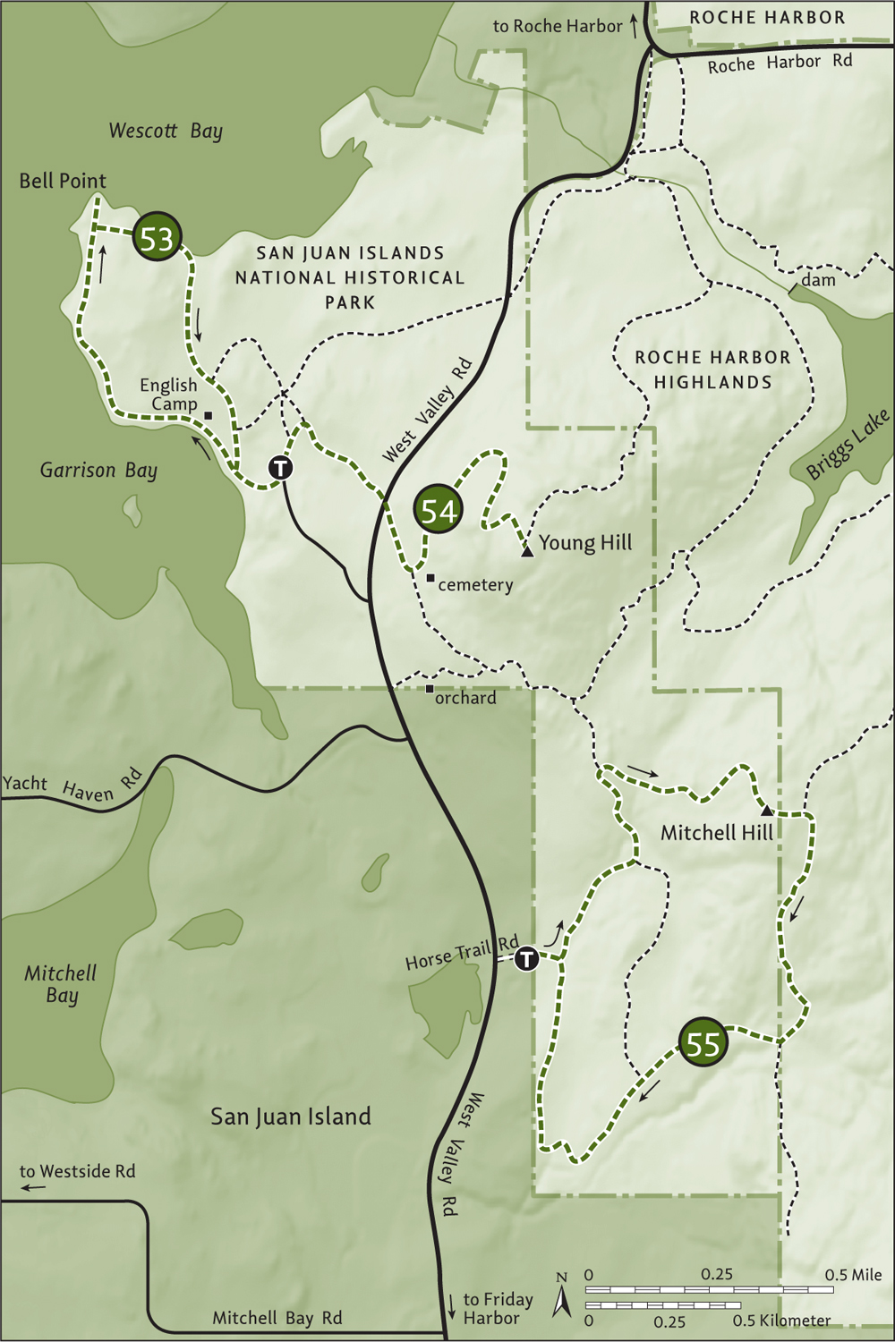
The trail continues left, making a big switchback and emerging at 0.9 mile (1.4 km) at the edge of a grassy ledge (elev. 550 ft/168 m), granting sweeping views west over Garrison, Mitchell, and Westcott bays and out over finger coves and narrow straits to Victoria and the Gulf Islands. Continue another 0.2 mile (0.3 km), climbing and snaking around mossy ledges, and arrive at Young Hill’s 650-foot (198-m) summit for more views. Here add the Olympics and San Juan Island’s highest peak, 1015-foot (309-m) Mount Dallas, to the visual menu.
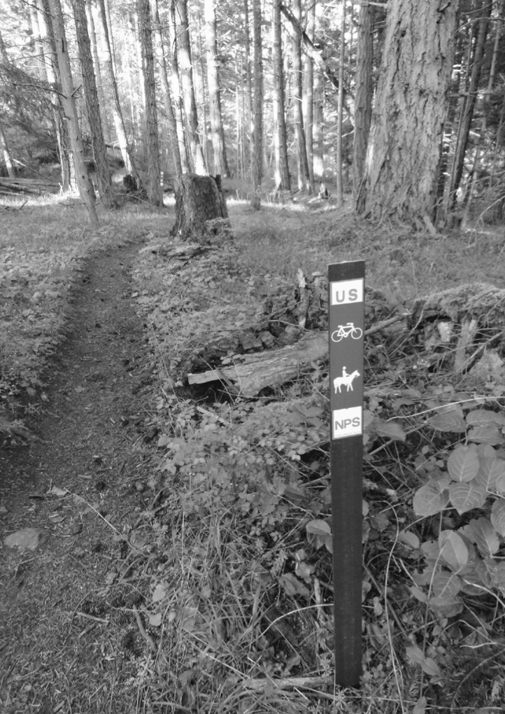
Forested trail on Mitchell Hill
Several unofficial trails traverse Young Hill and park officials hope to create signage that will keep you on the official routes, thus minimizing damage to fragile meadows and balds. Two official trails that make for excellent extended hiking adventures are the 1-mile (1.6-km) path northeast off of Young Hill, connecting to the Briggs Lake loop (Hike 56) in the Roche Harbor Highlands; and the 0.5-mile (0.8-km) connector through old-growth Garry oaks to the Mitchell Hill trail complex (Hike 55). At 0.2 mile (0.3 km) on this second trail, you can follow a right-hand path to a historical orchard, where deer can often be spotted feasting on apples.
| Mitchell Hill |
| RATING/ DIFFICULTY |
LOOP | ELEV GAIN/HIGH POINT |
| **/3 | 2.9 miles (4.7 km) | 450 feet (137 m)/515 feet (157 m) |
Maps: USGS Roche Harbor, park map at trailhead; Contact: San Juan Island National Historical Park; Notes: Open to mountain bikes and horses. Dogs permitted on-leash; GPS: N 48 34.328, W 123 08.262
![]() A former Department of Natural Resources property, the 312-acre (126-ha) Mitchell Hill tract was added to the San Juan National Historical Park in 2010. Consisting primarily of second-growth forest and traversed by old logging roads and user-built trails, it is of primary interest to local equestrians and mountain bikers. But old-growth pockets, remnants of the Old Military Road connecting American and English camps, and the chance to wander aimlessly in the woods will certainly appeal to some hikers. Save it for an overcast day, as the route is nearly entirely beneath forest cover.
A former Department of Natural Resources property, the 312-acre (126-ha) Mitchell Hill tract was added to the San Juan National Historical Park in 2010. Consisting primarily of second-growth forest and traversed by old logging roads and user-built trails, it is of primary interest to local equestrians and mountain bikers. But old-growth pockets, remnants of the Old Military Road connecting American and English camps, and the chance to wander aimlessly in the woods will certainly appeal to some hikers. Save it for an overcast day, as the route is nearly entirely beneath forest cover.
From Anacortes, take a Washington State ferry to Friday Harbor on San Juan Island. Follow Spring Street for two blocks and turn right onto 2nd Street. Bear left onto Guard Street in 0.2 mile (0.3 km), continuing on it when it becomes Beaverton Valley Road in 0.7 mile (1.1 km). Follow Beaverton Valley Road (which eventually becomes West Valley Road) for 6.6 miles (10.6 km), turning right onto dirt Horse Trail Road (0.7 mi/1.1 km past the Mitchell Bay Road junction). Proceed 0.1 mile (0.15 km) to the trailhead (elev. 120 ft/37 m). Parking is limited.
Hike past the gate and a huge Douglas fir, immediately coming to a junction. The old logging roads and a tangled web of user-built trails can make for confusion, but the Park Service has been adding signage encouraging you to stick to the official trails. You’ll be returning on the road-trail from the right, so continue left here. Ignore side trails and stay on the old road, traversing a grove of big cedars. Bear left where the road-trail splits and cross a small creek, coming to a signed junction at 0.4 mile (0.6 km). Head right, leaving the road for real trail and coming to a junction (elev. 300 ft/ 91 m) in thick old growth at 0.6 mile (1 km). The delightful trail left heads 0.7 mile (1.1 km) to English Camp, offering an alternative start with better parking facilities.
Your route continues right, slightly descending to cross a creek before climbing through a forest of oak and madrona. Radiating paths may cause confusion, but guideposts should offer some help navigating the way. Pass big wolf Douglas firs and clamber over mossy ledges and grassy balds. At 1.1 miles (1.8 km), crest one of Mitchell Hill’s wooded summits (elev. 515 ft/157 m) and begin descending, leaving national park land and reaching a junction at 1.2 miles (1.9 km) with an old fire road.
Go right, gradually descending through attractive forest. At 1.7 miles (2.7 km), follow the road right. At 1.8 miles (2.9 km), after crossing a creek, go right at a pipe gate and reenter national park land. Continue descending, crossing a creek and passing an old logging yard. Ignore side trails and stay right at a road-trail junction. The way eventually makes a sharp turn north. Cross another creek (elev. 100 ft/30 m) and catch a glimpse of Young Hill before closing the loop at 2.9 miles (4.7 km).
From the junction at the pipe gate, you can continue straight on the fire road 0.5 mile (0.8 km) to a limited viewpoint (elev. 550 ft/168 m) on a shoulder of Cady Mountain, looking over nearby farms below and out to Vancouver Island.
| Briggs Lake |
| RATING/ DIFFICULTY |
LOOP | ELEV GAIN/HIGH POINT |
| ***/2 | 4 miles (6.4 km) | 260 feet (79 m)/340 feet (104 m) |
Maps: USGS Roche Harbor, trails committee map online; Contact: San Juan Island Trails Committee, Roche Harbor Highlands; Notes: Open to mountain bikes and horses. Dogs permitted on-leash; GPS: N 48 35.862, W 123 07.900

![]() Follow gentle fire roads around a pretty reservoir, looking for and listening to bald eagles and a myriad of waterfowl. Centerpiece of the Roche Harbor Highlands, a large privately owned forest open to the public for nonmotorized recreation, Briggs Lake makes for a nice hike year-round. it’s especially appealing in winter, however, when the water level and eagle activity are high.
Follow gentle fire roads around a pretty reservoir, looking for and listening to bald eagles and a myriad of waterfowl. Centerpiece of the Roche Harbor Highlands, a large privately owned forest open to the public for nonmotorized recreation, Briggs Lake makes for a nice hike year-round. it’s especially appealing in winter, however, when the water level and eagle activity are high.
From Anacortes, take a Washington State ferry to Friday Harbor on San Juan Island. Follow Spring Street for two blocks and turn right onto 2nd Street. At 0.3 mile (0.5 km), after bearing left onto Guard Street, turn right onto Tucker Avenue and continue 0.4 mile (0.6 km), bearing left onto Roche Harbor Road. Drive 7.4 miles (11.9 km) to the intersection with West Valley Road and the trailhead (elev. 100 ft/30 m), located on the left.
Three trails radiate from the trailhead. You’ll be returning on the middle one and starting on the one farthest right (west)—the one leading to English Camp. Paralleling West Valley Road through a salal jungle, come to a junction in 0.2 mile (3 km). Continue straight, crossing a creek in a cedar ravine and coming to a signed five-way junction at 0.3 mile (0.5 km). Head left here on a fire road, paralleling the creek-cradling ravine and reaching a junction (elev. 260 ft/79 m) at 0.6 mile (1 km). The way right is a quiet 1 mile (1.6 km) trail to the summit of Young Hill (Hike 54). You want to continue straight on the old fire road, soon reaching the dammed outlet of Briggs Lake (elev. 240 ft/73 m).
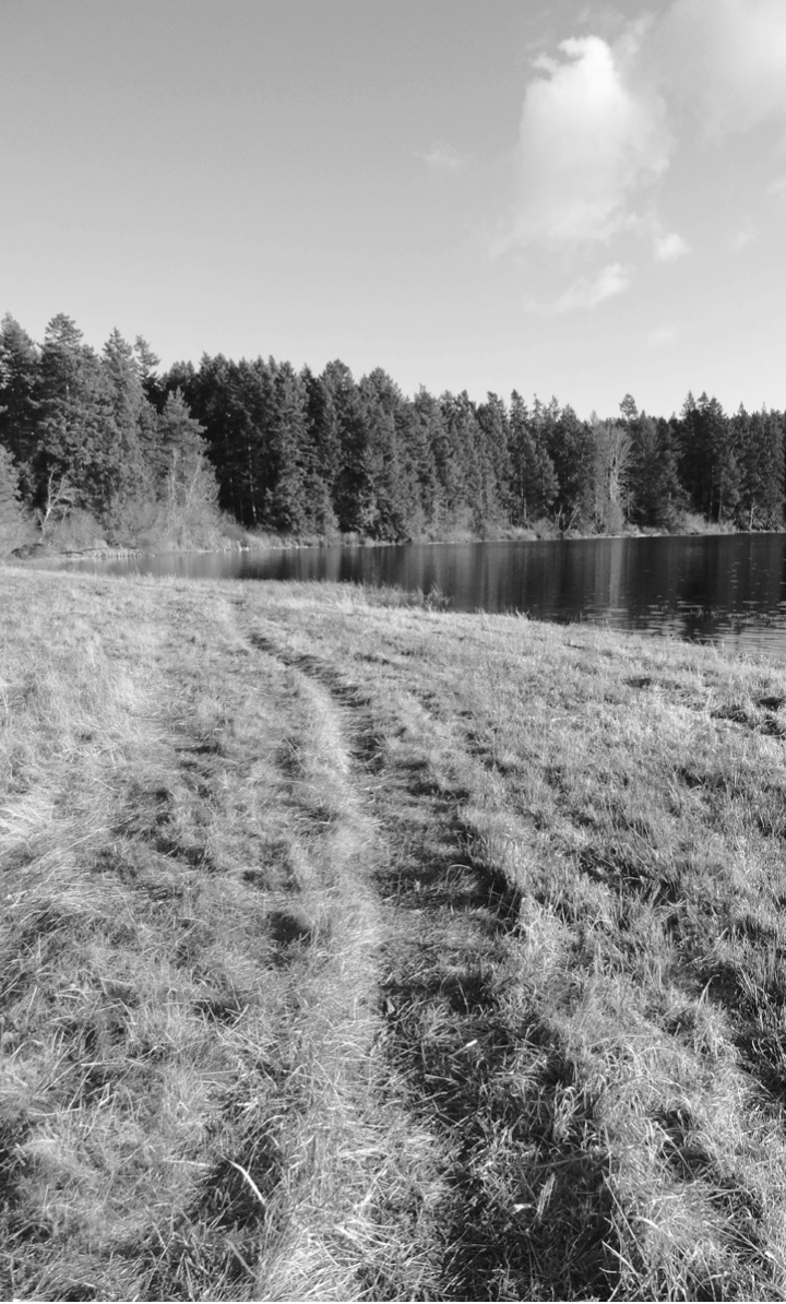
Grassy shoreline along Biggs Lake invites lounging.
The dam is closed to public access—don’t even think of walking on it to cut your hike short. Be sure to respect all posted regulations in the Roche Harbor Highlands, and be especially thoughtful around the lakeshore, as Briggs provides water to nearby Roche Harbor village. Continue straight instead, rounding a mossy bald and reaching a spur at 1 mile (1.6 km) to a ledge overlooking the lake. See any eagles or wintering swans? At 1.3 miles (2.1 km), stay left at a junction. The trail right leads to the Mitchell Hill–English Camp connector trail. Now cross an inlet and continue through attractive forest, ignoring an obscure trail right. After crossing a creek, the way pulls away from the lake and reaches a junction (elev. 340 ft/104 m) at 2.5 miles (4 km).
Right leads to Mitchell Hill. Head left instead, coming to another junction at 3.1 miles (5 km). The way straight is the direct way back to the trailhead. The way left is much more interesting, traveling through shore pines to open grassy slopes along Briggs Lake. At 3.3 miles (5.3 km), come to the outlet dam and continue hiking, now along the north side of the outlet creek. Bear left at a junction, passing a pump house. Then bear right at another junction, descending to the trailhead at 4 miles (6.4 km).
Long day hikes are possible by combining this hike with Young Hill (Hike 54) or Mitchell Hill (Hike 55). But be sure to have a good map, as all the interconnecting trails can be disorienting.
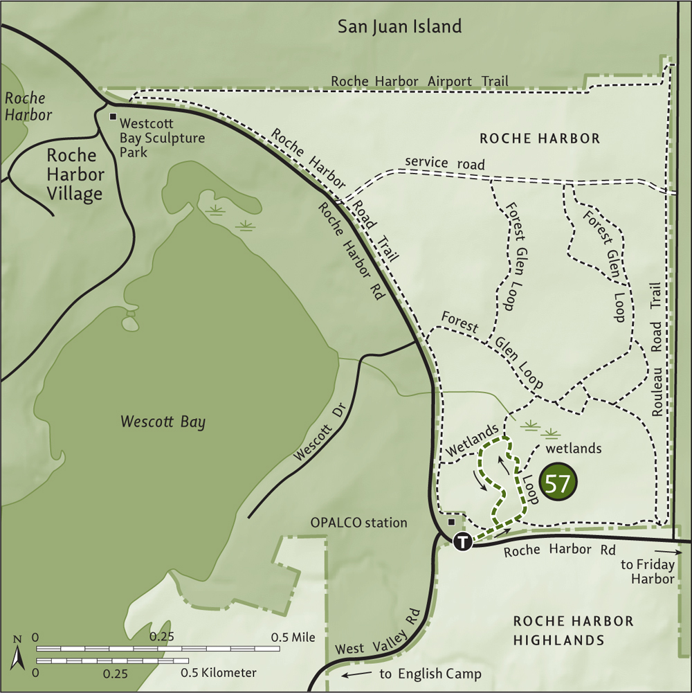
| Roche Harbor: Wetlands Loop |
| RATING/ DIFFICULTY |
LOOP | ELEV GAIN/HIGH POINT |
| **/1 | 0.8 mile (1.3 km) |
30 feet (9 m)/110 feet (34 m) |
Maps: USGS Roche Harbor, trails committee map online; Contact: San Juan Island Trails Committee, Roche Harbor Trails; Notes: Open to mountain bikes and horses. Dogs permitted on-leash; GPS: N 48 35.876, W 123 07.841
![]() This near-level hike to grassy wetlands within the Roche Harbor trail network is perfect for early morning and evening walks if you’re staying nearby. Or, combine this easy jaunt with adjoining trails for half- and all-day excursions.
This near-level hike to grassy wetlands within the Roche Harbor trail network is perfect for early morning and evening walks if you’re staying nearby. Or, combine this easy jaunt with adjoining trails for half- and all-day excursions.
See directions to Hike 56.
The Roche Harbor trail network is privately owned by Roche Harbor Village but open to public use. Please respect all posted regulations.
Start by carefully crossing the road and locating the trailhead near the OPALCO charging station. Begin on a boardwalk and come to a junction at 0.1 mile (0.15 km). Follow the grassy mowed path right, passing a trail on your left—your return. At 0.2 mile (0.3 km), come to a junction with the Rouleau Road Trail, which travels for 1.2 miles (1.9 km), paralleling roads.
Continue left through fir and pine forest, reaching a junction at 0.3 mile (0.5 km). Here a spur leads right a short distance through head-high salal to a wetlands viewpoint. Take it if you care to, or continue straight, soon getting good views of the grassy bird-loving wetlands (elev. 80 ft/24 m). At 0.4 mile (0.6 km), come to a junction. The trail right is a pleasant 0.15-mile (0.25-km) forested path connecting to the 1.75-mile (2.8-km) Forest Glen Loop, which pretty much follows service roads. It makes a better running route than a hike.
Head left and then left again where the wide mowed path splits. At 0.5 mile (0.8 km), leave the path for a more rustic trail left, climbing a small ridge (elev. 110 ft/34 m) and traversing a cedar grove to reach a familiar junction at 0.7 mile (1.1 km). The trailhead is 0.1 mile (0.15 km) to the right.
From the Wetlands Loop you can follow the grassy Roche Harbor Road Trail 1.3 miles (2.1 km) over rolling terrain and paralleling the road to the Westcott Bay Sculpture Park, which is definitely worth a visit.
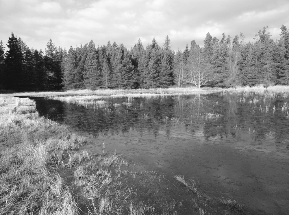
Look for birds and amphibians along the Wetlands Loop.
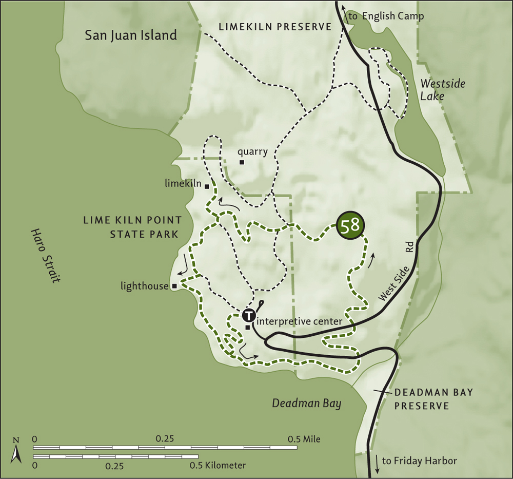
| Lime Kiln Point |
| RATING/ DIFFICULTY |
LOOP | ELEV GAIN/HIGH POINT |
| ****/2 | 2.2 miles (3.5 km) | 265 feet (81 m)/280 feet (85 m) |
Maps: USGS Roche Harbor, land bank map online; Contact: Washington State Parks, Lime Kiln Point State Park, and San Juan County Land Bank, Limekiln Preserve; Notes: Discover Pass required. Dogs permitted on-leash; GPS: N 48 30.925, W 123 08.954
![]() One of the most ecologically and historically fascinating places on San Juan Island, Lime Kiln Point harbors 5 miles (8 km) of interconnecting trails. Protected by a 36-acre (15-ha) state park and more than 170 acres (68 ha) of county preserve, this point once bustled with industry and is now one of the best places in the United States to spot whales from land. A lighthouse, interpretive center, and restored limekiln add to the area’s richness.
One of the most ecologically and historically fascinating places on San Juan Island, Lime Kiln Point harbors 5 miles (8 km) of interconnecting trails. Protected by a 36-acre (15-ha) state park and more than 170 acres (68 ha) of county preserve, this point once bustled with industry and is now one of the best places in the United States to spot whales from land. A lighthouse, interpretive center, and restored limekiln add to the area’s richness.
From Anacortes, take a Washington State ferry to Friday Harbor on San Juan Island. Follow Spring Street west through town for 1.6 miles (2.6 km) (the road becomes San Juan Valley Road). Turn left onto Douglas Road and drive 1.8 miles (2.9 km), bearing right onto Bailer Hill Road (which becomes West Side Road) and continuing 5.6 miles (9 km) to Lime Kiln Point State Park. Turn left and drive 0.1 mile (0.15 km) to the trailhead (elev. 60 ft/18 m). Privy available.
From the interpretive center follow the wheelchair-accessible interpretive trail 0.2 mile (0.3 km) to the coast and a junction. The lighthouse is to the right. You’ll be returning from that direction, so head left along the rocky open coastline and enter the San Juan County Land Bank’s Deadman Bay Preserve. Head up and over bluffs and enjoy sweeping views across Haro Strait to Vancouver Island and the Olympic Peninsula. Keep watching for orcas and other whales.
At 0.6 mile (1 km), reach a small parking lot, privy, and a spur leading to a cobbled beach on Deadman Bay. Explore the beach or resume hiking, crossing West Side Road and heading up steps to a viewgranting bluff in the Limekiln Preserve. At 0.8 mile (1.3 km), cross the road again, entering madrona groves and passing a big wolf Douglas fir. After reaching an elevation of 280 feet (85 m), begin descending through a forest reminiscent of a Wizard of Oz scene. Reenter the state park and reach a junction at 1.2 miles (1.9 km).
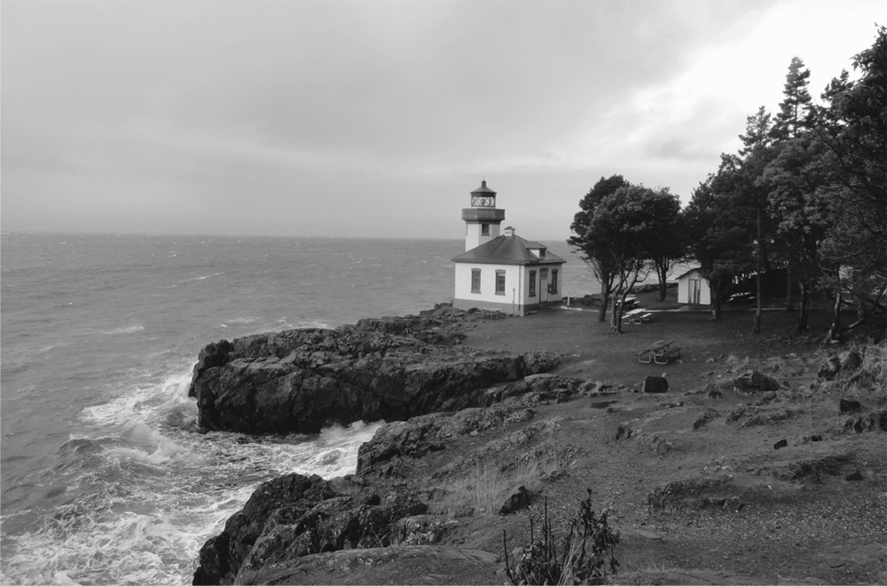
Lime Kiln State Park’s lighthouse is a great spot to look for whales.
The trail right leads to old roads and quarries and to 10-acre (4-ha) Westside Lake, if you’re looking for a longer hike. Otherwise head left, soon coming to a junction with the state park loop trail. The way left drops steeply through old quarries, reaching the trailhead in 0.2 mile (0.3 km). Go right instead, passing a water tower and reaching a junction at 1.4 miles (2.3 km). Left goes back to the parking lot. Your loop continues straight—but first hike right 0.1 mile (0.15 km) to a restored limekiln and interpretive displays. Industry from 1860 to 1920 denuded much adjacent forest and left big quarry pits behind. The trail continues beyond, passing another limekiln and old quarries.
Double back and continue hiking straight, twisting 0.2 mile (0.3 km) along the rocky coast to the much-photographed lighthouse built in 1919. Linger, or continue hiking along the coast to great whale-viewing spots, reaching the Deadman Bay Trail junction in 0.2 mile (0.3 km). Turn left to reach your vehicle.
The hike to Westside Lake is 0.6 mile (1 km) one-way, and you can then continue on a 0.4-mile (0.6-km) loop along the slender lake’s south shore. You can easily spend all day at Lime Kiln Point. Do visit the interpretive center, staffed by the all-volunteer Friends of Lime Kiln Society (FOLKS), who also provide support and educational programs for the park.
Spend enough time plying and hiking around the waters of the Salish Sea and you might see some of these waters’ most famous residents, its killer whales (Orcinus orca). Orcas are widely distributed throughout the world’s oceans. Highly social marine mammals, they typically fall into three distinct populations: offshore, transient, and resident.
Here in the Salish Sea we have the Southern Resident population, which consists of three pods: J, K, and L. They’re considered a distinct population and are in decline, with just eighty-two individuals in 2013. They were listed in 2005 under the Endangered Species Act, prompting a recovery plan. The biggest threats to these whales include pollution, overfishing, ship collisions, oil spills, noise disturbance from industrial and military activities, and irresponsible whale-watching.
Your best opportunity for spotting one of the three pods in the San Juan and Gulf islands is from May to September, but I have seen orcas off of Cypress Island in February. Many commercial outfitters in the islands offer whale-watching excursions, but some hikes in this book offer excellent land-based viewing, especially East Point on Saturna Island (Hike 89) and Lime Kiln Point on San Juan Island (Hike 58).
Plan a trip to the excellent Whale Museum (www.whalemuseum.org) in Friday Harbor to learn more about these Salish Sea residents, the other cetaceans that ply these waters, and how we can protect them and their habitat.
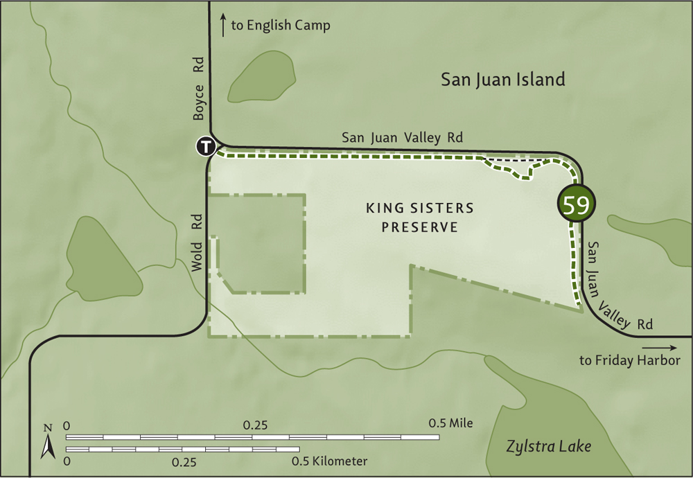
| King Sisters Preserve |
| RATING/ DIFFICULTY |
ROUNDTRIP | ELEV GAIN/HIGH POINT |
| **/1 | 1.4 miles (2.3 km) | 75 feet (23 m)/150 feet (46 m) |
Maps: USGS Roche Harbor, land bank map online; Contact: San Juan County Land Bank, King Sisters Preserve; Notes: Active farm. Dogs must be on-leash; GPS: N 48 31.748, W 123 05.930
![]() Enjoy a pastoral hike in the heart of San Juan Island farm country, in 62-acre (25-ha) King Sisters Preserve. Admire spring flowers, take in views of the island’s highest peak and one of its largest lakes, and get a peek at the goings-on of a working farm.
Enjoy a pastoral hike in the heart of San Juan Island farm country, in 62-acre (25-ha) King Sisters Preserve. Admire spring flowers, take in views of the island’s highest peak and one of its largest lakes, and get a peek at the goings-on of a working farm.
From Anacortes, take a Washington State ferry to Friday Harbor on San Juan Island. Follow Spring Street west through town (the road becomes San Juan Valley Road outside the city limits. In 4.2 miles (6.8 km) from the ferry dock, reach the junction of Boyce and Wold roads and the trailhead (elev. 100 ft/30 m). Park at the ride-share pullout on the left shoulder.
Start in a small thicket and soon emerge in open pasture along a fence line. Keep back from the fence, to avoid an electrifying moment. Gradually ascend on the wide grassy path that parallels San Juan Valley Road, enjoying nice views out to Zylstra Lake and 1080-foot (329-m) Mount Dallas, the highest peak on the island. Depending on the time of your visit, a flock of sheep may be grazing in the adjacent field.
At 0.35 mile (0.6 km), the trail splits at a cluster of mature firs. Go right, across a small rocky area (elev. 150 ft/46 m), and rejoin the main trail at 0.5 mile (0.8 km). Now head right, soon bending south to continue along the fence line. Cross a small boardwalk and reach the trail’s end (elev. 125 ft/38 m) at 0.7 mile (1.1 km). The San Juan Island Trails Committee hopes the path will someday run all the way to Friday Harbor. Return at your leisure, savoring the bucolic surroundings.
A 188-acre (76-ha) state marine park just 1 mile (1.6 km) off the southwest coast of Orcas Island, Jones Island is popular with boaters, especially kayakers. The park has moorage (7 buoys) and a 24-site campground open year-round (water available May–September).
| Jones Island |
| RATING/ DIFFICULTY |
LOOP | ELEV GAIN/HIGH POINT |
| ****/2 | 2.4 miles (3.9 km) | 200 feet (61 m)/140 feet (43 m) |
Map: USGS Friday Harbor; Contact: Washington State Parks, Sucia Island Marine State Park; Notes: Dogs permitted on-leash; GPS: N 48 37.080, W 123 02.863
![]() Wander through groves of stately Douglas fir and along grassy shoreline ledges, soaking up exceptional Salish Sea scenery. How many islands can you identify along the way? Admire camas blossoms in spring and bald eagles, seals, oystercatchers, and other wild critters year-round.
Wander through groves of stately Douglas fir and along grassy shoreline ledges, soaking up exceptional Salish Sea scenery. How many islands can you identify along the way? Admire camas blossoms in spring and bald eagles, seals, oystercatchers, and other wild critters year-round.
You need a private boat or to arrange for a watertaxi to access Jones Island. Friday Harbor’s San Juan Island Whale and Wildlife Tours (http://sanjuanislandwhales.com) offers reliable service. The trailhead is at the North Bay dock. Privy available.
From the North Bay dock, follow a wide wheelchair-accessible path to a large lawn flanked by campsites. Campsites are scattered around the lawn at South Bay too, and sites reserved strictly for paddlers can be found along the island’s west shore. Jones Island has a few Adirondack lean-tos as well.
At the south end of the lawn, come to a junction. You’ll be returning on the wide path straight ahead, so veer right here onto the Northwest Loop. At 0.2 mile (0.3 km), come to a junction. The path left hops over to the Southwest Loop and to paddle-in campsites; take it if you want a shorter loop option.
Otherwise continue right, climbing to a treed knoll (elev. 140 ft/43 m) above North Bay. Then gradually descend back to near sea level, reaching grassy ledges on the island’s north shore. Take in great views of Orcas Island’s Turtleback Mountain and Waldron Island’s Point Disney cliffs. Then follow an up-and-down course that hugs the shoreline, and curve around to head southward.
Pass junipers, big firs, rocky ledges, and grassy bluffs that burst with blossoms in spring. Take in views northwest to Spieden Island, Flattop Island, and Stuart Island’s Tiptop Hill. San Juan Island soon comes into view.
At 1.3 miles (2.1 km), reach a junction with the short connector trail. Continue right, passing campsites and now following the Southwest Loop. Enjoy more splendid shoreline serenity, including views out to the Wasp Islands—named not for insects but for the warship commandeered in the War of 1812 by Jacob Jones, namesake of the island you’re on. At 2 miles (3.2 km), reach the wide grassy lawn at South Bay. A short spur continues along the bay if you’re interested—otherwise, turn left and take the wide path back to North Bay, passing en route an old orchard, lean-tos, and the park’s water tank.
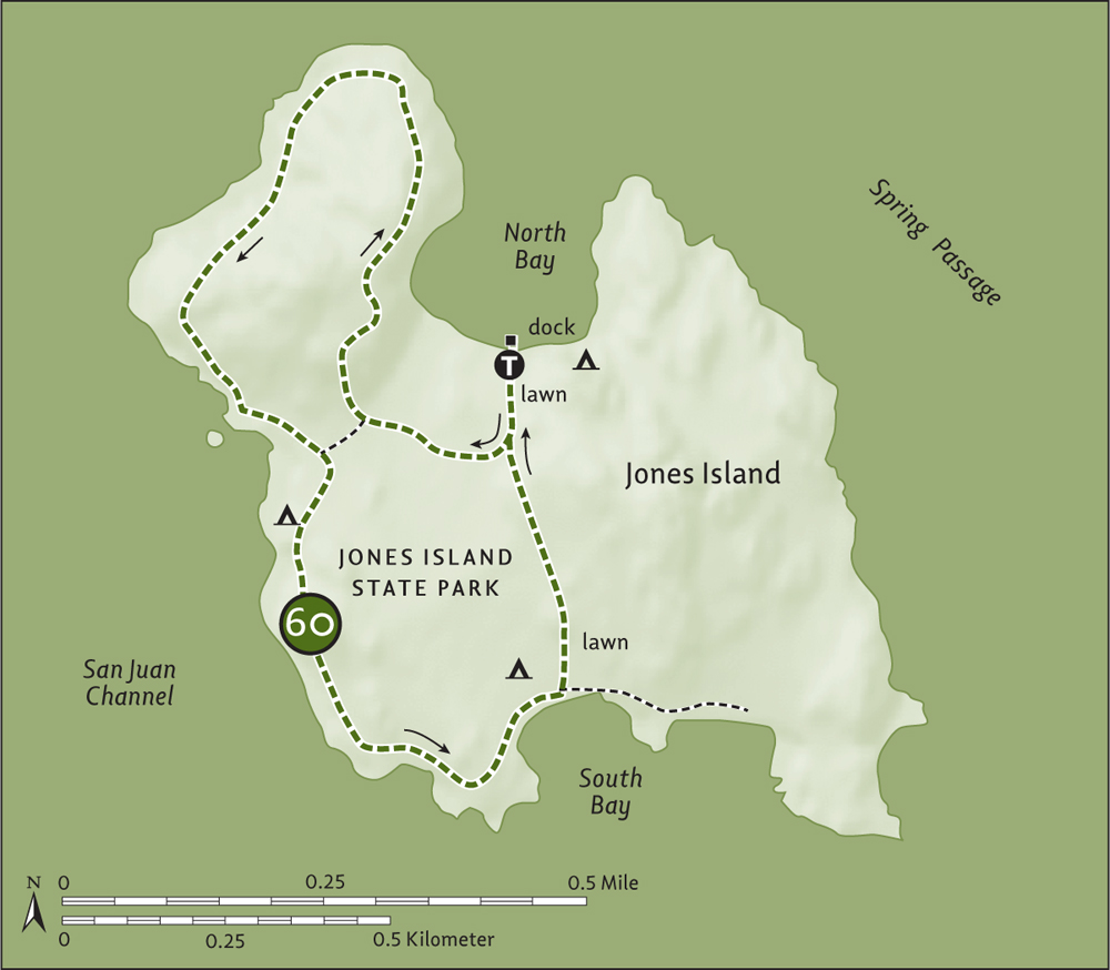
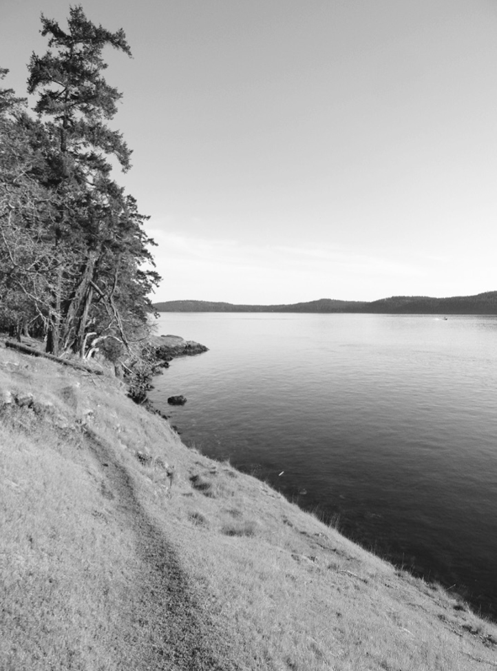
Jones Island’s loop trails offer good coastal hiking.
Westernmost of the San Juan Islands, 1786-acre (723-ha) Stuart Island hosts a year-round population of about forty people, a couple of public dirt roads, one of the last one-room schoolhouses in the state, and a large unit of the San Juan Islands National Monument. A lovely state park provides camping (18 sites) and moorage.
| Turn Point |
| RATING/DIFFICULTY | ROUNDTRIP | ELEV GAIN/HIGH POINT |
| ****/3 | 6 miles (9.7 km) | 1040 feet (317 m)/280 feet (85 m) |
Map: USGS Stuart Island; Contact: San Juan Islands National Monument and Washington State Parks, Stuart Island; Notes: Dogs permitted on-leash; GPS: N 48 25.891, W 122 49.714
![]() Hike from a quiet cove along country roads to a stunning lighthouse perched above churning waters busy with boats. The westernmost point in the San Juan Islands, Turn Point sits at the convergence of Haro Strait and Boundary Pass. Unsurpassed views of the nearby Gulf Islands, impressive forest, coastal ledges, and historical buildings make this unit of the San Juan Islands National Monument a beloved destination.
Hike from a quiet cove along country roads to a stunning lighthouse perched above churning waters busy with boats. The westernmost point in the San Juan Islands, Turn Point sits at the convergence of Haro Strait and Boundary Pass. Unsurpassed views of the nearby Gulf Islands, impressive forest, coastal ledges, and historical buildings make this unit of the San Juan Islands National Monument a beloved destination.
You need a private boat or to arrange for a watertaxi to access Stuart Island. Friday Harbor’s San Juan Island Whale and Wildlife Tours (sanjuanislandwhales.com) offers reliable service. The trailhead is at the Reid Harbor dock at Stuart Island State Park. Privy available.
This hike starts from the 85-acre (34-ha) Stuart Island State Park, which straddles a narrow forested ridge separating Reid Harbor from Prevost Harbor. Head up the steep dock ramp to the campground kiosk and trail junction. Then head left on the Prevost Loop, traversing ledges above Reid Harbor. Ignore a side trail right and reach a junction (elev. 120 ft/37 m) at 0.2 mile (0.3 km).
Continue straight, descending more than a hundred steps through a forest of impressive Douglas firs and madronas to a junction at 0.3 mile (0.5 km). The trail goes right 0.3 mile (0.5 km), circling around a marsh to reach the dirt county road from Reid Harbor. If the tide is low, you can alternatively reach the road by walking the beach.
Follow the road uphill beneath a thick emerald canopy, coming to Stuart’s one-room schoolhouse (elev. 260 ft/79 m) at 1.1 miles (1.8 km). The original schoolhouse is now a museum (visit if school is not in session), next to the newer schoolhouse. Buy a souvenir shirt at the kiosk, payment by honor system.
Continue along the road, reaching a junction at 1.2 miles (1.9 km). Bear right and carry on with pleasant road walking, staying right at two side roads, both leading to the island’s cemetery. Pass a wetland and a bucolic farm (respect private property; do not trespass).
At 1.8 miles (2.9 km), come to a T junction. Right leads 0.4 mile (0.6 km) to a public dock (an alternative starting point) on Prevost Harbor and an amazing view of Mount Baker. For Turn Point, turn left, passing a primitive airstrip and soon afterward entering the national monument. Round ledges (elev. 280 ft/85 m) and steeply descend—passing a short spur leading left to a ledge with good viewing over Haro Strait—before coming to the Turn Point Lighthouse grounds. Pass the keeper’s residence first, then a barn serving as a museum and staffed periodically by volunteers, reaching the 1893-built lighthouse at 3 miles (4.8 km).
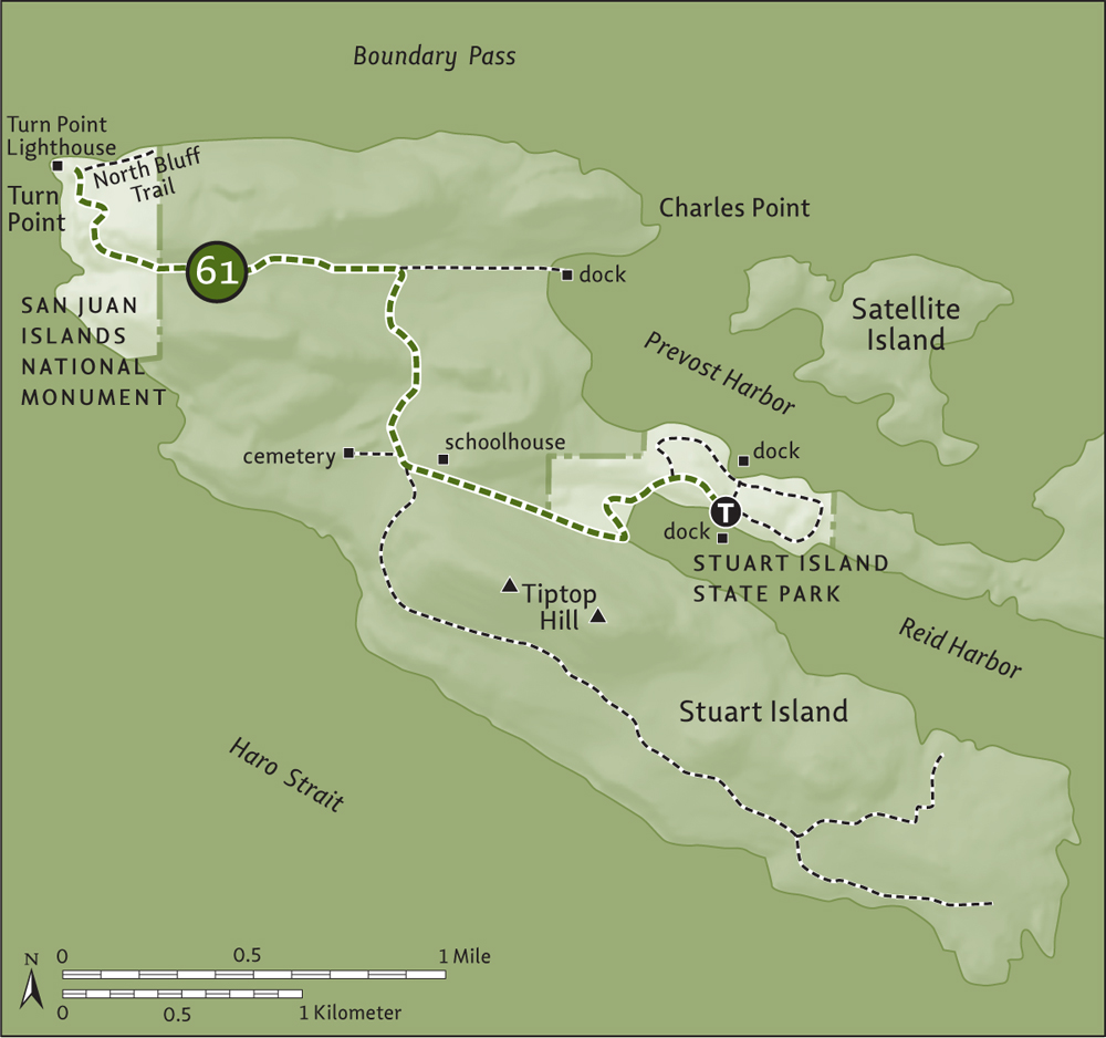
History aside, this spot is perfect for observing wildflowers, marine traffic, marine life (look for whales and pelagic birds), and a panorama of maritime views: Vancouver Island and Sidney Island are to the left. Moresby and Salt Spring islands are straight ahead. And Pender and Saturna islands are to the right. Lounge long on this lighthouse lawn, ideal for lunch breaks, and then retrace your steps to the dock.
Near the barn, you can pick up the 0.3-mile (0.5-km) North Bluff Trail leading to a Coast Guard structure and good views north across Boundary Pass. Back at Stuart Island State Park, consider hiking the 0.8-mile (1.3 km) East Loop and 1 mile (1.6 km) Prevost Loop, especially the latter, with its wonderful views across the harbor to Satellite and Saturna islands.
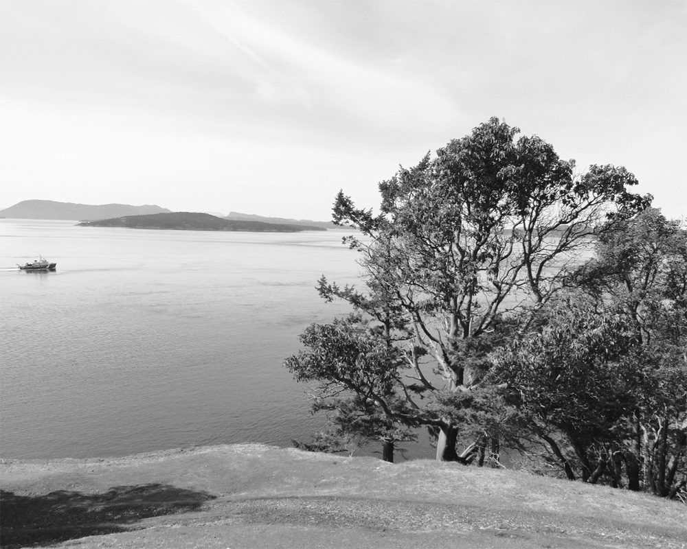
Turn Point provides excellent views of the Gulf Islands across Boundary Pass.
Off the north shore of Orcas Island are a series of small idyllic islands, several of which are marine state parks. With their sandstone composition, they are more similar to the Gulf Islands than to the San Juans. Of these islands, Patos, Matia, and Sucia all offer excellent hiking as well as exceptional camping and opportunities to observe wildlife. Access is via private boat or water taxi service.
Patos Island is a unit of the San Juan Islands National Monument, its 207 acres (84 ha) managed by Washington State Parks. Matia Island is one of the eighty-three islands protected in the San Juan Islands National Wildlife Refuge. Matia and Turn are the only sizeable islands within the refuge—and the only ones open to the public. Washington State Parks manages 5 acres (2 ha) around Matia’s Rolfe Cove as a marine park. The rest of the 145-acre (59-ha) island is federal wilderness, affording undisturbed habitat for endangered and threatened species.
Many believe Sucia Island to be the most beautiful of the San Juans. The island is a worthy destination for hikers, offering several miles of well-marked and maintained trails. The island is shaped like a horseshoe, with several long slender peninsulas, and it is rich in biological diversity and human history.
Sucia’s 564 acres (228 ha) are entirely protected as a state marine park. The island was named by Spanish Captain Francisco de Eliza, after the Spanish word for “foul” or “dirty”—but in this case in a nautical sense, referring to the reefs and rocks surrounding the island. The proper pronunciation is “soo-SEE-uh,” but the island is commonly pronounced “SOO-sha.” Sucia has 60 campsites, 48 mooring buoys, and seasonal potable water.
| Patos Island |
| RATING/ DIFFICULTY |
ROUNDTRIP | ELEV GAIN/HIGH POINT |
| *****/1 | 2.2 miles (3.5 km) | 120 feet (37 m)/70 feet (21 m) |
Map: USGS Stuart Island; Contact: San Juan Islands National Monument and Washington State Parks, Sucia Island State Park; Notes: Dogs permitted on-leash; GPS: N 48 47.056, W 122 57.848
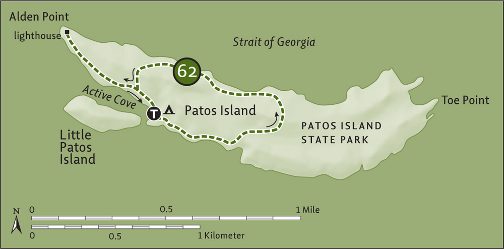

Patos Island Lighthouse
![]() Situated on Boundary Pass, Patos Island is the northernmost of the San Juans and an excellent destination for watching marine traffic and marine mammals—especially orcas. Enjoy hiking along sandstone-shelved shorelines, through old-growth forests, and to a beautifully restored historical lighthouse.
Situated on Boundary Pass, Patos Island is the northernmost of the San Juans and an excellent destination for watching marine traffic and marine mammals—especially orcas. Enjoy hiking along sandstone-shelved shorelines, through old-growth forests, and to a beautifully restored historical lighthouse.
You need a private boat or to arrange for a water taxi to access Patos Island. Outer Islands Expeditions in Eastsound on Orcas Island, (www.outerislandx.com) offers reliable service. The trailhead is at Active Cove. Moorage (2 buoys), campground (7 sites), and privy available. No water.
Patos Island was named by Spanish explorer Commander Dionisio Alcalá Galiano in 1792 (patos means “ducks” in Spanish). The ducks observed were probably alcids—auks, guillemots, and murrelets, which are common here. Uncommon in the San Juans, oak fern grows only on this island in the archipelago. From Active Cove take the path that veers right from the camping area—you’ll be returning from the left on the main path. Walk along the shore, admiring Orcas and Waldron islands. Notice the shelved sandstone—a characteristic shared by the outer San Juan Islands and the Gulf Islands to the north, owing to their younger age than the islands farther south.
The trail eventually turns inland, cresting the island’s backbone (elev. 50 ft/15 m) and traversing old-growth forest harboring some giants. Soon reach the island’s north shore and turn west. Admire excellent views north to the Gulf Islands, Point Roberts, and British Columbia summits and east to Mount Baker. At low tide, explore the shelved coastline.
The way meanders along the shore through a forest choked in thick understory, owing to the island’s dearth of browsers. Climb over a small ridge (elev. 70 ft/21 m) and reach the main path at 1.4 miles (2.3 km). Left goes back to Active Cove—but first you must absolutely go right 0.2 mile (0.3 km), reaching the lighthouse at Alden Point.
Savor the sweeping view of Boundary Pass at one of the most beautiful points in the San Juan Islands, and admire the handsome lighthouse built in 1908. In summer, volunteers with Keepers of the Patos Light (www.patoslightkeepers.org) staff the lighthouse. Go inside and learn about Helen Glidden, the daughter of a lighthouse keeper who penned the book The Light on the Island while living here from 1905 to 1913. When ready to depart, follow the main trail 0.6 mile (1 km) back to Active Cove, passing the old dock site for the lighthouse.
| Matia Island |
| RATING/ DIFFICULTY |
ROUNDTRIP | ELEV GAIN/HIGH POINT |
| ****/2 | 1.8 miles (2.9 km) | 200 feet (61 m)/100 feet (30 m) |
Map: USGS Mount Constitution; Contact: San Juan Islands National Wildlife Refuge and Washington State Parks, Sucia Island State Park; Notes: Dogs prohibited beyond campground; GPS: N 48 44.896, W 122 50.509
![]() Walk among some of the oldest, biggest, and tallest trees in the San Juan Islands. Then explore a hidden cove and a grassy ledged point with a sweeping view of sea and mountains. One of the least visited of the San Juans, Matia is one of the wildest islands in the archipelago.
Walk among some of the oldest, biggest, and tallest trees in the San Juan Islands. Then explore a hidden cove and a grassy ledged point with a sweeping view of sea and mountains. One of the least visited of the San Juans, Matia is one of the wildest islands in the archipelago.
You need a private boat or to arrange for a water taxi to access Matia Island. Outer Islands Expeditions in Eastsound on Orcas Island (www.outerislandx.com) offers reliable service. The trailhead is at Rolfe Cove. Dock, moorage (2 buoys), campground (6 sites), and privy available. No water.
Named Isla de Mata in 1792 by Spanish Captain Eliza for the island’s dense shrubbery, the island became Matia in 1854 when the US Coast Guard added an i. You’ll hear the name pronounced “ma-TEE-a,” in keeping with its Spanish origin, and also “MAY-shuh,” more anglicized. But no matter how you pronounce it, Matia is worth a visit. Given the island’s federal wilderness protection, dogs are not allowed beyond the campground and no off-trail travel is permitted.
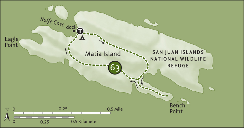
From the Rolfe Cove dock, locate the Wilderness Loop next to a humongous Douglas fir. You’ll be returning from the right, so hike straight ahead through a tunnel of ancient forest greenery. The trail climbs to about 100 feet (30 m), passing between two tree-shrouded knolls. Pass impressive firs, a huge hollowed-out cedar, and big fern boughs. Then reach a hidden cove wedged between sandstone cliffs.
At 0.6 mile (1 km), come to a junction. Take the spur trail left 0.3 mile (0.5 km) along open sandstone ledges to Bench Point and the tip of a small peninsula. Enjoy excellent views of Orcas, Lummi, and Clark islands as well as Mount Baker. Then retrace your way back to the junction and continue straight on the loop. Pass the site of Civil War veteran Elvin H. Smith’s cabin. The famed Hermit of Matia lived all alone here from 1892 until 1921, when he vanished on a supply-seeking rowing trip to Orcas during a storm.
Climb back up to 100 feet (30 m) and then descend through more primeval forest. Pass a tiny cove and wetland before returning to the camping area and dock 0.6 mile (1 km) from the spur junction.
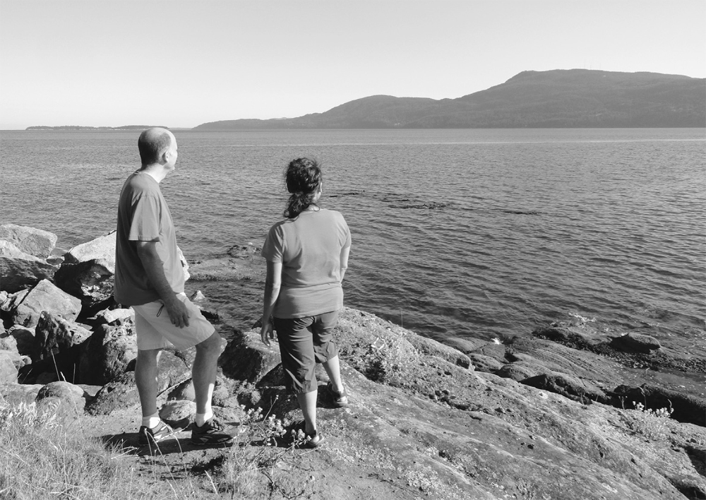
Hikers look out at Orcas Island from Bench Point.
| Ev Henry Finger and Johnson Point |
| RATING/ DIFFICULTY |
ROUNDTRIP | ELEV GAIN/HIGH POINT |
| *****/3 | 4.7 miles (7.6 km) | 550 feet (168 m)/110 feet (34 m) |
Maps: USGS Sucia Island, USGS Eastsound; Contact: Washington State Parks, Sucia Island State Park; Notes: Dogs permitted on-leash; GPS: N 48 45.173, W 122 54.317
![]() Hike along the bluffs soaking up spectacular Salish Sea scenery while exploring a couple of Sucia’s fingerlike peninsulas. Check out the bays that separate them too, looking for eagles, otters, and harlequin ducks—and possibly a fossil or two.
Hike along the bluffs soaking up spectacular Salish Sea scenery while exploring a couple of Sucia’s fingerlike peninsulas. Check out the bays that separate them too, looking for eagles, otters, and harlequin ducks—and possibly a fossil or two.
You need a private boat or to arrange for a water taxi to access Sucia Island. Outer Islands Expeditions in Eastsound on Orcas Island (www.outerislandx.com) offers reliable service. The trailhead is at Fossil Bay dock 2. Privy available.
This is a two-for-one hike: one trip out and back to Ev Henry Finger and another to Johnson Point.
Ev Henry Finger: From dock 2, head left through a picnic and camping area that occupies the isthmus between Fossil Bay and Fox Cove. Look out into Fox Cove Bay for its famous mushroom rock. At 0.2 mile (0.3 km), turn left onto the Ev Henry Loop and start climbing along steep ledges (elev. 75 ft/23 m) above Fossil Bay. After a few ups and downs, aided by steps, come to the loop junction at 0.5 mile (0.8 km).
Go left (you’ll be returning from the right) through a salal jungle, climbing about 75 feet (23 m) and reaching Ev Henry Point at 0.9 mile (1.4 km). From this grassy bluff, the views of Matia, Orcas, Waldron, Pender, and Saturna islands, as well as Mount Baker, are breathtaking. This point was named after yachtsman Everett (Ev) Henry, who led a drive to purchase Sucia from developers who wanted to subdivide it for vacation homes. Henry’s campaign was a success, with his purchases later donated to the state for a park.
Continue on the loop, hovering on a high bluff (elev. 100 ft/30 m) above sandstone-shelved beaches (which can be explored at low tide). At 1.4 miles (2.3 km), close the loop. Then retrace your steps 0.5 mile (0.8 km) back to the dock. On your return, consider a 0.6-mile (1-km) roundtrip side trip to 75-foot (23-m) Fox Point for nice views of Ev Henry Finger, Little Sucia Island, and Fox Cove.
Johnson Point: From dock 2, walk north past the dock to a very informative kiosk about the park. Then pass spurs to Fossil Bay dock 1, reaching a service road. Go right and then left, hiking past the park maintenance buildings and skirting Mud Bay. Pass the Mud Bay Trail (hikable only at low tide) and reach a junction with the Johnson Point Trail (elev. 70 ft/21 m) at 0.3 mile (0.5 km).
Head right, walking up and down along a forested ridge (elev. 110 ft/34 m) to a junction at 0.8 mile (1.3 km). The trail right drops to Snoring Bay and camps before continuing to the tip of Wiggins Head, a 0.5-mile (0.8-km) side trip one-way and well worth the effort. For Johnson Point, continue straight ahead through madrona and fir forests, going up and over ledges above Snoring Bay.
At 1.4 miles (2.3 km), reach the open point (elev. 15 ft/5 m) with its replica of a historical survey post and sweeping views of Mount Baker; Orcas Island’s Mount Pickett, Mount Constitution, and Turtleback Mountain; and Lummi, Matia, and Clark islands. Stay awhile before retracing your steps or considering side trips.
| Shallow Bay and Lawson Bluff |
| RATING/ DIFFICULTY |
LOOP | ELEV GAIN/HIGH POINT |
| *****/2 | 4.1 miles (6.6 km) | 350 feet (107 m)/160 feet (49 m) |
Maps: USGS Sucia Island, USGS Eastsound; Contact: Washington State Parks, Sucia Island State Park; Notes: Dogs permitted on-leash; GPS: N 48 45.173, W 122 54.317
![]() Stroll along Shallow Bay, scanning its serene waters for otters, seals, and guillemots. Check out a sandstone cliff resembling a chunk of Swiss cheese, its façade pockmarked with shallow caves. And walk along a bluff, hovering over crashing surf and soaking up sweeping views of the Gulf and San Juan islands.
Stroll along Shallow Bay, scanning its serene waters for otters, seals, and guillemots. Check out a sandstone cliff resembling a chunk of Swiss cheese, its façade pockmarked with shallow caves. And walk along a bluff, hovering over crashing surf and soaking up sweeping views of the Gulf and San Juan islands.
See directions to Hike 64.
From Fossil Bay dock 2, head right, passing a kiosk and spur to dock 1 and coming to a service road in 0.1 mile (0.15 km). You’ll be returning from the right, so carry on left, following the level service road through thick forest between two ridges. Stay straight at a junction (the trail right leads to Echo Bay), coming to Shallow Bay and a campground at 0.8 mile (1.3 km).
Walk the beautiful sandy beach to the right, enjoying views across the bay to Patos and Little Patos islands and perhaps some patos (ducks) in the bay. The beach is hemmed in by a boggy ghost forest, an excellent place for bird-watching. Pick up trail once again and hike up a steep bluff (elev. 30 ft/9 m) adorned with contorted firs and madronas, coming to Echo Bay Camp on a narrow isthmus between Shallow and Echo bays at 1.2 miles (1.9 km).
Follow the China Caves Trail, now traveling over gorgeous wind- and surf-sculpted sandstone ledges (elev. 50 ft/15 m), some of the prettiest and most photographed natural features in the San Juans. The way descends to a junction. Right heads to the Echo Bay North Camp. You want to go left, reaching the shoreline and the China Caves at 1.5 miles (2.4 km). The caves, small depressions in a big sandstone bluff, allegedly hid Chinese laborers smuggled from Canada in the late 1800s. The entire island has a history of smuggling, from illegal immigrants to alcohol during Prohibition to narcotics.
Now walk the sandy beach to the right, to the Shallow Bay North Camp, and pick up the Lawson Bluff Trail at 1.6 miles (2.6 km). Hike along Shallow Bay looking for playful otters and diving kingfishers. Pass big junipers and round an open bluff with sweeping views of the Gulf and San Juan islands. Then continue north, climbing along Lawson Bluff’s precipitous cliffs (elev. 75 ft/23 m). There are plenty of sunny spots among clusters of shore pines, inviting picnicking and lounging. Keep children nearby while enjoying the views.
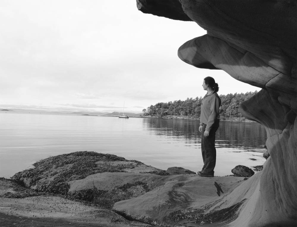
Sculpted sandstone ledges at Shallow Bay
At 2.3 miles (3.7 km), reach a service road. Right returns to Shallow Bay. You want to go left, climbing a little before descending toward Echo Bay. Ignore a right-hand trail to China Caves and a left turn to Ewing Cove (Hike 66), reaching Echo Bay North Camp at 2.6 miles (4.2 km). Now follow the service road right, along Sucia’s largest (and oft windy) bay, admiring Justice and the Finger islands.
At 2.9 miles (4.7 km), come to a junction for trails leading to China Caves and Shallow Bay. Continue on the service road, passing more camps and ignoring a right-hand road shortly afterward. The way, now in forest, marches along the highest ridge (elev. 160 ft/49 m) on the island, coming to a junction just past an old cistern at 3.8 miles (6.1 km). The trail straight goes to Johnson Point (Hike 64). You want to hike right, following the service road off the ridge, passing park maintenance buildings and a familiar junction and returning to Fossil Bay dock 2 at 4.1 miles (6.6 km).
| Ewing Cove |
| RATING/ DIFFICULTY |
LOOP | ELEV GAIN/HIGH POINT |
| *****/2 | 6 miles (9.7 km) | 500 feet (152 m)/160 feet (49 m) |
Maps: USGS Sucia Island, USGS Eastsound; Contact: Washington State Parks, Sucia Island State Park; Notes: Dogs permitted on-leash; GPS: N 48 45.173, W 122 54.317
![]() Hike to a hidden cove away from Sucia’s popular campgrounds and bays. Surrounded by reefs that harbor a plethora of pelagic birds and marine mammals, Ewing Cove is sweet spot to plop down on the beach with binoculars in hand. The trail to the cove, along shoreline bluffs and ledges, grants sweeping views of the sea and islands.
Hike to a hidden cove away from Sucia’s popular campgrounds and bays. Surrounded by reefs that harbor a plethora of pelagic birds and marine mammals, Ewing Cove is sweet spot to plop down on the beach with binoculars in hand. The trail to the cove, along shoreline bluffs and ledges, grants sweeping views of the sea and islands.
See directions to Hike 64.
From Fossil Bay dock 2, head right, first passing an informative kiosk and spurs to Fossil Bay dock 1 and then reaching a service road. Continue right, skirting Mud Bay and passing park maintenance buildings. Follow the road and ascend a ridge, passing the Johnson Point Trail and soon coming to an old cistern, built by one of the island’s early homesteaders. Captain Harnden made a living for his family by farming, barging, shuttling tourists, and remaining friendly with bootleggers who thrived in the San Juans during Prohibition.
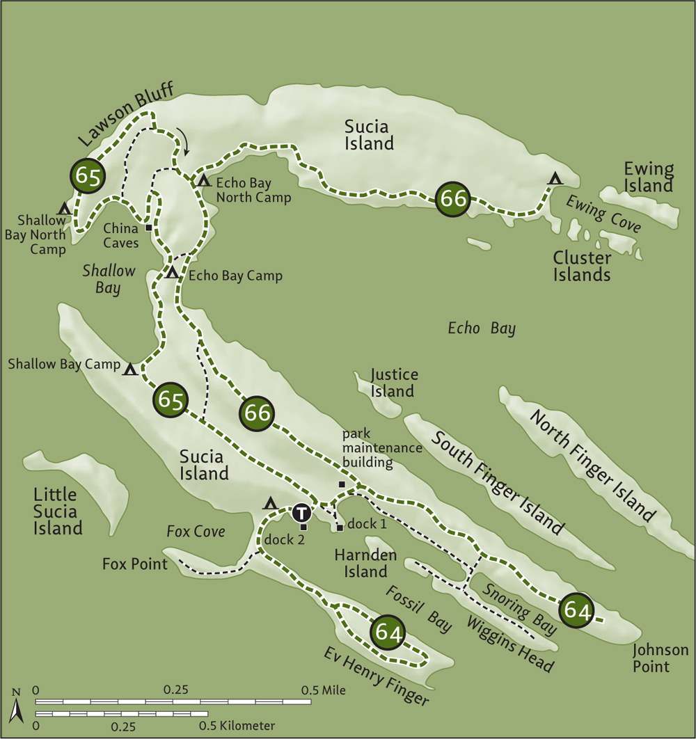
Continue on the service road, traversing the island’s 160-foot (49-m) high point and reaching Echo Bay Camp on a narrow isthmus at 1.2 miles (1.9 km). Stay on the service road, coming to a junction at Echo Bay North Camp at 1.5 miles (2.4 km). Bear right here onto the Ewing Cove Trail for one of the most scenic shoreline hikes in the San Juans.
Roaming up and over and around bluffs and ledges, the trail hugs the northern shoreline of Echo Bay. Amble past mature firs, gnarled junipers, and contorted madronas. At 2 miles (3.2 km), pause on an emerald blufftop, taking in views of nearby Finger Islands and Justice Island (which was seized from a drug smuggler in the 1980s) and farther out to Lummi, Matia, and Orcas islands.
The trail is pure hiking bliss, cresting grassy bluffs and skirting hidden coves favored by marine life. Look for kingfishers in overhanging trees and swallows nesting in the coastal bluffs. After passing through a stand of aspens (divine in October), reach a small sandy beach and campsites at Ewing Cove at 3 miles (4.8 km). Take a break on a weathered beach log and look out across the cove to Ewing and the Cluster islands, hotbeds for seals and birdlife. Return the way you came when you must.
Combine with a trip around Lawson Bluff and to the China Caves (Hike 65).