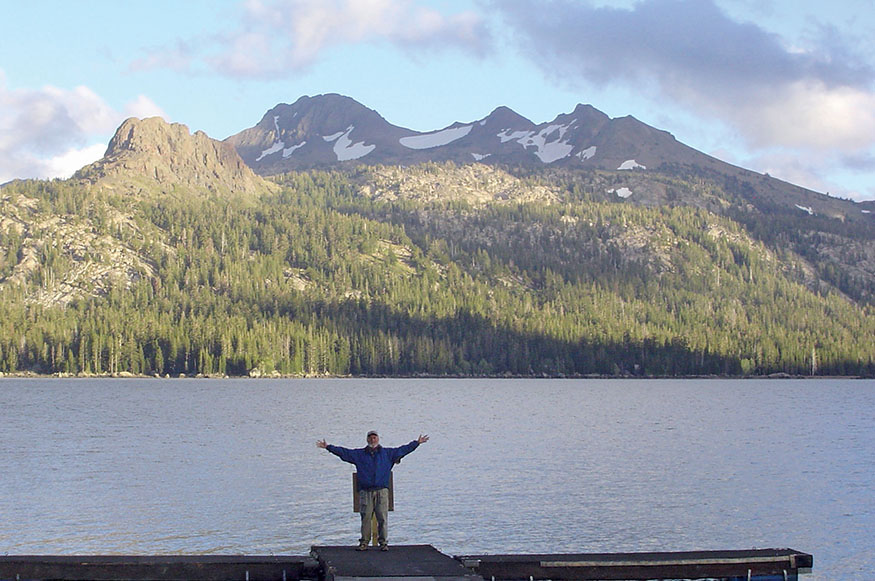
Caples Lake
Crossing the Sierra on the Emigrant Trail
No wealth can buy the requisite leisure, freedom, and independence which are the capital in this profession. It comes only by the grace of God. It requires a direct dispensation from Heaven to become a walker.”
—HENRY DAVID THOREAU, “Walking”
Caples Lake
You can’t see anything from a car, you have got to get out of the god-damned contraption and walk.
—EDWARD ABBEY, Solitaire: A Season in the Wilderness
THIS CHALLENGING TWO- OR THREE-DAY HIKE crosses the Sierra Nevada from east to west. It passes through some of the most breathtaking parts of these majestic mountains, traveling along the trail of the Pony Express and in the footsteps of adventurers who once sought fortune in the gold rush of the mid-1800s. Each day ends at a beautiful mountain resort. Take an extra rest day or two, and enjoy good food, peaceful settings, and a relaxing sauna. The hike crosses Carson Pass and West Pass. The longest day is 19 miles. The first two days will make a lovely walkabout. Day 3 is especially challenging and should be attempted only by experienced hikers. The mountain trail is poorly maintained and may require some cross-country hiking. The trek is perhaps made easier knowing that earlier travelers on this route were hauling all their worldly possessions over the passes by wagon. Walk back into history and across the Sierra Nevada Mountains.
ITINERARY
GOLD WAS DISCOVERED IN CALIFORNIA in January 1848, and word of unbelievable riches spread around the world. Sam Brannan, who ran a general store at Sutter’s Fort, was one of the first to learn of the discovery. Thinking that selling supplies to prospectors would be easier and more profitable than mining, he traveled to San Francisco and paraded through the streets waving his hat and shouting, “Gold! Gold! Gold from the American River.” San Francisco emptied overnight, and the word spread.
Treasure seekers from South America, Australia, and China poured in by sea. Entire crews abandoned ship after passing through the Golden Gate, and San Francisco’s harbor filled with empty ships, creating what looked like a “forest of masts.” Word of the discovery reached Washington, D.C., in November 1848, and President James Polk, wishing to solidify America’s new claim on California, announced the discovery to the nation. The American gold rush was on.
Thousands came by sea, calling themselves Argonauts after Jason and his crew, who sought the Golden Fleece in Greek mythology. Sailing around South America required five to six months, and many perished in the treacherous storms off Cape Horn. Others sailed to the Central American Isthmus, crossed it by land, and picked up another ship on the Pacific shore. Scores succumbed to yellow fever, cholera, and typhoid while slogging over swampy jungle trails.
However, because traveling by sea cost a princely sum—between $200 and $500 (about $6,500–$16,300 in today’s dollars)—most chose the overland route. The Emigrants’ Guide to Oregon and California, published in 1845, set the price of the latter at $50–$60.
Seeking fortune and adventure, they came to St. Louis and traveled for six months by horse, by oxcart, and on foot on the Oregon Trail over the plains along the Platte River before reaching Fort Laramie and the breathtaking scenery of the Rockies. Most left the Oregon Trail north of the Great Salt Lake at Sublette’s Cutoff and made their way to the headwaters of the Humboldt River, to follow its meandering and heartbreaking course through Nevada and the Great Basin.
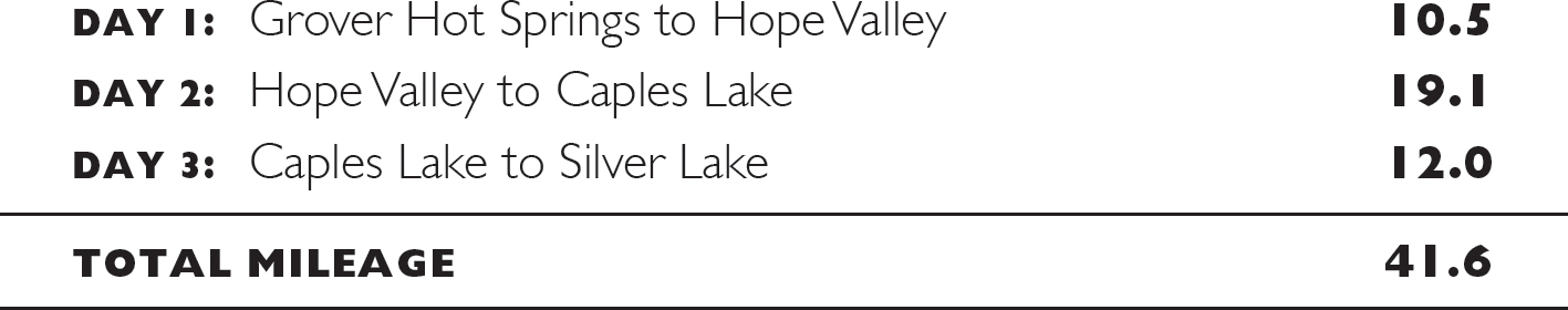
Carson River in Hope Valley
The Humboldt starts out with freshwater and rich pastures, but unlike most rivers that grow as they travel downstream, it disappears into the desert sands, turning into stagnant pools and alkaline plains before finally expiring in the Humboldt Sink. The last 150 miles of the river trail were littered with carcasses of cattle and oxen, discarded furniture, and abandoned wagons. Finally the pioneers crossed the Carson Desert and followed the Carson River into the Sierra Nevada. This route became known as the Emigrant Trail.
Despite higher passes and deeper snow than anything encountered in the Rockies, 20,000 adventurers crossed this route in 1849. Up to 50,000 a year followed from 1850 to 1852 before other routes drew travelers away.
On a crisp autumn day, my friend Scott and I set out to cross the Sierra on the trail of these early pioneers. A 41-mile ramble, this hike starts at Grover Hot Springs in the eastern Sierra, climbs out of Hot Springs Valley, and descends into Hope Valley. Then after crossing Carson Pass, it drops to Caples Lake, climbs over West Pass, and ends deep in the western Sierra at Silver Lake. The route crisscrosses the Emigrant Trail and for stretches follows the footsteps of the pioneers. Along the way, you’ll visit some of the most charming resorts and beautiful country in the Sierra.
Day 1: Grover Hot Springs to Hope Valley
GROVER HOT SPRINGS STATE PARK is just west of Markleeville. You can start the journey with a hot soak and a cold plunge in the pools. Our trail begins at the northwest corner of the park’s campground, skirting the broad, lush meadows of Hot Springs Valley (5,900'). Ascending the north face of the valley, the trail passes through forests of white fir, sweet fragrant Jeffrey pine, and red cedar. After the trail climbs gradually for 2 miles, the last mile of the 1,500-foot ascent is steep. Ancient, stately junipers with deep-red bark and dense, blue berries cling to granite cliffs.
From the crest, the view opens to the east, following the pastoral meadows of Hot Springs Valley down to the deep cut of the Carson River. Forested mountains tower above the valley. Farther east the forests thin, replaced by the desert sagebrush mountains of Nevada and the Great Basin.
We made this trek in mid-September, after the summer crowds, and, we hoped, before the winter snows. The 0.5-mile walk from the crest down to Burnside Lake (8,143') passed through meadows of grasses fading to brown, and skunk cabbage already saffron yellow and bent over, waiting to be blanketed in snow. The aspens at this elevation, higher than 8,000 feet, were starting to turn gold.
Burnside Lake rests in a high Sierra basin. Tall grasses grace most of its shoreline, but there are spots for a picnic and a swim in the clear waters. A dirt road descends a rolling 6 miles to Hope Valley. Sensible travelers will take this route and enjoy a 10.5-mile day of hiking. But not us. We spotted an interesting-looking trail on the map that wound through the mountains above the valley and promised to take us right to our destination, Sorensen’s Resort. After wandering for 4 miles, our trail sputtered out in the forest, and we had to turn back. Our 7:30 dinner reservation slipped by, and we walked the final miles with the glow of the Milky Way lighting our path.
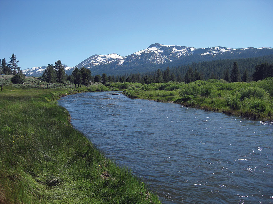
The view as you hike out of Hot Springs Valley
As we staggered into Sorensen’s at 9 p.m., the restaurant had just closed. Our host, after hearing of our 18-mile adventure, offered only sympathy, so we dined on crackers, Brie, and salami. Scott took a long draw on his Lagunitas IPA and said, “This is the best beer I have ever had.” I could not argue.
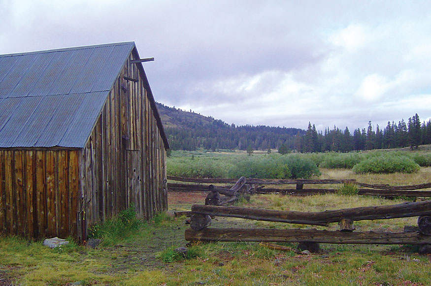
Sorensen’s Resort (7,000') lies at the east end of Hope Valley. Sitting right on top of the Emigrant Trail, it nestles in an aspen grove across the highway from the West Fork of the Carson River. Cabins with fireplaces, kitchens, and comfortable beds, plus a sauna and a fine restaurant, mean a sojourner can rest in comfort.
The Emigrant Trail was blazed and the valley named not by gold seekers traveling west but by a Mormon party heading east to the Salt Lake basin. In 1846 the Mormons traveled west to flee the persecution that plagued them in Illinois and Missouri. Brigham Young accepted a request from President James Polk to form a battalion that would travel to California to fight in the war with Mexico, and 500 men and 90 women set out on the Santa Fe Trail to San Diego.
They arrived a month after the war ended and were discharged in July 1847 at the sleepy pueblo of Los Angeles. Some headed to Yerba Buena (San Francisco’s earlier name), and others traveled north through the Central Valley. Eighty of these men found work with Sutter’s Fort at the confluence of the Sacramento and American Rivers. Six joined James Marshall and traveled 45 miles up Rio de los Americanos to build a sawmill in a beautiful valley that local Indians called Coloma. Marshall discovered gold in January 1848, and the history of California and America changed forever.
Orders came from Brigham Young for the Mormons in California to join the other saints in Salt Lake Valley, and on July 3, 1848, 1 woman, 45 men, 150 oxen, 150 horses and mules, and 17 wagons set out. Following trails that Indian traders used for perhaps 10,000 years, they forged a new wagon route across the Sierra. Crossing two great passes, West Pass at 9,550 feet and Carson Pass at 8,576 feet, they arrived in a serene valley. Henry William Bigler, a member of the first Mormon party, wrote in his journal: “July 29, Moved across about one mile and half and camped at what we called Hope Valley, as we now began to have hope.”
Continuing east down the Carson River and turning northwest, they found the Truckee River. Meeting a group of 18 wagons heading for the gold country, the Mormons drew a map of the new route. Others followed: first a trickle of fortune hunters, then a flood. In California: A Trip Across the Plains, in the Spring of 1850, James Abby wrote of the exhilaration his party felt when they reached Hope Valley after the long journey across the country:
Here for the first time on our route the picture of the mountain scenery is fully realized; the mountains close in upon us on every side, and raise their lofty peaks high toward heaven.
Day 2: Hope Valley to Caples Lake
LEAVING SORENSEN’S RESORT, cross the Carson River on the CA 89 bridge, and walk along the western edge of the valley. Hope Valley is a transition zone from the eastern to the western Sierra. Small streams and marshes fill the low spots, with sagebrush growing on higher ground. In the early 1850s, the valley, a spot to gather strength before ascending Carson Pass, filled with hundreds of wagons and grazing livestock.
After 2 miles, a dirt road (marked 31079) climbs the valley’s western slope to Scotts Lake (8,050'). Then a lovely trail gradually descends along Meadow Creek through forests of juniper, giant aspen, lodgepole pines, and white fir. It feels lush compared to the drier eastern side. Join the Tahoe Rim Trail, and take it south from Big Meadow. The rolling trail climbs gently 3 miles to Round Lake. After 2 more miles, join the Pacific Crest Trail in verdant Meiss Meadow.
The headwaters of the upper Truckee River start here and flow north to Lake Tahoe. In 1878 Louis Meiss bought 1,000 acres of wilderness that included this meadow. Every summer he drove his cattle to the high country to graze on tall grass. He and his wife, Elizabeth, built a log barn and a two-story cabin where they raised 10 children.
Weather can change quickly in the Sierra. So far we had hiked under sunny skies, but the clouds moved in and a gentle rain fell, settling the trail dust and sweetening the mountain air. As you climb out of the meadow, the view north is breathtaking. Mountains frame the broad, lush valley, and in the distance the deep blue waters of Lake Tahoe sparkle, surrounded by towering peaks.
A fierce wind blew from the west as we approached Carson Pass. The trail passes through a vast aspen forest where, bracing against the howling gales that blow through the pass, the trees bow to the east and none stands more than a dozen feet high. The trail meets CA 88 just west of Carson Pass. Head west, paralleling the highway, descending 1,600 feet in 3 miles to Caples Lake Resort (7,800').
Meiss Ranch
Our housing karma was not really clicking on this trip, and the reservations we’d made for two nights in a cabin were misfiled. A cabin and its kitchen would open up for the second night, but only a small room in the lodge was available for the first night. The resort has no restaurant. We had deposited a cache of gourmet delights in advance, but the lodge had only a small microwave. Scott’s East Indian sag paneer and aloo gobi should have simmered on the stove. Instead they were microwaved and eaten out of plastic yogurt containers with crackers as utensils. They had the consistency and taste of mud.
After a few bites he asked, “What do ya think?”
I contemplated the glop. “Up until now I thought the worst meal I ever had was in a village in central India—a disgusting lentil gruel with stale chapaties. After dinner the waiter set the dishes on the ground for the dog to clean. If it weren’t for this beer, this would be the worst meal of my life.”
Scott put his yogurt container and cracker down beside his bed. “No argument,” he said. After pausing for a moment, he added, “I once ate undercooked pig in a fishing village in the Philippines. I was sick for days. That meal was worse than this.”
And so it went, recalling our worst and then our best meals.
“A dim sum feast in Singapore.”
“An inedible vegan nut loaf at a Berkeley meditation retreat—I have felt sorry for vegans ever since.”
Scott studied his Anchor Steam, drank, and said, “This is the best beer I have ever had in my life.”
How many occasions in one lifetime can a person make this claim? Perhaps countless. All we need is a good day of hiking in the Sierra, a comfortable bed in a beautiful spot—even without the best cuisine—and we become more alive. Our endorphins are singing, and simple pleasures bring us joy.
The next morning we moved into a rustic cabin with a fireplace and full kitchen where we cooked and feasted. A snow and rain storm raged outside. When it let up, we walked to the shoreline and watched storm clouds battle above Caples Lake and the surrounding rugged Sierra peaks.
Day 3: Caples Lake to Silver Lake
THE FIRST TWO LEGS OF THIS JOURNEY crisscross the Emigrant Trail, but the last leg follows it for half a day. Crossing 8,576-foot Carson Pass with horses, mules, oxen, and wagons proved an arduous task for the pioneers, but climbing 9,550-foot West Pass was the most difficult trial they faced; they called it “Conquering the Elephant.” After that, the trail to Old Hangtown (Placerville), with the promise of fortunes, was comparatively easy. For the modern trekker, with only a light day pack, this leg is a 12-mile hike that plunges deep into the Sierra wilderness.
Silver Lake
Day 3 of this walkabout can be challenging because the trail from Caples Lake to West Pass is poorly marked and maintained. You may lose the trail at times and need to hike cross-country. Frank Tortorich Jr. has written an excellent guide for this trail: “Hiking the Gold Rush Trail: A Hiking Guide over West Pass.” Please see The Route, for more information.
Leaving Caples Lake Resort, hike along the highway to the dam at the western end of the lake. Then follow the trail along the southwestern shore to a marker for the Historic Emigrant Trail. Before the dam was built in 1922, the basin held two small lakes. The Emigrant Trail passed right through the middle of what is now Caples Lake. Wagons fanned out across the basin, livestock grazed, and travelers rested for the hard push over the final pass. The pioneer wagons, with no brakes or springs, provided a bone-jarring ride, so most forty-niners walked the 2,000-mile journey. They averaged 14 miles a day across the prairie and 6–10 miles in the mountains.
Heading south, the trail gradually ascends through pinewoods. You may spot rust stains on boulders and granite worn smooth from wagon wheels, but it is amazing how little trace there is of the thousands of wagons, cattle, horses, oxen, and pioneers who traveled this same trail. Imagine the fear and excitement those adventurers felt as they climbed to West Pass. They had come so far, and now they were crossing the last great barrier before reaching their dreams. Perhaps some thought they could fill their pockets with gold nuggets lying in streambeds, but most knew they faced hardship in the Sierra foothills and a strong chance of losing everything in the search for riches.
An hour from Caples Lake, the trail passes through wildflower meadows on the back side of Kirkwood Ski Resort. We had the trail to ourselves in September, but in the winter hundreds of skiers and snowboarders fly over the tracks first laid by oxen-drawn wagons little more than a century and a half ago.
Emerging above treeline, the worn trail is still fairly easy to spot; it cuts right to left under a snowfield and up a rock-strewn mountainside to the pass. Imagine pushing a wagon filled with all your worldly goods while oxen strained to pull it over the ridge. Archer Butler’s party scaled West Pass on August 14, 1849, an experience he recounted in Forty-niners:
. . . leaving the lake at its southwestern extremity, [we] soon commenced the assent of the western ridge, the loftiest chain in all these ranges of mountains. The last ascent is six miles . . . The last two miles of the ascent are terrific, being excessively steep, and a part of the way so sideling that it is necessary for several men to brace themselves against the wagon to prevent its upsetting and rolling down the side of the mountain. By doubling teams, and assisting with manual strength, we succeeded in gaining the top of this dreaded eminence by two o’clock in the afternoon . . . We now come to a break in the wall like a gateway; through this we pass, in and instant of New World of California burst at once upon our impatient sight.
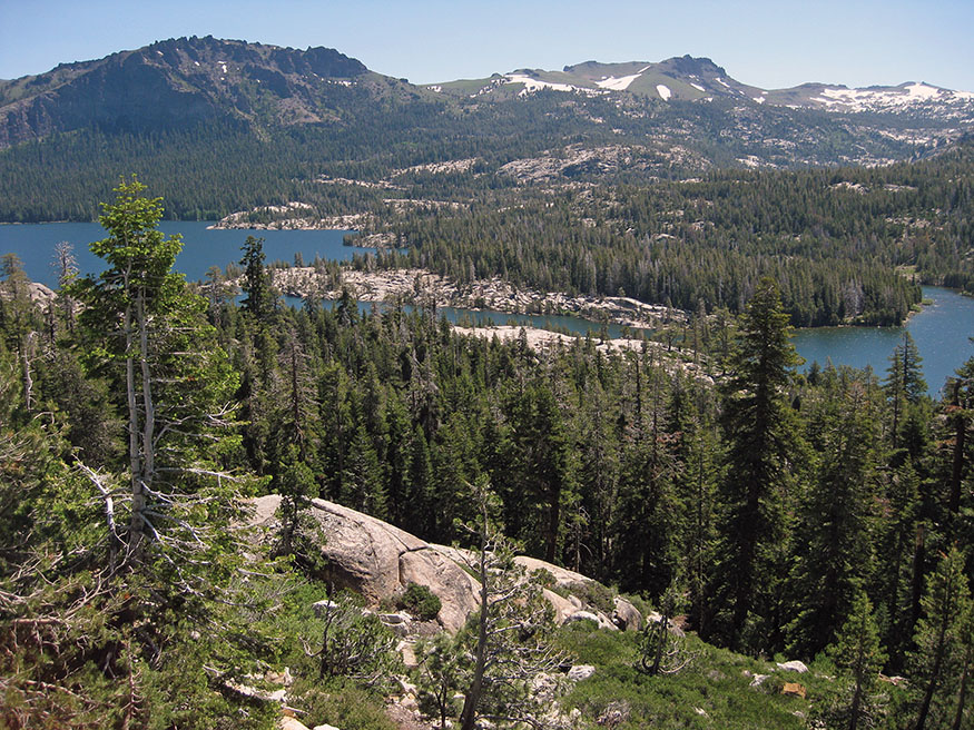
The summit provides a 360-degree view, with Caples Lake, Carson Pass, and mountain peaks stretching into Nevada in the east. Great mountainsides of exposed granite buffed smooth by ancient glaciers shine in the sunlight. To the west the mountains continue to the horizon before they drop to the foothills and Central Valley. Your destination, Silver Lake, sparkles like a jewel in a forested basin to the west.
Scott and I stopped for lunch, resting against a boulder overlooking hundreds of square miles of the Sierra. Horse Canyon Trail beckoned to us as it wandered above the treeline in the distance, but we were in no hurry to hike the last 5 miles of our journey. Neither of us wanted our adventure to end.
Scott said, “I think this hike is so relaxing because it narrows the choices of modern life. I’m always thinking about what I’m going to do next, where I’m going to go, what work needs to be done. I’ve felt free of that stress.”
“We’ve reduced the distractions,” I said.
“Right,” he said. “I’ve felt more relaxed each day. Our first day I thought about all the things I need to do when I get home. Today my mind feels calm, and I’ve really tuned into this beautiful wilderness. We haven’t needed to make many choices, just pay attention to the trail and keep walking.”
Horse Canyon Trail heads west through forests and then breaks through the treeline. A few western junipers cling to the rocks with thick gnarled trunks twisted and bent by fierce storms that rage along this open, western-facing slope below Thunder Mountain. In the Sierra, some of these junipers live 3,000 years. The trail gradually descends through fields of wildflowers. As winter approaches, most have turned shades of brown and red with hints of pale green, but a few orange paintbrushes and light-blue lupines survive to decorate the landscape.
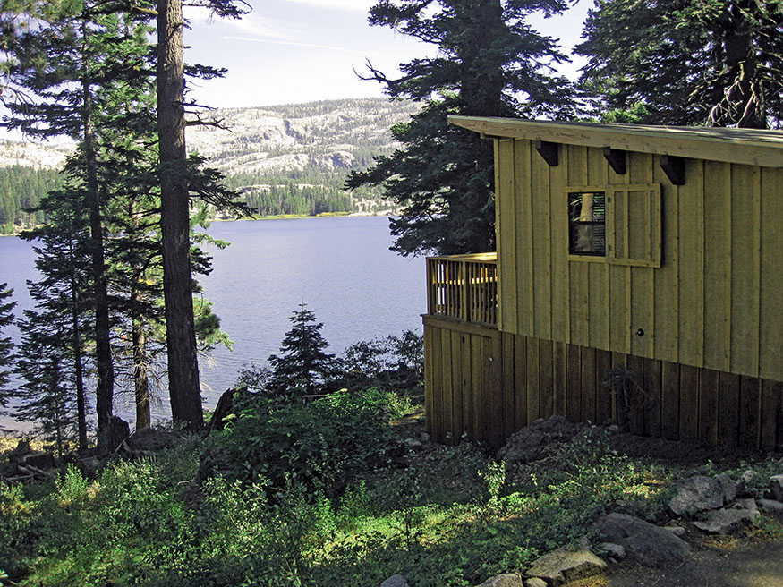
The trail drops through dense forests of white fir and towering aspen and emerges on CA 88 just north of Silver Lake. Walk the highway shoulder a short distance, and turn on the road that runs along the north side of the lake. The Kit Carson Lodge sits on a peninsula with comfortable cabins, a store, and a good restaurant. Most of the cabins have porches overlooking the peaceful lake surrounded by thick pine forests and exposed granite. Ospreys soar gracefully above the waters and then abruptly dive, turning talons first to snare a fish for dinner. Put your feet up and savor the memories of crossing the Sierra in the footsteps of California’s first inhabitants and those of the pioneers.

Thunder Mountain as seen from Horse Canyon Trail
THE ROUTE
All mileages listed for a given day are cumulative.
Day 1: Grover Hot Springs to Hope Valley
Drive 4 miles west from Markleeville on Hot Springs Road to the Grover Hot Springs State Park campground, and park at the end of the road that runs along west side of the campground ($8). The trail starts at the end of the road.
Walk from the Grover Hot Springs campground on the trail along the north side of the valley, following the signs to Burnside Lake. 3.8 miles
Descend the gravel Burnside Lake Road to CA 88. 9.5 miles
Hike east along the broad shoulder of CA 88 to Sorensen’s Resort.
total miles 10.5
Day 2: Hope Valley to Caples Lake
Leaving Sorensen’s Resort, hike west along CA 88 for 1 mile to CA 89, and cross the Carson River on the CA 89 bridge. Hike south on the west side of Hope Valley to the major Forest Service road (FS 31079) that climbs west out of the valley to Scotts Lake. FS 31079 can also be reached by continuing to walk along CA 88 for 1.4 miles beyond the CA 89 intersection. There is an open corridor paralleling CA 88 that is pleasant for walking. Turn right on a dirt road and right at the Y junction. After 0.3 mile, the road ascends to Scotts Lake. The rugged dirt road is marked with signs saying 31079 at both spots.
Leave Sorensen’s Resort and hike to Scotts Lake. 6.0 miles
Follow Meadow Creek Trail to the Tahoe Rim Trail at Big Meadow. 8.5 miles
Turn south on the Tahoe Rim Trail to Round Lake. 10.6 miles
Continue to Meiss Meadow and the Pacific Crest Trail. 13.0 miles
Hike the Pacific Crest Trail south to CA 88 just west of Carson Pass. 15.4 miles
Descend along CA 88 to Caples Lake Resort.
total miles 19.1
Day 3: Caples Lake to Silver Lake
The 3.6-mile section of the trail from Caples Lake to West Pass is poorly maintained and poorly marked. Keep an eye out for metal trail markers on trees and cairns left by other hikers. Frank Tortorich Jr.’s guide, Hiking the Gold Rush Trail: A Hiking Guide over West Pass ($14), is usually available at the Sorensen’s Resort bookshop, at the Carson Pass Visitor Center.
Hike west along the shoulder of CA 88 to the dam at the west end of Caples Lake. Take the trail on the west side of Caples Lake to the trail marked HISTORIC EMIGRANT TRAIL. 1.9 miles
Hike south on Emigrant Trail to West Pass. 5.5 miles
Shortly past West Pass, take Horse Canyon Trail west to CA 88. 10.8 miles
After a short walk south on CA 88 to Silver Lake, take the road on the north side of the lake. Follow the signs to Kit Carson Lodge.
total miles 12.0
A cabin at Kit Carson Lodge
TRANSPORTATION
Driving Directions with Two Cars
LEAVE ONE CAR AT YOUR FINAL DESTINATION, Caples Lake Resort or Kit Carson Lodge at Silver Lake, and drive the second car to Grover Hot Springs. Drive to Markleeville, turn right on Hot Springs Road, and continue another 4 miles. Park at the end of the road that runs along the west side of the campground ($8). Don’t forget to stop at the Caples Lake Resort to drop off food for your stay. Caples Lake Resort has a very small store but no restaurant.
Driving Directions with One Car
WITH ONE CAR, THERE ARE THREE OPTIONS for returning to Grover Hot Springs from Caples Lake Resort or Kit Carson Lodge at Silver Lake. Ask your innkeeper if he or she can arrange for transportation. We have found that people go out of their way to assist inn-to-inn hikers. A ride-hailing service is possible, although not always available this far from cities. A third option is a taxi. These taxi services are centered in South Lake Tahoe. Quotes on fares from Silver Lake to Grover Hot Springs ranged from $60 to $100.
ELITE TAXI 530-580-8294
SUNSHINE YELLOW CABS 530-544-5555
Don’t forget to drop off a supply of food at Caples Lake Resort. It has a very small store but no restaurant.
A Car-Free Option
THERE IS NO BUS SERVICE along this walkabout, but public transportation to South Lake Tahoe is available through Amtrak. Take the train to Sacramento and an Amtrak bus to South Lake Tahoe. The fare is $55 from Oakland and $73–$107 from Los Angeles. Go to amtrak.com for schedules and fares. For taxi services from South Lake Tahoe to Grover Hot Springs and returning from Silver Lake, please see previous section.
MAPS
NATIONAL GEOGRAPHIC’S Lake Tahoe Basin ($11.95) covers Days 1 and 2 of this walkabout. Their Carson Iceberg, Emigrant and Mokelumne Wilderness Areas covers Day 3. Go to shop.nationalgeographic.com.
PLACES TO STAY

Markleeville and Grover Hot Springs
Markleeville is 28 miles south of Lake Tahoe on CA 89. Grover Hot Springs State Park is 4 miles west of Markleeville at the end of Hot Springs Road.
CREEKSIDE LODGE $–$$ • 14820 CA 89 • Markleeville • 530-694-2511• creekside-lodge.com • Adjacent to Wolf Creek Restaurant.
GROVER HOT SPRINGS STATE PARK $ • 530-694-2248 • parks.ca.gov • Beautiful campground a short walk from the hot springs.
Hope Valley
SORENSEN’S RESORT $$–$$$$ • 14255 CA 88 • East of the intersection of CA 88 and CA 89 • 800-423-9949 • 530-694-2203 • sorensensresort.com • Great restaurant serving breakfast, lunch, and dinner; cabins with fireplaces, kitchens, and comfortable beds, plus a sauna.
Caples Lake
CAPLES LAKE RESORT $–$$$$ • 1111 CA 88 • 1 mile east of Kirkwood on CA 88. • 209-258-8888 • capleslakeresort.com • Small lodge rooms, nine comfortable cabins with fireplaces and kitchens. Beautiful setting on Caples Lake. No restaurant, so drop off a cache of food to cook in your cabin. No kitchen in the lodge rooms. Small store.
Silver Lake
KIT CARSON LODGE $$$–$$$$ • 32161 Kit Carson Road • 5 miles west of Kirkwood • 209-258-8500 • kitcarsonlodge.com • Beautiful setting on Silver Lake. Hotel rooms and cabins with balconies overlooking the lake. Nice restaurant serving Continental breakfast and dinner. Small store.