
American River
SIERRA NEVADA FOOTHILLS ALONG THE AMERICAN RIVER
Auburn to Sacramento
We are rapidly descending into the spring and we are leaving our snowy region far behind; everything is getting green; butterflies are swarming; numerous bugs are creeping out, wakened from their winter’s sleep, and the forest flowers are coming into bloom.
—JOHN C. FREMONT, March 1, 1844, journal entry along the American River
American River
One’s destination is never a place, but rather a new way of looking at things.
—HENRY MILLER, Big Sur and the Oranges of Hieronymus Bosch
THE AMERICAN RIVER STARTS HIGH IN THE PEAKS of the Sierra Nevada. It winds and crashes through deep canyons down to the foothills, where it is eventually tamed to form Folsom Lake. Released again, it flows wide and powerful to meet the Sacramento River. The discovery of gold on the American in 1848 brought a stampede of thousands to mine its banks and create a new California.
This 66-mile, four-day walkabout starts in the foothills town of Auburn and descends downstream, along the river. Spring is the perfect season for this hike, when the willows and cottonwoods are leafing out, wildflowers grace lush meadows, and the river is raging. Along the way you will visit a country B&B, inns on the river bank, and a luxurious resort and spa. Hike back in time through the old towns of Auburn, Folsom, and Sacramento, and enjoy saloons, a brewpub, live music, and excellent restaurants. Walk in the footsteps of the pioneers, hiking from inn to inn through the Sierra foothills along the American River.
Looking for a fun weekend inn-to-inn hike? Try the first two days of this walkabout. See page 70 for details.
ITINERARY

Day 1: Auburn to Flower Farm Inn
IT WAS A CHILLY MORNING in late January 1848 when James Marshall walked the millrace below the sawmill that he and his Mormon crew were constructing to supply lumber for Captain John Sutter’s ambitious building plans. They had diverted Rio de los Americanos into a narrow channel as it flowed through the valley named Coloma. The river now passed below the mill at a velocity that would drive the waterwheel that powered his saw. He stooped to pick up two gleaming pebbles and examined their luster in the morning sunlight. Pounding one between two rocks, he “found it could be beaten into different shape, but not broken. I then collected four or five more pieces.” His discovery would change the course of history for the United States, for California, and for the American River.
On May 16, 1848, just a few months after Marshall’s discovery, Claude Chana, a French prospector, camped on the banks of a small foothills creek, Auburn Ravine. He panned for gold in the frigid water and was rewarded with three heavy nuggets. A rush of treasure hunters followed, and the village of Auburn—the oldest gold rush town in California—was born. First a hamlet of tents sprang up, but fires laid it to waste. Still the town prospered, becoming the commercial center for the surrounding mining towns and a major stop on the road to Sacramento and San Francisco. Brick replaced wood and canvas, and many buildings from the 1890s have been restored to house the commercial enterprises of modern Old Town Auburn.
Our journey starts here. There are a few inns within a mile of Old Town. Others are farther away, along the interstate, but Old Town is worth a visit. The Auburn Ale House brewery has a nice selection of pub food and drafts. Across the street, the Edelweiss Restaurant, a good breakfast spot with a wide selection of omelets, is a local hangout where Auburnians meet to discuss the news of the day.

Flower Farm Inn

Looking down on the American River from Cardiac Hill
Leaving Old Town Auburn, walk up Sacramento Street through what was once the center of Chinese businesses and the red-light district. There were few women in the gold country during the 1850s. Here was a neighborhood where a miner with gold dust in his pocket could find gambling, opium, and other diversions. He might depart with his pockets empty.
A mile from Old Town, you will join Western States Trail. See The Route for directions to the trailhead. Best known as a horse path, the trail winds behind the easternmost houses of Auburn through an oak forest and along a pretty irrigation canal until it reaches Maidu Avenue (2.5 miles). The famous Tevis Cup Ride, a one-day, 100-mile horse race from Squaw Valley to Auburn, follows this route. Western States Trail continues down the American River with “staging areas” for parking horse trailers.
This is also the route of the Western States 100, a footrace that starts in Squaw Valley and ends at Placer High School in Auburn. Starting with a 2,200-foot ascent out of Squaw, runners navigate 100 miles of mountain trails with more than 18,000 feet of cumulative elevation gain. Timothy Olson set a race record in 2012 with the extraordinary time of 14:46:44.
Auburn sits atop the western slope of the American River Canyon, just downstream from the confluence of the North and Middle Forks of the river. The whitewater churns and winds far below. Our hike starts at an elevation of 1,359 feet and drops to 50 feet in Sacramento, but 900 feet of that descent happens within a few miles of Maidu Avenue. You can either continue along the irrigation canal 0.7 mile and then make a steep descent on trails to the river or follow the road from the entrance to the China Bar Area for a more gradual, paved descent. Please see The Route for more details.
The American was raging on the April morning when my friend Scott and I set out on this walkabout. It was early spring after the wettest rainy season in more than a decade, but on this day the skies were clear and sunny. Racing through the narrow canyon, conforming to and sculpting its contours, the river roiled, whitewater crashing into boulders and bounding off canyon walls.
The three forks of the American have their sources high in the Sierra. On the western slopes of Granite Chief, above Squaw Valley, the North and Middle Forks are born at around 8,000 feet. They can each be crossed with a few steps while hiking the Pacific Crest Trail. Granted Wild and Scenic status in 1978, the North Fork surges through a canyon with sheer walls soaring 4,000 feet. Its raging Class IV–V rapids can be navigated only by the most expert rafters and kayakers. The two forks merge near Auburn. Originating at Echo Summit, above Lake Tahoe, the South Fork’s more manageable Class II–III rapids make it the most popular river for rafting and kayaking west of the Rockies. The South Fork joins its two sisters at Folsom Lake.
Two trails follow the river downstream. The lower trail stays close to the water’s edge and may be preferable in summer when the river is lower. In early spring it was mostly submerged in the high water. The upper trail ranges from 100 feet to 0.25 mile above the river. It passes through forests of oaks and gray pines. In early April, wildflowers were just starting to bloom: blue lupine, white and pale-blue Douglas iris, and buckbrush dense with clusters of sweet-smelling white flowers. Poison oak was also thriving after the winter rains. It was lush, blooming with small white flowers and stretching out to caress the unwary hiker.
After 4 miles of whitewater rapids, the canyon widens and the current slows, starting to back up and fill Folsom Lake. Its color turns from shades of glacial greens to browns as it decelerates and quiets. Our route passes old mining towns that have been swallowed by the lake and have left few traces. Rattlesnake Bar was a thriving hamlet of 1,000 miners in 1865. A Mormon community mined Horseshoe Bar in 1848. There were more than 35 gold mining settlements along both sides of the American.
Now you are hiking along Folsom Lake, a vast reservoir formed by the Folsom Dam, which was built in 1955 for flood control, Central Valley irrigation, hydroelectric power, and recreation. The lake holds 1 million acre-feet of water. It was rapidly filling with spring snowmelt, and the gates of the dam were thrown open to leave room for when the weather in the Sierra turns warm and the snowpack melts in earnest. The trail is lovely, passing through forests and meadows. It was muddy at times but always passable and always feeling like a gradual descent.
You will reach the sign for Sterling Pointe Trail at 14.3 miles. Hike up to the staging area, and follow The Route along Lomida Lane to Auburn-Folsom Road. Turn right and proceed 0.2 mile to Flower Farm Inn. The only inn along this section of the river, it is a delightful oasis with cottages, a café, a nursery, and beautiful gardens. Chinese Silkie chickens, white and gray with fluffy plumage reaching all the way to their feet, have the run of the grounds. Fran, our host, learning that we had arrived on foot, disappeared into the back room. He emerged with a complimentary bottle of cabernet and the number for the Loomis pizza parlor. That evening we sat on the porch of our cottage in the last warm rays of the setting sun dining on pizza and sipping wine, content after a very pleasant day of hiking. The café is open Wednesday–Monday, 7:30 a.m.–4 p.m., with a great selection of sandwiches for the trail or for dinner.
Day 2: Flower Farm Inn to Old Town Folsom
JOHN BOWLER, THE FLOWER FARM INN’S PROPRIETOR, served us a delicious breakfast of sausages and farm-fresh eggs in the dining room of the main farmhouse. Affable and friendly, John is a former high school art teacher and now a very happy innkeeper. The B&B is a popular venue for weddings and a welcome refuge for an inn-to-inn hiker.
Retrace your steps back to the Sterling Pointe staging area and Western States Trail. Continue downriver. After hiking through the forest for a mile, we spotted the lower trail along the shoreline and decided to hike it until it disappeared into the rising lake. We had to periodically scramble to higher ground when the trail dipped beneath the surface or into a tributary. Views of Folsom Lake and the surrounding countryside opened up when we left the wooded upper trail. This is a hot and arid land in the summer, dominated by oaks and massive granite outcroppings, but in early spring it is verdant—long gray-green needles of stately gray pines, yellow-greens of freshly emerging willow and blue oak leaves, and deep-green grasses of every shade gracing the shoreline. Rounding a bend, the trail passed through broad fields of deep-blue lupine. Buckeyes became more prevalent as the trail descended, their tender spring leaf bundles unfolding. Turkey vultures and red-tailed hawks circled slowly on warm updrafts. Wild turkeys scampered across the trail and chortled in the woods. A small herd of mule deer grazed on the tall shoreline grass. Across the lake, to the east, the snowcapped peaks of the Sierra towered in the distance.
The trail follows a long ditch that winds along the contours of the lake. It is overgrown, and trees now grow out of its base. This crumbling artifact is a remnant of advanced gold mining techniques.
The gold that miners worked so hard to harvest started its journey 200 million years ago in a fiery sea of molten rock deep beneath the surface of the earth. Occasionally, the liquid rock would find a fault in the earth’s crust and erupt as a volcano. One massive molten bubble ascended to near the surface and cooled, creating the Sierra Nevada Batholith, a mass of granite beneath California and Nevada. As the bubble cooled, individual minerals froze into solid rock at different rates, forming veins. The Sierra Nevada Batholith was rich with veins of gold-bearing quartz.
Ten million years ago the immense pressure of the North American Continental Plate grinding over the Pacific Ocean Plate caused uplifts and folds, forming the Sierra Nevada Mountains. The earth’s thin mantle crumbled and eroded, exposing the granite. During ice ages, glaciers ground, polished, and carved Sierra valleys and peaks. In warmer periods, water and ice filled cracks in the rock surface, breaking off pieces that tumbled into rivers to be pummeled by racing currents. The grinding separated gold from quartz: the lighter quartz washed downstream, while the heavy gold sank, accumulating beneath boulders and in eddies.

Fields of springtime lupine
The first miners employed a shovel and knife to search for gold nuggets, but it soon became clear that most of the gold was in the form of very small flecks and grains. A new technology was adopted: panning. A miner scooped a slurry of gravel and water into his broad, flat pan and swirled it, washing the lighter pebbles over the edge and leaving behind the heavier gold dust.

Approaching Folsom, pass through an aged olive grove.
Soon the individual entrepreneur gave way to collectives using an advanced technology, the “California cradle.” One man shoveled ore into a sieve about the size and shape of a cradle, and another poured in buckets of water, washing the mixture down the floor of the cradle over strips of wood. The heavy gold sank and settled behind the strips. A third man rocked the cradle, moving the lighter minerals out the bottom. They stopped frequently to remove the gold dust and nuggets.
The cradle gave way to the more efficient “long-tom,” three planks, 9–12 feet long, nailed together. The team shoveled ore into one end, and water was supplied by buckets, a hose, or a small canal. The long-tom needed to be emptied only twice a day, saving much of the cradle’s drudgery.
There was serious money to be made. Individual entrepreneurial miners were replaced by corporations, and the miner became a wage slave. Rivers were dammed, partially or entirely, diverting the flow from their beds and exposing new territory for surface mining. Water was redirected into ditches and flumes. The long ditch running along the banks of Folsom Lake and Western States Trail is part of North Fork Ditch, built by the Natoma Company between 1852 and 1854.
The land becomes less wild, and there are more signs of civilization as you pass Granite Bay, 6.9 miles from the start of the second day’s hike. We had seen only a few other hikers and no houses from the trail since we’d left Auburn, but as the massive Folsom Dam comes into view, fishing boats are more common, teenagers gather on the shoreline, and the trail follows the crest of tall levees. The South Fork of the American River, the branch where James Marshall made his discovery, flows into Folsom Lake across from Granite Bay. The three forks have joined into one river.
The American River Parkway, a paved bike trail, starts its 31-mile journey to Old Sacramento at Beals Point (11.7 miles), just above Folsom Dam. It was a bit of a shock to leave the soft, convoluted woodland and shoreline trails to feel unyielding asphalt under our feet. Fortunately Western States Trail separates from the paved trail just below Folsom Dam.
This spring the Sierra was blanketed with its deepest snowpack in 60 years, and the river surged through the dam’s open gates. Below the dam, Folsom State Prison, built in 1880, stands ominously across the river like an ancient massive medieval citadel. Johnny Cash’s mournful “Folsom Prison Blues” ran through my mind. “I’m stuck in Folsom Prison, and time keeps draggin’ on.”
The trail passes through an aged olive grove and then returns to the river as it approaches the town of Folsom. Cross the river on Rainbow Bridge, and walk a short distance into Old Folsom.
Restaurants, taverns, and shops line recently renovated Old Town. We dined on delicious Mexican cuisine at Qbole and then capped the night at the Folsom Hotel and Saloon, where a local rock band played for a raucous and appreciative crowd.
The first two days of this walkabout would make a great weekend inn-to-inn hike. A light-rail train provides an easy ride into Sacramento. If you are hiking all the way to Old Sacramento, Folsom is a nice place to stop over for a rest day.
Day 3: Old Town Folsom to Arden Hills Resort, Club & Spa
ALTHOUGH JAMES MARSHALL had intended to stay in Coloma until construction of the sawmill was completed, his discovery of gold compelled him to return on the muddy trail to Sutter’s Fort. He and Sutter ran more tests, submerging a nugget in nitric acid. It came out untarnished. Sutter concluded, “I declare this to be gold.”
Sutter tried to keep the discovery a secret, but rumors slowly started to spread. Still, there was no great rush until Sam Brannan took action. Brannan had recently opened a general store at Sutter’s Fort and thought that selling supplies to prospectors would be easier and more profitable than doing the backbreaking work of mining. Quietly he bought up all the gear and mining supplies a gold miner might need. On May 12, taking a small quinine bottle of gold dust to San Francisco, he marched through the streets waving his hat crying, “Gold! Gold! Gold from the American River!”
Almost overnight, San Francisco nearly emptied, its inhabitants heading for Sutter’s Fort and the American River. The citizens of Monterey and Los Angeles soon heard of the riches and also headed for the hills. The military governor of California, Colonel Richard Mason, noted in August 1848:
The discovery of these deposits of gold has entirely changed the character of Upper California. Its people, before engaged in cultivating their small patches of ground and guarding their herds of cattle and horses, have all gone to the mines, or are on their way thither; laborers of every trade have left their work, and tradesmen their shops; sailors desert their ships as fast as they arrive on the coast, and several vessels have gone to sea with hardly enough hands to spread a sail.”
The news spread by ship, and treasure seekers from South America, China, and Australia poured in by sea. It took until November 1848 for word to reach Washington, D.C. President James Polk, wishing to solidify America’s new claim on California, announced the discovery to the nation, and the American gold rush was on.
Leaving Folsom, return to Rainbow Bridge, cross the river, and turn left on the bike trail. As you depart Folsom, you are walking through what once was the African American gold mining settlement of Negro Bar, founded in 1849. By 1850–51 there were 700 inhabitants, a store, and two hotels. In 1855 the town of Folsom was created, swallowing the small hamlet of Negro Bar.
The river moves briskly through Folsom, but it soon slows as it flows into Lake Natoma, a narrow reservoir that our trail follows for the next 5 miles until the Nimbus Dam. The hiking/biking trail winds along the northern shoreline on a narrow corridor between the lake and steep bluffs. The cliffs reveal layers of sandstone, lava flows, and the remnants of an ancient riverbed.
Mining technology continued to advance, and hydraulic mining was applied to these bluffs in the 1880s to profitable and devastating effect. Ditches were dug and pipes laid from an upstream dam. Swivel-mounted cannons concentrated the pressure of gravity-fed water with incredible force. The blast of water tore into the hillside, washing away tons of rock and soil. A Sacramento paper reported on one hydraulic operation:

Redbuds, some standing 20 feet high and wide, bloom in the spring.
With a perpendicular column of water 120 feet high, in a strong hose, of which they work two, ten men who own the claim are enabled to run off hundreds of tons of dirt daily. So great is the force employed that two men with the pipes, by directing streams of water against the base of the high bank, will cut it away to such an extent as to cause immense slides of earth, which often bring with them large trees and heavy boulders. . . . After these immense masses of earth are undermined and brought down by the streams forced from the pipes, those same streams are turned upon the tons of fallen earth, and it melts away before them, and is carried through the sluices with almost as much rapidity as if it were a bank of snow.
After a few miles, the bluffs recede, the land on the north side of the lake widens, and the paved bike trail strays away from the shoreline. A horse and hiking trail leaves the paved bike trail and heads off along the river through a shady oak forest. The hiking and horse trail is often marked as Western States Trail, as Pioneer Express Trail, or with the symbol of a horse and rider. It usually runs close to the river and through the forests. We tried to stay off the paved path whenever possible, and we managed to hike trails for probably 22 of the 28 miles between Folsom and Old Sacramento, the final two days of this walkabout. The feet somehow relax when they walk on soft, uneven earth and tire more quickly when walking on unforgiving asphalt.
American River Parkway is the longest continuous linear park in the United States. It appears as a narrow strip of green on the maps, but it feels expansive on the trail. The hiker knows that civilization is only a mile or two away, but the forests are deep and tranquil. We could not hear the sounds of traffic, lawn mowers, or even the conversations of bikers, only spring songbirds, the breeze through the trees, the river, and the chortle of wild turkeys in the woods.
The trail crosses the river 5.2 miles from Folsom on Hazel Avenue, just below Nimbus Dam. Now the river flows wild and powerful to its final destination, the confluence with the Sacramento River. It is controlled by the Folsom and Nimbus Dams, but the dam gates were opened wide this April morning. Islands were submerged, their willows and cottonwoods standing strong in the mighty current.
The trail winds through dense woods; open grasslands; and riparian forests of willows, cottonwoods, and box elders. Black walnuts and buckeyes join the forests of valley and live oaks. Redbuds, some standing 20 feet high and wide, were just coming into full bloom with brilliant lavender flowers. Canada geese and pairs of mallards rested from their long migrations in quiet eddies. Western pond turtles took sunbaths on logs. Fallen trees reveal the work of beaver. Rainbow trout, salmon, steelhead, and bass call the river home. We paused to watch three graceful river otters fishing and gamboling in a backwater, chasing each other, tumbling in an embrace, and then diving and streaking off. Butterflies grazed on wildflower blossoms.
Cross the river one more time at 14.1 miles, and enter William B. Pond Recreation Area. Turn inland shortly after the bridge to the park entrance and Arden Way. Follow The Route to the Arden Hills Resort, Club & Spa. There is other lodging off Sunset Boulevard. See Places to Stay for hotels and directions.
The Arden Hills Resort, Club & Spa is a fun place and a good value. The rooms are spacious and elegant, and a deep, soothing bathtub with jets massages the hiker’s weary muscles. You become a member for the days you stay, and you can use the Jacuzzi, pools, tennis and basketball courts, and spa. This is a great place for a rest day before the final leg of the hike. Enjoy a massage and even a pedicure. The restaurant is excellent: Scott dined on vegetarian pasta, and I feasted on melt-in-your-mouth prime rib. They will send you off in the morning with a full complimentary breakfast prepared to order by the chef.
Day 4: Arden Hills Resort, Club & Spa to Old Sacramento
RETRACE YOUR STEPS back to William B. Pond Recreation Area, and head downstream for the final 16.8-mile leg of the journey. Hiking along the north bank, you pass a series of man-made ponds and backwaters, the product of gold- and gravel-dredging operations in the early 1900s.
The discovery of gold on the American River sparked a rush bent on extracting wealth at any cost to the river—redirecting its flow, blasting its escarpments with hydraulic cannons, dredging its bed and banks, damming for power and flood control. Still, the mighty American is far from tamed or subdued. It is powerful, wild, and beautiful. Fish and aquatic life thrive in backwaters carved by dredges. Herons and egrets fish in the still waters.

Flooding on the lower American River
The river swings northeast 2 miles just past the Home Avenue Bridge and then turns northwest for its final 6 miles. We had planned to stay on the river’s north bank through Discovery Park and to cross into Old Sacramento on Jibboom Street, just before the confluence, but the river swelled, and parts of the trail and bike path were flooded. A couple pushing their possessions in a shopping cart told us Discovery Park was completely flooded and that it would be impossible to get to Old Sacramento on foot from the north bank. Try as humans might, the American will not be controlled. They directed us to cross the river on the pedestrian bridge just before 12th Street and to stroll into town on the Two Rivers Trail along the river’s south shore. As we hiked, we could see that Discovery Park was completely submerged.
We strolled along the wooden sidewalks of Old Sacramento to the Hostelling International hostel, a beautiful old mansion with a friendly staff, and stayed in a very inexpensive private room. That evening we crossed the Sacramento River on Tower Bridge to Raley Field and cheered the Rivercats to victory over the Tacoma Rainiers. Walking back, we stopped on the bridge to watch the river run wide and swift. The great rivers of Northern California, including the American, pour out of the mountains to join the Sacramento on its journey to San Francisco Bay. Great branches and massive trees passed below us in the powerful current.
This ends a 66-mile journey along the American River, a hike that descends from the foothills of the Sierra to the Sacramento Valley. It is a walkabout through extraordinary country and through history. Along the way, the hiker visits wonderful inns and interesting towns. This is a great springtime adventure, hiking inn to inn along the American River.
A Weekend Inn-to-Inn Hiking Adventure on the American River
THE FIRST TWO DAYS OF THIS WALKABOUT, from Auburn to Old Town Folsom, make a spectacular springtime weekend adventure. You can return to Auburn by taxi. Try Folsom Taxi (916-550-7730) or Express Cab (916-220-9000). If you are going to Sacramento, take the light rail. Check for schedules at sacrt.com and click on the online trip planner icon. For travel by train, see the Transportation section.
The idea for this walkabout was inspired by Steve McGinty. Thank you, Steve!
THE ROUTE
All mileages listed for a given day are cumulative.
Day 1: Auburn to Flower Farm Inn
From the center of Old Town Auburn, walk up Sacramento St. to Auburn-Folsom Road. 0.2 mile
Turn right on Auburn-Folsom Road to Pacific Ave. 0.7 mile
Turn left to Portland Ave. 1.0 mile
Turn right on Western States Trail along the irrigation canal until it crosses a paved street. 2.0 miles
Continue along the irrigation canal to Maidu Ave. 2.5 miles
There are two routes from Maidu Ave. to the river. You can continue along the irrigation canal trail another 0.7 mile until you reach a very steep trail to the left. A clear view of the river opens up at this point. Descend steep Cardiac Hill to the gravel parking area. There are many side trails, but stay on the main trail, and keep heading down. Or you can hike the paved road from the entrance to China Bar Area (100 yards downhill on Maidu Ave.) and descend to the gravel parking area. Pass through the metal gate and walk the road. You will reach a paved parking area after 0.8 mile. Follow the sign toward OREGON BAR RIVER ACCESS. Take Western States Trail heading downstream. 5.3 miles
To Rattlesnake Bar 11.3 miles
To Sterling Pointe Trail 14.3 miles
Turn right on Sterling Pointe Trail to the parking lot and staging area. 14.6 miles
Take the road out of the parking lot. Turn right on Lake Forest Dr., which becomes Lomida Lane, to Auburn-Folsom Road 16.7 miles
Turn right to Flower Farm Inn.
total miles 16.9
Day 2: Flower Farm Inn to Old Town Folsom
Return to Western States Trail. 1.4 miles
Turn right to Beeks Bight. 4.5 miles
To Granite Bay 6.9 miles
To Beals Point 11.7 miles
Join the American River Bikeway. Follow it around the Folsom Dam to Rainbow Bridge. 16.0 miles
Cross Rainbow Bridge into Old Town Folsom.
total miles 16.2
Day 3: Old Town Folsom to Arden Hills Resort, Club & Spa
Return to Rainbow Bridge, cross the river, and turn downstream. 0.2 mile
Follow the paved bike trail or hiking paths to Nimbus Dam. 4.9 miles
Cross the river on Hazel Ave. Bridge. 5.2 miles
Continue along the south side of the river until the bike trail crosses the river, and enter William B. Pond Recreation Area. 14.1 miles
If you are staying at the Arden Hills Resort, Club & Spa, walk to the park entrance and on Arden Way to Fair Oaks Blvd. 15.6 miles
Turn left on Fair Oaks Blvd. Stay on the south side of the street, on the sidewalk. Cross at Jacob Lane. Arden Hills Resort, Club & Spa is on the north side of Fair Oaks, 200 yards beyond Mission Ave. and the Fair Oaks Boulevard Nursery.
total miles 16.3
If you are staying at one of the other hotels listed in Places to Stay, leave the river 9.4 miles downstream from Folsom at the Sunrise Blvd. Bridge. Hike south 1.9 miles on the bike path that parallels Sunrise Blvd. to Folsom Blvd.
Day 4: Arden Hills Resort, Club & Spa to Old Sacramento
Return to William B. Pond Recreation Area and the American River Parkway along Fair Oaks Blvd. and Arden Way. 2.2 miles
Hike downstream on the north side of the river to the Watt Ave. Bridge. 5.1 miles
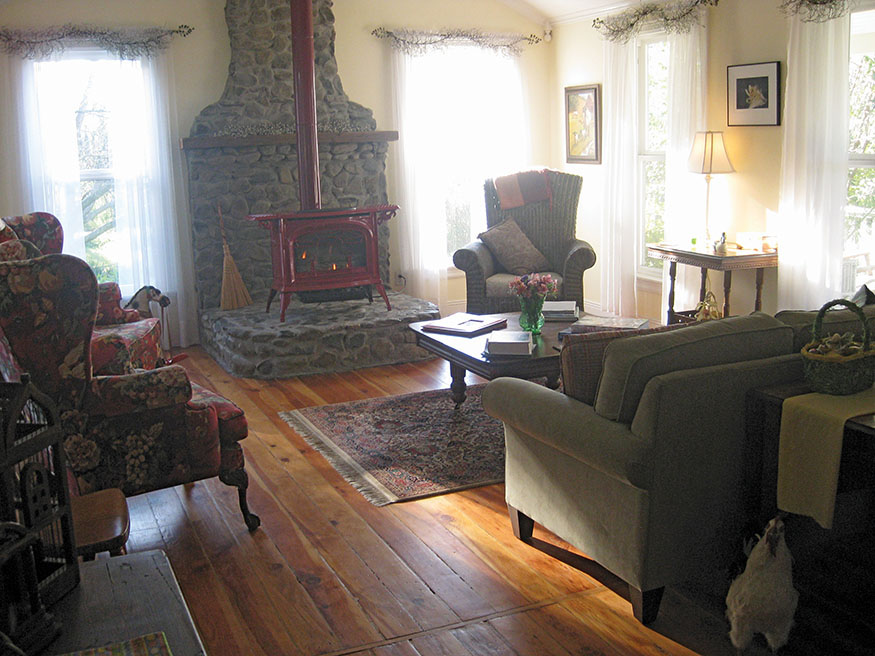
A sitting room at Flower Farm Inn
To the 12th St. Bridge 12.5 miles
To Discovery Park and Jibboom St. 15.1 miles
Cross the American River just before it joins the Sacramento River on Jibboom St., and walk into Old Sacramento.
total miles 16.8
TRANSPORTATION
Driving Directions
AUBURN IS ABOUT 200 MILES EAST of the San Francisco Bay Area, 100 miles southwest of Reno and 35 miles from Sacramento. Take I-80, exit at Maple St. (#119A), and drive a few blocks into Old Town Auburn. At the end of the walkabout, you can return to Auburn from Sacramento by train on Amtrak (amtrak.com) for $16. Checker Cab Taxi (916-532-2984) can pick you up at the Auburn train depot and return you to your car.
By Train
TAKE A BEAUTIFUL AND RELAXING TRAIN TRIP to Auburn from the Bay Area ($35), Los Angeles ($62), or Reno ($63) on Amtrak (amtrak.com). The trip may include a ride from Sacramento on an Amtrak bus.
Flying into the Bay Area
FOR TRIP PLANNING from the airport to Amtrak, visit 511.org. From SFO take BART to the Oakland Coliseum Station ($9.70), and walk a few minutes to the Amtrak Station. From the Oakland International Airport, take the BART Shuttle to Oakland Coliseum BART Station ($1.95) and walk a few minutes to the Amtrak Station. Then follow the “By Train” directions above.
MAPS
THE FOLSOM LAKE STATE RECREATION AREA offers a free map and brochure covering the first two days of this walkabout from Auburn to Folsom. You can download a copy at parks.ca.gov and search for “Folsom Lake.” For a better hard copy, call 916-988-0205, and they will mail you a free map.
The American River Parkway Foundation provides an excellent map of the river and trails from Beals Point on Folsom Lake to the Sacramento River, Days 3 and 4, for $5 at arpf.org.
PLACES TO STAY

Auburn
AUBURN HOLIDAY INN $$–$$$ • 120 Grass Valley Hwy. • 530-887-8787 • 800-814-8787 • auburnhi.com • 0.6 mile from Old Town.
POWER’S MANSION INN $$–$$$$ • 195 Harrison Ave. • 916-425-9360 • powersmansion.com • 0.9 mile from Old Town.
Loomis
FLOWER FARM INN $–$$$$ • 4150 Auburn Folsom Road • 916-652-4200 • flower farminn.com • Breakfast included. • See The Route for directions from the trail.
Folsom
LAKE NATOMA INN $$–$$$$ • 702 Gold Lake Dr. • 916-351-1500 • 800-808-5253 • lakenatomainn.com
BRADLEY HOUSE $$–$$$ • 606 Figueroa St. • 916-355-1962 • bradleyhousefolsom.com
Between Folsom and Sacramento
ARDEN HILLS RESORT, CLUB & SPA $$$–$$$$ • 1220 Arden Hills Lane • Sacramento • 916-482-6111 • ardenhills.club • Breakfast included. • See The Route for directions from the trail.
LA QUINTA $–$$ • 11131 Folsom Blvd. • Rancho Cordova • 800-753-3757 • laquinta sacramentoranchocordova.com • Continental breakfast included. • Leave the river 9.4 miles downstream from Folsom at the Sunrise Blvd. Bridge. Hike south 1.9 miles on the bike path that parallels Sunrise Blvd. to Folsom Blvd.
MARRIOTT $$$–$$$$ • 11211 Point East Dr. • Rancho Cordova • 888-236-2427 • marriott.com • Leave the river 9.4 miles downstream from Folsom at the Sunrise Blvd. Bridge. Hike south 1.9 miles on the bike path that parallels Sunrise Blvd. to Folsom Blvd.

Upper American River
Old Sacramento
These are a few of many places to stay.
DELTA KING HOTEL $$–$$$$ • 1000 Front St. • 916-444-5464 • deltaking.com • Riverboat hotel. Breakfast included.
EMBASSY SUITES BY HILTON SACRAMENTO RIVERFRONT PROMENADE $$$$ • 100 Capitol Mall • 916-326-5000 • embassysuites3.hilton.com • Breakfast included.
VAGABOND INN $–$$ • 909 Third St. • 916-446-1481 • vagabondinn.com • Continental breakfast included.
HI SACRAMENTO HOSTEL $–$$ • 925 H St. • Seven blocks from Old Sacramento • 916-668-6631 • hiusa.org