Trip 60
HIGHWAY 1 TO TERRACE CREEK CAMP
LENGTH AND TYPE: 11.6-mile out-and-back or 12.9-mile loop
RATING: Moderate
TRAIL CONDITION: Clear, poison oak
HIGHLIGHTS: Take in dramatic views of the furrowed Santa Lucia Range above steep coastal canyons that shelter redwood-flanked creeks.
TO REACH THE TRAILHEAD: The trailhead is on Highway 1 at gated Coast Ridge Road (North Coast Ridge Road on the USFS map) beside the Ventana Inn. The inn is on the east side of Highway 1, 2.2 miles south of Pfeiffer Big Sur State Park and 10 miles north of Julia Pfeiffer Burns State Park. Drive 0.1 mile along the inn entrance road to the public parking area on your left, for day use only. If you’re planning to camp, you must park at one of the turnouts along Highway 1 adjacent to the entrance road. From the parking area, walk up the entrance road till it forks. The left branch climbs past the restaurant, while the right branch leads to the gated trailhead.
TRIP SUMMARY: This 5.8-mile route along Coast Ridge Road and Terrace Creek Trail to Terrace Creek Camp can be approached as either an out-and-back or loop trip. You could continue east along the Pine Ridge Trail to swimming holes at the riverside Barlow Flat, Sykes, and Redwood Camps or return 5.3 miles to Big Sur Station via the westbound Pine Ridge Trail (see TRIP 59 Sykes & Redwood Camps). The latter route finishes with a 1.7-mile stroll south on Highway 1 to the inn. Though a strenuous day hike, the loop makes a pleasant weekend trip. To avoid excessive elevation gain and end on a moderate downhill gradient, consider starting from Big Sur Station.
From Coast Ridge Road, you’ll climb more than 1500 feet and traverse a spectacular ridge crest. The Terrace Creek Trail closely follows its namesake’s banks as the creek builds to support a narrow strip of redwoods. Temperatures drop as you descend the lush canyon through an oasis of ferns, fungi, and mosses to redwood-shaded Terrace Creek Camp.
The best times to hike this route are in winter and spring, when the swollen creek cascades past verdant new growth. Spring paints the flanks of Coast Ridge with abundant poppies, lupines, baby blue eyes, and myriad other emerging wildflowers. In summer, cool Terrace Creek canyon offers respite from the sweltering heat, though views along Coast Ridge Road disappear beneath a thick blanket of fog.
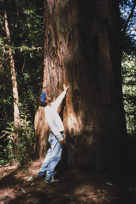
Ancient 1000-year-old redwoods form a narrow band winding through the Big Sur River canyon.
Trip Description
This hike begins along the first 4.2 miles of Coast Ridge Road, which offers convenient mile markers. From the gate (1040'), the road skirts the prestigious Ventana Inn and its short guest trails. In a few minutes, you’ll pass several private driveways and cross a shallow redwood-fringed gully (1 mile, 1420').
Past this creeklet, the trail crosses a smaller gully, where a creek cascades 40 feet down a sugary white marble stalagmite (1.2 miles, 1460'). This formation developed as marble deposits flowed downstream and accumulated at the base of the gully. Marble is one of the oldest rocks in the youthful Santa Lucia Range, stretching back hundreds of millions of years to a mountain range in what is now Mexico. The ancient rocks migrated north along the numerous northwest-trending faults to create some of the region’s most dramatic features.
Beyond the gully, you’ll continue to climb exposed Coast Ridge. Briefly returning to shade, the route passes through a second locked gate (1.5 miles, 1635'). After half a mile, the trail switchbacks and leads to impressive views northwest along the Big Sur River canyon to the Pacific. Continue 0.3 mile to a saddle, where dramatic inland views feature 4853-foot Ventana Double Cone, whose barren notched peak dominates the skyline just 5 miles northeast.
The road veers right from the saddle to a minor gully (3 miles, 2100'), passing a steep, gated private driveway on your left. Onward, the vegetation changes to rolling grasslands, highlighted in spring by spectacular wildflowers. You’ll steadily climb four minor ridges, then crest a fifth, which offers the best views thus far.
From the saddle, you’ll cross to an adjacent ridge and head north toward a prominent saddle. At mile 4, the road turns east past a spur road on your left. A hundred yards farther, you’ll reach a second saddle and the signed Terrace Creek Trail junction (4.2 miles, 2590'), also on your left.
From this junction, you’ll descend 1270 vertical feet along the steep 1.6-mile trail. Start out past encroaching brush that rebounded aggressively following a fire years back. Keep watch for abundant poison oak. After 0.3 mile, the trail crosses the typically dry headwaters of Terrace Creek and switchbacks down oak- and madrone-clad slopes.
You’ll follow the east bank for the next quarter mile before crossing the creek to continue your descent of the steep canyon. The creek holds true to its name, as it cascades past terraces of lush ferns, emerging mushroom caps, and delicate redwood sorrel. Follow the switchbacks another mile through the primeval redwood forest to Terrace Creek Camp and the Pine Ridge Trail junction (5.8 miles, 1320').
Nestled along the creek beneath a narrow belt of redwoods, the camp offers three small sites above the trail junction (with a pit toilet) and three below the junction. The largest site, with room for up to three tents, lies along the east bank above the Pine Ridge Trail.
If you’re continuing east or west along the Pine Ridge Trail, refer to TRIP 59 Sykes & Redwood Camps.