t Illustration of the Guaraní-Baroque style São Miguel das Missões
German immigrants arrived here in the 1820s and were the first to settle in the hills north of Porto Alegre. Nova Petrópolis, founded in 1858, remained relatively isolated until the mid-20th century and today, it retains a strong German character.
Stretching along Avenida 15 de Novembro, the town’s commercial center features a number of German-style buildings. Midway along the avenue is the Parque Aldeia do Imigrante, which pays tribute to the region’s early settlers. Set within an araucaria forest, the park houses beautifully reconstructed, half-timbered buildings dating from 1870 and 1910, which re-create the atmosphere of a 19th-century German hamlet. The park also hosts festivals and concerts and features a large bandstand as well as a beer hall.
The hamlets and farmsteads surrounding Nova Petrópolis also have a German flavor, and German is still the dominant language here.
"
⌂ Av 15 de Novembro 1966 § (54) 3281 1254 # 8am–5:30pm daily

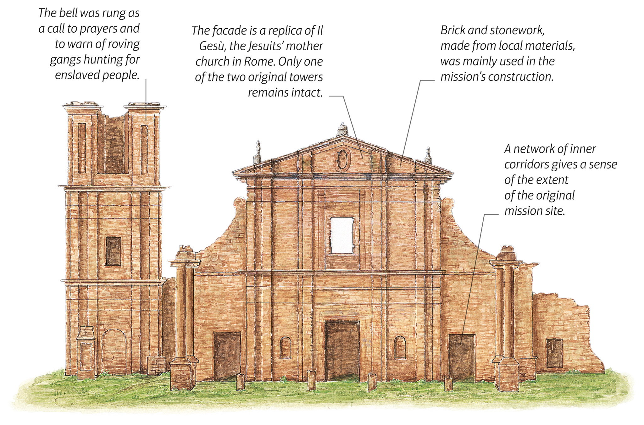
t Illustration of the Guaraní-Baroque style São Miguel das Missões
Surviving through several centuries of neglect, São Miguel Mission, a UNESCO World Heritage Site, presents a truly fine example of the Guaraní-Baroque style, a blend of indigenous and Iberian architectural elements. These influences are visible in the carved stonework and in the wooden sculptures housed in the museum. Designed in 1937 by Lúcio Costa, the early Modernist building that houses Museu das Missões was inspired by Jesuit-Baroque architecture. It includes statues and other relics excavated locally.
Although the surrounding area has been given over to farmland, it retains an air of isolation. Little remains of the workshops, school rooms, cloisters, and living quarters of the Jesuit mission. However, it is still possible to make out their distinct areas in the ruins.
- =
⌂ Rua São Nicolau s/n # 9am–noon, 2–6pm Tue–Sun (winter); 9am–noon, 2–8pm Tue–Sun daily (summer')
The number of people the original mission site housed at its height.

Insider Tip
Evening sees the ruins of São Miguel Mission illuminated by a colorful sound and light show that tells the story of the building's history.

t The twinkling lights of the mountain resort of Gramado, known for its Swiss-style architecture
Brazil’s best-known mountain resort, Gramado, mimics a cen-tral European village. The hilly landscape, reaching 2,706 ft (825 m), offers fantastic views.
“Swiss chalet” is the dominant architectural style and the profusion of geranium-filled window boxes, chocolate shops, and restaurants specializing in cheese fondues gives a feeling of being in Switzerland. However, only a tiny minority of the population is actually of Swiss origin.
The city’s flower-filled Parque Knorr and the Lago Negro, an artificial lake bordered by pine trees from Germany’s Black Forest, allow for pleasant strolls.
During early August, the city hosts the Festival de Gramado, one of Brazil’s most prestigious film festivals.
Lying some 10 miles (16km) east of Gramado’s main avenue is the Vale do Quilombo. Approached by a steep dirt road, much of the valley’s original dense Mata Atlântica (Atlantic rainforest) remains and the climate is warmer and more humid. The Ecoparque Sperry supports myriad fauna including coati, toucans, and howler and capuchin monkeys. Forest trails pass magnificent waterfalls that enhance the valley’s scenic splendor.
" ' \
⌂ Vale do Quilombo § (54) 99629 8765 # 9am–5pm Tue–Sun
Chilly winters, refreshing summers, and unspoiled nature attract visitors to Canela, once a stop-off point for cattle being herded across Rio Grande do Sul’s grasslands. The town is dominated by the Igreja Matriz Nossa Senhora de Lourdes, an imposing stone church built in 1953 in English Neo-Gothic style. Other buildings around town are an eclectic mix of local and European styles. The presence of students from local tourism colleges gives the town a vibrant feel.
Approximately 5 miles (8 km) north of Canela is the Parque do Caracol, a forest reserve with a 429-ft (131-m) waterfall. A highlight here is the 927-step stairway leading to the base of the cascade from where visitors can best appreciate its force and the surrounding forests. A farther 3 miles (5 km) north along the road from Caracol is the Parque da Ferradura, a forest reserve notable for the dram-atic views of the horseshoe-shaped Rio Caí and of the Arroio Caçador canyon and waterfall. The area is a popular destination for adventure tourism, with rafting along the fast-flowing Rio Paranhana. Rappeling down the park’s gorge allows for close-up views of the terrain.
"
⌂ Estrada do Caracol § (54) 3278 3035 # 9am–5:30pm daily
"
⌂ Estrada do Caracol § (54) 3278 9000 # 9am–5pm Tue–Sun
Experience Rio Grande do Sul

t A group of Pantanal gaúchos on horseback running a herd of Brazilian cattle
Gaúcho culture developed during colonial times when the Europeans arrived in Argentina, Uruguay, and southern Brazil. Since then the stern-faced cowboy (traditionally always referring to a man) has become the icon of Rio Grande do Sul, where the gaúcho traditions are still an integral part of daily life. Cattle drives, lead by men on horseback, are also a common sight across southern Brazil.

t A Pantanal cowboy with a traditional cow horn
Originally a nomadic lifestyle, gaúchos’ were skilled horsemen and cowhands who wandered the pampas (large treeless plains) hunting wild cattle for their hides. When Europeans introduced border and land agreements, these cowboys began to work as ranch hands, traveling where work was needed.
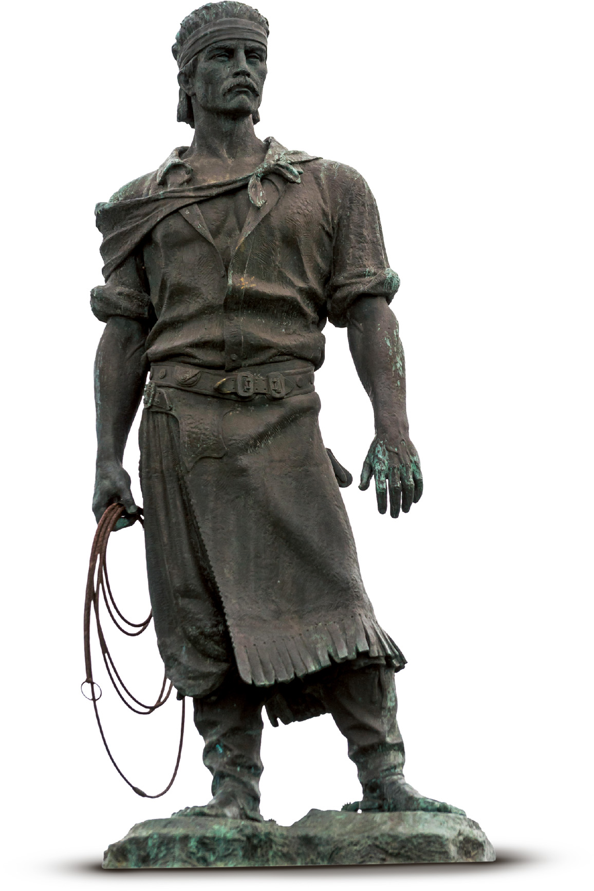
t The Estátua do Laçador statue of a gaúcho wearing traditional dress
Traditional gaúcho attire is worn daily by people on fazendas in rural Rio Grande do Sul and by city dwellers on special occasions. Traditional dress consists of a wide-brimmed felt-hat, bombachas (wide cotton pants), high leather boots, linen shirt, and a colorful kerchief. A true gaúcho also carries a knife, tucked in between his trousers and his tirador (sash). Women, called gaúchas, dress the same, sometimes with a long skirt or in a lace dress.
Meat and chimarrão – a hot bitter herbal drink – is at the heart of the gaúcho diet. In the Rio Grande do Sul countryside, gaúchos sip chimarrão through a bomba (silver straw) from a guia (gourd). Ubiquitous in southern Brazilian farm life is churrasco (Brazilian barbecue), where beef on long metal skewers is grilled over charcoal or firewood flames. Rice with jerked beef and stews with pumpkin and squash are also part of the culinary tradition.
The accordion and the acoustic guitar are the most common folk instruments featured in traditional gaúcho music. Polkas and marches are the most traditional dances and the music is a mix of Portuguese, Spanish, Basque, African, German, and Italian tradition, with songs about local life.
Every September, regional horsemen and women celebrate traditional gaúcho life at this week-long festival. The annual event pays homage to the leaders of the Farroupilha Revolution, the gaúcho-led civil uprising between 1835–45, which was an attempt to liberate Rio Grande do Sul from Brazil. Despite their defeat, modern-day gaúchos take to the streets of the capital Porto Alegre, as well in and around the state of Rio Grande do Sul, and celebrate with traditional music, folk dancing, and local fare.
Founded in 1875, Caxias do Sul was one of the earliest Italian colonias to be established in the Serra. At first commercial activity revolved around wine production, but over the next century other agro-processing industries, as well as textiles and metalworking, developed. Today, Caxias is Rio Grande do Sul’s second-largest city after Porto Alegre. Its wine-making heritage is celebrated at the biennial Festa da Uva.
Although concrete buildings have overtaken much of Caxias, some visible traces of the city’s colonial and Italian heritage survive. The Museu Municipal, built in 1880 as a private residence, documents the history of Caxias, starting with the arrival of the first immigrants from Veneto. The Museu Casa de Pedra, housed in a carefully preserved stone farmhouse built in 1878, sheds light on the lives of the pioneer settlers, with displays of tools, furniture, and photographs.
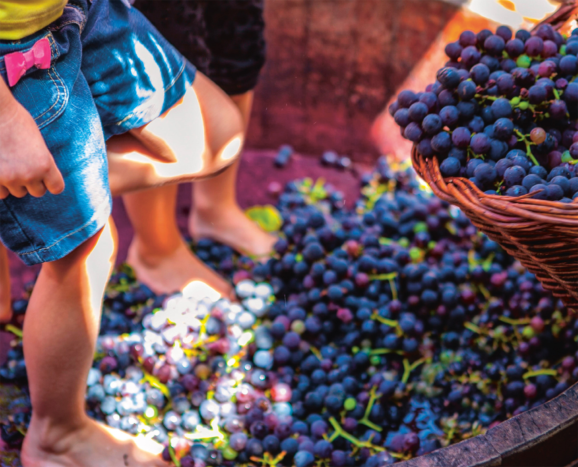
t Grape crushing at the biennial Festa da Uva in Caxias do Sul
" '
⌂ Rua Visconde de Pelotas, 586 § (54) 3221 2423 # 9am–5pm Tue–Fri, 11am–5pm Sat
"
⌂ Rua Matteo Gianella 531, Bairro Santa Catarina § (54) 3901 1463 # 9am–5pm Tue–Sat, 11am–5pm Sun
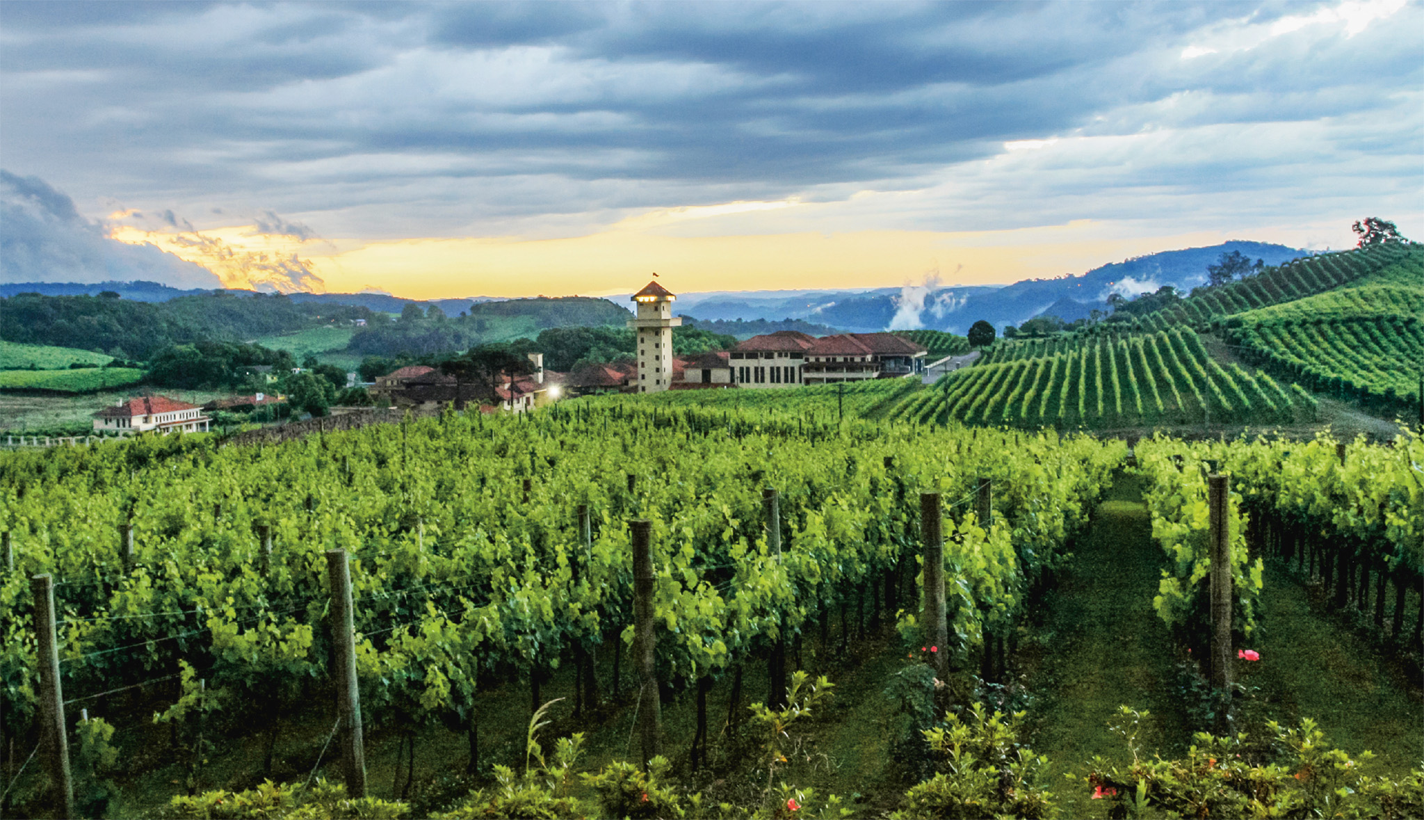
t Vineyards blanketing the Vale dos Vinhedos, near Bento Gonçalves
Examine a bottle of Brazilian wine and it is likely the label will indicate Bento Gonçalves as its place of origin. The city’s economy relies mainly on grapes and wine production, as a result of which Bento’s vintners dominate the Brazilian market.
Along with Caxias do Sol, Bento was one of the earliest Italian settlements in the Serra Gaúcha. However, the rapid growth of the city’s urban center in the 20th century has left few traces of Italian influence during the early years of immigration. The Museu do Imigrante has a rich collection of artifacts relating to Bento’s pioneer settlers, with rooms focusing on the arrival of the immigrants and the central role of the Catholic church in the community and farming.
The Cooperativa Vinícola Aurora is an enterprise of 16 grape-growing families and is the most prominent wine producer in Brazil. Visitors are shown the entire production process and tours culminate with a tasting. Fine wines are also produced by some smaller wineries around the beautiful Vale dos Vinhedos.
Adventure lovers can try extreme sports such as bungee-jumping, climbing, and rapeling at the Parque de Aventuras Gasper, located 5.5 miles (9 km) outside town.
Garibaldi, a small town just 12 miles (20 km) south of Bento Gonçalves, is known for its surprisingly good champagne-style sparkling wines. Part of the attraction of getting to this little town is the 15-mile (23-km) ride on the steam engine known as Maria Fumaça, or “Smoking Mary,” a name commonly given to tour-ist steam trains; the route takes an hour and a half.
⌂ Rua Erny Hugo Dreher 127, (Planalto) § (54) 3451 1773 # noon–6pm Tue–Sat
'
⌂ Rua Olavo Bilac 500, Cidade Alta § (54) 3455 2000 # 8:15am–5:15pm Mon–Sat, 8:30–11:30am Sun
⌂ Linha Eulália § (54) 3454 1072 # 9am–6pm Wed & Fri–Sun
The fact that Flores da Cunha claims the title of the largest wine-producing city in Brazil will come as no surprise. Just about every available patch of land in the municipality is given to grape vines and cantinas (bars), ranging from small artisan wine producers to large operators.
The town is remarkable for its beautiful setting and friendly people, and the same can be said of the surrounding villages, which could be mistaken for Italian farming communities. The people maintain the Venetian dialect of their immigrant forbears, making Flores da Cunha the most Italian of Brazilian towns. Visit Museu Municipal to learn more about its history.
Located in a fertile and picturesque valley, 8 miles
(13 km) southwest of Flores da Cunha, Otávio Rocha is especially striking, with vines extending down to the main streets. The village has become a popular place to eat, with a range of restaurants specializing in tasty, northern Italian country fare.
⌂ Av Vinte e Cinco de Julho 1608 § (54) 3292 2777
million cases of wine are produced in Brazil every year.
EXPERIENCE Rio Grande do Sul
|
DRINK Casa Valduga Explore the largest sparkling wine cellar in the Americas at one of Brazil’s best-known wineries. ⌂ Via Trento 2355, Vale dos Vinhedos ∑ casavalduga.com.br Casa Miolo Enjoy a tour and a tasting accompanied by an expert sommelier or oenologist at this charming bodega. ⌂ RS 444, Km 21, Vale dos Vinhedos ∑ miolo.com.br/en Lidio Carraro Personalized wine tours and tastings are on offer at this boutique winery. Its excellent degustacão raridades session lets you try 12 of the bodega’s top-range bottles. ⌂ Estrada do Vinho, RS 444, Km 21, Vale dos Vinhedos ∑ lidiocarraro.com/en |
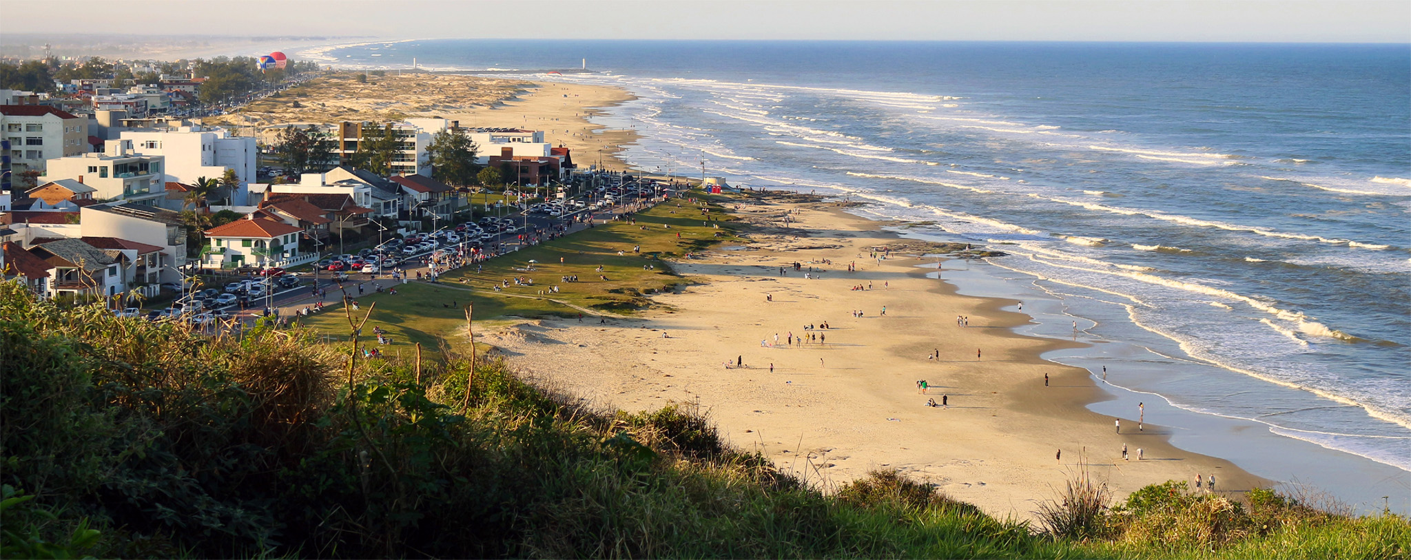
t Beautiful beaches lining the edge of the pretty seaside town of Torres
The main highlight of the long coastline of Rio Grande do Sul is Torres, located near the border with the neighboring state of Santa Catarina. Torres is named for three huge basalt rocks, or “towers,” that jut into the ocean and break the otherwise seemingly unending beach. The towers are located in the Parque da Guarita, on the southern perimeter of the town. Between the sea-cliff towers are sandy coves offering protection from fierce Atlantic rollers. From a hill at the southern edge of the park, visitors can enjoy tremendous views of the beautifully rugged coastline or trek through the dunes of 2-mile- (4-km-) long Praia de Itapeva. The water at Itapeva is tran-quil and favorable for swim-ming. Off Torres’s coast is Ilha dos Lobos, a small island and wildlife refuge.
Antônio Prado, the last of the major settlements in Brazil, was established in the Italian colonial zone in 1886. Located in the zone’s northern extreme and, until fairly recently, with poor links to other centers, it failed to make the transition from farming community to industrial town. The lack of development is one of the reasons why the town was declared a National Heritage Site in 1989.
The town is particularly well-known for the many wooden, stone-base buildings erected by Italian immigrants. Clustered around the town’s leafy and expansive central square, the Praça Garibaldi, and the roads that extend off it, are some 48 historic buildings, all protected and perfectly maintained. Most of the brightly painted clapboard structures with their unchanged interiors have been turned either into shops or into small government offices. One of these buildings on Praça Garibaldi is now the town hall. Also situated on Praça Garibaldi is the Museu de Antônio Prado, which offers an interesting and useful historical overview of the development of the small town.
⌂ Rua Luisa Bochese 34 § (54) 3293 5656 # 8:30–11:45am, 1:15–5:30pm Tue–Fri
The highland plateau of southern Brazil emerged from the accumulation of layers of ocean sediment, with the resulting rock formations lifted up to form the Brazilian Shield, an part of the Earth’s continental crust. Some 150 million years ago, lava poured onto the shield to create a thick layer of basalt rock. Cracks emerged at the edge of the plateau, taking the form of narrow, but deep, canyons. It is around one of the largest of these canyons – Canion do Itaimbezinho – that the Parque Nacional dos Aparados da Serra was created in 1959.
Canion do Itaimbezinho is a 2,360-ft- (720-m-) deep, 4-mile- (6-km-) long canyon featuring several ecosystems merging into one another. The plateau around Itaimbezinho is mainly cattle pasture, while dense Mata Atlântica covers Itaimbezinho’s lower reaches. The abundant flora ranges from lichens and mosses to orchids, as well as other flowering plants and giant araucaria pines. Trails around the canyon’s edge are well marked, varying in length between 1 mile (2 km) and 4 miles (6 km), with observatories offering views of the canyon.
The best season to visit the park is in winter (May to Aug-ust), when visibility stretches to the base of the canyon and toward the coast. September is the worst time to come here, with low cloud and heavy rainfall. During the rest of the year, fog often obscures views, though it can lift very quickly.
EXPERIENCE Rio Grande do Sul
|
stay Rio Grande do Sul is true gaúcho country, with excellent horse-riding opportunities. Stay at a fazenda (ranch) to get a real taste of this region’s cowboy way of life. Fazenda Potreirinhos ⌂ Estrada Geral Silveira, São José dos Ausentes ∑ fazendapotreirinhos.com.br \\\ Parador Casa da Montanha Ecovillage ⌂ Estrada do Faxinal, RS 429, Morro Agudo ∑ paradorcasadamontanha.com.br \\\ |