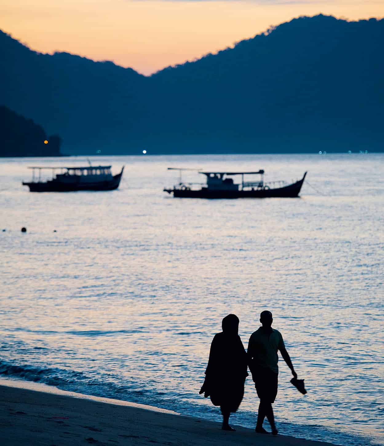
Sunset at Batu Ferringhi beach
James Tye/Apa Publications
Setting your priorities in Malaysia before you set off is essential to making your trip both pleasant and satisfying. Happily, many destinations offer a key that active travellers will be searching for, such as exploring Malaysia’s culture and history or engaging in a sport like scuba diving. Often there is an added bonus: a nearby forest or a beachside resort.
Malaysia’s well-developed transport infrastructure – rail, road and air – also offers the chance to step away from rigid planning if you desire to stay an extra day by the beach or want to do some more extensive shopping. Caution is needed if you are not used to a hot and humid climate and you may have to do a little extra planning when heading out on tour, trekking or just lazing by the pool. Caution is also advisable when you travel to particularly dangerous areas such as coastal areas of eastern Sabah and within the Strait of Melacca. Check the latest travel advice with your foreign office and monitor local developments before making arrangements.
Planning the journey
The towns hold a mirror to Malaysia’s ethnic blend of Malay, Chinese, Indians and Eurasians, living side by side or in their separate neighbourhoods. The northeast coast of Malaysia, especially between Kota Bharu and Kuantan, is one of the best places to see traditional Malay life with its rich Muslim culture, particularly evident in the kampungs (villages) of the interior. Step back into Malaysia’s history in the port towns of Melaka (also known as Malacca) or George Town, where colonial rivals once battled for supremacy. Your attention will also be captured by the beauty of the many mosques, temples, churches and shrines as the country’s faithful practise their beliefs. In Melaka, observe the way of life of the Nyonyas and Babas, the oldest locally born Chinese community, and its more modern manifestation in Penang.
Beyond urban limits you will find many opportunities to enjoy rural and forested Malaysia. But finding your way around the various rainforests, coral reefs or marine reserves can be bewildering if you plunge in unprepared. Unless you already have some experience in the region, use the services of one of the many first-class local tour operators (for more information, click here).
Malaysia has done a fine job of providing visitors with access to its natural assets without ‘taming’ these resources too much. At the heart of the peninsula, the huge Taman Negara gives you the most comprehensive view of rainforest animals and plants in their natural state. A more ‘compact’ approach is possible on the islands, such as Tioman or Langkawi.
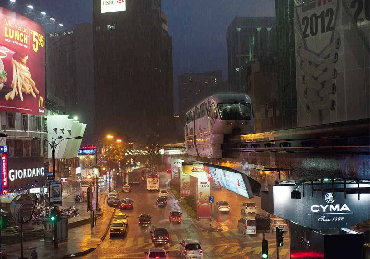
Bukit Bintang in the KLCC
James Tye/Apa Publications
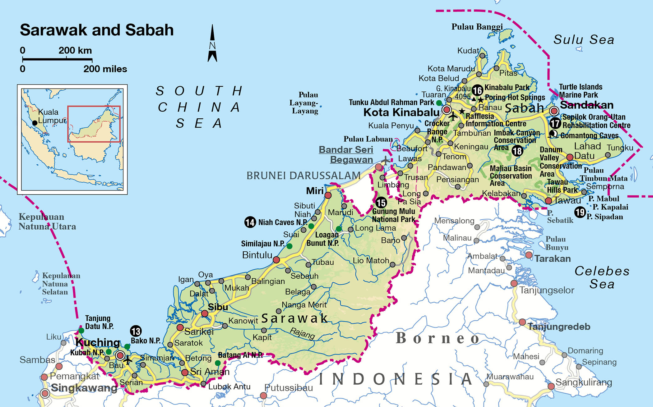
On the island of Borneo, the great natural attractions are Sarawak’s caves at Niah and Mulu, river cruises with a visit to tribal longhouses, Sabah’s national parks of Gunung Kinabalu and the offshore islands, and the Sepilok Orang-utan Sanctuary. If your main desire is to escape the coastal heat, highland retreats will refresh and invigorate, by offering a chance to enjoy what was once the exclusive domain of colonial administrators.
White sandy beaches and gentle sea breezes are for many the perfect recipe for a holiday from the stresses of modern life, and in Malaysia the offerings are plentiful. Whether on the peninsula or in the marine parks of Sabah and Sarawak, you’ll find many opportunities to bask and laze under the tropical sun (remember to use sunscreen and drink plenty of water to avoid sunburn and dehydration).
On the west coast the best beaches are on the island resorts of Pangkor and Langkawi. Unspoiled stretches of sand can also be found on the east coast, from Pantai Cahaya Bulan, north of Kota Bharu, down to Beserah, north of Kuantan. Further south are the resorts of Tioman Island and Desaru. In East Malaysia, Kuching and Kota Kinabalu have fine resort hotels.
The Centre
Malaysia’s prosperity in recent decades is most evident in the central region of the peninsula, where signs of wealth abound, from the international airport to KL’s dramatic skyline, to members of the middle class driving Malaysian-made Proton sedans on six-lane highways. But even as new light-rail systems wind through KL, progress has not entirely buried the past under chrome and concrete. Still thriving are the old commercial areas that brought so much wealth to the city and country.
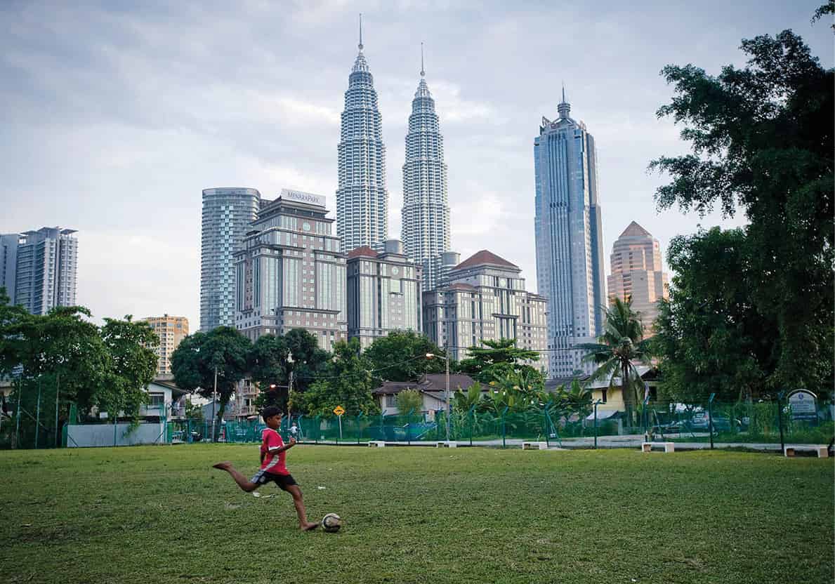
Playing football in the shadow of the KLCC skyline
James Tye/Apa Publications
Kuala Lumpur
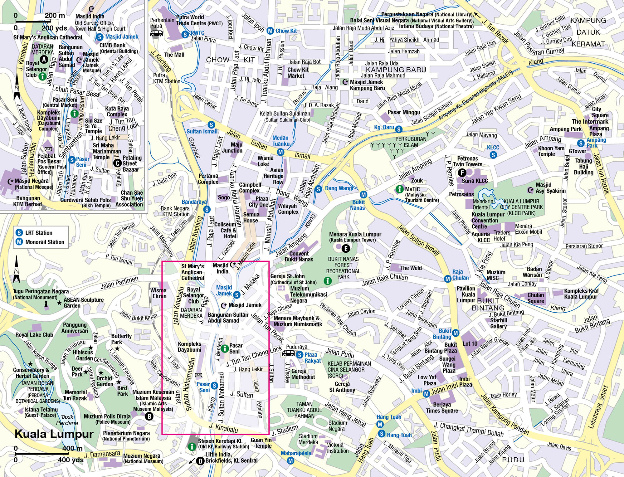
At times Kuala Lumpur 1 [map] appears to be a maze of pedestrian-unfriendly overpasses and expressways. But the city opens to islands of almost forest-like tree-cover before descending again into lively markets surrounded by the buildings that rise above the city’s busy streets. Visitors may initially be drawn to the 88-storey Petronas Twin Towers or Menara Kuala Lumpur (Kuala Lumpur Tower), which are symbols of modern KL. But the more fascinating splendours of the past are at street level, where distinctive neo-Gothic styles are beautifully preserved. Chinatown itself remains a hive of activity, located not far from pungent spice shops and ornate Hindu temples.
The Historic Centre
KL’s main historic quarter lies near Jalan Sultan Hishamuddin, where, on the east side of the broad avenue, is the Sultan Abdul Samad Building. The crypto-Moorish Federal Secretariat, once the Supreme Court and High Court but now housing government offices, was begun in 1894 (finished in 1897) and capped with three copper onion-shaped domes. One tops a clock tower 40m (120ft) high that bears a similarity to London’s Big Ben.
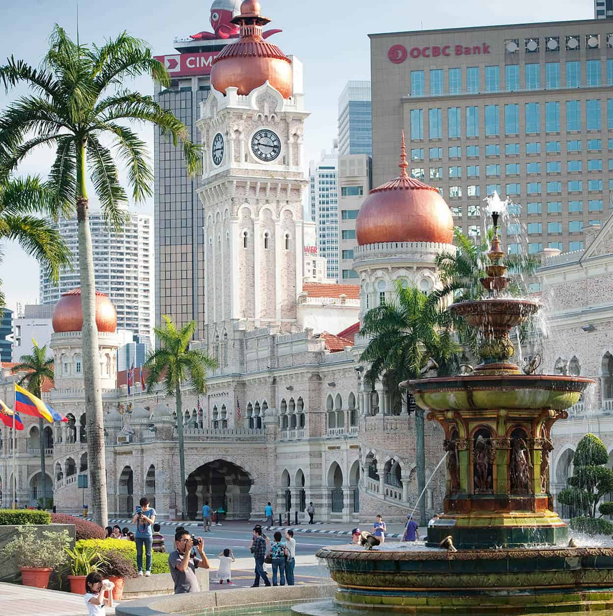
The Sultan Abdul Samad Building
James Tye/Apa Publications
On the western side of the boulevard is the Dataran Merdeka (Independence Square) A [map]: it was here that members of the mock-Tudor Royal Selangor Club (1884) took time off from the affairs of the Empire to play cricket. On the wide lawn, cheers greeted independence on 31 August 1957. St Mary’s Anglican Cathedral is on the square’s northern side. The oldest church in KL, it began life in 1887 as a wooden shack on Bukit Aman before being relocated here.
Walk southwards to the bridge at Leboh Pasar Besar to view Masjid Jamek. Since 1909 this building has marked the confluence of the Sungai Gombak and Sungai Klang, where the city’s roots were set down. It was here also that tin miners loaded supplies to be sent upriver and unloaded their tin for shipment west to Port Klang. It was designed in 1907 by British architect A.B. Hubbock in an Indian Moghul style: three-pointed domes over the prayer hall, two minarets and balustrades above an arcade of cusped arches – the whole predominantly gleaming white, with pink terracotta brick. Turn around to see one of the most striking skyscrapers – the 35-storey Dayabumi Complex (1970) that integrates traditional Islamic architectural themes – pointed arches, delicate open tracery – with otherwise modern design. Behind it is the Pejabat Pos Besar (General Post Office).
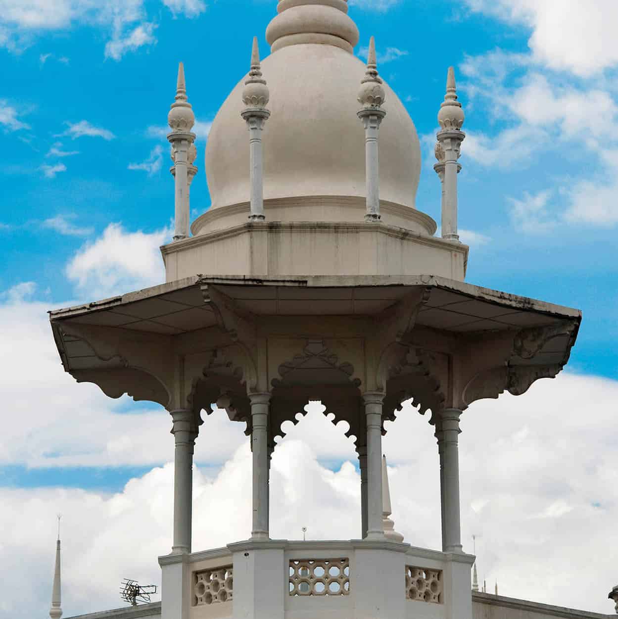
A minaret atop the Old Kuala Lumpur Railway Station
James Tye/Apa Publications
Hubbock also designed the Malaysian Railway buildings, located south on Jalan Sultan Hishamuddin. The old station (completed in 1911 and renovated in 1986) resembles a sultan’s palace and is more attractive than the sombre brown headquarters building opposite. A fine example of Moorish architecture, it reflects the Ottoman and Moghul glory of the 13th and 14th centuries. While it is still a stop on the suburban network, the city’s main rail hub is now KL Sentral, situated southwest of here near Muzium Negara (National Museum) on Jalan Damansara. Opened in 1963, the museum blends modern and traditional Malay design. Five main galleries cover such subjects as history, national sports and natural history.
Near the Old Railway Station
Across from the Old Kuala Lumpur Railway Station is Masjid Negara (National Mosque), a modern complex covering over 5 hectares (13 acres). On Friday and other important religious days it can house 8,000 worshippers under the tent-like stone roof of its Grand Hall. Above it all is a minaret 73m (239ft) high, with a balcony from which the muezzin calls to prayer. Opposite Masjid Negara’s car park is the splendid Islamic Arts Museum Malaysia B [map] on Jalan Lembah Perdana, which showcases the art and culture of the Islamic world.
Taman Botani Perdana (Perdana Botanical Gardens)
West of Masjid Negara are the Perdana Botanical Gardens (formerly the Lake Gardens), 101 hectares (250 acres) of parkland landscaped in 1888 while Frank Swettenham was British Resident. A popular place for picnicking, jogging and resting beneath the trees, it features a boating lake, a butterfly farm, orchid garden, bird park and the National Planetarium.
On a hill at the northern end of the park across Jalan Parlimen, the Tugu Peringatan Negara (National Monument) commemorates Malaysia’s unsettled history through the Emergency (for more information, click here). The bronze sculpture was designed by Felix de Weldon. Also on the monument grounds is a Cenotaph to the British Commonwealth’s dead of the two World Wars. West of the monument, outside the park, is Parliament House, which holds the sessions of the Senate and House of Representatives and is not open to the public.
Across the river going east from the Dayabumi Complex is the old Pasar Seni (Central Market), set in an attractive art deco building (1936) in pastel blue and pink with a bold, bright skylit roof. Clothes and arts and crafts have replaced the fish, meat and vegetables that used to be sold here.

Chowing down at a hawker stall on Jalan Petaling
James Tye/Apa Publications
Chinatown
Southeast from the Central Market lie the exotic offerings of Chinatown at Jalan Petaling C [map] and the surrounding streets. Here you will discover an enclave of pre-war Chinese shophouses sheltering, among other businesses, Chinese apothecaries who display their medicines in porcelain jars, a multitude of restaurants and stalls, fortune-tellers and pet shops. At night, when Jalan Petaling is closed to traffic, the area really comes alive. Pedlars sell replica watches, CDs and DVDs, clothing, jewellery and ornaments; the side streets are full of open-air restaurants offering barbecued meats, seafood, noodles, rice-pots and do-it-yourself ‘steamboats’ (for more information, click here).
Past the Jalan Tun H.S. Lee and Jalan Tun Tan Cheng Lock junction is the Sin Sze Si Ya Temple, founded by Yap Ah Loy, once the kapitan (headman) of KL’s early community. The largest temple is Chan See Shu Yuen Association on Jalan Petaling, built in 1906 and dedicated to Chong Wah, a Sung Dynasty emperor. It also marks Chinatown’s southern boundary.
An arresting display of colour comes in the form of the Sri Maha Mariamman Hindu Temple on Jalan Tun H.S. Lee. It was built in the style of a south Indian gopuram (temple gatehouse-tower), covered with a riot of colourful statuary from the Hindu pantheon. First erected in 1873, it was shunted across to its present site to make way for the railway station in 1855, and it is from here the annual Thaipusam pilgrimage to Batu Caves (for more information, click here) commences.
Southwest of Chinatown is Jalan Tun Sambanthan, which leads past KL Sentral and through the heart of Little India in Brickfields D [map], where you will find restaurants serving vegetarian fare, delectable curries, sinfully sweet candies and grocery shops alongside numerous boutiques selling Indian saris and Punjabi suits, flower stalls and pet shops.
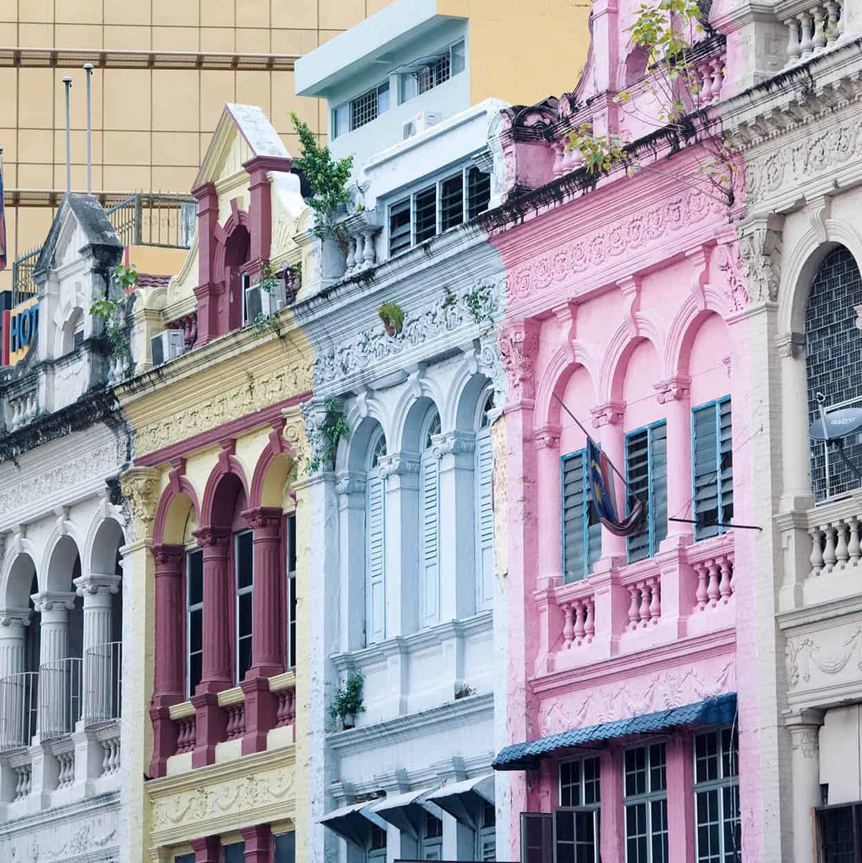
Old and new architecture visibly contrasts in KL
James Tye/Apa Publications
Northeast of the historic centre
KL’s ‘Golden Triangle’ is a modern office, entertainment and shopping district. Within this triangle, at the edge of the Bukit Nanas Forest Recreational Park, is the Menara Kuala Lumpur (Kuala Lumpur Tower) E [map] on Jalan Punchak, which opened in 1996 and rises to 421m (1,381ft). The non-stop lift takes 55 seconds from ground to the observatory, and offers the city’s best views.
Nearby is the city’s tallest landmark. The Petronas Twin Towers F [map] are located north of the triangle and part of the Kuala Lumpur City Centre (KLCC). The sky bridge on the 41st and 42nd floors and the observation deck on the 86th floor are open to the public. Below there is a concert hall, upmarket shopping mall and the interactive science centre Petrosains. Be mindful when out and about on Saturdays in and around the Petronas Twin Towers, Independence Square and Masjid Jamek as these sites are popular sites for (sometimes heated) political demonstrations.
Skirting north of the ‘Golden Triangle’ and going past the twin towers is the Jalan Ampang, 9km (5.5 miles) long, where you can see the tin magnates’ mansions that remain standing. One of the best preserved is the Dewan Tunku Abdul Rahman, built in 1935 by Chinese tin and rubber mogul Eu Tong Sen, which is near the Jalan Sultan Ismail junction. Nowadays it is the Malaysia Tourism Centre (MaTiC), which provides travel advice, brochures, Internet access, banking and a 24-hour tourist-police counter.
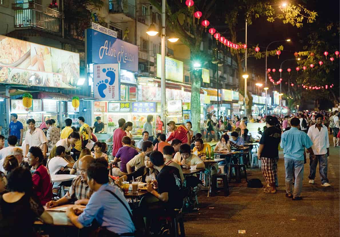
Jalan Alor is lively at night with hawker stalls
James Tye/Apa Publications
Markets
Day and night markets remain popular with Malaysians for cheap products and excellent local food. They are ideal for soaking up local colour and atmosphere. One of the cheapest daytime markets is at Chow Kit at the corner of Jalan Raja Alang and Jalan Haji Hussein. Southeast of Chow Kit is Kampung Baru, a night market catering to more traditional tastes. This Pasar Minggu (Sunday Market) begins on Saturday evening and trades on into the early hours of Sunday morning.
Selangor
Around Kuala Lumpur is the state of Selangor, an area that grew rich on tin and today is Malaysia’s wealthiest and most developed state. While the emphasis in this region is clearly on industry, information technology and administration, there are a number of sites well worth visiting.
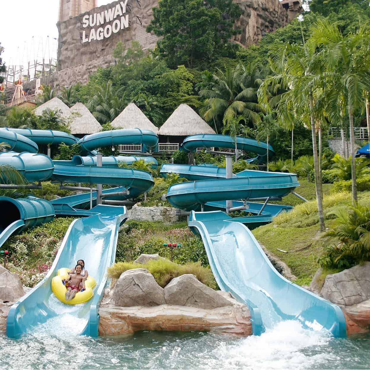
At the Sunway Lagoon Theme Park
Tourism Malaysia
Petaling Jaya and Sunway City
On the campus of the University of Malaysia is the Museum of Asian Art, with exhibits of regional pottery and ceramics dating from as early as the 9th century. Within the same campus, the Rimba Ilmu (Forest of Knowledge) is a tropical botanical garden but in a rainforest setting; it showcases over 1,600 species of the country’s flora, as well as those from Indonesia. Sunway Lagoon, near suburban Subang Jaya, is known for its rides and water attractions, including a beach with artificial waves for surfing. It’s great fun for the family.
Thaipusam Festival in the Batu Caves
The Batu Caves are the focus of the great Thaipusam Festival celebrating Lord Murugan receiving a sacred spear with which to vanquish the sources of evil.
Every January or February (depending on the moon) thousands of Hindus gather to do penitence for past sins. The most fervent of them punish themselves by having their tongues or cheeks pierced with skewers, and hooks inserted in their bodies. Some also carry a kavadi (a frame bearing peacock feathers and statuettes of deities). Some simply carry jars of milk, rose water, coconut or sugar-cane juice. During Thaipusam, as many as 500,000 people will crowd around the Batu Caves.
For tourists, the climb in humid heat up 272 steps to the cave-shrine entrance may be penitence enough.
Batu Caves
The giant Batu Caves 2 [map] are a popular excursion 45 minutes’ drive north of KL, just off the Ipoh Road. Set in limestone cliffs hidden in the forest, they were ‘discovered’ in 1878 by a group of explorers. The caves were a hideout for anti-Japanese communist guerrillas during World War II. Now transformed into a Hindu shrine, they receive the most attention during the Thaipusam Festival celebrated in the early months of each year.
There are in fact dozens of impressive limestone caves attracting botanists and zoologists to study their unique flora and fauna, but only three are accessible to the general public. At the top of a 272-step staircase is the Temple Cave, the most breathtaking of the three, with its architectural columns of lofty stalactites and stalagmites. At the foot of the hill, a bridge over a Koi pond leads to the Cave Villa, with three indoor galleries – the Valluvar Kottam, where verses of the ancient Tamil poet Thiruvalluvar are painted directly on stone tablets; a reptile gallery; and the art gallery, which displays colourful statues of Hindu deities. There is also a 15-minute cultural dance performance every hour. After exiting the Temple Cave, about a third of the way down the main steps, turn right for a guided tour of the Dark Cave’s ecosystem and geological formations. Prior booking is necessary if you wish to explore further and crawl through limestone passages.
Templer Park
Further north (another 9km/6 miles along the Ipoh Road) from the Batu Caves is Templer Park, which offers an insight into a Malaysian rainforest for those with little time to venture into the major national parks. Named after Britain’s last High Commissioner, Sir Gerald Templer, and covering an area of 1,200 hectares (2,965 acres), the rainforest comes complete with waterfalls, rushing streams and caves to explore in the Bukit Takun limestone cliffs. There are several forest trails, with the highest point being Bukit Takun, 740m (2,428ft), on the western side of the river in the park’s northern corner.
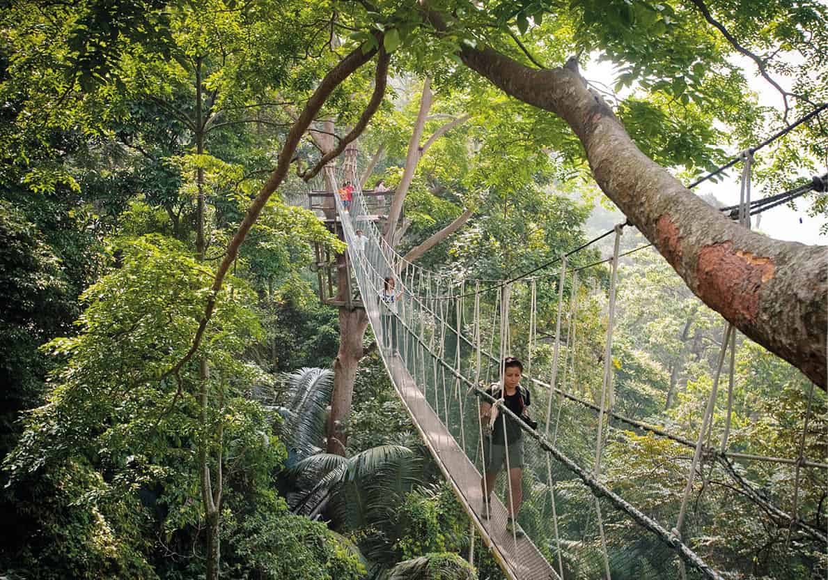
The FRIM Canopy Walkway
James Tye/Apa Publications
FRIM
For a rainforest experience with lofty views of the forest, head west of Batu Caves to the 600ha (1,480-acre) Forest Research Institute of Malaysia. Purchase your Canopy Walkway ticket from the visitor’s information centre before you head up the trail that leads to the Canopy Walkway, 30m (100ft) high, which has good views of the forest canopy.
Kuala Selangor
Northwest of Shah Alam is Kuala Selangor, on the Sungai Selangor estuary, where you can see large flocks of migratory birds (Sept–Oct) at the Kuala Selangor Nature Park. After dinner in one of the seafood restaurants at Pasir Penambang, head upriver to Kampung Kuantan for a boat ride to see the synchronous flashing of fireflies; it is best to appreciate this natural wonder on a new moon night.
Putrajaya
Located 25km (15.5 miles) south of KL is the federal administrative capital of Putrajaya, with its stately government buildings, mosques and public gardens. If dressed appropriately, there is the Persian-inspired Masjid Putra to visit during non-prayer time. Or walk down to the lakeside, and at the end of the Souq Putrajaya bazaar is the jetty for the Cruise Tasik Putrajaya; sunset is the best time to tour the lake.
Day trips from Kuala Lumpur
Beyond KL, the British colonial past – whose structures now stand increasingly in the shadow of KL’s skyscrapers – continues to echo through hill stations. These have now become resorts, set among golf courses, gardens and orchards in the mountain ranges of the peninsula’s interior. Retreats within easier reach of KL – Fraser’s Hill and Genting Highlands – draw families for holidays.
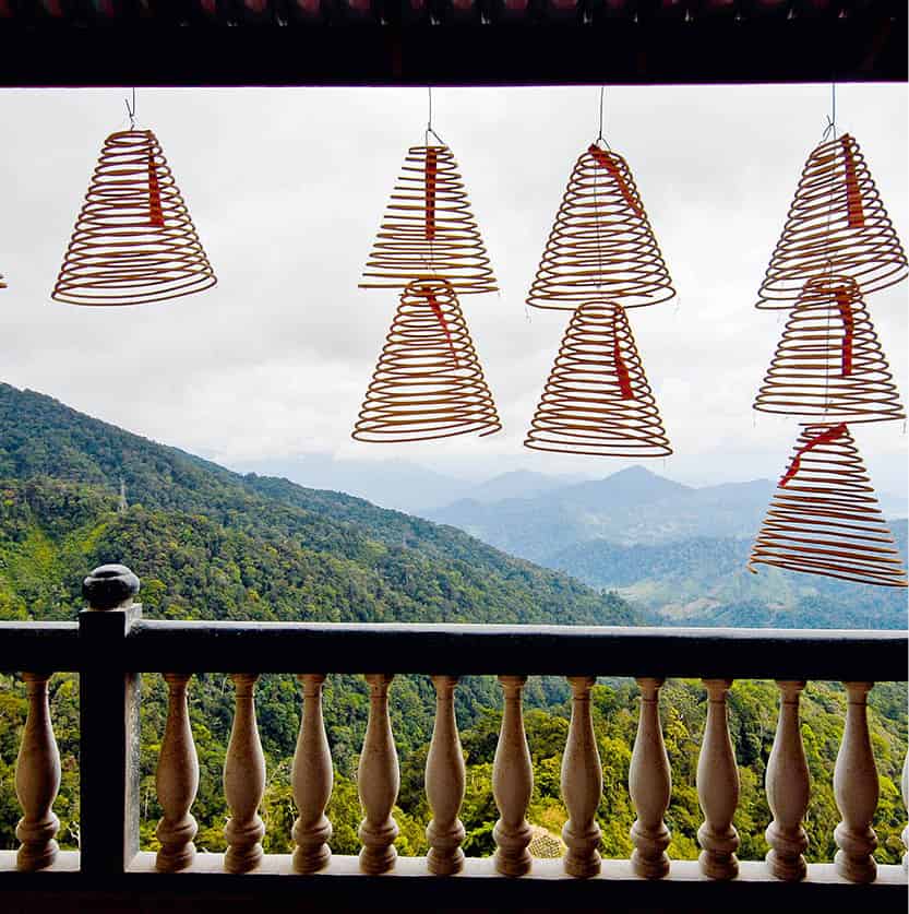
Overlooking the Genting Highlands
Jon Santa Cruz/Apa Publications
Genting Highlands
The closest of the highland resort areas to Kuala Lumpur, 51km (32 miles) away, is Genting Highlands, which rises to 2,000m (6,560ft). Descriptions of the resort and hotel complex vary from ‘big and bold’ to a ‘one-stop destination for fantasy, excitement and adventure’. You’ll find a wide range of facilities, including theme parks with cinemas, boat rides, restaurants and ten-pin bowling. The resort’s casino is Malaysia’s only such legal gambling house. Further down the hill, and less misty and wet, is the 18-hole golf course at the Awana Golf and Country Club.
Fraser’s Hill
In contrast to Genting Highlands, this charming, old-fashioned hill station, 100km (60 miles) northwest of KL, is built across seven hills, its highest point being 1,500m (4,920ft) in the Titiwangsa Range. These days, Fraser’s Hill offers a cool and peaceful retreat. The resort was named after Louis James Fraser, an English adventurer and scoundrel, who dealt in mule hides, tin, opium and gambling. Fraser had disappeared mysteriously before the hill station came into being in 1910.
En route to the Gap gate at the foothill of Fraser’s Hill, a signpost that reads ‘Emergency Historical Site’ marks where British High Commissioner Sir Henry Gurney was killed during the communist insurgency in 1951. The narrow road between the Gap and Fraser’s Hill is an alternating, one-way traffic system unless the secondary road (which is more prone to landslides), about 1km (0.6 miles) after the Gap gate, is open for exiting traffic. There is a wide range of accommodation, from stone bungalows to hotels and resorts, as well as a nine-hole golf course, playgrounds, archery and horse riding to enjoy.
Several nature trails are marked out through the nearby forests, and the wealth of birdlife means that forest walks are particularly enjoyable. Birdwatchers should look out for more than 270 species of birds, which may be seen in the immediate area. Montane species like the stunning Cutia, although a Himalayan bird, are found here. Eagles are easy to spot soaring above the trees.
The Northwest
In the far north, Penang is both a holiday destination and a commercial centre, while closer to the border with Thailand, Langkawi Island is Southeast Asia’s first Geopark and a leading resort for those in search of white sands, gentle seas, a scenic landscape and duty-free goods. While Ipoh is Perak’s state capital, made rich on tin, and Kuala Kangsar is the leisurely, royal state capital, the former mining towns of Papan and Gopeng are steeped in history. From Simpang Pulai in Perak, it is easy to access the cool breezes of Cameron Highlands, where the English palate for tea (on a plantation scale) and strawberries thrives in the adjacent state of Pahang. Other natural attractions – wild elephants in the interior forests at Belum-Temengor, birdwatching along the Perak coastline and beautiful beaches of Pulau Pangkor – make pleasant experiences.

A Chinese coffee shop in Ipoh
James Tye/Apa Publications
Perak
A journey to Perak takes travellers into what was once the key region for Malaysia’s economic prosperity. Tin, the basis for the state’s wealth, was taken from diggings that claimed to be the largest such mines in the world. The wealth from the mines paid for many of the historical structures evident throughout the state. Perak, which means silver in Malay, is Peninsular Malaysia’s second-largest state, reaching from Tanjung Malim in the south to the Thai border, covering some 21,000 sq km (8,108 sq miles). Its sultan’s family is also the last to be able to trace its ancestry to the 16th-century sultans of Melaka.
The journey north from KL either by train or car takes you through a captivating landscape of forests and plantations, reaching back from the coastal plains to climb the blue hills of the Titiwangsa Range.
Ipoh
Once the harbour for all incoming junks and sampans from the Strait of Malacca (Selat Melaka) through the Perak River, the city of Ipoh is on the Kinta River 220km (135 miles) north of KL. Ipoh offers good accommodation and amenities, including a range of restaurants with Chinese specialities, such as steamed chicken with bean sprouts and noodles.
Colonial influences are clearly evident in the railway station, whose Moghul architecture is reminiscent of KL’s old station and is locally nicknamed ‘the Taj Mahal’. The High Court and Hong Kong and Shanghai Banking Corporation (HSBC) buildings are also excellent examples of architecture from the Edwardian era. Other memories of the British presence are in the clock tower, commemorating the first British resident of Perak, James Birch, who was assassinated in 1875. St Michael’s School and the Royal Ipoh Club are also monuments of the colonial era.
Around Jalan Dato’ Sagor and the nearby streets are some of the best-preserved examples of Chinese architecture in Malaysia. For an insight into the local tin-mining industry, visit the excellent Muzium Geologi on Jalan Sultan Azlan Shah. In addition to exhibits of Perak’s rich variety of minerals, ores and fossils, there are models of tin-mining equipment.
Outside the city, amid vast caves in limestone outcrops, are a number of Buddhist temples. In the south the Sam Poh Tong Temple, founded in 1912, is located within high limestone caves and cavities near Gunung Rapat and is home to a group of monks and nuns. Six kilometres (4 miles) north of Ipoh is the Perak Tong, built in 1926 by a Buddhist priest from China. Here the main attraction is a 13m (41ft) sitting Buddha within the darkened cavern; altogether there are more than 40 Buddha statues.
Day Trips from Ipoh
Around Ipoh there are plenty of historical and natural sights to see and experience – from prehistoric art to historical buildings, show caves and tropical rainforests to a night safari and gorgeous beaches. Simpang Pulai also offers easy access to highland tea plantations in the neighbouring state of Pahang.
Tambun
About 15 minutes’ drive east of Ipoh is Tambun, which has the peninsula’s largest rock art site at Gua Tambun, a cliff face with over 600 Neolithic-period rock paintings depicting human and animal motifs. Nearby is the Lost World of Tambun, a popular water theme park with rides, a hot spring and spa.
Spotting a tapir
The tapir is remarkable for two features: its short, overlapping snout that resembles the sawed-off trunk of an elephant, and its unique body colouring – black at the front, white in the middle and back, with black rear legs. With luck you may spot one in Tanah Rata.
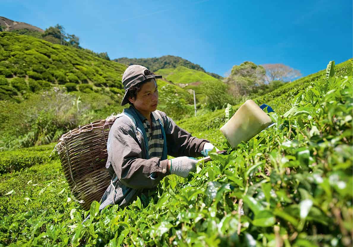
Picking tea at the Sungai Palas Estate in the Cameron Highlands
James Tye/Apa Publications
Cameron Highlands
Heading south from Ipoh on the North-South Expressway, exit at the Simpang Pulai interchange, turn right and follow signs to Cameron Highlands 3 [map] the state of Pahang. The finest of the British-inspired hill stations, 85km (53 miles) from Ipoh, stands on a splendid plateau in rolling green valleys, surrounded by the rugged peaks of the Titiwangsa Range, the tallest of which is Gunung Brinchang, at 2,031m (6,664ft). Located over 1,520m (4,987ft) above sea level, Cameron Highlands offers great relief amid morning mists and cool breezes. The hill station was named after William Cameron, a British surveyor who in 1885 reported the finding of the ‘fine plateau’. The Highlands still hide the answer to the mysterious disappearance of wealthy American Thai-silk entrepreneur Jim Thompson, who went missing one evening in 1967 after setting off for a stroll while on holiday at the hill station.
Spread over three districts are the townships of Brinchang, Tanah Rata (the main township) and Ringlet. Brinchang is known for its vegetable farms, flower nurseries, fruit gardens and tea plantations. Tanah Rata has hotels, good Chinese and Indian restaurants, and English-style tearooms serving the local Cameronian brew together with cakes and locally grown strawberries with cream. The main tea plantations are Cameron Bharat Plantation and Boh’s Sungei Palas Tea Estate. The latter features a Tea Centre (Tue–Sun), where you can learn about tea manufacturing, and sample various blends while enjoying great views of the estate.
Accommodation options in Tanah Rata vary depending on your budget, from international-class resorts to moderately priced guesthouses.
Forest exploration
The forests, especially those in the Cameron Highlands, were once strongholds for the rebels during the Communist Emergency. Some caution is required when venturing into them as many paths have few or no signposts; good maps are a must, and a guide is recommended for most trails.
The cooler climate makes forest walks here a special pleasure. Two relatively well-marked paths from Tanah Rata, which are easy enough for the whole family, lead to swimming and picnic spots at Parit Falls and Robinson Falls. Other more challenging choices, for which you should enlist the help of a guide, take you up to Gunung Jasar (1,696m/5,564ft) and Gunung Beremban (1,841m/6,040ft). The best buys in Cameron are fresh flowers, fruit and vegetables. Continue 13km (7 miles) from Tanah Rata to reach Ringlet town, which offers very little that is special, apart from flower nurseries and access to some tea plantations.
For those using public transport, the Highlands can be reached by train on the KL–Butterworth line to Tapah Road Station and then to the hills by taxi. The scenery changes from bamboo and palms to a denser rainforest of lush greenery, and then, as the temperature drops and the more comfortable mountain air takes over, the montane oaks and laurels that are common in temperate climates. The old road, though shorter, is more circuitous than the new road from Simpang Pulai.
Papan
Half an hour south of Ipoh on Route 5, and then a right onto Route A188, is the ghost-like town of Papan 4 [map]. Visit the home and dispensary of a World War II heroine, which is today a Memorial to Sybil Kathigasu (by prior appointment; mobile tel: 017-506 1875). Eurasian nurse Sybil Daly (later decorated with a George Medal for gallantry) and her medical doctor husband Dr A.C. Kathigasu supported the Malayan People’s Anti-Japanese Army guerrillas by secretly providing them with medical care, medicines and information during the Japanese Occupation. They were, however, betrayed, caught and tortured by the Japanese. A one-hour tour of the historical town or nearby Batu Gajah town is also available, starting from the memorial.
Gopeng and surroundings
Further south and 25km (16 miles) from Ipoh is Gopeng, where the Muzium Gopeng displays antiques and tin-mining artefacts from the glorious past. Nearby is Kampung Ulu Geroh, whose indigenous people, the Orang Asli, can show you the beautiful Rajah Brooke’s Birdwing (butterfly) and, if in bloom, the Rafflesia, the world’s largest individual flower. Further southwards is the show cave of Gua Tempurung, the longest cave system in the peninsula, stretching more than 4.5km (3 miles).
Saved from the overgrowth of foliage in the past two decades, Kellie’s Castle is a mansion 14km (9 miles) northwest of Gopengis. Construction was halted when its owner, rubber planter William Kellie Smith, died in Portugal in the mid-1920s.
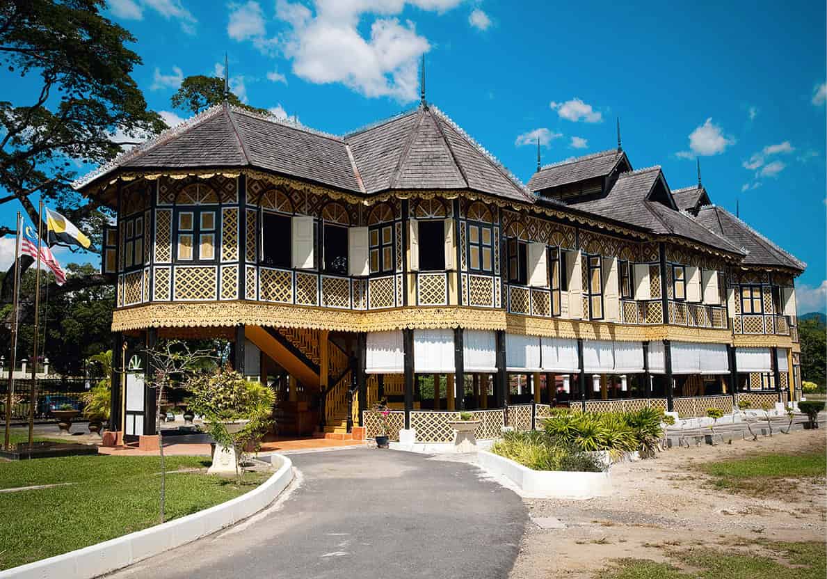
Kuala Kangsar’s Istana Kenangan
James Tye/Apa Publications
Kuala Kangsar
Home to the sultans of Perak since the 15th century, Kuala Kangsar is built on a reach of the Perak River (Sungai Perak) 50km (32 miles) from Ipoh, just off the highway. The town has two royal palaces: the brash stone residence Istana Iskandariah and the more elegant traditional timbered Istana Kenangan, now used as a Royal Museum. The most striking building, set on a grass mound, is the Masjid Ubudiah, with its dome of glowing copper.
Belum-Temengor Forest Complex
About 144km (89 miles) northwest from Kuala Kangsar, the lush Belum-Temengor Forest Complex surrounds Perak’s largest dam, offering visitors a chance to explore the rainforest with Orang Asli guides. The forest supports a wide range of animal and plant life, much of it endangered because of logging in the area. See all of the country’s 10 hornbill species here, keep watch for wild elephants foraging for food in the evenings and, if in luck, catch sight of the rare Rafflesia flower.
Taiping
A 30-minute drive from Kuala Kangsar, the old mining town of Taiping , which means ‘everlasting peace’, is the former capital of Perak state. It has a magnificent 90-hectare (222-acre) park, Lake Gardens, landscaped from a tin mine abandoned in 1890. The grounds are now home to a Japanese garden and the Taiping Zoo & Night Safari.
Built in 1883, the Perak Museum houses an interesting display of ancient weapons and Orang Asli implements and is the oldest museum in Malaysia. On the way, you will pass Taiping Prison, used by the Japanese in World War II and then for guerrilla troops captured during the Emergency.
Beyond the Lake Gardens, the Taiping War Cemetery bears impressive witness to the peninsula’s early role in the Pacific War against the Japanese. The tombs of soldiers of the Royal Australian Air Force, Indian Army Corps of Clerks, Ambulance Sepoy of the Indian Army Medical Corps and Royal Air Force reveal that many of them died on the very first day of active duty: 8 December 1941.
Once a tea estate, cool, cloud-enshrouded Bukit Larut (Maxwell Hill), 12km (7.5 miles) northeast of Taiping, is Malaysia’s smallest and oldest hill station. At 1,035m (3,400ft) above sea level, it has great views when the misty rain-clouds break. Near the jeep terminal, several bungalows and rest houses offer rooms for rent, but you must book in advance.
Perak’s coastline
About half an hour’s drive from Taiping is the Matang Mangrove Forest Reserve, where you can visit traditional charcoal kilns and fishing villages or head towards Kuala Gula Bird Sanctuary to watch migratory birds en route to Australia (Aug–Dec).
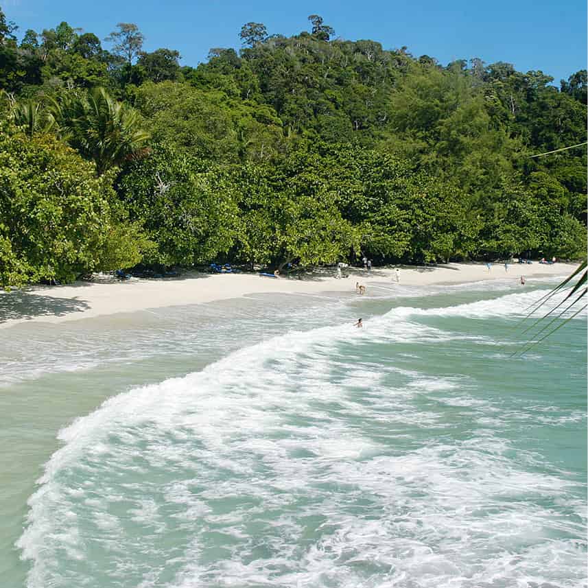
Pangkor Laut
Tourism Malaysia
Pulau Pangkor
The largest of the nine islands lying offshore in the Strait of Malacca is Pulau Pangkor. Its beaches offer aquatic activities and there are nearby forest walks. The ferry from Lumut, about 50km (31 miles) south of Taiping, to Pangkor Island takes 30–45 minutes. Berjaya Air also flies in from Sultan Abdul Aziz Shah Airport, near KL, daily except Tuesday and Thursday. Once there, you’ll find the wide sands of the Pantai Puteri Dewi (Beach of the Beautiful Princess) along the 122-hectare (301-acre) island’s northern shore. An adjoining private island and one of the most exclusive destinations in Asia, Pangkor Laut attracts well-heeled tourists.
Penang
On the northeast coast of Pulau Pinang 5 [map] (meaning Betel Nut Island), or Penang, George Town is the island’s main attraction and a UNESCO World Heritage Site. With rich colonial and historic roots amid the clutter of a market and commercial town, its narrow streets and busy thoroughfares add to the adventure. The city’s Chinese history is reflected in the shophouses and old hotels, and it also offers delicious food and great shopping.
Most of Penang’s activity is in the city, but it is also possible to relax at a beachside resort or to flee the heat by taking the railway link to the top of Bukit Bendera (Penang Hill). While George Town is predominantly Chinese, the western part of the island is rural Malay countryside with fruit orchards and quaint fishing villages.
Entry points to the island are by road and rail, a ferry journey across the Selat Selatan from the industrial town of Seberangi Prai or by way of the 7km (4.5-mile) drive over the Penang Bridge, which provides wonderful views of the harbour. South of this bridge is the Second Penang Bridge linking Batu Maung with Batu Kawan on the mainland. Flights, including international arrivals, land at the Bayan Lepas International Airport, which is 18km (11 miles) south of George Town.
Under the British, Penang was named Prince of Wales Island, and the capital took its name from the son of King George III. Nowadays, Penang has the second-largest economy among the states of Malaysia, and a population of over 1.6 million. It is also the centre for the country’s electronics industry.
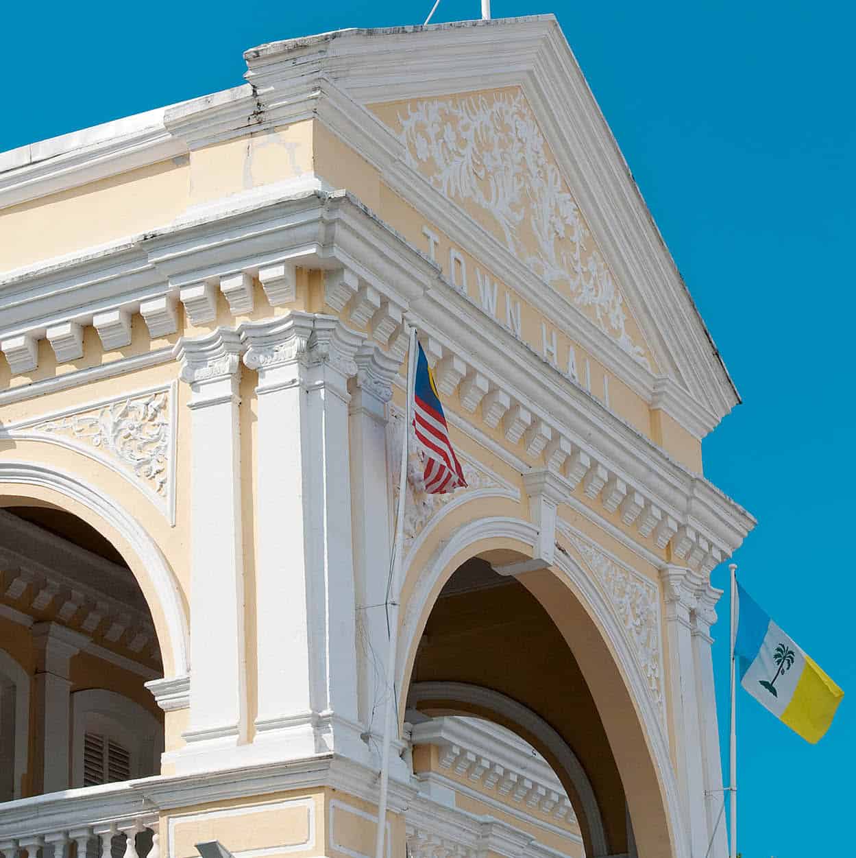
The Penang State Legislative Building in George Town
James Tye/Apa Publications
There are many ways to discover this historic city – by foot, trishaw or bicycle – but do wear a hat and sunblock and drink plenty of water.
Colonial Heritage Walk
One of the joys of touring George Town’s historic section is the opportunity to cover many of the sites in this compact area by foot, and the best place to begin your tour is the main ferry terminal at Weld Quay. Along the foreshore there are the Clan Jetties, a hamlet of houses on stilts, joined by wooden walkways over the water and inhabited by 2,000 boatmen and fishing families, each group belonging to a different Chinese clan.
At the other end of Pengkalan Weld is the Jam Besar (Clock Tower), presented to the town in 1897 to mark Queen Victoria’s Diamond Jubilee.
Across the road is Fort Cornwallis (named after Charles Cornwallis, Governor General of India), which marks the spot where Captain Francis Light arrived on 17 July 1786. The greenery of the park and gardens surrounds the fortifications, which were originally made of wood and rebuilt in 1810. Light’s statue stands inside the entrance of the fort. As no photograph of Light existed, the sculpture is a likeness made from a portrait of his son, William (who founded the city of Adelaide in South Australia).
Jalan Tun Syed Sheh Barakbah (also known as the Esplanade) runs between the waterfront and the Padang before the fort. This area is lined with handsome, 19th-century colonial government buildings and their brilliant white is highly evocative of the era in which they were built. The British worshipped in St George’s Church (1818) on Lebuh Farquhar. It is the oldest Anglican church in Southeast Asia. In the nearby Protestant cemetery, set among frangipani trees, is the grave of Francis Light, who died from malaria in 1794, only eight years after the start of his Penang adventure. The tombstones of many other graves reveal the hardships of the town’s history.
Clearing the forest
On the northeast corner of the waterfront, Kedah Point marks the spot where the Penang settlement’s founder Francis Light (for more information, click here) is said to have hit upon a cunning method of getting the surrounding forest cleared to make way for the town. He loaded a cannon with Spanish silver dollars, fired them into the forest, and invited local labourers to hack their way through the undergrowth to get to the money.
The Penang Museum and Art Gallery on Lebuh Farquhar is housed in what was the Penang Free School (1816), the first English-language school in Southeast Asia. There is a fine collection of historical memorabilia, old paintings, etchings and a 19th-century Chinese bridal chamber.
One of the great monuments from George Town’s colonial days is the Eastern & Oriental Hotel at 10 Lebuh Farquhar. Even if you are not staying in one of the hotel’s grand old rooms – where Rudyard Kipling and Somerset Maugham both stayed – have a drink in the venerable Farquhar’s Bar, overlooking the harbour, which is always lined with vessels from around the world. The E & O is actually a fusion of two separate hotels: the Eastern, facing the Esplanade, and the Oriental, facing the sea. It was the brainchild of Martin and Tigran Sharkie, Armenian brothers who also created the famous Raffles Hotel in Singapore.
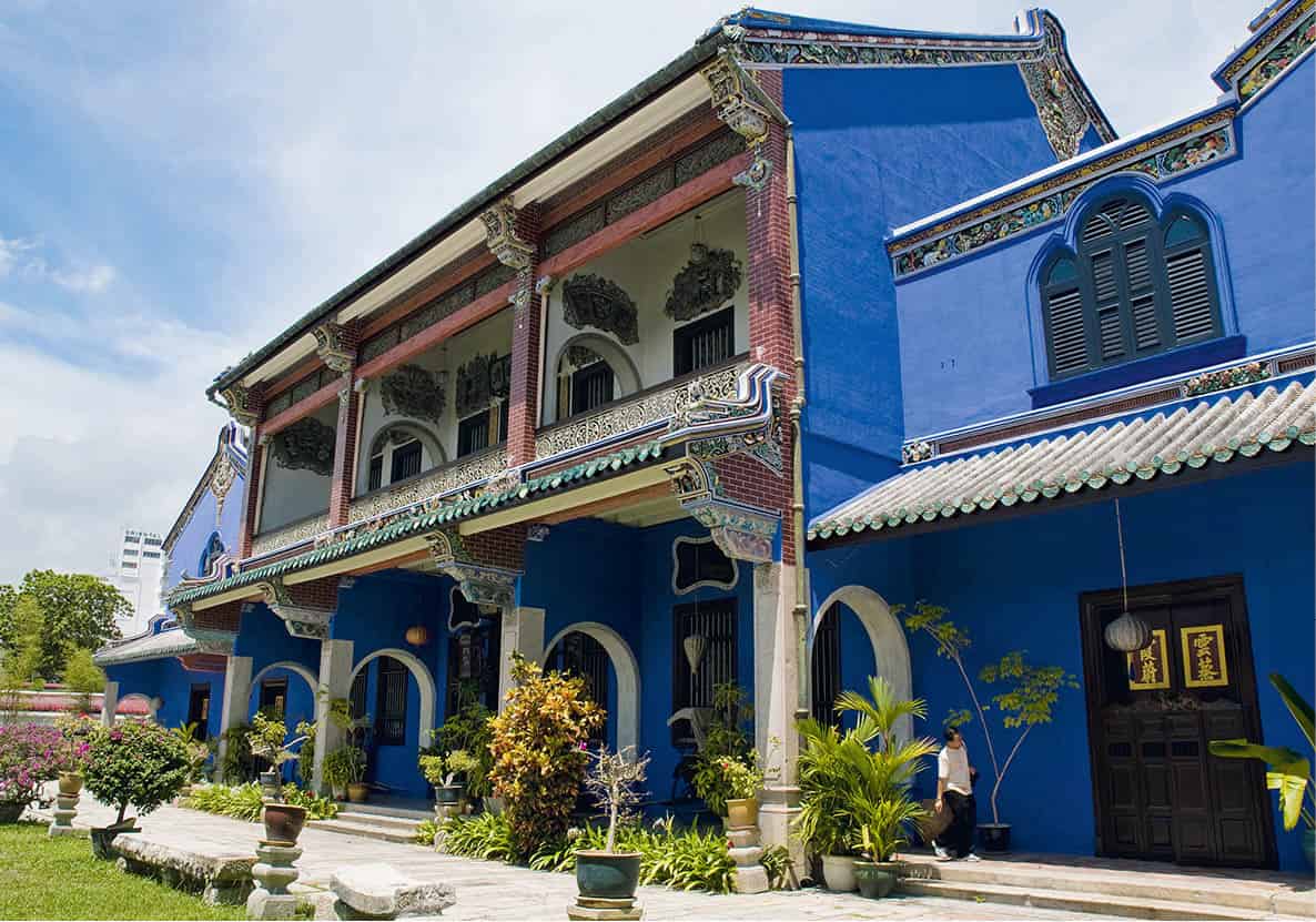
Cheong Fatt Tze Mansion
Tourism Malaysia
Nanyang Heritage Sites
This trail will bring you round to visit houses that display late 19th century Nanyang (South Seas) Chinese architecture and decorative arts. The Cheong Fatt Tze Mansion on Lebuh Leith, built around 1860 by Thio Thaw Siat, a Chinese businessman, is considered one of the best examples of 19th-century Chinese architecture in Penang. Restored to its former glory, this 38-room, five-courtyard house gained UNESCO recognition in 2000 and is now a boutique hotel. Tours are conducted three times a day for a small fee.
The Pinang Peranakan Museum on Lebuh Gereja is a mansion built by millionaire Chung Keng Kwee, but today holds a wide collection of jewellery, costumes and antique furniture of the Chinese Peranakan (the Baba Nyonya), descendants of Chinese settlers who adopted certain Malay ways.
Street of Harmony Walk
The busiest public temple in Penang is the Kuan Yin Temple, on Jalan Masjid Kapitan Keling, near St George’s Church. Dedicated to the Goddess of Mercy, who is identified with the Indian Boddhisattva of Fertility, it draws both the rich and poor to pay respect and is popular with newly wed couples. The atmosphere is heavy with the scent of burning joss sticks mixed with the aroma of flowers, scented oils, fruits, cakes and roast chicken, offered on the altars to help solve family problems.
On the same street is the Masjid Kapitan Keling, the state’s oldest mosque, built in 1800 for Muslim Indian soldiers. The Sri Maha Mariamman Temple on Lebuh Queen was built in 1883 and is the oldest Hindu temple in Penang. Vividly decorated, it is dedicated to Lord Subramaniam, the son of Shiva and destroyer of evil, who is the focus of worship during the Thaipusam festival held in the early months of the year.
Clan associations
Chinese immigrants arriving in Malaysia in the 19th century fell under the protection and control of clan associations, similar in function to medieval European guilds.
Historic Enclave Walk
The small enclave bordered by Lebuh Armenian in the north, Lebuh Cannon in the east and Lebuh Acheh in the southwest is the meeting point of Confucian and Islamic civilisations. No. 120 Lebuh Armenian was the Penang headquarters of the Tongmenghui, the political party of the Chinese leader Dr Sun Yat-Sen; the ground floor is open to the public and there is a short video presentation. On Lebuh Acheh the George Town World Heritage Office has tourist information about the city.
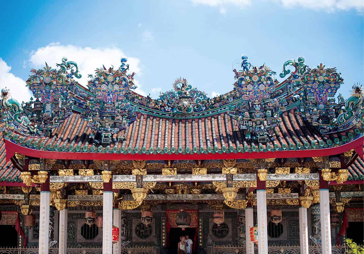
The Khoo Kongsi in George Town
James Tye/Apa Publications
The more flamboyant residential houses are the Clan Houses, bulwarks of community solidarity. Clan houses combine temples for ancestral worship with meeting halls to settle local problems – housing, jobs, medical care, help for orphans and discreetly handled intra-community crime. Off Lebuh Cannon – so called because of the holes made in the road surface here by cannonballs fired during the Great Penang Riot of 1867 – and through a laneway is the Khoo Kongsi (clan house of the family Khoo). Approach it via a narrow alley near the intersection of Lebuh Acheh and Jalan Masjid Kapitan Keling. Inside is an image of the clan’s patron, Tua Sai Yeah, a renowned general of the Ch’in dynasty (221–207BC). Other houses nearby date back to the mid-19th century. The ornate ancestral temple Leong San Tong stands opposite a smaller hall used for open-air Chinese opera and theatre. To the left is a shrine to the God of Prosperity and to the right is the hall of sinchoo (soul-tablets), gold plaques honouring clan dignitaries and simpler wooden panels for more humble clan members.
Southwest of George Town
The other main sights of interest outside George Town are Penang Hill and the Botanical Gardens. The drive out along Jalan Sultan Ahmad Shah takes you past the rubber magnates’ huge neo-Gothic and Palladian mansions, built during the boom that lasted through World War I.
The Buddhist Wat Chaiyamangkalaram monastery, on Lorong Burma, is famous for its reclining Buddha, 33m (108ft) long. Queen Victoria gave the site for the temple to the community in 1845.
Further west, away from the temple, you’ll find the Penang Botanic Gardens. The 30-hectare (74-acre) garden was created in 1844 as a tribute to Charles Curtis, its superintendent, who collected botanical specimens from the nearby hills. Leaf monkeys and long-tailed macaques are among the wildlife.
Jalan Dato Keramat, then Jalan Air Itam, leads west from the town to Suffolk House, where a guided tour introduces you to the Anglo-Indian garden house on the pepper estate once owned by Francis Light. Continue west to Penang Hill, 833m (2,733ft) above sea level, which served as a colonial hill station in the early 20th century. Take a five-minute ride on the Penang Hill Railway past bungalows and villas set amid tropical gardens for panoramic views of the island. Birdwatchers should look out for blue-tailed bee-eaters, sunbirds and spider-hunters.
Above the small town of Air Itam stands the Kek Lok Si (Temple of Paradise). It was founded by Abbot Beow Lean, a Chinese Buddhist priest from Fujian Province in China who arrived in Penang in 1887. The temple’s construction began in 1890 and took 20 years to complete. The centrepiece is the seven-tiered Pagoda of a Million Buddhas, which is 30m (98ft) high and dedicated to Tsi Tsuang Wang. The pagoda is actually a blend of three architectural styles, a Chinese octagonal base, a Thai central core and a Burmese peak. Inside the shrine are statues of the Laughing Buddha, radiating happiness; Sakyamuni Buddha, incarnation of the faith’s founder; and Kuan Yin, the Goddess of Mercy.
Western Penang island
Away from George Town’s hectic, bustling streets and midday heat, there is the chance to explore the remainder of the island. Head to Balik Pulau town and join a cycling tour to see the Malays, who live largely in the rural kampungs and fishing villages. The landscape here is a blend of hilly rainforest and occasional plantations of rubber, oil palms, pepper, nutmeg, cloves and other spices. This part of the island can be toured in a day – overnight accommodation away from the beach resorts and George Town is limited.
Meromictic lake
Penang National Park has one of two natural meromictic lakes in Asia. Off Pantai Kerachut, the lake is seasonal, filling up with seawater and freshwater only during the monsoon months (April–May and Oct–Nov). Being meromictic, the two layers of water never intermix because of different densities.
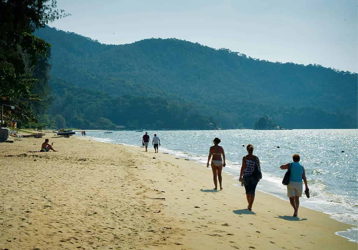
Strolling along Batu Ferringhi beach
James Tye/Apa Publications
Northwest of George Town
About 15km (9 miles) northwest of George Town are the resorts of Batu Ferringi, with sandy beaches and rows of luxury resorts offering waterskiing, sailing, windsurfing, horse riding and other sports. There are also small hotels for travellers on a budget. Be aware that water sports accidents have occurred there and the beaches may disappoint those who have travelled elsewhere in Malaysia.
Alternatively, you could trek through the Penang National Park. The forest reserve covers some 20 sq km (8 sq miles) of the island’s northwest corner. With only camping available as accommodation and vehicles denied access, the reward comes in possible sightings of wildlife like wild pigs, leopard-cats, slow loris, flying lemurs, leaf monkeys, macaques and black squirrels. The landscape is dotted with granite outcrops.
Near Teluk Bahang’s town centre are the Tropical Spice Garden and Penang Cultural Centre; the latter features art, crafts, music and dance, as well as traditional architecture from elsewhere in Malaysia. At the southern end of Teluk Bahang village is the Penang Butterfly Farm, which has hundreds of different specimens fluttering around a netted enclosure of landscaped gardens.
A tropical fruit farm, just 8km (5 miles) from Teluk Bahang, has cultivated 140 types of exotic fruit trees on its 10 hectares (25 acres) since opening in 1992.
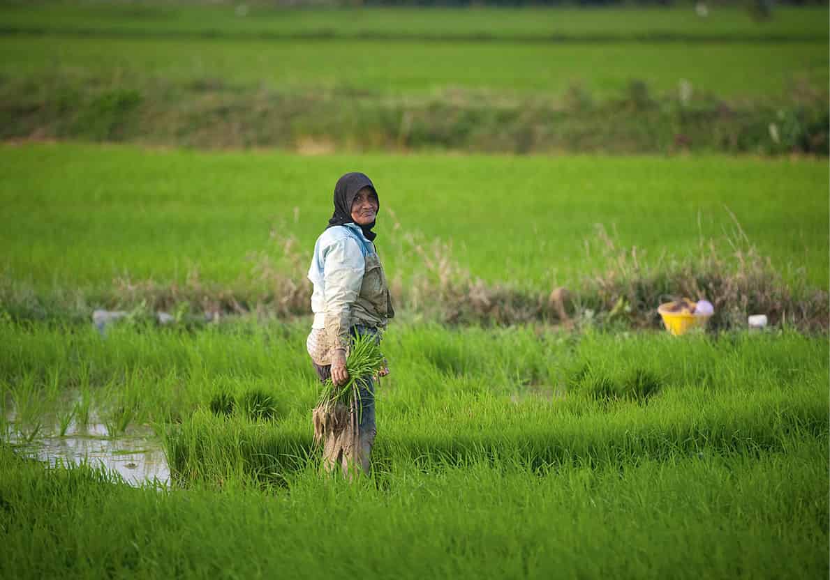
Kedah is the country’s rice basket
James Tye/Apa Publications
Kedah
From Seberangi Prai the road stretches north into Kedah state and heads into the rice bowl of Malaysia. The archaeological site at Lembah Bujang (Bujang Valley) 6 [map] possibly dates back to a 5th-century Hindu kingdom called Langkasuka, which Indian traders may have used as an entrepôt with China. Buddhist temples have also been uncovered in the area. Via the towns of Sungai Petani and Bedong, a left turn takes you to Merbok to visit the Candi Bukit Batu Pahat (Temple of Chiselled Stone Hill). This is one of the 10th-century temples now reconstructed in the Lembah Bujang, which is thought to have been built by representatives of the South Indian Pallava dynasty before the 7th century BC. More artefacts, ceramics, lingams (phallic symbols), stone caskets, and gold and silver Shiva symbols are on show at Merbok’s Muzium Arkeologi Lembah Bujang (Lembah Bujang Archaeological Museum).
Beyond the highest peak in Kedah, 1,200m (3,936ft) Gunung Jerai, lie rice fields fed by Sungai Muda. These extend northeast to Tasik Muda (Lake Muda), the gateway to the Ulu Muda Forest Reserve, which is accessible only by boat. This remote rainforest, with basic accommodation, gives visitors a chance to spot elephants, hornbills and maybe even the elusive tiger.
In the city centre of the Kedah state capital Alor Setar is the traditional padang (square), dominated by the Crown of Kedah monument. The Masjid Zahir, built in 1912, stands on the square’s western side. The Muzium Negeri (State Museum), about 15 minutes by car just north of the city, was built in 1736, and is worth a visit for its collection of Bunga Mas and Bunga Perak (flowers made of real gold and silver), sent to the ancient court of Siam as tribute.
The nearby port of Kuala Kedah is a departure point for ferries to Langkawi; you can see the remains of an 18th-century fort and sample some of Malaysia’s best seafood.
Langkawi Geopark
Langkawi’s geological formations have been evolving for more than 550 million years. Besides the three geoforest parks at Machinchang, Kilim and Dayang Bunting, there are also four geological monuments and 10 protected geosites, covering islands, waterfalls, lakes, ancient fossils, pinnacles, caves and beaches. These fossils of ancient and extinct sea creatures, between 550 and 250 million years, old are remarkably preserved in the rock and limestone landscape, but they are easier to find at Kilim.
Part of an archipelago of some 99 islands, the delightful resort island of Langkawi 7 [map] is Southeast Asia’s first UNESCO Geopark and lies just south of the sea border with Thailand. With its numerous hotels and resorts, it is increasingly seen as Malaysia’s premier island destination.
For those travelling by road (rather than flying from KL), ferries leave from Kuala Perlis and Kuala Kedah. There are daily ferries from Penang and several per day to Satun in southern Thailand. There are also flights to Langkawi from Singapore.
For ferry travellers, the Jetty Point Duty-free Complex in Kuah is your arrival point, while those coming by air will land at the international airport, 18km (11 miles) northwest of the town. Kuah has some good Chinese, Thai, Indian and Malay restaurants and shops selling a range of goods at duty-free prices. Kuah’s town square is dominated by a sculpture of a giant eagle (langkawi means red eagle in Malay).
It is possible to explore Langkawi’s 80km (50 miles) of roads by hiring a car, but many find motorcycles and scooters a better and cheaper alternative to reach parts of the island. South of Kuah is Pulau Tuba and Pulau Dayang Bunting, which make up the Dayang Bunting Marble Geoforest Park. This area and two other parts of the island form a geopark that protects the rocks, plants and animals. You can swim in Tasik Dayang Bunting (Lake of the Pregnant Maiden), Langkawi’s largest freshwater lake, associated with the fable of a Kedah princess who drank the lake’s water and became pregnant. Just be mindful of the aggressive food-pinching monkeys in the area.
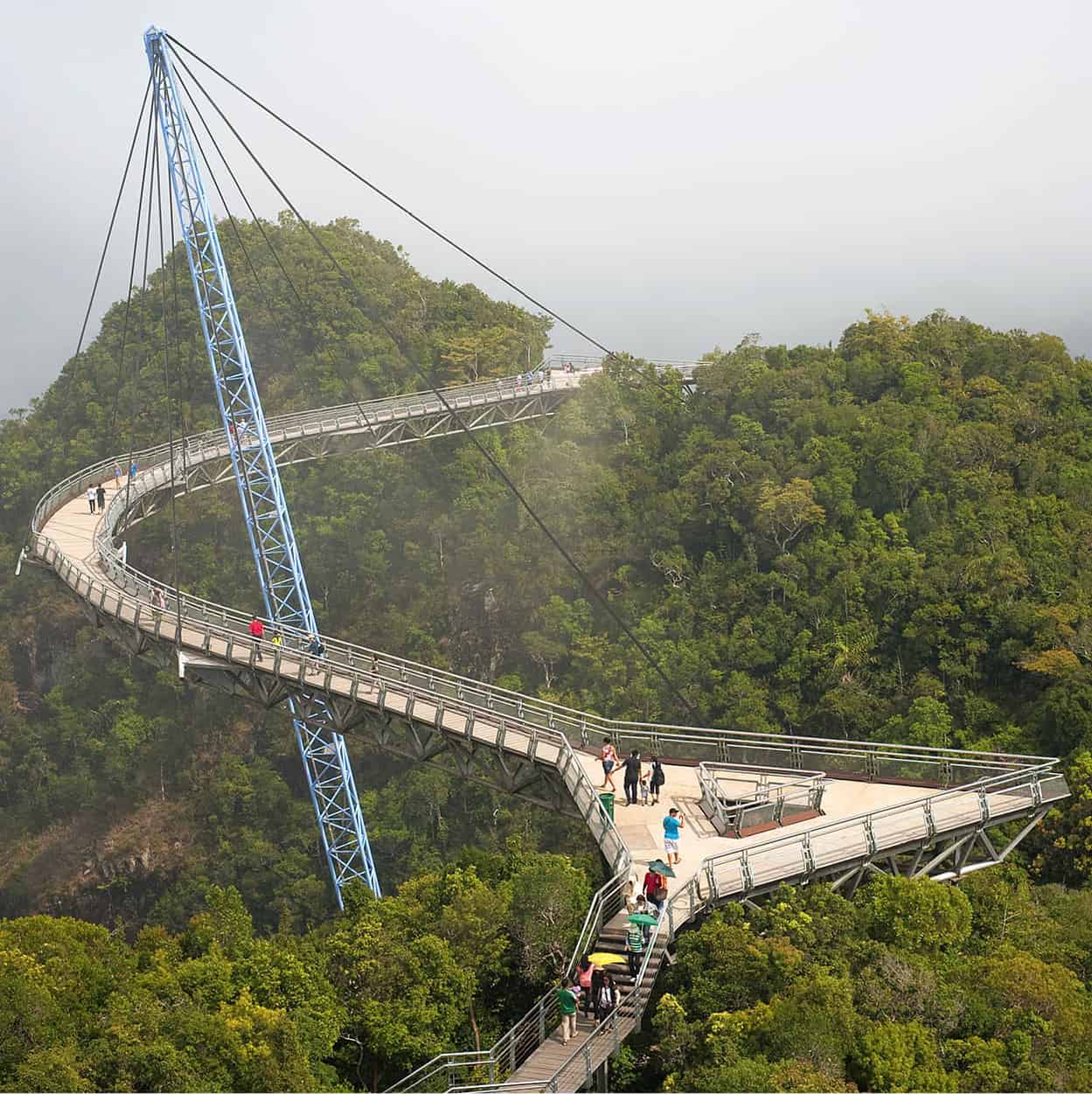
Langkawi’s SkyBridge
James Tye/Apa Publications
Most resort and budget accommodation is located around Pantai Cenang and Pantai Tengah on the island’s southwestern tip, within easy reach of the international airport. Here you will also find the island’s best public beaches. Elsewhere on the island, the fine beaches at Burau Bay, Datai Bay and Tanjung Rhu are reserved for the exclusive use of hotel guests.
Underwater World Langkawi at Pantai Cenang is reputed to be the largest aquarium in Southeast Asia, with over 5,000 marine and freshwater species. Nearby is the Muzium Laman Padi (Rice Garden Museum), which explains how rice is planted and harvested. En route to the airport is Temple Tree at Bon Ton, a collection of heritage homes that were once in a state of sore neglect and scattered around the peninsular. Each house was relocated here in pieces and reassembled as luxury accommodation. Also nearby the airport, the Pisang Handicraft & Art Village showcases batik artists at work.
Head northwest to the Machinchang Cambrian Geoforest Park to visit the Langkawi Geopark Tourist Information Centre at the Oriental Village shopping complex. Here you can get an insight into how geologically different the three geoforest parks are. Ride the Panorama Langkawi to the top of the 708m (2,320ft) Gunung Machinchang and cross the gravity-defying SkyBridge. Plan to be here at sunset to appreciate the best panoramas of the Andaman Sea and Thailand from the viewing platforms.
On the northern coast of Langkawi, on Jalan Teluk Yu, is the Kompleks Kraf Langkawi handicraft centre. But a more worthwhile reason to stop is for the Customs and Wedding Museum, showcasing the traditions of Malaysia’s ethnic groups.
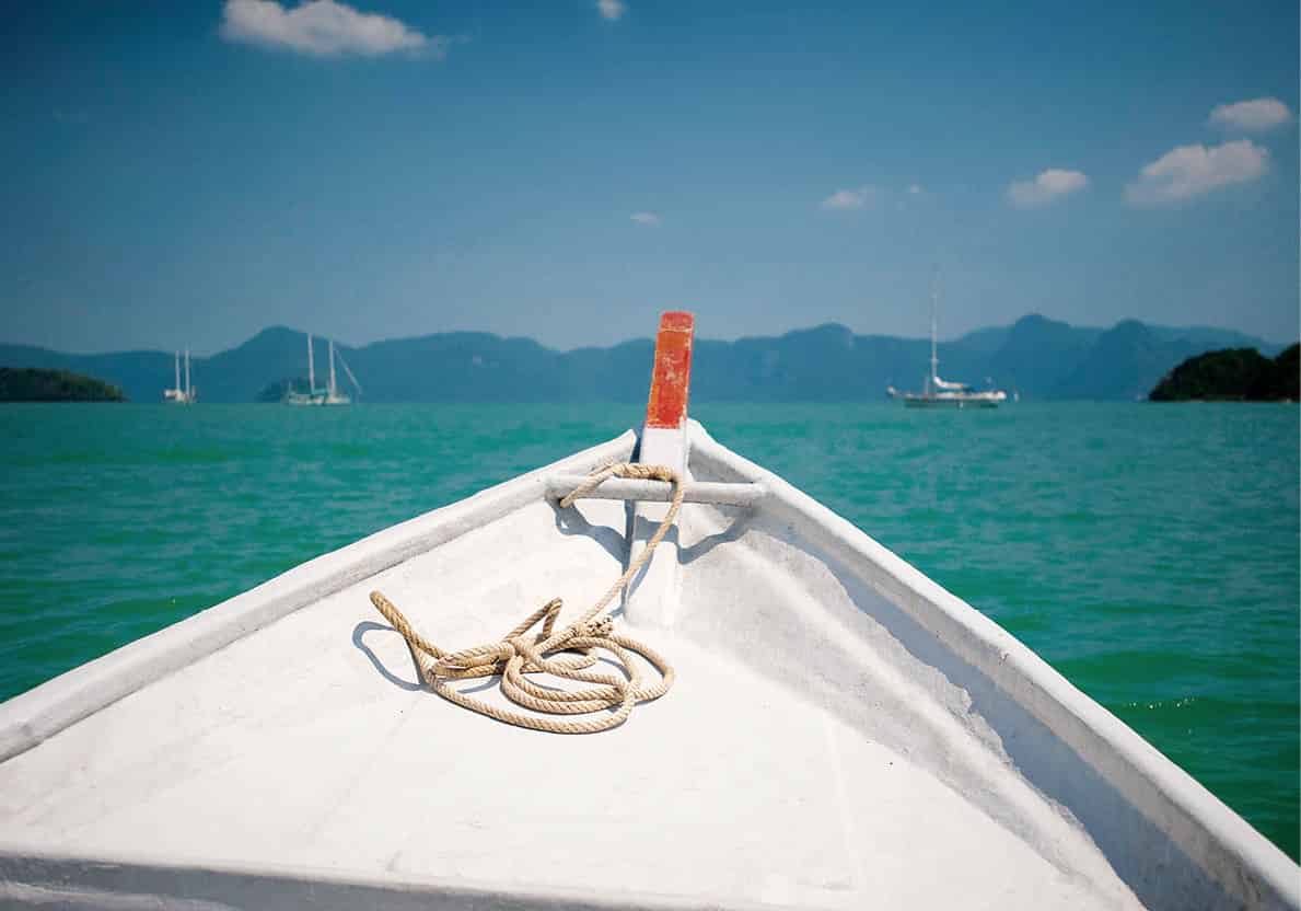
A small cruising boat off Langkawi
James Tye/Apa Publications
Cruise boats depart from Kilim Jetty to tour the Kilim Karst Geoforest Park, in northeastern Langkawi. But the best way to see these majestic limestone hills and mangrove forests is to paddle your own kayak through the narrow channels of brackish water. Besides the wildlife – soaring Brahminy Kites, mischievous macaques and languid snakes – there is also a visit to Gua Kelawar, a small cave populated by fruit bats. Nearby, on Jalan Ayer Hangat, Herbwalk was created by Dr Ghani and is used to raise funds for Traditional Malay Medicine. The collection includes more than 600 species, many with medicinal properties.
South of Langkawi is the marine park of Pulau Payar, where underwater visibility is rarely more than 3m (10ft), but there is nevertheless lots of life, including baby black-tip reef sharks and colourful soft coral blooms on wrecks in deeper waters.
Perlis
Malaysia’s smallest state, Perlis, also marks a change of scenery, from the flat rice lands to solitary limestone outcrops, many containing subterranean caves. The main towns are Arau, the royal town, and Padang Besar, where the Malaysian and Thai railways meet. An alternative route into Thailand is via the Perlis State Park, where, for the adventurous, a visit to the Gua Wang Burma is recommended (prior booking is required). From Kuala Perlis, south of the state capital, Kangar, it is a 45-minute ferry ride to Langkawi and there are regular departures during the day.
The East Coast and Interior
Malaysia’s less-visited east coast offers visitors a slower pace, set against the beauty of the region’s beaches and the richness of its forests. The region covers three states – Kelantan, Terengganu and Pahang – with most road traffic plying the coastal road between Kota Bharu, close to the Thai border, and Kuala Rompin in the south, the gateway to the Pahang section of the Endau-Rompin State Park. Historically resistant to many of the major changes in the rest of Malaysia, the region has been able to maintain its authentic Malay culture (with some Thai influence in northern Kelantan) and Islamic traditions.
The east coast’s beaches are less developed and offer opportunities for snorkelling and diving. Further into the interior, wildlife enthusiasts can enter the forests in Taman Negara National Park from all three states for jungle trekking and adventure travel. Kenyir and Bera are two large freshwater lakes for angling aficionados and at Tasik Bera visitors can also experience life with the Orang Asli from the Semelai tribe.
The region also offers the chance to see leatherback turtles coming to lay their eggs at Cherating near Kuantan; and to view the artisans at Kuala Terengganu, whose boat-building skills are legendary.
Kampung crafts
Traditional handicrafts, including the making of spinning tops, kites, silverware, baskets and batik, are still practised in many of the rural kampung in Kelantan and Terengganu.
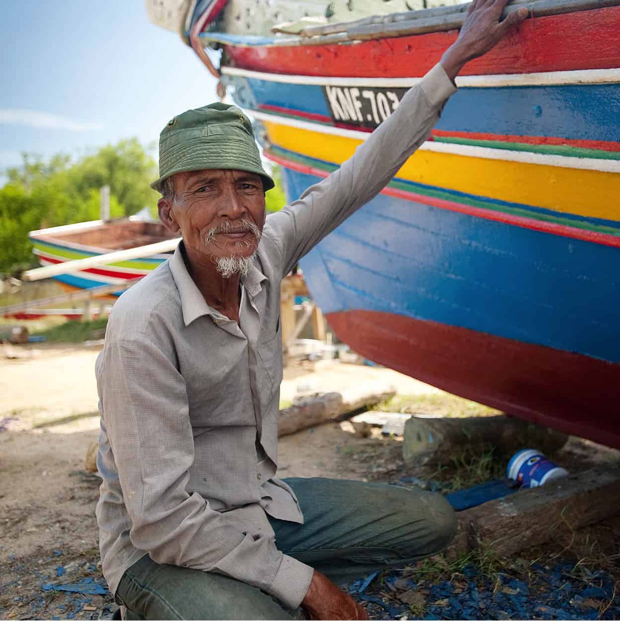
A fisherman with his Bangau boat at Bachok Beach
James Tye/Apa Publications
Kelantan
White sandy beaches stretch north from the state capital, Kota Bharu, to the Thai border. Buddhist temples close to the capital hark back to the time when Kelantan was under the influence of Siamese kings. The British colonial influence here, which came into being in a 1909 agreement with Siam, lasted only three decades before defeat by the Japanese in World War II. Kelantan’s isolation, as well as its embrace of Islam in the 17th century, enabled this cradle of Malay culture to remain intact.
Here you will see soaring decorative kites as well as the wayang kulit (shadow puppet shows), dating back to when Kelantan was influenced by the kingdom of Funan in Indochina some 2,000 years ago.
Known as the ‘Land of Lightning’ – due to the heavy storms during the wet season of November to February – Kelantan’s gateway is Kota Bharu, just 40 minutes by air from Kuala Lumpur and only 30km (19 miles) from the Thai border. To the south, where towns dot the main highway, are points of access to the many beaches and fishing villages that are at the heart of the region’s economy and culture.
Kota Bharu
On the banks of the Kelantan River, Kota Bharu’s key attractions are close to the Pasar Besar Siti Khadijah (Central Market) on Jalan Hulu. Here rows of food and farm produce resemble works of art, with vegetables, fruit and meat on the ground level and kitchenware, baskets and other goods on the floors above.
The Buluh Kubu Bazaar is good for bargain-hunters seeking T-shirts or silverware. Cottage-industry goods are found over the Jalan Wakaf Mek Zainab bridge, while the night market, near Pasar Besar, provides worthwhile evening entertainment and gives visitors a chance to savour Kelantanese food.
At sundown, riverside restaurants also come to life near to Padang Merdeka (Independence Square). The square was the site where the body of slain Malay warrior Tok Janggut (Father Long Beard), who led a rebellion against the British in the early years of the century, was exhibited in 1915. The Declaration of Independence was read here on 31 August 1957.
Across the square on Jalan Sultan is the state’s first brick building, a bank used by the Japanese Army as their headquarters during World War II but now the Memorial Perang Bank Kerapu, a war memorial museum. Next door is the Muzium Islam (Islamic Museum), and the ornate Masjid Al-Muhammadi (State Mosque) beyond.
The Istana Jahar (Museum of Royal Traditions and Customs) was built in 1887, with additions by Sultan Muhammad IV in the early years of the 20th century. The Istana Balai Besar (Palace with the Great Hall) was built in 1840 under Sultan Muhammad II and is now open only on ceremonial occasions (for invited guests). The best glimpse of living Malaysian culture can be seen at the Gelanggang Seni (Cultural Centre), on Jalan Mahmood opposite the Perdana Hotel. Performances here include wayang kulit, main gasing (top spinning) and silat (selfdefence), except on Fridays and during Ramadan. For the latest performance schedules, visit the Tourism Malaysia office on the ground floor of Kampung Kraftangan (Handicraft Village), 2km (1.2 miles) southwest from here.
Around Kota Bharu
Within just a few kilometres of Kota Bharu, visitors can find master silversmiths and expert batik-makers, but the maze of country lanes around the town could make it difficult to find the kampung communities where the artisans still use their traditional skills. The Tourist Information Centre on Jalan Sultan Ibrahim can recommend a guide.
Silver-craft factories can be visited at Kampung Sireh, along Jalan Sultanah Zainab, Kampung Marak and Kampung Badang, as well as on the road to Pantai Cahaya Bulan (PCB). Also on the way to PCB, visitors can see the skill and beauty of kain songket, richly woven materials of gold and silver thread, at Kampung Penambang. Songket was the product of the region’s early trade with China (silk) and India (gold and silver thread). Batik-makers are found throughout the state, but there are bigger factories at Kampung Puteh, Kubur Kuda and Kampung Badang, near the city.
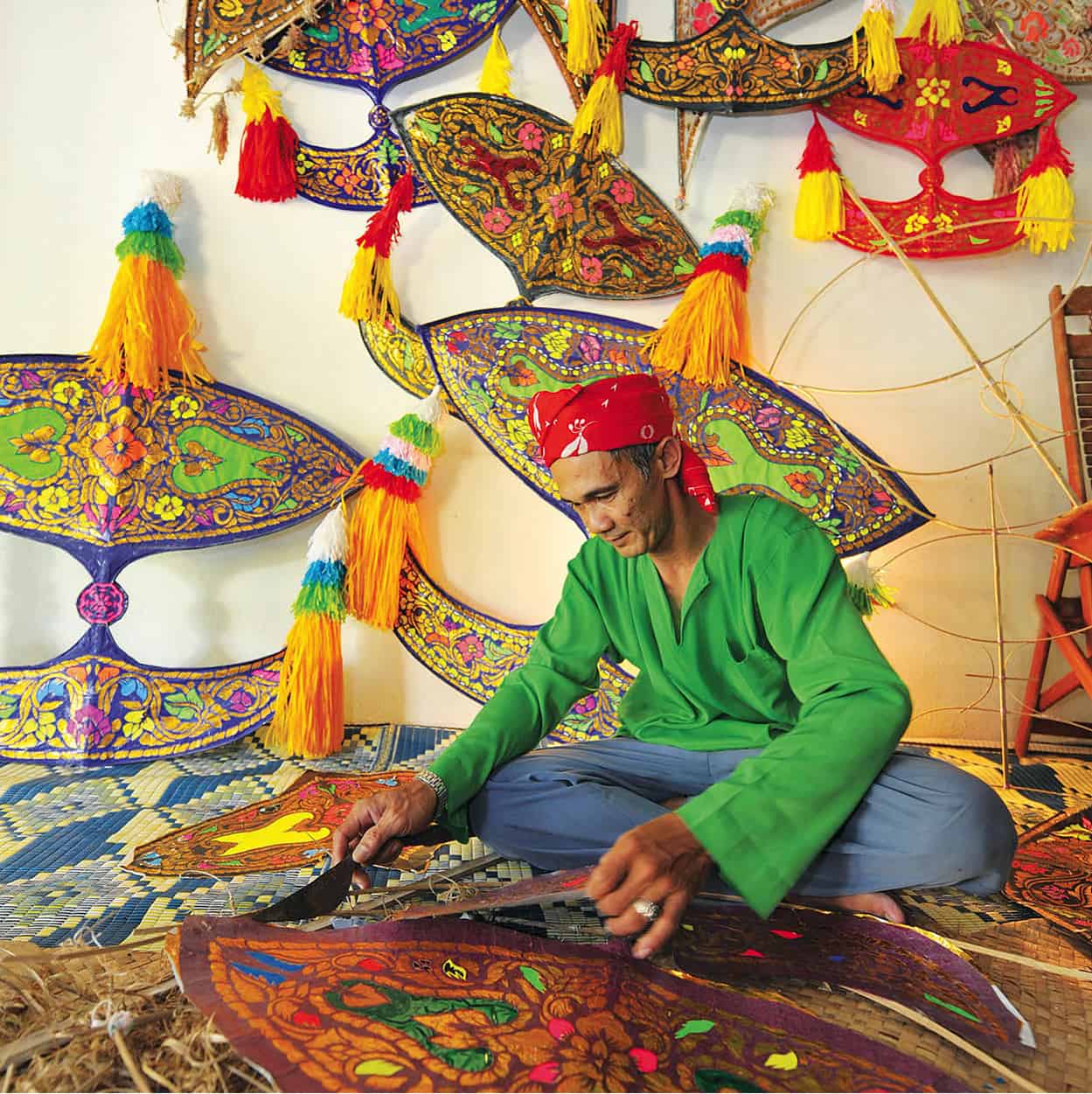
A craftsman making wau in Kota Bharu
Tourism Malaysia
Kite-makers also practise their age-old skills throughout the region, and while tradition would have the art passed from father to son, many fear the younger generation now lacks the patience to carry out the skilled handiwork required.
One of the oldest mosques in Malaysia is at Nilam Puri. Masjid Kampung Laut was dismantled and taken from a site closer to the river at Kampung Laut in 1968, after repeated flooding. The mosque was built entirely without the use of nails. It is now a centre for religious studies and open only to Muslims.
Temple attire
When visiting a place of worship remember to dress in an appropriately dignified manner. Note that you must also take off your shoes before entering a Hindu temple or a mosque
Kelantan’s ancient links with Thailand are evident in the number of Thai Buddhist Temples you will see half-hidden among the groves of palm and laurel, rising above the rice paddies. North of the estuary of the Kelantan River near Tumpat (12km/7 miles from town) is one of the most important of these temples, Wat Phothivihan, noted for its 40m (130ft) reclining Buddha. At Kampung Perasit, south of Kota Bharu, is Wat Putharamaram.
A significant landmark of World War II can be visited at Sabak Beach, 13km (8 miles) northwest of Kota Bharu, near the mouth of the Kelantan River. Here is the site of the first Japanese assault in the Pacific War, just over an hour before Pearl Harbor was bombed. Jutting out of the sandy beach in the pleasant shade of palm and casuarina trees stands a crumbling bunker that the Indian artillery defended to the last soldier.
Sunbathing etiquette
Topless sunbathing is forbidden. Two-piece bathing suits are generally acceptable, but only at beaches or poolside areas. Do dress more conservatively on the mainland beaches of Kelantan and Terengganu.
The Beaches
Kelantan’s white sandy beaches are easily reached from Kota Bharu and provide plenty of opportunities for a pleasant swim. Most popular is Pantai Cahaya Bulan, or Moonlight Beach. It is 10km (6 miles) north of the town, one reason why it is so popular during weekends and holidays.
Pantai Seri Tujuh (Beach of the Seven Lagoons), about 7km (4 miles) from Kota Bharu, lies on the border with Thailand.
To the south, Pantai Irama (Melody Beach) is some 25km (16 miles) from Kota Bharu; it is one of the most beautiful along the entire coast. On the journey to Terengganu is Pantai Bisikan Bayu (Beach of the Whispering Breeze, also known as Pantai Dalam Rhu). Stop off at the fishing village of Semerak, 19km (12 miles) from Pasir Puteh, where you can buy excellent seafood for a barbecue on the beach.
South of PCB is the Gunung Stong State Park, where you can trek, with the assistance of a guide, to the impressive seven-tier Jelawang Waterfall, one of the highest falls in Malaysia, and camp nearby.
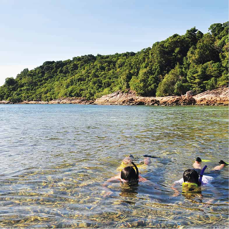
Snorkelling off Pulau Perhentian Besar
Tourism Malaysia
Terengganu
A coast of sandy beaches along the 225km (140 miles) of landfall facing the South China Sea, not to mention several offshore islands and hinterland forests near Tasik (Lake) Kenyir, give Terengganu its appeal. The wealth from offshore oil discoveries in recent years has buoyed the state, something you’ll see reflected in the skyline and busy traffic of the capital, Kuala Terengganu. So far the economic gains have failed to detract from the town’s relaxed charm. The main options for travelling to Terengganu are direct flights from KL or interstate buses to Kuala Terengganu, which is generally the starting point for a trip to the island resorts or to Tasik Kenyir.
The Islands
The islands off Terengganu’s north coast are accessible from both Kuala Terengganu or by way of the fishing village of Kuala Besut, 45km (28 miles) south of Kota Bharu, which is the departure point to Pulau Perhentian’s islands 8 [map].
These islands of Pulau Perhentian Kecil and Pulau Perhentian Besar are reached after a 45-minute speedboat ride. Their main appeal is that they are lush and tropical, with clear blue waters and coral reefs protected as part of Malaysia’s marine park network. On both islands, accommodation ranges from good resorts to chalets.
South from Pulau Perhentian Besar lies Pulau Redang, some 50km (31 miles) off the coast, and if snorkelling or diving you may get to see green turtles in the surrounding seas. Pasir Panjang (Long Beach) has the most bars and clubs, and is known for its party atmosphere. The journey to the islands takes two hours from the village of Merang (not to be confused with the town of Marang further south). There are also resorts on Pulau Lang Tengah, just west of the Redang Islands. Boats take 45 minutes to reach the island from Merang.
Kuala Terengganu
The lively state capital of Kuala Terengganu, bordered by the Terengganu River and the South China Sea, is the largest town in the state and has progressed from a sleepy fishing village to a bustling, colourful centre. Aside from the beautiful Masjid Tengku Tengah Zaharah, 4.5km (3 miles) out of town, most sites of interest are along the town’s waterfront. The mosque, built on an estuary of the Ibai River, gives the illusion that it is floating on water.
Back in town, a waterfront stroll leads through Chinatown, on Jalan Bandar. The old terraced buildings on both sides of the road create an attractive sense of timelessness even as the betting shops do a lively afternoon trade. Jalan Bandar leads you to the Pasar Besar Kedai Payang (Central Market), a multi-level complex attached to a car park, with a fruit, vegetable and fish market on the ground floor and local textiles and handicrafts above.
A short river cruise from the jetty, Pulau Duyong is a little island of boat-builders, whose reputations extend far beyond Malaysia. Late in the year, the Monsoon Cup sailing race is staged off the island in the blustery monsoon breezes.
Several other attractions are located outside the town. Opposite Pulau Sekati, 5km (3 miles) from town – but also accessible via the river – is the Terengganu State Museum, in a traditionally styled complex of four blocks housing 10 galleries at Bukit Losong. The largest state museum in Malaysia, its galleries are dedicated to maritime exhibits, traditional architecture, Islamic arts, textiles, crafts and royal regalia. For local silk weaving, try the Sutera Semai Centre at Chendering, 6km (3 miles) from Kuala Terengganu, where visitors can see different stages of silk-making and batik-painting. Also on offer is songket, woven with silver and gold threads, and brassware.
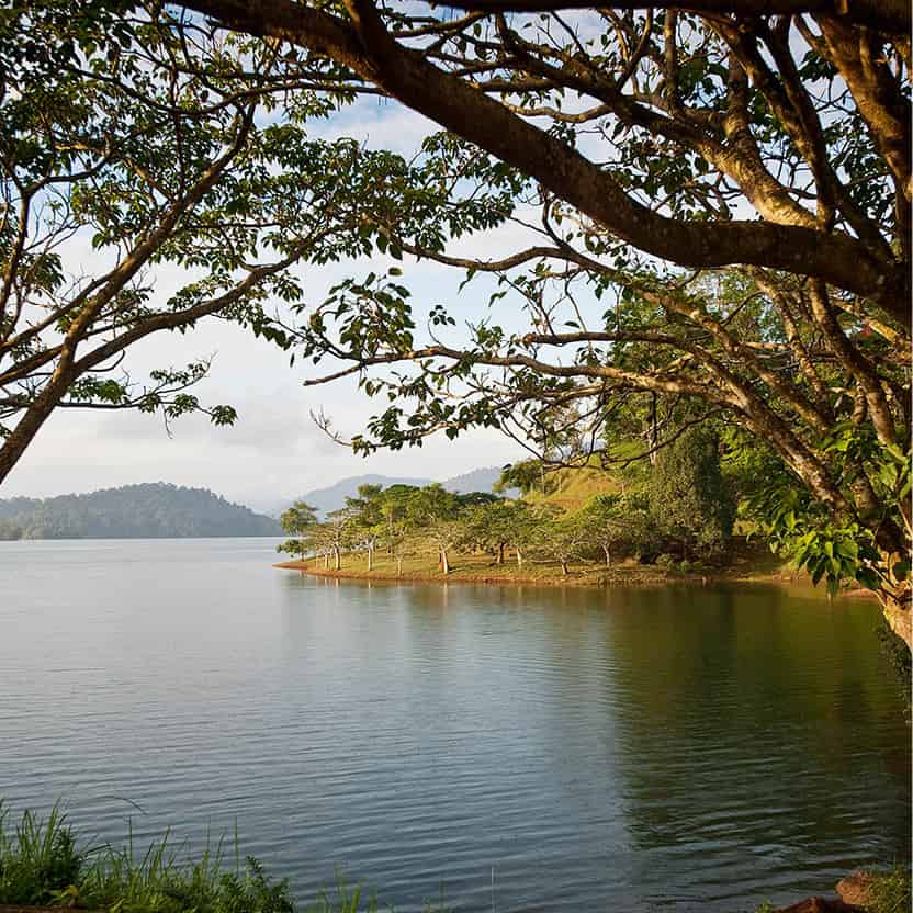
Tasik Kenyir
James Tye/Apa Publications
Around Kuala Terengganu
Around 55km (34 miles) inland from Kuala Terengganu is the largest constructed lake in Southeast Asia, Tasik Kenyir 9 [map]. It was created by flooding the valley to make the country’s largest hydroelectric dam, completed in 1985. For anglers looking for freshwater fish, the waters of Tasik Kenyir, covering an area of 260,000 hectares (642,460 acres) and 340 islands, are the place to go. There is also an adventurous trail to Taman Negara. Besides fishing, jet-skiing, windsurfing, canoeing and jungle trekking are also available.
There are also several waterfalls, rapids and cascades within the lake region, including the Sekayu Waterfall, just 56km (35 miles) west of Kuala Terengganu. After trekking through the rainforest, you can enjoy a swim in one of the many natural pools created among the rocks by the cascading river.
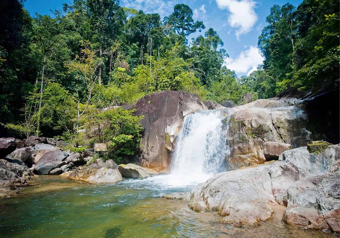
Sekayu Waterfall
James Tye/Apa Publications
Marang is a fishing village 15km (9 miles) south of Kuala Terengganu. It provides access to the island of Pulau Kapas which, though less than 2km (1 mile) in length, is considered one of the finest islands on the east coast. There are several resorts and chalet accommodation on the island.
Save the turtles
In the years before ecological awareness, many onlookers treated the turtles’ rendezvous as a popular spectacle. Crowds gathered in festive mood to build campfires on the beach, dance to loud music, take pictures by blinding flashlight of the turtles’ night-time egg laying, even ride the backs of the leatherback turtles. This irresponsibility almost put a stop to the natural phenomenon. The annual number of leatherbacks visiting Rantau Abang declined from about 2,000 in the 1950s to barely a few hundred by the end of the 1980s. At this point, the Malaysian Fisheries Department stepped in. Authorities have banned the use of flash photography or flashlights, discouraged people from consuming turtle eggs, and visitors must stay 5m (15ft) from the turtles. Despite this, in 2010, only a handful of leatherback turtles landed to lay 10 eggs at Rantau Abang and in 2011 there were none.
Rantau Abang
Turtle-watching at Rantau Abang was once the cornerstone of tourism in Terengganu. The Turtle and Marine Ecosystem Centre here released around half a million hatchlings between 1975 and 2005. However, while all four turtle species found in the state are protected, in 2011 no leatherback turtle landed to lay eggs at Rantau Abang, although there were a few the year before.
The dramatic decline in nesting turtles over the past decade has inevitably led to a drop in tourists visiting Rantau Abang, but there was renewed hope with the establishment of the Ma’Daerah Turtle Sanctuary, 10km (6 miles) north of Kemaman. Under the management of the Department of Fisheries, the sanctuary provides hatchery facilities on the beach between the towns of Kerteh and Paka. It is a restricted area and not open to visitors unless they have written permission.
Kuala Dungun and Points South
The highway south from Rantau Abang, heading towards Kuantan, the state capital of Pahang, passes through Kuala Dungun, which is predominantly Chinese in character and offers excellent cuisine. From here you can hire a boat to the island of Pulau Tenggol, 30km (18 miles) offshore, where you can go swimming and snorkelling among the angelfish. The centre of Terengganu’s petroleum industry is Kerteh, with its refineries and gasworks. But there are some picturesque beaches at the mouth of the Kerteh River nonetheless.
Pahang
The largest state in the peninsula has the longest river, the 475km (296-mile) long Pahang. Although its most famous sights lie to the west in the Genting and Cameron Highlands, Pahang has island resorts including the renowned Pulau Tioman (Tioman Island) in the far south (though access by sea is from Mersing in Johor). Endau-Rompin National Park, straddling the border with Johor state, complements the better-known Taman Negara in the far north, which has road access through the state capital Kuantan. Tasik Bera is a scenic lake, and visitors can also stay with the Orang Asli of the Semelai tribe.
The Coast
Just 47km (30 miles) from Kuantan is the beach resort areas of Cherating, Balok Beach and Pantai Teluk Chempedak, the latter 5km (3 miles) out of the bustling city. The beautiful Pelindung Beach is just a short trek through the Teluk Chempedak Forest Reserve. From May to September, green turtles may be seen under moonlit skies when they lay their eggs on the beach. You will find a pleasant beach nearby at Batu Hitam.
Kuantan
Kuantan offers a wide range of hotels, a lively shopping and market quarter, and a quiet ambience next to the river where good food stalls are found. Built on the fortunes from tin mining, the capital is now a commercial centre for Pahang’s oil, palm and other industries, and a key link in the east coast petroleum and gas pipelines.
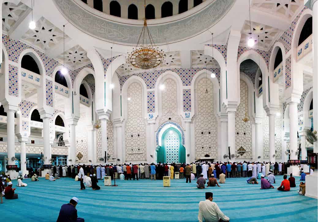
In Kuantan’s Masjid Sultan Ahmad Shah
Dreamstime
Jalan Masjid is where you will find the state mosque of Masjid Sultan Ahmad Shah and the Tourist Information Centre. The area around Jalan Haji Abdul Aziz and Jalan Besar has many shops, warehouses and the occasional moneylender. The nearby village of Selamat, at the estuary of Sungai Galing, is known for its fine kain songket silk brocade.
Sungai Lembing
About 42km (26 miles) northwest from Kuantan is the small tin-mining town of Sungai Lembing, which once had the most extensive subterranean mines in the world. Today it is the gateway to the Rainbow Waterfall, where a gorgeous rainbow at the base of the falls greets visitors who arrive well before 11am. If fine weather prevails, allow for a two-hour journey by four-wheel-drive and on foot to see this natural phenomenon. The town also has an informative Muzium Sungai Lembing housed in the former mine manager’s bungalow atop a hill overlooking the town. For a taste of local cuisine, dine at the food court at the Pasar Sungai Lembing.
Pekan
The sleepy old royal capital of Pahang, 45km (28 miles) south of Kuantan, is home to the sultan’s palace, Istana Abu Bakar, set upstream on the Pahang River among immaculate polo fields. Gilded and sapphire-blue domes grace two marble mosques and the Sultan’s Mausoleum. Nearby, on Jalan Sultan Ahmad, is the Victorian State Museum (Muzium Sultan Abu Bakar) that displays glories of the old sultanate and treasures from a Chinese junk salvaged from the South China Sea. The town also has a silk-weaving centre at the Pulau Keladi Cultural Village, 5km (3 miles) from Pekan.
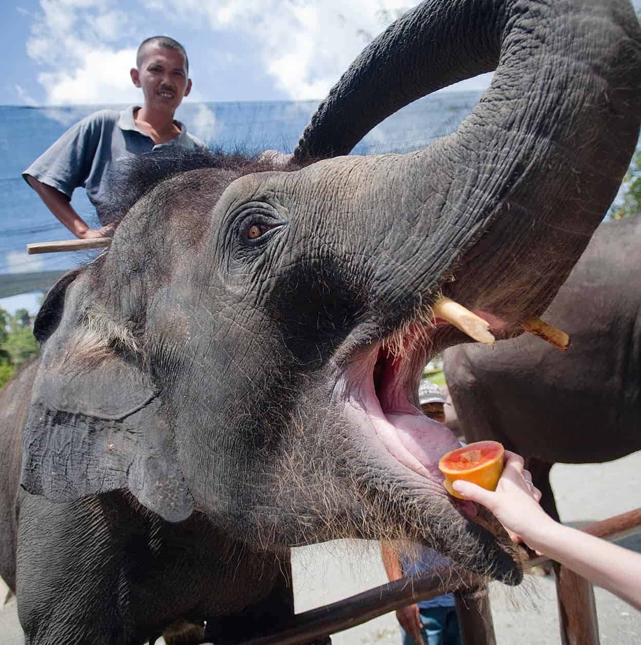
In Kuala Gandah Elephant Sanctuary
James Tye/Apa Publications
Lanchang
Near the town of Lanchang, 178km (111 miles) west of Pekan, is the Kuala Gandah Elephant Sanctuary, where visitors can interact with the endangered Asian elephant. Any visitor can feed the elephants from 2pm onwards, but only the first 100 who arrive at 1pm can ride and help bathe the elephants. However, as the sanctuary relies on visitors to minimise its operating expenses, do expect to see elephants put on a show for the tourists.
The national park of Taman Negara ) [map] provides an ideal setting for exploring vast rainforest, fast-flowing rivers and mountains of the peninsula’s Main Range. It covers an area of 4,343 sq km (1,676 sq miles), spreading across three states: Pahang, Terengganu and Kelantan.
Backpackers may want to go it alone, but most people are advised to plan their visit through a tour operator. Armed with an entry permit, visitors head first to the park headquarters, about 101km (63 miles) northeast of Lanchang by road via Jerantut and 60km (37 miles) by motor-powered longboat from Kuala Tembeling.
The boat ride on the Tembeling River is likely to be one of the highlights of your visit. Along the way, you may see wildlife and the Orang Asli fishermen – the only human residents allowed by park authorities to stay here. Wear a hat and bring along plenty of bottled water. The journey usually takes about three hours; even longer when short stretches of the river dry up, occasionally forcing passengers to walk along the riverbank while the boatmen push the sampan through the shallows.
You can also choose to take a two-hour drive from Jerantut to Kampung Kuala Tahan (village) where budget accommodation, convenience stores and floating restaurants serving local and Western cuisine are available. On the riverbank opposite the village is the headquarters at Kuala Tahan, which has a good range of accommodation, from resort chalets to bungalows and a dormitory, plus a restaurant and a general store. The park headquarters organises informative evening slide-shows as a general introduction to the features of the rainforest.
Stocking up
Buy batteries and insect repellent before visiting Taman Negara. The park’s isolation means that things are more expensive inside than out.
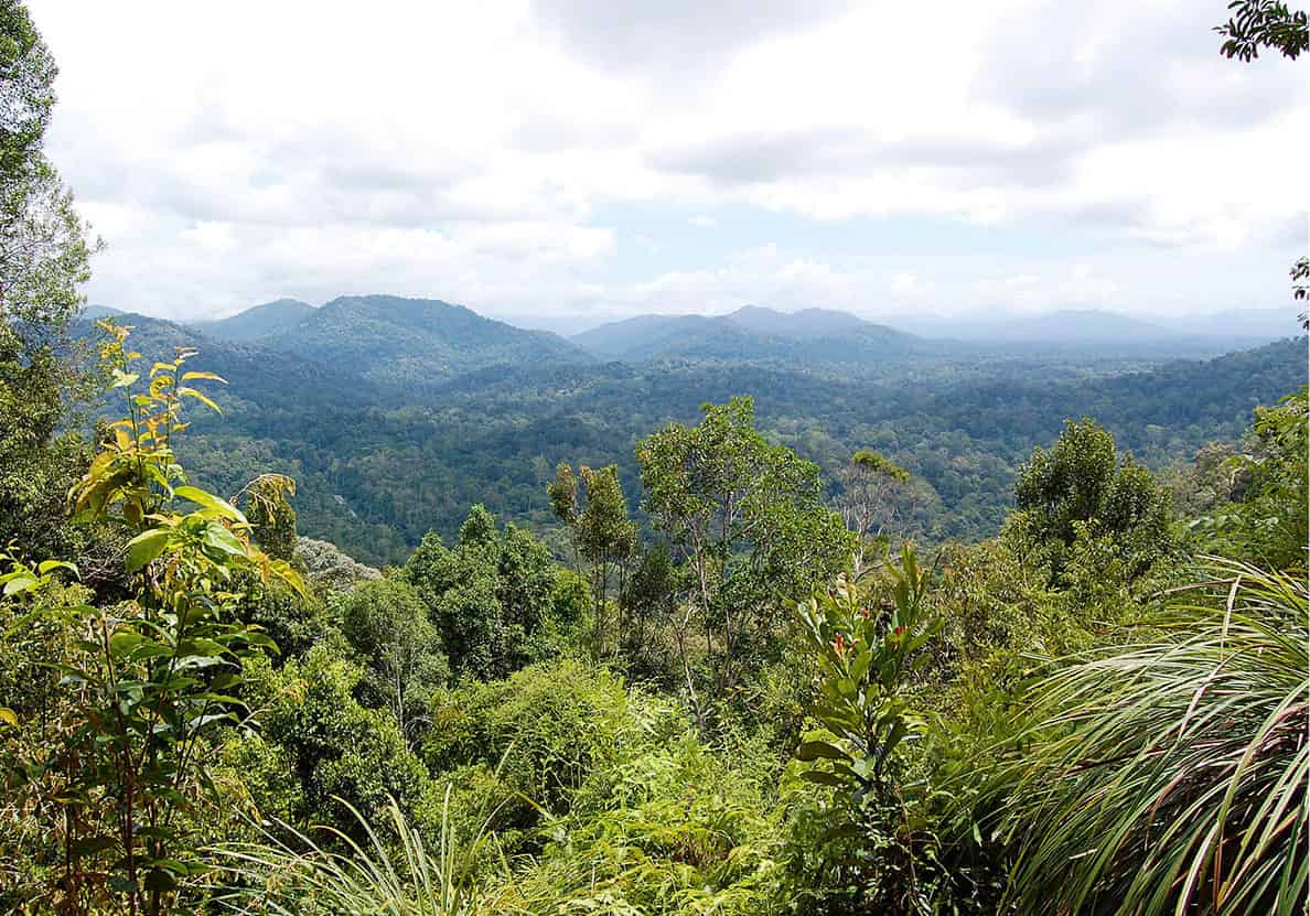
The view of Taman Negara National Park from Teresek Hill
Fotolia
Forest Trails
There are marked trails leading from the park’s headquarters into the forest, which you can explore with your own group or on an organised tour. There are both day trips and overnight tours to observation hides, where you can watch for wildlife visiting nearby salt licks and watering holes. Overnight stays are organised at several observation hides (bumbun), namely at Kumbang, Yong, Tabing, Belau and Cegar Anjing. Park headquarters will provide sheets if you do not have a sleeping bag. The most popular walk is across the elevated canopy trail, 27m (80ft) above the ground. From park headquarters, day trips leaving in the early morning include a walk to Bukit Indah, followed by a boat ride through the rapids to Kuala Trenggan, returning to headquarters on foot; a walk to the Tabing Hide, followed by a boat ride to the Lata Berkoh rapids, then another trek back to headquarters; a boat ride on the Tembeling River to the Gua Telinga (Bat Cave), which you enter on hands and knees until you can stand. You then find yourself in a great vault inhabited by hundreds of fruit and insect-eating bats, which have little interest in humans. Only the squeamish will object to the giant toads and harmless little white cave-racer snakes.
The most adventurous trek for experienced walkers and climbers is a seven to nine-day walk up and down the peninsula’s highest peak, Gunung Tahan (2,187m/7,175ft). A jungle guide must accompany the group on the strenuous climb.
Flora and Fauna
The dipterocarp rainforest here includes the tualang tree. At 50m (164ft), it is the tallest tree in Southeast Asia. At heights above 1,500m (5,000ft), you will see montane trees from the oak and laurel families.
With patience and luck by day, or rotating shift watches by night, you may see wild pigs, sambars, barking deer, gibbons, pig-tailed macaques, leaf monkeys, tree shrews or flying squirrels. Visitors to the Kumbang Hide have sometimes even caught sight of rare tigers and leopards.
During the fruit season, birdwatchers have spotted up to 70 species just around the park headquarters. Among them are lesser fish eagles, crested serpent eagles, fireback pheasants and garnet pittas. From September to March you can also see migrant Arctic warblers, Japanese paradise flycatchers and Siberian blue robins.
Even if you do not spot much of the wildlife mentioned here – and you are bound to see something – the sheer experience of the forest at night, with its incredible noises, the flitting of mysterious fireflies and the sense of invisible but omnipresent life and movement around you, will make it all worthwhile.
Tasik Bera
About 129km (80 miles) south of Jerantut is Tasik Bera. Protected under the RAMSAR Convention as a wetland of international importance, the lake and the surrounding forests is home to the Orang Asli of the Semelai tribe, as well as a wealth of biodiversity. Spend time with the Semelai to learn how they depend on the lake and forests to sustain them and to experience the centuries-old cultural traditions they practise to this day.
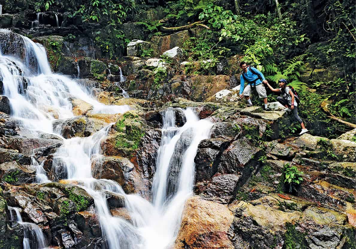
On Pulau Tioman
Tourism Malaysia
Pulau Tioman
The combination of first-rate resort facilities and magnificent natural beauty makes Pulau Tioman one of the finest in Asia. Preserved from logging, most of the rainforest has remained. A hilly ridge runs down the middle of the island at an altitude of 500m (1,640ft), rising at the southern end to two granite peaks – the Donkey’s Ears. The taller of these, Gunung Kajang, is 1,038m (3,405ft) high.
You can reach Tioman by flying from Kuala Lumpur (Sultan Abdul Aziz Airport) or by boat from the fishing village of Mersing. It takes about two hours to reach Tioman by express boat.
On the island’s west coast, choose between luxury accommodation and the modest but comfortable guesthouses, chalets and simpler cabins on Salang Beach further north. Facilities around the main island port of Tekek include restaurants, diving shops and duty-free shops selling alcohol and cigarettes.
Most trips around the island are by boat, and the fishermen charge a reasonable fee. From Tekek, make the forest trek over the hill to the east coast. Take a dip at the hilltop waterfall, then make your way down to the beach at Juara, a village serving excellent seafood. Have another swim in the sea, and if you do not feel like trekking back, return to Tekek by boat.
Birdwatchers may see pied imperial pigeons, bulbuls, frigate birds, sunbirds and flowerpeckers. Characteristically for island forests, there are no large mammals. There have been some recent reptile discoveries.
The South
The highway from Kuala Lumpur and Selangor leads through Negeri Sembilan, where the seaside resort town of Port Dickson is popular with day-trippers from Kuala Lumpur. Also on the west coast is the UNESCO World Heritage Site of Melaka (also known as Malacca); the rich tapestry of her history lies in the monuments and old homes, as well as the descendants of the colonisers – Malay, Indian, Chinese, Portuguese, Dutch and British. South of Melaka is Johor, where you can trek in a rainforest, catch some waves off the golden beaches of Desaru, sun-worship at any of Mersing’s isles or visit the southernmost tip of mainland Asia at Tanjung Piai.
Negeri Sembilan
In the ‘nine states’ federated as one in the 18th century, you travel past vast palm oil and rubber plantations to the state capital of Seremban, 64km (40 miles) southwest of Kuala Lumpur. You can also take a train from KL to Gemas, where the ‘Jungle Railway’ line to the east coast begins.
He who is greatest
Negeri Sembilan’s ruler is not a sultan but a Yam Tuan Besar or Yang Di Pertuan Besar, meaning ‘He Who is Greatest’.
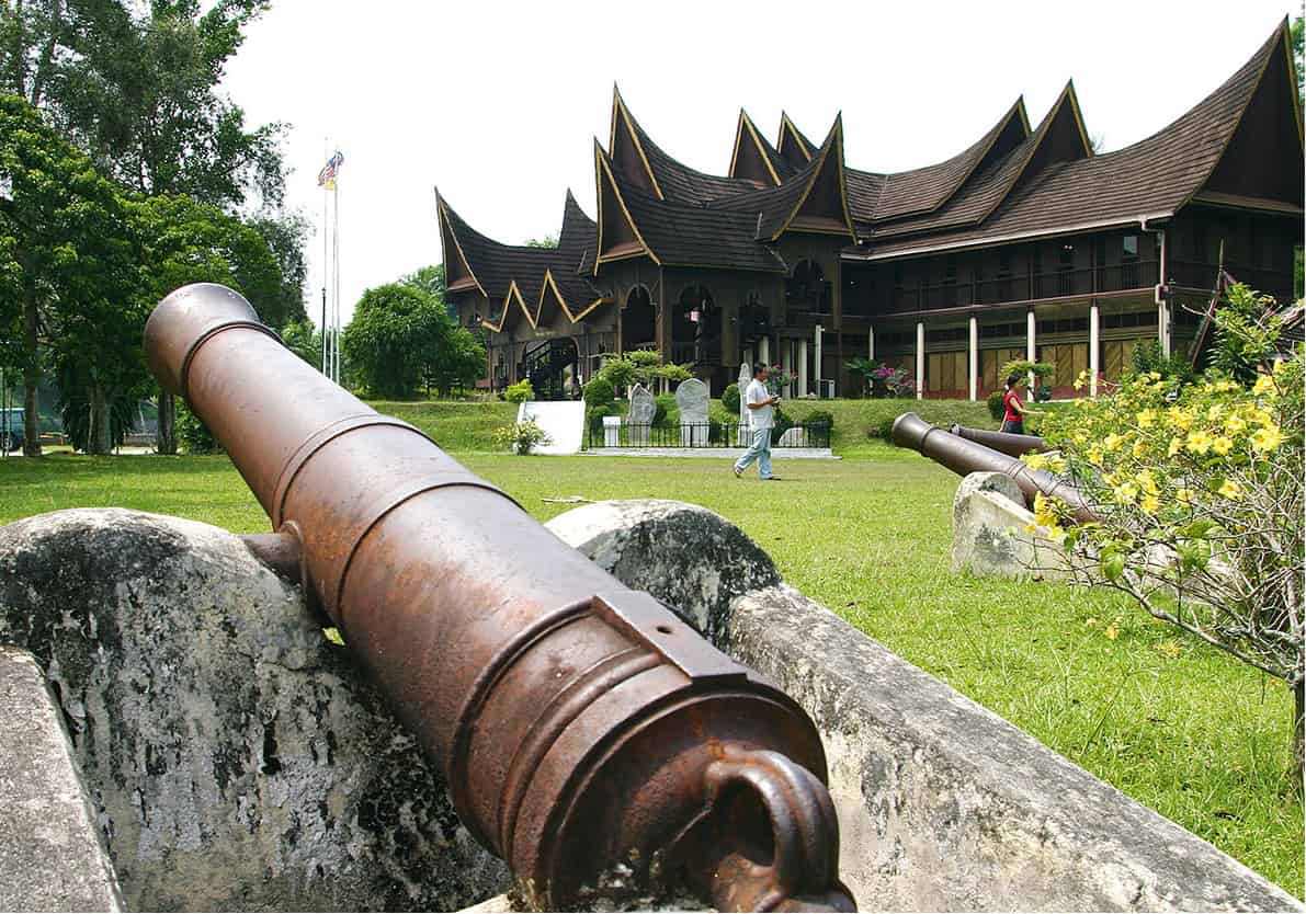
Minangkabau architecture on the State Museum in Negeri Sembilan
Tourism Malaysia
Seremban
Here, the distinctive Minangkabau buffalo-horn roofs of Sumatran (Indonesian) heritage are evident, together with the more recent colonial Victorian style and the traditions of Chinese commercial shophouses. The main attractions are the State Legislative Assembly Building, a nest of nine roofs, one for each founding state; and the State Museum Complex on Jalan Sungai Ujung, where weapons as well as brass and silverware and a tableau portraying a grand royal wedding are on display. In the grounds opposite is the Istana Ampang Tinggi, a Malay prince’s residence built entirely of wood. The neoclassical State Library, with its imposing colonial facade, was once the State Secretarial Building.
Sri Menanti
For what is probably the best original example of Minangkabau architecture, take a side trip to the old royal capital, 37km (23 miles) east of Seremban on the Kuala Pilah Road. The ruler’s palace, Istana Lama, was the official residence of the state royal family until 1931, replacing an earlier palace, which had burnt down. The palace features 99 pillars, denoting 99 warriors of various luak (clans), and was built without nails. Inside, you can see what it was like previously as a palace, including the very steep stairs to the upper floors.
Port Dickson
About 34km (21 miles) from Seremban is the seaside town of Port Dickson. The Tanjung Tuan (Cape Rachado) Forest Reserve on the Melaka-Negeri Sembilan border is accessible via the Jalan Pantai, 17km (11 miles) long, that passes beachside hotels, apartments and resorts. Beside forest trails, there is a fine view of the Strait of Malacca from the lighthouse believed to have been built by the Portuguese in the 16th century to help guide ships into the Melakan port. The Raptor Watch festival every March coincides with thousands of birds of prey migrating from Sumatra back to their breeding grounds in the northern hemisphere. About 26km (16 miles) north from here, just outside the town of Port Dickson, lies Fort Lukut (1847), built to protect the lucrative tin trade in the area. Inside is a foundation of an old palace and a royal burial ground. The fort is also known as Raja Jumaat, named after a 19th-century Bugis warrior.
Easily reached by taxi or express bus from KL, Melaka (Malacca) ! [map] was built on the trading empires of spices and textiles and a history enveloped in the blood of battles as rival colonial powers challenged each other to take hold of the port. In its glorious 15th-century heyday, it was the most vital port in Southeast Asia, with as many as 2,000 ships docked here at any one time. Today, even as high-rises make their presence felt, the colonial past remains in the architecture and monuments. In 2008, UNESCO inscribed Melaka, together with George Town in Malaysia’s northern state of Penang, as Historic Cities of the Strait of Malacca.
St Paul’s Hill Civic Zone
The most prominent building overlooking the Dutch Square is the Stadthuys A [map] (Town Hall), dating from around 1650. It was originally the official residence of Dutch governors and their officers. Since 1980 the building has housed the History, Ethnography and Literature Museum, tracing the town’s colonial and Malay past.
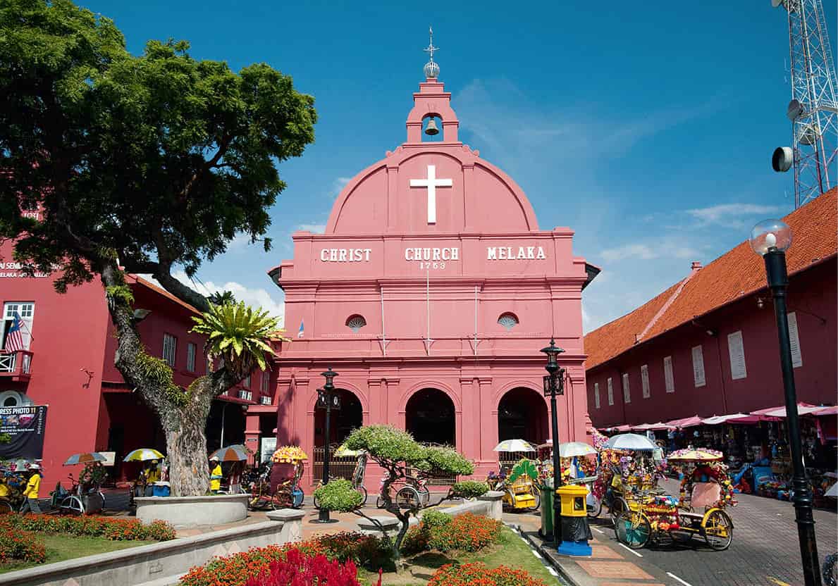
Melaka’s Christ Church
James Tye/Apa Publications
Christ Church, with an imposing red exterior, was built between 1741 and 1753, in commemoration of the centenary of the Dutch occupation, with later additions made by the British in the 19th century. Each of the long ceiling beams of the interior is hewn from one tree.
In the middle of the square is the Queen Victoria Diamond Jubilee Fountain, flanked by a mouse-deer statue. Behind the Stadthuys, a path leads to the remains of St Paul’s Church B [map], built by a Portuguese captain, Duarte Coelho, as a chapel in 1521. Originally known as the Church of Our Lady of the Annunciation, it was renamed by the Dutch, who captured Melaka in 1641, and fell into disuse when Christ Church was built. In front of the church tower is a statue of St Francis Xavier, the Spanish Jesuit missionary who visited Melaka several times from 1545 until his death in 1553. In the church, a stone slab marks his tomb, empty since his remains were transported to Goa in India. Granite tombstones from the Dutch era stand against the walls. A Dutch and British graveyard is to be found further down the hill.
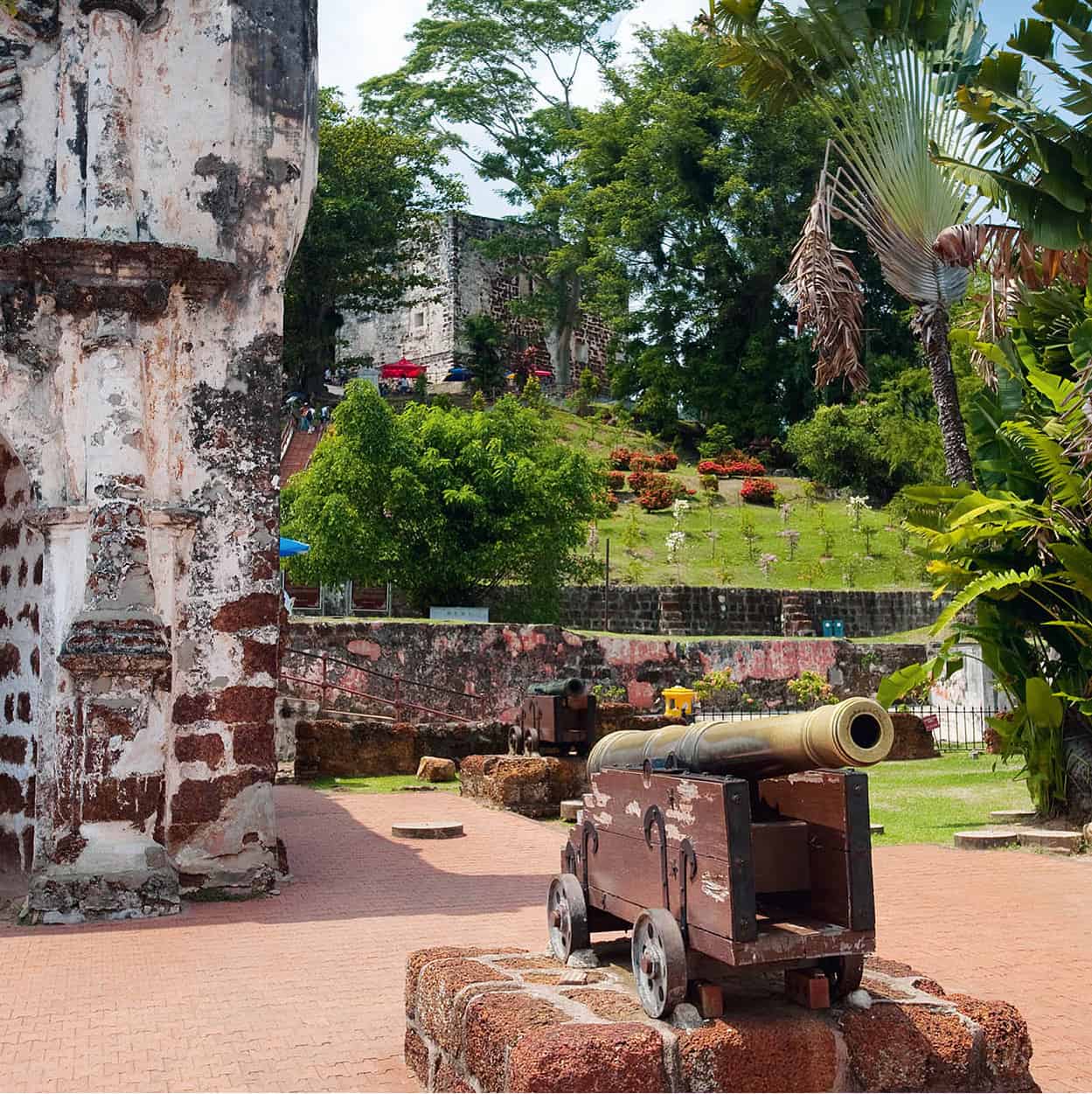
In the grounds of A’ Famosa fort
James Tye/Apa Publications
The Porta de Santiago C [map] (Santiago Gate) on Jalan Kota is all that remains of the 16th-century Portuguese fort, the A’ Famosa. Sir Stamford Raffles, then a government secretary in Penang, saved it from total destruction. The date, 1670, and coat of arms were added to the gateway by the Dutch East India Company. Subsequent development of the area unearthed the foundations of the fortress. Nearby, at the edge of the shopping mall, is the foundation of the Santiago Bastion, one of the fortress’ six original bastions during the Portuguese era. Next to it is the mosaic-tiled pyramid that commemorates Tunku Abdul Rahman’s announcement in 1956 of Britain granting the country’s independence. On 31 August 1957, he became the nation’s first prime minister.
Back towards the river, along Jalan Kota, is the Bastion of Courassa, renamed Frederick Hendrik, and across Jalan Merdeka is the Middleburg Bastion, one of three additional bastions erected by the Dutch. The foundation is original but the bastion is a representation of what it may have looked like (its original height and size are unknown). Walk towards the river mouth to see the Maritime Museum D [map], housed in a model of the Flor De La Mar, a Portuguese ship laden with bullion and other valuables that sank off Melaka’s coast. Exhibits include models of ships that have called at the port over its long history. Behind the ship, you can board the Melaka River Cruise, travelling past century-old townhouses and warehouses, and the gothic-style twin towers of the Church of St Francis Xavier.
The Peranakans
The Peranakan communities are descendants of early settlers who married the local women; their offspring were known as peranakan, Malay for ‘locally born’. The most famous of the Peranakans are the Baba Nyonya community of Melaka (baba, male, nyonya, female). They demonstrate the Chinese genius for adapting to local circumstances without losing the essentials of their own culture. Their subtle blend of Chinese and Malay traditions – in cuisine, dress and language – began back in the 15th century, when the entourage of Princess Hang Li Po, daughter of the Emperor of China and betrothed to Mansur Shah of Melaka, intermarried with local gentry. Their numbers were boosted in subsequent centuries by the influx of merchants and entrepreneurs, largely from Fukien (Fujian) in southern China.
The Chitty or Peranakan Hindu are the offspring of Indian traders who first arrived in Melaka in the 1400s and chose to settle down as well. Even the Portuguese were smitten. ‘I gave to each man his horse, a house and land,’ wrote Afonso de Albuquerque in 1604, when he reported with pride to Portugal that 200 mixed marriages had taken place.
Residential and Commercial Zone
This heritage zone is reached by crossing the bridge near the Stadthuys. The bridge was once the town’s main strategic link between the port and city and the site of major battles against the European invaders.
The living history of Melaka is to be found among the descendants of the original pioneers and entrepreneurs who married local Malay women. The Chinese-Malay descendants were called Baba (for the male) Nyonya (for the female). One of the Baba Nyonya families converted three houses on Jalan Tun Tan Cheng Lock (formerly Heeren Street) into the Baba Nyonya Heritage Museum E [map] and a café with a guesthouse on the upper floors. Built in 1896 by rubber planter Chan Cheng Siew, the first two houses offer a vivid insight into the life and culture of the Baba Nyonya. In a style best described as Chinese Palladian, with its neoclassical columns and heavy hardwood doors, the furnishings and decor bear witness to the great prosperity of Baba entrepreneurs. The third house was originally the servants’ quarters and far less ostentatious. At the top of the street at No. 8, is an 18th-century Dutch-era shophouse that has been authentically restored.
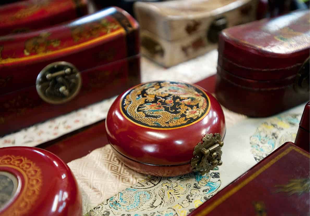
Antiques on Jonkers Street
James Tye/Apa Publications
Melaka is a paradise for antiques hunters, filled with new and old Oriental treasures – porcelain, statues, jewellery, silverware and ornate 19th-century furniture. You will find a few antique shops on Jalan Hang Jebat (formerly Jonker Street). During the weekend, it becomes the Jonker Street Weekend Night Market, where you can satiate your appetite for local food.
Along Jalan Tokong and Jalan Tukang Emas, locally known as ‘Harmony Street’, are Chinese and Hindu temples and a Muslim mosque. The Cheng Hoon Teng Temple (Green Cloud Temple) F [map], built in 1673, claims to be Malaysia’s oldest Chinese temple. Dedicated to Kwan Yin, the Goddess of Mercy, it is flamboyantly decorated with multicoloured birds and flowers made from glass and porcelain. The bronze statue of Kwan Yin was brought back from India in the 19th century. The Masjid Kampung Kling on Jalan Tukang Emas (1748) has a multi-tiered roof with a Chinese-inspired minaret, while the nearby Sri Poyyatha Vinayagar Moorthi Temple (1781) is dedicated to the elephant god Ganesh, or Vinayagar.
Nearby on Lorong Hang Jebat is the Cheng Ho Cultural Museum, which claims to be the site of one of the warehouses belonging to the Ming Dynasty’s Admiral Zheng He (Cheng Ho). The warehouses were used to store treasures amassed from his travels between Melaka and Africa – he sailed back to China only when the winds were favourable.
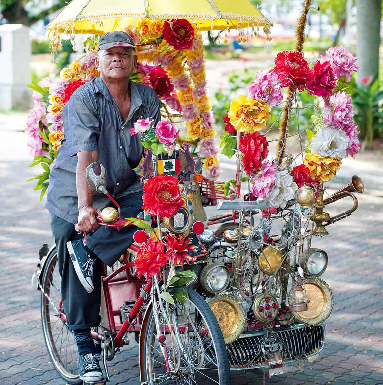
A colourful trishaw driver
James Tye/Apa Publications
The Chitty Village
Away from the old city centre, you may prefer to let a trishaw driver find the way to the nearby Muzium Chetti, next door to the Chitty Village on Jalan Gajah Berang. The one-room museum offers a historical overview of the Indian traders that first came to Melaka in the 1400s. They later married the local women, and, like the Baba Nyonya community, adopted certain cultural aspects of the Malays – in cuisine, dress and language.
Portuguese feasts
The Portuguese Eurasians celebrate two feasts in June – Festa San Juan (Feast of St John the Baptist) and Festa San Pedro (Feast of St Peter). In the latter, fishing boats are brightly decorated with sacred texts and neon lights to honour the patron saint.
The Portuguese Settlement
A short drive some 3km (2 miles) south of the town centre along Jalan Parameswara takes you to the heart of this little Eurasian community, peopled by descendants of the Portuguese colonists who married the local women. In the area around Jalan d’Albuquerque and Medan Portugis (Portuguese Square), you may hear snatches of Cristao, a 16th-century Portuguese dialect. The restaurants on and off the square serve good seafood. The community worships at the simple, unassuming St Peter’s Church, 3km (2 miles) northwest from here on Jalan Bendahara, where Easter is an especially big event and attracts other ethnic groups to the great, candlelit procession.
Chinatown
Walk along Jalan Bunga Raya, the city’s Chinatown, where you will see a variety of shops – selling anything from bales of cloth to rattan furniture and local delicacies. Off this street, between the former residence of a Chinese tycoon (now The Majestic Malacca hotel) and the Melaka River, lie the ruins of Ermida do Rozário (Rosary Chapel). Prior to the completion of St Peter’s Church in 1710, Catholics would attend a service here. It is also the final resting place of Emerici de Souza, a Portuguese dignitary who died in 1842.
Bukit Cina
Inland, the hillside provides a Chinese cemetery for more than 12,500 graves, mostly horseshoe-shaped tombs. The Poh San Teng Temple stands at the foot of Bukit Cina, honouring the deity Tua Pek Kong. The temple was built so that offerings could be made for the departed souls. Nearby is the Perigi Raja (King’s Well), dug in the 15th century.
Johor
Proximity to Singapore has buoyed the economy of Johor, the peninsula’s southernmost state, and that of its capital, Johor Bahru. Easy access from Singapore to east-coast resorts like Desaru and Sebana Cove in the southeast and the islands offshore from Mersing has also increased development of these destinations. In the 16th century, Johor provided refuge for the banished royal court of Melaka but today it offers many opportunities for tourism, from shopping to motor racing, horse riding to water sports, and adventure travel in the Endau-Rompin National Park. These relatively untouched forests at the border with Pahang delight ecotourists.
South of Melaka
The fishing port of Muar was of trading importance to the British in the 19th century, as can be seen in the graceful old neoclassical government offices. It was here that Australian troops made a heroic last stand against the Japanese advance on Singapore in January 1942. At Ayer Hitam, a wide range of Chinese-style pottery is on display beside the fruit market. The market town of Batu Pahat also offers respectable Chinese restaurants. The town witnessed a historic Melaka naval victory over the Siamese fleet in 1456.
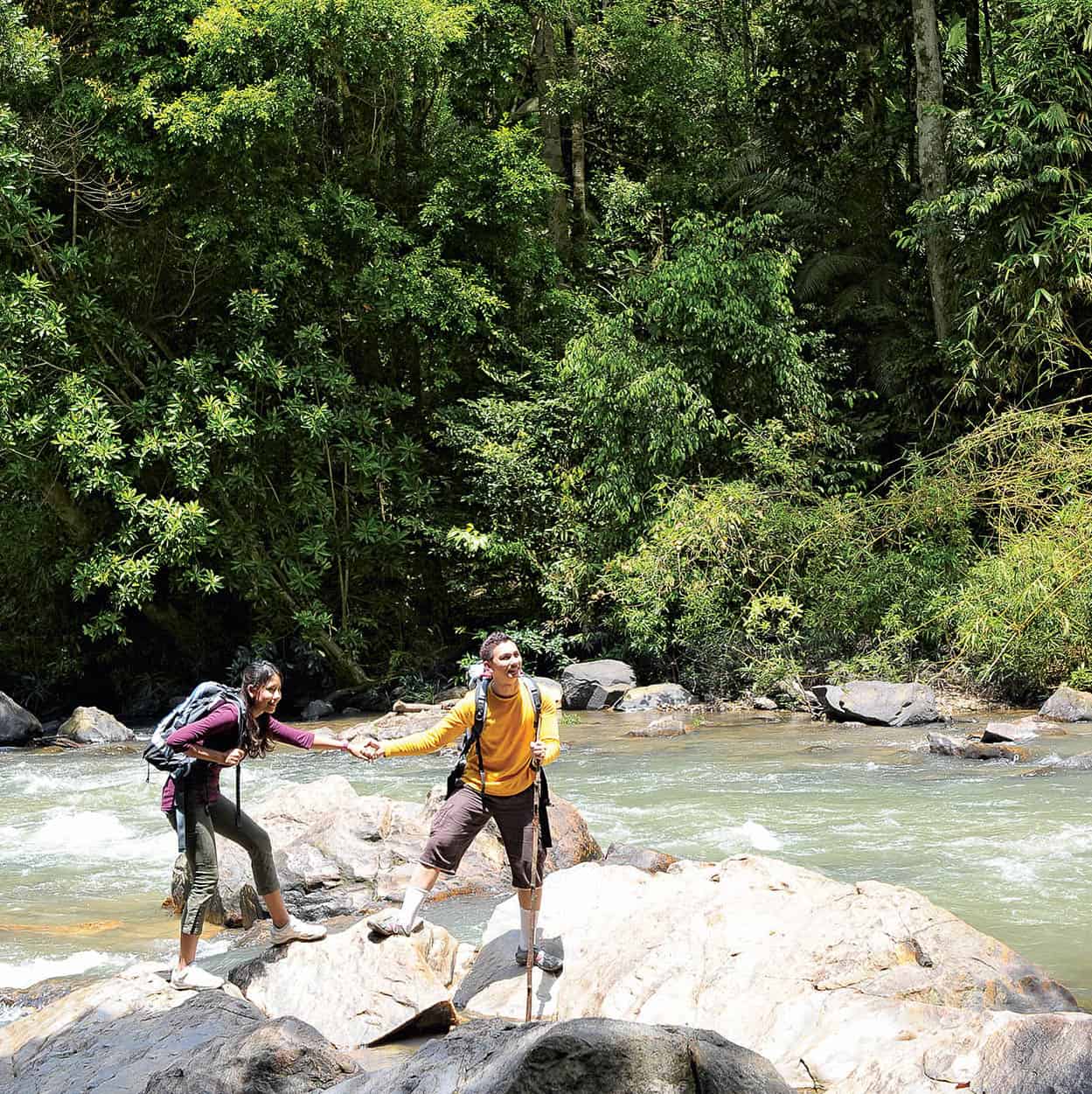
Exploring the Endau-Rompin National Park
Tourism Malaysia
The Endau-Rompin National Park
Straddling the Johor and Pahang border, Endau-Rompin National Park’s @ [map] 870 sq km (336 sq miles) of forest and rivers is fast gaining a reputation among travellers as an alternative to the more established Taman Negara. The park is home to the Malayan tiger, Asian elephant, wild boar and the largest surviving population of Sumatran rhinoceros in Peninsular Malaysia. Other species found here include the binturong (bear cat) and the white-handed gibbon, the only ape species in the peninsula. Among the birdlife are drongos, many species of hornbill and great argus pheasants. Endau-Rompin is also home to the Orang Asli of the Jakun tribe.
Much less developed than the parks of Sarawak and Sabah – and so far more pristine – Endau-Rompin offers a rare challenge to adventurous travellers. Facilities for accommodation are limited to chalets, dormitories and three campsites in the park, located at Batu Hampar, Upeh Guling and Buaya Sangkut. You must employ a guide or go on a group tour.
From Johor Bahru, travel by the North–South Expressway to Kluang, and take a detour to Kahang town. From there, only a four-wheel-drive vehicle will take you along the 56km (35-mile) jungle track to Kampung Peta, where there is a visitor centre and point of entry to the national park. Otherwise, you can get there via a three-hour boat journey from Felda Nitar II. There is controlled entry and quite strident regulations governing park usage and duration periods.
Johor Bahru
Citizens of Singapore cross the causeway to Johor’s state capital to escape for the weekend and sample its lively nightlife at ZON Johor Bahru, an integrated hotel, duty-free shopping and dining complex and ferry terminal (serving Indonesia’s Batam and Bintan islands) on Jalan Ibrahim Sultan, or to head further north. Outside the restaurants and malls, travellers can visit the sprawling market, and nearby along the Lido Waterfront take a look at the gleaming white marble of the Masjid Sultan Abu Bakar, the Royal Abu Bakar Museum and the Istana Gardens of the old palace, with its Japanese teahouse and the sultan’s private zoo, which is open to the public.
The neoclassical Istana Besar (palace) is now used for state ceremonies, the present-day sultans having moved further north to the modern Istana Bukit Serene, with its 32m (104ft) high tower. Other sights include the colonial-style clock tower overlooking the Dataran Bandaraya (City Square). The Galeri Seni is an art gallery, built in 1910 in a similar period style, exhibiting clothing, weapons, currency and manuscripts, as well as calligraphy, ceramic items and other artworks.
Johor’s southern coastline
Johor has three RAMSAR protected wetlands of international importance. Unlike the Johor National Park at Pulau Kukup and Tanjung Piai, Sungai Pulai has no boardwalks to see the mangrove ecosystem, with its myriad wildlife such as smooth otters, dusky leaf monkeys, mudskippers and kingfishers. Sungai Pulai is close to the Malaysia–Singapore Second Link that bridges Johor with the western side of Singapore, and the best way to explore its mangroves is to join a river cruise led by the Orang Asli from the Orang Seletar tribe.
Desaru and the islands north
The 25km (15 miles) of golden sands of Desaru are accessible by road via Kota Tinggi or via the Senai–Desaru Highway from Senai International Airport. If you are travelling through Kota Tinggi and are an avid birdwatcher, it might be worthwhile booking in advance the permit to see the Panti Bird Sanctuary, about 8km (5 miles) north of Kota Tinggi. But if you are travelling via the Senai–Desaru Highway, make a detour to Pasir Gudang. The Muzium Layang-Layang here displays the story of kites and the annual World Kite Festival held early in the year is a colourful event not to be missed. For motor-racing enthusiasts, the Johor Racing Circuit offers spectators international motor-racing competitions.
Desaru is 55km (34 miles) further east and is the first major beach resort for Singaporeans. There are several premier resorts and golf courses here, but budget travellers will also find reasonable-value chalet accommodation.
Off the coast from the resorts of Mersing, there are several islands – Pulau Rawa, Pulau Tengah, Pulau Besar, Pulau Tinggi and Pulau Sibu – offering white sandy beaches, coral reefs and budget accommodation. Boats can be hired from Mersing to take you out to one of the more secluded islands.
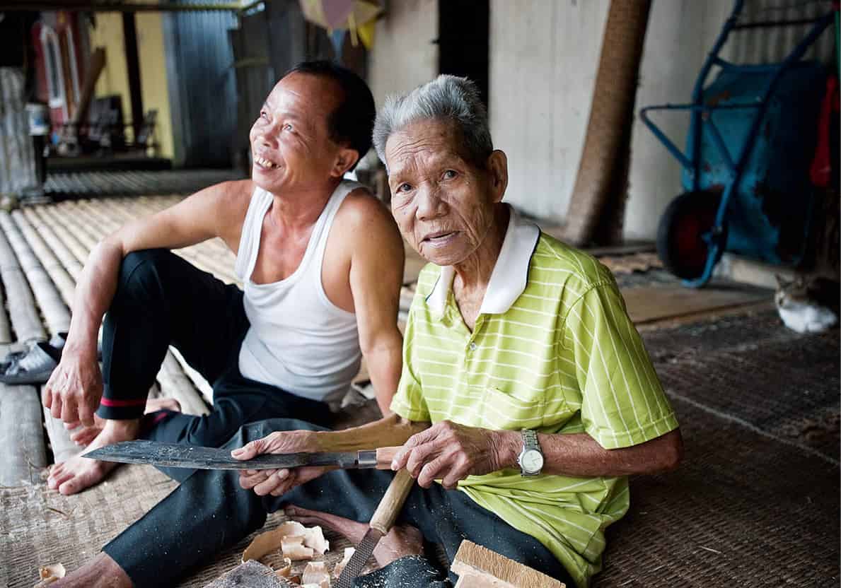
In an Annah Rais longhouse
James Tye/Apa Publications
East Malaysia
From rainforests to mountains, the states of Sarawak and Sabah offer enough adventure and natural beauty to make the journey across the South China Sea worthwhile. From shopping for exotic souvenirs and craftwork to dining in seaside restaurants, to the thrill of riding in a longboat along river ‘highways’ deep in the forests, it is all there for the choosing. Music festivals in Sarawak, such as Rainforest World Music and Borneo Jazz, add a cultural dimension.
Historic evidence of the ‘White Rajah’ – the lineage that commenced with adventurer James Brooke in the mid-19th century and lasted until the start of World War II – can still be seen in Kuching, Sarawak’s capital.
Away from the cities lie some natural treasures: Borneo’s highest mountain (Gunung Kinabalu in Sabah), its longest river (the Rajang in Sarawak), its many caves (including the Niah and Mulu Caves in Sarawak), and natural parks with wonderful wildlife and flora. For a change of pace, there are plenty of beaches along the southern and eastern coasts and lots of islands for snorkelling or turtle-watching.
Getting around can be a challenge. The rivers, more numerous and much longer than on the peninsula, still provide the principal way into the interior, supplemented by smaller aircraft operated by Malaysia Airlines (MASwings).
Sarawak
It is just 90 minutes by air from Kuala Lumpur to Kuching, the historic capital of Malaysia’s largest state – covering 124,967 sq km (48,250 sq miles). From the air you’ll be able to see that Sarawak has the country’s longest river, the Rajang, flowing 563km (350 miles) from the mountains on the Indonesian border to the South China Sea. The wealth of river systems among the forest terrain provides a vital link that will transport you to the tribes of the rainforest. Between taking river cruises or treks through the rainforest of Bako National Park, you can relax on the beaches of Santubong and Damai, just 40 minutes from Kuching. In eastern Sarawak, you can pursue more strenuous but exhilarating adventures in the Niah or Mulu cave systems.
Sarawak and Sabah operate their own immigration and visitors from peninsula are required to produce either their passports or identity cards.
Aborigines of Northern Borneo
These many tribes were once collectively known as Land or Sea Dayaks.
Iban, the largest indigenous group in Sarawak, dwell in longhouses along lowland river banks. They farm rice, rubber and pepper.
Melanau inhabit the coastal plain east of Kuching, where they fish and grow cassava.
Bidayuh, the original Land Dayaks who allied with the White Rajahs of the 19th century, are longhouse dwellers of western Sarawak.
Kenyah and Kayan are two distinct tribes but often live side by side along the upper reaches of Sarawak’s Baram and Rajang rivers. They farm hill rice and rubber, and rear pigs and poultry.
Penan, the last of East Malaysia’s nomads, stay upriver well clear of civilisation. The men make superb weapons – machetes and blowpipes – and the women are renowned as basket-weavers.
Kadazan/Dusun, Sabah’s biggest tribe, have adapted smoothly to urban life – and Christianity – in Kota Kinabalu. Others live on terraced hills around Gunung Kinabulu.
Bajau are Muslim seafarers affectionately known as ‘Sea Gypsies’. Their landlubber cousins are admired as daring cowboy cattle-breeders.
Murut are hunters in the hill country along the Sabah–Sarawak border.
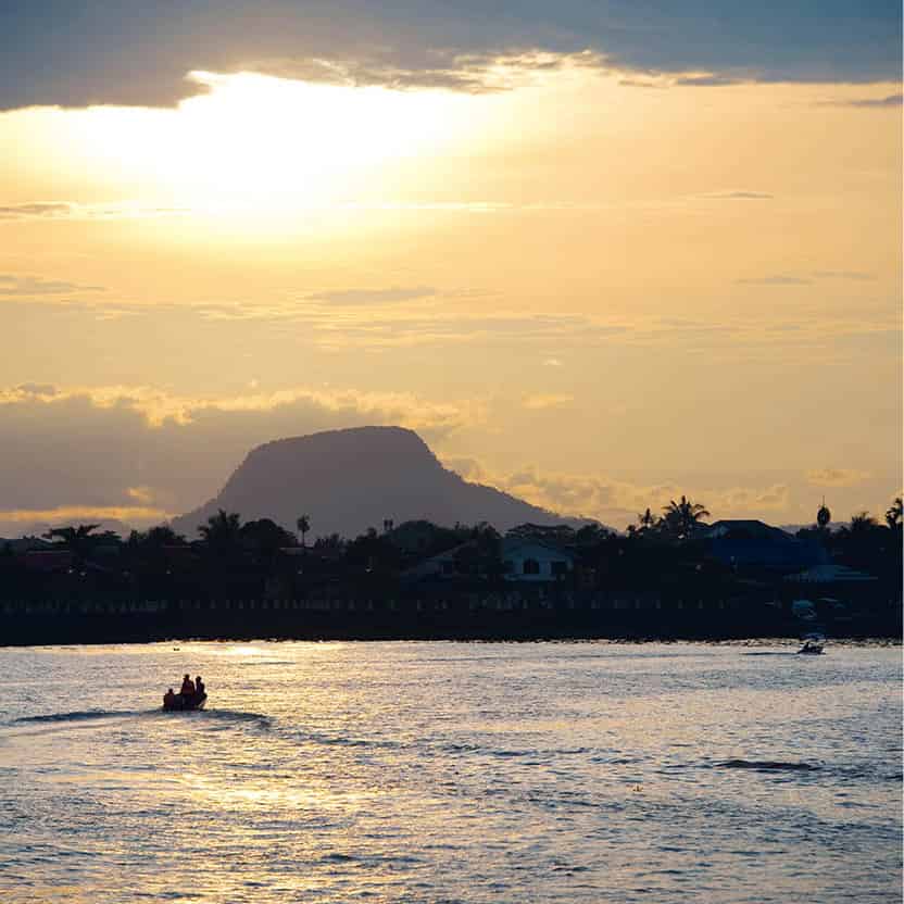
Kuching’s waterfront
James Tye/Apa Publications
Kuching
Unlike the other major towns of East Malaysia – Miri, Kota Kinabalu and Sandakan – Sarawak’s state capital has preserved its colonial charm, having been spared the bombs of World War II. Kuching is built on a bend of the Sarawak River, 32km (20 miles) from the sea. The residence and fort built by the White Rajahs (for more information, click here) lie on the north bank, while on the southern bank is the greater part of the town, including Chinese and Indian merchants, major hotels and several colonial buildings, permanent vestiges of the past.
The colonial buildings include the General Post Office, noteworthy for its 1930s neoclassical design and pillars, and the Court House. The courthouse site was originally a German Lutheran mission before James Brooke, the first of the White Rajahs, turned it into a judicial administration office. In 1858 that building was demolished, making way for a second and later a third structure (the one that still stands), completed in 1874. State Council meetings continued to be held there until 1973. Today it houses the Sarawak Tourism Complex. The clock tower, whose bells still chime on the hour, was added in 1883. In front of the courthouse is the Charles Brooke Memorial, 6m (20ft) in height, which was built in 1924 in remembrance of the second White Rajah.
In Malay, kuching means ‘cat’, but no one knows for sure why Sarawak’s capital has this name. One theory is that it was named after the stray cat population that was rife at the time of James Brooke’s arrival, although locals argue the town was named after the tidal stream that originated from Bukit Mata Kuching, where many mata kuching (cat eye) fruit trees grow. The most plausible theory? Brooke had named the Sarawak River port ‘Cochin’, after the one in India. If mispronounced, it sounds like kuching.
Along the Kuching Waterfront, north of the courthouse, is the Square Tower, which now houses souvenir shops.
West of the Courthouse is Jalan India Mall, a pedestrian mall marking the city’s Muslim centre. Sarawak’s oldest Indian mosque, Masjid Bandar Kuching, built in 1834, is here but there are plans to replace it with a three-storey mosque to accommodate the needs of the community. Still further west, the Masjid Bahagian Kuching, built in 1968 near the markets, is best seen from the other side of the river. A new mosque has also been built on the north side of the river.
Despite new high-rise constructions, the numerous traditional shophouses – both Chinese and Indian – ensure the city’s heritage is still within reach. Chinese shophouses along Jalan Padungan, mostly built during the rubber boom of the 1920s and 1930s, offer a variety of restaurants, coffee houses and handicraft shops.
More colourful is the Sunday Market on Jalan Satok, which actually starts late on Saturday afternoon and extends through Sunday morning, offering a bewildering array of items; Dayaks come to sell fruit, vegetables and handicrafts and even more exotic items from the forest. Clothes and household goods appeal to the locals.
East of the courthouse, the Tua Pek Kong Temple and the Chinese History Museum are near a group of five-star hotels that line the river. The temple, also known as the Siew San Teng Temple, was built in 1876 and is the oldest in Kuching; it remains an active place of worship. The nearby museum traces the long history of the Chinese in Sarawak, who lived there well before the arrival of James Brooke. Another temple is the Kuek Seng Ong Temple, on Lebuh Wayang, built in 1895. For a small fee, venture across the Sarawak River by tambang (ferry) to view the Astana (1870) and recently renovated Fort Margherita (1879). The Astana (which means ‘palace’ in Malay) was originally the Brooke family’s home. It comprises three bungalows under a single roof and is built off the ground, supported by brick pillars. The building has a library and a collection of artefacts associated with the Brooke family. The ground floor was the location for many garden parties hosted by the Rajahs; it was also used as an internment centre for Japanese prisoners of war in World War II. It is now the residence of the Governor of Kuching, the Yang Di-Pertua Negeri. Set among beautiful grounds, it is, unfortunately, not open to the public.
Up the hill to the right from the Astana, the road leads to Fort Margherita, which used to house the Muzium Polis. The white-turreted edifice was built by Sir Charles Brooke along the lines of an English medieval castle and named after his wife, Margaret. It was converted to a police museum in 1971, but this was closed in 2004. The views from here across the river to the city are most pleasant and the journey across the river on a small and colourful tambang has to be one of the last great river crossings in the whole of Southeast Asia. The boats depart from along the waterfront.
On the south side of the river, another colonial building is the Round Tower on Jalan Tun Abang Haji Openg. It was originally designed as a dispensary when built in the 1880s.
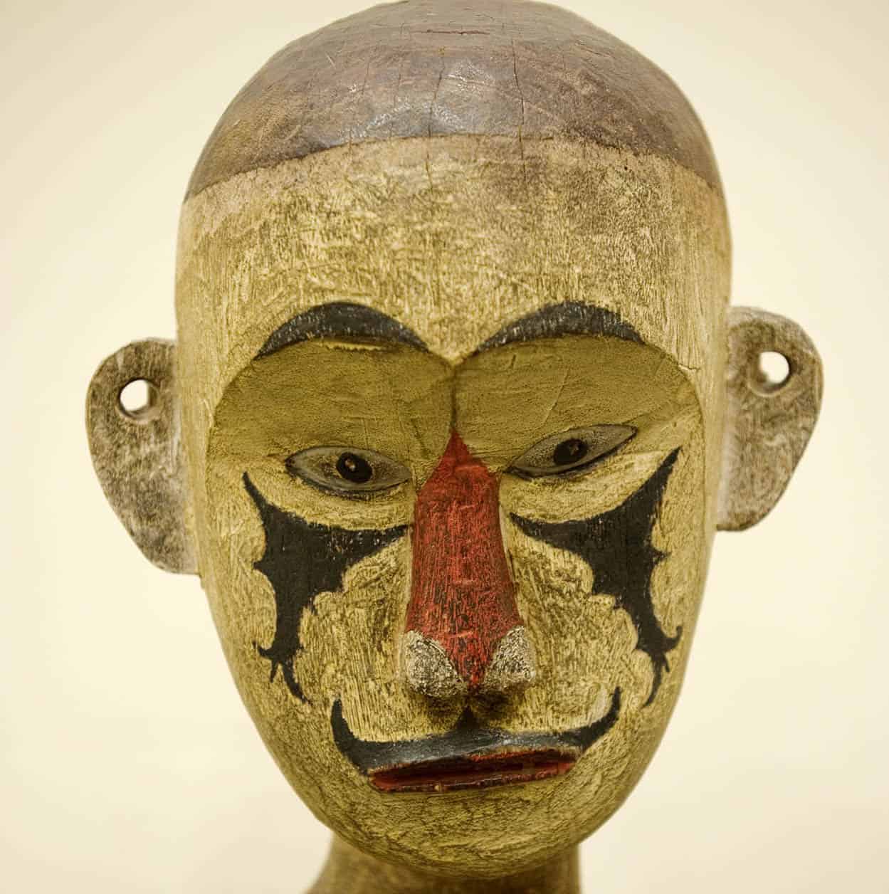
In the Sarawak Museum
James Tye/Apa Publications
Also south of the river on Jalan Tun Abang Haji Openg is the Sarawak Museum, which has one of the best collections of folk art and flora and fauna in Southeast Asia. The museum is divided between the old and new wings, connected by a footbridge across the road. The former was built in 1891 and styled along the lines of a Normandy townhouse; it is devoted to Sarawak’s rich history and diverse cultures. Another wing, completed in 1983, has more galleries and archaeological exhibits, including a reconstruction of early human settlements at the Niah Caves. There is a book and souvenir shop.
Within the museum’s grounds are the Botanical Gardens and the Heroes Memorial, the latter commemorating the dead from World War II, the Communist Emergency and the Confrontation with Indonesia. Adjacent to the new wing of the Sarawak Museum is the Muzium Islam Sarawak (Sarawak Islamic Museum), with its seven galleries.
Alfred Russel Wallace, nature sleuth
A contemporary of Charles Darwin, Alfred Russel Wallace proved a true detective in his pioneering research in evolution theory and ‘biogeography’ – the geographical distribution of animals and plants. In Malaysia, he is best known as the ‘discoverer’ of the national butterfly, the green-and-black ‘Rajah Brooke Birdwing’. But his most intriguing contributions came in the field of natural mimicry. Beyond the familiar camouflage techniques of chameleons and stick insects, he watched viceroy butterflies trick birds by cultivating a resemblance to the monarch butterfly, which the birds hate. He also discovered ant-eating spiders that look like their prey.
Highlights of the old wing include a reconstructed Iban Longhouse, complete with totem pole, hornbill-feather headdresses and skulls of head-hunting victims; the Kenyah Tree of Life Mural, repainted from one at a longhouse at Long Nawang; Melanau dolls, which serve as charms against disease and to lure animals to traps; and specimens of Alfred Russel Wallace’s extensive collection of insects.
The new wing is home to galleries of Hindu and Buddhist sculptures; Chinese, Thai, Japanese and European ceramics and brassware; a model of the Niah Caves (for more information, click here), with their birds, bats and other fauna; Stone Age artefacts; and funeral boats from the 8th century AD. A photographic history of Kuching is also interesting.
One gallery has become the world’s first Cat Museum, in honour of the city’s feline mascot (for more information, click here).
Around Kuching
The fishing village and peninsula of Santubong is 40 minutes from Kuching. There you will find beach resorts and cultural sights, plus trails for forest trekking, bike riding and golf. Gunung Santubong (810m/2,655ft) peers down on Damai, where you will find beach resorts. Nearby is the Sarawak Cultural Village, 7 hectares (17 acres) of craft demonstrations and cultural performances. Described as a ‘living museum’, it provides an opportunity to learn about Sarawak’s rich culture. In July each year the village comes alive with the Rainforest World Music Festival, a celebration of music and friendship.
There are three beach resorts and a rainforest resort at Damai, each offering a range of water sports, jungle trekking trips and cultural activities. Two of the resorts, both located at Teluk Penyu Beach, are within easy reach of the Cultural Village. Outside the village, there is access to local longhouses as well as trips to the Bako National Park, local fishing villages and nearby islands, and river cruises to spot dolphins, proboscis monkeys and migratory water birds around Bako-Buntal Bay.
In Sarawak two major centres are involved with orang-utan rehabilitation. Semenggoh Wildlife Centre, southwest of Kuching, rehabilitates orphaned babies and adults who have been kept as domestic pets. At Matang Wildlife Centre, northwest of Kuching, the focus of their work is on the orang-utans, but there are also enclosures for sambar deer, crocodiles, sun bears, civets and bear cats, as well as aviaries holding hornbills, sea eagles and other birdlife from Sarawak.
You can visit old gold mines in Bau, the historic gold-mining town about 36km (22 miles) south of Kuching. Although mining activities in the area ceased in 1921, illegal diggers continue to mine occasionally. Nearby, the Wind and Fairy Caves are two show caves worth a visit.
Bako National Park
Both Bako National Park £ [map] and Kubah National Park are within easy reach of Kuching. Sarawak’s oldest national park, Bako is also one of the smallest, covering just 27 sq km (10 sq miles), but it offers great opportunities to see a wide range of animal and plant life. Since the park is located just one hour (37km/23 miles) from Kuching, visitors have a choice between a day trip or an overnight stay; accommodation includes dormitories and chalets. You must first travel to Kampung Bako, where you can get a boat to transport you to the park headquarters at Telok Assam. The paunchy proboscis monkey, with its long nose, is the major attraction, but you can also see silver-leaf monkeys and long-tail macaques, as well as mouse deer, monitor lizards and a variety of birdlife.
At Bako there are 16 well-marked, colour-coded jungle trails with bridges over the swamps to the best spots for viewing flora and wildlife. Twelve of the trails lead off from the right of the park’s headquarters, just across from the arrival jetty. The Tanjong Sapi Trail, a 30-minute steep climb up to the cliff-tops overlooking the bay that fronts the park headquarters, is recommended.
On the Lintang Trail, a small observation hide at the Lintang Salt Lick offers the chance to see the animals at close quarters as they drink. Besides its good hilltop view over the forest, the Bukit Tambi Trail is home to several specimens of carnivorous plants: the bladderwort, pitcher plant and sundew (Venus flytrap).
Telok Delima and Telok Paku trails are the best paths for viewing the proboscis monkeys as they like to bed down in trees near the seashore. Very often, they will have been watching you long before you spot them, and if your presence upsets them, they will just honk and disappear. Along the seashore, keep a look out for hairy-nosed otters.
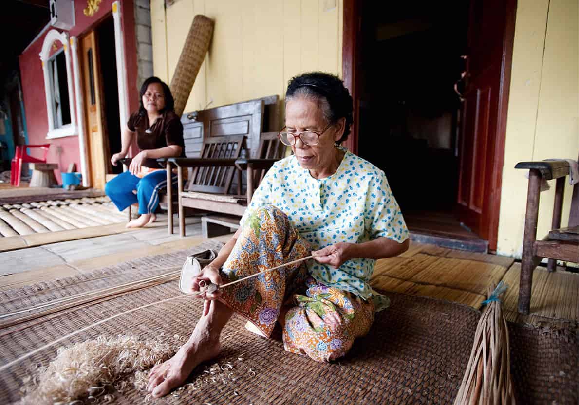
Stripping canes for basket weaving in an Annah Rais longhouse
James Tye/Apa Publications
A typical longhouse is a communal dwelling of perhaps 20 ‘apartments’, attached one to the other and extended as each family adds a unit of parents with children. Erected close to the river, it is built of sturdy, axe-hewn timber, preferably Sarawak’s coveted belian ironwood. The structure is raised above the ground on massive pillars – a technique evolved in the past to resist enemy attacks rather than mere river flooding.
A notched tree trunk serves as a stairway to the outer, open veranda, where the families congregate, dry their washing or lay out their fish, spices, fruit, nuts and vegetables. On the inner, closed veranda are the communal ‘lounges’, kept for recreation and ceremonies.
Off to the side behind partitions, family dwellings consist of bedrooms and kitchens. An attic under the roof is used for storing grain or rice. The attic sometimes doubles as a weaving room.
Modern times have brought running tap water, electricity generators, cooking stoves, radio and television. However, people also keep their traditions, wearing sarongs and proudly bearing hornbill tattoos on their throat and arms. Hanging from pillars and rafters are the ancestral head-hunting trophies – believed to give the clan strength and good fortune.
Visiting a Longhouse
The opportunity to see the tribes of Sarawak in their forest homes is a privilege not to be missed. However, tours to some longhouses have acquired the artificial character of a ‘tribal theme park’. As tourism grows and the popularity of such expeditions increases, it is a trend difficult to escape, the only real alternative being to travel even further into the forests at added expense. But the adoption by some villagers of Western clothing or items like televisions and radios shouldn’t put you off.
On offer for adventurous travellers is a choice between a day trip, an overnight stay at a guesthouse near a longhouse, or a stay in a longhouse itself. Tours from Kuching usually start very early and involve a two- to five-hour road journey to the river and then a one-hour cruise by longboat. Tour operators usually have exclusive arrangements with particular longhouses.
The format of a visit varies, but it may include cultural performances soon after arrival for day-trippers or at the day’s end as evening entertainment for those staying longer. The standard tour is an initial orientation to the longhouse, highlighting the bilik (apartments), as distinct from the ruai (communal areas). Tour groups are often greeted with tuak, a sweet wine made from glutinous rice, and a welcome dance. The musical and cultural performance includes a traditional dance. Demonstrations of the blowpipe and cockfighting are also likely to be on the agenda.
Before you leave, your tour guide will remind you to make sure that you have gifts – preferably nutritious food, clothes or children’s books – which you can buy during one of the bus stopovers on the way. Sweets and junk food are inappropriate. Malaysian tourism authorities are also able to offer advice on reputable tour operators in Kuching who organise visits on a small scale so as not to offend tribal customs.
Tours are available to Iban longhouses around Kuching, and Bidayuh longhouses in the hill regions. Visits to Iban communities are possible along the Skrang and Batang Ai rivers. To the east of Kuching you can visit the Kenyah and Kayan tribes. Excursions are organised either via Miri from Kuala Baram along the majestic Baram River, or via Sibu, from Kapit or Belaga, up the Rajang River. The Rajang is considered Malaysia’s greatest river at some 560km (350 miles) long; a journey along it is one of the world’s last great travel adventures. The approach to Belaga entails a passage through the Rajang’s Pelagus Rapids. There are seven in all: Bidai (big mat), Nabau (python), Lunggak (dagger), Pantu (sago), Sukat (measure), Mawang (fruit) and, most ominously, Rapoh (tomb).
Niah National Park
At Niah Caves $ [map] visitors can see the earliest traces of Homo sapiens in Sarawak; they lived in the area up to 40,000 years ago. Later the caves were used as burial grounds, and they are now the hunting ground of collectors of birds’ nests located on the cave roofs. The caves and surrounding 3,149-hectare (7,775-acre) park are 480km (300 miles) up the coast from Kuching, hidden within the forests around Miri.
Adventurer A. Hart Everett came across the caves in the 1870s, but it was not until 1958 that local explorer and Sarawak Museum curator Tom Harrison made the important discovery of a human skull dating back some 40,000 years, together with 1,200-year-old red hematite rock paintings. The fragments of the Deep Skull (so-called because it was found deep within an ancient pile of bat guano), together with tools, earthenware pots, jars and later bronze jewellery found nearby, are on display in the Sarawak Museum.
The park, near the town of Batu Niah, is midway between Bintulu and Miri, the latter a boom city known for its oil exploration. The caves are accessible by road from either settlement, taking at least two hours from Miri and three hours from Bintulu. The park’s headquarters is at Pengkalan Batu, and you will need to obtain a permit either here or in Miri. From here, you cross the Sungei Niah (or Niah River) by sampan, then follow the 3km (2-mile) boardwalk to the caves. For the cave tour, be sure to take a powerful flashlight, sturdy walking shoes with a good grip and a change of clothes – the heat and humidity are quite intense.
First seen is the Trader’s Cave, so-called because of its role as a meeting place for bird’s-nest gatherers and merchants. The main or Great Cave is a hollow 400m (1,312ft) up in the sandstone Subis Plateau. Besides giant crickets and scorpions (from which the extension of the boardwalk through the cave keeps you safe), the cave is home to millions of bats and swiftlets. The Deep Skull and other relics were discovered here.
The bats’ daily droppings furnish one tonne of highly valued guano fertiliser. But more lucrative than the guano are the swiftlets’ edible nests – used to make bird’s-nest soup – for which Chinese merchants are prepared to pay hundreds of dollars per kilo (about 100 nests), reselling them for thousands. Park authorities are increasingly concerned about the impact of the ongoing harvest on the swiftlets’ survival. The rush of nesting swiftlets flying into the cave at the day’s end, while nocturnal bats rush past into the evening sky, is a spectacular sight.
The boardwalk continues through the Great Cave down to the Painted Cave, also accessible without a guide. Discovered in 1958 along with the Deep Skull, its wall paintings representing red stick-figures of spreadeagle dancers were executed in a mixture of betel juice and lime around AD700. This cave was probably also used as a burial chamber.
Nearby are several forest trails, with the Bukit Kasut and the Madu trails both clearly marked. Look out for long-tailed macaques, together with a range of birdlife such as bulbuls, tailor birds, crested wood partridges, trogons and hornbills.
Bird’s-nest soup
Descendants of the nomadic Penan people who rediscovered the Niah Caves’ bird’s-nest riches in the 19th century divide up the cave into jealously guarded ‘stakes’, handed down from father to son. To scrape the nests from the cave ceiling, the Penan climb more than 60m (200ft) up a series of swaying bamboo poles tied together, or through narrow ‘chimneys’ inside the rock. As the old song says, ‘A lotta men did and a lotta men died’ – nobody knows how many.
White-bellied swiftlets are responsible for the high-priced nests, made from pure saliva rendered particularly glutinous by a diet of algae. An inferior product is furnished by ‘black-nest’ swiftlets, who mix feathers in with the saliva. While not for everyone, Chinese diners insist that the viscous, translucent soup is delicious.
Gunung Mulu National Park
Among the largest limestone cave systems in the world, the UNESCO World Heritage Site of Gunung Mulu National Park % [map] (53,000 hectares/130,600 acres) is one of Sarawak’s most important attractions. The cave system of 150km (94 miles) was first explored between 1976 and 1984 and requires a minimum two-day/one-night stay to be fully appreciated. The trip is demanding, and you need to be in good shape, especially if you are looking to undertake the climb to the limestone-sculpted pinnacles on Gunung Api (Fire Mountain).
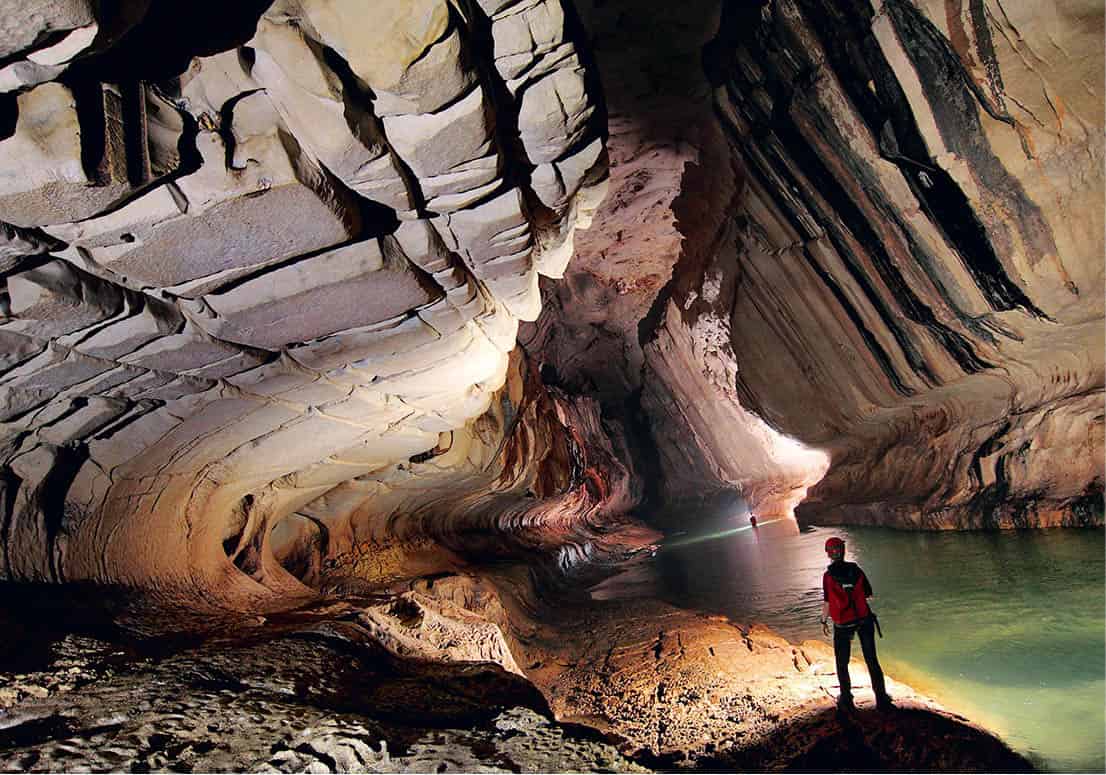
The underground caves in Gunung Mulu National Park
Alamy
A 35-minute flight from Miri arrives at the airport near the park’s headquarters. The alternative (by land and boat) also starts from Miri and is a four-stage trip. First, you travel by bus or taxi to Kuala Baram, at the mouth of the Batang Baram. From here, you take an express boat to Marudi, before meeting up with the noon boat to Long Terawan, followed by a third longboat along the Sungei Tutoh and Sungei Melinau to the park’s headquarters. This is the only alternative to the air trip and requires almost a full day of travel by bus and boat. The flight from Miri over rainforest in a small aircraft is considered the best way to begin your stay at Mulu and is also recommended for the return journey.
Mulu’s caves
With permits, experienced cavers can explore Mulu’s less accessible caves and wade chest-deep through underground streams. The best guides will provide miner’s helmets with built-in lamps to explore the pitch-black caves. Your own equipment should include very strong shoes made of rubber rather than leather, lots of socks, tough old clothes, a pair of gloves and a light sleeping bag.
There are four main ‘show caves’ at Mulu – Deer, Lang’s, Clearwater and Wind – as well as countless other ‘wild caves’, which are either too dangerous or too ecologically fragile to visit without special permits and qualified guides.
To give you an idea of the vast scale of the caverns, Sarawak Chamber, reputed to be the largest cave in the world, is said to be capable of holding 40 jumbo jets. Tours began in 1998, but entry is usually restricted to seasoned cavers. If you wish to see this spectacular chamber, ask for details well in advance when making your booking.
Nearest to the park’s headquarters are the Deer Cave and Lang’s Cave. The Deer Cave, with an enormous entrance and a passage 2km (1 mile) long and up to 220m (720ft) high, was once a shelter for deer. It is uncertain whether it was also used as a human burial ground, as other caves in the system were. Like many other large, open caves, it is home to millions of bats, which fly out in a cloud at dusk in search of food. Noteworthy is ‘Adam and Eve’s shower’, a cascade of water falling 120m (393ft) from the cave’s ceiling. Deep within the cave – reached after about an hour’s walking – is a hidden green valley known as the Garden of Eden.
Lang’s Cave, nearby, was discovered by a Berawan man called Lang who was out hunting wild boar and, although smaller, it has a variety of stalactites and stalagmites and spectacular rock curtains.
Both the Clearwater and Wind Caves are reached by longboat from park headquarters. The Clearwater Cave’s passage extends for 50km (31 miles). After passing the moss-covered stalactites near the entrance, you’ll need a good flashlight in order to see the limestone formations. Wind Cave is accessible to hardy cavers from near the Clearwater Cave, but other visitors must make their entry from the riverbank.
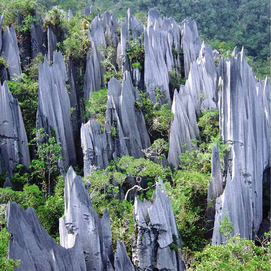
The Pinnacles
Tourism Malaysia
Exploring the Pinnacles, 900m (2,950ft) up the side of Gunung Api, will add extra days to the tour, but there are few sights to match these gigantic stone needles thrusting like petrified hooded ghosts above the dark-green canopy of the forest. Extra time, too, is required if you wish to attempt the climb up Gunung Mulu (2,376m/7,793ft), whose summit was successfully reached by Lord Shackleton in 1932 after earlier known attempts in the 19th century had failed. The ascent of Gunung Mulu alone can take up to five days, although experienced climbers have made the journey in less than two.
The richness of the park’s flora and fauna has been the topic of many scientific studies, revealing 1,500 species of flowering plant, 4,000 varieties of fungus, 75 species of mammal, 262 species of bird, 50 species of reptile and 281 species of butterfly. Birdlife includes stork-billed kingfishers along rivers and strawheaded bulbuls in the forests.
To observe wildlife in the forest canopy, you can use either the 30m (98ft) tall tower and bird hide near the park headquarters or the slightly lower Mulu Canopy Skywalk that is 480m (1,574ft) long.
Sabah
Covering the northern tip of Borneo, Sabah lies just clear of the cyclones that regularly sweep down across the Philippines, and so has been dubbed by generations of sailors the ‘Land Below the Winds’. Its capital, Kota Kinabalu – popularly known as KK – looks over the South China Sea, with the Sulu Sea to the northeast and the Celebes Sea to the south.
KK lies in the shadow of the Crocker Mountain Range, home of Gunung Kinabalu, one of Southeast Asia’s tallest mountains at 4,095m (13,435ft). The Kinabalu National Park is just one of several protected regions in the state.
The capital also serves as a gateway for visits to an offshore national park of coral islands. On the east coast, Sandakan provides a base for visiting the Turtle Islands Marine Park, the famous orang-utans of Sepilok and the Kinabatangan River. Visitors can choose from fishing, snorkelling, deep-sea diving, leisurely coral cruises in the beautiful waters surrounding Sabah, or just exploring KK’s markets.
Kota Kinabalu
Known as Jesselton (after Sir Charles Jessel, chairman of the North Borneo Chartered Co.) until World War II, Kota Kinabalu was renamed Api (Fire) by the occupying Japanese. Today’s KK was rebuilt from the ashes of the war after Allied bombing razed the city during the Japanese occupation. KK is at present a prosperous and busy sea port, with a growing manufacturing base and a population of more than 450,000 (greater KK’s population is now over 600,000). Rebuilt in a modern style, it is blessed with a beautiful natural setting: tree-clad coral islands off the coast and the dramatic backdrop of Gunung Kinabalu to the west. The city is generally used as a base for visiting the surrounding national parks. You’ll find a tourist information office (a former post office) on Jalan Gaya.
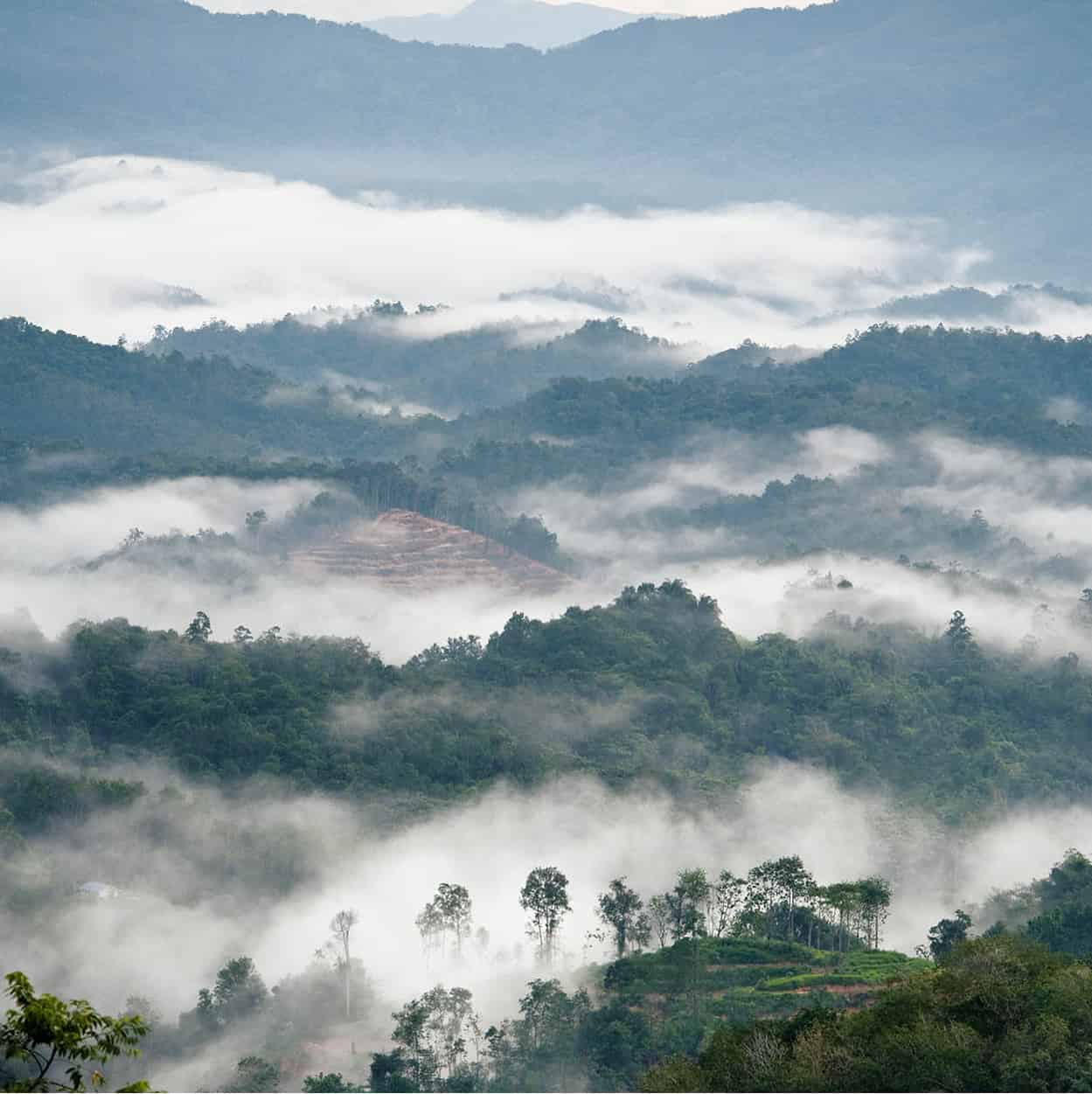
Looking over Kinabalu Park’s mountains and rainforest
James Tye/Apa Publications
The Masjid Bandaraya (City Mosque) in Teluk Likas, about 3km (2 miles) north of KK, shares similar features with the Nabawi Mosque in Medina. South of KK is the Sabah State Museum and Heritage Village on Jalan Bukit Istana Lama. The museum is styled along the lines of Murut and Rungus longhouses, and is set in grounds where you will also find a number of steam engines. Its historic photographic collection provides a chance to see the township as it was before the devastation of war.
Next door is the Science and Technology Centre and an Art Gallery. Across from the museum is an Ethnobotanic Garden, offering the chance to see a range of tropical plants.
One block east of Jalan Gaya is the Atkinson Clock Tower, built in 1905. Along with the tourist information office, it is one of the few pre-war structures still standing.
Walk up the hill to enjoy the view from the Signal Hill Observatory. One of the most popular markets in town is the Jalan Gaya Street Fair, held every Sunday morning. The Handicraft Market is at the waterfront, near the general and fish markets.
On the north side of town is the gleaming Sabah Foundation building, a 30-storey landmark. Construction of the tower was financed by timber royalties to the state, after the Sabah Foundation, devoted to state educational projects, was established in 1966. Views from the revolving restaurant and bar, on the 18th floor, are stunning. Plan to be here at sunset to appreciate the best views of KK.
The Coral Islands
Just a brief boat ride from KK are the five islands of the Tunku Abdul Rahman Park, which was created in 1974. Take the boat transfers from the Jesselton Point Ferry Terminal located at the end of Lorong Satu for either a group or individual tour to the islands. All five islands lie within an 8km (5 mile) radius and provide first-class beaches and superb opportunities for swimming and snorkelling, and there are boardwalk trails into the islands’ forested interiors.
Pulau Gaya is the largest of the coral islands. The park headquarters here can give you information about the flora and fauna, both underwater and in the forest. The sandy Police Beach on the north shore is good for swimming and exploring marine life among the coral reefs. On the boardwalk trail across a mangrove-swamp forest, look out for monkeys, bearded pigs and pied hornbills.
Some of the best nature trails are on neighbouring Pulau Sapi, a 10 hectare (25 acre) islet off the northwestern coast of Pulau Gaya. South of Sapi is Pulau Manukan, the most developed of the islands, with hilltop and beach-side chalets, a restaurant, swimming pool, and tennis and squash courts. Tiny Pulau Mamutik, covering just 6 hectares (15 acres) and largely unspoiled, with plenty of reefs at its northeastern end, is very popular with divers and snorkellers. The most remote and least developed island, with the park’s finest coral reefs and abundant marine life, Pulau Sulug offers a more tranquil and deserted atmosphere.
Around Kota Kinabalu
From the bus terminal near Jalan Undan, 10km (6.2 miles) east of KK, inexpensive journeys can be made to locations not far from the city. Visit one of the many tamu (village markets) held on different days of the week – ask at Kota Kinabalu’s tourist information office. The best are at Tuaran, 33km (20 miles) from KK, and further north at Kota Belud, where you will find the Mengkabong and Penambawan Bajau villages.
At Donggongon in the village of Kuai, 10km (6 miles) south of KK on Penampang River, is the Kampung Monsopiad. It was built to commemorate the legendary warrior Monsopiad, whose forte was beheading his enemies. Forty-two of his ‘trophies’ are on show at the Monsopiad Cultural Village.
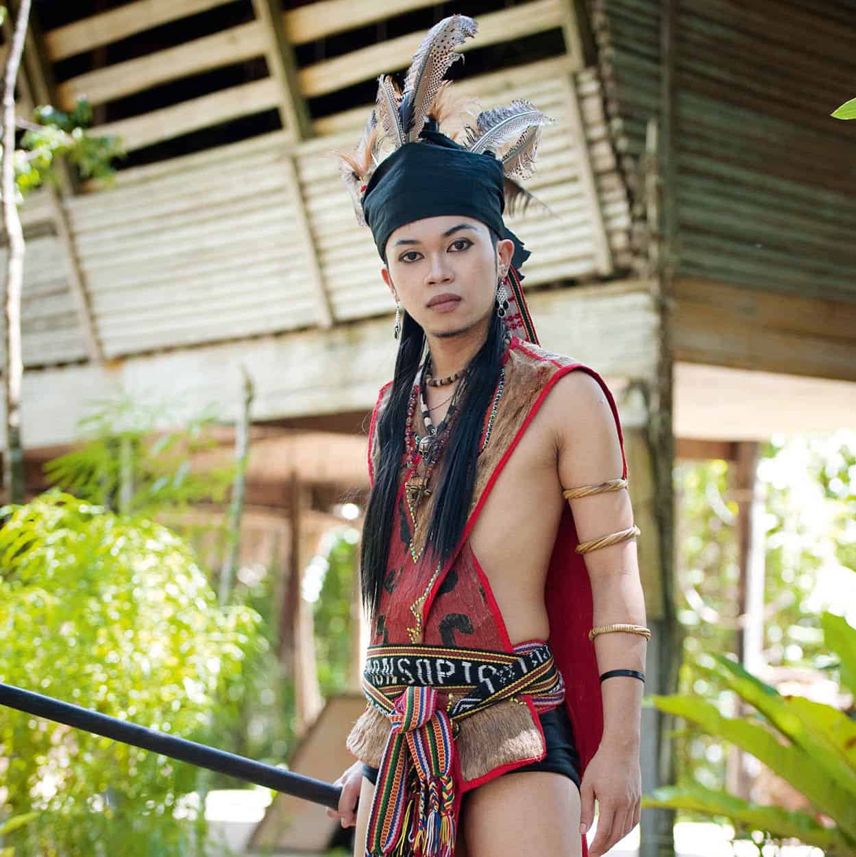
A Kadazan dancer at Monsopiad Cultural Village
James Tye/Apa Publications
To view the nearby tropical forests, ride on the railway to Beaufort, and another 40km (25 miles) northwest to the town of Tenom, with its Agricultural Research Station. Nearby, tour operators out of KK run rafting trips on the raging Padas River. Although the new North Borneo Railway train begins its journey at Tanjung Aru, you can save time by taking a taxi to Beaufort and then another from Tenom back to Kota Kinabalu. At Beaufort, Chinese shophouses stand on stilts next to the Padas River. The North Borneo Railway, an old-fashioned steam locomotive, runs to Papar a few times a week.
South from KK, heading towards the Crocker Mountain Range, is the Rafflesia Information Centre. This is dedicated to the world’s largest flower, the rafflesia, of which there are 14 varieties. About 300km (186 miles) northwest of KK and reached by a 75-minute flight is the diving and migratory birdwatching haven of Pulau Layang Layang (open March–July), where divers can see, among other large pelagic creatures, schools of hammerhead sharks and manta rays.
Kinabalu Park
The refreshing temperatures and spectacular scenery make a journey to Kinabalu Park ^ [map], a UNESCO World Heritage Site, more than worthwhile. Even if you avoid the vigorous climb to the mountain’s summit, the scenery, plants and wildlife close to the park’s headquarters are rewarding. Looming huge and dark in the light of dawn, the peak is revealed in its full splendour, but morning clouds often sweep upwards again to shroud it in mist. At 4,095m (13,435ft), Gunung Kinabalu is one of the highest peaks between the Himalayas and New Guinea. Its name means ‘sacred home of the dead’ to the Kadazan who live on its lower slopes. The park can be reached by road 90km (56 miles) from Kota Kinubalu. There is a special bus service from KK, but arrive early, as it departs once full. The trip to the park headquarters takes at least two hours, though only one and a half hours on return. There are also regular buses plying the highway between KK and Sandakan. The journey from Kota Kinabalu to the park and the climb up into the Crocker Range takes you through Malaysia’s varieties of forest and landscape, from lowland dipterocarp forest to subalpine meadow.
The park covers 754 sq km (291 sq miles), with temperatures far cooler than on the coast. They ease to a gentle 20°C (68°F) at park headquarters and can drop to freezing point at the resthouse where climbers spend the night prior to their assault on the summit, so warm clothing is a must, as well as rainproof clothing for those climbing the mountain.
To climb the summit, book at the Sabah Parks Headquarters in Kota Kinabalu well in advance, especially in April, July, August and December. The climb takes two days, with an overnight stay halfway up. Foreigners pay more than locals. The park has a good restaurant and accommodation ranging from chalets to simple hostels. At the park’s headquarters arrangements are made for mountain guides, porters and transport to the station where the climb begins. Instead of heading for the summit, you could book with Mountain Torq and traverse the world’s highest via ferrata or ‘iron road’ on the northern face of the mountain. Hardy souls may like to swim in the cool Liwagu River nearby. A small Mountain Garden provides a good introduction to the plant life you will find in Kinabalu’s forest.
The pitcher plant
The pitcher plant consists of a bowl often shaped like a miniature tuba with a curved lid sticking upright when open. Why do insects fall in? Those that go for the nectar under the pitcher lid get away safely. Others going for the nectar glands under the pitcher’s rim fall into a digestive liquid mixture of rainwater and enzymes. Unable to climb back up the sticky, scaly interior, they drown and are slowly digested. Cashing in on the activity around these plants, some spiders spin webs across the inside of the pitcher’s mouth and catch the falling insects.
The giant of the species is the Nepenthes rajah, with one pitcher measuring a record 46cm (18in) and holding 4 litres (7 pints) of water. They have been found digesting frogs and even rats.
The pride of the mountain’s plant life is its 1,200 different orchids, found up to an altitude of 3,800m (12,464ft). Ferns are also present in their hundreds. Rhododendron-lovers may find 25 different varieties, together with 60 types of oak and chestnuts. But the most fascinating flora remains the pink-speckled, carnivorous pitcher plants.
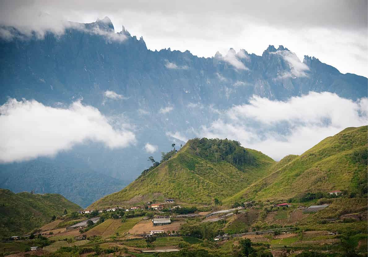
Gunung Kinabalu and its foothills
James Tye/Apa Publications
Many of the local forest’s 100 mammals are difficult to spot; the few orangutans, for instance, are practically invisible, but you can at least hear the gibbons whooping. Besides the usual sambar and mouse deer, bearded pigs and clouded leopards, there are 28 species of squirrel, as well as the slow loris and the western tarsier. Kinabalu also has some 326 species of birds, including the scarlet sunbird, whitehead’s spider-hunter, grey drongo, crested serpent eagle and white-rumped shama.
Meals and bedding are provided at the mountain lodges for the overnight stop. Rates differ between weekdays and weekends. Armed with warm and rainproof clothing, flashlight, and bananas and chocolate for energy, you make an early-morning start. After a stretch of road, the climb proper begins at Timpohon Gate. As you climb, you will notice the change from bamboo groves to oaks (the forest here has 40 different varieties), myrtle, laurel and moss-covered pines. The trees become more gnarled and stunted as you approach the barren granite plateau at the summit.
The first shelter at Carson’s Falls is at 1,951m (6,400ft). The best chance to see pitcher plants on the trail is at the Second Shelter on the trail at 2,134m (7,000ft), but remember, no picking. You make your overnight stop at the Laban Rata Resthouse or the Panar Laban Hut, Waras Hut or Gunting Lagadan at 3,353m (11,000ft). Panar Laban means Place of Sacrifice: here seven white chickens and seven eggs are offered each year by Kadazan climbers to the spirits of the sacred mountain.
To get to the summit at sunrise, you must get up at about 2am and make your way up across a barren granite plateau. The Sayat-Sayat Hut, 3,811m (12,500ft), is the last shelter before the summit. Directly to the north are the Donkey’s Ears rocks, and behind them the Ugly Sister Peak, as you make your way west to Low’s Peak (4,095m/13,435ft), the highest of the mountain’s nine peaks. The view from the Crocker Range and towards the Philippines is staggering. But you cannot stay long, as the summit soon becomes enveloped in mid-morning mists, making the descent treacherous for even experienced climbers. On 5 June 2015, there was a magnitude 6.0 earthquake in Sabah. This affected Kinabalu Park and mountain climbing activities at Gunung Kinabalu were suspended at the time of writing. Before you plan to travel to the Kinabalu Park, check for the latest information on www.sabahtourism.com.
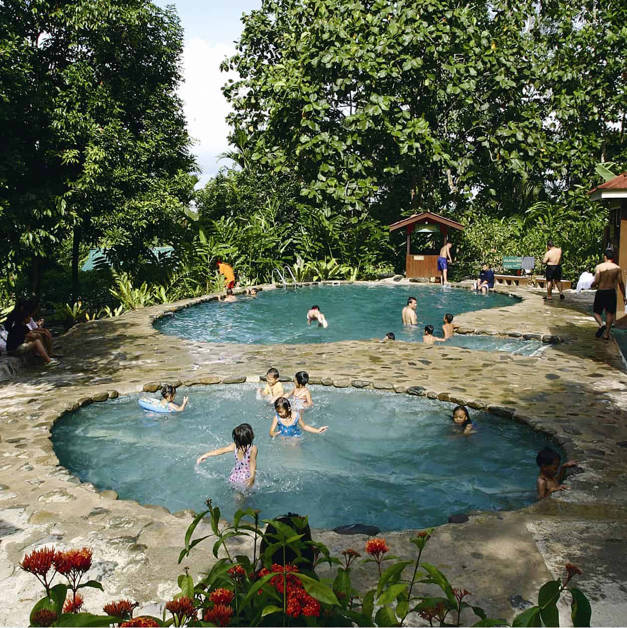
At Poring Hot Springs
Tourism Malaysia
Poring Hot Springs
The Poring Hot Springs, 37km (23 miles) from the park headquarters, offer great relief after the tough climb down the mountain. The springs, with their soothing sulphur baths, were developed by the Japanese during World War II. Cool off at the Langanan Waterfall along one of the trails, or at the Kepungit Waterfall, a site rich in butterflies and bat-filled caves. Nearby are groves of bamboo (poring means bamboo in Kadazan), a canopy walk, lodgings in chalets and hostels and a campsite.
Sandakan
Stretched along a narrow strip of land between steep hills and the Sulu Sea, Sandakan is the gateway to the Turtle Islands Marine Park, the Gomantong Caves, the Sepilok Orang-Utan Rehabilitation Centre and the Labuk Bay Proboscis Monkey Sanctuary. Once the capital of British North Borneo, modern Sandakan, like Kota Kinabalu, was devastated during World War II, leaving little evidence of the former township.
The lively Central Market at the waterfront is a good starting point for visitors. Sandakan’s oldest temple, built in the 1880s, is dedicated to the Goddess of Mercy, although modernisation has detracted from its character. The ornate Puu Jih Shih Buddhist Temple, ablaze with dragons and gilded Buddhas, stands on the hilltop above Tanah Merah, south of Sandakan town.
You can also tour the home of Agnes Keith, an American writer whose life in Sandakan from 1932–54, including experiences in a prisoner-of-war camp, was documented in three novels, including Land Below the Wind. Her prewar home was destroyed but reconstructed and is now a museum. Next door is the superb English Teahouse and Restaurant.
Other links to the war include the Sandakan Memorial Park on the site of the former prisoner-of-war camp in Taman Rimba, off Labuk Road. It commemorates the Allied soldiers who died during the Japanese occupation and serves as a remembrance of the Death March by 2,400 mostly Australian soldiers – of whom just six survived – from the camp to Ranau in September 1944. There is also a small Japanese graveyard in the corner of the old cemetery on the hills overlooking the town.
The Lower Kinabatangan River Basin
The Kinabatangan Basin, 80km (50 miles) southwest of Sandakan, offers a good chance to catch sight of a range of wildlife, especially Borneo’s pygmy elephants, hornbills, monitor lizards, macaques and orangutans, not to mention the elusive proboscis monkey. The Kinabatangan is a rewarding river for wildlife fans, with trips organised by Sandakan tour operators.
Orang-utans
In Malay, orangutan means ‘forest person’ – an appropriate mark of respect for the mammal biologically closest to man. These intelligent, russet-coloured apes live in the forests of Sabah and Sarawak. They are very individualistic nomads, meeting occasionally to share a fruit supper before going their own way. Some visitors to Sepilok confuse them with the similarly coloured red-leaf monkeys – but unlike monkeys, orangutans have no tails.
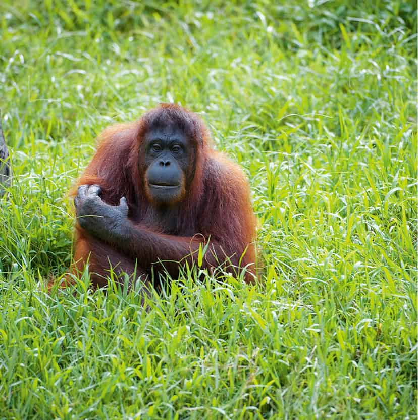
Malaysia’s famous inhabitant, the orang-utan
James Tye/Apa Publications
The Sepilok Orang-Utan Rehabilitation Centre
A 30-minute drive west of Sandakan, the Sepilok Orang-Utan Rehabilitation Centre & [map] is a nature reserve that provides rehabilitation and care for young orang-utans, previously held in captivity. This prepares them to live alone in the forest. Boardwalk trails take visitors to the feeding areas.
These highly theatrical apes exist at three levels here: tame, entirely in the care of zoologists; semi-tame, living within reach of the sanctuary’s feeding points; and wild, having moved off to remote parts of the forest away from their prying human cousins. Many of the orang-utans are as curious as the visitors. They have flashy tastes, preferring to snatch at bright objects rather than dull ones. They also have a good sense of parody. Watching someone put up an umbrella in the rain, they will immediately mimic this, using leaves and twigs.
Optimistic figures put the number of orang-utans at around 11,000 in Sabah, making it an endangered species.
Turtle Islands Marine Park
All year round, green and hawksbill turtles gather to lay their eggs on the island beaches north of Sandakan Bay. The park is 40km (25 miles) from Sandakan and comprises three islands – Pulau Selingaan, Pulau Bakkungan and Pulau Gulisaan – covering 1,740 hectares (4,295 acres). At Pulau Selingaan there are several furnished chalets where up to 20 visitors can stay overnight and maintain their night-long vigil.
West of Lahad Datu
Another access point to the wilds of Sabah is through the Danum Valley Conservation Area. The valley is 80km (50 miles) inland from Lahad Datu on Sabah’s east coast. Here are a range of walking trails through the protected forests, home to the western tarsier, orang-utan, leopard cat, deer, Malayan sun bear, the very rare Sumatran rhinoceros, smooth otter and 275 species of birdlife. Resort accommodation is available but to visit the wilderness area of the Maliau Basin Conservation Area, west of Danum, expect only camping facilities. Nicknamed ‘Sabah’s Lost World’, Maliau Basin was accidentally discovered in 1947 by a British pilot, then promptly forgotten until the first expedition in 1988. Less than half of the basin remains unexplored, but what has been discovered so far is an exciting diversity of flora and fauna, some of which are endemic to this basin. Imbak Canyon Conservation Area * [map] is located northeast of Maliau and is unique for its diversity of flora. It serves as the state’s botanical gene bank and a water catchment area. A valley 10km (6 miles) long, it is drained by the Imbak River and features beautiful waterfalls, hemmed in from three sides by sandstone ridges. Apply to the Yayasan Sabah (Sabah Foundation) in KK or Sandakan for the visitor’s permit, but it is best to go with a reliable tour operator.
Southeast islands of Sabah
Semporna, an hour’s drive from Tawau airport, is the gateway to the famous island of Pulau Sipadan ( [map] – Malaysia’s only oceanic island and one of the world’s five best dive sites. A pinnacle of limestone and coral rising up 600m (2,000ft) from the floor of the Celebes Sea, it spreads out like a mushroom cap to form a 12-hectare (30-acre) island. To safeguard the underwater reefs, no accommodation is allowed on the island. Instead, visitors stay at nearby Pulau Mabul and Pulau Kapalai, both well known for their underwater macro life. This part of Sabah is, at the time of writing, dangerous and many government security agencies advise against travelling to islands off the coast of eastern Sabah.
