Any mountain range 700km (450 miles) long and with summits over 4,000 metres (13,000ft) high must be counted as a major topographical incident on planet earth. Since the first attempts by Europeans in the early 19th century to follow Arab trade routes across this great barrier, the number of foreign travellers penetrating the Atlas up until World War II probably never exceeded a thousand. The slogan ‘Death to the infidel!’ applied to all unaccompanied strangers in this region.
The Atlas mystique lasted even after a prominent pass, Tagharat, and a distinct summit, Gourza (3,280 metres/10,700ft), had been reached by outsiders in 1871. The Hooker-Ball-Maw expedition observed, ‘The climate is admirable, the natural obstacles of no account, but the traditional policy of the ruling race has passed into the very fibre of the inhabitants, and affords an obstacle but impassable to ordinary travellers.’

Tagines in the Ourika Valley.
Clay Perry/Apa Publications
These days the Atlas is more accessible, and its inhabitants, having developed keen entrepreneurial instincts, are more hospitable towards visitors.
Lie of the land
Three main roads penetrate the High Atlas from Marrakech (for more information, click here): the spectacular Tizi N’Test pass (for more information, click here), the less interesting N8 through the western Atlas to Agadir (best in winter, when the high passes are often closed due to snow), and the well-maintained, though vertiginous, Tizi N’Tichka pass to Ouarzazate (for more information, click here). West of the Tizi N’Tichka, the High Atlas rises up to the jagged peaks of the Toubkal massif, before descending to the Tizi N’Test pass. From the Tizi N’Test, the Atlas Occidental continues westwards, north of the city of Taroudant, running down to meet the Atlantic Ocean between Agadir and Tamri. South of Toubkal the Jebel Siroua is a remote outlying plateau of extinct volcanic plugs filling the gap between the High Atlas proper and the Ouarzazate–Taroudant road.

Houses built into the hillside in the Ourika Valley.
Ming Tang-Evans/Apa Publications
If you are staying in Marrakech but not planning to travel very far afield, it would be a shame not to venture into the Atlas for at least a day or two. One of the easiest and most popular excursions is to the Ourika Valley, about an hour’s drive south along the P2017 (the ‘Route d’Ourika’), which passes through Marrakech’s nursery flower gardens and winds up into the lush foothills of the Atlas. In spring the hills are carpeted with wild flowers and blossoming fruit trees, while in summer the cool and shady landscape attracts crowds of picnicking Marrakchis at weekends.
Just over 30km (18 miles) from Marrakech, is the village of Tnine Ourika, which has some good tagine restaurants and a weekly souk on Mondays. A number of interesting local tourist initiatives can be found nearby. These include Nectarome (www.nectarome.com), a beautiful ‘bio-aromatic’ herb garden, producing organic essential oils and cosmetics, where you can also have lunch; Safranerie (www.safran-ourika.com), another beautiful herbal garden, specialising in saffron (there is a small museum dedicated to the spice) and various tisanes; and, most interestingly, the Ecomusée Berbere de L’Ourika (www.museeberbere.com), where local guides offer rewarding insights into local life and culture in the valley.
Continue up the road, following the river, to reach the village of Setti Fatma 1 [map], high in the cleft of the valley. A busy mule track cuts deeper south, but the main attraction is the series of seven waterfalls on the far side of the river, the first of which is reached after an easy climb through the rocks and trees. In the summer this is a popular spot for tourists and Marrakchis alike, with swimming in a deep, icy rock pool, while above, wild monkeys stalk the craggy heights and shower walnuts on the unwary.
Returning back down the Ourika Valley from Setti Fatma, and then turning left onto the P2030 brings you to the ski resort of Oukaimeden 2 [map], located at a breathless 2,650 metres (8,700ft) above sea level. The season, if there is sufficient snow, runs roughly from late December to the end of March, with pistes ranging from nursery to black level, although there is little in the way of piste-grooming, so conditions can be rough; rescue services are virtually non-existent and the nearest hospital is in Marrakech – best not to go off-piste. Donkeys are available to carry you and your skis from the pistes to the car park, and ancient ski equipment can be rented at the bottom of the pistes.
There are seven chair lifts to the top of Jebel Oukaimeden – the highest ski lift in North Africa. A local viewpoint with an orientation table is set at the top, with wide vistas south to Toubkal and the Tazahart Plateau, and northwards over the Haouz plain and Marrakech. There are prehistoric rock engravings along the north side of the pasture plateau. Huge flocks of sheep and goats graze here in early summer, brought up by villagers from the lower valleys. While an asphalt road goes back to the city, a mule path winds westwards, over the Tizi N’Oukaimeden, down paths through stunted walnut forests and evergreen oak, back to the terraced fields of the Mizane and Asni, a good five-hour hike.
The Toubkal massif
Shimmering in the haze beyond the pink walls of Marrakech, long flecks of snow barely 60km (38 miles) away brush the rugged profile of the southern horizon. This is the Toubkal massif, the craggy mass of rocky peaks and deep valleys that contains the highest summits of the Atlas chain. Roads teeming with people and domestic animals, scooters and lorries belching diesel fumes, cross the hot Haouz plain to Asni 3 [map]. The town’s bustling Saturday souk remains a mainly traditional affair, though you’ll also now find people selling carpets, fossils and other local trinkets. There are a few basic hotels and restaurants in Asni, but most people choose to stay in Imlil. A turning to the right before the market leads up to Moulay Brahim and the Kik Plateau.
To the south of Asni, somewhere in the distance at the head of the Mizane Valley, towers Jebel Toubkal, at 4,167 metres (13,670ft) the highest mountain in North Africa. To reach the road-head at Imlil from which all treks in the surrounding area and ascents of Toubkal begin, take the signposted left turn after the post office. There is a good tarmac road running 17km (11 miles) up the valley, offering spectacular views towards the Toubkal massif. The road passes the superbly sited Kasbah Tamadot hotel, owned by Richard Branson.
Imlil 4 [map] is a charming mountain village, with several good cheap places to stay, a scattering of restaurants and lots of souvenir shops, selling carpets, fossils and jewellery. There is also a Bureau des Guides in the village (just opposite the car park, tel: 0524 48 56 26; http://bureaudesguidesimlil.com), and anyone travelling independently for the first time in the area is recommended to pay it a visit, even if they have no intention of hiring a guide. Trekking companies are another option and deal with all the logistical problems of organising porters, provisions and accommodation. The more self-reliant can always backpack and dispense with the local services, but it would be wise to seek advice on routes and weather conditions.
Thousands flock to Imlil in spring and early summer to climb Jebel Toubkal 5 [map] and/or trek in the surrounding foothills – two of the most popular attractions in Morocco. For a mountain of this height and accessibility to have had its first recorded ascent (by a French party under the Marquis de Segonzac) as late as 1923 testifies to the tribal fortress mentality maintained by local people well into the 20th century. There’s also a well-developed hiking trail around the mountain – the ‘Toubkal Circuit’ (for more information, click here) – offering circular treks of between seven and 10 days, staying overnight in remote huts, Berber outposts and sometimes in open-air bivouacs.
One of the best places to use as a base, as well as to hire guides and arrange treks, is the stunning Kasbah du Toubkal (http://kasbahtoubkal.com), a beautifully restored kasbah at the top of Imlil with 360° views of Toubkal and the mountains around. The kasbah was the location for Martin Scorsese’s film about the Dalai Lama, Kundun. Most importantly, it is run by locals from the surrounding villages, and a 5 percent ‘surcharge’ on the price of the rooms goes to the local Village Association, which funds ambulances, clinics and schools. The kasbah also has a trekking lodge halfway up Jebel Toubkal.
Day hikes
From Imlil, for those shod in boots, there are a number of easy day hikes up to the Tamatert pass in the east (see below) or the Mzic pass in the west, both giving superb views back and beyond to the continuing chain of ridges and peaks overlooking the villages and green terraced fields of the Berbers.
Aremd (also known as Aroumd or Armed) is the last village in the Mizane Valley before the long hike up to the high mountains. It is an important trekking centre with a range of gîtes, a small hotel and a campsite. The valley here, more open than at Imlil, is a beautiful place to spend a day or two acclimatising before an arduous trek or recuperating before descending to Marrakech.
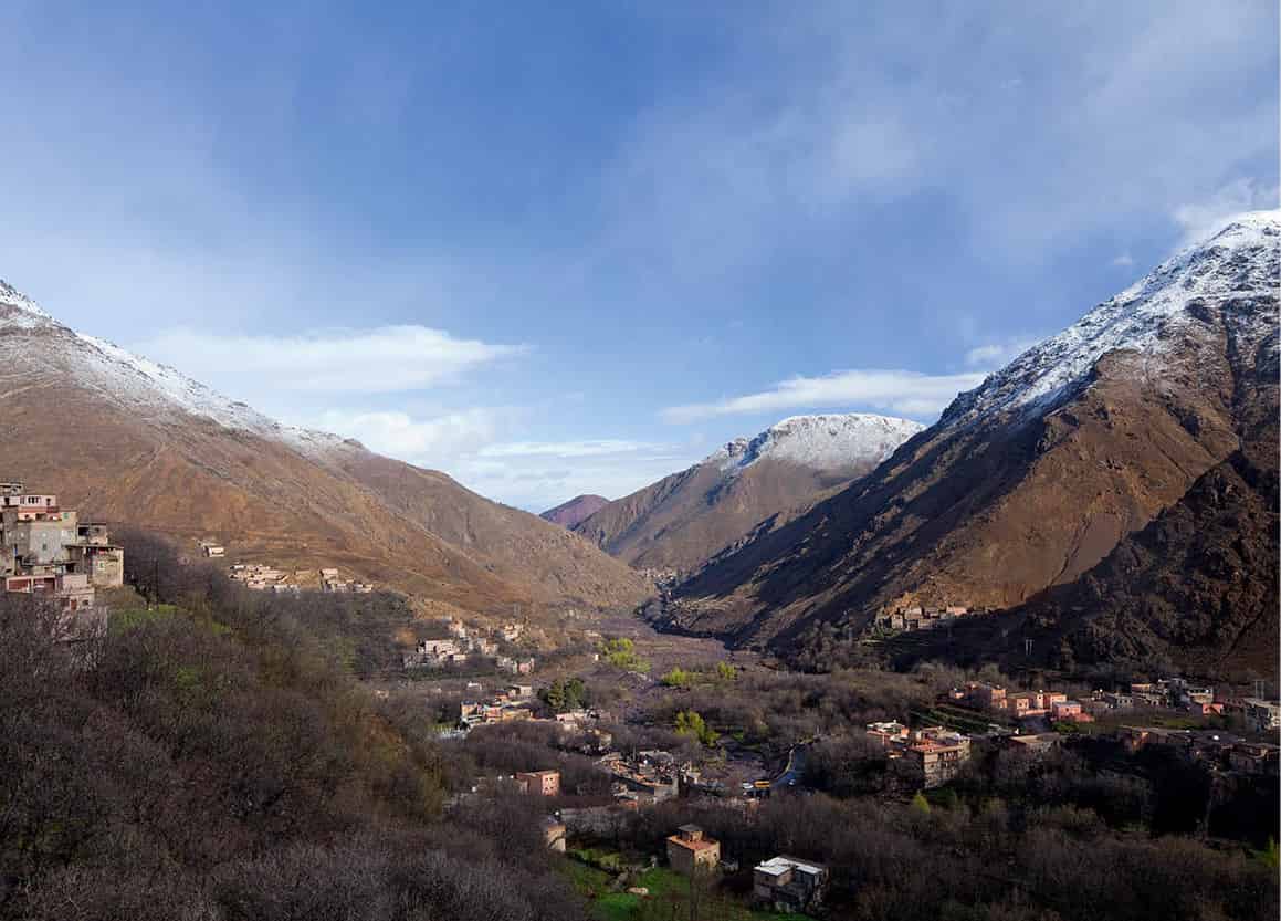
View from the terrace at Kasbah du Toubkal.
Ming Tang-Evans/Apa Publications
The religious shrine of Sidi Chamharouch (complete with associated shops catering for pilgrims), lies two hours away by foot or on mule back along the trail in the upper Mizane. Like a beacon, its white roof draws many on a day’s outing. Among this huddle of little houses squeezed into a niche at the foot of a rock slope, all Berber life is exposed to public view.
Trekking Guides
Nationally qualified trekking guides are called accompagnateurs, and are registered with the Ministry of Tourism. They all speak French and sometimes English, Spanish or German. The guides will also take charge of the hiring of mules and the provision of supplies on longer expeditions. As a rule, one mule can carry the baggage of three trekkers equipped for three to four days. In places where mules cannot go, loads are carried by porters.
Prices for guides and mules/muleteers are regulated. If you expect extra duties, such as the guide also doing your cooking, or if you choose to take a muleteer and no guide, you may have to pay more than the usual rates. All prices are exclusive of the guide’s food, which you are expected to provide.
Jebel Toubkal can usually be climbed in two days – the first day reaching the CAF Toubkal Refuge (www.refugedutoubkal.com) at 3,207 metres (10,522ft), which is about seven hours from Imlil, and reaching the summit (five hours) and returning to Imlil (five hours) on the second day. A lot of people include the ascent as part of longer treks (see box). Note that the ascent can only be made when the snows have melted, between May and October, unless you have suitable equipment (crampons, ice axe) and experience of extreme winter mountain conditions.
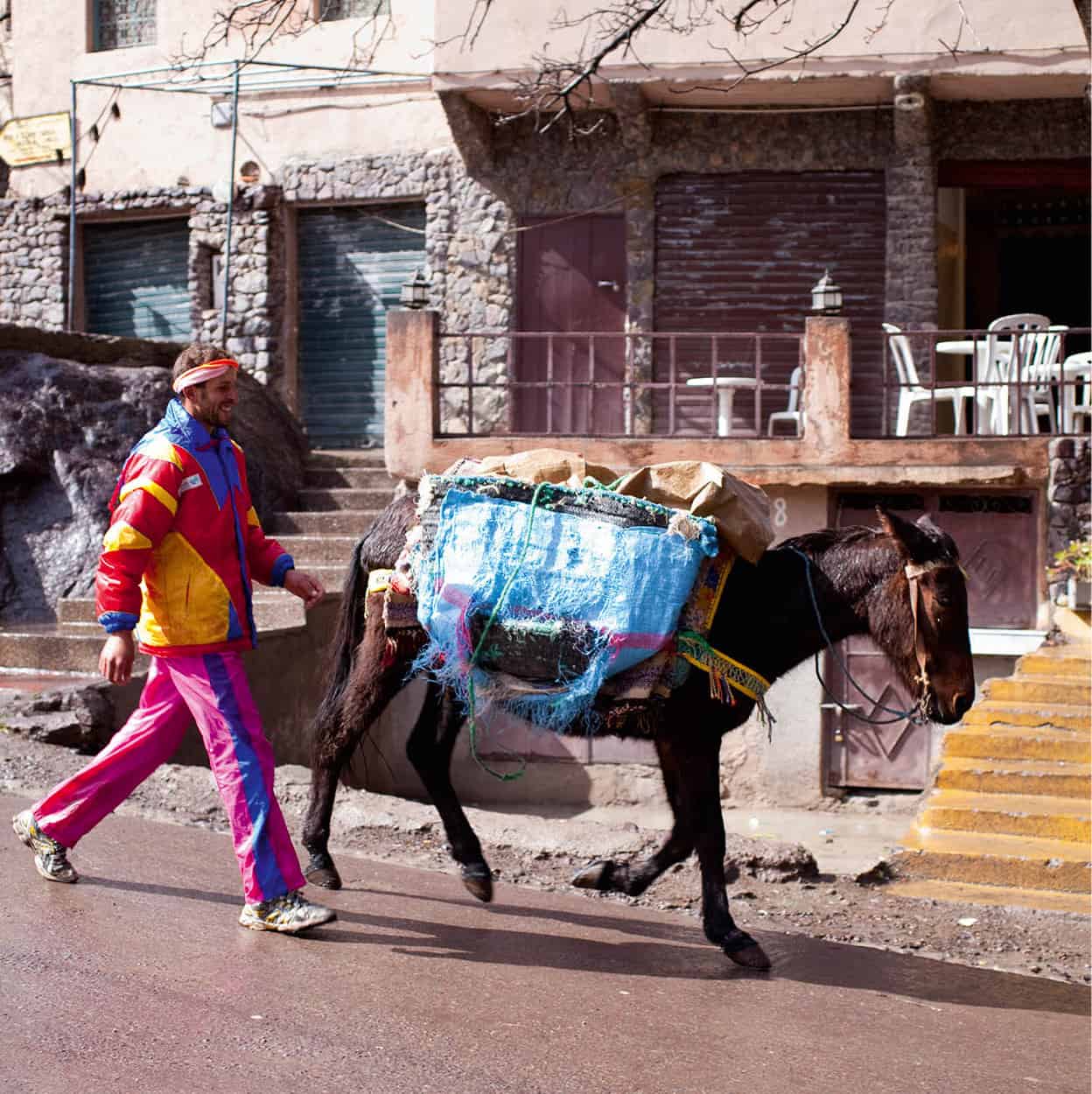
Imlil.
Ming Tang-Evans/Apa Publications
The CAF Toubkal Refuge has good dormitory facilities and a large communal area for cooking and eating. A spring supplies the hut, via a buried pipe, although it is still recommended that you boil drinking water. Gully water in the stream below flushes the toilets. Refreshments and simple meals can be ordered from the warden. During the summer months it is sensible to book a place in the refuge via a message carried by the in-season shuttle of mules and porters from Imlil (do this a day before going up to the hut). Camping below the hut is becoming increasingly popular. You have to leave the refuge by 6.30am – not necessarily a bad thing, given the importance of making an early start.
If you climb Toubkal outside the summer trekking season you may need crampons and an ice axe for complete comfort as well as stout boots and proper clothing. Knowing the prevailing conditions, a guide will advise exactly.
Fact
At first sight the Atlas appear to be remote. In fact, one-quarter of Morocco’s population lives on ground over 1,000 metres (3,300ft) above sea level.
The ascent is reasonably straightforward, a gradual walk up a stony slope, until one reaches the notoriously slippery upper scree, where care must be taken as one false move could well be dangerous. Moreover, the path has been ruined by the careless footwork of thousands of tired limbs. The summit is crowned by a pyramidal metal marker, and views stretch as far as the eye can see over the Atlas massif.
The route is graded by Atlas mountaineer Michael Peyron as type boulevard and, indeed, after about three hours, the summit appears like a big open corral. You’ll find people – usually the T-shirt and flip-flop brigade – stamping their feet and trotting round to keep warm. The major danger in climbing Toubkal is from altitude sickness – if you start vomiting or develop a severe headache, head back down immediately – although highly changeable weather conditions may also prove a threat if you’re not properly equipped.
Other treks around Imlil
A popular trek, which can be lengthened or shortened according to taste, takes the path from Imlil over the Tamatert pass to the crossroads village of Tacheddirt 6 [map], in a relaxing three and a half hours. Tacheddirt itself is an appealing Berber settlement, epitomising the traditional mountain way of life. There is accommodation in a mountain hut or in a couple of gîtes in nearby villages.
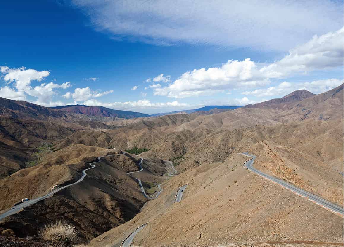
Road through the Tizi N’Tichka pass.
Ming Tang-Evans/Apa Publications
The major climb to the N’Addi pass (2,900 metres/9,600ft) that looms behind the village is rewarded by views of ravines and peaks zebra-striped with long streaks of snow. Riding a mule will be allowed only on the easy down slope (where there is a Jeep road) to the broad pastures of Oukaimeden below. At the head of the Tacchedirt Valley lies the Tacchedirt pass, leading to the large village of Timichi 7 [map], from where paths lead over the Tizi N’Ouattar, again to Oukaimeden, or continue to Setti Fatma at the head of the Ourika Valley (for more information, click here).
For the really adventurous, the towering Likemt pass offers routes over to the southern side of the Atlas, descending eventually to Ammzouzerte in the Tifnout Valley, at the head of which lies the remote Lac d’Ifni. Seen from the height of the moraine that blocks its southern end, the lake is like a blue-green jewel set in a bowl made by towering naked peaks. From its northern shore a path sets off across rocky ground to a tortuous gully that leads up to the mountain’s highest and most spectacular pass, the Tizi Ouanouns, to regain the head of the Mizane Valley, which descends first to the Toubkal Refuge and finally back to Imlil. The entire round trip is a one-week trek, without rest days or excursions to explore or climb nearby peaks.
All this merely scratches the surface of an area rich in opportunities for trekking, with many more routes heading off west of Imlil for almost as many days as you have the energy to walk.
To Ouirgane and Tin Mal
Back on the Tizi N’Test road, continuing south of Asni, the route continues to Ouirgane, a sleepy village nestled in gentle foothills near a lake reservoir. There are several lovely places to stay – or just to have lunch – here, and the village offers an especially welcome escape from the heat of Marrakech during the summer months.
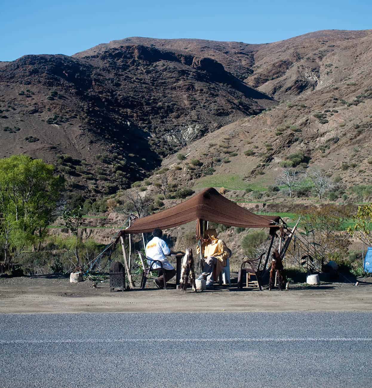
Mountain restaurant.
Ming Tang-Evans/Apa Publications
A little further on is Ijoukak where a piste leads into the less visited, but beautiful, Agoundis Valley. Close by stands the ancient kasbah of Talat N’Yaccoub 8 [map], surrounded by olive groves, with the foaming River Nfiss lapping at the foot of its ramparts. Dominating an adjacent knoll, with the snows of the western Igdet as a backdrop, is the Agadir N’Gouj, a former stronghold of the Goundafi tribe that was notorious in the 19th century for its dungeons. The entire area is now regarded as one of the outstanding beauty spots of the Great Atlas chain.
Higher up on the other side of the stream is the striking 12th-century mosque at Tin Mal 9 [map], a fortified holy town that was the birthplace of the Almohad movement, which eventually gave rise to the famous Berber dynasty of the Middle Ages. The mosque was built in 1156 by Abd el Moumin, who was the successor to Ibn Toumert, the theologian founder of Tin Mal. Although the town was ransacked by Merinids in 1276, the mosque remained the only thing standing. In the early 1990s it underwent a complete restoration and was declared a Unesco World Heritage Site in 1995. It is one of the few in Morocco that non-Muslims can visit (outside prayer times).
Fact
The mountain range was named the Atlas by Europeans inspired by the Greek myth. According to the story, the Titan Atlas was turned to stone by Perseus, supporting the heavens. Bowed by the weight, Atlas genuflected towards the setting sun in northwest Africa.
The mountain behind the mosque is Gourza, first climbed by the Hooker botanical expedition in 1871. Past here, the road narrows as it reaches the very top of the vertiginous Tizi N’Test Pass, at 2,092 metres (6,867ft) the second-highest mountain road in Morocco. Despite its wild beauty, the area is actually an environmental disaster, as vast forests have been chopped down for building materials and firewood. Here, and similarly along the eastern boundary of the Toubkal massif, plainly marked by the Tichka pass commercial road, the watershed divides the lush from the barren. A quilt of green fields stitched round a few oases occasionally brightens the monotony.
Gems and Fossils
In the High Atlas and Middle Atlas, makeshift stalls selling rocks packed with crystals and semi-precious stones, such as amethysts and quartz, can prove irresistible. The usual advice is, be cautious, as some of the items being hawked are not genuine. That said, many are, and you will sometimes see European gem traders examining stones under a magnifying glass. At one such stall, in 1996, a British geologist discovered an intensely blue pyramid-shaped rock, which the stallholder told her was lapis lazuli. Realising that it wasn’t but still intrigued by the rock, she bought it for a few dirhams and on her return home took it to London’s Natural History Museum. Tests revealed it to be an entirely new mineral containing silicon, aluminium, calcium, magnesium, iron and oxygen.
Fossils, too, are found on these stalls, including some impressive examples of ammonites. Morocco is one of the world’s best sources of this fossil, though check carefully, as sometimes the ridges have been enhanced by a chisel. And it was in Morocco, again in 1996, that the bones of a meat-eating African dinosaur as large as Tyrannosaurus rex were found. Though scientists had known of Carcharodontosaurus saharicus prior to the find, only one other skeleton of the dinosaur had hitherto been found and that had been lost.
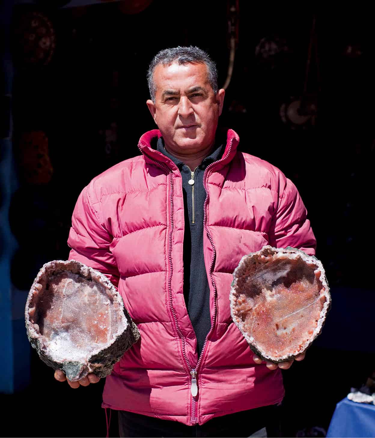
Atlas rocks.
Ming Tang-Evans/Apa Publications
The Western High Atlas
West of the Tizi N’Test road rises the Occidental or Western High Atlas, remote to most tourists, but surprisingly densely populated and supporting a thriving agricultural economy. The Seksawa Valley, its boxy dwellings planted on mountain sides prickling with television aerials, is the principal road for lorries travelling to and from Marrakech. Adventurous tourists bent on exploration away from the crowds will find many diverting sights in this region, including the picturesque Tichka Plateau.
One rewarding way of visiting the area is by mountain bike (they can be hired in Marrakech and Agadir). The mountains are not as rugged as the Toubkal, and the area is more densely covered by piste. As a base for such expeditions, one could do much worse than Imouzzer des Ida Outanane (for more information, click here), with its good hotel and nearby waterfalls.
East of the Toubkal massif
On the eastern side of the Toubkal massif, the Yagour Plateau (dotted with prehistoric rock engravings) and the Zat Gorge lead down to the Tizi N’Tichka Pass, meeting the main N9 road between Marrakech and Ouarzazate just above Taddert. This is a one-street town, lined with grill shops and the last truck stop before a dizzy series of heart-stopping hairpin bends takes you up and over the 2,260-metre (7,412ft) Tizi N’Tichka Pass.
The Tizi N’Tichka is a superb drive, but it is mainly a transport artery and is little used as a starting point for trekking. About 20km (12 miles) east of the Tichka and deliberately sidetracked by the main road built in 1936 lies Telouet ) [map], the old Glaoui seat of power situated on the ancient caravan route. Telouet is famous for its kasbah, deserted after the fall from grace of the self-styled Sultans of the South. First visited by a European in 1889 and once host to Wilfred Thesiger on his treks through the Atlas, the crumbling ruin is sufficiently intact to give an impression of past splendour. A guardian can unlock its gate and give a small tour, pointing out the once-magnificent reception rooms and the bower from which the privileged guests of the Glaoui could watch fantasias staged in the arena below.
Quote
‘I became lost in the castle, and found my torch shining upon white but manacled bones in a dungeon. With the turbulent history of Telouet they could have been either a hundred or less than five years old.’
Gavin Maxwell, Lords of the Atlas, 1966
Further up the Animter Valley, the path leads through a fertile valley up to the isolated Tamda Lake, full of trout and surrounded by stones, tightly packed with tiny fossils. The surrounding mountains are bare and lonely and largely uninhabited. Eastwards the path meanders across the Tizi N’Fedhrat to the picturesque village of Magdaz and the start of the mountains of the M’Goun Massif (in the Central High Atlas) with its fertile valleys and canyons.
The Central High Atlas
Rolling away east of the Tizi N’Tichka Pass (and northeast of Ouarzazate) are the mountains of the Central High Atlas. The main trekking base on the north side of this range is the beautiful Aït Bouguemez Valley. Known as the ‘Happy Valley’, this broad expanse of greensward sprinkled with small villages stretches roughly from Agouti to Jebel Aroudane; Agouti and Tabant are the main trekking and tourist centres. Once a remote Shangri-La, the valley has only recently opened up to the modern world following the construction of a new tarmac road in the early 2000s from the market town of Aït Mhammed.
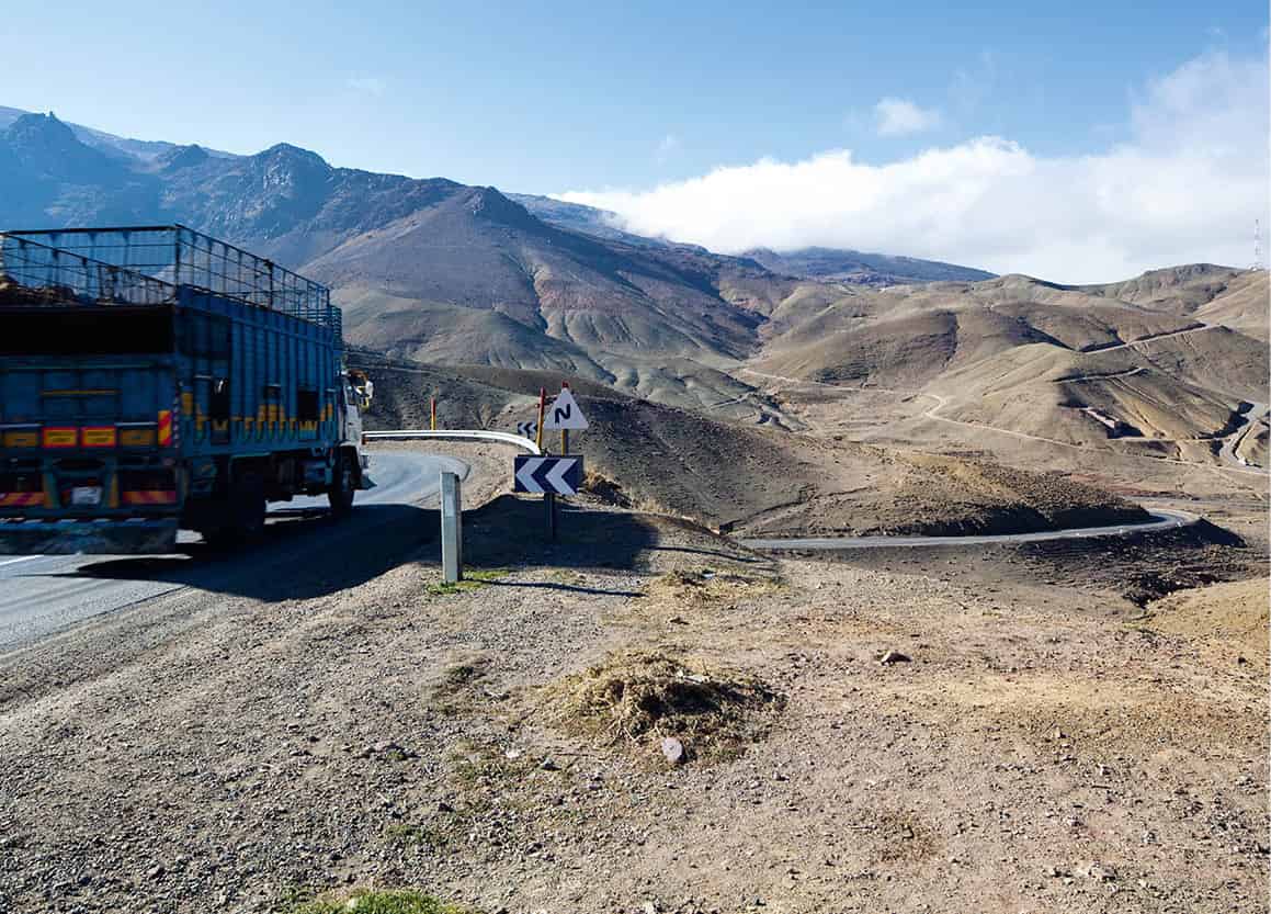
The High Atlas roads are not for the faint-hearted.
Ming Tang-Evans/Apa Publications
Trekking is normally problem-free from early May to Oct, but can be difficult at other times. Mules and porter assistance are essential.
An outdoor centre and guides school has been opened at Tabant ! [map] by the CFAMM (Centre de Formation aux Métiers de la Montagne), while between Tabant and Agouti, the Dar Itranean eco-tourism lodge (tel: 023-45 93 12; www.origins-lodge.com) also organises treks and cultural tours. Out in the mountains, accommodation is provided in gîtes, some of which offer facilities such as hammams, hot showers and electricity powered by generators or solar panels.
The main focus for trekking here is the mighty M’Goun Massif, south of Agouti and Tabant. The stunning landscapes, rich culture, rare wildlife and relative lack of tourists compared with the Toubkal massif are all conspiring to attract increasing numbers of intrepid trekkers and nature-lovers.
Dominating the area is the tremendous barrier ridge of Irhil M’Goun, 20km (12 miles) long and the second-highest peak in the High Atlas at 4,071 metres (3,356ft). Ascents of the mountain remain a formidable test of endurance until sleeping quarters are established. Easy summits to climb include the mammoth whalebacks of Azurki (3,677 metres/12,100ft) and Ouaoulzat (Wawgoulzat) (3,736 metres/12,340ft), which take four or five hours each.
Here are fine expeditions to be made to big limestone synclines such as Tignousti and Rat, and cross-country and river bed journeys of several days to remote Berber villages such as Magdaz. The spectacular sheer-sided gorges of Tessaout and Arous, draining southwest and northwest respectively from M’Goun, invite wetsuited wanderers and rock climbers.
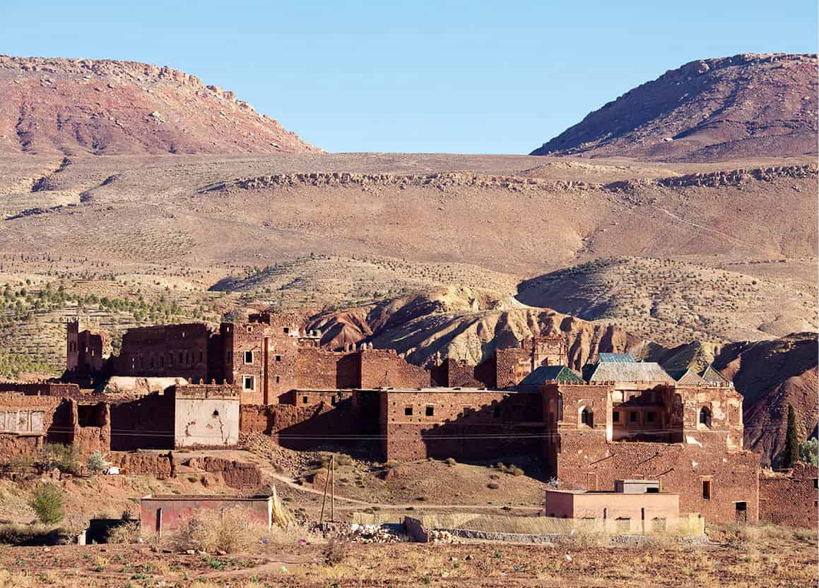
The kasbah at Telouet.
Ming Tang-Evans/Apa Publications
M’Goun Gorge
Striking through the heart of the M’Goun Massif, a dramatic canyon trek leads through the M’Goun (Achabou) Gorge as it winds south from the Central Atlas massif to the Dadès Valley at El Kelâa M’Gouna on the N10. Treks through the gorge take two days, supported by mules and porters and walking from Tabant over the Aït Imi pass to El Mrabtin. The best time to tackle it is June to late July, when assorted plunges and wading shallows are appropriate for bathing suits and gym shoes. There are no technical difficulties, but pack animals unable to follow through the narrower sections are obliged to detour along a dizzy man-made staircase on the canyon wall.
Berbers use the river bottom as a conventional thoroughfare, and you will stumble upon family groups crouching among the boulders, brewing mint tea. The trek is subject to the varying water level and to weather conditions (it can be dangerous in thunderstorms).
To quote the Berber specialist Michael Peyron: ‘Not all of it is hard work; there are moments when the magic of the canyon plays on the mind inducing serenity and reverie.’
Demnate and other approaches
Another way into the High Atlas region is from Demnate (100km/62 miles due east from Marrakech). Tourism here is still in its infancy, although the town’s crumbling mud-brick kasbah and craggy fortifications are impressive, while just outside town is the curious Imi N’Ifri, an impressive natural bridge-cum-archway.
Coming from the south, the valleys off the N10 Dadès road from Ouarzazate to Skoura, El Kelaa and Boumalne du Dadès are harder still, and the preserve of seasoned climbers and walkers accustomed to treeless and waterless wastes. Guiding services can be found at El Kelâa M’Gouna. Getting a lift to Boutaghrar on the River M’Goun cuts out the worst of the walk there.
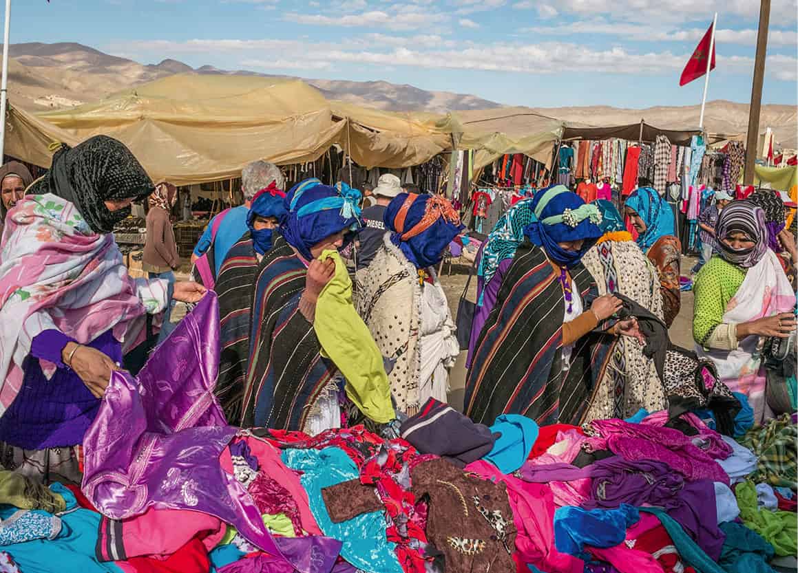
Berber women looking through clothes for sale at the Imilchil Marriage Fair.
Corbis
Wreathed in romantic legend, Imilchil @ [map] village is home to the Aït Haddidou, a tribe of semi-nomadic shepherds originating from Boumalne du Dadès in the 11th century. The village is best known for its famous Marriage Festival (see box), held a few kilometres south of the town. At other times it provides a good, quiet base for exploring the surrounding mountains, with gentle river walks beside turreted buildings or longer strolls on piste tracks across kilometres of pasture between the lakes.
Fact
Many of the names of the villages in the High Atlas are preceded by the Berber word Aït, meaning ‘of the people’.
Imilchil is technically in the High Atlas, although it’s easiest to reach from Kasba Tadla in the Middle Atlas (for more information, click here), driving past the twin lakes of Tislit and Isli.
Wedding Festival
Imilchil is best known for its annual Marriage Fair, held every September. The moussem celebrates the Romeo and Juliet-esque legend of two star-crossed lovers from rival tribes who were forbidden to meet, let alone marry. Heartbroken, they drowned themselves in the nearby lakes of Tislit (the woman) and Isli (the man), which were formed from their tears. The families of both tribes later decided to establish a day every year on which men and women of different tribes could marry each other. Today, the festival draws hundreds of visitors from the area. Men and women dressed in traditional finery go courting from tent to tent while families negotiate dowries. Engagements are made, though actual marriages – contrary to belief – do not happen during the moussem.
Recommended vantage points near Imilchil are Amalou N’Tiffirt (2,470 metres/8,100ft), which takes one hour to climb, and Bab N’Ouayyad (2,804 metres/9,200ft), which takes three hours. Summits here tend to be merely long hikes rather than more challenging ascents. Msedrid (3,077 metres/10,100ft) is probably the most frequented, and takes two days without a four-wheel-drive vehicle.
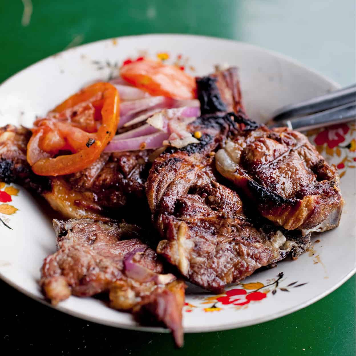
Tasty High Atlas lamb.
Ming Tang-Evans/Apa Publications
Those touring on wheels can leave Imilchil by the scenic road south to Agoudal, one of the highest inhabited villages in Morocco. After some spectacular scenery over the Tizi Tirherouzine pass, the road eventually arrives in Aït Hani, where it continues to Todra. Alternatively there is the more difficult but thrilling road from Agoudal to Msemrir and the Dadès Gorge, crossing the Tizi N’Ouano.
For those wishing to continue eastwards from the site of Imilchil’s moussem there is the faster road to Amouguer and Rich where it joins the N13 between Er Rachidia and Midelt. The latter, spectacularly perched on the edge of a high plain, has hotels and restaurants and is a good stop-off en route to the Tafilalt Valley in the south. It is also an important market for carpets, fossils and minerals (azurite, malachite and aragonite).
Secret canyons
Northwest of Agoudal, towards Anergui, over the vast undulating tableland called Kousser, the terrain is cracked by several precipitous canyons. The spectacular Tiflout is the principal gorge, fed by snaking tributaries of considerable complexity. These gorges and their branches have been used for centuries by the Haddidou Berbers during their migrations. Some of the main branches include the Melloul, a stretch of 20km (12 miles) between Anergui and Imilchil populated by cliff dwellers, along with the Tiflout (35km/22 miles), Wensa (15km/9 miles) and Sloul (15km/9 miles). Approaches and exits add to these distances.
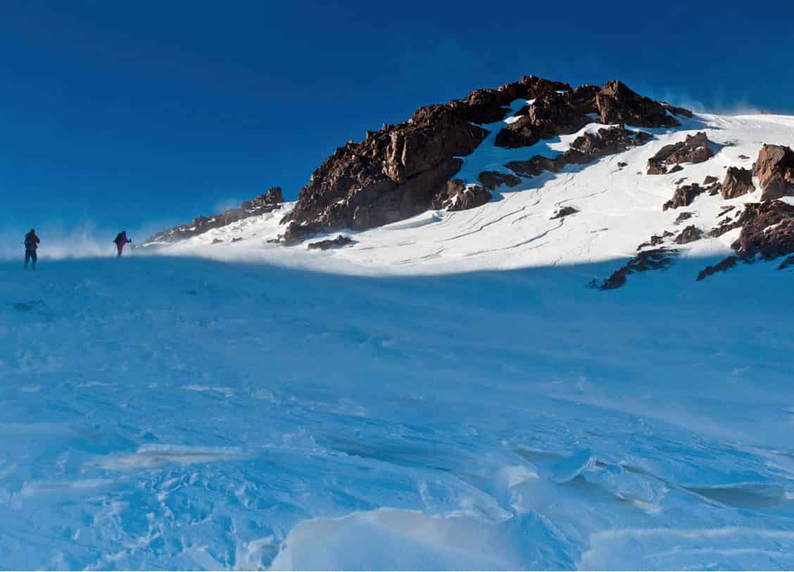
Mountaineers in the High Atlas.
iStock
Potholing, caving and rock climbing techniques, sometimes calling for bold swims in ‘squeezes’ (tunnelled rocks), require special equipment and experience. Wood and rock bridges (passerelles) should be treated with caution.
Jebel Ayyachi
The eastern ranges of the High Atlas culminate with a flourish at the dramatic Jebel Ayyachi (3,750 metres/12,300ft), The Cirque de Jaffar £ [map], named after a local saint, provides a rough but driveable dirt track along the base of the jebel and also serves as the best departure point for an ascent of the mighty Ayachi (3,737 metres/12,300ft) itself. Picturesque rock cataracts, the ravines of the Ijimi Valley and clumps of dwarf conifers combine to make the area a popular picnic spot.
Tip
In addition to the many carpet shops in Midelt, the closest town to Jebel Ayyachi, take a look inside Kasbah Myrien, a carpet workshop run by Franciscan nuns that produces good-quality kilims and Berber blankets.
Snow cover on the mountain is normal until at least June. Most attempts to reach the summit start at dawn from a bivouac at 2,200 metres (7,200ft), about 30 minutes above the road, and a fit party can attain the summit in five to six hours. Seen from the north in full winter robe, 40km (25 miles) long and with a dozen named summits, the mountain is one of the most arresting spectacles in Morocco.
