DIGGING DEEPER 1
HOW DO YOU KNOW WHERE TO DIG?
Let’s begin with one of the questions that I am asked most frequently: “How do you know where to dig?” That’s a great question that bears on some of the essential tools and methods archaeologists employ. In this chapter, we’ll answer that question by discussing archaeological surveying—that is, the process of looking for sites on the ground surface, because some are obvious, but others are not. Surface survey can also help us figure out where to dig at an already-known site.1
First and foremost, though, we need to define what we mean by a site, because they come in all shapes and sizes. For example, the Agora in Athens and huge mounds like Megiddo in Israel—I’ve excavated at both—are clearly ancient sites. But others can be tiny and very hard to find. As Brian M. Fagan and Nadia Durrani point out in their excellent introductory archaeology textbook, a site can be as small as “a tiny scatter of hunter-gatherer artifacts” or as large as the ancient city of Teotihuacán in Mexico; sites are simply “places where traces of past human activity are to be found … normally identified by the presence of artifacts.”2
We should also define what an artifact is—and isn’t. Quite simply, artifacts make up most of the “good stuff,” the stuff that’s worth writing home about from an excavation or a survey—they are things made or altered by human beings. Within this category, we include everything from the earliest stone tools to pottery, weapons, jewelry, clothes, and pretty much everything else portable that humans can make. Some artifacts, however, and things associated with them, can’t be moved. We call these features.3 Something like a ditch is a feature—it’s obviously made by a human, but you can’t move it without losing it. The same goes for doorways, fire pits, stone altars, and the like. Sometimes, though, we also call something a feature when we’re just not quite sure yet what it is, but we know it’s a “something.” Hence the archaeological axiom “One stone is a stone; two stones is a feature; three stones is a wall.”
There are several ways to find sites, but almost all involve conducting what we call archaeological surveys. Within this broad category are ground surveys, aerial surveys, remote sensing, and sample surveys. In all instances, the goal is to find sites that lie within a specific area, like the region around Pylos in southern Greece, where I once was part of a survey project called PRAP (Pylos Regional Archaeological Project), which we will discuss below.4
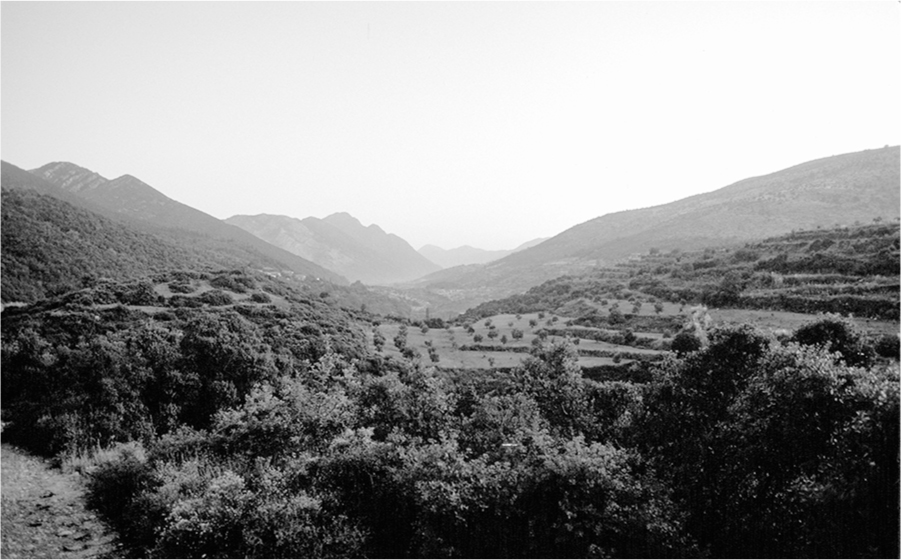
FIG. 1. Pylos (PRAP) survey area (photo by E. H. Cline)
The traditional way to do a ground survey is to have team members physically walk the area in question and see what remains are there. These are frequently called reconnaissance surveys or full-coverage surveys, but they can also be referred to as pedestrian surveys, for obvious reasons. In some areas, however, like regions of the northeastern United States where vegetation masks the ground surface, archaeologists sometimes conduct ground surveys by digging small shovel-test pits every few yards, to see whether there is any evidence of artifacts beneath the ground.5 The density of objects found determines whether these areas can be mapped as a site.
Ground surveys first became popular in the 1960s and 1970s and then gained traction in the 1980s, in part because they are usually a cheaper alternative to digging and can cover larger areas. They also allow archaeologists to ask and answer questions different from those explored at a single site, since they frequently involve multiple sites. For instance, someone may want to investigate how intensively a specific area in Greece was occupied during the Bronze Age and later periods—the Dark Ages, archaic and classical Greece, Roman and Byzantine periods, and the Turkish Ottoman age. Did the settlement pattern change during the later eras? Can the number of sites and their size tell us the relative population of various time periods? Can changes in where people settled tell us about what resources they were using, how dangerous their environment was, what the political situation was like?
Ground surveys can help provide answers for these kinds of questions. By doing surveys and identifying the various sites from different periods in the area, archaeologists can frequently construct a history of the region without ever digging at a single site. Many surveys result in subsequent excavations, though, especially when the archaeologists decide to concentrate on one of the promising new sites that they have just found and get a permit to dig.
Times have changed, and these days we don’t always begin with a ground survey; it sometimes makes more sense to start with aerial surveys, at least in areas where the ancient inhabitants erected buildings or otherwise left remains made from durable materials that might still be discernible. This can be as simple as buying aerial photographs or satellite images from specific companies, or as complicated and expensive as arranging for overhead flights to do an aerial survey of your area.
If you want to buy imagery, which is by far the easiest way to go, there are a few options. One possibility is to purchase declassified military satellite images like the ones taken by the Corona program, a surveillance operation conducted by US intelligence agencies from 1960 to 1972. Images from the program were declassified by an executive order in 1995 and are now used for all sorts of purposes, including finding archaeological sites.6 We can sometimes see sites very clearly even in these older images, either with the naked eye, by enlarging the image on a computer screen, or by looking at it with a magnifying glass.
Older photos like these can be very valuable. Aerial photos for warfare, spying, or general reconnaissance have been taken for more than a century. Some of them are useful in part because they were taken before recent economic development or urban expansion destroyed or damaged archaeological sites. Among the earliest examples are the discoveries of John Bradford, an archaeologist who was serving in the British army during World War II. In 1943, while studying photographs taken by the Royal Air Force for military purposes, he was able to locate more than two thousand Etruscan burial mounds in northern Italy, simply from the differences in color of the grass or soil visible in the pictures.7
Bradford joined forces in 1956 with an Italian engineer from Milan named Carlo Lerici; from 1957 onward, they explored many of the Etruscan tombs that Bradford had first identified on the aerial photographs, boring into the earth at these locations with a small high-speed auger or drill. Initially they inserted a hollow pipe containing a small spy camera and took photographs of the interior of the tombs, but soon they developed what is known as the Lerici periscope, which was specially designed with a powerful light that could fit into the narrow hole that had been drilled. This instrument helped them to quickly look inside the tombs without having to wait for photographic film to be developed, and to identify which tombs had already been looted, either in antiquity or in modern times, and which still contained ancient remains and even frescoes painted on the walls. In this way they were able to investigate several hundred tombs per season without excavating or damaging them in any way.8
In 2017, we created a modern version of the Lerici periscope at our site of Tel Kabri in Israel, using a drill, a colonoscopy camera, and a laptop computer. It worked—we could see the images on the laptop when we inserted the camera into the hole made by the drill—but, unfortunately, we had drilled straight into a large rock buried about three feet below the surface, so there wasn’t too much to see. I remain optimistic that this type of instrument can eventually be used successfully, given the right situation.
There is also the option of getting up-to-the-minute high-resolution contemporary color satellite images from companies like DigitalGlobe, or images that have been taken from the space shuttle. For example, there’s a fairly well-known picture of the ancient city of Angkor in Cambodia that was taken from the space shuttle Endeavor, in which all the buildings that are still standing can be seen very clearly.9
My colleague Sarah Parcak—a National Geographic Explorer and professor at the University of Alabama, who is perhaps better known as the “space archaeologist” and the winner of the $1 million TED Prize in 2016—surveys using satellite images. The images allow her to use all kinds of fancy techniques, like infrared imaging, to illuminate some features and suppress others. Using these techniques, she found several hundred previously undiscovered sites in Egypt, including seventeen lost pyramids as well as the nearly legendary site of Tanis, all of which were “hiding in plain sight,” as she puts it.10
Such new techniques with satellite imagery have enhanced our ability to see things that were previously essentially invisible, including ancient paths crisscrossing a desert. That’s how the lost city of Ubar in Oman was found in 1992. Endeavor had taken a picture of the area, and archaeologists noticed where the ancient paths converged. They subsequently excavated there and found the ancient site.11
Buried walls, earthworks, and other large constructions associated with settlements can often be seen more easily from the air than on the ground, even if one is walking right over them. In a raking light—that is, in the early morning or late afternoon when the sun’s rays come in at an oblique angle—or if an aerial photograph is taken at a slight tilt, shadows cast by buried walls are sometimes visible.
More commonly, aerial photos can illuminate “crop marks.”12 Such crop marks document the location of buried items precisely, whether they are features like ditches or structures like buildings and walls. They do so because those buried items affect the amount of water absorbed by the soil, which in turn affects the color and height of the vegetation that is growing directly above them. (Note that this won’t work if there is something built on top, like a modern parking lot, but it will work in a field where grass, wheat, barley, or thick weeds are growing.)
Thus, for example, if there is a buried ditch below the modern surface, the vegetation growing directly above it will be higher and lusher than the surrounding vegetation, because the soil right there contains more water and nutrients. If there is a buried wall below the modern surface, on the other hand, the vegetation growing directly above it will be lower, less dense, and less lush than the surrounding vegetation, because there are fewer nutrients in the soil at that location.13
These differences in height and density might be almost imperceptible at ground level, but from the air they are immediately obvious at certain times of the year. In England and in Europe, especially in Italy, crop marks that are about three feet wide and run straight as an arrow across the fields often indicate the presence of buried Roman roads. Round ones, like those that John Bradford saw in the Royal Air Force photographs of northern Italy, may indicate the presence of buried tombs.
When I’m on a flight that is landing somewhere in Europe, I frequently look out the window of the airplane as we are descending and try to see whether I can discern any crop marks in the fields surrounding the airport. It’s amazing how many times I’ve seen something that I’d love to go back and excavate, in order to figure out what it was.
Archaeologists have also added LiDAR to their toolkit. It’s most useful in places like Central America or Southeast Asia, because it can penetrate the trees in a jungle or rain forest, by firing lasers at the ground, and provide images of lost temples, buildings, and even cities that are completely overgrown and almost inaccessible now. That’s how the Maya city of Caracol in Belize was discovered in 2010.
Similarly, in June 2016, archaeologists working in Cambodia announced that they had found “previously undocumented medieval cities not far from the ancient temple city of Angkor Wat … that promise to upend key assumptions about south-east Asia’s history.” The cities are between nine hundred and fourteen hundred years old and were found by Australian archaeologist Damian Evans. Evans used LiDAR data captured by an instrument mounted in a helicopter during an aerial survey in 2015 that fully covered 734 square miles. He believes that “the colossal, densely populated cities would have constituted the largest empire on earth at the time of its peak in the 12th century.” Other archaeologists agree with his assessment, asserting that these are the most significant archaeological discoveries in the region in the past century.14

FIG. 2. Using LiDAR at ground level to record the wine jars at Tel Kabri (photo by E. H. Cline)
LiDAR is also useful in areas without tremendous amounts of vegetation; it has been used to map the site of Jezreel in northern Israel and is yet another way to locate Roman roads in England. We’ve used it at ground level at our site at Tel Kabri in Israel to quickly and accurately record the wine cellar that we found in 2013.15
Most recently, archaeologists have added commercial drones to their toolkit as well, flying the drones much as hobbyists fly model airplanes, both to find and document sites and to detect looting. From drones it is possible to take either low- or high-level photos of a region, sometimes sending the results directly to a computer for future manipulation and analysis.16
There are other remote-sensing techniques that are ground based and can help us figure out whether there is something under the ground where we might want to dig. They include electrical resistivity or conductivity, which basically works by running an electric current through the ground between two poles. If there is something like a buried wall in the way, it will interrupt the current; if there isn’t, the current won’t be interrupted. The end result is a rather fuzzy picture of what is below ground, but often it is not clear exactly how far below the surface the ancient remains are, or even whether the images are being interpreted correctly.17
This is where something called “ground truthing” comes in. Ground truthing means double-checking or confirming what has been spotted in the photographs or remote-sensing images to make certain it is real or has been properly interpreted. It frequently involves foot surveys or actual excavation. Thus, at our site of Tel Kabri in northern Israel, electrical conductivity images taken in 2003 indicated that there were probably walls in the area that we were interested in, and so in 2005 we went to ground-truth the area by excavating to see whether the images were accurate. It took us more than two weeks of digging through totally sterile soil (that is, soil with no archaeological remains in it at all) before we came upon the walls and floors belonging to our Canaanite palace, but they were there—fully six feet below the present surface.18

FIG. 3. Doing remote sensing at Megiddo (photo by E. H. Cline)
The same principles work with magnetometers, which measure the magnetic field in areas that are of interest to archaeologists. If there are buildings or ditches or other archaeological features that are buried underground, they may show up on a magnetometer reading, because such features affect the magnetic field in the area.
These techniques all share the same limitations. Although they show anomalies below the surface that stand out from the general soil, it can be difficult to pin down whether the anomalies match certain kinds of subsurface structures. The consistency of soil below the surface can also determine whether the anomalies stand out against it, and the readings don’t always let you know how deep the features are located. Different methods might give results that look different. In each case, excavation is needed to confirm what the remote-sensing device identifies.19
For some or all of these reasons, our attempts to use a magnetometer at Tel Kabri in Israel didn’t produce good results, most likely because of the nature of the soil at the site. On the other hand, at David Schloen’s excavations at Zincirli in Turkey, a magnetometer survey worked so well that the results looked like a photograph of excavated ruins, despite the fact that it had been done before the excavation while the ruins were still buried. The excavators at Troy tried several types of magnetometers before they finally found one kind—a cesium magnetometer—that yielded results. They were then able to map an entire lower town at Troy, buried under the agricultural fields around the mound. Teams had been excavating the mound since the days of Heinrich Schliemann in the late 1800s, but nobody had thought to excavate in the fields next to it, because it looked as though nothing was there. But there was.
Another common remote-sensing technique is ground-penetrating radar, which works exactly as its name suggests, by having radar signals bounce back up from buried objects.20 The newest versions of this technique are extremely powerful and can “see” down nearly four meters (about thirteen feet). This has resulted in some incredible discoveries from the area of Stonehenge in England in 2014 and 2015, including the fact that Stonehenge was apparently once a complete circle.21
Here, using ground-penetrating radar, as well as magnetometers and other remote-sensing techniques, archaeologists have been involved in something called the Stonehenge Hidden Landscapes Project. According to media reports, in just a few years of work they have detected Bronze Age burial mounds, Iron Age shrines, and enclosures for cows and other livestock that date to either the Bronze Age or the Iron Age, none of which had ever been noticed before.22
Most exciting were the reports in September 2014 that they had also found another monument of standing stones at Durrington Walls, less than two miles from Stonehenge, which probably dates to about the same time—that is, forty-five hundred years ago. Apparently dwarfing Stonehenge in size and therefore dubbed Superhenge, it was thought to be a C-shaped enclosure comprising more than fifty—and perhaps as many as ninety—giant stones, each about ten to fifteen feet long and five feet in diameter. None were visible: they appeared to have been deliberately buried horizontally about three feet below the surface, which is why they hadn’t been spotted before. It was only through remote-sensing techniques that they were first detected and reported.23
Two years later, however, in 2016, additional reports in the media noted that trial excavations had been conducted in the interim, in order to ground-truth the remote-sensing images by digging to reveal two of the huge stones. What the archaeologists found instead surprised them—no giant stones, but rather two enormous pits that may once have held huge timber posts. The posts are no longer present, for they had been removed at some point—if they were ever there—and the pits filled in with chalk rubble. The remote-sensing instruments had registered the rubble as solid rock, giving rise to the original reports of “giant stones” instead of the debris-filled pits that they actually were. Some media reports are now calling Superhenge a timber circle complex five hundred meters in diameter, but they note that it was never completed.24 Whether that is correct remains to be seen, but the sequence of events has become a cautionary tale: we should wait until the archaeologists have completed their work and published their findings in a peer-reviewed journal before we make further assumptions and construct new hypotheses.
Although big advances have been made in remote sensing in the past couple of decades, sometimes satellite imagery and other high-tech solutions don’t help at all in a search for sites. In those cases, archaeologists must resort to the tried-and-true methods of finding archaeological sites on foot. Sometimes this is as simple as taking advantage of the natural erosion that has occurred and keeping a sharp eye out while walking through potential areas.
Other times, it might be a better idea to conduct an organized ground survey, in which sites, structures, features, and artifacts can be seen directly on the ground. These techniques go back to the origins of survey archaeology and were made more systematic in the 1960s and 1970s. We used these methods on the two archaeological surveys in Greece that I participated in, as well as a survey in Israel, so I can attest to exactly what’s involved in doing a site survey in one of these areas. Such surveys are conducted throughout the world, limited only by visibility of materials on the ground and by permission of the landowners.
There are two types of ground surveys that are used in certain areas of the world. As has been mentioned, one type is conducted on a large scale and is intended to cover large areas quickly; this is the reconnaissance or full-coverage survey. The goal of these surveys is to create a map showing the location of possible ancient sites in a large landscape. The other type is an intensive survey that usually involves the examination of a single site or a small area that was initially discovered during the larger survey and flagged as being particularly promising.25 In this case, the goal is to identify as much as possible about the specifics of the location—its extent, age, cultural affiliation, and range of material objects—often as a prelude to excavation. The archaeologists will do a very detailed investigation of the site or a small area that may involve picking up and bringing back to the camp every single artifact that they find there.
Archaeologists working in an area where no comprehensive map exists of ancient sites from different time periods will start with a general reconnaissance survey. If done systematically and on foot, by having the team members painstakingly walk over every square meter of the area, it is called a full-coverage survey.26 This is what we did in the region of Boeotia near the city of Thebes in Greece back in the early 1980s, when I was a member of the CABBAGE (Cambridge and Bradford Boeotian Archaeological and Geographical Expedition) survey project, and again near the Mycenaean palace of Pylos in the early 1990s when I was on the PRAP survey.
At Pylos, we were split into three teams of about six people each. I was in charge of Team A, which we promptly renamed the “A-Team.” At first, we were assigned to survey the mountain heights on one side of the valley, despite my protestations that I was afraid of heights. Sure enough, on the very first day, as we began our survey, I froze and had to be manhandled back to the car from one sheer drop. It was hardly an auspicious start for the team or the team leader. Later we were able to move lower; I had no problems from then on, but I learned a valuable lesson that I still draw on to this day—listen to your team members, especially if they tell you about a phobia that might affect their performance.
Once we started to get into the swing of things, we got our routine down. First, we would find our location on a contemporary map, usually a readily discernible element such as a road. This is much easier today with GPS systems. We would then spread out, about 30 feet (9 meters) apart from each other, so that we covered a total of about 180 feet (55 meters, give or take). When I shouted or blew a whistle, each person would start walking forward in the designated direction and walk in a straight line to a specific predetermined point, usually another road or a boundary wall that was also marked on the map. This meant walking in increments of about the length of a US football field—about a hundred yards or meters—because more than that became complicated.
This is what is known in archaeological surveying terms as “walking a transect.” And when I say walking in a straight line, I mean quite literally walking in a straight line, regardless of whether that meant fording a stream, rappelling or falling down a small cliff, facing down a bull, or interacting with a local shotgun-toting farmer who didn’t want us on his land. All those things happened, either to me or to other people on our team, but what was much more frequent was ripping our legs to shreds, even through our pants, because we had to walk right through the underbrush, which in Greece is known as the macchi. That stuff can be nasty.
While we walked, we scoured the ground, looking for pottery sherds, stone tools and flakes, ancient walls, or anything else that might have marked the remains of an ancient settlement. By the way, it’s always easy to identify people who have just spent several weeks on an archaeological survey, because they’re the ones who spot the pennies and other loose change on the street when they get back to civilization.
Each team member carries a clicker, and they click once every time they see a pottery sherd, a worked piece of stone, or another type of artifact. Three pieces of pottery get three clicks, five pieces get five, and so on. At the end of every ten steps or so, team members write down the number that is on their clicker, which is the number of artifacts they saw during that small section, reset it to zero, and start walking and counting again. By the time they have reached the end point of the transect, they have a record of the number of the artifacts that they saw during each stage of the hundred-yard walk.

FIG. 4. Beginning a survey transect at PRAP (photo by E. H. Cline)
Why is that important? Durable items like pottery, stone, and metal, from archaeological structures below the ground, commonly appear on the surface, brought there by farming, erosion, rodents, irrigation ditches, pits, and a host of other natural and human processes. When walking across a site that was inhabited in Bronze Age, Iron Age, Roman, and Byzantine times, you will see potsherds and stone tools from all those periods simply lying on the ground. If the numbers are recorded via a clicker, they will increase astronomically as you enter the boundaries of the site. After you cross the boundary of the site on the other side, the numbers will decrease again.
A team member’s clicker tallies, recording the number of pieces of pottery and worked stone seen every ten paces or so, will be something like this: 1, 5, 25, 107, 510, 423, 298, 152, 87, 0. And the numbers for the people immediately adjacent to the team member, on either side, will probably be similar, because they are likely to have walked across that same site. Those further out, however, if their transect did not cross the site, will have a normal “background scatter” of artifact counts—for example, 1, 6, 4, 12, 0, 5, 3, 8, 5, 0.
The team members give their numbers to the team leader, who records them in a notebook and marks the probable site on the map, so that the follow-up team can find it again and examine it more thoroughly. And then the team members spread out again to cover the next section. Again they march a predetermined distance, clicking as they go, repeating the process again and again, until they reach the end of the designated area. They then swing around, spread out once again, and return the way that they came, covering the next segment in the transect, and repeating the process over and over. In this way, the team can traverse and record all of the sites in a square mile or kilometer, or whatever they choose, each day, until the whole region has been covered.
Back at camp, the results of each day’s survey are recorded, and from these results a map of potential sites is developed. The most promising of the new possible sites then receive a visit from a team of experienced surveyors, who are tasked with doing an intensive survey of the newly discovered area. The surveyors record the surface finds more carefully and collect representative objects from the site to document it for future researchers. In our case, the objects consisted mostly of pottery sherds whose size, location on a pot (rims, bases, or handles), manufacture techniques, or decoration helped the pottery experts on the team figure out what periods they came from.
Those are the survey methods that we used near Pylos in the 1990s and in Boeotia in the 1980s—and the same methods are often employed today elsewhere in the world. But if the ground is covered with a thick coating of leaves, as in thickly forested areas, or if natural processes have covered the ancient landscape with more recent soil, or if the ancient people did not construct large structures of durable material, which is the case in the northeastern United States, then survey techniques will differ. Places where objects were made from wood, fiber, or other perishable materials also don’t work for this kind of survey. Thus, although pedestrian surveys are widely employed in the eastern United States along river floodplains where farmers have been plowing the fields, they are not used in heavily wooded areas.
Furthermore, when the region is too large for a full-coverage survey, there are techniques to cover only specific portions, or randomly chosen portions, of an area. In such cases, called sample surveys, the areas to explore are often derived from sampling techniques used in statistics.27
There is also one other type of ground survey to mention. This is a targeted type of survey, which involves only revisiting sites that have previously been discovered. It is the type of survey that we did in the area around Tel Kabri in northern Israel during 2006 and 2007. We had already done some preliminary digging at the site in 2005 and had determined that we wanted to start a long-term multiseason excavation. First, though, we wanted to understand its context—what did the area around Tel Kabri look like before, during, and after its heyday in the Middle Bronze Age, almost four thousand years ago?

FIG. 5. Surveying in the Western Galilee (photo by E. H. Cline)
Fortunately, it was easy for us to do such a targeted survey of known sites because the Western Galilee, where Kabri is located, has been investigated previously by several teams of archaeologists doing full-coverage surveys in almost every season and under almost every condition imaginable during the past thirty years or more. We already had maps of the area, with all the known Middle Bronze Age sites marked on them. We also had access to the pottery and other artifacts that had been collected and stored by the previous teams of archaeologists.
Maps and survey reports in hand, we drove to these known sites and simply did an intensive survey of each site around Tel Kabri and its hinterland. Our goal was to confirm and refine the dates previously assigned to the sites. We also wanted to recheck how large (or small) each site was. In the end, we were able to produce a map showing the sites that were inhabited in the area just before, during, and after the time that Kabri had flourished as a major center almost four thousand years ago.28
And so the answer to the question posed at the beginning of this chapter, “How do you know where to dig?” boils down to one word—surveying—because once an area has been surveyed, it’s pretty easy to decide where you want to dig. As to how one actually digs, that’s a whole different story, which we will discuss in the next chapter.