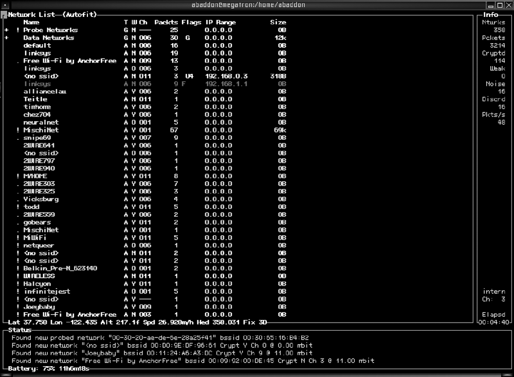
The goal of any wardriving expedition is to collect data on wireless networks within a given area; but a list of wireless networks, no matter how detailed, is not very useful if you cannot ever find that network again. That is why most wardriving tools support some form of GPS tracking to let you associate a discovered network with its physical location. Kismet acquires its GPS support from gpsdrive using gpsd. Once you have gpsd installed, you need to enable the GPS features in Kismet. To enable GPS support, edit your kismet.conf and look for the following line:
gps=false
You need to change this to read:
gps=true
Once that is set, start gpsd and then run Kismet; it should now display GPS coordinates on the main screen, and it can output .gps files containing location information for each discovered network.
Kismet comes with a tool called gpsmap that can take the .gps output files and overlay their data on a variety of maps. Here is an example of how to use gpsmap:
% gpsmap -o output.jpg -S 2 -b -r -p -k Kismet-Jul-24-2006-6.gpsThis takes in the GPS data from Kismet-Jul-24-2006-6.gps and outputs a map with our data overlays onto it.
Kismet offers a feature to help you track down a hard-to-find network. By selecting a network from the network list screen and pressing F, you enter the follow center mode. In this mode, Kismet uses GPS information to give you a bearing toward the network. See Figure 5-4.
