SOUTH KING
COUNTY
Renton, Kent, and Des Moines
74 Gene Coulon Memorial Beach Park
75 Cedar River Trail (Northwest Section)
78 Green River Natural Resources Area
79 Spring Lake and Lake Desire Park
80 Cedar River Trail (Southeast Section)
73 SEAHURST PARK
Burien, 4 miles north of Des Moines
182 acres of forest trails and Puget Sound beach provide saltwater exploration and views of the Olympic Mountains.
| TRAIL | 2 miles; natural surface, paved |
| STEEPNESS | Level to steep |
| OTHER USES | Pedestrians only |
| DOGS | On leash |
| CONNECTING TRAILS | None |
| PARK AMENITIES | Restrooms, playground, Environmental Science Center (ESC), picnic shelters |
| DISABLED ACCESS | Paved trail, restrooms, picnic shelters, ESC |


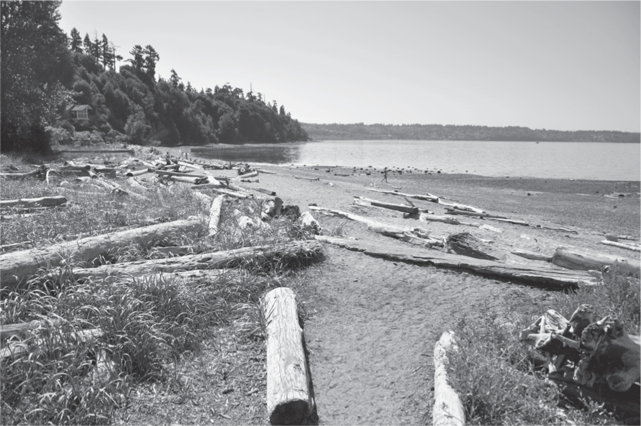
A rugged ravine and a mature forest of big-leaf maples and conifers welcome you to this park by the Sound. Forest trails lace the steep fern-strewn hillsides under moss-draped trees. The beach, at high or low tide, feels wild and open. Views extend west to Vashon Island and the Olympics. Bald eagles may soar above the water, where loons and grebes dive for fish.
Just minutes west of Seattle-Tacoma International Airport, this park is a microcosm of Puget Sound forest and tidal habitat. At low tide, the gently sloping beach invites exploration. Although the Seahurst beach has no rock-lined tide pools, small puddles preserve gallons of the last high tide, and in them often lounge colorful kelp crabs and red rock crabs. Also common are the smaller beach crabs (about 1.5 inches across the body), and the greenish hairy beach crab and its purplish companion. Drift logs make a natural playground for children.
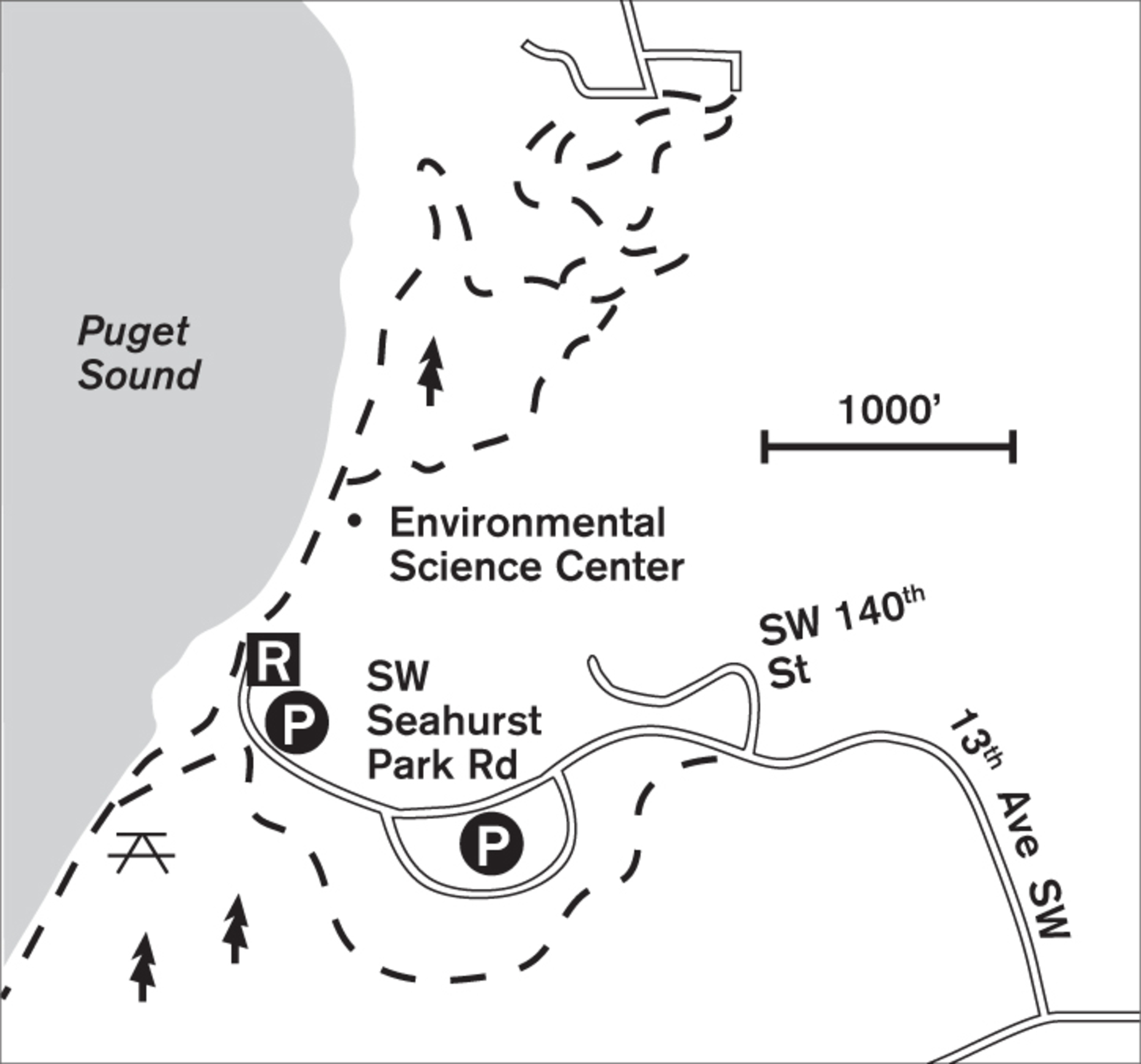
If the tide is high, or if you prefer dry feet, you can stroll the gravel trail above the beach for almost a mile each way. The old seawall was removed in 2013 and 2014 to allow a natural beach to re-form. The beach and steep forest trails in the north of the park are well maintained. To the south of the parking lot, the forest trails are primitive and not maintained, but according to park rangers, it’s a challenge to get lost: all trails lead to the park boundaries, to the parking lot, or back down to the beach.
ADDRESS: 1600 SW Seahurst Park Road, Burien
GETTING THERE: From I-5 northbound, take exit 154 (WA 518 W/Burien). From southbound, take exit 154B. Go west on WA 518 for 3 miles, where it changes names in Burien to SW 148th Street. Continue 0.7 miles, turn right on Ambaum Boulevard SW, go a few blocks, and turn left onto SW 144th Street. Go 3 blocks and turn right on 13th Avenue SW (signposted for the park), which becomes SW 140th Street and winds down to the park on Seahurst Park Road.
CONTACT: Burien Parks, (206) 988-3700, www.burienwa.gov. For volunteer information, visit www.seahurstpark.org.



74 GENE COULON MEMORIAL BEACH PARK
Renton, 7 miles north of Kent
The trail and facilities on this cozy 57-acre corner of Lake Washington attract bird-watchers, beachgoers, and boaters.
| TRAIL | 1.5 miles one way; paved |
| STEEPNESS | Level |
| OTHER USES | Pedestrians only |
| DOGS | Not allowed |
| CONNECTING TRAILS | None |
| PARK AMENITIES | Restrooms, playground, picnic shelters, interpretive trail, swimming beach, cafés, tennis courts |
| DISABLED ACCESS | Trail, restrooms, buildings |


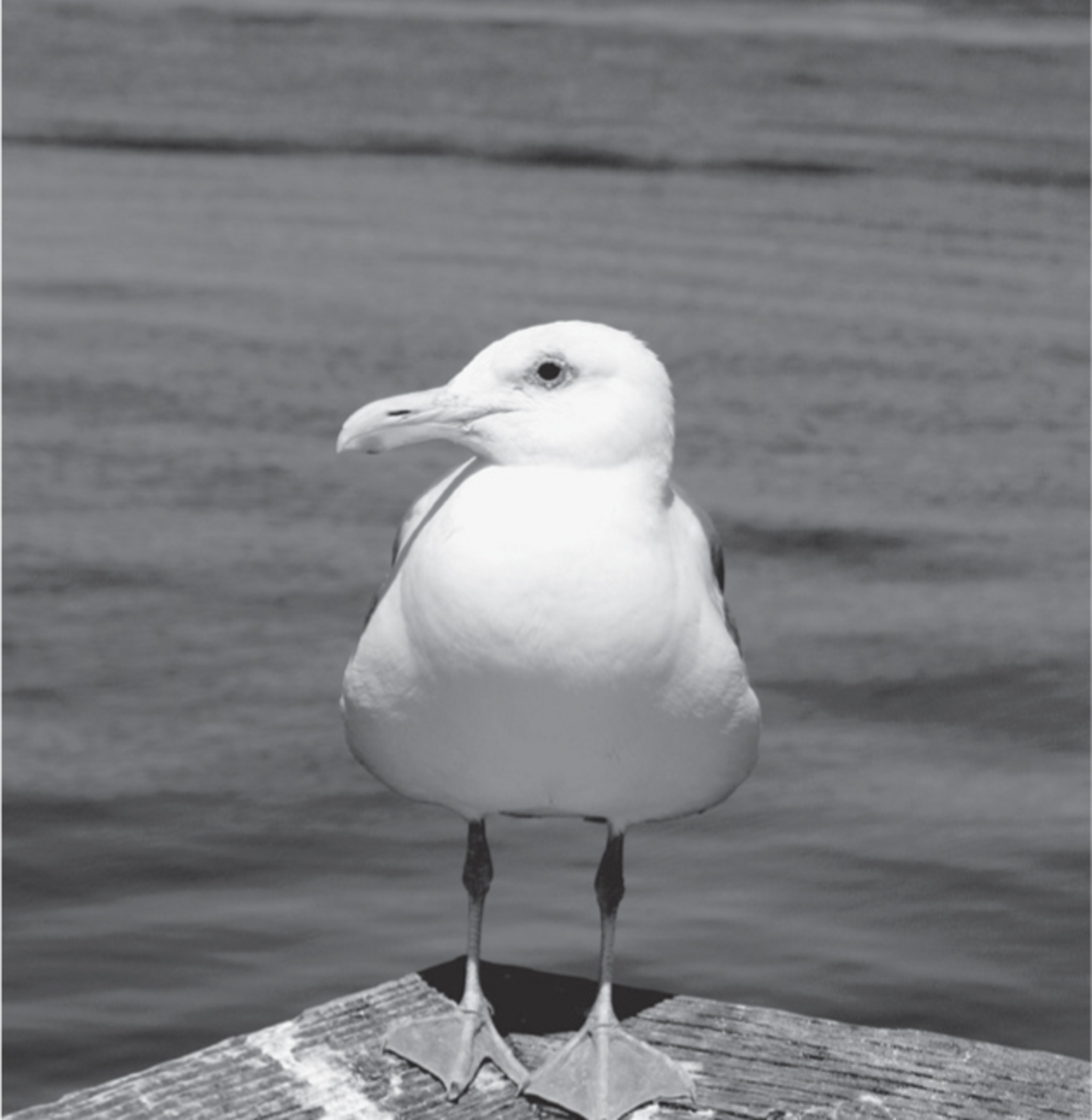
Hundreds of coots, their white bills poking the grass for food, waddle awkwardly over the lawn. On the water, dozens of mallards, Canada geese, and gulls cavort and swim. Lining the log booms like sentries, the gulls declare their territory with raucous calls.
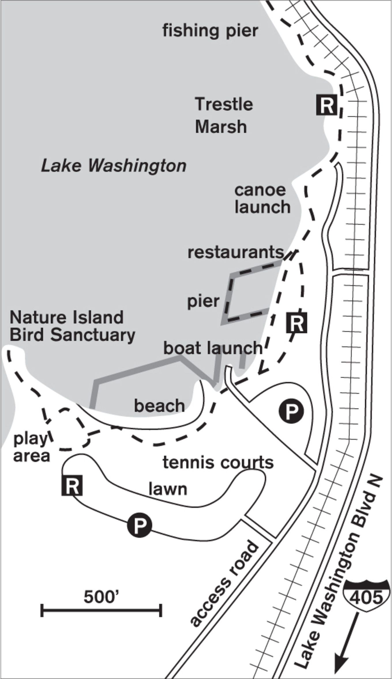
Gene Coulon is a long sliver of a park—in places, less than 100 feet wide—sandwiched between Lake Washington and the Burlington Northern Santa Fe Railway. Yet it’s so carefully designed that its broad, level shore walk, equipped with interpretive signs and landscaped with native plants, attracts walkers year-round. In summer you share it with boisterous children and quiet sun worshippers; in fall, winter, and spring you share it with waterfowl and fellow walkers.

Though the park is most heavily used in summer for its beach and boat launch, the lakeside walk has unexpected beauty in winter. Grasses are tawny yellow against the dark blue of the lake, and among the bare-stemmed bushes hang winter’s boldest ornaments: white snowberries and red rose hips. As the trail traces the contours of the lake, it crosses marshes and miniature gardens of native plantings. Before the restaurants arrived, the old pilings in Trestle Marsh marked the former railroad, cedar mill, and log-dumping site. In spring on Nature Island Bird Sanctuary, you may see nesting mallards and Canada geese. In any season, you can add distance to your stroll by exploring the boardwalks that surround the floating picnic area.
ADDRESS: 1201 Lake Washington Boulevard N, Renton
GETTING THERE: From I-405, take exit 5 (WA 900/Issaquah, Sunset Boulevard). Go west under the freeway on NE Park Drive. Cross the railroad tracks and take a hard right at the light onto Lake Washington Boulevard N. The southern park entrance is on the left in a few hundred yards. Other parking is available if you continue north on Lake Washington Boulevard N.
CONTACT: Renton Parks Division, (425) 430-6600, www.rentonwa.gov

75 CEDAR RIVER TRAIL (NORTHWEST SECTION)
Renton, 6 miles north of Kent, to Jones Road bridge, 5 miles east of Renton
A salmon-spawning river leads from Lake Washington alongside artwork, parks, and forest.
| TRAIL | 8 miles one way; paved |
| STEEPNESS | Level |
| OTHER USES | Bicycles |
| DOGS | Off-leash area, otherwise on leash |
| CONNECTING TRAILS | Cedar River Trail (Southeast Section) (Walk #80) |
| PARK AMENITIES | Restrooms, picnic areas at parks |
| DISABLED ACCESS | Paved trail, restrooms, picnic areas |


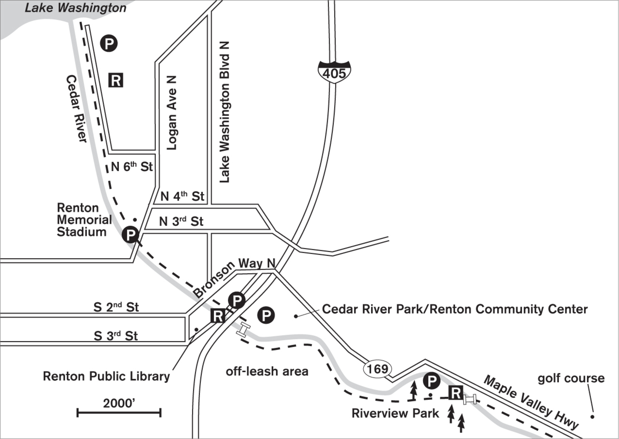
To experience one of the best examples of urban greenery by a river’s edge, begin at Lake Washington at the mouth of the Cedar River and walk south through a manicured park. After crossing under I-405, the trail changes to a more natural, forested setting.
So close is the clear, shallow Cedar River that when it rises only a foot at flood time, water covers the walkway. (Call the city for conditions after heavy rains.) At the Downtown Renton Library, which spans the river, continue south, past sculptures and through Liberty Park. Street crossings take you under the I-405 trestle to the Renton Community Center and another trailhead in Cedar River Park, where there is a fenced off-leash area.
Access to this section begins with a pedestrian bridge across the Cedar River. From here the trail, still well paved, traverses fields and enters a cool second-growth forest. Visible through a veil of cottonwoods and alder, the Cedar River parallels the path. In summer, swallows swoop for insects over the water, and year-round, birds forage and sing in the maple and hemlock hillside to the south. In fall you may see the spawning salmon making their way upstream. The trail closely parallels the highway, becoming more a bicycler’s than a walker’s trail. Those with a yen for a long walk can carry on the full 12 miles to Maple Valley.
ADDRESS: Northern end: 1060 N Nishiwaki Lane, Renton Renton Community Center: 1715 SE Maple Valley Highway, Renton
GETTING THERE: Northern end: From I-405 northbound, take exit 2 (WA 167/Rainier Avenue S). Stay left to get onto Rainier Avenue S. Continue 0.4 miles. Turn right onto Airport Way, which becomes Logan Avenue N. Go 0.4 miles and turn left onto N 6th Street. In 0.2 miles turn right onto Nishiwaki Lane to reach the trailhead parking.
From I-405 southbound, take exit 5 (WA 900 E/Park Avenue N) and turn right onto Park Avenue, which becomes Logan Avenue. Go 0.6 miles. Turn right onto N 6th Street and proceed as above.
Renton Community Center: From I-405, take exit 4 (WA 169 S) and follow signs for Maple Valley Highway (WA 169). Take the first right into Cedar River Park. The trail is behind the community center.
CONTACT: Renton Parks Division, (206) 430-6600, www.rentonwa.gov. To volunteer, contact Friends of the Cedar River Watershed: fcrw.wordpress.com.

76 DUWAMISH–GREEN RIVER TRAIL
Tukwila, 4 miles north of Kent, to Kent
An open riverside trail wanders through varied habitat and offers Cascade Range views.
| TRAIL | 13.5 miles one way (with breaks and unconnected sections); paved |
| STEEPNESS | Level |
| OTHER USES | Bicycles along some stretches |
| DOGS | On leash |
| CONNECTING TRAILS | Starfire Sports complex, Interurban Trail to the south |
| PARK AMENITIES | Restrooms, art, picnic shelters, playgrounds |
| DISABLED ACCESS | Trail, restrooms at Bicentennial Park, Briscoe Park, and Van Doren’s Landing Park |


A slice of peace between light industry, shopping malls, and freeways, the Duwamish–Green River Trail teases with reminders of a less industrialized time in the Tukwila and Kent region.
The best starting point is either toward the north end at Bicentennial Park in Tukwila or toward the south end at Van Doren’s Landing Park in Kent.
From Bicentennial Park the trail goes 0.5 miles north along the river, crosses under I-405, and goes into the 54-acre Starfire Sports complex (which includes Fort Dent Park). For the next mile, it skirts the landscaped edge of the park and crosses an old-style trestle footbridge that marks the confluence of the (now mainly dry) Black River and the Green River. The trail follows the Green River north another 3 miles.
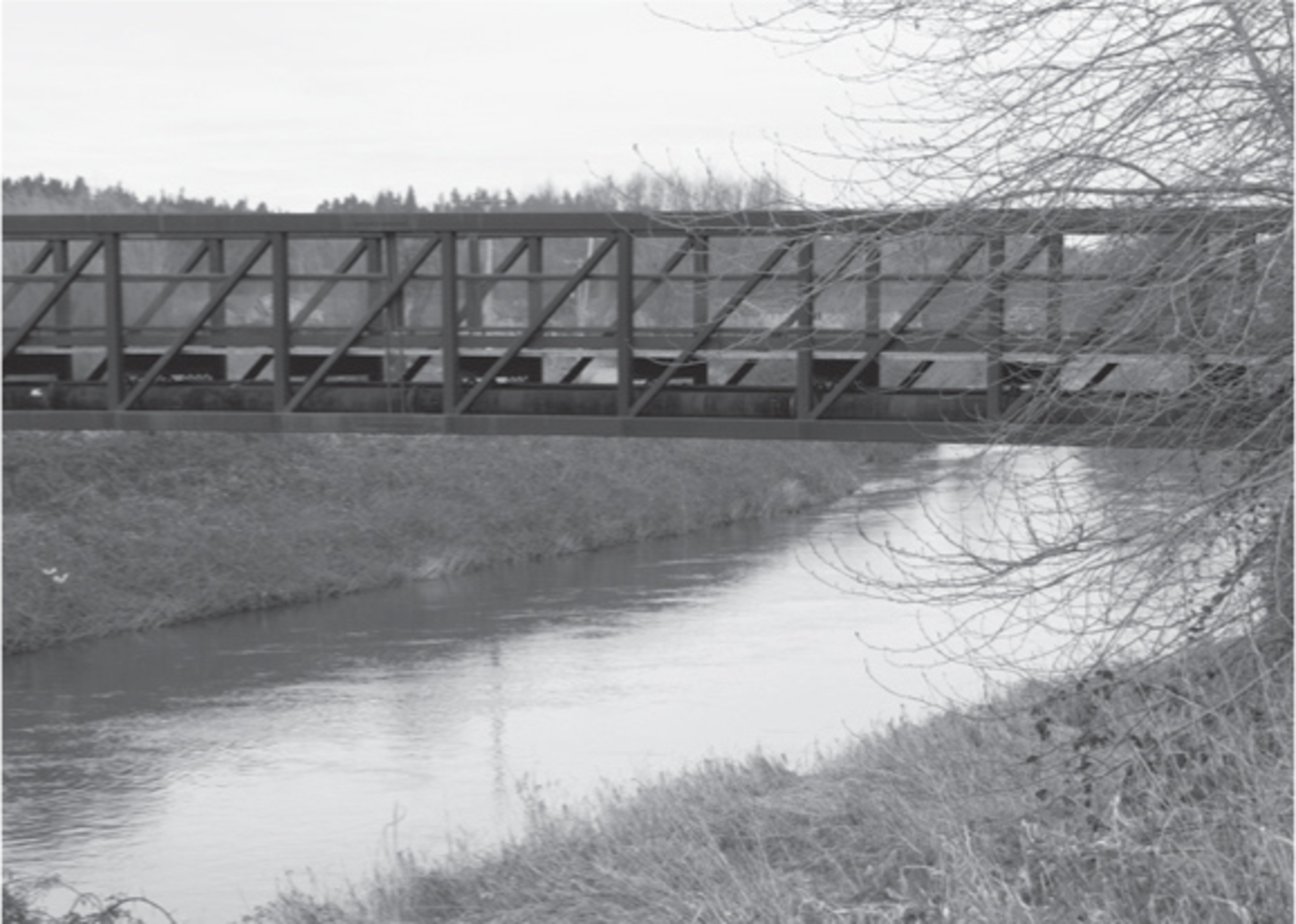

Heading south from Bicentennial Park, the trail hugs the riverbank. Where the river makes a sharp U-curve at S 180th Street, a lovely footbridge spans it, offering walks on either side. (If you don’t cross, the trail soon peters out into industry.) On the south side, a left turn takes you to a trailhead on West Valley Road S; a right turn takes you south into Kent and, in about a mile or so, to Briscoe Park at S 190th Street. Here you’ll find park amenities, including disabled access and a launch for hand-carried boats.
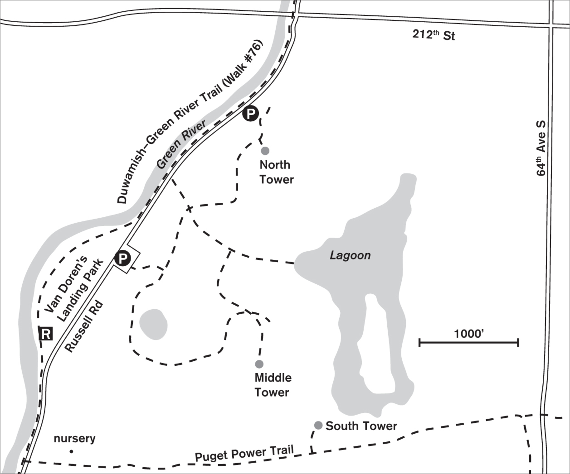
If you start at Van Doren’s Landing Park and walk south, you can make a side trip east on the Puget Power Trail into the Green River Natural Resources Area (Walk #78), 300 acres of wetland and bird-watching at its best. South from Van Doren’s Landing Park, a short walk on Russell Road brings you to another peaceful stretch starting at Russell Woods Park, until you reach the junction with the Interurban Trail near S 259th Street.
Fall and early winter visitors can enjoy the thrill of watching hundreds of salmon swim the river to their spawning grounds. Contact the Washington Department of Fish & Wildlife for more information.
ADDRESS: Bicentennial Park: 6000 Christiansen Road, Tukwila; Van Doren’s Landing Park: 21861 Russell Road, Kent
GETTING THERE: Bicentennial Park: From I-405, take exit 1 (WA 181 S/W Valley Highway). Go south on W Valley Highway for 0.4 miles. Turn right on Strander Boulevard. Cross the river and turn right into the park.
Van Doren’s Landing Park: Follow the directions above to W Valley Highway. Continue south on W Valley Highway, which becomes 68th Avenue S. Turn right on S 212th Street. Go 1.25 miles. Turn left on Russell Road. Go 0.5 miles; the park is on the right.
CONTACT: Tukwila Parks and Recreation Department, (206) 433-1800, www.tukwilawa.gov/residents/parks-recreation; Kent Parks, Recreation, and Community Services Department, (253) 856-5100, www.kentwa.gov/parksandrecreation


77 DES MOINES CREEK TRAIL
SeaTac, 2 miles north of Des Moines, to Des Moines, 1 mile north of downtown
A gentle trail through 96 acres of woodland along Des Moines Creek joins with 60 acres of beach park.
| TRAIL | 2 miles one way; natural surface, paved |
| STEEPNESS | Gentle |
| OTHER USES | Bicycles |
| DOGS | On leash |
| CONNECTING TRAILS | None |
| PARK AMENITIES | Restrooms, fishing pier, historical information, picnic area, playground at Des Moines Beach Park; none in northern end |
| DISABLED ACCESS | Paved trail, restrooms at marina |


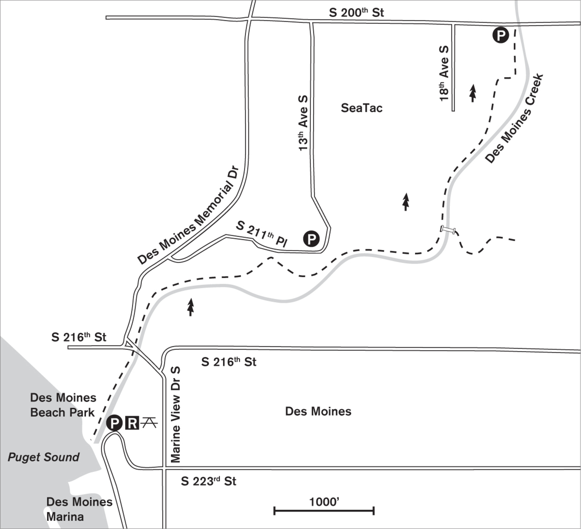
In a deep green cleft in the suburbs south of Seattle-Tacoma International Airport, Des Moines Creek Trail follows the bubbling, salmon-spawning stream toward Puget Sound. Fully paved all the way to Des Moines Beach Park, this forested trail can be walked either downstream or upstream, the grade fairly gentle either way.
From SeaTac the trail leads south between buttresses of blackberries, appearing to be nothing more than a paved right-of-way for the city utility cars. But as it rounds a corner and begins to slope gently downward, the berries give way to ferns, and the alders disappear under the overhanging canopy of big-leaf maples and Douglas firs. After about 0.25 miles of walking, the sound of churning water can be heard along with calls of forest birds. And then the stream appears, deep in its own ravine, clear and inviting as it flows over native rocks. Nature is reclaiming the area cleared of houses years ago in anticipation of airport runway expansion.
The paved trail means good walking year-round, but for those venturing off the pavement, the many steep dirt paths on the high hillside to the west become impassable in wet weather. No problem, though, for the mountain bikers who careen along the dirt trails in all weather, keen on sliding, jumping, and climbing the convoluted maze of byways. Fortunately, the paved trail by the creek has a center line so that bicycle and foot traffic is fairly orderly. Side trails over the creek and up the hillside lead to bordering neighborhoods.
Closely hugging the creek near the fenced-off wastewater treatment facility, the trail dives back into the forest and descends gently, passing under Marine View Drive until it reaches the historical buildings and open lawn of Des Moines Beach Park. Here you leave the scent of wet forest and inhale the rich heady scent of seawater. If the tide is out, there are acres of beach to explore and wading birds to watch. Surf scoters, goldeneyes, and grebes dabble, paddle, and muck about in the food-rich estuarine soup. Gulls call, cheer, and squabble over clams as the creek makes its last burbling yards to the sea.
ADDRESS: Northern end: 2151 S 200th Street, SeaTac; Beach end: 22030 Cliff Avenue S, Des Moines
GETTING THERE: Northern end: From I-5, take exit 151 (S 200th Street/Military Road). Go west on 200th Street until the road dips sharply. Find trailhead parking on the left.
Beach end: From I-5, take exit 149 (WA 516 W/Kent). Go west on Kent–Des Moines Road for 2 miles, and merge right into Marine View Drive S. Go about 5 blocks and turn left on S 223rd Street. This drops down the hill and becomes Cliff Street, which enters the park.
CONTACT: SeaTac Parks and Recreation Department, (206) 973-4780, www.ci.seatac.wa.us; Des Moines Parks, Recreation, and Senior Services Department, (206) 870-6527, www.desmoineswa.gov

78 GREEN RIVER NATURAL RESOURCES AREA
4 miles northwest of downtown Kent; 7 miles south of Renton
Watch for wildlife from a viewing tower in this 300-acre restored refuge and open space.
| TRAIL | 1.3 miles; gravel |
| STEEPNESS | Level |
| OTHER USES | Pedestrians only |
| DOGS | Not allowed |
| CONNECTING TRAILS | Kent Puget Power Trail along southern boundary, Duwamish–Green River Trail (Walk #76) |
| PARK AMENITIES | Parking, viewing platforms; picnic area at adjoining Van Doren’s Landing Park |
| DISABLED ACCESS | Wheelchair-friendly gravel trail |


Let the welcome sun warm you as you stroll this open space and restored wetlands in western Kent. Listen for the sound of wind in the tall grasses and the call of red-winged blackbirds in the reeds, and keep an eye out for evidence of coyotes—fur-filled scat on the pathways. On clear days Mount Rainier forms a dramatic backdrop to the southeast.
Previously a wastewater lagoon system with storm-water detention ponds, the Green River Natural Resources Area (also known as Kent Ponds) has undergone a face-lift with the addition of thousands of young native shrubs, tree plantings, and wheelchair-friendly paths. The wetlands and surrounding meadows are a natural breeding, brooding, and feeding site for more than 160 bird species, and are home to more than fifty mammal species, including river otter, beaver, coyote, and deer. At 300 acres, this is one of the largest man-made wildlife refuges in the United States.
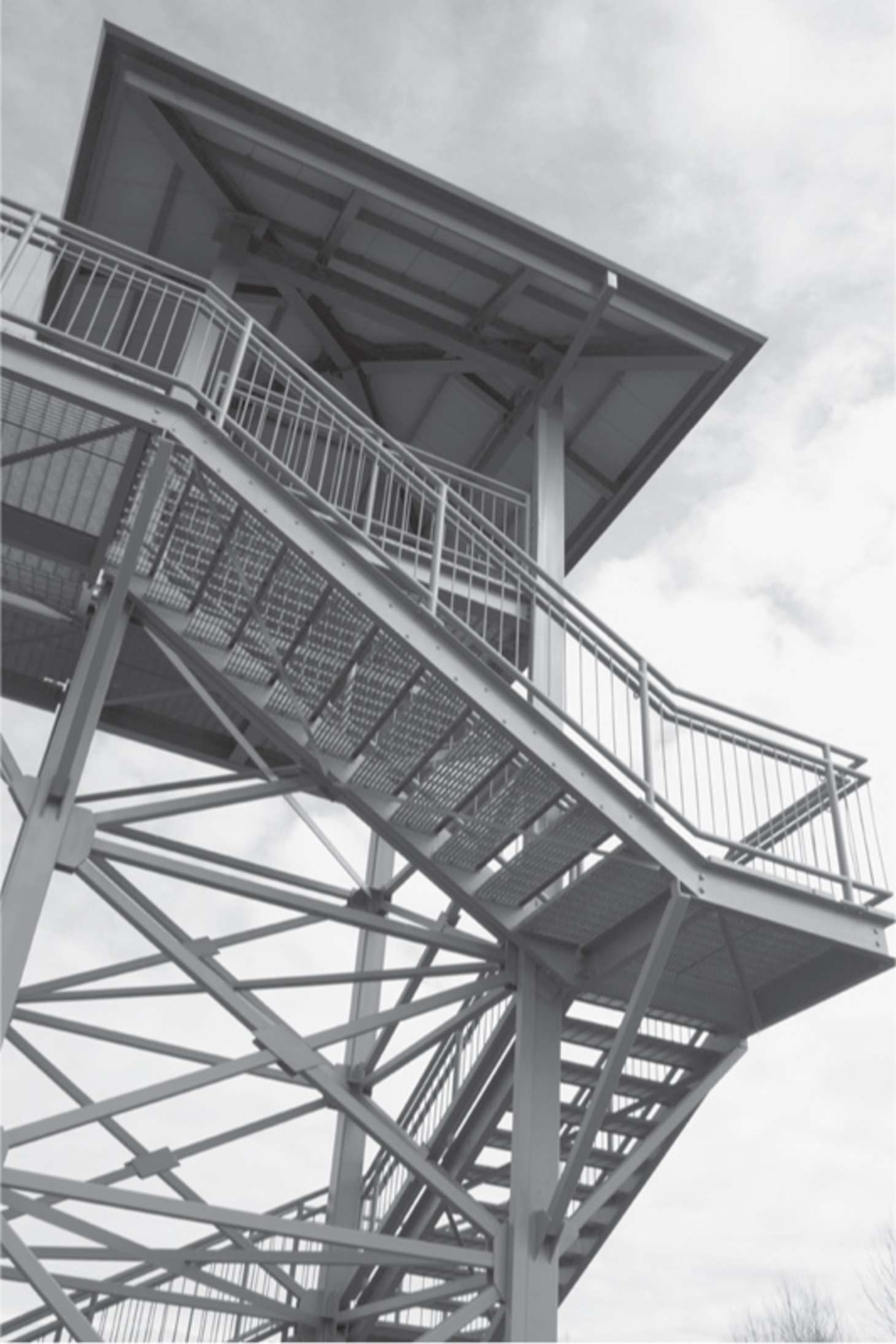

For the best bird-watching, fall and winter are good times to visit, when the grasses are low and the pond is more visible. Flocks of migrating birds use the area as a rest and staging place on their way south. On the water you may see ruddy ducks, great blue herons, and American coots; look overhead or on the bare tree branches for merlins and bald eagles. Two tall viewing platforms accessible from the Green River Natural Resources Area paths and one accessed from Kent’s paved Puget Power Trail on the southern boundary offer bird’s-eye views over the meadows. Due to the sensitive nature of the Green River Natural Resources Area, dogs are not allowed in the reserve.
ADDRESS: Van Doren’s Landing Park: 21861 Russell Road S, Kent
GETTING THERE: From I-405, take exit 2 (WA 167 Renton/Auburn) and head south on WA 167. Go 4 miles and take the S 212th Street exit. Turn right and go 2 miles. Turn left onto Russell Road. More parking is at Van Doren’s Landing Park, 0.5 miles away.
From I-5, take exit 152 (Orillia Road). Turn east on Orillia Road, which becomes S 212th Street. Cross the Green River and turn right on Russell Road.
CONTACT: Kent Parks, Recreation, and Community Services Department; (253) 856-5100; www.kentwa.gov/parksandrecreation

79 SPRING LAKE AND LAKE DESIRE PARK
8.5 miles southeast of downtown Renton
Get a workout climbing through 390 acres of lush forest to a rocky outcrop for a great view of snowy Mount Rainier.
| TRAIL | 4.5 miles; natural surface |
| STEEPNESS | Gentle to steep |
| OTHER USES | Bicycles and horses except on Peak Trail |
| DOGS | On leash |
| CONNECTING TRAILS | McGarvey Park to the north |
| PARK AMENITIES | None |
| DISABLED ACCESS | None |


Rising a full 400 feet above the placid waters of Spring Lake and Lake Desire, smooth boulder–topped Mount Echo beckons walkers with a yen for a workout and a view. This forested King County park is home to bobcats, owls, bears, and foxes, yet lies quietly above the nearby recreational lakes and neighborhoods of Maple Valley.
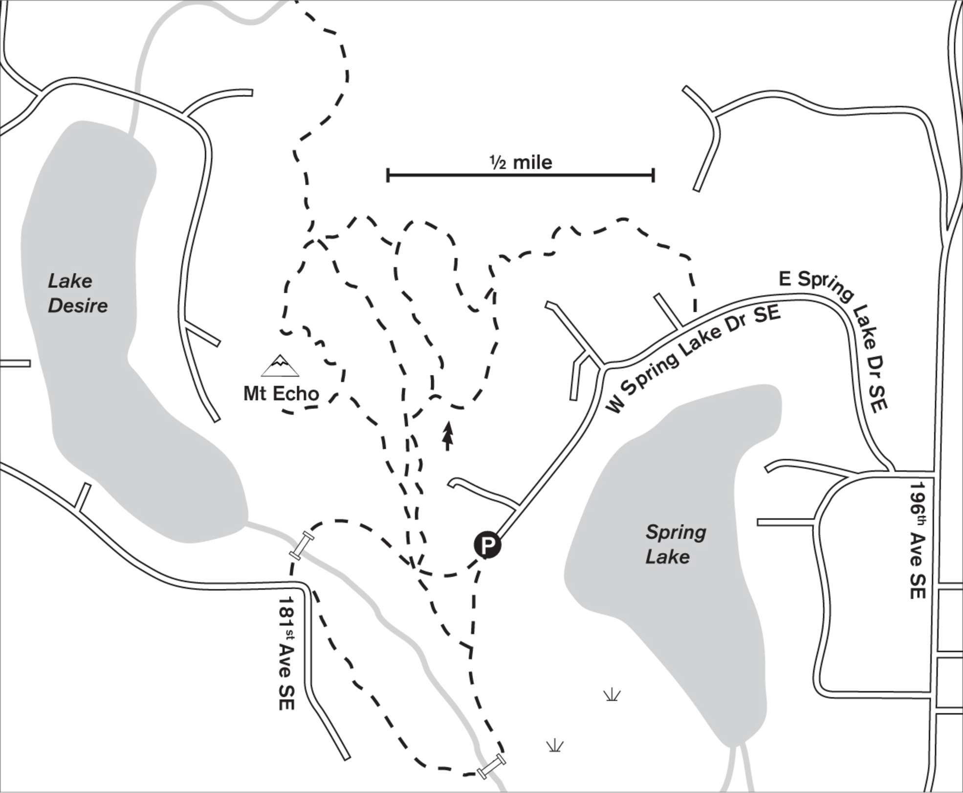
This park is a walkers’ destination, with nary a playground or sports field in sight. One comes here to traipse in the best of the Northwest nature and forest. Next to the small parking lot at the base of the trail, an informational sign helps you choose your walking trails. Head up the service road (wonderfully soft and more like a wide trail than a road), then cut off to the right into the forest on the signposted Peak Trail. So steep is this final 200-foot ascent to Mount Echo’s viewpoint that neither horses nor bicycles are allowed. A well-maintained trail of log steps leads you up and around the hillside until you come to the broad, rock-surfaced peak. On clear days look south into the face of glacier-covered Mount Rainier.
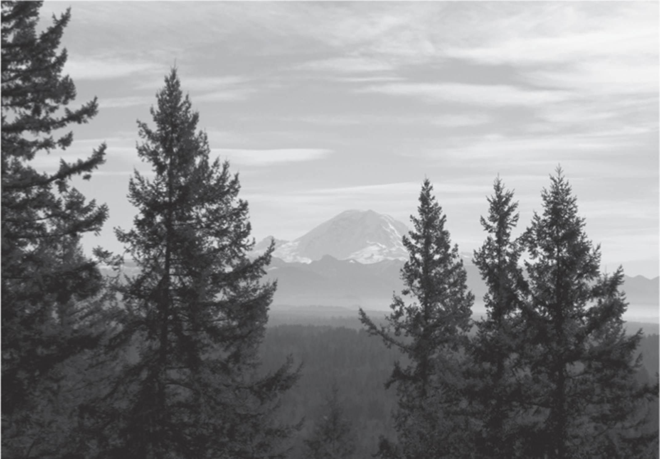

A winter walk promises glimpses of Lake Desire far below as you peer through the bare branches of the alders and maples. The lower forest is lush with sword ferns that line the gentle ravine, through which a small brook tumbles. In the green seasons you’ll be walking through a sylvan wonderland of tall canopied trees and huge old-growth stumps amid mahonia and sword ferns. Even then, the view from the peak is clear for great mountain scenery.
If you’re not up for a hill climb, meander the trails to the north of the trailhead, or take the 1.3-mile loop through the bog and wetlands of Spring Lake to the south.
ADDRESS: 18800 West Spring Lake Drive, Renton (approximate)
GETTING THERE: From I-405, take exit 4 (WA 169/Maple Valley). Go 6.3 miles on the Maple Valley Highway and turn right onto 196th Avenue SE. Go 1.4 miles and turn right onto SE 183rd Street, then right again onto E Spring Lake Drive. Stay right, merge onto W Spring Lake Drive, and follow it around the lake to the end of the road. To park on the left by the boat launch a Discover Pass is required, but it is not required at the trailhead.
CONTACT: King County Parks, (206) 477-4527, www.kingcounty.gov/recreation/parks

80 CEDAR RIVER TRAIL (SOUTHEAST SECTION)
Maple Valley, 8 miles east of Kent
Watch birds and spawning salmon along this forested rails-to-trails path.
| TRAIL | 6 miles one way; paved and natural |
| STEEPNESS | Level |
| OTHER USES | Bicycles, horses |
| DOGS | On leash |
| CONNECTING TRAILS | Green-to-Cedar Rivers Trail; Cedar River Trail (Northwest Section) (Walk #75) |
| PARK AMENITIES | Restrooms and picnic areas at Landsburg Park Trailhead |
| DISABLED ACCESS | Paved section at Maple Valley end; some access at Landsburg Park |


Lined with cottonwoods, alders, and mixed conifers, this converted rails-to-trails path is wide and smooth, and, being raised above the surrounding wetland, offers year-round dry-footed walking. A wild cry might break the stillness as a bald eagle rises from the river, a salmon clutched in its talons. In summer, golden-crowned kinglets call from the trees, swallows dive for insects, and dippers bob along the riverbanks like tireless windup toys.
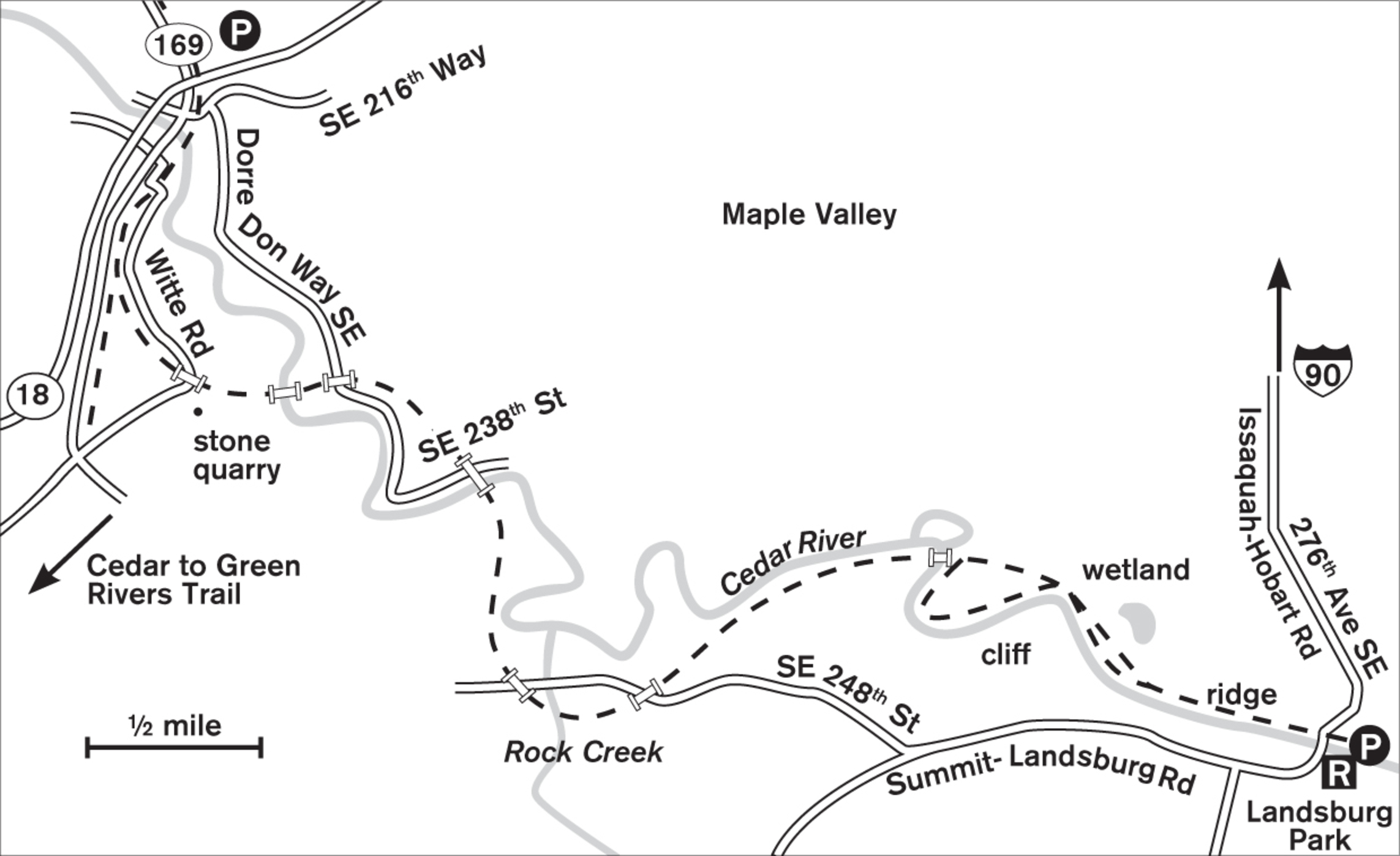
Running a course straighter than the Cedar River, the trail takes you alternately from forest to riverside to bridge. Beginning across from Foley’s Produce, the trail is paved all the way north to Renton. If you walk or bicycle, you can go as long as your feet and time hold out. On this stretch, the trail closely borders the Maple Valley Highway. See Walk #75, Cedar River Trail (Northwest Section), for another lovely stretch of regional trail.
Heading southeast from Foley’s, the pavement ends near the intersection with the Green-to-Cedar Rivers Trail (also known as the Lake Wilderness Trail). From here, the trail takes on its most natural surroundings. After passing a stone quarry and Rock Creek, the trail enters ever wilder landscape as you close with the river. About 1 mile from Landsburg Park (the easternmost trailhead), a reconstructed 1908 railroad bridge spans the river. High above the water, you have an eagle’s-eye view both up- and downstream to cliffs, eddies, and rapids. From here you can continue on the raised railbed or, river height permitting, explore the sandy path that traces the river’s edge to Landsburg Park.
ADDRESS: Foley’s Produce: 21419 SE Renton Maple Valley Road, Maple Valley (public parking is across the street); Landsburg Park: SE 253rd Street and Landsburg Road SE, Ravensdale
GETTING THERE: Foley’s Produce: From I-405, take exit 4 (WA 169/Maple Valley). Go south on WA 169 for 9.9 miles. The park is on the east side of the road, across from Foley’s Produce.
From I-5 north, take exit 142A (WA 18 Auburn/North Bend) and go east 15.6 miles on WA 18. Take the SE 231st Street exit and follow signs to WA 169 (Maple Valley). Turn north on WA 169, cross under WA 18, and park on the right, across from Foley’s Produce.
Landsburg Park: Follow the directions above to WA 169, but stay on WA 169 past WA 18 and turn left onto SE 216th Street. Go east for 3 miles and turn right onto 276th Avenue SE (Issaquah-Hobart Road). Go 2.4 miles to Landsburg Park. The trail begins on the west side of the road.
CONTACT: King County Parks, (206) 477-4527, www.kingcounty.gov/recreation/parks. To volunteer, contact Friends of the Cedar River Watershed: fcrw.wordpress.com.

81 CLARK LAKE PARK
4.5 miles east of downtown Kent; 18 miles south of Renton
This 130-acre park provides wetlands, lakes, meadows, groves of forest, and great mountain views.
| TRAIL | 2 miles; boardwalk, natural surface |
| STEEPNESS | Level to gentle |
| OTHER USES | Bicycles |
| DOGS | On leash |
| CONNECTING TRAILS | None |
| PARK AMENITIES | Benches, interpretive trail, viewing and fishing dock |
| DISABLED ACCESS | None |


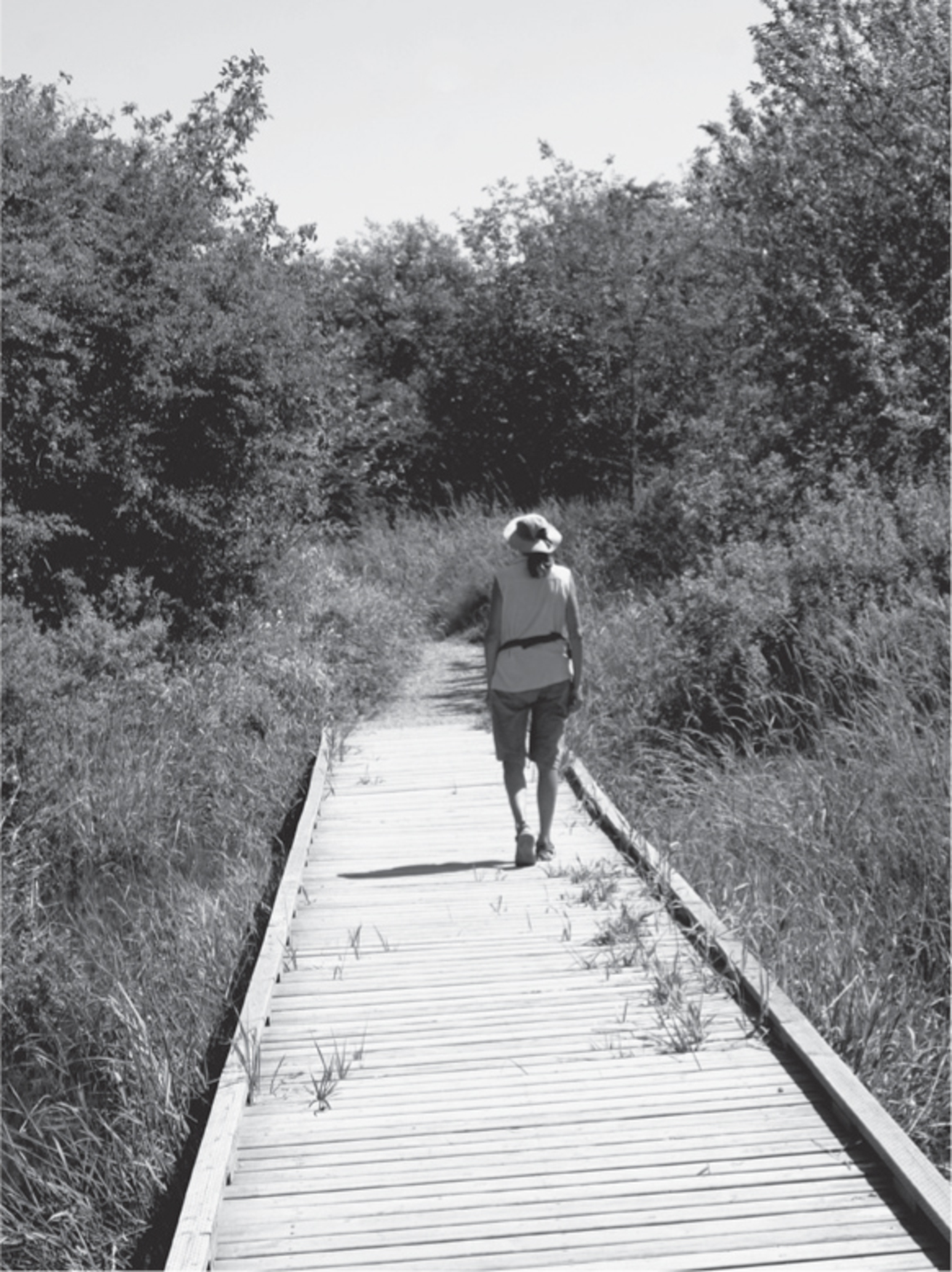
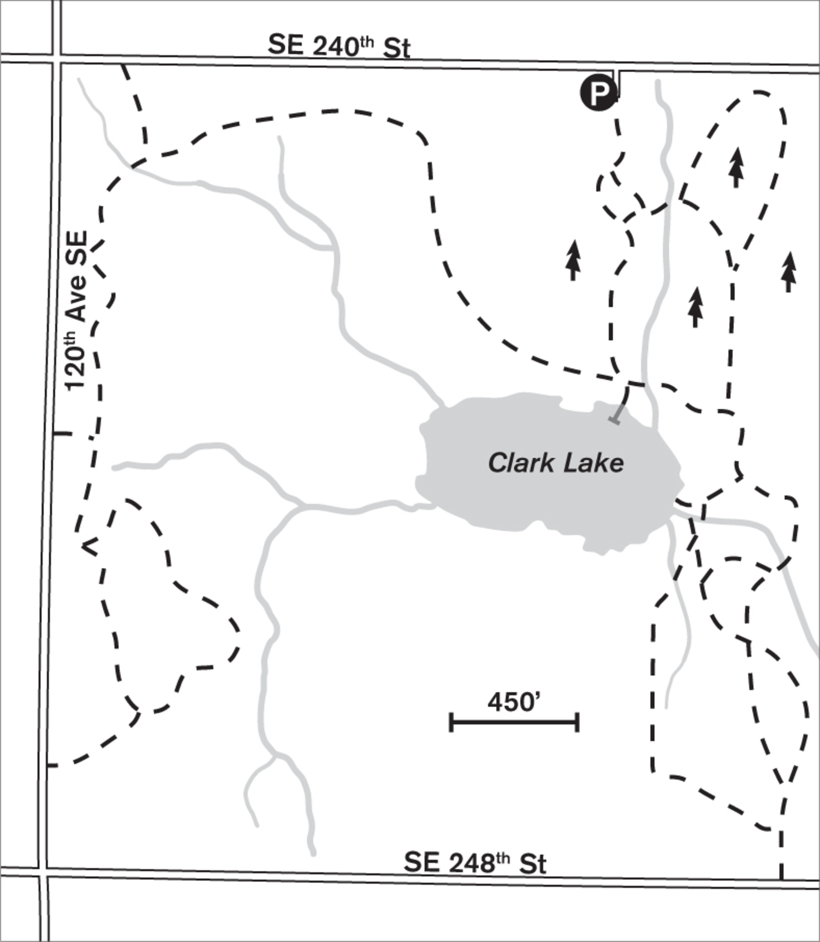
Leave the edge of suburbia and walk through restored meadows where plump heads of lavender, clover, and bright-yellow buttercups brighten the summer greenery. The land is in transition, slowly being reclaimed from its long-ago use as farmland. A quiet dell of Douglas fir and hemlock resounds with birdsong, and bird boxes offer shelter to nesting flickers. Nestled in the center of this passive-use park, 7-acre Clark Lake is home to native bass and rainbow trout. The graveled paths lead you through meadows and shady stands of forest, while nearer to the lake’s edge you walk on securely built boardwalks over sensitive wetlands and out to the lake’s edge on a viewing and fishing platform. The trail rises from the lake to the north and east, and even with summer’s luxuriant growth, the lake is visible. In summer, the once-domestic cherry trees drape with ripe red fruit, which is plundered by resident raccoons. In fall, the leaves stand brilliant with color against a backdrop of blue sky and the white cone of Mount Rainier to the south, and coho salmon may be seen in the stream.
In years past, the stream was home to both coho and Chinook salmon; with the help of volunteers, the stream is being cleared of invasive plants and replanted to provide improved habitat for the fish and other native wildlife. The original 29 acres were first annexed by the city in the early 1990s, and since then Clark Lake Park has been growing bit by bit as more land is purchased. Eagle Scout troops have built information kiosks at the entrances, and scores of volunteers have created boardwalks, fencing, and loop trails. Although the tannin-brown waters of the lake are tempting on hot summer days, swimming is not allowed due to underwater natural hazards.
ADDRESS: 12540 SE 240th Street, Kent (approximate)
GETTING THERE: From I-405, take exit 2 (WA 167 S). Go south on WA 167 for 4.2 miles. Exit at 212th Street SE. Turn left and follow 212th Street SE as it becomes 208th Street SE. In 1.8 miles turn right onto 116th Avenue SE. Go 2 miles and turn left onto SE 240th Street. The park is in 0.6 miles on the right.
Other trailheads with on-street parking are on 120th Avenue SE and SE 248th Street.
CONTACT: Kent Parks, Recreation, and Community Services Department; (253) 856-5100; www.kentwa.gov/parksandrecreation


82 SOOS CREEK TRAIL
4 miles east of downtown Kent
Walk miles of paved trail along a creek and through 775 acres of forested wetlands.
| TRAIL | 7.5 miles one way; paved |
| STEEPNESS | Level to gentle |
| OTHER USES | Bicycles, horses (horses may be on side trail) |
| DOGS | On leash |
| CONNECTING TRAILS | None |
| PARK AMENITIES | Restrooms, brochure, interpretive walks, picnic tables; playgrounds at trailheads |
| DISABLED ACCESS | Trail (though parts do not meet ADA standards), restrooms |


Just inches above the marshes, this paved path cuts a straight dark line through one of the finest wetlands in South King County. Chickadees call chicka dee dee dee from the branches of alder and oak. A red-tailed hawk soars overhead. Soos Creek Trail is a walker’s hidden paradise just minutes from downtown Kent.
Marshes like this one have an all-season appeal. In summer the trail is busy with skaters, cyclists, and walkers, and the marsh plants are tall and thick with green stalks and golden-brown cattails. The landscape feels enclosed and intimate. In winter the wet meadow areas predominate, with hardhack, alder, willow, and many bird species. In winter, too, you can see through the brush to the hillsides of fir and hemlock that rise from the creek.
The park’s shape is defined by meandering Soos Creek. The northern end is near Gary Grant Park northeast of Kent; the southern end is near Lake Meridian Park on Kent-Kangley Road. Along the length of the trail, you pass through several distinct types of wetlands. Ponds are home to great blue herons, ducks, geese, cattails, rushes, skunk cabbage, and wild roses. Scrub wetlands remain flooded year-round. In the forested wetland you’ll walk beside vine maple, cedar, salmonberry, and elderberry; then you climb to the upland forest, with its second-growth cedars, maples, and ferns.

Originally owned by the Northern Pacific Railroad, the land was logged in the late 1800s by large timber companies. After that, Finnish pioneers arrived, clearing the land with oxen and horses to raise fruits and vegetables. Look for remnants of the old orchards along the trail.
ADDRESS: Gary Grant Park: SE 208th Street and 136th Avenue SE, Kent; Trailhead near Lake Meridian Park: SE 266th Street and 148th Avenue SE
GETTING THERE: Gary Grant Park: From I-405, take exit 2 (WA 167 S/Auburn). Go south 3.9 miles on WA 167. Turn left (east) on SE 212th Street, which becomes SE 208th Street, and find the park trailhead in 3 miles.
From I-5 northbound, take exit 149A (WA 516, Kent); from southbound, take exit 149 (WA 516, Kent). Head east on WA 516 and exit onto WA 167 N. Go north on WA 167 for 2 miles, turn right on SE 212th Street, and proceed as above.
CONTACT: King County Parks, (206) 477-4527, www.kingcounty.gov/recreation/parks. Check the website for information on interpretive walks.


83 LAKE WILDERNESS ARBORETUM
Maple Valley, 8 miles east of Kent
Walk 42 acres of garden paths, an old railroad grade, and forest trails to the edge of Lake Wilderness.
| TRAIL | 3 miles total; gravel, natural surface |
| STEEPNESS | Level to gentle |
| OTHER USES | Pedestrians only on self-guided loop; horses and bicycles on Lake Wilderness Trail (also known as the Green-to-Cedar Rivers Trail) |
| DOGS | On leash; not allowed on nature loop trail |
| CONNECTING TRAILS | Green-to-Cedar Rivers Trail |
| PARK AMENITIES | Nature trail brochure and map, plant sales; Lake Wilderness Park offers restrooms, picnic area, beach, meeting rooms, playgrounds, tennis |
| DISABLED ACCESS | Garden trails |


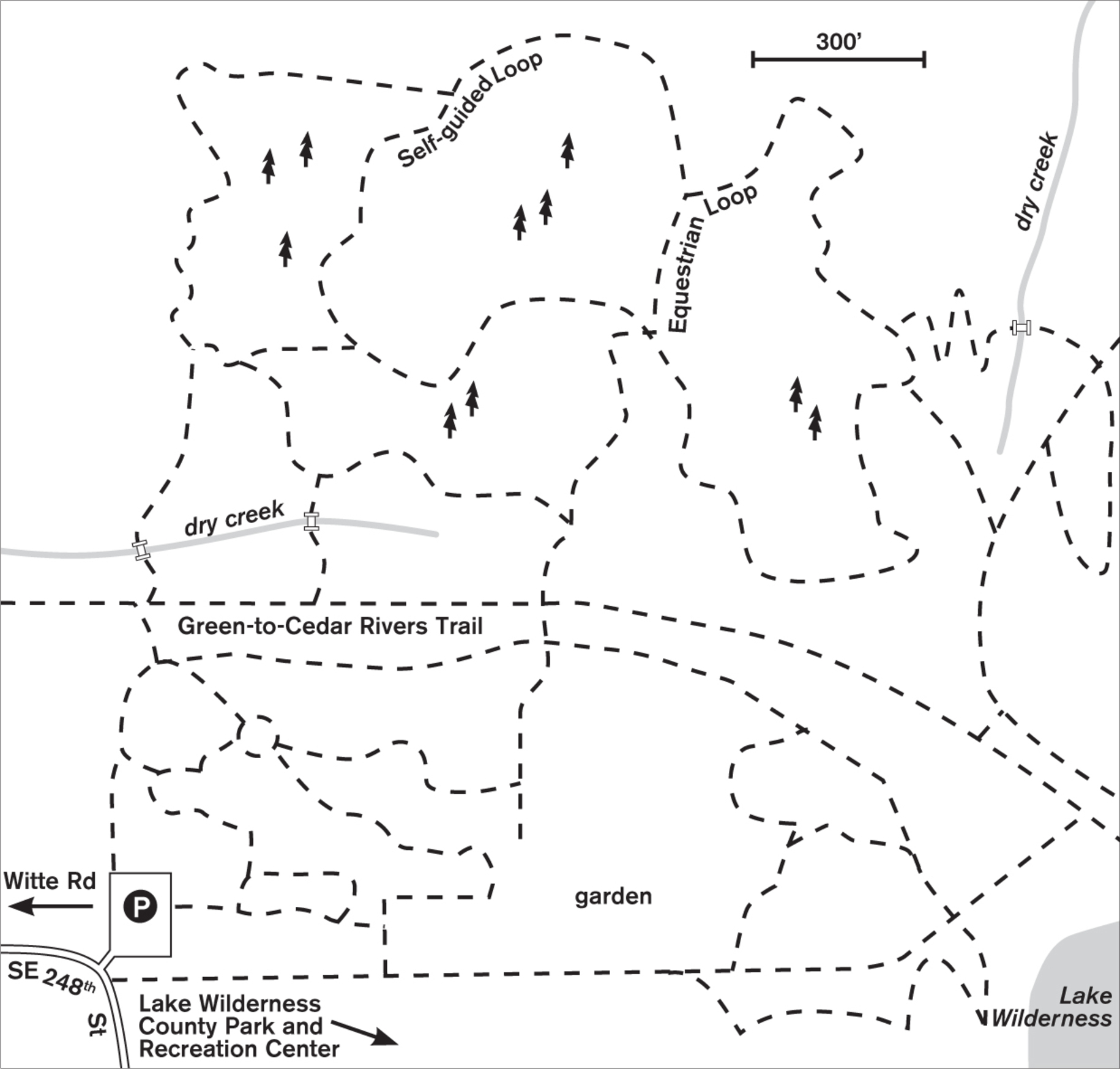
Located on the edge of Lake Wilderness Park, the Lake Wilderness Arboretum leases land from the county for a show garden with walking trails and interpretive information. In one walk, you can enjoy both an ornamental garden of native plants and a natural second-growth forest typical of the Cascade foothills.
The Lake Wilderness Arboretum Foundation, a nonprofit volunteer group, has created these gardens to provide examples of native plants and to teach why it’s important, when choosing nonnative ornamental plants, to select those that will thrive here without extra water or fertilizer. On the garden trails, you can see a wide variety of rhododendrons, both species and hybrids, and showy trees such as the purple-leafed smoke tree and unusual maples. Spring is, of course, spectacular with color, but each season offers some new and colorful changes in the garden. Volunteers are needed—there are always more plantings and projects in the works.
North across the old railroad grade, you enter a mature second-growth forest. On the self-guided loop, you can read about and observe this transitional forest, in which the more shade-tolerant western hemlocks and western red cedars are slowly replacing the Douglas firs. From high in the canopy, secretive warblers sing and tiny brown creepers spiral their way up the trunks in search of bark-dwelling insects. Orange lichen paint intriguing patterns on the trunks of the big-leaf maples.
To extend your walk, head either east or west on the railroad grade, part of the Green-to-Cedar Rivers trail. This raised gravel walk is dry even in the wettest months and maintains a natural forest setting for more than a mile in each direction. To the northwest it joins the Cedar River Trail (Walk #80) in 1.6 miles.
ADDRESS: 22520 SE 248th Street, Maple Valley
GETTING THERE: From I-405, take exit 4 (WA 169/Maple Valley). Go east for 10 miles on WA 169 to Maple Valley. After crossing WA 18, turn right on Witte Road. Go 0.8 miles and turn left on SE 248th Street. Go 0.5 miles to the arboretum next to Lake Wilderness Park.
From I-5, take exit 142A (WA 18 Auburn/North Bend). Exit WA 18 at WA 169. Turn right on SE 231st Street, then right (south) on WA 169. Go 0.3 miles, turn right again (south) on Witte Road, and proceed as above.
CONTACT: Maple Valley Parks and Recreation Department, (425) 432-9953, www.maplevalleywa.gov/departments-services/parks-recreation. For volunteer information, visit www.lakewildernessarboretum.org.

84 SALTWATER STATE PARK
2 miles south of downtown Des Moines
Explore 88 acres along McSorley Creek from forest to beach.
| TRAIL | 2 miles; natural surface |
| STEEPNESS | Level to steep |
| OTHER USES | Bicycles |
| DOGS | On leash |
| CONNECTING TRAILS | None |
| PARK AMENITIES | Restrooms, picnic areas, playground, underwater park; summer only: camping, concession stand |
| DISABLED ACCESS | Restrooms, camping, picnic areas |


At low tide, 1,500 feet of rocky beach creates a multitude of tide pools. Here red and yellow starfish cling, crabs scuttle, and snails creep. Inland, cool, shaded forest lets you wander over a hillside to a bluff overlooking Puget Sound and seagoing vessels.
One of the most popular state parks on the sound, Saltwater sees upward of three-quarters of a million visitors a year. The nice thing is, they come mostly in summer and on warm weekends, and most of them visit the beach. With careful timing, you can be virtually alone on the beach, communing with clams and mussels or watching the antics of the seagulls and crows as they drop the mollusks from the air to the concrete for an instant breakfast. At high tide, walk the several hundred yards of paved walkway next to the seawall.
For a forest stroll, leave from the playground and follow the soft-surfaced path along the hillside under a mix of Douglas fir and big-leaf maple. This forest was last logged more than 75 years ago, and the second-growth trees are reaching a hefty size. The lush undergrowth helps to muffle the sounds of visitors and the hum of traffic on the bridge overhead. The trail loops back to the McSorley Creek ravine at the eastern end of the campground. Other trails lead from the valley, make loops, and return. On the north side of the camping area, a footbridge crosses the creek, which once again is seeing a salmon run.
ADDRESS: 25205 8th Place S, Des Moines
GETTING THERE: From I-5, take exit 149 (Kent-Des Moines/WA 516). Go west on WA 516 for 1.9 miles to Marine View Drive. Turn left, go 1.2 miles to S 252nd Street and 8th Place S, and turn right into the park. A Discover Pass is required for parking.
CONTACT: Washington State Parks, Saltwater State Park Office, (253) 661-4956, www.parks.wa.gov


85 GAME FARM AND GAME FARM WILDERNESS PARKS
Auburn, 9.5 miles southeast of Kent
Glacier-fed White River cuts through 120 acres of landscaped and wild parks.
| TRAIL | 4 miles; natural surface, paved |
| STEEPNESS | Level |
| OTHER USES | Bicycles |
| DOGS | On leash |
| CONNECTING TRAILS | White River Trail (Walk #86) |
| PARK AMENITIES | Restrooms, playgrounds, art, picnic shelters, playing fields, sports courts; disc golf and camping in Game Farm Wilderness Park |
| DISABLED ACCESS | Paved trail, restrooms, amphitheater, picnic shelters |


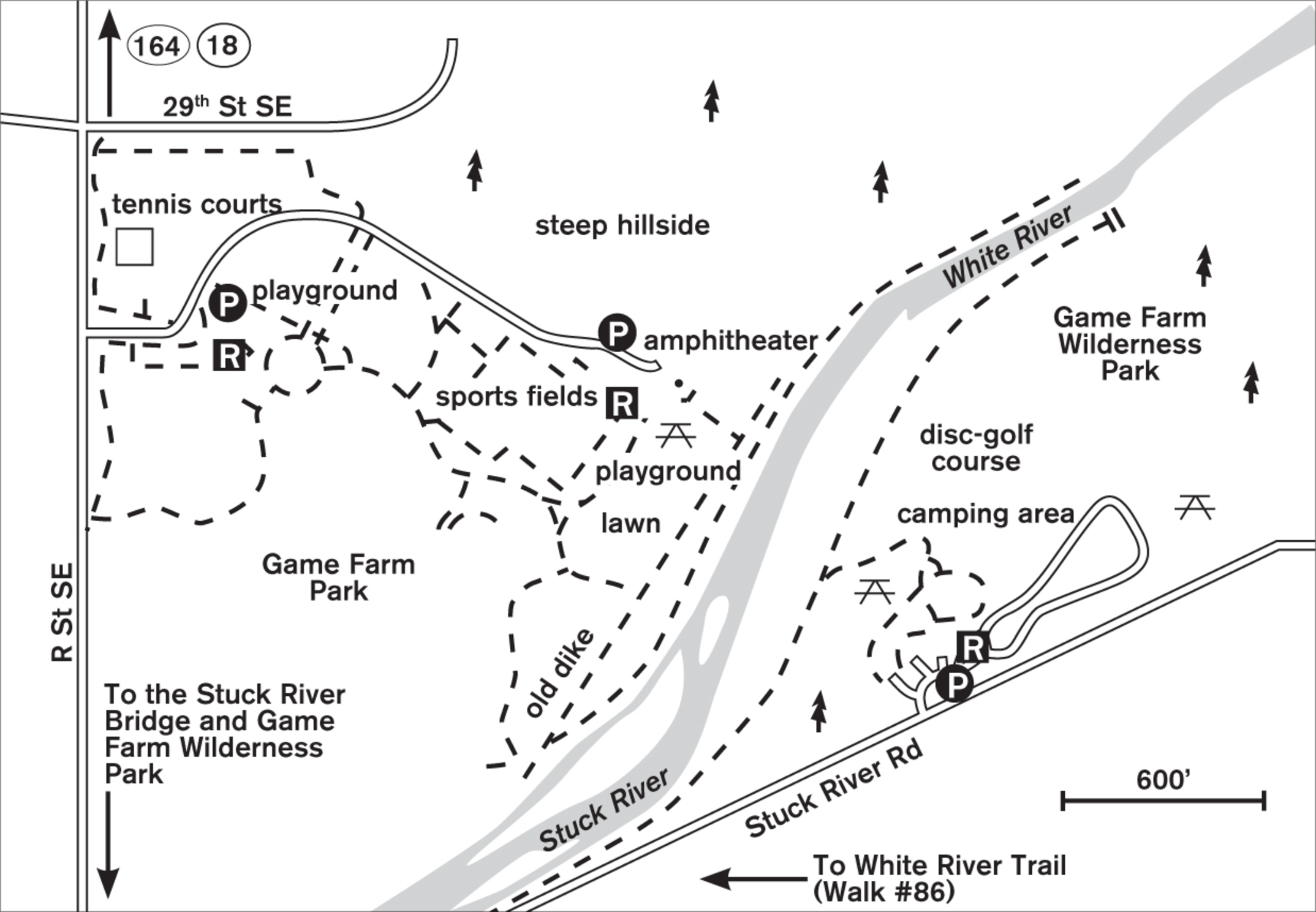
Two nonidentical twin parks line the sides of the milky, glacier-fed White River (which becomes the Stuck River as it passes the parks). Here you can choose civilization, amenities, and landscaping at Game Farm Park in the north, or a wilder, less gentrified park in the south.
Game Farm Park (named for its past history as a site on which shooting stock was raised) throbs with activity. Colonnades of landscaping trees border playing fields that are interconnected with more than 2 miles of paved walkways. Come for people-watching on weekends and for solitude on damp winter days. Park near the amphitheater at the southern end and walk past the picnic shelters toward the river. The almost-century-old diversion dam divides park landscaping from river wilderness. Walk along it, or step over it to find an unmaintained but well-used path on the riverbank. Follow this path of sand and rounded river rocks east along the river. Side trails lead to possible wading and picnic areas on the shores. (See Don’t Get Carried Away.) Beaver-toppled trees, with their telltale gnawing marks, lie jumbled in the river, awaiting removal by the rodents or the next flood.
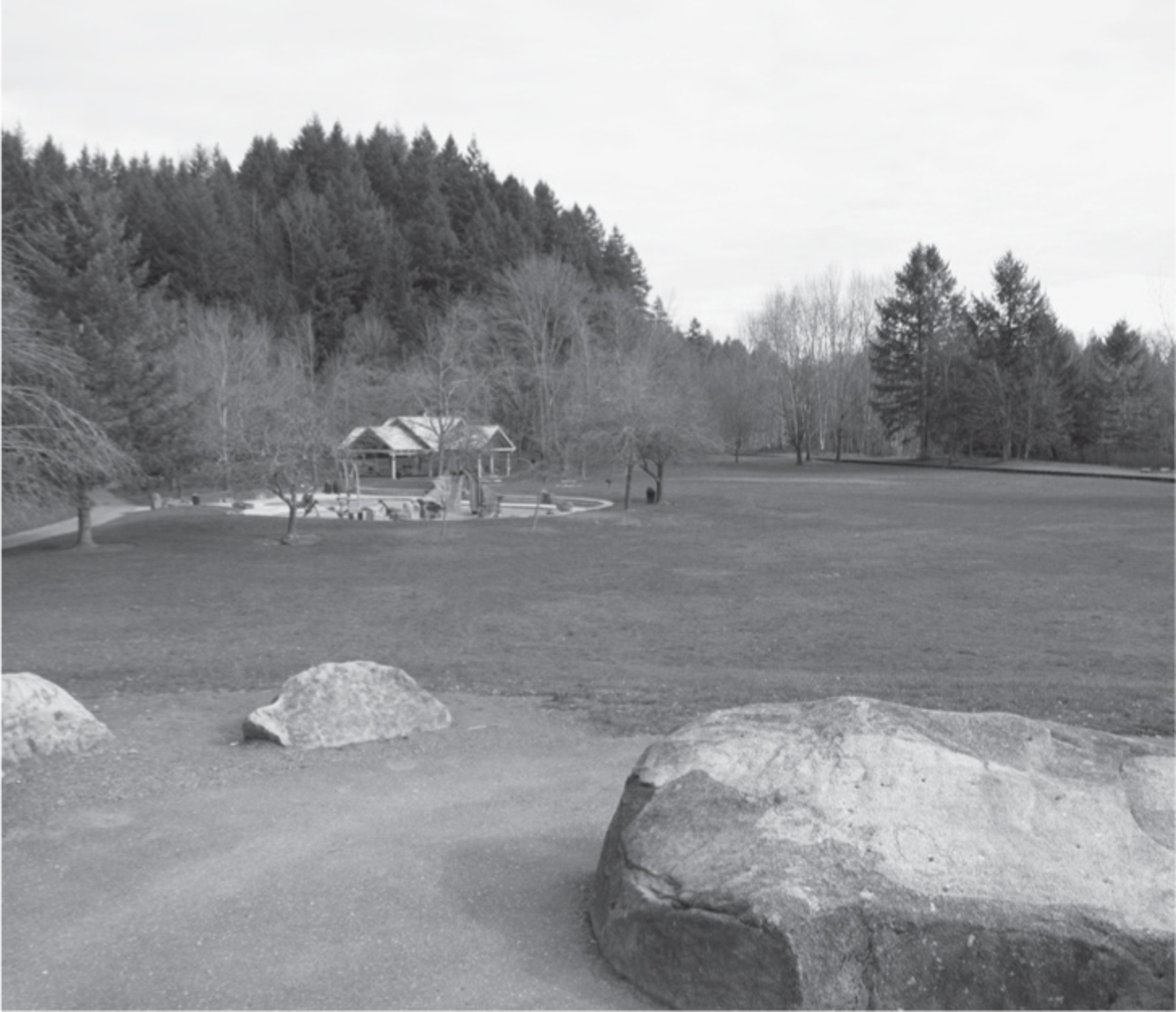

Across the river in Game Farm Wilderness Park (accessed via the R Street SE bridge), a campground, restrooms, and picnic shelters are the only amenities. An actively used disc-golf course parallels the sand-and-rock path that leads along the river. Across the water, 150-foot-high bluffs are a geological window to the past, while today’s trees cling tenaciously to the sandy walls. West from the day-use area, a short paved trail invites walkers, baby strollers, and wheelchairs.
Watch for dippers—small brown birds that bob and hunt for food along the rocky rapids. Breathe deeply of this fresh river-scented air.
ADDRESS: Game Farm Park: 3030 R Street SE, Auburn; Game Farm Wilderness Park: 2401 Stuck River Drive, Auburn
GETTING THERE: From I-405, take exit 2 (WA 167 S/Auburn). Go about 10 miles south on WA 167 to WA 18. Go east on WA 18 to the WA 164 (Auburn Way) exit. Head south for 0.9 miles and stay left for Howard Road. Go 0.25 miles and turn right onto R Street SE. Go 0.7 miles to Game Farm Park on your left. For Game Farm Wilderness Park continue on R Street SE, cross the river, and turn left.
From I-5, take exit 142A (WA 18 E/Auburn). Go 4 miles east on WA 18, take the WA 164 (Auburn Way) exit, and proceed as above.
CONTACT: Auburn Parks, Arts, and Recreation Department; (206) 931-3043; www.auburnwa.gov/things_to_do/parks_trails.htm

86 WHITE RIVER TRAIL
Auburn, 11 miles south of Kent
Follow the blue-white waters of the White/Stuck River on a paved trail bordered by cottonwoods and conifers.
| TRAIL | 2.2 miles; paved, natural |
| STEEPNESS | Level to gentle |
| OTHER USES | Bicycles; horses on soft-surface parallel trail |
| DOGS | On leash |
| CONNECTING TRAILS | Game Farm Wilderness Park (Walk #85) |
| PARK AMENITIES | Restrooms, playground, art, picnic area |
| DISABLED ACCESS | Paved trail, restrooms |


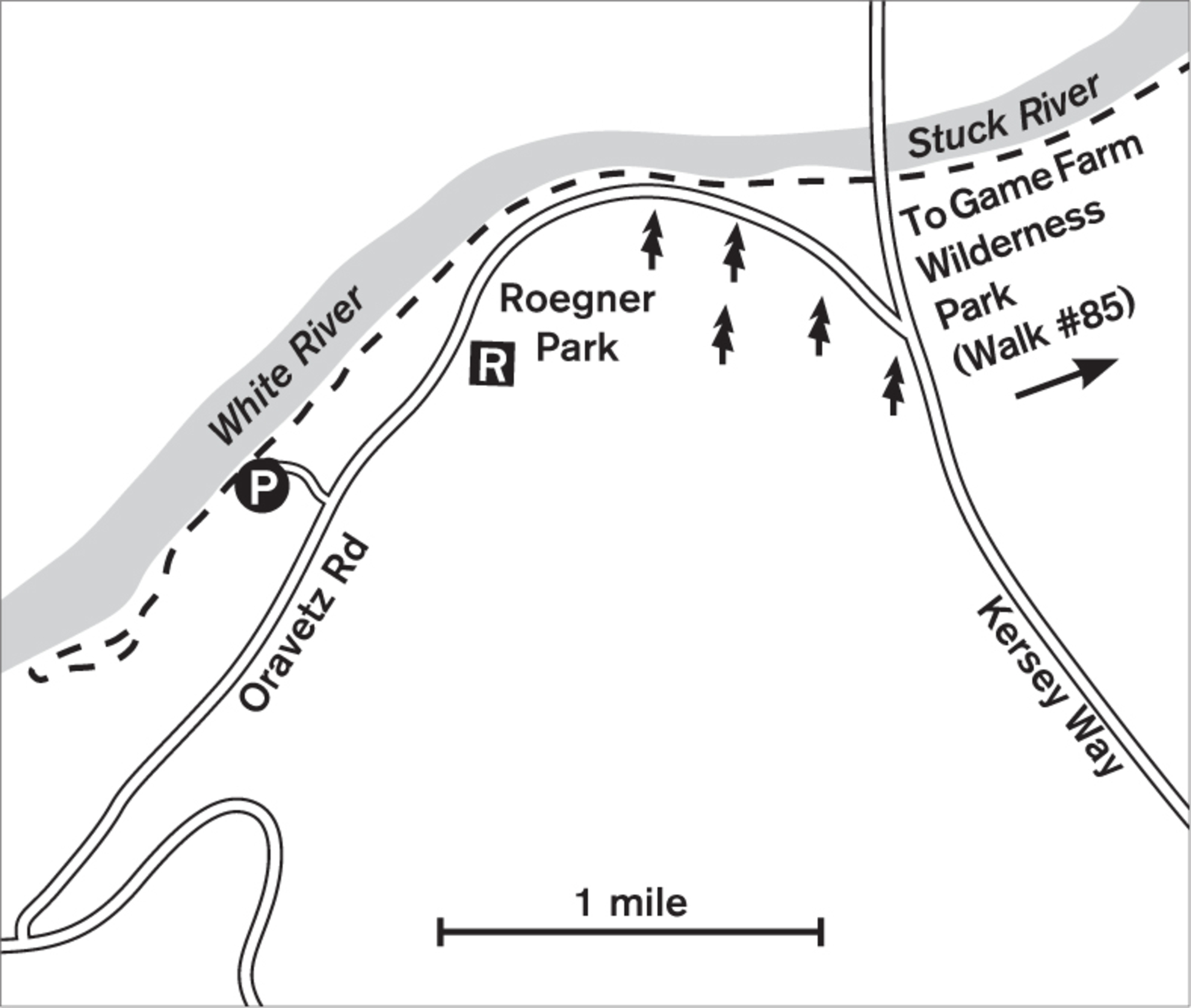
There is something both invigorating and peaceful about walking by the side of a swiftly flowing river. The slow pace of foot travel contrasts with the swift motion of the river, the energetic sound of moving water, and the sight of a lone rock fighting the force of the river flowing over it. Above and surrounding it all is the freshwater-scented breeze. The White River Trail has the added attraction of a smooth, paved walkway so that you can watch the river as you walk, without being overly mindful of your feet. Perhaps you’ll spot a great blue heron wading in an eddy or a bright-blue kingfisher perched on a maple branch, searching for its next meal. If you begin in Roegner Park, you can follow a loop trail to the west, return to the park and its amenities, and then walk upstream as far as you like before retracing your steps.


Is it called the White River or the Stuck River? The answer is both. Until the end of the nineteenth century, the White River, together with the Green and Black Rivers, formed the Duwamish River, which emptied into Elliott Bay in Seattle. The Stuck River flowed toward Tacoma. Farmers in the Kent Valley, forever worried about flooding, used to dynamite the rivers, and in one mishap, they diverted much of the flow of the White River to the Stuck Valley. A huge flood in 1906 changed the landscape further, and the White River was diverted permanently. Today the White and the Stuck are the same river, and they flow into the Puyallup River en route to Tacoma’s Commencement Bay. The milky color of the river is from the finely ground rock, the glacial till, that is carried by the water as it flows from the glaciers on Mount Rainier.
ADDRESS: Roegner Park: 601 Oravetz Road, Auburn
GETTING THERE: From I-5, take exit 2 (WA 167/Kent/Auburn). Go south on WA 167. After 14 miles, take the exit toward Algona Pacific. Go 0.3 miles and turn left onto Ellingson Road. Go 1.5 miles and turn right onto A Street SE. Go 0.7 miles and turn left onto Lakeland Hills Way. Turn left onto Oravetz Road SE. Go 0.4 miles. Roegner Park is on the left after the high school.
To begin at Game Farm Wilderness Park, 2401 Stuck River Drive, Auburn, follow directions for Walk #85.
CONTACT: Auburn Parks, Arts, and Recreation Department; (253) 931-3043; www.auburnwa.gov/things_to_do/parks_trails.htm
