OLYMPIA
106 Woodard Bay Natural Resources Conservation Area
109 Nisqually National Wildlife Refuge
115 Tumwater Historical Park and Capitol Lake Interpretive Trail
104 FRYE COVE PARK
12 miles northwest of downtown Olympia
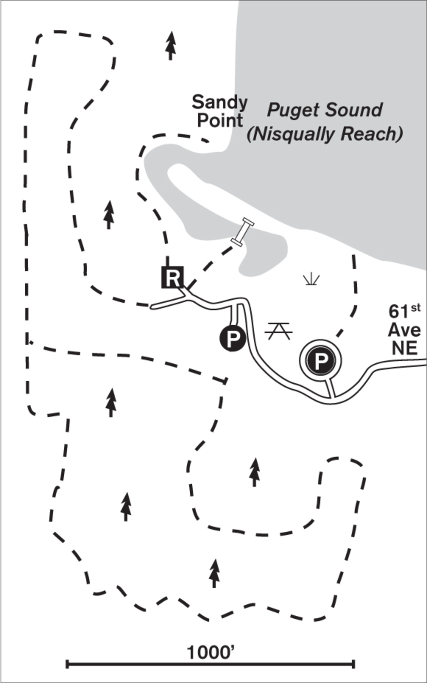
Forested trails through 86 acres lead to southern Puget Sound views at an Eld Inlet beach.
| TRAIL | 3 miles total; gravel, natural surfaces |
| STEEPNESS | Level to gentle |
| OTHER USES | Pedestrians only |
| DOGS | On leash |
| CONNECTING TRAILS | None |
| PARK AMENITIES | Restrooms, playground, picnic area, shelters, beach |
| DISABLED ACCESS | Gravel trail from parking lot to picnic area, restrooms |


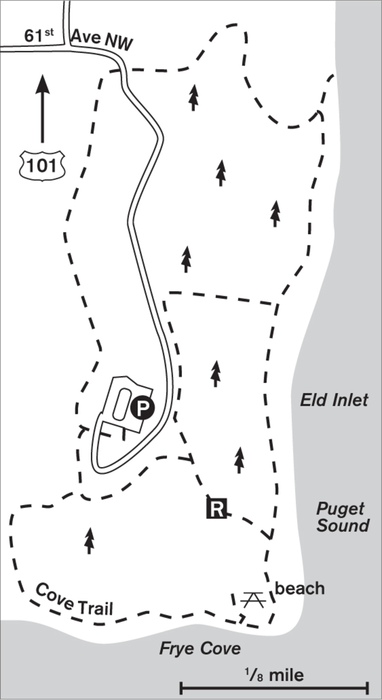
Tucked away on one of many finger inlets of southern Puget Sound, this forest and beach park entices with the twin luxuries of silence and seclusion.
When you enter the forest in summer, the big-leaf maples and alders shield you from the brilliance of the sun on the sound. Licorice ferns adorn the moss on the maples like miniature Dr. Seuss characters on parade around the tree trunks. Catkins from the red alders dangle above the trail and speckle the path.
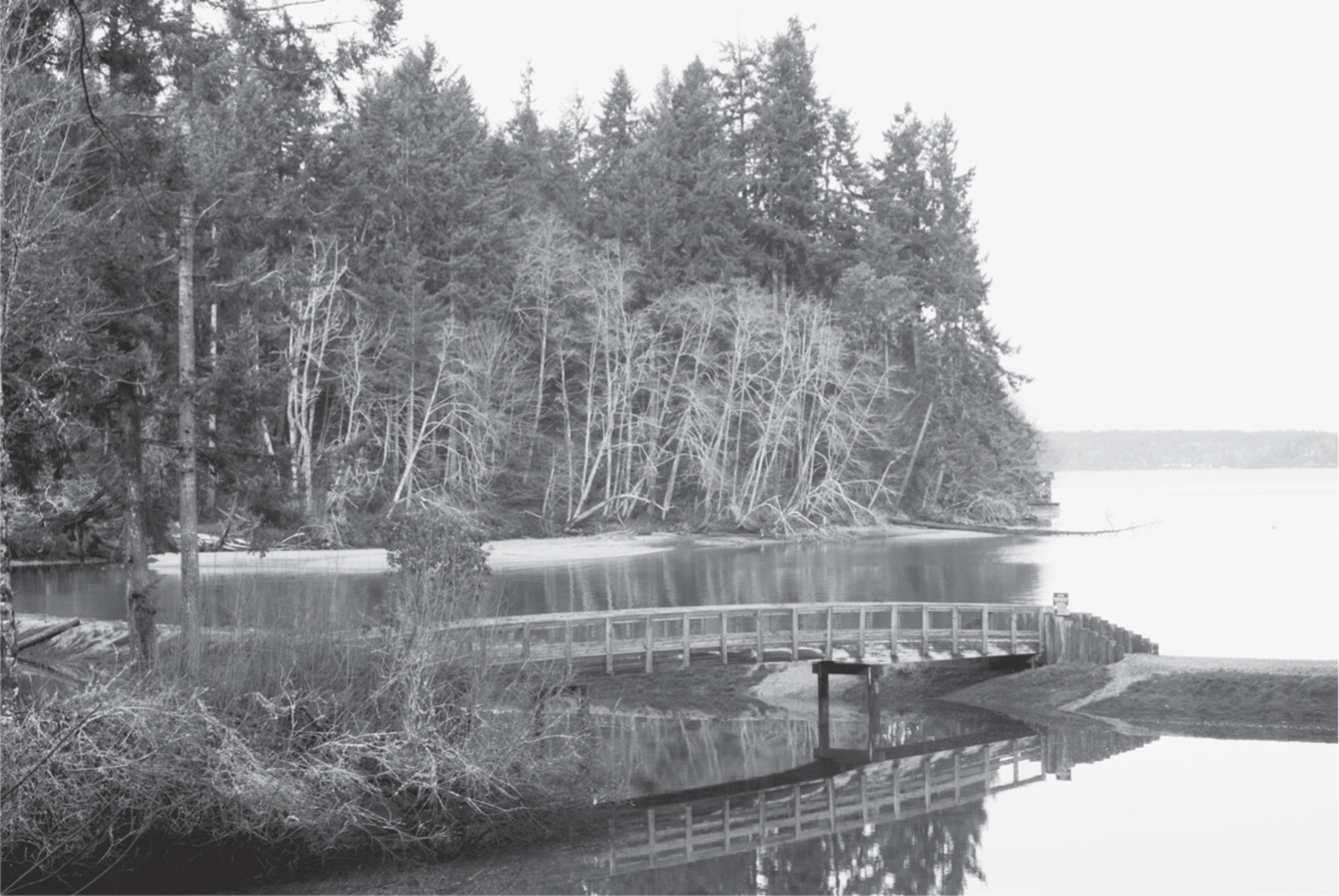
Last logged a hundred years ago, the forest has a mature presence, and the air carries the heady scent of cedar and salt. Hemlocks, some more than 200 feet tall, drape their graceful branches above the trail. Benches and observation decks are placed for glimpses of the Sound and beach below, and a raised walkway carries you over a dense ravine of sword ferns.
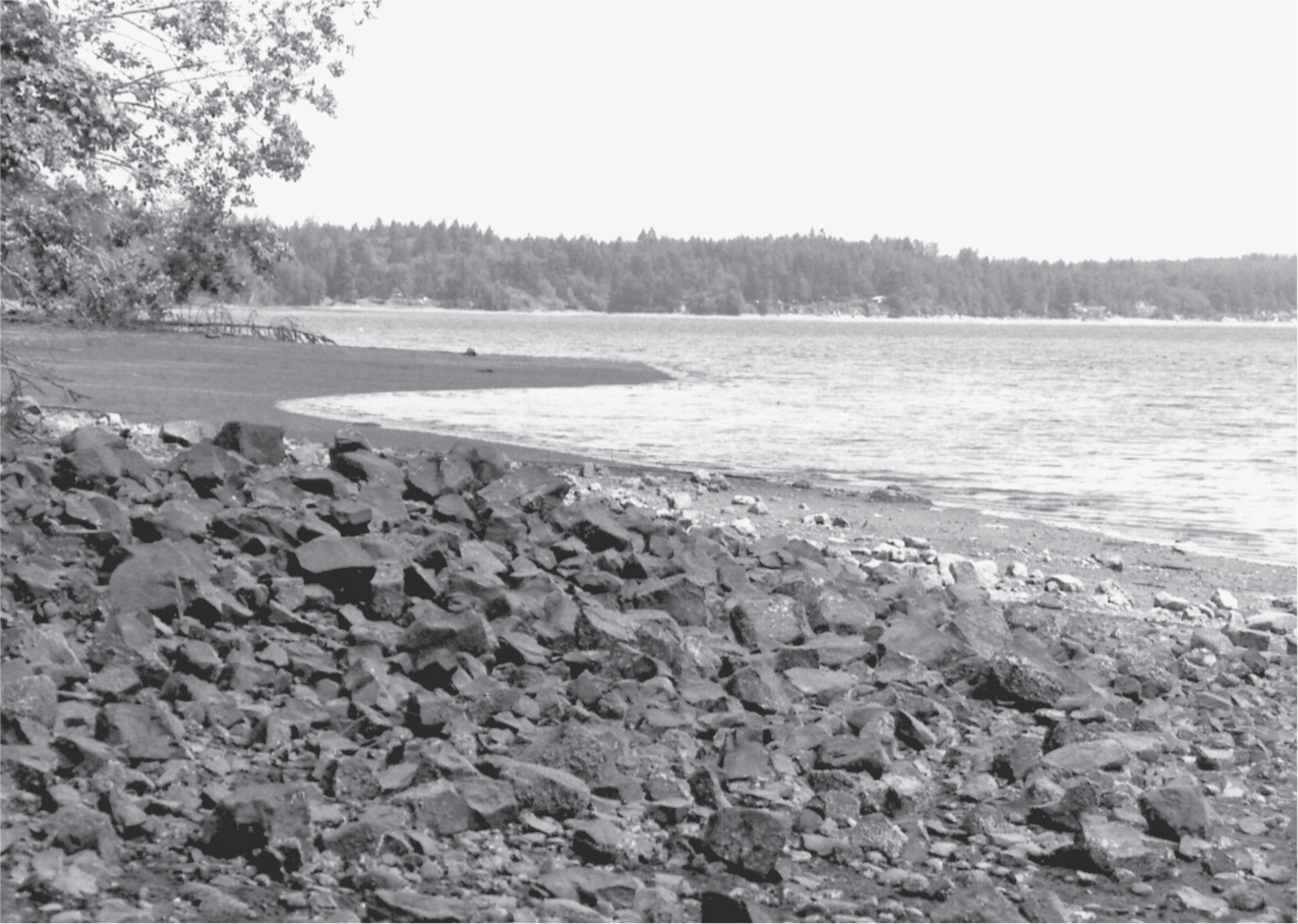
After you complete a forest loop on Cove Trail and return to the parking lot, you can descend a gentle-to-steep trail to arrive at the southern end of the beach. Air holes of a million clams dapple the sand-and-mud beach at low tide, and palm-sized clams and oysters provide feasts for crows and gulls. If the kids get tired of clams and sand, they can find lots of entertainment on the new playground near the shelters.

ADDRESS: 4000 61st Avenue NW, Olympia
GETTING THERE: From I-5, take exit 104 (US 101 N/Aberdeen). Stay on US 101 toward Shelton, and take the Steamboat Island Road exit. Go north on Steamboat Island Road NW for about 5.8 miles, and turn right on Young Road NW. Go about 2 miles, and turn left on 61st Avenue NW into the park.
CONTACT: Thurston County Parks and Recreation Department, (360) 786-5595, www.co.thurston.wa.us/parks

105 BURFOOT PARK
6 miles north of downtown Olympia
Forest trails through 60 acres descend to 1,000 feet of Budd Inlet beach with State Capitol views.
| TRAIL | 3.8 miles; natural surface |
| STEEPNESS | Moderate to steep |
| OTHER USES | Pedestrians only |
| DOGS | On leash |
| CONNECTING TRAILS | None |
| PARK AMENITIES | Restrooms, picnic shelters, playground, interpretive trail |
| DISABLED ACCESS | Horizon Trail (a 0.25-mile braille trail), restrooms, shelters, picnic area |


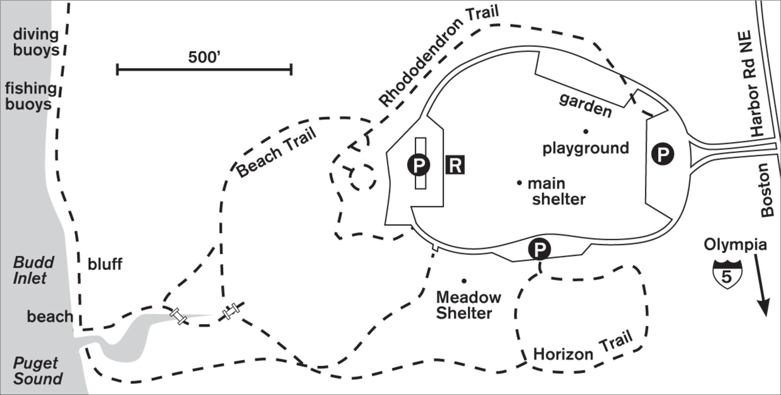
Most of the wonder of Burfoot Park is hidden from the casual first-time visitor. The central lawn and picnic area is so large and appealing that you might believe it’s all there is to the park. But drive or walk the parking loop, and you’ll discover the three trail entrances into the cool enchantment of the forest, which descends to the beach on Budd Inlet.
For an easy stroll, start on the Horizon Trail nature loop, which documents the changes in the forest since it was logged in the 1890s. Moisture encourages moss and old man’s beard to grow prolifically, and they cover the trees with a thick green shawl.
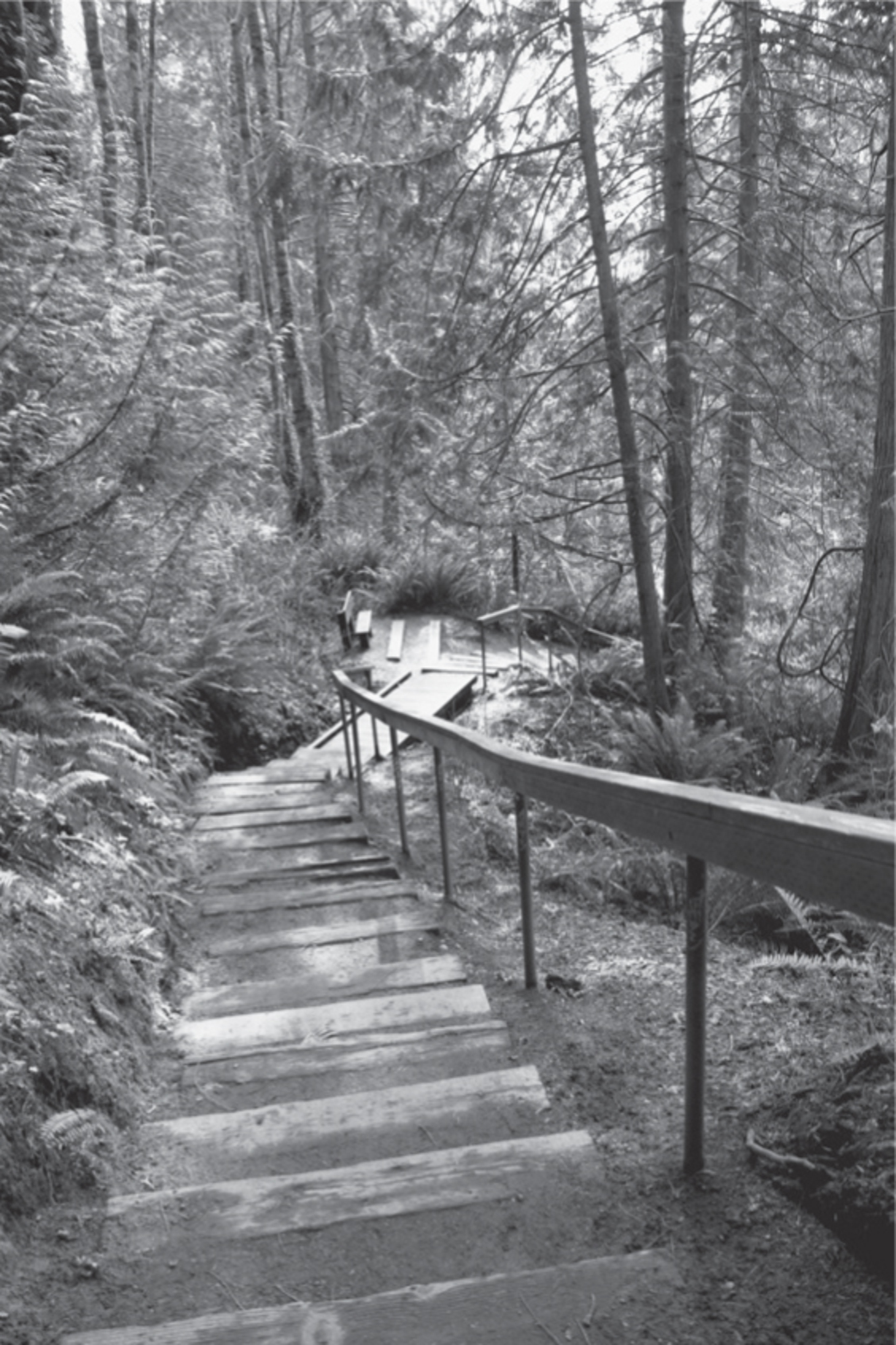

To the north, from the Rhododendron Trail, the right-fork Beach Trail descends the ridge of a ravine carpeted with sword fern. Here, the wrens call and hop on downed logs, their short perky tails bobbing. A clear rat-a-tat-tat may sound from above. High on a snag, pileated woodpeckers with iridescent red crests may be circling the tree, probing the bark for grubs. Farther along the fern-bedecked ravine, more snags bear the characteristic rectangular holes made by these birds, the largest western woodpeckers.
Though there are several trails, there is no need for signs; all trails lead to the beach. At low tide, crows stride the pebbled shore, and great blue herons may be feeding on small fish in the shallows. Massive drift logs make natural playgrounds for kids or a romantic resting place to sit and talk. To the south, the dome of the State Capitol rises between forested hills.
ADDRESS: 6927 Boston Harbor Road NE, Olympia
GETTING THERE: From I-5, take exit 105 if northbound, or exit 105B if southbound (City Center/Port of Olympia). Follow Port of Olympia signs and merge onto Plum Street. Go north on Plum Street (which becomes E Bay Drive, and then Boston Harbor Road NE). After 6 miles look for the park on the left.
CONTACT: Thurston County Parks and Recreation Department, (360) 786-5595, www.co.thurston.wa.us/parks

106 WOODARD BAY NATURAL RESOURCES CONSERVATION AREA
5 miles northeast of downtown Olympia
Gentle trails wind through 870 acres of protected forest and shoreline where seals, bats, and birds flourish on Henderson Inlet.
| TRAIL | 3 miles; boardwalk, natural surface, paved |
| STEEPNESS | Level to gentle |
| OTHER USES | Pedestrians only |
| DOGS | Not allowed |
| CONNECTING TRAILS | Chehalis Western Trail (Walk #107) from the Overlook Trail parking lot |
| PARK AMENITIES | Restrooms, picnic areas, interpretive signs, nature classes, canoe launch (seasonal) |
| DISABLED ACCESS | Parking lot to picnic area on Henderson Inlet via Whitman Road |


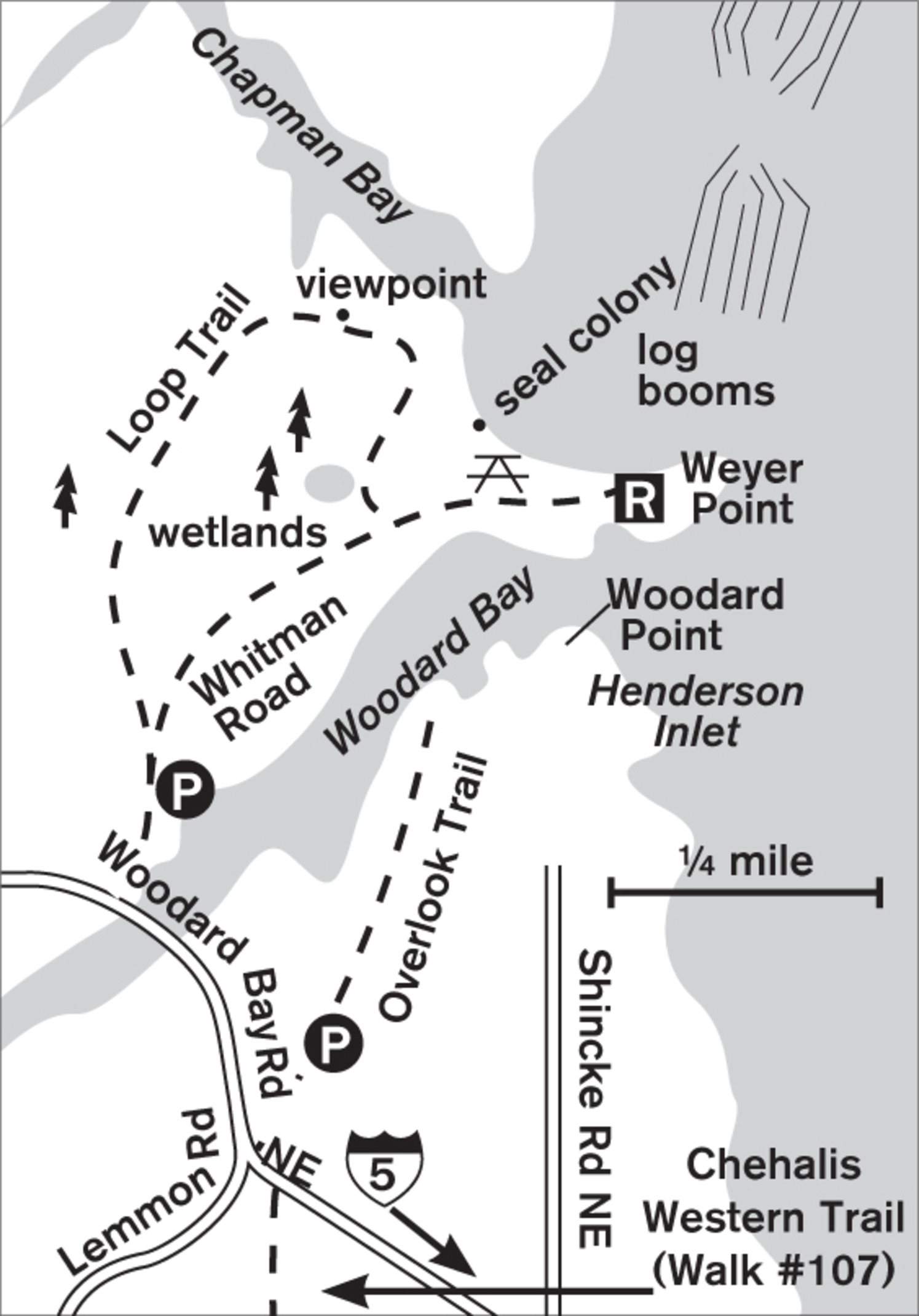
Beginning at the paved access road (gated for all vehicles except DNR and ADA), stroll 0.5 miles through moss-draped second-growth forest to Henderson Inlet. You may hear the sharp hammering of woodpeckers or the hoarse, barking sound of the green-backed heron. If the breeze is right, you’ll smell the salt water before you see it. The state of the tide determines whether you see shimmering, wet mud or hear the lapping of wavelets on the shore. The clearing at the tip of land called Weyer Point was once a bustling log dump where timber was transferred from railroad cars to the water, to be floated to mills in Everett. Interpretive signs bring the history to life.


The logging sounds are gone now, giving way to the persistent chatter of belted kingfishers as they hover, searching for lunch below. Soon you may hear the yaps and groans of harbor seals, sometimes three hundred to four hundred of them. In this maternity colony, females and their pups rest on the log booms or sun themselves on the shores. They are easily stressed, so enjoy them from afar. With binoculars, you can watch the cormorants, Canada geese, and gulls standing like nursemaids on old pilings above sleeping seals. Scientists recently discovered a colony of small brown Myotis bats that hibernate under the offshore wharves.
For variety, take the loop trail through the forest back to the entrance. This natural path ranges up and down gentle hillocks and through forest wetlands over wooden boardwalks. Overhead stand massive maples with spreading branches that could hold swings for giants. Sturdy cedars and hemlocks embrace their nurse logs or form their own colonies of two or three trunks growing together. When the trail parallels the shore of Chapman Bay high on a ridge, you can look down on the flocks of shorebirds or solitary great blue herons feeding.
If you crave more exercise or forest immersion, Woodard Bay’s Overlook Trail leaves from the Chehalis Western Trail parking lot (see Walk #107) just a minute south on Woodard Bay Road. This is a gravel and natural surface trail to the mouth of Henderson Inlet.
ADDRESS: 6998 Woodard Bay Road NE, Olympia
GETTING THERE: From I-5 southbound, take exit 108 (Martin Way/Sleater-Kinney Road NE). Go north on Sleater-Kinney Road NE for about 5 miles, until it takes a sharp turn to the left, becoming 56th Avenue NE. Go immediately right on Schinke Road NE, which becomes Woodard Bay Road NE. The Overlook Trail parking lot with restrooms is here.
To reach the primary trailhead, cross upper Woodard Bay on a bridge. Park immediately on the right by the gated entrance to Whitman Road. Bike racks are inside the gate, past the (summer only) kayak launching ramp. There may be seasonal trail closures to protect wildlife.
A Discover Pass is required for parking.
CONTACT: Washington State Department of Natural Resources, (360) 577-2025, www.dnr.wa.gov

107 CHEHALIS WESTERN TRAIL
5 miles northeast of downtown Olympia to 14 miles southeast of Olympia via Lacey
This rail-to-trail pathway cuts through farmland, wetlands, ponds, and forests from Woodard Bay to the Deschutes River.
| TRAIL | 21.5 miles; paved |
| STEEPNESS | Level |
| OTHER USES | Bicycles; horses north of S Bay Road and south of Fir Tree Road |
| DOGS | On leash |
| CONNECTING TRAILS | Olympia Woodland Trail (Walk #114), Woodard Bay Natural Resources Conservation Area (Walk #106), Yelm to Tenino Trail (Walk #120) |
| PARK AMENITIES | Restrooms, benches, picnic areas, viewing platforms |
| DISABLED ACCESS | Trail, restrooms |


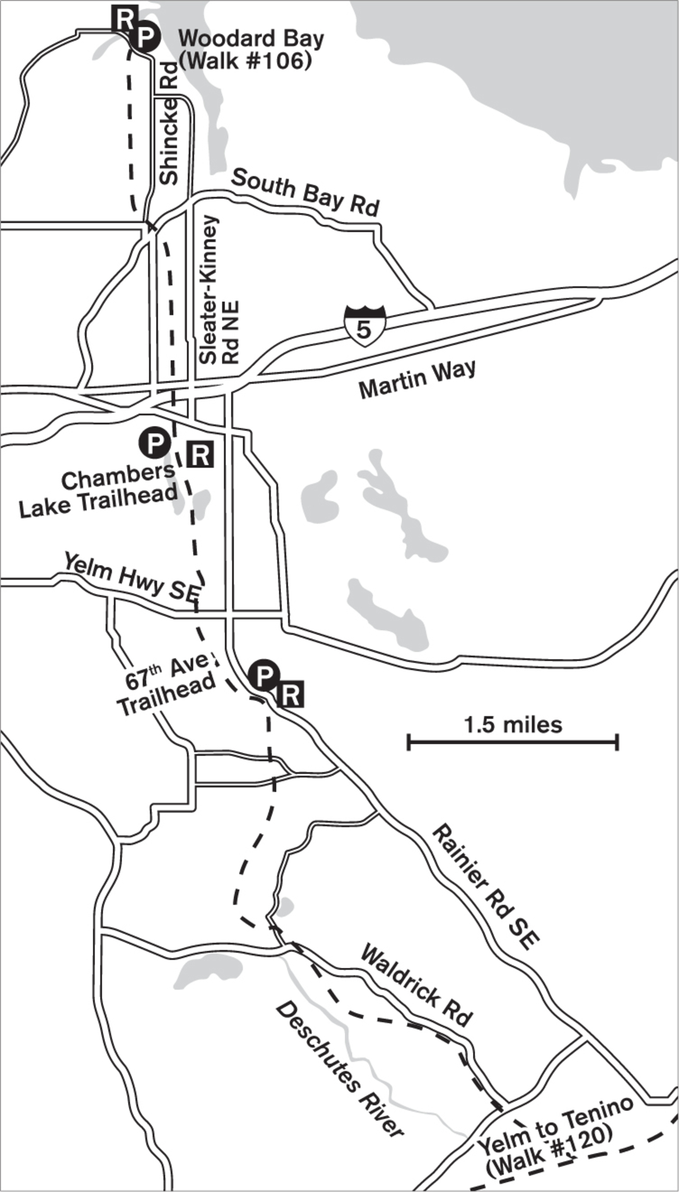
Immerse yourself in rural Western Washington just minutes from shopping-center madness on Martin Way. Walk a paved trail where the woods and wetlands replace the gunning of engines with the sweet chirping of crickets. Horses come to the fence to greet you, and raptors may be soaring over the meadows in search of mice. Small ponds and wetlands add more tranquil greenery. Near Shincke Road, a large marsh-rimmed pond hosts the usual colorful assortment: kingfishers, red-winged blackbirds, marsh wrens, and great blue herons. Recent construction on the trail now allows users to safely bridge the gap from the northern section (north of I-5 and Martin Way) to the southern section of this 21.5-mile thoroughfare without interruption.
Farmlands, scrub forest, and meadows rim the trail as it journeys southward. New viewing platforms overlook ponds and wetlands. Several trailheads exist south of I-5; the northern one at Chambers Lake is the most popular, with amenities on the edge of the lake. Other trailheads are located at 67th Avenue, Fir Tree Road, and 89th Avenue. The final stretch south of 103rd Avenue follows the Deschutes River upstream before intersecting the Yelm to Tenino Trail.
ADDRESS: Northern trailhead: 7204 Woodard Bay Road NE, Olympia; Chambers Lake trailhead: 3795 14th Avenue SE, Olympia; 67th Avenue trailhead: 4430 67th Avenue
GETTING THERE: Northern trailhead: From I-5 southbound, take exit 109 (Martin Way/ Sleater-Kinney Road N). Go north on Sleater-Kinney Road about 3.7 miles. Turn left onto 56th Avenue NE and go 0.5 miles. Turn right on Shincke Road, then turn left on Woodard Bay Road and drive until you reach the junction with Lemon Road. Park on the right.
Chambers Lake Trailhead: From I-5 northbound, take exit 108 (Sleater-Kinney Road S). Turn right on Sleater-Kinney. Cross Pacific Avenue and turn right onto 14th Avenue. The entrance is after the trestle on the left. From I-5 southbound, take exit 109 (Martin Way/College Street SE), head south on College Street SE, and proceed as above.
67th Avenue Trailhead: From I-5 northbound, take exit 108 (Sleater-Kinney Road S). Turn right at Sleater-Kinney Road. Turn left at 14th Avenue SE, then right onto College Street SE. Cross the Yelm Highway and stay on College Street, which becomes Rainier Road SE. Turn right onto 67th Avenue and follow it to the end. From I-5 southbound, take exit 109 (College Street). Turn left on College Street SE and proceed as above.
CONTACT: Thurston County Parks and Recreation Department, (360) 754-4371, www.co.thurston.wa.us/parks

108 TOLMIE STATE PARK
11 miles northeast of downtown Olympia
Explore 105 acres of forests, salt marshes, and beaches along the Nisqually Reach.
| TRAIL | 4.3 miles; natural surface, paved |
| STEEPNESS | Level (beach) to steep |
| OTHER USES | Pedestrians only in forest; bicycles on paved trails |
| DOGS | On leash |
| CONNECTING TRAILS | None |
| PARK AMENITIES | Restrooms, amphitheater, picnic shelters, underwater park; park closed Mondays and Tuesdays from October 1 to March 31 |
| DISABLED ACCESS | Restrooms, edge of marsh, picnic area, some trail sections |


Jellyfish, sculpins, and rock crabs share the saltwater marsh with eelgrass and pickleweed. On the tidal flats, young geo-ducks have been planted in plastic tubes to protect them from crabs and seagulls until they are a year old. Divers head offshore to explore the sunken barges that have created an underwater reef. You can explore the beach or head inland for miles of forest walking.
The upper parking lot offers the best views across Puget Sound to the Olympic Mountains. From there, a steep trail with railroad-tie steps leads to the beach and the lower picnic areas. As at other recreational beaches on the Sound, the best time for quiet and solitude is any day but a hot, sunny one. If the tide is in, you can stop on the footbridge over the marsh for a view of the inhabitants. Offshore the usual waterfowl gather—more during fall and winter migration than in summer.
From the beach, a long loop trail takes you west into the forest of lichen-covered trees. A boardwalk keeps your feet dry while letting you examine the plant life along the way. Benches make good snack stops or resting points. A shortcut about halfway through the trail brings you back to the parking lot.
The park honors Dr. William Fraser Tolmie, a pioneer physician with the Hudson’s Bay Company who served for 18 years at Fort Nisqually, just east of the present-day park. Married to a daughter of a Hudson’s Bay Company chief factor, John Work, Tolmie was instrumental in returning peace to the region after the Indian Wars of 1855–’56. The park is closed on Mondays and Tuesdays, and from October 1 to March 31.
ADDRESS: 7730 61st Avenue NE, Olympia
GETTING THERE: From I-5, take exit 111 (WA 510/Yelm/Marvin Road) and head west on Marvin Road NE. Go about 3.5 miles and turn right on 56th Avenue NE. Go 0.4 miles, turn left on Hill Street NE, then left again on 61st Avenue NE, where you will find the park. A Discover Pass is required for parking.
CONTACT: Washington State Parks, (360) 456-6464, www.parks.wa.gov


109 NISQUALLY NATIONAL WILDLIFE REFUGE
9.5 miles northeast of downtown Olympia
Walk through green forest by ponds and a river, or stroll the miles of level boardwalk crossing this 3,000-acre protected estuary.
| TRAIL | 1-mile loop, plus 3-mile round-trip boardwalk |
| STEEPNESS | Level |
| OTHER USES | Pedestrians only (no jogging) |
| DOGS | Not allowed |
| CONNECTING TRAILS | None |
| PARK AMENITIES | Restrooms, interpretive center (open Wednesday to Sunday), nature walks, observation decks |
| DISABLED ACCESS | Twin Barns Loop, Nisqually Estuary Boardwalk Trail, restrooms, interpretive center |


Completing its journey from the heights of Mount Rainier, the Nisqually River releases its pent-up energy into the broad expanse of the estuary. The air is rich with the scent of salt from Puget Sound and freshwater from the river. The open meadows and wetlands are vast, inviting exploration.
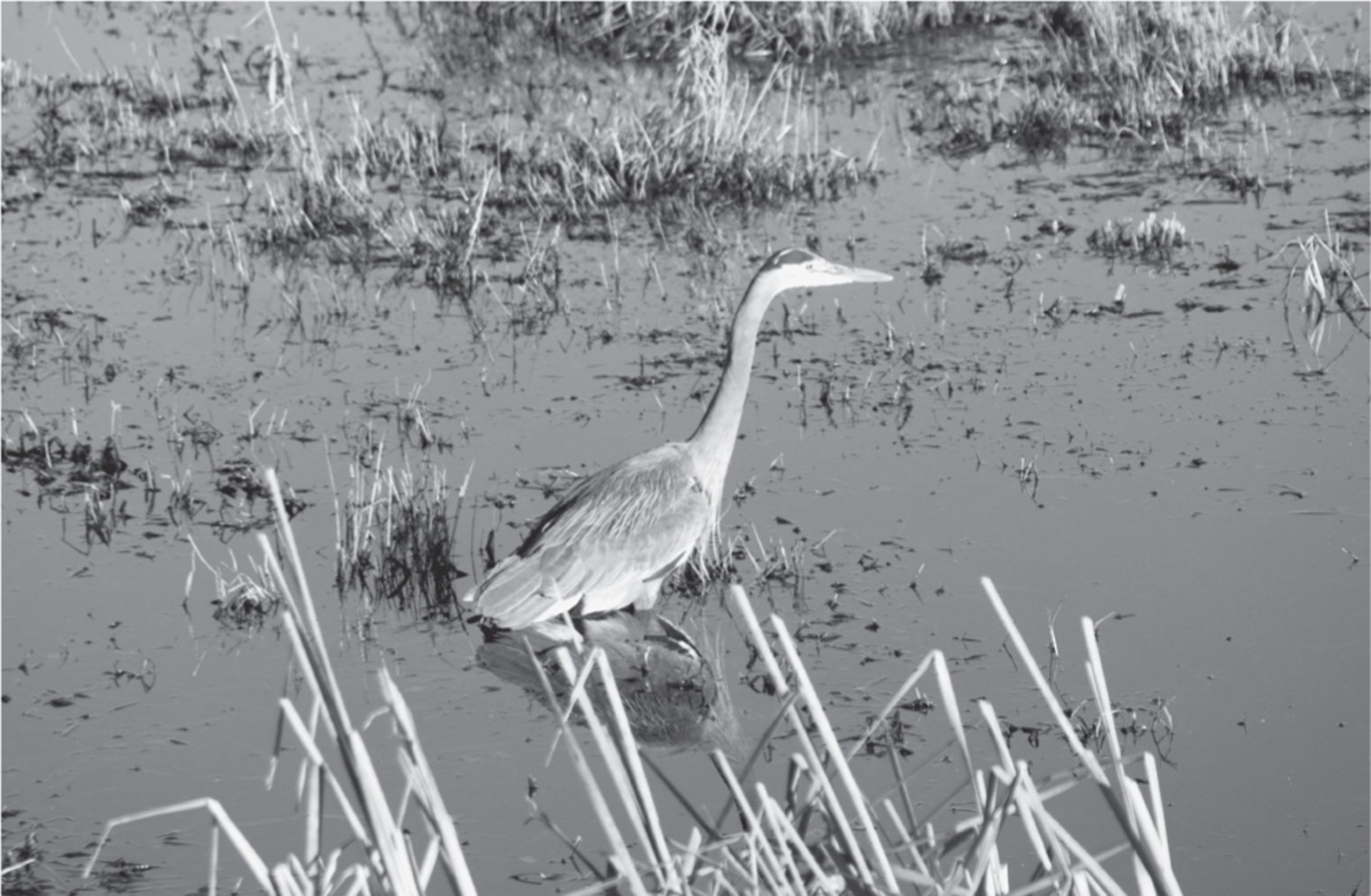
In winter, snow geese and white-fronted geese huddle into the receding tide line. Year-round, dozens of great blue herons stand like sentries of the wetland, some intent on the fish that dart between their stilt-like legs, others staring as though trying to comprehend the human forms with binocular eyes. Green-belted kingfishers hover above their prey, while over the grasslands immature bald eagles practice soaring and diving. Most visitors to the refuge come for the birds: there are more than a hundred species of resident waterfowl, raptors, and songbirds, as well as more than twenty thousand migratory birds that gather here during fall and winter.

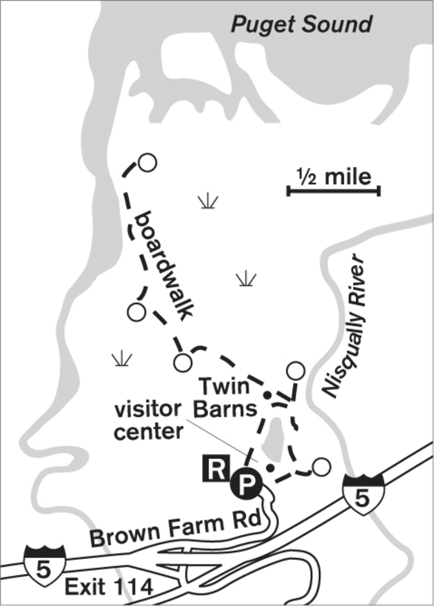
But you needn’t be a keen birder to appreciate a walk around the 1-mile Twin Barns Loop on either natural surface or boardwalk. This shorter stroll takes you through moss-draped forest and to viewing platforms and observation decks where interpretive signs explain the lives of muskrats and beavers.
For those wanting a longer sojourn, the Nisqually Estuary Boardwalk Trail continues as a spur from the barns and meanders to the north, with the salt-water tidal estuary to the northeast and the freshwater wetlands of McAllister Creek to the south. In recent years the old Brown Farm Dike was removed to allow the waters of Puget Sound to mingle with the river water and improve habitat. Along the new obstacle-free boardwalk you’ll find benches, viewing platforms, and a viewing blind. On clear days Mount Rainier highlights the skyline to the east, and from the Twin Barns Loop you can get views of the Olympics to the west.
The Nisqually Reach Nature Center offers a free summer-evening lecture series, and in the warm season there are free daytime guided walks focusing on the birds, plants, or history of the area.
ADDRESS: 100 Brown Farm Road, Olympia
GETTING THERE: From I-5, take exit 114 (Nisqually). Turn west at the end of the ramp and go under the freeway. Turn right (following signs) into the refuge. Holders of a Senior Pass or an Interagency Annual Pass are exempt from the $3 per vehicle admission fee.
CONTACT: Nisqually National Wildlife Refuge, (360) 753-9467, www.fws.gov/nisqually

110 SEQUALITCHEW CREEK
DuPont, 15 miles northeast of downtown Olympia
Huge moss-bedecked maples tower above a 38-acre watershed canyon where the clear stream makes its last journey to the waters of Puget Sound.
| TRAIL | 1.5 miles one way; gravel, paved |
| STEEPNESS | Gentle to moderate |
| OTHER USES | Bicycles |
| DOGS | On leash |
| CONNECTING TRAILS | None |
| PARK AMENITIES | Restrooms, interpretive guide, map |
| DISABLED ACCESS | None |


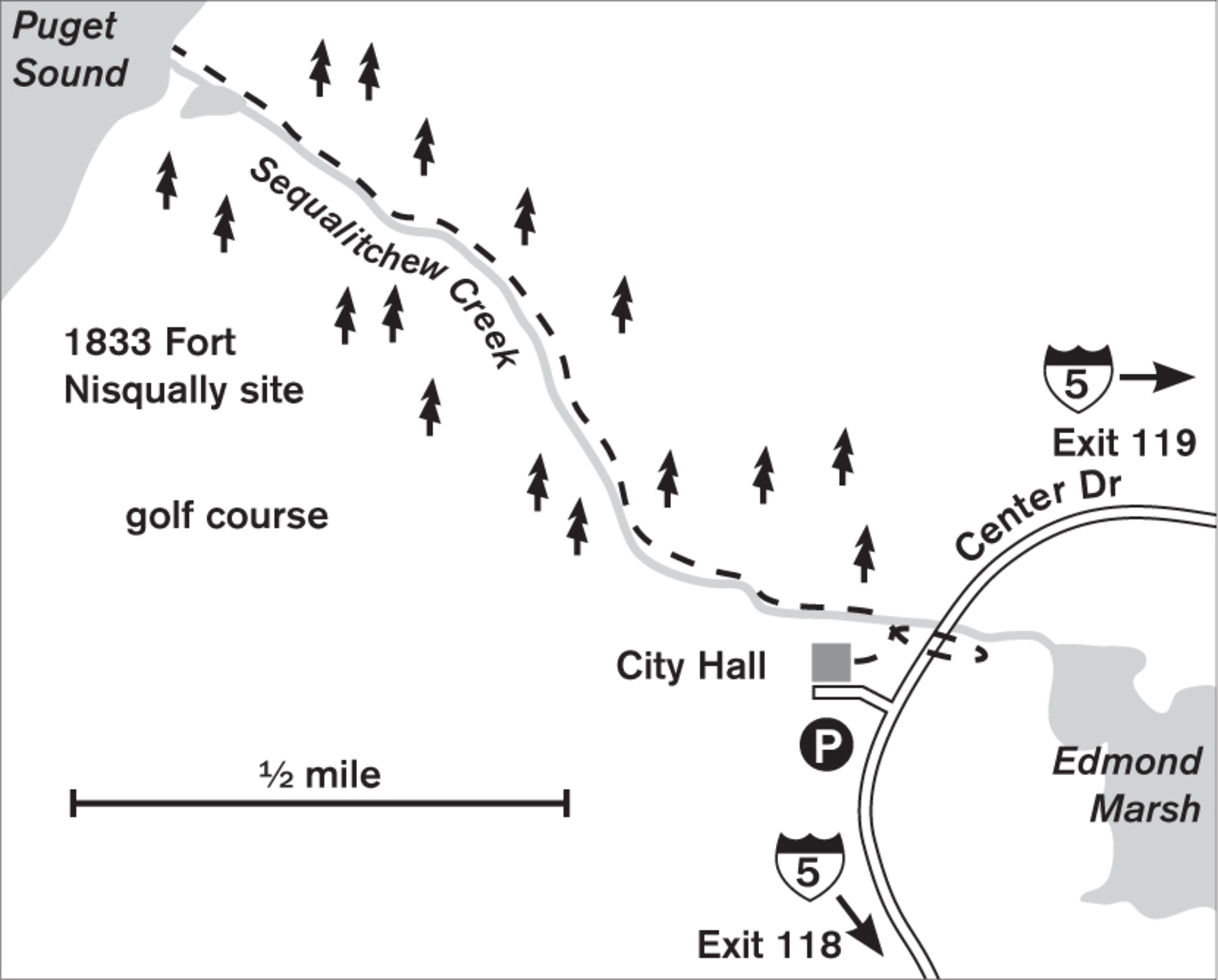
In a mighty forest of green canopy, green trunks, and green undergrowth, you can stroll gently downhill next to a murmuring creek on its last mile and a half to Puget Sound. This satisfyingly rich forest is a remnant of what surrounded a trading post of the Hudson’s Bay Company in the early 1830s. Nisqually Indians fished the creek for coho salmon and traded blankets, potatoes, and seeds. Now, the nearby town of DuPont is bustling with shops and schools, but they have preserved this gem of a walk.


Stop in at city hall for a trail map, then follow signage at the far end of the parking lot to cross the creek and turn north (left), downhill. Although much of the trail is a gentle gradient, there are steeper parts where the pavement has been replaced by deep gravel to combat slippage problems. Parents with strollers may have trouble here. This is a gloriously quiet walk, with just the sound of the creek in the deep cleft of forest. Near the wetlands is an old railroad tunnel, in which kids of all ages will love hooting and yodeling to create a symphony of echoes. Emerging from the tunnel, you’ll find an expansive stretch of Puget Sound beach complete with pebbles, driftwood, and bits of the old narrow gauge railway. If you want a short but heart-pumping workout, you can follow the switchbacks up a path on the south side that leaves the main trail just inland of the tunnel and wetlands.
ADDRESS: 1700 Civic Drive, DuPont
GETTING THERE: From I-5, take exit 119 (Steilacoom Road/DuPont). Turn west onto Steilacoom Road. Continue onto Barksdale Avenue. Go 0.3 miles to reach city hall on the right. To find the trailhead, park behind city hall, at the far end.
CONTACT: DuPont Parks and Recreation Department, (253) 912-5245, www.ci.dupont.wa.us

111 PRIEST POINT PARK
2.5 miles north of downtown Olympia
Meandering woodland trails through 341 acres lead out to the bluffs and shoreline of southern Puget Sound.
| TRAIL | 6 miles round-trip; natural surface |
| STEEPNESS | Gentle to moderate |
| OTHER USES | Pedestrians only |
| DOGS | On leash |
| CONNECTING TRAILS | None |
| PARK AMENITIES | Restrooms, picnic shelters, playground, wading pool |
| DISABLED ACCESS | Restrooms, picnic areas |


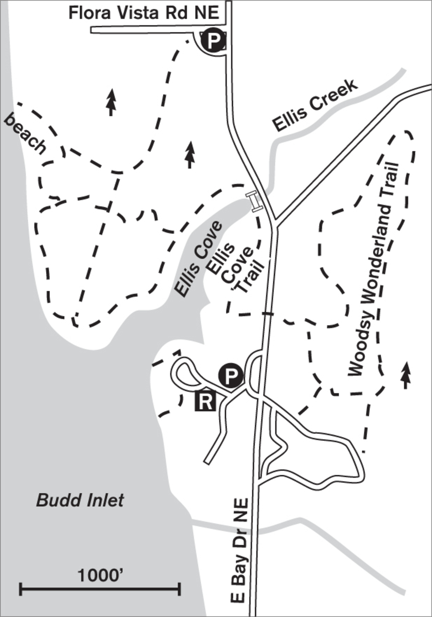
Warm sun filters through the summer canopy of big-leaf maples and Douglas firs. The air feels cool and then warm, and is fragrant with the delicious, almost imperceptible scent of blackberry blossoms. Ellis Cove Trail, the primary walking trail of Priest Point Park, meanders for 3 miles through woodland magic, passing creeks and ravines and then traversing bluffs above southern Puget Sound. Sword ferns, huckleberry, and salal weave a lush green carpet beneath towering western red cedars. This forest so well cocoons you in a sylvan spell that it’s hard to believe urban Olympia lies just minutes away.
The wide, soft, wood-chip path is easy on the feet and quiet, as bicycles and horses are prohibited. The sculptured wooden trail signs are imaginative and playful. At one junction, a carved squirrel shows the way out, and elsewhere a sea otter perches on the trail post. Look for the unexpected sculpture of the small black bear climbing a trunk high above the trail.
More forest trails can be found in the northwest quadrant of the park, accessed from parking on Flora Vista Road, or by footbridge over Ellis Creek itself. Here you’ll find paths leading to the pebbled beach of Budd Inlet, and more walking possibilities at mid- to low tide. Deep in the woods, the paths meander and turn, but there’s no fear of getting lost, what with all the wooden animals to give directions. Sturdy wooden walkways lead you down into the cool ravine where Ellis Creek ends in a tidal estuary.
Interpretive signs explain the life of the estuary and the native peoples who traveled to this point on Budd Inlet to trade. A French missionary lived here from 1848 to 1860. After he left, the virgin forest was reduced to stumps within 40 years. In 1905 the City of Olympia bought Priest Point Park and 75 years later created Ellis Cove Trail and the Woodsy Wonderland trails in the eastern portion of the park. This is one park to savor over and over again.


ADDRESS: 2600 E Bay Drive NE, Olympia
GETTING THERE: From I-5 northbound, take exit 105 (City Center/Port of Olympia); from southbound, take exit 105B. Follow signs for the Port of Olympia, staying right toward Plum Street. Follow Plum Street (which becomes E Bay Drive, then Boston Harbor Road NE) north for about 2 miles. The park entrance is on the right. To reach Ellis Cove Trail, enter the park and pass over Boston Harbor Road NE to get to another parking lot.
CONTACT: Olympia Parks, Arts, and Recreation Department; (360) 753-8380; www.olympiawa.gov/city-services/park

112 MCLANE CREEK NATURE TRAIL
7 miles southwest of downtown Olympia
Boardwalk trails lead past beaver ponds, over wetlands, and through 150 acres of temperate rain forest alive with wildlife.
| TRAIL | 2 wetland loops (0.6 miles and 1.1 miles), plus a 1-mile forest loop; natural surface, paved |
| STEEPNESS | Level to gentle |
| OTHER USES | Pedestrians only |
| DOGS | Not allowed |
| CONNECTING TRAILS | None |
| PARK AMENITIES | Restrooms, viewing platforms, picnic shelter, demonstration forest, interpretive signs |
| DISABLED ACCESS | Trail sections, restrooms |


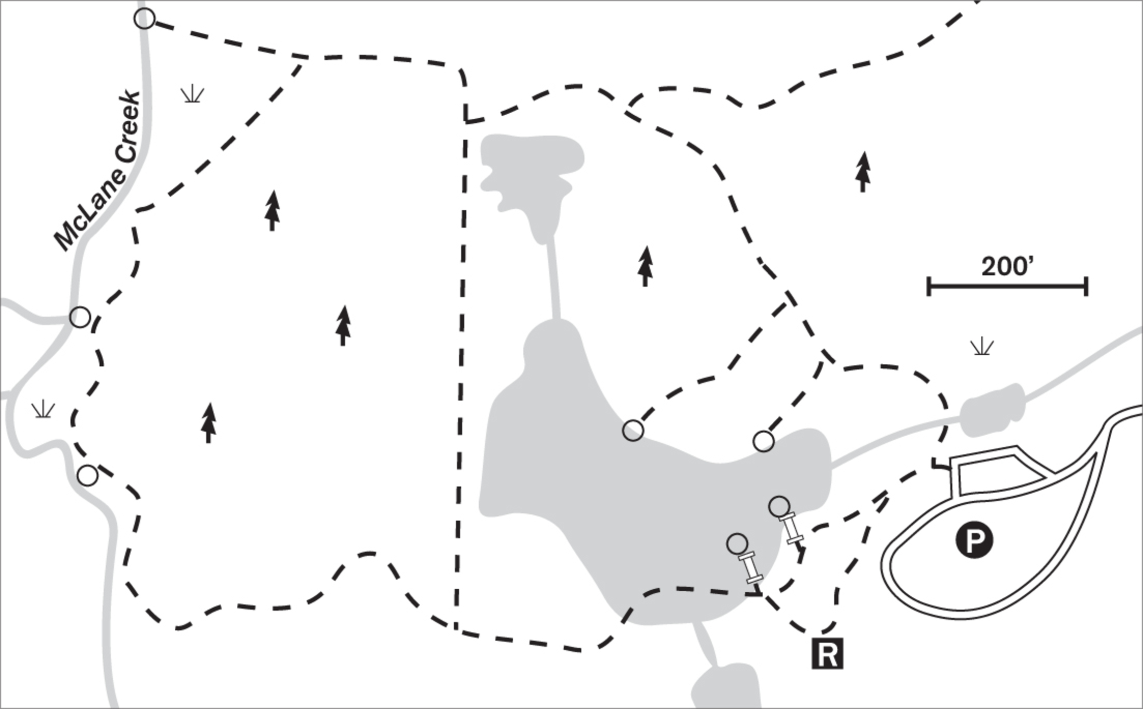
Enter a temperate rain forest in healing, more than 75 years after loggers took out the giants. Huge stumps show the scars of springboards but now serve as nurse logs for new saplings. Beavers maintain their ponds, and black-tailed deer and coyotes roam the open grassland at dawn and dusk.
Starting the loop either way leads you past active beaver ponds. These elusive but energetic rodents may not be easy to see, but you can observe the evidence of their work: freshly gnawed alders and cottonwoods lie tumbled along the water’s edge. In winter the pond is full, almost overflowing, and alive with ducks, geese, herons, frogs, otters, muskrats, and salamanders. Sometimes fall floods wash the dam out and the pond drains, but within six months the beavers can rebuild and refill the pond.
A cutoff trail, the Old Grade, makes a shorter loop or can be explored as a side trip from the main trail. This is a remnant of old logging days, when locomotives chugged through here on their way to the Mud Bay Timber Company on Puget Sound, just 5 miles away.
On the southern edge of the loop, you walk in a forest of western red cedar and Douglas fir. Moss and lichen adorn the massive limbs, and woodpeckers leave their markings where they have bored for insects. Sparkling-clear McLane Creek is home to spawning chum salmon. Interpretive signs along the trail help you envision the creek and surrounding habitat in all their seasonal changes.
ADDRESS: 5042 Delphi Road SW, Olympia
GETTING THERE: From I-5, take exit 104 (US 101 N/Aberdeen). Go 4 miles and take the Mud Bay/2nd Avenue exit. Turn left at the stop and go over the freeway. Take the first left onto McKenzie Road (which becomes Delphi Road). Go about 3 miles to the sign for McLane Creek Demonstration Forest and Nature Trail, and turn right to reach the trail parking. A Discover Pass is required for all vehicles.
CONTACT: Washington State Department of Natural Resources, (360) 577-2025, www.wa.gov/dnr



113 WATERSHED PARK (OLYMPIA)
1 mile south of downtown Olympia
Immerse yourself in 153 acres of a moss-draped temperate rain forest cut by whispering Moxlie Creek, where salmon come to spawn.
| TRAIL | 2.8 miles total; natural surface, boardwalk, wooden bridges |
| STEEPNESS | Gentle to steep |
| OTHER USES | Pedestrians only (no jogging) |
| DOGS | On leash |
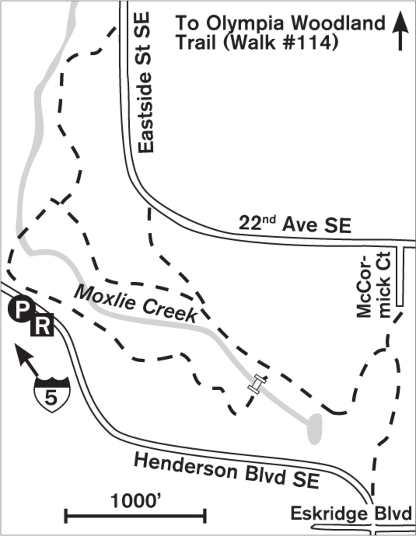
| CONNECTING TRAILS | Olympia Woodland Trail (Walk #114) at the Eastside Street pedestrian trailhead |
| PARK AMENITIES | Portable toilet at Henderson Boulevard parking lot |
| DISABLED ACCESS | Short section of gravel trail from 2829 Henderson Boulevard trailhead |


For nearly 100 years this temperate rain forest basin supplied the drinking water for all of Olympia. Saved from logging in the 1950s, Watershed Park now encircles you with a rich scent of wetland forest and the soothing sounds of birds and water. Bracken, horsetail, maples, and alder line G. Eldon Marshall Trail, which stretches from the rim to the streambed of Moxlie Creek and back. Trees tumbled by winter’s windstorms lie like giant matchsticks, their roots exposed like pinwheels.
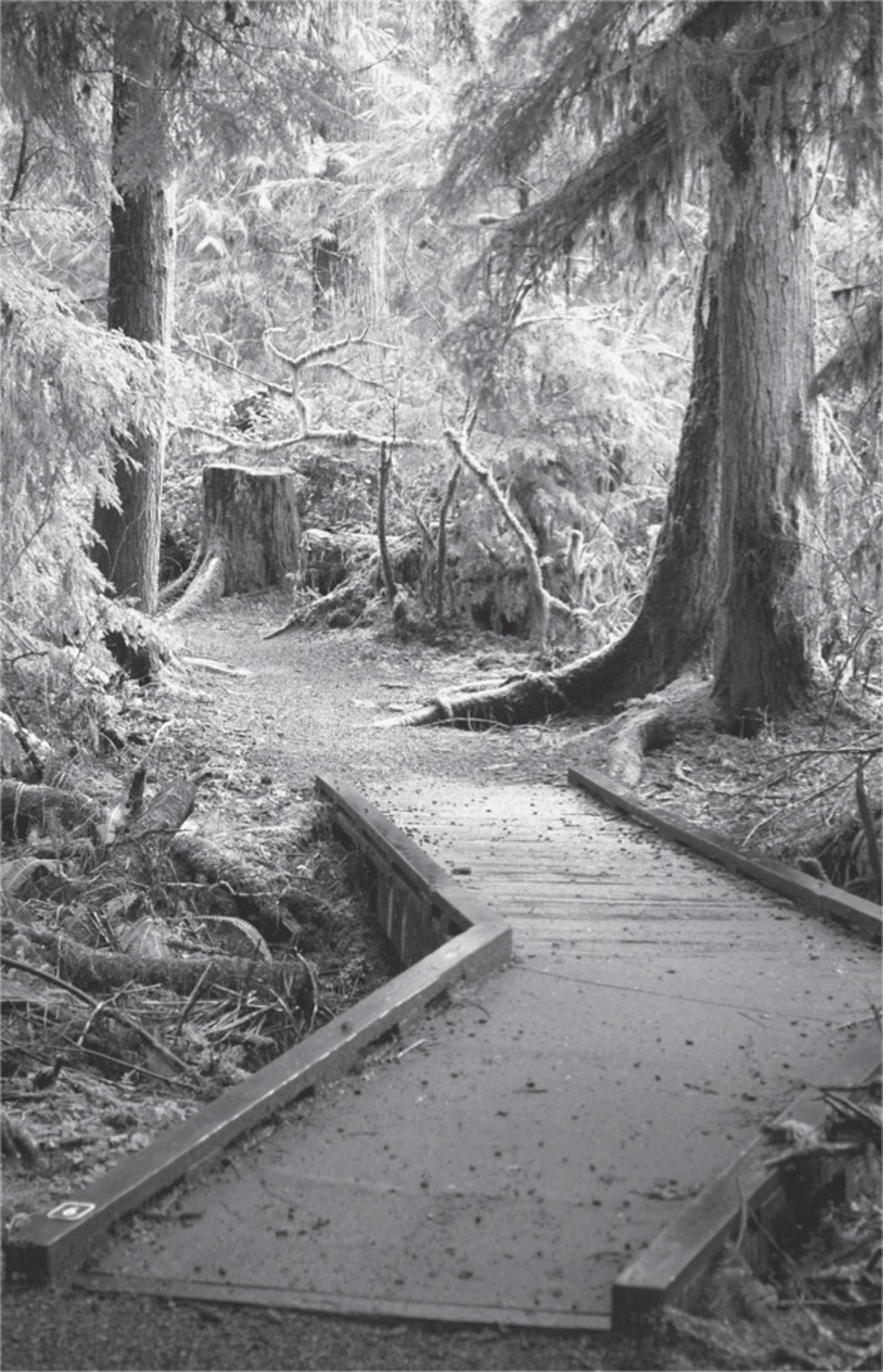
From the Henderson Boulevard parking lot, descend into the forest, taking the loop in either direction. Steps lead down to marshes where, in summer, green algae create an impressionist painting on the water’s surface. Sword ferns, bracken, and maidenhair ferns line the trail. In this deep, shady forest of Douglas fir, big-leaf maple, and alder, be ready for banana slugs and skunk cabbage, natural inhabitants of so wet and lush a place.
This is a popular walk, despite its ruggedness—or perhaps because of it. Young families come with children in tow, teaching them the wonders of the streambed, where salmon spawn and tadpoles scoot about like tiny bumper cars gone crazy. Dogs are welcome, but only on leash, to protect the fragile habitat and sensitive replanting areas. Boardwalks, too, protect the wetlands and help you keep your feet dry; sturdy wooden bridges offer vantage points above the clear, sandy-bottomed creek. Good trail maintenance has kept this rain forest walkable even on wet winter days.

ADDRESS: Parking: 2500 Henderson Boulevard SE, Olympia; Pedestrian: 2829 Henderson Boulevard SE; 1605 Eastside Street SE; 1201 22nd Avenue SE
GETTING THERE: From I-5 northbound, take exit 105 (City Center/Port of Olympia). Stay hard right, following Port of Olympia signs. At the end of the ramp, turn left (onto unmarked Henderson Boulevard) and go 0.25 miles to the trailhead on the left.
From I-5 southbound, take exit 105B. Follow signs for the Port of Olympia, staying left for Henderson Boulevard. Go under the freeway, and shortly after the roundabout the trailhead parking will be on the left.
CONTACT: Olympia Parks, Arts, and Recreation Department; (360) 753-8380; www.olympiawa.gov/city-services/parks. To volunteer to help maintain or enhance this park, call the Park Stewardship Program at (360) 753-8365.

114 OLYMPIA WOODLAND TRAIL
1 mile south of downtown Olympia
A level, accessible trail follows an old railway line for miles through a forest of towering maples and firs.
| TRAIL | 2.5 miles one way; natural surface, paved |
| STEEPNESS | Level |
| OTHER USES | Bicycles; horses on parallel natural trail |
| DOGS | On leash |
| CONNECTING TRAILS | Olympia’s Watershed Park (Walk #113), Chehalis Western Trail (Walk #107), Lacey Woodland Trail (extension to the east) |
| PARK AMENITIES | Restrooms, benches, map signs, picnic area |
| DISABLED ACCESS | Paved trail, restrooms, picnic area |


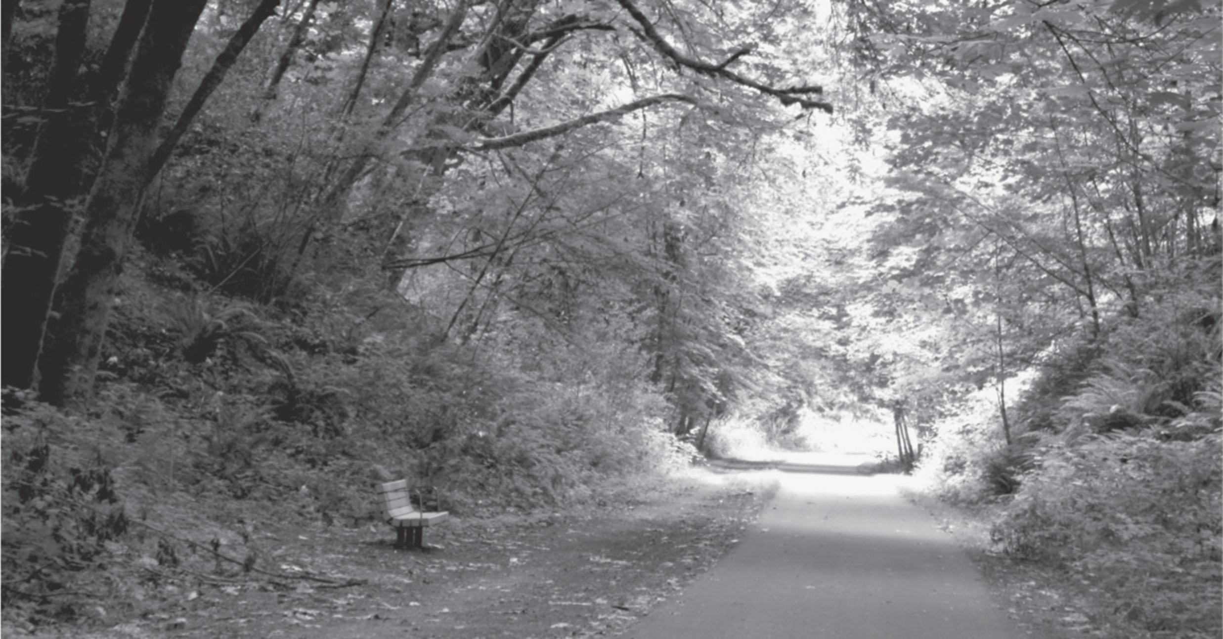
Birdsong rings brightly in this emerald thoroughfare of old Olympia forest. Huge maples, dressed in soft green moss-velvet, stand sentinel over the smoothly paved trail, and deep in a green cleft a stream rushes through a canopy of ferns. Just over 0.5 miles from the trailhead, near the Frederick Street trailhead (pedestrian only), a spur trail leads to a waterfall along East Indian Creek. Other small natural-surface nature trails have been built by volunteers and lead into the creek canyon or onto the surrounding ridges. Although never far from the interstate highway, the traffic blurs to white noise, and, surprisingly, the sound of birdcalls and the rushing stream can be clearly heard.

Over 25 years ago, this abandoned railway line began tempting Olympia’s residents with the dream of creating an accessible trail from Olympia to Lacey and beyond. The trail opened in 2007 and now extends almost 5 miles from the State Capitol. Hundreds of volunteers of all ages have planted over fifteen thousand shrubs and saplings to help restore native flora. The idea of “green” is a theme with the trail: the parking lot is porous pavement, the restrooms are lighted with solar tubes, and the entire roof of the restroom and picnic shelter at the Eastside Street trailhead is covered in plants.
The entire trail runs from Watershed Park in Olympia to central Lacey, for a total of 4.75 miles. Although the eastern trailhead is in Lacey’s Woodland Creek Community Park, with a pond and meadow trails, the 2.3 miles of interim trail traverse the business district and shops. For bicycling, the whole trail is a dream, but walkers seeking a natural venue should stick to the 2.5 miles between Olympia’s Eastside Street and the Chehalis Western Trail, or take short strolls at the Lacey end near Woodland Creek Community Park.
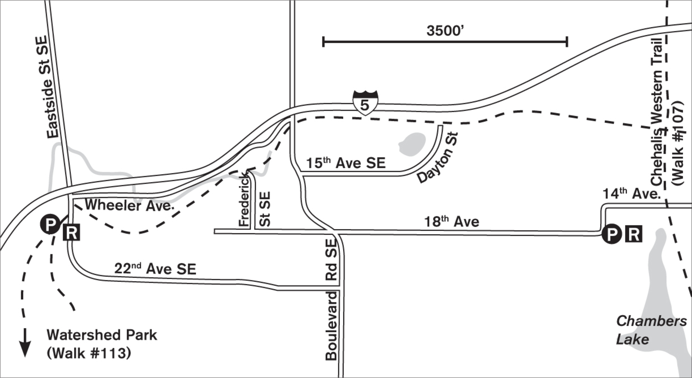
ADDRESS: 1600 Eastside Street SE, Olympia. Pedestrian trailheads at Frederick Street and Dayton Avenue.
GETTING THERE: From I-5, take exit 105 (Port of Olympia); from I-5 southbound, take exit 105B (Port of Olympia). Go straight through the light onto Plum Street. Go 0.1 miles and turn right onto Union Avenue SE. Go 0.2 miles and turn right onto Eastside Street SE. Cross the bridge and look on the left for the parking lot and a low building with plants on its roof.
CONTACT: Olympia Parks, Arts, and Recreation Department; (360) 753-8380; www.olympiawa.gov/city-services/parks. To volunteer, contact the Woodland Trail Greenway Association: www.wtga.org.

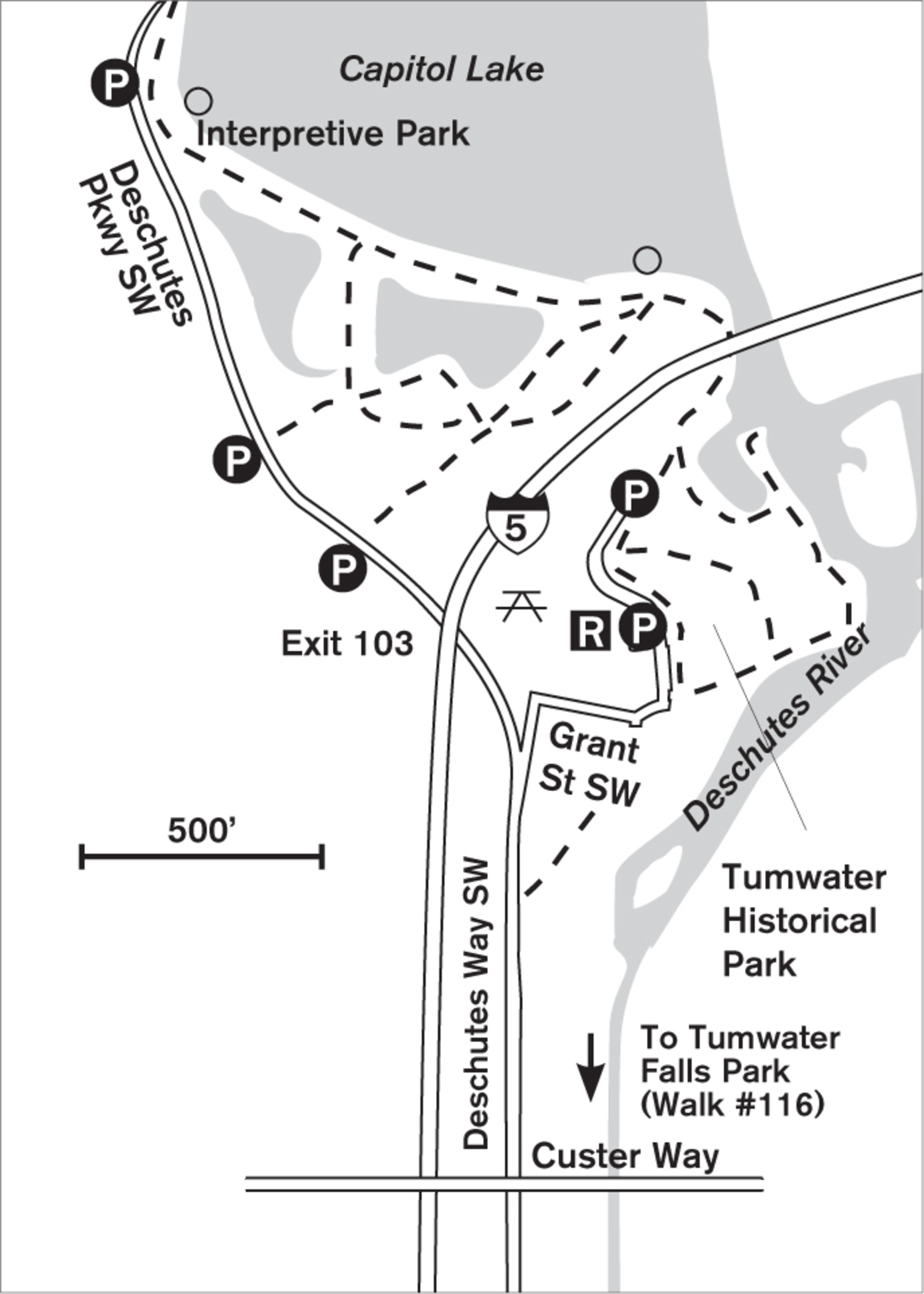
115 TUMWATER HISTORICAL PARK AND CAPITOL LAKE INTERPRETIVE TRAIL
Tumwater, 2 miles south of downtown Olympia, to Olympia
Wander 35 acres along the Deschutes River to Capitol Lake wetlands and an interpretive trail.
| TRAIL | 1.5 miles; natural surface, paved |
| STEEPNESS | Level |
| OTHER USES | Bicycles |
| DOGS | On leash |
| CONNECTING TRAILS | Capitol Lake; Tumwater Falls Park (Walk #116) via sidewalk |
| PARK AMENITIES | Restrooms, playground, picnic shelter, interpretive trail, fishing docks, viewpoints |
| DISABLED ACCESS | Paved trail, restrooms |


Nestled in a pocket of marsh and greenery beneath the ramparts of I-5, tiny Tumwater Historical Park may not be a long-distance destination in itself unless you’re a Washington State history buff. Numerous interpretive signs tell of life along the river, the old Olympia Brewery, and the early settlers. After strolling the garden-like setting of wild roses and marsh walks to the edge of the river, you can head north under the freeway to the shores of Capitol Lake, where a dock provides viewing access to the lake and a chance to get closer to the ducks and geese or to spot birds in the reeds that adorn its edges.
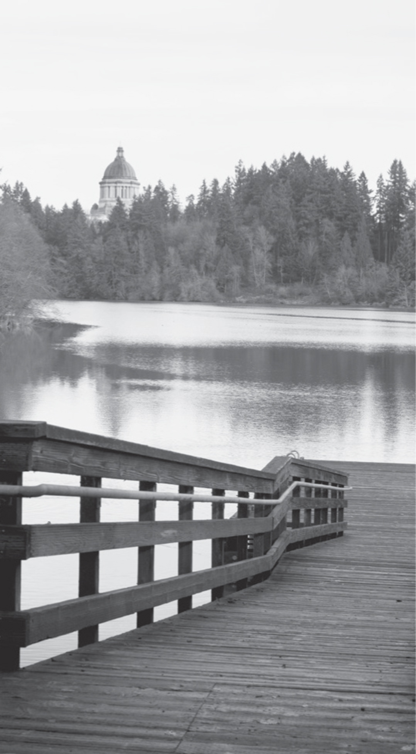

In this wild corner of Capitol Lake (created in the late 1970s when the lake was dredged) you may hear the blackbirds whistle tse-er, tse-er or spot a great blue heron studying the water for lunch. The trail splits here, with the paved portion following the lake toward the Capitol Lake Interpretive Center and another viewing and fishing dock. Dozens of botanical markers dot both sides of the trail for those interested in what grows along the lakeshore.
If you stay left and follow the fence line on a natural surface path, you can loop around a wetland, pass near road parking on Deschutes Way, and circle back to the paved lake trail. Despite its proximity to the freeway, this stretch of trail is surprisingly quiet except for the undulating song of robins and the chirps of wrens.
The lake was first proposed in 1911 as a means of trapping sediment from the Deschutes River, but was not created until 1951. Today this lake is home to migrating and resident flocks of, among others, western grebes, red-winged blackbirds, juncos, pied-billed grebes, scaups, ruddy ducks, and swallows. In recent years New Zealand land snails have colonized the water, and due to their invasive nature, the lake is closed for swimming and boating.
ADDRESS: Tumwater Historical Park: 802 Deschutes Way SW, Tumwater; Capitol Lake Interpretive Trail: 300 Deschutes Parkway SW, Olympia
GETTING THERE: From I-5 northbound, take exit 103 (Deschutes Way). Continue straight from the ramp through one stop sign, then turn right on Grant Road, which leads into the park.
From I-5 southbound, take exit 103 (2nd Avenue). At the light, turn left on Custer Way to cross the freeway. Immediately after the overpass, take a sharp right, curving down to Deschutes Way. Turn right, then right again onto Grant Road into the park. Parking is available along Deschutes Way to access the interpretive trail.
CONTACT: Tumwater Parks and Recreation Department, (360) 754-4160, www.ci.tumwater.wa.us/departments/parks-recreation. Washington State Department of Enterprise Services maintains the interpretive trail; call them at (360) 902-8881 or visit www.des.wa.gov.

116 TUMWATER FALLS PARK
2.5 miles south of downtown Olympia
The whoosh of cascading falls promises a sense of wilderness on this short jaunt into 15 acres of historical Washington.
| TRAIL | Less than 1 mile; paved, natural surface |
| STEEPNESS | Level to steep |
| OTHER USES | Pedestrians only |
| DOGS | On leash |
| CONNECTING TRAILS | Tumwater Historical Park (Walk #115) via 1 block of sidewalk |
| PARK AMENITIES | Restrooms, picnic area, playground, viewing platforms, interpretive signs, salmon ladders, guided tours, native garden, historical site |
| DISABLED ACCESS | Salmon ponds, interpretive kiosk, restrooms |


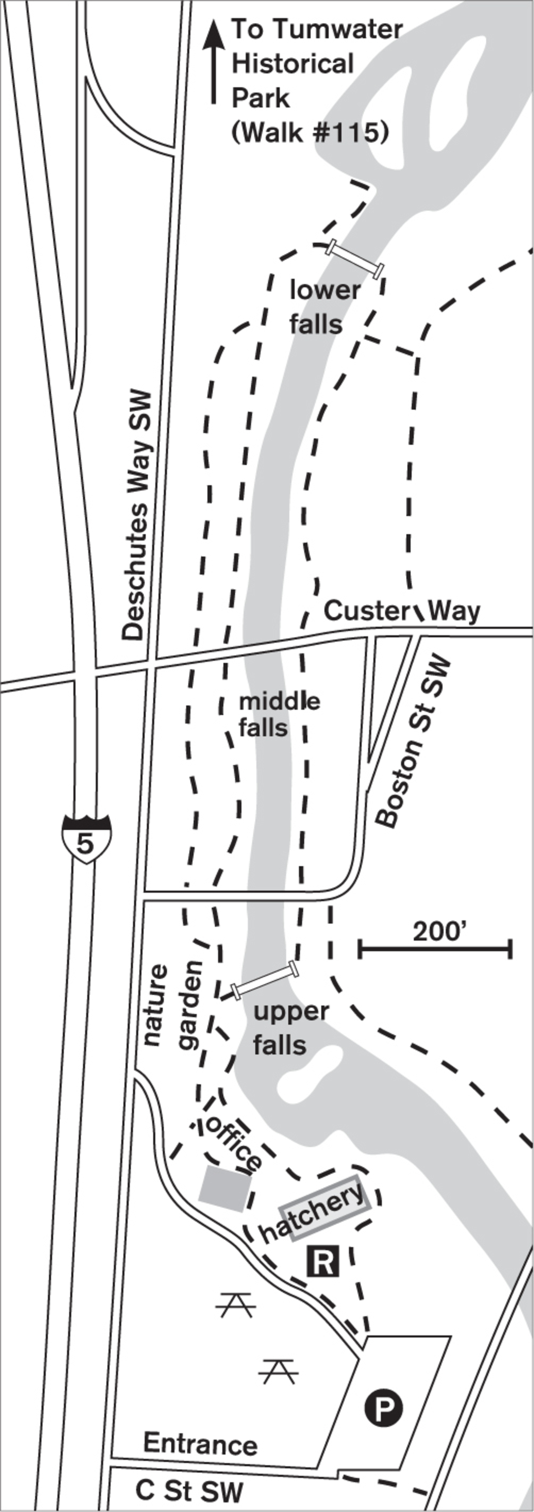
Walk the banks of the wild and tumbling Deschutes River as it makes the final leaps toward Puget Sound in three pounding cascades. A loop trail of paved pathways leads from the upper falls to the lower falls, and historical replicas of bridges span the river. So wonderfully noisy is this river that it blocks all sound of the nearby freeways and leaves you with a sense of having stepped out of the urban world into the mountains.
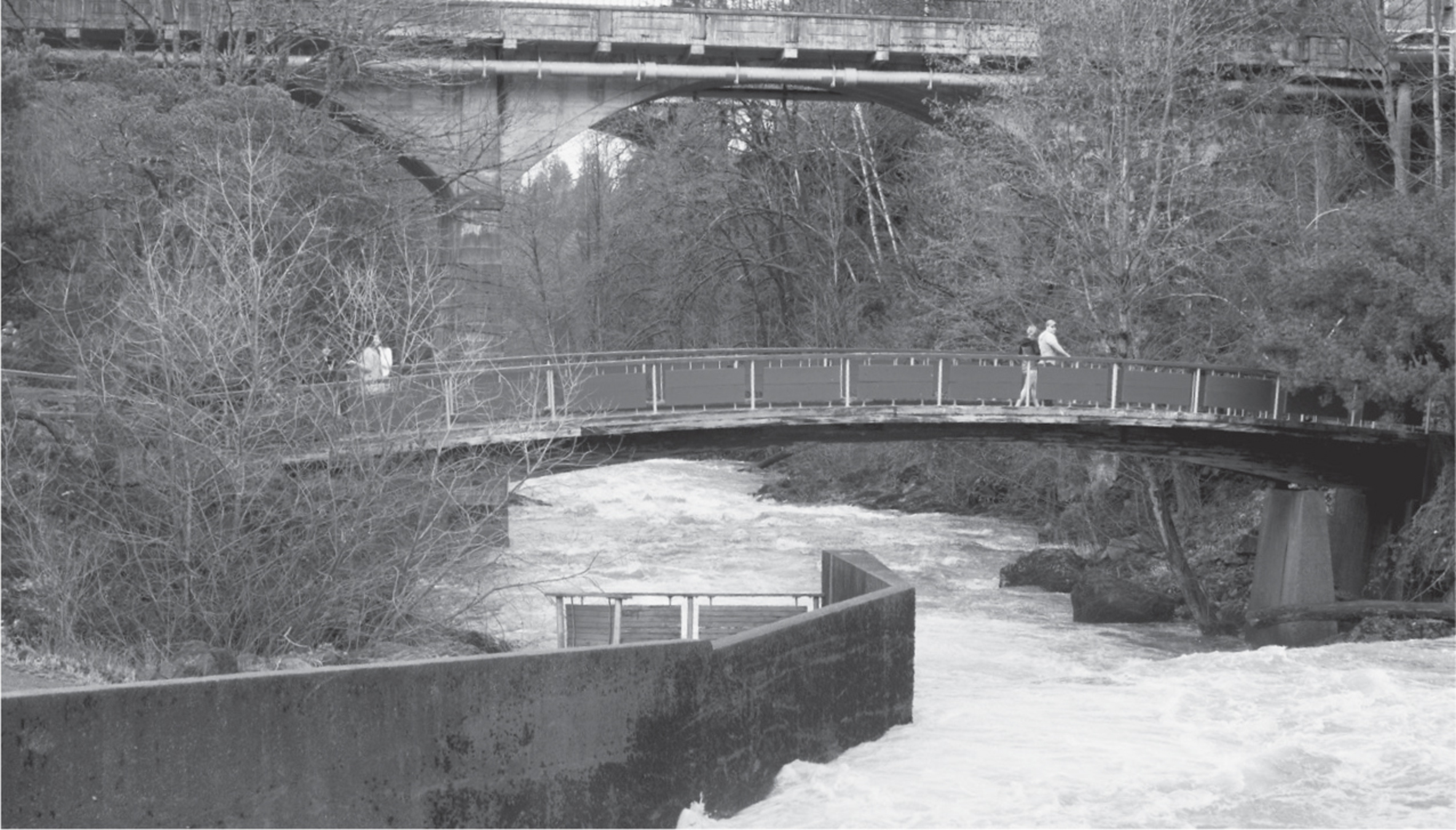

This small park is not only a great place for a short walk but it is full of information about the historical setting. It was here that Leopold Schmidt started the Olympia Brewery (visible across the river), and there were mills and logging ventures as well. In spring and summer the native-plants garden flourishes, and the maples create patterns of light and shadow over the well-maintained trails and footbridges. In winter the paths are kept clear and dry, and the rain-swollen river rages beside you.
In autumn, though, the park portrays its best character, with a colorful palette of fall leaves on the deciduous trees and the excitement of seeing the salmon run as the fish make their way up the ladders flanking the falls. A Washington Department of Fish and Wildlife facility is located on the grounds, and here you can learn about the spawning of the salmon and how the fish eggs and milt are harvested to be placed in hatcheries throughout the state.
Owned privately by the Olympia Tumwater Foundation, the park is free and open to the public daily. Side paths parallel the river on the old railroad grades, allowing for more exploration. Tumwater Falls Park is located immediately upriver from Tumwater Historical Park, and the two parks beg to be united. Until then, you can walk the 800 feet of sidewalk between the two, or drive for 1 minute and continue your walk and tour of historical Tumwater.
ADDRESS: 110 Deschutes Way SW, Tumwater
GETTING THERE: From I-5 southbound, take exit 103 (2nd Avenue) and follow 2nd Avenue to Custer Way, which will cross the freeway and river by the old Olympia Brewery. Turn right immediately onto Boston Street SW, then left onto Deschutes Way SW. In 0.2 miles turn left onto C Street SW into the park.
From I-5 northbound, take exit 103 (Deschutes Way). Continue north on Deschutes Way for 0.3 miles. Turn right onto C Street SW into the park.
CONTACT: Olympia Tumwater Foundation, (360) 943-2550, www.olytumfoundation.org. Donations to the park, which is a 501(c)(3) charity, may be tax deductible.

117 PIONEER PARK
Tumwater, 4 miles south of downtown Olympia
Stroll meadows and grasslands along the banks of the Deschutes River in this 85-acre community park.
| TRAIL | 1.5 miles total; gravel, natural surface, paved |
| STEEPNESS | Level |
| OTHER USES | Bicycles |
| DOGS | On leash |
| CONNECTING TRAILS | None |
| PARK AMENITIES | Restrooms, picnic areas, playground, playing fields |
| DISABLED ACCESS | Paved trail, restrooms |


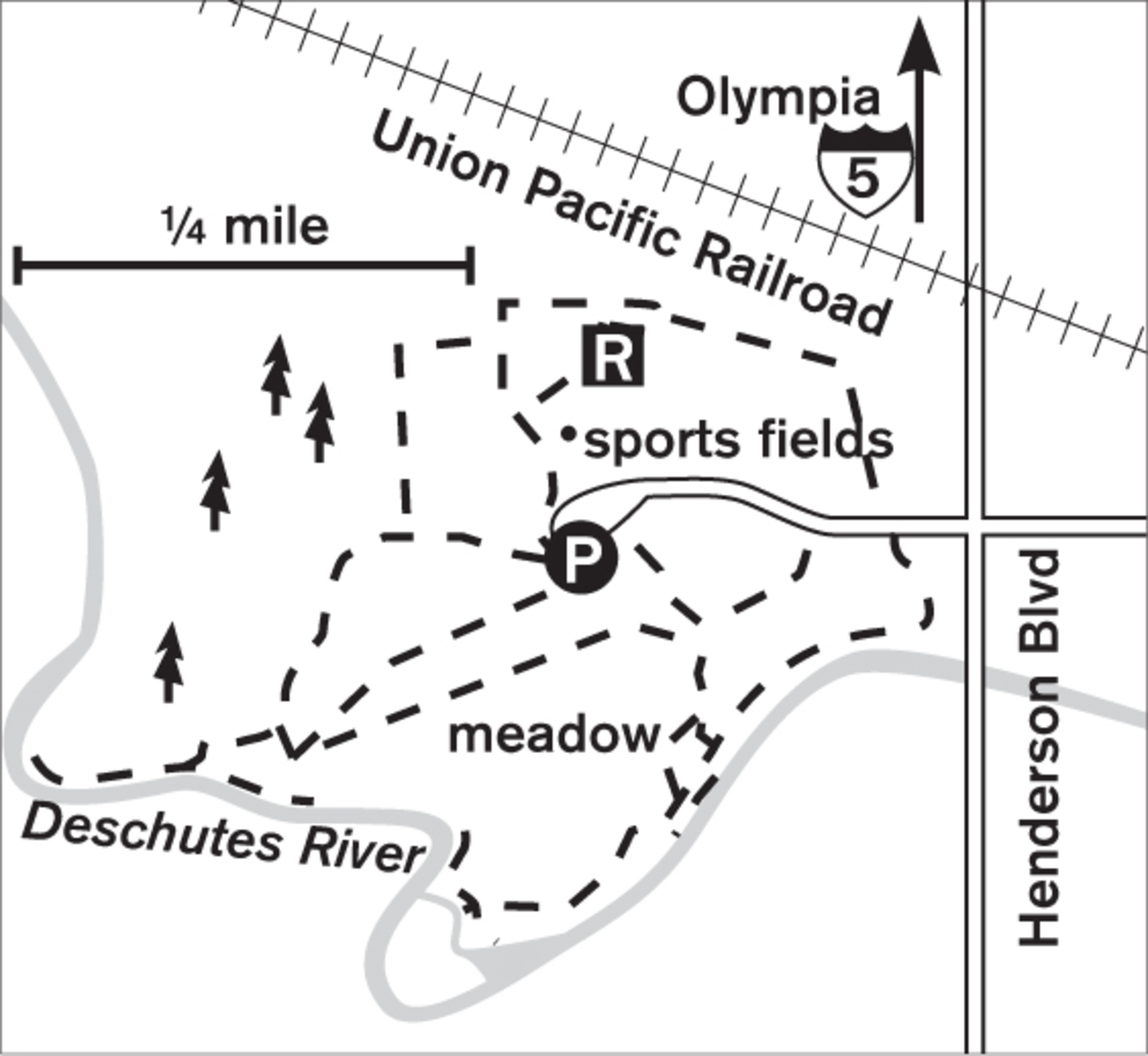
This spacious community park with a rural feel and open meadows lies only minutes south of downtown Olympia. Here you can walk well-defined trails through open grassland or explore the banks of the Deschutes River. A trail system completed in 1996 has enlarged the park, and now it appeals not only to playground users and ball players but also to walkers, joggers, and birders.
Nestled in a curve of the Deschutes River, the meadow hosts rabbits and shrews, food for the hunting hawks overhead. From the parking lot, turn south from the playing fields and cross the natural meadow. The row of cottonwoods and alders defines the riverbank, where you can wander the sandy edge or picnic on the graveled bar. No swimming is allowed, but you can stop and throw a fishing line. Free-to-borrow life jackets are available to allow parents some peace of mind as their children play on the riverbanks in summer. Back in the meadow, take a different loop to return to the cars. If it’s a clear day, look for the white crown of Mount Rainier to the east. Winter rains swell the river to dangerous levels, so it’s not a time for exploring too close to the banks.
ADDRESS: 5801 Henderson Boulevard SE, Tumwater
GETTING THERE: From I-5 northbound, take exit 101 (Tumwater Boulevard). Turn east and follow Tumwater Boulevard to its end (about 1 mile). Turn left on Henderson Boulevard and go about 0.6 miles. The park is on the left just past the Deschutes River.
From I-5 southbound, take exit 103 (2nd Avenue). At the flashing light, turn left on Custer Way, which crosses the freeway. Continue on Custer Way through one light, then turn right at Cleveland Avenue. Go 1.2 miles and turn right on Henderson Boulevard. Go 0.5 miles, across Yelm Highway and the railroad tracks. The park is on the right at the bottom of the hill.
CONTACT: Tumwater Parks and Recreation Department, (360) 754-4160, www.ci.tumwater.wa.us/departments/parks-recreation



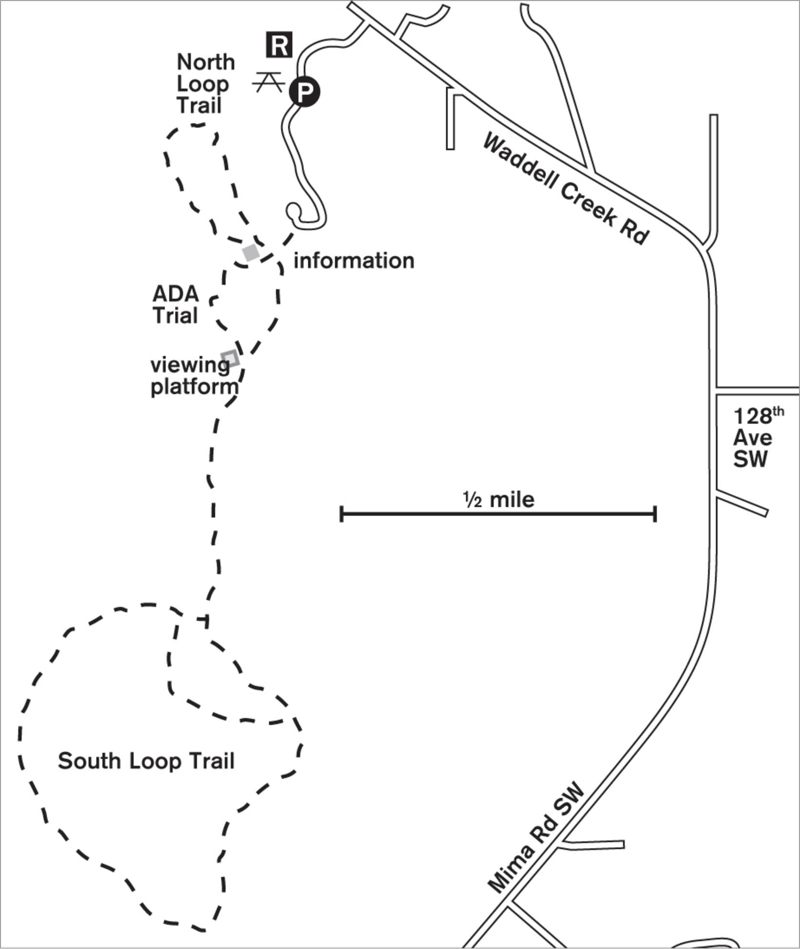
118 MIMA MOUNDS NATURAL AREA PRESERVE
10 miles south of downtown Olympia
Stretch your legs and your imagination in 625 acres of grassland where the earth mounds into a bubbled landscape.
| TRAIL | 3 miles; paved and natural surface |
| STEEPNESS | Level |
| OTHER USES | Pedestrians only |
| DOGS | Not allowed |
| CONNECTING TRAILS | None |
| PARK AMENITIES | Picnic tables, restrooms, viewing platforms, interpretive signs |
| DISABLED ACCESS | Paved 0.5-mile loop trail, interpretive kiosk, restrooms |


Leave your car in the embrace of the forest, and step into a rare and magical land of undulating prairie grasses and ground cover. In spring and summer the prairie glows with blue and yellow flowers, and butterflies flit between the blossoms. In fall and winter the grasses give way to low orange and brown ground cover, and clumps of frothy white reindeer lichen brighten the undulating mounds. Year-round, raptors circle overhead searching for voles and mice, and on clear days Mount Saint Helens rises above the forest to the southeast.
Unique in heavily forested western Washington, this natural grassland hides a geological mystery: How were these hundreds of acres of rolling mounds formed? Naturalists and scientists have long been pondering the origins of these mounds of glacial rocks and loam, and since 1841 more than thirty theories have been proposed, from burial grounds to gophers. Today, scientists generally agree that the mounds were formed after the last glaciers retreated 16,000 years ago and that they may have been the result of meltwater or earthquakes.


This unique prairie has long been known by the Native Americans who came here to find herbs and camas root, important plants used for healing and food. They maintained the health of the prairie by burning each year to keep the encroaching forest at bay. This practice also provided an open hunting ground and made traveling easier. Today, the DNR also does controlled burns to reduce the invasion of the forest and nonnative plants.
If you choose the long southern loop trail, you can see remnants of the stumps removed by the DNR. In fall and winter patches of controlled burns may be unsightly, but it is in these areas that the spring flowers flourish each year.
ADDRESS: 12470 Waddell Creek Road SW, Olympia
GETTING THERE: From I-5 northbound, take exit 95 and stay left to merge onto Maytown Road SW. Go toward Littlerock, where the road jogs slightly and becomes 128th Avenue SW. Continue west to the T-junction with Waddell Creek Road and Mima Road SW. Turn right onto Waddell Creek Road SW. The park is on the left in about 0.7 miles. A Discover Pass is required for parking.
CONTACT: Washington State Department of Natural Resources, (360) 577-2025, www.dnr.wa.gov

119 MILLERSYLVANIA STATE PARK
10 miles south of downtown Olympia
Walk through miles of old-growth forest and over lakeside wetlands in this 843-acre park.
| TRAIL | 8.6 miles; boardwalk, natural surface |
| STEEPNESS | Level |
| OTHER USES | Bicycles |
| DOGS | On leash |
| CONNECTING TRAILS | None |
| PARK AMENITIES | Restrooms, playground, picnic areas, beaches, campgrounds, fitness trail, nonmotorized-boat rentals |
| DISABLED ACCESS | Restrooms, campgrounds, paved trails |


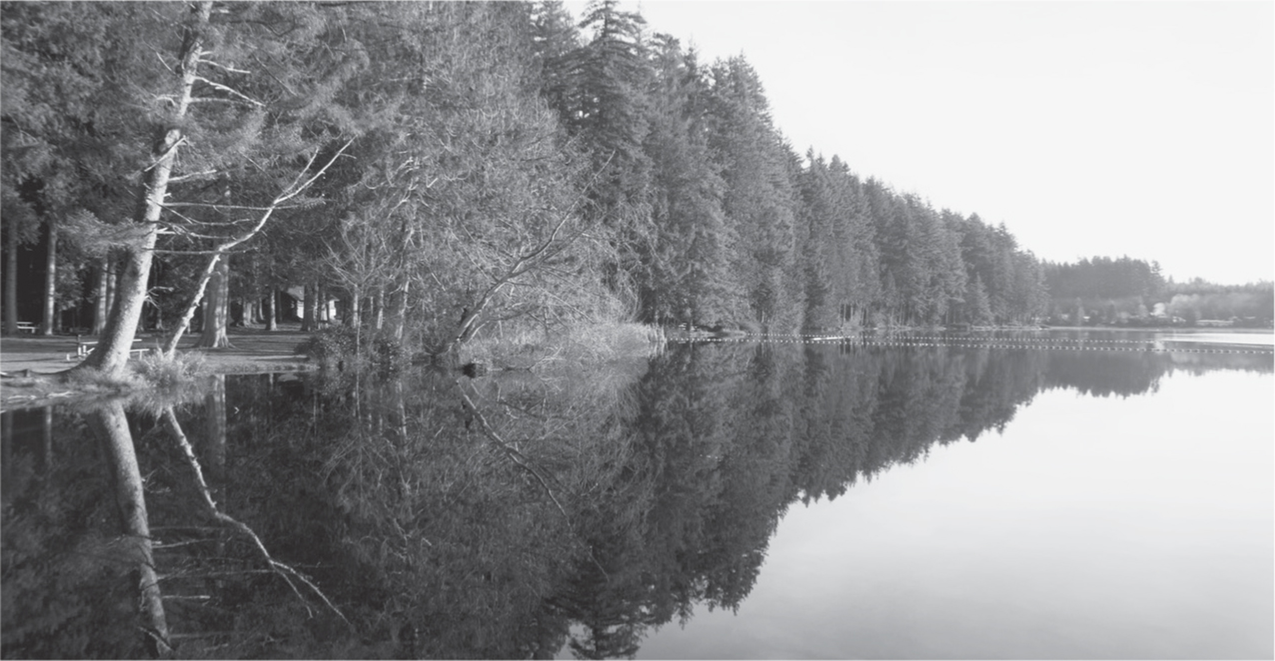
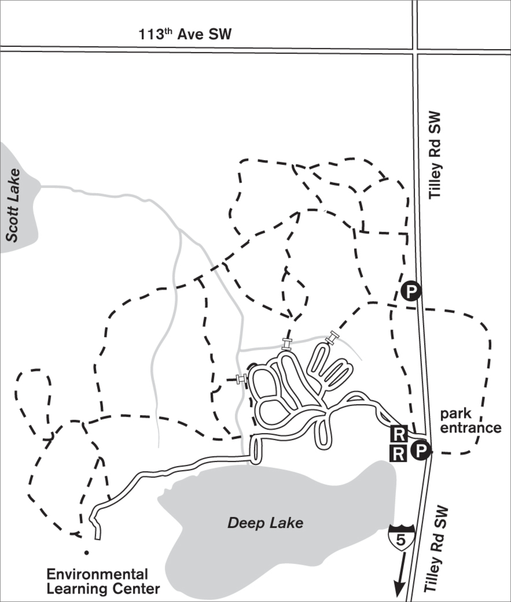
Stroll under immense old Douglas fir and western red cedar trees on miles of soft, needle-lined trails. Cross a wetland on a puncheon boardwalk. Enjoy the quiet of this state park forest in a section far from the bustle of the beaches (the park has 3,300 feet of lakefront). Here you may see pileated woodpeckers or their dainty cousins, the downy woodpeckers. Even if the birds elude you, you’ll see evidence of work in the large holes pecked into snags throughout the forest.
For those with a mind for exercise besides walking, follow the blue-and-white arrows to the 1-mile fitness trail. Millersylvania’s trail uses natural stumps for steps and logs for balance, an interesting (but possibly slippery) version of the normal exercise equipment found on other fitness trails.
Those arriving early or staying in the campgrounds might find scat or tracks of martens, raccoons, or coyotes. Around the borders of Deep Lake you may see evidence of muskrats or otters. Birdlife is prolific. On and over the lake, look for ducks, geese, ospreys, and eagles. In summer, hummingbirds frequent bushes by the orchard and lakeshore.
The land was homesteaded in 1855, and remnants of the narrow-gauge railroad and skid roads can still be found. In 1921 the Miller family, who had dubbed it Millersylvania, donated the land to the state, stipulating it was to be held forever as a park. The park’s structures were built almost entirely by hand in 1935 by the Civilian Conservation Corps. There is a separate parking lot for walkers on Tilley Road, in an old orchard north of the main entrance.
ADDRESS: 12245 Tilley Road S, Olympia
GETTING THERE: From I-5 southbound, take exit 99 (93rd Avenue S/WA 121 S). Turn left on 93rd Avenue S/WA 121 S. Drive 1.5 miles and turn right on Tilley Road S/WA 121 S. The park entrance is on the right in 2.9 miles. A Discover Pass is required for parking.
CONTACT: Washington State Parks, (360) 753-1519, www.parks.wa.gov


120 YELM TO TENINO TRAIL
Tenino, 13 miles south of downtown Olympia, to Yelm, 20 miles southeast of downtown Olympia
Walk past historic towns, farmland, forest, the Deschutes River, and McIntosh Lake on this rural rails-to-trails pathway.
| TRAIL | 14 miles one way; paved |
| STEEPNESS | Level to gentle |
| OTHER USES | Bicycles; horses on parallel trail |
| DOGS | On leash |
| CONNECTING TRAILS | Chehalis Western Trail (Walk #107) |
| PARK AMENITIES | Restrooms at all trailheads, picnic tables at Yelm trailhead, historic interpretive signs |
| DISABLED ACCESS | Paved trail |


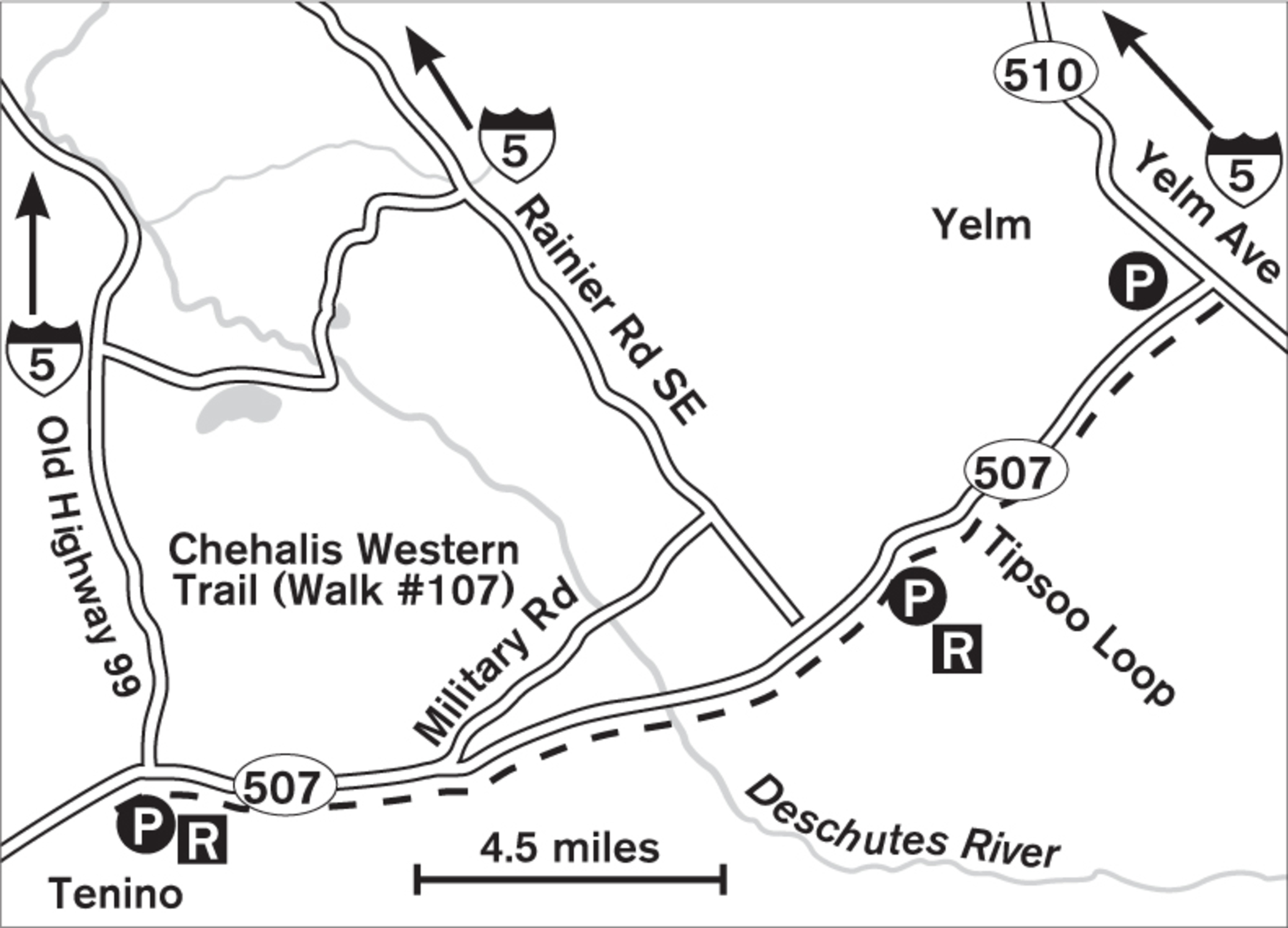
Walk through historic Yelm, and then into the countryside with great views of Mount Rainier. One of the newest rails-to-trails conversions in Western Washington, this bicyclers’ paradise (and walkers’ long-distance challenge) connects the rural towns of Yelm, Rainier, and Tenino along the route followed for more than 100 years by the Burlington Northern Railroad. Although the trail parallels WA 507 fairly closely, it is pleasantly quiet. You pass orchards, farms, and backyards.
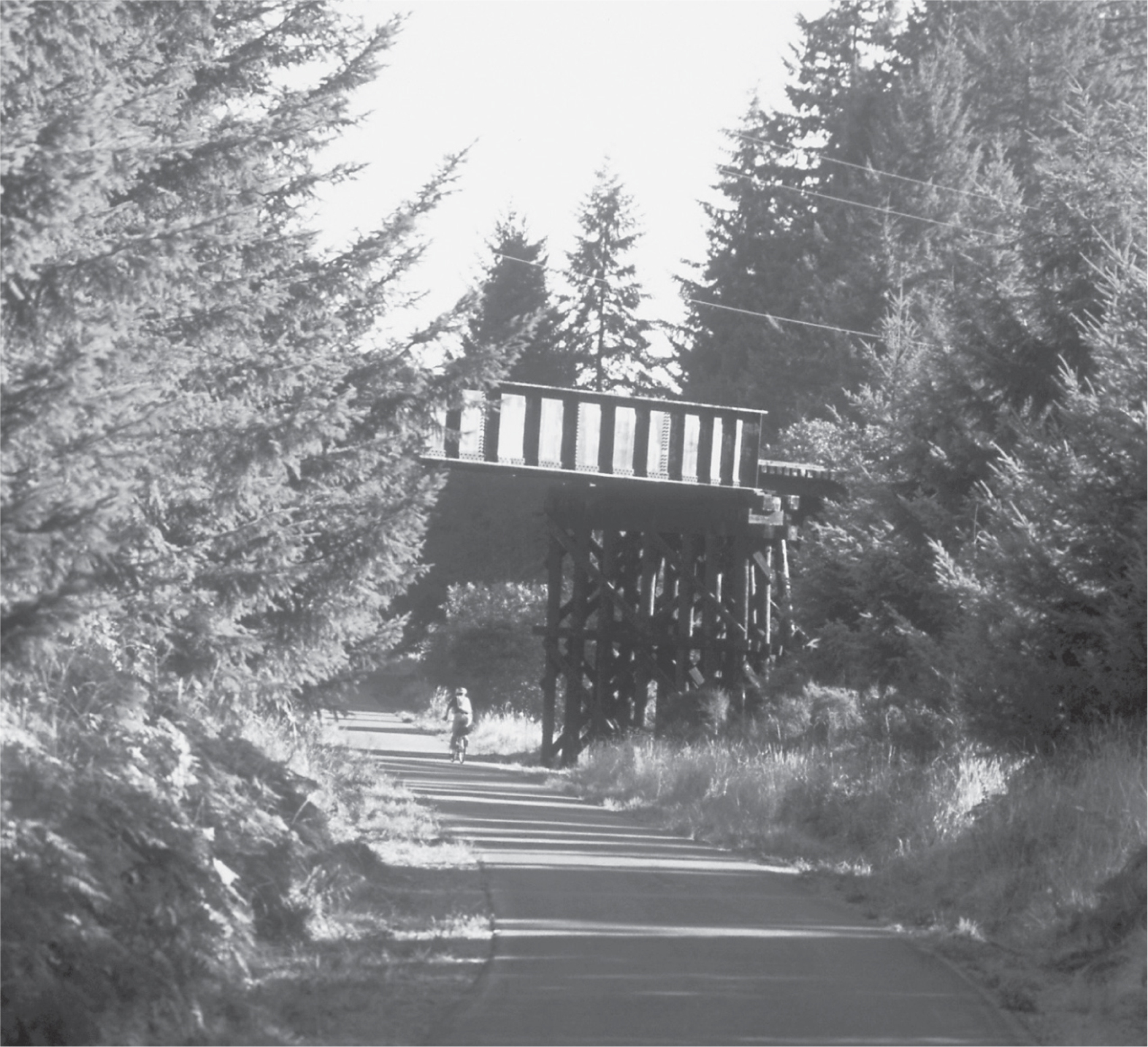
Now fully paved, the trail from Yelm goes southwest through the town of Rainier’s Wilkowski Park. Restrooms and a trailhead can be found here. West from Rainier, you cross the Deschutes River near the Chehalis Western Trail (Walk #107), then skirt the borders of Lake McIntosh for 0.75 miles, with some good birding. The trail passes under historic trestles and traverses tranquil sections of Douglas fir forest and agricultural land. The trail ends at Tenino City Park, which has parking and restrooms. Parts of the trail cross driveways and small roads, so keep kids and pets close.
ADDRESS: Tenino trailhead: Washington Avenue, Tenino; Yelm trailhead: 105 W Yelm Avenue, Yelm
GETTING THERE: Tenino trailhead: From I-5, take exit 101 (Tumwater Boulevard). Stay on Tumwater Boulevard through the traffic circle. Turn right onto Capitol Boulevard SE/Old Highway 99 SE. Go about 9.8 miles. In Tenino, turn left onto Sussex Avenue, then right onto S Frost Street. Follow S Frost as it becomes O’Brien, then turns sharply left to become Washington Avenue. The trailhead is in the park.
Yelm trailhead: From I-5 north- or southbound, take exit 111 (Marvin Way/WA 510). Go 13 miles southeast on WA 510 into Yelm. Before the first stoplight in Yelm, turn right into the city hall parking lot on W Yelm Avenue.
CONTACT: Thurston County Parks and Recreation Department, (360) 786-5595, www.co.thurston.wa.us/parks
