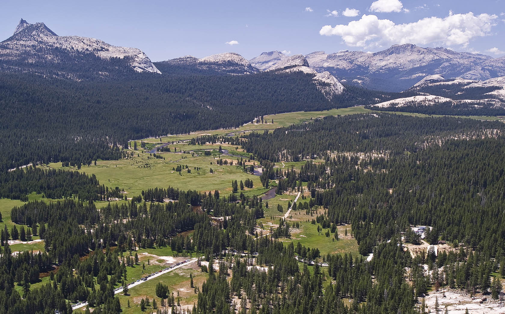

Lying at an elevation of 8,600 feet, Tuolumne Meadows is the gateway to Yosemite’s High Sierra—a stunning wilderness of flowery meadows, snow-capped peaks, and miles of sparkling granite. Hiking trails radiate out from Tuolumne (pronounced Too-All-Uh-Me) in all directions, offering hikers and rock climbers access to Yosemite’s alpine wonderland. Whether you’re looking for an easy stroll, a moderate day hike, or a strenuous week-long backpack, Tuolumne Meadows has it all. Tuolumne is also the Sierra Nevada’s largest subalpine meadow, making it a great place to just kick back and relax.
For thousands of years, the Ahwahneechee Indians journeyed from Yosemite Valley to Tuolumne Meadows to trade with the Mono Indians, who lived east of Yosemite. The high elevation also offered the Ahwahneechee relief from Yosemite Valley’s summer heat. Fast forward to the present, and not much has changed. In July and August, when Yosemite Valley is plagued with heat spells and crowds, savvy Yosemite visitors head to Tuolumne to cool off high above it all. Temperatures in Tuolumne Meadows are generally 15 to 20 degrees cooler than in Yosemite Valley. While not entirely uncrowded, Tuolumne Meadows never feels like a carnival, and true Sierra solitude is never more than a hike away. (Sweaty hiker note: hot showers can be purchased at Tuolumne Lodge.)
When it comes to Tuolumne hiking, timing is everything. In winter Tuolumne Meadows is often buried under 10–12 feet of snow. Visit in the early spring and many trails might still be covered in snow. Visit just after the snow melts and you’ll be fighting off swarms of mosquitoes. Visit after the mosquitoes die down, however, and you’ll be treated to High Sierra splendor. Check the park website (nps.gov/yose) for current trail conditions, and ask rangers about mosquitoes before hitting the trail. August and September are consistently good months for hiking in Tuolumne, but September usually brings the first frost. By late September, nights in Tuolumne often dip below freezing.
No matter when you visit Tuolumne, plan on bringing warm clothes. Summer days are famously sunny and warm, but nights can get chilly. Afternoon thundershowers, though infrequent, are possible. There have even been snow flurries in the summer.
Located alongside Tioga Road, Tuolumne Meadows is 55 miles (90-minute drive) from Yosemite Valley and 13 miles (30-minute drive) from the town of Lee Vining at the eastern base of the Sierra Nevada. In past years the Tuolumne Meadows Hikers Bus made a daily trip between Yosemite Valley and Tuolumne Meadows from July through mid-September. As this book went to press, the new park concessionaire, Aramark, had not officially announced continuation of this service. For up-to-date info call 209-372-4386 or visit travelyosemite.com. YARTS runs a shuttle between Mammoth Mountain and Yosemite Valley that stops in Tuolumne Meadows. The YARTS shuttle runs daily in July and August and on weekends in June and September (877-989-2787, yarts.com)
Throughout the summer a free shuttle runs between Olmstead Point and Tioga Pass (check the Yosemite Guide for seasonal hours and dates).
This small visitor center is a great place to get up-to-date Tuolumne info: trail conditions, shuttle schedules, weather reports, etc. There are also natural history exhibits and a small bookstore. Open through late September. (209-372-0263)
Pick up wilderness permits at this small building, located a half mile east of Tuolumne Campground, just off Tioga Road. (209-372-8427)
This seasonal store offers a surprisingly good selection of groceries, beer, wine, books and basic camping supplies. Located just west of Tuolumne Campground.
This small store sells an ample selection of outdoor gear—everything from tents to climbing shoes. Located just west of the Tuolumne Store on Tioga Road.
Free ranger-led walks, hikes and campfire programs are offered throughout the summer and into the fall. Check the Yosemite Guide for seasonal dates and times.
Like its counterpart in Yosemite Valley, the Yosemite Mountaineering School in Tuolumne offers rock climbing lessons for all abilities. (209-372-8435)
The Tuolumne Meadows Stables offers mule and horseback rides along several nearby trails. Options include 2-hour rides, 4-hour rides, half-day rides, full-day rides and multi-day pack trips. (209-372-8427)
 Tioga Pass Resort $$ (Brk, Lnch, Din)
More than a wayside restaurant, the Tioga Pass Resort is a High Sierra institution, luring visitors with its great menu and a cozy atmosphere. The food is high on quality, low on pretension, and full of 9,000-foot alpine charm. Located two miles east of Tioga Pass.
 Tuolumne Lodge $$ (Brk, Din)
Tuolumne Lodge offers the only sit down dining experience in Tuolumne Meadows. Diners are seated in random groups at large tables, so plan on getting to know your neighbors. Reservations are required for dinner. Box lunches are available if ordered the night before. Located next to the front office at Tuolumne Lodge. (209-372-8413)
Located in a Mobil gas station—yes, gas station—this otherwise nondescript mini-mart serves shockingly good food. From pizza and sandwiches to buffalo meatloaf and fish tacos with mango salsa, their menu is extensive and eclectic. Located near the junction of Tioga Road and Highway 395 in Lee Vining. (760-647-1088)
This bare bones take-out grill serves cheap, greasy staples like burgers, hot dogs and chicken sandwiches. There are also a handful of healthy options. It’s hardly gourmet, but it sure beats dehydrated camping food. Located next to the Tuolumne Store.
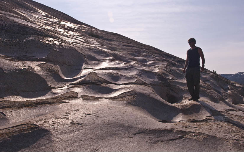
A 200-foot scramble to the top of this small dome offers great views of Tuolumne Meadows. Pothole Dome is named for a series of rounded depressions (“potholes”) on its southern flank. The smooth rock on the southern flank is often mistaken for glacial polish—a glassy veneer created when the underside of a moving glacier buffs the bedrock to a shine—but the polish on Pothole Dome’s southern flank was created by water, not ice. During the last Ice Age, water flowed under a glacier that covered Pothole Dome. The gritty water, channeled by a tunnel in the ice, flowed uphill over the dome, sculpting the potholes and polishing the rock. Actual glacial polish can be seen on Pothole Dome’s eastern slope.
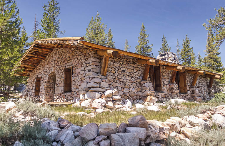
This bubbling, naturally carbonated spring is hardly picturesque, but the views of Tuolumne Meadows and the surrounding peaks make it a great destination. The path to Soda Springs is an easy 1.5 mile stroll—perfect for visitors of all ages. From the Lembert Dome parking area, follow the dirt road north and continue past the metal gate. After checking out Soda Spring, head over to Parsons Lodge (above), a quaint stone lodge built by the Sierra Club in 1914. For decades the building was used as a Sierra Club meeting house. Today Parsons Lodge houses a number of interesting exhibits, and free lectures are offered on summer weekends.
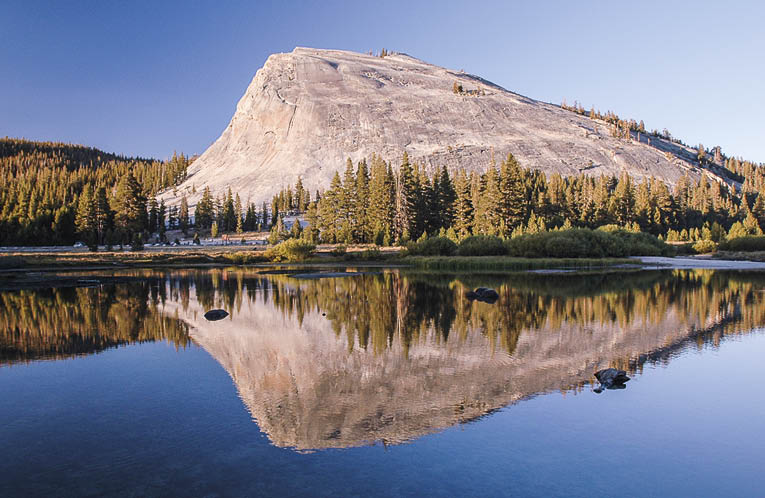
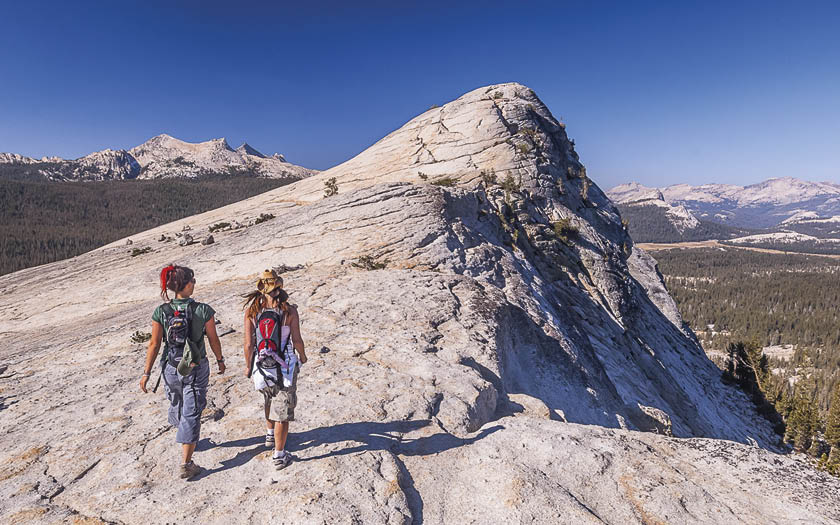
Looming 900 feet over the eastern end of Tuolumne Meadows, Lembert Dome is named for John-Baptiste Lembert, a sheepherder who homesteaded in Tuolumne Meadows in the late 1800s. In a strange twist of fate, the geological term used to describe formations like Lembert Dome is roche moutonnée (“stone sheep”). Roche moutonnées form when glaciers flow over a large rock outcrop, smoothing out a gradual uphill slope. As the glacier overrides the top, it plucks away at the rock below, forming a steep drop-off. A short trail heads to the top of Lembert Dome, which offers stunning 360-degree views of Tuolumne Meadows and the surrounding peaks.
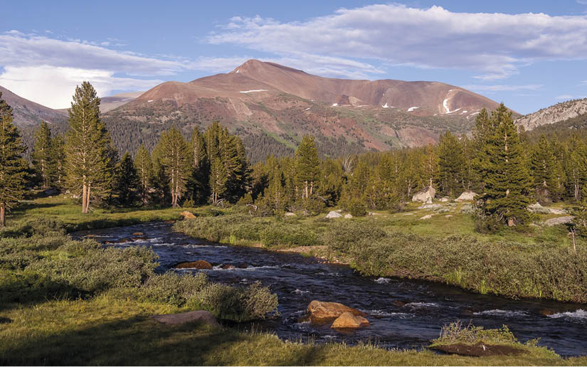
This roadside pullout along the Dana Fork of the Tuolumne River offers great views of Mt. Dana (on the left) and Mt. Gibbs. The pullout is marked by a small post labeled T36. At 13,053 feet Mt. Dana is the second highest peak in the park. Only Mt. Lyell (13,114 feet) is taller. Mt. Gibbs (12,764 feet) is the fifth highest peak in the park. While savoring the view of Mt. Dana and Mt. Gibbs, notice their dark coloration. The two peaks are composed of ancient metamorphic rocks that once covered all of Yosemite’s granite. This is one of the few places in the park where these ancient metamorphic rocks are still visible. A strenuous 3-mile hike heads to the top of Mt. Dana.

This beautiful meadow, located just west of the park boundary, lies 1,000 feet higher than Tuolumne Meadows. Twenty thousand years ago both meadows were buried under a massive glacier, but when global temperatures warmed around 15,000 years ago the ice started to melt. As the glacier retreated, huge chunks of ice broke off and formed depressions in the ground called kettles, which ultimately filled with water. The small ponds you see today are remnants of those kettles. You may also notice dozens of fallen trees on the north side of the meadow. These trees were knocked down several decades ago when an avalanche raced down the slopes above the meadow, which explains why all of the fallen trees point downhill.
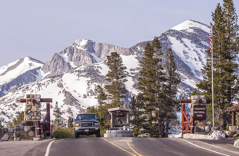
At 9,941 feet, Tioga Pass (above) is the highest highway pass in California. It marks Yosemite’s eastern boundary, which is also the watershed boundary for the Tuolumne River. (Precipitation that falls west of Tioga Pass flows down the Tuolumne River and is destined for San Francisco; precipitation that falls east of Tioga Pass flows down Lee Vining Creek towards the Great Basin Desert.) As Highway 120 heads east from Tioga Pass, it plunges down the sheer eastern slope of the Sierra Nevada to the small town of Lee Vining. Along the way you’ll be treated to great views of Tioga Lake, Ellery Lake and Lee Vining Canyon.

This alkaline lake, lying in the desert east of Yosemite, is famous for its unusual tufa towers: calcium carbonate spires (formed at underwater springs) that have recently been exposed due to low lake levels. Because Mono Lake has no outlet, dissolved salts from runoff concentrate over time. It’s estimated that over 280 million tons of salt are dissolved in the lake, making it roughly 2.5 times as salty as the ocean.
In 1941 the city of Los Angeles extended its aqueduct system to divert water flowing into Mono Lake. Predictably, lake levels plummeted. The lake lost one-third of its surface area and Negit Island (previously far offshore) turned into a peninsula. The island was a critical nesting site for birds—over 50,000 gulls, 85% of California’s breeding population, nest at Mono Lake—and coyotes marched across the peninsula to feast on the birds’ eggs. In 1978 the Mono Lake Committee teamed up with the Audubon Society to restore Mono Lake. In 1994 the lake’s tributary streams won legal protection, and the lake’s levels have been slowly rising ever since.
In the depths of the Ice Age 20,000 years ago, Mono Lake was much larger than its present size. The surface of the ancient lake, called Lake Russell, lay at an elevation of about 7,140 feet—nearly 750 feet higher than today. Glaciers descending from the eastern slopes of the Sierra Nevada emptied directly into the lake, calving off icebergs into the water.
Mono Lake was named after the Mono Indians, who gathered alkali fly larvae along its shore. The larvae, called kutsavi, were crushed into a paste that was considered a delicacy. As one white explorer noted in 1863, “The Indians gave me some; it does not taste bad, and if one were ignorant of its origin, it would make fine soup.”
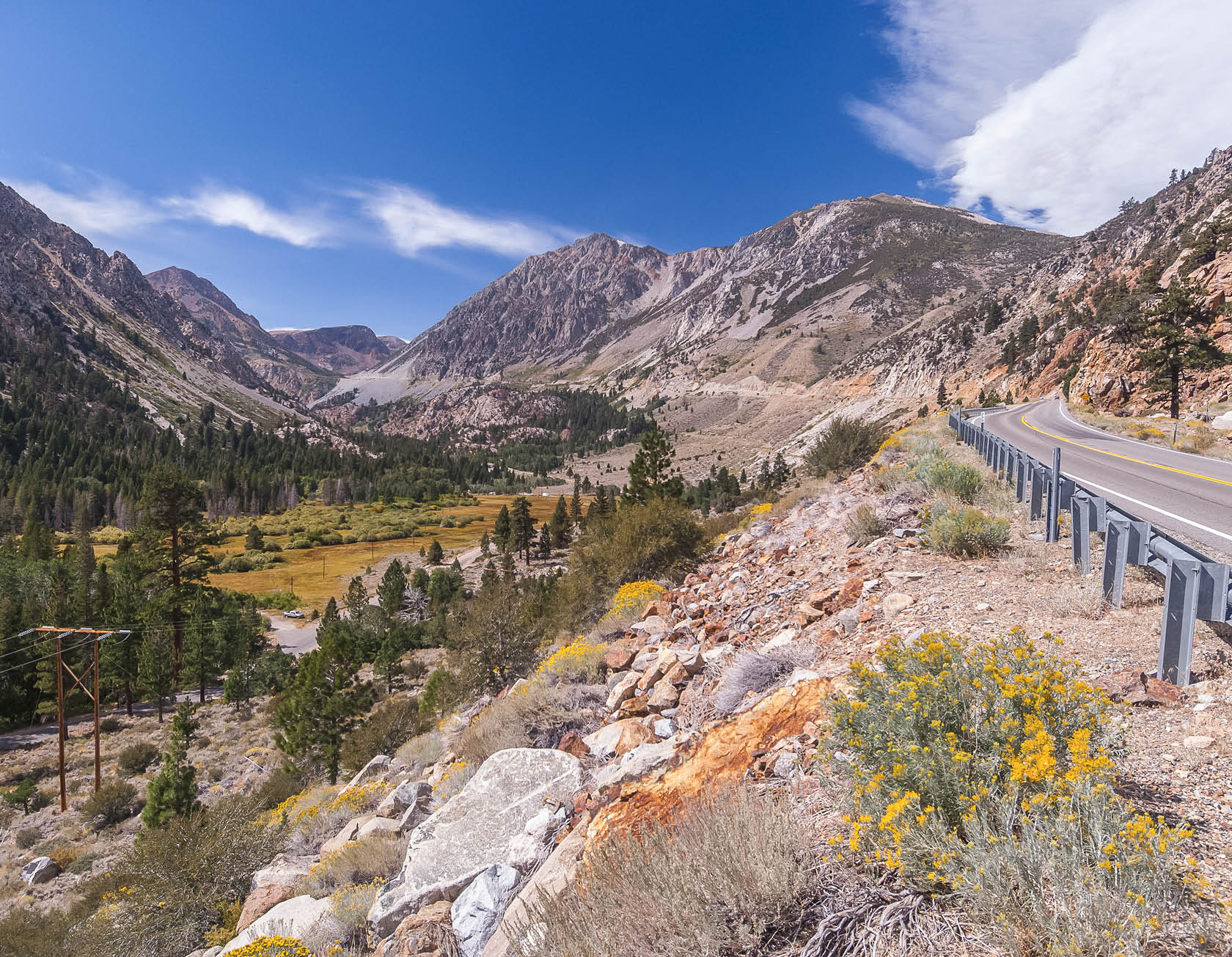
East of Tioga Pass, Tioga Road enters one of its most dramatic stretches. It starts innocently enough, twisting through pine forests and passing a pair of beautiful alpine lakes. Then, suddenly, Tioga Road makes a sharp turn north. Spread out below is Lee Vining Canyon, a startling expanse that slices through the crest of the Sierra Nevada and extends to the town of Lee Vining, which lies at the eastern base of the mountains. Over the next nine miles, Tioga Road clings to the steep mountainside as it plummets over 2,000 feet. Not to worry. Whatever you lose in brake pads you’ll gain in majestic scenery. (Tip: shift into low gear during the descent.) And if you think the drive is tough, try running up the road. That’s what over 100 masochists do each September during the Tioga Pass Run. This 12.4-mile race, which starts in Lee Vining and ends at Tioga Pass, climbs 3,200 feet. The 2015 winner, Patrick Parsel, completed the race in under 90 minutes.
Rating Moderate
Distance 1.6 miles, round-trip
Hiking Time 1 hour
Elevation Change 850 feet
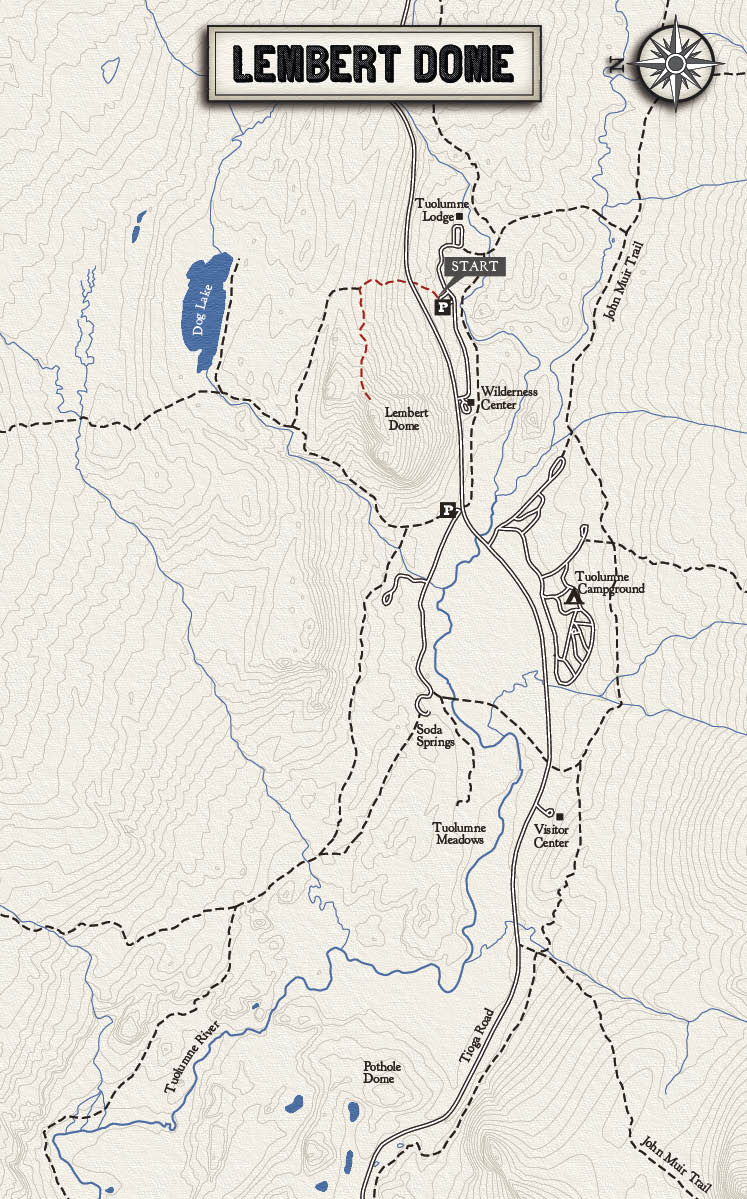
Summary For a relatively quick Tuolumne hike with dramatic views, nothing beats Lembert Dome. Rising 9,450-feet over the east end of Tuolumne Meadows, Lembert Dome offers panoramic views of the High Sierra, including peaks along the eastern crest of the Sierra and the Cathedral Range. From the Dog Lake parking area the trail climbs through a forest, heads west at a junction, and emerges onto an open stretch of bare granite. At this point there’s no official trail, but a series of cairns (small rock piles) will guide you towards the summit. With broad views of the western horizon, Lembert Dome is a fantastic spot to watch the sunset (make sure to bring a flashlight or headlight for the hike down).
Trailhead The best (and shortest) route to the top of Lembert Dome starts from the Dog Lake parking area near Tuolumne Lodge. Take the free shuttle, or drive east on Tioga Road from Tuolumne Meadows and turn right towards Tuolumne Lodge. Follow the road to the Dog Lake parking area. The trail starts at the upper end of the parking area and crosses Tioga Road.
Rating Moderate
Distance 7.5 miles, round-trip
Hiking Time 4–6 hours
Elevation Change 1,000 feet
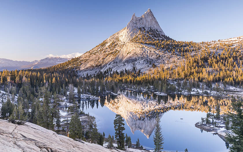
Summary These two small lakes, nestled along the John Muir Trail, are among the prettiest in Yosemite. Kick back on the smooth granite shores of Lower Cathedral Lake and soak in the dramatic views of Cathedral Peak, or continue to the flower-strewn meadows surrounding Upper Cathedral Lake and check out the peak from a different perspective. The hike to Cathedral Lakes is an uphill workout, but the scenery is definitely worth it. Lower Cathedral Lake, reached via a half-mile spur trail, is the larger of the two. If you’ve got a limited amount of time or energy, spend it there. But if your inner alpine lake lover is thirsting for more, continue a half mile past the spur trail to Upper Cathedral Lake. Backpacking note: Upper Cathedral Lake is a popular camping spot, but overnight camping is not allowed at Lower Cathedral Lake.
Trailhead The trail to Cathedral Lakes starts about 1.5 miles west of the Tuolumne Visitor Center. Parking is often tight due to the trail’s popularity, so consider riding the free shuttle from the Visitors Center.

Rating Moderate
Distance 4.6 miles, round-trip
Hiking Time 3–4 hours
Elevation Change 850 feet
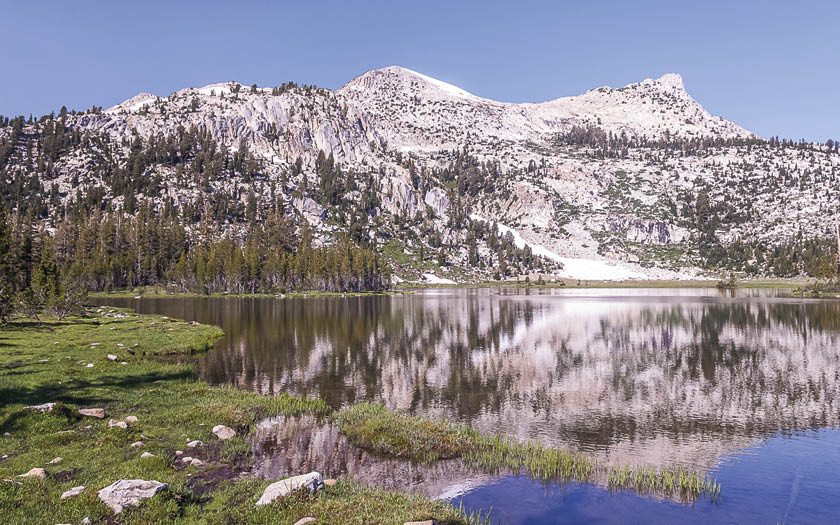
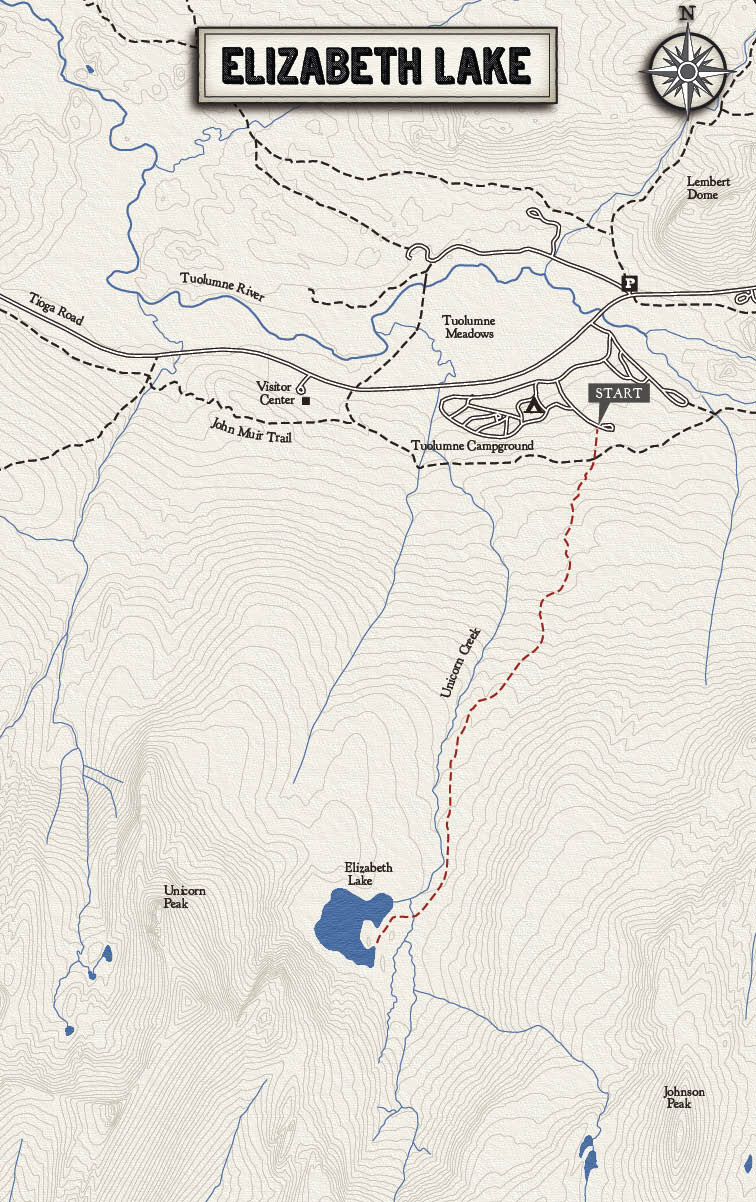
Summary While not as dramatic as Cathedral Lakes, Elizabeth Lake is a close runner-up, with lush meadows and shimmering reflections of the granite peaks above. The round-trip hike is also three miles shorter—perfect for lake lovers with a limited amount of time. Once at Elizabeth Lake, check out Unicorn Peak towering above. The peak’s “peculiar horn-shaped outline”—though hardly unicorn-esque from this angle—inspired the Whitney Survey to name it after the mythical creature. Experienced hikers can attempt a rugged scramble to the top of Unicorn Peak, which offers terrific 10,900-foot views of Tuolumne Meadows, but most visitors will be content to simply lounge around the lake. Following snowy winters, a long snow chute often lingers at the far end of the lake. Note: camping is not allowed at Elizabeth Lake.
Trailhead The trail to Elizabeth Lake starts in the Tuolumne Campground near the group camp restrooms on the B Loop. Signs in the campground will direct you to the trailhead. Don’t be put off by the initial steep climb—the trail soon mellows out.
Rating Moderate
Distance 10.4 miles, round-trip
Hiking Time 6–8 hours
Elevation Change 800 feet
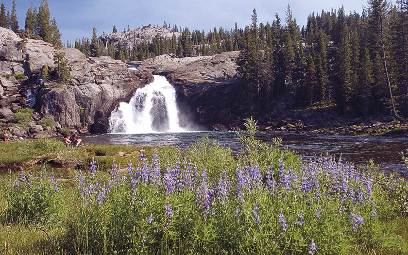
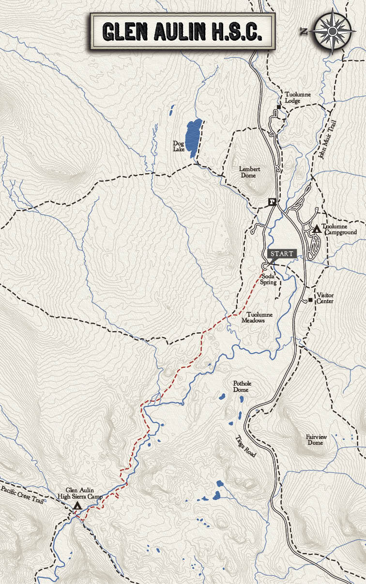
Summary Situated next to one of Yosemite’s most spectacular backcountry waterfalls, Glen Aulin is many people’s favorite High Sierra Camp. Even better: the hike to Glen Aulin from Tuolumne Meadows is almost entirely downhill, following the cascading Tuolumne River. You’ll still have to hike uphill on the way back, but after a good night’s rest in a comfy tent cabin you’ll be ready to hit the trail. Glen Aulin is also the jumping off point for several long backpacks, including the Grand Canyon of the Tuolumne and Matterhorn Canyon. Due to Glen Aulin’s popularity, a backpackers’ campground with bear boxes and toilets is located behind the High Sierra Camp. (To protect the water quality of the Tuolumne drainage, which ends up in San Francisco’s water supply, Glen Aulin’s high-tech composting toilet was built at a cost of several hundred thousand dollars—provoking some in the press to call it the “two-seat wonder.”)
Trailhead From the Lembert Dome parking area, follow the broad path towards Soda Springs and then follow the signs to Glen Aulin.
Rating Moderate
Distance 5 miles, round-trip
Hiking Time 2–3 hours
Elevation Change 800 feet
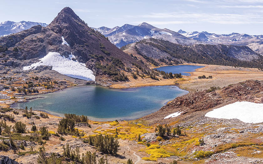
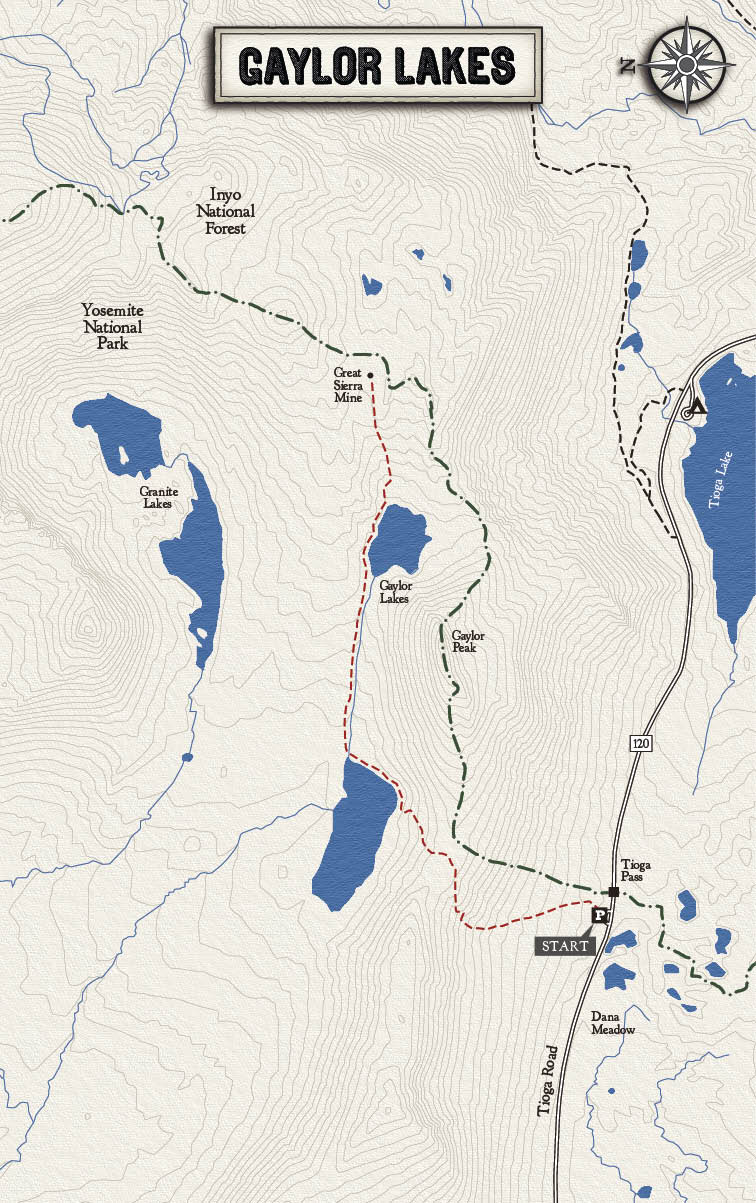
Summary This dramatic hike brings you to two shimmering lakes near the ruins of an old mining camp. Starting at an elevation of 10,000 feet, it’s one of the highest day hikes in Yosemite—which means open scenery with terrific views of the surrounding High Sierra. The trail starts near the park’s eastern boundary and immediately climbs a steep ridge with great views of Dana Meadow. From there the trail descends to the first lake, skirting the northern shore as the jagged peaks of the Cathedral Range seem to rise above the water to the west. Continue to the upper lake and you’ll find permanent snowfields lying in the shade of the mountains. After wrapping around the shore, the trail climbs a small ridge that provides sweeping views of both lakes. Nearby are the crumbling remains of the Great Sierra Mine, a failed silver-mining operation that was established here in the 1800s. Note: camping is not allowed at Gaylor Lakes.
Trailhead The trail starts from the small parking area with a restroom just west of the Tioga Pass entrance station. You can also ride the free shuttle, which makes a handful of stops at Tioga Pass throughout the day during the summer.
Rating Strenuous
Distance 13.5 miles, round-trip
Hiking Time 8–10 hours
Elevation Change 1,500 feet
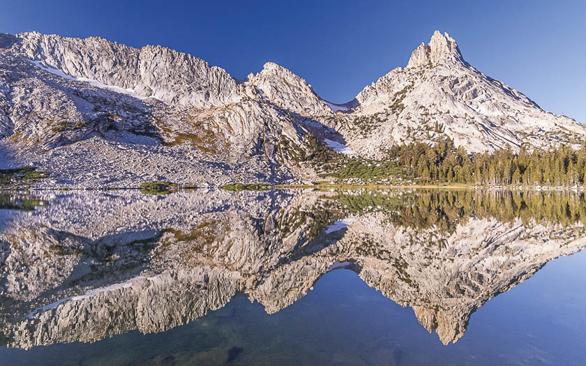
Summary These three picture-perfect lakes make a long, rewarding day hike or a terrific overnight backpack. Lower Young Lake, surrounded by lodgepole pines and dramatic granite, is distinguished by its sandy beaches. Middle Young Lake is the smallest of the three, and Upper Young Lake, located above treeline, offers the most spectacular scenery. The shortest, most scenic route to Young Lakes heads towards Dog Lake and continues north. (Note: an alternate route, less steep but longer, branches off the Glen Aulin trail about a mile past Soda Springs.) If you’re spending at least two nights at Young Lakes, nearby Mt. Conness makes a spectacular day hike—but only for rugged hikers who are used to off-trail travel. To climb Mt. Conness, head north from Middle or Upper Young Lake, skirt the ravine towards a series of marshy ponds, and pick up the unofficial use trail. Backpacking note: campfires are not allowed at Young Lakes.
Trailhead The trailhead via Dog Lake starts near the picnic tables at the Lembert Dome parking area. The info listed below is for a hike to Lower Young Lake; Upper Young Lake is about 0.7 miles beyond Lower Young Lake.

Rating: Difficult
Distance: 8 miles, round-trip
Hiking Time: 6–8 Hours
Elevation Change: 2,748 ft.
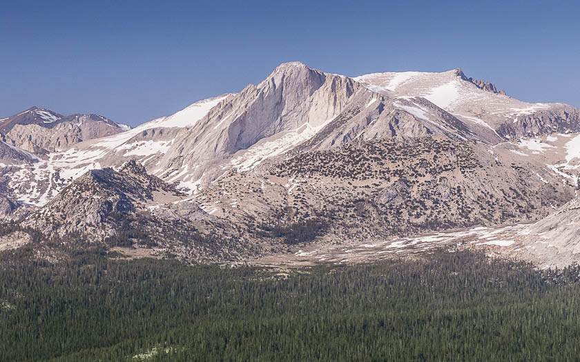
Summary At 12,590 feet Mount Conness is the eighth tallest peak in Yosemite, and the tallest peak in the Sierra Nevada north of Tioga Road. It’s sheer southwest face—a favorite among rock climbers—is one of the High Sierra’s most iconic sights. The summit of Conness lies on the national park boundary. The most direct route starts outside the park in the adjacent Inyo National Forest. From Sawmill Campground an unofficial trail climbs to Alpine Lake, then ascends to a wide plateau. The final push navigates a narrow knife edge—sure to quicken the pulse of all but the most battle-hardened hikers. The reward: sweeping views of the Sierra Nevada, including Conness Glacier, the second-largest glacier in the park after Lyell Glacier. Note: an easier but longer route to the top of Conness starts from Young Lakes.
Trailhead From Tioga Pass drive 2.1 miles north, then turn left onto Saddlebag Lake Road. Follow the dirt road 1.6 miles to Sawmill Campground. The trail starts from the northwest end of the campground.

Rating Very Strenuous
Distance 5.8 miles, round-trip
Hiking Time 5–6 hours
Elevation Change 3,100 feet
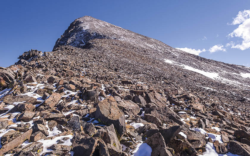
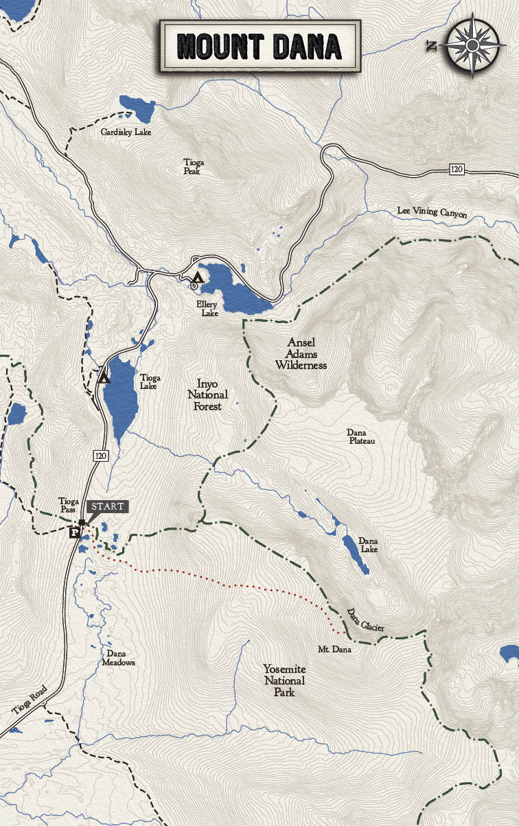
Summary At 13,053 feet, Mount Dana is the second highest peak in the park after Mount Lyell (13,114 feet). And while Mount Lyell requires a rugged, multi-day backpack and technical climbing, Mt. Dana can be done in an afternoon. Perched on the eastern crest of the Sierra Nevada, you’ll be treated to 360-degree views of the High Sierra, Mono Lake and the eastern deserts. The unofficial—yet well-worn—trail to the top starts at the Tioga Pass Entrance Station and climbs 1,700 feet to an open ridge. The final 1,000 feet requires a scamper up scree (loose rocks). The final ascent can be confusing. Stay near the eastern edge and look for cairns (small rock piles) to guide you. Note: Mount Dana is often covered in snow well into the summer—ask about conditions before your hike. Note #2: if you see dark clouds approaching, do not attempt this hike—you do not want to be this high up during one of the Sierra Nevada’s legendary thunderstorms.
Trailhead The trail to Mount Dana starts from the small parking area adjacent to the Tioga Pass Entrance Station. Ask the ranger at the kiosk for directions to the top, then follow the well-worn path east.
Rating Strenuous
Distance 13.6 miles, round-trip
Hiking Time 7–8 hours
Elevation Change 1,500 feet
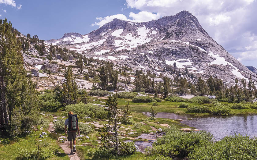
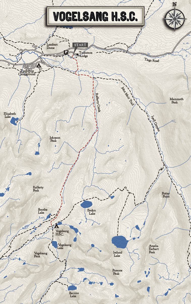
Summary At 10,100 feet, Vogelsang is the highest High Sierra Camp. While the other four High Sierra Camps are nestled among stately forests, Vogelsang is located above treeline, providing terrific views of the surrounding peaks. If you find yourself enthralled by Yosemite’s granite landscapes, this is definitely the High Sierra Camp for you. In addition to grand views, there’s a gurgling creek flowing through lush meadows—a great place to bask in the Sierra sunshine. Five hundred feet above the High Sierra Camp is gorgeous Vogelsang Lake, nestled in a granite bowl between Vogelsang Peak (11,516) and Fletcher Peak (11,410). Backpackers heading to Vogelsang should seriously consider the 19-mile loop that passes Evelyn Lake and heads back to the trailhead via Lyell Canyon—one of the finest three-day backpacks in the park.
Trailhead The trail to Vogelsang starts from the parking area at Tuolumne Lodge. The lodge parking area is for guests only, so park in the nearby Dog Lake parking area or ride the free shuttle. Follow the John Muir Trail about a mile to Rafferty Creek, then head towards Vogelsang.

Rating Very Strenuous
Distance 28 miles, one-way
Hiking Time 2–3 days
Elevation Change 4,700 feet
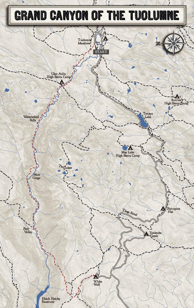
Summary This rugged backpack descends 4,700 feet down the stunning Grand Canyon of the Tuolumne River, then climbs 3,600 feet up to White Wolf Lodge. It’s one of the most physically demanding backpacks in the park, but it’s worth it. In places, the Grand Canyon of the Tuolumne River rivals Arizona’s Grand Canyon in depth, and as you descend you’ll be treated to dozens of roaring cascades. The most famous is Waterwheel Falls, where the river glides down a smooth granite slope, then explodes into a series of huge rooster-tail arcs. The trail continues below 5,000 feet in elevation, where black oaks and chaparral are common. (Watch out for rattlesnakes.) Spend the night in Pate Valley and rest up for the next day’s grueling ascent. After reaching White Wolf, you’ll be ready for a hot shower and a cozy bed. Book a night at White Wolf Lodge before your trip and finish off the hike in style.
Trailhead Hike down to Glen Aulin from Tuolumne Meadows. From Glen Aulin continue following the Tuolumne River downhill.
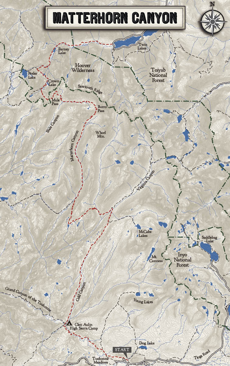
Rating Very Strenuous
Distance 38.4 miles, round-trip
Hiking Time 6–8 days
Elevation Change 3,500 feet
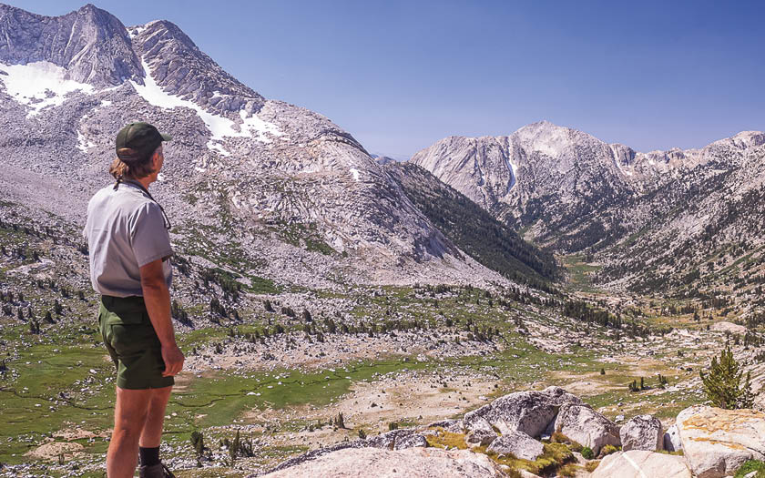
Summary Lying in the remote northeast corner of the park, Matterhorn Canyon is one of the most spectacular and seldom visited locations in Yosemite. Getting here requires several days of backpacking through rugged wilderness, but for quintessential High Sierra beauty—snow-capped granite peaks, flowery meadows, glacially carved U-shaped valleys—few hikes in the Sierra Nevada can compare. After following the Pacific Crest Trail for 20 miles from Tuolumne Meadows, you’ll head north into Matterhorn Canyon. The jagged Sawtooth Range looms above as you march up to Burro Pass (10,600 feet). After savoring the dramatic views, drop down into the meadowy, boulder-strewn canyon that heads to Mule Pass (10,400 feet). Say goodbye to Yosemite as you enter the Hoover Wilderness, which treats you to a handful of idyllic lakes before the hike ends at bustling, touristy Twin Lakes.
Trailhead From Tuolumne Meadows head to Glen Aulin, then follow the Pacific Crest Trail through Cold Canyon. Note: this one-way trip ends at Twin Lakes, where you can leave your car for several days for a small fee.
