Port Moody/Anmore
. . . . .
| ROUND TRIP | Up to 18 km (11 ¼ miles) |
| TERRAIN | Paved roads and cycle path; some flat, some hills |
| TRAFFIC VOLUME | Low to moderate |
| ALLOW | 2 to 3 ½ hours |
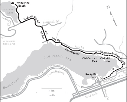
| HIGHLIGHTS | Rocky Point Park and Station Museum, Shoreline Park, views of Burrard Inlet, Noons Creek Hatchery, Old Orchard Park, Sasamat Lake |
| PICNIC SPOT | White Pine Beach at 9.0 km (or Old Orchard Park on either the outward or the return leg) |
| STARTING POINT | Rocky Point Park in Port Moody |
| HOW TO GET THERE | BY CAR: From St. Johns Street in Port Moody, turn left on Moody Street. Follow the overpass around to the left and turn left onto Murray Street. The parking lot for Rocky Point Park is just beyond the Station Museum. Note that there is a 4-hour parking limit. |
| BY TRANSIT: Take the West Coast Express to Port Moody Station, or take the 97 B-Line or a local bus to St. Johns Street at Williams Street. | |
| WHEN TO GO | July and August to swim at White Pine Beach. |
| CONNECTS WITH | Barnet-Inlet Trails |
PORT MOODY’S designated bike routes, which wind among the rolling hills surrounding Port Moody Inlet, by their very nature will take your breath away. By beginning with the gentle 3-kilometre cycle path in Shoreline Park, you have the option of turning around at the end of Alderside Road or Ioco School or simply lazing away the day in Old Orchard Park. Or you can accept the challenge and reap the reward of a picnic at Sasamat Lake, with the bonus of some freewheeling on the way home.
Shoreline Park is a precious stretch of waterfront preserved for recreational use—a commendable feat in a development-crazed society. A trail and boardwalks for pedestrians hug the shoreline. Running roughly parallel to the pedestrian trail, the cycle path passes through coniferous forest and mixed woodland with occasional views of the tidal flats. Cyclists can walk their bikes down to the mouth of Noons Creek, where unearthed middens indicate this area was once the site of Native encampments. There are glimpses of Burrard Inlet from Alderside Road, albeit from between waterfront homes.
Sasamat Lake, in Belcarra Regional Park, is often thronged on summer weekends when families come out to picnic and swim at White Pine Beach or hike the 3-kilometre trail around the lake. At other times you may find yourself with only the birds and squirrels for company.
KM THE ROUTE
0.0 Parking lot for Rocky Point Park. Pick up the designated cycle path and proceed in an easterly direction. Side trails lead to Noons Creek Hatchery, Old Mill site and viewing platform.
3.0 Old Orchard Park. Picnic tables, toilets, beach.
Continue west along Alderside Road.
4.8 Left onto Ioco Road. Some gentle ups and downs.
5.6 Right on 1st Avenue, opposite the church. Ioco School is on the corner. Begin a gradual climb.
6.4 Keep left on Bedwell Bay Road toward Belcarra where Sunnyside Road forks right. There are some bends and steep hills but also a wide shoulder to cycle on.
7.8 Right to White Pine Beach. Ride the gentle downhill to the beach.
9.0 Left into the first parking lot and walk bikes down the trail to the beach. Picnic tables, toilets, swimming, concession on summer weekends.
9.0 Retrace your outward route via Bedwell Bay Road, 1st Avenue, Ioco Road, Alderside Road and the Shoreline Park cycle path.
18.0 Rocky Point Park. Picnic area, toilets, pier. The Station Museum records Port Moody’s railway history.
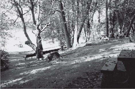
Old Orchard Park
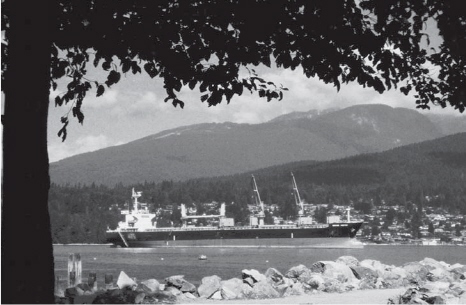
Freighter in Burrard Inlet