12 SOUTH MOUNTAIN: NATIONAL TRAIL
KEY AT-A-GLANCE INFORMATION
LENGTH: 15.5 miles
ELEVATION GAIN: 1,350 feet
CONFIGURATION: One-way
DIFFICULTY: Moderate, but long
SCENERY: Desert, city overlooks, mountain vistas, abandoned mineshafts
EXPOSURE: Completely exposed, very little shade
TRAFFIC: Heavy on eastern half, light on western half
TRAIL SURFACE: Packed dirt, gravel, bedrock
HIKING TIME: 7.5 hours
WATER REQUIREMENT: 4 quarts, 5–6 quarts during summer
SEASON: Year-round; hot in summer
ACCESS: Pima Canyon entrance 5 a.m.–7 p.m., Central Avenue entrance 5 a.m.–10 p.m.; free parking
MAPS: USGS Guadalupe, Lone Butte, and Laveen; park map available from visitor center and posted on plaques at trailheads
FACILITIES: Ramadas, picnic areas, visitor center, ranger station, toilets; drinking water available
DOGS: Yes, leashed at all times
COMMENTS: Visit phoenix.gov/recreation/rec/parks/preserves/locations/south/index.html, or call (602) 495-0222.
GPS Trailhead Coordinates
UTM Zone 12S
Easting 0408338
Northing 3691757
Latitude N33°21.775'
Longitude W111°59.157'
Directions
Pima Canyon Trailhead: Exit I-10 at Baseline Road. Drive west on Baseline Road 0.6 miles to 48th Street. Turn south on 48th Street, which soon becomes Pointe Parkway. Follow this curvy road 1 mile, skirting the Pointe South Mountain Resort. Just past Guadalupe Road, turn right onto 48th Street and then make an immediate left turn to enter Pima Canyon Park. Drive to the parking lot at the western end of the park.
San Juan Trailhead: Exit I-10 at Baseline Road and drive west 6 miles to Central Avenue. Turn south onto Central Avenue and drive 1.5 miles to the park entrance. Once inside the park, drive 2.2 miles to the junction of Summit Road and San Juan Road. Take San Juan Road west 4 miles until it ends at the San Juan Lookout. Note: San Juan Road is currently open only one weekend per month. Check the Web site for latest road conditions.
IN BRIEF
National Trail is the longest and grandest of all trails in South Mountain Park. It offers sweeping city vistas, secluded desert valleys, interesting rock formations, ancient Hohokam petroglyphs, historic abandoned mineshafts, and an all-day hike to delight hardy outdoor enthusiasts.
DESCRIPTION
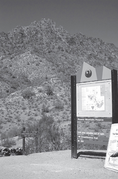
Touted as the largest city park in the country, South Mountain Park spans more than 16,000 acres of desert and mountain preserves at the southern edge of Phoenix. Ironically, the most recognizable feature in South Mountain Park is the man-made forest of television, microwave, and radio antennas atop the 2,690-foot Mount Suppoa. At night the blinking aircraft-obstruction lights on these antennas can be seen from nearly anywhere in the valley and serve as a welcome beacon for the directionally challenged. Visitors to South Mountain, however, don’t care for the antennas. They come to enjoy a wide variety of recreational activities, including hiking, mountain biking, horseback riding, picnicking, and sightseeing.
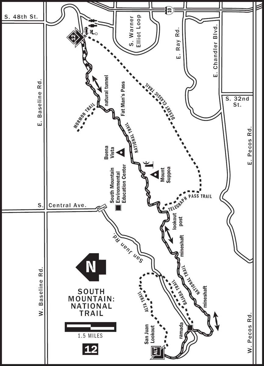
National Trail, the longest in the park, offers day hikers a complete South Mountain experience. In addition to being a superb hike showcasing the best features of the park, National Trail is also one of the premier mountain-biking trails in the country. On weekends, dozens of mountain bikers share the trail with just as many if not more hikers. Running east–west along the top of South Mountain’s two longest mountain ranges, National Trail intersects almost every other trail in the park. If you plan to hike the whole 15.5 miles along this trail, prepare to spend an entire day enjoying its many wonders. You also need to arrange a ride to take you from one end of the trail back to the other.
I prefer to hike this trail from east to west, facing the scenic Sierra Estrella mountain range and avoiding an otherwise steep uphill on the western end. Begin your hike from the parking lot at the western end of Pima Canyon Park, located in the shadows of the Pointe South Mountain Resort. The first 1.3 miles is a gentle promenade along a wide and level dirt road. On weekend mornings, prepare to share this road with many speedy mountain bikers and slow baby strollers. The road ends in a wide turnaround. Petroglyphs left by the ancient Hohokams can be found here on the backside of some boulders at the western end of this circular area. At the northwestern end of the turnaround, find the obvious trail markers for National Trail, which heads uphill. As you hike, watch out for mountain bikers speeding downhill. Although foot traffic has the right of way, sometimes bikers can’t see you or stop in time. After a gentle half-mile climb, walk along the top of a ridge and enjoy the open views of the Phoenix skyline to the north.
At 2.6 miles, National Trail intersects Hidden Valley Trail, a particularly scenic and secluded bypass that rejoins National Trail 0.5 miles later. Hidden Valley is a popular detour for National Trail hikers, and its length is similar to the circumnavigated section along National Trail. Hidden Valley Trail, however, is harder to follow and requires a little scrambling over rocky obstacles. If you opt for this half-mile jaunt through Hidden Valley, you will be treated to a natural rock tunnel, a quiet valley with scenic rocks, and a nine-inch-wide crack through two large boulders, ironically named Fat Man’s Pass. Take off your backpack and squeeze through sideways. Try the natural slide on the smooth rock surface immediately after going through Fat Man’s Pass. Claustrophobics and portly hikers need not worry; there is an easy bypass route over the boulders. Just beyond Fat Man’s Pass, Hidden Valley Trail merges back into National Trail at 3.2 miles.
If you choose to stay on the smoother and easier-to-follow National Trail, you can still visit the rock tunnel and Fat Man’s Pass. They are only a few feet from either end of Hidden Valley Trail. Simply return to National Trail after you check out these formations. An added advantage of staying on National Trail is that Mormon Trail junction at 2.75 miles offers a convenient escape from your commitment in case you are hesitant about finishing this long hike. Mormon Trail leads you to the Mormon Loop Trail, which then loops back to the dirt road and Pima Canyon Park.
Continue hiking west along National Trail after Fat Man’s Pass, facing the array of antenna towers on Mount Suppoa, the tallest point in South Mountain Park. At 4.5 miles, look to your left for the Chinese Wall, a dark-colored dike of Tertiary period granite and diorite. The trail reaches Buena Vista Lookout at 5 miles. Cross the paved parking area to find the trail on the other side of the road. After a small hill and at 5.7 miles, the trail joins a paved service road. Walk west along this road for 50 yards to pick up the trail again, which then heads straight for the massive antennas on the summit of Mount Suppoa. The trail skirts the fenced-off antenna complex on its northern side. Roughly 2,500 feet in elevation, this trail section is the highest accessible point in South Mountain Park. Do not dawdle too long though. Rumor has it that the Federal Communications Commission allows its technicians to work only two-hour shifts here because of the high-power transmitters.
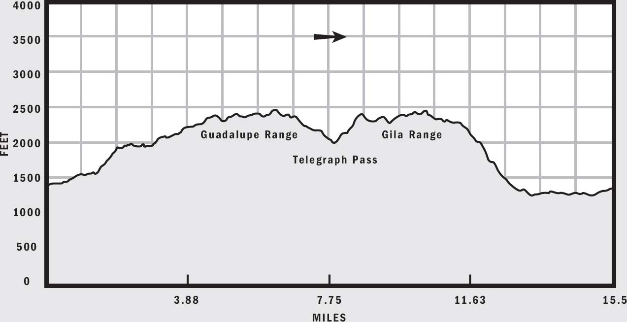
At 7.5 miles and with the antennas now safely behind you, continue hiking National Trail, which runs along a rocky ledge above Summit Road. Look for strange-looking elephant trees with smooth red bark and fragrant leaves. The trail drops down to the road and meets the Telegraph Pass Trail at 8 miles from the trailhead. From this saddle point, you can see the matchbox-like houses in Ahwatukee to the south and the tall buildings in downtown Phoenix to the north. Congratulations! You are now halfway through the hike.
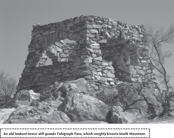
The western half of National Trail runs atop the Gila Range and sees much less traffic than the eastern Guadalupe range. Expect to encounter fewer crowds and hardly any mountain bikers. From Summit Road climb a steep section of trail to Telegraph Pass Lookout. The Army Signal Corps built this roofless watchtower in 1873 to guard a telegraph line running from Maricopa Wells all the way to the territorial capital of Prescott. This is a great place to rest and enjoy the views.
National Trail then climbs Goat Hill atop the Gila Range at an elevation of 2,300 feet, overlooking a small kart racing course at the base of the mountain and the Phoenix skyline in the distance. Just beyond Goat Hill, pass the Ranger Trail junction at 9.6 miles and continue hiking along a ledge on the southern side of the hill. Clusters of furry teddy bear cholla dot the steep hill below you. Enjoy the scenery here in relative isolation, and notice that the trail is obviously less worn than the first 8 miles. Many abandoned mineshafts lie just off the trail in the next few miles. A particularly large one can be found at 10.8 miles at trail-marker number 39. Most of the mineshafts have been sealed, but avoid the temptation to climb into any dark and potentially unsafe mineshaft openings.
National Trail finally begins its descent from the Gila Range at 12 miles from the trailhead. Hike down the steep hill as the trail winds through a scenic but desolate narrow canyon with colorful rocks. At 13 miles, cross a dry wash and climb toward a notch where the trail bends into the wide valley between the Gila Range and the Ma Ha Tuak Range to the north. Hike along the valley floor toward San Juan Road. National Trail intersects Bajada Trail at 13.9 miles and crosses San Juan Road shortly thereafter. The elevation in the valley is 1,250 feet, the lowest of the entire hike.
The final 1.5 miles of this long hike are relatively flat and uneventful as it parallels the road, skirting the southern tip of the Ma Ha Tuak Range below Maricopa Peak. The 15.5-mile National Trail ends at the San Juan Lookout where you should have a vehicle or a ride waiting.