30 MASSACRE GROUNDS TRAIL*
KEY AT-A-GLANCE INFORMATION
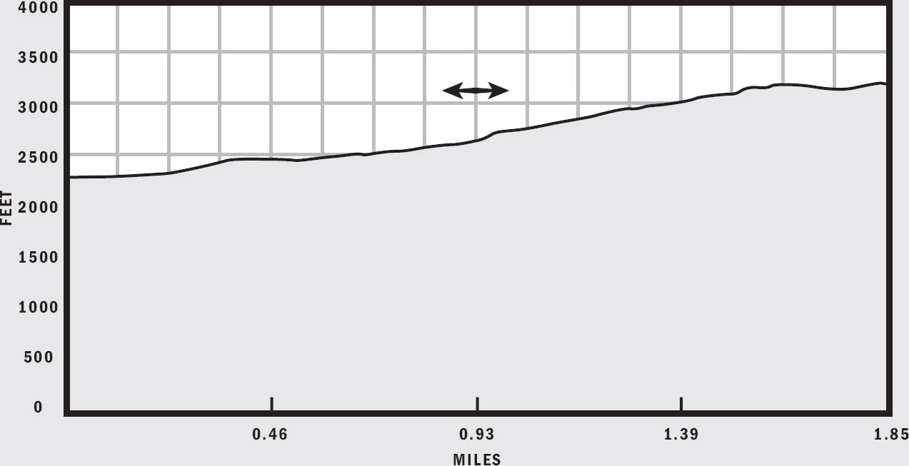
LENGTH: 5.7 miles
ELEVATION GAIN: 925 feet
CONFIGURATION: Out-and-back
DIFFICULTY: Moderate
SCENERY: Massacre Falls, Superstition Mountains, Four Peaks, desert
EXPOSURE: Mostly exposed, limited shade near Massacre Falls
TRAFFIC: Light
TRAIL SURFACE: Crushed rock, gravel
HIKING TIME: 3 hours
WATER REQUIREMENT: 2.5 quarts
SEASON: Year-round; hot in summer
ACCESS: Sunrise to sunset; free parking
MAPS: USGS Goldfield
FACILITIES: None
DOGS: Yes
COMMENTS: Massacre Falls flows only after storms.
GPS Trailhead Coordinates
UTM Zone 12S
Easting 0456995
Northing 3703437
Latitude N33°28.279'
Longitude W111°27.811'
Directions
Drive east on US 60 to the Idaho Road exit. Take Idaho Road north 2.25 miles and then turn northeast onto SR 88, the Apache Trail. Follow SR 88 to FR 78, First Water Road, which is a wide dirt road just past the entrance to Lost Dutchman State Park. Turn right onto First Water Road and drive 0.5 miles to the Crosscut Trailhead.

IN BRIEF
Take a relatively short hike into the northern flanks of Superstition Mountain for stunning views of surrounding hills, the distant city, and a seasonal waterfall. The trail also passes near the site where Apaches allegedly slaughtered a Mexican mining crew in the 1800s.
DESCRIPTION
Shrouded in legend and mystery, Massacre Grounds Trail evokes horror and wonder with its gruesome name. The imagination can run wild with phantasms of the Old Wild West if you let it. Fortunately, this relatively short jaunt into the Superstitions delivers nothing but pleasant views of rolling hills, unique rock formations, and the rugged beauty of Superstition Mountain. When in season, wildflowers dominate the foothills at the trail’s beginning, and near its terminus, intermittent cascades tumble over a wide cliff face after heavy rains.
The lore behind this trail’s lurid name stems from the Lost Dutchman’s Mine legend, an oft-told tale that has contributed to the mystery of these mountains for more than a hundred years. In the 1800s a crew of Mexican miners supposedly met a grisly fate at the hands of Apaches in the vicinity of today’s Lost Dutchman State Park. Massacre Grounds Trail passes near the location of this purported ambush. The “Dutchman” Jacob Waltz, a German immigrant and prospector, allegedly came upon their gold mine but took its location to the grave when he died in 1891. Many have since tried to locate the lost gold but none have ever succeeded. To learn more about the legend, consult one of the many available books on the subject or stop by Superstition Mountain Museum on SR 88 on the way to Massacre Grounds Trailhead.
From the unmarked trailhead, begin by crossing the wilderness boundary fence. Follow the gravel trail around a rocky hill capped by lichen-covered boulders. Then cross a dry wash lined by mesquites, hop bushes, and jojobas and head straight for a prominent needle-like spire atop a conical hill. Ignore a small spur trail that branches to the west. Behind the needle, Superstition Mountain is an impressive backdrop for this hike. Vegetation is fairly sparse, but because these foothills face north, they are especially hospitable to wildflowers. After winters with decent rainfall, a field of wild lupine and poppies blankets these slopes and adds vibrant colors to an already scenic setting.
The trail passes the rock spire to its left, climbing a gentle slope to a saddle with gracious views of Superstition Mountain’s precipitous cliffs and ridgeline. Then the trail crosses the saddle and begins to turn east into a narrow basin. Hike next to the dry creek, where dense clusters of mesquites and hop bushes thrive. The trail confusingly crosses the creek a few times, passes a small dry waterfall, and then turns left up a steep chalky hill at 1 mile from the trailhead.
At the top of the steep hill, cut across a bowl-like area with Four Peaks to the north and the tip of Weaver’s Needle to the east. Follow the trail as it curves around a wide basin and then turns south through a dense field of jojoba bushes. The moderate climb through jojoba bushes takes you up to a mound with excellent views of the Goldfield Mountains, the Salt River valley, and a distant Four Peaks, which appears to have a single flat summit from this vantage point. To the west, the Praying Hands rock formation lies at the cliff’s edge, while Pass Mountain frames the distant city.
The trail turns east again, circumnavigating a prominent north-facing cliff and gently climbing to the flat plateau above it. At 1.5 miles from the trailhead, enter and cross a deep wash on the plateau. Avoid the temptation to scramble up this wash—look for a semi-hidden egress on the other side. After crossing the wash, encounter an open rocky plateau dotted with prickly pear cacti where the trail can be somewhat difficult to follow. Look for cairns that mark the way. To the south, you should also be able to see the cliffs over which Massacre Falls flow.
Cross this rocky plateau, heading south. Look for a spur trail going east up a gentle slope, and follow it to a vista point at the tip of a dizzying drop-off. This is the end of the Massacre Grounds Trail. Now look north across the rolling hills toward Four Peaks. Massacre Grounds lies somewhere in the valley below. Backtrack along the trail that parallels the south-facing cliff to a notch at its western end. Then turn left toward Superstition Mountain and Massacre Falls.

Follow a faint trail south across a gentle slope. Soon you’ll cut through some dense bushes and arrive at the eastern tip of the cliff that forms Massacre Falls. The elevation here is 3,200 feet, and with nearly 2,000 feet of mountain still above you, there’s plenty of drainage water flowing down the cliff face if you happened to be here after a heavy storm. Even when the cliff is dry, an up-close view is worth the detour. Dark streaks in the reddish rock show the waterfall’s path, while lush plants grow at its base. Some atypical wildflowers, such as Texas betony, can be seen here in spring and early summer.
NEARBY ACTIVITIES
Nearby Lost Dutchman State Park provides many hiking opportunities including the popular Treasure Loop and Siphon Draw trails. The touristy ghost town of Goldfield and the Superstition Mountain Museum lie on SR 88 on your way back to town. First Water Trailhead, which is located farther east on First Water Road, offers another popular launching pad for hikes into the Superstitions. Trails accessible from there include Second Water Trail, Black Mesa Trail, and Dutchman’s Trail. If you continue driving east on SR 88, you’ll reach Canyon Lake, Tortilla Flat, Apache Lake, and eventually Roosevelt Lake. Many other trailheads serving the Superstition Wilderness are accessible from SR 88.
* Update: As of 2009, the access road to Massacre Grounds has been blocked off for reforestation. To reach this hike, park at the Crosscut Trailhead on First Water Road. Continue along First Water Road another 0.3 miles to find the old access road. Then, turn right and hike the road for 0.7 miles to reach the original trailhead.