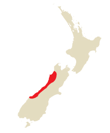
West Coast
Old Ghost Road
Paparoa National Park
Inland Pack Track
Westland Tai Poutini National Park
Welcome Flat
Towns & Facilities
Westport
Greymouth
Punakaiki
Fox Glacier
Franz Josef Glacier
West Coast
Why Go?
Take a walk on the wild side, literally. The West Coast echoes with memories of lawless gold rushes, and its weather often appears equally lawless – locals say that if you can’t see the mountains here then it’s raining, and if you can see them it’s about to rain. And yet the West Coast is one of the most dynamic tramping regions in New Zealand, with an emerging network of tracks that seems destined to elevate it to a position alongside the likes of Fiordland and Abel Tasman National Parks in the minds of trampers.
Leading the charge is the Old Ghost Road, opened at the end of 2015, soon to be followed by NZ’s newest Great Walk, the Paparoa Track, slated to open in 2019. Or you can shun these lofty blow-ins and instead tramp a long-time, perpetual favourite, heading up the Copland Valley to the soothing hot springs of Welcome Flat.
When to Go
The West Coast is synonymous with rain – Cropp River, inland from Hokitika Gorge, is the country’s wettest spot (in 2016 it had almost 12,000mm of rain). The average rainfall in the lowlands is between 2000mm and 3000mm, while it reaches 5000mm at the foot of the Southern Alps. Much of the rain falls in late winter and spring. Flooded and impassable rivers, however, should be expected at any time of year.
Warm ocean currents sweep along the coast, resulting in a surprisingly mild climate. Midsummer to autumn can be brilliantly sunny, with long spells of settled weather. Westport and Punakaiki average almost 2000 hours of sunshine annually.

Background Reading
Settlement of the West Coast was driven originally by the gold rushes, a time that was evocatively captured in Eleanor Catton’s novel The Luminaries, which won the 2013 Man Booker Prize. The epic-length book was set around Hokitika, Kaniere and the Arahura Valley, which you’re likely to pass through as you head between tramps on the West Coast.
Also passing through is the West Coast Wilderness Trail, one of several cycling trails – including the Old Ghost Road – on the West Coast. To get acquainted with the region’s cycling trails, look for Classic New Zealand Cycle Trails by the Kennett Brothers, or Mountain Biking South by Dave Mitchell.
DON’T MISS
The undoubted natural stars of the West Coast are a twinset of glaciers, Franz Josef and Fox, that leak from the Southern Alps towards the Tasman Sea. The areas around both glaciers offer a range of tramping opportunities (including the famously reflective Lake Matheson, near Fox Glacier), but you can also get onto the ice itself with a guided helihike. These trips whisk you high up onto the glacier in a helicopter before you set out walking over the ice for about three hours. The walks are run by Franz Josef Glacier Guides (![]() %03-752 0763, 0800 484 337; www.franzjosefglacier.com; 63 Cron St) and Fox Glacier Guiding.
%03-752 0763, 0800 484 337; www.franzjosefglacier.com; 63 Cron St) and Fox Glacier Guiding.
While at Franz Josef Glacier, also be sure to check out the West Coast Wildlife Centre (![]() %03-752 0600; www.wildkiwi.co.nz; cnr Cron & Cowan Sts; day pass adult/child/family $38/20/85, incl backstage pass $58/35/145;
%03-752 0600; www.wildkiwi.co.nz; cnr Cron & Cowan Sts; day pass adult/child/family $38/20/85, incl backstage pass $58/35/145; ![]() h8am-5pm)
h8am-5pm) ![]() S, which breeds two of the rarest kiwi – the rowi and the Haast tokoeka. A ‘backstage’ pass to the incubator and chick-rearing area is a rare opportunity to see fluffy kiwi chicks and learn how a species can be brought back from the brink of extinction.
S, which breeds two of the rarest kiwi – the rowi and the Haast tokoeka. A ‘backstage’ pass to the incubator and chick-rearing area is a rare opportunity to see fluffy kiwi chicks and learn how a species can be brought back from the brink of extinction.
DOC Visitor Centres
A DOC Westport Office (![]() %03-788 8008; www.doc.govt.nz; 72 Russell St, Westport;
%03-788 8008; www.doc.govt.nz; 72 Russell St, Westport; ![]() h8-11am & 2-4.30pm Mon-Fri)
h8-11am & 2-4.30pm Mon-Fri)
A Paparoa National Park Visitor Centre
Fast Facts
A The West Coast is NZ’s most sparsely populated region. Its 32,150 residents make up less than 1% of NZ’s population, spread throughout a disproportionate 9% of the country’s area.
A It has been estimated that by the end of the 21st century, Fox Glacier will have retreated by up to 5km, losing around 40% of its mass.
Top Tip
Encountering the infamous West Coast sandfly is a certainty. Keep them at bay by covering up when they are at their most active (dawn and dusk) and coating any exposed skin with a citronella-based repellent.
Resources
Old Ghost Road
Duration 5 days
Distance 85km (52.8 miles)
Difficulty Moderate
Start Lyell Campsite
End Mokihinui Rd, Seddonville
Gateway Westport
Transport Shuttle bus
Summary A dramatic tramp into history, it follows an old gold-mining trail that was never completed, crossing the Lyell Range through beech forest, tussock tops, river flats and the magnificent Mokihinui Gorge.
A shared tramping and mountain-biking track – indeed, the longest stretch of continuous singletrack in the country for mountain bikes – the Old Ghost Road opened in December 2015, but had effectively been in the making for 140 years. The track is the completion of a path that was intended to link goldfields in Buller Gorge and along the Mokihinui River in the 1870s, though the attempt was defeated, in part by the rugged nature of the terrain in between.
The tramp begins in the Buller Gorge and climbs over, along and then off the Lyell Range, finishing in style through the deep and narrow Mokihinui Gorge. While the gold-mining heritage – the ‘ghosts’ of the title – is fascinating, the flinty spirit of the pioneers is only part of the track’s appeal. The alpine section takes in truly spectacular panoramas, but the valley along the Mokihinui is just as captivating. The Mokihinui River is the third-largest on the West Coast, draining no fewer than five mountain ranges as it pours through ancient forest on its way to the Tasman Sea. It’s a rich habitat, home to numerous threatened species, including great spotted kiwi, whio (blue duck), longfin eels and the carnivorous snail called Powelliphanta.
The tramp can be completed in either direction, perhaps best determined by the weather forecast to maximise views on the southern, alpine end between Lyell Saddle Hut and Ghost Lake Hut. We describe the tramp over five days, allowing a short second day to Ghost Lake Hut across the most exhilarating section of the Old Ghost Road. The presence of six huts along the journey, however, allows you to break things up in any way you choose.
History
In 1862 two Māori prospectors discovered gold in the Buller Gorge, at what is now Lyell Reserve, the starting point for the Old Ghost Road. The inevitable gold rush that ensued saw a town arise at Lyell with a population at one point of 2000 and the requisite oversupply of pubs – six hotels in all.
Meanwhile, on the other side of the Lyell Range, gold was soon found in the Mokihinui River, where another set of goldfields was staked. As the kea flies, the two gold areas were no more than 30km apart, but with a whole lot of difficult mountain terrain in between.
In the 1870s work began on cutting a track through the mountains to connect Lyell to the Mokihinui goldfields, but the mountains won. With the gold proving scarcer than the miners had hoped, the track was abandoned. And so it sat for more than a century until an old map was unearthed in 2007 showing the proposed course of the track. In true Kiwi style it was decided that it’d make a hell of a recreational trail. Years of ingenious construction later, the Old Ghost Road opened in December 2015, completing the miners’ vision.
8Planning
WHEN TO TRAMP
Around a quarter of the Old Ghost Road is above 1000m, where snow may fall at any time, but particularly from May to November, and bad weather can blow in at any time of year. In favourable weather, however, it’s possible to tramp this track year-round. The best time is November through May.
MAPS
The best map is NewTopo’s tailor-made 1:40,000 Old Ghost Road map, which can be purchased through the Old Ghost Road website (https://oldghostroad.org.nz). The Mokihinui-Lyell Backcountry Trust also produces an excellent map, useful for planning. It shows an elevation profile and spots of mobile-phone coverage along the track. It can be downloaded or printed from the Old Ghost Road website.
HUTS & CAMPING
There are six huts along the Old Ghost Road, one of which – Goat Creek – is a Basic hut (free). The other five huts – Lyell Saddle, Ghost Lake, Stern Valley, Mokihinui Forks and Specimen Point – are managed by the Mokihinui-Lyell Backcountry Trust (https://oldghostroad.org.nz) and must be booked in advance through its online booking system. Four of these Trust huts (Mokihinui Forks excluded) have two four-person sleep-outs suitable for families and those seeking privacy. Mokihinui Hut has only bunks with no sleep-out. All huts have bunks, mattresses, toilets and rainwater supply, and all but Mokihinui Forks have gas cooking facilities.
Camping is catered for at Lyell Saddle, Ghost Lake, Stern Valley and Specimen Point Huts by way of purpose-built campsites. These must also be booked through https://oldghostroad.org.nz. Camping is also permitted at the Lyell Reserve, where there is a Basic DOC campsite (free) right on SH6.
There’s also pleasant camping at Seddonville Holiday Park (![]() %03-782 1314; www.seddonvillepark.co.nz; 108 Gladstone St, Seddonville; powered sites $17-25, dm $15-20, s/d/f with shared bathroom from $20/30/45;
%03-782 1314; www.seddonvillepark.co.nz; 108 Gladstone St, Seddonville; powered sites $17-25, dm $15-20, s/d/f with shared bathroom from $20/30/45; ![]() W), 3km from the trail’s end, which makes excellent use of an old schoolhouse and grounds.
W), 3km from the trail’s end, which makes excellent use of an old schoolhouse and grounds.
INFORMATION
The Old Ghost Road is managed by the Mokihinui-Lyell Backcountry Trust. All available information (and hut bookings) is on the track website (https://oldghostroad.org.nz).
8Getting There & Away
Lyell Reserve is 50 minutes’ drive (62km) east of Westport, right on SH6 along the scenic Buller Gorge. Seddonville, at the northern end of the track, is 45 minutes’ drive (50km) north of Westport.
Numerous companies run shuttles to and from the Old Ghost Road. Out of Westport, Hike n Bike Shuttle (![]() %027 446 7876; www.hikenbikeshuttle.co.nz; shuttle from $40) services both ends of the trail (Lyell/Seddonville $50/40) and can also organise a vehicle transfer, delivering your car from one end of the trail to the other (from $175). Trek Express runs to the Old Ghost Road from Nelson (Lyell/Seddonville $60/100).
%027 446 7876; www.hikenbikeshuttle.co.nz; shuttle from $40) services both ends of the trail (Lyell/Seddonville $50/40) and can also organise a vehicle transfer, delivering your car from one end of the trail to the other (from $175). Trek Express runs to the Old Ghost Road from Nelson (Lyell/Seddonville $60/100).
kThe Tramp
Day 1: Lyell Campsite to Lyell Saddle Hut
4–6 HOURS / 18KM / 760M ASCENT
Located right on SH6 in the scenic Buller Gorge, the Lyell campsite is a popular stop with both day visitors and overnighters attracted by its historical interest, in particular the gold-mining relics and the overgrown Lyell Cemetery, secreted in the bush, 10 minutes’ walk from the campsite.
The Old Ghost Road is well signposted at the far end of the campsite, and the wooden archway is pretty much a compulsory photo stop. Cross the bridge over Lyell Creek and follow the track as it begins its steady climb up what has long been a popular walkway, following the original miners’ dray road – one of the sections of track they did complete. Beech forest dominates as you head up the Lyell Valley. Around 45 minutes into the tramp you will reach the site of Gibbstown, where side tracks lead down to the site of the old alpine battery. It will take around an hour (3km) to reach Eight Mile from Gibbstown, but it is only the odd rusty relic, stranded in the undergrowth, that betrays the existence of these settlements. Insightful interpretive displays will stir the imagination.
As you wind your way further up the valley, other interesting features come into view, such as the earthquake slips caused by the 1929 Murchison and 1968 Inangahua earthquakes. The damage is clearly visible in a series of gouges, still largely bald except for the odd tree clinging precariously to the loose, rocky slopes. The most ominous of them, the Big Slips, are crossed around 2½ hours into the journey. Entire slopes here sheared away in the 1929 earthquake, leaving a massive scar. Gate signs indicate that cyclists must dismount as they cross the slips, and they’re sure not a spot to stop and linger for photos.
The track continues winding up the valley to Lyell Saddle, where a short spur track leads to Lyell Saddle Hut (11 bunks), perched on a ridge overlooking the Mokihinui South Branch and the Glasgow Range.
Day 2: Lyell Saddle Hut to Ghost Lake Hut
3–5 HOURS / 12KM / 460M ASCENT
From Lyell Saddle Hut the track climbs steadily but gently towards the tops, with the occasional view point out over the Glasgow Range and yonder as you wind hither and thither through the beech forest. The trees thin and become progressively stunted as you approach the bushline.
Around two hours (6km) from the hut you emerge onto the open tops of the Lyell Range, meandering along a benched track cut through the thick, golden tussock. Sweeping views take in an endless sea of peaks, all the way through to the area around Ghost Lake Hut, around two hours (6km) away along the tops of the range. If you have plenty of time to dawdle, this is the spot to do it. Be sure to check out the ‘ghost phone’ as you stand looking out towards Rocky Tor.
The trail remains more or less level as it continues up towards Mt Montgomery (1332m), sidling across its slopes before passing beneath Rocky Tor (1456m), the highest peak along the route. From here it is another hour of precipitous meandering along the ridge and side slopes before you reach Ghost Lake Hut (12 bunks), 1200m above sea level. Views abound in every direction, including down to its namesake lake, ringed with beech, and across the squiggly lines of the track as it descends then climbs over Skyline Ridge – your route tomorrow. It’s the most spectacularly positioned of the Old Ghost Road’s huts, but be sure to stay on the boardwalk if you go to explore the lake as it is a fragile environment.
Day 3: Ghost Lake Hut to Stern Valley Hut
4–5 HOURS / 13KM / 800M DESCENT
It’s mostly downhill from here – 800m over 13km, to be precise. Fortunately the gradient is mostly gentle, which means it’s not as hard on the knees as some descents can be.
From Ghost Lake Hut, the route wiggles and winds its way through gorgeous meadows and scrub back down into mature bush. The track then climbs onto Skyline Ridge, a floss-thin ridge with wrap-around views of the Matiri Range to the east and the forested slopes of the Lyell Range to the west.
At the end of the ridge, the track descends on stairs back into beech forest – goodbye alpine section. These stairs were a concession to the terrain, with the trail builders unable to find a way to construct a track that could be cycled here. Be grateful that you’re carrying just a backpack down the steps, and not a laden bike.
Around three hours from Ghost Lake Hut, you enter Stern Valley. There are two bridged crossings before you arrive in the valley meadows, with Stern Valley Hut (10 bunks) alongside the creek.
Day 4: Stern Valley Hut to Specimen Point Hut
7–10 HOURS / 25KM
The trail begins by meandering up through the north branch valley of Stern Creek, across strange but beautiful meadows. At the twins lakes known as Lake Grim and Lake Cheerful – pick your favourite according to your mood – the route switches back into climbing mode for a short, sharp ascent through a rock-strewn landscape known as the Boneyard, before one last sidle to reach Solemn Saddle and the start of the descent into the catchment of Goat Creek. Once over the saddle it’s just over one hour to Goat Creek Hut (four bunks), which has been restored to its original 1958 design. It will take around four to five hours to cover the 14km from Stern Valley to Goat Creek Hut, which means you’re just over halfway through the day’s journey.
The hut sits near the confluence of Goat Creek and the Mokihinui River South Branch, which is then followed in the direction of Mokihinui Forks. The south branch of the Mokihinui River is crossed on the longest suspension bridge (90m) on the track. As the track follows the river downstream, it passes through the magnificent podocarp Mokihinui Forest, in which reside whio, the karearea (NZ falcon) and pekapeka (native bats). Along the way you will also pass the Resurgence, a large spring that breaks the surface in a magical bubbling pool. It is thought to be the single largest freshwater spring in the southern hemisphere.
It’s around two to three hours (8km) from Goat Creek to Mokihinui Forks, where the South Branch meets the Mokihinui River North Branch. The historic Mokihinui Forks Hut (10 bunks) is located here.
Turning left at the forks, the trail continues for another 3km (less than an hour) to the head of the Mokihinui River Gorge and Specimen Point Hut (14 bunks). This hut sits atop a bluff over the Mokihinui with spectacular views down the river.
Day 5: Specimen Point Hut to Mokihinui Road
4–6 HOURS / 17KM
From Specimen Point, the Mokihinui Gorge leads the way as you follow the old miners’ road for the largely flat walk out to Seddonville.
The Mokihinui River was the focus of a significant environmental stoush, when a government-owned electricity company was granted consent to dam the river and build a hydroelectric power station just upstream from Seddonville in 2010. DOC, backed by other ardent conservationists Forest & Bird, lodged an appeal with the Environment Court and in 2012 the project was abandoned.
This section of track passes through old gold workings, with remnants to view along the way including a pelton wheel, drill rods, a stamping battery and, most significantly, the track itself, which at times is carved into the cliffs. It also crosses three airy suspension bridges spanning the infamous Suicide Slips. These slips were formed by the 1968 Inangahua earthquake and have posed a physical challenge to anyone wishing to travel up beyond the gorge.
About 45 minutes past the Suicide Slips the track reaches the site of yet another mining ghost town – Seatonville. The clearing here is an excellent lunch spot. Another hour on is a striking lookout point to Rough and Tumble Creek. The old iron bridge lying collapsed in the river is a hint that the track for the remainder of your journey was once the only land route to the northern town of Karamea.
With 2km to go, the track momentarily broadens into a 4WD road before re-entering bush and singletrack for the last 1km. The trail ends at a car park with a roofed shelter (and hungry sandflies), immediately adjacent to the Rough & Tumble Lodge.
PAPAROA NATIONAL PARK
the first explorers 170-odd years before them, most tourists travelling along the isolated West Coast between Westport and Greymouth are totally enthralled by the rugged seascape. Most famous are the Pancake Rocks, the curious limestone stacks at Dolomite Point that are battered by huge ocean swells and punched through by blowholes.
Inland are the rugged granite peaks of the Paparoa Range, lined by tramps rich with natural wonders and gold-mining history. Not until the creation and development of Paparoa National Park in 1987 did tracks such as the Inland Pack Track catch the attention of trampers, and the park’s tracks will get a further boost in 2019 when NZ’s 10th Great Walk, the Paparoa Track, opens here.
PAPAROA TRACK
For as long as most trampers care to remember, there have been nine Great Walks in New Zealand. That’s about to change, with the creation of the Paparoa Track Great Walk, which, at the time of research, was forecast to open in 2019. Linking two existing tramps, the Croesus Track and the Inland Pack Track, the Paparoa Track will be a three-day, 55km tramp that crosses the West Coast’s Paparoa Range to end beside the coast at Punakaiki.
The shared-use track (for trampers and mountain bikers) begins near Blackball, about 45 minutes’ drive from Greymouth, setting out along the Croesus Track. This track begins along Blackall Creek, passing the site of two gold-rush-era hotels – the second hotel site opens up grand views of the Paparoa Range, which you soon begin to climb. Emerging into alpine tussocks, there are wide views to the Tasman Sea. The first night is spent at Moonlight Tops Hut (19.9km from the trailhead), with views that stretch north into Paparoa National Park.
Early on Day 2, the track passes a junction with the Pike29 Memorial Track, which is also being created as part of the Great Walk project. This 10.8km (one-way) spur track descends into the Pike Valley, first through stunted alpine forest and then podocarp and red beech forest. It ends at the Pike River Mine, a former coal mine where 29 miners (hence the track’s name) were killed in 2010 following a series of explosions.
Past the Pike29 Memorial Track junction, the Paparoa Track rolls along the top of the Paparoa Range escarpment, where both the views and the drop are extensive. Halfway to the night’s stop at Pororari Hut, the track dips below the escarpment and into podocarp forest beneath cliffs, following the Tindale Ridge to Pororari Hut (16.4km from Moonlight Tops Hut).
It’s a downhill run from Pororari Hut, heading through the upper Pororari Valley, then along an old pack track before meeting up with the Inland Pack Track. Mountain bikers will exit through the Punakaiki Valley, but trampers will continue ahead between the limestone walls of the lower gorge of the Pororari River to arrive in Punakaiki.
You can monitor the progress of the trail by subscribing to updates through the DOC website (www.doc.govt.nz).
History
Middens (mounds of discarded shells and bone fragments) have been recorded at Barrytown, suggesting that Māori must have made many seasonal excursions to the nearby bays and rivers to gather food. The rugged coastline was a trade route for Māori carrying pounamu (greenstone) north from the Arahura River.
The first European explorers through the area were probably Charles Heaphy and Thomas Brunner, who were led by Māori guide Kehu on a five-month journey down the coast in 1846. They passed a group of Māori heading north, but the first settlement seen was Kararoa, 20km south of Punakaiki.
Heaphy was greatly impressed by the Paparoa region, devoting 12 pages of his diary to it. He also wrote about incessant rain, delays caused by swollen rivers, and of climbing rotting rata and flax ladders up the steep cliffs of Perpendicular Point. Later that year Brunner and Kehu returned to the area. It was an epic journey, lasting 18 months, in which they completely circumnavigated the Paparoa Range, traced the Buller River from source to mouth and travelled as far south as Paringa.
Gold was discovered on the West Coast as early as 1864, but the hunt for the precious metal only really gained momentum two years later when famed prospector William Fox chartered the SS Woodpecker and landed it on the lee side of Seal Island. The area just south of where the Fox River empties into the Tasman Sea became known as Woodpecker Bay, and miners by their thousands stampeded to this stretch of coast.
Reaching the areas along the ‘beach highway’ was extremely challenging for miners. Despite the Nelson Provincial Government replacing the Māori flax ladders at Perpendicular Point with chains, miners still looked inland for a safer route. In 1866 work began on the Inland Pack Track, which avoided the hazardous Perpendicular Point. It was cut through the western lowlands of the Paparoa Range, and in 1868 was used to extend the Christchurch–Greymouth telegraph line north to Westport.
After the miners left, tourism became the region’s main activity. A coastal track being cut by the early 1900s eventually became SH6.
The Paparoa Range and lowlands were thrust into the consciousness of the nation in the 1970s, when there was interest in logging the area. This sparked a heated conservation campaign that led to the establishment, in 1987, of the 430-sq-km national park.
Environment
The Paparoa Range is composed mainly of granite and gneiss peaks, which have been carved by glaciers and weathered by rain, snow and wind into a craggy chain of pinnacles and spires. It is a low but very rugged range, between 1200m and 1500m in height, offering a true wilderness encounter suitable only for experienced trampers with strong mental fortitude. Cloud and rain feature regularly in Paparoa’s midst.
Between the mountains and the coast are the western lowlands, which are totally different in character. This is a karst landscape – a limestone region where the soft rock has been eroded by rivers and underground drainage. What remains are deep canyons and gorges, with limestone walls that rise up to 200m above the rivers. There are blind valleys, sinkholes, cliffs, overhangs, numerous caves and streams that disappear underground.
The nikau palms that line the coast and highway also extend inland. They combine with a profusion of black mamaku tree ferns, smaller ferns and supplejack vines to form a jungle-like canopy. Still further inland, the lowland forest becomes a mixture of podocarp, beech and broad-leaved trees, with rimu and red beech often the most dominant species.
The size of the forest, and the fact that it’s been left relatively untouched by humans, has led to the park’s profusion of bird life. Commonly spotted along the tracks are bellbirds, tomtits, fantails, grey warblers, kereru (NZ pigeons), tui and the tiny rifleman. One of the favourites encountered is the western weka, a brown flightless bird often spotted in the Fossil Creek area along the Inland Pack Track, as well as in many other areas of the park. There are also many great spotted kiwi, but you’ll hear them at night more often than you’ll see them.
8Planning
INFORMATION
Paparoa National Park Visitor Centre (![]() %03-731 1895; www.doc.govt.nz; SH6, Punakaiki;
%03-731 1895; www.doc.govt.nz; SH6, Punakaiki; ![]() h9am-5pm Oct-Nov, to 6pm Dec-Mar, to 4.30pm Apr-Sep), opposite the entrance to the Pancake Rocks, is a helpful centre, selling maps, hut tickets and Great Walk passes. As the track involves many river crossings, be sure to check in here for the latest weather and track conditions.
h9am-5pm Oct-Nov, to 6pm Dec-Mar, to 4.30pm Apr-Sep), opposite the entrance to the Pancake Rocks, is a helpful centre, selling maps, hut tickets and Great Walk passes. As the track involves many river crossings, be sure to check in here for the latest weather and track conditions.
Inland Pack Track
Duration 2 days
Distance 25km (15.5 miles)
Difficulty Moderate
Start Punakaiki
End Fox River bridge
Transport Shuttle bus
Summary This historic track, carved by gold miners in 1866 to bypass the rugged coast, features an unusual landscape of steep gorges and interesting caves, as well as one of NZ’s largest rock bivvies.
This track explores Paparoa National Park’s otherwise hidden treasures, including valleys lined with nikau palms and spectacular limestone formations. A major highlight is spending a night at the Ballroom Overhang, one of the largest rock bivvies in NZ.
While there are no alpine passes to negotiate, nor any excruciating climbs above the bushline, the tramp is no easy stroll. There is plenty of mud to contend with, and numerous river crossings. It is suitable for well-equipped trampers with solid route-finding skills.
Dilemma Creek flows through a gorge so steep and narrow that trampers just walk down the middle of it. Occasionally you can follow a gravel bank, but much of the tramp involves sloshing from one pool to the next. When water levels are normal the stream rarely rises above your knees, and if it’s a hot, sunny day this can be the most pleasant segment of the trip, but during heavy rain and flooding you should avoid this track at all costs. If the forecast is poor, wait another day or move down the coast to find another tramp. To be trapped by rising rivers with no tent makes for a very long night.
The track can be tramped in either direction, but starting at Punakaiki makes navigating the Fox River bed much easier.
8Planning
WHEN TO TRAMP
The Inland Pack Track is best tramped from December through March, when the rivers are usually at their lowest. It’s also often good in autumn. River levels can be high in spring, when rainfall is typically high, so check at the DOC visitors centre in Punakaiki about conditions if planning to tramp then.
WHAT TO BRING
To stay overnight you’ll need a tent, as there are no huts along the track. No fires are permitted at the Ballroom Overhang, so take a camp stove.
MAPS & BROCHURES
This tramp is covered by NZTopo50 map BS19 (Punakaiki) and BS20 (Charleston). It’s also shown in full on NewTopo’s 1:35,000 Punakaiki and the Inland Pack Track map.
DOC’s Paparoa National Park brochure details tramps of varying lengths around the Punakaiki area, including the Inland Pack Track.
CAMPING
There are no huts on this tramp. The bivvy known as the Ballroom Overhang is the site of the only designated campsite.
8Getting There & Away
There are two places to start the tramp, both within a 15-minute walk of the Paparoa National Park Visitor Centre in Punakaiki. The more scenic start is from the Pororari River bridge, north of Punakaiki on SH6. The alternative is off Waikori Rd, along the Punakaiki River, south of Punakaiki on SH6.
The finish is at Fox River on SH6, 12km north of Punakaiki. Punakaiki Beach Camp runs on-demand tramper shuttles to Fox River ($20 per person, minimum two people). It can also drop your car at Fox River for you to pick up at the tramp’s end for $50.
WARNING: HEAVY RAINFALL
It cannot be stressed enough that the Inland Pack Track should not be attempted during or after periods of heavy rain. There are numerous river crossings and the route from Fossil Creek to Fox River–Dilemma Creek junction involves walking alongside and through the creek. These rivers and creeks can rise very quickly following rainfall – a swollen river should never be crossed.
Before departing, check conditions with the Paparoa National Park Visitor Centre, which posts daily weather forecasts. If heavy rain is forecast do not attempt the track.
kThe Tramp
Day 1: Punakaiki to \ Ballroom Overhang
7–8 HOURS / 19KM
The track starts from the car park at the Pororari River bridge on SH6. It follows the river closely along its true left (south) bank, through a spectacular landscape of towering limestone bluffs graced by nikau palms and tree ferns. Keep an eye on the river’s deep green pools: you may spot trout or eels in the morning, or perhaps you might feel inclined to take a dip…
After 3.5km the track comes to a junction, with the right fork leading back to Punakaiki River and SH6 – a popular three-hour loop walk for day trampers. Continue on the main track, which in 300m reaches a swing bridge across the Pororari River.
Heading northwards, the next 4km stretch works its way through silver beech forest. The track can become muddy in places, with fairly consistent scenery of thick bush and an occasional signposted sinkhole, but it is easy to follow.
After 1½ hours you enter a clearing where views of the Paparoas come into frame. Here you join a 4WD track across Bullock Creek Farm. The route passes the shacks of an abandoned lime works and a junction, the left fork of which leads back to SH6. Continue onwards to Bullock Creek, where large orange markers indicate the best place to ford.
Once across the creek, the track follows a farm road for almost 1km and then re-enters the bush. The track stays in beech and rimu forest, but sidles an open area and passes some immense stands of flax. After 2km the track begins ascending to a low saddle (200m) on the main ridge dividing Bullock Creek and the catchment formed by Fox River. There’s lots of mud here but the climb is easy, and views of Mt Fleming and flat-topped Mt Euclid are possible on a clear day. The descent on the other side is rapid.
The track remains fairly level until it emerges at Fossil Creek, 2½ hours from Bullock Creek, marked by a large rock cairn and a small sign. There is no track at this point – you simply follow the creek downstream for 1km or so, walking under a thick canopy of trees. The pools will be easy to wade through in normal conditions, though Fossil Creek regularly jams up with trees that came down in Cyclone Ita in 2014 and are now washing downstream. This might continue for several years yet!
It takes 30 minutes to reach the confluence with Dilemma Creek, marked by another rock cairn and a small sign. This section of track, following Dilemma Gorge downstream, is the most spectacular part of the trip. Hemmed in by massive limestone walls, you will constantly ford the river, avoiding deep pools and following gravel bars. Keep in mind that if the first ford is a problem, the rest will be even more difficult. Fox River can be reached in well under an hour, but most trampers, revelling in the stunning scenery, take 1½ to two hours to cover this short stretch through the gorge.
A signpost on the true left side of Dilemma Creek, just before the confluence with Fox River, indicates where the track resumes. The confluence is easy to recognise because a sharp rock bluff separates the two gorges.
If you are heading to the Ballroom Overhang you need to assess the river levels carefully – do not assume that Fox River is safe to cross. There are deep pools at the confluence, and during high water this is not a good place to ford. If you follow the track west (left) for 400m you come to a signposted junction for an alternative river crossing. This track drops to Fox River at a place where it may be forded. Again, assess your crossing carefully.
To reach the Ballroom Overhang, you will need to walk approximately 30 minutes upstream from the confluence along the Fox River. There is no formed track – you simply follow the river bed, crossing the river numerous times. The Ballroom Overhang is located on the true right (north) side of the river.
The rock overhang is appropriately named. It’s about 100m long, with a cavern and a towering arched ceiling, which is 20m high in the middle. The roof is a hanging garden of sorts, with grass, vines, rows of ferns and even small trees growing from it. There is plenty of sheltered space in which to pitch your tent; note that lighting fires is not permitted. You can freshen up in the Fox River, but remember: no soap!
Alternative Start: Punakaiki River Track
2 HOURS / 4KM
Purists who want to complete the whole, historic track should head south from Punakaiki on SH6, and turn down Waikori Rd (east). This short gravel road (1.5km) leads to a parking area just before a suspension bridge over the Punakaiki River.
After crossing the bridge, head northeast, following the large orange track markers. The track passes through logged swamps to the base of the hill that separates the Punakaiki River from the Pororari. A well-benched track climbs to a low saddle and then drops gently 80m to the Pororari. It levels off as it approaches the signposted branch track down the Pororari, one hour from the saddle. Head upstream to cross the swing bridge over the Pororari River, around 300m away.
Day 2: Ballroom Overhang to Fox River Bridge
2–2½ HOURS / 6KM
Return to the track on the true left (south) side of Fox River. A benched track here follows the river west. It’s a pleasant walk along the gorge, high above the river, and you pass scattered nikau palms and tangled kiekie. The track follows the valley for 3km before dropping to Fox River, where a wide ford to the true right (north) bank is marked.
On the other side is a junction. The track heading east (right) used to access Fox River Caves, but at the time of research it had been closed due to a slip at the entrance to the caves. It’s not expected to be reopened any time soon.
Stay on the true right (north) side and follow the track west along the river, crossing numerous gravel bars and following the large orange trail markers designed to keep wandering trampers on course. This section takes about 45 minutes. You emerge at the car park off SH6 at Fox River.
WESTLAND TAI POUTINI NATIONAL PARK
Around halfway down the West Coast, the 117-sq-km Westland Tai Poutini National Park extends from the highest peaks of the Southern Alps to the rugged and remote beaches of the wild West Coast. It is an area of magnificent primeval vistas – snowcapped mountains, glaciers, forests, tussock grasslands, lakes, rivers, wetlands and beaches. This magnificent landscape forms part of Te Wahipounamu–South West New Zealand World Heritage Area and is a treasure trove of amazing geology, rare flora and fauna and wonderful history.
The park is split by the Alpine Fault, creating a place of dramatic contrasts. East of the fault, mountains rise suddenly, and steep forested slopes are cut deeply with impassable gorges. High above, permanent snowfields feed myriad glaciers, including Fox Glacier (Te Moeka o Tuawe) and Franz Josef Glacier (Ka Roimata o Hine Hukatere), which descend right down to the lowlands.
On the west side are ancient rainforests – rata high up and a profusion of ferns, shrubs and trees lower down. There are many lakes to explore on the narrow coastal plain, and the soaring ice-covered mountains provide a dramatic backdrop.
History
Early Māori settlements were situated near Westland Tai Poutini’s lakes and lagoons, where food was plentiful. However, as they moved up and down the coast in their pursuit of pounamu (greenstone), it is evident that they travelled widely through the forests and up into alpine areas.
It was gold, once again, that lured larger populations to the area. Indeed, in the year straddling 1864–65 at least 16,000 miners came to the rain-soaked wilderness in the hope of filling their pockets with the shiny stuff. The first prospectors headed for the rivers, but in the spring of 1865 gold was found glittering in the black-sand beaches. Townships sprung up, but the rushes didn’t last. Just 18 months after their incredibly rapid emergence, the seaside settlements of Okarito, Five Mile and Gillespies were virtual ghost towns.
However, word soon spread of the stunning landscape – Fox and Franz Josef Glaciers, in particular. Determined visitors ventured to the remote coast to check it out for themselves, and by the start of the 1900s demand was such that the government was allocating funds for tracks and huts. Parties were guided on to the ice and into the mountains by the Graham brothers, Peter and Alec, forerunners of the guiding enterprises that thrive to this day.
Suggestions that the snowfields and glaciers of the region should be added to Aoraki/Mt Cook National Park united West Coast support for its own national park. Westland Tai Poutini National Park was subsequently gazetted on 29 March 1960.
During the 1970s the focus of conservation shifted to the lowland forests of the West Coast, resulting in the 1982 addition of the southern part of Okarito State Forest and Waikukupa State Forest. The park was further extended in 1983 to incorporate the complete catchment of the Upper Karangarua Valley, thus establishing more natural boundaries and securing an area with distinctive ecological and scenic values. Other additions were made to the park in 2002, namely North Okarito and Saltwater State Forests, with another 44 sq km added in 2010.
Environment
Westland Tai Poutini has a very wet climate, with the prevailing westerly pushing storms laden with huge amounts of moisture across the Tasman Sea. When they hit the high peaks of the Southern Alps the resulting storms and rainfall can be impressive, and as a consequence there’s plenty of snow and ice near the tops. In all, the park contains 60 named glaciers, two of which – Franz Josef and Fox – are among the West Coast’s best-known tourist attractions.
The lowlands are covered in dense rainforest, while nearer the coast are scenic lakes, wetlands and wide river mouths. Wading birds and other water-loving creatures thrive among the wetlands. The threatened kamana (crested grebe) can be found on Lake Mapourika, and Okarito Lagoon is famous for the stunning kotuku (white heron).
In the heart of the lowland forest lives the only population of the endangered rowi – NZ’s rarest kiwi. Kea are common throughout the park, and the forest is filled with bird life.
8Planning
INFORMATION
The national park has two DOC offices, the biggest of which is the Westland Tai Poutini National Park Visitor Centre (![]() %03-752 0360; www.doc.govt.nz; 69 Cron St;
%03-752 0360; www.doc.govt.nz; 69 Cron St; ![]() h8.30am-6pm Dec-Feb, to 5pm Mar-Nov), located in Franz Josef, the larger of the two glacier towns. The other is the DOC South Westland Weheka Area Office (
h8.30am-6pm Dec-Feb, to 5pm Mar-Nov), located in Franz Josef, the larger of the two glacier towns. The other is the DOC South Westland Weheka Area Office (![]() %03-751 0807; SH6;
%03-751 0807; SH6; ![]() h10am-2pm Mon-Fri) in Fox Glacier. Both stock maps and brochures, assist with hut bookings and hold current weather forecasts. The former doubles as an i-SITE, and so offers a broader range of general travel services.
h10am-2pm Mon-Fri) in Fox Glacier. Both stock maps and brochures, assist with hut bookings and hold current weather forecasts. The former doubles as an i-SITE, and so offers a broader range of general travel services.
Welcome Flat
Duration 2 days
Distance 36km (22.4 miles)
Difficulty Easy to moderate
Start/End Karangarua River bridge
Gateways Fox Glacier, Franz Josef Glacier
Transport Bus, shuttle bus
Summary This tramp heads along the Karangarua and Copland Rivers to open alpine areas with grand mountain scenery, plus a soothing soak in the Welcome Flat hot springs.
This tramp up the Copland Valley to Welcome Flat Hut is a popular overnight return trip for visitors to the Glacier Region. It offers a window into Westland Tai Poutini’s spectacular forest, river and mountain scenery, while natural hot pools at Welcome Flat are an added attraction for foot-weary adventurers.
The forests of the Copland Valley are visually dominated by a healthy canopy of southern rata, which makes for a spectacular sight during the summer flowering season. The forest gives way at higher altitudes to the upper montane vegetation of tree daisies and Dracophyllums, which in turn give way to the truly alpine habitats of tussock grasslands and native herbs.
Regular possum control has been undertaken since the mid-1980s and as a result the forest damage is significantly less than in the neighbouring Karangarua Valley, which has extensive canopy dieback. The only real drawback of this tramp is that you must eventually turn around and backtrack to SH6.
LANDSLIDE WARNING
There are two active landslide areas to be crossed on the track to Welcome Flat Hut. The landslide areas are approximately 30 minutes upstream of Architect Creek, and on the true left of Shiels Creek. Both are signposted. Due to unstable slopes, care is required during and just after heavy rain.
8Planning
WHEN TO TRAMP
The tramp along the Copland Track to Welcome Flat can be undertaken year-round if the creeks are fordable. The high season is from November through April. Bookings are required at Welcome Flat Hut year-round.
MAPS
This tramp is covered by NZTopo50 maps BX14 (Gillespies Beach) and BX15 (Fox Glacier).
HUTS & CAMPING
The recommended overnight stop for this tramp is Welcome Flat, a Serviced hut ($15), though it doesn’t have cookers – you’ll need to bring your own stove and fuel. The adjacent Sierra Room is a self-contained space (the old warden’s quarters) with a gas cooker, cooking utensils and a hot shower ($100 per night). There are also two Standard huts ($5) along this route, Architect Creek and Douglas Rock, also without cookers.
Welcome Flat has become an extremely popular tramp, so huts and campsites must be booked year-round, either online (www.doc.govt.nz) or in person at DOC visitors centres and local i-SITEs.
8Getting There & Away
The start of the track, Karangarua River bridge, is right on SH6, 48km from Franz Josef Glacier and 26km from Fox Glacier. A car park is about 150m down a dirt road on the north side of the bridge.
There’s a bus stop at the northern end of the bridge, from where you can flag down (or book ahead) the passing daily InterCity bus, which heads past going south to Haast at around 9.10am, and north to Fox and Franz at around 2.55pm. Glacier Shuttles & Charters Franz Josef (![]() %0800 999 739) runs shuttles to the trailhead from Franz Josef and Fox; contact them for prices, which vary according to passenger numbers.
%0800 999 739) runs shuttles to the trailhead from Franz Josef and Fox; contact them for prices, which vary according to passenger numbers.
WEATHER WARNING
Heed the weather warnings before departing on a tramp to Welcome Flat! Although the track is well benched, with flood bridges at major crossings, even small streams can become raging torrents during and after heavy rain – a common occurrence on the West Coast. Be sure to check the latest weather forecast at the DOC offices in either Franz Josef Glacier or Fox Glacier, and leave your tramp intentions at Adventuresmart (www.adventuresmart.org.nz).
kThe Tramp
Day 1: Karangarua River Bridge to Welcome Flat Hut
7 HOURS / 18KM
From the bus shelter, just northeast of the bridge on SH6, a vehicle track leads 150m to Rough Creek and a car park. The tramp begins by fording Rough Creek – a swing bridge 30 minutes’ walk upstream is only needed during floods. You can usually rock-hop across the creek without getting your feet wet. Remember that if you need to use the flood bridge, you’re going to encounter impassable rivers further up the valley and should not continue.
Beyond Rough Creek the track stays in the bush along the Karangarua River, although the track is out of view of the river most of the time until it breaks out onto an open river flat within 1km. Orange triangle markers lead you across the flat and back into the totara and rimu bush. About 4km from the car park the track passes the confluence of the Karangarua and Copland Rivers, where there is a five-minute side track (right) to a lookout over the rivers.
The track then swings almost due east to head up the Copland Valley. Eventually you descend to the water and begin boulder-hopping along the banks of the Copland River. Trail markers direct you back into the forest to cross a bridge over an unnamed stream, which drains the Copland Range to the north. Within 2km you cross another bridge over McPhee Creek and pass Architect Creek Hut (two bunks) before arriving at the long bridge over Architect Creek, the halfway point to Welcome Flat Hut.
At Architect Creek you begin an ascent (totalling 300m) to the hut. About 30 minutes beyond the creek is a landslide area. If conditions are wet, use caution and care when traversing these unstable slopes. At first the climb is gradual, and within 2km you reach the flood bridge over Palaver Creek. After Open Creek the track steepens until you cross Shiels Creek and reach the day’s high point (500m). You’re now 1km from the hot springs, with most of the tramp a descent through ribbonwood forest.
Welcome Flat thermal springs were first noted by Charles Douglas in 1896. The water emerges from the ground at around 60°C and flows through a series of three shallow pools towards Copland River. The hottest pool – knee-deep and the size of a tennis court – is still 55°C, so most bathers prefer the second pool. Sandflies can be thick here in the day, but a midnight soak on a clear evening is a trip highlight; lie back in the warm water and count the falling stars.
The excellent Welcome Flat Hut (31 bunks) is a short stroll from the pools and has a potbelly fireplace and coal. A warden is usually stationed here, and when there’s no warden the hut has a radio.
Side Trip: Douglas Rock Hut
5 HOURS / 14KM
Despite being on a rougher track than that to Welcome Flat, the route to Douglas Rock Hut makes an ideal day trip from Welcome Flat, especially without the burden of a heavy backpack.
From Welcome Flat Hut, cross the suspension bridge to the south side of Copland River. Head east along the river, and after 30 minutes you break out at the open tussock lands of Welcome Flat. This pleasant area along the river is surrounded by peaks and snowfields, including Mt Sefton (3151m), the Footstool (2764m) and Scott Peak (2537m). The flats are marked with rock cairns that lead more than 2km to Scott Creek at their eastern end. Scott Creek is not bridged, but under normal conditions is easy to ford. In bad weather it is extremely hazardous.
From Scott Creek the track climbs out of the flats and sidles above the Copland River Gorge, crossing two major stream washouts. The well-defined track can be slippery, so be careful if it’s wet. The track crosses a suspension bridge over Tekano Creek, 1½ hours from Scott Creek, then immediately arrives at Douglas Rock Hut (eight beds) in the first patch of forest below the bushline, at 700m.
Built in 1931–32, this hut originally had two rooms (one for men, one for women). In 1979 it was modified to one room, and platforms replaced the bunks. The only shelter between Copland Pass and Welcome Flat, the hut has a radio link to the DOC offices in Fox Glacier and Haast, providing weather reports at the times notified inside the hut.
Mt Sefton towers over Douglas Rock Hut, and beyond the hut a marked route continues towards Copland Pass. Marked by cairns and poles, the route ascends through subalpine vegetation with improving views of the high mountain peaks. The route ends at the alpine basin. Do not attempt to go further unless you have a high level of mountaineering experience and appropriate equipment.
Return to Welcome Flat Hut, reversing the day’s route.
Day 2: Welcome Flat Hut to Karangarua River Bridge
7 HOURS / 18KM
Retrace your Day 1 steps to the Karangarua River bridge on SH6.
TOWNS & FACILITIES
Westport
![]() %03 / POP 4035
%03 / POP 4035
The ‘capital’ of the northern West Coast is Westport. The town’s fortunes have waxed and waned on coal mining, but in the current climate it sits quietly stoked up on various industries, including dairy and, increasingly, tourism. It boasts respectable hospitality and visitor services, and makes a good base for the Heaphy Track and Old Ghost Road.
4Sleeping & Eating
![]() oBazil’s HostelHOSTEL$
oBazil’s HostelHOSTEL$
(![]() %03-789 6410; www.bazils.com; 54 Russell St, Westport; dm $32, d with/without bathroom $110/72;
%03-789 6410; www.bazils.com; 54 Russell St, Westport; dm $32, d with/without bathroom $110/72; ![]() W)
W)
Mural-painted Bazil’s has homey, well-maintained dorm and private rooms in a sociable setting. It’s managed by worldly types who offer surfing lessons (three hours $80; board and suit hire per day $45), rainforest stand-up paddleboarding (SUP) trips, and social activities aplenty. So do you want the yoga class ($8), something from the pizza oven ($10), or a little of both?
Westport Kiwi Holiday ParkHOLIDAY PARK$
(![]() %03-789 7043; www.westportholidaypark.co.nz; 37 Domett St, Westport; sites from $36, d $70-150;
%03-789 7043; www.westportholidaypark.co.nz; 37 Domett St, Westport; sites from $36, d $70-150; ![]() i
i![]() W)
W)
Though it’s more gravel than grass, this chipper holiday park has family-friendly perks including a playground, little aviary and a minigolf course (adult/child $5/3) out the front. From campsites to affordable A-frame units and communal facilities, everything’s in top working order. Fifteen minutes’ walk to town.
![]() oRough & Tumble LodgeLODGE$$$
oRough & Tumble LodgeLODGE$$$
(![]() %03-782 1337; www.roughandtumble.co.nz; Mokihinui Rd, Seddonville; d incl continental breakfast $210, extra person $50;
%03-782 1337; www.roughandtumble.co.nz; Mokihinui Rd, Seddonville; d incl continental breakfast $210, extra person $50; ![]() W)
W) ![]() S
S
With invigorating views of river and bush, this luxe tramping lodge sits at the West Coast end of the Old Ghost Road, at a bend in the Mokihinui River. Its five split-level quad rooms have silver birch banisters, posh bathrooms and verdant views. Bonus: profits are poured back into the maintenance of the walking track.
In the attached cafe and bar, a French chef whipping up two-course dinners ($40) and superb pizzas ($20) provides an extra incentive to stick around, as does the selection of locally sourced beers.
PR’s CafeCAFE$
(![]() %03-789 7779; 124 Palmerston St, Westport; mains $10-20;
%03-789 7779; 124 Palmerston St, Westport; mains $10-20; ![]() h7am-4.30pm Mon-Fri, to 3pm Sat & Sun;
h7am-4.30pm Mon-Fri, to 3pm Sat & Sun; ![]() W)
W)
Westport’s sharpest cafe has a cabinet full of sandwiches and pastries, and a counter groaning under the weight of cakes (Dutch apple, banoffee pie) and cookies. An all-day menu delivers carefully composed meals such as salmon omelette oozing with dill aioli, spanakopita, and fish and chips.
TommyknockersBISTRO$
(![]() %03-782 8664; www.minersonsea.co.nz; 117 Torea St (SH6), Granity; snacks from $4, mains $18-39;
%03-782 8664; www.minersonsea.co.nz; 117 Torea St (SH6), Granity; snacks from $4, mains $18-39; ![]() h11am-8pm)
h11am-8pm)
With the only bottleshop in town, Tommyknockers was always going to be popular. But this bar and bistro pushes the boat out with great grab-and-go snacks (from homemade savoury pies to Dutch apple cake) alongside a menu of swankier-than-average meals: pork belly with polenta, beef en croute and a host of good-looking salads. It closes earlier in winter.
7Supplies & Equipment
New WorldSUPERMARKET$
(![]() %03-789 7669; 244 Palmerston St, Westport;
%03-789 7669; 244 Palmerston St, Westport; ![]() h8am-8.30pm)
h8am-8.30pm)
The best supermarket for miles is located on the main road. Try the bakery’s apple turnovers.
8Information
Westport i-SITE (![]() %03-789 6658; www.buller.co.nz; 123 Palmerston St, Westport;
%03-789 6658; www.buller.co.nz; 123 Palmerston St, Westport; ![]() h9am-5pm Mon-Fri, 10am-4pm Sat & Sun;
h9am-5pm Mon-Fri, 10am-4pm Sat & Sun; ![]() W) Information on local tracks, walkways, tours, accommodation and transport. Self-help terminal for DOC information and hut and track bookings.
W) Information on local tracks, walkways, tours, accommodation and transport. Self-help terminal for DOC information and hut and track bookings.
8Getting There & Away
Sounds Air (![]() %0800 505 005, 03-520 3080; www.soundsair.com) has two to three flights daily to/from Wellington.
%0800 505 005, 03-520 3080; www.soundsair.com) has two to three flights daily to/from Wellington.
InterCity (![]() %03-365 1113; www.intercity.co.nz) buses reach Nelson (from $36, 3½ hours) and Greymouth (from $21, 2¼ hours). Change in Greymouth for Franz Josef or Fox Glacier (from $39, six hours). Similar prices on the same routes are available through Naked Bus (
%03-365 1113; www.intercity.co.nz) buses reach Nelson (from $36, 3½ hours) and Greymouth (from $21, 2¼ hours). Change in Greymouth for Franz Josef or Fox Glacier (from $39, six hours). Similar prices on the same routes are available through Naked Bus (![]() %09-979 1616; https://nakedbus.com). Buses leave from the i-SITE.
%09-979 1616; https://nakedbus.com). Buses leave from the i-SITE.
East West Coaches (![]() %03-789 6251; www.eastwestcoaches.co.nz) Operates a service through to Christchurch, via Reefton and the Lewis Pass, every day except Saturday, departing from the Caltex petrol station.
%03-789 6251; www.eastwestcoaches.co.nz) Operates a service through to Christchurch, via Reefton and the Lewis Pass, every day except Saturday, departing from the Caltex petrol station.
Karamea Express links Westport and Karamea ($35, two hours, Monday to Friday May to September, plus Saturdays from October to April). It also services Kohaihai twice daily during peak summer, and other times on demand.
Trek Express (![]() %027 222 1872, 0800 128 735; www.trekexpress.co.nz) passes through Westport on its frequent high-season tramper transport link between Nelson and the Wangapeka/Heaphy Tracks.
%027 222 1872, 0800 128 735; www.trekexpress.co.nz) passes through Westport on its frequent high-season tramper transport link between Nelson and the Wangapeka/Heaphy Tracks.
Greymouth
![]() %03 / POP 13,371 (DISTRICT)
%03 / POP 13,371 (DISTRICT)
Greymouth is the the largest town on the West Coast. For locals it’s a refuelling and shopping pit stop; for travellers it’s a noteworthy portal to tramping trails. Arriving on a dreary day, it’s no mystery why Greymouth, crouched at the mouth of the imaginatively named Grey River, is sometimes the butt of jokes. But with gold-mining history, a scattering of jade shops, and worthy walks in its surrounds, it pays to look beyond the grey.
4Sleeping & Eating
![]() oGlobal VillageHOSTEL$
oGlobal VillageHOSTEL$
(![]() %03-768 7272; www.globalvillagebackpackers.co.nz; 42 Cowper St; dm/d $32/80;
%03-768 7272; www.globalvillagebackpackers.co.nz; 42 Cowper St; dm/d $32/80; ![]() i
i![]() W)
W)
There’s collages of African and Asian art on its walls, and a passionate traveller vibe at its core. Global Village also has free kayaks – the Lake Karoro wetlands reserve is a short walk away – and mountain bikes for guests, and relaxation comes easily with a spa, sauna, barbecue and fire pit.
Greymouth Seaside Top 10 Holiday ParkHOLIDAY PARK, MOTEL$
(![]() %0800 867 104, 03-768 6618; www.top10greymouth.co.nz; 2 Chesterfield St; sites $40-46, cabins $60-125, motel r $110-374;
%0800 867 104, 03-768 6618; www.top10greymouth.co.nz; 2 Chesterfield St; sites $40-46, cabins $60-125, motel r $110-374; ![]() W)
W)
Well positioned for walks on the adjacent beach and 2.5km south of the town centre, this large park has various tent and campervan sites, simple cabins and deluxe sea-view motels. A playground and TV room keep kids entertained on rainy days, and there’s a full quota of amenities like laundry, plus unexpected comforts like underfloor heating in the communal showers.
Paroa HotelHOTEL$$
(![]() %0800 762 6860, 03-762 6860; www.paroa.co.nz; 508 Main South Rd, Paroa; units $149-300;
%0800 762 6860, 03-762 6860; www.paroa.co.nz; 508 Main South Rd, Paroa; units $149-300; ![]() W)
W)
A family affair since 1954, from kitchen to reception the venerable Paroa has benefitted from a makeover. Sizeable units with great beds are decorated in fetching monochrome and share a garden. The hotel’s warm service continues inside the noteworthy bar and restaurant. It’s opposite the Shantytown turn-off.
The bar-restaurant (mains $18 to $35) has a pleasing menu of mostly meaty mains (try the ‘oinkadoodledoo’).
Recreation HotelBISTRO$$
(![]() %03-768 5154; www.rechotel.co.nz; 68 High St; mains $17-26;
%03-768 5154; www.rechotel.co.nz; 68 High St; mains $17-26; ![]() h11am-late)
h11am-late)
A strong local following fronts up to ‘the Rec’ for its smart public bar serving good pub grub, such as a daily roast, burgers and local fish and chips amid pool tables and the TAB.
Out the back, Buccleugh’s dining room (evenings only) offers fancier fare such as venison backstrap, scallops accented with bacon and a dessert risotto (mains $18 to $34).
7Supplies & Equipment
Greymouth WarehouseSPORTS & OUTDOORS
(![]() %03-768 9051; www.thewarehouse.co.nz; Mawhera Quay;
%03-768 9051; www.thewarehouse.co.nz; Mawhera Quay; ![]() h7am-9pm)
h7am-9pm)
Camping equipment, fishing gear and sportswear are among the many products on sale in Greymouth’s superstore.
8Information
Greymouth i-SITE (![]() %03-768 7080, 0800 767 080; www.westcoasttravel.co.nz; 164 Mackay St, Greymouth Train Station;
%03-768 7080, 0800 767 080; www.westcoasttravel.co.nz; 164 Mackay St, Greymouth Train Station; ![]() h9am-5pm Mon-Fri, 10am-4pm Sat & Sun;
h9am-5pm Mon-Fri, 10am-4pm Sat & Sun; ![]() W) The helpful crew at the train station can assist with all manner of advice and bookings, including those for DOC huts and walks.
W) The helpful crew at the train station can assist with all manner of advice and bookings, including those for DOC huts and walks.
8Getting There & Away
All buses stop outside the train station. InterCity has daily buses north to Westport (from $21, 2¼ hours) and Nelson (from $40, six hours), and south to Franz Josef and Fox Glaciers (around $30, 3½ hours). Naked Bus runs the same route. Both companies offer connections to destinations further afield.
Atomic Travel runs daily between Greymouth and Christchurch, as does West Coast Shuttle (![]() %027 492 7000, 03-768 0028; www.westcoastshuttle.co.nz) – the fare is around $50.
%027 492 7000, 03-768 0028; www.westcoastshuttle.co.nz) – the fare is around $50.
Combined with the i-SITE in the train station, the West Coast Travel Centre (![]() %03-768 7080; www.westcoasttravel.co.nz; 164 Mackay St, Greymouth Train Station;
%03-768 7080; www.westcoasttravel.co.nz; 164 Mackay St, Greymouth Train Station; ![]() h9am-5pm Mon-Fri, 10am-4pm Sat & Sun;
h9am-5pm Mon-Fri, 10am-4pm Sat & Sun; ![]() W) books local and national transport, and offers luggage storage.
W) books local and national transport, and offers luggage storage.
View-laden train connection to Christchurch TranzAlpine (![]() %04-495 0775, 0800 872 467; www.greatjourneysofnz.co.nz; one way adult/child from $119/83) leaves Greymouth daily at 2.05pm.
%04-495 0775, 0800 872 467; www.greatjourneysofnz.co.nz; one way adult/child from $119/83) leaves Greymouth daily at 2.05pm.
Punakaiki
![]() %03 / POP 70
%03 / POP 70
Located midway between Westport and Greymouth is Punakaiki, a small settlement beside the rugged 38,000-hectare Paparoa National Park. Most visitors come for a quick squiz at the Pancake Rocks, layers of limestone that resemble stacked crepes. Get town information at the Paparoa National Park Visitor Centre.
4Sleeping & Eating
![]() oPunakaiki Beach HostelHOSTEL$
oPunakaiki Beach HostelHOSTEL$
(![]() %03-731 1852; www.punakaikibeachhostel.co.nz; 4 Webb St; sites per person $22, dm/d $32/89;
%03-731 1852; www.punakaikibeachhostel.co.nz; 4 Webb St; sites per person $22, dm/d $32/89; ![]() W)
W)
The ambience is laid-back but Punakaiki Beach is efficiently run. This spick-and-span 24-bed hostel has all the amenities a traveller could need, from laundry and a shared kitchen to staff who smile because they mean it. Comfy dorm rooms aside, the en suite bus ($140) is the most novel stay, but cutesy Sunset Cottage ($150) is also worth a splurge.
There’s a sea-view verandah to kick back in, and it’s a about 1km north of Pancake Rocks.
Punakaiki Beach CampHOLIDAY PARK$
(![]() %03-731 1894; www.punakaikibeachcamp.co.nz; 5 Owen St; powered/unpowered sites per person $20/17, d $68-98;
%03-731 1894; www.punakaikibeachcamp.co.nz; 5 Owen St; powered/unpowered sites per person $20/17, d $68-98; ![]() W)
W)
A classic Kiwi coastal camping ground five to 10 minutes’ walk from Pancake Rocks, this salty, beachside park has good grass studded with clean, old-style cabins and amenities. Linen costs $5 extra per person.
There’s a small grocery shop on-site (the only one in Punakaiki) that follows reception hours, roughly 8am to 8pm.
Hydrangea CottagesCOTTAGE$$$
(![]() %03-731 1839; www.pancake-rocks.co.nz; SH6; cottages $245-485;
%03-731 1839; www.pancake-rocks.co.nz; SH6; cottages $245-485; ![]() W)
W)
On a hillside overlooking the Tasman, these six stand-alone and mostly self-contained cottages are built from salvaged timber and stone. Each is distinct, like ‘Miro’ with splashes of colour and bright tiles, and two-storey ‘Nikau’ with a private, sea-facing deck. Occasional quirks like outdoor bathtubs add to the charm. It’s 800m south of Pancake Rocks and the visitor centre.
At the top of the price range is an extremely chic self-contained cottage that sleeps up to 12 people (two-night minimum stay). Across the highway from the other cottages, it has a secluded feel and looks right onto the beach.
The owners also run Punakaiki Horse Treks (![]() %03-731 1839, 021 264 2600; www.pancake-rocks.co.nz; SH6, Punakaiki; 2½hr ride $180;
%03-731 1839, 021 264 2600; www.pancake-rocks.co.nz; SH6, Punakaiki; 2½hr ride $180; ![]() hmid-Oct–early May).
hmid-Oct–early May).
Pancake Rocks CafeCAFE$$
(![]() %03-731 1122; www.pancakerockscafe.com; 4300 Coast Rd (SH6), Punakaiki; mains $10-26;
%03-731 1122; www.pancakerockscafe.com; 4300 Coast Rd (SH6), Punakaiki; mains $10-26; ![]() h8am-5pm, to 10pm Dec-Feb;
h8am-5pm, to 10pm Dec-Feb; ![]() v)
v)
Almost inevitably, pancakes are the pride of the cafe opposite the Pancake Rocks trail, heaped with bacon, berries, cream and other tasty toppings. Even better are the pizzas, from whitebait to four cheese (with a few good veggie options too). Time a visit for summer open-mic nights from 6pm on Fridays.
There are few food choices in Punakaiki, but fortunately Pancake Rocks Cafe delivers all-hours sustenance. Before 11am they serve good breakfasts ($10 to $24) ranging from bagels to German sausage fry-ups, and the conservatory area – all wooden benches and fairy lights – is a pleasant spot for a drink around sundown.
Punakaiki TavernPUB FOOD$$
(![]() %03-731 1188; SH6; breakfasts $6-26, mains $20-40;
%03-731 1188; SH6; breakfasts $6-26, mains $20-40; ![]() h8am-late;
h8am-late; ![]() W)
W)
Expect good banter and big meals at this busy pub, which serves food throughout the day. Corn fritter stacks, rib-eye steaks and pub mainstays like fish and chips feature on the menu, while a pool table and mixed cast of locals and tourists keep the ambience lively.
Heading north out of Punakaiki, the tavern’s on the left before you cross the Porari River. Buy wi-fi vouchers from the bar.
8Getting There & Away
InterCity and Naked Bus services travel daily north to Westport (from $16, one hour), and south to Greymouth (from $11, 45 minutes) and Fox Glacier (from $37, 5½ hours). Buses stop long enough for passengers to admire the Pancake Rocks.
Fox Glacier
![]() %03 / POP 400
%03 / POP 400
Fox Glacier is 23km from Franz Josef Glacier, around halfway between Franz and the trailhead for the Welcome Flat track. It is the quieter of the two glacier towns, and a gateway to the extremely photogenic Lake Matheson (www.doc.govt.nz), with its gorgeous walkway and delightful cafe.
For non-DOC related information, including transport bookings, visit the folks at Fox Glacier Guiding (![]() %03-751 0825, 0800 111 600; www.foxguides.co.nz; 44 Main Rd).
%03-751 0825, 0800 111 600; www.foxguides.co.nz; 44 Main Rd).
4Sleeping & Eating
![]() oFox Glacier Top 10 Holiday ParkHOLIDAY PARK$
oFox Glacier Top 10 Holiday ParkHOLIDAY PARK$
(![]() %0800 154 366, 03-751 0821; www.fghp.co.nz; Kerr Rd; sites $45-52, cabins from $75, units $144-280;
%0800 154 366, 03-751 0821; www.fghp.co.nz; Kerr Rd; sites $45-52, cabins from $75, units $144-280; ![]() W)
W)
Inspiring mountain views and ample amenities lift this reliable chain holiday park above its local competition. Grassy tent and hard campervan sites include access to a quality communal kitchen and dining room, and trim cabins (no private bathroom) and upmarket self-contained units offer extra comfort. A spa pool, playground with trampoline and double-seater fun bikes pile on the family-fun factor.
Ivory TowersHOSTEL$
(![]() %03-751 0838; http://ivorytowers.co.nz; 33-35 Sullivan Rd; dm $31-31, s/d without bathroom from $65/72, d/q with bathroom from $83/166;
%03-751 0838; http://ivorytowers.co.nz; 33-35 Sullivan Rd; dm $31-31, s/d without bathroom from $65/72, d/q with bathroom from $83/166; ![]() i
i![]() W)
W)
Warren-like Ivory Towers has mixed and women-only dorms, along with plain, private rooms with flatscreen TVs (and some with balconies). There are plenty of nooks and crannies to hide in, a TV room, three communal kitchens and a wee infrared sauna (free).
Reflection LodgeB&B$$$
(![]() %03-751 0707; www.reflectionlodge.co.nz; 141 Cook Flat Rd; d incl breakfast $230;
%03-751 0707; www.reflectionlodge.co.nz; 141 Cook Flat Rd; d incl breakfast $230; ![]() W)
W)
The gregarious hosts of this ski-lodge-style B&B go the extra mile to make your stay a memorable one. Blooming gardens complete with alpine views and a Monet-like pond seal the deal.
![]() oLake Matheson CafeMODERN NZ$$
oLake Matheson CafeMODERN NZ$$
(![]() %03-751 0878; www.lakematheson.com; Lake Matheson Rd; breakfast & lunch $10-21, dinner $29-35;
%03-751 0878; www.lakematheson.com; Lake Matheson Rd; breakfast & lunch $10-21, dinner $29-35; ![]() h8am-late Nov-Mar, to 3pm Apr-Oct)
h8am-late Nov-Mar, to 3pm Apr-Oct)
Next to Lake Matheson, this cafe does everything right: sharp architecture that maximises inspiring mountain views, strong coffee, craft beers and upmarket fare. Bratwurst breakfasts are a good prelude to rambling the lake, the pizzas are heaped with seasonal ingredients, and seafood risotto is topped with salmon sourced down the road in Paringa.
Part of the complex is the ReflectioNZ Gallery next door, stocking quality, primarily NZ-made art, jewellery and souvenirs.
Last KitchenCAFE$$
(![]() %03-751 0058; cnr Sullivan Rd & SH6; mains $25-35;
%03-751 0058; cnr Sullivan Rd & SH6; mains $25-35; ![]() h4-9.30pm)
h4-9.30pm)
Making the most of its sunny corner location with outside tables, the Last Kitchen serves locally sourced produce sprinkled with European flavour: creamy chicken Alfredo, heavily topped burgers and ginger lamb bulk out the mainly carnivorous menu.
7Supplies & Equipment
Fox Glacier General StoreSUPERMARKET$
(![]() %03-751 0829; SH6;
%03-751 0829; SH6; ![]() h8am-7.30pm)
h8am-7.30pm)
Fox’s village store provides all the basics, including some fresh produce and ample frozen goods.
8Getting There & Away
Direct InterCity and Naked Bus services along SH6 trundle through Fox Glacier once a day, heading south to Haast (from $20, 2½ hours) and north to Greymouth ($61, 4½ hours), stopping at Franz Josef ($10, 40 minutes) on the way. Book ahead for fares as low as $1. A direct daily bus also reaches Queenstown (from $59, 7¾ hours). For Nelson or Christchurch, transfer in Greymouth.
Most buses stop outside the Fox Glacier Guiding building.
Franz Josef Glacier
![]() %03 / POP 441
%03 / POP 441
Franz Josef Glacier is more action-packed than Fox Glacier, but heavy tourist traffic often swamps both towns from December to February.
4Sleeping & Eating
Rainforest RetreatHOSTEL, HOLIDAY PARK$$
(![]() %0800 873 346, 03-752 0220; www.rainforestretreat.co.nz; 46 Cron St; sites $39-48, dm $30-39, d $69-220;
%0800 873 346, 03-752 0220; www.rainforestretreat.co.nz; 46 Cron St; sites $39-48, dm $30-39, d $69-220; ![]() W)
W)
Options abound in these forested grounds: en suite doubles, self-contained units and dorm rooms that sleep between four and six (four-bed ‘flashpacker’ rooms are worth the higher rate). Campervan sites are nestled in native bush, the backpacker lodge brims with tour-bus custom, and you may have to fight for a spot in the gigantic hot tub, touted as NZ’s largest.
‘Retreat’ apartments ($300 to $650) suit luxury-leaning travellers, with underfloor heating, rain showers and large private decks to relax on.
Stop by the lively on-site Monsoon (![]() %03-752 0220; www.monsoonbar.co.nz; 46 Cron St; mains $15-33;
%03-752 0220; www.monsoonbar.co.nz; 46 Cron St; mains $15-33; ![]() h11am-11pm) for drinks in the sunshine or within the lively, chalet-style bar.
h11am-11pm) for drinks in the sunshine or within the lively, chalet-style bar.
![]() oTe Waonui Forest RetreatHOTEL$$$
oTe Waonui Forest RetreatHOTEL$$$
(![]() %0800 696 963, 03-752 0555; www.tewaonui.co.nz; 3 Wallace St; d incl breakfast & dinner from $749;
%0800 696 963, 03-752 0555; www.tewaonui.co.nz; 3 Wallace St; d incl breakfast & dinner from $749; ![]() hSep-Apr;
hSep-Apr; ![]() i
i![]() W)
W) ![]() S
S
Luxurious Te Waonui is filled with design flourishes that evoke the land: twinkly lights suggest glowworms, coal-black walls nod to the mining past, and local stone provides an earthy backdrop. Beyond the gorgeous, greenery-facing rooms, the prime draws are the five-course degustation dinner (included in the price) and the nightly Māori cultural show.
Top-notch green credentials include thoughtful use of natural light and building materials that are either recycled or sustainably sourced. Reuse your towels and the owners donate $5 to a kiwi conservation charity.
Glenfern VillasAPARTMENT$$$
(![]() %0800 453 633, 03-752 0054; www.glenfern.co.nz; SH6; d $265-299;
%0800 453 633, 03-752 0054; www.glenfern.co.nz; SH6; d $265-299; ![]() W)
W)
Forming something of a tiny, elite village 3km north of town, Glernfern’s one- and two-bedroom villas are equipped with every comfort from quality beds to plump couches, gleaming kitchenettes and private decks where you can listen to birdsong. Book well ahead.
![]() oSnake Bite BreweryASIAN, FUSION$$
oSnake Bite BreweryASIAN, FUSION$$
(![]() %03-752 0234; www.snakebite.co.nz; 28 Main Rd; mains $18-25;
%03-752 0234; www.snakebite.co.nz; 28 Main Rd; mains $18-25; ![]() h7.30am-10.30pm)
h7.30am-10.30pm)
Snake Bite’s motley Asian meals awaken taste buds after their long slumber through the West Coast’s lamb-and-whitebait menus. Choices include nasi goreng (fried rice), Thai- and Malaysian-style curries, and salads of calamari and carrot that zing with fresh lime. Try the mussel fritters with wasabi mayo. Between courses, glug craft beers on tap or ‘snakebite’ (a mix of cider and beer). Happy hour is between 3pm and 5pm.
Alice MayMODERN NZ$$
(![]() %03-752 0740; www.facebook.com/alicemayfranzjosef; cnr Cowan & Cron Sts; mains $22-33;
%03-752 0740; www.facebook.com/alicemayfranzjosef; cnr Cowan & Cron Sts; mains $22-33; ![]() h4pm-late)
h4pm-late)
Piling on the charm with its faux-Tudor decor, Alice May is the classiest restaurant in town. Sure, the menu includes meaty NZ favourites, but they usually come with a gourmet twist, like pork roasted in wine and star anise, brie-topped chicken or rosemary and pumpkin risotto. Try to snag an outdoor or window table for sigh-worthy mountain views. Happy hour (from 4.30 to 6.30pm) trims the drinks bill.
7Supplies & Equipment
Four SquareSUPERMARKET$
(![]() %03-752 0177; 24 Main Rd;
%03-752 0177; 24 Main Rd; ![]() h7.45am-8.30pm)
h7.45am-8.30pm)
It’s not as though you have options, so this mid-sized supermarket does the trick for self-catering and picnicking needs.
8Information
Franz Josef i-SITE (![]() %0800 354 748; www.glaciercountry.co.nz; 63 Cron St;
%0800 354 748; www.glaciercountry.co.nz; 63 Cron St; ![]() h8.30am-6pm) Helpful local centre offering advice and booking service for activities, accommodation and transport in the local area and beyond.
h8.30am-6pm) Helpful local centre offering advice and booking service for activities, accommodation and transport in the local area and beyond.
8Getting There & Away
Direct InterCity and Naked Bus services along SH6 pass through once daily, northwards to Hokitika ($29, 2½ hours) and Greymouth (around $29, four hours) and south to Haast (from $23, 3¼ hours), stopping at Fox Glacier ($10, 40 minutes) on the way. Book ahead for fares as low as $1. A direct daily bus also reaches Queenstown (from $62, 8½ hours). For Nelson or Christchurch, change services in Greymouth.
The bus stop is opposite the Four Square supermarket.
After hours, there’s a 24 hour petrol pump at Glacier Motors (![]() %03-752 0725; Main Rd;
%03-752 0725; Main Rd; ![]() h8am-7.30pm).
h8am-7.30pm).