
TRAIL 32 South Bay
Sierra Azul Open Space Preserve: Limekiln–Priest Rock Loop
TRAIL USE
Hike, Run, Bike, Dogs Allowed
LENGTH
5.2 miles, 2–3 hours
VERTICAL FEET
±1300'
DIFFICULTY
– 1 2 3 4 5 +
TRAIL TYPE
Loop
SURFACE TYPE
Dirt
FEATURES
Stream
Canyon
Autumn Colors
Wildflowers
Birds
Historic
Great Views
Secluded
FACILITIES
None
This loop, which starts and ends in Lexington Reservoir County Park, visits the northwest corner of Midpeninsula Regional Open Space District’s largest, most remote preserve. Much of the journey is over serpentine soil, which gives rise to a fascinating community of shrubs and wildflowers. Shrubs such as manzanita and currant may add splashes of unexpected color as early as December, and the bright red toyon berries attract numerous species of hungry songbirds. Often blazingly hot in summer, this route is perfect for a winter ramble if it’s not muddy. Spring rains may reveal migrating newts.
Best Time
Fall through spring, but trails may be muddy in wet weather.
Finding the Trail
From State Hwy. 17 northbound, exit at Alma Bridge Rd., south of Los Gatos. At 0.7 mile, you pass a parking area, right, for Lexington Reservoir. At 1.2 miles, stay right at a fork with the entrance road to Lexington Quarry. Roadside parking along Alma Bridge Rd is just ahead on the right, opposite gate SA22; there is additional parking 0.4 mile ahead opposite gate SA21. The trailhead is at gate SA22, on the southeast side of the road.
From Hwy. 17 southbound, take the Bear Creek Rd. exit south of Los Gatos. After 0.1 mile, you come to a stop sign at a four-way junction. Turn right, cross over Hwy. 17, and turn left to get on Hwy. 17 northbound. Go 0.4 mile to Alma Bridge Rd., turn right, and follow the directions above.
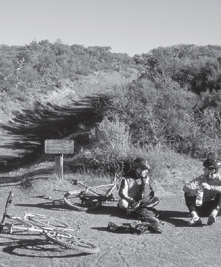
Cyclists rest at the junction of the Limekiln and Priest Rock trails.
Clumps of leather oak, a low shrub with curved and prickly leaves, indicate the presence of serpentine soil.
Trail Description
From the trailhead, 1 pass around gate SA22 and begin climbing moderately northeast on the Limekiln Trail, a rough and rocky road. Eventually the grade eases to gentle, and you follow a winding course up a hillside that drops steeply left into Limekiln Canyon, named for furnaces used to reduce limestone to lime. Several kilns operated nearby from the late 1800s until the 1930s.
 Canyon
Now the road turns left and crosses a side canyon. This is a landslide-prone area, and the road may be wet, muddy, and uneven. Young manzanita bushes have sprouted in the displaced soil, helping to stabilize it. Beyond the slide area, the road swings right.
Now you descend into a cool and shady creekside forest. Soon you reach the boundary between Lexington Reservoir County Park and the Sierra Azul Open Space Preserve. Here the road begins a moderate-to-steep climb over very rocky ground. The massive Lexington Quarry, which is on the north side of the canyon, is visible through openings in the dense bay forest.
 OPTIONS
More Sierra Azul Trails
The Priest Rock Trail, a rugged dirt road, climbs northeast from its junction with the Limekiln Trail2 nearly 1000 feet in 1.5 miles, to a junction with the Kennedy Trail. From there, you can make a 4.6-mile loop back to the Limekiln–Priest Rock junction2 by turning right onto the Kennedy Trail and right again onto the Limekiln Trail. Alternatively, you could follow the 6.2-mile Woods Trail, which descends east from this loop to a parking area at gate SA06 on Hicks Rd.
From the ridgetop, enjoy a fine view that stretches north from San Jose to the East Bay hills and Mt. Diablo.
You continue your uphill trek, eventually trading forest for thick stands of chaparral rooted in serpentine soil. Just beyond a fence and a gate is a four-way junction with the Priest Rock Trail, a dirt road that goes left and right along the ridgetop.2 Here the Limekiln Trail continues straight, but you turn right on the Priest Rock Trail.
 Great Views
A gentle ascent ends with a short, steep pitch, and now you are on level ground. An unsigned dirt road joins sharply from the left, and then a short trail to a viewpoint departs right. Other spur roads branch left and right, but you stay on the main dirt road. Crossing under a set of power lines and a tower, the road bends sharply left. A fence is just to the right of the road, and Priest Rock, a modest outcrop, rises behind it, half hidden in the chaparral.
Now the road begins to snake its way downhill, and soon you reach gate SA23 and the preserve boundary. Your road continues into Lexington Reservoir County Park, and you descend on a grade that alternates between gentle, moderate, and steep. Leveling briefly, the road then climbs gently through a possibly wet area. Now overlooking Lexington Reservoir, you resume winding downhill to the bottom of the Priest Rock Trail. At gate SA21, turn sharply right to meet paved Alma Bridge Road.3 Cross it carefully, turn right, and walk northeast along the road shoulder about 0.4 mile to the parking area.4
 MILESTONES
Trail 32
1 0.0 Take Limekiln Trail northeast
2 2.3 Right on Priest Rock Trail
3 4.8 Right on Alma Bridge Rd.
4 5.2 Back at parking area