TRAIL 33 South Bay
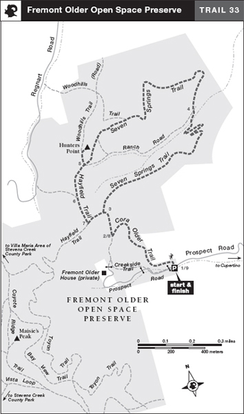
Fremont Older Open Space Preserve
TRAIL USE
Hike, Run, Bike, Child Friendly, Dogs Allowed
LENGTH
3.1 miles, 2–3 hours
VERTICAL FEET
±800'
DIFFICULTY
– 1 2 3 4 5 +
TRAIL TYPE
Loop
SURFACE TYPE
Dirt
FEATURES
Canyon
Summit
Wildflowers
Birds
Great Views
FACILITIES
Restroom
Varied terrain and superb views from Hunters Point make this semiloop route a favorite among South Bay hikers, bicyclists, and runners. In spring, the grasslands along the Cora Older and Hayfield trails come alive with wildflowers, and the secluded canyon traversed by the Seven Springs Trail offers shady respite on a warm day. Remnants of walnut and apricot orchards are reminders of Santa Clara Valley’s heyday as an agricultural paradise.
Best Time
Fall through spring, but trails may be muddy in wet weather.
Finding the Trail
From State Hwy. 85 at the Cupertino–San Jose border, take the De Anza Blvd. exit, go south 0.5 mile to Prospect Rd., and turn right. After 0.4 mile you come to a stop sign, where you stay on Prospect Rd. by turning left and crossing a set of railroad tracks. When you reach the junction of Prospect Rd. and Rolling Hills Rd., follow Prospect Rd. as it bends sharply left. At 1.8 miles, you reach the preserve entrance and the parking area, left. (The parking area is adjacent to Saratoga Country Club—a sign here warns you to beware of flying golf balls and to park at your own risk.) The trailhead is on the north side of Prospect Rd., across from the parking area.
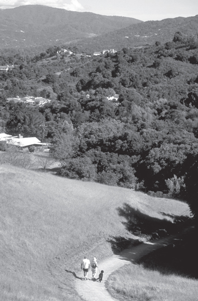
Looking south from Fremont Older Open Space Preserve toward Black Mountain.
Trail Description
From the trailhead, 1 which has information boards and a map holder, follow the Cora Older Trail uphill. The single-track trail switchbacks left, then winds uphill and crosses several culverts draining seasonal creeks. Turning left and crossing an open hillside, you soon reach a T-junction.2 Here, you go right on a dirt road and after several hundred feet arrive at another junction.3 From this junction, the road curves left, but you angle right on the Seven Springs Trail, a single track.
With a ravine holding a seasonal creek on your left, you enter a cool and shady forest. Soon the ravine widens to a valley, whose north-facing slope holds the remnants of an orchard. Winding your way downhill, you pass stands of walnut trees and then meander through a brushy area. The trail turns left, crosses a culvert draining the seasonal creek, and then reaches a four-way junction.4 Here, Ranch Road joins from the left and descends right as a closed road.
 Canyon
Your route, the Seven Springs Trail, continues straight and climbs toward the preserve boundary, then turns west to gain the ridgetop. On a level stretch you pass a junction with the single-track Woodhills Trail, right. Soon you pass a second junction, where an unnamed dirt road descends steeply left. Your trail traverses briefly across a hillside, then merges with Ranch Road, which ascends sharply from the left. Bear right a few steps to meet the Hayfield Trail.5 From this three-way junction, ascend right and soon come to a fork where the Woodhills Trail, a steep dirt road, goes left. Here you veer right and, in about 100 feet, find yourself atop Hunters Point. The view from Hunters Point takes in San Jose, the Santa Clara Valley, Mt. Hamilton, Mt. Umunhum, and most of the southern end of San Francisco Bay, the East Bay hills, and Mt. Diablo. On a clear day, you can even see Mt. Tamalpais and the San Francisco skyline.
 Great views
After enjoying a rest and the superb scenery, retrace your route to the junction with the Woodhills Trail, and then to the next junction, just west of where the Seven Springs Trail and Ranch Road merge.5 Now follow the Hayfield Trail as it angles right and descends on a moderate grade, passing in about 0.1 mile a dirt road signed REGNART ROAD, 0.2 MILE.6
Continue straight on a rolling course to a junction with a dirt road,7 signed PROSPECT ROAD PARKING, 0.8 MILE. Here turn left and, after several hundred feet, reach the junction with the Seven Springs Trail where you began this loop. Now turn right, go 0.1 mile, and then turn left on the Cora OlderTrail,8 retracing your route to the parking area.9
 HISTORY
Fremont Older’s Home
Fremont Older Preserve was named for a crusading San Francisco newspaper editor, who, with his wife, Cora, lived here for many years. After serving as a printer and editor in Redwood City, Older took over editorial duties at the San Francisco Bulletin in 1895. You can visit their home, “Woodhills,” which was completed in 1914 and is on the National Register of Historic Places, during the annual house and garden tour, which usually takes place in the spring. Call the Midpeninsula Regional Open Space District office for details: (650) 691-1200.
 MILESTONES
Trail 33
1 0.0 Take Cora Older Trail
2 0.4 Right on dirt road at T-junction
3 0.5 Right on Seven Springs Trail
4 1.2 Four-way junction; continue straight on Seven Springs Trail
5 2.0 Right on Hayfield Trail, right at junction with Woodhills Trail, climb to Hunters Point; then retrace to previous junction
6 2.4 Straight at junction with connector to Regnart Rd.
7 2.5 Left on dirt road
8 2.6 Retrace to parking area by going right on dirt road, then left on Cora Older Trail
9 3.1 Back at parking area