
CHAPTER THREE

Dakota Landscape in the Nineteenth Century
The Dakota knew Mni Sota Makoce as a network of connected places, each defined in specific ways. They followed a seasonal way of life, hunting game in the woods in winter, pursuing buffalo on the plains in summer, gathering edible plants in the woods and wetlands, fishing in the rivers and lakes, ricing and growing gardens on the lakeshores and riverbanks. Similarly, ritual use of sacred places for burials, ceremonies, and gatherings drew Dakota together at various times of year. Europeans were not present to observe the full seasonal patterns that linked Dakota places. As a result, they often made the mistake of thinking the Dakota were nomads who wandered aimlessly throughout the region. Occasionally they heard Dakota stories connected to places but had little understanding of what those stories and those places actually meant.
DAKOTA ON THE LAND IN THE EARLY NINETEENTH CENTURY

Dakota bands and the villages in which they lived are an important part of the geographic network for the Dakota people in Minnesota. The names of the bands, their villages, and their chiefs are recorded in the narratives of early travelers and in the records of government agents and missionaries, although spellings and translations vary a great deal. Still, the available nineteenth-century records include a more complete picture of the Dakota throughout the cycle of their seasons than is found in earlier documents. As in the earlier British and French accounts, reading between the lines is important.
By the late 1780s trade between the Dakota and Europeans was stabilizing, with fewer interruptions from war and politics. Traders appeared along the Mississippi and Minnesota rivers on a regular basis, supplying the Dakota with goods and encouraging them to hunt and trap. Many of the traders were French or British and were supplied by British companies. They reached the region through Michilimackinac, which was still controlled by the British government, despite the Treaty of Paris, which in 1783 declared it U.S. territory. Following Jay’s Treaty of 1794, Americans occupied the British fort on Mackinac Island but British traders continued to work in the Lake Superior and Upper Mississippi region.1

1794
Jay’s Treaty, between the United States and Great Britain, resolves issues remaining from the second Treaty of Paris, including boundaries in the Upper Mississippi and Lake Superior regions.
Both the European traders and the Dakota themselves sought to survive in this changing political environment. In the spring of 1805 British traders Robert Dickson and Rexford Crawford, intending to continue their own trade in the region, took a party of Dakota led by four chiefs, including Wabasha, to St. Louis to meet with Pierre Chouteau, a trader who was also the Indian agent for tribes west of the Mississippi River.2
As a result of this meeting, General James Wilkinson, the new governor of Louisiana, sent Lieutenant Zebulon Pike to the Upper Mississippi to “ascertain the most commanding Sites for Military Posts and to obtain permission for their Establishment in the Spring early,” and to gather knowledge about commerce, waterways, the quality of the soil and timber, and “whatever else may be deemed worthy of Note.” By late August Pike’s party reached the southern limits of Dakota land. He was accompanied by traders long familiar with the Dakota, including Joseph Renville, who was married to a Dakota woman from Kap’oża (or Kaposia), near present-day St. Paul. In the following days Pike visited Wabasha’s village, located on the Upper Iowa River near its mouth; Red Wing village, sited near the mouth of the Cannon River; and the Kap’oża village, then located near present-day Mounds Park in St. Paul. Pike reported the inhabitants of Kap’oża were absent because they were “out in the Land” harvesting wild rice.3
Reaching the island at the mouth of the Minnesota River now named for him, Pike observed a burial scaffold supporting four bodies, “two enclosed in boards and two in bark.” The dead were wrapped in new blankets. He learned that they had been brought from the Minnesota River and from the St. Croix to be buried there. The site could have been Pilot Knob (Oheyawahi), which rises up above the mouth of the Minnesota River. Near Bdote, the mouth of the Minnesota River, Pike was greeted by C̣etaŋ Wakuwa Mani (Petit Corbeau, or Little Crow) with one hundred fifty warriors. They climbed a hill “in the point between the Mississippi and Saint Peters” and saluted Pike and his party by firing off their guns. The next day Pike met with Little Crow and six other chiefs. He gave a speech asking for a grant of land and requesting that the Dakota make peace with the Ojibwe.4
After discussion between Pike and the assembled leaders, an agreement was signed on September 23, 1805. The document (discussed in more detail in Chapter 4) was a treaty with the “Sioux Nation of Indians,” a term used to refer to the Oc̣eti Ṡaḳowiŋ or Seven Fires of the Dakota. The only Dakota signers were Little Crow and “Way Aga Enogee” (Waŋyaga Inażiŋ, He Sees Standing Up), the chief known as Fils de Penishon. His village, later called Penichon’s or Penishon’s village, was located on the lower Minnesota River. Shortly after the treaty signing, Pike set off up the Mississippi to spend the winter among various Ojibwe bands. On April 11, 1806, on his return trip, Pike encountered a village of one hundred lodges and six hundred people at the mouth of the Minnesota River. He met with Little Crow at the mouth of the St. Croix, and on April 13 he gathered with other leaders at the Red Wing village. Farther downriver, on April 21 he met Wabasha and Red Thunder (Wakiŋyaŋ Duta), a Sisituŋwaŋ leader from Lake Traverse.5
1805
Lieutenant Zebulon Pike, sent by the governor of Louisiana Territory, signs a treaty with two Dakota leaders, Cetaŋ Wakuwa Mani (Little Crow) and Wanyaga Inażiŋ (He Sees Standing Up), for the purpose of building military posts.
In May 1806 four Dakota chiefs and a number of warriors went to St. Louis to meet with General Wilkinson, seeking to cement a relationship with the Americans. Wilkinson tried unsuccessfully to persuade them to go visit with the president in Washington. He wrote to Secretary of War Henry Dearborn that the Dakota had “strong claims to our attentions and courtesy,” but it would be many years before U.S. officials either built upon this relationship or built a fort based on the 1805 agreement.6
May 1806
Four Dakota chiefs and a number of warriors go to St. Louis to meet with General James Wilkinson, seeking to cement a relationship with the Americans.
The British government and British traders continued to operate unchecked in this part of American territory until after the War of 1812. Fur trader Thomas G. Anderson, who worked in the region both before and after Pike’s visit, kept a record and later wrote a narrative that provides some information on the Dakota. In 1806–7 Anderson wintered about fifty miles above the mouth of the Minnesota, building a post in a strip of timber which he said in some places stretched a mile out from the river. The distance from the river’s mouth would place him near several Waḣpetuŋwaŋ villages, including the Little Rapids village, although Anderson does not identify the Dakota either by village or chief. Game was plentiful in the region that year. The local Dakota were in their hunting grounds most of the winter, returning to the river in March to pay off the credit Anderson had given them in the fall.
The following year Anderson returned to the same location on the Minnesota River, though to very different conditions. It was a mild winter, and deer were hard to track on the bare ground. The nearest Dakota, he said, were fifty or sixty miles away, attempting to hunt for buffalo, which were not plentiful either. Many people were starving. Anderson reported that some had tried to find turtles and other food under the ice in a small lake but had drowned because they were too weak to climb out of the cold water.7
In 1809 Anderson went farther up the Minnesota River to Lac qui Parle, apparently among the Sisituŋwaŋ and Ihaŋktuŋwan. Arriving early in the fall, he joined in a buffalo hunt at Big Stone Lake, where many buffalo were killed. Anderson said little about what happened during the winter but noted that in the spring the Dakota he described as “my hunters” informed him they were not coming to the post to pay off their credits but were traveling two days to the south “on the road to Santa Fe” to trade for horses. Anderson was able to get three-quarters of what he said was due him before they left.8
The next year Anderson returned to Lac qui Parle, where he ran into difficulties because he refused credit to those who had gone for horses in the spring. In the end he would only give them ammunition for hunting, not the other items of trade they were accustomed to receiving in the fall. It was another difficult winter for Anderson because of a shortage of food, perhaps because the Dakota with whom he traded had chosen not to supply him with game. During the course of the season Anderson received visits from the Sisituŋwaŋ leader Red Thunder and another chief named Broken Leg, of the Gens de Perche (People of the Pole) band, probably of the Ihaŋktuŋwaŋ.9
In later years Anderson traded among what he called the Lower Sioux, which he said at this time consisted of six bands, including those of Wabasha, Red Wing, Red Whale, the Six, Little Crow, and Thunder or Red Thunder. Anderson added that Red Thunder was not considered to be attached to any band, which may explain why he included this Sisituŋwaŋ leader among the Lower Sioux. In 1810–11 Anderson had his post on Lake St. Croix. One summer, Anderson stayed at his trading post while his partners went east to Michilimackinac with their packs of furs. During that time Anderson reported the Dakota “were away at their summer villages,” though he provided no other information about them. Later he accompanied an entire Dakota village on a summer hunt on the Upper Mississippi River. Anderson noted that in the fringe of timber above the mouths of the Rum and Crow rivers, the deer would “retire from the scorching sun of summer; and if the mosquitoes are troublesome the pestered animals plunge into the river.” According to Anderson’s account, the men hunted deer while woman and children stopped to pick berries and stretch and dry the skins. Traps were also set for small animals.10
The party soon reached “the borders of their Chippewa enemies,” although Anderson does not say exactly where this was. Though certainly not the usual summer war party, which would not have included women and children, the group prepared for the possibility of hostilities, but none occurred and the party turned back. Later that summer Anderson also described going west with two canoes of hunters to pursue buffalo at Big Stone Lake but added few details about those he accompanied.11
Anderson was involved in fighting against the Americans during the War of 1812, along with other British traders of the region and a number of Dakota, including Wabasha and Red Thunder. Another chief, Tataŋkamani, or Walking Buffalo, chief of the Red Wing village, opposed this involvement. Other chiefs remained neutral.12
1814
The Treaty of Ghent ends the War of 1812, and the U.S. claim to the Minnesota region is fully recognized.
Following the war, Americans sought to reestablish relations with the Dakota. On July 19, 1815, government officials signed a treaty of peace and friendship with the “Sioux of the Lakes” (Bdewakaŋtuŋwaŋ) at Portage des Sioux, near the mouth of the Missouri River. The Dakota were brought to the treaty by Nicolas Boilvin, U.S. Indian agent at Prairie du Chien. The treaty stipulated that the signers “acknowledge themselves and their aforesaid tribe to be under the protection of the United States, and of no other nation, power, or sovereign, whatsoever.” The best known of the signers was Tataŋkamani. The same day a similar treaty was signed with the “Sioux of St. Peter’s River.” The following year, on June 1 in St. Louis, a treaty was signed with the “Siouxs of the Leaf [Waḣpetuŋwaŋ, the Siouxs of the Broad Leaf [?], and the Siouxs who shoot in the Pine Tops [Wazikute or Waḣpekute].” Signers of the last treaty, forty-one in all, included some who had signed the other two treaties, including Tatangamarnee (Tataŋkamani). The terminology used to describe these groups was garbled, as were the names of many of the signers, making it difficult to identify the Dakota involved.13
It was not until the summer of 1819, when representatives of the U.S. Army under Lieutenant Colonel Henry Leavenworth appeared at the mouth of the Minnesota River to build a fort, that U.S. government representatives began to have regular contact with the various Dakota bands and villages in the region.
1819–20
The American military arrives at the mouth of the Minnesota River to begin construction of a military post.
DAKOTA SEASONAL PATTERNS IN THE LATE EIGHTEENTH AND EARLY NINETEENTH CENTURIES
In the 1820s and 1830s seven Bdewakaŋtuŋwaŋ villages were located along the Minnesota and Mississippi rivers. Above Ṡakp̣e’s village on the Minnesota were a number of Sisituŋwaŋ and Waḣpetuŋwaŋ villages, continuing all the way to the headwaters. The Waḣpekute did not usually have fixed village sites but used the region between the Minnesota and Mississippi, along the course of the Cannon River, and the area to the south. Dakota villages were, in effect, summer villages, occupied not year round, but at particular times in the warm months. They were located in the river bottoms, in areas that might be subject to flooding in the spring. Their location reflected a way of life heavily dependent on the river for transportation. The Dakota had horses but continued to rely on dogs and canoes, both dugout and birch bark. The summer village sites were bases of operations occupied sporadically, starting after the rivers had subsided in the spring and continuing until the fall, when the inhabitants left the rivers to hunt for deer.14
Lawrence Taliaferro: Indian Agent
[ THOMAS G. SHAW ] Perhaps the richest written source of information about the Dakota in the early nineteenth century are the journals and letters of Lawrence Taliaferro, who acted as Indian agent for the Upper Mississippi Dakota at Fort Snelling from 1820 to 1839. Taliaferro’s journal provides information on Dakota leaders, Dakota villages, and the patterns in which Dakota people lived on the land.
Lawrence Taliaferro (1794–1871) was born into a wealthy land- and slave-owning eastern Virginia family. He served as an officer in the First Regiment of U.S. Infantry during the War of 1812. Following the war he secured a post as a U.S. Indian agent through the patronage of family friend James Monroe. Like all Indian agents, he was invested with the rank of major, although he did not hold a commission in the army. Taliaferro had no qualifications apart from his experience as an army officer and the common presumption within the U.S. ruling class that gentlemen of proper birth and breeding were natural leaders.
Taliaferro arrived at the new military post at St. Peters, at the mouth of the Minnesota River, in the summer of 1820. The post was known to Americans as St. Peters. He remained as agent for both the Dakota and western Ojibwe until 1826 and thereafter solely for the Dakota until he resigned in November 1839.
During his almost twenty years of association with the Dakota, Major Taliaferro kept a daily journal. He developed close relationships with a number of Dakota during his residence. He provided European-style wooden coffins to grieving families as a measure of his regard and their standing and even allowed a number of Dakota to be buried in a small cemetery behind his house. Over the years he frequently referred to the Dakota both collectively and individually as his “friends.” Perhaps most crucially, he had a relationship with Aŋpetu Inażiŋwiŋ, the Day Sets, daughter of Maḣpiya Wic̣aṡṭa, or Cloud Man. The nature and longevity of this relationship is not made clear in the journal, but there are references to their daughter, Mary, mostly after 1835, when she began attending the mission school at Lake Harriet. Despite these relationships, Taliaferro never became proficient in the Dakota language and never rid himself of his biases regarding Dakota culture.i
The journals, which are unique for this period, contain an amazing depth and variety of information. The relationships Taliaferro built with Dakota people over almost twenty years are significant in themselves, allowing the reader and researcher to see patterns develop over time. We witness the maturation of these relationships and how they were affected by events and in turn effected events themselves.
The journals are a particularly rich source of information on Dakota lands and land use. They document when particular bands left the vicinity of the agency for hunting, ricing, sugaring, and war, providing firsthand information on the seasonal subsistence cycle. Numerous direct references to places and their significance include camping sites, villages, hunting lands, ricing lakes, and geographical features. Taliaferro did not often have a firm grasp of Dakota understanding, and the factual information is frequently accompanied with misinformed editorializing.
Taliaferro made frequent reference to Dakota agricultural, hunting, and food-gathering practices. He was committed to teaching the Dakota European-style deep-plow farming, believing they could regularize their diets by producing agricultural surpluses in the manner of European farmers. In many cases he misunderstood what he was seeing and the long-standing logic behind traditional practices. Nonetheless, his observations provide the historian with information that is not available in other sources.
Of special significance are numerous transcriptions of Dakota “talks,” or speeches. While Taliaferro’s reasons for recording them were probably self-serving, these are essentially oral history transcriptions. He was not fluent in Dakota, so the translated text probably came from Dakota interpreter Scott Campbell. Many of the talks are words spoken in formal councils with the attendant ceremony—words calculated for public effect. Many times the scene and the speaker’s gestures are described as well. As such, these records are tangible remainders of Dakota oratory. Generally they are recorded word for word. Most have government policy or intertribal relations as their topic.
Other talks were much less formal. Many times they were recorded in the agent’s office with only the interpreter and a few other Dakota as witnesses. These can be best characterized as conversations with more personal and local issues as the subject. Sometimes they were set down word for word; in other cases they were paraphrased. Both formal and informal talks record the words of specific Dakota, however, and through them the reader hears contemporary people speak about contemporary issues. The informal dialogues provide much less self-conscious information. The reader learns about burial places, travel routes, hunting grounds, places of spiritual importance, and locations of seasonal food and materials. Because of Taliaferro’s long tenure, he was able to record the changes in Dakota culture and living patterns as the Dakota struggled to accommodate and mitigate increased Ojibwe and American pressure on their resources.
Taliaferro seldom ventured far from the agency adjacent to Fort Snelling, though he was responsible for all the Dakota, not just the neighboring Bdewakaŋtuŋwaŋ. He viewed the military reservation as the crucial center of the region and reasoned that visiting Dakota expected to find him at the agency. Consequently, his best information was local. He knew the people of nearby villages far better than those to the west beyond Little Rapids. Much of his intelligence concerning events in this region was obtained through conversations with missionaries, traders, and visiting Dakota rather than by direct observation and experience.
Despite their removal from his jurisdiction in 1826, the Upper Mississippi Ojibwe continued to visit the St. Peters Agency, placing themselves in direct contact with local and visiting Dakota. Taliaferro designated a particular camping area near Coldwater Spring for the Ojibwe. The comings and goings of these people and their interactions with the Dakota gave him opportunities to observe and describe councils, dances, games, and feasts, as well as warfare. Despite his obvious cultural biases and with the benefit of historical distance and clearer cultural understanding, Taliaferro’s journals provide much information and many intriguing clues about how the Dakota viewed and interacted with the physical and spiritual world.
Joseph N. Nicollet, Mapmaker and Ethnographer
Before the nineteenth century, the details of Dakota seasonal patterns and the locations in which they took place were described haphazardly. This changed with the arrival of French geographer Joseph N. Nicollet, who came to the Upper Mississippi River in 1836 and compiled a detailed map of the entire region, published by the U.S. government in 1843. Perhaps the most important surviving record of Dakota geography and place names in the nineteenth century, Nicollet’s map was the first real attempt to produce an accurate accounting of the region and the first attempt by anyone after Pierre Le Sueur in 1700 to record native place names for local sites. While compiling this geographical record, Nicollet kept journals—not published until the 1970s—recording the meanings of place names, the relationships between peoples and places in the region, and important cultural information about the Dakota and the Ojibwe of Minnesota. Nicollet recorded this information without the prejudices of the missionaries or the government agents, always seeming to show a sympathy and respect for native cultures.ii

Joseph Nicollet’s 1843 map of the Upper Mississippi, including many Dakota and Ojibwe names, was the most detailed map of the region after those done 140 years earlier based on information supplied by Pierre Le Sueur.
As Stephen R. Riggs noted, the Dakota divide the year differently than Europeans do. He reported that, while the Dakota have twelve moons or months to which they give meaningful names, “five moons are usually counted to the winter, and five to the summer, leaving only one each to the spring and autumn.” The two transitional moons corresponded more or less to April and October. Present-day Minnesotans will recognize the logic of the abrupt transition from winter to summer and summer to winter. And like present-day Minnesotans, the Dakota in the nineteenth century “had very warm debates, especially towards the close of winter,” about whether spring had finally come.15
The Dakota use of the land related not only to daily subsistence but also to their beliefs and rituals and the meaning they attached to particular places in the region. Medicine ceremonies, feasts, and Dakota ball games were held at village sites at various times of year. Prominent locations such as Wakaŋ Tipi (Carver’s Cave), Mounds Park, and Oheyawahi (Pilot Knob) were used for burial and ceremonial purposes.
A regular pattern of resources was available in the country of the Dakota, but the changeable weather of every season and every year meant that all resources did not have good years at the same time. In some years the wild rice crop or the corn crop failed. Game was scarce in some places in some years. Through their knowledge of the region, the Dakota were able to harvest some crops or resources more intensively when others failed. For example, it seems the Dakota may have preferred eating meat to fish, but they fished when they needed to.16
To understand Dakota life it is necessary to understand the pattern of seasonal subsistence activities. As will be seen, the Dakota names for the seasons related to the land: winter moons or months connected to animals, while the names for the summer months described horticultural or gathering activities.17
FALL AND WINTER HUNTING
November is Takiyuḣa-wi, “the deer-rutting moon.” Missionary Samuel Pond stated that in October, after receiving supplies of trade goods, larger bands broke into smaller ones and set off for the deer hunt. Pond himself spent several deer hunting seasons with Dakota communities—to learn about the people and their language. He later wrote that in the fall of 1835, “I went off with the Indians on a hunting expedition. The Language however was the game I went to hunt, and I was as eager in pursuit of that as the Indians were of deer.” In the process, Pond had a unique opportunity to be a participant-observer, in the anthropological sense, of Dakota life, beliefs, and social organization.18
Deer hunting took place in backwater regions, up small streams and valleys away from the Mississippi and Minnesota rivers. The Dakota living in what is now the Twin Cities area did most of their hunting on the Sauk River, the Rum River, the St. Croix River, and Rice Creek. This territory was part of a productive area where the Ojibwe, former allies and sometime enemies of the Dakota, occasionally ventured. The region stretched diagonally across the present state of Minnesota north of the Twin Cities. Local Indian agents Lawrence Taliaferro and Henry Schoolcraft and tribal members themselves referred to it as “the middle ground.” On August 18, 1836, Taliaferro met with Ojibwe chief Bagone-giizhig (Hole-in-the-Day), who in a conversation at the agency with Dakota chief Wakiŋyaŋ Taŋka (Big Thunder, known as Little Crow) spoke about the need to share this space: “Let us, said he, to the Sioux, —keep our middle ground clear,” Taliaferro wrote. Keeping it clear meant keeping the peace, since this was a contested zone, a region where Dakota and Ojibwe battled in summer but which they shared in winter, a season when they rarely fought.19
1820
Lawrence Taliaferro begins work as Indian agent at Fort Snelling.
Dakota bands departed the rivers to go to their hunting grounds in September or October, after ricing had been completed, not returning until after the first of the new year. On October 31, 1830, Taliaferro reported that he held a council with the Dakota and Ojibwe “to settle their differences for the winter.” They left the next day to “go off on their hunts.” He added, “Nothing I hope will disturb their mutual intentions for the winter.”20
A few hunting locations were associated with particular Dakota villages. The Kap’oża village usually hunted along the St. Croix River, sometimes going as far north as St. Croix Falls. The area was more easily accessible to them by overland travel than through the circuitous water route down the Mississippi to the mouth of the St. Croix. In December 1835, translator Scott Campbell returned to Fort Snelling from the St. Croix River, reporting to the agent that “The Sioux & Chippeways were below the falls of St. Croix—on the Chip Land by invitation—Dancing—playing Ball & feasting together.”21
Waḣpetuŋwaŋs from the Little Rapids village of Mazamani were reported in 1828 hunting on a small lake near the head of the Sauk River. In 1831 they hunted between the Crow and Sauk rivers, reaching an agreement with the Sandy Lake Ojibwe for the winter. The Black Dog village and Cloud Man’s village usually hunted along the Rum River, making arrangements with the Rum River and Mille Lacs Ojibwe. Samuel Pond accompanied a hunting party from Cloud Man’s village in the winter of 1836 that traveled along the Rum River.22
Dakota-Ojibwe Peace Treaties
The Dakota and Ojibwe people had seasonal peace treaties to minimize conflict in their shared lands. Although they had made treaties prior to the construction of Fort Snelling and arrival of the U.S. Indian agent, Lawrence Taliaferro’s presence facilitated the process. His efforts began in 1820, in collaboration with the first commander at St. Peters, Lieutenant Colonel Henry Leavenworth, who negotiated a treaty with the Dakota that year that was never ratified. Meetings with the Dakota occurred both at the site of the first military encampment, Cantonment New Hope, located at the mouth of the Minnesota River, and at Coldwater Spring, which was first occupied by U.S. officials during the summer of 1820. Taliaferro arrived that summer. He did not record a narrative of what occurred, but he did leave lists of presents given to Dakota leaders starting in June 1820.iii
Throughout his journals Taliaferro mentions renewals of such treaties of “Peace and Friendship.” By 1831, Taliaferro stated, “I have held more than 200 councils since July 1820—between these old enemies—& have been instrumental in doing some good so they say to me & to each other.”iv
These treaties often involved songs and ceremonies. Taliaferro described one such event in June 1823 at the mouth of the Minnesota River:
Meeting of the Sioux & Chippeways—June 1823 at the Entry of the St. Peters West of the Mississippi River in View of the Agency House
211 Chippeway—342 Sioux from Several Bands. The Sioux were drawn up in line 150 yards from the Chippeways with 4 Flags unfurled—Singing the Peace Song.
The Chippeways also in line parallel with the St Peters. The Braves of both nations then advanced to the number of about 40, 20 of a side with their Arms & War implements. When at the distance of ten paces—the parties halted for a moment—then advanced singing the Braves Song and gently but Quickly pressed each others Sides above the hips—Shook hands—When the Combined Sioux & Chippeways—fired general Salute—after which Pipes of peace passed as a renewal and Confirmation of their General Peace in the Month of July 1821.v
Among the Dakota and Ojibwe leaders most supportive of peace were the bands closest to each other, including the Mille Lacs, Rum River, and St. Croix Ojibwe and the Bdewakaŋtuŋwaŋ from Kap’oża, Black Dog, and Penichon villages. In 1836 Taliaferro noted that Piajick (Bayezhig) or Lone Man, the Ojibwe war leader for a St. Croix band, “was the first to step forward in 1821—to assist me in forming & confirming a peace between the Chipp[e]ways of the St Croix and the Sioux of the Mississippi.” Many local Ojibwe were members of the Maingan or Wolf clan, descended from intermarriage between Dakota men and Ojibwe women in the St. Croix River region decades earlier.vi
In 1825, as will be discussed in the next chapter, Taliaferro was instrumental in bringing about the Treaty of Prairie du Chien, which sorted out the boundaries between tribes, drawing lines between tribal territories, even in areas where hunting land was actually shared. Because the region had never been surveyed by the government, the agreed-upon line made use of geographic sites known to both tribes—sites which probably had cultural significance, although their meaning is not explained in the treaty. They include such locations as “the standing cedar” on the St. Croix, two lakes known to the Ojibwe as the “Green Lakes” and to the Dakota as “the lakes they bury the Eagles in,” and “the standing cedar that ‘the Sioux Split’” near the Rum River. In 1835 Major Jonathan Bean, an Indian agent on the Missouri River, surveyed the line between the Dakota and Ojibwe from the Eau Claire River northwest across Wisconsin and Minnesota, though neither side could agree on the exact course it should take.vii
Less formal ceremonies occurred on many other occasions. Sometimes Dakota traded with visiting Ojibwe for maple sugar and birch-bark canoes, which they used for ricing. According to Taliaferro, the Dakota provided blankets, guns, and traps in exchange. Trading such items—which might otherwise have been provided by the Indian agent—may have been especially important for the Ojibwe during the period after 1827, when Taliaferro was instructed by superiors to send them to their designated agent, Henry Schoolcraft at Sault Ste. Marie, or subagent, George Johnston at La Pointe. The distance of the Lake Superior agents and the nearness of Taliaferro to Ojibwe villages on the Upper Mississippi and St. Croix rivers led the local Ojibwe to continue coming to Fort Snelling.viii
During such visits the Ojibwe usually camped near Coldwater Spring, which for a while was the location of a trading post run by Benjamin F. Baker, who operated among both the Ojibwe and the Dakota. Representatives of the tribes would take turns dancing at each other’s camps. The Ojibwe’s landing place on the Mississippi was named Chippewa Point by agency employees.ix
Ṭaḳu Wakaŋ Tip̣i / Morgan’s Mound and Mni Sni / Coldwater Spring
Ṭaḳu Wakaŋ Tip̣i is known to the Dakota people as “the dwelling place of the gods.” Place-name historian Paul Durand described the location as “a small hill over-looking the Fort Snelling prairie located between the VA Hospital and Naval Air Station.” Missionary Samuel Pond learned from Dakota elders that this was the dwelling place of Uŋkteḣi, a powerful underwater spirit, also known as Ṭaḳu Wakaŋ, who inhabited springs, waterways, and locations such as the Falls of St. Anthony. A tunnel was said to lead from this site to the Minnesota River, permitting the spirit easy passage. The soldiers at Fort Snelling named it Morgan’s Mound or Hill in the 1820s.x
Exactly what constitutes the boundaries of this hill and the boundaries of the sacred site are matters of discussion. Early maps provide varying details. Government agencies like to insist that the Dakota people document every single place a square inch at a time, but Dakota places are often linked by cultural connections that transcend physical borders. Given the recorded Dakota beliefs about a water passage to adjacent rivers, it is clear the “dwelling place of the gods” included nearby Mni Sni (Coldwater Spring), which comes out of the ground just below the lowest part of Morgan’s Mound. Dakota elder and minister Gary Cavender made this point in 1999 at a time when the spring was endangered by highway construction: “There is that sacred spring that is in negotiation, that sacred spring is the dwelling place of Uŋktehi, the God of the Waters, and in that spring there is an underground river that goes into the big river, and that is his passageway to get out into the world. To block the sacred passageway would be courting with drought and things of that nature that have to do with water, because after all, this is the God of the water.”xi
The spring has been described as a manifestation of Uŋkteḣi, as are all bubbling springs. Coldwater Spring was also important in the history of Fort Snelling. The soldiers who came to build the fort camped here in the summer of 1820 and Lawrence Taliaferro began his work as Indian agent here that same year. Adjacent to Coldwater Spring was the habitual camping place of the Ojibwe who came to visit Fort Snelling, the Indian agency, and the nearby Dakota communities. The Indian agent’s efforts to mediate between the Dakota and Ojibwe began here in the summer of 1820, when the military encampment was moved from Cantonment New Hope to Coldwater Spring.xii
At that time a group of Dakota leaders decided to invite Ojibwe leaders to come to Bdote, the mouth of the Minnesota River, to meet with them to make peace. They left a message on birch bark for the Ojibwe on the Sauk River. Henry Schoolcraft, who visited the area with the expedition of Michigan Territorial Governor Lewis Cass, described this message and later took it back with him to Washington. Schoolcraft stated that the message included images representing Colonel Henry Leavenworth and the Dakota leaders Ṣakp̣e, Wambdi Taŋka (Big Eagle) of Black Dog village, and another chief whose name was not known to the Americans. The Dakota leaders issued the invitation, and Leavenworth was to mediate the meeting. Another symbol indicated the military cantonment, “then recently established at Cold Spring on the western side of the bluffs above the influx of the St. Peters,” which was to be the meeting’s location. According to Schoolcraft, “The frame, or crossed poles of the entire 50 lodges composing this party, had been left standing on the high, open prairie on the west bank of the Mississippi above Sauk River, and immediately opposite the point of Hornblende Rocks.”xiii
As a result of this effort, preliminary meetings occurred between the Dakota and Ojibwe at Coldwater Spring in the summer of 1820. Taliaferro arranged for the Dakota and Ojibwe to meet again in July 1821 to sign a treaty. Anthropologist Ruth Landes, in her work on the Prairie Island Dakota, records a traditional account of a peace ceremony said to have occurred between the Dakota and Ojibwe. The story relates that the Dakota chief was named “Shakopee” and had a village in an area near the former Ford factory in St. Paul and near Minnehaha Falls in Minneapolis, a place which may have been at or near Coldwater. But the story also says that the event took place at the town of Shakopee, which may be the result of confusion in translation or in remembering the tradition. After a pipe ceremony involving the Dakota and Ojibwe leaders there was a feast, dancing, and other celebrations lasting through the night. Everyone was happy when peace was restored. Landes noted that even in 1935 the Dakota and Ojibwe still talked of being enemies, yet “these people made peace, probably as often as they made war.”xiv
In 1999 Ojibwe religious leader and educator Edward Benton-Banai recounted other aspects of the Ojibwe and Dakota meetings at the spring. The site was part of “a neutral place for many nations to come, and that further geographically defines the confluence of the three rivers, which is actually the two rivers, that point likewise was a neutral place. And somewhere between that point and the falls, there were sacred grounds that were mutually held to be a sacred place. And the spring from which the sacred water should be drawn was not very far, and I’ve never heard any direction from which I could pinpoint, but there’s a spring near the [medicine] lodge that all nations used to draw the sacred water for the ceremonies.” He remembered that his grandfather, who died in 1942 at the age of 108, often recalled that his family “traveled by foot, by horse, by canoe to this great place to where there would be these great religious spiritual events, and that they always camped between the falls and the sacred water place. Those are his words.” Benton-Banai went on to say that he had many discussions with Dakota spiritual leader Amos Owen of Prairie Island about the importance of Coldwater Spring to both the Dakota and Ojibwe.xv
The people of Wabasha and Red Wing villages usually hunted inland, either to the north in the area of present-day Wisconsin along the Red Cedar and Chippewa rivers or west in the rich region of present-day southeastern Minnesota, along the headwaters of the Cannon, Zumbro, Root, Blue Earth, and Des Moines rivers, an area known as Waḣpekute territory but shared with other Dakota bands. According to Joseph Nicollet, the convergence of the Des Moines and Blue Earth rivers was known as Mni Akipam Kaduza, meaning “water running to opposite sides.” Throughout this region Dakota might encounter the Sac and Fox, with whom they were sometimes at war. Here too, Lawrence Taliaferro attempted to reduce friction between groups in an intertribal area known as the “neutral ground.” Ultimately several treaties were required to sort out tribal claims, but the uncertainties there, as with the area between the Dakota and Ojibwe, reduced access and increased game populations, which made the area desirable for hunting.23
Dakota bands traveled through their hunting grounds regularly, never returning to an area more than every two or three years, according to Samuel Pond. Whole communities of men, women, and children traveled together in these hunting parties, covering a short distance each day. Travel was on foot, with horses—if the community had them—pulling travois frameworks carrying the heaviest loads. Hunters forged ahead looking for game, while the rest of the party followed, taking down the tepees and setting them up in a new place. The social organization of the deer hunt, as described by Samuel Pond, resembled the complex organization of buffalo hunting for Dakota on the prairies: “The movements of a hunting party were regulated by orders issued by the chiefs, or, if no chief were present, by one of the principal men of the party. These orders were given out after the wishes of a majority of the party had been ascertained by consultation, and were commonly proclaimed by a herald in the morning or evening, the only time when the hunters were likely to be all at home.” To make sure the whole community was fed, special rules applied to what happened to the deer that were killed. Game was divided among all hunters who claimed a portion even if they did not shoot the deer, though the hunter who killed the deer was always allowed to keep the skin.24
During some years in both winter and summer, people from Black Dog village hunted to the south in the region of the Waḣpekute, which bordered the territory of the Sac and Fox, sometimes subjecting them to the threat of warfare. Although the herds of buffalo had receded to the west since the beginning of the nineteenth century, there were years when buffalo were still seen in this region. In June 1827, Wambdi Taŋka (Big Eagle), chief of Black Dog village, left with Wabasha’s son-in-law, who had some connection to the village, to hunt on the Des Moines River. Later in the summer Taliaferro reported that the Black Dog chief, with seven lodges of his band, was still on the plains and was rumored to be going as far as the Coteau de Prairie, though he might return in the fall to gather rice on the Cannon River. Cloud Man, or Maḣpiya Wic̣aṡṭa, the Black Dog war chief, was on his way back to the village on the Minnesota River with three lodges. On his return he gave Taliaferro an account of what had occurred during the summer hunt, although Taliaferro recorded no details.25
On May 6, 1829, Wambdi Taŋka returned with his followers “from his hunt on the Des Moines River,” where they appear to have spent the whole winter. In September 1835 Wambdi Taŋka’s son Maza Ḣota (Gray Iron) visited the agent prior to departing for the same region. Taliaferro asked him to transmit a message of peace if he encountered Sisituŋwaŋ and Waḣpetuŋwaŋ people during the winter.26
This may have been the hunting trip recorded in the life story of Joseph Jack Frazer or Ite Maza (Iron Face), the son of a white trader and a Dakota woman whose name is recorded as “Ha-zo-do-win,” a daughter of Tataŋkamani (Walking Buffalo), the chief of the Red Wing village. Frazer grew up with his mother’s family and as an adult remained part of his grandfather’s band but was married to a daughter of Maza Ḣota, by then chief of Black Dog village. According the narrative of Frazer’s life recorded by Henry H. Sibley, one winter in the 1830s when Frazer and his uncle Wakute wintered on the headwaters of the Root and Whitewater rivers, they were joined by Maza Ḣota. When the Black Dog leader set off to return in the spring, Frazer accompanied him as far as Pine Island on the headwaters of the Zumbro River. There he also met his friend Ta Oyate Duta, son of Wakiŋyaŋ Taŋka, who had by then succeeded his father, C̣etaŋ Wakuwa Mani, in the leadership of the Kap’oża band. The two men hunted for several weeks before Frazer and his wife returned to the Root River.27
The chief of Penichon’s village also hunted in the region of the Des Moines River. In July 1831 Taliaferrro wrote in his diary that he would “send Penition Chief to hunt with the Sioux on the Des Moines this fall and all winter until spring—so as my councils may be continually repeated,” a reference to his attempts to foster peace with the Sac and Fox.28
Taliaferro’s journal mentions the killing of other game in the fall. In August 1835 several bear were spotted on the “9 mile ridge creek [possibly at Kap’oża] within a few days past which fact seems to revive the drooping spirits of our neighboring Indians as Game has been considered scarce this season.” The next month ten bear were killed in the cornfields at Cloud Man’s village on Lake Calhoun. Taliaferro reported, “This put the Indians in fine spirits—& their Corn was gatherd the faster & with more pleasure.” At the same time he noted that “the high winds has blown down the wild rice—unlucky.” Taliaferro explained the presence of so many bear by a lack of food farther north. He also noted that raccoons were overrunning the agency gardens.29
Muskrat hunting was mainly a spring activity, although sometimes the animal was hunted in the fall. In 1835, when muskrats were “unusually abundant,” people killed “40 to 60 per diem.” There are only a few references to buffalo hunting, usually by Dakota bands farther west. On March 3, 1828, the Odawa and French trader Joseph LaFramboise arrived at Fort Snelling, reporting hard winter conditions along the Sheyenne River, in present-day North Dakota. He stated that ten lodges containing fifty people had died, probably from lack of food, “the snow being so deep that they could not pursue the Buffalo.”30
During the winter, chiefs sometimes returned to Fort Snelling to meet with the agent and the traders and pay for the credits of trade goods given them in the fall. In some cases the elderly and infirm were left by their bands near the Indian agency so they could receive aid from the agent when necessary. Toward the end of his time at Fort Snelling, Taliaferro stated that over the years he had aided thousands of Dakota and Ojibwe, at his own expense. For example, in March 1836, with the temperature at twelve and a half degrees below zero, Taliaferro received a visit from a Waḣpekute woman whose name he did not know, along with her children and others in need. The woman presented him with a pipe and spoke about her relationship to two prominent Waḣpekute leaders:
My Father—I have called to see you with my family & friends to shake hands with you. my child[re]n shake ha[n]ds with your Father—I am connected with the Chief Tah saugah [C̣aŋ Sagye, or Cane] of the Wah paa kootas [Waḣpekute] & also with Wah maa de sappah [Wambdi Sapa, or Black Eagle], you see me poor and miserable my friend gone by the hands of his enemies and his children left for me to provide for. We are without a Blanket. Scarcely a petty coat and as you see dirty and in great want.
Taliaferro gave “this family 6 or 8” rations of beef and pork, along with tobacco and four bars of lead for making ammunition. He said it was all he could spare.31
In some cases, however, staying near the fort could be a problem, especially for women, who might be molested by soldiers. In December 1827 Taliaferro wrote that the soldiers were “troublesome to the Indian women who are encamped near the Agency—their husbands & friends being out hunting.” Taliaferro aided them by driving the soldiers away. Generally, he advised the visiting Dakota to stay away from the garrison at the fort.32
SPRING SUBSISTENCE
The deer hunting season continued through November and December and into January. At that point, if the hunt had gone well the community would usually have a large surplus of dried meat. At this time of year deer were becoming lean, so bands left the hunting grounds and moved closer to the summer villages, where they set up tepees in a sheltered area.33
Now was the time for fishing or spearing through holes in the ice for “Pike, Pickerel, Black bass, & Sun fish in all their varieties,” according to Taliaferro. Dakota who lived along the rivers, such as the Black Dog and Kap’oża villages, fished and speared in the lakes in the floodplain—or “ponds,” as Taliaferro called them. In late March 1836, Taliaferro noted he saw Dakota fishing in “adjacent ponds in groups of 8 & 15—cutting from the ice, fine pike, pickerel, sun fish, &c &c.” From the agency he could have seen Snelling Lake, just below the bluff; across the Minnesota River to what was then known as Prescott’s Pond (destroyed by a new river channel in modern times); and upriver toward what are now called Gun Club and Long Meadow lakes. The blacksmith at the Indian agency often supplied spears or repaired them for the Dakota.34
Samuel Pond wrote that this was a season of rest, assuming the deer hunt had been successful. It ended in March when the Dakota went to hunt or spear muskrats and make maple sugar. These activities required members of the community to split up because the muskrats and the maple trees were located far apart. Pond wrote, “A few of the women accompanied the men to the hunting ground, and a few of the men staid with the women at the sugar bush, but the men were the fur-hunters and the women were the sugar-makers.”35
Conflicts over the use of maple sugaring sites occurred during the 1820s and 1830s as demand for firewood expanded from the area close to Fort Snelling. Soldiers apparently sometimes tapped the trees themselves as well. In March 1829, one Dakota leader stated in a discourse with Taliaferro,
My Father
We are poor people raised in the woods. We have no rights perhaps—but what we think ours we hope will not be taken away from us without our consent. The Other War Chief (Col Snelling) and you my Father promised not to let any person interfere with a Small piece of ground where our women go sometimes make a little Sugar. You promised us this when the Soldiers made Vinegar on it one year.
A few days later the family of Dakota interpreter Scott Campbell returned from a sugar camp to say they had been “ordered off by the Soldiers of Lieut. Jouetes Company.” Taliaferro reflected in his journal on the difficulty of sorting out the laws when public officials were involved.36
Not all of the locations where Dakota went sugaring have been recorded. One known site was Nicollet Island just above the Falls of St. Anthony in Minneapolis. A Hennepin County history describing the area in 1842 states that the island was “covered with magnificent maple trees,” supplying three or four sugar camps for Dakota people, including those from the Cloud Man and the Penichon (Good Road) villages. Location on an island was said to provide “plenty of moisture” for the trees, making the sap abundant. Later, army officer Seth Eastman painted a view of Dakota women at a sugaring site, perhaps on Nicollet Island. Lieutenant James Thompson’s 1839 map of the Fort Snelling reservation marks one “sugar orchard” along the west bank of the Mississippi River below St. Anthony Falls, possibly near the present location of the University of Minnesota. According to Taliaferro, there was also a maple grove near Minnehaha Falls, which was known at the time as Little Falls, and the area around Wakaŋ Tipi (Carver’s Cave), near the Kap’oża village, had a “sugar forrest.” Waḣpetuŋwaŋ from Little Rapids may have gathered sugar in the area between the Sauk and Crow rivers, where they also sometimes hunted in winter. Several early settlers of Wright County, in Maple Lake and Albio townships, recall visits from groups of Dakota who gathered sugar on the settlers’ claims in the 1850s. Likely many other locations were used by the Dakota for sugaring in the mixed woodland areas around the Twin Cities and throughout the Minnesota and Mississippi river valleys.37
While the women gathered the sugar, the men hunted muskrats, the staple of the Dakota fur trade in the nineteenth century. The Minnesota River valley was well populated with muskrats, even while beaver were in decline. Many Dakota traveled long distances for the hunt. Indians living in the area of Bdote might travel hundreds of miles to go and return from the Upper Minnesota River. As Pond wrote, spring was the best time of year to hunt muskrats because as the sun melted the snow and ice, muskrat houses thawed out more quickly than the surrounding areas because of their dark color, making them easy to find. To kill muskrats the Dakota used axes to break open the muskrat lodges and barbed spears as well as traps and guns to kill the inhabitants. Pond wrote that many of those seeking muskrats survived on muskrat meat during this season of the year. He noted that the meat was edible in small quantities during cool weather but spoiled quickly in warm weather and that the carcasses gave off a rank, musky odor.38
Pond stated that even if the Dakota had the opportunity to hunt waterfowl at this season of the year, ammunition was often too precious, because the Dakota depended on muskrat furs for much of their trade. Taliaferro mentions the Dakota hunting geese and ducks, especially in areas he could see nearby, such as “the pond near the fort,” probably a reference to Snelling Lake. In March 1828, Taliaferro wrote that he saw the first geese that morning and that “the Indians ran out of their Lodges in every direction expressing their delight at the occurrence this early.”39
For Taliaferro, as well as the Dakota, the appearance of migrating waterfowl was a signal of transition, the coming of spring or the nearness of winter. In March 1828, he wrote of seeing geese: “Indians from all the Lodges within the Vicinity of my house ran out to express their delight at the certain omen of a Speedy Spring—or rather b[r]eaking up of the Ice on the Rivers.” On April 4, 1836, Taliaferro wrote,
This day is so fine that the Inhabitants & military are like the Bees, & ants b[u]sy flying about & others sunning and thawing out after a long & tedious winter.
Many stragling Indians also to be seen who are smiling at the prospect of spring—& the appearance of wild geese Ducks &c &c40
On March 22, 1828, Taliaferro stated, with a typical lack of understanding, that Dakota people who had just carried out a “Medicine feast” presented him with the first goose killed that month: “This is one of their many Superstitions always to make a feast of the first Animal Killed at the commencement of each Season.” Other early observers noted that the Dakota held such feasts for the first corn and wild rice, celebrating the arrival of each season’s resources.41
The inhabitants of the settlement closest to the fort, Black Dog village, were known as Marhayouteshni (Maġa yuṭe ṡni), “those who do not eat geese,” a possible reference to the fact that even though they lived in an area known for massive migrations of waterfowl, they did not eat them, but reserved them instead for trade with the officers at Fort Snelling. On March 28, 1828, Taliaferro wrote of a late snowstorm, mentioning “frequent changes in the weather” and “Ducks—Geese &c in great abundance brought in this day by the Indians.” The next year, on April 10, he wrote, “Mild and pleasant weather this morn[in]g—Indians commence to Kill wild geese.” A few days later he noted that “Fish—Geese—Ducks are brought in by the Indians to trade at the Fort.” The presence of the chief Kaḣboka, from Black Dog village, provides a clue to which bands were killing and trading ducks and geese.42
Dakota communities more distant from the agency also hunted waterfowl in spring or fall. While traveling down the Mississippi in October 1821, Taliaferro noted he “Passed the Band of Chief Warbeshas—on an Island engaged in putting up their tents—with a view to hunt Ducks Geese Deer &c for a short time.”43
Spring hunting and trapping for furs did not occur in winter hunting areas but along river valleys, sometimes to the west. During one productive season, in May 1836, Taliaferro reported that Maḣpiya Wic̣aṡṭa (Cloud Man) had returned with several others “from the plains” with eight hundred to five thousand muskrats between them.44
On their return to the area of their summer villages in the spring, Dakota people held medicine dances. Joseph Nicollet described such an event in frigid conditions on Pilot Knob on February 15, 1837; Taliaferro recorded these ceremonies occurring in February and at other times of the year. On some occasions the Dakota welcomed observers from the fort at locations including Pilot Knob, Carver’s Cave, Lake Calhoun, Lands End (near the present-day entrance to Fort Snelling State Park), Pike Island, and other sites “near the agency.”45
1836–39
French geographer Joseph Nicollet explores the Upper Mississippi region, later producing a comprehensive 1843 map of the region.
The Dakota medicine ceremony, the Wakaŋ Wac̣ip̣i, was similar in many ways to that of other midwestern tribes. On June 12, 1834, Taliaferro reported, “A large body of Sioux have a medicine ceremony and dance at Lake Calhoun this day. Some Chippeways were invited and attended.” In addition to medicine ceremonies, Taliaferro refers in his journal to many dances and ceremonies, often given in front of the agency house for assembled visitors. Yet, Taliaferro provides little specific information. Though he was a keen observer of Dakota customs, his knowledge of their ceremonial life was not sophisticated.
Another important marker of spring’s coming was the breakup of ice on the rivers, especially because rising water could flood the sites of summer villages. One particularly bad year was 1826, when in April, as the ice melted, the waters on the Mississippi and Minnesota rivers rose as much as twenty feet above normal, covering most of the houses and government buildings near Fort Snelling on the river flats, including the trading post run by Jean-Baptiste Faribault on Pike Island.46
According to Taliaferro, the 1826 flooding also swept away the Penichon, Black Dog, and Shakopee villages. This may explain why, when the river started rising in March 1828, local Dakota were “busily engaged in moving their Lodges from the banks of the River St. Peters upon the contiguous Bluffs—it being rapidly on the rise,” even though ice on the two rivers was still firm.47
Another regular spring occurrence was the burning of the prairies. In April 1828 Taliaferro reported “Extensive fires in every direction. The Pra[i]ries are and will be burnt over—much damage to the under growth & trees. The fact of the origin of the extensive plains in the north and west may be ascribed to the yearly inroads made by fire on the wood Lands.” The previous year he had noted that native people employed fires to aid in hunting, writing, “The moment they Start upon their Winter or fall hunt, they set fire to the Prairies—which starts off the Game in every direction, to avoid otherwise certain destruction.”48
On other occasions Taliaferro suggested burning was practiced by both the Indians and the military. The soldiers may have intended to improve grazing areas and make the land easier to plow in the open prairie west of the fort. On October 11, 1835, Taliaferro wrote that the commander of Fort Snelling, Major John Bliss, had set out at sunrise “with 50 or 60 men to set fire to the Pra[i]rie. Rather wet for fire at this hour. The policy of Pra[i]rie burning may be questioned, at any rate I have order[e]d the Indians in the most positive manner not to set fire or permit their children to fire the Pra[i] rie on any account—for it is sure to burn up the fenceing, wood choppings—Hay stacks & again the Cattle suffer & horses, and the game is at once driven off to a great distance.”
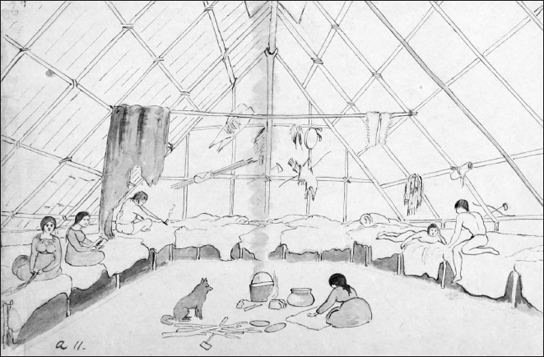
The platforms used for beds inside the bark houses of a Dakota summer village were recorded by Robert O. Sweeny in the 1850s.
SUMMER JOURNEYS AND FALL HARVEST
In May the sugar makers and the muskrat hunters finally returned to the villages along the rivers and began to live in summer houses, which consisted of gabled structures made of a pole framework covered with elm bark. These houses had a built-in platform at bed height all around the perimeter of the structure.49
For the next few months, meat resources were scarce. Summer hunting was shorter and more sporadic than in winter, though it sometimes covered the same territory. On June 19, 1827, Taliaferro stated, “The Sioux Bands near this Post have generally left for their Summers hunt.—and will remain some thirty or forty days. Some of them will go in the direction of the Chippeways frontier, may expect to loose their Scalps.” Hunting in the summer was more dangerous because it was frequently a time for war parties. In July 1817 explorer Stephen Long noted the residents of Cetaŋ Wakuwa Maŋi’s Kap’oża village were absent on a hunting party up the St. Croix River. Given the season, there could have been many other possibilities. In July 1823, William H. Keating, a member of Long’s second expedition, stated that the Kap’oża village was “abandoned for the season,” giving no other details. The people from Kap’oża hunted on the Crow River in the summer of 1834. In June 1829 Kaḣboka of Black Dog village hunted on the Sauk River, while Wambdi Taŋka, Big Eagle, hunted on the St. Peters River.50
In July 1827 Taliaferro noted that the chief of Penichon’s village and others of his band were “on the plains in pursuit of subsistence.” Traveling up the Minnesota River in mid-July 1823, Long’s expedition encountered the chief of Black Dog village not at his home but with family members over a hundred miles away, close to the Cottonwood River near present-day New Ulm. In September 1835 British geologist George William Featherstonhaugh stated that the members of Black Dog village were “on the prairies hunting buffalo.”51
In some cases men could not get ammunition to hunt in the summer because traders were unwilling to supply it until the time of year when animal furs were thickest. In June 1827 Taliaferro stated that some families had little to eat during the summer until corn ripened in August, unless they obtained wild plant foods. Starting in the 1830s the Dakota were promised the payment of treaty annuities, which persuaded them to camp near Fort Snelling rather than go out hunting. Delays in payment led to summer scarcities. At such times and at other occasions during the year, the Indian agency supplied food, ammunition, and other provisions, such as fish hooks and lines and spears.52
For the Dakota, June is Ważuṡtec̣aṡa-wi, “the moon when the strawberries are red,” while one name for July is C̣aŋpasapa-wi, “the moon when the chokecherries are ripe.” In addition to berries and fruits, many wild plant foods became available in the spring and summer, including tipsiŋna or wild turnips, and mdo, a kind of potato. Other food plants included the pṡiŋc̣iŋc̣a (psinchinca), a round root the size of a hen’s egg, and the pṡiŋc̣a (psincha), a spherical root an inch in diameter, both of which grew in shallow lakes and marshy ground including the wetlands bordering the Minnesota River. Pond noted that these roots were harvested by women standing in the water: “When a psinchinca is detached from the mud it immediately rises to the surface of the water; but the psincha does not float and must be raised by the foot until it can be reached by the hand, a difficult operation, requiring much dexterity where the water is up to the arms as it often is where they grow.” Pond recalled, “scores of women might be seen together in shallow lakes, gathering these treasures of the deep.” It appears these roots provided food at various times of year when other resources failed. On April 30, 1829, Taliaferro wrote that “the Indians are now Subsisting entirely on Wild or Marsh Potatoes—without Salt or grease of any Kind whatever—(a poor diet).”53
Summer was a time of great sociability among the Dakota, when larger bands were reunited. In earlier eras, going back to the 1600s, the mouth of the Minnesota had been a location where western and eastern Dakota bands met. With the building of Fort Snelling and placement of the Indian agency there, an extra dimension was added to its traditional role. Starting with the first treaties, annuity payments were often made during the summer at the fort, drawing those from all the Dakota bands involved.
The area around the fort was often the site for Dakota ball play, or lacrosse, between Dakota villages and between Dakota and Ojibwe. On July 4, 1835, various Dakota villages played ball on the plain near the fort for the amusement of artist George Catlin, who was visiting the area. Catlin painted portraits of some of the players.54
If Dakota villages grew corn, it was planted in June, when strawberries were ripe, usually on ground “where there was a thrifty growth of wild artichokes.” Dakota women planted corn in hills, not in rows of plowed fields as whites did. Pond wrote that many Dakota villages did not grow more than enough corn to feed the community for a few weeks. Often they ate all the corn in its “green” state—that is, fresh from the cob, at its sweetest. Some corn was dried and put in bark containers for winter sustenance, but because Dakota made use of many other resources it was not common for villages to store large quantities of corn.55
During his time at Fort Snelling, Taliaferro sought to encourage a shift among the Dakota to increased dependence on agriculture—particularly the growing of corn—which he saw as a crucial step in instructing them in what he viewed as “the arts & habits of civilized life.” These included the use of plows and men’s participation in agricultural activities usually carried on by Dakota women. Taliaferro urged the chief Cloud Man, who had been a member of the Black Dog band, to move to Lake Calhoun and establish an agricultural colony which would grow not only corn but other crops, such as beans and squash.56
1829
Cloud Man, or Maḣpiya Wic̣aṡta, and other members of the Black Dog village begin agricultural experiment at Lake Calhoun.
As a result of Taliaferro’s influence, the people of that community appear to have adopted plows in preparing the ground for growing corn, but the work of cultivation was still carried out mainly by the women. Taliaferro himself made use of the agricultural skills of Dakota women, hiring some to work in his garden at the Indian agency. In 1839, the final year Cloud Man’s band was at Lake Calhoun, missionary Gideon Pond left a detailed description: “The Ind’s at this village plant about 80 acres (I plowed only 15 acres for them this spring) as it has all been planted before it is comparatively easy for them to cultivate it with the hoe.” He noted that “the women do mostly some of the men however help their wives through the whole of it (the corn belongs to the women),” making the same point about corn that Jonathan Carver had made about women’s harvesting of wild rice seventy years before. Pond noted that in 1839 the village had harvested about 2,300 bushels of corn and two hundred bushels of potatoes. Finally, he wrote, “Each woman has her little field to take care of. The 80 acres which they plant is divided into 50 fields yet all lies or nearly all together.” He did not say whether the women at Cloud Man’s village grew their corn in hills in the traditional way, but a map of the area drawn by Taliaferro in the 1830s suggests the fields were divided up irregularly rather than in rectilinear plots.57
Bde Maka Ska / Lake Calhoun, Minneapolis
[ KATHERINE BEANE ] As one strolls along the busy shores of Lake Calhoun—known to the Dakota as Bde Maka Ska (“white banks lake”) in reference to the sandy white beaches that enveloped the waters—the true history of this place feels absent. A small monument on the east side of the lake marks a spot that largely goes unseen. This location is now more closely associated with inline skating, dog walking, jogging, and summer fun, but it was not always simply a place of leisure. The history of the land and the waters that have protected this space for centuries is a long and contentious one upon which only a small fraction of perspectives have been properly documented.xvi
From 1830 to 1839 a small agricultural community of Dakota known as Ḣeyate Otuŋwe, “the village at the side,” was located at Lake Calhoun, then a marshy area that had previously served as a place to harvest wild rice, located roughly six miles from Bdote, a site of creation for the Dakota people. The community, which in 1839 had a total population of 207, including 72 men, 54 women, and 81 children, was under the supervision of Indian agent Lawrence Taliaferro. The village of Ḣeyate Otuŋwe came into being in 1829 when Chief Cloud Man, or Maḣpiya Wic̣aṡṭa, a member of the Black Dog band of Dakota, decided to try the “white man’s way” of farming. He was influenced to do so after surviving a treacherous incident in a snowstorm. Missionary Samuel Pond stated that the chief—who like many Dakota in Minnesota sometimes hunted a great distance from their summer villages—was hunting on the plains near the Missouri River when he and the other members of his party were overtaken by a sudden blizzard.xvii
According to Samuel Pond, the storm was so violent that the hunters lay down, each wrapped in his furs. Maḣpiya Wic̣aṡṭa could not communicate with his companions and did not know whether they were dead or alive. The men lay there for three days and nights under the snow. During this time Maḣpiya Wic̣aṡṭa remembered that Indian agent Taliaferro had urged them to plant crops at Lake Calhoun. When the storm was over, the members of the party found that they were near a “large camp of Indians who came to their assistance.” On returning home to Black Dog village, Maḣpiya Wic̣aṡṭa persuaded a group of families to accept government assistance to start a new village in which agriculture would be emphasized for subsistence. They were given seed and farm tools, and the colony began in August 1829.xviii
Dakota people, historically seen in western anthropological terms as hunters and gatherers, were traditionally not viewed as farmers, though they had always cultivated gardens at village sites. Their way of life did not fit under the term agriculture because they traveled at different times of year and harvested their food from wild and native plants rather than subsisting off of plants that were not indigenous to the area. Another difference from European agriculture was that in Dakota culture it was the women who cultivated crops, not the men.
From Samuel Pond’s point of view, Maḣpiya Wic̣aṡṭa’s decision was “to turn their attention to agriculture and adopt the customs of civilized people.” Thus, the Dakota—particularly Dakota men—would spend less time hunting and more time farming: Pond defined the change as “abandoning the chase and cultivating the arts of civilized life.” He viewed Maḣpiya Wic̣aṡṭa as a “man of superior discernment, and of great prudence and foresight.” Pond noted that the chief was “opposed by many of the other chiefs, and none of them entered heartily into his views.”xix
Maḣpiya Wic̣aṡṭa’s decision to take up agriculture could be viewed as assimilation to western values and culture. This was Indian agent Taliaferro’s understanding: he named the village Eatonville in honor of John Eaton, secretary of war in the administration of President Andrew Jackson, calling the village “my little Colony of Sioux agriculturists.” Eatonville was viewed as an experiment to see if the Dakota’s lives would be improved by emphasizing agriculture as a way of life. This perspective sees Maḣpiya Wic̣aṡṭa’s and his fellow band members as pawns of civilization, on a “progressive” path to assimilation into European ways. From the chief’s perspective, however, he had a decision to make, one supported economically by the local Indian agent and missionaries, which may have had a strong influence. It was a time of transformation for the Dakota. Maḣpiya Wic̣aṡṭa’s decision was not merely economic or cultural but also political, a move toward self-sufficiency and independence. Maḣpiya Wic̣aṡṭa had a choice to make, and he opted to try another way of life. The traditional ways of the Dakota were becoming less and less viable, especially with the decline of buffalo and its disappearance from the eastern regions of the Dakota homelands.xx

The village of Maḣpiya Wic̣aṡṭa, known as Ḣeyate Otuŋwe, “the village at the side,” located on the east side of present-day Lake Calhoun in Minneapolis, was recorded in this map by Indian agent Lawrence Taliaferro, who preferred to call the village Eatonville. Here he encouraged Dakota to concentrate more heavily on agriculture, shown in the irregular fields on this map. However, contrary to the male-dominated approach encouraged by Taliaferro, women continued to be the main cultivators of the soil.
Maḣpiya Wic̣aṡṭa was not seeking to become something other than a Dakota person. He did not intend to forsake his identity as a Dakota man; he was simply making an honest attempt to adapt to his surroundings, changing with the times as any human being, as well as any community, must in order to live. The change in subsistence patterns did not make the people of this village any less Dakota. Its members not only tried to feed themselves more efficiently but shared their wealth, in a typically Dakota way, with neighboring bands, thus ensuring the survival of even more Dakota people. In September 1835, Taliaferro felt the need to lecture the people of Maḣpiya Wic̣aṡṭa’s village “to explain fully to the Indians—not to give their corn away to others of their relations—with other matter of importance to their interests.” Despite the fact that the people in this village embraced agriculture, Taliaferro was never able to convince them to stop being Dakota.xxi

As the corn in their fields ripened, Dakota women and children sat in scaffolds to prevent birds from damaging the crop, as shown in an engraving based on a painting by Seth Eastman.
While the people of the village begun by Maḣpiya Wic̣aṡṭa spent more time growing crops than did other villages, he was not the only Dakota leader to turn to farming. Ecological decline had led other nearby Dakota communities to take up agriculture since the 1770s. At the same time, though the members of the village farmed during the summer, they continued to hunt, fish, and gather crops as usual over the course of the year. It was people from Ḣeyate Otuŋwe that Samuel Pond accompanied on a winter hunting trip to the Rum River, hoping to make progress in learning the Dakota language. Ḣeyate Otuŋwe was the place where the Dakota language was first written down in a comprehensive way by the missionaries and the Dakota they taught.xxii
Missionaries like Samuel and Gideon Pond, who arrived at Fort Snelling in 1834 and spent twenty years preaching Christianity and documenting the Dakota language, were certain they were working with a dying race of people. They felt it was their duty to record these peoples and to save as many of them as they could. The idea that the Dakota would survive the colonial impact of invasion, or that they had their own spirituality and/or religions that were distinct to them, handed down to them by their own god (Tuŋkaṡida), did not seem to pass through their minds. These brothers were, however, among the few whites who came into contact with Dakota people and made any attempt to learn their language. But there was an agenda to their learning the language: in order to convert as many Dakota people as possible, they would need to translate the Bible into Dakota first. Thus language acquisition was a necessary step in order to speed up the conversion process.
In the end, ḣeyate Otuŋwe was abandoned by Maḣpiya Wic̣aṡṭa’s band due to fear of retaliation from the Ojibwe following a war between the two nations in 1839. As a result, many have viewed the village at Lake Calhoun as a “failed experiment,” ignoring the fact that the villagers continued to emphasize agriculture in the years following, when they were located on the Minnesota River near Bloomington. After the treaties of 1851, Maḣpiya Wic̣aṡṭa and his band moved up the river with other Dakota to the area near Yellow Medicine, joining the Hazelwood Republic, a self-governing body of farmer Indians that chose their own officers, advised by the missionary Stephen R. Riggs. According to Pond, Maḣpiya Wic̣aṡṭa was among those placed in the concentration camp at Fort Snelling over the winter of 1862–63. He died there and was buried “within sight of the valley he loved so well and not far from where he was born.”xxiii
From a Dakota point of view, Maḣpiya Wic̣aṡṭa’s village was not a failure because it insured the survival of his people and his descendants. He could not read the future, but he saw his people hungry and did what he needed to do—and for a period of time it worked. Many Dakota villages were nourished by the crops Ḣeyate Otuŋwe harvested during a time when food was not so readily available to them. The legacy of Maḣpiya Wic̣aṡṭa lived on after his death and has served as a source of inspiration to his descendants. He is remembered as a man not afraid to take on a challenge, and he has continued to serve as a source of inspiration for many of his descendants who reside in the Twin Cities area as well as for those who are still living in exile from their home territory of Mni Sota Makoce.xxiv
Dakota who did shift more intensively to growing corn did not abandon hunting or food-gathering. It would have made no sense for people in the Minnesota country to attempt to survive on only a few agricultural resources. Even later white settlers did not try to do so. Pond went hunting with Dakota from Cloud Man’s village at Lake Calhoun and wrote that while they waited for their corn to ripen, they could often be found catching bullheads in Mud Lake, now called Lake Hiawatha, along Minnehaha Creek above the famous falls.58
During the same period, other bands grew crops as a supplement to hunting and gathering. In 1835, Mazamani of the Little Rapids village asked Taliaferro for aid in getting his lands plowed “as others are.” He also asked “for our women a corn Mill as our women find it hard to beat their corn after our fashion,” suggesting his band did not intend to change gender roles as urged by the agent. Even Waḣpekute bands, usually described as nomadic, grew some corn, though it is not clear whether this practice was influenced directly by the example of Cloud Man’s village. In May 1836, Skush Kah Hah (possibly Ṡkaŋ ṡkaŋ yaŋ, or Moving Shadow) of the Cannon River Waḣpekute visited the Indian Agency at Fort Snelling. Taliaferro wrote, “We had considerable conversation as to his people & his fears of the Sacs & Foxes had induced them to leave the Cannon River for this season only to raise their corn on the St Peters 7 miles up this River & asked for shoes &c.” However, the Waḣpekute did not adopt agriculture in the fashion of whites, as an activity for men. The leader told Taliaferro, “My Father—we call for a few hoes to enable our women to break the ground and I hope you will spare us some as we are much in want of such things, we wish also for a few fish spears—& files—& fish hooks & lines if you have any.”59
Other villages—such as Kap’oża and Black Dog, from which the people of Cloud Man’s village had originated—followed the agricultural village’s example more directly. In March 1836, Wambdi Taŋka came to see Taliaferro at the agency: “He asked for a plough & chains & harness—to open a farm at his village, his family & friends had (10) horses. His son, & nephew were active men and would attempt to plough themselves if I would start them with the means &c.” Taliaferro promised to provide him with a plow and harness.60
A similar agricultural experiment was taking place at Lac qui Parle, where the trader Joseph Renville and missionaries Thomas Williamson and Stephen R. Riggs also sought to convince the Waḣpetuŋwaŋ to grow more corn as a way to avoid food shortages. Some of the Waḣpetuŋwaŋ had moved from the villages near Little Rapids to grow corn at Lac qui Parle. However, their experience provided a cautionary tale about the difficulties involved in depending on any single resource in the Minnesota climate when on June 20, 1842, a very late frost killed all the garden crops. Many of those living at Lac qui Parle were forced to move back to the lower Waḣpetuŋwaŋ villages to stay with relatives. The following year a drought made things worse. Williamson, usually stationed at Lac qui Parle, spent part of that time at Fort Snelling. In May 1843 he wrote that more than half the Indian members from the Lac qui Parle church spent half the winter within fifty miles of Fort Snelling. More than a dozen came to his church services from January until April. Many expected to stay in the lower Minnesota River valley and plant that spring. Williamson stated, “One principal object which I had in view in coming here was to procure some aid for those who came in this direction in consequence of the failure of their crops. My success in this respect exceeded my hopes but not their expectations.” The government granted them $2,500-worth of blankets, guns, ammunition, and a large surplus of provisions. At the same time Williamson was filling in for the doctor at the fort and was paid sixty dollars per month.61
One way or another it was clear farming was not a panacea, and the agricultural way of life was never fully embraced by Dakota communities. In 1839 an elderly Dakota man at Lac qui Parle told missionary Riggs about his recollection that when he was a boy corn was first planted below Fort Snelling on the Minnesota. Generally, “as soon as it was fit to eat they devoured it all.” In addition they hunted buffalo and deer and gathered wild rice. According to the account, “they raised no more corn until he was a young man. Then some relatives planted a small patch. The next year his relatives planted a small patch and a number of others planted also. Thus the number who made corn increased every year and their fields were enlarged a little. Other villages along the Saint Peters River, following their example, planted corn.” The Treaty of 1837 provided funding to pay for government farms run by government farmers adjacent to many Dakota villages, designed to provide food and to encourage farming by the Dakota. Even among the Dakota who embraced agriculture, however, traditional resources remained important.62
Late in the summer was the time for ricing throughout Dakota country. The Dakota equivalent of September is Psiŋhaketu-wi, “the moon when the rice is laid up to dry,” while October is Wi-ważupi, “the drying rice moon.” The Dakota relied on wild rice as a major resource during the winter. The rice crop was variable, depending on water levels. Many lakes around the Twin Cities, including some in present-day south Minneapolis and along the Minnesota River, had thick beds of wild rice. The Rice Creek corridor in present-day Anoka, Ramsey, and Washington counties provided the Dakota with a great deal of rice. Whole bands went to the ricing places in late August or early September. Dakota people obtained birch-bark canoes in trade from Ojibwe who came to Fort Snelling to visit the Indian agent. Taliaferro noted in his journal on June 10, 1829, “These light canoes are in great demand among the Sioux—who use them in gathering the Wild Rice from the Lakes & Ponds adjacent.” In August 1827 Taliaferro warned that Dakota who had neglected their corn crops “must look out for rice or starve nearly during the approaching winter.”63
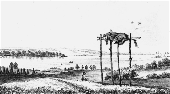
Like many Dakota village sites, the one at Lake Traverse recorded in 1823 by Samuel Seymour had burial scaffolds on a nearby hill.
Cranberries were another important crop in the fall. On October 12, 1835, Taliaferro reported, “Cranberries brought in—high prices paid—by the citizens for transportation to the lower country.” In April 1826 he also reported cranberries, possibly dried, being brought to the post. On his departure from the agency in the fall of 1839, Taliaferro included among his effects on board the steamboat Gypsey one barrel of cranberries. Later on, during early white settlement, cranberries harvested by Indian people continued to be an export item from the Minnesota region.64
Sporadic hunting and fishing also supplemented the gathering of wild plant foods. Spearfishing took place all along the rivers near Fort Snelling. One summer fishing place for the people of Kap’oża was at Grey Cloud Island, near Pine Bend on the Mississippi. In September and October some trapping was done, although it is not described in much detail. Taliaferro in his journal mentioned that the Kap’oża band went above the Falls of St. Anthony to hunt for beaver in late September 1831, intending to stay there until traders arrived with merchandise for credit.65
Prior to departing for the winter hunting grounds the Dakota had more ceremonies, though Taliaferro did not always describe them with a great deal of understanding. On October 12, 1835, he gave a puzzled and puzzling account of what he observed by moonlight:
The Indians as late as 7 oclk began Danceing any and [all] kinds of figures of a rude nature—Buffalo—first then—War—Discovery—beg[g]ing and last of all the fence dance—intermixed with Medicine ceremonies—fireing at the Devil—all in great glee—men, boys, women and girls—all by a slight ray of the moons beams. From what I could learn from the speakers remarks alias—captain of the Dance & master of the ceremonies—The Agent is likely to have a general Visit on tomorrow Tuesday.
Some of the dances mentioned, including the buffalo dance, the discovery dance, the war dance, the begging dance, and the medicine ceremony, have been described in various sources, but the reason for the dance taking place in the moonlight and whether it was intended for the benefit of the agent or the soldiers is unclear.66
Taliaferro did receive a visit the next day, not from the Dakota but from the fort’s commander, Major Bliss, who complained about the Indians’ continuing presence around the fort. By late October or early November most of the Dakota villagers had left to go hunting for the winter, not to return until February or March. As Taliaferro put it a few weeks later, on November 4, “Cold rain, and disagreeable weather. The Indians haveing finished their fall hunt—Depart generally for their winter hunt—usually return 1st March—after which the usual spring hunt is commenced. Divided into Fall,—Winter, spring,—summer.”67
The seasonal cycle never ended, but it did vary from year to year depending on weather, war, and rotation of land use. Managing the cycle required the combined knowledge of many band members, who passed on their experiences through the generations. The record kept by Taliaferro and the missionaries and other whites provides a rich view of the Dakota relationship to the land, as it was then, as it had been, and as it would soon cease to be, in the era after the Dakota land cessions and the devastation of 1862–63.
1839
Lawrence Taliaferro resigns as Indian agent at Fort Snelling.
DAKOTA BALL PLAY
During the summer and at other times of the year Dakota villagers traveled throughout Minnesota to each other’s villages to play ball games. These games were associated with many aspect of Dakota culture and highlight their strong connection to the land and the places they lived within it. Views about the ball games varied widely depending on the writer’s perspective. Missionaries and government agents saw the game in simplistic terms, often with little sympathy or cultural understanding. Not until Dakota writers such as Charles Eastman gave accounts of the game was it possible for non-Dakota to view it with a fuller cultural understanding.68
Dakota ball play, or Takapsic̣api, often called lacrosse, from the French name for the racket used in the game, was a feature of Dakota life often described by early European visitors and missionaries. Using the takapsic̣api, a hooped ball racket or club, and tapa, the wooden ball, Dakota men and women played energetic games in summer and winter, for their own entertainment and that of visitors. One of the earliest written accounts was given by Joseph Marin, who reported that the Dakota played for several days against the Sac and Fox near his trading post on the Mississippi in December 1753. On his trip down the Mississippi in the spring of 1806, Lieutenant Zebulon Pike stopped at the present site of La Crosse, Wisconsin, the location of a prairie where native people often played the sport. On April 20, 1806, Pike observed a game between the Dakota and the Ho-Chunk and Fox. Pike described the ball as being made of a hard substance “covered with leather.” The game was played on the prairie, with goals in the form of a line marked a half mile apart. Pike, like other observers, did not indicate if there were boundaries on the sides of the field, though riverbanks or forests may have created natural boundaries. According to Pike the “parties” wagered “the amount of some thousand Dollars.” The object was to carry the ball across the opponent’s boundary four times. Players tried to get the ball into their rackets, running with it toward the goal but flinging it great distances when necessary. Pike stated that in the game he witnessed “the Sioux were the conquerors,” not for their running ability but “from their superior skill in throwing the Ball.”69

Robert O. Sweeny made this drawing in the 1850s of Dakota people playing Takapsic̣api or ball play, often known as lacrosse, on Shakopee’s Prairie, the earlier location of Ṡakp̣e’s Village, the present-day site of the town of Shakopee. The Dakota played the game in contests between villages and with other tribes at meeting places.
Many years later the missionary Samuel Pond gave a more detailed account of Dakota ball play. He noted that “all the active and able-bodied men engaged in it,” though women also had their own form of the game that was played most often on frozen lakes and rivers. Men wore only breechcloths and moccasins, but they were highly decorated with body paint and ribbons or feathers, “which fluttered like streamers when they ran.” The game began when the ball was carried to the center of the ball grounds and tossed into the air, at which time “there was a general rush, followed by a clattering of clubs” by members of the two contesting teams, including, in all, a hundred or more players. The ball could only be touched with the club and the goal was to direct it across two opposite boundaries about a half mile apart, each representing one of the teams. While Pike suggested players could keep the ball “in the air for hours,” Pond stated that the net in the hoop of the ball club provided a most precarious surface in which to hold the ball, so that only the most adroit player could balance it there while running toward the goal line. The ball often fell on the ground, and players struggled to get it or direct it through the air as far as possible past the other players, who were scattered throughout the game grounds.70
The game required great dexterity, and because men collided, giving and receiving “accidental blows from ball clubs,” there were often injuries. The players’ endurance was tested, as were their tempers. The inhabitants of two or three villages might watch the game at the borders of the field, “elated or depressed as the ball went this way or that across the playground.” Players and spectators bet upon the game’s result, often, Pond stated, more than they could afford to pay. Spectators were loud in their applause or “sharp censure” about the course of the game and the actions of individual players.
The game paused after one of the teams scored a point but soon resumed, though unlike Pike, Pond was vague about just how it was determined that a game had ended. He noted, “The game might be soon decided by the defeat of one of the parties, but it was more likely to continue till all were glad to have it end and indeed needed several days of rest.”
In writing about Dakota ball play in the 1830s, Pond suggested it was a pure sport, one in which “religious ceremonies were not mingled,” and shared many picturesque qualities comparable to the games of ancient Greece. Though “nearly naked,” the players were “quite as well clothed as the competitors in the old Grecian games.” He noted “this would have been one of the most celebrated games in the world if it had been played by the ancient Greeks and described by Homer.”71
In later letters, however, Pond gave differing interpretations of the game, presenting the missionaries’ prevailing view that it was “heathen” in nature. In August 1835, early on in his residence at Lake Calhoun, Pond wrote about all the events occurring in the community on the Sabbath morning. A man came to borrow an ax, another was chopping wood outside his window, women and children were “screaming to drove the blackbirds from their corn.” Then “again I am interrupted by one who tells me that the Indians are going to play ball near our house to-day. Hundreds assemble on such occasions. What a congregation for a minister of Christ to preach to! Alas! As far as I know, the glad tidings of salvation never reached the ears of a Dakota. Yet I cannot hope that some will be gathered into the fold of Christ even from among this wild and savage nation.”72
Samuel Pond’s brother Gideon also wrote disparagingly of Dakota ball play and the contexts in which the Dakota played it. He noted that in 1845 the chief he called Mahkanartahkah, or Ground Kicker, “made a ball-play to the spirit of a child he lost last fall.” He bought “$50 or $60 worth of clothing and invited ninety men to play for it, forty-five on a side. Besides this he feasted them all.” Gideon Pond compared it to a card game called “game-of-the-departed-spirits,” whose object was conciliating the spirits of the dead. He suggested the Dakota believed beautiful weather was evidence of a favorable view. In the case of the ball play, he noted sarcastically that there had been an ensuing snowstorm. “Heathenism is expensive,” Gideon Pond wrote.73
Other missionaries abhorred the game because it involved gambling and was therefore viewed as a form of “dissipation” that prevented the Dakota from hearing their religious message. Though the missionaries’ accounts only vaguely suggested the social context in which games were played, the teams represented the villages from which they came, which meant the games were viewed as tests of the pride and strength of villages and their people. Lawrence Taliaferro, the Indian agent at Fort Snelling in the 1820s and 1830s, provides numerous examples of these contests. Although Taliaferro shared the missionaries’ perspective about the need to “civilize” the Dakota, he did not seem to view ball play as interfering with the mission. Instead, he appeared to appreciate it as a picturesque sport which he was eager to show off to visitors, both men and women. Taliaferro also found it useful to encourage ball play as a summer distraction that might prevent young men from going to war. In May 1829 sixty men of the Black Dog band participated in a “Grand Dance” at the council house and other locations. He gave them tobacco and rations of bread and pork, noting “The day was a fine one. This is the season for War & I keep all the Bands amused…either playing at Ball, Dancing or some feasting expectation.”74
In June 1834, two teams of a hundred men each played ball near the agency. The game was “well contested, with stakes including two horses, six guns, eight kettles, and six blankets.” Black Dog village was the winner, though Taliaferro did not state which team they were playing. The following year in July he received a visit from the artist George Catlin, who was touring the Upper Mississippi with his wife. Eager to provide picturesque subjects, Taliaferro arranged for members of Lake Calhoun’s Cloud Man village to dance and play ball for him. They assembled “painted and ready for play,” but the game was interrupted by a violent storm. Catlin gave them several loaves of bread, and they promised to reappear the next day. Taliaferro noted that “the Ladies were all expectation—but have unluckily been disappointed. I will try again to gratify and amuse them.” The next day, July 4, he reported that “the different villages of the Sioux played ball for the amusement” of the Catlins.75
Taliaferro also stated that Catlin took “the likeness of two Sioux at Ball Play in the act of doing so.” Catlin said that he painted the two men, “Ah-no-je-nahge [Anoka Inażiŋ] (he who stands on both sides), and W-chush-ta-doo-tah (the red man),” possibly both from Cloud Man’s village, exactly as they “had struggled in the play,” though they posed for him in his “painting room.” Catlin noted that the Dakota generally held the club with both hands, unlike the Choctaw, who from Catlin’s observation used two clubs. It was much more difficult, he stated, to catch the ball with the hoop of one club than to wedge it between two.76
Taliaferro recorded a number of occasions when Dakota played ball with Ojibwe people around Fort Snelling. In July 1835 Ojibwe who often came to the Indian agency at the fort to negotiate short-term treaties with the nearby Dakota danced at the fort and then at the Indian agency council house. The following day they were planning to play ball. Taliaferro wrote, “The Sioux stake Guns & Blankets—Chippeways stake—Bark Canoes, & Sugar.” These were the kinds of goods the two tribes generally traded with each other, since the Ojibwe were no longer within the agency’s jurisdiction at that time and so could not get the kinds of trade goods the Dakota did. For their part, the Dakota desired birch-bark canoes to use in harvesting wild rice. Later on that same year Taliaferro reported, via interpreter Scott Campbell, that the Dakota and Ojibwe were camped at the falls of the St. Croix River, dancing, playing ball, and feasting together. The Ojibwe had invited them to the area to hunt.77
According to Taliaferro, ball play could occur any time throughout the year, often associated with seasonal ceremonies. In February 1836, while the rivers were still frozen and there was snow on the ground, he noted that the Dakota had concluded their medicine ceremonies, ball plays, and other unnamed activities and were going to go on their spring hunts, which would continue into April.78
Taliaferro made no references to the Dakota women’s version of ball play, but several accounts and visual images exist. In 1835, when descending the Mississippi River from his visit to Fort Snelling, Catlin stopped at Prairie du Chien, where he observed a different kind of ball game played by the women of Wabasha’s village, which had come there to receive its annuity payments. The men hung a quantity of ribbons and calicoes from a pole to be stakes in the game. Two balls were attached to a string about a foot and a half long. Each woman had a short stick with which she tried to catch the string and throw the two balls across the goal. According to Catlin, the game was as fiercely contested as those played by men and could go on for hours. Catlin recorded the scene in a painting showing the rushing women at play and the men who cheered them on.79
Another portrayal of the women’s game was done by Seth Eastman, a military officer stationed at Fort Snelling in the early 1830s and again in the 1840s—an oil painting likely made during his later visit. It shows the women at play on a prairie, probably the area west of Fort Snelling. Eastman’s wife, Mary, described a women’s game, similar to Catlin’s account, in one of the stories in her book Dahcotah, or Life and Legends of the Sioux. She told of the women playing a game on the ice during December for the prize of “bright cloths and calicoes” hanging on a pole. However, the game involved the same kind of bat and ball used in the men’s version.80
Despite curiosity and even interest, it was hard for Europeans to fully grasp all the social and cultural contexts of Dakota ball play and its role in inter-village social relations. Anthropologist Ruth Landes, in interviews with Dakota people at Prairie Island in the 1930s, learned that during the summer months Red Wing villagers were invited to play ball and have other athletic contests with Kap’oża and a village at present-day Mendota. Games were usually played from May to August. Messengers were sent between the villages, a first to tell people to start to train, a second to name the date of the games, “a third to remind the villages of the name and place of the host village and urge all to attend.” Bets were put up in advance. According to one of her informants, rivalries between villages were sometimes expressed by the use of “gaming medicines” designed to disrupt opponents, though this more often was done during foot races.81
Historian Edward D. Neill wrote that “the last great-ball play” in the present-day Twin Cities area occurred on July 13, 1852, at Oak Grove in Hennepin County, the site to which Samuel and Gideon Pond and the Cloud Man’s village band had relocated in 1843. According to Neill, the parties were Ṡakp̣e’s band playing against the Good Road (Penichon), Sky Man (Cloud Man), and Gray Iron (Black Dog) bands. The game involved two hundred fifty players and lasted for several days “encompassed by a cloud of witnesses.” Ṡakp̣e’s band won the first day, receiving a prize of about two thousand dollars’ worth of property. During the next two days Ṡakp̣e’s band lost three games. Neill reported that a quarrel broke out about some of the prizes, and the Black Dog village band left just as a company from Kap’oża came to reinforce Ṡakp̣e’s. Throughout these several days, he said, four or five thousand dollars changed hands.82
Neill’s account made clear the nature of the social relations involved in the game, but with an undertone of sarcasm about the expense involved. However, once again the games’ full context was not given from the point of view of the people themselves. Ite Maza (Iron Face), whose English name was Jack Frazer, was a member of the Wakute or Red Wing band of Dakota in the 1820s and 1830s. His account communicated a sense of the excitement that attended Dakota communities gathering in the summer for such games. It told of one occasion when the three most easterly bands—those of Wabasha, Red Wing, and Little Crow—played against “all the other new comers: from other bands.” They were encamped near Sand Point at the midpoint of Lake Pepin, in the vicinity of present-day Lake City, and they continued to play for an entire month, with heavy bets of “horses, guns, kettles, silver works and other valuables.”83
A more detailed account from the Dakota point of view was written by Charles Eastman in his book Indian Boyhood, in which he told of a Dakota ball game that occurred when he was a small boy living in a Waḣpetuŋwaŋ village on the Minnesota River. Since Eastman was born in 1858, this event would have occurred after the removal of the various bands to the Upper Minnesota River. Sisituŋwaŋ, Waḣpetuŋwaŋ, and Bdewakaŋtuŋwaŋ bands were located in villages stretching from below Fort Ridgely to the Lower Sioux Agency and beyond, all the way to Lac qui Parle.84
Eastman wrote that the events took place at midsummer, after fur hunters had been successful in the spring and the maple harvest had been productive. The women’s gardens were already producing corn and potatoes. There was plenty of stored wild rice and dried venison from the winter, as well as “freshly dug turnips, ripe berries, and an abundance of fresh meat.” Suggesting the context of the period following the Treaty of 1851, he wrote, “The Waḣpetunwan band of Sioux, the ‘Dwellers among the Leaves,’ were fully awakened to the fact that it was almost time for the midsummer festivities of the old, wild days.” The planned event, he wrote, was something like a present-day midwestern state fair for the Dakota. Invitations in the form of tobacco were sent to the various bands, including the “Light Lodges,” or Kap’oża band, the “Dwellers Back from the River,” or Cloud Man band, and others from the Blue Earth (Makato) band, a Waḣpetunwan group located close to the Lower Agency.
When the various bands gathered, Makato’s tepee was “pitched in a conspicuous spot, with a picture of a pipe painted above the entrance and opposite, the rising sun, symbolic of welcome and good will to men under the bright sun.” There was a meeting to appoint a “medicine man” or spiritual leader to make the balls used in the contest. The task was given to “Chakpee-yuhah, Keeps the Club,” who one evening appeared in the circle of tepees to dedicate, in a sense, the coming games. He brought with him a little boy who wore “a bit of swan’s down in each ear,” referring to the kind of decoration other accounts mention being worn by ball players. Though Eastman wrote the story in the third person, it is evident that the young man was himself. Chakpee-yuhah announced that the game would be between the Kap’oża band—whom, he said, addressing that band, “claim that no one has a lighter foot than you”—and the Waḣpetuŋwaŋs. He brought two balls, a black one representing the Kap’oża band and a red ball for the Waḣpetuŋwaŋs. He announced that if the Waḣpetuŋwaŋs won the game, the young man (Eastman himself), who until now had borne the name Hakadah, which he implied meant “the pitiful last,” would then be known as “Ohiyesa, or Winner.” If the Kap’oża band won, one of their children could receive the name.85
The ground for the game was a narrow strip of land between a lake and the Minnesota River, three-quarters of a mile long and a quarter of a mile in width. Given the general location, the lake could have been an oxbow or backwater of the river. Spectators were arranged along the sides and ends of the grounds. “Soldiers,” essentially village policemen on horseback, had the job of keeping order. Eastman noted that “they were so strict in enforcing the laws that no one could venture with safety within a few feet of the limits of the field.” Order also required that “if any one bore a grudge against another, he was implored to forget his ill-feeling until the contest be over.”
Like outside observers, Eastman described the impressive body paint worn by the players, including images of the rainbow, the sunset sky, the Milky Way, lightning, and “some fleet animal or swift bird.” Players were arranged strategically, “as in a basketball game,” with the largest men in the middle to receive the ball when it was thrown up in the air at the beginning of the game. Eastman details the precariousness of the racket in holding the ball and the desperate shots across the field, with players clashing to reach it. Though one team or another seemed to get the advantage, the game reached a point when “the herald proclaimed that it was time to change the ball.” After a few minutes’ rest the red ball was tossed into the game, leading to the resumption of battle, with more than a hundred men scrambling for it. Eventually, a player named Antelope took the sphere and began to run for the goal. Interestingly, Eastman describes the ball being nestled in his palm and him throwing it. It is unclear how this maneuver would have been possible under the rules as described by other accounts, although perhaps there was some provision for it. Despite the valiant efforts of several of the opposing Kap’oża band, Antelope was able to get the ball across the goal. As a result, Eastman received his name, Ohiyesa, at an assembly in which Makato spoke graciously about the opposing Kap’oża band, in the “friendly contest in which each band must assert its prowess.”
Given Eastman’s age at these events, it is unclear how many details he remembered and how many were based on the stories he heard as he was growing up. In any case, he was able to place ball play in a context far richer and more in keeping with Dakota cultural traditions and values than the accounts of missionaries and other European Americans. For the Dakota, the ball game encapsulated community history and identity and multiple strands of their values and their culture. In telling this story many years later, Eastman described the last days of the Dakota in their homelands of Mni Sota Makoce, before the beginning of their exile.
A TOUR OF DAKOTA SUMMER VILLAGES
In the nineteenth century Dakota summer villages spread across present-day south and central Minnesota from west to east, along the Minnesota and Mississippi rivers from Lake Traverse and Big Stone Lake and through the Twin Cities area to the far southeastern corner of Minnesota. These villages were the base of operations where Dakota communities grew their summer crops and from where they set out for other activities away from the rivers at various times of year.
LAKE TRAVERSE, BIG STONE LAKE, AND LAC QUI PARLE
Bde Hdakiŋyaŋ, “lake lying crosswise,” or Lake Traverse, is the southernmost body of water in the river system of the Red River of the North, which flows toward Hudson Bay. A number of Sisituŋwaŋ and Ihaŋktuŋwaŋ or Yankton villages were located around the lake. Hunting buffalo was a primary subsistence activity of Dakota at these villages. In 1839 missionary Stephen R. Riggs visited the village of Sisituŋwaŋ chiefs Maka Ideya (Burning Earth) and Wic̣aŋḣpi Ite (Star Face). He reported that it was located at the southern end of the lake and had forty houses and ten lodges, perhaps a distinction between summer houses and tepees. Joseph Nicollet wrote around the same time that the people of this village were called “Waziata Sisiton, the Sissitons of the North.” Riggs also noted that the village of Wanataŋ, a famous Ihaŋktuŋwaŋ leader sometimes called the Charger, was on the lake and had thirty houses. Two other unidentified villages brought the total of people who lived at the lake in the summer to fifteen hundred. Later accounts suggest some villages may have been located on an island at the south end of the lake.86
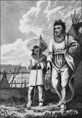
Wanataŋ, known to whites as “the Charger,” was the leader at Lake Traverse, recorded in 1823 by the artist Samuel Seymour, who traveled through the region on an expedition led by Major Stephen H. Long.
Across the continental divide south of Lake Traverse is Bde Iŋyaŋ Takiŋyaŋyaŋ, Big Stone Lake, a twenty-six-mile-long meandering lake considered the head of the Minnesota River. The lake’s Dakota and English names refer to granite outcrops in the region. In 1839 Riggs noted a village with twelve to fifteen houses on an island near the lower end of the lake, perhaps the village of Upi Iyahdeya, or Extended Tail Feathers, the name said to refer to someone who touched the tail of a bird, mentioned by Nicollet in 1838. The same chief was present at the Treaty of 1851 at Traverse des Sioux.87
THE UPPER MINNESOTA RIVER
Downriver from Big Stone Lake at Bde Iyedaŋ, or Lac qui Parle, was a Waḣpetuŋwaŋ village. The French name for this lake means “the lake that talks”: apparently the French believed this was the meaning of the Dakota name. However, Riggs suggested the name was from bde iyahde, referring to the fact that the Minnesota River was connected to the lake. Another possibility is bde iyahan, which would mean “speaking lake.” A Waḣpetuŋwaŋ leader known in English as the Little was associated with this village in the 1820s and 1830s.88
The Peżihutaziziḳ’api (“where they dig the yellow medicine”) or Yellow Medicine River flows into the Mississippi southeast of present-day Granite Falls. It was not the site of a Dakota village but in the 1850s the Upper Sioux Agency was located here. The name refers to a plant with a yellow root, possibly the moonseed, which grows in thickets in this region. The Upper Agency was established on the north side of the Yellow Medicine River, one mile west of its mouth. Nicollet visited in 1838 and noted that the Yellow Medicine River and nearby Hawk Creek (on the opposite side of the river) were “very wooded their whole length.” He described the Yellow Medicine as three feet deep and sixty feet wide at its mouth, with clear water running “over a bed of sand and pebbles.” In the 1850s at the Yellow Medicine’s mouth was the village of Waḣpetuŋwaŋ leader Iyangmani (Running Walker). Between 1854 and 1862 Hazel Creek, several miles north of the Yellow Medicine River along the Minnesota, was the location of the Hazelwood Republic mission and agricultural colony, led by missionaries Thomas S. Williamson and Stephen R. Riggs. This is the site of the current Upper Sioux community Pezihutazizi Oyate.89
The Caŋṡayapi or Redwood River flows into the Minnesota at Redwood Falls. The river was an early landmark, though there is no record of a village here. It became the site of the Lower Sioux Agency in the 1850s, the name meaning they paint the trees red at this location. William H. Keating, in his account of Stephen Long’s 1823 expedition, noted that where the Redwood and Minnesota river valleys united was a large rock “of an irregular hemispherical form, about forty or fifty feet in circumference.” The rock was blackened and “had been cleft” as though by lightning, and nearby trees and bushes appeared to have been burned. The Lower Agency was located roughly eight miles below the mouth of the Redwood River, in the area where the new villages of Dakota leaders Big Eagle, Makato, and Wakute stood in the 1850s. Ṡakp̣e’s village was located less than a mile north of the junction of Ramsey Creek and the Redwood River, where the township’s 1859 survey map showed an Indian village. Nicollet wrote in 1838 that the Redwood River was thirty feet wide, had a strong current, and had “lively and clear” waters.90
Birch Coolee, a creek that flows into the Minnesota River opposite the Lower Agency—at Morton in present-day Renville County—was the site of an Indian agency and settlement for remaining and returning Dakota beginning in the 1880s. The creek was said to have been named for the thick presence of paper or canoe birch located there, in the “southwest limit of its geographic range.” The creek was named Tampa on Nicollet’s 1843 map, from taŋpa, the Dakota word for birch. The present-day Lower Sioux Indian Community is located near the old Lower Agency, approximately two miles south of Morton along the south bank of the Minnesota River.91
Near the mouth of the Cottonwood River was Maya Kic̣aksa or “village of the cut bank.” This was Sleepy Eye’s village, the later site of the town of New Ulm. The name refers to a bank cut by the waters of the Minnesota River. The village leader was the Sisituŋwaŋ Iṡtaḣba, known as Sleepy Eye. According to Samuel Pond, Sleepy Eye was respected in all the Sisituŋwaŋ villages in the region. When Nicollet visited this village in August 1838, he was served boiled wild rice. He reported that the people were “engaged in collecting their crop of corn, and were much disposed to improve in agriculture.” He also noted that his party was entertained with a “grizely bear dance,” performed by a band member named Kaŋġimdoka or Raven Man. Sleepy Eye was often also at Traverse des Sioux but seemed to prefer spending his summers with others of his band at Swan Lake, known to the Dakota as Maġa Taŋka Ota Bde. The lake was renowned, according to missionary Riggs, for “its ducks and geese, and ‘many swans’ in former days, with its turtles, its fish, its muskrats, and wild rice.”92
The Sisituŋwaŋ village Maya Skadaŋ, “little white bluff” (also called White Bluff or White Rock Village), was located on the right bank of the Minnesota River, downstream from the later village at Oiyuweġe, or Traverse des Sioux. Maya Skadaŋ was situated at the eastern end of an overland shortcut across the big southern bend of the Minnesota River at the present site of St. Peter. Nicollet wrote that Maya Skadaŋ was “the rendezvous of all the villages of Sisseton when they left for buffalo hunts or when they went to gather wild rice in the area.” It was also where they waited for traders arriving from the east in the fall. In the 1830s the village appears to have relocated across the river to Traverse des Sioux. The Sisituŋwaŋ chief Sleepy Eye, though he had his own village, was sometimes associated with this one. In November 1843 Riggs noted that Sleepy Eye, “the acknowledged chief in this part of the country, who lives some distance above this[,] was here frequently during the rice gathering and brought us ducks etc.” Riggs also referred to a chief at this village named “Great Walker,” or more accurately Big Walker, Tataŋkamani, “who is next to him, and lives here [and] has lately commenced learning to read himself and promises well to exert his influence in favor of education.”93


Maple sugaring was an important part of the seasonal round, practiced every spring throughout Dakota country. When Seth Eastman painted this view of Dakota women, reports suggested that the location was Nicollet Island, in present-day Minneapolis, which was known for its maple groves. An artist and military officer, Eastman recorded many aspects of Dakota seasonal life during his time at Fort Snelling, first in the 1830s, when he had a relationship with the Dakota woman Wakaŋ Inażiŋ Wiŋ or Stands Sacred, daughter of the leader Maḣpiya Wic̣aṡṭa or Cloud Man, and later during the 1840s, when he returned as commander of the fort.
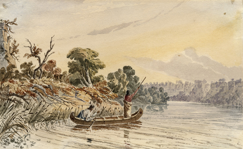
In a view which suggests the area of the Mississippi River near Fort Snelling, Seth Eastman recorded a man spearfishing from a canoe.
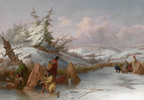
Spearfishing through the ice was a common source of food for Dakota along the Minnesota and Mississippi rivers in the early nineteenth century. Indian agent Lawrence Taliaferro often supplied them with fish spears or had the blacksmith at the agency repair their spears over the course of the winter.
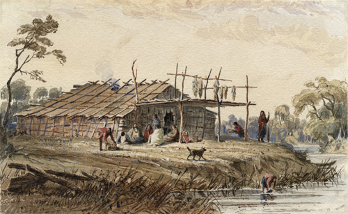
Dakota summer villages commonly included bark houses, left permanently in place for use in the seasons of the year when Dakota people returned to their villages along the Minnesota and Mississippi rivers.
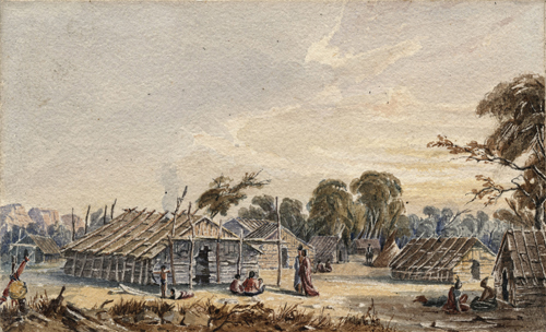
The village of Medicine Bottle, Wakaŋ Ozaŋzaŋ, recorded in this Seth Eastman view from the 1840s was an offshoot of Kap’oża, located at Pine Bend, along the Mississippi River south of the present-day Twin Cities.
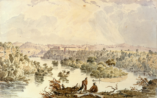
Seth Eastman’s 1840s watercolor view of Fort Snelling from upriver, opposite the site of present-day Hidden Falls Park in St. Paul, shows native people in the foreground and Oheyawahi/Pilot Knob in the distance beyond the fort, at right.

Kap’oża village, near present-day St. Paul, had a number of locations at various times, including the area near today’s Mounds Park and downtown St. Paul. After the 1837 treaty which ceded Dakota land east of the Mississippi, residents moved the village to the site of present-day South St. Paul, where Eastman made this painting in the late 1840s.
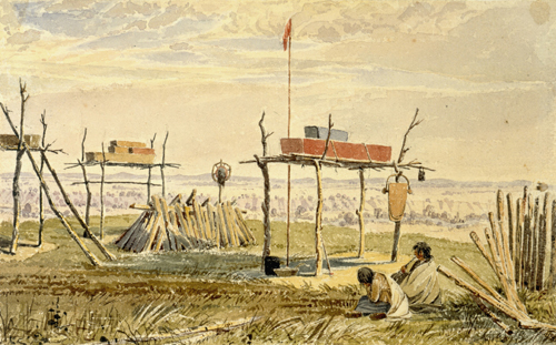
A close-up view of the top of Oheyawahi/Pilot Knob, by Seth Eastman in the 1840s, documented the use of the hill as a burial place.

The leader Wapahaṡa was recorded in this painting by Henry Inman, based on a view by an earlier artist during the chief’s visit to Washington, DC, in 1825.

C̣etaŋ Wakuwa Mani, known to whites as Petit Corbeau or Little Crow, was one of the signers of Pike’s 1805 treaty that led to the construction of Fort Snelling. He was recorded in this painting by Henry Inman based on an earlier painting or sketch by an artist during the chief’s visit to Washington in 1825.

In 1820 Dakota leaders left a pictographic message on bark along the Sauk River, inviting Ojibwe leaders to come to Coldwater Spring, where they would agree to make peace with the aid of American officials. Depicted were the chiefs, the American military establishment at the spring, and tepees representing the various Dakota villages. The image was recorded by government officials who found the message during an expedition through the region.

Wambdi Taŋka or Big Eagle, the Dakota leader of the Black Dog village on the lower Minnesota River, was painted by the artist George Catlin during his visit to Minnesota in 1835.
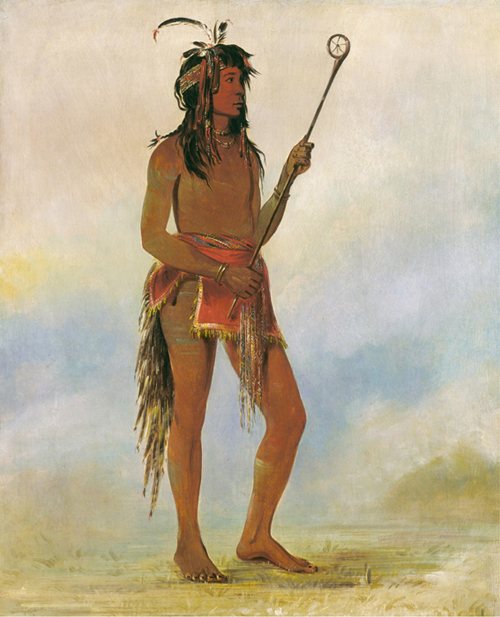
On his visit to Minnesota in 1835, artist George Catlin watched Dakota ball play near Fort Snelling and recorded some of the participants as they were dressed for the game. This contest included people of the village of Maḣpiya Wic̣aṡṭa or Cloud Man and others. Among the players was Anoka Inaziŋ, “He who stands on both sides,” who was a member of Penichon’s village on the Minnesota River.
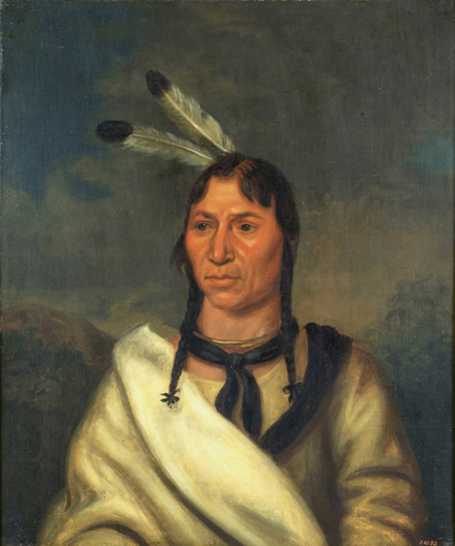
Iṡtaḣba or Sleepy Eye, a Sisituŋwaŋ leader from the area around Traverse des Sioux and Swan Lake, was respected throughout the region. He played a major role in the negotiations of the 1851 Treaty of Traverse des Sioux, trying unsuccessfully to secure better terms for the Dakota.
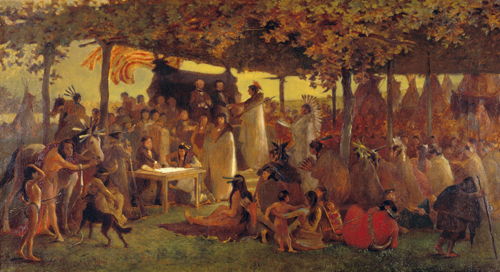
The Treaty of Traverse des Sioux, involving the Sisituŋwaŋ and Waḣpetuŋwaŋ Dakota, was the first of two treaties that year by which the Dakota ceded their land in southern Minnesota. Frank B. Mayer’s color painting provided the basis for another painting which currently hangs in the Minnesota State Capitol.
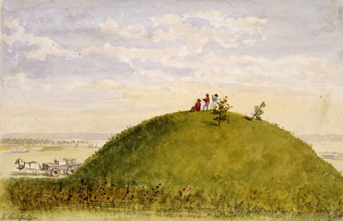
Burial mounds were a common feature of the Minnesota landscape when whites arrived on the scene, as in this view by Edwin Whitefield, said to be located in Hennepin County. Many such mounds were leveled or plowed under in the years that followed.
THE LOWER MINNESOTA RIVER
Below Traverse des Sioux were at least three Waḣpetuŋwaŋ villages, all sometimes included under the rubric of the Little Rapids village, which was the farthest north. Traveling down the Minnesota River, the first of the villages was located near present-day Belle Plaine, below the mouth of the Rivière au Bois Franc, “river of the big woods,” now Robert Creek. Its leader was Wakaŋhdi, from wakaŋhdi, “lightning,” often translated as “vivid lightning,” or “lively spirit.” He was also known as Broken Arm. Taliaferro sometimes referred to him as the chief of “the Bois village” or the “Bois Franc Indians.”94
Wiyaka Otidaŋ, “little village of the sandbar,” was located near the mouth of Sand Creek as it existed until the late nineteenth century, northwest of the present town of Jordan. This place was known to the French as the Batture au Fièvre, which meant “Rapids of the Fever,” referring to the first French traders in the region, who were attacked by fevers when they came here. Downriver was a village at Iŋyaŋ C̣eyaka, or Little (now Carver) Rapids. The Dakota name means “the barrier of stone,” a reference to the ledges of sandstone and limestone that cross the riverbed a quarter of a mile apart at this location. Together they cause a fall of three feet in the river. The village was located in several spots near the rapids.95
The chiefs of Little Rapids, which was a Waḣpetuŋwaŋ village in the 1830s, were Wanakṡante, which Nicollet translated as “Rebounding Iron,” and Mazamani, or Iron Walker. According to Taliaferro, Mazamani did most of the speaking when the chiefs came to visit him. He died from smallpox in September 1838. The next month Taliaferro gave his son a condolence gift: “In explenation of the present given yesterday to the Son of the late—war chief Mooseomone—I remark that his Father belonged to the late delegation to Washington—an old & highly esteemed man of the Wahpeeton Sioux of the Little Rapid on the St Peters—& died of the Small Pox in the early part of September. He was a warm friend of the Agent who was inst[r]umental in saveing his life on his return from the great council of Prarie du chien in 1825. He laid four weeks very ill at the agency.” The son took the same name as his father after his father’s death.96
In the 1820s Taliaferro had dealings with another chief located at or near Little Rapids named Kiŋyaŋ, or Red Eagle. Nicollet stated that the chief had been known as Wambdi Duta, meaning “Red Eagle,” but “he is now called Kiya,” or “he who flies.” Nicollet said that in 1838 the chief was located at a place called Tiŋṭa Maġaboḣpa, “the prairie where the swan fell to earth” or “the prairie where he threw the swan to ground,” a reference to an incident regarded as miraculous involving a trader named Rocque, which Nicollet did not record. Taliaferro indicated that this prairie was the end of a land route from the mouth of the Minnesota River through the area later known as the Big Woods, a dense forest that followed the east bank of the river. In 1829 Taliaferro referred to a man named Red Eagle as a Waḣpekute chief and stated that he had come from the plains and had “formerly lived ab[o]ve the Little Rapids,” though he may have been referring to a different individual.97
Both Kiŋyaŋ and Mazamani expressed to Taliaferro their interest in engaging more intensively in agriculture. On August 20, 1827, Taliaferro noted that Kiŋyaŋ intended to go to the Omaha to obtain horses to till his land: “He also applied for some plough & Harness Some Seed potatoes—Corn &c.” Similarly, in June 1835 Taliaferro recorded a speech by Mazamani at the agency in which he asked for his lands to be plowed and for a corn mill for the women to use.98
The Bdewakaŋtuŋwaŋ village located farthest upstream on the Minnesota River and the one with the largest population in the mid-nineteenth century was Ṡakp̣e’s village, or village of the Six, located in various places near present-day Shakopee. The Dakota name was Tiŋta Otoŋwe, meaning “village of the prairie,” a reference to the unwooded land on the terrace on the river’s south side. In 1823 the village was located on the north side of the river, where cornfields and burial scaffolds were found, although explorer Stephen Long may have confused scaffolds for drying corn with those used for burial. At that time a cemetery and a cornfield were also located on the south side of the river. Taliaferro called the village “twenty mile village.” Its leader bore the hereditary name Ṡakp̣e, the Six (though with one generation it was Ṡakpedaŋ, Little Six). Another leader of the Shakopee band in the 1830s, whose village was located near the mouth of the Credit River, was known as Ḣuyapa, or Eagle Head.99
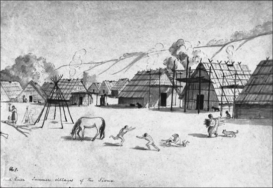
The bark houses of a permanent Dakota summer village are recorded in this 1850s view by Robert O. Sweeny.
Near the mouth of Nine Mile Creek in present-day Hennepin County was Titaŋka Taŋnina, the village of Penichon (or Penishon, Penetion, and other spellings). The name was said to come from an early chief of the village, known as Fils du Penishon (“son of Penishon”), apparently the descendent of a French trader. Historian Elliot Coues suggests that it is a garbled version of the name given the site of the village, “Taku Kokepeshni Wojupi, the clearing of him who fears nothing.” Some have suggested Titaŋka Taŋnina, which means “the old village,” shows that it was the first village of the Dakota on the Minnesota River, one that dates back hundreds of years. Nicollet also noted, without explanation, that the band was called Oyateshitsha (Oyate ṡic̣a), “the bad band” or “the bad people.” The chief of the village in the 1830s was Tac̣aŋku Waṡte, His Good Road, usually Good Road.100
The closest village to Fort Snelling was Hohaanskae (Ohaŋska), “the village of the long avenue,” or Black Dog village, whose people were sometimes called Maġa Yuṭe Ṡni (Marhayouteshni), “those who do not eat geese,” as explained earlier in this chapter. The village was about four miles above Fort Snelling, near the present site of the Mall of America and below extensive burial mound groups, now almost entirely destroyed. The name “the village of the long avenue” is a reference to the extensive vista of the Minnesota River from its mouth to this village. The Dakota version of this name noted first by Joseph Nicollet is similar to C̣okaŋ Haŋska, said to refer to the long bottomland lake parallel to the river in this area, recorded by Frederic W. Pearsall, a local historian whose wife and children were part of the Dakota community at Granite Falls. Taliaferro sometimes called it “four mile village,” indicating its distance from Fort Snelling. The earliest published reference to a chief named Black Dog is in a document from November 1742 recording a speech presented to French government official Paul Marin by several Dakota chiefs. Among them was Chonkasaba, that is, Ṡunḳa Sapa, or Black Dog. Later Dakota chiefs were known as “the Black Dog chief” but had other personal names.101
A famous view of what must be a portion of the Black Dog village is found in a watercolor by artist and army officer Seth Eastman, who was in charge of Fort Snelling in the 1840s. Eastman had a relationship with Wakaŋ Inażiŋ Wiŋ (Stands Sacred), the mother of his daughter Nancy Eastman and the daughter of Maḣpiya Wic̣aṡṭa (Cloud Man). Eastman recorded the area’s landscape and the life of Dakota people in a way unmatched by any other early artist. In a view now owned by the Minnesota Historical Society, he depicted two burial scaffolds on a bluff above the Minnesota River at Black Dog. In the background of the painting, in the distance on the left bank of the river, a faint image of Fort Snelling is visible. Opposite it on the right is Oheyawahi or Pilot Knob, also a burial place of the Dakota.102
Another historic view of the Black Dog village burial site is found in an engraving published in Harper’s Magazine in 1853, based on a work by the German artist Adolf Hoeffler, who traveled to the Upper Mississippi that year and recorded his observations and a few images. In his view, Hoeffler showed Dakota summer houses on the lower slopes of the river bank. In the background, higher up, a crude depiction of a burial scaffold appears.103
MISSISSIPPI RIVER
Kap’oża, Little Crow’s village, was located at various sites near present-day downtown St. Paul. The name Kap’oża meant “those who traveled unencumbered with much baggage,” though missionary Thomas Williamson stated that it referred to the skill of the band members at Dakota ball play or lacrosse. In 1805 and 1817 the village was located below Wakaŋ Tipi (the site of Mounds Park and the Bruce Vento Nature Sanctuary in St. Paul) at the Grand Marais, meaning “big swamp,” a reference to present-day Pig’s Eye Lake, along the Mississippi River. From the 1820s to the mid-1830s Kap’oża was located on the other side of Mounds Park, within present downtown St. Paul, possibly near the mouth of Phalen Creek and at the site where the St. Paul Union Depot was built. After the Treaty of 1837, which transferred Dakota land east of the Mississippi to the United States, the village moved to the South St. Paul side of the river.104
Iŋyaŋ ṡa / Red Rock
At Newport in Washington County is an oval granite boulder, about five feet long, which formerly sat on the east bank of the Mississippi River. The Dakota left offerings at the rock and sometimes painted it. It was a landmark for both the Dakota and early whites. In an account of explorer Stephen Long’s 1823 trip in the region, geologist William H. Keating noted it was not surprising that the rock would have been viewed “with some curiosity,” considering that its composition differed “so materially from those of the rocks which are found in the neighborhood,” largely sandstone and limestone. Keating wrote of the offerings left by Dakota people: “The party found the feather of an eagle, two roots of the ‘Pomme de Prairie [prairie turnip],’ painted with vermilion; a willow branch, whose stem was painted red, had been stuck into the ground on one side, &c.” Unfortunately the “gentlemen” of Long’s party, perhaps including Keating himself, “broke off a fragment of this idol to add to the mineralogical collections, taking care, however not to leave any chips, the sight of which would wound the feelings of the devotee, by convincing him that the object of his worship had been violated.” A description of the rock from 1888 states, “It is painted in stripes, twelve in number, two inches wide and from two to six inches apart. The north end has a rudely drawn picture of the sun, and a rude face with fifteen rays.” In the 1860s the site became a summer location for Methodist camp meetings. In 1964 the rock was moved to the grounds of the Newport United Methodist Church.xxv
Iŋyaŋ ṡa or Red Rock, located on the bank of the Mississippi River at the present-day town of Newport, was a landmark which the Dakota painted and where they left offerings. An account from 1888—around the time of this photograph—stated that the rock was painted with twelve stripes and had drawings of the sun on the north end.

Today Iŋyaŋ ṡa or Red Rock is located in front of the Newport United Methodist Church, as shown in this 2010 photograph.
The original village was located on both sides of the river and below extensive burial mounds on the bluffs above. Some of these mounds still exist in Mounds Park, described by William H. Keating in 1823 as being “situated at a handsome turn on the river.” Indeed, the river here makes a great bend, allowing someone at the site of the mounds or even below them an extensive view both upriver and down. Stephen Long, who visited the site first in 1817, said the village leader, Petit Corbeau (Little Crow)—at this date it was C̣etaŋ Wakuwa Mani—claimed this strategic location allowed him “to exercise a command over the passage of the river” and extract tribute from traders who passed.105
In May 1829, Indian agent Lawrence Taliaferro, who sometimes called Kap’oża “nine mile village on the Mississippi,” referring to its distance from Fort Snelling, wrote that some members wished to form other communities with new chiefs. Taliaferro refused to “countenance” their desire, especially because the “Seceders” wished to form “a permane[n]t Camp within Sight of the Garrison of Ft Snelling. But I this day order[e]d them back to their old Village or any other Point the[y] might Select not nearer the Fort than five miles.” Medicine Bottle, or Wakaŋ Ożaŋżaŋ, whose name was sometimes given as Nasiampah, organized a group from Kap’oża at Pine Bend along the Mississippi River, which rejoined the Kap’oża band in 1836, after C̣etaŋ Wakuwa Mani’s death.106
Farther downriver was the Red Wing village, located near the present-day town of Red Wing. This village was adjacent to the massive landform called Barn Bluff, which rises above the Mississippi just below the mouth of the Wazi Ożu Wakpa (Cannon River). The Dakota name for the village, Ḣe Mni C̣aŋ, or “hill water wood,” means, essentially, “hill that appears as if it were in the water.” German artist Henry Lewis visited the site in the 1850s and said the name Barn Bluff, from the French La Grange, accurately described the massive hill’s appearance. He noted that on the top of the bluff was a mound and that the view from there was “indescribably beautiful.”107
The chief of Red Wing village, known as Tataŋkamani or Walking Buffalo, died on March 4, 1829, at the age of eighty-four. Taliaferro wrote that “during his whole life he was a firm friend of the Whites for the last 30 years more firmly attached to the Americans—and refused utterly to join in the War of 1812 against the arms of the United States.” Just before his death he had visited Fort Snelling and made a statement to Taliaferro and Colonel Josiah Snelling: “Among all of My Nation there is not one in it who has held on to the Americans like me and my band—in the worst times. Red Wing never deserted you—this you both well Know to be true. I am the Same Man & have the Same heart for your nation now that I ever had and shall never change.”108
Wakute became leader of the band after the death of the older chief, who was his uncle. For a time after that he moved with some of the village to live with Wabasha’s band at the “Grand Encampment,” at the location of the present-day town of Wabasha. In August 1835, Wakute was informed by Taliaferro that as long as he lived with Wabasha’s band he would not be considered a chief with whom Taliaferro would deal, since Wabasha’s band had been transferred to the supervision of the Indian agent at Prairie du Chien in 1834. If, however, “you return to the Village of your Father at the head of Lake Pepin—you will again be under my care but as you selected 3 years ago Wab[i]shas band as a residence and have been paid upon his pay Roll your annuity since that time of course you must visit Pra[i]rie du Chiens.”109
Early settlers described various sites around the current town of Red Wing used by Dakota, mentioning a cornfield planted by villagers along Fourth Street and burial scaffolds on College Hill. Dakota often camped northwest of town in the area of Prairie Island, the present location of the Prairie Island Indian Community.110
The Bdewakaŋtuŋwaŋ Dakota village found lowest on the Mississippi River was that of the Kiyuksa band, at Wabasha’s village or Wapasha’s Prairie, now the location of the city of Winona. The name of the band refers to breaking rules and violating customs and was given, according to some sources, “from the intermarrying of relations among them.” The band resided part of the year at Wabasha’s Prairie, called the prairie aux ailes (“prairie of the wings”) by the French. According to place-name historian Paul Durand, the French name described the two bluffs “which stretch like two immense wings” above the prairie. In 1823 Keating stated that the band consisted of two villages, one on Lake Pepin and another on the Upper Iowa River, the latter being where Zebulon Pike encountered them in 1805.111
The first Dakota leader of this band recorded in French sources, Wapahaṡa, known as Red Standard or Red Leaf, is often called Wabasha. His son was the chief who met Zebulon Pike in 1805. His son, signer of the 1837 treaty, also took the name Wabasha, although he was often listed in government records as “Tah tape saah” (or possibly Tate apa s’a), Upsetting Wind or Whipping Wind.112
On May 6, 1836, Taliaferro reported the Kiyuksa band was on the east side of the Mississippi River at “the Foot of the ‘Mountain in the Water,’” or Trempealeau, a temporary change brought on by Fox attacks. In the 1850s, before their removal to reservations on the Upper Minnesota River, members of the band still lived in the area of Winona, and settlers described their gardens and burial grounds. John Burns, who built a farm in a valley adjacent to the later town of Winona, received permission to live there from Wabasha’s band: “The locality was the special home of Wabasha and his family relatives when living in this vicinity. It was sometimes called Wabasha’s garden by the old settlers.” Burns’s account, recorded by a local historian, continued,
Quite a number of Indian graves were on these grounds. Nearly in front of the farmhouse there were two or three graves of more modern burial lying side by side. These were said to be the last resting-place of some of Wabasha’s relatives. The Sioux made a special request of Mr. Burns and his family that these graves should not be disturbed. This Mr. Burns promised, and the little mounds, covered with billets of wood, were never molested, although they were in his garden and not far from his house. For many years they remained as they were left by the Indians, until the wood by which they were covered rotted away entirely. A light frame or fence of poles put there by Mr. Burns always covered the locality during his lifetime.113
The locations of Dakota villages and many of the places that made up the landscape of their homelands continued to be known to white Minnesotans for many years after the Dakota were exiled, though the meaning of these places and how they fit together into a coherent relationship with the land was often lost. At the same time, the Dakota were erased from the written history of Minnesota, confined to a kind of prehistoric natural history, in which there was only a vague sense that they had been there at one time before “civilization” transformed the region of Minnesota.