THE BEST OF UTAH’S NATIONAL PARKS

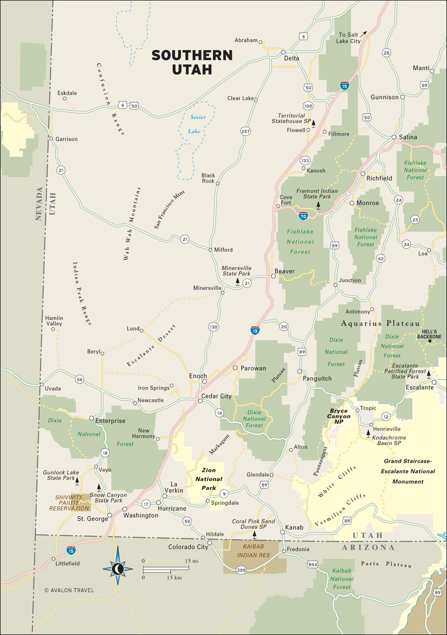
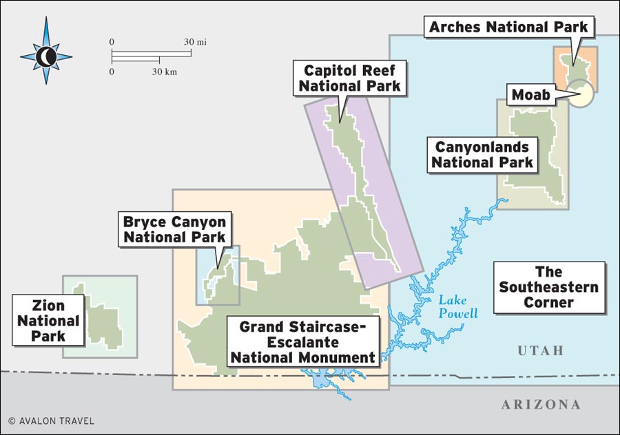
 Southern Utah is so filled with staggering beauty, drama, and power that it seems like a place of myth. Five spectacular national parks and several national monuments are all within a day’s drive of one another. The colorful canyons, arches, and mesas found within this high dry area are surprisingly diverse, and each park has its own characteristic landscape.
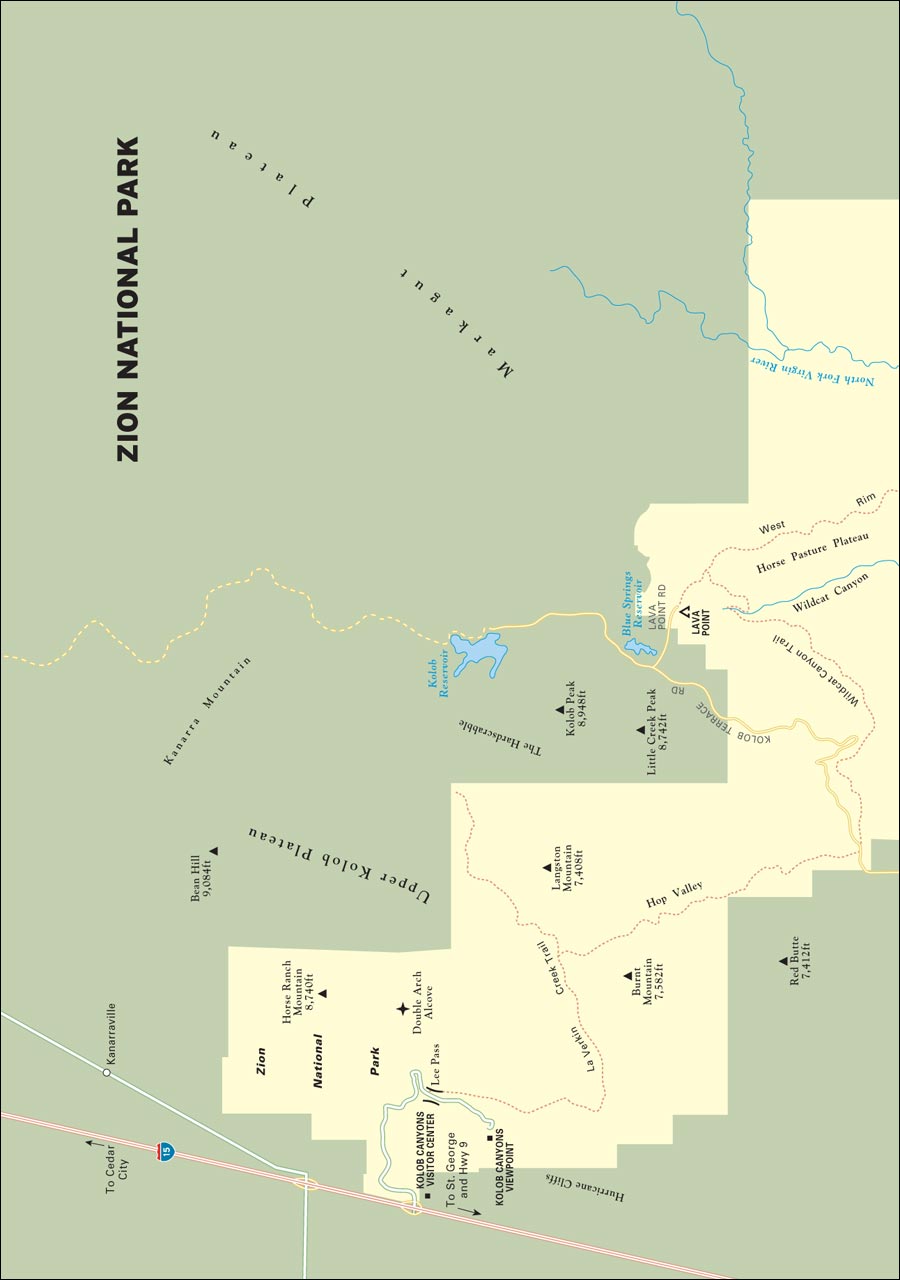
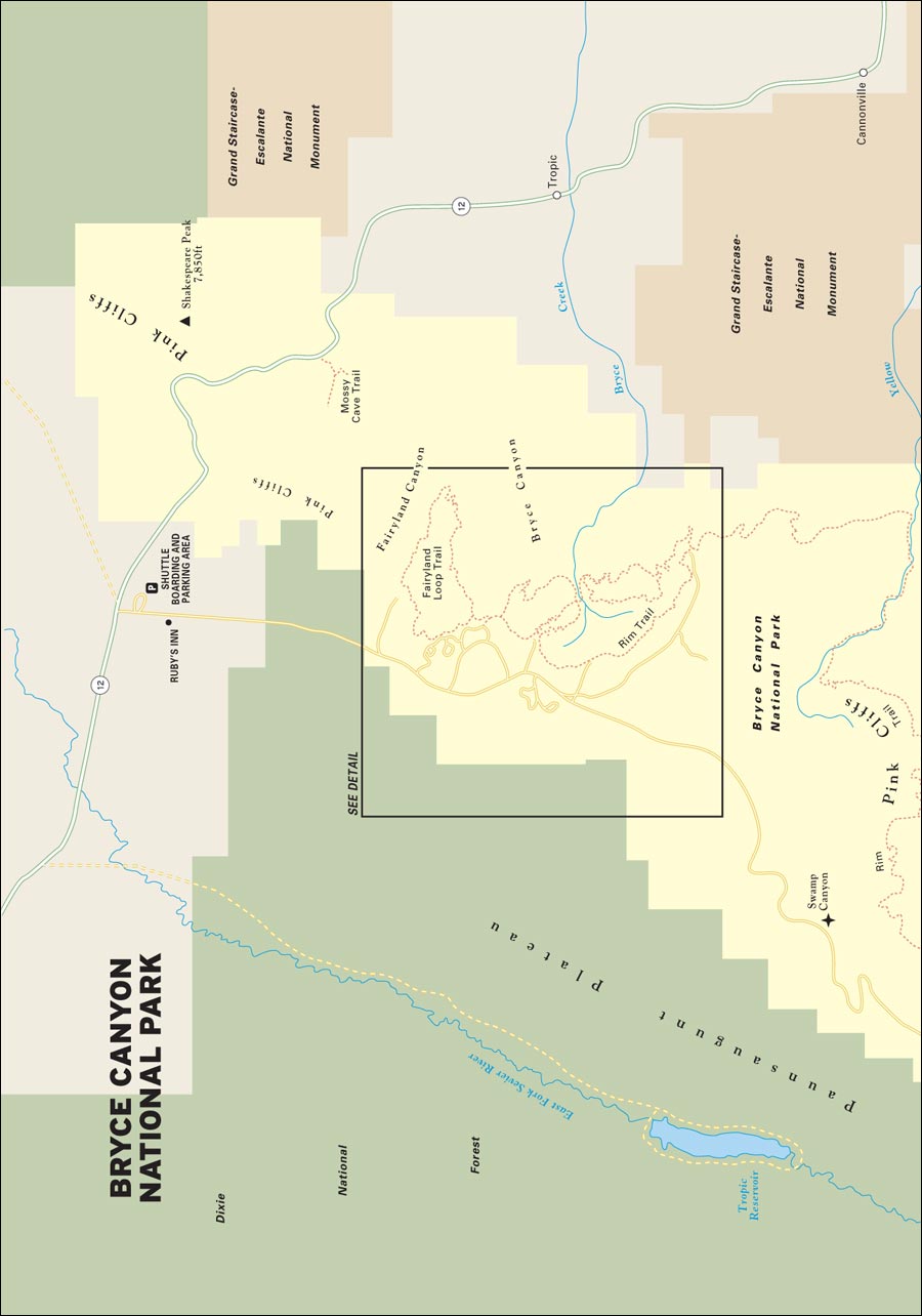
Zion National Park contains stunning contrasts, with towering rock walls deeply incised by steep canyons containing a verdant oasis of cottonwood trees and wildflowers. Bryce National Park is famed for its red and pink hoodoos, delicate fingers of stone rising from a steep mountainside. At sunrise the lighting is especially magical, the air crisp, and the trails empty.
A large section of the Grand Staircase-Escalante National Monument preserves the dry washes and slot canyons trenched by the Escalante River and its tributaries. Long-distance hikers descend into the deep, narrow river channels here to experience the near-mystical harmony of flowing water and stone.
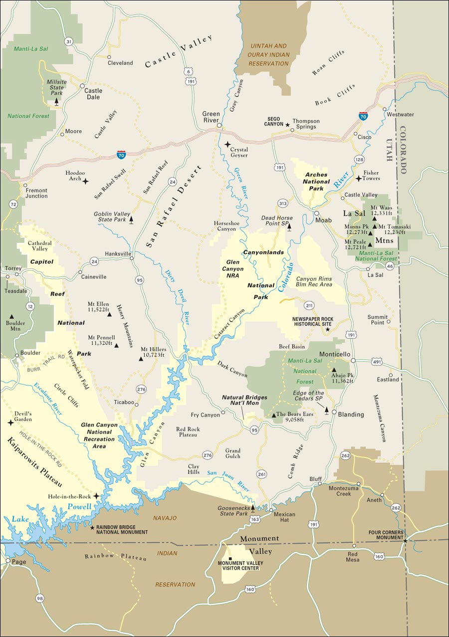
The highlight of Capitol Reef National Park is the Waterpocket Fold, an enormous wrinkle of rock rising from the desert. The Fremont River carves a magnificent canyon through the formation, offering a leafy, well-watered sanctuary from the otherwise arid landscapes of southern Utah.
 |
 |
In Canyonlands National Park, the Colorado River carves through deep red sandstone. From the Island in the Sky unit, expansive vistas take in hundreds of miles of canyon country, while rafting the Colorado’s Cataract Canyon is the wet and thrilling climax of many a vacation. The beauty is more serene and mystical at Arches National Park, where delicate rock arches provide vast windows into the solid rock. Short trails draw hikers into an eerily beautiful land of slickrock promontories and stone arches. High-spirited Moab is the recreational mecca of southeastern Utah, known for its mountain biking and comfortable—even sophisticated—dining and lodging.
Southern Utah is more than a showcase of erosion. Its cliffs and canyons have been home to Native Americans for thousands of years, and the haunting beauty of Native American rock art is on display at hundreds of locations.
Although many people first visit as part of a grand tour of the Southwest, they often return to further explore a smaller and distinctive corner of this vast landscape. After a small glimpse of the magnificence and variety, some latch on to one special place and return year after year, growing to know it intimately.
 |
 |
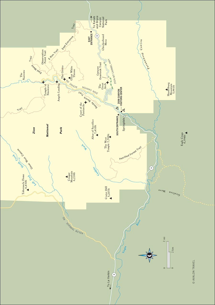
In Zion National Park, hiking trails lead up narrow canyons cut into massive stone cliffs, passing quiet pools of water and hanging gardens. The park’s main canyon, carved by the Virgin River, is an easy place to find a day hike; however, the rest of the park’s canyons are the province of canyoneers and long-distance hikers.
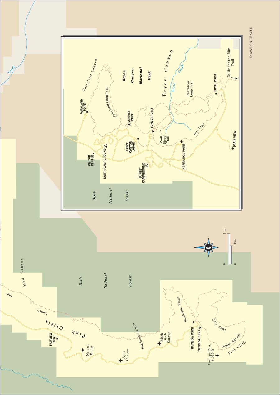
Bryce Canyon has famous vistas across an eroded amphitheater of pink sandstone hoodoos. Short trails lead down from the canyon edge into a wonderland of fanciful formations and outcrops, and you’ll have quite a different experience from the amateur photographers perched along the rim if you venture into the park’s backcountry.
Grand Staircase preserves some of the Southwest’s best canyon hiking. Numerous day hikes and long-distance hiking trails follow the slot canyons of the Escalante River. Mountain bikers can head down the Hole-in-the-Rock Road or the Burr Trail to visit some of the same landscape via jeep road; even cruising scenic Highway 12 in a car is an eye-popping experience.
Capitol Reef preserves a vast wrinkle of rock called the Waterpocket Fold, which buckles up into a vertical barricade across more than 100 miles of southeast Utah. Of the few canyons that penetrate Waterpocket Fold, the Fremont River Canyon is most accessible along Highway 24. Ancient petroglyphs, pioneer farms and orchards, and soaring rock formations extend the length of the canyon. A paved scenic highway explores more canyons along the fold’s western face. The rest of the park is remote backcountry—just the way hikers and backpackers like it.
Canyonlands National Park is made up of four sections: the River District, containing the canyons of the Colorado and Green Rivers; the Needles District, with hiking trails and backcountry roads through a standing-rock desert; the Maze District, a remote area filled with geologic curiosities and labyrinthine canyons; and the Island in the Sky District, a flat-topped mesa that overlooks the rest. A separate area, the Horseshoe Canyon Unit, lies to the west and contains a significant cache of prehistoric rock art.
Just up the road from Moab is Arches National Park, with its famous rock bridges. Arches is a great family park: It’s not too large and there are lots of accessible hikes to explore. Unlike other Utah national parks, there’s plenty to see even if you can’t get out of the car and hike. Be sure to hike the Windows Section, a series of arches and rock fins at the center of the park, and to Delicate Arch, overlooking the Colorado River.
At the heart of Utah’s slickrock country, Moab is the recreation capital of southeastern Utah. Although mountain biking put Moab on the map, old mining roads make four-wheel-driving an increasingly popular alternative. Arches National Park is just minutes from downtown, and Canyonlands’ districts are an easy drive from Moab. But Moab is a destination in itself: a youthful, high-energy town that offers good restaurants, brewpubs, and coffee shops.
Although Arches and Canyonlands parks get most of the attention from first-time visitors, veterans of the area know that southeastern Utah has abundant other wonders in national recreation areas, national monuments, and state parks. After you have explored the national parks, be sure to save time to visit such fascinating destinations as Natural Bridges and Hovenweep National Monuments, Dead Horse Point State Park, and the lovely alpine glades of La Sal National Forest.
The parks are all open year-round, although spring (Apr.-early June) and early fall (Sept.-Oct.) are the most pleasant times to visit. They are also the busiest seasons, and travelers may find that popular campgrounds and hotels are booked well in advance.
Spring rain can also dampen trails, and late winter-early spring storms can play havoc with backcountry roads. Bryce Canyon, at 6,600-9,100 feet, can be snowy well into the spring, but it is pleasant during the summer when other areas of southern Utah bake.
Thunderstorms are fairly common in summer (late July-early Sept.) and bring the threat of flash flooding, especially in slot canyons. In Canyonlands, Arches, and Moab, summer temperatures can reach the 100s.
A few highways close for the winter, most notably the roads around Cedar Breaks National Monument. However, winter can be a great time to visit the high country around Bryce, where cross-country skiers take to the park roads. Around Escalante, the canyons can be quite nice in the winter during the day, but nights are freezing. In Canyonlands and Arches, winter days tend to be bright and sunny, but nighttime temperatures can dip into the teens or lower.
 |
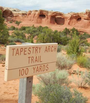 |
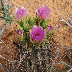
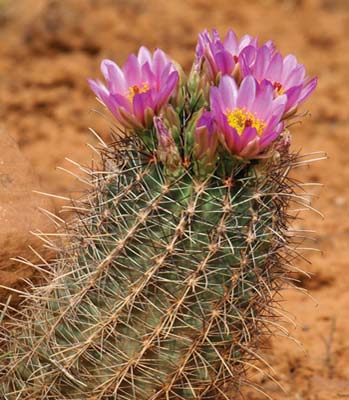
| cactus flowers | trail to Tapestry Arch, Arches National Park |
Although the national parks of Utah are located in a geographically compact area, connecting the dots to visit each of them isn’t always straightforward. The rugged topography of the area has made road building difficult, so visiting all of the parks requires a lot of driving. Unpaved back roads can serve as shortcuts if you have a high-clearance vehicle, but check locally before setting out to determine current conditions: Rainstorms and snowmelt can render these roads impassable.
If you’re planning on making the rounds of the national parks, buy an America the Beautiful—National Parks and Federal Recreational Lands Pass (valid for one year, $80) at your first stop to cover entrance to all national parks. Senior passes (lifetime pass $10) and free passes for residents with permanent disabilities are also available.
Many national parks now offer reserved campsites. If you want to camp in a park, reserve ahead—this is especially important at Arches—or plan to arrive early in the day to get an unreserved site.
Prepare for wide variations in temperature; nights in the desert can be very chilly even when summer highs soar above 100°F. Remember to use lots of sunscreen.
There’s no need to pack dressy clothes. Casual clothes are acceptable nearly everywhere, even in what passes for a classy restaurant.
Alcohol presents another issue. If you want to drink, especially away from Moab or Springdale, pack your own, especially if you have discerning tastes. While many restaurants in the towns around these parks now offer a selection of alcoholic beverages, southern Utah does not have a drinking culture.
Bring your cell phone, but don’t count on reception in the canyons of southern Utah.
Despite their proximity, visiting all of Utah’s national parks is a bit complicated because of the rugged terrain. You must plan on a lot of driving. So get in a road-trip frame of mind, cue up some good music, and head out. The following itinerary only scratches the surface of what there is to see, but after this sampler, you’ll know where to focus your next Utah adventure.
If you fly into Salt Lake City or Las Vegas, you’ll probably get to Zion National Park sometime in the afternoon. Settle into your motel in Springville and head into the park to check out the visitors center and take a ride up Zion Canyon on the park shuttle bus. Hop off for views of the Court of the Patriarchs and to take an easy hike up the Riverside Walk. Start the next day with a hike up the West Rim Trail to Angels Landing or, if you want something a bit easier going, hike the Emerald Pools trails. Spend the afternoon visiting Springville’s galleries, and if your legs are up for it, go for an early evening hike up the Watchman Trail.
Head east out of the park via the Zion-Mt. Carmel Highway (Hwy. 9); turn north onto U.S. 89 and east onto Highway 12 to reach Bryce Canyon National Park (84 miles from Zion). Park the car and spend the day riding the park shuttle to vista points and exploring hoodoos from trailheads along the road. Camp in the park, or stay at the historic park lodge or one of the motels just outside the park entrance.
Get up in time to see the rising sun light up the hoodoos, then drive 42 miles east on Highway 12 through the town of Escalante to the dramatic Lower Calf Creek Falls Trail. Cool your toes in the pool under the falls, then continue east to Boulder, where you’ll spend the night at the Boulder Mountain Lodge (be sure to make reservations for dinner at Hells Backbone Grill when you book your hotel room).
Explore more of the Escalante River canyons. Drive 12.5 miles south from Highway 12 and turn onto Hole-in-the-Rock Road to traipse around Devils Garden. You can also visit the canyons of Dry Fork of Coyote Gulch, 26 miles south of Highway 12. Return to Boulder for the night.
From Boulder, follow Highway 12 north 39 miles over Boulder Mountain to Highway 24 and Torrey, your base for exploring Capitol Reef National Park. In the park, explore the old pioneer town of Fruita, hike to see petroglyphs, and drive the scenic park road. Add a hike up the Chimney Rock Trail or along Capitol Wash, then return to Torrey for dinner and a bed.
Head to the east side of Capitol Reef and turn south from Highway 24 onto the Notom-Bullfrog Road and follow this well-maintained (but mostly dirt) road 68 miles south to Bullfrog Bay, where a ferry (May-Oct.) crosses Lake Powell. Ride the ferry, and once on the other side, head away from the lake for 40 miles on Highway 276 to Highway 95 and Natural Bridges National Monument. (If you’d rather stick to pavement, or if the ferry isn’t in season, continue east on Highway 24 to Hanksville, then turn south on Highway 95 to reach Natural Bridges.) Often overlooked, this small park is a gem, with three massive rock bridges and an Anasazi cliff dwelling along a nine-mile loop highway. Unfortunately, there’s no lodging at Natural Bridges, except for a small campground, so you’ll have to head back to Highway 95 and continue east to U.S. 191 to find a room for the night. The first town you’ll come to on U.S. 191 is Blanding, which has plenty of options; however, tiny Bluff, 26 miles south, is more charming.
 |
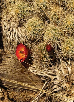 |
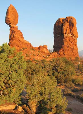
| Balanced Rock, Arches National Park | cactus flower |
Get an early start if you want to explore the Needles District of Canyonlands National Park. Head north 46 miles from Bluff and turn west off U.S. 191 at Monticello. Follow well-marked paved roads west and north to BLM Newspaper Rock Historical Monument, one of the finest and most accessible petroglyph sites in Utah. From Newspaper Rock, continue west on Highway 211 to the Needles District, where a good short hike is along the Cave Spring Trail. Unless you’re camping in Canyonlands, head back to Highway 191 and north 40 miles to spend the night in Moab.
Moab is just a few miles south of Arches National Park. You can tour Arches in half a day if you take only short hikes to viewpoints; if you want to visit all of the sites along the park road and hike to famed Delicate Arch, you’ll spend all day in the park. If you have one more day left in your trip, uses it to explore Canyonlands’ Island in the Sky District, taking in the astonishing vista points (particularly Grand View Point) and saving time for a hike to the cliff edge. In the evening, enjoy the lively scene in Moab, with its good restaurants and brewpubs.
It’s difficult to imagine more dramatic landscapes than those found in Utah’s national parks. These day hikes through epic canyons, arches, and needles of sandstone invite you to get out of your vehicle and explore.
The Emerald Pools trails start from Zion Lodge and make good variable-length hikes. Depending on your stamina and time available, hike to Lower, Middle, or Upper Emerald Pool, or take more time and visit all three.
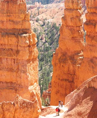
Given the high elevation and the fact that all of Bryce’s best hikes descend from the rim (meaning a climb back up to the rim at the hike’s end), it’s good to start with the relatively easy 1.5-mile trek to Queen’s Garden. This will get you off the rim and down into the hoodoos and, unless you’re acclimated to the 8,000-foot elevation, give you a bit of a workout. If you need a longer hike, connect with the Navajo Loop Trail to bring the total distance to about three miles.
The hike up Calf Creek to Lower Calf Creek Falls is a delectable sampler of the kinds of sights that make the slickrock canyon country of Escalante such a compelling destination. From a trailhead right off Highway 12 (15 miles northeast of Escalante), a trail follows a desert canyon past rock art, ruins of an ancient Native American village, and beaver ponds, and terminates at a delicate 126-foot waterfall. The 5.5-mile round-trip trail is easy enough for families.
Many of the hikes in Capitol Reef involve quite a bit of climbing to reach high viewpoints over the Fremont River and the Waterpocket Fold. However, hiking Grand Wash is easy and scenic. Grand Wash is one of only five canyons that cut through the rock reef, with walls up to 800 feet high and narrows of just 20 feet. Pick up the trail from Highway 24, five miles south of the visitors center, where Grand Wash enters Fremont Canyon. For a view over the wash, continue on the trail and climb up to Cassidy Arch (3.5 miles round-trip), named after outlaw Butch Cassidy.
 |
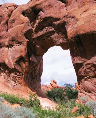 |
| hiking the Navajo Loop Trail, Bryce Canyon | Pine Tree Arch on Devils Garden Trail, Arches |
The hike into Horseshoe Canyon to view the phenomenal rock art at the Great Gallery is a near-mystical experience for many. The 6.5-mile trail requires negotiating a steep canyon wall, but experiencing the stunning petroglyphs in a verdant canyon is well worth the effort. The trailhead is 30 miles east of Highway 24 on gravel roads.
In Canyonlands’ Island in the Sky District, the landscape is nearly all vertical, and many hiking trails explore the rock faces and canyon walls. The Grand View Trail traverses more level ground, ending at the southernmost tip of the Island in the Sky peninsula, where you’ll have views over much of the park, including the gorges of the Green and Colorado Rivers.
Stretch your legs on the hike to Chesler Park, in the Needles District. Although the hike begins at the busy four-wheeling Elephant Hill parking area, it quickly leads away from the noisy crowds to a lovely meadow, complete with old cowboy line camp.
The three-mile round-trip hike to Delicate Arch is a fantastic experience, a moderately demanding trail up a slickrock formation to the arch and transcendent views over the Colorado River Canyon. If you’d prefer a trail without the crowds, go to Devils Garden, at the end of the paved parkway, and hike the 7.2-mile loop trail past eight arches and the weird formations in Fin Canyon.
Utah is famously family friendly, and national parks are traditional places for summertime family vacations, so it’s not hard to find activities in southern Utah that are fun for both kids and adults. The national parks all have programs for children; generally they run Memorial Day-Labor Day. Junior Ranger programs are essentially workbooks that will keep kids occupied for a while.
Zion National Park has a wide array of summertime programs for school-age children (who must be accompanied by an adult for all activities). Daily programs at the Zion Nature Center focus on geology, animals, and ecosystems; short hikes on weekdays may even include a lesson on using a global positioning system (GPS) unit. Reservations are required for some programs; ask at the visitors center.
Horseback rides, which start at the corrals near the Emerald Pools trailhead, are a hit with kids age seven and up.
After a few hours of hiking and riding, spend an afternoon or evening at the Zion Canyon Giant Screen Theatre.
Bryce Canyon National Park’s fantastically sculpted rocks give even the stodgiest hikers a child’s sense of imagination. Wander down the Queen’s Garden Trail and make up your own names for the rock formations. Bryce has the usual Junior Ranger and ranger-talk programs for kids, but a special treat might be staying up late for a look at the night sky—the stars are fantastic here. Night sky programs run over 100 times per year, and include a multimedia show followed by a chance to look at the sky through telescopes.
Capitol Reef’s Ripple Rock Nature Center offers a number of special programs, including some geared toward pioneer life. Kids can spin wool, pretend to milk a cow, make cornmeal on a prehistoric grinding stone, identify fossils, or play with animal puppets.
Although much of Canyonlands National Park is too rugged and remote for most family outings, the Needles and Island in the Sky Districts have a number of shorter trails. In the Needles District, the short Cave Spring Trail gives hikers a chance to scamper across slickrock, scale ladders up steep (but not too high) cliffs, examine pictographs, and visit an old cowboy line camp. Stop by the visitors center at either district to borrow an Explorer Pack (deposit required) loaded with binoculars, a hand lens, a notebook, and other naturalist tools.
Arches National Park’s many short trails and dramatic rock sculptures make it one of the most appealing national parks for visitors of all ages. Although there are few kid-specific activities beyond the Junior Ranger booklet, regular ranger-led activities are suitable for older children. A ranger-led hike in the Fiery Furnace requires a bit of hiking experience and agility; children under age five are not permitted, but older kids, including teens, will probably enjoy the scenery and the scrambling.
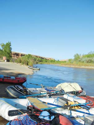
Cap off a visit to canyon country with a raft trip down the Colorado River. The trip from Fisher Towers toward town has quiet stretches punctuated by white water; it’s offered in half-day and full-day versions and is a good bet for families.