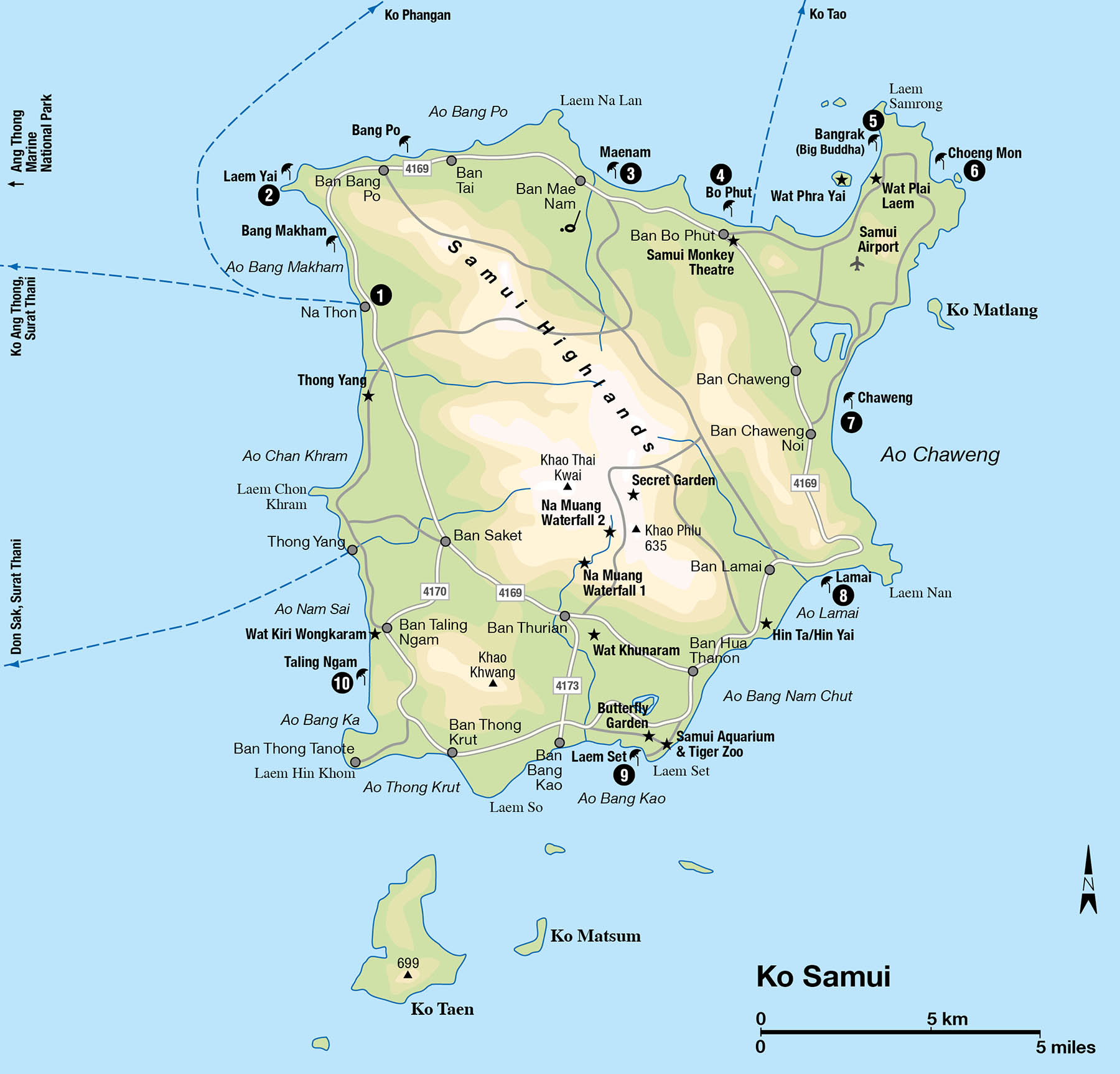
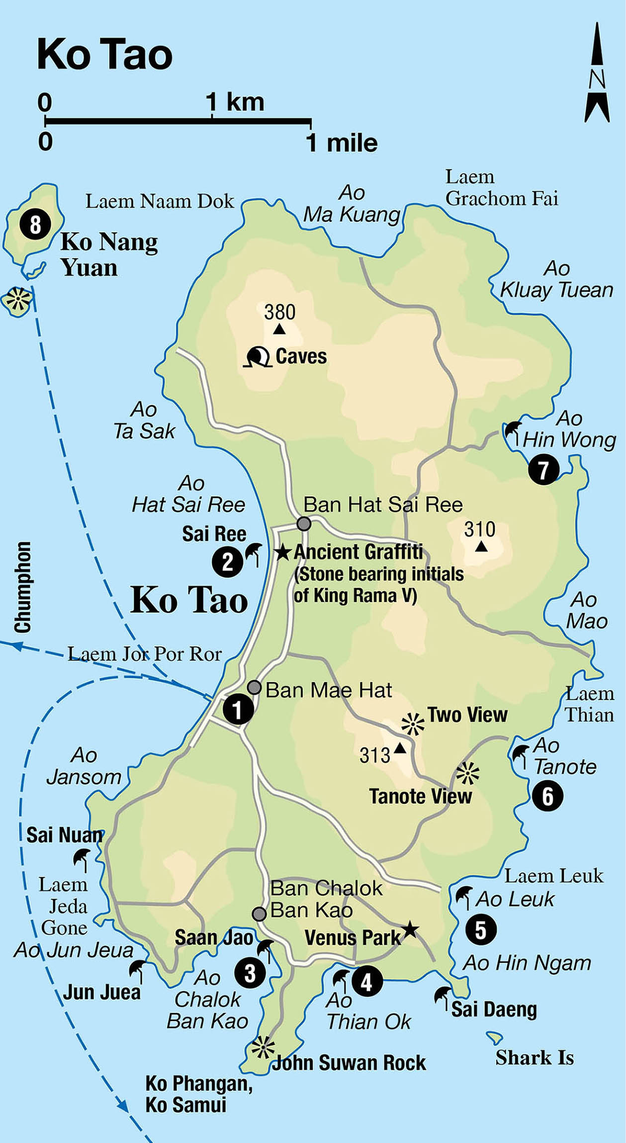
Located some 80km (50 miles) from the mainland town of Surat Thani in the southern Gulf of Thailand, palm-fringed Ko Samui is the biggest of 80 islands that make up the Samui Archipelago, an island chain including the party island of Ko Phangan, the dive mecca of Ko Tao and pristine Ang Thong Marine National Park . With only a handful of the islands featuring any significant settlement, much of the area remains unspoilt, with perfect white-sand beaches ringed by colourful coral reefs, and rugged forested interiors.
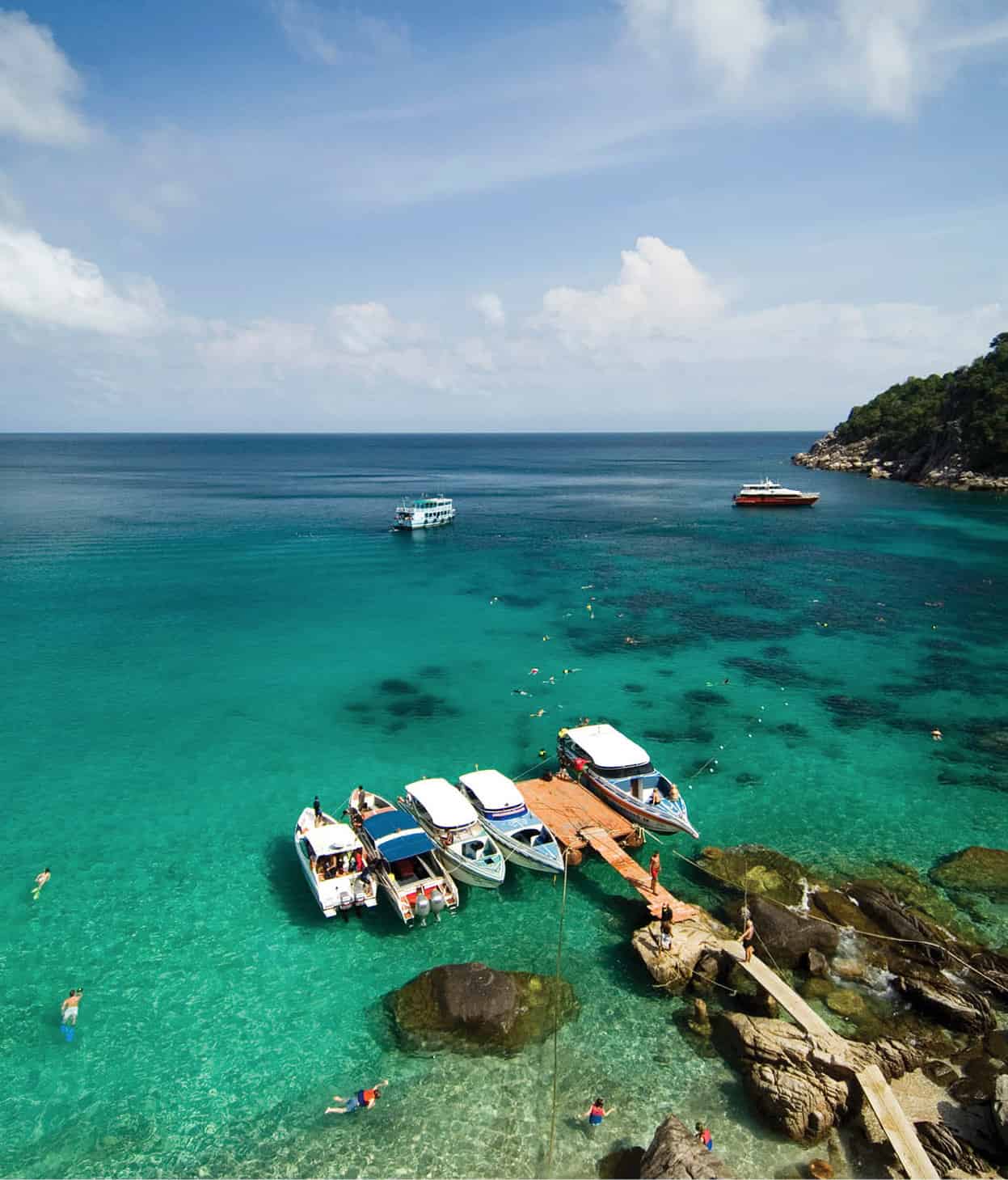
The pier at Ko Tao.
John W. Ishii/Apa Publications
The coconut islands
For over a century, the immigrant Chinese from Hainan and the Muslim fishermen on these islands derived their incomes from coconut plantations and fishing. While tourism dominates today, many of Ko Samui’s poorer islanders still make their living from the coconut plantations.
Ko Samui is an hour’s flight from Bangkok, 644km (400 miles) away. The Samui Archipelago’s three largest islands are firmly entrenched on the tourist map. While Ko Samui increasingly tailors itself to the higher-end market, Ko Phangan and Ko Tao still gear themselves to backpackers, the first of whom arrived on these shores in the 1970s. This might soon change, however, as plans have been tabled to open an airport on Ko Phangan. Convenient ferry connections between the three islands make it easy to sample the unique pleasures of each on a single holiday.
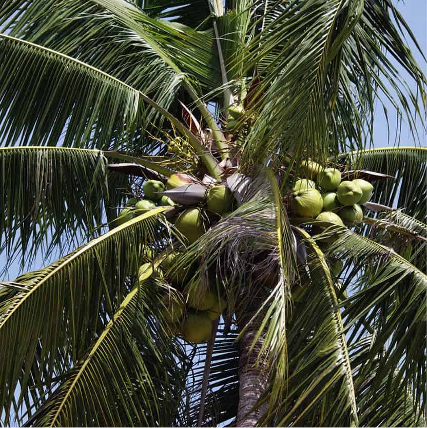
Coconut Palm tree on the beach at Ko Samui.
Fotolia
The Samui Archipelago saw a significant jump in tourists in 2005, as holiday-makers scrambled to find alternative destinations away from the tsunami-hit resorts along the Andaman coast. Development boomed, particularly on Ko Samui, during the following years and the island remains a very popular holiday spot.
When globetrotting backpackers first began travelling to Ko Samui in the 1970s, travellers’ tales of this island paradise soon surfaced, and it was only a matter of time before Samui’s secret was out. The simple A-frame huts that once sheltered budget travellers can still be spotted on the island’s peripheral beaches, but nowadays the most scenic bays have been taken over by luxury resorts that blend in with the palm-lined beach fronts.
However, Ko Samui’s raw beauty is still largely intact, and its laid-back vibe is one reason the island attracts so many repeat visitors. Many have secured their own piece of this 247-sq-km (95-sq-mile) tropical paradise by buying holiday houses or condos on the island, which are more affordable than those in Phuket.
Ko Samui has rapidly established itself as Thailand’s hottest spa destination, offering a wide variety of extravagant hotel-based pampering spas as well as independent day spas and retreat centres that claim to restore both physical and spiritual health. For those who tire quickly of the soft sandy beaches, the jungle treks and waterfalls of Samui’s interior offer a different kind of escape.
Ko Samui still has some way to go before matching the yachting marinas and theme parks of Phuket, but as it now has an 18-hole golf course and large supermarket chains added to its list of amenities, it looks destined to follow in the same footsteps. The island’s rapid rise, however, has not been without consequence. Severe water shortages are becoming a regular occurrence during the driest months, while the rainy season sometimes brings flood waters rushing down from deforested hills to many road and beach-front properties.
For better or worse, Ko Samui is becoming increasingly cosmopolitan. Dining choices are varied and moving more upscale, with more design-conscious eateries independent of hotels opening regularly. The nightlife scene is always busy, and the island has gained more atmospheric bars and clubs to join the dingy ‘beer bars’, British-style pubs and meat-market clubs.
Some long-term repeat visitors to Samui complain that the island’s idyllic charms are fraying at the edges. Aside from the obvious upsurge in construction, the behaviour and attitude of the locals have come under rap. While most of Samui’s population still exudes the famous southern hospitality, there are increasingly disturbing reports of opportunistic rip-offs and a seemingly uncaring attitude that borders on rudeness. Road rage and assault have also been reported, along with unsympathetic, and at times compliant, responses by the local police.
Tip
The southwest monsoon brings light, intermittent rains to the Samui archipelago from June to Oct. From Nov to Jan, the northeast monsoon takes over: the heaviest rains fall during this period, with Nov being the wettest month. Given the rather unpredictable wet-weather pattern, the best time to visit the islands is from Feb to May – although there are plenty of fine days right through to Sept.
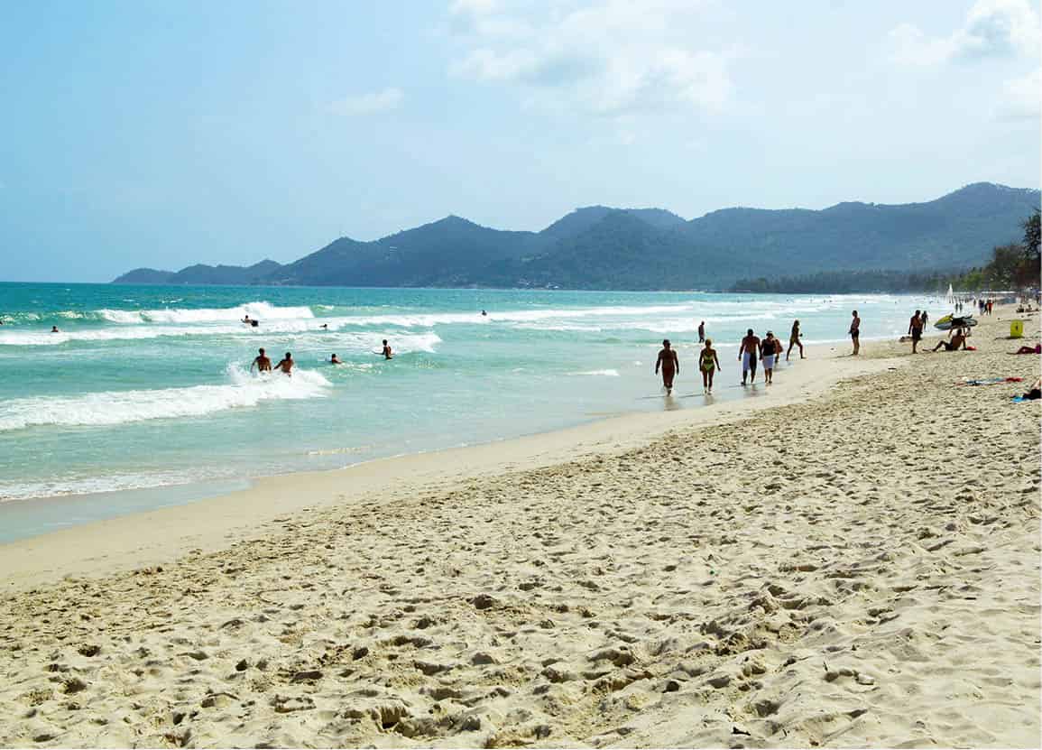
A beautiful beach in Ko Samui.
John W. Ishii/Apa Publications
Getting to Ko Samui
It is possible to fly direct to Ko Samui’s airport (located in the northeastern tip of the island) from Bangkok, Phuket and Krabi. The tropical escape begins the minute you touch down at the island’s international airport. With its quaint open-plan buildings and manicured gardens, this is one of Thailand’s most picturesque arrival points. Many people also travel by boat from mainland Surat Thani (Ban Don pier) to the busy port town of Na Thon 1 [map] on Ko Samui’s northwest coast.
Na Thon, which is also the island’s administrative centre, has little of interest to visitors, save for a few Chinese-influenced old wooden shophouses, souvenir shops, banks, restaurants, travel agents, a few faceless hotels, and an immigration office for visa extensions.
Ko Samui’s roads are generally well paved and the ring road, Route 4169, that loops the island is eminently driveable. Yet, accidents are frequent (mainly caused by intoxicated drivers) and great care should still be taken if driving your own car or riding a motorbike.
Tip
A popular pastime for Samui locals is to watch and gamble on buffalo fighting at one of the island’s several stadiums. In front of an animated crowd hanging around the edge of the ring, the head-to-head duel involves two beasts locking horns and battling it out until one runs away with its tail between its legs. Check with your hotel on forthcoming events.
Hat Laem Yai/Hat Maenam
The secluded Hat Laem Yai 2 [map] beach, located on a headland with a steep hillside rising behind it, is home to one of Ko Samui’s most expensive resorts, the all-villa Four Seasons Koh Samui. Laem Yai has magnificent orange-tinted sunset vistas, though it is thin on hotel and restaurant options.
The second beach of note on the north coast is Hat Maenam 3 [map], about 13km (8 miles) from Na Thon and 6km (4 miles) from the airport. The 4km (2.5-mile)-long stretch of beach is fairly isolated and quiet. The golden sand underfoot is a little coarse and the beach is pleasant but quite narrow. Numerous budget hotels have sprung up here in addition to the deluxe Santiburi Beach Resort, Golf & Spa. Nights can be quiet in Maenam due to the near absence of bars and clubs; for them you have to head south to Bo Phut and Chaweng.
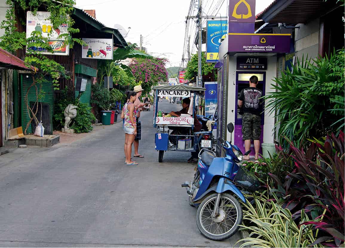
Fisherman’s Village, Bo Phut.
Alamy
Hat Bo Phut
East of Maenam is Hat Bo Phut 4 [map]. While the beach is nice enough and of similar standard to Maenam, the 2km (1-mile)-long Bo Phut is better known for the quaint seafront lane of old wooden shophouses known as Ban Bo Phut or Fisherman’s Village. The old timber shacks have been tastefully converted into restaurants, bars and shops, making this one of the nicest places on the island to wander around. A number of resorts are found at Bo Phut, among them the luxurious Anantara Bophut Ko Samui.
Of all the islands in the gulf, Ko Samui has the most off-beach attractions, many of which can be enjoyed by the whole family. Largely set up for tourists, but also a mark of the island’s coconut-plantation heritage, the trained ‘monkey work coconut’ shows at Samui Monkey Theatre in Bo Phut (daily 10.30am, 2pm, 4pm; tel: 08-7265 6662; charge) reveal how southern Thais use simian labour to assist them in harvesting coconuts from towering palms. These shows will appeal or appal, depending on your view of animal welfare.
Hat Bangrak
Northeast of Bo Phut and part of a headland is Hat Bangrak 5 [map], better known locally as Big Buddha Beach, which takes its name from Wat Phra Yai, or Big Buddha Temple (daily sunrise–sunset; free). The 12-metre (39ft)-high seated golden image is across the bay on a small islet linked by a causeway to the end of the beach. At low tide, the water can retreat quite far out, exposing a swathe of mud. There is some budget and mid-range accommodation set behind the beach.
A short hike and a left turn from the temple entrance in the middle of a large fish-filled pond is Wat Plai Laem, an interesting little temple with a base shaped like a giant lotus flower. Above the pond is a giant pink statue of the multi-armed Chinese Goddess of Mercy, Kwan Im.

Giant Buddha statue at Wat Phra Yai, Hat Bangrak.
Dreamstime
Hat Choeng Mon
On the other side of the headland is Hat Choeng Mon 6 [map], a small but serene white-sand bay backed by casuarina trees. It has a relatively undeveloped ambience, except for a couple of upmarket resorts. There is hardly any nightlife here, but then busy Chaweng beach is only a short drive away. Several of the island’s premier beach resorts, such as the Imperial Boathouse, Tongsai Bay, and the all-villa Sala Samui Resort & Spa occupy prime positions along this idyllic stretch of beach.
Hat Chaweng
The island’s busiest beach by far, and arguably still the prettiest, is the 6km (4-mile)-long Hat Chaweng 7 [map] on the east coast. The beach is roughly divided into three sections: North Chaweng, Central Chaweng and Chaweng Noi, in the south. The stunning powdery white-sand beach facing clear turquoise waters follows the shore from the headland in the north near the small island of Ko Matlang, all the way down to the curving bay and rocky end point of Chaweng Noi.
North Chaweng beach is sheltered by a coral reef, which means that while the sea is protected from strong winds during the monsoon season, the waters can also be still as a millpond at other times of the year. It is also less crowded than Central Chaweng, which has the highest concentration of development. Behind the rather cramped line of beach resorts, Chaweng Beach Road is a largely faceless sprawl of somewhat tacky tourist-orientated shops, restaurants and bars. However, upmarket shopping arcades such as Iyara Plaza, Central Shopping Arcade, and Central Festival are a sign of gentrification.
Past a tiny spit of land is the relatively quiet beach enclave of Chaweng Noi, which is thinner on accommodation and restaurants.
Hat Lamai
South of Chaweng, over a rocky ridge that has stunning viewpoints back towards the Chaweng shoreline, is Samui’s second-most populous beach, Hat Lamai 8 [map]. The beach is lovely and far less hectic compared with Chaweng, with better accommodation choices for budget travellers, although there are also several boutique resorts. Lamai is also the home of the island’s original ‘wellness’ centres, namely The Spa Resort and Tamarind Springs.
A little beyond the beach’s southern tip are two naturally hewn suggestive rock formations known as Hin Ta (Grandfather Rock) and Hin Yai (Grandmother Rock). As they resemble male and female genitalia, the rocks are the subject of much photo-taking (and sniggering).
Dining at Lamai isn’t a patch on Chaweng’s variety and quality, and unfortunately, Lamai gets a bad rap for its slightly lascivious nightlife scene, with its slew of raunchy girly bars and the sex workers who prop them up.
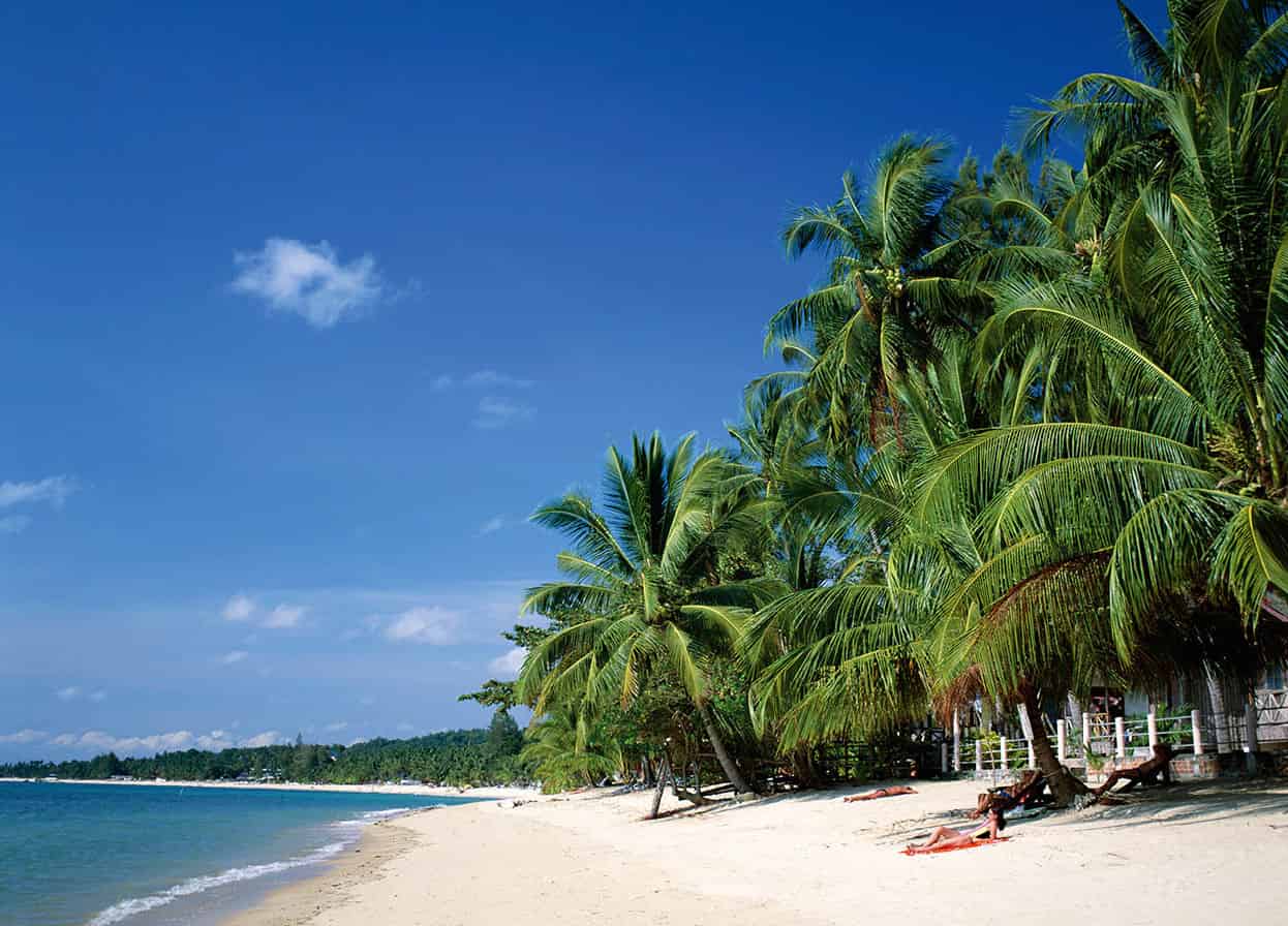
Hat Chaweng is Ko Samui’s most popular beach.
AWL Images
Inland attractions near Lamai
Taking Route 4169 inland from Hat Lamai leads to one of the temples featured on most island tours, Wat Khunaram (daily sunrise–sunset; free). The temple is famous as the home of mummified monk Luang Phor Daeng. His body is still seated in the same meditating position he held when he died in 1973.
Continuing past the village of Ban Thurian is Na Muang Waterfall 1, where, in the wet season, a cascade of water plunges some 20 metres (66ft) into a large pool. Getting to Na Muang Waterfall 2 involves a fairly strenuous 1.5km (1-mile) trek; a more novel way would be an elephant ride offered near the entrance to Na Muang Waterfall 1.
Another of Lamai’s attractions is the Samui Aquarium & Tiger Zoo, located within the Samui Orchid Resort in south Lamai (daily 11am–4pm; daily show at 1.30pm; tel: 0-7742 4019; www.samuiaquariumandtigerzoo.com; charge). The aquarium exhibits are nothing to write home about; more entertaining is the daily bird and Bengal tiger show. Visitors also have the opportunity to become a sea-lion trainer for a day with the guidance of professional trainers.
South and west coasts
The south- and west-coast beaches aren’t as pretty, although a few beautiful resorts have nestled along these shores. Some visitors intent on a more secluded holiday much prefer the beach at Hat Laem Set 9 [map] (also sometimes referred to as Hat Na Thian) along the south. The stylish Centara Villas Samui, with its elegant rooms, is a popular accommodation choice here.
Rounding the southern coast and heading to the west is Hat Taling Ngam ) [map], the site of the spectacular Intercontinental Samui Baan Taling Ngam, where the views from a vantage point on a steep hill make up for the rather ordinary beach resting at the bottom.
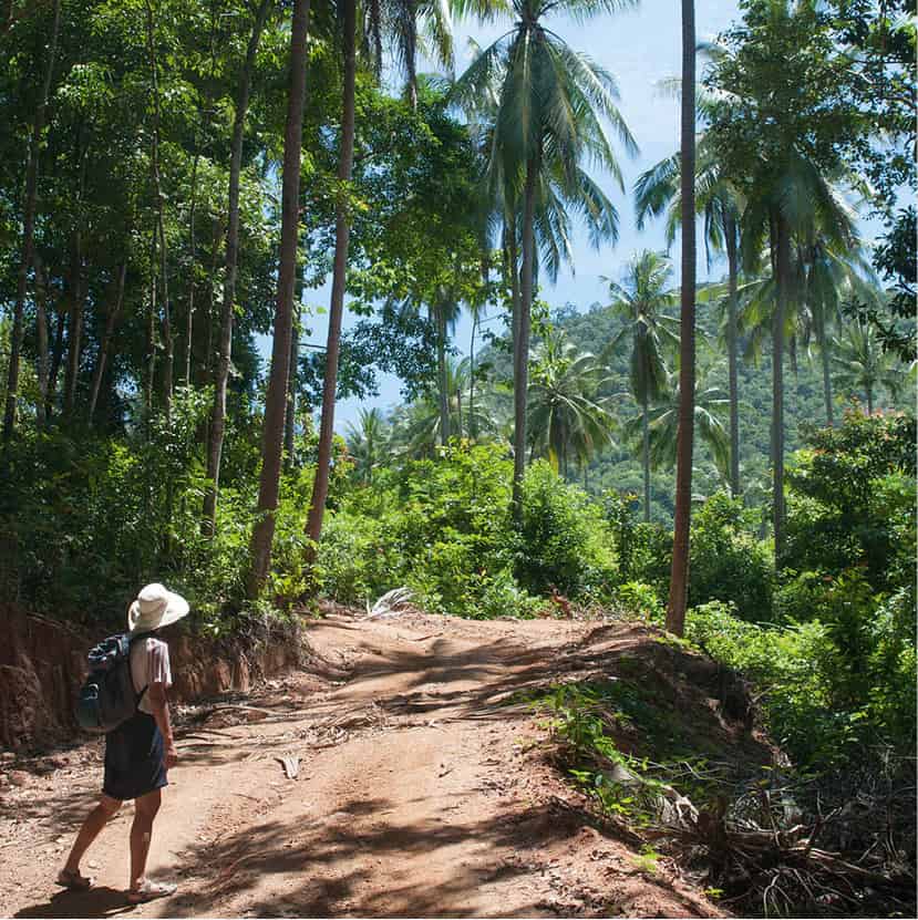
Ko Samui’s jungle-filled interior invites exploration.
Bigstock
Activities
Ko Samui’s waters offer the typical gamut of water sports – jet-skiing, kayaking, windsurfing, water-skiing, parasailing, deep-sea fishing and sailing. The Ko Samui International Regatta (www.samuiregatta.com), which celebrated its 15th year in 2017, has helped to establish the island as a yachting base and a few companies now charter luxury boats.
Although Ko Samui has numerous dive shops, the waters around the island are not particularly good for diving and snorkelling. Most dive trips head out to Ang Thong Marine National Park, Hin Bai and Ko Tao (for more information, click here).
For land-based action, hire a four-wheel-drive jeep and embark on an island safari exploring the winding dirt trails that lead up into the mountainous hills. The more adventurous can rent a mountain bike and explore the interior of the island.
Although Ko Phi Phi’s Maya Bay (for more information, click here) was the chosen location setting for the film The Beach, it was the dramatic scenery of Ang Thong Marine National Park, near Ko Samui, that was Alex Garland’s original inspiration for his bestselling novel. Lying some 31km (19 miles) west of Ko Samui, the 42 islands that make up the Ang Thong archipelago stretch over a 100-sq-km (39-sq-mile) expanse of land and sea. Virtually uninhabited by humans, the islands are home to a diversity of flora and fauna, including macaques, langurs and monitor lizards. Pods of dolphins are known to shelter in the waters late in the year.
Meaning ‘Golden Bowl’, Ang Thong Marine National Park takes its name from the Talay Nai (inland sea), an emerald-green saltwater lagoon encircled by sheer limestone walls that are covered with vegetation. A principal stop on any day trip to the island chain, the picturesque lake can be reached by a trail from the beach on the island of Ko Mae Ko.
Several tour companies on Ko Samui operate day trips, including kayaking expeditions to the archipelago, which usually include a stop on the largest island of Ko Wua Talab, or Sleeping Cow Island. Aside from a beach and the park’s headquarters, there is a steep climb 400 metres (1,312ft) up to a lookout point with unrivalled views of the surroundings, with Ko Samui and Ko Phangan in the distance. Also involving an arduous climb is Ko Wua Talab’s other highlight, Tham Bua Bok, or Waving Lotus Cave. It is named after lotus-shaped rock formations.
Diving and snorkelling at Ang Thong Marine National Park is usually best experienced at the northern tip of the island chain, around the islet of Ko Yippon. Although visibility isn’t crystal-clear, the shallow depths make it easy to view the colourful coral beds, inhabited by sea snakes, fusiliers and stingrays. There are also shallow caves and archways to swim through.
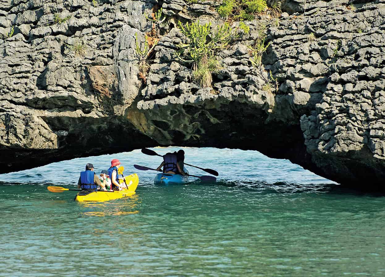
Sea-canoeing among the limestone formations of Ang Thong Marine National Park.
John W. Ishii/Apa Publications
Ko Phangan
The second-largest island in the Samui archipelago, Ko Phangan 1 is blessed with numerous seductive white-sand beaches and rich forest topography, yet the island’s current international reputation stems almost exclusively from the infamous Full Moon Party (for more information, click here), which takes place at Hat Rin on the island’s southern tip. With an infamy rivalling that of Ibiza and Goa, the lunar gathering has steadily grown since the first party back in the late 1980s. Nowadays, the monthly beach party is a point of hedonistic pilgrimage for an estimated 30,000 revellers from all over the world.
Lying around 20km (12 miles) north of Ko Samui, or a 40-minute boat journey, Ko Phangan became an outpost on the shoestring traveller’s map in the 1980s, around the same time as Ko Samui. But while the latter rapidly developed into a hub for package holiday-makers and flashy beach homes for the wealthy, Ko Phangan has largely remained an enclave of backpackers, drug-craving revellers and New Age nirvana-seekers. However, there are increasingly more upmarket accommodation choices, and pockets of the 193-sq-km (75-sq-mile) island are becoming built up, particularly Hat Rin and its vicinity, which now looks and feels like a separate resort when compared with the rest of the island.

Verdant Ko Phangan.
Fotolia
While most revellers confine themselves to the southern-cape beaches of Hat Rin Nok (Sunrise Beach), Hat Rin Nai (Sunset Beach) and nearby Leela Beach, there are plenty of other more isolated bays that skirt the mountainous interior. Increasingly better roads have made the furthest reaches of the island more accessible, but even so, a couple of coves, such as Hat Kuat (Bottle Beach), can be reached only by boat.
The island’s administrative centre and main arrival point is the small town of Thong Sala 1 [map], located around halfway up the west coast. Apart from fishing boats unloading their daily haul, the port is usually busy with ferries, catamarans and speedboats travelling to and from Ko Samui, Ko Tao and Surat Thani. Accommodation touts pounce on new arrivals as soon as they set foot on the pier, which can be helpful if no reservations have been made and it is close to the full moon. The town has all the usual tourist-friendly services – internet cafés, banks, shops, and a few restaurants and bars. There are also several Thai-boxing camps, plus morning and night markets.
Ban Khai and Ban Tai
East of Thong Sala, the south coast is endowed with a continuous stretch of beach running all the way up to the Hat Rin cape, though the shallow reefs make the water often impossible to swim in. The most popular beaches here are between the villages of Ban Tai 2 [map] and Ban Khai 3 [map]; the former is a small fishing village with boats clogging up part of the seafront. Both basic and more comfortable family-run bungalow accommodation are found along the length to Thong Sala, with Ban Khai, the closest to Hat Rin, the only spot with any night activity.
Tip
There are no official tourism offices in Ko Phangan. A good source for information is the website managed by the Phangan Batik shop in Thong Sala: www.kohphangan.com. The site has a wealth of information and useful tips, including Full Moon Party dates. There is also an official tourism website at http://kohphangan-tourism.com with details on tours and packages.
Hat Rin
The original appeal of Hat Rin, east of Ban Khai, was that it had two beaches within easy walking distance – across a flat headland – where both sunrise and sunset views could be enjoyed. But this is now where all the action takes place, and these are certainly no longer Ko Phangan’s most serene beaches.
Hat Rin Nok 4 [map], or Sunrise Beach, is the wider, more popular bay, and is where the main nightlife cranks up, climaxed by the monthly Full Moon Party. Hat Rin attracts a global melting pot of young clubbers and alternative-lifestyle devotees, who find this tiny pocket of Thailand the perfect place to express their inner selves (fuelled, of course, by booze and drugs). This is the lure for many, though more jaded travellers will regard the scene as one big cliché.
The less attractive of the two beaches is Hat Rin Nai 5 [map], or Sunset Beach, a thinner stretch of sand lined with beach huts that offer at least a tad of respite from the late-night cacophony over at Hat Rin Nok. There is a pier towards the southern end of this beach for boats shuttling to Ko Samui. The walk between the two beaches is jam-packed with accommodation, shops, restaurants, internet cafés, travel agents and the like.
Further towards the island’s southern tip is pretty Leela beach. It is around a 15-minute walk to Hat Rin Nai, and has a more peaceful atmosphere, removed from the main Hat Rin mayhem.
East-coast beaches
There are several small but fine bays that run north up the east coast from Hat Rin, but a lack of roads makes boat transportation (from Hat Rin) the only way to venture there. Development is therefore patchy along this coast. Hat Yuan 6 [map] and Hat Yao (not to be confused with the longer Hat Yao on the west coast), and particularly Hat Thian 7 [map] are a draw with visitors who seek isolated and undisturbed beaches.
At the top of the east coast are the increasingly popular twin bays of Ao Thong Nai Pan Noi 8 [map] and Ao Thong Nai Pan Yai 9 [map], described by many as the island’s most beautiful coves. There is a good choice of accommodation at both bays, separated by a headland that can be traversed in about 20 minutes. Getting to these beaches is a nightmare, however, as the first stretch of the 12km (8-mile) road from Ban Tai in the south, as far as Sadet, is actually a dirt track, riddled with potholes. It’s tricky to navigate on a motorbike, particularly after heavy rain. A good alternative is to take a pick-up truck taxi from Thong Sala.
Tip
The advantage of staying on any of the west-coast beaches is fewer crowds and beautiful sunset views, with the islands of the Ang Thong Marine National Park framed against the horizon.
North-coast beaches
Hat Kuat ) [map], or Bottle Beach, is the first of two bays that are worth seeking out on the north coast. There is a decent road from Thong Sala up to Ao Chalok Lam, from where you can take a boat to Bottle Beach. It is one of Ko Phangan’s best bays and has its own insular scene that attracts lots of repeat visitors. The splendid white-sand beach is backed by steep hills and, like elsewhere in Ko Phangan, most accommodation is at the budget end.
The second bay to the west, Ao Chalok Lam ! [map], holds a large fishing village. Ban Chalok Lam is the island’s second port, with a pier in the centre of the large curving bay that is usually busy with fishermen who supply the seafood restaurants here with fresh catches. The small white-sand cove of Hat Khom @ [map] along this stretch, and closer to the headland east, is the best bit of beach here, ringed by a coral reef offshore. The 10km (6-mile) road from Thong Sala in the south to Ao Chalok Lam is one of the island’s best roads, so getting there is not a problem.

A rowing boat at Ao Thong Nai Pan Noi.
iStock
West-coast beaches
The west-coast beaches stretching from Ao Mae Hat all the way to Thong Sala in the south are considered more attractive than those along the southeast shores, but somehow they see fewer visitors compared with the Hat Rin area.
Starting from the northwest corner is Ao Mae Hat £ [map], which has a sandbank at low tide that connects to the reef-fringed tiny island of Ko Ma (Horse Island). The reef that runs up the coast from Ao Chaophao all the way to Ko Ma is considered by some to be the island’s best snorkelling and diving site.
Further down the coast is scenic Hat Salad $ [map], with good snorkelling just off the northern edge of the beach. Next is an attractive 1km (0.5-mile)-long sandy stretch called Hat Yao % [map], or Long Beach. It has become very popular in recent years and is giving Hat Rin a run for its money with its range of accommodation, bars, restaurants and other facilities. Further south is a nice small bay called Ao Chaophao ^ [map], which has a decent range of facilities. The inland Laem Son Lake demarcates Ao Chaophao from the next beach, Ao Si Thanu. Further down the coast are three more beaches of note: Ao Hin Kong and Ao Wok Tum, both of which are divided by a small stream that empties into the sea, followed by Ao Plaaylaem.
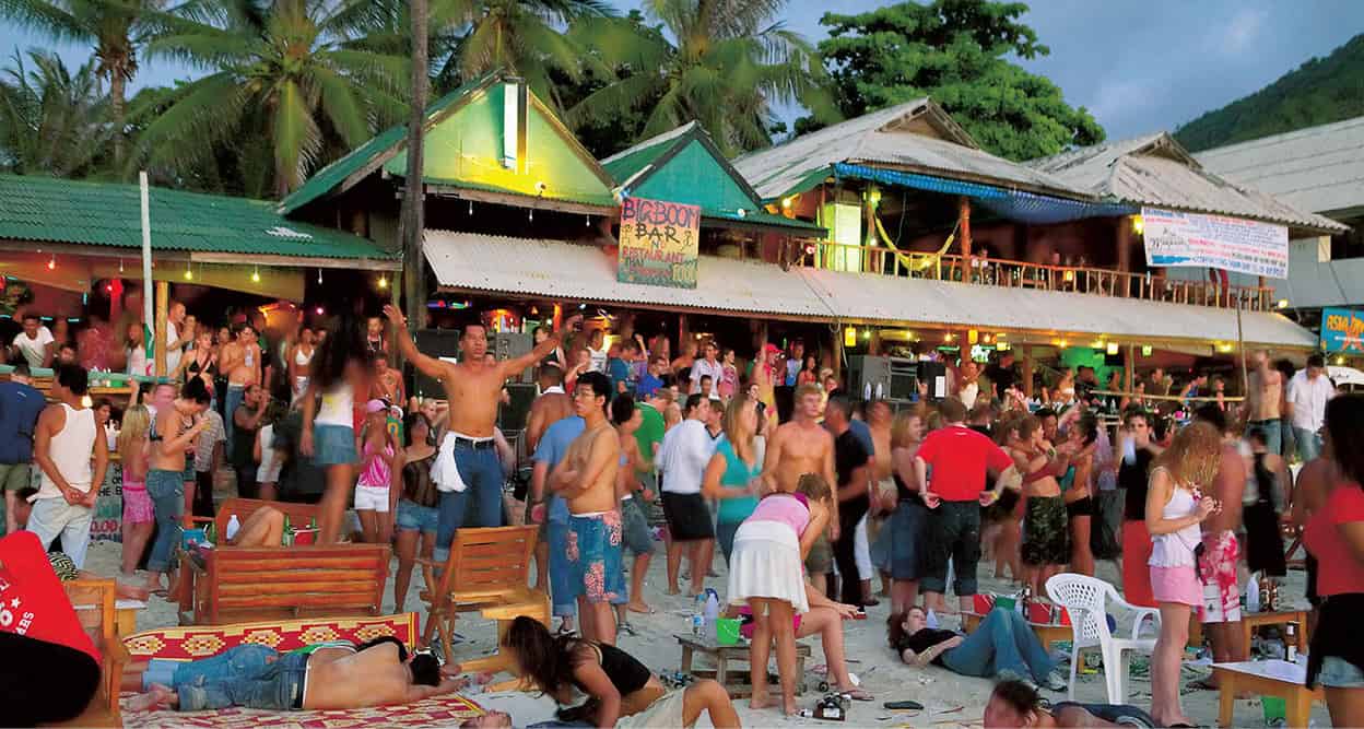
Full Moon party animals at Hat Rin Nok.
Alamy
Full Moon Party
An essential stop on any backpacker’s tour of Southeast Asia, the Full Moon Party on Hat Rin Nok is dubbed the ‘world’s biggest beach party’.
The raucous Full Moon Party (or F-M) on Hat Rin Nok, or Sunrise Beach draws hundreds of thousands of global visitors throughout the year. Estimates claim 10 million baht is added to the island’s economy on one single party day alone, so the government’s intermittent calls for the event to be scrapped are unlikely to materialise for a while at least.
The event builds in momentum from sunset to sunrise. Paradise Bungalows, at the southern end of the beach, was the original venue. It is where the most popular DJs spin their tunes, although others vie for attention at the main bars all along the beach. As each leans towards a different groove, the dance hotspots shift periodically.
Some 30,000 visitors attend each party, with the wildest events in December and January. Guesthouses inevitably fill up as the day approaches, with some only taking bookings for a minimum of four or five nights. Those craving beauty sleep should choose accommodation well away from Hat Rin Nok, which can be loud on most nights, rising to deafening on full moon. Transport to the party from other beaches is plentiful. And if you prefer to nurse a hangover within the confines of a luxury hotel in Ko Samui, numerous boats make the night-time crossing between the two islands.
Generally, people spend the night wasted on concoctions of cheap booze, getting painted in fluorescent ink, dancing and passing out on the sand. Aside from this and the fleeting romances (mostly of the one-night stand variety), a lot of party-goers are there to sample what first gave F-M its notoriety – the taking of illicit substances. Popular still are magic-mushroom omelettes and teas, Speed and Ecstasy punches, and ganja cookies. But beware, plain-clothed and uniformed police are on patrol and road blocks on routes to the party are set up to search for drugs. Penalties for possession of or being under the influence of illegal drugs are extremely harsh in Thailand.
Precautions
The party is great fun, but given the nature of the event and the potential for getting completely smashed it should be obvious that some precautions are needed. Pick-pockets are on the prowl; thefts and muggings do happen, so it’s best not to carry valuables. And don’t take drugs from strangers or leave your drinks lying around; they are sometimes spiked. As are the drinks buckets that are available to fill up from.
Sunrise is met by triumphant cheers, and the incentive to raise the tempo once more for anyone who might be thinking about collapsing into bed. The beach party winds up late morning, but for those who still have their brain cells and eardrums intact, the traditional after-party kicks off at Backyard Bar up the hill. For upcoming F-M dates and other party details check out www.phanganist.com or http://fullmoonparty-thailand.com.
Inland attractions
The beach at Ao Thong Nai Pan Yai was a favourite stop-off for King Chulalongkorn, who made numerous visits to Ko Phangan between 1888 and 1909. Another of the king’s haunts was Than Sadet Waterfall, which flows out to Hat Sadet beach in the next cove down the east coast from Ao Thong Nai Pan Yai, or some 12km (7 miles) up from Hat Rin. The island’s largest falls, Than Sadet, meaning Royal Stream, has boulders carved with inscriptions by King Chulalongkorn, King Rama VII and the previous monarch, Rama IX.
The island’s other cascades are Than Praphat Waterfall, on the way to the east-coast beach of Hat Namtok, Than Prawet Waterfall, located near Ao Thong Nai Pan Noi, and Phaeng Waterfall halfway across the island en route from Thong Sala to Ban Chalok Lam village. All these falls come under the umbrella of Than Sadet National Park, a 65-sq-km (25-sq-mile) reserve that aims to protect the biodiversity of Ko Phangan’s forested interior as well as the small outlying islands that are within the park’s boundaries.
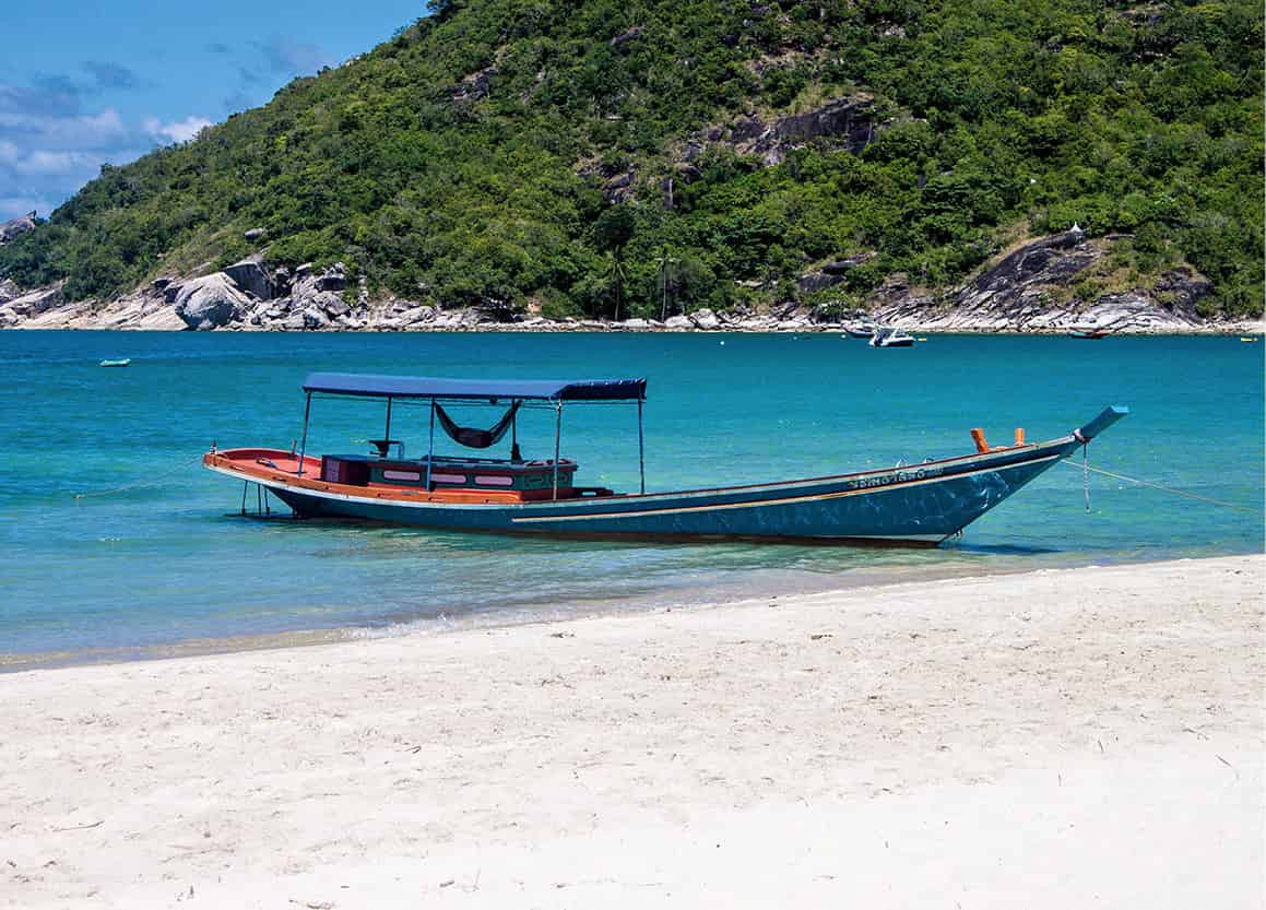
Thong Nai Pan Yai beach on Koh Phangan.
Dreamstime
If the soul also needs centring, then the cave monastery at Wat Kow Tham, at the top of a hill near the village of Ban Tai, has a meditation centre called Nunamornpun. Its 10- and seven-day retreats, including some that are silent, are designed for Western visitors and place emphasis on the key principle of compassionate understanding. Early registration is advised as places fill up quickly. For more information and registration check http://www.watkowtahm.org.
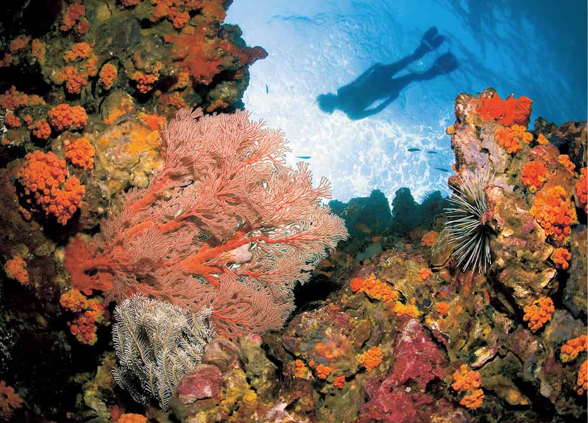
Diving among the coral reefs off Hin Bai (Sail Rock).
Getty Images
Diving and snorkelling
As with Ko Samui, the majority of Ko Phangan’s diving is conducted at a handful of dive sites some distance from the island, at Ang Thong Marine National Park (for more information, click here), Hin Bai (Sail Rock) and around Ko Tao (for more information, click here). Snorkelling and diving closest to Ko Phangan is best experienced along the reefs on the northwest tip of the island, around Ko Ma, Ao Mae Hat and Hat Yao. Ko Ma is Ko Phangan’s best dive site, with fairly shallow depths of up to 20 metres (66ft) and various types of coral, including a multicoloured anemone garden. The area is frequented by blue-spotted stingrays, giant grouper and reef sharks.
Located about halfway between Ko Phangan and Ko Tao, Hin Bai is regarded as one of the best dive sites in the Samui archipelago and is suitable for all levels of diver. The rugged rock emerges like an iceberg from the water; most of its bulk is hidden below the surface, reaching depths of 30-plus metres (98ft). The granite pinnacle is circled by large schools of pelagic fish, but the highlight is a dramatic vertical chimney that can be entered at 19 metres (62ft) below, with an exit at 6 metres (20ft) from the surface.
Nightlife and entertainment
Apart from the notorious Full Moon parties, Ko Phangan has plenty of other regular weekly and monthly party nights to keep extreme party animals bouncing until that ultimate night arrives again. Half Moon parties shape up twice a month, a week before and after full moon, held at a hypnotically-lit outdoor venue in Ban Tai. Unlike the free Full Moon parties, the Half Moons and all other parties on the island have an entry fee. The lovely waterfall setting for the pre-full moon Paradise Party attracts a large party contingent to the waterfalls that are found off the road to Ban Chalok Lam.
Famous for its post-full moon all-day recovery session, the funky two-floor Backyard Bar, up the hill behind Hat Rin Nok on the way to Leela beach, also holds regular party nights, with differing musical slants. Hat Rin’s bars tend to be ephemeral, but mainstays include Pirates Bar, along with Cactus Club and Drop-In Club. For more information on the island’s entertainment scene, check out www.phanganist.com. Sadly, safety concerns around the parties are increasing and some governments now issue warnings about attacks on tourists on the island. For tips on staying safe see Full Moon Party (for more information, click here).
Tip
Ko Tao is too tiny and undeveloped to have a tourism office. A good bet for information and tips on the island is the website: www.kohtaotoday.com.
Ko Tao
Some say Ko Tao, or Turtle Island, is named after its rather loose geographical shape of a diving turtle; others have attributed its name to the turtles that were once prevalent swimmers in these waters. Today, the laid-back island might just as well be called ‘aqualung island’ for the density of affordable dive schools that operate expeditions to the coral-abundant waters. This is one of the world’s best places to learn how to mine the pleasures of the deep.
Just a decade ago, Ko Tao, a rugged rock, topped with tropical forest and fringed with some picturesque secluded bays, consisted solely of rustic backpacker bungalows. It had little appeal for non-divers, who would quickly tire of listening to endless divers’ tales in the bars and restaurants each night. Since then, development has brought better facilities, accommodation options and entertainment venues, with plenty more activities to occupy landlubbers. And the bonus of having a large percentage of visitors studying in dive schools or out on dive trips is that the island’s beaches can be relatively peaceful and relaxing during the day.
The tiny 21-sq-km (8-sq-mile) island, located around 40km (25 miles) northwest of Ko Phangan and 60km (37 miles) from Ko Samui, is the northernmost inhabited island in the Samui archipelago. Due to its remoteness, it was seldom visited in the past, and there are few historical sites for visitors to explore, save for the initials of King Rama V (Chulalongkorn) carved into a large boulder at the southern end of Hat Sai Ree beach. The king visited the island in 1899, and the spot has become a place where locals pay their respects. In the 1930s and 1940s, the island was used as a political prison, but since the 1980s, Ko Tao has been welcoming increasing numbers of overseas visitors, who now arrive by ferries and speedboats from the mainland port of Chumphon (for more information, click here), some 80km (50 miles) to the east; or from Ko Samui, Ko Phangan or Surat Thani to the south.
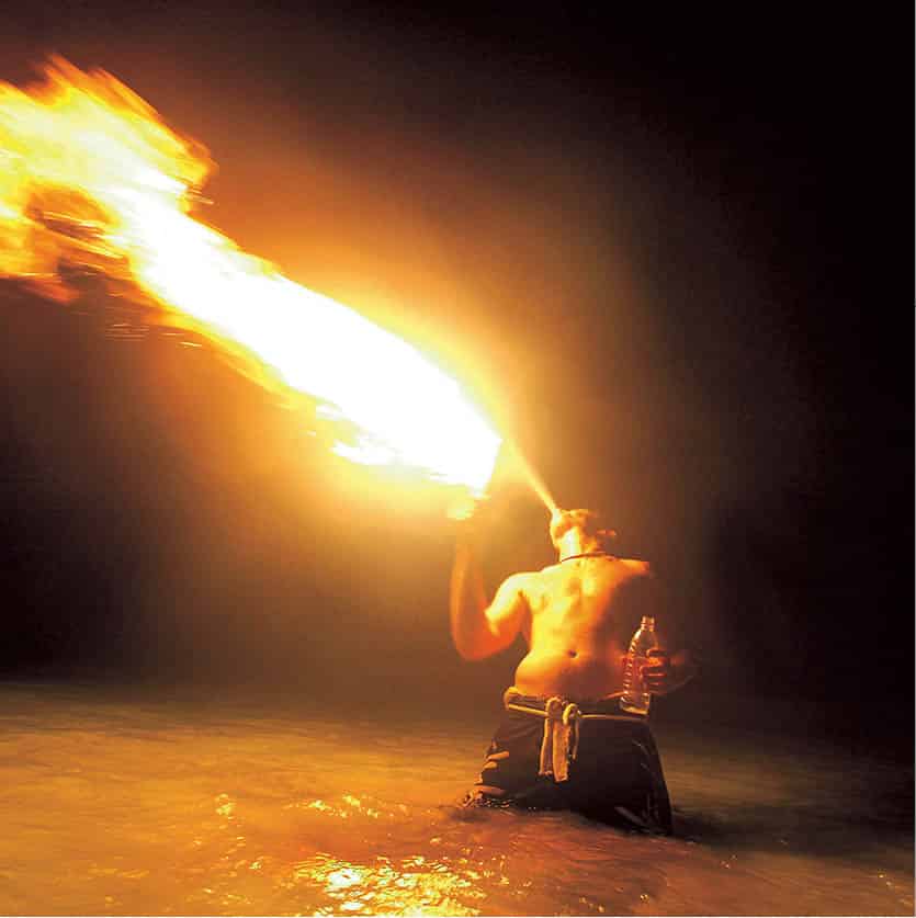
A fire-eater performing at Ko Phangan’s Full Moon Party.
Getty Images
West-coast beaches
The island’s main arrival point is the small but lively village of Ban Mae Hat 1 [map] on the west coast. It is little more than a one-street village lined with a post office, banks, cafés, bars and other tourist-related facilities.
There are bays at Hat Sai Nuan and Ao Jansom south of the village, while to the north is the small, shallow bay of Ao Hat Mae. There is some accommodation here but it may be too close for comfort to the village for some. Much nicer is the 2km (1-mile)-long Hat Sai Ree 2 [map], the island’s longest and most popular curve of white-sand beach. Sai Ree is lined with hotels to suit most budgets, getting gradually quieter further north, with the ever-growing Ban Hat Sai Ree village backing on to the beach just over the halfway mark. Beyond Sai Ree, the road makes an incline up towards the northern tip of the island, with several more out-of-the-way cliff-top resorts, including the attractive Thipwimarn, from whose restaurant you can experience stunning sunset views.
South-coast beaches
Ko Tao’s southern shores have quite a few small but nevertheless pretty beaches that are found in either direction from the island’s second-busiest beach of Ao Chalok Ban Kao 3 [map], a well-protected bay that is jammed with multiple resorts, dive shops, eateries and bars. The large headland at the eastern end of Ao Chalok Ban Kao has a fantastic viewpoint on top of the John Suwan Rock, with lovely vistas in either direction. To the east of the promontory is the long, yet quiet, Ao Thian Ok 4 [map], and further still is Hat Sai Daeng.
Within walking distance, to the west of Ao Chalok Ban Kao, is the small and scenic bay of Ao Jun Jeua. Unfortunately, the monsoon season from June to October brings high winds and heavy seas here, causing disruption to ferry schedules and resulting in a lot of flotsam being washed up on these beaches.
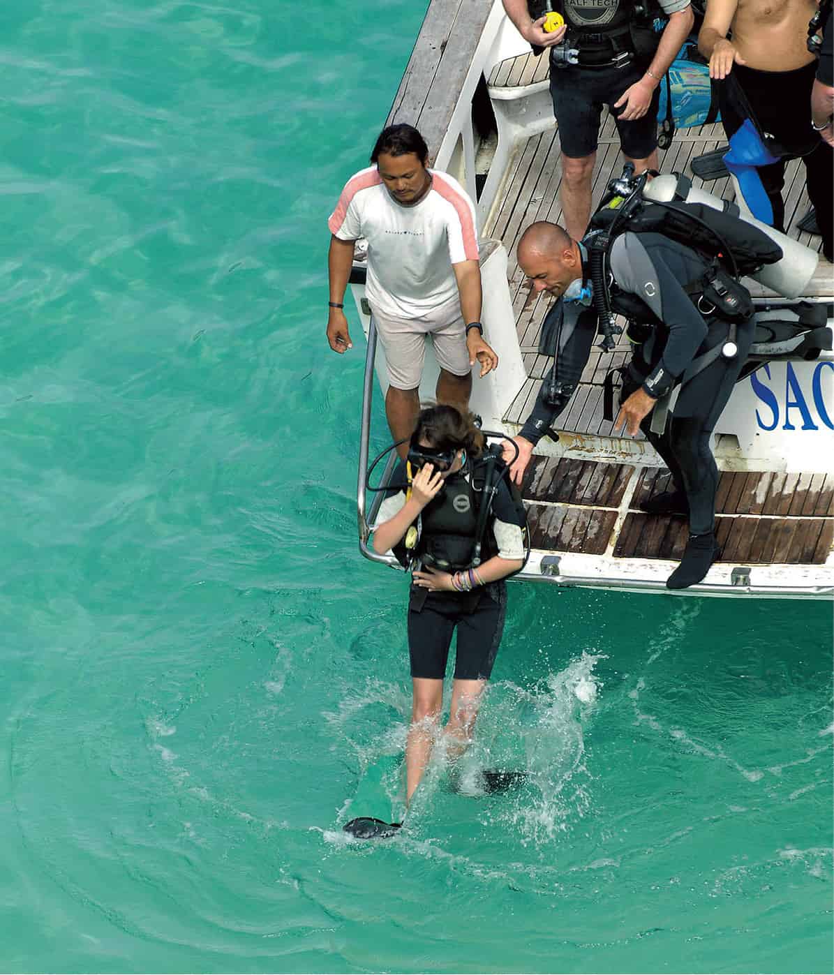
Taking the plunge at Ko Tao.
John W. Ishii/Apa Publications
East-coast beaches
The east coast of the island has several isolated inlets. There are scant sleeping options (although Ao Tanote is expanding), and none have outstanding beaches, but there is plenty of good snorkelling and diving to be experienced. The dirt trails to the eastern shores can be treacherous (the only other way is by boat) and once you are there, it can be awkward and expensive to venture back west. Most resorts along this coast offer basic facilities, with some generating electricity only between sunset and sunrise. Heading north from Hat Sai Daeng, the bays include lovely Ao Leuk 5 [map], the scenic horseshoe-shaped Ao Tanote 6 [map], the tiny cape of Laem Thian, and, eventually, the remote Ao Hin Wong 7 [map].
North coast
A short boat ride off the island’s northern tip is the picture-perfect Ko Nang Yuan 8 [map], a gathering of three islets joined together by mere wisps of sand that can be walked across at low tide. The setting is incredible, both above and below sea level, so much so that dive trips and boat tours from around the island, as well as Ko Samui and Ko Phangan, all converge here, somewhat spoiling the idyll. With simple bungalows spread across the three outcrops, only the Nangyuan Island Dive Resort (tel: 0-81958 1766; www.nangyuan.com) has the rights to operate here, with outside visitors charged THB100 just to step foot on the island.
Diving and snorkelling
As a premier dive destination, Ko Tao’s reputation has diminished slightly in the last decade, mainly due to the hefty increase in the number of divers; at the more popular sites, the undersea human traffic can be annoying. Even so, visibility in the warm water is usually very clear – sometimes over 30 metres (98ft) – and there is a variety of dive sites to choose from. While sightings of giant groupers and turtles are not uncommon, and territorial disputes with triggerfish best avoided, an encounter with an underwater giant such as a whale shark is still a special event.
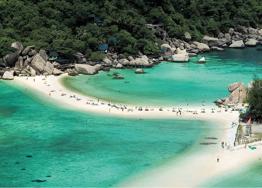
Stunning Ko Nang Yuan is a must-see.
John W. Ishii/Apa Publications
Unlike the lengthy journey times to dive sites from Ko Samui and Ko Phangan, Ko Tao is fortunate to have more than 25 chartered dive sites close by that can be reached in less than 30 minutes. The close proximity and favourable conditions (outside the Nov–Dec monsoon) make the island’s waters an ideal place to learn how to dive.
Some of the best dive sites are found off Ko Nang Yuan, including the granite boulder and swim-throughs of Nang Yuan Pinnacle, the pair of coral-coated rock formations known as the Twins, and Green Rock, with its tunnels and swim-throughs. Some 5km (3 miles) northwest of Ko Tao, the Chumphon Pinnacle is arguably the best dive site in the Gulf of Thailand, suitable for advanced divers only, who may encounter grey reef sharks and sizeable fish. In the opposite direction, the Southwest Pinnacle, 7km (4 miles) from Ko Tao, is rated as one of the best soft-coral reefs in the region; its currents attract large schools of pelagic fish. Other frequently visited sites are White Rock, Hin Wong Pinnacle and Shark Island.
With nearly 50 dive schools and competitive dive packages that include accommodation, a few resorts refuse to take in non-divers during the peak season. Advance reservations are advised. The majority of schools offer PADI open-water certification, with rates averaging from THB8,500 to THB10,000. Qualified divers can expect to pay THB1,000 for fun dives, which are discounted if you bring your own equipment.
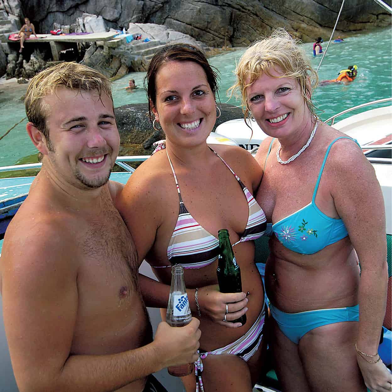
Taking a break at Ko Tao.
John W. Ishii/Apa Publications
Activities
Ko Tao’s compact size makes the island an ideal place for walking, with the reward of panoramic hilltop views or a hidden pristine cove at the end of your journey. If hiking the rugged coast is too strenuous, day-long boat trips around the island can be chartered independently with longtail-boat operators at beaches and piers, or through your guesthouse. A round-island tour will cost around THB1,000 for the boat, but operators may ask for more depending on how many people are aboard.
Water sports such as kayaking, wakeboarding and water-skiing can be done on Ao Tanote or Hat Sai Ree. And on land there are increasing options like Flying Trapeze Adventures at Hat Sai Ree or Perfect Day Hiking Tours.
Entertainment
Some of the healthy diving camaraderie on Ko Tao spills over into its lively nightlife scene. The island is also an escape for Ko Phangan visitors who seek a reprieve from that island’s party-town atmosphere, although Ko Tao has its own regular party nights with guest DJs (fliers and posters notify fresh-faced arrivals of the latest place to shake their booty). As the island develops, the nightlife on offer is starting to move from basic beach bars blaring loud trance and techno to the dreaded fire-jugglers and cheap-Thai-whiskey scene of Ko Phangan. But cooler venues, such as MOOV Bar, also exist.
