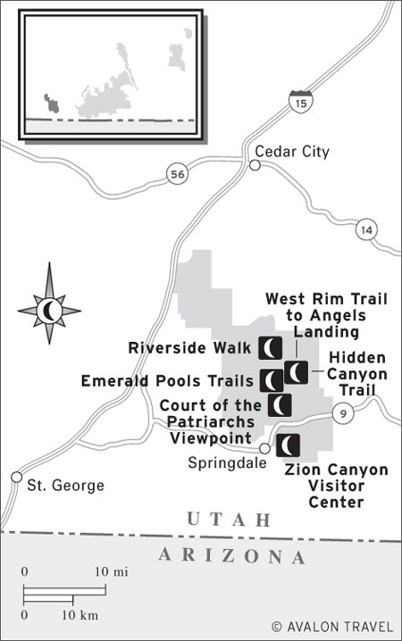
HIKING FROM KOLOB TERRACE ROAD
Zion is a magnificent park with stunning, soaring scenery. The canyon’s name is credited to Isaac Behunin, who believed this spot to be a refuge from religious persecution. When Brigham Young later visited the canyon, however, he found tobacco and wine in use and declared the place “not Zion”—which some dutiful followers then began calling it.
The geology here is all about rocks and water. Little trickles of water, percolating through massive chunks of sandstone, have created both dramatic canyons and markedly undesertlike habitats, enabling an incredible variety of plants to find niches.
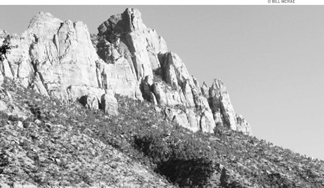
The first thing that catches the attention of visitors are the sheer cliffs and great monoliths of Zion Canyon, reaching high into the heavens. Energetic streams and other forces of erosion created this land of finely sculptured rock. The park spreads across 147,000 acres and contains eight geologic formations and four major vegetation zones. Elevations range from 3,666 feet, in lower Coalpits Wash, to 8,726 feet, atop Horse Ranch Mountain.
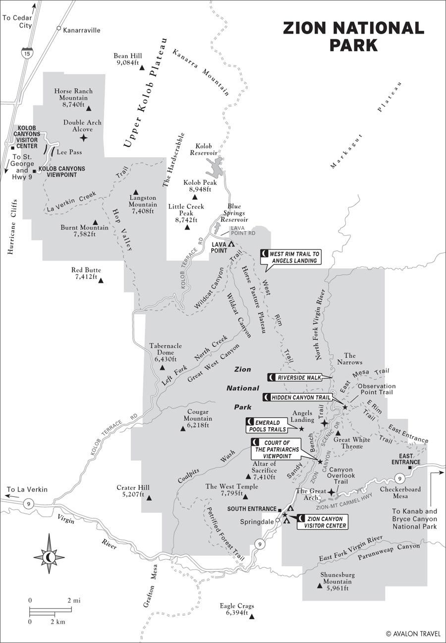
The highlight for most visitors is Zion Canyon, which is approximately 2,400 feet deep. Zion Canyon Scenic Drive winds through the canyon along the North Fork of the Virgin River, past some of the most spectacular scenery in the park. A shuttle bus ferries visitors along this route spring-early fall. Hiking trails branch off to lofty viewpoints and narrow side canyons. Water-loving adventurers can continue past the pavement’s end and hike at the Virgin River at the Narrows in upper Zion Canyon.
M Zion Canyon Visitor Center: It’s always a good idea to drop by a park’s visitors center, and this one is an especially interesting place to explore. The highlights are the outdoor exhibits, the excellent bookstore, and a shuttle bus stop that will ferry you up the canyon (click here).
M Court of the Patriarchs Viewpoint: Hop off the shuttle bus to spend a few moments trying to fit all three mountains into your camera’s viewfinder. The Patriarchs, along with the Great White Throne, are emblematic of Zion’s massive sandstone rocks (click here).
M Emerald Pools Trails: A little bit like in the story of the three bears, there’s an Emerald Pool Trail that’s right for just about everyone. The trail to the lower pool is paved (though nonelectric wheelchair users may need a push), the trail to the middle pool offers a good short hike, and the trail to the upper pool will make most hikers break a sweat. All three pools are indeed emerald green, and the trails are lined with wildflowers (click here).
M West Rim Trail to Angels Landing: If you want to do one vigorous day hike, this is a classic. Be prepared for spectacular views and some tenuous footing along the way—not for acrophobes or children (click here).
M Hidden Canyon Trail: Hike up the East Rim Trail to the turnoff for Hidden Canyon. After a chain-assisted traverse of a cliff face, you’ll pop into a shady, steep-walled narrow canyon with caves, pools, a small arch, and moisture-loving plants (click here).
M Riverside Walk: If you’re a die-hard hiker, don’t count this level paved path as a hiking trail—save it for an after-dinner stroll. But for those who aren’t up to steep trails, this walk along the Virgin River is a good way to see the water, the plantlife, and the soaring canyon walls. At the end of the trail you can watch hikers set off up the Narrows (click here).
LOOK FOR M TO FIND RECOMMENDED SIGHTS, ACTIVITIES, DINING, AND LODGING.
The spectacular Zion-Mt. Carmel Highway, with its switchbacks and tunnels, provides access to the canyons and high plateaus east of Zion Canyon. Two other roads enter the rugged Kolob section northwest of Zion Canyon. Kolob is a Mormon name meaning “the brightest star, next to the seat of God.” The Kolob section includes wilderness areas rarely visited by humans.
Zion’s grandeur is evident all through the year. Even rainy days can be memorable as waterfalls plunge from nearly every crevice in the cliffs above. Spring and fall are the choice seasons for pleasant temperatures and the best chances of seeing wildlife and wildflowers. From about mid-October through early November, cottonwoods and other trees and plants blaze with color. Summer temperatures in the canyons can be uncomfortably hot, with highs hovering above 100°F. Summer is also the busiest season. In winter, nighttime temperatures drop to near freezing, and the weather tends to be unpredictable, with bright sunshine one day and freezing rain the next. Snow-covered slopes contrast with colorful rocks. Snow may block some of the high-country trails and the road to Lava Point, but the rest of the park is open and accessible year-round.
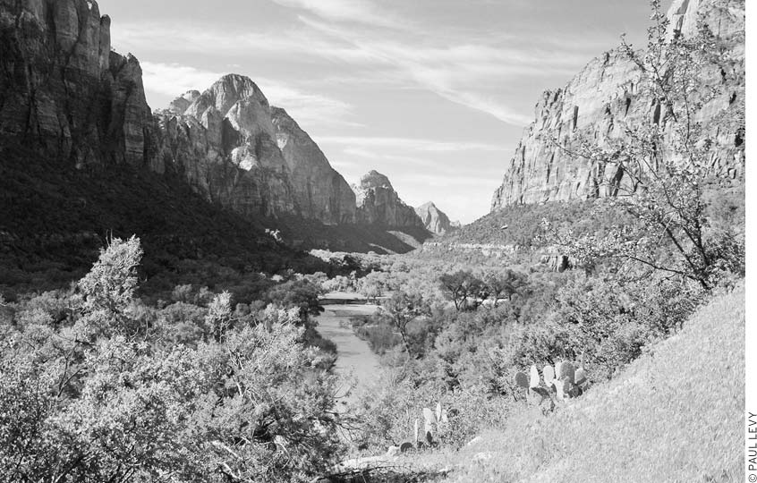
The Virgin River lies at the bottom of Zion Canyon.
Visitors short on time should drop in at the Zion Canyon Visitor Center and ride the shuttle along Zion Canyon Scenic Drive, stopping for short walks on the Weeping Rock and Riverside Walk trails. If you have a full day, you can also include an easy hike to the Emerald Pools or an ambitious trek up to Angels Landing.
It’s always worth spending part of a day hiking with a park ranger. If you can join a ranger hike, spend the morning of your second day going wherever the ranger leads you. In the afternoon, depending on your energy, hike to Weeping Rock (short) or Hidden Canyon (longer).
After this, it’s time for longer hikes: Angels Landing is a classic for those who are in good shape and not afraid of heights. Alternatively, if weather conditions and your own abilities are suitable, the hike up the Virgin River (largely in the river) is a spectacular way to spend another full day.
For visitors with more time and a desire to leave busy Zion Canyon, the Kolob is great for longer hikes. It’s also worth taking just a couple of hours to drive Kolob Canyons Road, which begins at I-15. Motorists with more time may also want to drive Kolob Terrace Road to Lava Point for another perspective of the park; this drive is about 44 miles round-trip from the town of Virgin and has some unpaved sections.
Zion National Park (435/772-3256, www.nps.gov/zion, $25 per vehicle, $12 pedestrians, bicyclists, and motorcyclists) is 43 miles northeast of St. George, 60 miles south of Cedar City, 41 miles northwest of Kanab, and 86 miles southwest of Bryce Canyon National Park. There are two entrances to the main section of the park: From Springdale, you enter the south end of Zion Canyon, near the visitors center and the Zion Canyon shuttle buses; from the east, you come in on the Zion-Mt. Carmel Highway, pass through a long tunnel, then pop into Zion Canyon a few miles north of the visitors center.
There’s also a separate entrance for the Kolob Canyons area, in the park’s northwest corner. A third entrance leads to the less-traveled part of the park and is accessed by the Kolob Terrace Road, which heads north from Highway 9 at the tiny town of Virgin and goes to backcountry sites. (There’s no entrance station on Kolob Terrace Road.) Kolob Canyons Road, in the extreme northwestern section of the park, begins just off I-15’s exit 40 at the Kolob Canyons Visitor Center and climbs to an overlook for great views of the Finger Canyons of the Kolob; the drive is 10 miles round-trip.
Large RVs and bicycles must heed special regulations for the long tunnel on the Zion-Mt. Carmel Highway.
The park’s sprawling visitors center (8am-6pm daily winter-spring, 8am-7:30pm daily summer, 8am-5pm daily fall), between Watchman and South Campgrounds, is a hub of activity. The plaza outside the building features several interpretive plaques, including some pointing out environmentally sensitive design features of the visitors center. Inside, a large area is devoted to backcountry information; staff members can answer your questions about various trails, give you updates on the weather forecast, and help you arrange a shuttle to remote trailheads. The backcountry desk opens at 7am daily late April-late October, an hour earlier than the rest of the visitors center. A Backcountry Shuttle Board allows hikers to coordinate transportation between trailheads.
The busiest part of the visitors center is the bookstore, stocked with an excellent selection of books covering natural history, human history, and regional travel. Topographic and geologic maps, posters, and postcards are also sold here.
Although it is small and has just a handful of exhibits, this visitors center (435/772-3256, 8am-6pm daily summer, 8am-5pm daily spring and fall, 9am-5pm winter) is a good place to stop for information on exploring the Kolob region. Hikers can learn about current trail conditions and obtain the permits required for overnight trips and Zion Narrows day trips. Books, topographic and geologic maps, posters, postcards, slides, and film are sold. The visitors center and the start of Kolob Canyons Road are just off I-15’s exit 40.
With the exception of ranger-led hikes, Zion Canyon Field Institute classes, horseback rides from Zion Lodge, and the running commentary from the more loquacious shuttle-bus drivers, Zion is a do-it-yourself park. Outfitters are not permitted to lead trips within the park. If you’d like a guided tour outside park boundaries, there are several outfitters in Springdale that lead biking, canyoneering, and climbing trips.
The best way to get a feel for Zion’s impressive geology and variety of habitats is to take a hike with a park ranger. Many nature programs and hikes are offered late March-November; check the posted schedule at the Zion Canyon Visitor Center. Children’s programs, including the popular Junior Ranger program, are held Memorial Day-Labor Day at Zion Nature Center near South Campground; ask at the visitors center for details.
The Zion Canyon Field Institute (435/7723265, www.zionpark.org) is authorized to run educational programs in the park, which include animal tracking, photography, and archaeology; fees vary.
At the northern end of South Campground, the Zion Nature Center (noon-5pm daily summer) houses programs for kids, including Junior Ranger activities for ages 6-12. Although there’s no shuttle stop for the Nature Center, it’s an easy walk along the Pa’rus Trail from the Zion Canyon Visitor Center or the Human History Museum. Check the park newsletter for kids’ programs and family hikes. Programs focus on natural history topics such as insects and bats in the park. Many Junior Ranger activities can be done on your own—pick up a booklet ($1) at the visitors center bookstore.
The old park visitors center has been retooled as the Zion Human History Museum (9am-7pm daily summer, 10am-6pm daily spring, 9am-6pm daily fall, closed Dec.-early Mar.), covering southern Utah’s cultural history with a schmaltzy film introducing the park and fairly bare-bones exhibits focusing on Native American and Mormon history. It’s at the first shuttle stop after the visitors center. This is a good place to visit when you’re too tired to hike any farther or if the weather forces you to seek shelter.
During the busy seasons, April-October, the road is closed to private cars, and you must travel up and down Zion Canyon in a shuttle bus (90 minutes round-trip, free). Most visitors find the shuttle an easy and enjoyable way to visit the following sites.
A short trail from the parking area leads to the viewpoint. The Patriarchs, a trio of peaks to the west, overlook Birch Creek; they are, from left to right, Abraham, Isaac, and Jacob. Mount Moroni, the reddish peak on the far right, partially blocks the view of Jacob. Although the official viewpoint is a beautiful place to relax and enjoy the view, you’ll get an even better view if you cross the road and head about 0.5 miles up Sand Bench Trail.
Rustic Zion Lodge (435/772-7700 or 888/297-2757, www.zionlodge.com), with its big front lawn, spacious lobby, snack bar, restaurant, and restrooms, is a natural stop for most park visitors. You don’t need to be a guest at the lodge to enjoy the ambiance of its public areas, and the snack bar is not a bad place to grab lunch.
Cross the road from the lodge to catch the Emerald Pools trails, or walk a 0.5 miles north from the Zion Lodge shuttle stop to reach the Grotto.
The Grotto is a popular place for a picnic. From here, a trail leads back to the lodge, and across the road, the Kayenta Trail links up with the Emerald Pools trails or goes farther on to Angels Landing.
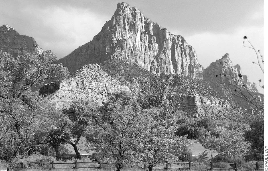
Visible from several points along Zion Canyon Drive is the Great White Throne. Topping out at 6,744 feet, this bulky chunk of Navajo sandstone has become, along with the Three Patriarchs, emblematic of the park. Ride the shuttle in the evening to watch the rock change color in the light of the setting sun.
Several trails, including the short and easy Weeping Rock Trail, start here. Weeping Rock is home to hanging gardens and many moisture-loving plants, including the striking Zion shooting star. The rock “weeps” because this is a boundary between porous Navajo sandstone and denser Kayenta shale. Water trickles down through the sandstone, and when it can’t penetrate the shale, it moves laterally to the face of the cliff.
While you’re at Weeping Rock, scan the cliffs for the remains of cables and rigging that were used to lower timber from the top of the rim down to the canyon floor. During the early 1900s, this wood was used to build pioneer settlements in the area.
Look up: This is where you’re likely to see rock climbers on the towering walls or hikers on Angels Landing. Because outfitters aren’t allowed to bring groups into the park, these climbers presumably are quite experienced and know what they’re doing.
The last shuttle stop is at this canyon, where 2,000-foot-tall rock walls reach up from the sides of the Virgin River. There’s not really enough room for the road to continue farther up the canyon, but it’s spacious enough for a fine paved wheelchair-accessible walking path. The Riverside Walk heads one mile upstream to the Virgin Narrows, a place where the canyon becomes too narrow even for a sidewalk to squeeze through. You may see people hiking up the Narrows (in the river) from the end of the Riverside Walk. Don’t join them unless you’re properly outfitted.
The east section of the park is a land of sandstone slickrock, hoodoos, and narrow canyons. You can see much of the dramatic scenery along the Zion-Mt. Carmel Highway (Hwy. 9) between the east entrance station and Zion Canyon. Most of this region invites exploration on your own. Try hiking a canyon or heading up a slickrock slope (the pass between Crazy Quilt and Checkerboard Mesas is one possibility). Highlights on the plateau include views of the White Cliffs and Checkerboard Mesa, both near the east entrance station, and a hike on the Canyon Overlook Trail, which begins just east of the long tunnel. Checkerboard Mesa’s distinctive pattern is caused by a combination of vertical fractures and horizontal bedding planes, both accentuated by weathering. The highway’s spectacular descent into Zion Canyon goes first through a 530-foot tunnel, then a 5,600-foot tunnel, followed by a series of six switchbacks to the canyon floor. Because the tunnel, completed in 1930, is narrow, any vehicle more than 7 feet, 10 inches wide, 11 feet, 4 inches high, or 40 feet long (50 feet with trailer) must be escorted through in oneway traffic; a $15 fee, good for two passages, is charged at the tunnel to do this. Bicycles must be carried through the long tunnel on a car or truck; it’s too dangerous to ride.
hanging garden at Weeping Rock
North and west of Zion Canyon is the remote backcountry of the Kolob. This area became a second Zion National Monument in 1937, and then was added to Zion National Park in 1956. From here you’ll see all but one of the rock formations in the park and evidence of past volcanic eruptions. Two roads lead into the Kolob. The paved five-mile Kolob Canyons Road begins at the Kolob Canyons Visitor Center just off I-15 and ends at the Timber Creek Overlook and picnic area; it’s open year-round. Kolob Terrace Road is paved from the town of Virgin (Hwy. 9, 15 miles west of the south entrance station) and runs 20 steep miles to the turnoff for Lava Point; snow usually blocks the way in winter.
This five-mile scenic drive winds past the dramatic Finger Canyons of the Kolob to Timber Creek Overlook and a picnic area at the end of the road. The road is paved and has many pullouts where you can stop to admire the scenery. The first part of the drive follows the 200-mile-long Hurricane Fault, which forms the west edge of the Markagunt Plateau. Look for the tilted rock layers deformed by friction as the plateau rose nearly one mile. Taylor Creek Trail, which begins two miles past the visitors center, provides a close look at the canyons.
In the late 1990s, visitors to Zion remembered the traffic nearly as vividly as they remembered the Great White Throne: Throughout much of the summer, the canyon road was simply a parking lot for enormous RVs. To relieve the congestion, the National Park Service has instituted an April-October shuttle bus service through the canyon.
There are actually two separate bus lines: One line travels between Springdale and the park entrance, stopping within a short walk of every Springdale motel and near several large visitor parking lots; the other bus line starts just inside the park entrance, at the visitors center, and runs the length of Zion Canyon Road, stopping at scenic overlooks, trailheads, and Zion Lodge. Lodge guests may obtain a pass authorizing them to drive to the lodge, but in general, private vehicles are not allowed to drive up Zion Canyon.
This is less of a pain than it might seem. It’s still fine to drive to the campgrounds; in fact, the road between the park entrance and the Zion-Mt. Carmel Highway junction is open to all vehicles. Buses run frequently, so there’s rarely much of a wait, and most of the bus drivers are friendly and well-informed, offering an engaging commentary on the sights that they pass (even pointing out rock climbers on the canyon walls).
If you get to Zion before 10am or after 3pm, there may be parking spaces available in the visitors center lot. Midday visitors should just park in Springdale (at your motel or in a public lot) and catch a shuttle bus to the park entrance.
Riding the bus is free; its operating costs are included in the park admission fee. Buses run as often as every six minutes 5:30am-11pm daily, less frequently early in the morning and in the evening. No pets are allowed on the buses. November-March, private vehicles are allowed on all roads, and the buses are out of service.
Zion Canyon Scenic Drive is a six-mile road that follows the North Fork of the Virgin River upstream. Impressive natural formations along the way include the Three Patriarchs, Mountain of the Sun, Lady Mountain, Great White Throne, Angels Landing, and Weeping Rock. The bus stops at eight points of interest along the way; you can get on and off the bus as often as you want at these stops. The road ends at Temple of Sinawava and the beginning of the Riverside Walk Trail.
Zion Canyon shuttle
Lee Pass, four miles beyond the visitors center, was named after John D. Lee, who was the only person ever convicted of a crime in the infamous Mountain Meadows Massacre; he’s believed to have lived nearby for a short time after the 1857 incident, in which a California-bound wagon train was attacked by an alliance of Mormons and local Native Americans. About 120 people in the wagon train were killed. Only small children too young to tell the story were spared. The close-knit Mormon community tried to cover up the incident and hindered federal attempts to apprehend the killers. Only Lee, who was in charge of Indian affairs in southern Utah at the time, was ever brought to justice; he was later executed.
East of Zion Canyon, Checkerboard Mesa’s unusual facade is due to oppositional fracturing.
La Verkin Creek Trail begins at Lee Pass Trailhead and offers trips to Kolob Arch and beyond. Signs at the end of the road identify the points, buttes, mesas, and mountains. The salmon-colored Navajo sandstone cliffs glow a deep red at sunset. Timber Creek Overlook Trail begins from the picnic area at road’s end and climbs 0.5 miles to the overlook (elevation 6,369 feet); views encompass the Pine Valley Mountains, Zion Canyon, and distant Mount Trumbull.
The Kolob Terrace section of the park is a high plateau roughly parallel to and west of Zion Canyon. From the town of Virgin, the road runs north through ranch land and up a narrow tongue of land, with drop-offs on either side, and then the land widens into a high plateau. The Hurricane Cliffs rise from the gorge to the west, and the back side of Zion Canyon’s big walls are to the east. The road passes in and out of the park and terminates at Kolob Reservoir, a popular boating and fishing destination outside the park. This section of the park is much higher than Zion Canyon, so it is a good place to explore when the canyon swelters in the summertime. It’s also much less crowded than the busy canyon.
The panorama from Lava Point (elevation 7,890 feet) takes in the Cedar Breaks area to the north, the Pink Cliffs to the northeast, Zion Canyon Narrows and tributaries to the east, the Sentinel and other monoliths of Zion Canyon to the southeast, and Mount Trumbull on the Arizona Strip to the south. Signs help identify features. Lava Point, which sits atop a lava flow, is a good place to cool off in summer—temperatures are about 20 degrees cooler than in Zion Canyon. Aspen, ponderosa pine, Gambel oak, and white fir grow here. A small primitive campground near the point offers sites during warmer months (free) but there is no water. From Virgin, take the Kolob Terrace Road about 21 miles north to the Lava Point turnoff; the viewpoint is 1.8 miles farther on a well-marked spur road.
This high-country lake north of Lava Point has good fishing for rainbow trout. An unpaved boat ramp is at the south end near the dam. People sometimes camp along the shore, although there are no facilities. Most of the surrounding land is private. To reach the reservoir, continue north 3.5 miles on Kolob Terrace Road from the Lava Point turnoff. The fair-weather road can also be followed past the reservoir to the Cedar City area. Blue Springs Reservoir, near the turnoff for Lava Point, is closed to the public.
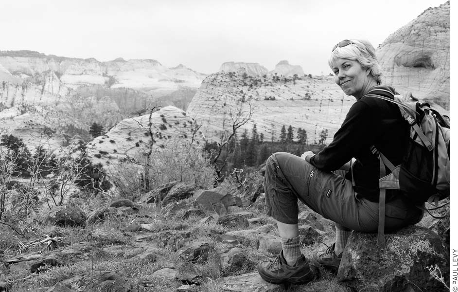
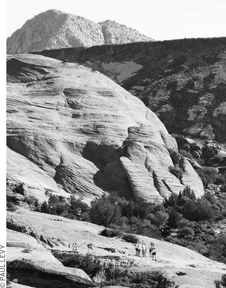
The Kolob Terrace overlooks Zion National Park’s canyons.
Zion’s hiking trails are tailored to all abilities, making it easy to explore. Both the Pa’rus Trail and Riverside Walk are wheelchair accessible. Casual hikers can spend several days riding the shuttle bus up Zion Canyon and hopping off for short hikes. These hikes, past lush hanging gardens or up to vertiginous viewpoints, may whet your appetite for extended backpacking trips or an in-water hike up the Virgin River Narrows.
Experienced hikers can do countless off-trail routes in the canyons and plateaus surrounding Zion Canyon; rangers can suggest areas. Rappelling and other climbing skills may be needed to negotiate drops in some of the more remote canyons. Groups cannot exceed 12 hikers per trail or drainage. Overnight hikers must obtain backcountry permits from the Zion Canyon or Kolob Canyons visitors centers or from https://zionpermits.nps.gov. The permit fees are based on group size: $10 for 1-2 people, $15 for 3-7, and $20 for 8-12. Some areas of the park—mainly those near roads and major trails—are closed to overnight use. Ask about shuttles to backcountry trailheads outside Zion Canyon at the visitors center’s backcountry desk (435/772-0170). Shuttles are also available from Zion Rock and Mountain Guides (435/772-3303) and the Zion Adventure Company (435/772-1001) in Springdale.
The trails in Zion Canyon provide perspectives of the park that are not available from the roads. Many of the hiking trails require long ascents but aren’t too difficult at a leisurely pace. Carry water on all but the shortest walks. Descriptions of the following trails are given in order from the mouth of Zion Canyon to the Virgin River Narrows.
• Distance: 3.5 miles round-trip
• Duration: 2 hours
• Elevation change: 50 feet
• Effort: easy
• Trailheads: South Campground and Canyon Junction
• Shuttle stops: Zion Canyon Visitor Center and Canyon Junction
This paved, wheelchair-accessible trail runs from South Campground to the Canyon Junction shuttle-bus stop. For most of its distance, it skirts the Virgin River, and it makes for a nice early-morning or evening stroll. Listen for the trilling song of the canyon wren, then try to spot the small bird in the bushes. The Pa’rus Trail is the only trail in the park open to bicycles and pets.
• Distance: 2.7 miles round-trip
• Duration: 2 hours
• Elevation change: 370 feet
• Effort: easy-moderate
• Trailhead: just north of Watchman Campground
• Shuttle stop: Zion Canyon Visitor Center
No, this hike doesn’t go to the top of 6,555-foot Watchman Peak, but it does lead to a mesa southeast of the visitors center with a good view of this prominent mountain. The hike starts off fairly unspectacularly, but it gets more interesting as it gains elevation. Be sure to look back over your shoulder for views of Zion Canyon’s high walls.
At the top of the mesa, the Watchman pops into view. The short mesa-top loop trail is worth taking for its views of Springdale and its nice assortment of wildflowers, including barrel cacti.
During the middle of the day, this trail can bake in the sun. Try to hike it on a cool day or early or late in the day. In fact, it’s a good shakedown hike to do on the evening you arrive at Zion. As soon as the sun drops behind the canyon walls, set out—on long summer evenings, you’ll have plenty of time to complete it before dark.
• Distance: 1.7 miles round-trip
• Duration: 3 hours
• Elevation change: 500 feet
• Effort: easy
• Trailhead: Zion Lodge
• Shuttle stops: Court of the Patriarchs or Zion Lodge
This loop trail has good views of the three Patriarchs, the Streaked Wall, and other monuments of lower Zion Canyon. During the main season, Zion Lodge organizes three-hour horseback rides on the trail. The horses churn up dust and leave an uneven surface, though, so hikers usually prefer to go elsewhere during those times. The trail soon leaves the riparian forest along Birch Creek and climbs onto the dry benchland. Piñon pine, juniper, sand sage, yucca, prickly pear cactus, and other high-desert plants and animals live here. Hikers can get off the shuttle at the Court of the Patriarchs Viewpoint, walk across the scenic drive, and then follow a service road to the footbridge and trailhead. A 1.2-mile trail along the river connects the trailhead with Zion Lodge. In warmer months, try to hike in the early morning or late afternoon.
• Distance: 0.6 miles one-way to Lower Emerald Pool; 1 mile to Middle Emerald Pool; 1.4 miles to Upper Emerald Pool
• Duration: 1-3 hours
• Elevation change: 70 feet to Lower Emerald Pool; 150 feet to Middle Emerald Pool; 350 feet to Upper Emerald Pool
• Effort: easy-moderate
• Trailhead: across the footbridge from Zion Lodge
• Shuttle stop: Zion Lodge
Three spring-fed pools, small waterfalls, and views of Zion Canyon make this hike a favorite. You have a choice of three trails. The easiest is the paved trail to the Lower Pool; cross the footbridge near Zion Lodge and turn right. The Middle Pool can be reached by continuing 350 yards on this trail or by taking a totally different trail from the footbridge at Zion Lodge (after crossing the bridge, turn left, then right up the trail). Together these trails make a 1.8-mile round-trip loop. A third trail begins at the Grotto Picnic Area, crosses a footbridge, and turns left before continuing for 0.7 miles; the trail forks left to the Lower Pool and right to the Middle Pool. A steep 0.4-mile trail leads from the Middle Pool to Upper Emerald Pool. This magical spot has a white sand beach and towering cliffs rising above. Don’t expect to find solitude; these relatively easy trails are quite popular.
• Distance: 5.4 miles round-trip
• Duration: 4 hours
• Elevation change: 1,488 feet
• Effort: strenuous
• Trailhead: Grotto Picnic Area
• Shuttle stop: The Grotto
This strenuous trail leads to some of the best views of Zion Canyon. Start from Grotto Picnic Area (elevation 4,300 feet) and cross the footbridge, then turn right along the river. The trail climbs the slopes and enters the cool and shady depths of Refrigerator Canyon. Walter’s Wiggles, a series of 21 closely spaced switchbacks, wind up to Scout Lookout and a trail junction—it’s four miles round-trip and a 1,050-foot elevation gain if you decide to turn around here. Scout Lookout has fine views of Zion Canyon. The trail is paved and well graded to this point. Turn right at the junction and continue 0.5 miles to the summit of Angels Landing.
Angels Landing rises as a sheer-walled monolith 1,500 feet above the North Fork of the Virgin River. Although the trail to the summit is rough, chains provide security in the more exposed places. The climb is safe with care and good weather, but don’t go if the trail is covered with snow or ice or if thunderstorms threaten. Children must be closely supervised, and people who are afraid of heights should skip this trail. Once on top, you’ll see why Angels Landing got its name—the panorama makes all the effort worthwhile. It’s most pleasant to do this hike during the cooler morning hours.
Energetic hikers can continue 4.8 miles on the main trail from Scout Lookout to West Rim Viewpoint, which overlooks the Right Fork of North Creek. This strenuous 12.8-mile round-trip hike from Grotto Picnic Area includes 3,070 feet of elevation gain. West Rim Trail continues through Zion’s backcountry to Lava Point (elevation 7,890 feet), where there’s a primitive campground. A car shuttle and one or more days are needed to hike the 13.3 miles (one-way) from Grotto Picnic Area. You’ll have an easier hike if you start at Lava Point and hike down to the picnic area; even so, be prepared for a long day hike. The trail has little or no water in some seasons.
• Distance: 0.5 miles round-trip
• Duration: 30 minutes
• Elevation change: 100 feet
• Effort: easy
• Trailhead: Weeping Rock parking area
• Shuttle stop: Weeping Rock
A favorite with visitors, this easy trail winds past lush vegetation and wildflowers to a series of cliff-side springs above an overhang. Thousands of water droplets glisten in the afternoon sun. The springs emerge where water seeping through more than 2,000 feet of Navajo sandstone meets a layer of impervious shale. Signs along the way identify some of the trees and plants.
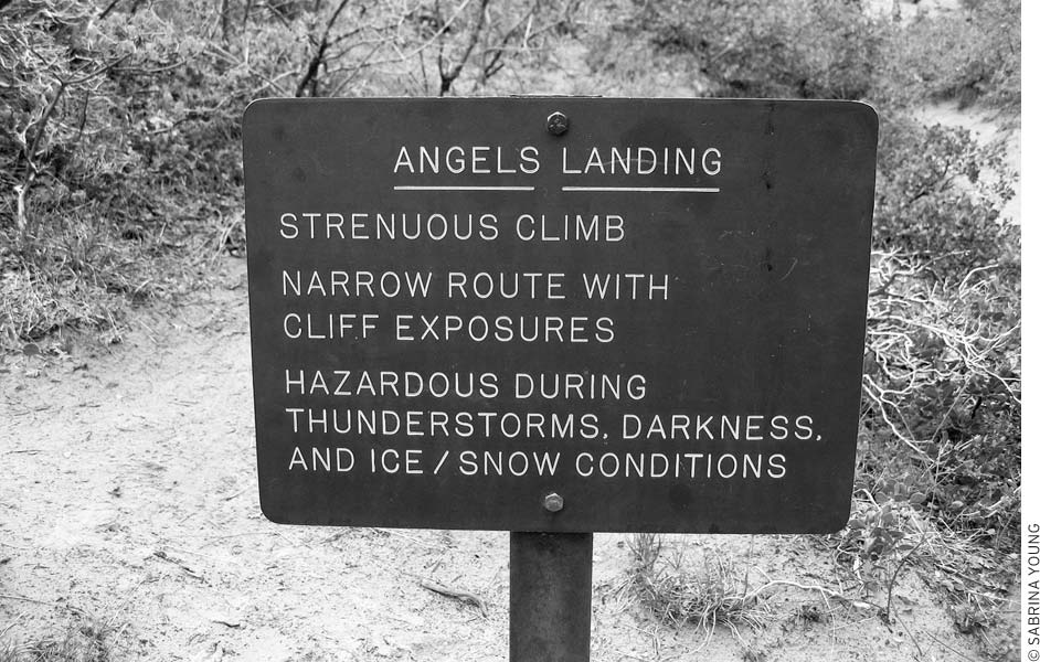
Everything this sign says about the trail to Angels Landing is true!
• Distance: 8 miles round-trip
• Duration: 5 hours
• Elevation change: 2,148 feet
• Effort: strenuous
• Trailhead: Weeping Rock parking area
• Shuttle stop: Weeping Rock
This strenuous trail climbs to Observation Point (elevation 6,507 feet) on the edge of Zion Canyon. Trails branch off along the way to Hidden Canyon, upper Echo Canyon, the east entrance, East Mesa, and other destinations. The first of many switchbacks begins a short way up from the trailhead at Weeping Rock parking area. You’ll reach the junction for Hidden Canyon Trail after 0.8 miles. Several switchbacks later, the trail enters sinuous Echo Canyon. This incredibly narrow chasm can be explored for short distances upstream and downstream to deep pools and pour-offs. Echo Canyon Trail branches to the right at about the halfway point; this rough trail continues farther up the canyon and connects with trails to Cable Mountain, Deertrap Mountain, and the east entrance station (on Zion-Mt. Carmel Highway). The East Rim Trail then climbs slickrock slopes above Echo Canyon with many fine views. Parts of the trail are cut right into the cliffs; this work was done in the 1930s by the Civilian Conservation Corps. You’ll reach the rim at last after three miles of steady climbing, and then it’s an easy 0.6 miles hike through a forest of piñon pine, juniper, Gambel oak, manzanita, sage, and some ponderosa pine to Observation Point. Impressive views take in Zion Canyon below and mountains and mesas all around. The East Mesa Trail turns right about 0.3 miles before Observation Point and follows the plateau northeast to a dirt road outside the park.
hiking Zion’s trails
• Distance: 3 miles round-trip
• Duration: 2.5-3 hours
• Elevation change: 850 feet
• Effort: strenuous
• Trailhead: Weeping Rock parking area
• Shuttle stop: Weeping Rock
See if you can spot the entrance to Hidden Canyon from below. Inside the narrow canyon are small sandstone caves, a little natural arch, and diverse plantlife. The high walls, rarely more than 65 feet apart, block sunlight except for a short time at midday. From the trailhead at the Weeping Rock parking area, follow the East Rim Trail 0.8 miles up the cliff face, then turn right and go 0.7 miles on Hidden Canyon Trail to the canyon entrance. Footing can be a bit difficult in places, but chains provide handholds on the exposed sections. Steps chopped into the rock just inside Hidden Canyon help bypass some deep pools. After heavy rains and spring runoff, the creek forms a small waterfall at the canyon entrance. The canyon itself is about one mile long and mostly easy walking, although the trail fades away. Look for the arch on the right about 0.5 miles up the canyon.
• Distance: 2.2 miles round-trip
• Duration: 1.5-2 hours
• Elevation change: 57 feet
• Effort: easy
• Trailhead: Temple of Sinawava parking area
• Shuttle stop: Temple of Sinawava
This is one of the most popular hikes in the park, and except for the Pa’rus, it’s the easiest. The nearly level paved trail begins at the end of Zion Canyon Scenic Drive and heads upstream along the Virgin River to the Narrows. Allow about two hours to fully take in the scenery—it’s a good place to get a close-up view of Zion’s lovely hanging gardens. Countless springs and seeps on the canyon walls support luxuriant plant growth and swamps. Most of the springs occur at the boundary between the porous Navajo sandstone and the less permeable Kayenta Formation below. The water and vegetation attract abundant wildlife; keep an eye out for birds and animals and their tracks. Late morning is the best time for photography. In autumn, cottonwoods and maples display bright splashes of color. At trail’s end, the canyon is wide enough only for the river. Hikers continuing upstream on the Narrows hike must wade and sometimes even swim.
• Distance: 16 miles one-way
• Duration: 12 hours
• Elevation change: 200 feet
• Effort: strenuous
• Trailheads: end of Riverside Walk or Chamberlain’s Ranch
• Shuttle stop: Temple of Sinawava
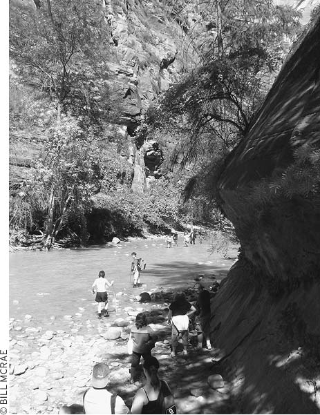
entering the Narrows
Upper Zion Canyon is probably the most famous backcountry area in the park, yet it’s also one of the most strenuous. There’s no trail and you’ll be wading in the river much of the time, which can be knee- to chest-deep. In places, the high fluted walls of the upper North Fork of the Virgin River are only 20 feet apart, and very little sunlight penetrates the depths. Mysterious side canyons beckon.
Hikers should be well prepared and in good condition—river hiking is more tiring than hiking over dry land. The major hazards are flash floods and hypothermia. Finding the right time to go through can be tricky: Spring runoff is too high, summer thunderstorms bring hazardous flash floods, and winter is too cold. That leaves just early summer (mid-June-mid-July) and early autumn (mid-Sept.-mid-Oct.) as the best bets. You can get through the entire 16-mile (one-way) Narrows in about 12 hours, although two days is best to enjoy the beauty of the place. Children under 12 shouldn’t attempt to hike the entire canyon.
Don’t be tempted to wear river sandals or sneakers up the Narrows; it’s easy to twist an ankle on the slippery rocks. If you have a pair of hiking boots that you don’t mind drenching, they’ll work, but an even better solution is available from the Zion Adventure Company (36 Lion Blvd., Springdale, 435/772-1001, www.zionadventures.com) and other Springdale outfitters. They rent specially designed river-hiking boots, along with neoprene socks, walking sticks, and in cool weather, dry suits. Boots, socks, and sticks rent for $21 for the first day, $10.50 for each additional day; with a dry suit the package costs $49 for the first day, $24.50 for each additional day. They also provide a valuable orientation to hiking the Narrows and lead tours of the section below Orderville Canyon (about $150 pp, depending on group size and the season).
Talk with rangers at the Zion Canyon Visitor Center before starting a trip; they also have a handout with useful information on planning a Narrows hike. No permit is needed if you’re just going partway in and back in one day, although you must first check conditions and the weather forecast with rangers. Permits are required for overnight hikes, which must be “top down,” starting at Chamberlain’s Ranch and hiking downstream to the Riverside Walk; get permits from the backcountry desk at the visitors center the day before you plan to hike or the morning of your hike (7am-noon) or by applying at https://zionpermits.nps.gov. You will also be issued a plastic bag specially designed to collect human waste. Only one-night stays are allowed. No camping is permitted below Big Springs. Group size for hiking and camping is limited to 12 along the entire route.
A downstream hike saves not only climbing but also the work of fighting the river currents. If you’re planning to hike the full length of the Narrows, it is strongly recommended that you take the downstream route. The main hitch is that this requires a shuttle to the upper trailhead near Chamberlain’s Ranch, reached via an 18-mile dirt road that turns north from Highway 9 east of the park. The lower trailhead is at the end of the Zion Canyon Scenic Drive. The elevation change is 1,280 feet. During the summer, Zion Rock and Mountain Guides (1458 Zion Park Blvd., 435/772-3303, www.zionrockguides.com, 6:30am and 9:30am, $35 pp) offers a daily shuttle to Chamberlain’s Ranch. Make shuttle reservations 9am-6pm the day before you want to ride. There is a small discount in the fare if you also rent gear from them. Zion Adventure Company (435/772-1001, www.zionadventures.com) has a similar service.
A good half-day trip begins at the end of the Riverside Walk and follows the Narrows 1.5 miles (about 2 hours) upstream to Orderville Canyon, then back the same way. Orderville Canyon makes a good destination itself; you can hike quite a ways up from Zion Canyon.
You can’t take the park shuttle bus to trailheads east of Zion Canyon, although the long-distance East Rim Trail, which starts just inside the park’s eastern boundary, joins trails that lead down into Zion Canyon’s Weeping Rock trailhead.
• Distance: 1 mile round-trip
• Duration: 1 hour
• Elevation change: 163 feet
• Effort: easy
• Trailhead: parking area just east of the long (westernmost) tunnel on the Zion-Mt. Carmel Highway
This fun hike starts on the road east of Zion Canyon and features great views from the heights without the stiff climbs found on most other Zion trails. A booklet available at the start or at the Zion Canyon Visitor Center describes the geology, plantlife, and clues to the presence of wildlife. The trail winds in and out along the ledges of Pine Creek Canyon, which opens into a great valley. Panoramas at trail’s end take in lower Zion Canyon in the distance. A sign at the viewpoint identifies Bridge Mountain, Streaked Wall, East Temple, and other features. The Great Arch of Zion—termed a “blind arch” because it’s open only on one side—is below; the arch is 580 feet high, 720 feet long, and 90 feet deep.
• Distance: 10.6 miles one-way
• Duration: 6-8 hours
• Elevation change: 1,340 feet
• Effort: strenuous
• Trailheads: east entrance of Zion National Park; Weeping Rock trailhead
This trail is best done as a one-way trek. It’s possible to do it as a long day hike but beautiful enough to encourage a slower-paced overnight trip. The great views start with a look at Checkerboard Mesa and continue as the big features of Zion Canyon come into view. The first half of the hike involves a steady climb, but then the trail tops out on a mesa and finishes by dropping into Zion Canyon. This downhill stretch is amazingly beautiful—even the slickrock that you walk on in places seems like a work of art. In the slickrock section, keep an eye out for the rock cairns that mark the way.
The Observation Point trail joins this trail at nine miles; it’s a steep two miles on this spur trail to Observation Point. The main trail continues down a paved path to Weeping Rock and the Zion Canyon shuttle bus.
The East Rim Trail tops out at 6,725 feet, high enough that snow may linger into the spring. Check with the staff at the visitors center backcountry desk if you’re hiking early in the season.
During the summer, this area of the park can be extremely hot, and in the early spring, it’s often too muddy to hike. These trails, which head north from Highway 9 west of the town of Springdale, are accessible without paying the park entrance fee.
• Distance: 5 miles round-trip
• Duration: 2.5 hours
• Elevation change: 163 feet
• Effort: easy
• Trailhead: Highway 9, about 6 miles west of park entrance, near a power substation
From the parking area, this trail heads up Huber Wash through painted desert and canyons. One of the highlights of hiking in this area, besides the desert scenery, is the abundance of petrified wood. There’s even a logjam of petrified wood at the 2.5-mile mark, where the trail ends in a box canyon decked with a hanging garden. If you’re up for a tricky climb over the petrified logjam, you can clamber up and catch the Chinle Trail, then hike five miles back to the road. The Chinle Trail emerges onto Highway 9 about 2.5 miles east of the Huber Wash trailhead.
This is an ideal autumn hike. Even then, it’ll be quite warm. Remember to bring plenty of water.
• Distance: 3.5 miles round-trip
• Duration: 2 hours
• Elevation change: 100 feet
• Effort: easy
• Trailhead: Highway 9, about 7.3 miles west of park entrance. The trailhead parking area may not be marked; it’s between Rockville and Virgin, almost directly across Highway 9 from the turnoff to Grafton.
At 3,666 feet, the Coalpits Wash trailhead is the lowest spot in Zion. This low elevation makes it an ideal winter hike, and it’s also the best place to look for early spring wildflowers, including mariposa lilies, purple sagebrush, and pale evening primrose. Birders also like this shrubby area. If you have the opportunity to take a ranger-led tour up this wash, take it—you’ll likely be introduced to many new plants.
The stream in this wash carries water for much of the year. After about 1.5 miles, Coalpits joins Scroggins Wash. Though most hikers turn around at this point, it’s possible to keep going up the ever-narrowing wash (the Chinle Trail joins in at 3.75 miles) and turn this into a good cool-season backpacking trip.
Access these hikes from Kolob Canyons Road, which begins at I-15 south of Cedar City. You’re likely to have the trails to yourself in this section of the park.
• Distance: 5 miles round-trip
• Duration: 4 hours
• Elevation change: 450 feet
• Effort: easy-moderate
• Trailhead: 2 miles east of Kolob Canyons Visitor Center, left side of the road
This excellent day hike from Kolob Canyons Road heads upstream into the canyon of the Middle Fork of Taylor Creek. Double Arch Alcove is 2.7 miles from the trailhead; a dry fall 350 yards farther blocks the way (water flows over it during spring runoff and after rains). A giant rockfall occurred here in June 1990. From this trail you can also explore the North Fork of Taylor Creek. A separate trail along the South Fork of Taylor Creek leaves the drive at a bend 3.1 miles from the visitors center, then goes 1.2 miles upstream beneath steep canyon walls.
• Distance: 14 miles round-trip
• Duration: 8 hours
• Elevation change: 700 feet
• Effort: strenuous
• Trailhead: Lee Pass
Kolob Arch vies with Landscape Arch in Arches National Park as the world’s longest natural rock span. Differences in measurement techniques have resulted in controversy: Kolob Arch’s span has been measured variously at 292-310 feet, while Landscape Arch measures at 291-306 feet. Kolob probably takes the prize because its 310-foot measurement was done using an accurate electronic method. Kolob’s height is 330 feet, and its vertical thickness is 80 feet. The arch makes a fine destination for a backpacking trip. Spring and autumn are the best seasons to go; summer temperatures rise above 90°F, and winter snows make the trails hard to follow.
You have a choice of two moderately difficult trails. La Verkin Creek Trail begins at Lee Pass (elevation 6,080 feet) on Kolob Canyons Scenic Drive, four miles beyond the visitors center. The trail drops into Timber Creek (intermittent flow), crosses over hills to La Verkin Creek (flows year-round), then turns up side canyons to the arch. The 14-mile round-trip hike can be done as a long day trip, but you’ll enjoy the best lighting for photos at the arch if you camp in the area and see it the following morning. Carry plenty of water for the return trip; the climb to the trailhead can be hot and tiring.
From the town of Virgin, Kolob Terrace Road runs north and passes several trailheads, including the Subway, a popular canyoneering spot, and a couple of great trails at Lava Point. These trails are far less traveled than those in Zion Canyon, and at about 7,000 feet, they stay fairly cool in summer.
Snow blocks the access road to Lava Point for much of the year; the usual season is May or June-early November. Check road conditions with the Zion Canyon or Kolob Canyons Visitor Center. From the south entrance station in Zion Canyon, drive west 15 miles on Highway 9 to Virgin, travel north 21 miles on Kolob Terrace Road (signed for “Kolob Reservoir”), then turn right and continue 1.8 miles to Lava Point.
• Distance: 9 miles round-trip
• Duration: 7 hours
• Elevation change: 2,000 feet
• Effort: strenuous
• Trailheads: Left Fork or Wildcat Canyon
The Left Fork of North Creek, a.k.a. “The Subway,” is a special semitechnical canyoneering hike for strong swimmers. This challenging day hike involves, at the very least, lots of route-finding, many stream crossings, and some rope work. Obviously, the Left Fork is not for everyone.
Like the Narrows, the Left Fork can be hiked either partway up and then back down, starting and ending at the Left Fork Trailhead; or, with a shuttle, from an upper trailhead at Wildcat Canyon downstream to the Left Fork Trailhead. The “top-to-bottom” route requires rappelling skills and at least 60 feet of climbing rope or webbing. It also involves swimming through several deep sections of very cold water.
Even though the hike is in a day-use-only zone, the Park Service requires a special permit, which, unlike other Zion backcountry permits, is available ahead of time through a somewhat convoluted lottery process. Prospective hikers should visit the park’s website (www.nps.gov/zion), click on “Wilderness Information,” then click on “The Subway,” and follow links to the permit. From there, you will be introduced to the complicated lottery system of applying for a permit to hike the Subway. Lotteries are run monthly for hiking dates several months in the future. Each lottery entry costs $10 for two hikers, and each individual hiker can apply only once per month.
If you’re planning this hike at the last minute, try calling 435/772-0170 or checking www.nps.gov/zion to see if there are any openings. The Left Fork trailhead is on Kolob Terrace Road, 8.1 miles north of Virgin.
• Distance: 14 miles round-trip
• Duration: 8 hours
• Elevation change: 1,050 feet
• Effort: strenuous
• Trailhead: Hop Valley trailhead, 13 miles north of Virgin off the Kolob Terrace Road
Although most hikers reach Kolob Arch via the La Verkin Creek Trail, you can also hike to the scenic arch on the Hop Valley Trail from Kolob Terrace Road. The Hop Valley Trail is seven miles one-way to Kolob Arch with an elevation drop of 1,050 feet; water is available in Hop Valley and La Verkin Creek. You may have to do some wading in the creek, and the trail crosses private land (no camping).
• Distance: 4 miles round-trip
• Duration: 2 hours
• Elevation change: 50 feet
• Effort: easy
• Trailhead: Wildcat Canyon trailhead (southern end), 16 miles north of Virgin off Kolob Terrace Road
Most of the trails in this remote area of the park are long and challenging. Northgate Peaks is the exception: an easy family hike along a sandy trail. Hike out from the southern Wildcat Canyon Trailhead and pass the turnoff to the Hop Valley Trail; about 200 yards farther, turn right (south) onto the Northgate Peaks Trail. The trail passes through a pine-strewn meadow to a trail’s end overlook of the Great West Canyon, surrounded by highly textured sandstone domes. Wildflowers, including the strikingly pretty shooting stars, are abundant near the end of the trail. This is also a good place to look for raptors.
• Distance: 13.3 miles one-way
• Duration: 8 hours or overnight
• Elevation change: 3,600 feet
• Effort: strenuous
• Trailhead: Lava Point trailhead
The West Rim Trail goes southeast to Zion Canyon, with an elevation drop of 3,600 feet (3,000 of them in the last six miles). This is the western end of the same trail that takes hikers from Zion Canyon to Angels Landing. Water can normally be found along the way at Sawmill, Potato Hollow, and Cabin Springs.
From its start on the edge of the Kolob Plateau to its end in Zion Canyon, the West Rim Trail passes through a wide range of ecosystems, including sandstone domes and an unexpected pond at Potato Hollow, and many great views. The trail is most often done as a two-day backpacking trip, which gives hikers time to explore and enjoy the area.
You can also reach the Lava Point trailhead by hiking the one-mile Barney’s Trail from Site 2 in Lava Point Campground.
• Distance: 10 miles round-trip
• Duration: 5 hours
• Elevation change: 450 feet
• Effort: moderate
• Trailhead: Lava Point trailhead
The Wildcat Canyon Trail heads southwest from Lava Point to a trailhead on Kolob Terrace Road (16 miles north of Virgin), so if it’s possible to arrange a shuttle, you can do this as a one-way hike in about three hours. The trail, which travels across slickrock, through forest, and past cliffs, has views of the Left Fork North Creek drainage, but it lacks a reliable water source. You can continue north and west toward Kolob Arch by taking the four-mile Connector Trail to Hop Valley Trail.
You can also reach the Lava Point trailhead by hiking the one-mile Barney’s Trail from Site 2 in Lava Point campground.
One of the fringe benefits of the Zion Canyon shuttle bus is the great bicycling that’s resulted from the lack of automobile traffic. It used to be way too scary to bike along the narrow, traffic-choked Zion Canyon Scenic Drive, but now it’s a joy.
On the stretch of road where cars are permitted—between the Zion Canyon Visitor Center and Canyon Junction (where the Zion-Mt. Carmel Highway meets Zion Canyon Scenic Drive)—the two-mile paved Pa’rus Trail is open to cyclists as well as pedestrians and makes for easy stress-free pedaling. Bicycles are allowed on the park road, but they must pull over to allow shuttle buses to pass.
If you decide you’ve had enough cycling, every shuttle bus has a rack that can hold two bicycles. Bike parking is plentiful at the visitors center, Zion Lodge, and most trailheads.
Outside the Zion Canyon area, Kolob Terrace Road is a good place to stretch your legs; it’s 22 miles to Kolob Reservoir.
There’s no place to mountain bike off-road within the park, but there are good mountain-biking spots, including places to practice slickrock riding, just outside the park boundaries. It’s best to stop by one of the local bike shops for advice and a map of your chosen destination.
Bike rentals and maps are available in Springdale at Bike Zion (1458 Zion Park Blvd., 435/772-0320, www.bikingzion.com) and at Zion Cycles (868 Zion Park Blvd., 435/772-0400, www.zioncycles.com).
Trail rides on horses and mules leave from the corral near Zion Lodge (435/679-8665, www.canyonrides.com) and head down the Virgin River. A one-hour trip ($40) goes to the Court of the Patriarchs, and a half-day ride ($80) follows the Sand Bench Trail. Riders must be at least age 7 for the short ride and age 10 for the half-day ride, and riders can weigh no more than 220 pounds.
Rock climbers come to scale the high Navajo sandstone cliffs; after Yosemite, Zion is the nation’s most popular big-wall climbing area. However, Zion’s sandstone is far more fragile than Yosemite’s granite, and it has a tendency to crumble and flake, especially when wet. Beginners should avoid these walls—experience with crack climbing is a must.
For route descriptions, pick up a copy of Desert Rock by Eric Bjørnstad or Rock Climbing Utah by Stewart M. Green. Both books are sold at the Zion Canyon Visitor Center bookstore. The backcountry desk in the visitors center also has a notebook full of route descriptions supplied by past climbers. Check here to make sure your climbing area is open—some are closed to protect nesting peregrine falcons—and remember to bring a pair of binoculars to scout climbing routes from the canyon floor.
If you aren’t prepared to tackle the 2,000-foot-high canyon walls, you may want to check out a couple of bouldering sites, both quite close to the south entrance of the park. One huge boulder is 40 yards west of the park entrance; the other is a large slab with a crack, located 0.5 miles north of the entrance.
During the summer, it can be intensely hot on unshaded walls. The best months for climbing are March-May and September-early November.
If watching the climbers at Zion gives you a hankering to scale a wall, the Zion Adventure Company (36 Lion Blvd., Springdale, 435/772-1001, www.zionadventures.com) runs half-day and day-long climbing clinics for beginning and experienced climbers. Similar offerings are provided by Zion Rock and Mountain Guides (1458 Zion Park Blvd., Springdale, 435/772-3303, www.zionrockguides.com). Because no outfitters are permitted to operate inside the park, these classes are held near St. George.
Several good outfitters have shops in Springdale, just outside the park. Here you can buy all manner of gear and outdoor clothing. You can also pick up canyoneering skills, take a guided mountain-bike ride (outside the park), or learn to climb big sandstone walls.
Campers who left that crucial piece of equipment at home should visit Zion Outdoor (868 Zion Park Blvd., Springdale, 435/772-0630, www.zionoutdoor.com), as should anybody who needs to spruce up their wardrobe with some stylish outdoor clothing.
Zion Cycles (868 Zion Park Blvd., Springdale, 435/772-0400, www.zioncycles.com) and Bike Zion (1458 Zion Park Blvd., Springdale, 435/772-0320, www.bikingzion.com) both offer rentals of all sorts of bikes, from kids bikes ($12 half-day) to road bikes ($28 half-day) to full-suspension mountain bikes ($40 half-day).
Canyoneering supplies, including gear to hike the Narrows or the Subway, are available from Zion Adventure Company (36 Lion Blvd., Springdale, 435/772-1001, www.zionadventures.com) and Zion Rock and Mountain Guides (1458 Zion Park Blvd., Springdale, 435/772-3303, www.zionrockguides.com).
Within the park, lodging is limited to Zion Lodge and three park campgrounds. Look to Springdale or the east entrance of the park for more options.
This rustic lodge (435/772-7700 or 888/297-2757, www.zionlodge.com) is in the heart of Zion Canyon, three miles up Zion Canyon Scenic Drive. Zion Lodge provides the only accommodations and food options within the park. It’s open year-round; reservations for guest rooms can be made up to 13 months in advance. During high season, all rooms are fully booked months in advance. Doubles begin at $175; cute cabins are $183.
The Red Rock Grill (435/772-7760, dinner reservations required, 6:30am-10am, 11:30am-3pm, 5:30pm-9pm daily, dinner entrées $15-20), the lodge restaurant, offers a Southwestern and Mexican-influenced menu for breakfast, lunch, and dinner daily. A snack bar, the Castle Dome Café (breakfast, lunch, and dinner daily spring-fall) serves decent fast food, including salads and coffee.
The lodge also has evening programs, a post office (Mon.-Sat.), and a gift shop.
Campgrounds in the park often fill up on Easter and other major holidays. During summer, they’re often full by early afternoon, so it’s best to arrive early in the day. The South Campground and Watchman Campground (information 435/772-3256, $16), both just inside the south entrance, have sites with water but no showers. Watchman (164 sites) has some sites with electrical hookups ($18) along with prime riverside spots ($20). Reservations can be made in advance for some sites at Watchman Campground (877/444-6777, www.recreation.gov, $10 reservation fee) but not at South Campground. One of the campgrounds stays open year-round.
South Campground (126 sites) is a bit smaller than Watchman, with a few choice walk-in sites and easy access to the Pa’rus Trail, but tenters shouldn’t eschew Watchman; loops C and D are for tents, and these sites are more spacious than those at South. Some of the fruit trees planted in the campgrounds by early pioneers are still producing; you can pick your own.
It should be noted that camping in Zion’s two big campgrounds can be pretty laid-back; indeed, it can be luxurious. Campers have easy access, via the park’s free shuttles, to good restaurants in Springdale. It’s also simple enough to find showers in Springdale; just outside the park, the privately owned Zion Canyon Campground charges $4.
Private campgrounds are just outside the park in Springdale and just east of the park’s east entrance. Camping supplies and groceries are available just outside the park entrance at Sol Foods (Springdale shuttle stop, 95 Zion Park Blvd., 435/772-0277, www.solfoods.com, 8am-4pm daily).
Up the Kolob Terrace Road are six first-come, first-served sites at Lava Point Campground (no water, free), a small primitive campground open during warmer months. The Red Ledge Campground in Kanarraville (435/586-9150, $25) is the closest commercial campground to the Kolob Canyons area, and there’s no campground in this part of the park; go two miles north on I-15, take exit 42, and continue 4.5 miles into downtown Kanarraville. The campground is open year-round with tent and RV sites, cabins, a store, showers, and a laundry room. The tiny agricultural community of Kanarraville was named after a local Paiute chief. A low ridge south of town marks the southern limit of prehistoric Lake Bonneville. Hikers can explore trails in Spring and Kanarra Canyons within the Spring Canyon Wilderness Study Area just east of town.
Mormons settled tiny Springdale (population 457) in 1862, but with its location just outside the park’s south entrance, the town is not a typical Mormon settlement but rather is geared toward serving park visitors. Its many high-quality motels and B&Bs, as well as frequent shuttle bus service to the park’s entrance, make Springdale an appealing base for a visit to Zion. Farther down the road toward Hurricane are the little towns of Rockville and Virgin, both quickly becoming B&B suburbs of Springdale.
You know you should be in the park, not looking at movies of it on a six-story-tall screen at Zion Canyon Giant Screen Theatre (145 Zion Park Blvd., 435/772-2400 or 888/256-3456, www.zioncanyontheatre.com, films start on the hour 11am-8pm daily summer, winter hours vary, $8 adults, $6 under age 12). But assuming you’ve been out hiking all day and need a little rest, come here to meet the Anasazi, watch Spanish explorers seek golden treasure, witness the hardships of pioneer settlers, enter remote slot canyons, and join rock climbers hundreds of feet up vertical cliff faces. The feature program is Treasure of the Gods, but there’s nearly always a big-screen version of a Hollywood movie showing as well. Don’t expect to see current hits; all the movies are a few years old.
Just outside the park, the Watchman stands guard above Springdale.
The highlight at the open-air O. C. Tanner Amphitheater (435/652-7994, www.dixie.edu/tanner) is a series of musical concerts held on Saturday evenings throughout the summer. The amphitheater is just outside the park entrance.
The quality of lodgings in the area just outside Zion National Park is quite high. Springdale offers a wide range of lodging. Rockville has several B&Bs, and Hurricane, the next town west of the park, has all the standard chain motels and the least expensive rooms in the area. Just down the road toward Hurricane are the little towns of Rockville and Virgin, both of which are quickly becoming suburbs of Springdale.
The hosts at the Bunkhouse at Zion B&B (149 E. Main St., Rockville, 435/772-3393, www.bunkhouseatzion.com, $61-89) are dedicated to living sustainably, and they bring this ethic into their two-room B&B. The views are remarkable from this quiet spot in Rockville.
The least expensive lodgings in Springdale are the motel rooms at Zion Park Motel (865 Zion Park Blvd., Springdale, 435/772-3251, www.zionparkmotel.com, $84-149), an older well-kept motel with a small pool, located about one mile from the park entrance. The Canyon Ranch Motel (668 Zion Park Blvd., Springdale, 435/772-3357 or 866/946-6276, www.canyonranchmotel.com, $99-109) is another good value, with small units—some with kitchenettes—scattered around a grassy shaded lawn.
In Springdale, Under the Eaves B&B (980 Zion Park Blvd., Springdale, 435/772-3457, www.undertheeaves.com, $95-185) features six homey guest rooms, two with a shared bath, the rest with private baths, plus a spacious suite, all in a vintage home and a garden cottage. Children over age eight are welcome, and all guests get free breakfast at nearby Oscar’s Café.
Also in Springdale, Rockville Rose Inn (125 E. Main St., Rockville, 435/772-0800, www.rockvillerose.com, $95-115) has guest rooms in a large Victorian set back from the road.
An attractive motel and a good value is Best Western Zion Park Inn (1215 Zion Park Blvd., Springdale, 435/772-3200 or 800/934-7275, www.zionparkinn.com, $135-155), part of a complex with a restaurant, a swimming pool, a gift shop, and some of the nicest guest rooms in Springdale. In addition to regular guest rooms, there are also various suites and kitchen units available.
For a place with a bit of personality, or perhaps more accurately, with multiple personalities, try the Novel House Inn at Zion (73 Paradise Rd., Springdale, 435/772-3650 or 800/711-8400, www.novelhouse.com, $139-159), a B&B with 10 guest rooms, each decorated with a literary theme and named after an author, including Mark Twain, Rudyard Kipling, and Louis L’Amour. All guest rooms have private baths and great views, and the B&B is tucked off the main drag.
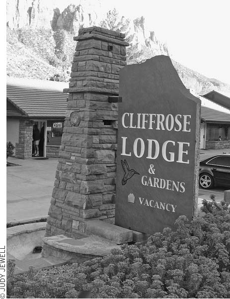
The Cliffrose is a longtime favorite motel in Springdale.
The renovated Driftwood Lodge (1515 Zion Park Blvd., Springdale, 435/772-3262 or 800/801-8811, www.driftwoodlodge.net, $129-199) has a pool and spa on its spacious grounds, pet-friendly guest rooms, and a seriously good restaurant on-site. It’s a big step up from the area’s budget motels.
M Flanigan’s Inn (428 Zion Park Blvd., Springdale, 435/772-3244 or 800/765-7787, www.flanigans.com, $169-219) is a quiet and convenient place to stay. Guest rooms are set back off the main drag and face onto a pretty courtyard. Up on the hill behind the inn, a labyrinth provides an opportunity to take a meditative walk in a stunning setting. An excellent restaurant (The Spotted Dog Café), a pool, and spa services make this an inviting place to spend several days. Two villas, essentially full-size houses, are also available.
Red Rock Inn (998 Zion Park Blvd., Springdale, 435/772-3139, www.redrockinn.com, $139-192) offers accommodations in individual cabins and a cottage suite, all with canyon views. Full-breakfast baskets are delivered to your door.
Probably the most elegant place to stay is the M Desert Pearl Inn (707 Zion Park Blvd., Springdale, 435/772-8888 or 888/828-0898, www.desertpearl.com, $178-198), a very handsome lodge-like hotel perched above the Virgin River. Some guest rooms have views of the river; others face the pool. Much of the wood used for the beams and the finish moldings was salvaged from a railroad trestle made of century-old Oregon fir and redwood that once spanned the north end of the Great Salt Lake. The guest rooms are all large and beautifully furnished, with a modern look.
The closest lodging to the park is at Cable Mountain Lodge (147 Zion Park Blvd., Springdale, 435/772-3366 or 877/712-3366, www.cablemountainlodge.com, $169-279), in the same complex as the big-screen theater. Along with being extremely convenient, it’s very nicely fitted out, with a pool, guest rooms with microwaves and fridges or small kitchens, and appealing architecture and decor to go along with the spectacular views.
Just outside the south gates to Zion, the M Cliffrose Lodge (281 Zion Park Blvd., Springdale, 435/772-3234 or 800/243-8824, www.cliffroselodge.com, $159-269) sits on five acres of lovely well-landscaped gardens with riverfront access. The guest rooms are equally nice, especially the riverside rooms, and there’s a pool and a laundry room. The Cliffrose is favored by many longtime Zion fans.
If you aren’t able to camp in the park, the Zion Canyon Campground (479 Zion Park Blvd., 435/772-3237, www.zioncamp.com) is a short walk from the park entrance. Along with tent sites (no dogs allowed, $30) and RV sites ($39), there are motel rooms ($65). The sites are crammed pretty close together, but a few are situated right on the bank of the Virgin River. Facilities include a store, a pizza parlor, a game room, a laundry room, and showers.
Just outside the park entrance, near the Springdale shuttle stop, Sol Foods (95 Zion Park Blvd., 435/772-0277, www.solfoods.com, 8am-4pm daily) is a short walk from either park campground and a good place for a salad or sandwich ($8-10). Sol Foods also runs the town’s only supermarket (995 Zion Park Blvd., 435/772-3100, 7am-11pm daily spring) and stocks groceries and camping supplies in the store near the park entrance.
M Mean Bean Coffee (932 Zion Park Blvd., 435/772-0654, 6:30am-afternoon daily) is the hip place to hang out in the morning. Besides excellent coffee drinks, they serve breakfast burritos and a few pastries and sandwiches. For a more substantial meal, head across the way to Oscar’s Café (948 Zion Park Blvd., 435/772-3232, www.cafeoscars.com, 8am-2 hours after sunset daily, $8-19), where you can get a good burger or a Mexican-influenced breakfast or lunch. The patio is set back off the main road and is especially pleasant.
An old gas station has become the M Whiptail Grill (445 Zion Park Blvd., 435/772-0283, noon-10pm daily, $8-15), a casual spot serving innovative homemade food, such as incredibly good spaghetti squash enchiladas. There’s very little seating inside, so plan to eat at the outdoor tables or take your meal to go.
Also good, and reasonably priced, is Zion Pizza and Noodle (868 Zion Park Blvd., 435/772-3815, www.zionpizzanoodle.com, 4pm-close daily, $11-16), housed in an old church and serving a good selection of microbrews.
Springdale’s other good place for pizza is Flying Monkey (975 Zion Park Blvd., 435/772-3333, www.flyingmonkeyzion.com, 11am-9:30 or 10pm daily, $8-10), tucked into the back of a newer development near the local supermarket. A wood-fired oven turns out very good pizza and sandwiches.
The following restaurants all offer full liquor service: The M Spotted Dog Café (Flanigan’s Inn, 428 Zion Park Blvd., 435/772-3244, www.flanigans.com, dinner 5pm-9:30pm daily spring-fall, 5pm-9:30pm Tues.-Sun. winter, breakfast buffet 7am-11am daily spring-fall, dinner $13-25) is one of Springdale’s top restaurants; it uses high-quality ingredients for its American bistro cuisine. Be sure to order a salad with (or for) your dinner—the house salad is superb. If you want to eat outside, try to get a table on the back patio, which is quieter and more intimate than the dining area out front.
Another good, and very popular, place for dinner in Springdale is the Bit & Spur Restaurant (1212 Zion Park Blvd., 435/772-3498, reservations recommended during busy season, www.bitandspur.com, 5pm-close daily, $15-23), a lively Mexican-influenced place with a menu that goes far beyond the usual south-of-the-border concoctions. The sweet-potato tamales keep us coming back year after year.
Another strong player in Springdale’s fine-dining scene is the refined but still casual Parallel 88 (1515 Zion Park Blvd., 435/772-3588, www.paralleleighty-eightrestaurant.com, 7am-10:30am and 5pm-close daily, dinner entrées $15-25), at the Driftwood Lodge. Dinners include a delicious braised lamb shank and an equally tasty vegetable parmentier (layered spinach, yams, and other veggies topped with red pepper coulis). The wine selection is relatively extensive for Utah but pretty pedestrian.
People traveling with their dogs have a bit of a dilemma when it comes to visiting Zion. No pets are allowed on the trails (except the Pa’rus Trail) or in the shuttle buses, and it’s absolutely unconscionable to leave a dog inside a car here in the warmer months. Fortunately, the Doggy Dude Ranch (Hwy. 9, Rockville, 435/772-3105, www.doggyduderanch.com) provides conscientious daytime and overnight pet care.
The Zion Canyon Medical Clinic (120 Lion Blvd., 435/772-3226) provides urgent-care services.
You may want to check out the art galleries along Zion Park Boulevard; some of them have high-quality merchandise.
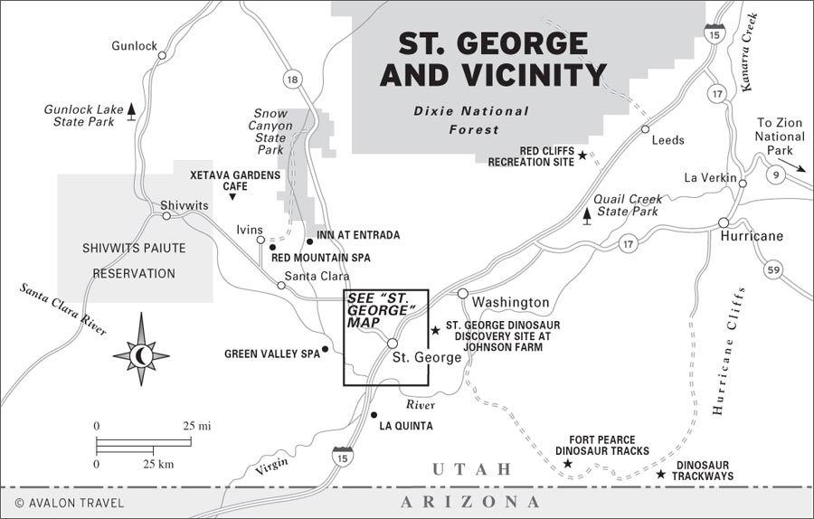
Springdale is located at the mouth of Zion Canyon, just outside the park’s main (south) entrance. From I-15 just north of St. George, take exit 16 and head east on Highway 9; it’s about 40 miles to Springdale. If you’re coming from the north, take I-15’s exit 22, head southeast through Toquerville, and meet Highway 9 at the town of La Verkin.
Southern Utah’s largest city, St. George (population about 73,000) is between lazy bends of the Virgin River on one side and rocky hills of red sandstone on the other. Although it has gained a reputation as a retirement haven, thanks in part to its warm winter climate and its plethora of golf courses, the city won’t have much appeal to most travelers. In order to appreciate St. George, it may be necessary to visit its outskirts, where Snow Canyon State Park and a couple of spas can be found.
In 1861, more than 300 Mormon families in the Salt Lake City area answered the call to go south to start the Cotton Mission, of which St. George became the center (hence the frequent use of the term “Dixie” to describe the area). The settlers overcame great difficulties to start farms and to build an attractive city in this remote desert. Brigham Young chose the city’s name to honor George A. Smith, who had served as head of the Southern (Iron) Mission during the 1850s. The title Saint means simply that he was a Mormon—a Latter-day Saint.
Visits to some of the historic sites will add to your appreciation of the city’s past; ask for the “St. George Historic Walking Tour” brochure at the Chamber of Commerce (97 E. St. George Blvd., 435/628-1658, www.stgeorgechamber.com, 9am-5pm Mon.-Fri.). The warm climate, dramatic setting, and many year-round recreation opportunities have helped make St. George the fastest-growing city in the state.
Visitors can see the St. George Temple (250 E. 400 S., 435/673-5181) from the outside and stop in its visitors center, and you can tour Brigham Young’s Winter Home (67 W. 200 N., 435/673-2517), but if your focus is Zion, you’ll most likely just use St. George as a jumping-off point.
Back in the early Jurassic, when the supercontinent of Pangaea was just beginning to break up, lakes covered this part of present-day Utah, and dinosaurs were becoming the earth’s dominant vertebrates. Two sites southeast of St. George preserve dinosaur tracks from this era. Of the two, the more recently discovered site at Johnson Farm is more impressive and much easier to get to; indeed, it has been called one of the world’s 10 best dinosaur-track sites. The Fort Pearce site is good if you’re hankering for some back-road travel and like scouting dino tracks and petroglyphs in remote washes.
Tracks at the St. George Dinosaur Discovery Site at Johnson Farm (2180 E. Riverside Dr., 435/574-3466, www.dinotrax.com, 10am-6pm Mon.-Sat., 11am-5pm Sun. Mar.-Sept., 10am-5pm Mon.-Sat. Oct.-Feb., $6 adults, $3 ages 3-11) were discovered in 2000 by a retired optometrist. Since then, a vast number of tracks, including those of three species of theropods (meat-eating dinosaurs), and important “trace fossils” of pond scum, plants, invertebrates, and fish have also been uncovered.
Excavation work is ongoing, and a visitors center provides a good look at some of the most exciting finds, including a wall-size slab of rock with footprints going to and fro. Also quite remarkable are the “swim tracks,” which settled a long-standing argument over whether dinosaurs actually swam.
The track site is on the outskirts of St. George, about two miles south of I-15’s exit 10.
A scenic back-road drive through the desert between St. George and Hurricane passes the ruins of Fort Pearce and more dinosaur tracks. Much of the road is unpaved, and it has rough and sandy spots, but it’s usually suitable for cautious drivers in dry weather.
This group of tracks documents the passage of at least two different dinosaur species more than 200 million years ago. The well-preserved tracks, in the Moenave Formation, were made by a 20-foot-long herbivore weighing an estimated 8-10 tons and by a carnivore half as long. No remains of the dinosaurs themselves have been found here.
In 1861 ranchers arrived in Warner Valley to run cattle on the desert grasslands. Four years later, however, troubles with the Native Americans threatened to drive the settlers out. The Black Hawk War and periodic raids by Navajo made life precarious. Springs in Fort Pearce Wash—the only reliable water for many miles—proved the key to domination of the region. In December 1866 work began on a fort overlooking the springs. The stone walls stood about 8 feet high and were more than 30 feet long. No roof was ever added. Much of the fort and the adjacent corral (built in 1869) have survived to the present. Local cattle ranchers still use the springs for their herds. Petroglyphs can be seen in various places along the wash, including 0.25 miles downstream from the fort along ledges on the north side of the wash.
St. George spa-goers often hike in Snow Canyon State Park, but it’s there for anyone to use.
To reach this somewhat remote site from St. George, head south on River Road, cross the Virgin River Bridge, and turn left on 1450 South. Continue on this main road and keep bearing east through several 90-degree left and right turns. Turn left (east) onto a dirt road at the Fort Pearce sign and continue 5.6 miles to a road that branches right along a small wash to the Fort Pearce parking lot. The dinosaur tracks are in a wash about two miles farther down the road from Fort Pearce; the parking area is signed.
If St. George’s outlet stores and chain restaurants threaten to close in on you, head a few miles north of town to the red-rock canyons, sand dunes, volcanoes, and lava flows of Snow Canyon (435/628-2255, http://stateparks.utah.gov, 6am-10pm daily year-round, $6 per vehicle). Walls of sandstone 50-750 feet high enclose the five-mile-long canyon. Hiking trails trace the canyon bottom and lead into the backcountry for a closer look at the geology, flora, and fauna. Common plants are barrel, cholla, and prickly pear cacti; yucca; Mormon tea; shrub live oak; cliffrose; and cottonwood. Delicate wildflowers bloom mostly in the spring and autumn, following the wet seasons, but cacti and the sacred datura can flower in the heat of summer.
Wildlife includes sidewinder and Great Basin rattlesnakes, Gila monsters, desert tortoises, kangaroo rats, squirrels, cottontails, kit foxes, coyotes, and mule deer. You may find some Native American rock art, arrowheads, bits of pottery, and ruins. Many of the place-names in the park honor Mormon pioneers. Snow Canyon was named for Lorenzo and Erastus Snow, not for the rare snowfalls.
Summer is too hot for comfortable hiking, except in the early morning. Highway 18 leads past an overlook on the rim of Snow Canyon and to the paved park road (Hwy. 300) that drops into the canyon and follows it to its mouth and the small town of Ivins. Snow Canyon is about 12 miles northwest of St. George. It is reached either by Highway 18—the faster way—or through the towns of Santa Clara and Ivins. The campground here has a few lovely sites.
With 10 golf courses in the area, St. George enjoys a reputation as Utah’s winter golf capital. Greens fees are highest in the winter (listed here) and drop by nearly 50 percent during the hot summer months. Red sandstone cliffs serve as the backdrop for Dixie Red Hills (1250 N. 645 W., 435/634-5852, $20.50), the city’s first golf course, built in the 1960s on the northwest edge of town; it’s a nine-hole par-34 municipal course. The 18-hole par-71 Green Spring Golf Course (588 N. Green Spring Dr., 435/673-7888, $64), just west of I-15’s exit 10, has a reputation as one of the finest courses in Utah.
Professionals favor the cleverly designed 27-hole par-72 Sunbrook Golf Course (2366 Sunbrook Dr., 435/634-5866, $56) off Dixie Downs Road, between Green Valley and Santa Clara. The St. George Golf Club (2190 S. 1400 E., 435/634-5854, $33) has a popular 18-hole par-73 course south of town in Bloomington Hills. The Southgate Golf Course (1975 S. Tonaquint Dr., 435/628-0000, $33), on the southwest edge of town, has 18 holes. The adjacent Southgate Game Improvement Center (435/674-7728) can provide golfers with computerized golf-swing analyses plus plenty of indoor practice space and lots of balls.
Entrada (2511 W. Entrada Tr., 435/674-7500) is a newer 18-hole private course that’s fast on its way to becoming St. George’s most respected. The Johnny Miller-designed course is northwest of St. George at beautiful Snow Canyon and incorporates natural lava flows, rolling dunes, and arroyos (dry riverbeds) into its design. Guests at the Inn at Entrada can get a package deal to golf; in peak winter season rates are $175, including lodging for two and golf for one. The 18-hole par-72 Sky Mountain (1030 N. 2600 W., 435/635-7888, $45), northeast of St. George in nearby Hurricane, has a spectacular setting.
Mountain bikers in the know come to St. George fall-early spring to ride single-track trails and slickrock that is just as good as what you’ll find in Moab. One of Utah’s most spectacular trails is Gooseberry Mesa, southeast of Hurricane, a challenging but fun ride with both slickrock and single track. The Green Valley Loop starts at the Green Valley Spa and is mostly advanced single track.
Less intense cycling can be found at Snow Canyon State Park, where the paved six-mile Whiptail Trail and the eight-mile gravel and sand West Canyon Road are open to bicycles.
Snow Canyon State Park (435/628-2255, http://stateparks.utah.gov, 6am-10pm daily year-round, $6 per vehicle) offers many technical rock-climbing routes in the park.
St. George offers many places to stay and eat. Motel prices stay about the same year-round, although they may drop if business is slow in summer. Considering the popularity of this destination, prices are reasonable. Golfers should ask about golf-and-lodging packages. You’ll find most lodgings along the busy I-15 business route of St. George Boulevard (exit 8) and Bluff Street (exit 6). As for food, you’ll find almost every fast-food place known to humanity just off the interstate on St. George Boulevard.
Many of St. George’s less expensive lodging choices are chains operating at exit 8 off I-15. Near downtown, there are some decent locally owned choices. The Chalet Motel (664 E. St. George Blvd., 435/628-6272, from $40) offers fridges and microwaves, some efficiency kitchens in larger guest rooms, and a pool. M Dixie Palms Motel (185 E. St. George Blvd., 435/673-3531, $40) is a classic old-fashioned courtyard motel on the main strip right downtown, with an outdoor pool and fridges and microwaves in the guest rooms. It’s a top pick for budget travelers.
In the downtown area, the Spanish-style Best Western Travel Inn (316 E. St. George Blvd., 435/673-3541 or 800/528-1234, www.stgeorgebestwestern.com, $63-70) is a relatively small motel with an outdoor pool and an indoor spa. It’s a good mid-range choice.
Close to downtown is one of St. George’s best: the Best Western Coral Hills (125 E. St. George Blvd., 435/673-4844 or 800/542-7733, www.coralhills.com, $77-132), a very attractive property with indoor and outdoor pools and two spas, an exercise room, and a complimentary continental breakfast.
Look for more motels at I-15’s exit 6. The Lexington Hotel & Conference Center (850 S. Bluff St., 435/628-4235 or 877/539-7070, www.lexingtonhotels.com, $89) is a large complex complete with indoor and outdoor pools, a whirlpool, recreation and fitness facilities, a tennis court, a putting green, and a good on-site restaurant. At the Best Western Abbey Inn (1129 S. Bluff St., 435/652-1234 or 888/222-3946, www.bwabbeyinn.com, $80-110), all guest rooms have microwaves and fridges. There’s a small outdoor pool, an indoor spa, recreation and fitness facilities, and a hot breakfast included.
Quite comfortable is the Ambassador Inn (1481 S. Sunland Dr., 435/673-7900 or 877/373-7900, http://ambassadorinn.net, $70), located at the south end of town near the convention center, east of I-15’s exit 6. Near the interstate, LaQuinta (91 E. 2680 S., 435/674-2664 or 888/788-2457, www.laqstgeorge.com, $69-129) is a comfortable place to crash on the edge of town.
A couple of B&Bs are good alternatives to the more generic lodgings that dominate St. George. Just across from Brigham Young’s Winter Home, the M Seven Wives Inn Bed & Breakfast (217 N. 100 W., 435/628-3737 or 800/600-3737, www.sevenwivesinn.com, $100-189) offers guest rooms in two historic homes, including one that served as a safe house for polygamists after the practice was banned in the 1880s, and a cute cottage. All guest rooms have private baths and are decorated with antiques. Children are welcome, and pets are permitted in the cottage. There’s an outdoor pool, in-room massage service, and good weekday “business rates” ($70) are offered.
You’ll find an entire compound of pioneer-era homes at the Greene Gate Village Historic Bed & Breakfast Inn (76 W. Tabernacle St., 435/628-6999 or 800/350-6999, www.greengatevillage.com, $99-199). Nine beautifully restored homes offer a variety of lodging options—groups or families can rent an entire home. Many guest rooms come with kitchens and private baths, some with private whirlpools. There’s also a pool shared by all guests. Children are welcome.
A particularly nice standard motel is the Crystal Inn (1450 S. Hilton Inn Dr., 435/688-7477 or 800/662-2525, www.crystalinns.com, $119-200, online specials as low as $75) is located on a golf course and has beautiful public areas and nicely appointed guest rooms. Facilities include a pool, a sauna, and private tennis courts.
Golfers and those who want a bit of plushness should seriously consider the Inn at Entrada (2588 W. Sinagua Tr., 435/634-7100, www.innatentrada.com, from $179), located near Snow Canyon State Park. A stay at the inn is the easiest way to gain access to the resort community’s top-notch golf course. It’s a lovely setting, lodging is in “casitas,” and there’s a spa and restaurant on-site.
St. George is home to two large spa resorts and recreation centers in gorgeous natural settings. The Green Valley Spa (1871 W. Canyon View Dr., 435/628-8060 or 800/237-1068, www.greenvalleyspa.com, from $189 B&B package, spa packages with lodging and all meals from $400, depending on treatments and activities, many specials offered) is a fitness, sports, health, and beauty spa with all-inclusive rates. Facilities include three pools, racquetball courts, a fully equipped gym with an array of fitness, yoga, and meditation classes as well as tennis instruction, golf privileges, and hiking and climbing in neighboring canyons. There’s also a whole catalog of beauty and rejuvenation treatments, which may be included in a package deal or tacked on at extra cost, including massage, wraps, and aromatherapy as well as more spiritual renewals such as personal meditation guidance. Guest rooms flank a parklike pool and garden area. Three spa meals are served daily; they’re included in the cost of most packages. Rates vary widely, with summer the least expensive time to visit.
Slightly less swanky, the Red Mountain Spa (202 N. Snow Canyon Rd., 877/246-4453, www.redmountainspa.com) focuses even more intently on outdoor adventure and fitness. It’s located near Snow Canyon, and morning hikes in the beautiful state park are a great part of the routine. Facilities include numerous swimming and soaking pools, a fitness center and gym, tennis courts, a salon, a spa, and conference rooms, plus access to lots of hiking and biking trails. Prices, which include all meals, lodging, and use of most spa facilities and recreation, start at about $230 pp double, with special deals often available online. Spa services, including massage, facials, body polishing, and aromatherapy, cost extra.
The best camping in the area is at Snow Canyon State Park (435/628-2255, reservations 800/322-3770, www.reserveamerica.com, $8 reservation fee, reservations required in spring, $16 without hookups, $20 with hookups). Sites are in a pretty canyon and include showers. From downtown St. George, go 12 miles north on Highway 18, then turn left and continue two miles.
The other public campgrounds in the area are Quail Creek State Park (435/879-2378, www.stateparks.utah.gov, $13) and the Bureau of Land Management (BLM) Red Cliffs Recreation Site (435/688-3200, $8), both north of town off I-15 (take exit 16 when coming from the south; take exit 23 when approaching from the north). Quail Creek is on a reservoir and is a good option if you have a boat. Red Cliffs is a little more scenic and has hiking trails.
If you need a place to park an RV for the night right in town, McArthur’s Temple View RV Resort (975 S. Main St., 435/673-6400 or 800/776-6410, $31 tents, $42 RVs) is near the temple district but has little shade.
For a major recreation and retirement center, St. George is curiously lacking in unique places to eat. Almost every chain restaurant can be found, but don’t expect a bevy of local fine-dining houses.
The best place to head for lunch or dinner is Ancestor’s Square, a trendy shopping development downtown at the intersection of St. George Boulevard and Main Street. M Painted Pony (435/634-1700, www.painted-pony.com, 11:30am-10pm Mon.-Sat., 4pm-9pm Sun., lunch $8-10, dinner $24-34) is a stylish restaurant where the kitchen puts Southwestern and, in some cases, Asian touches on American standards; try salmon rolls with a carrot orange sauce. Downstairs from the Painted Pony is another pretty good restaurant, Benja Thai and Sushi (435/628-9538, www.benjathai.com, 11:30am-10pm Mon.-Sat., 5pm-9pm Sun., $11-20), one of the very few Thai restaurants in southern Utah. Just across St. George Boulevard, Bear Paw Coffee (75 N. Main St., 435/634-0126, 7am-3pm daily, $7-9) is a bright spot for coffee drinkers and anyone who wants a good breakfast.
There’s a sweetly elegant spot up by Snow Canyon: Xetava Gardens Cafe (815 Coyote Gulch, 435/656-0165, www.coyotegulchartvillage.com, 8am-9:30pm Thurs.-Sat., 8am-5pm Sun.-Wed., dinner $10-30). Dinners range from excellent burgers and pizza to rack of lamb; this is also a great place to come for breakfast ($7-9) after a morning hike.
The St. George Chamber of Commerce (97 E. St. George Blvd., 435/628-1658, www.stgeorgechamber.com, 9am-5pm Mon.-Fri.), in the old county courthouse, can tell you about the sights, events, and services of southwestern Utah. Better online sources of information are www.utahsdixie.com and www.utahstgeorge.com.
For recreation, visit the Interagency Visitor Office (196 E. Tabernacle St., 435/688-3246, www.fs.fed.us/r4/dixie, 8am-5pm Mon.-Fri.) for information on fishing, hiking, and camping in the national forest and BLM lands around town.
There is a post office (180 N. Main St., 435/673-3312). The Dixie Regional Medical Center (544 S. 400 E., 435/688-4000) provides hospital care.
St. George’s new airport (SGU), located five miles southeast of downtown off I-15’s exit 2, opened in early 2011 and, depending on the economy, should lead to an increase in air service. Delta (800/323-2323, www.delta.com), in partnership with Skywest Airlines (www.skywest.com), offers several daily direct flights to and from Salt Lake City, while United (800/864-8331, www.ual.com) offers flights to and from Los Angeles.
Several of the usual rental-car companies operate at the St. George airport: Budget (435/673-6825 or 800/527-0700), Avis (435/627-2002 or 800/230-4898), and Hertz (435/652-9941 or 800/654-3131).
It’s an easy two-hour drive from Las Vegas to St. George, so travelers may want to consider flying into Vegas and renting a car there.
Greyhound (435/673-2933) buses depart from McDonald’s (1235 S. Bluff St.) for Salt Lake City, Denver, Las Vegas, and other destinations. The St. George Shuttle (790 S. Bluff St., 435/628-8320 or 800/933-8320, www.stgshuttle.com) will take you to Las Vegas ($25) or Midvale ($55), a Salt Lake City suburb, in a 15-passenger van. Trips depart from the Shuttle Lodge Inn (915 S. Bluff St.).
Cedar City (population about 28,000), known for its scenic setting and its summertime Utah Shakespearean Festival, is a handy base for exploring a good chunk of southern Utah. Just east of town are the high cliffs of the Markagunt Plateau—a land of panoramic views, colorful rock formations, desolate lava flows, extensive forests, and flower-filled meadows. Also on the Markagunt Plateau is the Cedar Breaks National Monument, an immense amphitheater eroded into the vividly hued underlying rock.
Within an easy day’s drive are Zion National Park to the south and Bryce Canyon National Park and Grand Staircase-Escalante National Monument to the east.
Cedar City’s lively festival (general info 435/586-7880, box office 435/586-7878 or 800/752-9849, www.bard.org) presents three Shakespearean plays or other classics each summer season in the Adams Shakespearean Theatre (351 W. Center St.), an open-air theater in the round, closely modeled on the original Globe Theatre of Elizabethan London. The indoor Randall Jones Theatre presents the “Best of the Rest”—often recent Broadway hits. A total of eight or nine plays are staged each season (late June-mid-Oct.).
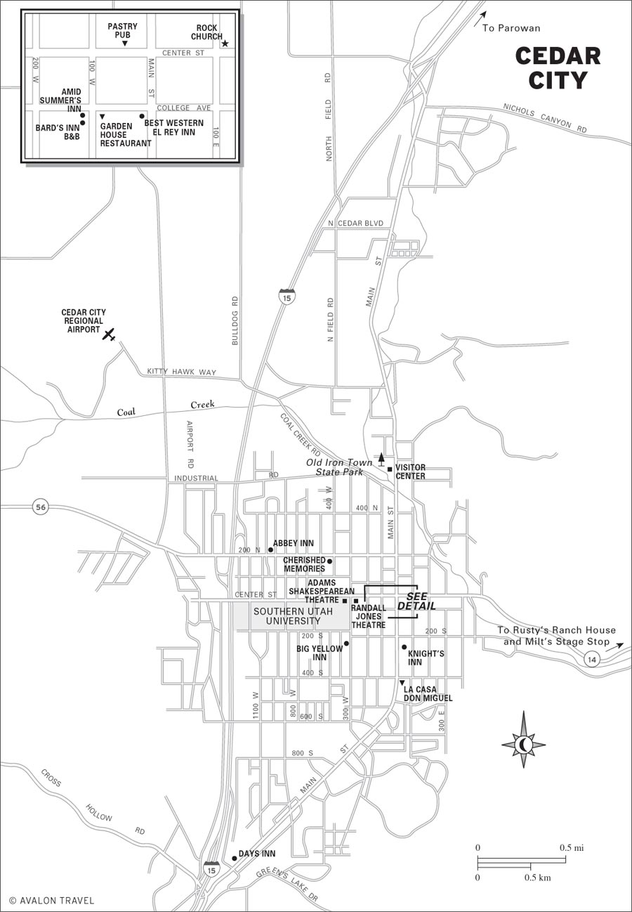
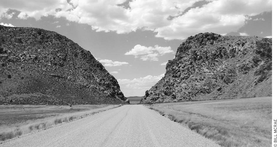
Narrow Parowan Gap, etched with ancient petroglyphs, has long been a thoroughfare.
Costumed actors stage the popular free Greenshow (7pm Mon.-Sat.) before the performances, with a variety of Elizabethan comedy skits, Punch and Judy shows, period dances, music, juggling, and other good-natured 16th-century fun. Backstage tours of the costume shop, makeup room, and stage show you how the festival works. At literary seminars each morning, actors and Shakespearean scholars discuss the previous night’s play. Production seminars, held daily except Sunday, take a close look at acting, costumes, stage props, special effects, and other details of play production.
The Greenshow and seminars are free, but most other events are $22-71, and it’s wise to purchase tickets well in advance; last-minute theatergoers, however, can usually find tickets to something.
The theaters are on the Southern Utah University campus near the corner of Center Street and 300 West. Rain occasionally dampens the performances (the Elizabethan theater is open to the sky), and plays may move to a conventional theater next door, where the box office is located.
This in-town state park (635 N. Main St., 435/586-9290, $3) focuses on history rather than recreation. The ironworks had their start in 1850, when Brigham Young, hoping to increase Utah’s self-sufficiency, sent workers to develop an “Iron Mission.” The ironworks eventually became a private company, and although it never really prospered financially, the area has become Iron County. Here, indoor and outdoor exhibits focus on the iron foundry and other aspects of local history.
Ten miles west of the small I-15 town of Parowan is a pass where Native Americans created many petroglyphs, designs pecked into the rocks. People hunting in the Red Hills and wildlife commonly passed through this gap, and it may have served as an important site for hunting rituals. The meaning of the rock art hasn’t been deciphered, but it probably represents the thoughts of many different Native American groups over the past 1,000 or more years. Geometric designs, snakes, lizards, mountain sheep, bear claws, and human figures are all still recognizable. You can get here on a good gravel road from Parowan by going north on Main Street and turning left and continuing 10.5 miles on the last street (400 North). Or, from Cedar City, go north on Main Street, which becomes Highway 130 at I-15’s exit 62, and follow signs for north for 13.5 miles, then turn right and go 2.5 miles on a good gravel road (near milepost 19). In Cedar City, you can get an interpretive brochure and map at the Bureau of Land Management (BLM) office (176 E. D. L. Sargent Dr., Cedar City, 435/586-2401).
Starting at Cedar City’s eastern boundary, Highway 14 plunges into a narrow canyon flanked by steep rock walls before climbing up to the top of the Markagunt Plateau. This is a very scenic route, passing dramatic rock cliffs and pink-rock hoodoos that echo the formations at Zion and Bryce Canyon National Parks. Although it’s not a quick drive—especially if you get caught behind a lumbering RV—the scenic qualities of the canyon and the incredible vistas, which extend across Zion and down into Arizona, will amply repay your patience. The route also passes several wooded campgrounds and small mountain resorts. Because of their elevations—mostly 8,000-9,000 feet—these high-mountain getaways are popular when the temperatures in the desert basin towns begin to soar. The route ends at Long Valley Junction, at U.S. 89, which is 41 miles east of Cedar City.
During the Shakespearean Festival, Cedar City is a popular destination, so it’s best to reserve a room at least a day or two in advance during the summer. There are two major concentrations of motels. A half dozen large chain hotels cluster around the I-15 exits together with lots of fast-food restaurants and strip malls. Downtown along Main Street are even more motels. You can easily walk from most of the downtown motels to the Shakespeare Festival. Many of Cedar City’s B&Bs are also within a stroll of the festival grounds.
Note that the following prices are for the summer festival high season. Outside high season, expect rates to drop by about one-third.
Right downtown, the Best Western El Rey Inn (80 S. Main St., 435/586-6518 or 800/528-1234, www.bwelrey.com, $85-130) offers a breakfast bar.
Also downtown, the Knight’s Inn (281 S. Main St., 435/586-9916, www.knightsinncedarcity.com, $52-62) has a bit of a budget ambience, but it’s pleasant and a good deal, with a pool and complimentary continental breakfast.
At I-15’s exit 57, the Days Inn (1204 S. Main St., 435/867-8877 or 888/556-5637, $70-103) is a well-kept place with an indoor pool and complimentary continental breakfast.
One of the best places to stay in Cedar City is the Abbey Inn (940 W. 200 N., 435/586-9966 or 800/325-5411, www.abbeyinncedar.com, $89-99), which has remodeled guest rooms, an indoor pool, and a good breakfast included.
Bed-and-breakfast inns and Shakespeare seem to go hand-in-hand. The Bard’s Inn Bed & Breakfast (150 S. 100 W., 435/586-6612, www.bardsbandb.com, $109-129), two blocks from the Shakespearean Festival, has seven guest rooms, all with private baths, as well as a two-bedroom cottage. It’s open during festival season only. Right next door, the antiques-filled Amid Summer’s Inn (140 S. 100 W., 435/867-4691, www.amidsummersinn.com, $115-185) has eight sumptuously decorated guest rooms in a restored 1930s cottage. Also near the Shakespearean Festival, at the edge of the Southern Utah University campus, the M Big Yellow Inn (234 S. 300 W., 435/586-0960, www.bigyellowinn.com, $100-199) is easy to spot; it’s yellow, full of antiques, and several of the guest rooms are in a house directly across the street from the main inn.
East of Cedar City on Highway 14 are a handful of campgrounds in the Dixie National Forest. The closest, Cedar Canyon (635/865-3200, www.fs.fed.us/r4/Dixie, early June-mid-Sept., $12), is 12 miles from town in a pretty canyon along Cow Creek. It’s at 8,100 feet elevation and has water.
Cedar City KOA (1121 N. Main St., 435/586-9872 or 800/562-9873, year-round, $27 tents, $45 RVs) has cabins, showers, a playground, and a pool. Country Aire RV Park (1700 N. Main St., 435/586-2550, year-round, $32) has showers and a pool.
Cedar City has some good casual restaurants. At the M Pastry Pub (86 W. Center St., 435/867-1400, www.cedarcitypastrypub.com, 10am-10pm Mon.-Sat., $6-9) you’ll find pastries, good sandwiches, and coffee; it’s a good place for lunch or a quick bite to eat before a play. Stop by La Casa Don Miguel (453 S. Main St., 435/586-6855, lunch and dinner daily, $6-12) for the best Mexican food you’ll find for miles around.
The Garden House Restaurant (164 S. 100 W., 435/586-6110, dinner from 5pm Mon.-Sat., $12-19) is housed in a charming cottage off the main drag. It offers what passes for fine dining in Cedar City; the food (pasta, salmon, grilled trout) is OK but not great. Alcohol is not served.
East of Cedar City on Highway 14 is a dramatic desert canyon with two steak houses that share an owner and Western ambience. Rusty’s Ranch House (2275 E. Hwy. 14, 435/586-3839, www.rustysranchhouse.com, dinner from 5:30pm Mon.-Sat., $15-28) is two miles east of town on Highway 14 and serves good steak and seafood dinners in a dramatic canyon setting. Two miles farther up the same road is Milt’s Stage Stop (3560 E. Hwy. 14, 435/586-9344, www.miltsstagestop.com, 5pm-9pm daily, $15-25), serving steak, prime rib, and seafood.
The Cedar City Brian Head Tourism Bureau (581 N. Main St., 435/586-5124 or 800/354-4849, www.scenicsouthernutah.com) is just south of Iron Mission State Park. The Dixie National Forest’s Cedar City Ranger District Office (1789 Wedgewood Lane, 435/865-3200) has information on recreation and travel on the Markagunt Plateau. The BLM’s Cedar City District Office (176 E. D. L. Sargent Dr., 435/586-2401) is just off Main Street on the north edge of town.
Cedar City is just east of I-15, 52 miles northeast of St. George and 253 miles southwest of Salt Lake City; take I-15’s exit 57, 59, or 62. Delta (800/323-2323, www.delta.com) has flights operated by SkyWest between the small Cedar City Regional Airport (CDC, 2560 Aviation Way, 435/586-2950) and Salt Lake City. Rent a car from Enterprise (435/865-7636) or Hertz (435/586-9806) at the airport.
