BRYCE MUSEUM AND WILDLIFE ADVENTURE
CEDAR BREAKS NATIONAL MONUMENT
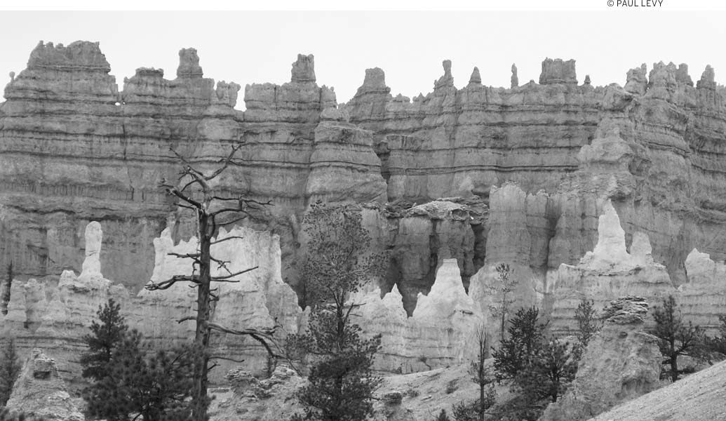
In Bryce Canyon, a geologic fairyland of rock spires rises beneath the high cliffs of the Paunsaugunt Plateau. This intricate maze, eroded from soft limestone, now glows with warm shades of red, orange, pink, yellow, and cream. The rocks provide a continuous show of changing color through the day as the sun’s rays and cloud shadows move across the landscape.
Looking at these rock formations is like looking at puffy clouds in the sky; it’s easy to find images in the shapes of the rocks. Some see the natural rock sculptures as Gothic castles, others as Egyptian temples, subterranean worlds inhabited by dragons, or vast armies of a lost empire. The Paiute tale of the Legend People relates how various animals and birds once lived in a beautiful city built for them by Coyote; when the Legend People began behaving badly toward Coyote, he transformed them all into stone.
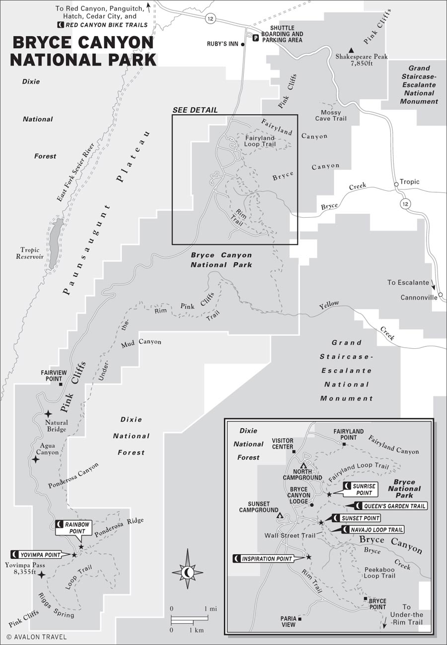
Bryce Canyon isn’t a canyon at all, but rather the largest of a series of massive amphitheaters cut into the Pink Cliffs. In Bryce Canyon National Park, you can gaze into the depths from viewpoints and trails on the plateau rim or hike down moderately steep trails and wind your way among the spires. A 17-mile scenic drive traces the length of the park and passes many overlooks and trailheads. Away from the road, the nearly 36,000 acres of Bryce Canyon National Park offer many opportunities to explore spectacular rock features, dense forests, and expansive meadows.

The park’s elevation ranges 6,600-9,100 feet, so it’s usually much cooler here than at Utah’s other national parks. Expect pleasantly warm days in summer, frosty nights in spring and fall, and snow at almost any time of year. The visitors center, the scenic drive, and a campground stay open throughout the year.
Allow a full day to see the visitors center exhibits, enjoy the viewpoints along the scenic drive, and take a few short walks. Because of the layout of the park, with viewpoints all on the east side of the scenic drive, rangers recommend driving all the way south to Rainbow Point, and then stopping at viewpoints on your way back toward the park entrance; this means you won’t constantly need to turn left across oncoming traffic.
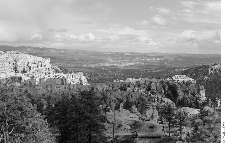
Bryce isn’t a canyon at all, but a highly eroded amphitheater.
The hike into Queen’s Garden is a good, relatively short hike, and it’s easy to fit into a one-day tour of the park. If you have more time to hike, the Navajo Loop Trail is also good; it can be combined with the Queen’s Garden for a pretty substantial trek. Another good bet for strong hikers is the outstanding Peekaboo Loop. These trails are often crowded near the rim, but less so the farther out you get. But if the crowds begin to get to you, it’s time to visit the Fairyland Loop Trail, which is off the main drag and less trafficked.
If you’re interested in photographing the hoodoos—and it’s hard to resist the urge—it makes sense to spend the night in or near the park. Photographers usually obtain the best results early and late in the day, when shadows set off the brightly colored rocks. Memorable sunsets and sunrises reward visitors who stay overnight. Moonlit nights reveal yet another spectacle.
If you want to travel into the backcountry, be sure to consult with a ranger about your plans. Remember that winter can last a long time at this elevation, and many trails can be blocked by snow and ice into the spring. The weather can also take a toll on the trails, and it’s not uncommon to learn that your selected trail has been closed by rockfall.
Bryce Canyon National Park (435/834-5322, www.nps.gov/brca, $25 per vehicle, $12 cyclists, pedestrians, and motorcycles, admission good for 7 days and unlimited shuttle use) is just south of the incredibly scenic Highway 12, between Bryce Junction and Tropic. To reach the park from Bryce Junction (at the intersection of U.S. 89 and Hwy. 12, 7 miles south of Panguitch), head 14 miles east on Highway 12, then south three miles on Highway 63. From Escalante, it’s about 50 miles west on Highway 12 to the turnoff for Bryce; turn south onto Highway 63 for the final three miles into the park (winter snows occasionally close this section). Both approaches have spectacular scenery.
Special hazards you should be aware of include crumbly ledges and lightning strikes. People who have wandered off trails or got too close to the drop-offs have had to be pulled out by rope. Avoid cliffs and other exposed areas during electrical storms, which are most common in late summer.
From the turnoff on Highway 12, follow signs past Ruby’s Inn for 4.5 miles south to the park entrance; the visitors center (435/834-5322, 8am-8pm daily May-Sept., 8am-6pm daily Apr. and Oct., 8am-4:30pm daily Nov.-Mar.) is a short distance farther on the right. A brief slide show, shown every 30 minutes, introduces the park. Geologic exhibits illustrate how the land was formed and how it has changed. Historic displays cover the Paiute people, early nonnative explorers, and the first settlers; trees, flowers, and wildlife are identified. Rangers present a variety of naturalist programs, including short hikes, mid-May-early September; see the posted schedule.
The most basic tour of the park, which comes with the price of admission, is a ride on the park shuttle bus. Shuttle buses run every 12 minutes or so during the peak part of the day, and the trip through the park takes 50 minutes. Of course, the beauty of the shuttle is that you can get off at any stop, hike for a while, and then catch another bus. Shuttle season is early May-mid-October.
Beyond a shuttle ride, Ruby’s Inn (26 S. Main St., 866/866-6616, www.rubysinn.com), a hotel, restaurant, and recreation complex at the park entrance, is a good place to take measure of the opportunities for organized recreation and sightseeing excursions around Bryce Canyon. The lobby is filled with outfitters who are anxious to take you out on the trail; you’ll find lots of recreational outfitters, along with vendors who organize hayrides, barn dances, and chuckwagon dinners. Ruby’s Horseback Adventures (435/834-5341 or 866/782-0002, www.horserides.net, Apr.-Oct.) offers horseback riding in and near Bryce Canyon. There’s a choice of half-day ($85) and full-day ($135, including lunch) trips, as well as a 1.5-hour trip ($65). During the summer, Ruby’s also sponsors a rodeo (7pm Wed.-Sat., $10 adults, $7 ages 3-12) across from the inn.
You can also explore the area around Bryce Canyon on a noisier steed. Guided all-terrain vehicle (ATV) tours of Red Canyon are offered by Ruby’s ATV Tours (435/834-5232, 1-hour trip $45).
Horseback rides are also offered by a concessionaire inside the park at the Lodge at Bryce Canyon. Canyon Trail Rides (435/679-8665, www.canyonrides.com) offers a two-hour ride ($60) that goes to the canyon floor. Half-day rides are also available.
If you’d like to get a look at Bryce and the surrounding area from the air, take a scenic flightseeing tour with Bryce Canyon Airlines (Ruby’s Inn, 435/834-8060), which offers both plane and helicopter tours. There’s quite a range of options, but a 35-minute airplane tour ($159 pp, 2-person minimum) provides a good look at the surroundings.
From elevations of about 8,000 feet near the visitors center, the park’s scenic drive gradually winds 1,100 feet higher to Rainbow Point. About midway you’ll notice a change in the trees from largely ponderosa pine to spruce, fir, and aspen. On a clear day, you can enjoy vistas of more than 100 miles from many of the viewpoints. Because of parking shortages on the drive, trailers must be left at the visitors center or your campsite. Visitors wishing to see all of the viewpoints should take a walk on the Rim Trail.
Note that even though the viewpoints are described here in north-to-south order, when the park is bustling, it’s better to drive all the way to the southern end of the road and visit the viewpoints from south to north, thus avoiding left turns across traffic. Of course, if you’re just heading to one viewpoint or trailhead, it’s fine to drive directly to it.
The turnoff for Fairyland Point is just inside the park boundary; go north 0.8 miles from the visitors center, then east one mile. Whimsical forms line Fairyland Canyon a short distance below. You can descend into the fairyland on the Fairyland Loop Trail or follow the Rim Trail for other panoramas.
These overlooks are off to the left about one mile south of the visitors center; they’re connected by a 0.5-mile paved section of the Rim Trail. Panoramas from each point take in large areas of Bryce Amphitheater and beyond. The lofty Aquarius and Table Cliff Plateaus rise along the skyline to the northeast; you can see the same colorful Claron Formation in cliffs that faulting has raised about 2,000 feet higher. A short walk down either the Queen’s Garden Trail or the Navajo Loop Trail from Sunset Point will bring you close to Bryce’s hoodoos and provide a totally different experience from what you get atop the rim.
It’s well worth the 0.75-mile walk south along the Rim Trail from Sunset Point to see a fantastic maze of hoodoos in the “Silent City.” It’s also accessible by car, from a spur road near the Bryce Point turnoff. Weathering along vertical joints has cut many rows of narrow gullies, some more than 200 feet deep. It’s a short but steep 0.2-mile walk up to Upper Inspiration Point.
This overlook at the south end of Bryce Amphitheater has expansive views to the north and east. It’s also the start for the Rim, Peekaboo Loop, and Under-the-Rim Trails. From the turnoff two miles south of the visitors center, follow signs 2.1 miles in.
Cliffs drop precipitously into the headwaters of Yellow Creek, a tributary of the Paria River. You can see a section of Under-the-Rim Trail winding up a hillside near the mouth of the amphitheater below. Distant views take in the Paria River Canyon, White Cliffs (of Navajo sandstone), and Navajo Mountain. The plateau rim in the park forms a drainage divide. Precipitation falling west of the rim flows gently into the East Fork of the Sevier River and the Great Basin; precipitation landing east of the rim rushes through deep canyons in the Pink Cliffs to the Paria River and on to the Colorado River and the Grand Canyon. Take the turnoff for Bryce Point, and then keep right at the fork.
This sweeping panorama takes in a lot of geology. You’ll see levels of the Grand Staircase that include the Aquarius and Table Cliff Plateaus to the northeast, Kaiparowits Plateau to the east, and White Cliffs to the southeast. Look beyond the White Cliffs to see a section of the Kaibab Plateau that forms the north rim of the Grand Canyon in Arizona. The overlook is on the left, nine miles south of the visitors center.
This large feature lies just off the road to the east, 1.7 miles past Farview Point. The span is 54 feet wide and 95 feet high. Despite its name, this is an arch formed by weathering from rain and freezing, not by stream erosion, as with a true natural bridge. Once the opening reached ground level, runoff began to enlarge the hole and to dig a gully through it.
You can admire sheer cliffs and hoodoos from the Agua Canyon overlook to the east, 1.4 miles past Natural Bridge. With a little imagination, you may be able to pick out the Hunter and the Rabbit below. Ponderosa Canyon overlook, to the east 1.8 miles farther, offers a panorama similar to that at Farview Point.
The land drops away in rugged canyons and fine views at the end of the scenic drive, 17 miles south of the visitors center. At an elevation of 9,115 feet, this is the highest area of the park. Yovimpa and Rainbow Points are only a short walk apart yet offer different vistas. The Bristlecone Loop Trail is an easy one-mile loop from Rainbow Point to ancient bristlecone pines along the rim. The Riggs Spring Loop Trail makes a good day hike; you can begin from either Yovimpa Point or Rainbow Point and descend into canyons in the southern area of the park. The Under-the-Rim Trail starts from Rainbow Point and winds 22.5 miles to Bryce Point; day hikers can make a 7.5-mile trip by using the Agua Canyon Connecting Trail and a car shuttle.
Although it’s possible to have an entirely pleasant visit to Bryce by just riding the shuttle and hopping off to snap pictures at various viewpoints, a short hike or horseback ride down off the rim will give you an entirely different perspective on the hoodoos, native plants, and, perhaps, wildlife of the park.
Hikers enjoy close-up views of the wonderfully eroded features and gain a direct appreciation of Bryce’s geology. Because almost all of the trails head down off the canyon’s rim, they’re moderately difficult, with many ups and downs, but the paths are well graded and signed. Hikers not accustomed to the 7,000-9,000-foot elevation will find the going relatively strenuous and should allow extra time. Be sure to carry water and drink frequently—staying well hydrated will give you more energy.
Wear a hat and sunscreen to protect against sunburn, which can be a problem at these elevations. Don’t forget rain gear, because storms can come up suddenly. Always carry water for day trips; only a few natural sources exist. Ask at the visitors center for current trail conditions and water sources; you can also pick up a free hiking map at the visitors center. Snow may block some trail sections in winter and early spring. Horses are permitted only on Peekaboo Loop. Pets must stay above the rim; they’re allowed on the Rim Trail only between Sunset and Sunrise Points.
Overnight hikers can obtain the required backcountry permit ($5-15) at the visitors center. Camping is allowed only on the Under-the-Rim and Riggs Spring Loop trails. Backpack stoves must be used for cooking; wood fires are prohibited. Although there are several isolated springs in Bryce’s backcountry, it’s prudent to carry at least one gallon of water per person per day. Ask about the location and flow of springs when you register for the backcountry permit.
Don’t expect much solitude during the summer on the popular Rim, Queen’s Garden, Navajo, and Peekaboo Loop Trails. Fairyland Loop Trail is less used, and the backcountry trails are almost never crowded. September-October are the choice hiking months—the weather is best and the crowds smallest, although nighttime temperatures in late October can dip well below freezing.
• Distance: 11 miles round-trip
• Duration: 5-6 hours
• Elevation change: 540 feet
• Effort: easy
• Trailheads: Fairyland Point, Bryce Point
• Shuttle stops: Fairyland Point, Bryce Point
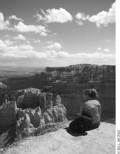
Short hiking trails lead to scenic overlooks.
This easy trail follows the edge of Bryce Amphitheater. Most people walk short sections of the rim in leisurely strolls or use the trail to connect with five other trails that head down beneath the rim. The 0.5-mile stretch of trail near the lodge between Sunrise and Sunset Points is paved and nearly level; other parts are gently rolling.
• Distance: 8 miles round-trip
• Duration: 4-5 hours
• Elevation change: 900 feet
• Effort: strenuous
• Trailheads: Fairyland Point or Sunrise Point
• Shuttle stops: Fairyland Point or Sunrise Point
This trail winds in and out of colorful rock spires in the northern part of Bryce Amphitheater, a somewhat less-visited area one mile off the main park road. Although the trail is well graded, remember the climb of 900 vertical feet you’ll make when you exit. You can take a loop hike of eight miles from either Fairyland Point or Sunrise Point by using a section of the Rim Trail; a car shuttle saves three hiking miles. The whole loop is too long for many visitors, who enjoy short trips down and back to see this “fairyland.”
• Distance: 1.5 miles round-trip
• Duration: 1.5 hours
• Elevation change: 320 feet
• Effort: moderate
• Trailhead: Sunrise Point
• Shuttle stop: Sunrise Point
A favorite of many people, this trail drops from Sunrise Point through impressive features in the middle of Bryce Amphitheater to a hoodoo resembling a portly Queen Victoria. This is the easiest excursion below the rim. Queen’s Garden Trail also makes a good loop hike with the Navajo Loop and Rim Trails; most people who do the loop prefer to descend the steeper Navajo and climb out on Queen’s Garden Trail for a 3.5-mile hike. Trails also connect with the Peekaboo Loop Trail and go to the town of Tropic.
• Distance: 1.3 miles round-trip
• Duration: 1.5 hours
• Elevation change: 520 feet
• Effort: moderate
• Trailhead: Sunset Point
• Shuttle stop: Sunset Point
From Sunset Point, the trail drops 520 vertical feet in 0.75 miles through a narrow canyon. At the bottom, the loop leads into deep, dark Wall Street—an even narrower canyon 0.5 miles long—then returns to the rim. Other destinations from the bottom of Navajo Trail are Twin Bridges, Queen’s Garden Trail, Peekaboo Loop Trail, and the town of Tropic. The 1.5-mile trail to Tropic isn’t as scenic as the other trails, but it does provide another way to enter or leave the park; ask at the visitors center or in Tropic for directions to the trailhead.
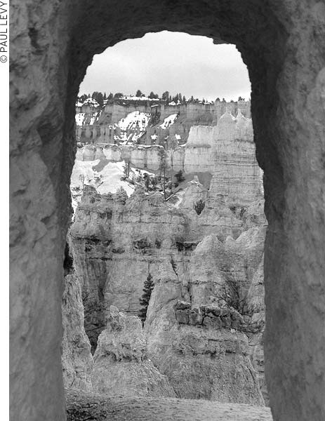
Hike down the Navajo Loop Trail to get up close and personal with the hoodoos.
• Distance: 5.5-7 miles round-trip
• Duration: 4 hours
• Elevation change: 500-800 feet
• Effort: moderate-strenuous
• Trailhead: Bryce Point
• Shuttle stop: Bryce Point
This enchanting walk is full of surprises at every turn—and there are lots of turns. The trail is in the southern part of Bryce Amphitheater, which has some of the most striking rock features. You can start from Bryce Point (6.5 miles round-trip), from Sunset Point (5.5 miles round-trip via Navajo Trail), or from Sunrise Point (7 miles round-trip via Queen’s Garden Trail). The loop segment itself is 3.5 miles long, with many ups and downs and a few tunnels. The elevation change is 500-800 feet, depending on the trailhead you choose. This is the only trail in the park where horses are permitted; remember to give horseback travelers the right of way and, if possible, to step to higher ground when you allow them to pass.
• Distance: 23 miles one-way
• Duration: 2 days or longer
• Elevation change: 1,500 feet
• Effort: strenuous
• Trailheads: Bryce Point, Rainbow Point
• Shuttle stops: Bryce Point, Rainbow Point
The longest trail in the park winds 23 miles below the Pink Cliffs, between Bryce Point to the north and Rainbow Point to the south. Allow at least two days to hike the entire trail; the elevation change is about 1,500 feet, with many ups and downs. Four connecting trails from the scenic drive also make it possible to travel the Under-the-Rim Trail as a series of day hikes. Another option is to combine the Under-the-Rim and Riggs Spring Loop Trails for a total of 31.5 miles.
The Hat Shop, an area of delicate spires capped by erosion-resistant rock, makes a good day hiking destination; begin at Bryce Point and follow the Under-the-Rim Trail for about two miles. Most of this section is downhill (elevation change of 900 feet); you’ll have to climb it on the way out.
• Distance: 4.3 miles round-trip
• Duration: 2 hours
• Elevation change: 628 feet
• Effort: moderate
• Trailhead: Swamp Canyon
• Shuttle stop: Swamp Canyon
This loop comprises three trails: the Swamp Canyon Connecting Trail, a short stretch of the Under-the-Rim Trail, and the Sheep Creek Connecting Trail. Drop below the rim on the Swamp Canyon trail to a smaller sheltered canyon that is, by local standards, a wetland. Swamp Canyon’s two tiny creeks and a spring provide enough moisture for a lush growth of grass and willows. Salamanders live here, as do a variety of birds; this is usually a good trail for bird-watching.
• Distance: 1 mile round-trip
• Duration: 30 minutes
• Elevation change: 150 feet
• Effort: easy
• Trailheads: Rainbow Point, Yovimpa Point
• Shuttle stop: Rainbow Point
This easy one-mile loop begins from either Rainbow or Yovimpa Point and goes to viewpoints and ancient bristlecone pines along the rim. These hardy trees survive fierce storms and extremes of hot and cold that no other tree can. Some of the bristlecone pines here are 1,700 years old.
• Distance: 8.5 miles round-trip
• Duration: 5 hours
• Elevation change: 1,625 feet
• Effort: strenuous
• Trailhead: Rainbow Point
• Shuttle stop: Rainbow Point
One of the park’s more challenging day hikes or a leisurely overnighter, this trail begins from Rainbow Point and descends into canyons in the southern area of the park. Of the three backcountry campgrounds along the trail, the Riggs Spring site is most conveniently located; it’s about halfway around the loop. Great views of the hoodoos, lots of aspen trees, a couple of pretty meadows, and good views off to the east are some of the highlights of this hike. Day hikers often take a shortcut that bypasses Riggs Spring and saves 0.75 miles.
• Distance: 1 mile round-trip
• Duration: 30 minutes
• Elevation change: 209 feet
• Effort: easy
• Trailhead: Highway 12, between mileposts 17 and 18
This easy trail is just off Highway 12, northwest of Tropic, near the east edge of the park (which means that park entrance fees aren’t required). Hike up Water Canyon to a cool alcove of dripping water and moss. Sheets of ice and icicles add beauty to the scene in winter. The hike is only one mile round-trip with a small elevation change. A side trail just before the cave branches right a short distance to a little waterfall; look for several small arches in the colorful canyon walls above. Although the park lacks perennial natural streams, the stream in Water Canyon flows even during dry spells. Mormon pioneers labored three years to channel water from the East Fork of the Sevier River through a canal and down this wash to the town of Tropic. Without this irrigation, the town might not even exist. From the visitors center, return to Highway 12 and turn east, then travel 3.7 miles toward Escalante; the parking area is on the right just after a bridge, between mileposts 17 and 18. Rangers schedule guided walks to the cave and the waterfall during the spring-fall season.
If you’d like to get down among the hoodoos but aren’t sure you’ll have the energy to hike back up to the rim, consider letting a horse help you along. Canyon Trail Rides (Lodge at Bryce Canyon, 435/679-8665, www.canyonrides.com), a park concessionaire, offers guided rides near Sunrise Point, and both two-hour ($60) and half-day ($80) trips are offered. Both rides descend to the floor of the canyon; the longer ride follows the Peekaboo Loop Trail. Riders must be at least seven years old and weigh no more than 220 pounds; the horses and wranglers are accustomed to novices.
You guessed it: If there’s a piece of gear or clothing that you need, the General Store at Ruby’s Inn (26 S. Main St., 435/834-5484, www.rubysinn.com, 7am-10:30pm daily) is the best place to look for it. Here you’ll find a large stock of groceries, camping and fishing supplies, film and processing, Native American crafts, books, souvenirs, and a post office. Horseback rides, helicopter tours, and airplane rides are arranged in the lobby just outside the store. In winter, cross-country skiers can rent gear and use trails located near the inn as well as in the park. Snowmobile trails are also available, but snowmobiles may not be used within the park. Western-fronted shops across from Ruby’s Inn offer trail rides, chuckwagon dinners, mountain bike rentals, souvenirs, and a petting farm.
Inside the park, there’s another general store (mid-Apr.-late Sept.), with groceries, camping supplies, coin-operated showers, and a laundry room. It is located between North Campground and Sunrise Point.
If you need specialized outdoor gear, you’re more likely to find it 50 miles east in the town of Escalante than in the Bryce Canyon neighborhood.
Travelers may have a hard time finding accommodations and campsites April-October in both the park and nearby areas. Advance reservations at lodges, motels, and the park campground are a good idea; otherwise, plan to arrive by late morning if you expect to find a room without reservations. You’ll also find that there’s a huge variation in room prices from day to day and from season to season. Use the prices cited below, for summer high season, only as a general guide; what you may find on the Internet or by phone on a particular evening may differ markedly.
The Lodge at Bryce Canyon is the only lodge inside the park, and you’ll generally need to make reservations months in advance to get a room in this historic landmark (although it doesn’t hurt to ask about vacancies). Other motels are clustered near the park entrance road, but many do not offer much for the money. The quality of lodgings is somewhat better in Tropic, 11 miles east on Highway 12, and in Panguitch, 25 miles to the northwest.
During the winter, it’s easy to find inexpensive accommodations in this area; even guest rooms at Ruby’s Inn start at about $60. Several motels are clustered on Highway 12, right outside the park boundary. Many of these have seen a lot of use over the years, usually without a lot of attendant upkeep. Foster’s Motel (1150 Hwy. 12, 435/834-5227 or 800/372-4750, www.fostersmotel.com, $79) has pine-paneled motel rooms best suited for budget travelers who don’t want to camp and don’t plan to spend a lot of time in their rooms. It’s four miles west of the park entrance in a small complex with a restaurant and a supermarket.
A full-service hotel complex with pleasant guest rooms is the Bryce Canyon Resort (13500 E. Hwy. 12, 435/834-5351 or 866/834-0043, www.brycecanyonresort.com, from $89-194), with an indoor pool, a restaurant, a store, and lodging options that include standard motel rooms, suites, and cottages that sleep up to six.
The sprawling Best Western Ruby’s Inn (26 S. Main St., 435/834-5341 or 800/468-8660, www.rubysinn.com, $125-140) offers many year-round services on Highway 63 just north of the park boundary; winter rates are about half high-season rates. The hotel features an indoor pool and a hot tub and all the bustling activity you could ever want. Kitchenettes and family rooms are also available; pets are allowed. Ruby’s Inn is more than just a place to stay, however: This is one of the area’s major centers for all manner of recreational outfitters, dining, entertainment, and shopping. Many tour bus groups bed down here. Although it is kind of a zoo, the quality of the guest rooms at Ruby’s is generally higher than at other lodgings in the immediate area. If you want something more sumptuous and relaxing, consider staying at a B&B in nearby Tropic.
One of the newer hotels, and a good value for the area, is the Bryce View Lodge (991 S. Hwy. 63, 435/834-5180 or 888/279-2304, www.bryceviewlodge.com, $103-120), which has guest rooms in handsome buildings near the park entrance, across the road from Ruby’s Inn (it’s owned by Ruby’s).
Six miles west of the park turnoff, Bryce Canyon Pines Motel (Hwy. 12, Milepost 10, 435/834-5441 or 800/892-7923, www.brycecanyonmotel.com, $110-135) is an older motel with both motel rooms and cottages, a seasonal covered pool, horseback rides, an RV park, and a restaurant (breakfast, lunch, and dinner daily early Apr.-late Oct.).
Set among ponderosa pines a short walk from the rim, the M Lodge at Bryce Canyon (435/834-8700 or 877/386-4383, http://brycecanyonforever.com, Apr.-Oct., rooms $139-243, cabins $198) was built in 1923 by a division of the Union Pacific Railroad; a spur line once terminated at the front entrance. The lodge has lots of charm and is listed on the National Register of Historic Places. It also has by far the best location of any Bryce-area accommodations; it’s the only lodging in the park itself. Accommodations options include suites in the lodge, motel-style guest rooms, and lodgepole pine cabins; all are clean and pleasant but fairly basic in terms of amenities. The location, however, could not be better.
Activities at the lodge include horseback rides, park tours, evening entertainment, and ranger talks; a gift shop sells souvenirs, while food can be found at both a restaurant and a snack bar. Try to make reservations as far in advance as possible.
The park’s two campgrounds ($15) both have water and some pull-through spaces. Reservations are accepted seasonally for 13 RV sites at North Campground and 20 tent and RV sites at Sunset Campground. Make reservations at least two days in advance (877/444-6777, www.recreation.gov, May-Sept., $10 reservation fee). Otherwise, try to arrive early for a space during the busy summer season, because both campgrounds usually fill by 1 or 2pm. North Campground is on the left just past the visitors center. The best sites here are just a few yards downhill from the Rim Trail, with easy hiking access to other park trails. At least one loop is open year-round. Sunset Campground (late spring-early fall) is about 2.5 miles farther on the right, across the road from Sunset Point. Sunset has campsites accessible to people with disabilities (Loop A).
Basic groceries, camping supplies, coin-operated showers, and a laundry room are available at the General Store (mid-Apr.-late Sept.), between North Campground and Sunrise Point. During the rest of the year, you can go outside the park to Ruby’s Inn for these services.
The Dixie National Forest has three Forest Service campgrounds ($10-12) located in scenic settings among ponderosa pines. They often have room when campgrounds in the park are full. Sites can be reserved at Pine Lake, King Creek, and Red Canyon Campgrounds (877/444-6777, www.recreation.gov, $10 reservation fee). Pine Lake Campground (mid-May-mid-Sept.) is at 7,700 feet elevation, just east of its namesake lake, in a forest of ponderosa pine, spruce, and juniper. From the highway junction north of the park, head northeast 11 miles on Highway 63 (gravel), then turn southeast and go six miles. Contact the Escalante Ranger District office in Escalante (435/826-5400) for information on Pine Lake.
King Creek Campground (usually May-late Sept.) is on the west shore of Tropic Reservoir, which has a boat ramp and fair trout fishing. Sites are at 8,000 feet elevation. Go 2.8 miles west of the park turnoff on Highway 12, and then head seven miles south on the gravel East Fork Sevier River Road. Red Canyon Campground (late May-late Sept.) is just off Highway 12, four miles east of U.S. 89. It’s at 7,400 feet elevation, below brilliantly colored cliffs. Contact the Powell Ranger District office (435/676-9300) in Panguitch for more information on King Creek and Red Canyon Campgrounds.
Camping is available a little farther away at beautiful Kodachrome Basin State Park (801/322-3770 or 800/322-3770, www.reserveamerica.com, $16). From Bryce, take Highway 12 east to Cannonville, then head nine miles south to the park.
Private campgrounds in the area tend to cost $25 or more. The Ruby’s Inn Campground (26 S. Main St., 435/834-5301, www.rubysinn.com, early Apr.-late Oct.) is at the park junction and has spaces for tents ($25) and RVs ($35-46); showers and a laundry room are open year-round. They’ve also got a few tepees (from $38) and bunkhouse-style cabins (bedding not provided, $62). All of the considerable facilities at Ruby’s are available to campers. Bryce Canyon Pines Campground (milepost 10, Hwy. 12, 435/834-5441 or 800/892-7923, www.brycecanyonmotel.com, Apr.-Oct., $20 tents, $30 RVs), four miles west of the park entrance, has an indoor pool, a game room, groceries, and shaded sites.
The dining room at the M Lodge at Bryce Canyon (435/834-8700, http://brycecanyonforever.com, 6:30am-10am, reservations not accepted, 11am-3pm, and 5pm-10pm daily Apr.-Oct., $12-22) is atmospheric and offers food that’s as good as you’re going to find in the area. For lunch, the snack bar is a good bet in nice weather; the only seating is outside on the patio or in the hotel lobby.
If you really want a high-volume dining experience, Ruby’s Inn Cowboy Buffet and Steak Room (26 S. Main St., 435/834-5341, www.rubysinn.com, 6:30am-10pm daily, $10-25) is an incredibly busy place. It’s also one of Bryce Canyon’s better restaurants, with sandwiches, steaks, and a buffet with a salad bar. Casual lunch and dinner fare, including pizza, is served in the inn’s snack bar, the Canyon Diner (11:30am-10pm daily Apr.-Oct.).
Bryce Canyon Resort (13500 E. Hwy. 12, 435/834-5351 or 800/834-0043, www.brycecanyonresort.com, 7am-10pm daily, $8-22), near the turnoff for the park, has an on-site restaurant that features burgers and Mexican food.
Two long-established restaurants west of the park entrance have a low-key, noncorporate atmosphere and pretty good food. The small family-run restaurant attached to Bryce Canyon Pines (milepost 10, Hwy. 12, 435/834-5441 or 800/892-7923, 7am-10pm daily, $8-17) is a homey place to stop for burgers, soup, or sandwiches. The restaurant is famous for its fruit pies. Two miles west of the park turnoff is Foster’s (Hwy. 12, 435/834-5227, 7am-10pm daily, $11-26), a well-regarded steak house with an Old West atmosphere.
Sometimes the bustle at Bryce’s rim and at the large commercial developments right at the entrance to the park can be a little off-putting. It’s easy to escape the crowds by heading just a few miles west on scenic Highway 12.
The drive on Highway 12 between U.S. 89 and the turnoff for Bryce Canyon National Park passes through this well-named canyon. Because Red Canyon is not part of Bryce—it’s part of Dixie National Forest—many of the trails are open to mountain biking and ATV riding. In fact, this canyon has become very popular as other Utah mountain biking destinations have become crowded. Red Canyon’s bike trails are spectacularly scenic and exhilarating to ride. Ruby’s Inn provides a shuttle service for Red Canyon mountain bikers.
Staff members at the Red Canyon Visitor Center (Hwy. 12, between mileposts 3 and 4, 435/676-2676, www.fs.fed.us, 9am-6pm Fri.-Mon. Apr.-May, 9am-6pm daily Memorial Day-Labor Day, 9am-6pm Thurs.-Mon. Sept.-Oct.) can tell you about the trails and scenic backcountry roads that wind through the area. Books and maps are available.
The U.S. Forest Service maintains many scenic hiking trails that wind back from the highway for a closer look at the geology. The following trails are open to hikers only. Because this is not part of the national park, dogs are permitted on these trails.
• Distance: 1 mile round-trip
• Duration: 30 minutes
• Elevation change: 100 feet
• Effort: easy
• Trailhead: Red Canyon Visitor Center
The Pink Ledges Trail, the easiest and most popular trail in the area, loops past intriguing geological features. Signs identify some of the trees and plants.
• Distance: 1.4 miles round-trip
• Duration: 1 hour
• Elevation change: 150 feet
• Effort: easy-moderate
• Trailhead: Red Canyon Visitor Center
The Birds Eye Trail winds by red-rock formations, including a supposedly bird-shaped rock, and connects the visitors center with the Photo Trail and its parking area on Highway 12, just inside the forest boundary.
• Distance: 1.8 miles round-trip
• Duration: 1.5 hours
• Elevation change: 250 feet
• Effort: moderate-strenuous
• Trailhead: Red Canyon Campground, site 23
This trail climbs to views of the interesting geology of Red Canyon. It’s a good choice if you’d like to burn off a little energy and get a sense of the surrounding country. The campground is on the south side of Highway 12 between mileposts 3 and 4.
For a longer hike (4 miles one-way), turn left off the Buckhorn Trail after about 0.6 miles onto the Golden Wall Trail. Follow the Golden Wall Trail south past yellow limestone walls, and then north again back to Highway 12, where it comes out across from the visitors center. A short spur, the Castle Bridge Trail, climbs to a ridge overlooking the Golden Wall before rejoining the Golden Wall Trail.
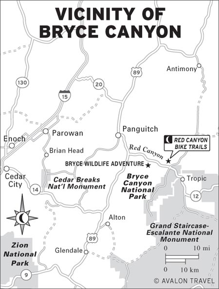
• Distance: 0.8 miles round-trip
• Duration: 1 hour
• Elevation change: 300 feet
• Effort: moderate
• Trailhead: Highway 12 pullout, just west of the tunnels
The Tunnel Trail ascends to fine views of the canyon and the two highway tunnels. The trail crosses a streambed and then climbs a ridge to access excellent views.
A rather wonderful paved bike trail parallels Highway 12 for five miles through Red Canyon. Parking lots are located at either end of the trail, at the Thunder Mountain Trailhead and Coyote Hollow Road.
True mountain bikers will eschew the pavement and head to Casto Canyon Trail, a 5.5-mile one-way trail that winds through a variety of red-rock formations and forest. This ride starts west of the visitors center, about two miles east of U.S. 89. Turn north from Highway 12 onto Forest Road 118, and continue about three miles to the Casto Canyon parking lot. For part of the way, the trail is shared with ATVs, but then the bike trail splits off to the right. The usual turnaround point is at Sanford Road.
This ride can be linked with other trails to form a 17-mile one-way test of biking skills and endurance, with the route starting and ending along Highway 12. If you don’t have a shuttle vehicle at each of the trailheads, you’ll need to pedal back another eight miles along the paved roadside trail to retrieve your vehicle. Start at Tom Best Road, just east of Red Canyon. You’ll climb through forest, turning onto Berry Spring Creek Road and then Cabin Hollow Road. Once the trail heads into Casto Canyon, you’ll have five downhill miles of wonderful red-rock scenery. When you reach the Casto Canyon trailhead, you can choose to return to Highway 12 or pedal out to U.S. 89 and Panguitch. Much of the trail is strenuous, and you must take water along because there’s no source along the way. There are several side trails you could use to make this into a shorter ride; stop by the Red Canyon Visitor Center for more information.
Red Canyon Campground (Hwy. 12, 435/676-9300, www.fs.fed.us/r4/dixie, late May-late Sept., $12) is located at 7,400 feet and has 37 first-come, first-served sites. Drinking water and showers ($2) are available.
A museum and natural history complex, Bryce Museum and Wildlife Adventure (1945 W. Hwy. 12, 435/834-5555, www.brycewildlifeadventure.com, 9am-7pm daily Apr. 1-Nov. 15, $8) is a wildlife showcase housed in a large building just west of the turnoff to Bryce Canyon. This taxidermy collection depicts more than 800 animals from around the world displayed in dioramas resembling their natural habitats. It’s actually quite well done, and kids seem to love it. There’s also a good collection of Native American artifacts and a beautiful butterfly display. You can also rent ATVs and mountain bikes here.
If you’re driving between Zion and Bryce National Parks, consider stopping at Cedar Breaks. But take note: This is high country, and the road is closed mid-October-late May.
Cedar Breaks National Monument (www.nps.gov/cebr, $4) is much like Bryce Canyon, but it’s on a different high plateau and lacks the crowds that flock to Bryce. Here on the west edge of the Markagunt Plateau, a giant amphitheater 2,500 feet deep and more than three miles across has been eroded into the stone. A fairyland of forms and colors appears below the rim. Ridges and pinnacles extend like buttresses from the steep cliffs. Traces of iron, manganese, and other minerals have tinted the normally white limestone a rainbow of warm hues. The intense colors blaze during sunsets and glow even on cloudy days. Rock layers look much like those at Bryce Canyon National Park, but here they’re 2,000 feet higher. Elevations range from 10,662 feet at the rim’s highest point to 8,100 feet at Ashdown Creek. Cottony patches of clouds often drift above the craggy landscape. In the distance, beyond the amphitheater, are Cedar City and the desert’s valleys and ranges. Dense forests broken by large alpine meadows cover the rolling plateau country away from the rim. More than 150 species of wildflowers brighten the meadows during summer; the colorful display peaks during the last two weeks of July, when the Annual Wildflower Festival (435/586-9451, www.nps.gov/cebr) takes place.
Two easy trails near the rim provide an added appreciation of the geology and forests. Allow extra time on foot—walking can be tiring at high elevations. Regulations prohibit pets on the trails.
A five-mile scenic drive leads past four spectacular overlooks, each with a different perspective. Avoid overlooks and other exposed areas during thunderstorms, which are common on summer afternoons. Heavy snows close the road for much of the year. You can drive in only from about late May, sometimes later, until the first big snowstorm of autumn, usually in October. Winter visitors can ski, snowshoe, or travel by snowmobile (only on unplowed roads) from Brian Head (2 miles north of the monument) or Highway 14 (2.5 miles south).
Cedar Breaks National Monument is 24 miles east of Cedar City, 17 miles south of Parowan, 30 miles southwest of Panguitch, and 27 miles northwest of Long Valley Junction (Hwy. 14 and U.S. 89).
A log cabin visitors center (435/586-0787 summer, 435/586-0787 winter, www.nps.gov/cebr, 9am-6pm daily June 5-mid-Oct.) includes exhibits, an information desk, and a bookstore. The exhibits provide a good introduction to the Markagunt Plateau and identify local rocks, wildflowers, trees, animals, and birds. Staff members offer nature walks, geology talks, and campfire programs; see the schedules posted in the visitors center and at the campground. The Point Supreme Overlook is located west of the visitors center. The entrance fee ($4 per vehicle) is collected near the visitors center; there’s no charge if you’re just driving through the monument without stopping.
• Distance: 4 miles round-trip
• Duration: 2 hours
• Elevation change: 400 feet
• Trailhead: visitors center
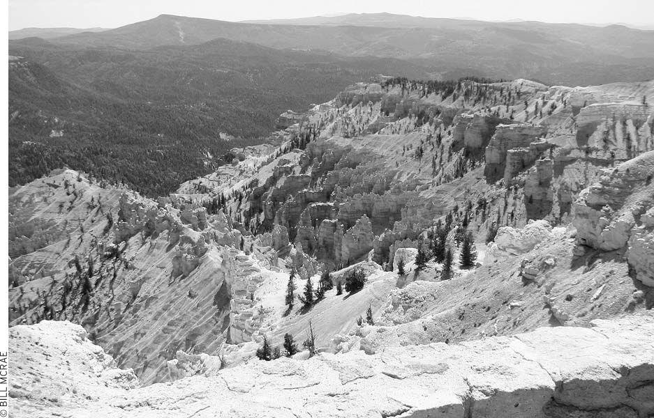
Lose the crowds at Cedar Breaks National Monument.
The Spectra Point/Ramparts Trail begins at the visitors center, then follows the rim along the south edge of the amphitheater to an overlook. Hikers who are short on time or feeling the effects of the 10,000-foot elevation can cut the distance in half by stopping after one mile at Spectra Point, where weather-beaten bristlecone pines grow. The trail’s end is marked by an overlook.
• Distance: 2 miles round-trip
• Duration: 1 hour
• Elevation change: 20 feet
• Effort: easy
• Trailhead: visitors center
The Alpine Pond Trail drops below the rim into one of the few densely wooded areas of the amphitheater. The trail winds through enchanting forests of aspen, subalpine fir, and Engelmann spruce. You can cut the hiking distance in half with a car shuttle between the two trailheads or by taking a connector trail that joins the upper and lower parts of the loop near Alpine Pond. Begin from either Chessmen Ridge Overlook or the trailhead pullout 1.1 miles farther north. A trail guide ($1) is available at the start or at the visitors center.
Point Supreme Campground (mid-June-late Sept., $14), east of the visitors center, offers 28 first-come, first-served sites with water. If you plan to visit in June or September, it’s best to call ahead to check that it’s open; in some years the season is short. There’s a picnic area near the campground.
The nearest accommodations and restaurants are two miles north in Brian Head, where Cedar Breaks Lodge (223 Hunter Ridge Rd., Brian Head, 435/677-3000 or 888/282-3327, www.cedarbreakslodge.com, $94-109 summer, $120-139 winter) has fairly plush guest rooms, a day spa, and good deals during the summer (Brian Head is busiest during the ski season).
Mormon pioneer Ebenezer Bryce homesteaded near the town site of Tropic in 1875, but the work of scratching a living from the rugged land became too difficult. He is remembered as saying of the area, “Well, it’s a hell of a place to lose a cow.” He left five years later for more promising land in Arizona. The name of the park commemorates his efforts. Other pioneers settled six villages near the upper Paria River between 1876 and 1891. The towns of Tropic, Cannonville, and Henrieville still survive.
A log cabin built by Ebenezer Bryce has been moved to a site beside the Bryce Pioneer Village Motel (80 S. Main St.); ask to see the cabin’s small collection of pioneer and Native American artifacts. There is a visitor information booth (11am-7pm daily early May-late Oct.) in the center of town.
Travelers think of Tropic primarily for its cache of motels lining Main Street (Hwy. 12), but several pleasant B&Bs also grace the town.
At the Bryce Canyon Inn (21 N. Main St., 435/679-8502 or 800/592-1468, www.brycecanyoninn.com, Mar.-Oct., $70 motel rooms, $99 cabins), the tidy cabins are nicely furnished and are one of the more appealing options in the Bryce neighborhood. The economy motel rooms are small but clean and a good deal.
Up on a bluff on the outskirts of town, the Buffalo Sage B&B (980 N. Hwy. 12, 435/679-8443 or 866/232-5711, www.buffalosage.com, $80) has great views and guest rooms decorated in an upscale Southwestern style.
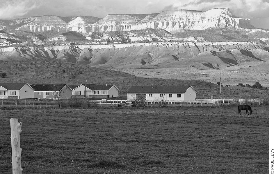
Bryce Valley, east of the park, is visible from the town of Tropic.
America’s Best Value Bryce Valley Inn (199 N. Hwy. 12, 435/679-8811 or 800/442-1890, www.brycevalleyinn.com, $68-105) has conventional motel rooms in an attractive wood-fronted Western-style motel with an adjoining restaurant. Pets are permitted, but an extra fee is charged.
One of the most pleasant places to stay in Tropic is in the Bryce Country Cabins (320 N. Hwy. 12, 435/679-8643 or 888/679-8643, www.brycecountrycabins.com, $99-139). The cabins overlook a meadow, and each has a private bath.
At the other end of town, the Bullberry Inn B&B (412 S. Hwy 12, 435/679-8820 or 800/249-8126, www.bullberryinn.com, from $105) has wraparound porches, and the guest rooms have private baths and rustic-style pine furniture.
At Bryce Canyon Livery B&B (660 W. 50 S., 435/679-8780 or 888/889-8910, www.brycecanyonbandb.com, $115) every guest room has a private bath; several have balconies with views of Bryce Canyon.
The M Stone Canyon Inn (435/679-8611 or 866/489-4680, www.stonecanyoninn.com, $145-225 rooms, $275-330 cottages), just west of Tropic with views of Bryce, is a strikingly handsome modern structure with comfortable uncluttered rooms, all with private baths. Stone Canyon also has two-bedroom guest cabins that can be divided into smaller units. The owners are happy to point you toward their favorite trails.
In town, you can find tent ($12) and RV ($30) camping at Bryce Pioneer Village Motel (80 S. Main St., 435/679-8546 or 800/222-0381, www.brycepioneervillage.com) in addition to guest rooms and cabins ($70-95). Head east to Cannonville for Cannonville/Bryce Valley KOA (175 N. Red Rock Dr., Cannonville, 435/679-8988 or 888/562-4710, www.koa.com, $30-35), or continue south from Cannonville to Kodachrome Basin State Park (801/322-3770 or 800/322-3770, www.reserveamerica.com, $16).
There are a few dining options in town. The best place to start your search for a meal is Clarke’s (141 N. Main St., 435/679-8633, 7am-10pm daily, $7-22), an all-around institution that, in addition to selling groceries, serves Mexican food, pasta, pizza, ice cream, and steaks from a variety of venues within a complex that’s essentially the town center.
Tropic is 11 miles east of Bryce Canyon National Park on Highway 12, and it is visible from many of the park’s viewpoints.
Pioneers arrived here in 1864, but the Ute people forced them to evacuate just two years later. A second attempt by settlers in 1871 succeeded, and Panguitch (the name is from the Paiute word for “big fish”) is now the largest town in the area.
Panguitch is one of the more pleasant towns in this part of Utah, and it has an abundance of reasonably priced motels, plus a couple of good places to eat. It’s a good stopover on the road between Zion and Bryce National Parks.
The early-20th-century commercial buildings downtown have some of their original facades. On side streets you can see sturdy brick houses built by the early settlers. Stop by the Daughters of Utah Pioneers Museum (125 E. Center St., 4pm-8pm Mon.-Sat. Memorial Day-Labor Day, free) in the old bishop’s storehouse to see historic exhibits about Panguitch. During the off-season, the museum is open by appointment; phone numbers of volunteers are on the door.
The city park on the north edge of town has picnic tables, a playground, tennis courts, and a visitor information cabin. A swimming pool (250 E. Center St., 435/676-2259) is by the high school.
Travelers in the area during the second weekend in June should try to swing by for the annual Quilt Walk, an all-out festival with historic home tours, quilting classes, and lots of food. The Quilt Walk commemorates a group of seven pioneers who trudged through snow to bring food back to starving townspeople—they spread quilts on the deep, soft snow and walked on them in order not to sink.
Panguitch is the best place in greater Bryce Canyon to find an affordable motel room—there are more than a dozen older motor court lodgings, most very nicely maintained. Of these, the Color Country Motel (526 N. Main St., 435/676-2386 or 800/225-6518, www.colorcountrymotel.com, $69-89) is one of the most attractive, with an outdoor pool and clean well-furnished guest rooms.
The Adobe Sands (390 N. Main St., 435/676-8874 or 800/497-9261, www.adobesandsmotel.com, May-Oct., $55-70) is pet friendly, and it offers clean basic guest rooms at budget prices.
Another good midrange pick is the Canyon Lodge (210 N. Main St., 435/676-8292 or 800/440-8292, www.color-country.net/~cache, $69-89) with clean basic guest rooms plus a three-bed suite.
Along U.S. 89, the New Western Motel (180 E. Center St., 435/676-8876 or 800/528-1234, http://newbrycewesterninn.com, $74-99) has a swimming pool and a hot tub plus laundry facilities. Some guest rooms are in an older building, but all guest rooms have recently been refurbished.
Stay in one of the town’s landmark redbrick homes: the tidy M Red Brick Inn of Panguitch B&B (161 N. 100 W., 435/676-2141 or 866/733-2745, www.redbrickinnutah.com, $119) has distinctive barnlike architecture and cozy bedrooms, including two adjoining bedrooms that share a bath—perfect for families. If you like B&Bs, this is definitely the best place in town to stay.
Hitch-N-Post Campground (420 N. Main St., 435/676-2436, www.hitchnpostrv.com, year-round) offers spaces for tents ($15) and RVs ($27) and has showers and a laundry room. The Big Fish KOA Campground (555 S. Main St., 435/676-2225, mid-Apr.-mid-Oct., from $25 tents, $36 RVs, $49 cabins) on the road to Panguitch Lake includes a pool, a recreation room, laundry, and showers. The closest public campground is in Red Canyon (Hwy. 12, 435/676-9300, www.fs.fed.us/r4/dixie, $12).
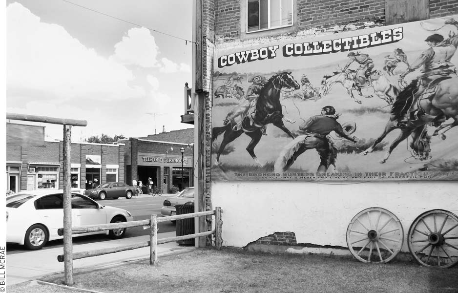
Panguitch makes the most of its Old West facades.
The culinary high point of a visit to Panguitch will likely be the mesquite-grilled meats at Cowboy’s Smokehouse Bar-B-Q (95 N. Main St., 435/676-8030, 6:30pm-9pm Mon.-Sat. mid-Mar.-mid-Oct., $10-18), where live country music and Western atmosphere are regular features. The Flying M Restaurant (580 N. Main St., 435/676-8008, 7am-9pm daily, $8-18) is a favorite for its hearty breakfasts and standard American comfort-food dinners, including homemade turkey potpies.
Contact the Bryce Canyon Country (55 S. Main St., 435/676-1160 or 800/444-6689, www.brycecanyoncountry.com) for information on Panguitch and the nearby area. The Powell Ranger District Office (225 E. Center St., 435/676-9300, 8am-4:30pm Mon.-Fri.) of the Dixie National Forest has information on campgrounds, hiking trails, fishing, and scenic drives in the forest and canyons surrounding Bryce Canyon National Park.
There is a post office (65 N. 100 W.), and Garfield Memorial Hospital (200 N. 400 E., hospital 435/676-8811, clinic 435/676-8842) is the main hospital in this part of the state.
Panguitch is on U.S. 89, seven miles north of Bryce Junction (Hwy. 12 and U.S. 89). From Bryce Junction, it is 11 miles east on Highway 12 to Bryce Canyon National Park.