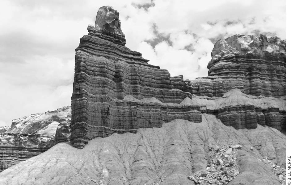
Although Capitol Reef gets far less attention than the region’s other national parks, it is a great place to visit, with excellent hiking and splendid scenery. Wonderfully sculpted rock layers in a rainbow of colors put on a fine show; you’ll find these same rocks throughout much of the Four Corners region, but their artistic variety has no equal outside Capitol Reef National Park. About 70 million years ago, gigantic forces within the earth began to uplift, squeeze, and fold more than a dozen rock formations into the central feature of the park today—the Waterpocket Fold, so named for the many small pools of water trapped by the tilted strata. Erosion has since carved spires, graceful curves, canyons, and arches. The Waterpocket Fold extends 100 miles between Thousand Lake Mountain to the north and Lake Powell to the south. (Look for it if you ever fly south from Salt Lake City—we never really grasped its magnitude until we flew over it on the way to Mexico.) The most spectacular cliffs and rock formations of the Waterpocket Fold form Capitol Reef, located north of Pleasant Creek and curving northwest across the Fremont River toward Thousand Lake Mountain. The reef was named by explorers who found the Waterpocket Fold a barrier to travel and likened it to a reef blocking passage on the ocean. One specific rounded sandstone hill reminded them of the Capitol Dome in Washington DC.
Roads and hiking trails in the park provide access to the colorful rock layers and to the plants and wildlife that live here. You’ll also see remnants of the area’s long human history—petroglyphs and storage bins of the prehistoric Fremont people, a schoolhouse and other structures built by Mormon pioneers, and several small uranium mines from the 20th century. Legends tell of Butch Cassidy and other outlaw members of the Wild Bunch who hid out in these remote canyons in the 1890s.
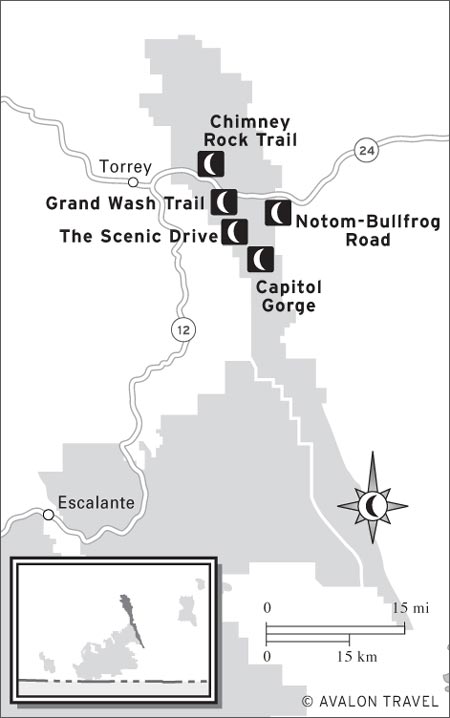
M The Scenic Drive: Capitol Reef’s 25-mile round-trip Scenic Drive encompasses not only scenery and all its attendant geology, but also human history, pioneer sites, and even free fruit in season (click here).
M Notom-Bullfrog Road: You’ll pass nearly 80 miles of the Waterpocket Fold’s eastern side while traveling along this road, which exposes the fold’s geologic wonders. Distinctive panoramas are your reward, and scenic side canyons beckon hikers (click here).
M Chimney Rock Trail: The trail to Chimney Rock starts right on Highway 24, and even if you weren’t meaning to visit Capitol Reef, it’s worth taking a couple of hours to hike it. Panoramic views from the top take in the face of Capitol Reef (click here).
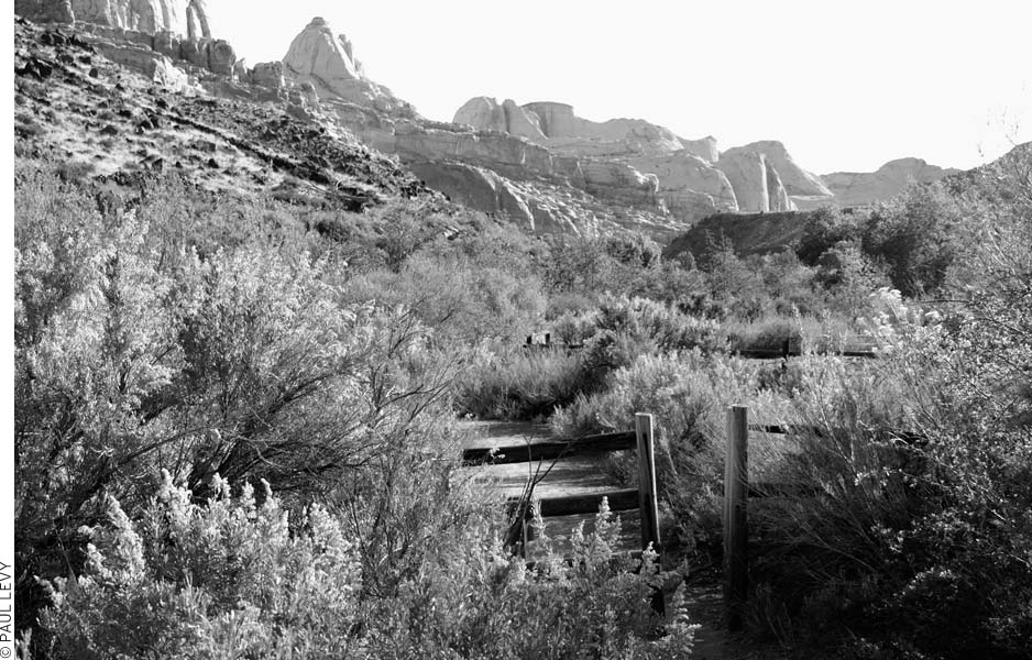
M Grand Wash Trail: Hike from the trailhead on Highway 24 into the Narrows, where the canyon walls close in and rise to 200 feet. Grand Wash offers easy hiking, great scenery, and an abundance of wildflowers (click here).
M Capitol Gorge: Hike through another wash past rock art left by the Fremont people and a Mormon “pioneer register” to a turnoff for a spur trail (leading to natural water reservoirs called water pockets). Listen for the lovely song of the canyon wren (click here).
LOOK FOR M TO FIND RECOMMENDED SIGHTS, ACTIVITIES, DINING, AND LODGING.
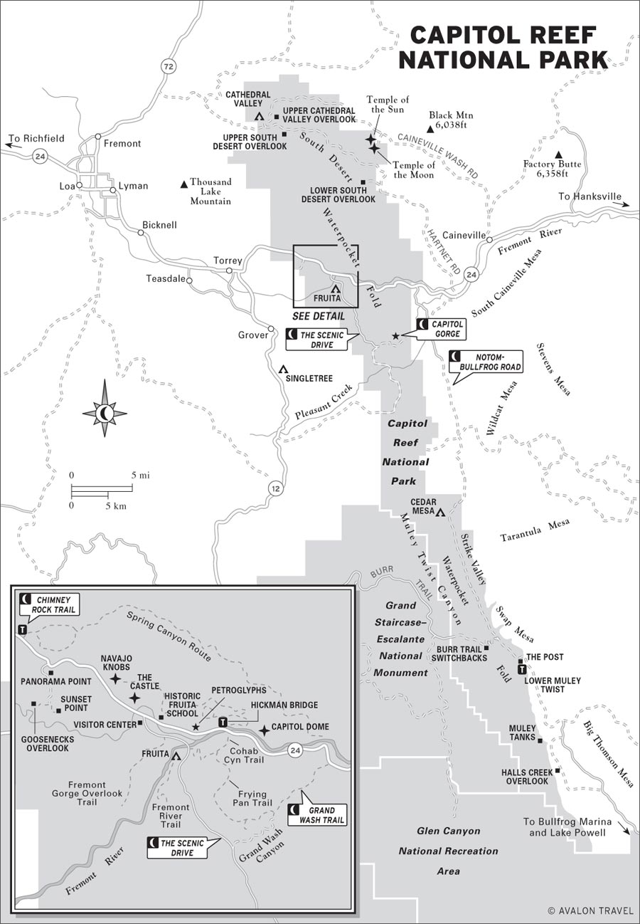
Even travelers short on time will enjoy a quick look at visitors center exhibits and a drive on Highway 24 through an impressive cross section of Capitol Reef cut by the Fremont River. You can see more of the park on the Scenic Drive, a narrow paved road that heads south from the visitors center. The drive passes beneath spectacular cliffs of the reef and enters Grand Wash and Capitol Gorge Canyons; allow at least 1.5 hours for the 21-mile round-trip and any side trips. The fair-weather Notom-Bullfrog Road (about half paved, with paved segments at both north and south ends) heads south along the other side of the reef for almost 70 miles, offering fine views of the Waterpocket Fold. Burr Trail Road (dirt inside the park) in the south actually climbs over the fold in a steep set of switchbacks, connecting Notom Road with Boulder. Only drivers with high-clearance vehicles can explore Cathedral Valley in the park’s northern district. All of these roads provide access to viewpoints and hiking trails.
Expect hot summer days (highs in the upper 80s and low 90s) and cool nights. Late-afternoon thunderstorms are common in July-August; be alert for impending storms, which can bring flash flooding. Winter brings cool days (highs in the 40s) and night temperatures in the low 20s and teens. Snow accents the colored rocks while rarely hindering traffic on the main highway. Winter travel on the back roads and trails may be halted by snow, but it soon melts when the sun comes out. Annual precipitation averages only seven inches, peaking in the late-summer thunderstorm season.
Many southern Utah travelers treat Capitol Reef as a pass-through, and indeed, it’s easy to get a feel for the park by taking a short hike off Highway 24, perhaps just the walk out to Goosenecks and Sunset Point. But a short visit here may leave you longing for more. On a one-day visit, be sure to stop at the visitors center for the slide show (it’s less schmaltzy than many national-park slide shows and explains the geology quite nicely), hike either Grand Wash or Capitol Gorge, and spend some time exploring the park’s human history, from petroglyphs left by the Fremont people to the Fruita blacksmith shop. It’s easy to spend 2-3 days camping at the park campground or staying in nearby Torrey and taking day hikes in the park’s core district. But if you’ve got the proper vehicle, after a couple of days you’ll want to explore the Notom-Bullfrog Road. If you’re just driving, this is easy to do in a day; if you get out of the car to explore every canyon, it can take all the time you have.
The most accessible part of Capitol Reef National Park (435/425-3791, www.nps.gov/care, $5 per vehicle, $3 cyclists and pedestrians) is along Highway 24, about 11 miles east of Torrey. In fact, several trails start right off the highway, which means that it’s not necessary to pay the admission fee to get a tiny taste of this park.
At the visitors center (Hwy. 24, 8am-6pm daily June-Sept., 8am-4:30pm daily Oct.-May), start with the good 10-minute slide show, shown on request, introducing Capitol Reef’s natural wonders and history. Rock samples and diagrams illustrate the park’s geologic formations, and photos identify local plants and birds. Prehistoric Fremont artifacts on display include petroglyph replicas, sheepskin moccasins, pottery, basketry, stone knives, spear and arrow points, and bone jewelry. Other historic exhibits outline exploration and early Mormon settlement.
Hikers can pick up a map of trails that are near the visitors center and of longer routes in the southern areas of the park; naturalists will want the checklists of plants, birds, mammals, and other wildlife, while history buffs can learn more about the area’s settlement and the founding of the park. Rangers offer nature walks, campfire programs, and other special events Easter-mid-October; the bulletin board outside the visitors center lists what’s on. The visitors center is on Highway 24 at the turnoff for Fruita Campground and the Scenic Drive.
From the west, Highway 24 drops from the broad mountain valley near Torrey onto Sulphur Creek, with dramatic rock formations soaring to the horizon. A huge amphitheater of stone rings the basin, with formations such as Twin Rocks, Chimney Rock, and the Castle glowing in deep red and yellow tones. Ahead, the canyon narrows as the Fremont River slips between the cliffs to carve its chasm through the Waterpocket Fold.
Capitol Gorge is one of only five canyons cut through the Waterpocket Fold.
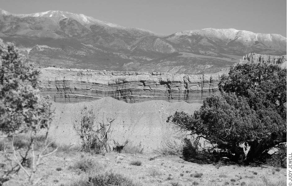
Exposed rocks at Capitol Reef reveal windswept deserts, rivers, mud flats, and inland seas of long ago. Nearly all the layers date from the Mesozoic Era (65-230 million years ago), when dinosaurs ruled the earth. Later uplift and twisting of the land, which continues to this day, built up the Colorado Plateau of southern Utah and the Rocky Mountains to the east. Immense forces squeezed the rocks until they bent up and over from east to west in the massive crease of the Waterpocket Fold.
Ponderosa pine and other cool-climate vegetation grow on the flanks of Thousand Lake Mountain at elevations of 7,000-9,000 feet in the northwest corner of the park. Most of the Waterpocket Fold, however, is at 5,000-7,000 feet, covered with sparse junipers and piñon pines that cling precariously in cracks and thin soils of the slickrock. The soil from each rock type generally determines what will grow. Mancos Shale forms a poor clay soil supporting only saltbush, shadscale, and galleta grass. On Dakota sandstone you’ll see mostly sage and rabbitbrush. Clays of the Morrison Formation repel nearly all plants, while its sandstone nurtures mostly juniper, piñon pine, and cliffrose; uranium prospectors discovered that astragalus and prince’s plume commonly grow near ore deposits. Sands of the Summerville Formation nourish grasses and four-wing saltbush. The Fremont River and several creeks provide a lush habitat of cottonwood, tamarisk, willow, and other water-loving plants.
Streamside residents include beavers, muskrats, mink, tree lizards, Great Basin spadefoot toads, Rocky Mountain toads, and leopard frogs. Spadefoot toads, fairy shrimp, and insects have adapted to the temporary water pockets by completing the aquatic phases of their short life cycles in a hurry. Near water or out in the drier country, you might see mule deer, coyotes, gray foxes, porcupines, spotted and striped skunks, badgers, black-tailed jackrabbits, desert cottontails, yellow-bellied marmots, rock squirrels, Colorado chipmunks, Ord’s kangaroo rats, canyon mice, and five known species of bats. With luck, you may sight a relatively rare (and suitably distant) mountain lion or black bear.
Although you can’t miss seeing the many small lizards along the trails, snakes tend to be more secretive; those in the park include the striped whipsnake, Great Basin gopher snake, wandering garter snake, and the rarely seen (and quite venomous) midget faded rattlesnake. Some common birds are the sharp-shinned hawk, American kestrel, chukar, mourning dove, white-throated swift, black-chinned and broad-tailed hummingbirds, violet-green swallow, common raven, piñon and scrub jays, canyon and rock wrens, and rufous-sided towhee. Most wildlife, except birds, wait until evening to come out, and they disappear again the following morning.
Take in the incredible view from Panorama Point, 2.5 miles west of the visitors center on the south side of Highway 24. Follow signs south for 250 yards to Panorama Point and views of Capitol Reef, the distant Henry Mountains to the east, and looming Boulder Mountain to the west. The large black basalt boulders were swept down from Boulder Mountain to the reef as part of giant debris flows between 8,000 and 200,000 years ago.
On a gravel road one mile south of Panorama Point are the Goosenecks of Sulphur Creek. A short trail leads to Goosenecks Overlook (elevation 6,400 feet) on the rim for dizzying views of the creek below. Canyon walls display shades of yellow, green, brown, and red. Another easy trail leads 0.3 miles to Sunset Point and panoramic views of the Capitol Reef cliffs and the distant Henry Mountains.
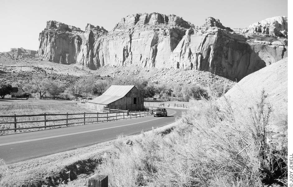
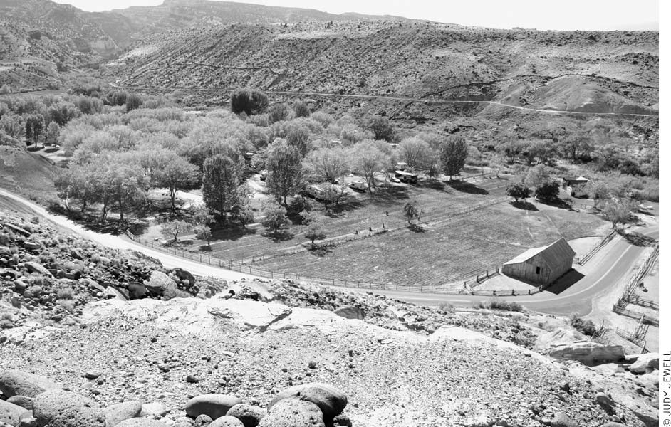
Remnants of the pioneer community of Fruita stretch along the narrow Fremont River Canyon. The Fruita Schoolhouse is just east of the visitors center on the north side of Highway 24. Early settlers completed this one-room log structure in 1896. Teachers struggled at times with rowdy students, but the kids learned their three R’s in grades one through eight. Mormon church meetings, dances, town meetings, elections, and other community gatherings took place here. A lack of students caused the school to close in 1941. Rangers are on duty some days in summer; ask at the visitors center. At other times, you can peer inside the windows and take photos.
Farther down the canyon, 1.2 miles east of the visitors center on the north side of Highway 24, are several panels of Fremont petroglyphs; watch for the road signs. Several mountain sheep and human figures with headdresses decorate the cliff. You can see more petroglyphs by walking to the left and right along the cliff face. Stay on the trail, and do not climb the talus slope.
Behunin Cabin is 6.2 miles east of the visitors center on the south side of Highway 24. Elijah Cutlar Behunin used blocks of sandstone to build this cabin in about 1882. For several years, Behunin, his wife, and 11 of their 13 children shared this sturdy but quite small cabin (the kids slept outside). They moved on when flooding made life too difficult. Small openings allow a look inside the dirt-floored structure, but no furnishings remain.
Near the end of the narrow sandstone canyon, a small waterfall, created when the Fremont River was rerouted in 1962 to accommodate the highway, attracts photographers. The river twists through a narrow artificial crack in the rock before making its final plunge into a pool below. Take the sandy path from the parking area to where you can safely view the falls from below. The pool beneath the falls used to be a popular swimming hole, but water dynamics have changed over the years; the National Park Service closed it to swimming in 2011, when three people almost drowned because of the extremely heavy flow and strong currents. Parking is 6.9 miles east of the visitors center, near mile marker 86, on the north side of Highway 24. This area is closed during the warmer months and opens again when it’s too cold for people to be tempted to swim.
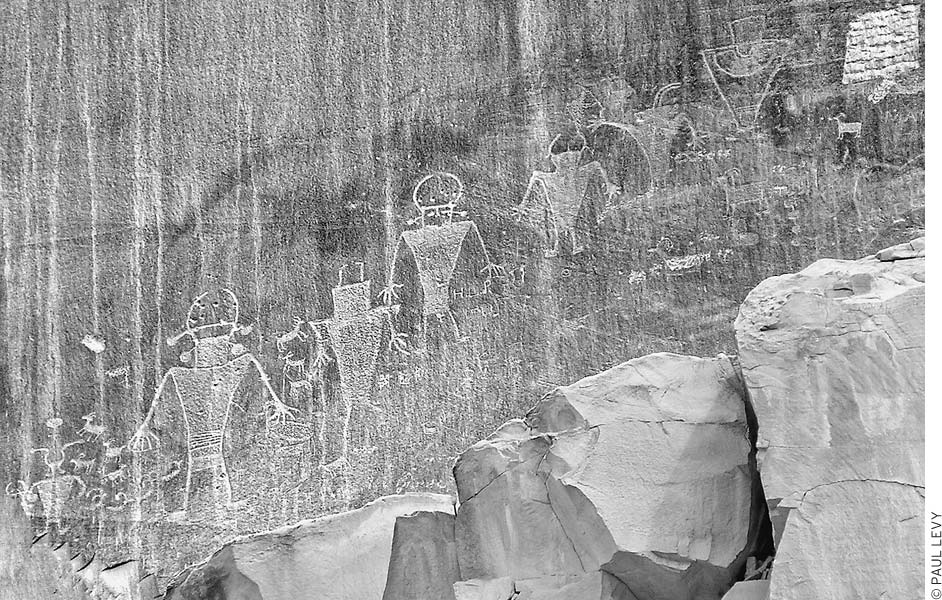
Fremont petroglyphs along Highway 24
Turn south from Highway 24 at the visitors center to experience some of the reef’s best scenery and to learn more about its geology. A quick tour of this 25-mile out-and-back trip requires about 1.5 hours, but several hiking trails may tempt you to extend your stay. It’s worth picking up a brochure at the visitors center for descriptions of geology along the road. The Scenic Drive is paved, although side roads have gravel surfaces. Note that drivers must pay the $5 park entrance fee to travel this road.
In the Fruita Historic District, you’ll first pass orchards and several of Fruita’s buildings. A blacksmith shop (0.7 miles from the visitors center, on the right) displays tools, harnesses, farm machinery, and Fruita’s first tractor. The tractor didn’t arrive until 1940, long after the rest of the country had modernized. In a recording, a rancher tells about living and working in Fruita. The nearby orchards and fields are still maintained using old-time farming techniques.
The Gifford Farmhouse, one mile south on the Scenic Drive, is typical of rural Utah farmhouses of the early 1900s. Cultural demonstrations and handmade items are available. A picnic area is just beyond; with fruit trees and grass, this is a pretty spot for lunch. A short trail crosses orchards and the Fremont River to the Historic Fruita School.
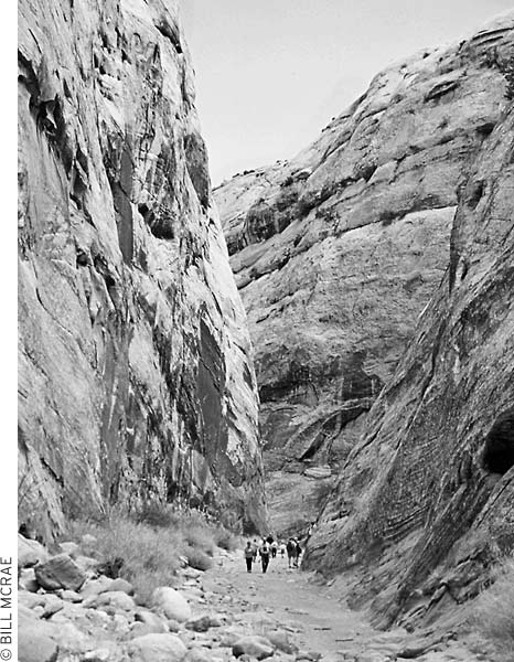
The Scenic Drive leaves the Fremont River valley and climbs up a desert slope, with the rock walls of the Waterpocket Fold rising to the east. Turn east to explore Grand Wash, a dry channel etched through the sandstone. A dirt road follows the twisting gulch one mile, with sheer rock walls rising along the sandy streambed. At the road’s end, an easy hiking trail follows the wash 2.5 miles to its mouth along Highway 24.
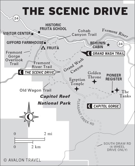
Back on the paved Scenic Drive, continue south past Slickrock Divide to where the rock lining the reef deepens into a ruby red and forms odd columns and spires that resemble statuary. Called the Egyptian Temple, this is one of the most striking and colorful areas along the road.
Capitol Gorge is at the end of the Scenic Drive, 10.7 miles from the visitors center. Capitol Gorge is a dry canyon through Capitol Reef, much like Grand Wash. Believe it or not, narrow twisting Capitol Gorge was the route of the main state highway through south-central Utah for 80 years. Mormon pioneers laboriously cleared a path so wagons could get through, a task they repeated every time flash floods rolled in a new set of boulders. Cars bounced their way down the canyon until 1962, when Highway 24 opened, but few traces of the old road remain today. Walking is easy along the gravel riverbed, but don’t enter if storms threaten. An easy one-mile saunter down the gorge will take day hikers past petroglyphs and a “register” rock where pioneers carved their names.
The Scenic Drive curves east toward Capitol Gorge and onto Pleasant Creek Road (turn right 8.3 miles from the visitors center), which continues south below the face of the reef. After three miles, the sometimes rough dirt road passes Sleeping Rainbow-Floral Ranch (closed to the public) and ends at Pleasant Creek. A rugged road for 4WD vehicles—South Draw Road—continues on the other side, but it is much too rough for cars. Floral Ranch dates back to the early years of settlement at Capitol Reef. In 1939 it became the Sleeping Rainbow Guest Ranch, from the translation of the Native American name for Waterpocket Fold. Now the ranch belongs to the park and is used as a field research station by students and faculty of Utah Valley University. Pleasant Creek’s perennial waters begin high on Boulder Mountain to the west and cut a scenic canyon completely through Capitol Reef. Hikers can head downstream through the three-mile-long canyon and then return the way they went in, or continue another three miles cross-country to Notom Road.
Only the most adventurous travelers enter the remote canyons and desert country of the park’s northern district. The few roads cannot be negotiated by 4WD vehicles, let alone ordinary cars, in wet weather. In good weather, high-clearance vehicles (good clearance is more important than four-wheel drive) can enter the region from the east, north, and west. The roads lead through stately sandstone monoliths of Cathedral Valley, volcanic remnants, badlands country, many low mesas, and vast sand flats. Foot travel allows closer inspection of these features or lengthy excursions into the canyons of Polk, Deep, and Spring Creeks, which cut deeply into the flanks of Thousand Lake Mountain.
The Scenic Drive passes historic buildings from the old town of Fruita and provides access to several hiking trails.
Mountain bikers enjoy these challenging roads as well, but they must stay on established roads. Much of the north district is good for horseback riding as well.
The district’s two main roads—Hartnett Road and Cathedral Road (a.k.a. Caineville Wash Rd.)—combine with a short stretch of Highway 24 to form a loop, with a campground at their junction. Cathedral Valley Campground’s five sites provide a place to stop for the night; rangers won’t permit car camping elsewhere in the district. The campground is on the 4WD Cathedral Valley loop road about 36 miles from the visitors center (from the park entrance, head 12 miles east on Highway 24, turn north and ford the Fremont River, and then follow Hartnett Road about 24 miles to the campground); check on road conditions at the visitors center before heading out. The Upper Cathedral Valley Trail, just below the campground, is an enjoyable one-mile walk offering excellent views of the Cathedrals. Backcountry hikers must have a permit and camp at least 0.5 miles from the nearest road. Guides to the area can be purchased at the visitors center.
Capitol Reef is only a small part of the Waterpocket Fold. By taking the Notom-Bullfrog Road, you’ll see nearly 80 miles of the fold’s eastern side. This route crosses some of the younger geologic layers, such as those of the Morrison Formation, which form colorful hills. In other places, eroded layers of the Waterpocket Fold jut up at 70-degree angles. The Henry Mountains to the east and the many canyons on both sides of the road add to the memorable panoramas. The northernmost 10 miles of the road have been paved, and about 25 miles are paved on the southern end near Bullfrog, a settlement on the shores of Lake Powell. The rest of the road is dirt and gravel, and it can get pretty washboarded and bumpy. Most cars should have no trouble negotiating this road in good weather. Keep an eye on the weather before setting out, though; the dirt-and-gravel surface is usually OK for cars when dry but can be dangerous for any vehicle when wet. Sandy spots and washouts may present a problem for low-clearance vehicles; contact the visitors center to check current conditions. Have a full tank of gas and carry extra water and food; no services are available between Highway 24 and Bullfrog Marina. Purchase a small guide to this area at the visitors center. Features and mileage along the drive from north to south include the following:
The Waterpocket Fold is a vast wrinkle nearly 100 miles long.
About 65 million years ago, well before the Colorado Plateau uplifted, sedimentary rock layers in south-central Utah buckled, forming a steep-sided monocline, a rock fold with one very steep side in an area of otherwise nearly horizontal layers. A monocline is a “step-up” in the rock layers along an underlying fault. The rock layers on the west side of the Waterpocket Fold have been lifted more than 7,000 feet higher than the layers to the east. The 100-mile-long fold was then subjected to millions of years of erosion, which slowly removed the upper layers to reveal the warped sedimentary layers at its base. Continued erosion of the sandstone has left many basins, or “water pockets,” along the fold. These seasonal water sources, often called “water tanks,” are used by desert animals, and they were a water source for prehistoric people. Erosion of the tilted rock layers continues today, forming colorful cliffs, massive domes, soaring spires, stark monoliths, twisting canyons, and graceful arches. Getting a sense of the Waterpocket Fold requires some off-pavement driving. The best viewpoint is along Burr Trail Road, which climbs up the fold between Boulder and Notom-Bullfrog Road.
Notom-Bullfrog Road runs from Highway 24 south to a ferry crossing at Lake Powell; it follows the Waterpocket Fold for much of the way.
• Mile 0.0: The turnoff from Highway 24 is 9.2 miles east of the visitors center and 30.2 miles west of Hanksville (another turnoff from Highway 24 is three miles east).
• Mile 2.2: Pleasant Creek; the mouth of the canyon is 5-6 miles upstream, although it’s only about three miles away if you head cross-country from south of Notom. Hikers can follow the canyon three miles upstream through Capitol Reef to Pleasant Creek Road (off the Scenic Drive).
• Mile 4.1: Notom Ranch is to the west; once a small town, Notom is now a private ranch.
• Mile 8.1: Burrow Wash; hikers can explore the narrow canyon upstream.
• Mile 9.3: Cottonwood Wash; another canyon hike just upstream.
• Mile 10.4: Five Mile Wash; yet another canyon hike. Pavement ends.
• Mile 13.3: Sheets Gulch; a scenic canyon is upstream here.
• Mile 14.1: Sandy Ranch Junction; high-clearance vehicles can turn east and go 16 miles to the Henry Mountains.
• Mile 14.2: Oak Creek Access Road; the creek cuts a two-mile-long canyon through Capitol Reef and makes a good day hike. Backpackers sometimes start upstream at Lower Bowns Reservoir (off Hwy. 12) and hike the 15 miles to Oak Creek Access Road. The clear waters of Oak Creek flow year-round but are not potable.
• Mile 14.4: Oak Creek crossing.
• Mile 20.0: Entering Capitol Reef National Park; a small box has information sheets.
• Mile 22.3: Cedar Mesa Campground is to the west; the small five-site campground is surrounded by junipers and has fine views of the Waterpocket Fold and the Henry Mountains. Free sites have tables and grills; there’s a pit toilet but no drinking water. Red Canyon Trail (4 miles round-trip) begins here and heads west into a huge box canyon in the Waterpocket Fold.
• Mile 26.0: Bitter Creek Divide; streams to the north flow to the Fremont River; Halls Creek on the south side runs through Strike Valley to Lake Powell, 40 miles away.
• Mile 34.1: Burr Trail Road Junction; turn west up the steep switchbacks to ascend the Waterpocket Fold and continue to Boulder and Highway 12 (36 miles). Burr Trail is the only road that actually crosses the top of the fold, and it’s one of the most scenic in the park. Driving conditions are similar to the Notom-Bullfrog Road—OK for cars when dry. Pavement begins at the park boundary and continues to Boulder. Although paved, the Burr Trail still must be driven slowly because of its curves and potholes. The section of road through Long Canyon has especially pretty scenery.
• Mile 36.0: Surprise Canyon Trailhead; a hike into this narrow, usually shaded canyon takes 1-2 hours.
• Mile 36.6: Post Corral; a small trading post here once served sheepherders and some cattle ranchers, but today this spot is just a reference point. Park here to hike to Headquarters Canyon. A trailhead for Lower Muley Twist Canyon via Halls Creek is at the end of a 0.5-mile-long road to the south.
• Mile 37.5: Leaving Capitol Reef National Park; a small box has information sheets. Much of the road between here and Glen Canyon National Recreation Area has been paved.
• Mile 45.5: Road junction; turn right (south) to continue to Bullfrog Marina (25 miles) or go straight (east) for Starr Springs Campground (23 miles) in the Henry Mountains.
• Mile 46.4: The road to the right (west) goes to Halls Creek Overlook. This turnoff is poorly signed and easy to miss; look for it 0.9 miles south of the previous junction. Turn in and follow the road three miles, then turn right at a fork and continue 0.4 miles to the viewpoint. The last 0.3 miles may be too rough for low-clearance vehicles. A picnic table is the only “facility” here. Far below in Grand Gulch, Halls Creek flows south to Lake Powell. Look across the valley for the double Brimhall Bridge in the red sandstone of the Waterpocket Fold. A steep trail descends to Halls Creek (1.2 miles one-way), and it’s possible to continue another 1.1 miles up Brimhall Canyon to the bridge. A register box at the overlook has information sheets on this route. Note, however, that the last part of the hike to the bridge requires difficult rock-scrambling and wading or swimming through pools. Hikers looking for another adventure might want to follow Halls Creek 10 miles downstream to the narrows, where convoluted walls as high as 700 feet narrow to little more than arm’s length apart. This beautiful area of water-sculpted rock sometimes has deep pools that require swimming.
• Mile 49.0: Colorful clay hills of deep red, cream, and gray rise beside the road. This clay turns to goo when wet, providing all the traction of axle grease.
• Mile 54.0: Beautiful panorama of countless mesas, mountains, and canyons; Lake Powell and Navajo Mountain can be seen to the south.
• Mile 65.3: Junction with paved Highway 276; turn left (north) for Hanksville (59 miles) or right (south) to Bullfrog Marina (5.2 miles).
• Mile 70.5: End at Bullfrog Marina in Glen Canyon National Recreation Area.
“So winding that it would twist a mule pulling a wagon,” said an early visitor. This canyon has some of the best hiking in the southern district of the park. In the 1880s Mormon pioneers used the canyon as part of a wagon route between Escalante and new settlements in southeastern Utah, replacing the even more difficult Hole-in-the-Rock route.
Unlike most canyons of the Waterpocket Fold, Muley Twist runs lengthwise along the crest for about 18 miles before finally turning east and leaving the fold. Hikers starting from Burr Trail Road can easily follow the twisting bends down to Halls Creek, 12 miles away. Two trailheads and the Halls Creek route allow a variety of trips.
Start from Burr Trail Road near the top of the switchbacks (2.2 miles west of Notom-Bullfrog Rd.) and hike down the dry gravel streambed. After four miles, you have the option of returning the same way, taking the Cut Off route east 2.5 miles to the Post Corral trailhead (off Notom-Bullfrog Rd.), or continuing eight miles down Lower Muley Twist Canyon to its end at Halls Creek. On reaching Halls Creek, turn left (north) and travel five miles up the creek bed or the old jeep road beside it to the Post. This section of creek is in an open dry valley. With a car shuttle, the Post would be the end of a good two-day 17-mile hike, or you could loop back to Lower Muley Twist Canyon via the Cut Off route and hike back to Burr Trail Road for a 23.5-mile trip. It’s a good idea to check the weather beforehand and avoid the canyon if storms threaten.
Cream-colored sandstone cliffs lie atop the red Kayenta and Wingate Formations. Impressively deep undercuts have been carved into the lower canyon. Spring and fall offer the best conditions; summer temperatures can exceed 100°F. Elevations range from 5,640 feet at Burr Trail Road to 4,540 feet at the confluence with Halls Creek to 4,894 feet at the Post.
An information sheet is available at the visitors center, and the trailheads have a small map and route details. Topographic maps of Wagon Box Mesa, Mount Pennell, and Hall Mesa as well as the 1:100,000-scale Escalante and Hite Crossing maps are sold at the visitors center. You’ll also find this hike described in David Day’s Utah’s Favorite Hiking Trails and in the small spiral-bound Explore Capitol Reef Trails by the Capitol Reef Natural History Association, available at the visitors center. Carry all the water you’ll need for the trip because natural sources are often dry or polluted.
This part of the canyon has plenty of scenery. Large and small natural arches along the way add to its beauty. Upper Muley Twist Road turns north off Burr Trail Road about one mile west from the top of a set of switchbacks. Cars can usually go in 0.5 miles to a trailhead parking area; high-clearance 4WD vehicles can head another three miles up a wash to the end of the primitive road. Look for natural arches on the left along this last section. Strike Valley Overlook Trail (0.75 miles round-trip) begins at the end of the road and leads to a magnificent panorama of the Waterpocket Fold and beyond. Return to the canyon, where you can hike as far as 6.5 miles, to the head of Upper Muley Twist Canyon.
Two large arches are a short hike upstream; Saddle Arch, the second one, on the left, is 1.7 miles away. The Rim Route begins across from Saddle Arch, climbs the canyon wall, follows the rim (offering good views of Strike Valley and the Henry Mountains), and descends back into the canyon at a point just above the narrows, 4.75 miles from the end of the road. The Rim Route is most easily followed in this direction. Proceed up-canyon to see several more arches. A narrow section of canyon beginning about four miles from the end of the road must be bypassed to continue; look for rock cairns showing the way around to the right. Continuing up the canyon past the Rim Route sign will take you to several small drainages marking the upper end of Muley Twist Canyon. Climb a high tree-covered point on the west rim for great views; experienced hikers with a map can follow the rim back to Upper Muley Road. There is no trail and no markers on this route. Bring all the water you’ll need; there are no reliable sources in Upper Muley Twist Canyon.
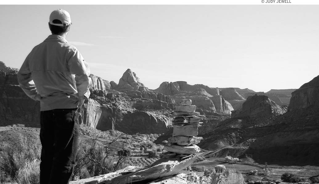
Fifteen trails for day hikes begin within a short drive of the visitors center. Of these, only Grand Wash, Capitol Gorge, and the short paths to Sunset Point and Goosenecks are easy. The others involve moderately strenuous climbs over irregular slickrock. Signs and rock cairns mark the way, but it’s all too easy to wander off if you don’t pay attention to the route.
Although most hiking trails can easily be done in a day, backpackers and hikers might want to try longer trips in Chimney Rock-Spring Canyons to the north or Muley Twist Canyon and Halls Creek to the south. Obtain the required backcountry permit (free) from a ranger and camp at least 0.5 miles from the nearest maintained road or trail. (Cairned routes like Chimney Rock Canyon, Muley Twist Canyon, and Halls Creek don’t count as trails but are backcountry routes.) Bring a stove for cooking; backcountry users are not permitted to build fires. Avoid camping or parking in washes at any time—torrents of mud and boulders can carry away everything.
Stop by the visitors center to pick up a map showing hiking trails and trail descriptions. These trailheads are located along the main highway through the park and along the Fremont River. Note that the Grand Wash Trail cuts west through the reef to the Scenic Drive.
• Distance: 3.5 miles round-trip
• Duration: 2.5 hours
• Elevation change: 800 feet
• Effort: moderate-strenuous
• Trailhead: 3 miles west of the visitors center, on the north side of Highway 24
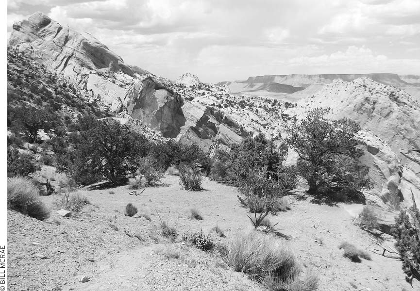
Towering 660 feet above the highway, Chimney Rock (elevation 6,100 feet) is a fluted spire of dark red rock (Moenkopi Formation) capped by a block of hard sandstone (Shinarump Member of the Chinle Formation). The trail leads pretty much straight uphill from the parking lot to a ridge overlooking Chimney Rock, and then levels off a bit. Panoramic views take in the face of Capitol Reef. Petrified wood along the trail has been eroded from the Chinle Formation (the same rock layer found in Petrified Forest National Park in Arizona). It is illegal to take any petrified wood.
• Distance: 10 miles one-way
• Duration: 6 hours
• Elevation change: 540 feet
• Effort: moderate
• Trailhead: Chimney Rock parking lot
Except for its length, this is not a particularly difficult trail. It begins at the top of the Chimney Rock Trail and runs to the Fremont River and Highway 24; since it begins and ends on the highway, a car shuttle can eliminate the need to hike out and back. The wonderfully eroded forms of Navajo sandstone present a continually changing exhibition. The riverbed is normally dry. (Some maps show all or part of this as “Chimney Rock Canyon.”) Check with rangers for the weather forecast before setting off, because flash floods can be dangerous, and the Fremont River (which you must wade across) can rise quite high. Normally, the river runs less than knee-deep to Highway 24 (3.7 miles east of the visitors center). With luck, you’ll have a car waiting for you. Summer hikers can beat the heat with a crack-of-dawn departure. Carry water, as this section of canyon lacks a reliable source.
From the Chimney Rock parking area, hike Chimney Rock Trail to the top of the ridge and follow the signs for Chimney Rock Canyon. Enter the unnamed lead-in canyon and follow it downstream. A sign marks Chimney Rock Canyon, which is 2.5 miles from the start. From this point, it’s an additional 6.5 miles downstream to reach the Fremont River. A section of narrows requires some rock-scrambling (bring a cord to lower backpacks), or the area can be bypassed on a narrow trail to the left above the narrows. Farther down, a natural arch high on the left marks the halfway point.
Chimney Rock
Upper Chimney Rock Canyon could be explored on an overnight trip (permit required). A spring (purify the water before drinking it) is located in an alcove on the right side, about one mile up Chimney Rock Canyon from the lead-in canyon. Wildlife uses this water source, so camp at least 0.25 miles away. Chimney Rock Canyon, the longest in the park, begins high on the slopes of Thousand Lake Mountain and descends nearly 15 miles southeast to join the Fremont River.
• Distance: 5 miles one-way
• Duration: 3-5 hours
• Elevation change: 540 feet
• Effort: moderate-strenuous
• Trailhead: across Highway 24 from Chimney Rock parking lot
This moderately difficult hike begins by following a wash across the highway from the Chimney Rock parking area, descends to Sulphur Creek, then heads down the narrow canyon to the visitors center; it’s five miles if you’ve arranged a car or bike shuttle, and double that if you have to hike back to your starting point. It’s best to hike Sulphur Creek during warm weather, because you’ll be wading in the normally shallow creek passing through a slot canyon. Wear sneakers or other shoes that you don’t mind getting wet. Before starting out, check to make sure the water level isn’t too high for hiking (you can do this by examining the route’s endpoint behind the visitors center; it should be ankle-deep or less for a safe and fun hike).
Three small waterfalls are along the route, but it’s fairly easy to climb down rock ledges to the side of the water; two falls are just below the goosenecks and the third is about 0.5 miles before the visitors center. Carry water with you.
• Distance: 2 miles round-trip
• Duration: 1.5 hours
• Elevation change: 380 feet
• Effort: easy-moderate
• Trailhead: 2 miles east of the visitors center, on the north side of Highway 24
The graceful Hickman Natural Bridge spans 133 feet across a small streambed. Numbered stops along the self-guided trail correspond to descriptions in a pamphlet available at the trailhead or visitors center. Starting from the parking area (elevation 5,320 feet), the trail follows the Fremont River’s green banks a short distance before climbing to the bridge. The last section of trail follows a dry wash shaded by cottonwoods, junipers, and piñon pines. You’ll pass under the bridge (eroded from the Kayenta Formation) at trail’s end. Capitol Dome and other sculptured sandstone features surround the site. Joseph Hickman, for whom the bridge was named, served as principal of Wayne County High School and later in the state legislature; he and another local, Ephraim Pectol, led efforts to promote Capitol Reef.
• Distance: 4.5 miles round-trip
• Duration: 3-5 hours
• Elevation change: 540 feet
• Effort: moderate-strenuous
• Trailhead: Hickman Natural Bridge Trailhead
A splendid overlook 1,000 feet above Fruita beckons hikers up the Rim Overlook Trail. Take the Hickman Natural Bridge Trail from the parking area, turn right at the signed fork, and hike for about two miles. Allow 3.5 hours from the fork for this hike. Panoramic views take in the Fremont River valley below, the great cliffs of Capitol Reef above, the Henry Mountains to the southeast, and Boulder Mountain to the southwest.
Continue another 2.2 miles from the Rim Overlook to reach Navajo Knobs. Rock cairns lead the way over slickrock along the rim of the Waterpocket Fold. A magnificent view at trail’s end takes in much of southeastern Utah.
• Distance: 4.5 miles round-trip
• Duration: 2-3 hours
• Elevation change: negligible
• Effort: easy
• Trailhead: 4.7 miles east of the visitors center, on the south side of Highway 24
One of only five canyons cutting completely through the reef, Grand Wash offers easy hiking, great scenery, and an abundance of wildflowers. There’s no trail—just follow the dry riverbed. (Flash floods can occur during storms.) Only a short distance from Highway 24, canyon walls rise 800 feet above the floor and narrow to as little as 20 feet in width; this stretch of trail is known as the Narrows. After the Narrows, the wash widens, and wildflowers grow everywhere. Cassidy Arch Trailhead is two miles from Highway 24.
The hike can also be started from a trailhead at the end of Grand Wash Road, off the Scenic Drive. A car or bike shuttle can make it a one-way hike of about 2.5 miles.
These hikes begin from trailheads along the Scenic Drive. Drivers must pay the $5 National Park admission fee to travel this road.
• Distance: 4.5 miles round-trip
• Duration: 2-3 hours
• Elevation change: 1,000 feet
• Effort: moderate-strenuous
• Trailhead: Fruita blacksmith shop
From the start at the Fruita blacksmith shop, the trail climbs a short distance, then crosses Johnson Mesa and climbs steeply to the overlook about 1,000 feet above the Fremont River. The overlook is not a place for the acrophobic—even people who aren’t ordinarily afraid of heights might find it a little daunting.
• Distance: 3.5 miles round-trip
• Duration: 2.5 hours
• Elevation change: 400 feet
• Effort: moderate-strenuous
• Trailheads: across the road from Fruita Campground (one mile south of the visitors center) and across Highway 24 from Hickman Natural Bridge trailhead
Cohab is a pretty little canyon overlooking the campground. Mormon polygamists (“cohabitationists”) supposedly used the canyon to escape federal marshals during the 1880s. It’s possible to hike this trail starting from either trailhead. Starting from the campground, the trail first follows steep switchbacks before continuing along more gentle grades to the top of the reef, 400 feet higher and one mile from the campground. You can take a short trail to viewpoints or continue 0.75 miles down the other side of the ridge to Highway 24.
Another option is to turn right at the top on Frying Pan Trail and head to Cassidy Arch (3.5 miles one-way) and Grand Wash (4 miles one-way). The trail from Cassidy Arch to Grand Wash is steep. All of these interconnecting trails offer many hiking possibilities, especially if you can arrange a car shuttle. For example, you could start up Cohab Canyon Trail from Highway 24, cross over the reef on Frying Pan Trail, make a side trip to Cassidy Arch, descend Cassidy Arch Trail to Grand Wash, walk down Grand Wash to Highway 24, then walk (or car shuttle) 2.7 miles along the highway back to the start, for 10.5 miles in total.
The dark-colored vertical stripes often seen on sandstone cliff faces across the Colorado Plateau are known as desert varnish. They’re mostly composed of very fine clay particles, rich in iron and manganese. It’s not entirely known how these streaks are formed, but it seems likely that they’re at least partly created by mineral-rich water coursing down the cliffs along the varnished areas and wind-blown clay dust sticking to cliff faces. Bacteria and fungi on the rock’s surface may help this process along by absorbing manganese and iron from the atmosphere and precipitating it as a black layer of manganese oxide or reddish iron oxide on the rock surfaces. The clay particles in this thin layer of varnish help shield the bacteria against the drying effects of the desert sun. Prehistoric rock artists worked with desert varnish, chipping away the dark surface to expose the lighter underlying rocks.
Desert varnish streaks sandstone walls.
Hiking the Frying Pan Trail involves an additional 600 feet of climbing from either Cohab Canyon or Cassidy Arch Trail. Once atop Capitol Reef, the trail follows the gently rolling slickrock terrain.
• Distance: 2.5 miles round-trip
• Duration: 2 hours
• Elevation change: 770 feet
• Effort: moderate-strenuous
• Trailhead: Fruita Campground amphitheater
The Cohab Canyon Trail climbs from the tree-shaded Fruita Campground.
The trail starts out quite easy, passing orchards along the Fremont River (elevation 5,350 feet). This part of the trail is wheelchair accessible. After 0.5 miles, it begins a climb up sloping rock to a Miners Mountain viewpoint overlooking Fruita, Boulder Mountain, and Capitol Reef. Bring $0.50 for a trail brochure describing traditional agricultural practices in the valley and the geological formations visible at the top of the trail.
• Distance: 3.5 miles round-trip
• Duration: 3 hours
• Elevation change: 670 feet
• Effort: moderate-strenuous
• Trailhead: end of drivable section of Grand Wash Road
• Directions: Turn left off the Scenic Drive, 3.6 miles from the visitors center, and follow Grand Wash Road to the trailhead.
Cassidy Arch Trail begins near the end of Grand Wash Road, ascends the north wall of Grand Wash, and then winds across slickrock to a vantage point close to the arch. Energetic hikers will enjoy good views of Grand Wash, the great domes of Navajo sandstone, and the arch itself. The notorious outlaw Butch Cassidy may have traveled through Capitol Reef and seen this arch. Frying Pan Trail branches off Cassidy Arch Trail at the one-mile mark, and then wends its way across three miles of slickrock to Cohab Canyon.
• Distance: 3.5 miles round-trip
• Duration: 3 hours
• Elevation change: 1,000 feet
• Effort: moderate-strenuous
• Trailhead: on the Scenic Drive, 6 miles south of visitors center, between Grand Wash and Capitol Gorge
Wagon drivers once used this route as a shortcut between Grover and Capitol Gorge. The old trail crosses a wash to the west, and then ascends steadily through piñon and juniper woodland on Miners Mountain. After 1.5 miles, the trail leaves the wagon road and continues north for 0.5 miles to a high knoll and the best views of the Capitol Reef area.
The Fremont River Trail starts out level, then climbs to provide good views of the valley and the local geology.
• Distance: 2 miles round-trip
• Duration: 1-2 hours
• Elevation change: 100 feet
• Effort: easy-moderate
• Trailhead: Capitol Gorge parking area
Follow the well-maintained dirt road to the parking area in Capitol Gorge to begin this hike. The first mile downstream is the most scenic: Fremont petroglyphs (in poor condition) appear on the left after 0.1 miles; narrows of Capitol Gorge close in at 0.3 miles; a “pioneer register” on the left soon after consists of names and dates of early travelers and ranchers scratched in the canyon wall. If you’re able to, scramble up some rocks and follow a cairn-marked trail across the slickrock, then head up out of the wash at the trail marker to see natural water tanks, about 0.8 miles from the trail. These depressions in the rock collect water and give the Waterpocket Fold its name. Back in the wash, listen for canyon wrens—their song starts on a high note and then trills down the scale. From the turnoff to the water tanks, hikers can continue another three miles downstream to Notom Road.
• Distance: 4 miles round-trip
• Duration: 3 hours
• Elevation change: 1,100 feet
• Effort: strenuous
• Trailhead: Capitol Gorge parking area
Fruita Campground provides easy access to a couple of good hiking trails.
The Golden Throne Trail begins at the trailhead at the end of the drivable part of Capitol Wash. Instead of heading down Capitol Gorge from the parking area, turn left up this trail for a steady climb to dramatic views of the reef and surrounding area. The Golden Throne is a massive monolith of yellow-hued sandstone capped by a thin layer of red rock. This is a good hike to take around sunset, when the rocks take on a burnished glow.
Ditch the car and really get to know this country with a big loop tour. For a strenuous ride with steep grades, take the Boulder Mountain Loop. Start from Highway 24 near Capitol Reef, take the Notom-Bullfrog Road to Burr Trail Road, and then take Highway 12 over Boulder Mountain to Highway 24 and back to Capitol Reef. This is definitely the sort of trip that requires some touring experience and a decent level of training (Boulder Mountain is quite a haul). This route can run 80-125 miles over several days.
In the remote northern section of the park, cyclists can ride the challenging Cathedral Valley Loop. The complete loop is more than 60 miles long. Little water is available along the route, so it’s best ridden in spring or fall, when temperatures are low. Access the loop on either Hartnett Road (11.7 miles east of the visitors center) or Caineville Wash Road (18.6 miles east of the visitors center). A small campground is located about 36 miles into the loop.
Although the Scenic Drive doesn’t have much of a shoulder, it’s not a bad bicycling road, especially early in the morning before car traffic has picked up. Dirt spur roads off the Scenic Drive lead up Grand Wash, into Capitol Gorge, and up South Draw to Pleasant Creek.
Contact the visitors center for more information on these and other routes.
Rock climbing is allowed in the park. Climbers should check with rangers to learn about restricted areas, but registration is voluntary. Permits are not required unless climbers plan to camp overnight. Climbers must use “clean” techniques (no pitons or bolts) and keep at least 100 feet from rock-art panels and prehistoric structures. Because of the abundance of prehistoric rock art found there, the rock wall north of Highway 24—between the Fruita School and the east end of Kreuger Orchard (mile 81.4)—is closed to climbing. Other areas closed to climbing include Hickman Natural Bridge and all other arches and bridges, Temple of the Moon and Temple of the Sun, and Chimney Rock.
The harder, fractured sandstone of the Wingate Formation is better suited to climbing than the more crumbly Entrada sandstone. The rock is given to flaking, however, so climbers should use caution. Be sure that your chalk matches the color of the rock; white chalk is prohibited.
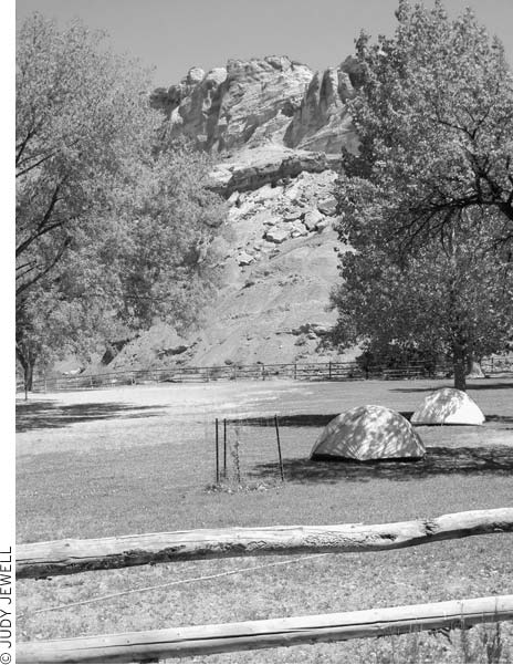
Fruita Campground (year-round, $10), one mile south of the visitors center on the Scenic Drive, has 71 sites for tents and RVs with drinking water and heated restrooms, but no showers or hookups. Campers must get their water from the visitors center November-April. The surrounding orchards and lush grass make this an attractive spot. Sites are first-come, first-served and often fill by early afternoon in the busy May-October season. One group campground (reservations required, $3 pp, $50 minimum) and a picnic area are nearby. Submit written reservation requests for the group site to Group Campsite Reservations, Capitol Reef National Park, HC 70, Box 15, Torrey, UT, 84775.
Two campgrounds offer first-come, first-served primitive sites with no water. The five-site Cedar Mesa Campground (year-round, free) is in the park’s southern district, just off Notom-Bullfrog Road (dirt); campers enjoy fine views of the Waterpocket Fold and the Henry Mountains. From the visitors center, go east 9.2 miles on Highway 24, then turn right and go 22 miles on Notom-Bullfrog Road (avoid this road if it’s wet). Cathedral Valley Campground (year-round, free) serves the park’s northern district; it has six sites near the Hartnett Junction, about 30 miles north of Highway 24. Take either Caineville Wash Road or Hartnett Road. Both roads are dirt and should be avoided when wet. Hartnett has a river ford.
If you’re just looking for a place to park for the night, check out the public land east of the park boundary, off Highway 24. Areas on both sides of the highway (about nine miles east of the visitors center) can be used for free primitive camping.
Backcountry camping is allowed in the park; obtain a free backcountry permit at the visitors center.
Torrey (population 179) is an attractive little village with a real Western feel. Only 11 miles west of the Capitol Reef National Park visitors center, at the junction of Highways 12 and 24, it’s a friendly and convenient place to stay, with several excellent lodgings and a good restaurant.
There are other little towns along the Fremont River, which drains this steep-sided valley. Teasdale is a small community just four miles west, situated in a grove of piñon pines. Bicknell, a small farm and ranch town, is eight miles west of Torrey.
You can rent mountain bikes at Backcountry Outfitters (Hwy. 12 and Hwy. 24, 435/425-2010, www.ridethereef.com); their main business is guiding people on hiking, canyoneering, 4WD, or horseback trips.
Hondoo Rivers and Trails (435/425-3519 or 800/332-2696, www.hondoo.com), run by longtime locals, offers guide services for both day trips and multiday backcountry excursions; for a real treat, check out the inn-to-inn trail rides. They also provide shuttle services.
The Entrada Institute (www.entradainstitute.org), a nonprofit organization that seeks to further understanding and appreciation of the natural, historical, cultural, and scientific heritage of the Colorado Plateau, sponsors a cultural event as part of their Saturday Sunset Series (7:30pm Sat. late May-late Oct., usually free). Events range from talks by local ranchers on the cattle industry to musical performances. These events are held at Robber’s Roost Bookstore (185 W. Main St., 435/425-3265, www.robbersroostbooks.com), which is a good place to visit any time of day.
There are a few small bunkhouse cabins at the center of town, at the Torrey Trading Post (75 W. Main St., 435/425-3716, www.torreytradingpost.com, $35). They aren’t loaded with frills—the toilets and showers are in men’s and women’s bathhouses—but the price is right, pets are permitted, and there’s a place to do laundry.
The Capitol Reef Inn and Cafe (360 W. Main St., 435/425-3271, www.capitolreefinn.com, $53, spring-fall) has homey motel rooms and a good café serving breakfast, lunch, and dinner. In the front yard, the motel’s owner and his brother have built a kiva resembling those used by Native Americans. It’s obviously a labor of love, and a pretty cool place to explore.
At the east end of Torrey, the Rim Rock Inn (2523 E. Hwy. 24, 435/425-3388 or 888/447-4676, www.therimrock.net, $59-69, Mar.-Dec.) does indeed perch on a rim of red rock; it’s just about as close as you can get to the park. The motel and its two restaurants are part of a 120-acre ranch, so the views are expansive.
Another Torrey hotel with good views is the Howard Johnson (877 N. Hwy. 24, 435/425-3866 or 800/221-5801, www.hojo.com, $89-109), located toward the east end of town. A decent Mexican restaurant is right next door.
In a grove of trees immediately behind downtown Torrey’s old trading post and country store is Austin’s Chuck Wagon Lodge (12 W. Main St., 435/425-3335 or 800/863-3288, www.austinschuckwagonmotel.com, rooms $49-79, cabins $135, Mar.-Dec.), with guest rooms in an older motel ($49), a newer lodge-like building, or newer two-bedroom cabins. There’s also a pool and a hot tub.
In a pretty setting three miles south of town, Cowboy Homestead Cabins (Hwy. 12, 435/425-3414 or 888/854-5871, www.cowboyhomesteadcabins.com, $79) has attractive one and two-bedroom cabins with private baths, kitchenettes, and outdoor gas barbecue grills.
In Teasdale, four miles west of Torrey, Pine Shadows (125 S. 200 W., Teasdale, 435/425-3939 or 800/708-1223, www.pineshadowcabins.net, $98) offers spacious, modern cabins, equipped with two queen beds plus full baths and kitchens, in a piñon forest.
Head five miles down the Notom-Bullfrog Road to find accommodations at the Notom Ranch Bed & Breakfast (Notom Rd., 435/456-9153, www.notomranchbandb.com, $75), a working ranch on the edge of the park with Western-themed guest rooms and expansive views. Guests can arrange to have a home-cooked dinner ($10) at the ranch, which beats driving to and from Torrey for an evening meal. Breakfast is also served.
The lovely SkyRidge Inn Bed and Breakfast (950 W. Hwy. 24, 435/425-3222 or 800/448-6990, www.skyridgeinn.com, $99-149) is one mile east of downtown Torrey. The modern inn has been decorated with high-quality Southwestern art and artifacts; all six guest rooms have private baths. SkyRidge sits on a bluff amid 75 acres, and guests are invited to explore the land on foot or bike.
Muley Twist Inn (off 125 S., outside Teasdale, 435/425-3640 or 800/530-1038, www.muleytwistinn.com, $99-140), an elegantly decorated five-bedroom B&B, is on a 30-acre parcel with great views. One guest room is fully accessible to wheelchair users. It’s another really wonderful place to come home to at the end of a day of driving or hiking.
Stay in a renovated 1914 schoolhouse: The Torrey Schoolhouse Bed and Breakfast (150 N. Center St., 435/491-0230, $115-145) has been renovated but retains many period touches and an old-fashioned atmosphere, but with modern amenities such as a shiatsu massage chair in every room, memory foam mattress toppers, flat-screen TVs, and a wheelchair-accessible suite.
If you’re looking for comfortable motel rooms with perks like an in-room coffeemaker and ironing board and an outdoor pool, a good choice is the Best Western Capitol Reef Resort (2600 E. Hwy. 24, 435/425-3761, www.bestwestern.com, $150-170).
The M Lodge at Red River Ranch (2900 W. Hwy. 24, 435/425-3322 or 800/205-6343, www.redriverranch.com, $160-245) is between Bicknell and Torrey beneath towering cliffs of red sandstone on the banks of the Fremont River. This wonderful wood-beamed lodge sits on a 2,200-acre working ranch, but there’s nothing rustic or unsophisticated about the accommodations. The three-story structure is newly built, although in the same grand architectural style as old-fashioned mountain lodges. The great room has a massive stone fireplace, cozy chairs and couches, and a splendid Old West atmosphere. There are 15 guest rooms, most decorated according to a theme, and all have private baths. Guests are welcome to wander ranch paths, fish for trout, or meander in the gardens and orchards. Breakfast and dinner are served in the lodge restaurant but are not included in the price of lodgings; box lunches can be ordered.
Although most campers will try for a site at Capitol Reef National Park, the campground there does not take reservations and fills up quickly. Torrey has a couple of private campgrounds that cater to both RV and tent campers. Thousand Lakes RV Park (Hwy. 24, 1 mile west of Torrey, 435/425-3500 or 800/355-8995, www.thousandlakesrvpark.com, Apr.-late Oct., $18 tents, $28 RVs with full hookups) has sites with showers, wireless Internet, a laundry room, and a store. Thousand Lakes also has cabins, ranging from Spartan (no linens, $35) to deluxe (sleeps 8, linens provided, $95), as well as Western-style cookouts on summer weeknights ($15-23). Right in town, the Sand Creek RV Park (540 W. Hwy. 24, 435/425-3577, www.sandcreekrv.com, Apr.-mid-Oct., $15 tents, $22-27 RVs, $30 camping cabins) has shaded tent spaces in a pleasant grassy field. Showers ($5 for nonguests) and laundry facilities ($5 to wash and dry) are available.
Head into Torrey for dinner at Cafe Diablo.
The U.S. Forest Service’s Sunglow Campground (Forest Rd. 143, east of Bicknell, 435/836-2811, $8) is just east of Bicknell at an elevation of 7,200 feet. The seven first-come, first-served sites are open and have water mid-May-late October. The surrounding red cliffs really light up at sunset, hence the name. Several other Forest Service campgrounds are on the slopes of Boulder Mountain along Highway 12 between Torrey and Boulder. These places are all above 8,600 feet and usually don’t open until late May-early June.
Torrey’s restaurant of note is M Cafe Diablo (599 W. Main St., 435/425-3070, www.cafediablo.net, 11:30am-10pm daily Apr.-Oct., dinner entrées $22-32). The specialty is zesty Southwestern cuisine, with excellent dishes like fire-roasted pork tenderloin, eggplant-and poblano-stuffed tamales, and pumpkin-seed trout. This is one of the few places you can order free-range rattlesnake meat, cooked into crab cake-like patties. Because there aren’t many restaurants this good in rural Utah, this place is worth a detour, though it must be said that it’s not the place for a quiet romantic dinner—it’s a high-volume, fast-paced, high-energy dining experience. Lunchtime, which features a Cuban sandwich ($12), crab chalupas ($12), turkey picadillo ($12), and more, tends to be a bit quieter.
Another pleasant surprise in this small town is the Capitol Reef Inn and Cafe (360 W. Main St., 435/425-3271, www.capitolreefinn.com, 7am-9pm daily, $10-15), where there’s an emphasis on healthy and, when possible, locally grown food. It’s easy to eat your veggies here—the 10-vegetable salad will make up for some of the less nutritious meals you’ve had on the road.
For something a little less elevated, try the burgers and milk shakes at Slacker’s Burger Joint (165 E. Main St., 435/425-3710, noon-8pm Mon.-Thurs., noon-9pm Fri.-Sat., noon-5pm Sun., $6-12), in the center of Torrey. The pastrami burger is rightfully famous, and an afternoon milk shake hits the spot after a day of hiking.
About 12 miles east of Capitol Reef, stop by the tiny M Mesa Market (Hwy. 24, Caineville, 435/487-9711, www.mesafarmmarket.com, 7am-7pm daily late Mar.-Oct., $3-17) for artisanal cheese and yogurt, sourdough bread baked in a wood-fired oven, and whatever produce is growing in the back 40. You won’t find better picnic makings anywhere in southeastern Utah, and if he has a minute to spare, the owner will explain the sustainable nature of his farm and dairy.
The Fremont River Ranger District (138 S. Main St., Loa, 435/836-2800, www.fs.fed.us/r4/fishlake, 8am-4:30pm Mon.-Fri.) of the Fishlake National Forest has information about hiking, horseback riding, and road conditions in the northern and eastern parts of Boulder Mountain and the Aquarius Plateau.