M NATURAL BRIDGES NATIONAL MONUMENT
NATURAL BRIDGES TO BULLFROG MARINA BY FERRY
NATURAL BRIDGES TO LAKE POWELL VIA HIGHWAY 95
Although Arches and Canyonlands capture more attention, Utah’s southeastern corner contains an incredible wealth of scenic and culturally significant sites. Consider rounding out your trip to this part of Utah with a tour of Anasazi ruins, remote desert washes, soaring natural bridges, snowy mountain peaks, and a vast reservoir.
Highway 191 runs south from Moab between Canyonlands National Park and the surprisingly tall Abajo Mountains to the west and the La Sal Mountains to the east. In the heat of the summer, these mountains are cool refuges. Also east of the highway, nearly to the Colorado border is Hovenweep National Monument, an Anasazi site with an astounding collection of masonry buildings. Here the Anasazi lived in more or less of a city until they suddenly departed about 900 years ago.
The San Juan River runs across the southern tier of the region, with Cedar Mesa to the north and Monument Valley and Navajo tribal land to the south. Bluff, a charming town that’s now the put-in for most river trips on the San Juan, was settled in 1880 by Mormon pioneers who made the incredible wagon train trip from Escalante through steep canyons, including Hole-in-the-Rock.
Cedar Mesa is a place to explore on foot; canyons here often shelter Anasazi ruins. To the west of the mesa, Natural Bridges National Monument is often overlooked, probably because it’s rather remote. But its soaring stone bridges (carved by streams and spanning a streambed) are beautiful, even elegant, and a night in the campground will allow you to see stars in one of the nation’s darkest places.
LOOK FOR M TO FIND RECOMMENDED SIGHTS, ACTIVITIES, DINING, AND LODGING.
M Edge of the Cedars State Park: Indoor and outdoor archeological exhibits make this Blanding museum a good introduction to the area and its Anasazi, Ute, Navajo, and Anglo history (click here).
M Floating the San Juan River: Take a few days away from the rest of the world and paddle from Bluff to Lake Powell. You’ll go through deep canyons, past rock art and ruins, and down a few Class III rapids (click here).
M Hovenweep National Monument: It’s worth taking the detour to this impressive collection of masonry dwellings. Six villages with varying architectural styles are among the ruins here (click here).
M Natural Bridges National Monument: Hike an 8.6-mile loop to visit three spectacular natural bridges. If you’re short on time or energy, a nine-mile drive with short hikes to each bridge will also do the trick (click here).
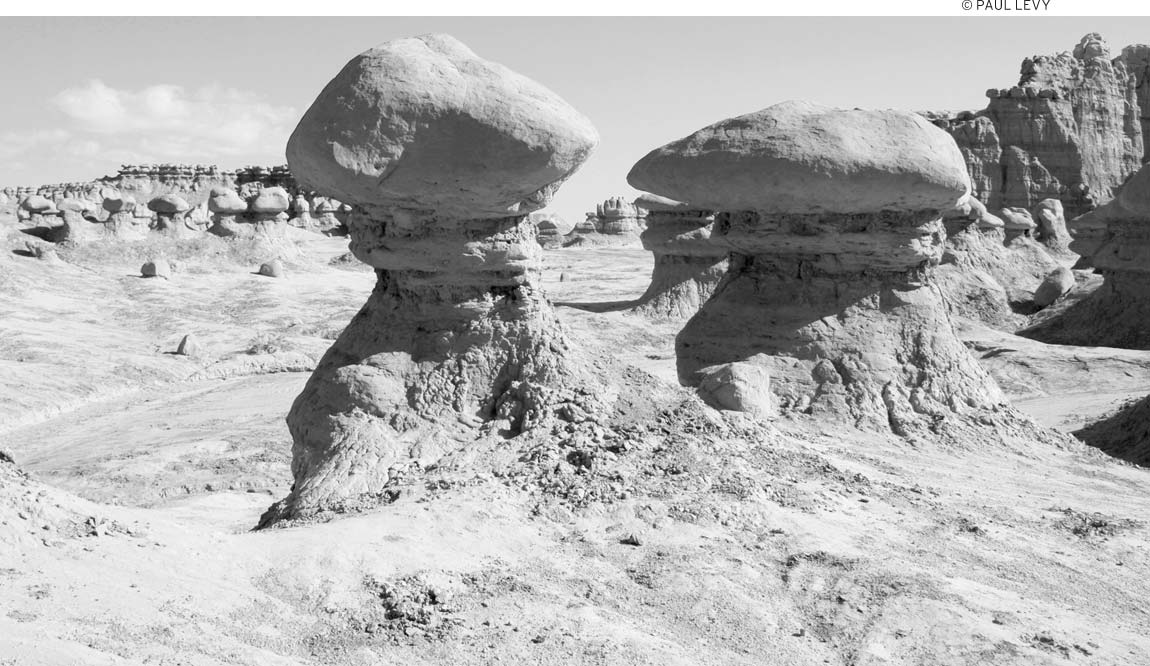
M Goblin Valley State Park: Big mushroom-shaped rock formations, some with eroded “eyes,” cluster around the valley floor of this state park. Tromp down into the valley and wander among these sandstone oddities (click here).
At Lake Powell the Colorado River is backed up by the Glen Canyon Dam. Lake Powell draws boaters—including visitors who rent houseboats to motor to the huge reservoir’s remote inlets and canyons—but for a quick look, the car ferry across the lake is far less expensive. The surrounding Glen Canyon Recreation Area encompasses the rugged canyons that drop down toward Lake Powell; before the dam was built, Glen Canyon was considered the equal of the Grand Canyon for drama and beauty, and in low-water years, a few peeks into the past are possible. A popular side trip—usually visited via tour boats from one of the lake’s marinas—is to Rainbow Bridge National Monument, where the enormous stone bridge spans an arm of the lake.
On the western edge of the region, about 25 miles south of I-70, Goblin Valley State Park has rock formations that would be worthy of national park status if they weren’t so close to Arches. Here you can hike among hoodoos, spires, and balancing rocks, many with wind-carved “eyes” that explain the area’s supernatural moniker.
Remember that this is remote country and fill your gas tank when you have the opportunity. Hanksville and Blanding are good places to check your gauge; if it’s showing less than half a tank, definitely fill up. Likewise, pack a lunch and plenty of water when exploring remote areas such as Cedar Mesa, Hovenweep, or Glen Canyon.
Although it’s possible to spend many days exploring the backcountry of Cedar Mesa, floating the San Juan River, houseboating to remote reaches of Lake Powell, or really getting to understand the ancient dwellings at Hovenweep National Monument, most travelers will, at least initially, just pass through. Be sure to allow a day to visit Hovenweep and the Edge of the Cedars Museum in Blanding. From there, if you are short on time, head west across Cedar Mesa to Natural Bridges National Monument and north through Hanksville to Goblin Valley State Park.
Although there are motels in all of the towns included in this chapter, you’ll have more flexibility if you are camping. There are many campgrounds and even more de facto primitive campsites, where you can make your own camp; however, be certain that you have the necessary permits before camping in the Cedar Mesa area.
U.S. 191 runs south out of Moab, with the La Sal Mountains to the east and Canyonlands National Park to the west. A string of small towns—Monticello, Blanding, and Bluff—offer places to stop for a meal or a motel room as well as opportunities to explore mountains, desert, rivers, and archeological sites.
This small Mormon town (population 2,000) is about 50 miles south of Moab and pretty much its polar opposite. Quiet and relatively untouristed, it’s the best place to stay if you’re visiting the Needles District and don’t want to camp. Monticello (“mon-tuh-SELL-o”) is at an elevation of 7,069 feet, just east of the Abajo Mountains. It is 46 miles east of the entrance to the Needles District of Canyonlands National Park.
The local golf course, The Hideout (549 S. Main St., 435/587-2200, $40 for 18 holes) is popular in the summer because, at over 7,000 feet in elevation, it’s not too hot.
Monticello has a number of comfortable and affordable motels. The Inn at the Canyons (533 N. Main St., 435/587-2458, www.monticellocanyonlandsinn.com, from $75) is nicely renovated and has an indoor pool, a pretty basic continental breakfast, and microwaves and fridges in the guest rooms. The Monticello Inn (164 E. Central St., 435/587-2274, www.themonticelloinn.org, from $65) is a well-maintained older motel with a pleasant in-town setting and a few guest rooms that allow pets.
Eight miles north of town, the Runnin’ Iron Inn (milepost 79.5, U.S. 191, 435/587-2351, http://canyonlandsbestkeptsecret.com, from $59) is a small motel with an Old West ambience, fitting for its middle-of-nowhere location, which happens to be pretty convenient to the Needles District. If you don’t need a luxurious guest room or a microwave and fridge, this is a fun place to stay. It’s part of a faux-Western town called Roughlock, which also houses an RV park ($20) with tent sites ($20), a few camping cabins ($39) that have no bath or cooking facilities, and a steak house.
The local B&B, the Grist Mill Inn (64 S. 300 E., 435/587-2597, www.oldgristmillinn.com, from $89) is indeed housed in an old flour mill. But rest assured, you won’t be sleeping under an old millstone; the seven guest rooms are all furnished in typical B&B fashion, and all have private baths and TVs.
Campgrounds in the nearby Manti-La Sal National Forest include Buckboard and Dalton Springs (435/587-2041, $10). Buckboard, seven miles west of town on Blue Mountain Road (Forest Rd. 105), is at 8,600 feet in elevation, so it’s not your best bet early in the spring. But when the rest of southeastern Utah swelters in the summer, this shady campground is perfect. Dalton Springs is along the same road, a couple of miles closer to town, at 8,200 feet. An abandoned ski area nearby is a good place for mountain biking.
Not only can you get a good cup of coffee and freshly made juice at Peace Tree Juice Cafe (516 N. Main St., 435/587-5063, 7am-5pm daily, $79), this is also the only place this side of Moab that you’re likely to get a vegetarian Thai wrap sandwich (and it tastes really good).
It’s just like a backyard cookout at K&A Chuckwagon (196 N. Main St., 435/587-3468, 5pm-9pm daily May-Sept., $15). Settle in at one of the long tent-covered picnic tables and wait for your steak or salmon to be cooked on the big kettle grill. Chuckwagon beans and potatoes accompany the meal, and dessert is included. It’s all highly informal and friendly, much like all of Monticello.
Up the road at the Roughlock encampment, the Line Camp (milepost 79.5, U.S. 191, 435/587-2351, 5pm-8pm daily, $17-26) is another good steak house with sides of potatoes, beans, and salad as well as a big extra helping of Western atmosphere accompanying every meal. Beer is available at this restaurant, and you can bring your own wine (free corkage).
The expansive new Southeastern Utah Welcome Center (216 S. Main St., 435/587-3401, www.southeastutah.com, 9am-6pm Wed.-Mon. Mar.-Oct., 9am-6pm Fri.-Sun. Nov.-Feb.) is a great place to stop for information about southeastern Utah, including Canyonlands National Park.
The public library (80 N. Main St., 435/587-2281) is in the city park.
The San Juan Hospital (364 W. 100 N., 435/587-2116) is friendly and small, and it’s a good place to have any camping-related injuries repaired.
The largest town in San Juan County, Blanding (population 3,290, elevation 6,105 feet) is also a handy stop for travelers, especially for visitors to Hovenweep National Monument. If you’re heading east toward Hovenweep or west into the Cedar Mesa area, check your gas gauge; Blanding is a good place to gas up.
One mile north of present-day Blanding, prehistoric Anasazi people built at least six groups of pueblo structures between 700 and 1220. The Edge of the Cedars State Park Museum (660 W. 400 N., 435/678-2238, www.stateparks.utah.gov, 9am-5pm Mon.-Sat., $5 adults, $3 children) features an excellent array of pottery, baskets, sandals, jewelry, and stone tools. The pottery collection on the second floor stands out for its rich variety of styles and decorative designs. The museum also has exhibits and artifacts of the people who followed the Anasazi—the Utes and Navajo and the early Anglo pioneers.
A short trail behind the museum leads past six clusters of ruins, each of which contains both rectangular rooms on the surface and circular depressions of underground kivas and pit houses. Only Complex 4 has been excavated and partly restored to suggest the village’s appearance when the Anasazi lived here. You may enter the kiva by descending a ladder through the restored roof; the walls and interior features are original.
The Dinosaur Museum (754 S. 200 W., 435/678-3454, www.dinosaur-museum.org, 9am-5pm Mon.-Sat. Apr. 15-Oct. 15, $3 adults, $2 seniors, $1.50 children) showcases the prehistoric plant and animal life of this corner of Utah. Exhibits include life-size models of dinosaurs as well as fossils and skeletons. Don’t miss the models of feathered dinosaurs.
With one exception, Blanding’s motels are all pretty generic. That exception is Stone Lizard Lodging (88 W. Center St., 435/678-3323, www.stonelizardlodging.com, $59), an older motel with nicely remodeled guest rooms at very reasonable rates. The Four Corners Inn (131 E. Center St., 435/678-3257 or 800/574-3150, www.fourcornersinn.com, from $62), which has a restaurant next door and a simple continental breakfast, is a fine enough place to spend a night. Another good option is the Gateway Inn (88 E. Center St., 435/678-2278 or 888/921-2279, http://gatewayinnblanding.com, from $66), with an outdoor pool and pet-friendly guest rooms.
At the south edge of town, Blue Mountain RV Park (1930 S. Main St., 435/678-7840, www.bluemountainrvpark.com, $32 RVs) is also home to a trading post with some high-quality Native American rugs, jewelry, and baskets. Although tent campers are welcome at the RV park, Devil’s Canyon Campground (reservations 877/444-6777, www.recreation.gov, $10, $9 reservation fee), at an elevation of 7,100 feet in the Manti-La Sal National Forest, is a better bet for tents. It has sites with water early May-late October (no water or fees off-season). A 0.25-mile nature trail begins at the far end of the campground loop. From Blanding, go north eight miles on U.S. 191, then turn west onto a paved road for 1.3 miles; the turnoff from U.S. 191 is between mileposts 60 and 61.
Blanding is a somewhat unlikely spot to find an outpost of the Peace Tree Juice Cafe (164 N. Grayson Pkwy., 435/678-3969, 7am-5pm daily, $3-8), with its vaguely hippie vibe, tasty wraps, and fresh juices. Although Fattboyz Grillin’ (733 S. Main St., 435/678-3777, 7am-9pm daily, $5-19) is open for all meals, it’s best at dinner, when the ribs are well marinated and the locals are shoulder-to-shoulder. In addition to ribs, there are chicken, burgers, and Navajo tacos on the menu. Since Blanding is a dry town, no alcohol is served.
Bluff, a sleepy community of about 300 inhabitants, is nestled in a striking physical location. In the past few years, Bluff has become a rather unlikely mecca for recreationists and escapees from urban congestion. The quality of lodging is better than that of almost any other town of this size in the state, and local outfitters make it easy to get out and enjoy the remarkable scenery hereabouts.
Bluff is the oldest non-Native American community in southeastern Utah; it was settled in 1880 by Mormon pioneers who had traveled the excruciatingly difficult Hole-in-the-Rock Trail from the town of Escalante down into what’s now Lake Powell.
Spend an afternoon poking around local washes or examining a large pictograph panel, found along the cliff about 0.3 miles downstream from the Sand Island campground. Fort Bluff is being reconstructed; it is located near the north end of town. The visitors center, located in the small museum, is worth a stop; the staff can give you detailed directions for good informal hikes in the nearby washes.
If you want a guided trip into the backcountry of southeastern Utah, Far Out Expeditions (425/672-2294, www.faroutexpeditions.com) is a local company with lots of experience leading day trips and overnights in the area.
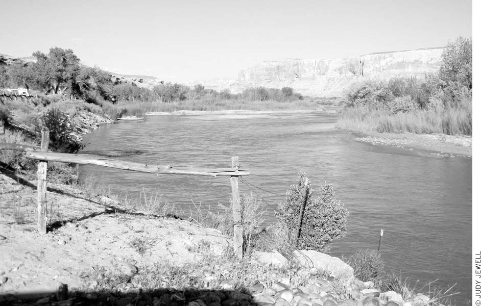
The San Juan River runs by the town of Bluff.
From the high San Juan Mountains in southern Colorado, the San Juan River winds its way into New Mexico, enters Utah near Four Corners, and twists through spectacular canyons before ending at Lake Powell. Most boaters put in at Sand Island Campground near Bluff and take out at the town of Mexican Hat, 30 river miles downstream. This trip combines ancient Native American ruins, rock art, and a trip through Monument Upwarp and the Upper Canyon, with fast water for thrills (Class III rapids) and weirdly buckled geology to ponder. Longer trips continue on through the famous Goosenecks, the “entrenched meanders” carved thousands of feet below the desert surface, and through more Class III rapids on the way to Clay Hills Crossing or Paiute Farms (not always accessible) on Lake Powell. Allow at least four days for the full trip, though more time will allow for exploration of side canyons and visits to Anasazi sites. Rafts, kayaks, and canoes can be used. The season usually lasts year-round because of adequate water flow from Navajo Reservoir upstream.
Many commercial river-running companies offer San Juan trips. If you go on your own, you should have river-running experience or be with someone who does. Private groups need to obtain permits ($6-18 pp) from the Bureau of Land Management’s San Juan Resource Area office (435/587-1544, www.blm.gov); permits are issued through a preseason lottery, although boaters with flexible schedules can usually get permits close to their time of travel. Permit fees vary depending on how far you’re floating.
Some people also like to run the river between Montezuma Creek and Sand Island, a leisurely trip of 20 river miles. The solitude often makes up for the lack of scenery. It’s easy to get a river permit for this section because no use limits or fees apply.
If you’re looking for a multiday trip on the San Juan River, contact local Wild Rivers Expeditions (101 Main St., 435/672-2244 or 800/422-7654, www.riversandruins.com), which offers both day and multiday trips out of Bluff; trips run daily in summer, and only a day’s notice is usually needed to join a float. Eight-hour, 26-mile day excursions to Mexican Hat cost $165 adults, $123 under age 13; motors may be used if the water level is low. Some of the larger Moab-based outfitters offer San Juan River trips when interest allows.
Attractive M Desert Rose Inn (701 W. Main St., 735/672-2303 or 888/475-7673, www.desertroseinn.com, from $119) is one of the nicest lodgings in this corner of the state. The large lodge-like log structure has two-story wraparound porches and guest rooms furnished with pine furniture, quilts, and Southwestern art. At the edge of the property are a number of handsome one-bedroom log cabins. This is definitely a class act.
The other great place to stay is Recapture Lodge (220 E. Main St., 435/672-2281, www.recapturelodge.com, $75). For many years the heart and soul of Bluff, the lodge is operated by longtime outfitters and has an easy nonchalance that is immediately welcoming. Besides guest rooms and kitchenettes, Recapture Lodge has trails out the back door, a swimming pool, a hot tub, a coin laundry, tours, and llama pack trips. The Recapture also rents a couple of fully equipped homes in Bluff for families and groups.
Kokopelli Inn Motel (160 E. Main St., 435/672-2322, www.kokoinn.com, from $82), just next door to the Recapture, is a fine place to stay, though it pales in comparison to Bluff’s unique lodges.
Sand Island Recreation Area (435/587-1500, www.blm.gov, $10) is a Bureau of Land Management (BLM) camping area along the San Juan River, three miles south of town, with piped water. Large cottonwood trees shade this pretty spot, but tenters need to watch for thorns in the grass. River-runners often put in at the campground, so it can be a busy place. Two RV parks are right in town: Cadillac Ranch RV Park (U.S. 191, 435/672-2262, www.cadillacranchrv.com, year-round, $28) is in the center of town and Cottonwood R.V. Park (U.S. 191, 435/672-2287, http://cottonwoodrvpark.blogspot.com, Mar. 15-Nov. 15, $30) is at the west end of Bluff.
It’s worth spending the night in Bluff just to eat at the M San Juan River Kitchen (435/672-9956, www.sanjuanriverkitchen.com, 5:30-about 9pm Tues.-Sat., $10-18), where as much food as possible comes from the restaurant’s organic garden. The food is not just local; it’s also delicious. Smoked chicken enchiladas feature homemade green chili, and a steak-and-egg sandwich turns into a real treat when braised chard and grilled mushrooms share the space between slices of ciabatta. The kitchen serves good beer and wine, which is not so easy to come by in these parts. Lastly, the space is quite lovely—modern and simple yet warm.
A longtime local hangout and a good place for a meal and a friendly vibe is the Twin Rocks Cafe (435/672-2341, www.twinrockscafe.com, 7am-8pm daily, $5-20), next to the trading post just below the impossible-to-miss Twin Rocks. Here you can dine on Navajo tacos (fry bread with chili) or Navajo pizza (fry bread with pizza toppings) as well as more standard fare. Be sure to visit the trading post for high-quality Native American crafts, many of them produced locally by Navajo artisans.
Settle in under the big cottonwood tree for a flame-grilled steak dinner at the Cottonwood Steakhouse (Main St. and 4th St. E., 435/672-2282, 5:30pm-9:30pm daily spring-fall, $17-25). Dinners come with salad, beans, and potatoes; for $9, you can split an entrée with someone else and get full servings of side dishes. Indoor dining is also an option.
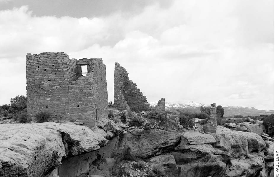
Hovenweep was the site of six Anasazi villages.
Stop by the Comb Ridge Coffee House (680 S. U.S. 191, 435/672-9931, 7am-5pm Tues.-Sun., sandwiches $5-6.25) for a breakfast muffin or slice of quiche, a cup of coffee, and a dose of friendly community spirit. Premade sandwiches and ice cream round out the menu at this sweet spot.
Delve into the region’s cultural history and architecture at remote Hovenweep National Monument (970/562-4283, www.nps.gov/hove, $6 per vehicle, $3 cyclists and pedestrians, $25 annual Local Passport also includes entrance to Canyonlands and Arches National Parks and Natural Bridges National Monument), where the Anasazi built many impressive masonry buildings during the early-mid-1200s, near the end of their 1,300-year stay in the area. A drought that began in 1274 and lasted 25 years probably hastened their migration from this area. Several centuries of intensive farming, hunting, and woodcutting had already taken a toll on the land. Archaeologists believe the inhabitants retreated south in the late 1200s to sites in northwestern New Mexico and northeastern Arizona. The Ute word hovenweep means “deserted valley,” an appropriate name for the lonely high-desert country they left behind. The Anasazi at Hovenweep had much in common with the Mesa Verde culture, although the Dakota sandstone here doesn’t form large alcoves suitable for cliff-dweller villages. Ruins at Hovenweep remain essentially unexcavated, awaiting the attention of future archaeologists.
The Anasazi farmers had a keen interest in the seasons because of their need to know the best time for planting crops. Astronomical stations (alignments of walls, doorways, and tiny openings) allowed the sun priests to determine the equinoxes and solstices with an accuracy of 1-2 days. This precision also may have been necessary for a complex ceremonial calendar. Astronomical stations at Hovenweep have been discovered at Hovenweep Castle, House of Square Tower Ruins, and Cajon Ruins.
Hovenweep National Monument protects six groups of villages left behind by the Anasazi. The sites are near the Colorado border, southeast of Blanding. Square Tower Ruins Unit, where the visitors center is located, has the most ruins and the most varied architecture. In fact, you can find all of the Hovenweep architectural styles here. There are other ruins that are good to visit if you’d like to spend more time in the area; you’ll need a map and directions from a ranger to find them because they aren’t signed. One group, the Goodman Point, near Cortez, Colorado, offers relatively little to see except unexcavated mounds.
The visitors center (970/562-4282, 8am-6pm daily May-Sept., 8am-5pm daily Apr. and Oct., 8am-4:30pm daily Nov.-Mar.) has a few exhibits on the Anasazi, photos of local wildlife, and a small bookstore. A ranger can answer your questions, provide brochures and handouts about various aspects of the monument, and give directions for visiting the other groups of ruins. Mesa Verde National Park (970/529-4465, www.nps.gov/meve) administers Hovenweep.
This extensive group of Anasazi towers and dwellings lines the rim and slopes of Little Ruin Canyon, located a short walk from the visitors center. Obtain a trail-guide booklet from the ranger station. You can take easy walks of less than 0.5 miles on the rim; combine all the trails for a loop of about two miles with only one up-and-down section in the canyon. The booklet has good descriptions of Anasazi life and architecture and of the plants growing along the trail. You’ll see towers (D-shaped, square, oval, and round), cliff dwellings, surface dwellings, storehouses, kivas, and rock art. Keep an eye out for the prairie rattlesnake, a subspecies of the Western rattlesnake, which is active at night in summer and during the day in spring and fall. And stay on the trail: Don’t climb the fragile walls of the ruins or walk on rubble mounds.
Holly Ruins group is noted for its Great House, Holly Tower, and Tilted Tower. Most of Tilted Tower fell away after the boulder on which it sat shifted. Great piles of rubble mark the sites of structures built on loose ground. Look for remnants of farming terraces in the canyon below the Great House. A hiking trail connects the campground at Square Tower Ruins with Holly Ruins; the route follows canyon bottoms and is about eight miles round-trip. Ask a ranger for a map and directions. Hikers can also continue to Horseshoe Ruins (one mile farther) and Hackberry Ruins (just beyond Horseshoe). All of these are just across the Colorado border and about six miles one-way by road from the visitors center.
Horseshoe Ruins and Hackberry Ruins are best reached by an easy trail (one mile round-trip) off the road to Holly Ruins. Horseshoe House, built in a horseshoe shape similar to Sun Temple at Mesa Verde, has exceptionally good masonry work. Archaeologists haven’t determined the purpose of the structure. An alcove in the canyon below contains a spring and a small shelter. A round tower nearby on the rim has a strategic view. Hackberry House has only one room still intact. Rubble piles and wall remnants abound in the area. The spring under an alcove here still has a good flow and supports lush growths of hackberry and cottonwood trees along with smaller plants.
Cutthroat Castle Ruins were remote even in Anasazi times. The ruins lie along an intermittent stream rather than at the head of a canyon like most other Hovenweep sites. Cutthroat Castle is a large multistory structure with both straight and curved walls. Three round towers stand nearby. Look for wall fragments and the circular depressions of kivas. High-clearance vehicles can get close to the ruins, about 11.5 miles one-way from the visitors center. Visitors with cars can drive to a trailhead and then walk to the ruins, 1.5 miles round-trip on foot.
Cajon Ruins are at the head of a little canyon on Cajon Mesa on the Navajo Reservation in Utah, about nine miles southwest of the visitors center. The site has a commanding view across the San Juan Valley as far as Monument Valley. Buildings include a large multiroom structure, a round tower, and a tall square tower. An alcove just below has a spring and some rooms. Look for pictographs, petroglyphs, and grooves in the rock used for tool grinding. Farming terraces were located on the canyon’s south side.
A small campground near the visitors center (no reservations, $10) has 31 sites geared toward tent campers, although a few sites will accommodate RVs up to 36 feet long. Running water is available only during summer, when five gallons are allotted to each camper. Like Hovenweep’s ancient inhabitants, campers are often treated to excellent stargazing; the monument is far from light pollution, and the dark night skies are frequently clear.
One approach is from U.S. 191 between Blanding and Bluff; head east nine miles on Highway 262, continue straight six miles on a small paved road to Hatch Trading Post, and then follow the signs for 16 miles. A good way in from Bluff is to go east 21 miles on the paved road to Montezuma Creek and Aneth, then follow the signs north for 20 miles. A scenic 58-mile route through Montezuma Canyon begins five miles south of Monticello and follows unpaved roads to Hatch and on to Hovenweep; you can stop at the BLM’s Three Turkey Ruin on the way. From Colorado, take a partly paved road west and north 41 miles from U.S. 491 (the turnoff is four miles south of Cortez).
Don’t expect your cell phone to work in this remote area.
Head way off the beaten track to explore ancient ruins and stunning geography in the area west of U.S. 191 and east of Glen Canyon and Lake Powell. Experienced hikers can wander deep into this rugged area; those with less experience or fortitude may want to focus on the trails at Natural Bridges National Monument.
Just south of Blanding, Highway 95—here labeled Trail of the Ancients National Scenic Byway—heads west across a high plateau toward the Colorado River, traversing Comb Ridge, Cedar Mesa, and many canyons. This is remote country, so fill up with gas before leaving Blanding; you can’t depend on finding gasoline until Hanksville, 122 miles away. Hite and the other Lake Powell marinas do have gas and supplies, but their hours are limited.
Cedar Mesa and its canyons have an exceptionally large number of prehistoric Anasazi sites. Several ruins are just off the highway, and hikers will discover many more. If you would like to explore the Cedar Mesa area, be sure to drop in at the Kane Gulch Ranger Station (435/587-1532, www.blm.gov, 8am-noon daily spring and fall), at the west end of Cedar Mesa, four miles south of Highway 95 on Highway 261. BLM staff issue the permits required to explore the Cedar Mesa backcountry for day-use ($2) and for overnight stays ($8 pp) in Grand Gulch, Fish Creek Canyon, and Owl Creek Canyon. The number of people permitted to camp at a given time is limited, so call ahead. BLM staff will also tell you about archaeological sites and their historic value, current hiking conditions, and where to find water. Cedar Mesa is managed for more primitive recreation, so hikers in the area should have good route-finding skills and come prepared with food and water. The ranger station sells maps but has no water.
Well-preserved pueblo ruins left by the Anasazi are tucked under an overhang across the wash. Find the trailhead on the north side of Highway 95, 11 miles west of U.S. 191, between mileposts 111 and 112. Follow cairns for 0.5 miles through juniper and piñon pine woodlands and across slickrock to the overlook, where you can see four kivas and several other structures. Parts have been reconstructed, but most of the site is about 900 years old.
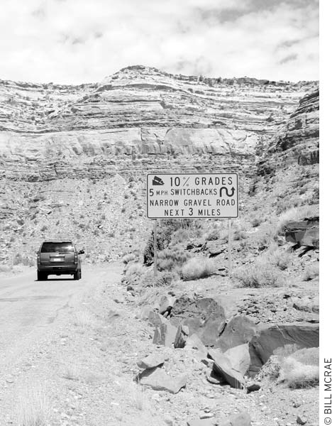
Geologic forces have squeezed up the earth’s crust in a long ridge running 80 miles south from the Abajo Peaks into Arizona. Sheer cliffs plunge 800 feet into Comb Wash on the west side. Engineering the highway down these cliffs took considerable effort. A parking area near the top of the grade offers expansive panoramas across Comb Wash.
This tributary canyon of Comb Wash has spectacular scenery and many Native American ruins. Much of the canyon can be seen on a day hike, but 2-3 days are required to explore the upper reaches. The main streambeds usually have water, but purify it before drinking it. To reach the trailhead, turn north onto Comb Wash Road (between mileposts 107 and 108 on Hwy. 95) and go 2.5 miles on the dirt road, past a house and a water tank, then park in a grove of cottonwood trees before a stream. The mouth of pretty Arch Canyon is just to the northwest (it’s easy to miss). Look for a Native American ruin just up Arch Canyon on the right. More ruins are tucked under alcoves farther up-canyon.
A road and a short trail to the rim of Arch Canyon provide a beautiful view into the depths. Turn north on Texas Flat Road (County Rd. 263) from Highway 95, between mileposts 102 and 103, continue four miles, park just before the road begins a steep climb, and walk east on an old jeep road to the rim. This is a fine place for a picnic, although there are no facilities or guardrails. Texas Flat Road is dirt but passable when dry for cars with good clearance. Trucks can continue up the steep hill to other viewpoints of Arch and Texas Canyons.
Archaeologists have excavated and stabilized this Anasazi village on the gentle slope of Mule Canyon’s South Fork. A stone kiva, circular tower, and 12-room structure are all visible, and all were originally connected by tunnels. Cave Towers, two miles southeast, would have been visible from the top of the tower here. Signs describe the ruins and periods of Anasazi development. Turn north from Highway 95 between mileposts 101 and 102 and continue 0.3 miles on a paved road. Hikers can explore other ruins in the North and South Forks of Mule Canyon; check with the Kane Gulch Ranger Station for advice and directions. You might see pieces of pottery and other artifacts in this area. Federal laws prohibit the removal of artifacts: Please leave every piece in place so that future visitors can enjoy the discovery too. Be sure to have a BLM day hiking permit when exploring this area.
Within this twisting canyon system are some of the most captivating scenery and largest concentrations of Anasazi ruins in southeastern Utah. The main canyon begins only about six miles southeast of Natural Bridges National Monument. From an elevation of 6,400 feet, Grand Gulch cuts deeply into Cedar Mesa on a tortuous path southwest to the San Juan River, dropping 2,700 feet in about 53 miles. Sheer cliffs, alcoves, pinnacles, Anasazi cliff dwellings, rock-art sites, arches, and a few natural bridges line Grand Gulch and its many tributaries.
From the Kane Gulch Ranger Station, a trail leads four miles down Kane Gulch to the upper end of Grand Gulch, where a camping area is shaded by cottonwood trees. Junction Ruin, a cave dwelling, is visible from here, and less than one mile farther into Grand Gulch are more ruins and an arch.
Kane Gulch and Bullet Canyon provide access to the upper end of Grand Gulch from the east side. A popular loop hike using these canyons is 23 miles long (3-4 days); arrange a 7.5-mile car shuttle or hitch. Ask at the ranger station if a shuttle service is available. Collins Canyon, reached from Collins Spring Trailhead, leads into lower Grand Gulch from the west side. Hiking distance between Kane Gulch and Collins Spring Trailheads is 38 miles one-way (5-7 days). A car shuttle of about 29 miles (including eight miles of dirt road) is required. Be sure to visit the BLM’s Kane Gulch Ranger Station or Monticello office for a permit and information. You must have a day-use ($2) or overnight camping permit ($8) to enter the area.
South of the Kane Gulch Ranger Station, Highway 261 loses its pavement and becomes contorted into a series of steeply banked switchbacks known as the Moki Dugway. Slow down and take this stretch of road (with 1,100 feet of elevation change and 5-10 percent grades) at 5-10 mph. About 10 miles south of the Dugway is the town of Mexican Hat, a modest trade and tourism center.
Spectacular geology surrounds this tiny community perched on the north bank of the San Juan River. Folded layers of red and gray rock stand out dramatically. Alhambra Rock, a jagged remnant of a volcano, marks the southern approach to Mexican Hat. Another rock, which looks just like an upside-down sombrero, gave Mexican Hat its name; you’ll see this formation from U.S. 163, two miles north of town. Monument Valley, Valley of the Gods Scenic Drive, Goosenecks State Park, and Grand Gulch Primitive Area are only short drives away. The riverbanks near town can be a busy place in summer as river-runners on the San Juan put in, take out, or just stop for ice and beer.
Mexican Hat is about 10 miles south of the Moki Dugway, a series of steep switchbacks.
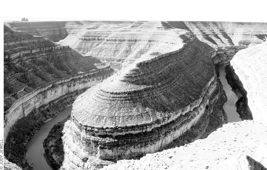
The tightly wound San Juan River flows 1,000 feet below this viewpoint at Goosenecks State Park.
The San Juan River winds through a series of incredibly tight bends 1,000 feet below. So closely spaced are the bends that the river takes six miles to cover an air distance of only 1.5 miles. The bends and exposed rock layers form exquisitely graceful curves. Geologists know the site as a classic example of entrenched meanders, caused by gradual uplift of a formerly level plain. Signs at the overlook explain the geologic history and identify the rock formations. Goosenecks State Park (435/678-2238, http://stateparks.utah.gov) is an undeveloped area with a few picnic tables and vault toilets. A campground (free) is available but has no water. From the junction of U.S. 163 and Highway 261, four miles north of Mexican Hat, go one mile northwest on Highway 261, then turn left and go three miles on Highway 316 to its end.
One of the great views in the Southwest is just a short drive from Goosenecks State Park and more than 1,000 feet higher in elevation. Although the view of the Goosenecks below is less dramatic than at the state park, the 6,200-foot elevation provides a magnificent panorama across the Navajo Reservation to Monument Valley and countless canyons and mountains. To get here, travel northwest nine miles on Highway 261 from the Goosenecks turnoff. At the top of the Moki Dugway switchbacks, turn left (southwest) and go 5.3 miles on gravel County Road 241 (the turnoff may not be signed), and follow it toward the point. This road is not suitable for wet-weather travel.
The San Juan Inn and Trading Post (435/683-2220 or 800/447-2022, www.sanjuaninn.net, from $84), at a dramatic location above the river, just west of town, offers clean guest rooms without extras, a few yurts, Native American trade goods, and a restaurant, the Olde Bridge Bar and Grill (435/683-2220, 7am-9pm daily, $8-15), serving American, Mexican, and Navajo food. Hat Rock Inn (435/683-2221, www.hatrockinn.com, $145) offers the nicest guest rooms in town and a swimming pool. Mexican Hat Lodge (435/683-2222, www.mexicanhat.net, from $84) offers guest rooms, a pool, and a fun but somewhat expensive restaurant (lunch and dinner daily) with grilled steaks and burgers.
Valle’s Trading Post and RV Park (435/683-2226, year-round, $20), has tent and RV sites with hookups. The camping area is pretty basic, but great scenery surrounds it. The trading post offers crafts, groceries, showers, vehicle storage, and car shuttles. Goosenecks State Park has free camping with great views but no amenities.
Great sandstone monoliths, delicate spires, and long rock fins rise from the broad valley. This strange red-rock landscape resembles better-known Monument Valley but on a smaller scale. A 17-mile dirt road winds through the spectacular scenery. Cars can usually travel the road at low speeds if the weather is dry (the road crosses washes). Allow 1-1.5 hours for the drive; it’s studded with viewpoints, and you’ll want to stop at all of them. The east end of the road connects with U.S. 163 at milepost 29 (7.5 miles northeast of Mexican Hat, 15 miles southwest of Bluff); the west end connects with Highway 261 just below the Moki Dugway switchbacks (four miles north of Mexican Hat on U.S. 163, then 6.6 miles northwest on Hwy. 261).
Towering buttes, jagged pinnacles, and rippled sand dunes make this area along the Utah-Arizona border an otherworldly landscape. Changing colors and shifting shadows during the day add to the enchantment. Most of the natural monuments are remnants of sandstone eroded by wind and water. Agathla Peak and some lesser summits are the roots of ancient volcanoes, whose dark rock contrasts with the pale yellow sandstone of the other formations. The valley is at an elevation of 5,564 feet in the Upper Sonoran Life Zone; annual rainfall averages about 8.5 inches.
In 1863-1864, when Kit Carson was ravaging Canyon de Chelly in Arizona to round up the Navajo, Chief Hoskinini led his people to the safety and freedom of Monument Valley.
Hollywood movies made the splendor of Monument Valley widely known to the outside world. Stagecoach, filmed here in 1938 and directed by John Ford, became the first in a series of Westerns that has continued to the present. John Wayne and many other movie greats rode across these sands.
The Navajo have preserved the valley as a park with a scenic drive, visitors center, and campground. From Mexican Hat, drive 22 miles southwest on U.S. 163, and turn left and go 3.5 miles to the visitors center. At the turnoff on U.S. 163 is a village’s worth of outdoor market stalls and a modern complex of enclosed shops where you can stop to buy Navajo art and crafts.
At the entrance to the Monument Valley Navajo Tribal Park is a visitors center (435/727-5874, 6am-8pm daily May-Sept., 8am-5pm daily Oct.-Apr., $5 pp age 10 and up, free under age 10) with exhibits and crafts. This is a good place to get a list of Navajo tour guides to lead you on driving or hiking trips into the monument. Lots of folks along the road will also offer these services.
Take one of several guided tours leaving daily year-round from the visitors center to visit sites such as a hogan, a cliff dwelling, and petroglyphs in areas beyond the self-guided drive. The trips last 1.5-4 hours and cost $45-90 pp. Guided horseback rides from near the visitors center cost around $75 for two hours; longer day and overnight trips can be arranged too. If you’d like to hike in Monument Valley, you must hire a guide. Hiking tours of two hours to a full day or more can be arranged at the visitors center.
A 17-mile self-guided scenic drive (6am-8:30pm daily May-Sept., 8am-4:30pm daily Oct.-Apr.) begins at the visitors center and loops through the heart of the valley. Overlooks provide sweeping views from different vantage points. The dirt road is normally OK for cautiously driven cars. Avoid stopping or you may get stuck in the loose sand that sometimes blows across the road. Allow 90 minutes for the drive. No hiking or driving is allowed off the signed route. Water and restrooms are available only at the visitors center.
Don’t be surprised to find that lodgings at Monument Valley are expensive; they’re also extremely popular, so be sure to book well ahead.
The Navajo-owned M View Hotel (435/727-5555, www.monumentvalleyview.com, from $199) provides the only lodging in Monument Valley Tribal Park. Views are terrific from this stylish newer hotel; reserve a room well in advance.
M Goulding’s Lodge and Trading Post (435/727-3231, www.gouldings.com, from $140) is another great place to stay in the Monument Valley area. Harry Goulding and his wife, Mike, opened this dramatically located trading post in 1924. It’s a large complex tucked under the rimrocks two miles west of the U.S. 163 Monument Valley turnoff, just north of the Arizona-Utah border. Modern motel rooms offer incredible views of Monument Valley. Guests can use a small indoor pool; meals are available in the dining room. A gift shop sells a wide range of souvenirs, books, and Native American crafts. The nearby store has groceries and gas pumps, a restaurant is open daily for all meals, and tours and horseback rides are available. The lodge stays open year-round, and rates drop in winter and early spring. Goulding’s Museum, in the old trading post building, displays prehistoric and modern artifacts, movie photos, and memorabilia of the Goulding family. The Gouldings campground ($25 without hookups, $42 with hookups) is pleasant and well managed.
About 30 minutes south in Kayenta, Arizona, the adobe-style Hampton Inn (U.S. 160, 520/697-3170 or 800/426-7866, from $189) is the nicest place in town, and it’s only a little more expensive than its Kayenta neighbors.
Streams in White Canyon and its tributaries cut deep canyons, then formed three impressive bridges, now protected as Natural Bridges National Monument (435/692-1234, www.nps.gov/nabr, $6 per vehicle, $3 cyclists and pedestrians, $25 annual Local Passport also includes entrance to Natural Bridges and Hovenweep National Monuments and Arches and Canyonlands National Parks). Silt-laden floodwaters sculpted the bridges by gouging tunnels between closely spaced loops in the meandering canyons. You can distinguish a natural bridge from an arch because the bridge spans a streambed and was initially carved out of the rock by flowing water. In the monument, these bridges illustrate three different stages of development, from the massive, newly formed Kachina Bridge to the middleaged Sipapu Bridge to the delicate and fragile span of Owachomo. All three natural bridges will continue to widen and eventually collapse under their own weight. A nine-mile scenic drive has overlooks of the picturesque bridges, Anasazi ruins, and twisting canyons. You can follow short trails down from the rim to the base of each bridge or hike through all three bridges on an 8.6-mile loop.
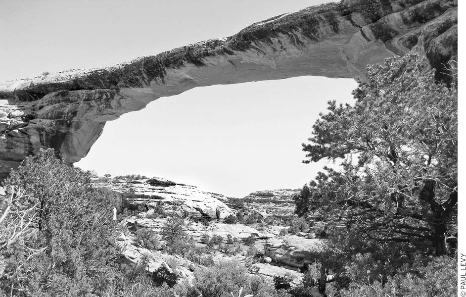
the fragile and elegant Owachomo Bridge, in Natural Bridges National Monument
Ruins, artifacts, and rock art indicate a long occupation by Native Americans ranging from archaic groups to the Anasazi. Many fine cliff dwellings built by the Anasazi still stand. In 1883, prospector Cass Hite passed on tales of the huge stone bridges that he had discovered on a trip up White Canyon. Adventurous travelers, including those on a 1904 National Geographic magazine expedition, visited this isolated region to marvel at the bridges. The public’s desire for protection of the bridges led President Theodore Roosevelt to proclaim the area a national monument in 1908. Federal administrators then changed the original bridge names from Edwin, Augusta, and Caroline to the Hopi names used today. Although the Hopi never lived here, the Anasazi of White Canyon very likely have descendants in the modern Hopi villages in Arizona.
From the signed junction on Highway 95, it is 4.5 miles on Highway 275 to the visitors center (435/692-1234, 8am-6pm daily May-Sept., 8am-5pm daily Apr. and Oct., 8am-4:30pm daily Nov.-Mar.), at an elevation of 6,505 feet. Monument Valley Overlook, two miles in, offers views south across a vast expanse of piñon pine and juniper to Monument Valley and distant mountains. A slide show in the visitors center illustrates how geologic forces and erosion created the canyons and natural bridges. Exhibits introduce the people who once lived here, as well as the area’s geology, wildlife, and plants. Outside, labels identify common plants of the monument.
Rangers can answer your questions about the monument and the surrounding area. If asked, staff will provide details on locations of ruins and rock art sites. You can purchase regional books, topographic and geologic maps, postcards, and slides. Checklists of birds, other wildlife, and plants are available too.
The Bridge View Drive is always open during daylight hours, except after heavy snowstorms. A winter visit can be very enjoyable; ice or mud often close the steep Sipapu and Kachina Trails, but the short trail to Owachomo Bridge usually stays open. Pets aren’t allowed on the trails or in the backcountry at any time.
Other than the small but popular campground at the national monument, the nearest accommodations are 40 miles east near Blanding or 50 miles west at Hite.
A large solar electric-power station is across the road from the visitors center. This demonstration system, the largest in the world when it was constructed in 1980, has 250,000 solar cells spread over nearly an acre and produces up to 100 kilowatts. Batteries, located elsewhere, store a two-day supply of power. The monument is far from the nearest power lines, so the solar cells provide an alternative to continuously running diesel-powered generators.
When the sun sets, Natural Bridges becomes one of the darkest places in the United States. In fact, the International Dark Sky Association has named this the world’s first dark-sky park. Come here for some serious stargazing!
This nine-mile drive begins its one-way loop just past the campground. You can stop for lunch at a picnic area. Allow about 1.5 hours for a quick trip around. To make all the stops and do a bit of leisurely hiking takes most of a day. The cross-bedded sandstone of the bridges and canyons is part of the 265-million-year-old Cedar Mesa Formation.
Sipapu Bridge viewpoint is two miles from the visitors center. The Hopi name refers to the gateway from which their ancestors entered this world from another world below. Sipapu Bridge has reached its mature or middle-age stage of development. The bridge is the largest in the monument and has a span of 268 feet and a height of 220 feet. Many people think Sipapu is the most magnificent of the bridges. Another view and a trail to the base of Sipapu are 0.8 miles farther. The viewpoint is about halfway down on an easy trail; allow half an hour. A steeper and rougher trail branches off the viewpoint trail and winds down to the bottom of White Canyon, which is probably the best place to fully appreciate the bridge’s size. The total round-trip distance is 1.2 miles, with an elevation change of 600 feet.
Horse Collar Ruin, built by the Anasazi, looks as though it has been abandoned for just a few decades, not 800 years. A short trail leads to an overlook 3.1 miles from the visitors center. The name comes from the shape of the doorway openings in two storage rooms. Hikers walking in the canyon between Sipapu and Kachina Bridges can scramble up a steep rock slope to the site. Like all ancient ruins, these are fragile and must not be touched or entered. Only with such care will future generations of visitors be able to admire the well-preserved structures. Other groups of Anasazi dwellings can also be seen in or near the monument; ask a ranger for directions.
The Kachina Bridge viewpoint and trailhead are 5.1 miles from the visitors center. The massive bridge has a span of 204 feet and a height of 210 feet. A trail, 1.5 miles round-trip, leads to the canyon bottom next to the bridge; the elevation change is 650 feet. Look for pictographs near the base of the trail. Some of the figures resemble Hopi kachinas (spirits) and inspired the bridge’s name. Armstrong Canyon joins White Canyon just downstream from the bridge; floods in each canyon abraded opposite sides of the rock fin that later became Kachina Bridge.
The Owachomo Bridge viewpoint and trailhead are 7.1 miles from the visitors center. An easy walk leads to Owachomo’s base—0.5 miles round-trip with an elevation change of 180 feet. Graceful Owachomo spans 180 feet and is 106 feet high. Erosive forces have worn the venerable bridge to a thickness of only nine feet. Unlike the other two bridges, Owachomo spans a smaller tributary stream instead of a major canyon. Two streams played a role in the bridge’s formation. Floods coming down the larger Armstrong Canyon surged against a sandstone fin on one side while floods in a small side canyon wore away the rock on the other side. Eventually a hole formed, and waters flowing down the side canyon took the shorter route through the bridge. The word owachomo means “flat-rock mound” in the Hopi language; a large rock outcrop nearby inspired the name. Before construction of the present road, a trail winding down the opposite side of Armstrong Canyon provided the only access for monument visitors. The trail, little used now, connects with Highway 95.
• Distance: 8.6 miles round-trip
• Duration: 5-6 hours
• Elevation change: 500 feet
• Effort: moderate-strenuous
• Trailhead: Sipapu Bridge
A canyon hike through all three bridges can be the highlight of a visit to the monument. Unmaintained trails make a loop in White and Armstrong Canyons and cross a wooded plateau. The trip is easier if you start from Sipapu and come out on the relatively gentle grades at Owachomo. You can save 2.5 miles by arranging a car shuttle between the Sipapu and Owachomo trailheads. Another option is to go in or out on the Kachina Bridge Trail midway to cut the hiking distance in half. As you near Owachomo Bridge from below, a small sign points out the trail, which bypasses a deep pool. The canyons remain in their wild state; you’ll need some hiking experience, water, proper footwear, a compass, and a map (the handout available at the visitors center is adequate). The USGS 7.5-minute topographic maps also cover this area.
When hiking in the canyons, keep an eye out for natural arches and Native American writing. Try not to step on midget faded rattlesnakes or other living entities (including the fragile cryptobiotic soil). And beware of flash floods, especially if you see big clouds billowing in the sky in an upstream direction. You don’t need a hiking permit, although it’s a good idea to talk beforehand with a ranger to find out current conditions. Overnight camping within the monument is permitted only in the campground. Backpackers, however, can go up or down the canyons and camp outside the monument boundaries. Note that vehicles can’t be parked overnight on the loop drive.
The Natural Bridges Campground (first-come, first-served, year-round, $10) is in a forest of piñon pine and juniper. Obtain water from a faucet in front of the visitors center. Rangers give talks several evenings each week during the summer season. The campground is often full, but there is a rather grim designated overflow area near the intersection of Highways 95 and 261. RVs and trailers longer than 26 feet must use this parking area. To reach the campground, drive 0.3 miles past the visitors center and turn right.
Lake Powell is at the center of the Glen Canyon National Recreation Area (520/608-6404, 7 days $15 per vehicle or $7 cyclists and pedestrians, no charge for passing through Page on U.S. 89), a vast land covering 1.25 million acres in Arizona and Utah. When the Glen Canyon Dam was completed in 1964, conservationists deplored the loss of the remote and beautiful Glen Canyon of the Colorado River beneath the lake’s waters. In terms of beauty and sheer drama, Glen Canyon was considered the equal of the Grand Canyon. Today, we have only words, pictures, and memories to remind us of its wonders. On the other hand, the 186-mile-long lake now provides easy access to an area most had not even known existed. Lake Powell is the second-largest artificial lake in the United States. Only Lake Mead, farther downstream, has a greater water-storage capacity. Lake Powell, however, has three times more shoreline—1,960 miles—and when full, it holds enough water to cover the state of Pennsylvania one foot deep. Just a handful of roads approach the lake, so access is basically limited to boats—bays and coves offer nearly limitless opportunities for exploration by boaters—as well as long-distance hiking trails.
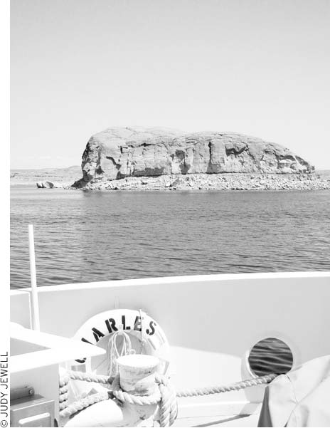
A ferry crosses Lake Powell from Halls Crossing to Bullfrog.
Eight miles west of the entrance to Natural Bridges National Monument, travelers must make a decision: whether to continue on Highway 95 to cross the Colorado by bridge at Hite or to follow Highway 276 to the Halls Crossing Marina and cross the river, at this point tamed by the Glen Canyon Dam and known as Lake Powell, by car ferry.
Obviously, the ferry is the more exotic choice, and both Halls Crossing and Bullfrog Marinas offer lodging and food, a relative scarcity in this remote area. Crossing the Colorado on the ferry also makes it easy to access Bullfrog-Notom Road, which climbs for 60 miles through dramatic landscapes on its way to Capitol Reef National Park’s otherwise remote Waterfold Pocket. The road ends at Notom, just four miles from the eastern entrance to Capitol Reef Park on Highway 24. Drivers can also turn west on the Burr Trail and follow back roads to Boulder, near the Escalante River Canyon.
At the junction of Highways 95 and 276, a large sign lists the departure times for the ferry; note that these may be different than the times listed in the widely circulated flyer or on the website. Confirm the departure times (435/684-3088, www.udot.utah.gov) before making the 42-mile journey to Halls Crossing.
The crossing time for the three-mile trip from Halls Crossing to Bullfrog is 27 minutes. Fares are $25 for cars, which includes the driver and all passengers, $10 bicycles and foot passengers, and $15 motorcycles. Vehicles longer than 20 feet pay $1.50 per foot.
Ferry service runs late April-early October, and there’s a trip every other hour daily beginning with the 9am boat from Halls Landing, which then leaves Bullfrog at 10am The final ferry from Halls Crossing departs at 3pm, and the final ferry from Bullfrog departs at 4pm The ferry does not run early October-late April.
If drought or downstream demand lowers the level of Lake Powell beyond a certain point, there may not be enough water for the ferry to operate. If this is the case, there will be notices about the ferry’s status at just about every park visitors center in southern Utah.
For reservations and information regarding lodging, camping, tours, boating, and recreation at both Halls Crossing and Bullfrog Marina, contact Lake Powell Resorts & Marinas (888/896-3829, www.lakepowell.com).
Arriving at Halls Crossing by road, you’ll first reach a small store offering three-bedroom units in trailer houses and an RV park. Continue for 0.5 miles on the main road to the boat ramp and Halls Crossing Marina (435/684-2261). The marina has a larger store (groceries and fishing and boating supplies), tours to Rainbow Bridge, a boat-rental office (fishing, waterskiing, and houseboats), a gas dock, slips, and storage. The ranger station is nearby, although rangers are usually out on patrol; look for their vehicle in the area if the office is closed.
On the western side of the lake, Bullfrog Marina is more like a small town (albeit one run by Aramark), with a visitors center (435/684-7420), a clinic, stores, a service station, and a handsome hotel and restaurant. The marina rents boats ranging from kayaks ($45 per day) to 12-person party boats ($600 per day) to houseboats ($4,320-15,000 per week), but for guided boat tours of Lake Powell, you’ll have to go to the Wahweap Marina near Page, Arizona.
Defiance House Lodge (888/896-3829, www.lakepowell.com, from $146) offers comfortable lake-view accommodations and the Anasazi Restaurant (breakfast, lunch, and dinner daily summer, $9-32). The front desk at the lodge also handles family units (well-equipped trailers, about $300 per night), an RV park ($46), and houseboat rentals (from $750 per day, 3-day minimum). Showers, a laundry room, a convenience store, and a post office are at Trailer Village. Ask the visitors center staff or rangers for directions to primitive camping areas with vehicle access elsewhere along Bullfrog Bay.
Bullfrog Marina can be reached from the north via paved Highway 276. It is 40 miles between Bullfrog and the junction with Highway 95. Ticaboo, 20 miles north of Bullfrog, has another good lodging option. The Ticaboo Lodge (435/788-2110 or 800/842-2267, from $122) is a hotel with a swimming pool, a restaurant, and a service-station complex that pretty much constitutes all of Ticaboo.
If the Lake Powell ferry schedule doesn’t match your travel plans, Highway 95 will quickly get you across the Colorado River to the junction with Highway 24 at Hanksville.
In 1883 Cass Hite came to Glen Canyon in search of gold. He found some at a place later named Hite City, which set off a small gold rush. Cass and a few of his relatives operated a small store and post office, which were the only services for many miles. Travelers who wanted to cross the Colorado River here had the difficult task of swimming their animals across. Arthur Chaffin, a later resident, put through the first road and opened a ferry service in 1946. The Chaffin Ferry served uranium prospectors and adventurous motorists until the lake backed up to the spot in 1964. A steel bridge now spans the Colorado River upstream from Hite Marina. Cass Hite’s store and the ferry site are underwater about five miles down the lake from Hite Marina.
Beyond Hite, on the tiny neck of land between the Colorado River bridge and the Dirty Devil bridge, an unmarked dirt road turns north. Called Hite Road, or Orange Cliffs Road, this long and rugged road eventually links up with backcountry routes—including the Flint Trail—in the Maze District of Canyonlands National Park.
The uppermost marina on Lake Powell, Hite is 141 lake miles from Glen Canyon Dam. It is hit hard when water levels drop in Lake Powell, which has been most of the time in recent years. When water is available, boats can continue up the lake to the mouth of Dark Canyon in Cataract Canyon at low water or into Canyonlands National Park at high water. During times of low water, the boat ramp is often high above the lake. Hite tends to be quieter than the other marinas and is favored by some anglers and families. Facilities include a small store with gas, three-bedroom housekeeping units in trailer houses (about $300), and a primitive campground (free) with no drinking water. Primitive camping is also available nearby, off Highway 95 at Dirty Devil, Farley Canyon, White Canyon, Blue Notch, and other locations. A ranger station (435/684-2457) is occasionally open; look for the rangers’ vehicle at other times. Contact Lake Powell Resorts & Marinas (888/896-3829, www.lakepowell.com) for accommodations reservations.
Although the town of Page is hot, busy, and not particularly appealing, it is the largest community anywhere near Lake Powell, and it offers travelers a number of places to stay and eat. The town overlooks Lake Powell and Glen Canyon Dam; the large Wahweap Resort and Marina is just six miles away.
Nearly all Page motels are on or near Lake Powell Boulevard (U.S. 89L), a 3.25-mile loop that branches off the main highway. Page is a busy place in summer, however, and a call ahead is a good idea if you don’t want to chase around town looking for vacancies. Expect to pay top dollar for views of the lake. The summer rates listed here drop in winter (Nov.-Mar.).
In a way, the most appealing lodgings are in the small apartments-turned-motels on and around 8th Avenue, a quiet residential area two blocks off Lake Powell Boulevard. These apartments date back to 1958-1959, when they housed supervisors for the dam construction project. One such place is Bashful Bob’s Motel (750 S. Navajo Dr., 928/645-3919, www.bashfulbobsmotel.com, from $39), a great little budget place with simple two-bedroom apartments, all with kitchenettes. Debbie’s Hide A Way (117 8th Ave., 928/645-1224, www.debbieshideaway.com, from $99) is another place with a personal touch and a quiet garden in back; all guest rooms are suites with kitchens. Debbie’s also has a two-bedroom apartment ($75) a couple of blocks from the motel. Lulu’s Sleep Ezze (105 8th Ave., 928/608-0273 or 800/553-6211, www.lulussleepezzemotel.com, from $95, cash discount) is especially sweet.
Courtyard Page (600 Clubhouse Dr., 928/645-5000 or 877/905-4495, www.marriott.com, from $159) is a good chain hotel with a great setting, with views, a restaurant, a pool, a spa, an exercise room, and an adjacent 18-hole golf course.
Dam Bar and Grill (644 N. Navajo Dr., 928/645-2161, 5pm-11pm daily, $8-25), in the Dam Plaza, serves up steaks, barbecue, seafood, pasta, and sandwiches; it also has a sports bar. Fiesta Mexicana (201 S. Lake Powell Blvd., 928/645-3999, 11am-9pm daily, $8-15) is a busy but friendly little Mexican place (and here in Arizona, it’s easy to get a margarita).
It’s a lonely road that leads north from the Glen Canyon Recreational Area and Lake Powell to I-70, just west of the town of Green River. The crossroads town of Hanksville is a good place to gas up (don’t expect any bargains on gas) and grab a burger, and Goblin Valley State Park is worth the detour. Highway 24 north of Hanksville also provides access to Canyonlands National Park’s Maze District and the incredible rock art in the park’s Horseshoe Canyon Unit.
Even by Utah standards, tiny Hanksville (population just over 200) is pretty remote. Ebenezer Hanks and other Mormon settlers founded this out-of-the-way community in 1882 along the Fremont River, then known as the Dirty Devil River. The isolation attracted polygamists like Hanks and other fugitives from the law. Butch Cassidy and his gang found refuge in the rugged canyon country of “Robbers’ Roost,” east of town. Several houses and the old stone church on Center Street, one block south of the highway, survive from the 19th century.
Travelers exploring this scenic region find Hanksville a handy if lackluster stopover; Capitol Reef National Park is to the west, Lake Powell and the Henry Mountains are to the south, the remote Maze District of Canyonlands National Park is to the east, and Goblin Valley State Park is to the north.
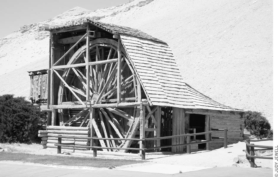
This waterwheel is the most scenic thing in the crossroads town of Hanksville.
E. T. Wolverton built this ingenious mill during the 1920s at his gold-mining claims in the Henry Mountains. A 20-foot waterwheel, still perfectly balanced, powered ore-crushing machinery and a sawmill. Owners of claims at the mill’s original site didn’t like a steady stream of tourists coming through to see the mill, so it was moved to the BLM office at Hanksville. Drive south 0.5 miles on 100 West to see the mill and some of its original interior mechanism.
Whispering Sands Motel (68 E. 100 N., 435/542-3238, from $89) has spacious guest rooms with cable TV and phones. In the center of town, the Red Rock Campground (435/542-3235 or 800/894-3242, mid-Mar.-Oct., $28 RVs) has showers, laundry, and a restaurant.
Hanksville’s restaurants cluster at the south end of town; don’t expect anything fancy. The Red Rock (26 E. 100 N., 435/542-3235, 8am-8pm or later daily Apr.-Oct., $9-23) is at the campground, with home cooking, beer, and wine. Blondie’s Eatery (3 N. Hwy. 95, 435/542-3255, 7am-9pm daily, $5-13) is a casual sit-down place with chicken and burgers across from Whispering Sands motel. Stan’s Burger Shack (140 S. Hwy. 95, 435/542-3441, 7am-10pm daily, $5-8), at the Chevron station, is more a fast-food burger joint that’s a step up from the chains.
The Bureau of Land Management (435/542-3461) has a field station 0.5 miles south of Highway 24 on 100 West, with information on road conditions, hiking, camping, and the buffalo herd in the Henry Mountains.
Thousands of rock formations, many with goblin-like “faces,” inhabit Goblin Valley State Park (435/564-8110, reservations 800/322-3770, www.reserveamerica.com, year-round, $7 per vehicle day-use, $16 camping). All of these so-called goblins have weathered out of the Entrada Formation, here a soft red sandstone and even softer siltstone. Carmel Canyon Trail (1.5-mile loop) begins at the northeast side of the parking lot at road’s end, then drops down to the desert floor and a strange landscape of goblins, spires, and balanced rocks. Just wander around at your whim; this is a great place for the imagination. A 1.3-mile trail connects the campground and the goblin-studded Carmel Canyon Trail.
Curtis Bench Trail begins on the road between the parking lot and the campground and goes south to a viewpoint of the Henry Mountains; cairns mark the 1.5-mile (one-way) route.
The turnoff from Highway 24 is at milepost 137, which is 21 miles north of Hanksville and 24 miles south of I-70; follow signs west five miles on a paved road, then south seven miles on a gravel road.
Although there are off-road vehicle and motorcycle riding areas just west of the park, bicycling is limited to the park’s roads. However, 12 miles north, the Temple Mountain Bike Trail traverses old mining roads, ridges, and wash bottoms. Popular hikes near the state park include the Little Wild Horse and Bell Canyons Loop, Chute and Crack Canyons Loop, and Wild Horse Canyon. The park is also a good base for exploring the San Rafael Swell area to the northwest.
Camping at Goblin Valley is a real treat; the late-evening and early-morning sun makes the sandstone spires glow. If you’re not much of a camper, consider booking one of the park’s two yurts ($60). They’re tucked back among the rock formations, and each is equipped with bunk beds and a futon, a swamp cooler, and a propane stove. There are only 26 camping sites, so it’s best to reserve well in advance.
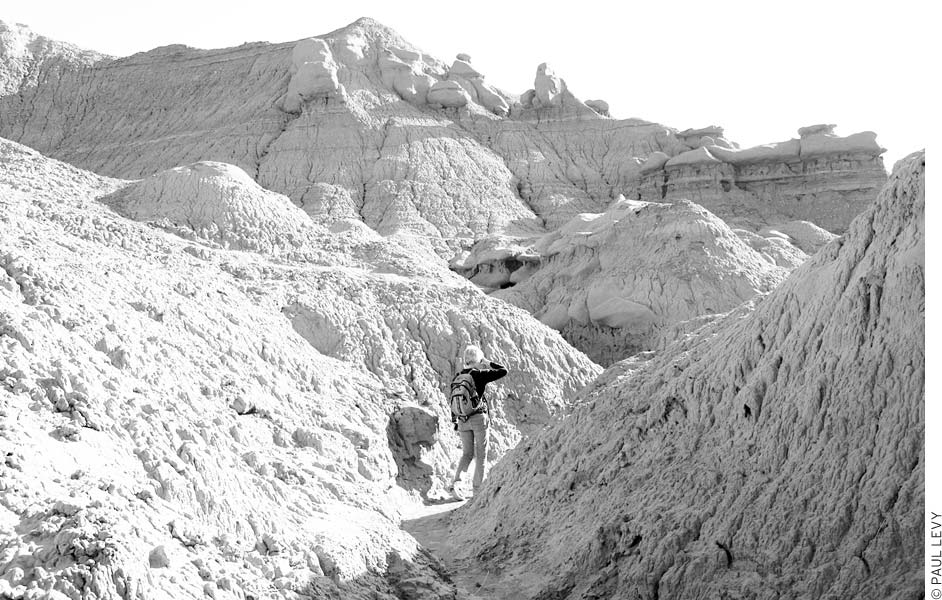
Goblin Valley State Park
Green River (population about 950) is, except for a handful of motels and a lively tavern, pretty run-down, but it’s the only real settlement on the stretch of I-70 between Salina and the Colorado border. Travelers can stop for a night or a meal, set off on a trip down the Green River, or use the town as a base for exploring the scenic San Rafael Swell country nearby.
Green River is known for its melons. In summer, stop at roadside stands and partake of wondrous cantaloupes and watermelons. The blazing summer heat and ample irrigation water make such delicacies possible. Melon Days celebrates the harvest on the third weekend of September with a parade, a city fair, music, a canoe race, games, and lots of melons.
Stop by this fine museum (1765 E. Main St., 435/564-3427, http://jwprhm.com. 8am-7pm daily summer, call for hours fallspring, $6 adults, $2 ages 3-12) to learn about Powell’s daring expeditions down the Green and Colorado Rivers in 1869 and 1871-1872. An excellent multimedia presentation about both rivers uses narratives from Powell’s trips. Historic riverboats on display include a replica of Powell’s Emma Dean.
The Green River’s Labyrinth and Stillwater Canyons are downstream, between the town of Green River and the river’s confluence with the Colorado River in Canyonlands National Park. Primarily a canoeing or kayaking river, the Green River at this point is calm and wide as it passes into increasingly deep, rust-colored canyons. This isn’t a wilderness river; regular powerboats can also follow the river below town to the confluence with the Colorado River and head up the Colorado to Moab, 2-3 days and 186 river miles away.
The most common trip on this portion of the Green River begins just south of town and runs south through the Labyrinth Canyon, ending at Mineral Bottom, a distance of 68 river miles. Moab Rafting and Canoe Company (805 N. Main St., Moab, 435/259-7722, http://moab-rafting.com, $625 for a 5-day trip) offers this trip in canoes and has rentals available. Sherry Griffith Expeditions (435/259-8229 or 800/332-2439, www.griffithexp.com, $900 for a 5-day trip), also based in Moab, offers the same trip in kayaks. For longer excursions, inquire about special 10-day guided trips that go all the way down the Green to its confluence with the Colorado River. Alternatively, you can plan your own self-guided trip down the Green River. Tex’s Riverways (435/259-5101, www.texsriverways.com) offers canoe and touring kayak rentals and all the other equipment you need to outfit a multiday trip, plus shuttle services to and from the river. Permits are required to paddle in Labyrinth Canyon; they’re free and available to download from the BLM website (www.blm.gov) or can be picked up in town at the John Wesley Powell Museum (1765 E. Main St.) or Green River State Park (150 S. Green River Blvd.).
With some luck, you’ll catch the spectacle of this cold-water geyser on the bank of the Green River. The gusher shoots as high as 60 feet, but only 3-4 times daily, so you may have to spend half a day here in order to see it. The eruption, typically lasting seven minutes, is powered by carbon dioxide and other gases. A 2,267-foot-deep petroleum test well drilled in 1935-1936 concentrated the geyser flow, but thick layers of old travertine deposits attest that mineralladen springs have long been active at this site. Colorful newer travertine forms delicate terraces around the opening and down to the river. The orange and dark red of the minerals and algae make this a pretty spot, even if the geyser is only quietly gurgling.
Crystal Geyser is 10 miles south of Green River by road; boaters should look for the geyser deposits on the left, about 4.5 river miles downstream from Green River. From downtown, drive east one mile on Main Street, turn left, and go three miles on signed Frontage Road (near milepost 4), then turn right and go six miles on a narrow paved road just after going under a railroad overpass. The road goes under I-70, then is unpaved for the last 4.5 miles; keep right at a fork near some power lines. Some washes have to be crossed, so the drive isn’t recommended after rains. When the weather is fair, cars shouldn’t have a problem. Buildings and antennas passed on the way belong to the Utah Launch Complex of White Sands Missile Range. From 1963 to 1979 several hundred Pershing and Athena rockets blasted off here for targets at White Sands, New Mexico, 400 miles away.
Green River has a few rather shabby older motels as well as newer chain motels to choose from; unless noted, each of the following has a swimming pool—a major consideration in this often sweltering desert valley.
One of the older places, the Robber’s Roost Motel (325 W. Main St., 435/564-3452, www.rrmotel.com, from $39) is cheap and basic and right in the center of town; it does not have a pool. Green River’s newer motels are on the east end of town. The Super 8 (1248 E. Main St., 435/564-8888 or 800/888-8888, $75), out by I-70’s exit 162, is a good value, with spacious, comfortable guest rooms. The Holiday Inn Express (1845 E. Main St., 435/564-4439, $124) is predictably comfortable—not a bad thing if you’re coming out of the desert or off the river.
The nicest place to stay in town is M The River Terrace (1740 E. Main St., 435/564-3401 or 877/564-3401, www.river-terrace.com, from $106), with somewhat older but large guest rooms, some of which overlook the Green River and some with balconies. Breakfast is included, plus there’s a restaurant adjacent to the hotel. The very pleasant outdoor pool area is flanked by patios and shaded tables.
Several campgrounds, all with showers, offer sites for tents and RVs year-round. Green River State Park (150 S. Green River Blvd., 435/564-3633 or 800/322-3770, www.reserveamerica.com, year-round, $5 day-use, $16 camping) has a great setting near the river; it’s shaded by large cottonwoods and has a boat ramp. Shady Acres RV Park (350 E. Main St., 435/564-8290 or 800/537-8674, www.shadyacresrv.com, year-round, $20 tents, $27-35 hookups, $42 cabins) is not all that shady and may be a bit too close to the noisy road for tent campers; it has a store, showers, and a laundry. Green River KOA (235 S. 1780 E., 435/564-3651, $29 tents, $46 hookups, from $64 cabins) has campsites and cabins (bring sleeping bags) across from the John Wesley Powell Museum and next to the Tamarisk Restaurant.
Other than motel restaurants and fast food, the one really notable place to eat in Green River is M Ray’s Tavern (25 S. Broadway, 435/564-3511, 11am-10pm daily, $8-26). Ray’s doesn’t look like much from the outside, but inside you’ll find a friendly welcome, tables made from tree trunks, and some of the best steaks, chops, and burgers in this part of the state. Don’t expect haute cuisine, but the food is good, and the atmosphere is truly Western; beer drinkers will be glad for the selection of regional microbrews after a long day navigating the river or driving desert roads.
Directly adjacent to the River Terrace hotel is a decent American-style restaurant, The Tamarisk (880 E. Main St., 435/564-8109, 7am-10pm daily, $6-27), with riverfront views.