Quietly, New Mexico gives way to Arizona as you continue to motor west. The character of the land here is harsher than any you’ve seen earlier in your journey. There certainly are green and inviting places in Arizona, but at this moment you could be forgiven for not believing it.

And yet, there are many who are profoundly drawn to this place. I first glimpsed it myself many years ago in what is called the Arizona Strip, that northwestern portion of the state that is cut off from the rest by the Grand Canyon. There, far from the bright lights of any metropolis, I lay on the ground one evening and saw more stars in the sky than I had ever thought possible—I could swear they overlapped.
Water, that most precious of commodities, is in short supply. You could say that water in this area is an acute condition, rather than a chronic one—you will see a great many dry stream beds which gush to life on only a few occasions during the year. The lack of a reliable supply of water through much of this territory has shaped Arizona’s history and destiny. Early inhabitants, such as the Anasazi, were likely forced to move elsewhere when weather patterns made their already-marginal existence untenable; more recently, the path of the railroads was dictated in part by the same limitations.
In this minimalist landscape, the austere is beautiful, and the beautiful is sublime. This land is a canvas bearing the strokes of Mother Nature the artist, for whom a millennium is no more than a moment. Red rock country, a painted desert, and the scar from a meteoric collision all await you in a place where trees turn to stone and volcanic eruptions shape the countryside.
Just across the New Mexico-Arizona border you’ll encounter the community of . . .
LUPTON
![]()
![]()
You’ll cross the state line on the north frontage road, but quickly switch to the south side at exit #359.
From Route 66, Lupton looks to be mostly a sort of “strip” comprised of trading posts offering tourist-oriented souvenirs. The most notable thing about these trading posts is their garish appearance, including bright primary colors and replicas of teepees. At least one of them features a wooden American Indian chief standing outside. This area is an excellent place to pick up that bullwhip or rubber tomahawk you’ve been wanting.
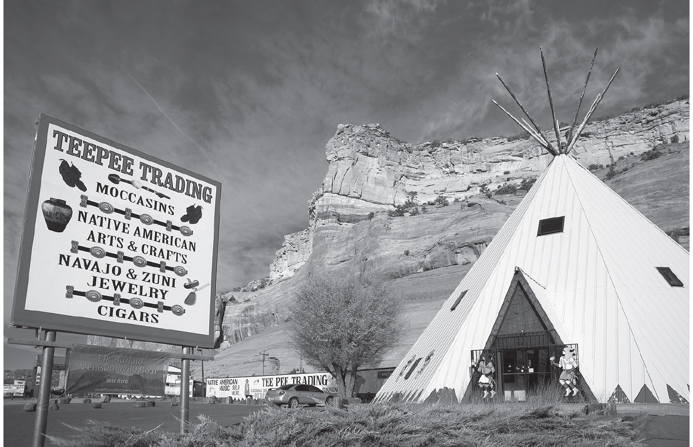
Lupton, Arizona. GPS: 35.36021,-109.04966
About twenty-five miles or so to the north of here via Highway 12 is Window Rock, a natural feature consisting of an aperture carved in a large sandstone formation by the forces of wind, dust, and water. There is a viewing area at the Window Rock Tribal Park (Hwy 12.) The nearby community of Window Rock has been the official capital of the Navajo nation since 1938. There is a museum nearby on Highway 264.
Traveling Route 66 in Lupton, you will quickly cross to the south side of I-40 for the run toward Sanders. Here you’ll see what remains of the former Ortega’s Indian Galeria, which was housed in a geodesic-domed building, now in derelict condition. There’s a similar structure, also a trading post, which you’ll see later at Meteor City.

![]() Continue on the south frontage road to Allentown at exit #351 and cross to the north frontage road.
Continue on the south frontage road to Allentown at exit #351 and cross to the north frontage road.
HOUCK
At Houck is something called Fort Courage, built as a replica of the fort used in the 1960s television series F Troop. Nearby is an old coffee house in a sort of Googie-wannabe style.
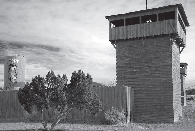
This tourist attraction tapped into the popularity of the F Troop television comedy. GPS: 35.28316,-109.20755

![]() Continue on the north frontage road toward Sanders. At exit #346, this becomes Querino Dirt Road. If conditions are good, continue ahead. If not, enter the interstate here and then use exit #339 for Sanders.
Continue on the north frontage road toward Sanders. At exit #346, this becomes Querino Dirt Road. If conditions are good, continue ahead. If not, enter the interstate here and then use exit #339 for Sanders.
If you took Querino Road, then at the end of it you’ll need to join the interstate (exit #341). Leave I-40 at exit #339.
SANDERS
At mile marker 339 is the village of Sanders. The former Route 66 Diner (Arizona Park Ests. #26), housed in a building manufactured by the renowned Valentine, is in the portion of town south of the interstate. To find it, go south on 191, left on Navajo, then right on E. Butte.

This Valentine-brand diner has seen much better days. Sanders, Arizona. GPS: 35.20965,-109.32856

![]() Leave Sanders on the north frontage road heading west.
Leave Sanders on the north frontage road heading west.
CHAMBERS–NAVAJO
You’ll meet up with U.S. 191 North at Chambers.
FURTHER AFIELD
About thirty-seven miles north of Chambers via U.S. 191 is the village of Ganado and the Hubbell Trading Post National Historic Site (1/2 AZ-264). Established in the 1870s, this is the oldest continuously operating Navajo trading post, now run by the National Park Service. John Hubbell’s grave overlooks the site from nearby Hubbell Hill.
Thirty-six miles north of Hubbell’s Trading Post is the Canyon de Chelly National Monument, which contains probably the most-photographed ruin in the United States: the White House ruin. The ruin is reached by an arduous trail, about 2.5 miles round-trip, which may leave you breathless on the ascent, but it is well worth the effort. The trail goes past an active farmstead and across a small stream before reaching the bottom of the canyon, where the ruin is built into the canyon wall. This is the only ruin in the park that is accessible without a guide.

![]() Continuing on Route 66, you’ll need to join the interstate here at Chambers (exit #333) due to the fact that the Mother Road remnants in this area are rough, impassable, or come to dead ends. Continue on I-40 to exit #303.
Continuing on Route 66, you’ll need to join the interstate here at Chambers (exit #333) due to the fact that the Mother Road remnants in this area are rough, impassable, or come to dead ends. Continue on I-40 to exit #303.
PETRIFIED FOREST
No longer accessible from what remains of old 66, the Painted Desert and the Petrified Forest, a pair of natural attractions straddling the highway, must be reached from I-40 (at exit #311). However, in this vicinity you can use the I-40 overpasses to look at the adjoining terrain and pick out where the Highway 66 pavement used to run. The paving was pretty thoroughly removed in this area, but out here scars are slow to heal, and you can often spot differences in the color and character of the soil and vegetation signaling where the old roadbed was. Keep alert and you’ll see what I mean.
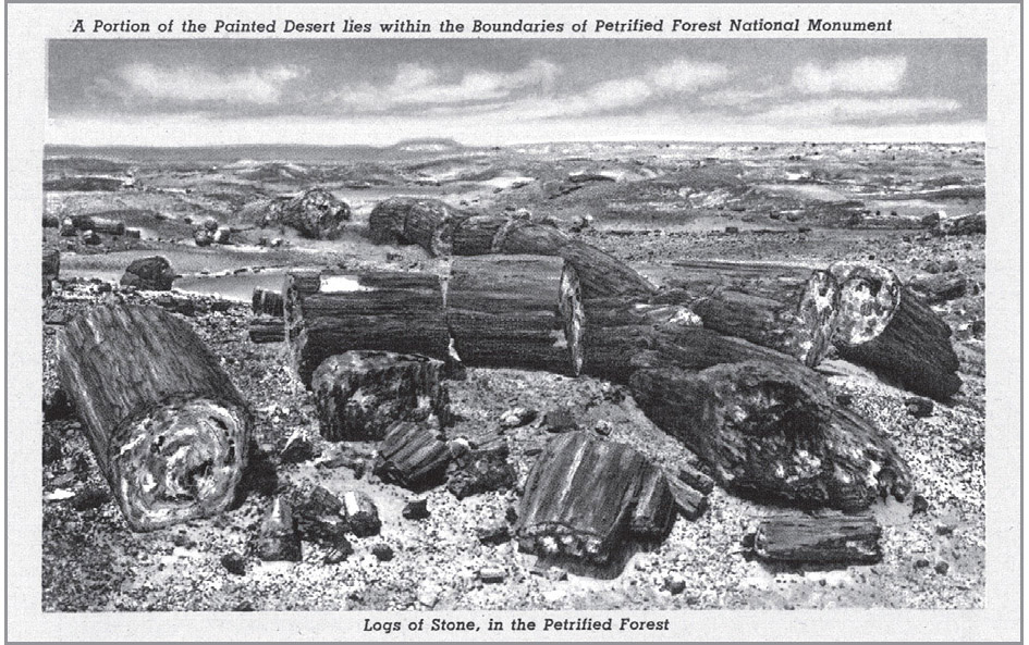
The Petrified Forest National Park is about twenty-six miles east of Holbrook. It was established in 1906 during the Theodore Roosevelt administration, and designated a national park in 1962. This area was once a dense and humid forest eons ago, and conditions were such that fallen trees transformed into mineralized versions of themselves. The agate and quartz that comprise these fossils still exhibit the visible characteristics of wood, such as grain and growth rings. The park includes natural formations, such as undisturbed fallen trees, as well as some man-made structures like the Agate House, a pueblo that is fashioned from the rare material. Other features include the Puerco Indian Ruin, a 100-room pueblo dating from about A.D. 1300, and Newspaper Rock, which is covered in petroglyphs.
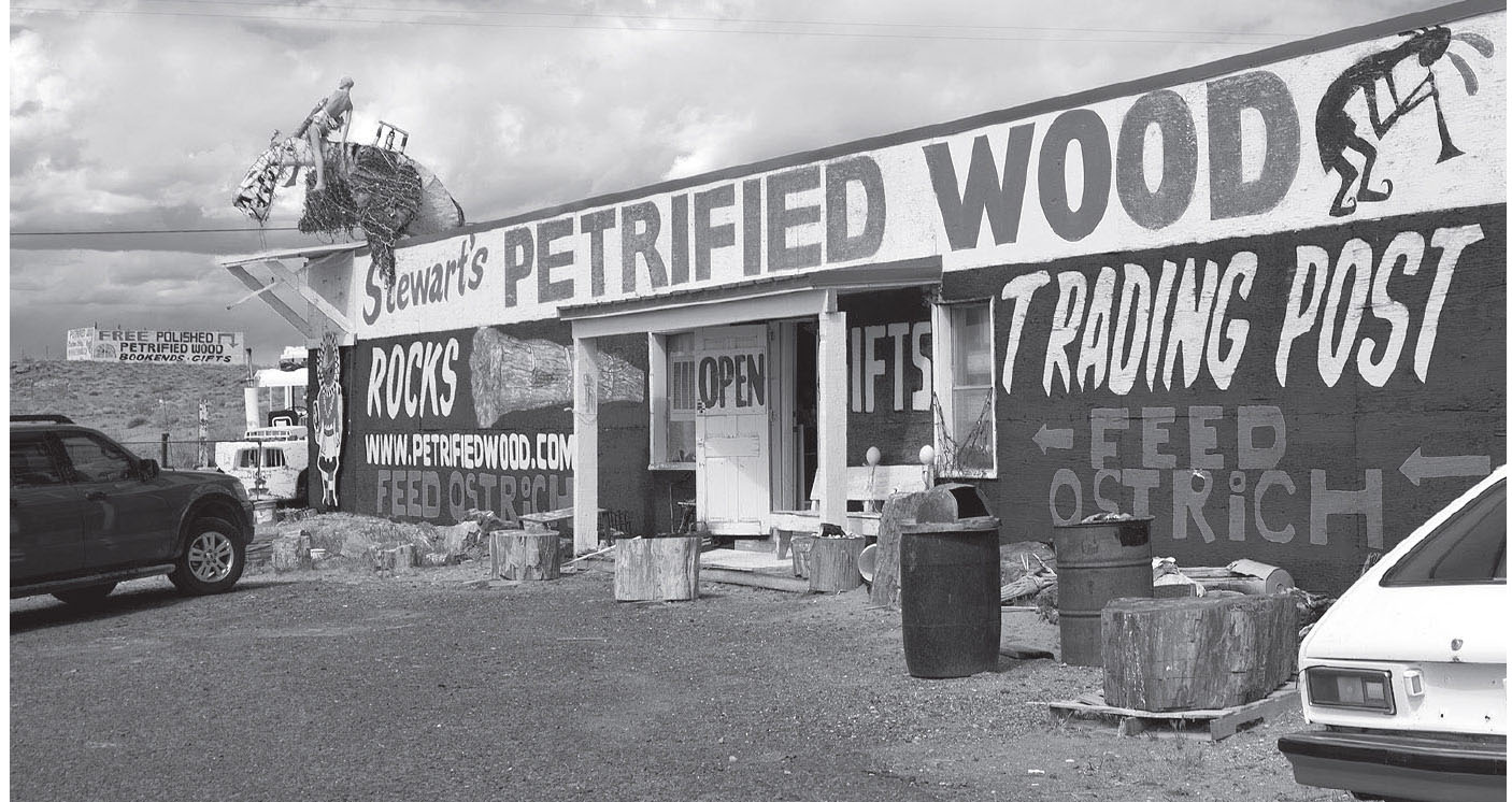
Rock shop at exit #303, near Adamana, Arizona. GPS: 35.00212,-109.89702
The Painted Desert is just north of the highway and connects with the Petrified Forest to the south. Plenty of photo opportunities are provided by the colorful mineral deposits that give the area its name. These are particularly impressive in early-morning or pre-dusk light. The Painted Desert Inn (1 Park Rd.), at Kachina Point, was built in the 1920s and then restored in the ’30s by the Civilian Conservation Corps. Later, it became a part of the Harvey House chain.
Both the Petrified Forest and the Painted Desert are bona fide Route 66-era attractions, so be sure to take advantage of this opportunity to experience them.
HOLBROOK
![]()
![]()
Take exit #289/Business Loop 40 into Holbrook (Navajo Boulevard), which follows the course of old Route 66, including a turn to the west on Hopi Drive.
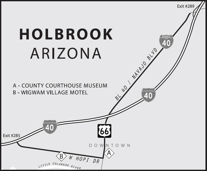
Holbrook is well-known to 66 travelers as the home of the Wigwam Village Motel (811 W. Hopi Dr.). There were at one time seven such villages, all built between 1933 and 1950, with the original one in Horse Cave, Kentucky. The sister set of units near San Bernardino was the last to be built. Each village consists of several individual room units designed to resemble American Indian teepees. Furthermore, all units of each village originally had pay-per-listen radios, the receipts of which were forwarded to the originator of the concept, Frank Bedford, as a sort of royalty fee.

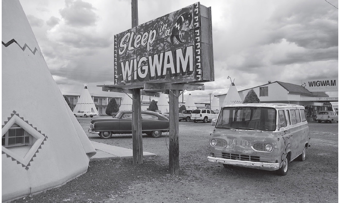
Ambience at the Wigwam Motel, Holbrook, Arizona. GPS: 34.90287,-110.16864
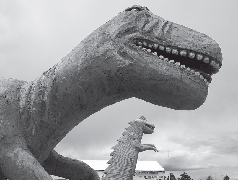
Holbrook, Arizona. GPS: 34.90493,-110.15810
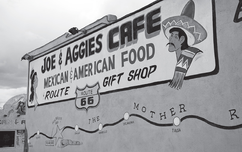
Holbrook, Arizona. GPS: 34.90172,-110.15908
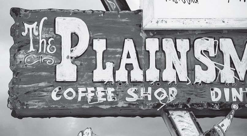
Holbrook, Arizona. GPS: 34.90295,-110.17098
HOLBROOK ATTRACTIONS
The old Navajo County Courthouse (Navajo Blvd. and E. Arizona St.), built in 1898, now houses a museum and visitor center and includes the original Old West jail. The jail has preserved some old inmate artwork on the walls. You can also pick up a copy of Holbrook’s self-guided walking tour of various points of interest at the museum. Included is the Blevins House, where an Old West shootout occurred in 1887.
There are numerous purveyors of petrified wood and other exotic minerals in Holbrook, some of which include some campy dinosaur figures as décor.

![]() Rejoin I-40 at the west end of town (exit #285 interchange).
Rejoin I-40 at the west end of town (exit #285 interchange).
If you haven’t had your fill of petrified wood yet—or if you skipped the Petrified Forest completely—you might want to exit at Geronimo (exit #280), where the trading post has what they boast is the World’s Largest Petrified Log on display.

Geronimo’s, west of Holbrook, Arizona. GPS: 34.91954,-110.25513
JOSEPH CITY
![]()
![]()
Leave I-40 at exit #277 to enter the town of Joseph City.
This community was originally established by Mormons circa 1876—America’s centennial year, and exactly fifty years before the establishment of U.S. 66 and the rest of the federal highway system.
West of the town proper is the famous Jackrabbit Trading Post (3386 Historic Rte. 66). The billboard proclaiming “HERE IT IS” has to be one of the best-known sights along the route. I for one find myself transported back in time whenever I see it. Aside from the billboard, the Jackrabbit is also famous for its slogan: “If you haven’t been to the Jackrabbit, you haven’t been in the Southwest.” Lots of travelers over the years have had their photographs taken sitting astride the giant jackrabbit figure on the premises. To find the Jackrabbit, you can either cross to the south side of I-40 at exit #274 and then turn west, or you can take the interstate west to exit #269 and then double back on the south frontage road.

ROADSIDE MARKETING AT THE JACKRABBIT
Anticipation. That’s something that comes to mind when I think of the Jackrabbit Trading Post. Sure, the big billboard exclaiming, “Here It Is!” is unique and impressive and known the world over. But the marketing strategy for the Jackrabbit is all about anticipation. And when it’s done right, anticipation is one of the hardest things to resist.
In addition to the renowned billboard pictured, the Jackrabbit posted smaller signs up and down the highway in both directions giving progress reports. When you were eighty-seven miles away, you’d see a simple sign with a jackrabbit silhouette stating: “87 miles.”
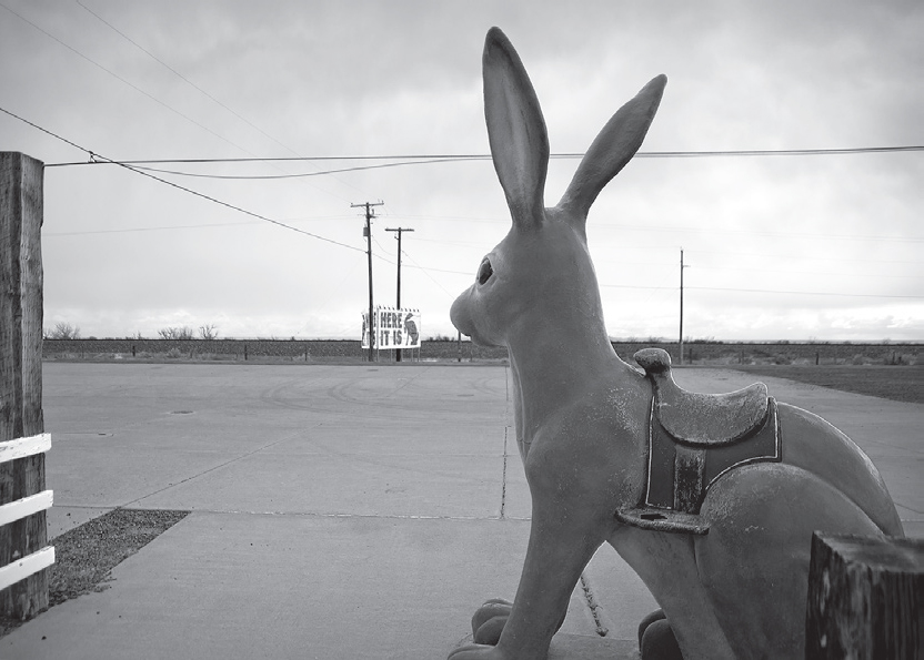
Jackrabbit Trading Post, Joseph City. GPS: 34.96765,-110.43054
Several miles later, there’d be exactly the same graphic, but with the enticing figure: “69 miles.”
As you, the Route 66 motorist, approached ever closer, the signs would appear more and more frequently: 26 miles . . . 18 . . . 14 . . . 11 . . . .
It’s no wonder, then, that by the time the family arrived, everyone in the car—including dear old dad—was desperate to pull over and find out for themselves just what all the fuss was about. And we still do pull over, even today.

Here It Is: the most famous billboard on all of Route 66, Joseph City, Arizona. GPS: 34.96765,-110.43054

![]() After visiting the Jackrabbit, rejoin I-40 at exit #269 just to the west. Continue until you reach exit #257.
After visiting the Jackrabbit, rejoin I-40 at exit #269 just to the west. Continue until you reach exit #257.
MANILA–HIBBARD–HOBSON
Manila shows up plainly as a town directly on Route 66 in my 1957 road atlas, as does Hibbard. By that time, Hobson had already been bypassed, and it appeared just south of the route. Hobson is still down there, right on the railroad tracks, as befits a very old alignment. The memory of Hibbard persists thanks to the I-40 exit sign—exit #264 is called Hibbard Road. Today, the community at this exit is called Havre.
If you have a rugged vehicle and are feeling adventurous, take the Hibbard Road exit, go to the north side of the interstate, and follow the road west. You will lose the pavement for most of the way, but you will pass through what was once a well-traveled piece of back country. At the Highway 87 junction, cross to the south side of I-40 for the run into Winslow.
WINSLOW
As you enter Winslow from the east, the highway splits into eastbound and westbound portions. As always, when the highway splits like this through any town, I recommend that you double back after you’ve passed through town in order to see what’s on the other side.
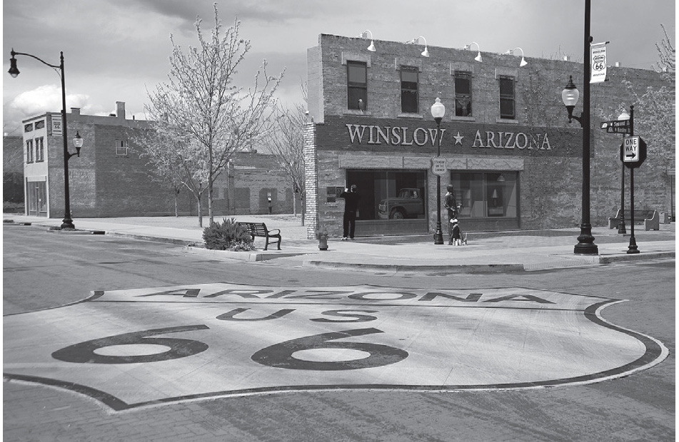
Downtown Winslow, Arizona. GPS: 35.02334,-110.69812
Winslow received mention in the Eagles’ song “Take It Easy” many years ago, and the town has latched onto this bit of trivia for all it’s worth. Go check out the “corner in Winslow, Arizona” yourself, where you’ll see a sign quoting the famous line, a bronze statue, and a mural that includes a girl in a flatbed Ford (Kinsley St. and 2nd St.).
WINSLOW ATTRACTIONS
The Old Trails Museum (212 N. Kinsley) houses a collection of Winslow historical artifacts and Route 66 memorabilia in a former bank building that includes many of its original features.
Winslow’s 1st Street Pathway, which runs a half-dozen blocks or so, was only the first phase in a project to revitalize the downtown area, collectively referred to as “Renaissance on 66.” In phase two, five blocks of 2nd and 3rd Streets had new streetlamps installed, Route 66 banners hung, and brick inlays added to the crosswalks and intersections. The pathway links two of the town’s most historic landmarks: the La Posada Hotel and the Hubbell Trading Post.
The La Posada Hotel (303 E. 2nd St.) is a former Harvey House property created in 1928 by top-tier architect Mary Colter, widely regarded today for being far ahead of her time. Offering a modest number of guest rooms in a space larger than the Hearst Castle, this Spanish hacienda-style jewel was restored in the late 1990s and features a museum, gardens, and meeting spaces.
The Hubbell Trading Post (1/2 AZ-264) is part of an extensive network of stores once operated in the Southwest by the Hubbell family. This one was established in 1924, before Route 66 became a reality. The building has recently been renovated in order to house historical exhibits, as well as a new visitor center and offices for the local chamber of commerce.
Winslow’s Remembrance Garden (E. 3rd St. and Transcon Ln.) is a memorial to the lives lost in the September 11 terrorist attacks. On display are some beams from the World Trade Center wreckage.
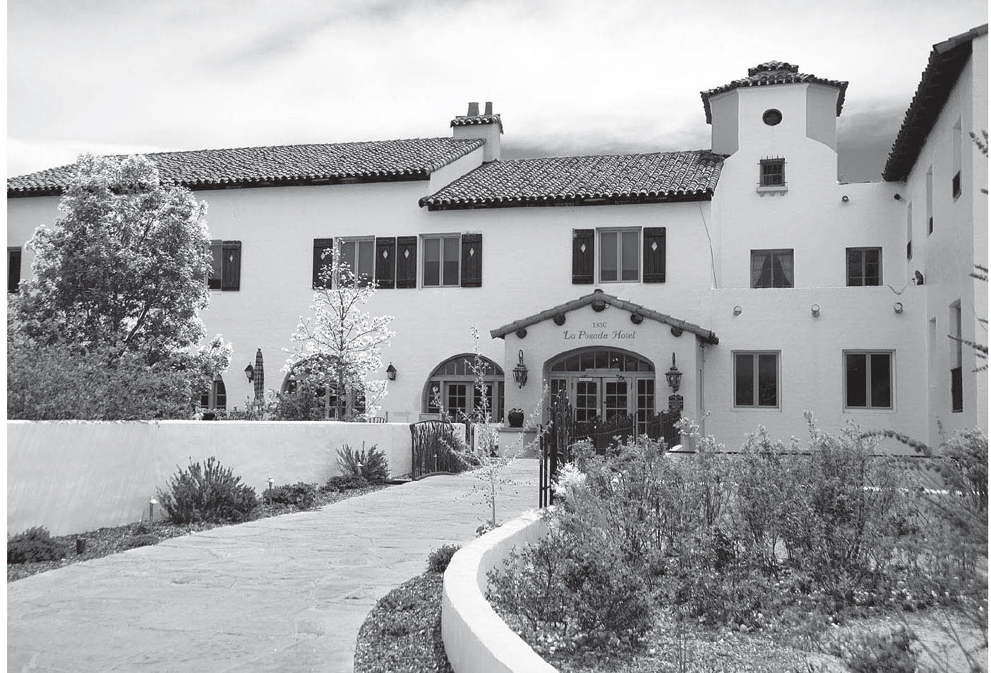
La Posada Hotel, Winslow, Arizona. GPS: 35.02168,-110.69511
FURTHER AFIELD
Just outside Winslow is Homolovi Ruins State Park (AZ 87). This is a 4,000-acre preserve with more than 300 archaeological sites and numerous petroglyphs. Homolovi is a Hopi word meaning “place of the little hills.” The four major pueblo sites here are thought to have been occupied from A.D. 1200 to 1425. The park is an active archaeological site; archaeologists work here Monday through Friday in June and July, revealing agricultural features and pit houses.

![]() Leave Winslow on Old 66/W. 3rd and join I-40 again at exit #252 at the west end of town.
Leave Winslow on Old 66/W. 3rd and join I-40 again at exit #252 at the west end of town.
LEUPP CORNERS–DENNISON
According to my trusty 1957 atlas, Leupp Corners was a small community at the Route 66 junction with a gravel road going north to the town of Leupp. That road (or the closest thing to it) is marked today as State Highway 99.
METEOR CITY
![]()
![]()
Leave I-40 at exit #239 for Meteor City.
This is Meteor City, a geodesic-dome-style trading post by the side of the highway. When I first started traveling Route 66, this was still an active business, but not long after, the folks running it pulled up the stakes. Now, it’s in a deplorable state with probably no hope of ever being active again.

![]() Rejoin I-40 until exit #233.
Rejoin I-40 until exit #233.
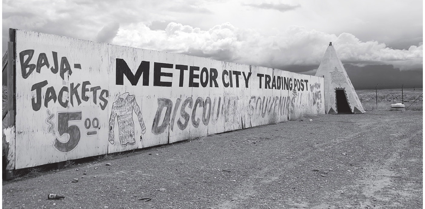
Former site of the Meteor City Trading Post. GPS: 35.09439,-110.93550
RIMMY JIMS
Rimmy Jim was the moniker of the man who originally ran the Meteor Crater concession. The crater itself is about six miles south of I-44 here at exit #233. The meteor was traveling at 45,000 mph when it hit earth; the impact resulted in a crater 570 feet deep, one mile across, and three miles in circumference. Today, you’ll find a gift shop, snack bar, interpretive exhibits, and observation platforms at the site. You can hike around the crater via guided tour, but you cannot enter it. Since the object causing the crater originated in outer space, there is also a sort of Astronaut Hall of Fame on the premises. Fun fact: a segment of 1984’s Starman was filmed at the crater.
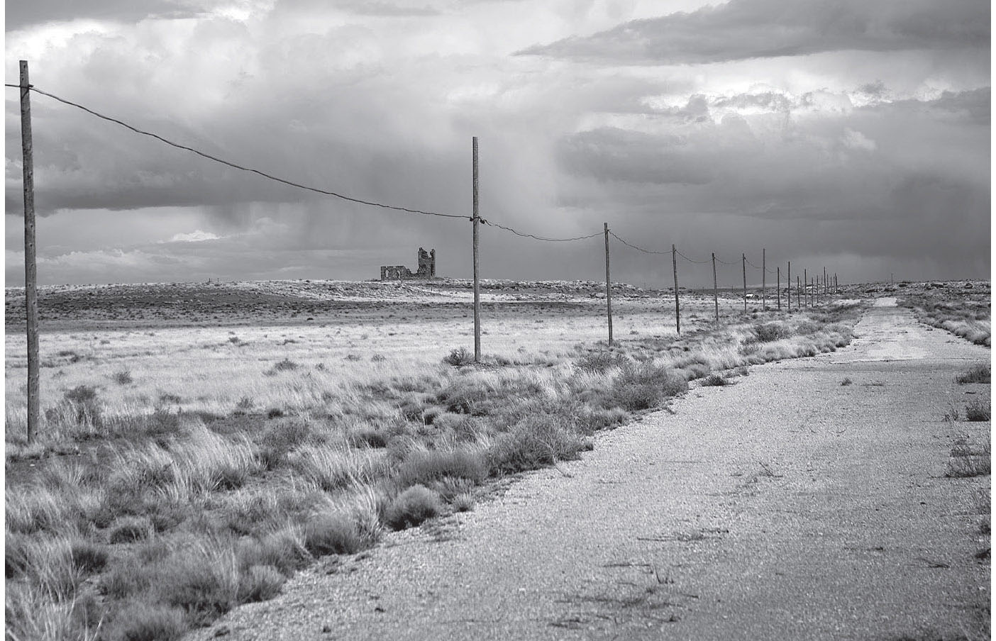
Former observation tower near Meteor Crater, Arizona. GPS: 35.10464,-111.03123
Nearby, on an unused stretch of old 66, is the stone ruin of a primitive observation tower used in the old days, the Meteor Crater Observatory (Meteor Crater Rd.). It’s on private property and lately has been fenced off from explorers like you and me.

TWO GUNS
You may or may not be able to gain access to Two Guns (exit #230), due to the fact that it rests on private property. It has gone through cycles where it has been posted against trespassing, and periods where visitors have been at least permitted, if not encouraged, to enter. Two Guns was a town only in the loosest sense; it was actually a made-to-order tourist trap, with several cages of captive animals, such as coyotes and mountain lions, to lure the motorist off the highway. This is the stuff that lasting memories are made of, for young boys traveling with mom and dad.
TWIN ARROWS
Twin Arrows, at exit #219, is an abandoned tourist complex featuring a café, trading post, and fuel station. It’s distinguished by a pair of enormous arrows sticking out of the ground. I’ve been hoping for years that someone would make a go of it here, but so far those hopes have not been answered. Now that this property belongs to the American Indian group running the casino on the opposite side of the freeway, I’m sure it’ll never happen.
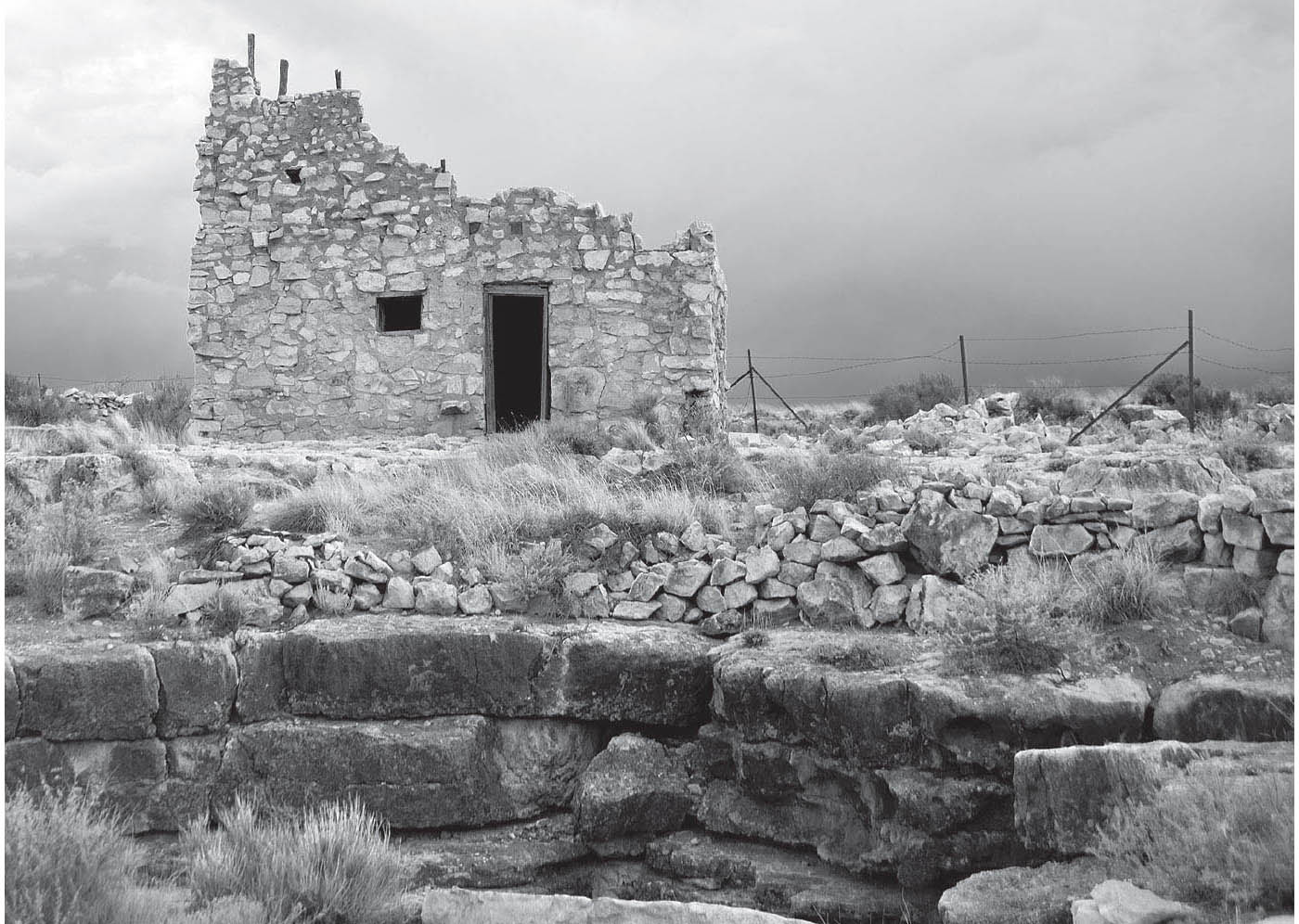
Part of the vast tourist complex at Two Guns, Arizona. GPS: 35.11507,-111.09106
WINONA
![]()
![]()
From Winona, you have a choice to make regarding your approach to Flagstaff (see the reference map).

Twin Arrows, Arizona. GPS: 35.16144,-111.27924
This is the place made somewhat famous for its reference in Bobby Troup’s classic song, in which he exhorts: “Don’t forget Winona.” There’s not a great deal to see in Winona, other than the big, gleaming vintage trestle bridge that used to carry the highway. From Winona, you can take an early alignment to Flagstaff by using Townsend-Winona Road, then turning south at Highway 89. To use the later alignment, return to the interstate and exit at Walnut Canyon Road/Historic 66 (exit #204).

COSNINO
Once the Townsend-Winona Road loop mentioned above was bypassed, Route 66 took a slightly more direct path toward Flagstaff, passing through the village of Cosnino, near today’s exit #207.
FLAGSTAFF
![]()
![]()
You’ll enter Flagstaff from the northeast. Route 66/BL-40 is also U.S. 89 in town.
Nestled at the feet of the San Francisco Peaks, Flagstaff enjoys nearly the same elevation as Denver, and so has a considerable skiing season in the winter months. The same slopes in summer make for excellent hiking, affording views that sometimes extend into neighboring Utah to the north. There is a Flagstaff anecdote that says that Cecil B. DeMille almost made Flagstaff the center of filmdom instead of Hollywood. However, the day he arrived from the east there was snow falling, and so he decided to stay on the train and continue to California and sunnier climes. The rest, as they say, is history.

On Route 66 in Flagstaff. GPS: 35.21387,-111.59956
Entering Flagstaff from the east, prior to arriving downtown, you’ll see a vintage roadhouse known as the Museum Club (3404 E. Rte. 66). Built in 1931 to house a taxidermy collection and other artifacts, it was originally called the Dean Eldridge Museum. Later it evolved into a honky-tonk nicknamed the Zoo because of all the animal trophies on display, and it has seen the likes of some top-tier performers over the years. There are a few stories of ghost hauntings here; one of the former owners committed suicide in front of the fireplace. Look for the guitar-shaped neon sign out front.
In downtown Flagstaff you’ll find a lot of vibrancy, mixed together with a lot of vintage architecture and still-working neon. The Hotel Monte Vista (100 N. San Francisco St.) first opened its doors on January 1, 1927, and has played host to the likes of Jane Russell, Spencer Tracy, Humphrey Bogart, Theodore Roosevelt, and many, many others of similar celebrity. It’s said that Zane Grey did some of his writing here at the hotel. The adjoining bar has a neon marquee that says simply: COCKTAILS.
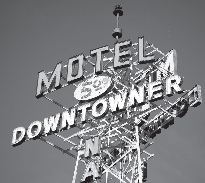
Flagstaff, Arizona. GPS: 35.19627,-111.64852
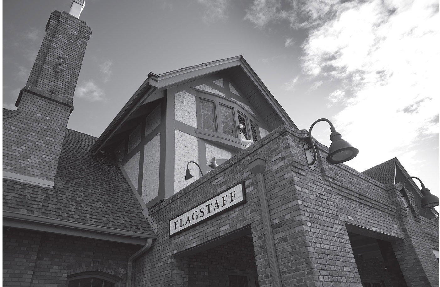
The former Santa Fe railroad depot now serves as the town visitor center. Flagstaff, Arizona. GPS: 35.19746,-111.64897
Route 66 runs right alongside the railroad tracks through Flagstaff, so you’ll see the old Santa Fe depot (1 Historic Rte. 66) as well. It has been spruced up and turned into a visitor center with a gift shop.
There is also a lively commercial district along old 66/Santa Fe Avenue, San Francisco Street, and Aspen Avenue.
FLAGSTAFF ATTRACTIONS
Walnut Canyon National Monument (3 Walnut Canyon Rd.), established in 1915, is home to the ruins of a small Sinagua community. The thirteenth-century community is comprised of some 300 rooms. There is a steep, self-guided walking trail here that meanders through the canyon past numerous cliff dwellings.
The world-famous Lowell Observatory (1400 W. Mars Hill Rd.), established in 1894, is where astronomers discovered Pluto in 1930; the telescope used at the time is still on display. Also here is the original twenty-four-inch refractor used in the 1890s. Guided tours and lectures are available.
Riordan Mansion State Historic Park (409 W. Riordan Rd.) features the forty-room Riordan Mansion, built in 1904 in the Arts and Crafts style. The architect, Charles Whittlesey, also designed the Grand Canyon’s El Tovar Lodge. This house was built for two close-knit families; the Riordan brothers married two sisters from another prominent family, and both couples lived and raised their own families here. The house features log-slab siding, volcanic stone archways, and hand-split wood shingles. Interior appointments include handmade furniture and stained-glass windows. A truly unique feature of the house is the set of photographic windows in the Rendezvous Room. A prominent photographer, John K. Hillers, was commissioned by the owners, and his photographic transparencies were fused to panes of translucent glass, so that the photos are illuminated by the incoming sunlight. These windows were painstakingly restored in the 1990s using his original glass negatives found at the Smithsonian Institution.
The Arizona Historical Society’s Pioneer Museum (2340 N. Fort Valley Rd.) is located north of town in a building that served as a hospital for the indigent from 1908 until 1938. Also on the grounds are a barn and root cellar that were utilized by the hospital, and a cabin that was moved to the site in 1967 from elsewhere in Flagstaff. From November to February each year, the museum presents “Playthings of the Past,” an exhibit of toys from the 1880s through the 1960s. Every June, they host a Wool Festival featuring sheep, goat, and llama shearings, as well as wool spinning, dyeing, and weaving demonstrations.
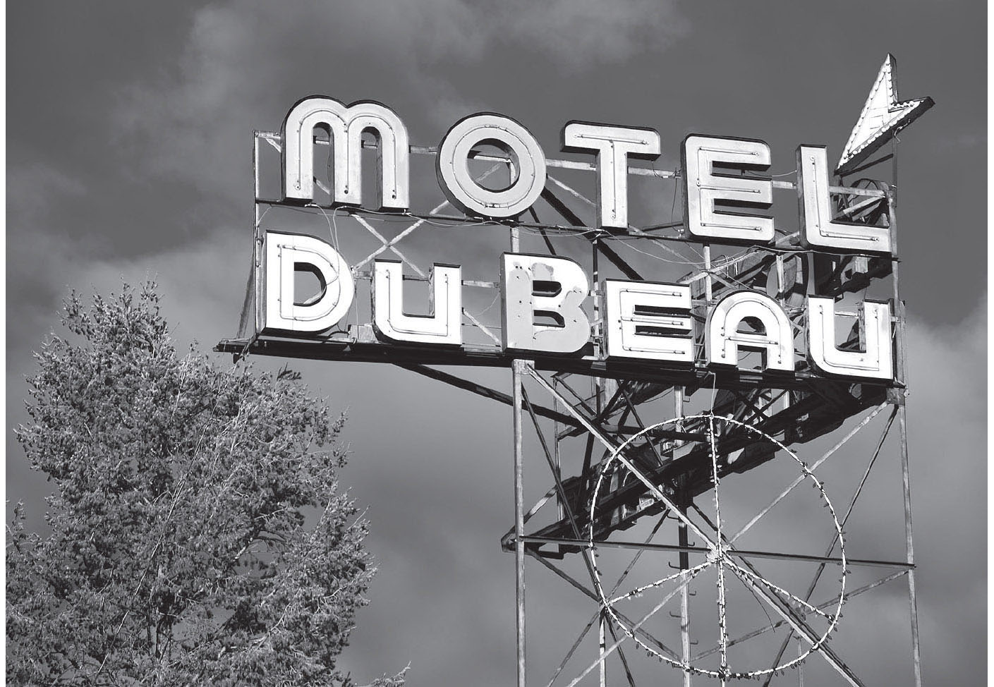
Flagstaff, Arizona. GPS: 35.19681,-111.65067
Here at Flagstaff, Route 66 crosses paths with the Arizona Trail, a hiking path spanning the state from the Utah state line in the north all the way to the Mexican border in the south. Conceived by a Flagstaff schoolteacher, the 820-mile trail earned its designation in 2009 as a National Scenic Trail after decades of effort. You can get more information about the trail at City Hall (211 W. Aspen Ave.).
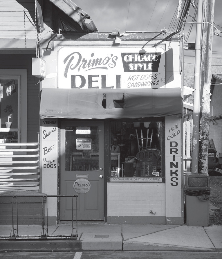
Flagstaff, Arizona. GPS: 35.19493,-111.64916
FURTHER AFIELD
About fifteen miles north of Flagstaff (take U.S. 89) is the Sunset Crater Volcano National Monument (6082 Sunset Crater Rd.). This cinder cone was formed around A.D. 1064, and was active intermittently for the next 200 years or so. The Lava Flow Nature Trail begins at the visitor center and consists of a forty-five-minute walk that traverses some of the lava flows and affords some nice views. For the stout of heart, the Lenox Crater Cinder Cone Trail is steep and strenuous.
From Sunset Crater, a paved road crosses the lava flow and connects with Wupatki National Monument (25137 N. Wupatki Loop Rd.). Established in 1924 by Calvin Coolidge, Wupatki is composed of several ruins on 35,000 acres thought to have been inhabited by ancestors of the Hopi. Most impressive is the Tall House, a 100-room complex with a nearby amphitheater and ball court. Self-guided walking trails take the visitor through each of the ruins.
To the south of Flagstaff (thirty miles) is Sedona. A sort of New Age sanctuary, Sedona is famous for its red rock scenery, which changes in appearance throughout the course of each day. The nearby Red Rock-Secret Mountain Wilderness is a red-hued landscape filled with canyons, pinnacles, cliffs, ruins, and rock art. Sedona also hosts an International Film Festival every March.
Beyond Sedona, but still on ALT 89, is the old mining community of Jerome. This town, perched on the side of Cleopatra Hill, was just about gone until it was resurrected as a sort of art colony. Today, the town bustles with guests browsing the assortment of galleries, shops, and historic buildings. Just walking the streets of Jerome is an enjoyable experience. While you’re in town, check out the old Douglas Mansion (100 Douglas Rd.) at Jerome State Historic Park. The museum traces the history of Jerome and the Douglas family in particular, through photos, minerals, and artifacts. Very close to Jerome is the Tuzigoot National Monument (25 Tuzigoot Rd.). Here you can tour a pueblo once inhabited by the Sinagua people that rests on a ridge some 120 feet above the surrounding valley.
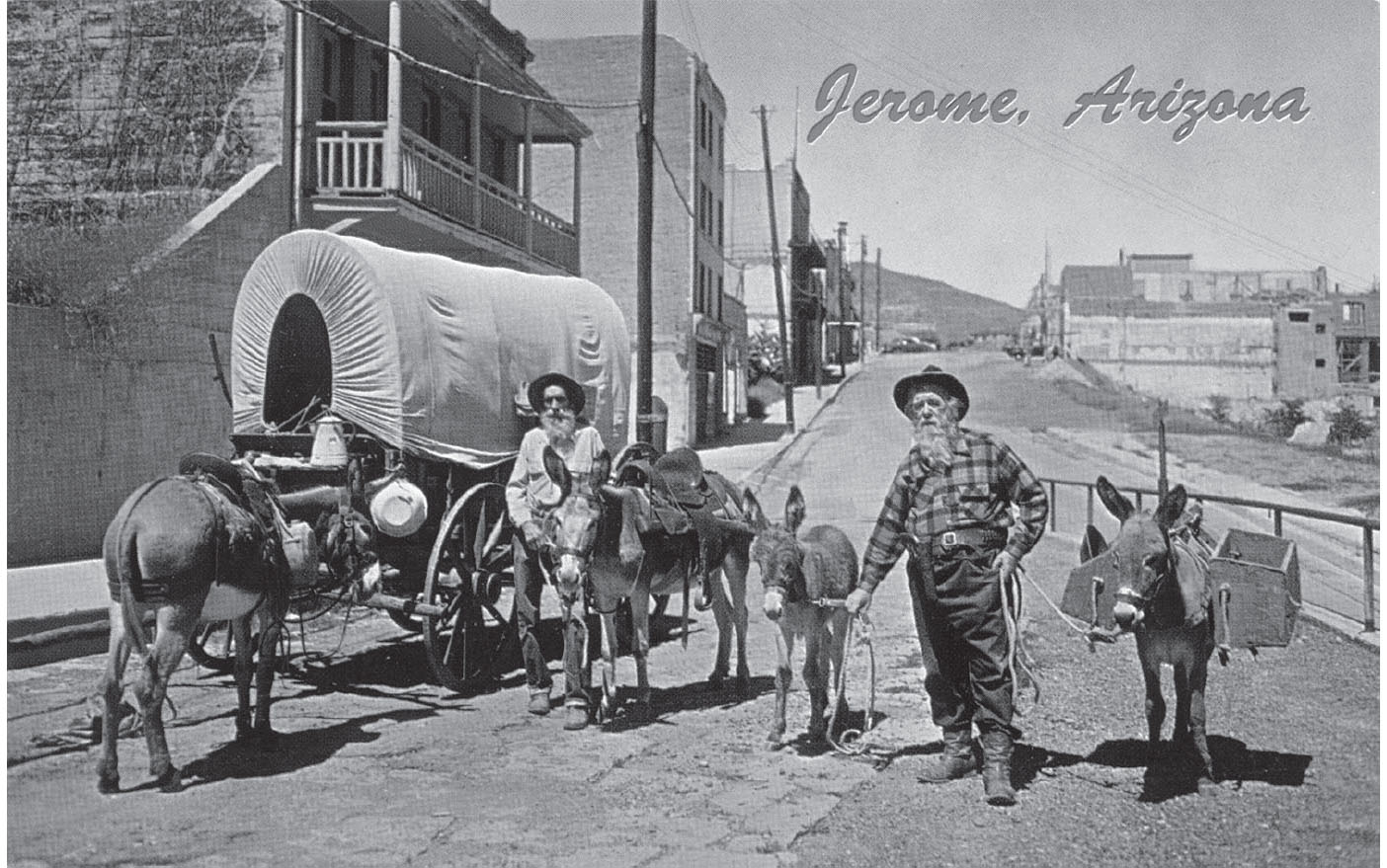
Jerome has a mining heritage.
Southeast of Jerome and Sedona, near I-17, are the Montezuma Castle National Monument (Montezuma Castle Rd.) and Montezuma Well (E. Beaver Creek Rd.). Named by early explorers who assumed it was Aztecan in origin, the castle structure is about ninety percent intact and is at the end of a paved trail, which makes for an easy stroll. The well is about eleven miles away and consists of a spring at the bottom of a canyon-like depression. The sides of the depression are filled with small pueblo ruins.
Farther south of Jerome on ALT 89 is the city of Prescott (pronounced “press kit”). Prescott is a destination in itself, offering a beautiful historic downtown district ideal for walking around. Prescott has more Victorian-era buildings than any other community in Arizona. The Sharlot Hall Museum (415 W. Gurley St.) alone has twelve buildings on three acres evoking the flavor of territorial Arizona. Included are the old Territorial Governor’s Mansion, Fort Misery Cabin, and the Bashford House, considered a premier example of Western High Victorian style. Prescott also is home to the country’s oldest rodeo, which has been held consistently since 1888. And, if you appreciate Western art, don’t miss the Phippen Museum (4701 AZ-89), named for the founder of the Cowboy Artists of America.

![]() Back on Route 66 heading west out of Flagstaff, the road will eventually force you back onto the interstate between exits #191 and #190. Leave the interstate again at exit #185.
Back on Route 66 heading west out of Flagstaff, the road will eventually force you back onto the interstate between exits #191 and #190. Leave the interstate again at exit #185.
BELLEMONT
The name Bellemont literally means “pretty mountain.” Here at exit #185 are some fragments of old 66 on both sides of today’s I-40, both paved and unpaved, and going in both directions from the exit. I recommend that you explore the area and make good use of the tips you learned in the “How to Find Route 66” chapter in the front portion of this book.

Parks, Arizona. GPS: 35.25996,-111.94834
PARKS
This tiny town at exit #178 (formerly called Maine) was severely damaged by the construction of the interstate. It includes the Parks in the Pines General Store (12963 Historic Rte. 66), established in 1921, years before the highway was designated Route 66.
From Parks, I recommend that you stay away from I-40 for a while by taking Parks Road/Historic 66 westward. It becomes Wagon Wheel Road, and will lead you to Deer Farm (6769 Deer Farm Rd.), a petting zoo that includes several varieties of deer, plus some more recent acquisitions.


![]() Jump back onto I-40 near Deer Farm (see the reference map) for the run to Williams. Then use exit #165, which will take you into town along Grand Canyon Avenue (old 66). If you take a quick right after the “Williams – Gateway to the Grand Canyon” sign onto Rodeo Road, you’ll find the Canyon Motel & RV Park here on the east edge of town. More details follow.
Jump back onto I-40 near Deer Farm (see the reference map) for the run to Williams. Then use exit #165, which will take you into town along Grand Canyon Avenue (old 66). If you take a quick right after the “Williams – Gateway to the Grand Canyon” sign onto Rodeo Road, you’ll find the Canyon Motel & RV Park here on the east edge of town. More details follow.
WILLIAMS
![]()
![]()
Highway 66 through Williams is divided into eastbound and westbound portions; don’t forget to turn around when you reach the end of town so you can drive it in the other direction.
Williams was the last town to be bypassed by the construction of the interstate in 1984. It therefore had the last active stretch of Route 66 and the last stoplight on I-40.
The town is named after Bill Williams, a prominent fur trapper who is widely believed to be the first white man in the area. There is a mountain south of town also bearing his name, as well as the Bill Williams Trail, also to the south of town.
Williams has a very nice stretch of vintage 66 running through town, lined with small motels and other tourist-related businesses. Williams, though small, was very well-developed for the motoring public, due in large part to its proximity to the Grand Canyon. Williams is the traditional jumping-off point for Grand Canyon National Park, which lies about sixty miles or so to the north. You should explore this town thoroughly.
WILLIAMS ATTRACTIONS
The renovated Fray Marcos Hotel (235 N. Grand Canyon Blvd.) was formerly a Harvey House and acts as both museum and depot for the Grand Canyon Railway, perhaps the most tradition-rich method of getting to the canyon. The railway was established in 1901, and from then until 1927, more than half of all canyon visitors came by train. Today, you can get a taste of the Old West by taking the train from Williams. The Grand Canyon Depot, at the end of the run at the canyon’s south rim, is one of only three remaining log-constructed depots in the U.S., and is on the National Register. It was built out of rustic logs in 1909 to complement the adjoining Ponderosa pine forest. At the Grand Canyon, facilities are plentiful, including a laundromat, post office, general store, and bank. The 1905 El Tovar Hotel (Apache St. and Center Rd.) is also nearby. Activities at the Grand Canyon include hiking, camping, mule rides to the bottom of the canyon, helicopter tours, and white-water rafting.
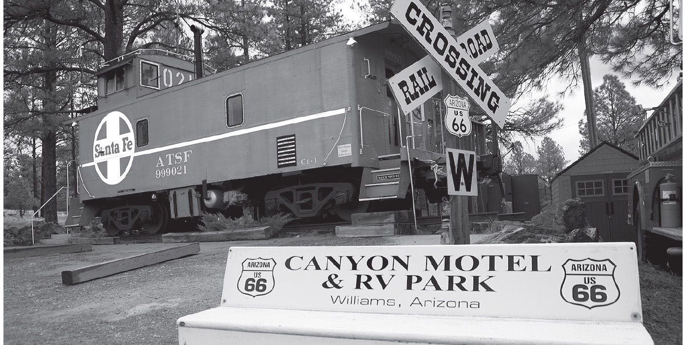
You can spend your night in a railroad car in Williams, Arizona. GPS: 35.25821,-112.17099

Route 66 spirit is alive in Williams. GPS: 35.25018,-112.18941
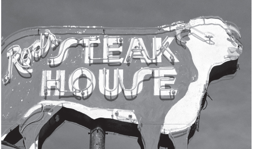
Williams, Arizona. GPS: 35.25166,-112.18500
Notable businesses in Williams include the Turquoise Teepee (114 Historic Rte. 66) and Rod’s Steak House (301 E. Rte. 66), a fixture on the route since 1945. The Williams and Forest Service Visitor Center (200 W. Railroad Ave.) has brochures to guide you on a historic walking tour of the city.
If you like unusual accommodations, be sure to check into the Canyon Motel & RV Park (1900 Historic Rte. 66) east of town. Besides the standard motel rooms and campsites, you can choose from a small collection of cabooses and other railcars.

![]() At the west end of town, you’ll need to rejoin I-40 at interchange #161. Between here and Ash Fork there are some Mother Road fragments back in the woods that are suitable for hiking or mountain biking. They get a pretty thorough treatment in Jerry McClanahan’s EZ66 Guide for Travelers. For this narrative, we’re going to stay with I-40 until exit #146 (Ash Fork).
At the west end of town, you’ll need to rejoin I-40 at interchange #161. Between here and Ash Fork there are some Mother Road fragments back in the woods that are suitable for hiking or mountain biking. They get a pretty thorough treatment in Jerry McClanahan’s EZ66 Guide for Travelers. For this narrative, we’re going to stay with I-40 until exit #146 (Ash Fork).
ASH FORK
This is the self-proclaimed Flagstone Capital of the World. As we’ve seen in a number of other towns, Route 66 splits itself into eastbound and westbound portions, separated by a city block. Make sure to turn around and check out the eastbound portion before you move on. You’ll need to enter I-40 at the west edge of town, but not for long (see below).

Ash Fork, Arizona. GPS: 35.22437,112.48345
DeSoto’s Salon (314 W. Lewis Ave.) has a pretty well-preserved old car planted on its roof. On an older dead-end alignment of 66 is the local historical museum (Pine Ave.), which includes a detailed diorama depicting the town in its Route 66 heyday.

![]() IMPORTANT: Between Ash Fork and Seligman is the Crookton Road exit (#139). This is the route to take in order to cruise the longest unbroken section of old 66 remaining: Seligman to Topock. From now on, and all the way to the California border (see the reference map), you will remain on old Route 66 and won’t have to use any interstate highway at all. Yay! This stretch was so completely bypassed by I-40 that, today, it is as unspoiled as any section of the road anywhere, all the way to the Colorado River.
IMPORTANT: Between Ash Fork and Seligman is the Crookton Road exit (#139). This is the route to take in order to cruise the longest unbroken section of old 66 remaining: Seligman to Topock. From now on, and all the way to the California border (see the reference map), you will remain on old Route 66 and won’t have to use any interstate highway at all. Yay! This stretch was so completely bypassed by I-40 that, today, it is as unspoiled as any section of the road anywhere, all the way to the Colorado River.
SELIGMAN
![]()
![]()
As you know, earlier alignments of Route 66 tended to cling close to the railroad tracks in town. So don’t fail to explore Railroad Avenue, which is a block or so away from the official I-40 Business Loop (Chino Street). Both streets are genuine Route 66.
Seligman is home to the Delgadillo brothers, Angel and Juan. These brothers had a lot to do with the resurgence in interest in the old highway after its “final” demise. Angel used to run the barber shop in Seligman, and Juan (now deceased) operated the Snow Cap Drive-In (301 AZ-66). Juan’s son now continues the tradition at the drive-in. Whether the place is open or closed, be sure to get out of your car and do some exploring on the grounds of the Snow Cap. It is chock-full of interesting artifacts, humorous signs, and other surprising touches.

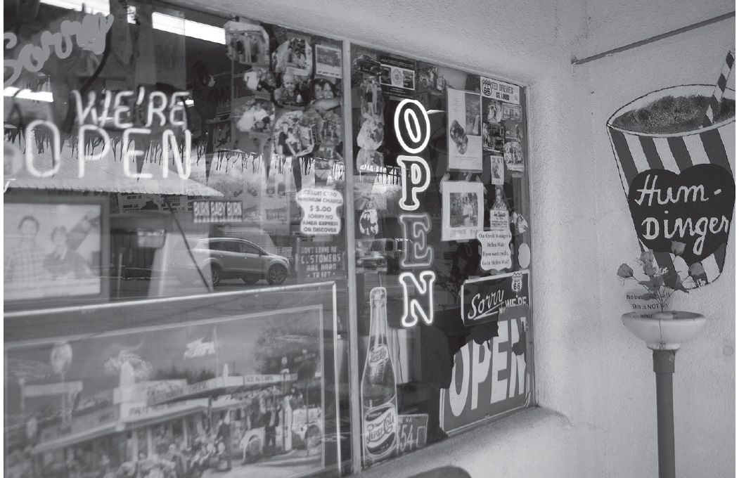
Snow Cap Drive In, Seligman, Arizona. GPS: 35.32622,-112.87302
A little ways past the Snow Cap is Angel’s Route 66 Gift Shop and Visitor Center (22265 Historic Rte. 66) where, if you’re lucky, Angel can share a few stories and you can stock up on Mother Road merchandise.
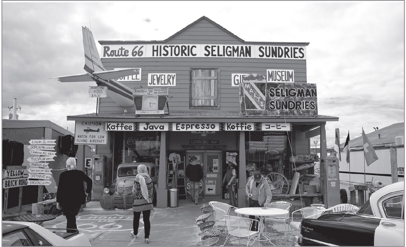
Seligman, Arizona. GPS: 35.32678,-112.87579
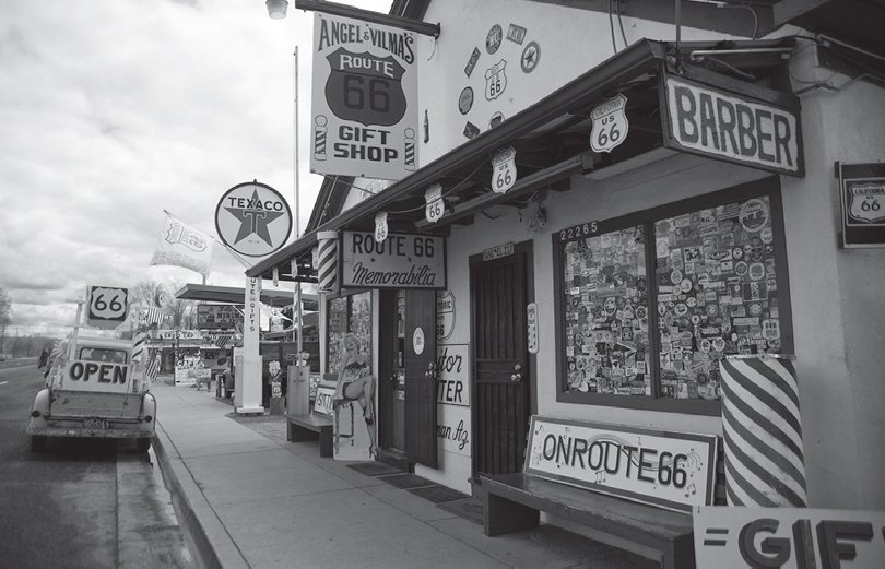
Seligman, Arizona. GPS: 35.32631,-112.87342
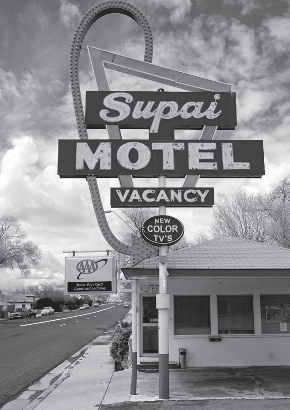
Seligman, Arizona. GPS: 35.32689,-112.87654
A little farther along is what’s known as Historic Seligman Sundries (22405 Historic Rte. 66), in a building that was once home to a roadside store called Ted’s at the Flagpole, as evidenced in an old postcard from that era.

Route 66, west of Seligman. GPS: 35.42061,-113.04711
AUDLEY–PICA–YAMPAI
This is a series of small communities strung out along Route 66 when the predecessor to the alignment you are now driving was still current. They are all just southwest of the modern-day road.
GRAND CANYON CAVERNS
Here’s a good old-fashioned roadside attraction. Called Coconino Caverns on some old maps—and later, Dinosaur Caverns—the Grand Canyon Caverns (115 Mile Marker AZ-66) are accessed by an elevator that takes you twenty-one stories underground. Aside from the normal cave formations, attractions below include a mummified bobcat. Outside, you’ll see dinosaur replicas lining the walkway to the front door. This complex has everything: motel rooms, a restaurant, a gift shop, and even an airstrip.
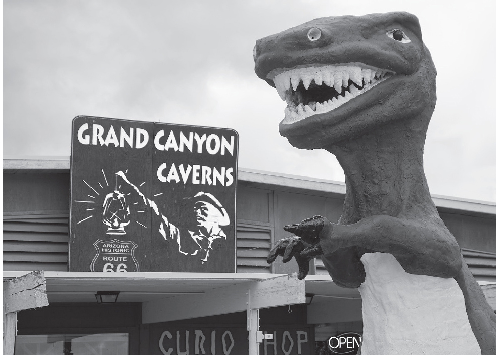
Grand Canyon Caverns, Arizona. GPS: 35.51770,-113.21947

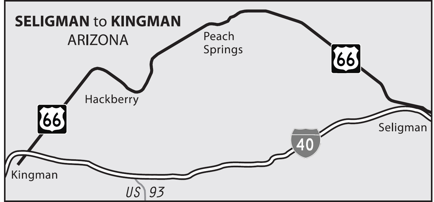
![]() As you approach Peach Springs from the east, keep your eye on the north horizon. There is a point at which you can see all the way to the south rim of the Grand Canyon, which makes its closest approach to the highway along here.
As you approach Peach Springs from the east, keep your eye on the north horizon. There is a point at which you can see all the way to the south rim of the Grand Canyon, which makes its closest approach to the highway along here.
It is possible to take Highway 18 from this vicinity (just east of Peach Springs) to a relatively untrammeled part of the Grand Canyon called Hualapai Hilltop. There is a rather demanding trail here that you can take down into the canyon to the remote village of Supai.
PEACH SPRINGS
The Hualapai tribal headquarters (941 Hualapai Way) are located here in Peach Springs. On the west side of town is Indian Route 1, which goes north to Grand Canyon West Airport (5001 Diamond Bar Rd.) and the Grand Canyon Skywalk (Eagle Point Rd.). The road is only partially paved. If you want to take in the Skywalk, it’s best to make inquiries with Grand Canyon West to determine your best option—call (888) 868-9378.
TRUXTON
Here in Truxton is the former Frontier Motel and Restaurant, with a cluster of street signs standing out front. One says Will Rogers Highway, another says Historic Route 66, and a third tells us that this was the Beale Wagon Road, in use from 1857 to 1882.
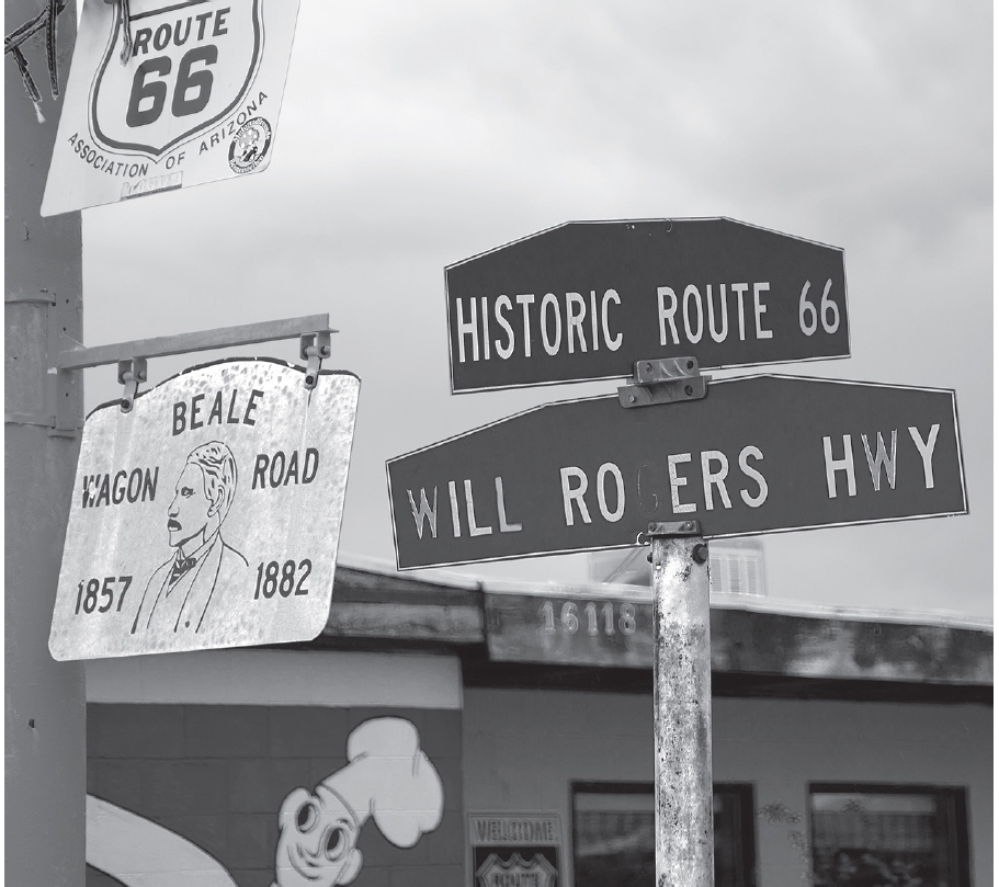
Truxton, Arizona. GPS: 35.48477,-113.56337
CROZIER
Although the town of Crozier appears plainly on the path of Highway 66 in my 1957 atlas, Rittenhouse had already reported it as “bypassed” in 1946. It’s near here that you’ll run across Keepers of the Wild (13441 AZ-66), a nonprofit sanctuary for rescued exotic animals.
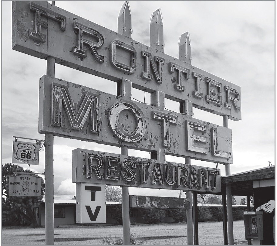
Truxton, Arizona. GPS: 35.48477,-113.56337
VALENTINE
A scene from the movie Easy Rider was filmed here in Valentine on the south side of the highway, just west of the Indian Agency (13067 E. Hwy 66). In the movie, Peter Fonda fixes a flat tire in the background while a cowboy shoes a horse in the foreground, demonstrating that some things really don’t change.
HACKBERRY
The Hackberry General Store (11255 AZ-66) is a must-stop. The old advertising signs and other assorted artifacts make it obligatory to get out of your vehicle and have a look around. Several years ago, this location was home to Bob Waldmire’s International Bioregional Old Route 66 Visitor Center.
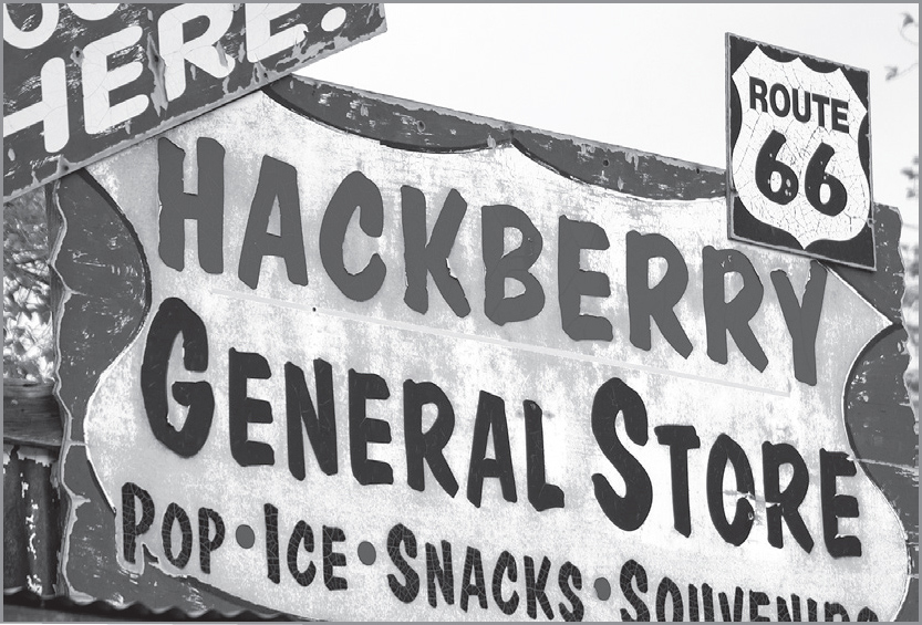
On the grounds of the Hackberry General Store. GPS: 35.37471,-113.72298

Hackberry, Arizona. GPS: 35.37471,-113.72298
KINGMAN
![]()
![]()
Follow Andy Devine Avenue all the way through town. There’s a small park near the western edge of town that includes a retired steam locomotive from the Santa Fe line. It’s there that you’ll need to bear left in order to take the old Route 66 alignment into the hills toward Oatman.
This settlement was named for Lewis Kingman, a civil engineer with the Santa Fe railroad, in 1880. Today there’s no mistaking Kingman, thanks to the huge beige-colored tower that’s been painted with these words: “Welcome to Kingman, the Heart of Historic Route 66.”

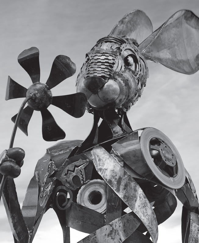
Public art in downtown Kingman, Arizona. GPS: 35.18887,-114.05309
Kingman is the hometown of the well-known character actor Andy Devine, who grew up at the Beale Hotel (325 E. Andy Devine Ave.), which his parents used to run. Every September, the city throws Andy Devine Days, a week-long celebration in Devine’s honor that includes a rodeo, parade, and various other events. Clark Gable and Carole Lombard got married at the local Methodist Church (1730 Kino Ave.) here in Kingman, and then raced down Route 66 to honeymoon in nearby Oatman. In the downtown area, one block from the route, there is a nice neon sign at the House of Hops (312 E. Beale St.), formerly the Kingman Club.
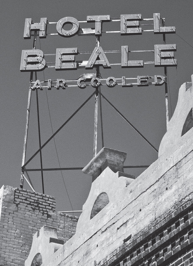
Kingman, Arizona. GPS: 35.18865,-114.05312

Nightlife in Kingman, Arizona. GPS: 35.18972,-114.05400
KINGMAN ATTRACTIONS
The Kingman Visitor Center (120 W. Andy Devine Ave.) houses a Route 66 museum, including a theater showing short films and an extensive gift shop. You can also pick up a walking tour map here to historic sites in the city.
The Bonelli House (430 E. Spring St.) is a two-story mansion built in 1915, on the site of an earlier dwelling that burned down. Therefore, this structure was built of locally quarried tufa stone, a material valued for its fire resistance and its insulating, cool-in-the-summer characteristics. The home is maintained by the Mohave Museum of History and Arts (400 W. Beale St.), which also includes items relating to the town’s favorite son, Andy Devine.
The Kingman Army Air Field Museum (4540 Flightline Dr.) is adjacent to the modern-day airport. This base in Kingman was one of a handful of sites assigned to dispose of thousands of warplanes at the close of World War II.
FURTHER AFIELD
South of Kingman is Hualapai Mountain Park (6230 Hualapai Mountain Rd.). Established in the 1930s, the park has several cabins constructed by the Civilian Conservation Corps. The scenery is beautiful, and there are several trails for hiking, as well as a campground.
North of Kingman is the near-ghost town of Chloride, founded in 1862. To reach Chloride, take U.S. 93 North. A sign will direct you to turn right on a county road to the small, now-quiet town of Chloride.
Also north of Kingman via U.S. 93 are Lake Mead, the Boulder Dam, and Las Vegas. Opinions on Las Vegas, Nevada, are generally of two kinds: love it, or hate it. I count myself among the few who don’t feel strongly one way or the other. I don’t care for the casino scene, but what I do like about Las Vegas is its location. My wife and I have used Vegas as a convenient launching pad for a number of other destinations. Easy day trips out of Las Vegas include Death Valley, Zion National Park, the ghost town of Rhyolite, and—of course—Route 66.
Vegas’s other redeeming feature for Route 66 fans, at least as I see it, are its signs and architecture. If you think the Mother Road has some wild and kitschy signs and architecture, then Las Vegas has to be the record-holder. In Vegas, there are casinos and other businesses that mimic Hawaiian islands, pirate ships, castles, pyramids, miniature cities of the world, and much, much more, most of them open twenty-four hours a day and brightly lit all through the night. If Las Vegas should fall into disuse over the next generation or two, as Route 66 has, then it will make for some fine exploration one day for the ruin-hunters among us.
ROUTE 66 TV SERIES
In the fall of 1960, the CBS television network launched a weekly series called Route 66. On the show, two young men (portrayed by Martin Milner and George Maharis) traveled around the country in a Corvette and became involved in the lives of the people they met in each episode.
Although only a small number of the 100-plus episodes were actually filmed on Route 66, the series is notable for a number of reasons. The early 1960s were a transitional period in America, and the series took on themes that were unconventional—even daring—for the time. The two protagonists came into contact with a runaway heiress, a dying blues singer, and a heroin addict, to name just a few. They tackled issues such as gang violence, racism, labor unions, and mental illness at a time when most television shows stayed on safer ground.
Also notable about the program were the logistical challenges involved. The series was shot on location throughout the country (even in Canada) and required a crew of fifty to sixty people, along with two tractor-trailers full of equipment. It was probably the largest mobile filming operation in television history up to that time.
Guest stars on the show included some fading film stars such as Joan Crawford, but more interesting in retrospect is the roster of up-and-coming talent featured, including such now-familiar names as Rod Steiger, Suzanne Pleshette, and Robert Redford.

![]() Returning to Route 66: Soon after leaving Kingman on old 66 near Locomotive Park (310 W. Beale St.) and the Kingman Visitor Center (120 W. Andy Devine Ave.), the scenery and terrain begin to change. Be mindful of the conditions out here; there are lots of dusty, gravelly switchbacks and plenty of low places in the road where flash flooding can occur.
Returning to Route 66: Soon after leaving Kingman on old 66 near Locomotive Park (310 W. Beale St.) and the Kingman Visitor Center (120 W. Andy Devine Ave.), the scenery and terrain begin to change. Be mindful of the conditions out here; there are lots of dusty, gravelly switchbacks and plenty of low places in the road where flash flooding can occur.
MCCONNICO
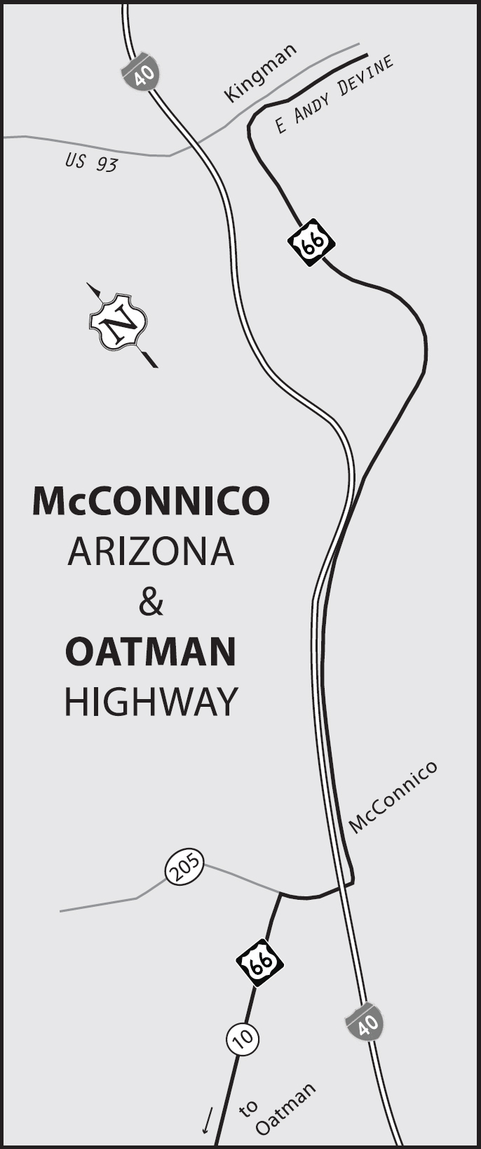
According to my 1957 atlas, roughly at McConnico there was a fork in the road, and today there still is. The older stretch of road went on to Oatman from here, but that alignment had already been bypassed. By 1957, official Route 66 went southward through Griffin and on to Yucca, Haviland, Powell, and Topock. That, of course, is the same alignment that was later upgraded to become Interstate 40. The narrative in this book covers the preferred route through Oatman. Begin by crossing over to the west side of I-40 at the #44 interchange, and then make a left turn onto Oatman Highway/County Road 10 (see the reference map on page 401).
About fifteen miles or so after crossing the interstate at McConnico, you’ll encounter Cool Springs Camp (8275 W. Oatman Rd.). Not long ago it was little more than a pile of rubble, but this success story has made a comeback, thanks to its caring owners. The structure was temporarily rebuilt in the early 1990s so that it could be destroyed in a scene for the film Universal Soldier. This time around, however, it’s a keeper. About a mile or so past Cool Springs is what remains of Ed’s Camp. After that, get ready for numerous switchbacks in the old highway.
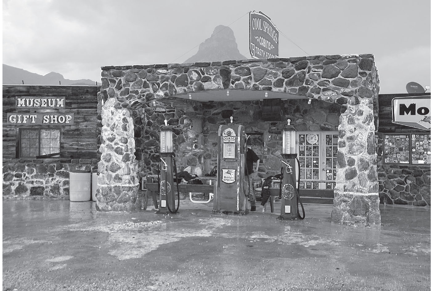
Cool Springs Camp, a ruin beautifully restored, west of McConnico, Arizona. GPS: 35.02731,-114.30879
GOLDROAD
Sitgreaves Pass, just east of Goldroad, was a very hard climb for vehicles in days gone by. Some cars and drivers had a very difficult time of it, and so there were wreckers in the area solely to haul hapless motorists over these crests. Some vehicles could make it in reverse, if not forward. The reason for this was two-fold: one, reverse is a substantially lower gear than first; and two, moving in reverse could overcome the shortcomings of early gravity-fed fuel delivery systems.
For some time, the old Gold Road Mine (10277 Oatman-Topock Hwy) had shut down production and was conducting public tours of the mine instead. Later, however, mining resumed and tours were discontinued when the price of gold went up enough to make mining worthwhile. They could be either mining or touring when you make your trip through here.
OATMAN
Mining was big business in this area through the 1930s and right up until the onset of World War II. The town was named after Olive Oatman, who was abducted by the Mojave Indians as a young girl and lived with them for several years.
You can’t really get lost in Oatman, as there’s just one road through it: old Route 66. This is a true Old West mining town that went through a ghost town phase and is now clinging to life as a tourist town. There are wooden plank sidewalks here, and the town’s most celebrated inhabitants are its burros, descendants of the beasts of burden that were brought here in the gold-mining days. There are feed dispensers scattered around town so that you can indulge them. Get out of your car and do some walking around here.

The old Oatman Hotel (181 Main St.) is where Clark Gable and Carole Lombard came for their honeymoon in 1939. You can view their suite (room 15) and lots more of the place just by wandering upstairs. The bar downstairs has walls that are covered in dollar bills. If you find a space, you can add one of your own.

Oatman, Arizona. GPS: 35.02748,-114.38531
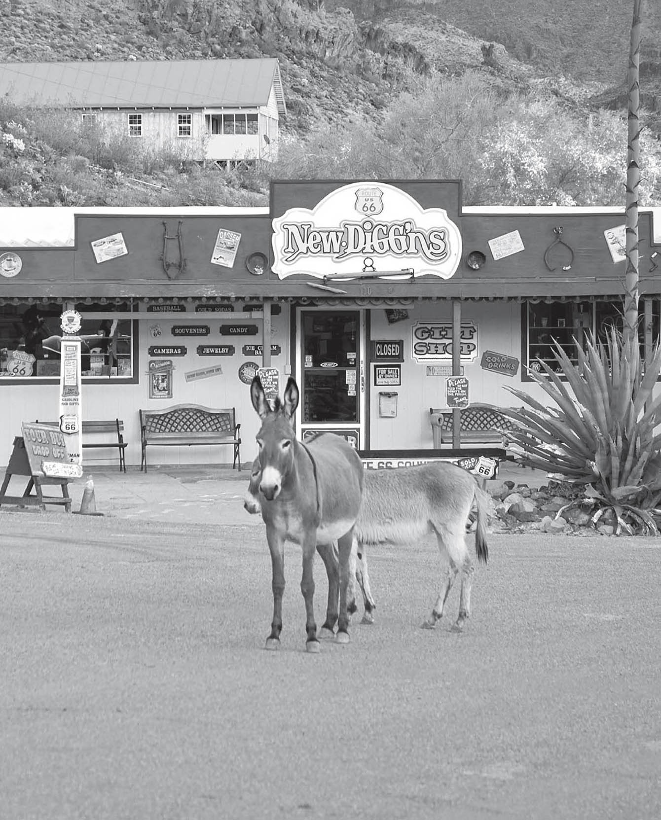
Burros really do run free in Oatman. GPS: 35.02571,-114.38286
Every July, Oatman holds an annual Egg-Frying Contest. Entrants use every solar-based gizmo imaginable to try and fry an egg in fifteen minutes or less. I’ve been told that the town’s population sometimes increases tenfold for this event.
In the early 1960s, portions of How the West Was Won were filmed in Oatman and its environs.
GOLDEN SHORES–TOPOCK
Neither of these communities qualifies as much of a town. Golden Shores is really no more than a housing subdivision that sprouted where two roads merge. A view from the air reveals that Topock is virtually identical. Topock comes from the Mojave word meaning “water crossing,” which is certainly appropriate.
There is an arching bridge (circa 1916) here that crosses the Colorado River, but it carries no vehicle traffic, only a pipeline. Today’s Route 66 adventurer is forced to make the crossing on the I-40 bridge.
FURTHER AFIELD
Consider a side trip down Highway 95 to Lake Havasu City. In 1971, the London Bridge was painstakingly dismantled and re-assembled here in Lake Havasu City, piece by piece, and turned into a tourist attraction. The man who masterminded the plan originally thought he was buying London’s Tower Bridge, which is much more picturesque, but after learning of his mistake, he decided to follow through with his plan anyway.
Route 66 has now passed through seven states on its journey west, and is now poised at the crossing of the Colorado River. The promised land of California awaits you on the opposite shore.