High, wide, lonesome country” is what cowboys called the Arizona Strip. Even many Arizonans have never heard of this quiet stretch of high desert on the Arizona–Utah border, sandwiched between the North Rim of the Grand Canyon and the Vermilion Cliffs. For most visitors, it’s the Highway 89A Grand Canyon corridor, connecting the communities of northern Arizona with those of southern Utah via the only road bridge over the Colorado River in 600 miles (970km).
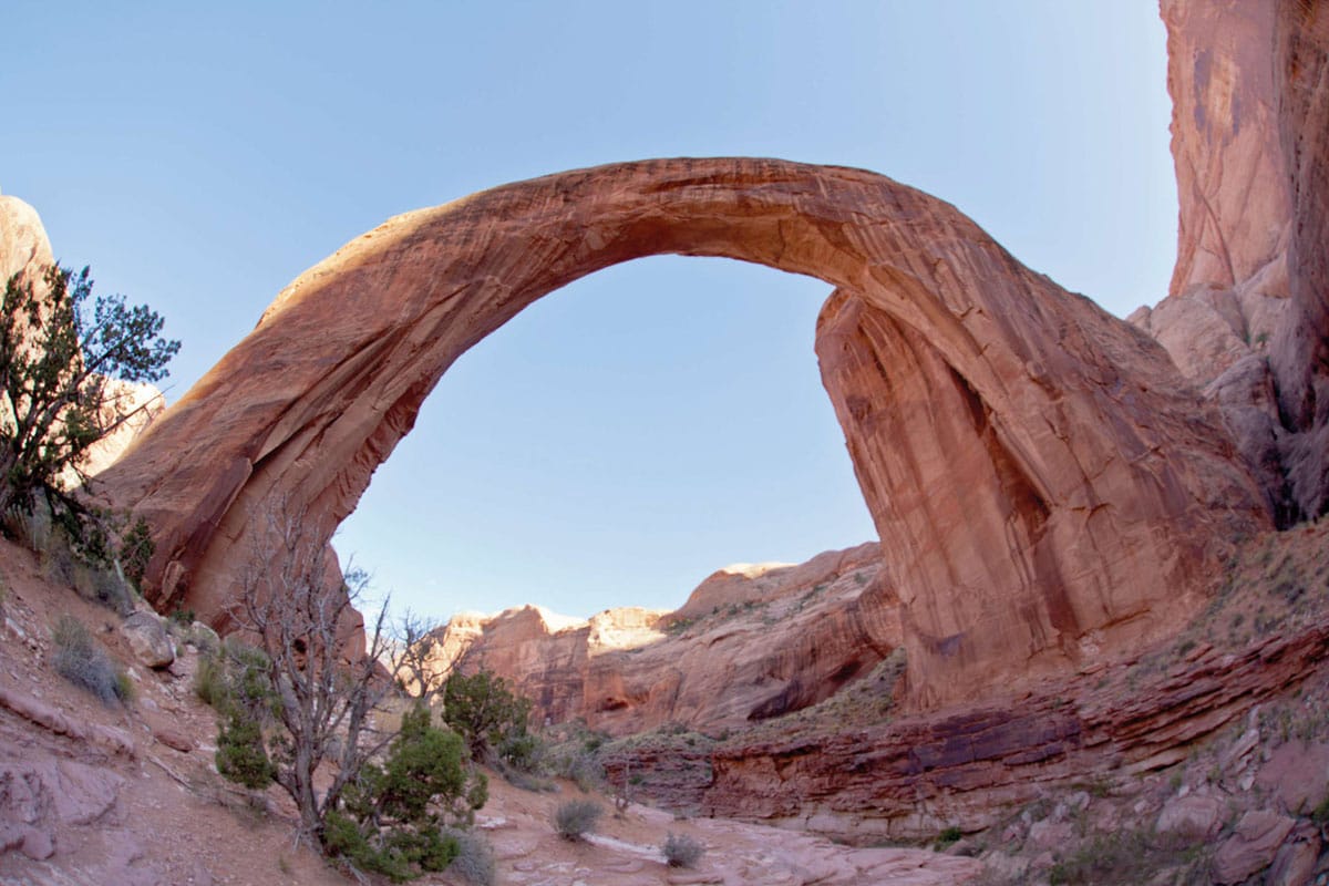
Arches National Monument.
APA Richard Nowitz

On Lake Powell.
APA Richard Nowitz
To the Kaibab Paiute, the Arizona Strip was once a bountiful homeland of tallgrass prairie, sunflowers, and hundreds of other food plants. Their ancestors roamed long distances seasonally, living in wickiup brush shelters and weaving beautiful baskets to gather pinyon nuts, seeds, and other foods. In summer, they hunted deer and elk on the Kaibab Plateau, then returned to stone houses beside springs to harvest corn and squash like their predecessors, the Virgin River Anasazi. Springs “belonged” to individual families, who acted as caretakers on behalf of the natural world, learning the songs of each rock and tree.
The road to recovery
The Kaibab Paiute were almost wiped out by 18th-century Spanish diseases and 19th-century Navajo and Ute slave trading. Then, in the 1860s, Mormon colonists took over water sources and traditional hunting and gathering lands for farms, ranches, and settlements, and the Kaibab Paiutes quickly lost their self-sufficiency and became poverty-stricken. The situation has changed, due largely to education, legal challenges over self-determination and access to water, and modest commercial development on the tiny reservation surrounding Pipe Spring National Monument.

A mountain goat in Grand Canyon National Park.
Istockphoto

Things look less rosy for the land itself. The huge cattle drives of the 1870s and 1880s badly overgrazed the Strip. Lush grasslands have been replaced by sagebrush and erosion of deep arroyos, and despite better stewardship of the land under the Bureau of Land Management, it struggles to recover. Although ranching, logging, and mining are still evident, tourism and outdoor recreation are becoming more important economically. Four-wheel-drivers, river runners, hikers, and other outdoor-lovers can explore some of the most beautiful and little-traveled backcountry in the state in Grand Canyon National Park, four national monuments, and eight wilderness areas.
Unnatural beauty
Given this abundant natural beauty, it’s ironic that the area’s most popular attraction is unnatural. Some 130 miles (210km) north of Flagstaff, on Highway 89, is 180-mile (290km) -long Lake Powell ! [map], the second largest man-made lake in the Western Hemisphere. The lake is formed by 710ft (220-meter) -high Glen Canyon Dam, downstream at Page @ [map], which generates 1,200 megawatts of hydroelectricity for the megalopolises of Phoenix and environs – and ample controversy.
When it was begun in 1956, the dam had the blessing of almost everyone concerned. By the time it was finished in 1963, conservationists like the Sierra Club’s David Brower and writer Wallace Stegner had belatedly recognized that Glen Canyon was comparable in grandeur to anything – including the nearby Grand Canyon – on the Colorado Plateau.
That said, Lake Powell, administered by the National Park Service as part of 1.2-million-acre (486,000-hectare) Glen Canyon National Recreation Area (tel: 928-608-6200; www.nps.gov/glca; Mon–Fri 7am–4pm), is a stunning place to waterski, fish, and explore the shoreline. Miles of blue water and a 1,961-mile (3,156km) shoreline of carved sandstone cliffs make the lake a photographer’s dream. Houseboats, popular with vacationers, may be rented at Bullfrog Marina (tel: 435-684-7423), one of four marinas, along with fishing tackle and powerboats.

The Glen Canyon National Recreation Area provides the opportunity for water recreation.
APA Richard Nowitz
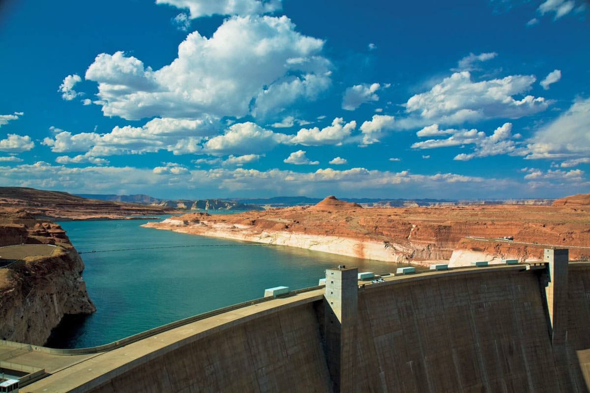
The Glen Canyon Dam impounds the waters of Lake Powell.
APA Richard Nowitz
Tip
Contact the Glen Canyon Natural History Association (tel: 877-453-6296; www.glencanyonnha.org) for help with trip planning in the Arizona Strip and adjoining public lands in Utah.
Carl Hayden Visitor Center (tel: 928-608-6404; daily May–Oct 8am–6pm, Nov–Feb 8.30am–4.30pm, Mar–Apr 8am–5pm with exceptions; charge), next to the dam in Page, has exhibits, interpretive presentations, and information on hiking side canyons and river trips. It offers frequent self-guided and guided tours of the dam and powerplant, which is operated by the US Bureau of Reclamation. Expect tight security measures at Glen Canyon Dam. No bags, purses, knives, weapons, or food are allowed inside the visitor center. You may only bring in wallets, cameras, and clear water bottles.
The Park Service operates a developed campground at Lees Ferry and primitive campgrounds at Lone Rock Beach, Stanton Creek, Hite, Dirty Devil, and Farley. A concessionaire operates well-developed campgrounds at Wahweap and Bullfrog inside the park.
Also on Navajo land is 290ft (90-meter) -high Rainbow Bridge National Monument (tel: 928-608-6200; daily), the world’s tallest known natural bridge. The bridge can only be reached by hiking overland across the Navajo Nation or by boat, followed by a 1-mile (2km) hike into a side canyon directly from Lake Powell. The site is sacred to the Navajo, who control overland access to the two rugged access trails. For hiking and camping permission, contact Navajo Parks and Recreation (tel: 928-871-6647; www.navajonationparks.org). You can only enter Antelope Canyon Tribal Park, one of the area’s most beautiful slot canyons, east of Page, with a tour guide. Authorized tour companies are listed at www.discovernavajo.com.
You’ll find equally stunning vistas at the Horseshoe Bend viewpoint, which is set on the cliffs over a hairpin loop in the Colorado River. It’s roughly a half mile (800 meters) to the overlook from the trailhead, which is about 5 miles (8km) south of the Carl Hayden Visitor Center on Highway 89.

Antelope Canyon is one of the most accessible slot canyons in the Page area.
APA Richard Nowitz
Lake Powell was named for explorer John Wesley Powell, whose 1869 and 1871–72 river-running trips were the first to explore the Green and Colorado River gorges. John Wesley Powell Memorial Museum (tel: 928-645-9496; Mon–Fri 9am–5pm; charge) has old drawings and photos about Powell’s life and voyages, geological displays, and Indian artifacts. The museum is located in downtown Page, which has grown from a makeshift shantytown for dam workers into far northern Arizona’s largest community, with a variety of mainstream lodgings, restaurants, and gas options.
Into the Strip
To enter the Arizona Strip itself, head back south to the junction of Highway 89 and 89A, at Bitter Springs, and drive west on Highway 89A via Marble Canyon. When it opened in 1929, the narrow, 467ft (142-meter) -high Navajo Bridge over the Colorado River was the highest steel structure in the world. A wider bridge was opened in 1997, and you can walk across the old structure. The small Navajo Bridge Visitor Center (tel: 928-355-2319; Mar–Oct 9am–5pm) is an impressive piece of desert architecture, with pueblo-style sandstone walls and a fine little bookstore. This is a popular spot to look for one of the reintroduced California condors now living in and around the Grand Canyon. Birds can be seen circling Marble Canyon looking for food in the cliffs below.
Behind the dramatic Vermilion Cliffs is Lees Ferry £ [map], once a ferry crossing operated by John D. Lee, a prominent Mormon elder. He was sent here by Mormon leader Brigham Young after the 1857 Mountain Meadow Massacre in Utah of a wagon train bound for California, for which he would be executed. At the mouth of the Paria River, Lee’s old homestead, Lonely Dell Ranch, is a pretty spot with a log cabin, a blacksmith shop, ranch house, and shady orchards, a good place to stop and watch the river runners putting in on the Colorado River.
The 293,000-acre (119,000-hectare) Vermilion Cliffs National Monument $ [map] incorporates Paria Canyon–Vermilion Cliffs Wilderness, which has no fewer than three spectacular slot canyon hikes. The most popular is the 38-mile (61km) hike through the narrow, 2,000ft (600-meter) -deep Paria River Canyon to Paria, Utah, a trip of four to six days. The southern trailhead is at Lees Ferry. Day users must register before setting out; all overnight trips are by permit only, with daily quotas in force. The best time to do this river hike (which requires wading in places) is mid-March to June. This is not a place you want to be during a flash flood in the summer monsoon season.
Monument hiking tips, permits, and up-to-date weather information can be obtained from the Paria Contact Station (Mar−Nov daily 8.30am−4.15pm), located 41 miles (66km) east on Highway 89 from Kanab, or from the BLM Arizona Strip Field Office in St. George, Utah (345 E. Riverside Dr; tel: 435-688-3200; Mon–Fri 7.45am–5pm, Sat 10am–3pm).
Tip
There are numerous undeveloped sites along the shoreline and camping on the southern shore of Lake Powell with permission from the Navajo Nation.
Buffalo Jones
Jesse “Buffalo” Jones was an aging buffalo hunter who had participated in the mass slaughter of the shaggy beasts on the Great Plains in the 1870s. In 1906, realizing that the buffalo were close to extinction, he drove a herd of survivors to the Arizona Strip, where he set up a buffalo preserve and tried unsuccessfully to breed “cattalo,” a cross between buffalo and cattle.
Celebrated western writer Zane Grey was introduced to Jones in 1907, while the colorful frontiersman was on a fund-raising tour of the East Coast. Jones, clad in fringed buckskin, held audiences spellbound with stories of lassoing wild mountain lions in the Grand Canyon and other tales of life on the western frontier. Grey, who had honeymooned in northern Arizona the year before, was intrigued. He traveled to Arizona and witnessed Jones’s lion-hunting skills firsthand, which became a key inspiration for Last of the Plainsmen and other stories.
Although Grey admired Jones, he was dismayed by Jones’s ruthless pursuit of his prey. “He shore can make animals do what he wants,” wrote Grey in Don, the Story of a Lion Dog. “But I never seen the dog or horse that cared two bits for him.” Descendants of Jones’s original buffalo herd may still be seen in House Rock Valley today.
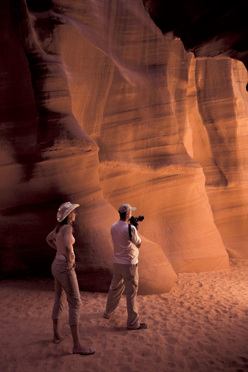
Swirling sandstone and dramatic lighting make Antelope Canyon a favorite of photographers.
APA Richard Nowitz
The first white men to see the mouth of the Paria River were Spanish Padres Dominguez and Escalante whose expedition left Santa Fe, New Mexico, in 1776, hoping to forge an overland route to Monterey, California. They were forced to turn back near St. George, then tried, unsuccessfully, to cross the Colorado River at Lees Ferry. Eventually, they found a good ford, 40 miles (64km) upriver, at a spot known as the Crossing of the Fathers (it has since been flooded by Lake Powell). The San Bartolome Historic Site marker on the north side of Highway 89A, marks one of their campsites. You’ll find it west of the 1890 Cliff Dwellers Lodge, a tiny redstone oasis built beneath a boulder, with lodging, restaurant, gas station, store, and stunning views.
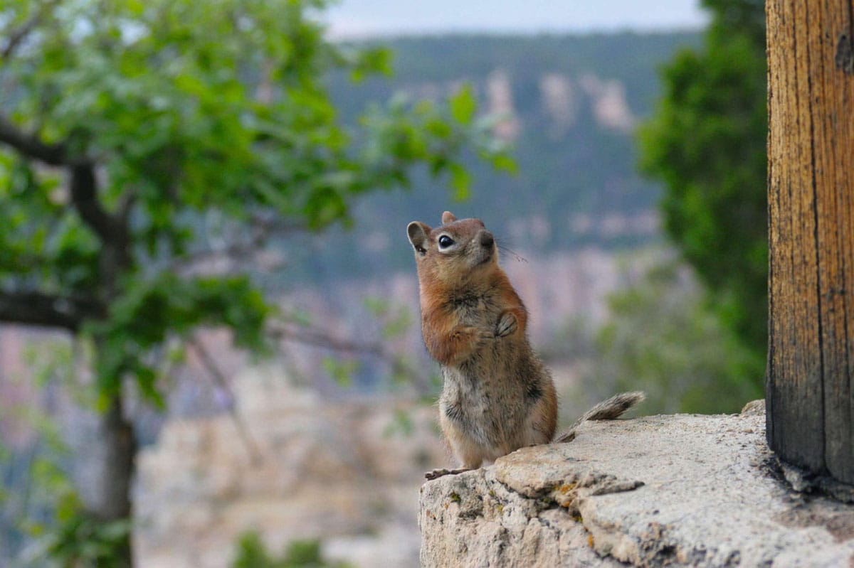
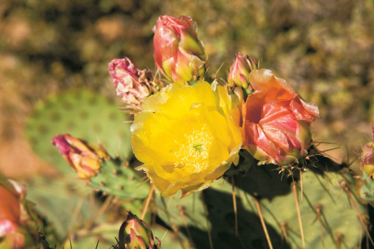
Although the landscape can appear harsh, a number of animals make the desert their home.
Istockphoto
The Vermilion Cliffs support desert bighorn sheep, pronghorn, mountain lion and, since 1996, California condors, which were reintroduced at House Rock Valley, a grassy break in the cliffs. House Rock Valley was home to Mormon pioneer Jim Emett, who operated Lees Ferry in the early 1900s. Emett and his neighbor, frontiersman Jesse “Buffalo” Jones (click here), guided Zane Grey on his first mountain lion hunting trip to Arizona in 1907, when they spent time at both ranchers’ homesteads on the Strip and explored Surprise Valley, near the Grand Canyon. Grey later wrote that Emett was “the man who influenced [me] most,” noting Emett’s love of the West and all living things despite “so few of the joys commonly yearned for by men.” The frontier spirit embodied in men like Emett became recurrent themes in such classic Grey novels as Riders of the Purple Sage and Last of the Frontiersmen.
The Kaibab Plateau
The road winds onto the 8,000ft (2,400-meter) Kaibab Plateau through old-growth ponderosa pine forest. The turnoff for the North Rim of the Grand Canyon is at Jacob Lake % [map], named for Mormon missionary Jacob Hamblin, whose exploring party came through in the 1860s. Starting in 1866, Franklin Woolley, followed by his brother Edwin “Dee” Woolley, explored the plateau’s potential for lumber, grazing, and Mormon settlements and hatched numerous schemes for development.
Woolley’s most extravagant caper came in 1892, when he and Brigham Young’s son John, on a mission in England, hired Buffalo Bill, whose famous Wild West Show was currently in London, to escort a party of wealthy English nobles interested in game hunting and ranching in the region. None of the Brits decided to purchase ranches, but they stopped at Jacob Lake, where Buffalo Bill reputedly said grace at one meal, offering thanks for many blessings, specifically “Emma Bentley’s custard pie.”
Excellent homemade pies and milkshakes are still served at historic Jacob Lake Inn, operated by descendants of Edwin Woolley Tiny Jacob Lake Visitor Center has exhibits and information on visiting the rough backcountry of Kaibab National Forest. One of the best hikes here is in Snake Gulch, where you’ll see remarkable Virgin River Anasazi rock art.
From Jacob Lake, Highway 89A spirals 3,000ft (900 meters) off the plateau, descending from ponderosa pine into pinyon-juniper dwarf forest. Views of the western Arizona Strip and southwestern Utah’s Color Country are breathtaking. It’s hard to drive and goggle at the scenery, so pull off at Le Fevre Overlook. From here, you can see the geological formation known as the Grand Staircase, including the White Cliffs of Navajo Sandstone in Zion National Park.
At the base of the Kaibab Plateau, the small Mormon community of Fredonia ^ [map] (a contraction of the English word “Free” and the Spanish word “Doña” to signify a free woman – a reference to the town’s polygamous past) is a good place to spend the night, with small motels, Mexican restaurants, gas stations, and convenience stores. If you’re heading south, you can also pick up information on Kaibab National Forest at the US Forest Service headquarters.
Mormon outpost
Turn west on Highway 389 and continue to Pipe Spring National Monument & [map] (tel: 928-643-7105; daily Jun–Aug 7am–5pm, Sept–May 8am–5pm; tours on the hour and half-hour up to 4.30pm; charge), a small 1870 fortified ranch where the Mormon-owned Canaan Cattle Company ran the Church’s large tithe cattle herd. The two-story fort was ostensibly built to enclose springs from the nearby Sevier Cliffs and to keep out Navajo raiders; in reality, there was more to fear from government officials hounding polygamous families (including Dee Woolley and his young wife Flora). The women were kept busy making pies, bread, and stews for travelers, explorers, miners and, after the St. George Temple had been completed, Mormon newlyweds who had been “sealed” and were returning home on the Honeymoon Trail. John Wesley Powell used the West Cabin as a headquarters during his 1872 survey, which ascertained that lands originally thought to be in Utah were actually in Arizona, creating the area we know today as the Arizona Strip.
Tip
Designed around natural sandstone formations, Lake Powell National Golf Course (tel: 928-645-2023) is one of the most scenic in Arizona.
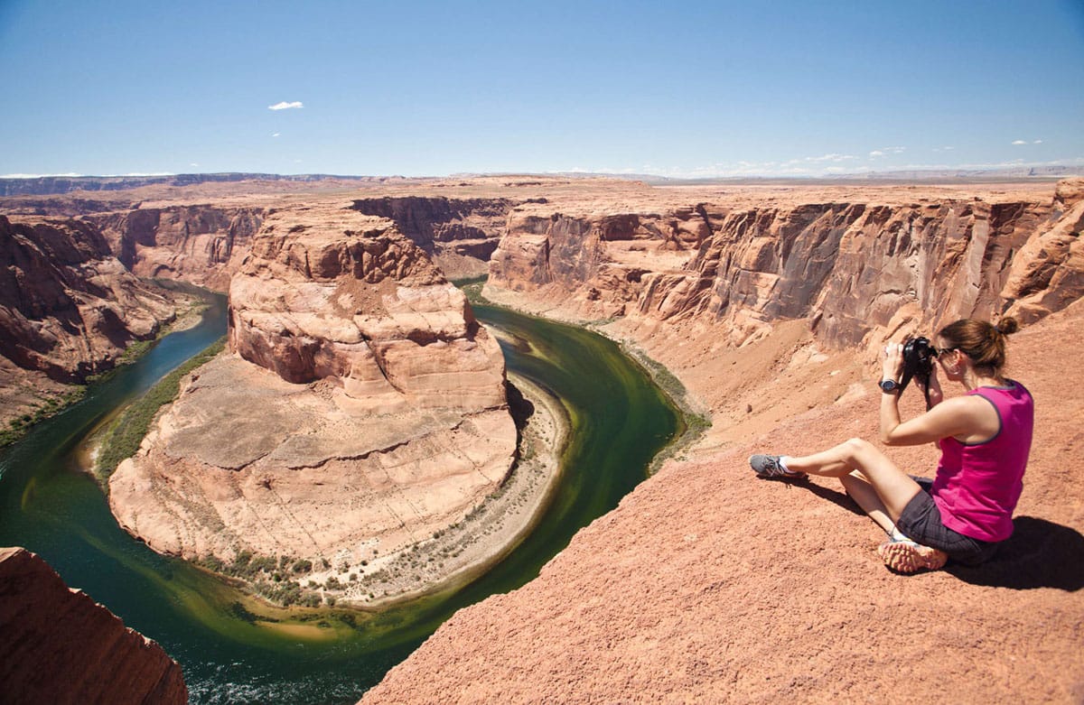
Horseshoe Bend is a dramatic U-shaped meander in the Colorado River.
Istockphoto
Tip
The Bureau of Land Management’s excellent Arizona Strip map offers an overview of the region and is essential for navigating backcountry roads.
In summer, rangers in period costume offer fascinating living-history demonstrations of pioneer life. Year-round tours leave from the visitor center and pass through the heavy wooden doors of the fort into two buildings joined by a catwalk. Spring water was piped into a ground-floor spring room where milk was kept cool, then processed into butter and cheese. Milk, meat, butter, and cheese were sent by the wagonload to St. George, Utah, every two weeks to feed workers constructing the new St. George Temple. A second-floor room housed Arizona’s first telegraph. A self-guided tour through the orchards has a push-button oral history by Maggie Heaton, a hired hand at Pipe Spring in 1898.

Watch your step carefully when near the edge.
APA Richard Nowitz
The Kaibab Paiute Tribe, whose reservation surrounds the monument, jointly operates the monument and the attractive on-site museum, the only facility documenting Kaibab Paiute history and culture, with the National Park Service. The tribe runs a campground, offers guided tours of rock-art sites, hikes, and cultural activities, and holds a powwow every October. Many tribal members work at the tribe’s convenience store or at tribal headquarters opposite the visitor center, and live in nearby Kaibab and Moccasin.
All in the family
The Arizona Strip tends to attract nonconformists. Colorado City * [map], on the Arizona–Utah border, is one such town. Its massive, half-finished houses with more than one door, bonneted wives, and young girls in quaint leggings and floral shifts are just a few outward signs of the secretive polygamous lifestyle still practiced by members of the Fundamentalist Church of Jesus Christ of Latter Day Saints (FLDS), a breakaway sect of the Mormon church. Residents of Colorado City are tolerated by the authorities, but the recent trial of the sect’s leader Warren Jeffs for coercing underage girls into forced marriages has thrust an unwelcome spotlight back on the community and caused residents to shun outsiders. It’s probably best to avoid stopping here.
The Return of Glen Canyon
Since 2000, ongoing drought in the Southwest has severely affected the Colorado River and brought Lake Powell reservoir levels down to 118ft (36 meters) below capacity. As the water levels drop, marinas are drying up but hiking and primitive camping on new beaches and side canyons in the northern reaches of the lake are improving. Archaeological remains are now reappearing like the mythical lost city of Atlantis. Some are reachable via day hikes, such as Defiance House, an Ancestral Pueblo dwelling with granaries and rock art, located 3 miles (5km) up Forgotten Canyon. Once mourned as “The Place No One Knew,” Glen Canyon is beginning to reemerge of its own volition, even as the dam faces an uncertain future.
Views to the south take in an area of spare beauty that includes the Shivwits Plateau, Mount Trumbull Wilderness and Mount Logan Wilderness, Grand Wash Cliffs Wilderness and Paiute Wilderness in the Virgin Mountains. All of these are now part of the 1.1-million-acre (450,000-hectare) Grand Canyon–Parashant National Monument ( [map] (tel: 435-688-3200; Mon–Fri 7.45am–5pm, Sat 10am–3pm), managed by the Bureau of Land Management. The very remote monument expands the geological story of the Grand Canyon by including volcanic landmarks like 8,028ft (2,447-meter) Mount Trumbull (which provided the wood for the St. George Temple). It is also an ecologically unique area where the Sonoran, Great Basin, and Mohave Deserts intersect, providing critical habitat for endangered California condors, desert tortoises, Southwest willow flycatchers, desert bighorn sheep, and pronghorn antelope.
Remote outpost
Dirt roads are the norm in this undeveloped monument. Avoid them during the summer, and don’t travel without several gallons of gas and water, food, and spare tires. The monument’s size and the long distances required to reach its features are intimidating, but travelers will enjoy the 60-mile (100km) drive to 6,393ft (1,947-meter) Toroweap Overlook, where the Grand Canyon drops away 3,000ft (900 meters). Tuweep Ranger Station, about 6 miles (10km) before the overlook, is open year-round and has information on hiking, camping, and road conditions.
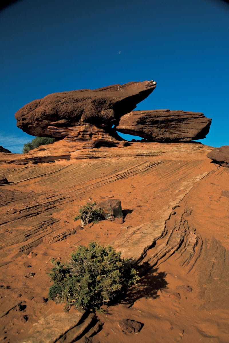
Curious rock formations are found throughout the Glen Canyon National Recreation Area.
APA Richard Nowitz

The Glen Canyon Bridge spans the chasm just below the dam.
APA Richard Nowitz