TRIP 15 Olompali State Historic Park
| Distance | 2.7 miles, Loop | |
| Hiking Time | 1 to 2 hours | |
| Elevation Gain/Loss | ±900 feet | |
| Difficulty | Moderate | |
| Trail Use | Good for kids | |
| Best Times | All year | |
| Agency | CSP | |
| Recommended Map | Olompali State Historic Park (CSP) |
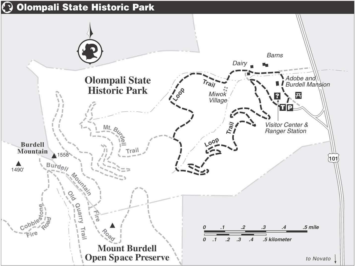
HIGHLIGHTS Where else can you walk in the footsteps of Coast Miwok Indians, Jesuit seminarians, and the Grateful Dead rock band? This historic state park sits on the northeastern side of Burdell Mountain, a high ridge of rolling, grassy slopes graced with majestic oaks, and furrowed with deep, densely forested ravines. The Loop Trail, though short, gives you a fine introduction to the landscape, flora, and fauna of Marin County’s northeast corner. The south side of Burdell Mountain, a Marin County open space preserve, can be explored by following the description for Trip 14, Mt. Burdell Open Space Preserve. You can also make a traverse of Burdell Mountain from Olompali to the open space preserve on a trail that connects with the route described below.
DIRECTIONS From Highway 101 northbound, north of Novato, go 2.4 miles past the park entrance, which has no access from the northbound lane. At San Antonio Road, carefully turn left, across the southbound lane. Swing into a wide turnout, where San Antonio Road joins Highway 101. Now merge into the southbound lane, go south on Highway 101 for 2.4 miles, and, at the signed entrance road, turn right. Go 0.2 mile to the parking area and a self-registration station.
From Highway 101 southbound, south of Petaluma, go 2.4 miles past San Antonio Rd, turn right at the signed entrance road, and go 0.2 mile to the parking area.
FACILITIES/TRAILHEAD A visitor center is in the Burdell Frame House north of parking area. Water and a toilet are available here. Picnic tables and a toilet are beside the parking area and in the garden area. The trailhead is on the west side of the parking area. Learn more about the park’s fascinating history at the visitor center, or through the park’s educational programs. For more information call (415) 892-3383.
Climb an overgrown dirt road to a T-junction in a grove of California bay. To the right is a 50-foot bridge that crosses Olompali Creek; you will use this later. Turn left and continue uphill on a gentle grade. Where the road bends sharply right, you have a fine view east over the marshy confluence of San Antonio Creek and the Petaluma River, and out across San Pablo Bay. Now your route, the Loop Trail, changes from dirt road to single-track trail and swings left.
Park Flora
Olompali State Historic Park has showy displays of spring wildflowers, including blue-eyed grass, winecup clarkia, and Ithuriel’s spear. The park’s trees include coast live oak, valley oak, blue oak, black locust, madrone, and California buckeye.
The trail continues to zigzag uphill, alternating between gentle and moderate grades. Just shy of 2 miles, you reach a four-way junction. From here, a trail opened in the fall of 1999 leads over Burdell Mountain to Mt. Burdell Open Space Preserve. Your route, the Loop Trail, goes right and begins to descend. After the descent eases and you reach a flat spot in the midst of a dense forest, the trail makes a 90-degree right turn and then continues on a gentle downhill grade.
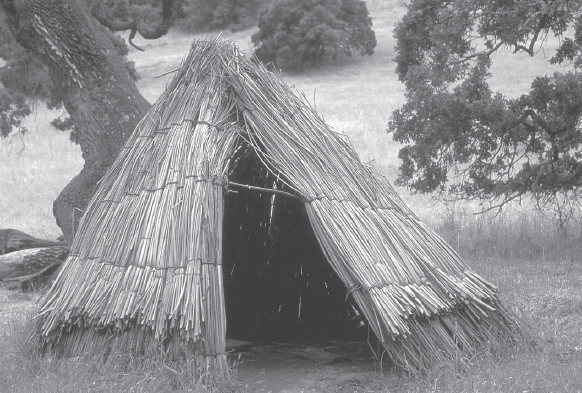
A reconstructed Coast Miwok house along the Loop Trail in Olompali State Historic Park.
Nearing Olompali Creek, the grade steepens. A set of wooden steps brings you to a junction, where a wide dirt path merges from the left, and your route, now a dirt road, swings right. Olompali Creek is in a deep ravine, left, and the road, which may be muddy in places, heads downstream, soon passing a reservoir made by damming the creek.
You pass through an open, grassy area, and nearby is a reconstructed Coast Miwok village consisting of two typical houses, one made from tule reeds, the other from redwood bark. After passing several picnic tables, the road swings left, crosses Olompali Creek, which flows through a culvert, and then veers right.
The Burdell Barns, part of the historic ranch complex, are just ahead. Just ahead of the first barn — one with a corrugated metal roof — leave the dirt road by veering right. Go about 200 feet, across a weedy field, to a bridge over Olompali Creek. Once across, close the loop, turn left, and retrace your route to the parking area.