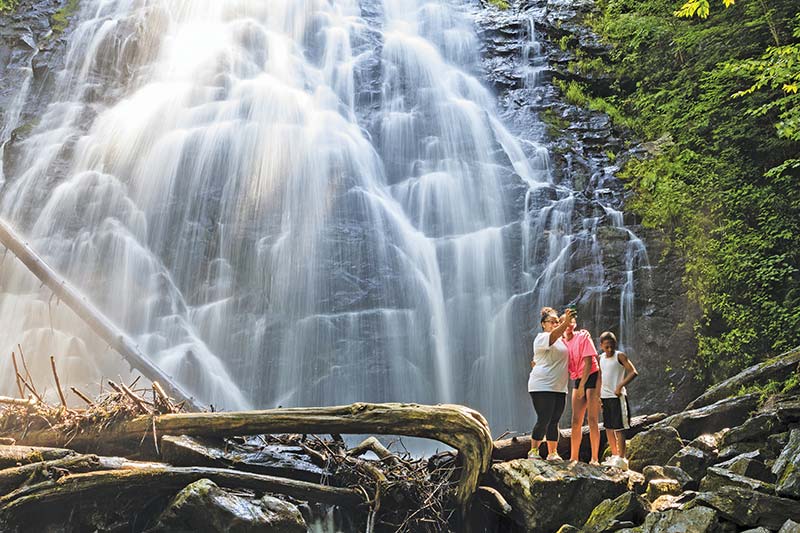
James River Overlook (MP 63.2)
 S US-501 West: Natural Bridge (MP 63.7)
Apple Orchard Mountain (MP 76.5)
Great Valley Overlook (MP 99.6)
N&W Railroad Overlook (MP 106.9)
Virginia’s Explore Park (MP 115)
Mill Mountain and the Roanoke Star (MP 120)
Roanoke Valley Overlook (MP 129.6)
Devils Backbone Overlook (MP 143.9)
 VA-8 South: Fairy Stone State Park (MP 165.2)
Rocky Knob Recreation Area (MP 167)
S Chateau Morrisette Winery (MP 171.5)
 US-52 South: Mount Airy (MP 199.5)
S Blue Ridge Music Center (MP 213)
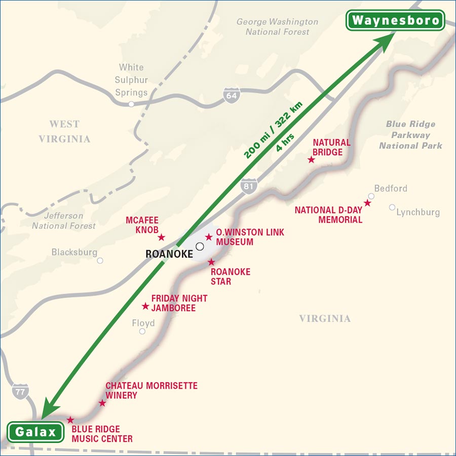
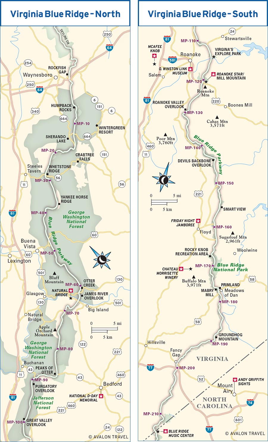
Rockfish Gap marks Mile 0 of the Blue Ridge Parkway. For the next 217 miles, the road follows the gentle swales and curves of Virginia’s Blue Ridge Mountains.
The first stretch of the Parkway is characterized by a pleasant patchwork of pastures, meadows, and hayfields, river crossings, more than a few lakes, and overlooks that take in wide valleys. Thick, mid-elevation hardwood forests grow all along the mountainsides, creating a lush green blanket in spring and summer and a bright patchwork in fall. A huge variety of wildflowers grows alongside the road.
For some ways, the Appalachian Trail (AT) parallels the Blue Ridge Parkway, either closely or on the next ridgeline over. For AT hikers, the long, nearly flat ridges of Virginia’s mountains provide a well-earned break on their trek along the crest of the mountain chain. You’ll find similar features on your drive. There are curves—what mountain road is missing curves?—and you will climb a mountain or two, but this part of the Parkway is the easiest to drive.
Blue Ridge Parkway planners elected to chase the wandering ridgelines of the mountains along the Virginia stretch of the route, often giving travelers spectacular views to the east and west without having to rely on so many overlooks. There are overlooks, though, and when you stop at one, the sight is often breathtaking. Many look across wide, flat-bottomed river valleys that were the interstate highways of their day, carrying settlers from New York to Alabama. Looking out from the highest vantage, Sharp Top in the Peaks of Otter, you’ll gaze across valleys and up the slopes of the mountains some miles distant, the heads of their companions peeking over their shoulders. Gaps—passes through the mountains, connecting east with west—appear periodically. These spots, used by Native Americans and European settlers alike to cross these hills more easily, are blessed with the most panoramic of views.
You could spend anywhere from two days to a week exploring this region. If hikes aren’t your thing, then the trip is shorter (2-4 days), as the easiest hikes don’t take long to get you to some outstanding spots, and the sights, cities, and towns here will draw you in for a night or at least a daylong side trip. Hikers and thorough sightseers will want closer to a week, as some of the best hikes are half-day treks (or more), cities like Roanoke deserve at least two days to explore, and Floyd has a Friday-night-only happening that you simply must experience.
Planning ahead is key on this leg of the journey. The Parkway is open year-round, although few facilities outside Peaks of Otter are open beyond May-October. There are few restaurants along the Parkway and only a handful of places to rest your head, and if you’re traveling during peak times (read: an autumn trip to take in some incredible fall colors), you may be in for a wait or be left with no place to stay. Make hotel or campground reservations in advance. Many of the best places can book up nearly a year out for late September and all of October (peak leaf-peeping months). Roanoke, the largest city in the region, has the widest selection of accommodations.
The Blue Ridge Parkway through Virginia is the easiest stretch along the route. Along this part of the Parkway, the weather is generally mild, though winter ice and snow can (and often do) close the Parkway. Perhaps the largest travel factor to take into account is traffic. During peak color season—late September through October—the Parkway gets crowded, things slow down, roadways are lined with leaf peepers and photographers, and the overlooks are filled to capacity. That said, it’s a marvelous time to visit; you just have to be alert to traffic and pedestrians and patient with your travels.
If you’re following the route prescribed in this guide, you’ll join the Blue Ridge Parkway at Rockfish Gap, near Waynesboro and Charlottesville, as soon as you leave Skyline Drive and Shenandoah National Park. Following the Parkway south from here, you’ll cover 217 miles, a little less than half the distance of the whole route. At Milepost 216.9, the Parkway crosses the North Carolina state line, but not before passing close by the town of Galax, Virginia, and Mount Airy, North Carolina.
Getting on and off the Blue Ridge Parkway isn’t difficult on this segment. From Richmond, Virginia, drive west on I-64 for 93 miles (90 minutes) to reach the Parkway entrance. From Charlottesville, Virginia, drive west on I-64 for 25 miles (30 minutes).
Roanoke, the largest city in the region, is a good starting point. To get to Roanoke from Greensboro, North Carolina, drive north on US-220 for 100 miles (two hours).
There are a number of other points you can use to enter the Blue Ridge Parkway, as many highways intersect with this part of the route.
These are the most convenient spots to fuel up along this route:
• MP 0, US-250 less than one mile west
• MP 45.6, US-60 less than five miles west
• MP 63.7, US-501 less than two miles south
• MP 90.9, VA-43 less than five miles north
• MP 106, US-460 less than four miles west
• MP 112.2, VA-24 less than two miles east or west
• MP 121.4, US-220 less than five miles north
• MP 177.7, US-58 less than one mile east
• MP 199.4, US-52 less than one mile north
• MP 215.8, VA-89 less than eight miles north
The two major airports in the region are in Charlottesville and Roanoke. Charlottesville Albemarle Airport (CHO, 100 Bowen Loop, Charlottesville, 434/973-8342, www.gocho.com) is served by Delta, American Airlines, United Airlines, and US Airways, with flights arriving daily from cities all across the Eastern Seaboard and Midwest. Airlines flying out of the Roanoke-Blacksburg Regional Airport (ROA, 5202 Aviation Dr. NW, Roanoke, 540/362-1999, www.flyroa.com) include Allegiant Air, American Airlines, Delta Airlines, United Airlines, and US Airways.
The Richmond International Airport (RIC, 1 Richard E. Byrd Terminal Dr., Richmond, 804/226-3000, www.flyrichmond.com) is only about 90 minutes east of Rockfish Gap and Milepost 0 of the Blue Ridge Parkway along I-64.
At the Charlottesville Amtrak station (CVS, 810 W. Main St., 434/296-4559 or 800/872-7245, www.amtrak.com, 6am-9:30pm daily), the Cardinal/Hoosier State, Crescent, and Northeast Regional lines pass through daily.
Roanoke’s Amtrak Station (RNK, 101 Norfolk Ave., 800/872-7245, www.amtrak.com) opened in fall 2017 and serves passengers on the Crescent and Northeast Regional lines.
Both Charlottesville and Roanoke have Greyhound stations near downtown where it is easy to get to accommodations or a car rental agency. The Charlottesville Greyhound station (310 W. Main St., 434/295-5131, www.greyhound.com, 8am-10pm daily) is just a few blocks from the Amtrak station. The Roanoke Greyhound station (26 Salem Ave. SW, 540/343-5436, www.greyhound.com, 5:15am-6:15am and 9am-5pm Mon.-Fri., 9am-10am and 1pm-5pm Sat.-Sun.) is very convenient to downtown.
At only 1,909 feet high, Rockfish Gap offered wildlife, then Native Americans, then colonists and settlers, and now endless interstate traffic—including you—an easy place to pass through these mountains. It’s a rather ho-hum start to the epic Blue Ridge Parkway; there’s little more than a sign here announcing the Parkway and another sign with the speed limit.
Two miles down is the first excellent stop of the Blue Ridge Parkway: At the Rockfish Valley Overlook (MP 2), you’ll be at around 2,100 feet of elevation, which gives a good vantage point over the surrounding land. The rolling valley and the Rockfish River below and the mountain peaks in the distance make this a prime spot for photos, especially in morning or evening light.
The first visitors center you come to on the Blue Ridge Parkway is at Milepost 5.9, the Humpback Rocks Visitor Center (MP 5.9, 540/377-2377, 10am-5pm daily May-Nov.). At the visitors center, you’ll find maps and pamphlets about many of the on- and off-Parkway attractions nearby, as well as restrooms. There are two short hikes here: one to a farm and homestead made up of relocated buildings and structures on Parkway land, which have been assembled here as a whole farm; the other to the namesake Humpback Rocks.
The self-guided Mountain Farm Trail leads through a reconstructed 19th-century farmstead, with exhibits on life in the rural Blue Ridge. Across the road, a steep, two-mile trail climbs to the jagged top of Humpback Rocks (3,080 ft.) for a 360-degree view of the mountains. Past Devil’s Knob (3,851 ft.) is a turnoff to VA-664 east toward Wintergreen Resort.
Distance: 0.5 mile out and back
Duration: 20 minutes
Elevation gain: negligible
Difficulty: easy
Trailhead: Humpback Rocks Visitor Center parking area at MP 5.9
Less of a hike and more of a stroll, this trail takes you through an 1890s mountain farm. Grab a brochure about the trail at the visitors center and follow the paved trail to a gravel path that leads through the farm. Along the way, you’ll pass a cabin, a weasel-proof chicken house, a collection of farm tools, a garden, a barn and a pigpen, and the springhouse. All along the way, you’ll have a view of Humpback Rocks.
Distance: 2 miles out and back
Duration: 90 minutes
Elevation gain: 750 feet
Difficulty: moderate to strenuous
Trailhead: Humpback Gap parking area at MP 6 (or cross the Parkway from the end of the Mountain Farm Trail)
A short hike, but one that is at times steep and rocky, this is more than a leg-stretching hike but less than a monumental undertaking. The sight of Humpback Rocks and the views from the pinnacle make the effort worth it.
Starting from the Humpback Gap parking area, follow the blue-blazed trail to the left of the kiosk. The trail ascends steeply, but it’s in good condition. At the trail intersection at 0.5 mile, stay straight on the blue-blazed trail. The next 0.4 mile is tough—rocky with a few sets of wooden and rock steps in the hardest parts—but you’re almost there. At the next intersection, bear left on a spur trail to the rocks (it’s obvious). From your perch on the rocks, the view is simply spectacular. This is an especially good spot for a sunrise expedition as the sight of the countryside coming alive is quite remarkable.
Just off the Parkway at Reed’s Gap, Wintergreen Resort (39 Mountain Inn Loop, Roseland, 434/325-2200, www.wintergreenresort.com, year-round) has plenty of accommodations, from two-person studios, lodges, and condos ($155-265) to two- to six-bedroom homes (requiring a two-night stay, $289-880) and lodges ideal for very large groups ($799-1,590). To get here, leave the Parkway at Milepost 13.7, then take VA-664 one mile to the resort entrance (on your left). Many environmentalists, Parkway advocates, and supporters of the Appalachian Trail weren’t too happy when private land adjacent to the Parkway was turned into Wintergreen Resort. Though it gets a bad rap with some land-use advocates, the resort is known for its preservation program and on-property trail system. The whole resort is 11,000 acres, with more than 6,000 acres permanently dedicated to forest preservation and over 30 miles of trails lacing the mountainsides.
Activities include hiking the extensive network of trails that includes part of the old Appalachian Trail (hiking guides $3), fly-fishing guide services, archery, zip-lining, a minigolf course, mountain biking, and too many more activities to list. The resort also has a huge snow-tubing park and the odd thrill of summer tubing (it’s down a track, not on snow), and 26 ski and snowboard trails, including a terrain park. There are two golf courses at Wintergreen: Devil’s Knob Golf Course (par 70, 6,712 yards, $49-119, depending on season), the highest course in Virginia; and Stoney Creek Golf Course (par 72, 7,158 yards, $39-79, depending on season).
There are several dining options available at Wintergreen, though they are for resort guests and members. If you’re staying here, try The Edge (434/325-8080, 11am-10pm Sun.-Thurs., 11am-midnight Fri.-Sat., $9-25), serving pub food and a fun late-night menu; The Copper Mine Bistro (434/325-8090, 7am-11am and 5:30pm-9pm Mon.-Sat., 7am-11am Sun., $10-35), where you can grab breakfast and a fun Mediterranean-inspired dinner; and Devils Grill (434/325-8100, 11:30am-4pm and 5:30pm-9:30pm Mon.-Sat., 11:30am-4pm and 5pm-9pm Sun., $10-38), serving lunch and a hearty dinner with dishes like pasta Bolognese, steaks, and fish.
Just off the Parkway is Sherando Lake Recreation Area (96 Sherando Lake Rd., Lyndhurst, 540/291-2188, www.fs.usda.gov, 6am-sunset daily, $8/vehicle day-use fee). To get here, turn west on VA-664 at Reed’s Gap (MP 13.7). Follow VA-664 for 2.6 miles, then take your first left; 2 miles in, turn right and you’ll be at the recreation area.
Built by the Civilian Conservation Corps in the 1930s as a recreation area and flood-control measure, the distinctive features of the area are the lakes. The 25-acre lower lake has a sandy swimming beach and is open for boating; the 7-acre upper lake is known for trout, bass, and bluegill fishing. A 37-site campground, S Sherando Lake Recreation Area Campground (96 Sherando Lake Rd., Lyndhurst, 877/444-6777, www.recreation.gov, $20), rings the lakes, and there are miles of hiking trails in the surrounding George Washington and Thomas Jefferson National Forests. It’s picturesque, well appointed, and rich with activities perfect for kids and Parkway explorers; combine this with its location and you have the makings of a great campground.
Pick up a trail map at the campground and take a look at what hikes might appeal to you. Most everyone will at least want to take the mile-long Lakeside Trail, which circles Sherando Lake. You can add to that the short, but steep, 0.75-mile Cliff Trail. Both of these hikes will put you in prime position for some great photos of the lake, especially when fall colors are in full blush.
Most of the longer hikes here are full-day affairs. This shorter one gives you a view of the lake and a taste of ridge-top hiking:
Distance: 3-mile loop
Duration: 2 hours
Elevation gain: 950 feet
Difficulty: moderate with strenuous sections
Trailhead: Sherando Lake Recreation Area Campground
Begin climbing out of the campground on a moderate incline as you follow one arm of the mountain up to the ridge top proper. Sections of the trail are rocky, so watch your footing. Also keep an eye out for poison ivy, which you can see in a few places. For the most part, the trail is narrow, but there is no exposure to heights or steep drop-offs to speak of. At just over 0.5 mile into the hike, you’ll come to a rocky overlook (possibly the site of a small landslide) where there’s a great view of the larger of the two lakes.
Continue on the trail another quarter mile to the ridge, where Blue Loop Trail meets Torry Ridge Trail. Turn right and follow the ridgeline about a mile before turning right again down Blue Loop Trail. Along the ridge, it’s very flat and easy to make good time, but pace yourself as the water you brought is all the water you’ll have on the hike. Once you turn right back onto Blue Loop, it’s about 0.5 mile to a Forest Service Road (FDR 91). From the road, it’s another 0.5 mile back to the campground.
Mountain biking enthusiasts know Sherando as the home of one of the burliest trails in this part of the state. Head up the steep, rocky Blue Loop Trail past the lake toward the park entrance—you’ll end up carrying your bike, trust me—to the yellow-blazed Torry Ridge Trail, 1,000 feet above. Go down the ridgeline, carrying your bike yet again through a nasty rock garden, then head down the blue-blazed Slacks Trail to the orange-blazed White Rock Trail back to the lake. The whole thing is an 11-mile loop, and all the carrying makes the ride down that much sweeter.
Where North Carolina and Great Smoky Mountains National Park to the south are rife with waterfalls, there are few that impress in Virginia, but when you find one like Crabtree Falls, it really impresses. Crabtree Falls descends down a set of five cascades, the first of which you can see after an easy, 10-minute hike from the trailhead. Called the highest waterfall “in Eastern America,” the “highest in Virginia,” and the “highest in the Virginia Blue Ridge,” it’s a tough call to say which is true, though through some crafty manipulation of the numbers, they all could be. At the very least, it’s the highest waterfall in the Virginia Blue Ridge, falling and cascading a total distance of 1,200 feet. This isn’t the only Crabtree Falls you’ll encounter on the Blue Ridge Parkway; the other is in North Carolina (at MP 339.5).
Distance: 3.4 miles out and back
Duration: 2-2.5 hours
Elevation gain: 1,500 feet
Difficulty: strenuous
Trailhead: To reach the trailhead of Virginia’s Crabtree Falls, exit the Parkway at MP 27.2 and head east on VA-56 for 6.6 miles. The parking area is on the right side of the road.
You’re in for a climb as the trail gains 1,500 feet in only 1.7 miles. Start your climb by crossing the Tye River, then follow the trail a quarter mile to the first overlook. At 0.4 mile, you’ll come to another platform and a great view of a 70-foot cascade. The next good view is at 0.7 mile, where you’ll be able to look back downstream and get a feel for the elevation here. From this point, the falls become steeper and more impressive.
At 0.9 mile, the creek falls over a smooth, nearly vertical rock face, but as impressive as it is, it’s not the best. At 1.5 miles, you’ll come to the base of the upper and most impressive falls. As the water falls, it splits, taking multiple paths down the face, making for some very interesting photos. The trail continues beside the falls for another 0.2 mile, taking you to the top. The view from here is bad; you’re too close to the action to gain any real perspective. Take the footbridge across the creek and follow a short side trail to another observation platform. Though the view of the falls from here is scant at best, you will be able to get a great look at the valley and gorge you just ascended.
The trail continues on another 1.2 miles to VA-826 (a four-wheel-drive-only road) and a second trailhead there. You’re more than welcome to explore the forest here, but to get back to the trailhead, go back down the path and take a second look at Crabtree Falls on the way down.
Whetstone Ridge was so named because early settlers found the fine-grained stone along this ridge ideal for sharpening stones. You’ll find flush toilets and little else here aside from a trailhead to the long Whetstone Ridge Trail.
Distance: 23.6 miles out and back
Duration: 2 days, 8-9 hours total
Elevation gain: 1,700 feet
Difficulty: strenuous
Trailhead: MP 29 at the end of the parking area
This hike is quite pleasant other than the distance. Much of the trail follows the original route of the Appalachian Trail (dating back to the 1930s). In summer, there are no views to speak of as the greenery completely hems you in. In fall and winter, the views are expansive in every direction. Bring plenty of water (especially if you plan to camp), as there are no reliable water sources along the trail.
The hike is straightforward—ascend the ridgeline via a few switchbacks and follow the combination forest service road and trail. At four miles in, you’ll reach a small campsite. At 5.7 miles, you’ll begin a rocky descent that’s steep at times. Ascend at six miles, just as steeply. At 7.3 miles, you’ll come to one of the only summertime views of the distant countryside. When you reach the knob at 8.2 miles, you’ll have a good view of the Parkway as it winds along the crest of the Blue Ridge Mountains. At 9.2 miles, a side road cuts away, down the mountain: Stay on the ridge. You’ll leave the road at 9.5 miles and begin a long descent along a pretty narrow path. Continue on this route until you reach VA-603 in 2.3 miles.
The trail is open to hikers, bicyclists, and horseback riders. Trail etiquette states that horses have the right of way; hikers yield to horses; bicyclists yield to horses and hikers. This trail is maintained by the U.S. Forest Service, but Park Service regulations prohibit bikes on their trails (unless marked otherwise), so please walk your bike in the first 0.25 miles to the clearly marked boundary with Forest Service land. Horse folks and bicyclists can do this trail in one day. The same is not so true for hikers. Camping is permitted, making this hike doable in two long segments or three shorter ones. It is best to either camp or arrange for another car to pick you up at the VA-603 trailhead.
I love an odd place name, and Yankee Horse Ridge fits the bill. The story goes that during the Civil War, a hard-riding Union soldier drove his horse to exhaustion here. When the horse fell and couldn’t get up, he did the only humane thing: put it down. The story is likely true as these mountains, ridges, and passes saw considerable activity during the Civil War. This stop is notable for two reasons: a pleasant little hike and waterfall, and a chance to see the remnants of a century-old logging operation.
Distance: 0.2-mile loop
Duration: 20 minutes
Elevation gain: negligible
Difficulty: easy
Trailhead: MP 34.4 at the end of the parking area
Many like to think that the Blue Ridge Parkway passes through virgin forest and untouched lands, but the reality is that Native Americans and European settlers built homes and raised families here for hundreds of years before industrialists found the mineral- and timber-rich mountains and used them to their ends. This path follows a section of the Irish Creek Railway, a narrow-gauge railroad that carried more than 100-million board feet of lumber off the mountain and to mills below.
The trail starts with a short set of steps that lead to a reconstructed portion of the railroad laid on its original bed. Turn right onto the tracks and cross a bridge over Wigwam Creek. In a moment, the trail will turn left, up the hill, but you should continue along the tracks and railroad bed for a little way more. It’s interesting to see how the forest reclaims the railroad, yet the railroad stays clearly visible once you know what to look for. Retrace your steps to the turn and head uphill. You’ll find a pair of bridges across Wigwam Creek where you can take a gander at the 30-foot Wigwam Falls before continuing around this little loop and back to the parking area.
If you needed evidence of the gentleness of Virginia’s Blue Ridge Mountains, your evidence can be found here, at Bluff Mountain. Engineers only built 1 tunnel on the whole 217 miles of Virginia’s Blue Ridge Parkway and 25 tunnels in North Carolina. The Bluff Mountain Tunnel is that lone Virginia subterranean crossing. It’s 630 feet long and 13 feet tall (some sources claim 13 feet, 7 inches, but if you’re concerned about tunnel height, it’s best to err on the side of caution).
There are several overlooks providing glimpses of Otter Creek as it makes its way to a parallel track with the Parkway. Otter Creek descends from 1,100 feet down to 650 feet, the lowest point on the Parkway, at the James River a few miles distant. Starting at Milepost 57.6, then again at Mileposts 58.2, 59.7, 60.4, 60.8, 61.4, 62.5, 63.1, and finally 63.2, you can catch glimpses of Otter Creek. One of the best views is at Milepost 60.4 at The Riffles Overlook, where Otter Creek drops over a 20-foot cascade.
At Milepost 60.8, you’ll find the Otter Creek Campground (877/444-6777, www.recreation.gov, May-Oct., $16-19), with 42 tent and 26 RV sites, and Otter Creek Trail.
Distance: 6.8 miles out and back
Duration: 3-3.5 hours
Elevation gain: 200 feet
Difficulty: easy to moderate
Trailhead: Otter Creek Campground
Aside from one steep ascent/descent, this is a languid walk beside a very pleasant creek. Cross Otter Creek via a set of concrete stepping-stones immediately after starting the trail. You’ll reach a Parkway overpass at 0.3 mile and a nice look at the creek at 0.4 mile (in the creek are some inviting large, flat rocks, perfect for sunbathing and navel gazing). At 0.6 mile, you’ll reach some steps to Terrapin Hill Overlook, a short trail with an elevation gain of nearly 800 feet. A stone culvert and concrete tunnel take you under the Parkway and VA-130 just before you cross Otter Creek and pass beneath a fern-laden cliff. The trail begins to ascend a little more steeply at 1 mile, becoming a little tougher at 1.2 miles.
When you reach the 1.4-mile mark, take a moment to check out the small cave just off the trail. Then begin the short, steep descent and return to Otter Creek. You’ll soon pass the Lower Otter Creek Overlook (MP 62.5) and continue downstream. Cross Otter Creek again by boulder-hopping at 2 miles in, and continue until you meet with Otter Lake Loop Trail, 2.4 miles into your trip.
Walk the banks of the lake, then cross over Otter Creek at the dam and turn right (turn left and you’ll loop the lake, which you can do on the return trip or as a separate hike). At 3 miles into the hike, you’ll have excellent views of the creek and see some deep pools that you may want to dip your feet into. At 3.4 miles, you’ll arrive at the James River Visitor Center (no phone, 10am-5pm Wed.-Sun.), where you can rest, check out the displays, ride back to the campground (if you are traveling with companions and you’ve arranged your own shuttle ahead of time) or retrace your steps back to base camp.
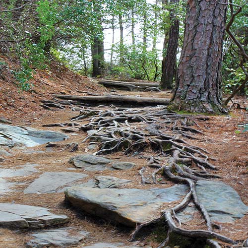
rocky trail near Wintergreen Resort
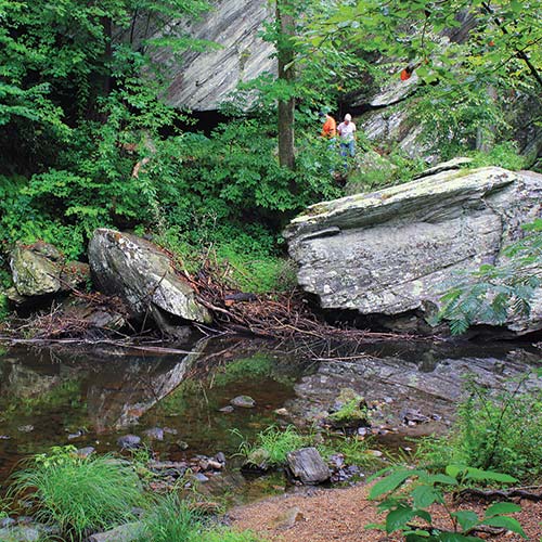
Otter Creek Trail
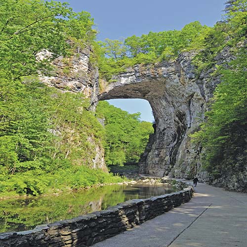
Natural Bridge
Distance: 1-mile loop
Duration: 20 minutes
Elevation gain: 100 feet
Difficulty: easy to moderate
Trailhead: Otter Lake Overlook at MP 63.1
The trail starts at the dam where you’ll cross the stream via a set of concrete stepping-stones, then ascend some stone steps. Follow the trail 0.3 mile to a bench where a short trail leads down to another lake view. On the main trail, you’ll ascend gradually to the high point above the lake. At 0.4 mile, there’s another bench and the trail descends. Cross a little creek and pass through a small wetland where the creek feeds the lake, then cross over Little Otter Creek at 0.5 mile. After you cross Little Otter, you’ll come to the ruins of an old cabin. Take a moment to check it out and see how early settlers here built their homes to last quite some time.
Soon after the cabin, you’ll come to a marked junction with Otter Creek Trail. Cross the bridges and head back to the parking area along the edge of the Parkway.
The Parkway hits its lowest point—649.4 feet—where it crosses the James River at Milepost 63.2. Just beyond, at Milepost 63.6, are the James River Visitor Center (10am-5pm Wed.-Sun.), a picnic area, and a couple of trails: the Trail of Trees Self-Guiding Trail and James River Self-Guiding Trail, both of which are 0.4 mile long and pretty easy. The Trail of Trees is a loop that details the relationships between 40 or so plants and trees common to the region. The James River Trail is quite interesting as it leads to a system of canals and locks built to use the James River for shipping. It’s a nice walk beside the river.
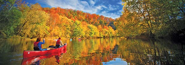
canoeing along the James River north of Roanoke
 S US-501 West: Natural Bridge (MP 63.7)
One of Virginia’s most impressive sights stands tall just 16 miles from the Blue Ridge Parkway. Exiting the Parkway at Milepost 63.7 and following US-501 west will take you right to Natural Bridge (6477 S. Lee Hwy., 540/291-1326, www.dcr.virginia.gov, 8am-dusk daily, $8 adults, $6 children ages 6-12, free ages 5 and under), a jaw-dropping 215-foot-tall limestone span. Thomas Jefferson, onetime owner of Natural Bridge, said it was “so beautiful in archaeology, so elevated, so light, and springing as it were up to Heaven, [that] the rapture of the spectator is really indescribable.” Which is to say, a visit to this natural wonder will leave you speechless.
According to native legend, the “Bridge of God” materialized to help a band of Monocan Indians who were fleeing from raiding Shawnee and Powhatans. In 1749, British Lord Fairfax hired Colonel Peter Jefferson (father of six-year-old Thomas, a son destined to become president) to survey the land around today’s US-11. One young assistant carved his initials on the stone wall; the faint “GW” is still visible, making George Washington the only president to have officially defaced a Virginia landmark. In 1773, Thomas Jefferson gained title to the bridge and 157 surrounding acres from King George III for 20 shillings (that’s about $140 in today’s money). Near the base, he built a two-room log cabin (one for him, one for guests) and installed a “sentiment” book in which prominent visitors could record their impressions. During the Revolutionary War, soldiers made bullets by pouring molten lead from the bridge into the creek below and mined saltpeter from nearby caves for gunpowder.
Today, all visits to Natural Bridge start at the main ticket building, which encloses a gargantuan gift shop, an indoor pool, a miniature golf course, an ATM, and a post office. Walk downhill or take a shuttle bus to the beginning of the trail, where a café (open seasonally) offers light fare in an open patio alongside the creek. Children’s voices echo up the deep, wooded gorge, where you’ll get your first glimpse of the sheer size of the thing. At 50-150 feet wide and 90 feet long, it’s massive, but surprisingly graceful for 36,000 tons of stone. The trail continues along the creek. It’s a pleasant walk when it’s not too crowded. You’ll encounter an old saltpeter mine, picnic areas, and the Lace Waterfalls past an open space where Easter sunrise services have been held since 1947.
It’s said that the ghost of a woman haunts the Natural Bridge Caverns (15 Appledore Ln., 540/291-2482, www.naturalbridgeva.com, 9am-4pm daily mid-Mar.-late Mar., 9am-5pm daily Apr.-Nov., 9am-4pm Fri.-Sun. Dec.-mid-Mar., $18 adults, $12 children ages 6-12, free ages 5 and under), the deepest cave (37 stories) on the East Coast. Guided tours to spots including the Wishing Well Room, Colossal Dome Room, and Mirror Lake leave every half hour. Be aware that it’s a hike to the bottom—a series of staircases, actually, and you have to take them back up.
Natural Bridge Zoo (5784 S. Lee Hwy., 540/291-2420, www.naturalbridgezoo.com, 9am-6pm daily Mar.-late May, 9am-6pm Mon.-Fri., 9am-7pm Sat.-Sun. late May-Aug., 9am-5pm Mon.-Fri., 9am-6pm Sat.-Sun. Sept.-late Oct., 9am-5pm daily late Oct.-late Nov., 9am-4pm daily late Nov.-early Dec., $12 adults, $10 seniors 65 and older, $8 children ages 3-12, free ages 2 and under), on US-11 South, harbors the usual: giraffes, camels, bears, and monkeys, along with rare and endangered species such as a white tiger born in 1997. It also boasts the largest petting zoo in the state.
If you haven’t had your critter fix by now, stop by the Virginia Safari Park (229 Safari Ln., 540/291-3205, www.virginiasafaripark.com, 9am-5pm daily mid-Mar.-late Mar. and Nov., 9am-5:30pm Mon.-Fri., 9am-6:30pm Sat.-Sun. Apr.-May and Sept., 9am-6:30pm daily June-Aug., 9am-5:30pm daily Oct., $20 adults, $19 seniors, $13 children ages 2-12, free ages 1 and under), a 180-acre drive-through zoo. A three-mile road takes you past bison, zebras, antelope, and ostriches roaming free (more or less). There’s also a petting zoo, an aviary, and a primate house. Kids love the giraffe feeding station. Buy buckets of feed, giraffe grain, or lettuce (which giraffes love, evidently) and take a peek at these exotic animals up close.
The Natural Bridge Hotel (15 Appledore Ln., 540/291-2121, www.naturalbridgeva.com, $71-150) is comfortable and environmentally responsible. The hotel uses a number of sustainable products and practices across the entire property, proving that green can equal comfortable and luxurious. There are around 115 rooms, including several suites. Four restaurants serve cuisine from fine dining to pub standards.
Looking at these mountainsides, it’s easy to imagine that the sparse trees and lower understory were either groomed to look this way or were planted, as the name suggests, as an apple orchard. After all, there are plenty of orchards in this part of Virginia. In fact, weather conditions have pruned the trees over time, peeling them back again and again, giving the mountainside the appearance of a cultivated orchard. Considering that Apple Orchard Mountain, at 3,950 feet, is the highest peak along Virginia’s stretch of the Blue Ridge Parkway, it makes sense that it’s a prime target for the wind, ice, and snow that gave the mountain its peculiar appearance and name. The “orchard” isn’t the only odd sight here: The thing that looks like a giant golf ball on top of the mountain is a huge radar array that was used during the Cold War for defense purposes. Today, the FAA uses it to monitor air traffic.
Distance: 2.4 miles out and back
Duration: 1.5-2 hours
Elevation gain: 1,000 feet
Difficulty: moderate to strenuous
Trailhead: Sunset Field Overlook at MP 78.4
Directions: To reach the trailhead, drive south along the Parkway to MP 78.4.
This hike drops off the Parkway for a very pleasant 1.2-mile hike to Apple Orchard Falls and a return trip that will have your thighs burning as you gain 1,000 feet in elevation.
Head past the trail sign and cross the Appalachian Trail to enter the Jefferson National Forest (camping is allowed within the national forest) just 0.2 mile into the hike. There’s a series of switchbacks that will be a mild nuisance on the way down, but you’ll love them on the return trip. At 0.6 mile, you’ll come upon a roadway, then at 0.8 mile a wider roadway and Cornelius Creek Trail to the left. Continue straight for Apple Orchard Falls.
At one mile, the path begins to parallel the creek. Soon after, the trail descends steeply beneath a large rock outcropping and a rhododendron thicket. Once you cross the creek via a footbridge, the trail will ascend just as quickly, leading you immediately to Apple Orchard Falls.
Apple Orchard Falls drops some 150 feet over a rock face. The stone is lichen covered, fern riddled, and looks like the sort of place fairies would live. Walk around a bit and take in the waterfall, which looks quite different from different perspectives. When you’ve looked to your heart’s content, reverse your path and head down from the falls, then immediately (and steadily) head back up the mountain to the parking area at Sunset Field Overlook.
After dipping to its lowest point and climbing to the highest peak in Virginia, the Blue Ridge Parkway winds its way to the Peaks of Otter Recreation Area (MPs 83.1-85.9). Indeed there are two peaks: Flat Top, a lumpy mountain nearly indistinguishable from the others around it, and the conical Sharp Top, the shorter, more iconic, and more easily identifiable of the two. Sharp Top was believed by many to be the highest peak in Virginia for a long time (but it’s actually Mount Rogers in the southwestern corner of the state), and in 1852, believing this was the case, state officials offered a chunk of stone from Sharp Top for inclusion in the Washington Monument. It was embedded into the obelisk with the inscription: “From Otter’s summit, Virginia’s Loftiest peak, To crown a monument, To Virginia’s noblest son.”
Archaeological evidence suggests that Native Americans hunted elk in these valleys and on these mountainsides at least 8,000 years ago, and it’s no doubt Sharp Top cut quite the sight then as now. In more recent history, the valley was visited by Algonquian, Cherokee, Iroquois, and Sioux tribes hunting buffalo, elk, deer, and bear. European settlers knew of the area long before beginning to clear land here in 1766, and the first permanent settlers began to arrive soon after the end of the Revolutionary War. In the late 1830s or early 1840s, an ordinary (another name for tavern) opened, and by 1860, it was a popular spot for wealthy vacationers from flatter regions of the state. Polly Wood’s Ordinary still stands today between the Peaks of Otter Picnic Area and Abbott Lake. When the Park Service acquired land for the Blue Ridge Parkway in the 1930s, a community of 20 families lived here, including the Johnson family, for whom the Johnson Farm Trail is named. A church and school stood where the Peaks of Otter Lodge stands today.
Just down the Parkway from the Peaks of Otter Lodge is the Peaks of Otter Visitor Center (MP 86 at junction with VA-43, 85919 Blue Ridge Pkwy., Bedford, 540/586-4496, 10am-5pm daily). In addition to restrooms, there are a few displays on the history, flora, and fauna of the region. Three trails—Harkening Hill Trail, Johnson Farm Trail, and Elk Run Trail—make loops from here and range from easy to strenuous.
You can climb the marvelous peaks of both Sharp Top and Flat Top. There is also a shuttle (hourly 10am-4pm Sat.-Sun. early May-late May, Wed.-Sun. late May-Sept., daily Oct., one-way $6 adults, $4 children ages 12 and under, round-trip $10 adults, $6 children ages 12 and under) to a point near the summit of Sharp Top, and you can get tickets from the Country Store in the lodge. The shuttle departs from the store. There’s no bus to the top of the longer, but easier, Flat Top.
Distance: 9 miles out and back
Duration: 6-6.5 hours
Elevation gain: 1,400 feet
Difficulty: moderate to strenuous
Trailhead: Flat Top Mountain Overlook parking area at MP 83.5
This hike goes from the Flat Top Mountain Overlook at Milepost 83.5 to the Peaks of Otter Picnic Area. If you have two cars, it’s a great shuttle hike of 4.5 miles. Otherwise, you can hike to the picnic area and return, making a nine-mile trip; or turn back at the summit for a hike just under six miles.
The first 0.3 mile is a steady ascent along a ridgeline, but once you cross through the small gap, the trail gradually becomes steeper until, at 0.6 mile, you begin a set of switchbacks that carry you to mile 1.3. Along the way, you’ll pass through mountain laurel and rhododendron and enter a small, rocky field.
At mile 1.5, you’ll reach a bench and a new series of switchbacks. This is even steeper and rockier than the last section. At two miles in, you’ll reach a second bench and a quarter mile on, an intersection with Cross Rock Trail. Drop briefly into a small gap at mile 2.7, then begin climbing through some impressive boulders. You’ll reach the 4,001-foot summit at mile 2.8. From here, you’ll have spectacular views of the Piedmont to the east, Sharp Top to the south, and Harkening Hill to the west.
Here you have two choices: press on to the picnic area or reverse course back to the trailhead. If you reverse course, take your time picking through the boulder field. If you press on, at mile 3, the view opens and you have a nice look at Sharp Top. At mile 3.4, you’ll cross a ridgeline, then a second one at mile 3.6. At mile 4, you’ll swing around onto the southeast face of the mountain and descend a series of laurel-lined switchbacks. The trail eases as you near the Peaks of Otter Picnic Area at mile 4.5.
Distance: 3 miles out and back
Duration: 2.5-3 hours
Elevation gain: 1,500 feet
Difficulty: strenuous
Trailhead: near MP 86, across the road from the Peaks of Otter Visitor Center
This hike is a lung-busting, thigh-burning workout, so take your time. In many places the trail is rocky, and you could twist an ankle if you misstep or are wearing improper footwear. But at the top, your effort pays off with unheralded views. You can hike before dawn to the summit in time for sunrise (be sure you have a strong headlamp with fresh batteries). It’s windy and a good six degrees cooler on the summit, so you may want to pack an extra layer.
From the trailhead, begin your ascent and cross the bus road at 0.2 mile (pedestrians aren’t allowed on the bus road, so don’t think of hiking it up or back). The trail is steep in places and very rocky in others, but it’s pretty straightforward. When you reach the 1.2-mile mark, a spur trail to your right will take you to Buzzards Roost, a lesser peak on the mountain, but one with good views. Immediately after passing the spur to Buzzards Roost, the trail turns much steeper and there are handrails bolted into the rock in places. As you approach the summit, which is made of giant, house-sized boulders, you’ll meet one more path, which branches off to the left to the shuttle stop. Just below the summit is a stone shelter that exists in case of inclement weather (which can come up fast, so keep your eyes peeled). Head up another set of stone stairs to the summit, where you’ll be treated to 360-degree views. You can see the lodge, Abbott Lake, the Parkway snaking off to the north and south, the lights of Bedford, and the bulk of Flat Top. To go back, simply reverse course, or head to the bus stop to catch a ride, provided you bought a ticket.
The S Peaks of Otter Lodge (85554 Blue Ridge Pkwy., Bedford, 540/586-1081 or 866/387-9905, www.peaksofotter.com, year-round with limited openings Dec.-Mar., from $154) is a must-stay on the Parkway, especially during leaf season. The food at the lodge’s restaurant (7:30am-10:30am, 11:30am-3:30pm, and 4:30pm-9pm daily, $3-25) is all right, but the view of Abbott Lake and Sharp Top rising above as it’s reflected in the lake’s waters is quite striking. Get to your meal a little early to grab a window seat for an unobstructed view. On Friday nights, a seafood buffet and carving station ($28 adults, $15 children) is popular. In addition to the restaurant, there’s a grab-and-go case and coffee shop (8am-4:30pm Mon.-Fri., 7am-4:30pm Sat.-Sun., $8), a gift shop (9am-8pm daily), and lounge (4pm-9pm Mon.-Fri., 2pm-9pm Sat.-Sun.).
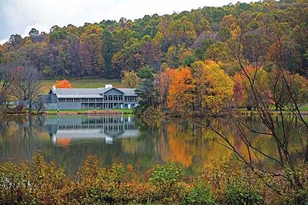
The Peaks of Otter Lodge recalls classic motels from the golden age of road trips.
The Peaks of Otter Campground (10454 Peaks Rd., Bedford, 540/586-7321, reservations 877/444-6777, www.recreation.gov, May-late Oct., $20) has 140 sites for tents and RVs (there are no electric hookups). Campsites are shady and generally cool, and the Peaks of Otter Lodge is a short walk away.
 VA-43 South: Bedford (MP 86)
The first time I saw Bedford, established as the town of Liberty in 1782, I was hooked. The people are welcoming, the town center is a throwback to that idealized Main Street of old, and the mountain setting is beautiful. It’s small, but Bedford lacks that cloistered feel that some small towns exude. Locals are open and kind, and most visitors leave with fond memories and a desire to return. Given its proximity to the Peaks of Otter and the Blue Ridge Parkway, it’s a fantastic waypoint if you’d rather stay in a B&B than a lodge or campground on the Parkway, and there are enough good restaurants in town to make any meal one to remember. While in town, take a little time to learn some of the history and culture of Bedford by paying a visit to the National D-Day Memorial or Thomas Jefferson’s other Virginia home—Poplar Forest.
VA-43 meets the Parkway at the Peaks of Otter, and Bedford is 11 miles to the southeast. At Milepost 106, US-460 will also take you to Bedford (21 miles east).
Bedford’s National D-Day Memorial (3 Overlord Circle, 866/935-0700, 10am-5pm daily Mar.-Nov., 10am-5pm Tues.-Sun. Dec.-Feb., $10 adults, $6 students and children ages 6-18, $19 combo ticket with Poplar Forest) honors the men who fought and lost their lives in the Normandy Invasion of World War II. The memorial stands on an 88-acre hilltop overlooking Bedford and is designed to be toured in chronological order, first telling of the planning and preparation for Operation Overlord (commonly known as D-Day), then leading through the storming of the beachheads at Normandy, and the eventual victory of Allied Forces. Informational placards and sculptures represent the generals, admirals, and commanders who made victory possible. The most moving element is the quartet of sculptures on the pool and simulated Normandy beach. Through the Surf, Death on Shore, Across the Beach, and Scaling the Wall show soldiers in various poses—rushing through the water onto the shore with rifle held high overhead; fallen on the sand; rushing across the beach; scaling the cliffs above—and tell the story of that day’s events. A large stone arch at the top of the memorial signifies the end of the war in Europe.
As you enter the memorial from the gift shop, you’ll find Homage, a statue honoring the Bedford Boys, a group of young men from Bedford. The Bedford Boys were part of the 29th Infantry Division, 116th Infantry Regiment, Company A, which assaulted Omaha Beach on D-Day. That morning, 31 men from Bedford loaded into landing craft to be part of the first wave of attackers. One landing craft struck an obstacle, keeping five of the Bedford Boys out of immediate action. Of the 26 who reached the beach, 16 were killed and 4 were wounded within minutes. Three were unaccounted for and later presumed killed in action. On D-Day, Bedford suffered the worst loss, per capita, of any community in the United States. When Congress approved plans for the National D-Day Memorial, Bedford was the natural choice.
Touring the memorial on your own is fine, but the guided tours (free), which are often led by veterans, offer a glimpse into the stories and symbolism that went into the overall design of the memorial and its individual elements, including those life-size statues on the “beach.”
In 1773, Thomas Jefferson inherited a 4,812-acre working tobacco farm from his father-in-law, providing the future president with a welcome source of income. In 1806, he laid the foundation there for a house he would come to cherish. “When finished,” he said, “it will be the best dwelling house in the state, except that of Monticello; perhaps preferable to that, as more proportioned to the faculties of a private citizen.” Poplar Forest (1542 Bateman Bridge Rd., Forest, 434/525-1806, www.poplarforest.org, 10am-5pm daily Mar. 15-Dec., last tour leaves at 4:05pm, $16 adults, $14 seniors and military, $8 students and youth 12-18, $4 children ages 6-11, free ages 5 and under, $19 combo ticket with National D-Day Memorial) served as a year-round retreat from that other “curiosity of the neighborhood,” which had already become a magnet for visitors. Eventually Jefferson was making the three-day ride from his official residence three or four times a year and staying at Poplar Forest up to two months at a time.
Poplar Forest was sold in 1828, two years after Jefferson’s death. A nonprofit organization began restoration in the early 1990s. The exterior has been completely restored, but work continues inside and on the wing of service rooms. The sparsely furnished interior emphasizes the structure’s simple, classical lines. Guided tours are included with admission. In the Hands-On History pavilion (open in midsummer), kids can learn colonial-era skills, like writing with a copy of Jefferson’s polygraph and using a drop spindle.
A winding gravel drive leads to the north portico. The entire house forms a perfect octagon, a shape also used in the two brick privies on the opposite side. Similarities to Monticello appear in the three-piece windows that fill the parlor with light, and alcove beds, one of which has been reproduced here. Twin earth mounds on either side of the house were formed from soil excavated from the wine cellar and sunken lawn and were once planted with aspens and weeping willows.
To reach Poplar Forest, take VA-811 from US-221 or US-460, then turn onto VA-661 (Bateman Bridge Rd.) and follow the signs.
This is apple country, and there are plenty of orchards to visit around Bedford. Gross’ Orchard (6817 Wheats Valley Rd., 540/586-2436, www.grossorchards.com, 8am-6pm Mon.-Sat., free) has been family owned and operated since the late 1800s, so these folks know their apples. Located at the foot of the Peaks of Otter, the orchard grows peaches and several types of apples. Peaches are available in summer, from mid-June to mid-September, and the first of the fall apples come in around the first of September, with different types ripening throughout the season. In the store, you can buy an assortment of jams, jellies, butters, and other homemade treats.
Johnson’s Orchard (2122 Sheep Creek Rd., 540/586-3707, www.peaksofotterwinery.com, noon-5pm Sat.-Sun. Jan.-Mar., noon-5pm daily Apr.-Dec., free) is another longtime family-owned orchard, dating back to the late 1800s as well, but the family’s farming life in these mountains predates the farm by another century. On the 200 or so acres of the orchard, they have close to 200 varieties of apples on 7,500 trees, including the Gold Nugget, an apple they developed on site. Grab a basket and go pick your own or simply buy some from the store, but do take a few minutes to wander out into the orchard for the views of neat rows of trees and the surrounding mountains.
There are six wineries within a short drive of Bedford, and the Bedford Wine Trail (http://thebedfordwinetrail.com) leads across some beautiful countryside as you learn a bit about Virginia’s wine. Pick up a trail map at the Bedford Welcome Center (816 Burks Hill Rd., 540/587-5681 or 877/447-3257, www.visitbedford.com, 9am-5pm daily) and have it stamped at all six wineries, then return it to the welcome center for a free gift.
Stops on the trail include Hickory Hill Vineyards (1722 Hickory Cove Ln., Moneta, 540/296-1393, www.smlwine.com, noon-5pm Wed.-Sun.), LeoGrande Vineyards and Winery (1343 Wingfield Dr., Goode, 540/586-4066, 11am-6pm Fri.-Sun.), Ramulose Ridge Vineyards (3061 Hendricks Store Rd., Moneta, 540/314-2696, 1pm-6pm daily), Seven Doors Winery (5800 Johnson Mountain Rd., Huddleston, 540/589-9530, www.sevendoorswinery.com), White Rock Vineyards (2117 Bruno Dr., Goodview, 540/890-3359 or 540/798-0323, www.whiterockwines.com, noon-5pm Thurs.-Mon.), and Peaks of Otter Winery (2122 Sheep Creek Rd., Bedford, 540/586-3707, www.peaksofotterwinery.com, noon-5pm Sat.-Sun. Jan.-Mar., noon-5pm daily Apr.-Dec.). Tasting fees range from complimentary to $10.
Bedford is a small town, so if you want to watch a sporting event or have a late-night beer, your choices are limited. One of the only spots to head to is Clam Diggers (109 S. Bridge St., 540/587-6727, www.idigtheclam.com, 5pm-9 pm Wed., 5pm-11pm Thurs.-Sat., $6-25). The attraction is their full bar and small but decent selection of draft beer. They also serve an assortment of seafood dishes, including steamed shrimp, crab, and clams.
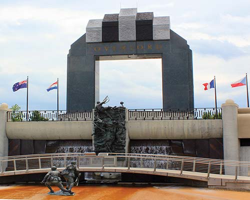
National D-Day Memorial
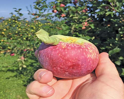
an apple at one of the orchards near Bedford
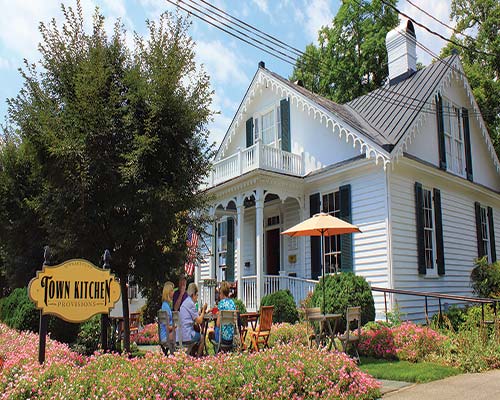
eclectic Town Kitchen & Provisions in Bedford
Bedford has received several iterations of the “Main Street U.S.A.” designation, and Centerfest (540/586-2148, www.centertownbedford.com, typically the fourth Sat. in Sept., free) is one of the reasons why. This one-day gathering has been occurring every year for more than three decades and regularly draws crowds in excess of 10,000 to Bedford’s Main Street. Among the things you’ll find at Centerfest are arts and crafts booths, pony rides and similar activities for kids, and, of course, fair food.
The Bedford Country Store (115 N. Bridge St., 540/586-2222) sells a little bit of everything: antiques; garage-sale-worthy junk; handcrafted pieces of art and crafts; and a selection of local meat, produce, and dairy. It also has a deli and ice cream counter. It’s an interesting little spot, though it’s less country store than the name leads you to believe.
In the nearby town of Moneta, the Diamond Hill General Store (1017 Diamond Hill Rd., Moneta, 540/297-9309, www.diamondhillgeneralstore.info, 7am-8pm Mon.-Thurs., 7am-9pm Fri., 9am-9pm Sat., 9am-8pm Sun.) sells gifts, wine, gas, bait and fishing tackle, and groceries, and has a deli, ice cream counter, and garden center. It’s the oldest operating business around Smith Mountain Lake, and the original part of the store dates back to 1857.
Peddler Antiques (1165 Burnbridge Rd., Forest, 434/525-6030, 11am-4pm Mon., 11am-5pm Tues.-Fri., 10am-5pm Sat., 1pm-5pm Sun.) is near Thomas Jefferson’s Poplar Forest and is one of the oldest antiques shops in the region. Located in a brick schoolhouse, it has a nice assortment of furniture, jewelry, vintage accessories, fine china, and books. If you’re in the area, it’s worth the stop.
The rolling hills around the lower elevations here are ideal for mountain golf. At Ivy Hill Golf Club (1148 Ivy Hill Dr., Forest, 434/525-2680, www.ivyhillgc.com, 18 holes, par 72, 4,811-7,107 yards, $23-45, rates vary by season) in Forest, 14 miles east from Bedford on US-221, the course is both fun and challenging. Water in play on four holes offers an additional challenge as you account for the slight grade and elevation changes.
Also in Forest is London Downs Golf Club (1400 New London Rd., Forest, 434/525-4653, www.londondowns.com, 18 holes, par 72, 4,965-6,938 yards, $20-39, rates vary by season), another nice club where you’ll find wide, forgiving fairways that often favor long hitters.
The 20,600-acre, 40-mile-long Smith Mountain Lake has more than 500 miles of shoreline and more opportunities to fish, camp, swim, canoe, and kayak than you have time for in one visit. A great way to get a feel for the second-largest freshwater lake in Virginia is by visiting Smith Mountain Lake State Park (1235 State Park Rd., Huddleston, 540/297-6066, www.dcr.virginia.gov/state-parks, 8:15am-dusk daily, parking $5-10). Cabins as well as tent and RV camping are available (800/933-7275, www.reserveamerica.com, $20-125). Two public beaches on the lake are open from Memorial Day through Labor Day and are guarded during operating hours.
If you’re interested in fishing, many charters are available, and the Smith Mountain Lake website (www.visitsmithmountainlake.com) has a comprehensive list and detailed information on acquiring a Virginia fishing license (if your guide doesn’t take care of that for you). One of the more intriguing guides is Captain Bert with Captain Bert’s Fishing Charters and Waterfront Lodging (540/721-5788, www.captainbert.com, $325 two people half day, $500 two people full day, extra $25 pp for additional anglers). Captain Bert is none other than Daniel Berthiaume, former NHL goalie, and today he searches Smith Mountain Lake for another record fish. The lake already holds the record for a lake-caught striped bass at 49.4 pounds.
Boat rentals are available at several places. One of the easiest to get to is Bridgewater Marina’s State Park Rentals (1235 State Park Rd., Huddleston, 540/297-3642, www.bwmarina.com, 10am-6pm daily Memorial Day-Labor Day) at the park marina. You can rent a pontoon ($240/day), a ski boat ($350/day), or a Wave Runner ($295/day), as well as water skis, tubes, wakeboards, and kneeboards.
S Town Kitchen & Provisions (309 N. Bridge St., 540/586-0321, www.townkitchenprovisions.com, 11am-7pm Tues.-Fri., 11am-3pm Sat., noon-3pm Sun., $6-11) serves a small but creative menu of sandwiches (including an excellent bahn mi and the Woody, their spin on a Reuben), salads, and frittatas; has an excellent little bottle shop with carefully curated wine and beer sections; and carries a nice assortment of local cheeses and other foodstuffs. Everything from the rotating selection of daily soups to the sides and mountainous sandwiches is top notch. The restaurant is on the first floor of a historic home, so interior seating is limited to a series of tables for two in the wide hallway and in the back, but there’s seating outside that’s perfect for groups. I recommend eating outside, weather permitting.
Folks Country Restaurant (1619 Forest Rd., 540/589-9041, 6am-2pm Mon.-Sat., 7am-2pm Sun., $5) serves home-style grub—biscuits, hotcakes, burgers, and sandwiches—every day of the week. You can get breakfast all day, and, if you’re daring or just interested in trying some authentic country food, order the pork brains and eggs. Pork brains are something like soft tofu: they scramble up nicely and take on the flavors of whatever is around. The hardest thing about eating them is wrapping your head around what’s on your fork, but they are tasty.
Happycoffee (104 N. Bridge St., 540/707-9256, www.behappycoffee.com, 6am-10pm Mon.-Thurs., 6am-11pm Fri., 8am-11pm Sat., 8am-9pm Sun., $2-13) is a cheerful little place in downtown serving caffeine-loaded drinks and a small menu of pastries, bagels, quesadillas, and breakfast items. Coffee is sourced from select growers and roasted in Lynchburg, just a few miles away.
Get your barbecue and beer fix at Beale’s Beer (510 Grove St., 540/583-5113, www.bealesbeer.com, 4pm-9pm Wed.-Thurs., 4pm-10pm Fri., noon-10pm Sat., noon-7pm Sun., $4-22). The barbecue spans styles and you can get chopped pork, sliced brisket, smoked turkey, Texas-style hot links, and some great variations on barbecued sandwiches. Their flagship beer, a Helles lager, is a good match with anything on the menu. Their other brews include several lagers, a selection of IPAs, and even some fruit-forward beers.
Bedford Social Club (124 S. Bridge St., 540/586-9454, www.bedfordsocialclub.com, 5pm-late Wed.-Sat., $19-27) has a little bit of everything and a scene that’s hot with locals. The barbecued pork chops, grilled New York strip, and seared scallops get great reviews. On a weekend night, it’s a great spot to be seen.
While you’re in Bedford, you might as well go for the whole country experience. Reba Farm Inn (1099 Reba Farm Ln., 540/583-1906, www.rebafarminn.com, $105-115) is located on an amazing piece of country property that you can explore on foot or horseback. Trail rides are available through Saddle Soar Equitainment, owned by the inn’s proprietors. Amenities include a pool, outdoor whirlpool tub, game room, and a range of trail rides.
S Vanquility Acres Inn (105 Angus Ter., 540/587-9113 or 540/761-3652, www.vanquilityacresinn.com, $75-225) has both B&B-style rooms and cabins on their 10-acre farm. The rooms are large, and the cabins perfect for groups. Every morning, they serve a full country breakfast on the back deck or in the dining room. Amenities include an outdoor fireplace, hot tub, massive deck, and a covered patio. Unlike many B&Bs of the “country” ilk, this one is very tastefully decorated, with enough flourishes to get the “country” across without drowning you in it.
The Bedford Welcome Center (816 Burks Hill Rd., 540/587-5681 or 877/447-3257, www.visitbedford.com, 9am-5pm daily) contains the typical racks of brochures advertising area attractions, restaurants, and accommodations, but this welcome center also contains a number of display cases representing the local cultural attractions. An architectural model of the National D-Day Memorial and two cases of memorabilia from WWII give you a taste of what the memorial has to offer, and from the back deck, you can see the victory arch and memorial on top of the hill; artifacts on loan from the Bedford Museum tease the stories they have to tell there; and other cases are filled with local art, crafts, and artisanal items, many of which are available in the small gift shop or area stores. The most helpful thing here is the staff, most of whom are lifelong residents with a deep and abiding love for this small town and what it has to offer. You can also purchase tickets to the D-Day Memorial here. The welcome center’s website provides plenty of information on the town of Bedford, the National D-Day Memorial, the Peaks of Otter, and the countryside around this part of the Parkway.
Centra Bedford Memorial Hospital (1613 Oakwood St., 540/586-2441, www.centrahealth.com) offers 24-hour emergency services at their 50-bed facility in town.
If you need police services, look to the Bedford Police Department (215 E. Main St., 540/587-6011, www.bedfordva.gov) or Bedford County Sheriff (1345 Falling Creek Rd., 540/586-4800, www.bedfordcountysheriff.org).
Near Purgatory Overlook, a carriage road once wound through the mountains and valleys on a track so rough, passengers felt they’d been sentenced to Purgatory. Fortunately, the Blue Ridge Parkway is more like a bit of heaven than that. Less than 0.5 mile down the road, at the Sharp Top Parking Area (MP 92.5), you’ll have a fantastic view of Sharp Top. This is a great spot to photograph the iconic mountain, so have your camera ready.
Looking west from the Blue Ridge Parkway, you’ll notice that the valley is wide, flat-bottomed, and nearly arrow-straight. Today, I-81 travels this route from Pennsylvania down to Tennessee, but for hundreds of years it’s been a highway of sorts. Called the Great Valley, this essentially unbroken path runs from New York to Alabama, bordered by the Blue Ridge on the east and the Allegheny Mountains on the west. There’s evidence of it being used as a war path, a trading route, and a hunting path for Native Americans. German and Scots-Irish pioneers from Pennsylvania followed this route as they migrated into the wilds of the new continent and settled here and there along the way. Plus, it’s a pretty great valley to look at.
The Norfolk and Western Railroad played a very significant role in the development of the city of Roanoke, just a few miles from here. In 1852, the first rails were laid on a track running from Lynchburg (near Bedford) to Bristol, Tennessee. The view here is among the best on the Parkway. Green pastures on rolling hills dotted with farmhouses, the easy slope of the Blue Ridge Mountains, and that incredible expanse of sky overhead make this a place to linger.
Roanoke, the largest city in southwestern Virginia, sits in the Roanoke River Valley beneath the peaks of the Blue Ridge, and adjacent to the Great Valley. The metro area—which includes Roanoke and the nearby cities of Salem and Vinton—has a population of more than 300,000. Aided by accolades like being named one of the Top 50 Cities for Expansion and Relocation, a Five Star Community (for quality of life), and one of the 100 Best Places for Business Development, and helped by the city’s proximity to the major corridor that is I-81, Roanoke is on a track for continual growth.
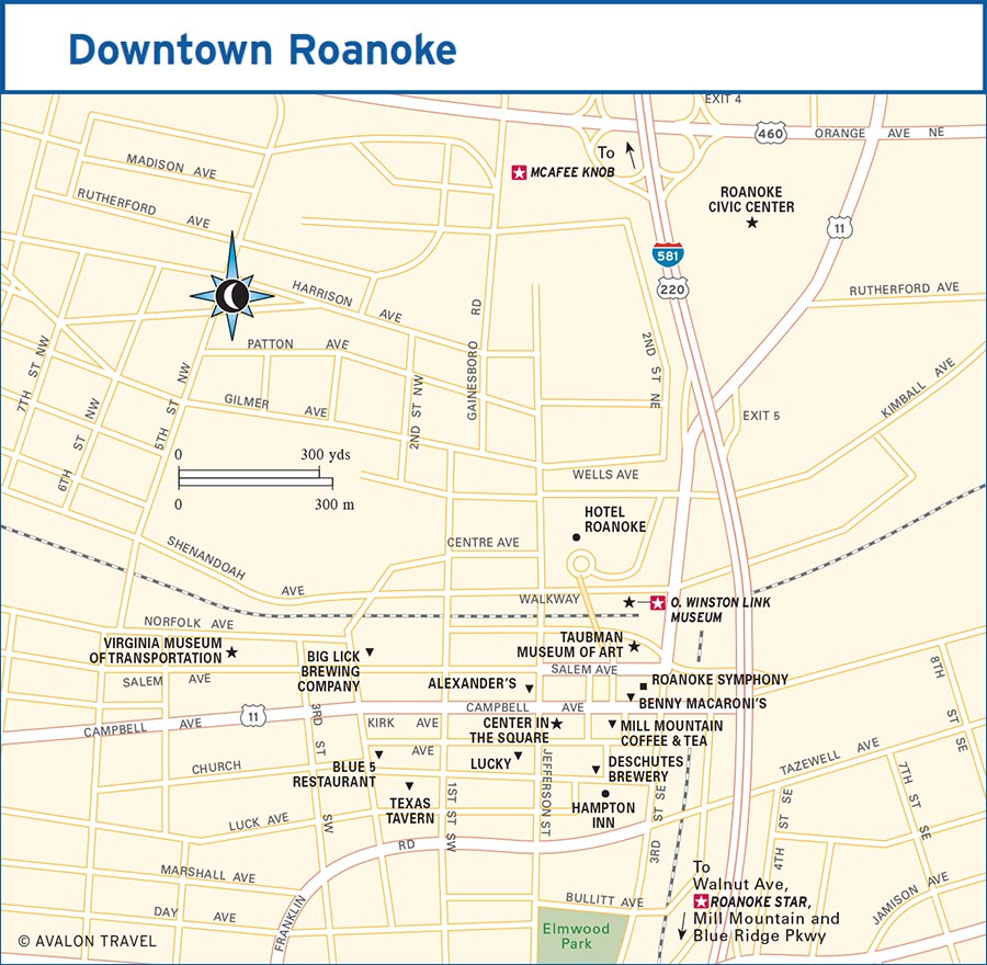
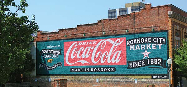
Roanoke is a charming blend of old and new.
As the cultural, medical, and transportation center for the region, Roanoke can rightfully be called the “Capital of the Blue Ridge.” Vibrant neighborhoods throughout the city each have their own flair, and you’ll find that residents of these neighborhoods, in particular the hip Grandin Village, are especially proud of where they live. This lends the whole city a pride in the place, a pride that is well deserved. Downtown, the City Market Building, a historic market dating back to the city’s earliest days, and Market Square Plaza, with its long row of permanent farmers market stalls, provide a focal point for visitors and residents alike, as a number of the top restaurants and shops are within shouting distance of one another.
Roanoke is known by two other names, Magic City and The Star City. Magic City came about due to its unprecedented growth following the arrival of the N&W. The Star City was earned in 1949, when downtown merchants installed a giant star on nearby Mill Mountain as a Christmas decoration.
At Milepost 106, US-460 will take you to Roanoke (nine miles southwest). From Milepost 112.2, you’re only five miles from Roanoke. From Milepost 121.4, the Parkway meets US-220, putting Roanoke only five miles north. Salem, a suburb of Roanoke, is only 12 miles west and accessible easily from any of these points as well.
With I-81 running right by the city, Roanoke is easy to reach. Two major North Carolina cities are within striking distance of Roanoke. From Raleigh and the RDU International Airport, it’s a trip of 159 miles to the north to reach Roanoke. Charlotte and Charlotte Douglas International Airport lie only 200 miles south along I-77.
The largest airport in southwestern Virginia is the Roanoke-Blacksburg Regional Airport (ROA, 5202 Aviation Dr. NW, Roanoke, 540/362-1999, www.flyroa.com). Airlines serving this airport include Allegiant Air, American Airlines, Delta Airlines, and United Airlines.
It’s just a short cab ride to downtown; Yellow Cab (540/345-7711, www.yellowcabroanoke.com) is one option. There are several car rental agencies with locations in the airport, including Avis (540/366-2436, www.avis.com), Budget (540/265-7328, www.budget.com), Enterprise (540/563-8055, www.enterprise.com), and Hertz (540/366-3421 or 800/654-3131, www.hertz.com).
The Amtrak Station (101 Norfolk Ave., 800/872-7245, www.amtrak.com), extending Amtrak passenger service from Roanoke to Washington DC and beyond, opened in fall 2017. The station is served by the Crescent and Northeast Regional lines.
If you take a bus to Roanoke, the Greyhound Bus terminal (26 Salem Ave. SW, 540/343-5436, www.greyhound.com, 5:15am-6:15am and 9am-5pm Mon.-Fri., 9am-10am and 1pm-5pm Sat.-Sun.) is convenient to downtown, just a couple of blocks away from the City Market Building and Market Square.
Valley Metro (1108 Campbell Ave. SE, 540/982-2222 or 800/388-7005, www.valleymetro.com, $1.50 one-way, weekly unlimited pass $14) provides bus service across Roanoke and to nearby Salem. The Star Line, a free trolley, will take you on a downtown route that’s convenient to many shops and restaurants.
In 1882, 25 area “Hucksters” (an antiquated term for vendors) received licenses to open for business in stalls, booths, and in the open air in the Historic Roanoke City Market (market 24 hours daily; vendors 8am-5pm Mon.-Sat., 10am-4pm Sun.) in the heart of downtown Roanoke. Today, it’s the oldest continuously operating open-air market in Virginia and one of the oldest such markets in the nation. And judging by weekend crowds and the bustling street and stalls any time, any day of the week, it’s only grown in popularity. As Roanoke has evolved into a friendly, surprisingly cosmopolitan city, Market Square has served as a sort of anchor to the downtown renaissance.
Permanent awnings shade vendors and sidewalk shoppers. You can find the usual locally grown fruits and vegetables here, as well as eggs, flowers, cheese and other dairy products, and live plants. The market’s oldest continuous vendor—Martin’s Plant Farm—has been selling here since 1904. The market stalls only close two days a year: Christmas and New Year’s. During growing season, many farmers are planting, picking, and preparing for the market on Sunday-Monday, so selection may be limited. On Saturdays in April-September you’ll find live music and a few activities for kids in the market 11am-2:30pm.
Across Campbell Avenue from Market Square is the City Market Building (32 Market Sq. SE, 540/986-5992, www.citymarketbuilding.com, 10am-7pm Mon.-Tues., 10am-9pm Wed.-Sat., 11am-3pm Sun.). It’s been quite some time since the City Market Building has been the site of livestock auctions or the home of butcher shops, fishmongers, and wholesale produce, but the spirit of the place survives. The City Market Building now houses a half-dozen restaurants, an interior food court, public restrooms, and ample outdoor seating.
Across the street, on the corner of Salem Avenue and Market Street, is an interesting cast-iron fountain. Since 1898, the Dog Mouth Fountain (so named because of the dog head on the fountain) has offered cool, clean drinking water to human and beast alike. As with all good things, there’s a legend that goes with it. It is said that if you drink from this fountain, you’ll always feel the need to return.
Center in the Square (1 Market Sq. SE, 540/342-5700, www.centerinthesquare.org, 10am-5pm Mon.-Sat., 1pm-5pm Sun., individual museum hours vary) opened in 1982 as a hub for Roanoke’s cultural offerings, a place where various arts groups and museums could have permanent homes in a central location. After a $7.5-million renovation of the building once home to the W. E. McGuire’s Farmers’ Supply Co., five arts and science organizations moved in. On opening weekend, 40,000 visitors flooded through the doors, and it’s been a success ever since. Purchase a Center Pass ($21 adults, $16 children ages 4-17, free under 4) or a Center Pass with Roanoke Pinball Museum ($25 adults, $20 youth ages 9-17, $15 children 4-8, free under 4) ticket if you plan on visiting everything here.
In the lobby, there’s a trio of aquariums, one showing Roanoke River aquatic life, one with area turtles, and another that’s a living coral reef. The Mill Mountain Theatre (540/342-5740, www.millmountain.org, performance times and prices vary), which puts on plays, concerts, and dance recitals throughout the year, is also in the lobby. You can find out a little more about what each museum offers and purchase tickets at the box office before taking the stairs or elevator to your museum of choice. Before you leave, be sure to head up to the sixth floor and go out onto the roof; the views are quite nice.
On the second floor, the Harrison Museum of African American Culture (540/857-4395, www.harrisonmuseum.com, 10am-5pm Tues.-Sat., 1pm-5pm Sun., $7 adults, $4.75 ages 5-17, free ages 4 and under) celebrates the art, history, and culture of African Americans in the Roanoke River Valley. The Don & Barbara Smith Children’s Museum, Kids Square (540/342-5724, www.kidssquare.org, 10am-5pm Tues.-Sat., 1pm-5pm Sun., $8) has 15,000 square feet devoted to places for kids to socialize, learn, and play. Play areas include a theater with costumes, lights, and props; a “sandbox” filled with rubber pellets; treehouses, rope bridges, and climbing walls; a grocery store, vet’s office, and bank; and a sensory cove.
Take a fun break and check out the Roanoke Pinball Museum (11am-5pm Tues.-Thurs., 11am-8pm Fri., 10am-8pm Sat., 1pm-6pm Sun., $12.40 ages 9 and up, $6.78 ages 6-8, free ages 5 and under with adult ticket). Here, more than 50 pinball machines produced from 1932 to 2016 are waiting for you to step up and start playing.
The fourth and fifth floors are taken up by the Science Museum of Western Virginia (540/342-5710, www.smwv.org, 10am-5pm Mon.-Sat., 1pm-5pm Sun., $15 adults, $13.50 seniors, military, students, and children ages 6-17, $7.50 ages 2-5, free under 2). This is a great museum for kids, with tons of interactive exhibits such as a living river touch tank and a butterfly garden.
The O. Winston Link Museum (101 Shenandoah Ave., 540/982-5465, www.roanokehistory.org, 10am-5pm Tues.-Sat., $6 adults, $5.50 seniors, military, and students, $5 ages 3-12, free ages 2 and under) displays the work of Brooklyn photographer Winston Link, who captured the end of the steam locomotive era. Depicting exclusively the N&W Railroad (the last major rail line to operate exclusively on steam engines) in Virginia, West Virginia, Maryland, and North Carolina in the 1950s, the dramatic photographs, almost all of which are black and white, bring the beauty and power of steam engines to life. Contrast the photographs of steam trains roaring past drive-in theaters with ones where they make their way around long, gentle curves in the mountains. In the latter photos, the landscape is as much the focus as the trains. It’s a small museum, but it contains hundreds of photos as well as a few films.
At the same location, the History Museum of Western Virginia presents a full picture of Roanoke’s history under one roof. Permanent exhibits tell the story of the Roanoke River Valley dating back thousands of years up to the present. Special exhibits include pieces of Roanoke memorabilia, Appalachian musical instruments, and other tidbits from the valley’s past.
From the O. Winston Link Museum, a pedestrian bridge leads across the tracks to the Market Square and the Center in the Square areas. On the opposite side, a path leads to the Virginia Museum of Transportation (303 Norfolk Ave. SW, 540/342-5670, www.vmt.org, 10am-5pm Mon.-Sat., 1pm-5pm Sun., $10 adults, $8 seniors and children ages 3-18), which serves as a monument to the many methods of simply getting from one place to another. Inside the restored freight station three blocks west of Market Square are an O-scale model railroad, a gift shop, and a gorgeous collection of antique autos, including a 1934 Ford V-8 Model A Sedan and a 1950 Studebaker Landcruiser, the latter more spaceship than car. Dozens of train engines and cars, a few of which are open to visitors, fill the lot out back. Steam engines, diesel locomotives, post office cars, and a classic caboose cover virtually the entire history of rail travel.
The Taubman Museum of Art (110 Salem Ave. SE, 540/342-5760, www.taubmanmuseum.org, 10am-5pm Wed.-Sat., noon-5pm Sun., free, guided tours $8) is in a beautiful contemporary building that is sometimes the subject of ire from community members who do not like the design. Permanent exhibits include fine examples of folk art, as well as galleries of works by contemporary artists and American art from 1820 through the recent past. The museum is open until 9pm the third Thursday and first Friday of the month.
Blue 5 (312 2nd St. SW, 540/904-5338, www.blue5restaurant.com, 11:30am-11pm Mon.-Tues., 11:30am-midnight Wed.-Thurs., 11:30am-1am Fri., 4pm-1am Sat.) has outstanding beer choices, hosts a fun lineup of live music, and serves an excellent menu ($8-34) of full meals and shareable appetizers. It’s a one-stop spot with a broad selection of beers from multiple breweries.
At Stellina (104 Kirk Ave. SW, 540/400-7315, 5pm-late Mon.-Sat.), a speakeasy secreted away inside the Italian eatery Fortunato, expect to find some of the best cocktails in the city. The drinks here are on par with those at the fine-dining restaurant Lucky, which is no coincidence since they’re sister establishments.
Corned Beef & Co. (107 S. Jefferson St., 540/342-5534, www.cornedbeefandco.com, 11am-midnight Mon.-Tues., 11am-2am Wed.-Sat., $8-25) is a fun spot to hit at night that also serves lunch and dinner. It’s a lively place thanks to karaoke, DJs, a billiards room with nine tables, shuffleboard, and even the occasional standup comic.
Roanoke is catching on to the craft beer scene at an incredible pace. New breweries and craft-beer-centered bars seem to open monthly.
Parkway Brewing Company (739 Kessler Mill Rd., Salem, 540/404-9810, www.parkwaybrewing.com, 2pm-8pm Sun.-Mon., noon-8:30pm Wed.-Sat.) is my favorite. Their Raven’s Roost Baltic Porter is on its way to becoming my favorite porter. Parkway always has something going on, like live music, food trucks, Lego building contests, and tarot readings. You may catch a belly dancer or a burlesque show (Parkway is generally kid-friendly, but leave Junior at home for this one), or get sucked into a one-night cornhole tournament.
In 2017, Portland, Oregon, powerhouse Deschutes Brewery (315 Market St. SE, 540/259-5204, www.deschutesbrewery.com, 1pm-9pm daily) opened a taproom in Roanoke, with plans for a full-scale brewery in the area by 2021. With some two-dozen taps of Deschutes’ killer beers—west coast IPAs, porters, wheats, excellent seasonal brews, and more—expect to find some new favorite pints to have in the Star City.
Big Lick Brewing Company (135 Salem Ave., www.biglickbrewingco.com, 5pm-9pm Thurs., 4pm-9pm Fri., 1pm-9pm Sat.) takes its name from the moniker Roanoke held long before it was a proper town. Their beer spans the spectrum from the usual IPAs (from very hoppy to reasonably hoppy) to stouts and porters, red ales, and wheat ales.
Fans of opera, ballet, and symphony productions will be happy to know that Roanoke has all three. Opera Roanoke (540/982-2742, www.operaroanoke.org) puts on nearly a dozen performances a year, from full operas to Opera 101 lectures to short concerts, at venues across the region. Roanoke City Ballet (540/345-6099, www.roanokeballet.org) puts on performances at a number of venues throughout Roanoke. You can hear the Roanoke Symphony (128 E. Campbell Ave., 540/343-9127, www.rso.com) at a number of performances during the year at venues large and small. Past performances include works by major classical composers and themed holiday performances, as well as interesting arrangements of contemporary musicians like Billy Joel and Procol Harum. If you want to attend a concert by major touring acts, the Berglund Center (710 Williamson Rd., 540/853-2241, www.theberglundcenter.com) hosts dozens of concerts every year.
An outstanding example of the possibilities of regional theater, the Mill Mountain Theatre (540/342-5740, www.millmountain.org) shows original works, classics, and children’s plays at Center in the Square.
One definite stop in Roanoke, whether you’re a shopper or not, is Black Dog Salvage (902 13th St. SW, 540/343-6200, www.blackdogsalvage.com, 9am-5pm Mon.-Sat., noon-5pm Sun.). This shop is a wonderland of reclaimed and salvaged architectural pieces, antiques, and decorative items. There are some crazy treasures to be found here, like a bin of mannequin parts, numbered nails used by railroad workers, old signs, and a dynamite plunger more at home in a cartoon than in real life. There are also all sorts of things in their expansive yard, and if you’re looking for something specific, ask; they may just be able to find it for you. They have a second salvage warehouse and yard (629 Ashlawn St. SW, 9am-5pm Thurs.-Sat. or by appointment) where you’ll find bins of bowling pins, slabs of marble, church pews, and massive stained-glass windows.
Eli’s Provisions (209 Market St. SE, 540/982-2164, www.elisroanoke.com, 10am-8pm Mon.-Thurs., 10am-9pm Fri., 9am-9pm Sat., 11am-6pm Sun.) specializes in Virginia-made foodstuffs. If you want beer, wine, cheese, ham, preserves, peanuts, or anything else edible that’s made, grown, fermented, or aged in Virginia, they’ve got it.
Since you’re traveling along the Blue Ridge Parkway, it’s safe to assume you’ll be doing a hike or two. If you find that you need something—new socks, a water bottle, a daypack, a quick-dry shirt—Walkabout Outfitter (301 Market St. SE, 540/777-2727, www.walkaboutoutfitter.com, 10am-5:30pm Mon.-Sat., 11am-4pm Sun.) carries a small selection of camping and hiking goods as well as clothing and accessories you can use on the trail.
Roanoke Natural Foods Co-Op (1 Market Sq., 540/904-2733, www.roanokenaturalfoods.com, 10am-7pm Sun.-Mon., 9am-7pm Tues.-Sat.) is the largest cooperatively owned natural foods grocery in Virginia. The store carries a well-curated selection of organic, natural, and good-for-you items in their location on Market Square. At their second location in Grandin Village (1319 Grandin Rd., 540/343-5652, 8am-9pm daily), they have a full grocery store stocked with the highest-quality products they can find.
Also in Grandin Village is Too Many Books (1504 Grandin Rd. SW, 540/985-6469, www.toomanybooksroanoke.com, 10am-5:30pm Mon.-Sat., 1pm-5pm Sun.), a used, rare, and out-of-print bookshop. For book nerds and the other folks who love the smell of those old pages, this is an awesome bookstore where you can plunder for hours. They have two stories of books, from the strange to the top sellers.
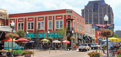
Roanoke’s Center in the Square

farmers market bounty
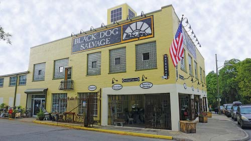
Black Dog Salvage, a great place to pick up a one-of-a-kind souvenir
Chocolatepaper (308 Market St. SE, Suite 3, 540/342-6061, www.chocolatepaperroanoke.com, 10am-6pm Mon.-Fri., 9am-6pm Sat., noon-5pm Sun.) has a selection of gifts, Virginia goodies, chocolates and candies, and books. It’s a fun shop, and you’ll find some great gifts inside, but if you’re a chocolate lover, schedule a tasting to sample a half-dozen chocolates and wines in a fun afternoon.
The Market Gallery (23 Salem Ave., 540/342-1177, www.marketgalleryroanoke.com, 10am-5:30pm Tues.-Thurs. and Sat., 10am-9pm Fri.) is an artist-member cooperative gallery. Close to 30 regional artists exhibit their work here. Paintings, drawings, prints, photographs, sculpture, and other diverse art forms are represented, and just about everything is for sale, so when you see something you like, take it home with you.
From urban greenways to the Appalachian Trail to water sports to caves, there’s an awful lot to do outdoors in and around Roanoke. For trip ideas, outfitter details, and a crazy comprehensive catalog of things to do and see, check out the website for Roanoke Outside (www.roanokeoutside.com).
The Appalachian Trail extends nearly 2,200 miles on its way from Georgia to Maine. In Virginia, it passes near Roanoke and Salem. Just a few miles from a trailhead in the mountains above Salem, you’ll find one of the most iconic overlook spots on the trail: McAfee Knob. Even if you don’t know the name, you’ve seen the pictures: a hiker, maybe two, standing on a rock ledge seemingly suspended in midair, the valley below and mountains behind.
Distance: 7 miles out and back
Duration: 3.5-4 hours
Elevation gain: 1,750 feet
Difficulty: moderate
Trailhead: 6 miles from I-81 exit 141 on VA-311 North
Directions: Finding the trailhead can be tricky. From Roanoke, get on I-81 South and take exit 141 for Salem. Turn left onto VA-419/Electric Road and go 0.4 mile to the next traffic light and turn right onto VA-311 North. Take VA-311 5.6 miles to the top of the mountain. The trailhead is on the left. Be careful as you park and pull out; it’s nearly a blind curve.
This is a great hike for novices, and the views at the end are incredible. The distance is the toughest thing as the trail is easy and the ascent pretty gradual. In all, it’s a good way to get a feel for hiking on a well-made, well-maintained trail. You don’t need high-end hiking boots; boots are best, but comfy shoes with a beefy sole will suffice.
The trail to McAfee Knob begins across VA-311. An informational kiosk awaits around a quarter mile into the hike; here you can get a little more info on the trail ahead. Moving on, you’ll cross a series of wooden walkways before you reach the John Springs Shelter about 0.8 mile in. Take a break, drink some water, and continue on. There are another five walkways between the John Springs Shelter and the Catawba Mountain Shelter, which you’ll come to in 1.4 miles. Just before you reach the shelter, you’ll pass a spring where you can refill water bottles (provided that you have something to use to treat the water).
The Appalachian Trail crosses a fire road, then goes through a right of way for a high-tension power line. About 0.3 mile beyond the power line is one of the first good overlooks, giving you a view of the Catawba Valley. A half mile on, you’ll come to the short spur trail leading to McAfee Knob.
The view from McAfee Knob is about 270 degrees. To the west, you’re looking at Catawba Valley and North Mountain; this is a spectacular view as the Allegheny Mountains ripple away into the distance. To the east is the Roanoke Valley. To the north you can see Tinker Cliffs, and to the northeast, you can see Sharp Top poking into the sky. To return, retrace your steps.
Roanoke has an outstanding set of urban trails and greenways spread throughout the city. There are greenway trails in Salem and in Vinton, and plans to eventually connect the three towns via a contiguous multiuse trail. The greenway system (several parts of which are former railroad beds) takes you on pleasant paths between neighborhoods, from downtown to the Star on Mill Mountain, along the Roanoke River, and into parts of the city you don’t see or pay attention to when zipping past in a car. Maps are available in the visitors center (101 Shenandoah Ave. NE, 9am-5pm daily) and at www.roanokevalley.org. UnderDog Bikes (1113 Piedmont St. SE, Roanoke, 540/204-4276, www.underdogbikesva.com, 10am-6pm Mon. and Wed.-Fri., 10am-5pm Sat., 10am-4pm Sun.) is right on the greenway, making picking up or dropping off a bike easy as can be. They have rental bikes ($12/hour or $30/24 hours), tandem bikes ($20/hour or $50/24 hours), kids’ trailers ($9/hour or $20/24 hours), and trail-a-bikes ($9/hour or $20/24 hours).
What the greenway is to terrestrial travel, the blueway is to aquatic travel. The Roanoke River Blueway (www.roanokeriverblueway.org) is a 45-mile water trail that runs from East Montgomery County Park, through Roanoke, Salem, and Vinton, and on to Smith Mountain Lake. The Roanoke River is a great spot for sports like waterskiing and wakeboarding, as well as calmer endeavors like fishing, tubing, and wading. You can canoe, kayak, stand-up paddleboard, and generally splash around all along the river. Unfortunately, canoes, kayaks, and stand-up paddleboards are difficult to come by in Roanoke, with the nearest outfitter a 20-minute drive away.
If you can’t find enough to do outside exploring the mountains, how about going inside? There are caves all up and down the Blue Ridge Mountains, and near Roanoke, you have a couple of easy options. At Dixie Caverns (5753 W. Main St., Salem, 540/380-2085, www.dixiecaverns.com, 9:30am-5pm Mon.-Fri., 9:30am-6pm Sat.-Sun., $14 adults, $6 ages 5-12, free under 5), take a 45-minute guided tour of this cave system, discovered by a dog (and then two farm boys) in 1920. They also have a rock shop (9am-6pm daily), where you can buy all sorts of minerals, gems, and semiprecious stones and stone art pieces, as well as a campground ($12/person for tents, $34/RV hookups).
Guided tours of a cave that’s well lit, packed with handholds, and filled with visitors is one thing; donning some coveralls, a helmet, and a headlamp is another type of cave exploration entirely. Wilderness Adventure at Eagle Landing (11176 Peaceful Valley Rd., New Castle, 540/864-6792, www.wilderness-adventure.com) is a teen adventure camp, but they periodically run caving trips for small groups and families. Call for a schedule.
Salem is home to the Salem Red Sox (540/389-3333, www.salemsox.com, tickets $8-14), a Class A farm team for the Boston Red Sox. They play home games at LewisGale Field (1004 Texas St., Salem) and tickets are cheap. With full concessions—that means hot dogs, those wonderfully salty soft pretzels, beer, and wine—and an enthusiastic home crowd, taking in a game here is just about the perfect way to spend a summer evening.
Part recreation, part meal on the run, Discover Roanoke Food Tours (540/309-1781, www.roanokefoodtours.com, from $52 adults, from $34 children ages 8-12, from $20 ages 7 and under) is a great way to get a look at the city, learn a little of its more interesting stories, and find some great places to eat. They hit 5-6 restaurants for a bite and often a sip of something good. Tours include the Downtown Food and Cultural Tour, the Sunday Brunch Food Tour, and the Roanoke Craft Beer Tour. Your guides know their city and know a thing or two about food, so don’t be shy about asking what you’re seeing, smelling, or tasting.
Mill Mountain Coffee & Tea (117 Campbell Ave. SE, 540/342-9404, www.millmountaincoffee.com, 6:30am-11pm Mon.-Thurs., 6:30am-midnight Fri., 7am-midnight Sat., 8am-9pm Sun., $4-8) is your typical coffee shop serving a variety of drinks and baked goods alongside a small selection of sandwiches and salads. This place is notable for its good coffee and its status as a late-night hangout. It’s the place to get your late-night cup of coffee or just unwind for a few minutes before heading home.
Scratch Biscuit Company (1820 Memorial Ave., 540/855-0882, 6am-1pm Mon.-Fri., 7am-2am Sat., $2-8) makes biscuits from scratch, and they’re crazy good. The menu is simple: $2-, $3-, and $4-biscuits, each with extra toppings like butter, mustard, country ham, smoked tofu, brisket, or a fried green tomato. They have a few other things like grits, pancakes, and cinnamon rolls, but always get a biscuit.
Texas Tavern (114 W. Church Ave., 540/342-4825, www.texastavern-inc.com, 24 hours daily, $4), also known as “Roanoke’s Millionaires Club,” was established in 1930 and has been serving up burgers, breakfast, and their famous chile (yup, that’s how they’ve spelled it for more than 20 million bowls) in the heart of downtown ever since. It’s an out-of-place building—squat white brick with one door and a window that looks in over the tiny cooktop—with only 10 seats, all at the counter. Specialties include that chile, as well as the Cheesy Western, a cheeseburger topped with a fried egg, relish, pickles, and onions.
S River and Rail Restaurant (2201 Crystal Springs Ave. SW, 540/400-6830, www.riverandrailrestaurant.com, 11am-2pm and 5pm-10pm Tues.-Sat., 11am-2pm Sun., $12-28) works closely with a network of farmers, ranchers, and fishers from the Roanoke Valley and the region to put the best of the area’s bounty on every plate. On the menu you’ll find exceptional seafood and pork dishes, a killer charcuterie board (including some of the best pickles anywhere), oysters on the half shell, and cornbread served with charred onion butter. The wine list has a lovely selection by the bottle and glass, but the cocktails are stupendous. Expect to find creative drinks that deliver on flavor and booze.
Benny Marconi’s (120 E. Campbell Ave., 540/400-8818, www.bennysva.com, 11am-midnight Sun.-Thurs., 11am-3am Fri.-Sat., $4-35) sells one thing: pizza. Okay, two things if you count the beer, and three things if you count the fact you can buy a slice or a pie. The pies are massive—28-inch beasts—so the slices are equally massive, equal to a pair of normal slices. Pies come in five toppings—cheese, pepperoni, sausage, and two monthly specials—and there’s a pizza-eating challenge if you’re into culinary competitions. Order a Benny’s Challenge Pizza ($40), eat the whole eight-pound monster in an hour or less, and you get $500 (and heartburn).
A meal at downtown’s cool and fun S Lucky (18 Kirk Ave. SW, 540/982-1249, www.eatatlucky.com, 5pm-9pm Mon.-Wed., 5pm-10pm Thurs.-Sat., bar open until late, $16-40) is one you’ll tell your friends about. Just about everything is sourced from Virginia or neighboring states. Go for the fried chicken, boiled peanuts, or pork shoulder. The cocktails are, hands down, the best in Roanoke. They’ve been known to smoke glasses and liquors, freeze freshly juiced fruits and vegetables into giant ice cubes, and put new twists on classic drinks. And if that’s not enough, they have prosecco on draft.
The menu at The Blue Apron Restaurant and Red Rooster Bar (210 E. Main St., Salem, 540/375-0055, www.blueapronredrooster.com, 11:30am-2:30pm and 5pm-close Tues.-Sat., $8-34) in Salem is built around small, shareable plates. Most everything can be sized up to become an individual entrée, but the only way to eat here is to order at least two small plates per person and share them. Chef Scott Switzer changes the menu seasonally, so there’s always something new to try. The steak frites are always a winner, and the herb-marinated pan-roasted chicken will make you rethink the idea that chicken is boring. Anything the kitchen does with fish, order it. The wine list and cocktail menu pair well with the food, rounding out the whole experience.
Ask locals for a date-night spot and they’ll invariably recommend Table 50 (309 Market St., 540/904-2350, www.table50roanoke.com, 5pm-10pm Mon.-Sat., 5pm-9pm Sun., bar 4pm-late nightly, $14-35) with enthusiasm. It’s a classic steakhouse kind of place: dark booths, a lush interior, and rich, meaty dishes on every plate. Any steak will satisfy, but so will the crab cakes, the duck duo, the lamb, or any of the pastas or sides.
The City Market Building (32 Market Sq. SE, 540/986-5992, www.citymarketbuilding.com) has around a half-dozen restaurants in it. Wall Street Tavern (540/342-9555, www.wallstreettavernva.com, 11am-10pm Sun.-Tues., 11am-11pm Wed.-Thurs., 11am-midnight Fri.-Sat., bar open later, $9-21) is a fun American restaurant and lunch counter with a nice-sized outdoor area and a menu that includes sandwiches, wraps, steak, pasta, and seafood dishes, plus a great drinks menu. Doner Kebab (540/904-2244, 11am-7pm Mon.-Thurs., 11am-9pm Fri.-Sat., $5-12) is a Mediterranean restaurant with an American touch at lunchtime prices. Think hummus and kebabs, but also burgers and a good Philly cheesesteak. Fork in the Market (540/400-0644, www.marketfork.com, 11am-10pm Mon.-Wed., 11am-11pm Thurs.-Sat., 11am-9pm Sun., $5-18) serves giant burgers, a crazy array of hot dogs and sausages, and pizzas topped with everything from the expected to mac and cheese. Fork in the Market also has two sister restaurants, Fork in the Alley and Fork in the City, and a food truck called Fork in the Road.
In Salem, Baymont Inn and Suites (179 Sheraton Dr., Salem, 540/795-2114, www.wyndhamhotels.com, $79-120) is convenient to I-81, only a 15-minute drive into downtown Roanoke, and budget friendly. There are several two-room suites and a pool. Given that you can get into a room for right at $100 with tax, it’s hard to pass up.
S Black Lantern Inn (1226 Franklin Rd. SW, 540/206-3441, www.blacklanterninn.com, $125-190) has three rooms, each one well appointed with a private bath with jetted thermal massage tub, complimentary bicycles and golf clubs, king-size bed with super-soft linens, and “pillows galore.” A variety of drinks and refreshments are available. Breakfast offerings accommodate anyone from gourmet to vegan. The inn is Virginia Green certified, and there’s a nice view of the Roanoke Star on Mill Mountain. For stays in October, there’s a two-night minimum.
Rooms at Brugh’s Inn of Salem (1226 Lynchburg Turnpike, Salem, 540/312-9138, www.brughsinn.com, $109-145) all have gas log fireplaces, queen-size beds, and free Wi-Fi. If you’re cost-conscious, you can skip the full breakfast for a pretty nice continental spread and save a few dollars (but spring for the breakfast; you’re on vacation). The rooms are nicely decorated and spacious enough to spread out in for a few days. There is a screened porch, which is a great spot to start the day with a cup of coffee or tea, and a great place to end it with a glass of wine.
The King George Inn (315 King George Ave., 575/675-4034, www.kinggeorgeinnbandb.com, $140-155) is walkable to downtown Roanoke, but that’s not the only reason to stay here. Four large, TV-free rooms with private baths, a gourmet breakfast every morning, and a gift basket with soaps made especially for the inn should help persuade you. It’s a beautiful home and it’s beautifully cared for. Decorations are tasteful and appropriate, the colors throughout are calming, and the overall decor is quite relaxing.
One of the most luxurious accommodations in town, S Hotel Roanoke (110 Shenandoah Ave., 540/985-5900, www.hotelroanoke.com, $149-374) is surprisingly affordable. Part hotel, part conference center, Hotel Roanoke has a beautiful lobby, thanks to the fine woodworking, a half-dozen Great Depression-era murals, and stunning chandeliers. The hotel, which originally contained fewer than three-dozen rooms, was built in 1882 by the Norfolk and Western Railroad to accommodate visitors and executives carried here by the new railroad. Two dining rooms—The Regency Room ($21-43) and The Pine Room ($8-15)—serve guests and visitors. You must try the peanut soup at The Regency Room (the recipe is about as old as the hotel), and don’t even think of skipping dessert.
Fences like this one are built using traditional designs and methods.
Hampton Inn & Suites Roanoke Downtown (27 Church Ave. SE, 540/400-6000, www.hamptoninn3.hilton.com, $159-179) is one of the newest hotels in Roanoke and is in an excellent location near Center in the Square and the market there, the Market House, downtown shopping and restaurants, and a city park.
Surprisingly, there is one campground nearby. Dixie Caverns (5753 W. Main St., Salem, 540/380-2085, www.dixiecaverns.com, $12/person for tents, $34/RV) in Salem has around 60 campsites for tents and RVs, plus there’s a cool cave to check out.
Your first stop for travel information should be this guide, but your second stop should be the Roanoke Valley Convention and Visitors Bureau (540/342-6025 or 800/635-5535, www.visitroanokeva.com); their website is chock-full of information and itineraries. The staff at the Roanoke Valley Visitor Information Center (101 Shenandoah Ave. NE, 540/342-6025 or 800/635-5535, 9am-5pm daily) will give you those locals-only tips that put you at the best restaurants, in the best shops, and out experiencing the city the way locals do.
Police can be contacted at the Roanoke City Police Department (348 Campbell Ave. SW, 540/853-2212, www.roanokeva.gov) and the Roanoke County Police Department (5925 Cove Rd., 540/562-3265, www.roanokecountyva.gov).
Carilion Roanoke Memorial Hospital (1906 Bellview Ave. SE, Roanoke, 540/981-7000, www.carilionclinic.org) is one of the biggest in Virginia.
At Blue Ridge Parkway Milepost 115, you’ll find Virginia’s Explore Park (MP 115, 540/427-1800, www.explorepark.org, dawn-dusk daily, free), an 1,100-acre park with 14 miles of walking and mountain biking trails, a picnic area, and plenty to explore, all open to the public at no charge. There’s a Blue Ridge Parkway Visitor Center (540/427-1800, 9am-6pm daily May-Oct.) here with a gift shop; two exhibit galleries detailing the history of the Parkway and the settling of the region around Roanoke, the highlight of which is a giant relief map/model of the Parkway; and a short film about the Parkway, which is worth the watch if you haven’t seen it at any of the other visitors centers.
You’ll also find two other buildings, the Arthur Taubman Center and Mountain Union Church, beside the visitors center, but these are generally only open for recreational programs and activities, or for private events. There are a few other reconstructed buildings throughout the park, each of which tells some part of the story of settling here. Among these structures are a grist mill, Kemp’s Ford School House, and a frontier fort.
If you’re interested in hiking, pick up a trail map at the visitors center and go for a stroll in the woods. The trails are generally in good condition, though some of the mountain biking trails can get sketchy in spots. Speaking of mountain biking, nine miles of the trails here are International Mountain Biking Association sanctioned.
Distance: 1.36-mile loop, with options to extend the hike
Duration: 1 hour
Elevation gain: 300 feet
Difficulty: easy to moderate
Trailhead: beside the Blue Ridge Parkway Visitor Center
This easy hike takes you around the central point of Explore Park and down to the banks of the Roanoke River. Departing from the trailhead behind the Parkway Visitor Center and Taubman Center, the path wanders a relatively flat track for a little more than a quarter mile before a side trail leads to Palmer’s Pond, a small forest pond that can be quite pretty. If you decide to head out to the pond, the trip is 0.8 mile out and back.
Continuing on, the trail reaches the River Walk and Roanoke River about a half mile in. Follow the banks and you’ll find a trio of spur trails leading to a small network that weaves its way through the historic area. If you choose to explore here, you can add a half mile (and a half hour) or more to the walk. Around a mile in, you’ll reach a second connector with the River Walk, and the Old Salem Turnpike Trail will turn right and lead you back up to the trailhead.
Standing between Roanoke and the Blue Ridge Parkway is a single peak: Mill Mountain. The Roanoke Star, the city’s most famous landmark, stands just below its summit.
In 1949, the Roanoke Merchants Association decided to announce the start of the Christmas season with a fantastically big decoration: a giant star to crown Mill Mountain and shine over downtown. They raised $28,000 for the construction and installation, and throughout the summer, Roanoke Iron & Bridge Works built the structure for the star and its supports. Once satisfied with the design, they drove it to the chosen site just below the summit of Mill Mountain. The 88.5-foot tall Roanoke Star was set in place, outlined with more than 2,000 feet of neon tubing, and wired for electricity. On November 23, 1949, Thanksgiving Eve, the switch was thrown and the star blazed with light. Visible from 60 miles away, it was quite the sight then as now. Though the Merchants Association intended it as a holiday decoration, it was so popular that the city left it on year-round. The star was lit white for a long time; then, in 1976, to celebrate the Bicentennial, the design was changed to include a red and blue star.
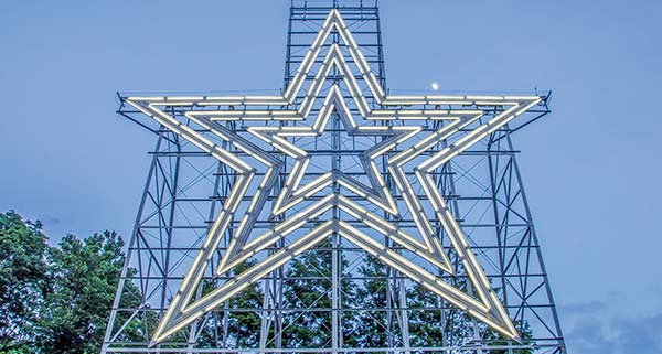
the Roanoke Star
The views of the city and valley from the observation platform at the Roanoke Star are unrivaled. A trolley ran up here around 1910, but it was soon shut down as folks preferred the drive up winding Walnut Avenue. To drive to the star, simply follow Walnut Avenue up the mountain and follow the signs. You can also walk or bike there by taking the Mill Mountain Greenway to the Discovery Center and parking area, where two hiking trails—the long and the short versions of the Star Trail—lead to the star and a tremendous overlook.
The Mill Mountain Zoo (Mill Mountain Park, 540/343-3241, www.exemplum.com/mmzoo, 10am-5pm daily, last tickets sold at 4pm, $9 adults, $7 ages 3-11, free age 2 and under) has 175 animals representing 90 species, and among those numbers, 21 are listed as vulnerable species. You can see a red wolf, snow leopard, and red panda here. There’s a ZooChoo Train ($2) that circles the zoo; zookeeper talks; and fun activities like Breakfast with the Animals (every third Sat., $15 adults, $11 children, reservations required) and Zoo Boo (regular admission costs only), a daylong, trick-or-treating, costume-contest Halloween-themed zoo bonanza.
There are several walking and hiking trails on Mill Mountain. The Star Trail leads to the Roanoke Star, but others connect to neighborhoods in Roanoke. Parents with little hikers in tow may want to pay a visit to Crystal Spring Trail (trailhead at the end of Ivy St.; get there from the Parkway by turning onto Mill Mountain Pkwy. at MP 120.5, continuing along the J P Fishburn Pkwy. and Walnut Ave. SE, then turning left on Ivy St.), a 1.2-mile out-and-back hike that’s about as easy as it gets. The good thing about this trail is that it’s an easy way to get kids excited to hike. Surrounded as you are by the forest here, there’s the sense that you’re somewhere wild, not three blocks from civilization.
Distance: 2.8 miles out and back
Duration: 1.5-2 hours
Elevation gain: 900 feet
Difficulty: moderate
Trailhead: on Walnut Avenue about 1 mile from Ivy Street
Directions: To reach the trailhead, exit the Blue Ridge Parkway at the Mill Mountain Parkway (MP 120.5); continue along to the J P Fishburn Parkway and then Walnut Avenue SE; turn left onto Ivy Street and the trailhead is at the end of the street.
There’s an easier way to reach the Roanoke Star, but this route lets you earn the view and takes you through a dense forest filled with woodpeckers.
From the parking area, cross the street and head up a short set of stone steps. Immediately you’ll be faced with six or eight fairly long switchbacks as you ascend. The switchbacks keep the trail at a nice, accessible grade and provide plenty of spots for benches where you can sit and soak up the noise of the forest. Continue along the trail until you reach the top, just under 1.5 miles into the hike. There, you’ll find a junction with a gravel road and some brochures with trail maps. Turn left and you’ll be in a paved parking area; turn right, you’ll meet up with a paved path at the Roanoke Star and the overlook.
Distance: 0.4 mile out and back
Duration: 15 minutes
Elevation gain: 50 feet
Difficulty: moderate
Trailhead: parking area at the summit of Mill Mountain
Park in the paved parking area at the summit of Mill Mountain, then follow the gravel path and you’ll be at the Roanoke Star in no time flat.
The scenic four-mile, one-way Roanoke Mountain Loop Road makes its way around Roanoke Mountain. Along the way there are seven overlooks that provide really good views of Roanoke, the Roanoke Valley, and Mill Mountain. At the top, there’s a short spur road to a parking area where you’ll find a trail that takes you to the summit.
Distance: 0.3-mile loop
Duration: 10 minutes
Elevation gain: 60 feet
Difficulty: easy to moderate
Trailhead: parking area on Roanoke Mountain Loop Road
This pretty little hike affords you a few good landscape shots and gives you a good place to watch the sun set. Begin at the set of stone steps at the far end of the parking lot and descend. You’ll immediately ascend a second set of stone steps and come to the summit. Wintertime is when the views are best, though it’s quite pretty in summer when the mountain laurel is blooming. Continue on the trail and ascend again to the parking lot.
Take one last look at Roanoke and the Roanoke Valley from this overlook, perched at 2,100 feet.
You’ll find a lot of references to the Devil, Hell, and Purgatory in exceptionally rocky spots like Devils Backbone. I guess if I had to pick my way through rocky fields and outcroppings while on a wagon loaded with all my earthly possessions, I’d come up with a similar name for these places. As you look out here, Devils Backbone is the steep point jutting out between the overlook and Pine Spur.
The Smart View Overlook (MP 154.1) gives you a great look at a beautiful valley. The Smart View Recreation Area (MP 154.4), a 500-acre recreation area at 2,503 feet, has 42 or so picnic tables, a restroom, and drinking water. A loop trail at the recreation area wanders the ridge and can be broken down into a couple of shorter hikes, though the longer one is recommended. As for the name, it’s an antiquated way of saying “good view.” In the case of Smart View, the smart part applies to the pastoral beauty of the long view here.
Distance: 3-mile loop
Duration: 1.5-2 hours
Elevation gain: 150 feet
Difficulty: easy to moderate
Trailhead: parking area at Smart View, across from the picnic area
Squeeze through the fence and cross an open meadow to enter the woods. At 0.2 mile, you’ll meet a side trail to the picnic area, but ignore it (unless you’re hungry) and continue on. At 0.4 mile, you’ll reach another trail, which leads to the Smart View Overlook (MP 154.1); bear right. Here, the trail descends through ferns and switchbacks until it crosses the creek. After crossing, you’ll ascend through a rhododendron thicket. From this point south, the rhododendron thickets are a constant companion as the Parkway continues to gain elevation.
At 0.7 mile in, you’ll reach a set of steep rock steps, then at 1 mile you’ll find that the restrooms are just to your right; keep going. In a few hundred yards, there’s a second trail to the picnic area; rather than go that way, descend on the path to the left. The Trails family cabin at mile 1.2 was built in the 1890s. It’s an attractive structure (if you’re into the whole rustic thing), and between it and the views of Virginia’s Piedmont to the east, you can spend a few minutes taking photos here. Cross a small creek via a stone bridge, then ascend a small knob. A path to the right will lead back to the parking lot where the hike began if you need to shorten it.
Continuing down the trail from the knob, you’ll have more great Piedmont views, then descend into a little pine grove. From here, the trail carries you right back to the parking area.
 VA-8 North: Floyd (MP 165.2)
Floyd is a rare place where you’ll find hippie holdouts, fifth-generation Floyd County families, retired college professors, and yurt-dwelling, alpaca-owning neo-hippies living side by side, and they all get along. Somehow the mix of old and new, mainstay and counterculture, contemporary art and long-held traditions works. It must be the music.
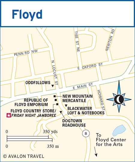
On Friday nights (well, on most nights, really, but especially on Friday nights), the streets of this small town echo with the high lonesome sound of bluegrass and old-time bands. In the Floyd Country Store, a hundred feet slap out a rhythm to the music as cloggers, flatfooters, and mountain dancers keep time. On the dance floor are homemakers and teachers, farmers and preachers, children and grandparents, newcomers and old-timers, all in this place to hear the music and share in a moment. This encapsulates the town. It’s a place that people want to share and keep visiting every chance they get.
The town of Floyd is accessible via VA-8 at Milepost 165.2. Floyd is six miles north.
There’s only one stoplight in downtown Floyd, so it’s easy to find the Floyd Country Store (206 S. Locust St., 540/745-4563, www.floydcountrystore.com, 10am-5pm Mon.-Thurs., 10am-10:30pm Fri., 10am-6pm Sat., 11am-5:30pm Sun.), the heart of this town. In 1910, a business called Farmer’s Supply opened here, and the building has been in continuous use ever since. It changed hands more than a few times, and in the 1990s, the decision was made to close the store for one evening a week, for the now legendary Friday Night Jamboree (6:30pm Fri., $5). There’s also a café ($3.50-8) if you get hungry after dancing the night away at the Jamboree.
Through the week, you can get everything from overalls to penny candy to books on home remedies to a pair of hand-knit alpaca socks at the Floyd Country Store, but all that changes for the Friday Night Jamboree. Racks and shelves are cleared out, pushed to the side to make room for a dozen rows of folding chairs and a good-sized dance floor. The crowds build on the street. Musicians tune banjos and mandolins, and play runs on their fiddles and guitars on sidewalks, in parking lots, and doorways. Spontaneous songs build as one musician joins another. Then, promptly at 6:30pm, the music starts inside and the Jamboree is on.
The Jamboree celebrates the best of traditional Appalachian music, with acts ranging from country (real country, not the pop, Top-40 radio country) to bluegrass to old time. “Granny’s Rules” apply here, and that means “no smoking, no drinking alcohol, no bad language, and no conduct unbecoming to a lady or gentleman.” Don’t be shy, work your way up front and get a seat where you can see the dancers, and, if the spirit so moves you, join in. Local bands, as well as regional and national touring acts, perform here, so you’ll hear top talent every week.
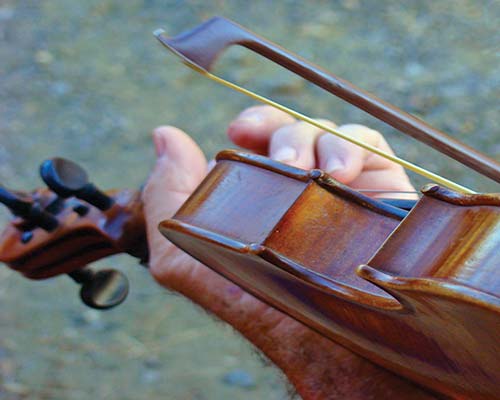
musician at the Friday Night Jamboree in Floyd
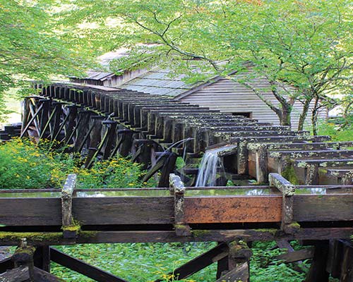
Mabry Mill
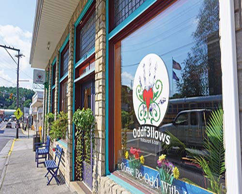
Oddf3llows, Floyd
There are two other musical programs at the Floyd Country Store, both also aimed at preserving the music of these hills. On Saturdays, they have American Afternoon (noon-1:30pm Sat.), followed by an Americana-themed open mic. On Sundays, there’s an open jam (1:30pm-6pm Sun.) led by local old-time and bluegrass bands (old-time bands get the first and third Sundays, bluegrass the second and fourth).
For five days in July, FloydFest (894 Rock Castle Gorge Rd., 888/823-3787, www.floydfest.com, tickets $100-300) descends on the town, bringing with it an eclectic crowd hungry to hear music from a wide range of musical acts. Past performers include David Grisman, Los Lobos, Lauryn Hill, Lettuce, Thievery Corporation, and other acts from bluegrass to jam bands and everything in between. It’s kid-friendly (but no dogs), you can camp (and even glamp), and with certain tickets, you can come and go as you please (and as traffic allows).
Floyd Center for the Arts (220 Parkway Ln. S., 540/745-2784, www.jacksonvillecenter.org, 10am-5pm Mon.-Sat., noon-5pm Sun.) is an old farm complex that has been transformed into a center for art, mountain music, theater, dance, crafts, and rural heritage. It’s half a mile south of town on VA-8, with a gallery and gift shop on the premises.
Bookstores and coffee shops go together like, well, bookstores and coffee shops. When you need a caffeine fix in Floyd, head to Black Water Loft & Notebooks (117 S. Locust St., 540/745-5638, 7am-5pm Mon.-Fri., 8am-5pm Sat.). You’ll find some outstanding locally roasted coffee and a selection of children’s books, books by local authors, art and craft supplies, and, of course, local music.
New Mountain Mercantile (114 S. Locust St., 540/745-4278, 11am-5pm Mon.-Thurs. and Sat., 11am-6pm Fri.) sells locally made art, jewelry, clothing, and home and garden accessories. You can pick up handmade aromatherapy products as well as soaps, candles, and crystals in this funky little shop. Next door is the Republic of Floyd Emporium (114-B S. Locust St., 540/745-2898, www.republicoffloyd.com, 11am-6pm Mon., Wed.-Thurs., and Sat., 11am-8pm Fri., 11am-5pm Sun.), a store featuring microbrews and imported beer; snack foods; a good wine selection; and all sorts of hats, shirts, prints, and collectibles designed by Floyd artists.
Oddf3llows (110 N. Locust St., 540/745-3463, 11am-9pm Wed.-Sat., 10:20am-8pm Sun., $11-25) features eclectic food, a welcoming atmosphere, and fun people. The menu runs the gamut from steaks and seafood to a few vegetarian dishes. You can order a mushroom-smothered rib eye, tuna spiced with cinnamon and chili, a great burger, or some shrimp and grits that will make your mouth water. Their wine and beer selection is very good. From time to time, there’s live music in the dining room. There’s also a bar upstairs called Oddbar (4pm-9pm Thurs.-Sat.).
Two miles north of town, S The Historic Pine Tavern Restaurant (585 Floyd Hwy. N., 540/745-4482, www.thepinetavern.com, 4:30pm-9pm Fri., noon-9:30pm Sat., 11am-8pm Sun., $14) offers family-style meals on shared platters. Meals include heaping platters of fried chicken, roast beef, and country ham; and bowls overflowing with mashed potatoes, dumplings, green beans, pinto beans, coleslaw, and buttermilk biscuits. Oh, and you get dessert, too. Come hungry.
Dogtown Roadhouse (302 S. Locust St., 540/745-6836, www.dogtownroadhouse.com, 5pm-10pm Thurs., 5pm-midnight Fri., noon-midnight Sat., noon-10pm Sun., $5-15) offers up some fabulous wood-fired pizzas as well as a great beer selection. There are only six pizzas on the menu; fortunately, they’re all delicious.
Two cabins built from hand-hewn logs and a 200-year-old log farmhouse make up S Ambrosia Farm Bed & Breakfast (271 Cox Store Rd., 540/745-6363, www.ambrosiafarm.net, $90-135). The innkeepers—she has her MFA in ceramic sculpture and he’s an engineer focused on energy efficiency—have done a lot to make the accommodations feel like escapes. And their work pays off. Surrounded by pastures and hills, the farm is truly a retreat. Each of the rooms is comfortable, and breakfast focuses on the farm philosophy of using what’s in season, easily available, and of the highest quality.
Stay in a yurt—a great, round, tentlike structure—with Floyd Yurt Lodging (540/505-4586, www.floydyurtlodging.com, $119). Yurts are portable, circular tents built on collapsible frames traditionally used by nomads in far-flung places like Siberia and Mongolia. It’s spacious, comfortable, fun, and unusual.
The Floyd County Chamber of Commerce (109 E. Main St., 540/745-4407 or 540/239-8509, www.visitfloydva.com, 10am-5pm Mon.-Thurs., 10am-7pm Fri., 10am-3pm Sat., 11am-3pm Sun.) happily supplies information on the area. The website has a few good details for visitors.
 VA-8 South: Fairy Stone State Park (MP 165.2)
At Milepost 165.2, the Parkway crosses over VA-8. From here, it’s only 23 miles southeast to Fairy Stone State Park (967 Fairystone Lake Dr., Stuart, 276/930-2424, www.dcr.virginia.gov, 8am-10pm daily, parking $5). From VA-8, turn onto VA-57 to get into the park. This is one of the six original state parks in Virginia, and the largest one to boot. At 4,639 acres, there is plenty to explore at Fairy Stone, from more than 15 miles of hiking trails to a 168-acre lake, where you can fish, swim, or go boating. You can also seek out some of the namesake fairy stones for yourself.
There’s also a campground (800/933-7275, www.reserveamerica.com, $20 group camping, $30 RVs) and cabins ($102). With 25 one- and two-bedroom cabins, one lodge, 50 tent and RV sites, and six group campsites, it’s not difficult to find a place to spend the night, though reservations are recommended.
The Rocky Knob Recreation Area consists of more than 4,000 acres of backcountry that bulges out from the Blue Ridge Parkway, encompassing Rock Castle Gorge. This narrow, deep, impressive valley is breathtakingly beautiful, and the hikes will have you panting, too. The high-elevation meadows, deep coves, and craggy peaks, combined with the drastic elevation changes and abundant streams, create an area where the plant life is among the most diverse along the Parkway.
As inhospitable as these mountains may seem, at one time around 70 families lived in the immediate area. They scratched family farms out of the mountainsides, built sawmills and gristmills, and raised kids and livestock in this beautiful and rugged place.
While you’re at Rocky Knob, it’s worthwhile to get out on the trails and take a look at the mountains up close and personal.
The Rocky Knob Campground (877/444-6777, www.recreation.gov, May-Oct., $20) has more than 80 tent sites and close to 30 RV sites. It’s a popular stop, especially during summer and fall, so call ahead for reservations.
Distance: 10.6-mile circuit
Duration: 7-8 hours
Elevation gain: 1,050 feet
Difficulty: strenuous
Trailhead: Rocky Knob Campground
With steep, narrow descents and grueling ascents, this is not a trail to be taken lightly. From the Rocky Knob Campground, cross the Parkway and pass through the fence. Turn left and head into the woods. Switchbacks start at 0.3 mile in, and here you’ll cross Little Rock Castle Creek, thick with rhododendrons. Keep descending until you reach an old road at 0.5 mile. Follow the road another half mile to where a bench lets you rest before descending to an area that looks as if it were settled long ago.
At 1.5 miles, you’ll reach another ridge. Descend again. The trail is steep here and will stay this way until you reach a draw at 2.3 miles in, where it still descends, but a bit more easily. You’ll reach some pools in Little Rock Castle Creek at 2.5 miles in. Here, the valley opens up a good bit. Continue on the trail until you reach a fire road at 3 miles. Turn right. In a quarter mile, you’ll reach a backcountry camping area, the site of a Civilian Conservation Corps work camp from the late 1930s. Stay on the road until it begins to swing away from the creek and skirt the lower part of the mountain. Cross a bridge at 4.25 miles in and make your way to the White House, once the home of a wealthy community member, at the 4.5-mile mark. The property is still privately owned, so take nothing but photos.
After you leave the White House, cross the creek a couple of times and begin ascending through more rhododendron thickets. Five miles in, you’ll see a few small waterfalls, cascades, and rills. A tall rock face that’s dry except during spring rains, at which time it turns into a lovely waterfall, will greet you at 5.4 miles. In a quarter mile, the trail will leave the road and you’ll turn right. The road continues on to some now-defunct cabins a little over a mile distant.
There’s a mess of boulders called Bare Rocks at mile 5.8. Though it may be tempting to stick your head into the small caves and clefts found here, don’t. They are perfect spots for copperheads, rattlesnakes, and other woodland creatures. The ascent turns steep at mile 6.2, then lessens a bit once you reach a set of switchbacks after a dense rhododendron and mountain laurel thicket. At mile 7.1, you’ll arrive at Grassy Knoll. For the next quarter mile or so, you’ll be on lovely pasture land, then, at mile 7.5, a cell phone tower will give you a jarring reminder of our intrusion into nature.
Keep on the trail and emerge from the woods into an absolutely stunning meadow around mile 7.6. The 360-degree views here are exactly what you’ve been working toward all day. After a half mile, you’ll reenter the woods and come out again into another beautiful meadow.
At mile 9, you’ll pass Rock Castle Gorge Overlook at Milepost 168.7, then begin to ascend Rocky Knob. Take the right-hand trail at 9.4 miles in, then make your way to the ridgeline leading to Rocky Knob. There’s a shelter where Earl Shaffer, the first Appalachian Trail thru-hiker, stayed when this was part of the Appalachian Trail. At the 10-mile mark, you’ll reach a trail leading to the picnic area in just over 0.5 mile; you can go this way and cut the trail short if you like. If not, keep climbing, cross another knob, then walk through a fence and into a final pasture. You’ll go through a small orchard, then parallel the Parkway before arriving back where you started.
Shorter hikes are also possible here. From the picnic area at Rocky Knob, it’s possible to do 1.1-, 2.3-, and 2.6-mile hikes that provide some of the same views as the 10.6-mile Rock Castle Gorge Trail, taking you through some of those meadows described at the end of the gorge trail.
At Milepost 171.5, head west on Black Ridge Road to Winery Road, where you’ll find Chateau Morrisette Winery (291 Winery Rd. SW, Floyd, 540/593-3647, www.thedogs.com, 10am-5pm Mon.-Thurs., 10am-6pm Fri.-Sat., 11am-5pm Sun.), a popular spot for locals and visitors, especially for their Sunday brunch. The mountaintop winery is composed of 13 acres of vines, an amazing 32,365-square-foot timber-frame tasting room made from salvaged timbers, and a great set of outdoor spaces for parties big and small. During fall, the views of the Blue Ridge are particularly excellent.
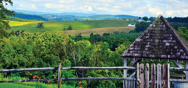
view from Chateau Morrisette Winery
Chateau Morrisette is one of six Virginia wineries started prior to 1980, making it one of the oldest wineries in the state. Though grape production began on the property in the early 1970s, it wasn’t until 1978 that Chateau Morrisette Winery came about. Then, winemaker and owner David Morrisette, a graduate of Mississippi State University’s inaugural Viticulture and Enology program, ripped out the vines his father had planted, planted his own, and became the first official winemaker for Chateau Morrisette Winery. A mere 2,000 gallons of wine were produced in their first vintage in 1982; today, the winery produces well over 60,000 cases annually.
Visitors to the winery can take part in tastings and tours (11am, 1pm, and 3pm Mon.-Thurs.; 11am, 1pm, 3pm, and 5pm Fri. and Sat.; noon, 2pm, and 4pm Sun.). Tastings come in two flavors: the standard 10-wine tasting and a winery tour ($8), or the Elite Wine Tasting ($30) with 10 bottles of the current vintage and possibly barrel tastings or the pouring of a reserve wine. The Elite Tasting includes an in-depth talk about terroir, grape varieties, and Virginia wine as a whole. You’ll also discuss pairing ideas and leave with a keepsake glass. Reservations are required for the Elite Wine Tasting but not for the standard tasting or for tours.
Sample some of their fine wine with fine food at the on-site restaurant (11am-2pm Wed.-Thurs., 11am-9pm Fri.-Sat., 11am-3pm Sun. Apr.-Nov.; 11am-4pm Thurs. and Sun., 11am-8pm Fri.-Sat. Jan.-Mar.; $13-30). Lunch and dinner are good, with internationally influenced Southern fare, but the brunch ($7-22) sticks a little closer to home with a smaller menu that’s Southern through and through. Reservations are highly recommended. The HUT (noon-4pm Sun. June-Oct., $3-8) serves picnic fare and welcomes a variety of musicians to perform in the Sunday Sounds concert series.
Called by many “the most picturesque spot on the Blue Ridge Parkway,” Mabry Mill is among the top five places to photograph in any season, making it a sure-stop on your journey. The mill sits just off the road, fed by a series of flumes and chutes that channel the water from a nearby stream to the waterwheel, which turns the gristmill and sawmill inside. The water empties into a little pond in front of the building. The pond is almost always still, though sometimes the surface is rippled by wind or the ducks that live here, so it reflects the sky, mill, and trees, making for a postcard-perfect shot. In the fall, when the trees are lit with color, it’s quite striking.
The Mabry family settled in the area around 1782 when they received a land grant one county over. Ed Mabry was born here in 1867, spent a little time away, then moved back with his wife, Lizzy. He built the mill in 1903 to provide blacksmithing and wheelwright services to the community. Soon he was operating a sawmill here, then a gristmill.
A half-mile trail takes you through the grounds, where you’ll learn about mountain industries, starting with the water-powered sawmill and gristmill (where you can buy cornmeal, buckwheat, and other meals ground on-site, demonstrations 9am-4pm daily May-Nov.), passing by a lumber-drying rack and log cart, and the family cabin. You then pass a moonshine still before seeing the sorghum mill and blacksmith shop. By the blacksmith, you can take the path back to your car or wander back to where one of the flumes directing water to the mill starts; either way, you’ll be off the trail in no time.
The S Mabry Mill Restaurant (266 Mabry Mill Rd. SE, 276/952-2947, www.mabrymillrestaurant.com, 7:30am-6pm daily late Apr.-early Nov., $4-10) is famous for their pancakes, which come in buckwheat, cornmeal, sweet potato, and plain old pancake. You must order a stack. Breakfast is served all day, and it’s the good, hearty country fare you’d expect. Lunch and dinner include meat loaf, pulled pork, chicken potpie, roast turkey, a burger, and a half-dozen sandwiches.
Perched on 12,000 acres in the Blue Ridge Mountains not far from the Parkway, S Primland (2000 Busted Rock Rd., Meadows of Dan, 866/960-7746, www.primland.com, $304-1,200) is more than a resort: it’s an escape into luxury that most of us will only know a few times in our lives. The main lodge has rooms and suites, cottages line the fairways of the resort’s golf course, and there are mountain homes suitable for large gatherings. Most fantastic of all are the tree houses, which sit high on the ridge overlooking the Dan River Gorge, the Roaring Creek Gorge, or the confluence of Roaring Creek and the Dan. From their decks, the view is stupendous. The interior of the tree houses (and all the rooms, cottages, and houses, for that matter) is sheer elegance. Everything is comfortable and plush, designed to help you forget the outside world for a while.
You can do just about anything you want at Primland. Activities include an ATV trail-riding program, birding outings, fly-fishing, horseback riding, mountain biking, sporting clays and other sports, a spa, and an acclaimed stargazing program. There’s one of the prettiest disc golf courses you could ever play, and a real golf course that’s the height of mountain course design.
Dining is exceptional. The dining room, elements, serves breakfast (7am-11am daily, $6-16) and dinner (6pm-9pm daily, $30-45), as well as a Chef’s Table tasting menu ($150). The 19th Pub (11am-11pm daily, $12-29) serves lunch and dinner in a less-formal atmosphere. There’s also Stables Saloon, a buffet ($35 adults, $15 children) open seasonally for breakfast and periodically for events.
The tower (which looks like a tall tobacco barn) atop Groundhog Mountain is one of the loveliest sights on the Parkway. The grassy knob; the hand-hewn, primitively constructed fence; and the breadth of the sky above all add up to a beautiful scene. There is a picnic area and a comfort station with restrooms, so you can linger if you want to watch the sun go down (or come up, if you’re an early riser). Views from here are sweeping, to say the least. You can see the Dan River Valley and the mountains easing into Piedmont as well as Pilot Mountain’s odd, quartzite peak jutting upward.
Down the road at Orchard Gap (MP 194), you’ll see a series of cabins on the top of a bald ridge just off the Parkway. These are the Lonesome Pine Cabins (64 Lonesome Cabin Ln., Fancy Gap, 888/799-9214 or 276/398-3332, www.lonesomepinecabins.net, $95-135), and it’s quiet and starry here, making for a nice one-nighter in this area.
The Blue Ridge Parkway skirts the southern edge of Fancy Gap, and US-52 crosses its path here. Just a couple of minutes off the Parkway you’ll find pretty much all Fancy Gap has to offer—a handful of shops, restaurants, hotels, and gas stations. US-52 will take you south to Mount Airy, North Carolina, and I-77 is just four minutes from the Parkway, making access easy from the north or south.
Fancy Gap was originally known as Foggy Camp, but the name changed sometime in the 1800s. Rumor has it that young Ira Blair Coltrane, who would become a self-taught engineer and a colonel in the Confederate army, was helping his grandfather drive a wagon up a steep and rutted road. He looked around, saw a better route up the mountain across the valley, and said that it would make a “Fancy Road.”
Fancy Gap has a quartet of eateries as well as a few fast food chains. The Gap Deli at the Parkway (7975 Fancy Gap Hwy., 276/728-3881, www.thegapdeli.com, 11am-7pm Mon.-Fri., 10am-7pm Sat.-Sun., $5-8) serves sandwiches, salads, soups, and some killer peanut butter pie in a lovely setting with indoor and some outdoor seating. Gearhead Diner (7145 Chances Creek Rd., 276/728-2773, 8am-7pm Wed.-Fri., 7am-7pm Sat., 7am-6pm Sun., $4-12) makes a mean burger but also serves up the usual diner fare for breakfast, lunch, and dinner. Lakeview Restaurant (7830 Fancy Gap Hwy., 276/728-7841, 7am-9pm Mon.-Sat., 7am-2:30pm Sun., $8) is where the locals go for breakfast. The fried chicken is spot on.
 US-52 South: Mount Airy (MP 199.5)
In downtown Mount Airy, you’ll notice 1960s police squad cars, business names that may seem oddly familiar, and cardboard cutouts of Barney Fife peering out from shop windows. Mount Airy is the hometown of Andy Griffith and a mecca for fans of The Andy Griffith Show. People who grew up in small towns in the Carolinas (and probably elsewhere, too) recognize their families and neighbors in the fictional residents of Mayberry. The show’s inspired writing and acting are a deep well of nostalgia, and its fans are legion.
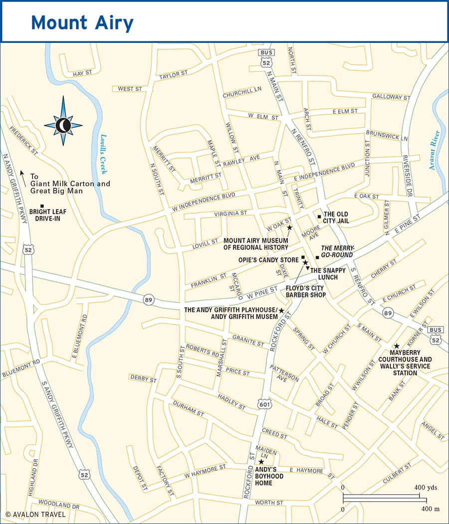
You can reach Mount Airy from the Blue Ridge Parkway by turning south on US-52 at Fancy Gap (MP 199.5), a 14-mile journey; by taking I-77/74 south to NC-89 west, a trip of 24 mostly interstate miles; or by taking a curvy back road that will let you catch a glimpse of life on the slopes of the Blue Ridge Mountains. To take the back road, VA-679/NC-1717, turn onto Orchard Gap Road at Milepost 194, then stay straight on Wards Gap Road, which will lead you into town over the course of a 14-mile, 30-minute journey.
You can’t leave Mount Airy without paying a visit to the sites that honor favorite son Andy Griffith. It isn’t open for tours, but you can rent Andy’s boyhood home (711 E. Haymore St., 336/789-5999, $175/night) on Haymore Street if you care to spend the night. The Andy Griffith Museum (218 Rockford St., 336/786-7998, www.andygriffithmuseum.com, 9am-5pm Mon.-Fri., 11am-4pm Sat., 1:30pm-4:30pm Sun., $3, $5 with audio guide) features hundreds of pieces of memorabilia from Griffith’s long career in television, movies, and music, including scripts and props from his still-running eponymous TV show. Outside the museum and the attached Andy Griffith Playhouse (www.surryarts.org, show times and ticket prices vary) stands a lifelike statue of Andy and Opie with fishing poles in tow that looks like it was grabbed right out of The Andy Griffith Show opening credits.
If you can’t get enough of Andy and Barney, hop into a Mayberry squad car to tour all the major sights in town. Mayberry Squad Car Tours (625 S. Main St., 336/789-6743, www.tourmayberry.com) leave from “Wally’s Service Station” and cost “$35 for a carload.” And if that’s not enough, stop by Floyd’s City Barber Shop (129 N. Main St., 336/786-2346, 7am-5pm Mon.-Wed. and Fri., 7am-3pm Sat.) for a haircut. You won’t find Floyd the barber in there, but you will find some friendly folks in an old-fashioned barbershop. If you’re in the mood for a trim, you may just sit in the same seat as Andy Griffith, who received many a haircut here during his Mount Airy days.
Teamed up with WPAQ 740 AM, the Surry Arts Council hosts The Merry-Go-Round (Earle Theater, 142 N. Main St., 336/786-2222, www.surryarts.org, 11am-1:30pm Sat., $5), the country’s third-longest-running live bluegrass and old-time music radio show. Come to the Earle Theater for the show, or show up as early as 9am toting an instrument if you’d like to join in the pre-show jam session. It’s one of the state’s great small-town treats.
A local institution that has a great deal to do with the vitality of Mount Airy’s musical traditions is the Bluegrass and Old-Time Fiddlers Convention (691 W. Lebanon St., 336/345-7388, www.mtairyfiddlersconvention.com), held every year since 1972 during the first full weekend in June at Veterans Memorial Park. Thousands of people come to the festival from around the world to play old-time and bluegrass music with their friends and compete in what is a very prestigious competition in this genre. The heart of the action takes place at the hundreds of individual campsites that spring up all over the park, in informal jam sessions among old and new friends. It’s some of the best old-time music to be heard anywhere.
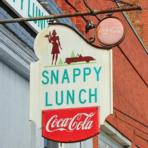
The Snappy Lunch in Mount Airy
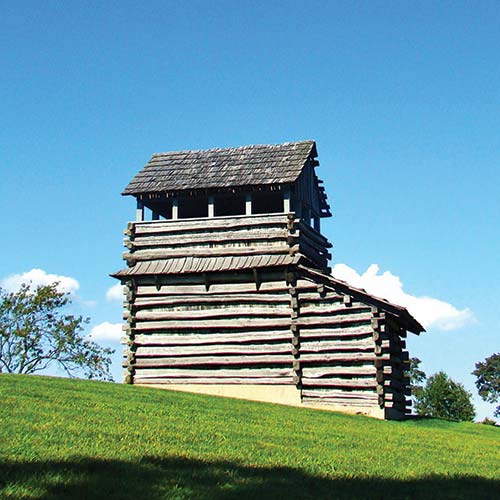
the lookout tower on Groundhog Mountain
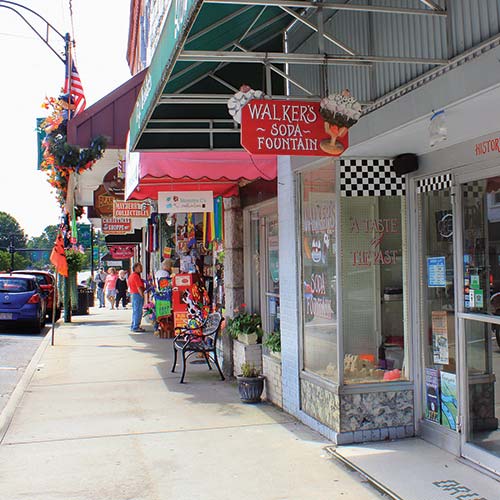
storefronts in Mount Airy
The Surry Arts Council hosts the citywide Mayberry Days (www.mayberrydays.org), an annual fall festival featuring a barbecue cook-off, concerts, and appearances by cast members of The Andy Griffith Show. During Mayberry Days, members of TAGSRWC, an acronym for The Andy Griffith Show Rerun Watchers Club, gather with other fans, some of the remaining cast members, and impersonators of Mayberry characters. They come to town and have a big-eyed time getting haircuts at Floyd’s City Barber Shop, riding in squad cars, and arresting each other. TAGSRWC boasts hundreds of chapters whose names reference the series, such as “Her First Husband Got Runned Over by a Team of Hogs” (Texas) and “Anxiety Magnifies Fearsome Objects” (Alabama).
A rare golf course among the pastures and hayfields is the beautiful Cross Creek Country Club (1129 Greenhill Rd., 336/789-5131, www.crosscreekcc.com, 18 holes, par 72, greens fees $40 daily, 9 holes $20, includes cart) in Mount Airy. Course conditions are always fantastic, and the course presents quandaries to golfers of all levels.
If you want a fun little par-3 course, head to Hardy’s Custom Golf (2003 W. Pine St., 336/789-7888, www.hardrockgolf.net, 18 holes, par 54, greens fees $8, with cart $10, 9 holes $5, with cart $8). The course is lighted for play day or night. There’s also mini golf (36 holes, $2.50) as well as foot golf (18 holes, walking $10 all day, 18 holes $8, 9 holes $5; with cart $20 all day, 18 holes $10, 9 holes $8), a combo of soccer and golf.
Yadkin River Adventures (104 Old Rockford Rd., Rockford, North Carolina, 336/374-5318, www.yadkinriveradventures.com, canoe trips $65/2 hours, $75/4 hours, and $85/6 hours; kayak trips $40/2 hours, $50/4 hours, $60/6 hours) in Rockford offers rentals of canoes, kayaks, and sit-on-tops, along with shuttle service for full- and half-day paddling adventures. The Class I Yadkin River is great for paddlers of all ages and experience levels, and it has beautiful views of Pilot Mountain.
Pilot Mountain State Park (1792 Pilot Knob Park Rd., Pinnacle, North Carolina, 336/325-2355, www.ncparks.gov) is a beautiful place for hiking, swimming, rock climbing, rappelling (in designated areas), canoeing on the Yadkin River, and camping ($10-23, $15 seniors) at one of the 49 designated tent and trailer sites. Each site has a tent pad, a picnic table, and a grill, as well as access to drinking water and hot showers. There are a dozen trails here, ranging in length from 0.1 mile (from parking lot to overlook) to 4.3 miles (circling the mountain) to 6.6 miles (connecting the two sections of the park). Pilot Mountain, the park’s namesake 1,400-foot-tall rocky protrusion, is a startling sight that reminds some of a UHF knob on an old television set, the kind you may have used to watch The Andy Griffith Show. Pilot Mountain is so named because it’s a prominent and obvious landmark; it appears in The Andy Griffith Show as Mount Pilot.
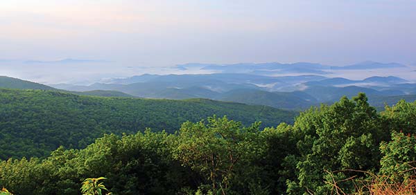
The sun burns off the morning mist near Fancy Gap.
The 400-foot rock faces that extend for two miles are the most striking feature of Hanging Rock State Park (1790 Hanging Rock Park Rd., Danbury, North Carolina, 336/593-8480, www.ncparks.gov, 7am-7pm daily Dec.-Feb., 7am-9pm daily Mar.-Apr. and Oct., 7am-10pm daily May-Sept., 7am-8pm daily Nov.), about 40 minutes outside Mount Airy. If you’ve exhausted the routes on Pilot Mountain (doubtful), this is a great place for rock climbing and rappelling (a permit and registration with park staff are required; climbers must also finish and exit the park by closing time). You can also hike to waterfalls and beautiful overlooks, and swim in a nearby lake. Hanging Rock State Park has 73 tent and trailer campsites ($10-22), one of which is wheelchair-accessible. Each site has a tent pad, a picnic table, a grill, access to drinking water, and access to a washhouse (mid-Mar.-Nov.) with hot showers and laundry sinks. There are also two-bedroom, four-bed vacation cabins ($88 daily Dec.-mid-Mar., $100 mid-Mar.-mid-June and Sept.-Nov., $520 weekly mid-June-Aug.) for rent. Reserve campsites or cabins at least a month in advance with the park office.
While you’re in Mount Airy, you have to eat at S The Snappy Lunch (125 N. Main St., 336/786-4931, www.thesnappylunch.com, 5:45am-1:45pm Mon.-Wed. and Fri., 5:45am.-1:15pm Thurs. and Sat., $1-5), a diner whose claims to fame include mentions on The Andy Griffith Show and a “World Famous Pork Chop Sandwich,” which is notoriously sloppy, delicious, and cheap. Eating here is like stepping back in time. The Snappy Lunch has been in the community since 1923.
The Copper Pot Restaurant (123 Scenic Outlet Ln., Ste. 4, 336/352-4108, www.copperpotrestaurant.com, 7am-9pm Mon.-Sat., $10) is a down-home restaurant specializing in dishes of the “meat and two” or “meat and three” variety. It’s country cooking all the way, so prepare for fried okra, pinto beans, and inexpensive food.
If you need a cup of coffee, Brady’s Coffee Company (717 W. Independence Blvd., www.bradyscoffeecompany.com, 7:30am-5pm Mon.-Fri., 9:30am-3pm Sat., $2-7) is the place for you. The selection is small, so expect to find the usual drinks—lattes, cappuccinos, drip coffee—and not so many of the complicated ones you find elsewhere.
In Mount Airy, Quality Inn (2136 Rockford St., 336/789-2000, www.qualityinn.com, from $75), Holiday Inn Express (1320 Ems Dr., 336/719-1731, www.hiexpress.com, from $120), and Hampton Inn (2029 Rockford St., 336/789-5999, www.hamptoninn3.hilton.com, from $129) are good options.
Pilot Knob Inn Bed and Breakfast (361 New Pilot Knob Ln., Pinnacle, North Carolina, 336/325-2502, www.pilotknobinn.com, $159-249) in Pinnacle is an unusual B&B in that guests can stay in suites in the main lodge or in one of several restored century-old tobacco barns on the property. Each one-bedroom barn-turned-cabin is well equipped with modern conveniences, including two-person hot tubs and stone wood-burning fireplaces. Children and pets are not allowed, but horses can occupy a stall on the property for an additional $50 per night.
Find out more of what Mount Airy has to offer by stopping by the Mount Airy Visitors Center (200 N. Main St., 800/948-0949 or 336/786-6116, www.visitmayberry.com, 8:30am-5:30pm Mon.-Fri., 10am-5pm Sat., 1pm-4pm Sun.).
There is a hospital in town, Northern Hospital of Surry County (830 Rockford St., 336/719-7000, www.northernhospital.com). If you require the police, contact the Mount Airy Police Department (150 Rockford St., 336/786-3535, www.mountairy.org).
From the Piedmont Overlook at Milepost 203.9, you have a grand view of the Piedmont of Virginia and North Carolina rolling away from you. To the southwest, beside I-77, is Sugarloaf Mountain, which gets its name from the distinctively loafy roundness of its peak.
The Blue Ridge Music Center (700 Foothills Rd., Galax, 276/236-5309, www.blueridgemusiccenter.org, 10am-5pm daily May-Oct., free) is a museum dedicated to the roots music of the hills in this part of North Carolina and Virginia. Video and audio displays help tell the story of the development of old-time and bluegrass music and show how this distinct sound has influenced other genres throughout the years. As you tour the music center, you’ll see fantastic antique and contemporary examples of banjos, fiddles, guitars, and dobros. Midday Mountain Music concerts (noon-4pm daily, free) give area musicians opportunities to play for a crowd, and regular evening concerts ($10) by more established acts draw crowds from all over.
Distance: 2.8 miles out and back
Duration: 1.5 hours
Elevation gain: 100 feet
Difficulty: moderate
Trailhead: Blue Ridge Music Center parking area
From the handicapped parking area of the music center parking lot, descend along a service road. Very soon you’ll go down some steps and cross a stream via a footbridge. You’ll cross another bridge at 0.25 miles, but in the meantime enjoy the walk in these piney woods.
The Fisher Peak Trail joins our trail at 0.35 miles. Keep to the right to stay on the High Meadow Trail. A half mile in, there’s a little rock face and a bench where you can rest. From here, you can hear concerts from the music center if someone’s playing. Enter the meadow at 0.6 mile, then weave in and out of the woods and meadow for the next 0.4 mile. At 1 mile, the Fisher Peak Trail goes off to the left. Bear right and begin a gradual descent until you reach Foothills Road at 1.4 miles.
To return, you can retrace your steps or go along the Fisher Peak Loop Trail, a trek that’s just a little longer than your return trip. If you want to go this way, there’s a short spur trail to the peak, but besides that, Fisher Peak Trail joins the High Meadow Trail 0.35 miles from the parking lot, at which point you’ll turn right and return to your car.
 VA-89 North: Galax (MP 215)
Music has played an important part in most cultures’ development, and the Scots-Irish settlers who established communities in these mountains were no different. They brought with them fiddles, mandolins, and bagpipes, and they would have been happy to learn that today, music from these instruments (from fiddles and mandolins, mostly) echoes off the hillsides around Galax. Galax calls itself “The World Capital of Old-Time Mountain Music.” The number of people who play an instrument, sing, square dance, clog, flatfoot, or mountain dance is astonishing. That’s one of the reasons Galax has hosted the Old Fiddler’s Convention every August since 1935. The City of Galax Visitor’s Center (111 E. Grayson St., 276/238-8130, www.visitgalax.com, 9am-5pm Mon.-Thurs., 9am-7pm Fri., 9am-4pm Sat.) has information on the Old Fiddler’s Convention and more.
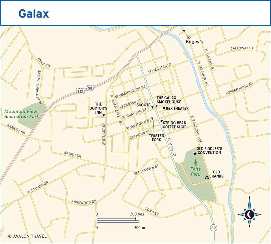
Galax is just seven miles north of the Parkway at Milepost 215 via VA-89.
No music-loving mountain town is complete without a jam session or two. In Galax, you can come together with other fans and bluegrass, country, and old-time musicians at Stringbean Coffee Shop (215 S. Main St., 276/236-0567) for a musical gathering starting at 6:30pm on Tuesday nights. In nearby Independence, there’s a jam session (6:30pm-9pm Wed.) at the Historic 1908 Courthouse (107 E. Main St., Independence). And on Saturdays, the Blue Ridge Music Center has a concert series (4pm-6pm Sat., free).
Every Friday, WBRF 98.1 FM and the Galax Downtown Association sponsor Blue Ridge Backroads (8pm-10pm Fri.), one of the few remaining live bluegrass radio shows in the country. It’s held at the historic Rex Theater (113 E. Grayson St., 276/236-0329, www.rextheatergalax.com), which also hosts live bluegrass and country bands. Ticket prices vary for concerts, but to attend a recording of Blue Ridge Backroads, tickets are $5 and available at the door only.
In mid-July, Galax hosts hordes of barbecue lovers during the two-day Virginia State Barbecue Championship (276/236-2184, www.smokeonthemountainva.com). There’s a $10,000 purse for the event, which is a qualifier for the World Food Championships. This is no backyard barbecue; pro teams come from all over the nation to compete for big money and the chance to qualify for more contests.
The annual six-day Old Fiddler’s Convention (276/236-8541, www.oldfiddlersconvention.com, early Aug., $6-12/day, $40 full convention, camping $80) defines the character of Galax. Tens of thousands of musicians, mountain dancers, and music lovers descend on this town to play in impromptu groups in the campground and on the streets, meet up with seldom-seen friends, trade instruments, and swap stories of conventions past. Don’t be surprised to see multiple generations of a family who’ve been coming every year since the convention was started in 1935.
The Old Fiddler’s Convention is about getting together and playing, but it’s also about friendly competition and a little showing off. Every day of the festival, musicians, bands, and dancers compete onstage. Young musicians can compete to see who is the best fiddler (old-time and bluegrass), mandolin player, clawhammer and bluegrass banjo picker, guitar player, and band. The competition is stiff, but it gets stiffer in other divisions. Old-time and bluegrass bands compete for a $775 top prize. Small cash prizes also go out to fiddlers, to autoharp, guitar, mandolin, dulcimer, dobro, and players of both clawhammer and bluegrass banjo styles. The best folk song, the best flatfoot dance, and the best all-around performer also go home with a little folding money in their pockets.
They’re strict about their music here, and competition rules say things like: “to qualify, a band must consist of at least a banjo, a fiddle, and a guitar,” “no bluegrass banjo style picking to be in old-time band. No old-time banjo style picking to be in bluegrass band,” and “dulcimer competition is for lap dulcimer only.” If you’re not attuned to the differences between bluegrass and old-time music, clawhammer versus bluegrass banjo styles, or exactly what a lap dulcimer may be, don’t worry. You’ll be surrounded by folks who will be more than happy to get into deep discussions explaining the finer points of these two genres.
Twisted Fork (110 W. Oldtown St., 276/238-3313, www.twistedforkva.com, 11am-3pm and 5pm-9pm Tues.-Sat., $9-15) serves a menu of fresh pasta, Italian entrées, and sandwiches from a team that cooked at the lauded Primland Resort in nearby Meadows of Dan. Here, the food is simple and exceptionally executed.
The Galax Smokehouse (101 N. Main St., 276/236-1000, www.thegalaxsmokehouse.com, 11am-9pm Mon.-Sat., 11am-3pm Sun., $6-20) is, according to locals, one of the best restaurants in Galax. Specializing in barbecue, they serve pork spareribs, boneless rib tips, pulled pork barbecue, Texas-style beef brisket, smoked chicken, burgers, and all the barbecue sides you’d expect. Their sauce comes in seven varieties ranging from hot and spicy Texas style to sweet Tennessee sauce to the vinegar-based eastern North Carolina style.
It’s worth eating at Scoots (104 N. Main St., 276/236-2006, 7am-9pm Mon.-Sat., $2-9) if for no other reason than the name. The sandwich-heavy menu includes a monster burger (topped with onion rings, among other things) and a double hamburger, grilled pimento cheese, a flounder sandwich, and corn dogs. There are also a few plates, like the seafood trio, a flounder dinner, and something called the Pig Wing Dinner.
The Doctor’s Inn (406 W. Stuart Dr., 276/238-9998, www.thedoctorsinnvirginia.com, $149) was built in 1913 and is listed on both the Virginia Landmark Register and the National Register of Historic Places. The six rooms here can accommodate just about any party, from a couple on a romantic getaway to a girls’ weekend in the mountains to someone passing through solo. Breakfast ranges from lighter fare like oatmeal or yogurt with granola to more filling meals like biscuits, sausage casseroles, and country ham.
Fiddler’s Roost Bed & Breakfast Cabins (485 Fishers Peak Rd., 276/236-1212, www.fiddlersroostcabins.com, $120-300) consists of six private log cabins. Cabins include a three-bed, two-bath unit with a wraparound porch and hot tub, ideal for groups of six; other cabins are perfect for a pair of travelers. You may think that with separate accommodations you won’t be getting breakfast, but you’re wrong; the innkeepers deliver a full gourmet breakfast right to your door every morning of your stay.
Old Cranks RV Park and Campground (407 Railroad Ave., 276/728-6798, www.oldcranksrvpark.com, RV sites $33, tent sites $15) offers RV and tent camping near the site of the Old Fiddler’s Convention and less than a mile from downtown Galax. There’s also an ice cream shop and motorcar museum here. And the name doesn’t come from a cranky owner—it refers back to the old cranks you had to use to start your car on the earliest models.