
Mount Tallac affords a view across Lake Tahoe like no other: a cobalt-blue expanse of water bordered by mountains that span miles of Sierra wildlands. The Tahoe area has a wide range of scenic hikes with access to hundreds of lakes. The best for scenic beauty are Echo Lakes, Donner, Fallen Leaf, Sardine, Caples, Loon, and Union Valley. The north end of the Northern Sierra starts near Bucks Lake and extends to Bear River Canyon. In between are the Lakes Basin Recreation Area in southern Plumas County, the Crystal Basin in the Sierra foothills west of Tahoe, Lake Davis near Portola, and the Carson River Canyon and Hope Valley south of Tahoe. It’s true that people come here in droves, but if you’re willing to hunt a bit, there are trails you can share with only chipmunks.


1 FOWLER PEAK TO BUCKS SUMMIT (PCT)
3 GRASS LAKE TRAIL/LITTLE JAMISON CREEK
12 WILD PLUM LOOP/HAYPRESS CREEK
13 YUBA RIVER TO FOWLER PEAK (PCT)
14 GROUSE RIDGE TO GLACIER LAKE
16 CARR/FEELY TRAILHEAD TO PENNER LAKE
17 DONNER PASS TO THE YUBA RIVER (PCT)
19 PIONEER TRAIL/OMEGA OVERLOOK
23 PALISADE CREEK TRAIL TO HEATH FALLS
32 WESTERN STATES TRAIL: DEADWOOD TO ELDORADO CREEK
34 MCGUIRE TRAIL/WESTERN STATES TRAIL
35 GRANITE CHIEF TRAIL TO TINKER KNOB
36 GRANITE CHIEF TRAIL TO EMIGRANT PASS
42 BARKER PASS TO DONNER PASS (PCT)
44 MEEKS CREEK TRAIL TO RUBICON LAKE
45 RUBICON AND LIGHTHOUSE LOOP
49 UPPER EAGLE FALLS AND EAGLE LAKE
52 MOUNT TALLAC (TALLAC TRAILHEAD)
53 RAINBOW AND LAKE OF THE SKY TRAILS
54 MOUNT TALLAC LOOP (GLEN ALPINE TRAILHEAD)
60 ROCKBOUND PASS AND LAKE DORIS
62 GROUSE, HEMLOCK, AND SMITH LAKES
63 LYONS CREEK TRAIL TO LAKE SYLVIA
64 HORSETAIL FALLS VISTA/PYRAMID CREEK LOOP
67 ECHO LAKES RESORT TO BARKER PASS (PCT)
68 DARDANELLES LAKE AND ROUND LAKE
70 CAPLES LAKE TRAILHEAD TO EMIGRANT LAKE
73 LAKESHORE TRAIL AND INSPIRATION POINT
75 WOODCHUCK BASIN TO WHEELER LAKE
76 DISCOVERY STUMP/NORTH GROVE LOOP
78 CARSON PASS TO ECHO LAKES RESORT (PCT)
79 CARSON PASS TO SHOWERS LAKE
80 WOODS LAKE TO WINNEMUCCA LAKE
81 WOODS LAKE TRAILHEAD TO ROUND TOP LOOP
82 WOODS LAKE TRAILHEAD TO FOURTH OF JULY LAKE
85 BLUE LAKE DAM TO GRANITE LAKE
86 HOT SPRINGS CREEK WATERFALL
87 GROVER HOT SPRINGS TO BURNSIDE LAKE
88 BLUE LAKES ROAD TO CARSON PASS (PCT)
90 EBBETTS PASS TO BLUE LAKES ROAD (PCT)
92 WOLF CREEK TRAIL TO WOLF CREEK FALLS
94 MOSQUITO LAKES TO HEISER LAKE
100 HUCKLEBERRY TRAIL/RELIEF RESERVOIR
102 SONORA PASS TO EBBETTS PASS (PCT)

26.0 mi one-way/3 days
at Fowler Peak north of Little Grass Valley Reservoir in Plumas National Forest
Most Pacific Crest Trail (PCT) hikers will sprint through this section of trail. From Fowler Peak trailhead, it passes through Plumas National Forest country until reaching the southern border of the Bucks Lake Wilderness. It starts quite nicely, where you drop down to the Middle Fork Feather River (3,180 feet), a great trout stream with an excellent footbridge to get you across a gorge. We suggest you linger here and soak it in. Enjoy it, because the rest of this route won’t exactly have you writing postcards home. It climbs from the Middle Fork Feather to 6,955-foot Lookout Rock, a long, dry pull, and then drops down to Bucks Creek. Most of this region is dry rattlesnake country, so watch your step, and time your water stops.
To continue north on the PCT, see the Bucks Summit to Feather River (PCT) hike in the Sacramento and Gold Country chapter. If you are walking this trail in reverse, see the Yuba River to Fowler Peak (PCT) hike in this chapter to continue south.
User Groups: Hikers, dogs, and horses. No mountain bikes. No wheelchair access.
Permits: A wilderness permit (free) is required. Parking and access are free. A single permit is required to hike the Pacific Crest Trail. Contact the national forest, Bureau of Land Management, or national park office at your point of entry for a combined permit that is good for traveling through multiple-permit areas during your dates of travel.
Maps: For a map, ask the U.S. Forest Service for Tahoe and Plumas National Forests. For topographic maps, ask the USGS for Onion Valley, Dogwood Peak, and Bucks Lake.
Directions: From Oroville, take Highway 162 east for eight miles to Highway 174 (Forbestown Road and the junction signed Challenge/LaPorte). Turn right on Forbestown Road and drive east to Highway 120/Quincy-LaPorte Road. Turn left and drive past LaPorte to Little Grass Valley Road. Turn left on Little Grass Valley Road and drive to Black Rock Campground and Forest Road 94. Bear left on Forest Road 94 and drive three miles to Forest Road 22N27. Turn right and drive four miles to the parking area.
Contact: Plumas National Forest, Feather River Ranger District, 530/534-6500, www.fs.usda.gov/plumas.

3.0 mi/2.0 hr
in Plumas-Eureka State Park east of Quincy
From Eureka Peak (elevation 7,447 feet), you get a panoramic view of the north Sierra that includes all the peaks of the Lakes Basin National Recreation Area and beyond. Mount Elwell (7,818 feet) is the most prominent to the south, Plumas National Forest to the north, and the west is crowned by Blue Nose Mountain (7,290 feet), Stafford Mountain (7,019 feet), and Bear-trap Mountain (7,232 feet). It’s the vista that compels people to make the climb—a serious three-mile loop, and the first half is an hour-long huff-and-puff to the top. The trailhead starts at a parking area near the dam at Eureka Lake (elevation 6,300 feet). If you bear left at a fork on the way up, you will hike past False Peak to the left and then up to Eureka Peak and can turn it into a loop. It then climbs 1,150 feet to the top. Bring plenty of water and snacks to enjoy from the summit. At rare times (usually at night for illegal campers), the ranger closes the gate to Eureka Lake, which adds 1.2 miles to the hike on each end.
User Groups: Hikers only. No dogs, horses, or mountain bikes. No wheelchair facilities.
Permits: No permits are required, $8 day-use and parking fee.
Maps: A brochure and trail map is available for a fee from Plumas-Eureka State Park. For a topographic map, ask the USGS for Johnsville.
Directions: From Sacramento, take I-80 east for 97 miles to Truckee and the exit for Donner Pass Road/Highway 89 North. Follow that exit to the traffic circle, then take the second exit for 0.2 mile to another traffic circle. Take the third exit on that traffic circle to Highway 89 and drive 22.6 miles to Sierraville and a junction for Highway 49/Highway 89 (signed for Quincy/Downieville). Turn left (signed 49/89) and drive 4.9 miles to a turnoff for Highway 89. Turn right on Highway 89 and drive 17 miles to Johnsville Road. Turn left and drive 5.1 miles to Johnsville-McCrea Road. Turn left and drive 0.5 mile to the park entrance. From the kiosk, continue to the parking area; the trailhead is near the dam at Eureka Lake.
Contact: Plumas-Eureka State Park, 530/836-2380, www.parks.ca.gov.

3.8 mi/2.5 hr
in Plumas-Eureka State Park east of Quincy
Your payoff destinations include pretty little Jamison Lake and several ghost town structures from the mining days.
From the trailhead at the Jamison Mine building, take the Grass Lake Trail. It follows along Little Jamison Creek. You’ll find a short spur trail to Little Jamison Falls. That’s a must-do, of course. Back on the trail, you will climb 1.75 miles to Grass Lake. The trail skirts the east side of the lake. For those on a day hike, this is far enough: a good trail from a historic site, a waterfall, a lake, and a picnic.
You can forge onward. It’s another two miles to Jamison Lake, and with the trail climbing more steeply you can continue to spur trails for several lakes—Rock, Jamison, and Smith Lakes—and beyond to other nearby trails listed in the section. That includes Smith Lake and Mount Elwell. Note that the first half mile of trail is within the state park, and the remainder is in Plumas National Forest.
User Groups: Hikers, dogs, horses, and mountain bikes. No wheelchair facilities.
Permits: No permits are required; $8 day use and parking.
Maps: A brochure with trail map is available for a fee from Plumas-Eureka State Park. For a topographic map, ask the USGS for Johnsville.
Directions: From Sacramento, take I-80 east for 97 miles to Truckee and the exit for Donner Pass Road/Highway 89 North. Follow that exit to the traffic circle, then take the second exit for 0.2 mile to another traffic circle. Take the third exit on that traffic circle to Highway 89 and drive 22.6 miles to Sierraville and a junction for Highway 49/Highway 89 (signed for Quincy/Downieville). Turn left (signed 49/89) and drive 4.9 miles to a turnoff for Highway 89. Turn right on Highway 89 and drive 17 miles to Johnsonville Road. Turn left on Johnsonville Road and drive 4.6 miles to Jamison Mine Road. Turn left and drive 0.7 mile to the Jamison Mine Complex. The trailhead starts at the far end of the parking lot.
Contact: Plumas-Eureka State Park, 530/836-2380, www.parks.ca.gov.

10.4 mi/6 hr
at Smith Lake in Lakes Basin National Recreation Area south of Quincy
This is one of the great off-the-radar hikes in the north Sierra. From atop Mount Elwell (7,818 feet), you’re surrounded by the Lakes Basin National Recreation Area, a wildland filled with alpine lakes and granite peaks. You’ll find yourself dreaming of the days when you might visit them. There are multiple ways to approach Mount Elwell. The Smith Lake trailhead is an excellent choice (many believe the best trailhead is at Lake Basin Campground near site 15, while others leave from Gray Eagle Lodge via Long Lake). Plan for a 5.2-mile trek one-way with a challenging 2,000-foot-plus elevation gain in two climbs; 5,720 feet to 7,818 feet. From the Smith Lake trailhead, head out for 0.8 mile to a junction with the Mount Elwell Trail on the left. The trail climbs through forest, passes Maiden Lake, and then gets even steeper as it rises up the flank of Elwell. The final ascent is a panorama you’ll never forget. Long Lake sits at the foot of Mount Elwell and is one of the prettiest lakes in the region. You can return the way you came for a 10.4-mile day, or turn it into a 7.2-mile loop by instead steeply descending to the Long Lake Trail. Another route (see next listing) is available on the Long Lake Trail.
User Groups: Hikers, dogs, mountain bikes, and horses. No wheelchair facilities. No mountain bikes permitted on Pacific Crest Trail.
Permits: No permits are required. Parking and access are free.
Maps: A trail map is available for a fee at the Beckwourth Ranger District. For a map, ask the U.S. Forest Service for Plumas National Forest. For a topographic map, ask the USGS for Gold Lake.
Directions: From Sacramento, take I-80 east for 97 miles to Truckee and the exit for Donner Pass Road/Highway 89 North. Follow that exit to the traffic circle, then take the second exit for 0.2 mile to another traffic circle. Take the third exit on that traffic circle to Highway 89 and drive 22.6 miles to Sierraville and a junction for Highway 49/Highway 89 (signed for Quincy/Downieville). Turn left (signed 49/89) and drive 4.9 miles to a turnoff for Highway 89. Turn right on Highway 89 and drive 15.3 miles to the Gold Lake Highway. Turn left on the Gold Lake Highway and drive five miles to the sign for Gray Eagle Lodge. Turn right and drive 0.4 mile to a fork. Bear right a short distance to Smith Lake and the trailhead.
Contact: Plumas National Forest, Beckwourth Ranger District, 530/836-2575, www.fs.usda.gov/plumas.

2.5 mi/1.5 hr
north of Sierra City
Long Lake is a celestial-level setting in the heavenly Lakes Basin National Recreation Area. It’s big, gorgeous, often cobalt blue, and nestled at the foot of Mount Elwell. The trailhead for this hike is at the Lakes Basin Campground (elevation 6,300 feet) near site 15. From here, the trail is clear and well maintained but requires a short huff-and-puff of a mile. Here you’ll see the turnoff for a 0.25-mile spur trail to Long Lake. The trail skirts along the southeast shoreline. For an easy walk and a trail picnic at a gorgeous destination, this is it.
Most hikers will want to continue on to several other lakes and destinations nearby. It is one mile to little Silver Lake, 0.75 mile to Cub Lake, and another 0.5 mile to Little Bear and Big Bear Lakes. You can also connect to the Mount Elwell Trail.
Camping is permitted only at the Lakes Basin Campground. No camping is permitted at either Long or Silver Lakes.
User Groups: Hikers, dogs, mountain bikes, and horses. No wheelchair facilities. No mountain bikes permitted on Pacific Crest Trail.
Permits: No permits are required. Parking and access are free.
Maps: A trail map is available for a fee at the Beckwourth Ranger District. For a map, ask the U.S. Forest Service for Plumas National Forest. For a topographic map, ask the USGS for Gold Lake.
Directions: From Sacramento, take I-80 east for 97 miles to Truckee and the exit for Donner Pass Road/Highway 89 North. Follow that exit to the traffic circle, then take the second exit for 0.2 mile to another traffic circle. Take the third exit on that traffic circle to Highway 89 and drive 22.6 miles to Sierraville and a junction for Highway 49/Highway 89 (signed for Quincy/Downieville). Turn left (signed 49/89) and drive 4.9 miles to a turnoff for Highway 89. Turn right on Highway 89 and drive 15.3 miles to the Gold Lake Highway. Turn left on the Gold Lake Highway and drive about six miles until you see the sign for the Lakes Basin Campground. The trailhead is near site 15.
Contact: Plumas National Forest, Beckwourth Ranger District, 530/836-2575, www.fs.usda.gov/plumas.

2.0 mi/1.0 hr
on the southern boundary of Lakes Basin National Recreation Area north of Sierra City
The one-mile hike to Big Bear Lake is an easy, popular, and pretty walk. For visitors who stay at Gold Lake Lodge, it’s always a must-do. The trailhead is alongside the parking lot next to the road to the lodge; the trail is a closed road to Round Lake. It becomes a trail within a few hundred yards when routed west to Big Bear Lake, the first in a series of nearby beautiful alpine lakes in the Lakes Basin National Recreation Area. Although most day users return after a picnic at Big Bear Lake, the trip can easily be extended, either west to Round Lake or Silver Lake or north to Long Lake.
User Groups: Hikers, dogs, mountain bikes, and horses. No wheelchair facilities.
Permits: No permits are required. Parking and access are free.
Maps: A trail map is available for a fee from Beckwourth Ranger District. For a map, ask the U.S. Forest Service for Plumas National Forest. For a topographic map, ask the USGS for Gold Lake.
Directions: From Sacramento, take I-80 east for 97 miles to Truckee and the exit for Highway 89 North. Take that exit to the traffic circle, then take the third exit to Highway 89 and drive 22.6 miles to a junction for Highway 49/Highway 89 (signed for Quincy/Downieville). Turn left and drive 17.8 miles (stay on 49 at junctions) to Bassetts and the Gold Lake Highway. Turn right and drive 7.9 miles to the exit on left for Gold Lake Lodge and trailhead.
Contact: Plumas National Forest, Beckwourth Ranger District, 530/836-2575, www.fs.usda.gov/plumas.

1.0 mi/1.0 hr
north of Sierra City
Frazier Falls is a 178-foot, silver-tasseled waterfall that tumbles out of a chute into a rocky basin. It is like a miniature version of Feather Falls (near Lake Oroville). The trail is a 0.5-mile romp on a gentle paved route that leads to the scenic, fenced overlook of the falls. The best time to visit is early summer, when snowmelt from the high-country peaks fills Frazier Falls like a huge fountain. In addition, wildflowers along the trail in early summer add a splash of color, with violet lupine the most abundant. The road to the trailhead is paved all the way, the hike is easy, the falls are beautiful, and as you might expect, thousands of people make the trip every summer. Elevations span 6,200 to 6,240 feet; that’s correct: it’s flat.
User Groups: Hikers, wheelchairs, and dogs. No ATVs, mountain bikes, or horses. Wheelchair facilities are available.
Permits: No permits are required. Parking and access are free.
Maps: A trail map is available for a fee from Beckwourth Ranger District. For a map, ask the U.S. Forest Service for Plumas National Forest. For a topographic map, ask the USGS for Gold Lake.
Directions: From Sacramento, take I-80 east for 97 miles to Truckee and the exit for Donner Pass Road/Highway 89 North. Follow that exit to the traffic circle, then take the second exit for 0.2 mile to another traffic circle. Take the third exit on that traffic circle to Highway 89 and drive 22.6 miles to Sierraville and a junction for Highway 49/Highway 89 (signed for Quincy/Downieville). Turn left (signed 49/89) and drive 4.9 miles to a turnoff for Highway 89. Turn right on Highway 89 and drive 15.3 miles to the Gold Lake Highway. Turn left on the Gold Lake Highway and drive 1.7 miles to Frazier Creek Road. Turn left and drive 3.9 miles to the trailhead.
If you continue west on Gold Lake Highway for several miles, you will see another trailhead sign for Frazier Falls; it can also be reached on this route, but the road is unpaved.
Contact: Plumas National Forest, Beckwourth Ranger District, 530/836-2575, www.fs.usda.gov/plumas.
4.2 mi/2.0 hr
north of Highway 49 in Tahoe National Forest
Haskell Peak is one of the great but little-known lookouts. On clear days, visitors can see a series of mountain peaks both nearby and distant; on perfect days, they include a glimpse of Mount Shasta and Lassen Peak in Northern California, Mount Rose in Nevada, and the closer Sierra Buttes. To get this view requires a 1,100-foot climb over the course of 2.1 miles, where you top out at the 8,107-foot summit. The trail climbs at a decent, steady grade through heavy forest for the first mile. It then flattens and reaches an open area, where Haskell Peak comes into view. From here it’s only a 0.25-mile (but very steep) climb to the top. You’ll discover that Haskell Peak is the flume of an old volcano and has many unusual volcanic rock formations. A fire lookout was once perched here, but it’s gone now. Elevations range from 7,000 to 8,107 feet.
User Groups: Hikers, dogs, horses, and mountain bikes. No wheelchair facilities.
Permits: No permits are required. Parking and access are free.
Maps: For a map, ask the U.S. Forest Service for Tahoe National Forest. For a topographic map, ask the USGS for Clio.
Directions: From Sacramento, take I-80 east for 97 miles to Truckee and the exit for Donner Pass Road/Highway 89 North. Follow that exit to the traffic circle, then take the second exit for 0.2 mile to another traffic circle. Take the third exit on that traffic circle to Highway 89 and drive 22.6 miles to Sierraville and a junction for Highway 49/Highway 89 (signed for Quincy/Downieville). Turn left and drive 17.8 miles (stay on 49 at junctions) to Bassetts and the Gold Lake Highway. Turn right and drive 3.7 miles to Forest Road 9 (Haskell Peak Road). Turn right and drive 8.4 miles. The trailhead is on the left; parking is available on either side of the road.
Contact: Tahoe National Forest, Yuba Ranger District, 530/478-6253, www.fs.usda.gov/tahoe.

5.0 mi/3.5 hr
west of Packer Lake in Tahoe National Forest
Most lakes are green, but Deer Lake is azure blue. With the spectacular Sierra Buttes in the background, this trip is popular. It gets some of the heaviest use of any trail in this section of Tahoe National Forest. It’s a 2.5-mile hike to the lake where you climb 1,000 feet and top out at 7,110 feet.
From the trailhead, you’ll climb through a basin and get a sweeping view of the massive Sierra Buttes and the surrounding forested slopes. As you head on, you’ll cross a signed spur trail, a 0.25-mile route to Grass Lake. Most take the detour, and for some, this alone is enough of a trip. Deer sightings are common. Then, back on the trail to Deer Lake, it’s onward, over the ridge and down to Deer Lake. On warm evenings, the brook trout can leave tiny circles while feeding on surface insects. This hike has it all, and that’s why it often includes so many other people.
User Groups: Hikers, dogs, horses, and mountain bikes. No wheelchair facilities.
Permits: No permits are required. Parking and access are free.
Maps: A trail map is available for a fee at the Downieville Ranger District. For a map, ask the U.S. Forest Service for Tahoe National Forest. For a topographic map, ask the USGS for Sierra City.
Directions: From Sacramento, take I-80 east for 97 miles to Truckee and the exit for Donner Pass Road/Highway 89 North. Follow that exit to the traffic circle, then take the second exit for 0.2 mile to another traffic circle. Take the third exit on that traffic circle to Highway 89 and drive 22.6 miles to Sierraville and a junction for Highway 49/Highway 89 (signed for Quincy/Downieville). Turn left (signed 49/89) and drive 17.8 miles (stay on 49 at junctions) to Bassetts and the Gold Lake Highway. Turn right (north) on to Gold Lake Highway and drive 1.4 miles to Sardine Lake Road. Turn left on Sardine Lake Road and drive a short distance. Cross the Salmon Creek Bridge and continue 0.3 mile to Packer Lake Road. Turn right on Packer Lake Road and drive 2.5 miles to the trailhead. Parking is available in the Packsaddle camping area just opposite the trailhead.
Contact: Tahoe National Forest, Yuba Ranger District, 530/478-6253, www.fs.usda.gov/tahoe.
6.6 mi/3.5 hr
near Packer Lake in Tahoe National Forest
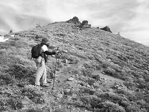
The sensation can feel like you are walking on air. Many get dizzy. Some are afraid to look down. Most all feel a sense of rapture. This is your payoff at the 8,587-foot Sierra Buttes and its lookout station. A small grated walkway extends around the lookout, where you can look straight down, past your boots and into the open air below. You are atop a pinnacle that is roughly 5,000 feet over Sierra City on one side and 2,800 feet over Sardine Lakes on the other.
The 360-degree view is one of the best you can get with a short hike, but that’s not what will stay with you for years. You will remember the act of faith required to traverse a set of metal stairways and grated deck that jut out over open space. Only the daring will look down to see the plummeting open space below. Put this one on your must-do list. The Sierra Buttes are a series of towering crags located in Tahoe National Forest that loom above the Yuba River Canyon, Sierra City and Highway 49.
It’s a one-way hike of 3.3 miles, by my estimate, with a climb of about 2,400 feet. I did it in an hour, 10 minutes, with a steady, rhythmic pace that I estimated at a little less than my normal 2.5 mph.
The parking area and trailhead are at about 6,200 feet, where trail starts as an old jeep road (a designated OHV route is off to the right). You begin to climb right away. After making your way up to a ridge, it becomes a single-track hiking path, shaded below old-growth whitebark pine. At a few openings in the forest ahead of you, you can see how the route follows the ridge and rises to the southern spine of the buttes. In about a mile, look for a huge boulder field on your left. An unsigned cutoff spur leads about 30 yards to your first gorgeous lookout, of Young America Lake directly below and beyond to Upper and Lower Sardine Lake, backed by an overview of Mount Elwell and the Lakes Basin.
From here, the climb gets steeper. It’s a short trip, so those not used to the grade or altitude can take plenty of time. Near tree line, the trail emerges and hits the old jeep road, the one used in the 1960s when the lookout was constructed, and you turn left, then know you are getting close. The trail bounds, rises, and carves its way through the lower buttes. To the distant north, 10,457-foot Lassen Peak comes into view. You continue up the trail, round a bend, and suddenly the lookout, top pinnacle, and the series of metal stairs are in front of you.
At the stairs, some people have no trouble bounding right up. Others need a steadying hand of comfort from behind. Some look down. Others? No way. The stairs jangle and rattle as you climb; you might hear a little voice in the back of your head daring you to look down. At one spot, where a set of stairs extends over open air, you realize why this hike is an act of faith. The final set of stairs gives you access to the grated catwalk deck around the lookout building, perched on the top of a crag. It can be eerie to peer down through the grate in some spots and see nothing but air so far below. Some get vertigo from the spatial disorientation and will suddenly grab on to the building or whoever is standing next to them. The view is fantastic. Directly below to the west, the Yuba River Canyon drops 5,000 feet in 10 miles and leads out toward the Sacramento Valley. To the south, you can scan across gorgeous French Meadows Reservoir, Grouse Ridge, and the Bowman Lakes and on to the distant snowy crest of the Crystal Basin on the edge of Tahoe. Below to the east is the showstopper, the Sardine Lakes.
As pretty as it is, what you will remember at the Sierra Buttes Lookout is not the view. It’s the edge-of-the world, fear-tinged euphoria. The experience can open your pores and make every cell in your body feel alive.
User Groups: Hikers, dogs, and horses. No mountain bikes (except on jeep trail). No wheelchair access.
Permits: No permits are required. Parking and access are free.
Maps: A trail map is available for a fee from the Downieville Ranger District. For a map, ask the U.S. Forest Service for Tahoe National Forest. For a topographic map, ask the USGS for Sierra City.
Directions: From Sacramento, take I-80 east for 97 miles to Truckee and the exit for Highway 89 North. Follow that exit to the traffic circle, then take the third exit to Highway 89 and drive 22.6 miles to a junction for Highway 49/Highway 89 (signed for Quincy/Downieville). Turn left and drive 17.8 miles (stay on 49 at junctions) to Bassetts and the Gold Lake Highway. Turn right and drive 1.4 miles to Sardine Lake/Packer Lake Road. Turn left and drive a short distance to a junction signed Sardine Lakes ahead, Packer Lake to right. Turn right on Packer Lake Road. Continue past turnoff for Packer Lake and bear left at a fork (still paved), following the signs to a trailhead for the Pacific Crest Trail (do not bear right at a jeep road). Continue as road becomes dirt (OK for cars) to a parking area on left at trailhead. Parking and trailhead signed.
Contact: Tahoe National Forest, Yuba Ranger District, 530/478-6253, www.fs.usda.gov/tahoe.

5.2 mi/1-3.0 hr
east of Sierra City in Tahoe National Forest
Chapman Creek is a babbling brook that you can walk alongside, or you can stop to picnic near it, fish a little in it, or do absolutely nothing. That’s right, nothing. It’s that kind of place. The trailhead, elevation 5,840 feet, is set at a campground, which provides easy access. Outside of campers, few others know of it. The trail winds easily along the contours of Chapman Creek under the canopy of a dense forest, rising gently along the way. It climbs to 6,400 feet, 560 feet in a span of 1.5 miles. The river is the lifeblood for a variety of birds and wildlife, but few visitors make the trip for that reason. Rather they come to stroll and let their minds wander and be free. Few do the entire trail, which official ends at Forest Road 09-13.
User Groups: Hikers, dogs, horses, and mountain bikes. No wheelchair facilities.
Permits: No permits are required. Parking and access are free.
Maps: For a map, ask the U.S. Forest Service for Tahoe National Forest. For a topographic map, ask the USGS for Sierra City.
Directions: From Sacramento, take I-80 east for 97 miles to Truckee and the exit for Donner Pass Road/Highway 89 North. Follow that exit to the traffic circle, then take the second exit for 0.2 mile to another traffic circle. Take the third exit on that traffic circle to Highway 89 and drive 22.6 miles to Sierraville and a junction for Highway 49/Highway 89 (signed for Quincy/Downieville). Turn left on Highway 49 and drive over Yuba Pass; continue for four miles to the Chapman Creek Campground on the right. The trailhead and a parking area are at the north end of the campground.
Contact: Tahoe National Forest, Yuba Ranger District, 530/478-6253, www.fs.usda.gov/tahoe.
6.0 mi/1 day
east of Sierra City in Tahoe National Forest
A canyon with a hidden stream and a waterfall surrounded by old-growth red fir make this a hike for the properly inspired. Why must you be properly inspired? The route to the trailhead causes it to get missed. The trail climbs from 4,400 feet up Haypress Creek to 5,840 feet, a 1,440-foot rise over just three miles. The trail starts out almost flat for the first 0.5 mile, and then it crosses over Haypress Creek on a footbridge. There’s an excellent view of the Sierra Buttes in this area. Continue on Haypress Creek Trail, where you rise past a rocky area and into a once-logged forest. The trail soon enters an old-growth forest. It then contours along Haypress Canyon, and then passes by a pretty waterfall. This hike makes a great day trip with a picnic lunch, and trail use is typically quite light. Note that on the return trip, you turn right on the Pacific Crest Trail to complete the loop. Walk 0.5 mile and turn left at the Wild Plum Loop sign to return.
User Groups: Hikers, dogs, and horses. No mountain bikes. No wheelchair facilities.
Permits: No permits are required. Parking and access are free.
Maps: For a map, ask the U.S. Forest Service for Tahoe National Forest. For a topographic map, ask the USGS for Haypress Valley.
Directions: From Sacramento, take I-80 east for 97 miles to Truckee and the exit for Donner Pass Road/Highway 89 North. Follow that exit to the traffic circle, then take the second exit for 0.2 mile to another traffic circle. Take the third exit on that traffic circle to Highway 89 and drive 22.6 miles to Sierraville and a junction for Highway 49/Highway 89 (signed for Quincy/Downieville). Turn left on Highway 49 and drive 12 miles (past Bassetts) to Wild Plum Road (near the eastern end of Sierra City) at the sign for Wild Plum Campground. To then reach the trailhead, drive one mile on this road to the Wild Plum trailhead parking area. Walk through the campground to its upper loop, walk around a locked gate, and continue up the road 0.25 mile to the Wild Plum Loop Trail sign. Walk 0.25 mile to the intersection with the Pacific Crest Trail, turn left, and cross a bridge over Haypress Creek. Continue for 200 yards to the trailhead, on the right.
Contact: Tahoe National Forest, Yuba Ranger District, 530/478-6253, www.fs.usda.gov/tahoe.

51.0 mi one-way/4 days
in Tahoe National Forest, off Highway 49 east of Sierra City
Pristine alpine lakes and high mountain lookouts highlight this section of the Pacific Crest Trail. Although nearly as beautiful as the section of trail south near Tahoe, this stretch gets far less use. It starts at the Yuba River, and in the first two miles, it climbs an endless series of switchbacks up the back side of the Sierra Buttes. This is a long, grueling climb on exposed terrain with a great reward. Note that the spur trail up to the Sierra Buttes Fire Lookout is an additional 1,400-foot climb, but it furnishes one of the top lookouts in California. The trail then heads north. It skirts past the western border of the Gold Lakes Basin, where a dozen high alpine lakes make for easy side trips and camps. With some terrible switchbacks, the PCT passes Mount Gibraltar (7,343 feet), Stafford Mountain (7,019 feet), and Mount Etna (7,163 feet), and flanks below Pilot Peak (7,457 feet). It then heads along the western slope, eventually reaching the Fowler Peak trailhead.
To continue north on the PCT, see the Fowler Peak to Bucks Summit (PCT) hike in this chapter. If you are walking this trail in reverse, see the Donner Pass to the Yuba River (PCT) hike in this chapter.
User Groups: Hikers, dogs, and horses. No mountain bikes. No wheelchair access.
Permits: A wilderness permit (free) is required. Parking and access are free. A single permit is required to hike the Pacific Crest Trail. Contact the national forest, Bureau of Land Management, or national park office at your point of entry for a combined permit that is good for traveling through multiple-permit areas during your dates of travel.
Maps: For a map, ask the U.S. Forest Service for Tahoe National Forest. For topographic maps, ask the USGS for Haypress Valley, Sierra City, Mount Fillmore, and Onion Valley.
Directions: From Sacramento, take I-80 east for 97 miles to Truckee and the exit for Donner Pass Road/Highway 89 North. Follow that exit to the traffic circle, then take the second exit for 0.2 mile to another traffic circle. Take the third exit on that traffic circle to Highway 89 and drive 22.6 miles to Sierraville and a junction for Highway 49/Highway 89 (signed for Quincy/Downieville). Turn left on Highway 49 and drive 12 miles (past Bassetts) to near the eastern end of Sierra City. Look for the Pacific Crest Trail access sign and park on the right (north) side of the road.
Contact: Tahoe National Forest, Yuba Ranger District, 530/478-6253, www.fs.usda.gov/tahoe.

8.0 mi/4.0 hr
in Tahoe National Forest north of Emigrant Gap
The prize destination is a hidden, pristine lake called Glacier Lake, set at the foot of a volcanic massif called Black Butte. Highlights include beautiful sweeping views of the Sierra and the opportunity for side trips to several other lakes. A round-trip from the trailhead to Glacier Lake and back is just under seven miles. It is one of the highlights of the Bowman Lakes Recreation Area, generally ranging 5,000-7,500 feet in elevation, featuring Sierra granite, pines, and dozens of alpine lakes.
It’s a bumpy drive (four-wheel drive helps) up past a small campground to the Grouse Ridge trailhead and parking area. From the trailhead, the hike starts on an exposed ridge. Within just a few minutes, two gorgeous azure lakes come into view to your left, Milk Lake and Round Lake. Many creep over to the ridge to get a better look. Then, back on the trail, another pretty lake can be spotted off to your right, Sanford Lake. The trail then descends quickly into a forested valley, where you arrive at an unsigned trail junction (out of curiosity, we explored this and found it led down a canyon to pretty Downey Lake. This alone is a good trip, an easy 20-minute jaunt to get there). Continuing north, you pass a signed trail junction on your left (which is routed west down to Round Lake, Milk Lake, and then Carr and Feely Lakes), and then come to a trail cutoff on your right—this is your turn for Glacier Lake.
This cutoff trail passes through a series of meadows and stands of pines, rising steadily along the way, with exposed Sand Ridge (fantastic wildflowers in mid-June) directly off to your left. Eventually you will spot Black Butte, the craggy ridge set on the nearby horizon ahead, and realize that Glacier Lake, your destination, is set right at the foot of it. You will top a ridge and come across a series of small camping flats, popular in July and August, and descend to lake’s edge, an elevation of 7,500 feet. This is a small and pristine setting, with the lake’s clear, calm waters providing a sharp contrast to the high backdrop of the buttes, brown, black, and craggy, even crumbling in spots.
User Groups: Hikers, dogs, horses, and mountain bikes. No wheelchair facilities.
Permits: A campfire permit (free) is required for overnight use. Parking and access are free.
Maps: For a map, ask the U.S. Forest Service for Tahoe National Forest. For topographic maps, ask the USGS for Cisco Grove and English Mountain.
Directions: From Sacramento, take I-80 east past Emigrant Gap to the exit for Highway 20. Take that exit and go west four miles to Bowman Lake Road (Forest Road 18). Turn right on Bowman Lake Road and drive about five miles to Grouse Ridge Road. Turn right and go six miles (often rough) to a fork at Grouse Ridge. At the fork, bear right to the campground or bear left to the trailhead. A four-wheel-drive, high-clearance vehicle is recommended.
Contact: Tahoe National Forest, Nevada City Ranger District, 530/265-4531, www.fs.usda.gov/tahoe.
7.0 mi/3.0 hr
in Tahoe National Forest north of Emigrant Gap
The highlight of Lindsey Lakes Trail is that it intersects with other trails, including the Grouse Ridge Trail, and is set in a gorgeous landscape that features Sierra alpine beauty. But the trail itself from Lindsey Lakes to Rock Lake is a service road closed to public vehicle traffic, so you’re hiking up a road. This 3.5-mile trail dead-ends after climbing past the three Lindsey Lakes, and it offers a great optional side trip. From the trailhead at Lower Lindsey Lake (elevation 6,160 feet), hike up to the other lakes on a short trail (it’s quite steep in several places) before you top out at 6,400 feet. The route gets medium use and accesses good swimming holes with cold water, but the fishing is poor. A side trip from the Lindsey Lakes Trail is Crooked Lakes Trail (excellent).
User Groups: Hikers, dogs, and horses. Mountain bikes not advised. No wheelchair facilities.
Permits: No permits are required. Parking and access are free.
Maps: For a map, ask the U.S. Forest Service for Tahoe National Forest. For topographic maps, ask the USGS for English Mountain and Graniteville.
Directions: From Sacramento, take I-80 east past Emigrant Gap to the exit for Highway 20. Take that exit and go west four miles to Bowman Lake Road (Forest Road 18). Turn right on Bowman Lake Road and drive 8.5 miles to a junction signed Lindsey Lake, Feely Lake, Carr Lake. Turn right (dirt, some rocks, passable for cars, SUV recommended) and drive four miles (at fork, turn left for Lindsey Lake, right for Carr and Feely Lake). Turn left and drive about a mile to Lindsey Lake and trailhead. The last half mile of road can be rough; high-clearance vehicles are advised.
Contact: Tahoe National Forest, Nevada City Ranger District, 530/265-4531, www.fs.usda.gov/tahoe.
6.0 mi/3.0 hr
at Carr Lake in Tahoe National Forest north of Emigrant Gap
This is the most popular trailhead in the Bowman Lakes Recreation Area. It’s crowded all summer, and the parking lot fills early on summer weekends. The reason is because you get easy access to Carr Lake and Feeley Lake, and then launch into wildlands to gorgeous Island Lake and stunning Penner Lake, an easy six-mile round-trip. Dozens of small lakes are within reach on the Crooked Lakes Trail, Grouse Ridge Trail, and others. Milk Lake, for instance, is also gorgeous. The area feels like wilderness, but is not designated as wilderness. Mountain bikes are permitted on trails, though until all the snow melts off and surface dries out, conditions are poor for biking.
This is how you do it. From the parking area, walk back a short distance and turn right for a short climb past Carr Lake on the right. You emerge above Carr and Feely Lake (6,720 feet) coming into view on the left. The trail runs along the right side of Feely and then enters forest. It’s a gentle climb then to Island Lake, named for the little rock “islands,” as they call them, and the junction of the Crooked Lakes Trail (signed). Take the Crooked Lakes Trail through a fir forest for 1.5 miles, which includes a short climb, to Penner Lake. Penner Lake (along with Milk) is one of the prettiest lakes in the area. The ambitious can continue another mile to Upper Rock Lake.
User Groups: Hikers, dogs, mountain bikes, and horses. No wheelchair facilities.
Permits: No permits are required. Parking and access are free.
Maps: For a map, ask the U.S. Forest Service for Tahoe National Forest. For topographic maps, ask the USGS for English Mountain and Graniteville.
Directions: From Sacramento, take I-80 east past Emigrant Gap to the exit for Highway 20. Take that exit and go west four miles to Bowman Lake Road (Forest Road 18). Turn right on Bowman Lake Road and drive 8.5 miles to a junction signed Lindsey Lake, Feely Lake, Carr Lake. Turn right (dirt, some rocks, passable for cars, SUV recommended) and drive four miles (at fork, turn left for Lindsey Lake, right for Carr and Feely Lake). Turn right and drive about a mile to the parking area for Carr Lake and trailhead. The last half mile of road can be rough; high-clearance vehicles are advised, four-wheel drive is better.
Contact: Tahoe National Forest, Nevada City Ranger District, 530/265-4531, www.fs.usda.gov/tahoe.

38.0 mi one-way/3 days
from Highway 80 to Highway 49 in Tahoe National Forest
This is not one of the more glamorous sections of the Pacific Crest Trail. But it is still provides rewards. For the most part, the PCT here follows a crest that connects a series of small mountaintops before dropping down to Jackson Meadow Reservoir and Highway 49. Some good views are to be had on the first leg of the trail, so many that some PCT hikers begin to take them for granted after a while. The trail is routed past Castle Peak (elevation 9,103 feet), Basin Peak (9,015 feet), and Lacey Mountain (8,214 feet). Most can cover this much terrain for an ambitious first day, perhaps with stops at Paradise Lake or White Rock Lake. As the trail drops to Jackson Meadow Reservoir, the views end, but in time you’ll catch sight of the lake; surrounded by firs, it is quite pretty. The PCT then skirts the east side of the reservoir, passes several drive-to campgrounds, heads through Bear Valley (not the Bear Valley), and drops steeply to Milton Creek and four miles beyond that to Loves Falls at Highway 49.
back side approach to Castle Peak
To continue north on the PCT, see the Yuba River to Fowler Peak (PCT) hike in this chapter. If you are walking this trail in reverse, see the Barker Pass to Donner Pass (PCT) hike in this chapter.
User Groups: Hikers, dogs, and horses. No mountain bikes. No wheelchair facilities.
Permits: A campfire permit (free) is required for overnight use. Parking and access are free. A single permit is required to hike the Pacific Crest Trail. Contact the national forest, Bureau of Land Management, or national park office at your point of entry for a combined permit that is good for traveling through multiple-permit areas during your dates of travel.
Maps: For a map, ask the U.S. Forest Service for Tahoe National Forest. For topographic maps, ask the USGS for Norden, Soda Springs, Webber, Haypress Valley, Independence Lake, and English Mountain.
Directions: From Auburn, take I-80 east to the Boreal/Donner Summit and the signed exit for Pacific Crest trailhead parking area. Take that exit to parking. There is no hiker parking in the Donner Summit rest area.
Contact: Tahoe National Forest, Sierraville Ranger District, 530/994-3401, www.fs.usda.gov/tahoe.
10.0 mi/1 day
in Tahoe National Forest north of Emigrant Gap
In just a few hours you can be transported to heaven. Some people, however, call it the Bowman Lakes Recreation Area. It is a five-mile hike with a 1,500-foot climb to reach Glacier Lake (7,000 feet). You pass lake after lake and then end up at a pristine setting with a high back wall. The small lake is set in a rockbound bowl with the Black Buttes looming nearby. The tree cover is sparse, and the rock cover is abundant.
Start your hike from the trailhead at Carr Lake. You then pass Carr Lake on the right, Feely Lake on the left, and then Island and Round Lakes. You’ll drop down into forest and meadow landscape and reach a trail junction (right leads up to Grouse Ridge, another trailhead where you can start this trip). At the junction, continue east on Glacier Lake Trail. You will continue through a meadow and some forest. Here you start a gradual climb, passing a small lake before entering a rocky area and then dropping down to the pretty lake. Several backpacking campsites are available.
Some maps of Tahoe National Forest do not show the direct route to Glacier Lake. Our route climbs up through a beautiful canyon. One map I saw, on the other hand, shows the trail routed up a hot, exposed route on Sandy Ridge off to the left (no good). This trailhead is popular and the parking lot fills.
User Groups: Hikers, dogs, and horses. Mountain bikes not advised. No wheelchair facilities.
Permits: No permits are required. Parking and access are free.
Maps: For a map, ask the U.S. Forest Service for Tahoe National Forest. For topographic maps, ask the USGS for Cisco Grove and English Mountain.
Directions: From Sacramento, take I-80 east past Emigrant Gap to the exit for Highway 20. Take that exit and go west four miles to Bowman Lake Road (Forest Road 18). Turn right on Bowman Lake Road and drive 8.5 miles to a junction signed Lindsey Lake, Feely Lake, Carr Lake. Turn right (dirt, some rocks, passable for cars, SUV recommended) and drive four miles (at fork, turn left for Lindsey Lake, right for Carr and Feely Lake). Turn right and drive about a mile to the parking area for Carr Lake and trailhead. The last half mile of road can be rough; high-clearance vehicles are advised, four-wheel drive is better.
Contact: Tahoe National Forest, Nevada City Ranger District, 530/265-4531, www.fs.usda.gov/tahoe.
1.0 mi/0.5 hr
east of Nevada City, off of Highway 20 in Tahoe National Forest
The Caltrans Omega Overlook provides a view over the South Yuba River Canyon and beyond, as well as a historic site of a huge hydraulic gold-mining operation. There is a parking area, a restroom, and a viewing area. It is also a primary trailhead for the 25-mile Pioneer Trail. The Pioneer Trail is like taking a history lesson. You trace the route of the first wagon road, opened by emigrants and gold seekers in 1850. The trail is better suited for mountain biking. In fact, it has become almost exclusively a biking trip, but its historical significance still merits inclusion in this book. It provides a short out-and-back walk with a great view. Significant sites along the Pioneer Trail are Central House (once a stagecoach stop) and White Cloud and Skillman Flat (former millsites, one burned down).
A high percentage of mountain bikers seem to use the one-way trip downhill from Omega to Five Mile House, with a shuttle. When encountering other trail users, all need to remember to demonstrate the utmost courtesy; that means slow the heck down.
User Groups: Hikers, dogs, mountain bikes, and horses. No wheelchair facilities.
Permits: A campfire permit (free) is required for overnight use. Parking and access are free.
Maps: For a map, ask the U.S. Forest Service for Tahoe National Forest. For a topographic map, ask the USGS for Washington.
Directions: From Nevada City, take Highway 20 east and drive for 16.9 miles to Omega Overlook on the left. Turn left and drive a short distance to parking.
Contact: Tahoe National Forest, Nevada City Ranger District, 530/265-4531, www.fs.usda.gov/tahoe.
1.0 mi/0.5 hr
off Highway 20 near Lake Spaulding
Many short interpretive trails are long on words in brochures and short on beauty. Not this one. From the parking area, the trail quickly leads into rich forest and to pretty Bear River. It provides glimpses of a series of gorgeous sites amid a forest of pines and cedars, with a payoff of a pretty stream and small waterfall. Much of the trail is soil cement or compressed gravel. It is designed as an interpretive loop walk, with information about ecosystems, wildlife, geology, and cultural history available. For Buddy, the family golden retriever, it’s always a favorite.
User Groups: Hikers, dogs, and wheelchairs (with assistance). No horses or mountain bikes. Dogs permitted, but rangers strongly discourage bringing them on this trail.
Permits: No permits are necessary. Parking and access are free.
Maps: For a topographic map, ask the USGS for Blue Canyon.
Directions: From Sacramento, take I-80 east past Emigrant Gap to the exit for Highway 20. Take that exit and go west four miles to Bowman Lake Road (Forest Road 18). Turn right on Bowman Lake Road and drive 0.6 mile to the Sierra Discovery Trail parking lot on the left.
Contact: Pacific Gas & Electric, 916/386-5164, www.pge.com./recreation.
7.2 mi/4.0 hr
south of Cisco Grove in Tahoe National Forest
Most people would like to know what heaven is like. This trip to Loch Leven Lakes is unlikely to be your final resting place, yet it provides a glimpse of what heaven might be. Although there is some road noise at the beginning of this trip, the end is well worth it. You get sweeping vistas of ridges and valleys, gorgeous high alpine meadows, and glaciated mountain terrain with a series of pretty lakes.
The trail starts at 5,680 feet, then works its way upward on a moderate grade to the southwest. Granite outcrops are numerous, and huge boulders (deposited by receding glaciers) lie sprinkled among Jeffrey pine and lodgepole pine. In the first 1.1 mile, the trail crosses a creek and railroad tracks. It then climbs through a forest. Here the trail becomes steeper, where you climb 800 feet in 1.25 miles. It then tops the summit and descends gently to Lower Loch Leven Lake (2.5 miles from the trailhead). Many people stop here, content to just take in the surroundings. But you can forge on for another mile, circling Middle Loch Leven Lake (2.8 miles from the trailhead) and heading east up to High Loch Leven Lake (3.6 miles from the trailhead), at 6,800 feet. At the south end of Lower Loch Leven Lake, turn left at the trail junction to see Middle and High Loch Leven Lakes (turning right at the junction will route you to Salmon Lake, a less-crowded alternative). Once you’ve come this far, beautiful High Loch Leven is an easy trip and a must-do.
But this hike is not without frustration: The first hour involves a continuous climb, with the echo of I-80 traffic in the background. You do not escape the noise until you top the ridge. Elevations range 5,680-6,850 feet at the ridge, a gain of 1,070 feet. With access so easy off I-80, the area can become inundated with people on summer weekends. With no trailhead quota, the numbers can affect the sense of a wild place.
User Groups: Hikers, dogs, and horses. Mountain bikes not advised. No wheelchair facilities.
Permits: No permits are required. Parking and access are free.
Maps: For a map, ask the U.S. Forest Service for Tahoe National Forest. For a topographic map, ask the USGS for Cisco Grove.
Directions: From Sacramento, take I-80 east for 70 miles into the Sierra Nevada and to Exit 165 toward Cisco Grove. Take that exit a short distance to Hampshire Rocks Road. Turn left on Hampshire Rocks Road and drive (well signed) 0.4 miles (0.2 miles past the old Big Bend Visitor Center). The trailhead is on the opposite side of the road from the parking area.
Contact: Tahoe National Forest, Truckee Ranger District, 530/587-3558, www.fs.usda.gov/tahoe.
6.0 mi/3.0 hr
in Tahoe National Forest near Soda Springs
If timing is everything in love and the outdoors, then time this trip for the shoulder seasons, spring or fall. In summer, mountain bikers take over this trail. Traffic is high on weekends. Lower Lola Montez is a beautiful alpine lake set at 7,200 feet. Start at Toll Mountain Estates, a private community. The first 0.25 mile is on single-track. Then you reach a dirt road and turn right, cross Castle Creek, and continue until the road becomes single-track again. The route is marked all the way, and with all the people who ride this in summer, it’s an easy track to follow.
User Groups: Hikers, dogs, horses, and mountain bikes. No wheelchair facilities.
Permits: No permits are required. Parking and access are free.
Maps: For a map, ask the U.S. Forest Service for Tahoe National Forest. For topographic maps, ask the USGS for Soda Springs and Norden.
Directions: From Auburn, take I-80 east for 55 miles to Soda Springs. Take the Soda Springs/Norden exit and cross the overpass to the north side of the freeway. Follow the paved road east, past the fire station, for 0.3 mile to the trailhead parking area.
Contact: Tahoe National Forest, Truckee Ranger District, 530/587-3558, www.fs.usda.gov/tahoe.
10.0 mi/6.0 hr
in Tahoe National Forest near Soda Springs
The hike to Heath Falls is like going on vacation on your credit card. You can have all the fun you want, but when you return home, you have to pay up. That’s because the trip to the Heath Falls Overlook is downhill nearly all the way, where you descend 1,700 feet over five miles. Stunning alpine scenery will have you smiling the whole time. The return trip is a long and steady five-mile climb back uphill, so be sure you have plenty of trail snacks, water, and energy left for it.
The trail begins at the dam between the two Cascade Lakes, the first of many lakes you’ll see on this trip. The big hunk of imposing rock you have to walk around is 7,704-foot Devils Peak. Take the right fork signed for the North Fork American River, and get ready for a steady diet of granite, lakes, and vistas. At 2.2 miles, the trail leaves the rocks behind and enters the forest, switchbacking downhill for two miles to the Palisade Creek Bridge. Look for an unsigned junction 300 yards beyond it, where Heath Falls Overlook Trail heads east. Follow it for 0.5 mile to the trail’s end, at a vista of the American River’s Heath Falls. After you enjoy the falls overlook, you’ve got to make the long climb home. Hope you have at least one Clif Bar left.
The Forest Service lists the Palisade Creek Trails as 11.1 miles long; their trail experts are referring to the entire length of that particular trail, end to end, one-way, rather than our preferred route to the waterfall and back.
User Groups: Hikers, dogs, and horses. No mountain bikes. No wheelchair facilities.
Permits: No permits are required. Parking and access are free.
Maps: For a map, ask the U.S. Forest Service for Tahoe National Forest. For topographic maps, ask the USGS for Soda Springs and Norden.
Directions: From Sacramento, take I-80 east for 79 miles to Exit 174 for Soda Springs/Norden. Take that exit for 0.2 mile to Donner Pass Road. Turn right on Donner Pass Road and drive 0.7 mile to Soda Springs Road. Turn right and drive 0.9 mile to Pahatsi Road. Turn right and drive 0.2 mile (turns to dirt, becomes Kidd Lakes Road) and continue straight for 3.8 miles (you pass Kidd Lake on your left and the Royal Gorge Devils Lookout Warming Hut on your right) to a fork. After the warming hut, take the left fork and drive 0.5 mile to the trailhead, signed as Palisade Creek Trail, on the north side of Cascade Lakes.
Contact: Tahoe National Forest, Truckee Ranger District, 530/587-3558, www.fs.usda.gov/tahoe.
14.0 mi/2 days
in Tahoe National Forest near Donner Summit
The first 1.6 miles of this trail follow the same route as the Summit Lake Trail (see listing), along the PCT access trail and through the tunnel underneath I-80 to a fork. To reach Warren Lake, take the left fork (the right fork goes to Summit Lake). Summit Lake Trail is an easy stroll; the Warren Lake Trail climbs 1,500 feet and then drops 1,500 feet, which you must repeat on the return trip. The elevation change means you part company with most casual hikers.
From the fork, the route climbs through lodgepole pine and red fir forest to a saddle at three miles, where there are excellent views of much of the landscape you will hike through. The trail drops gently over the next 3.5 miles, into a wide valley basin that has a mix of volcanic and glaciated rocks. Wildflowers abound on the valley floor. After a brief climb to a ridge, the final mile is a steep descent, where you plummet 1,000 feet to Warren Lake. You’ll find many campsites on the lake’s west and south sides.
For Day 2, note that just before you reach the top of the ridge, about 1.3 miles from Warren Lake, there is a left spur trail that leads to Devils Oven Lake. It’s a good day hike for Day 2.
User Groups: Hikers, dogs, horses, and mountain bikes. No wheelchair facilities. No mountain bikes on Pacific Crest Trail.
Permits: No permits are required. Parking and access are free.
Maps: For a map, ask the U.S. Forest Service for Tahoe National Forest. For a topographic map, ask the USGS for Norden.
Directions: From Sacramento, take I-80 east for 86 miles to Exit 176 for Castle Peak/Boreal Ridge Road exit (just west of Donner Summit). Take that exit and turn right, go a very short distance, and then immediately turn left, and drive 0.4 mile to the trailhead for Donner Summit and the Pacific Crest Trail.
Contact: Tahoe National Forest, Truckee Ranger District, 530/587-3558, www.fs.usda.gov/tahoe.

4.0 mi/2.0 hr
in Tahoe National Forest near Donner Summit
The Summit Lake Trail is a quick and easy leg-stretcher and a great hike for families. It leads two miles to a pretty alpine lake at 7,400 feet. It is crowded on weekends. You will find those who are not fit often complain that the short climb is harder than they expected. For those who live at sea level, it’s rather the elevation that usually gets them. Start the trip at the PCT trailhead. Head east, where you roughly parallel the freeway. A half mile in, watch for an intersection. You must turn left and follow the PCT Access Trail north (signed for Castle Pass and Peter Grubb Hut) through a tunnel underneath I-80 (it’s not as bad as it sounds). Once you’re on the north side of the freeway, you’ll reach a fork. Bear right for Summit Lake and Warren Lake, then start to climb a bit. The trail alternates through fir forest and occasional open ridges, with some excellent views to the south and east. At 1.6 miles, you’ll see another trail fork: Warren Lake to the left and Summit Lake to the right. Bear right, and finish out your walk to the lake’s edge.
User Groups: Hikers, dogs, horses. No mountain bikes. No wheelchair facilities.
Permits: No permits are required. Parking and access are free. No mountain bikes on Pacific Crest Trail.
Maps: For a map, ask the U.S. Forest Service for Tahoe National Forest. For a topographic map, ask the USGS for Norden.
Directions: From Sacramento, take I-80 east for 86 miles to Exit 176 for Castle Peak/Boreal Ridge Road exit (just west of Donner Summit). Take that exit and turn right, go a very short distance, and then immediately turn left, and drive 0.4 mile to the trailhead for Donner Summit and the Pacific Crest Trail.
Contact: Tahoe National Forest, Truckee Ranger District, 530/587-3558, www.fs.usda.gov/tahoe.

10.5 mi/2 days
on the North Fork American River near Baxter in Tahoe National Forest
This is an old mining trail built for a goatlike miner from the 1850s, steep on the way into the canyon with a 2,000-foot descent. For the trip back out of the canyon, it qualifies as a kill-me, eat-me hike. From the trailhead, the route winds steeply down to the river and Euchre Bar near Rawhide, where a suspension footbridge crosses the North Fork American River. The trail then leads upriver for 2.4 miles, along an excellent stretch of water for fishing, camping, panning for gold, and swimming (cold). The trail extends along the river for 5.3 miles. Sharp-eyed hikers will see rusted-out remnants from the gold rush era.
User Groups: Hikers, dogs, and horses. Mountain bikes not advised. No wheelchair facilities.
Permits: Campfire permits are required for overnight use. Parking and access are free.
Maps: For a map, ask the U.S. Forest Service for Tahoe National Forest. For topographic maps, ask the USGS for Dutch Flat and Westville.
Directions: From Sacramento, take I-80 east for 51 miles to Exit 146 for Alta. Take that exit 0.2 mile to Morton. Turn right on Morton, drive 100 feet to Casa Loma Road, then turn left on Casa Loma and drive three miles (requires several jogs, becomes rough, high-clearance recommended, four-wheel drive advised near end) to the trailhead.
Contact: Tahoe National Forest, Nevada City Ranger District, 530/265-4531, www.fs.usda.gov/tahoe.
4.5 mi/3.5 hr
near the North Fork American River in Tahoe National Forest
Miners in the 1850s were like mountain goats. Like any good goat, they knew the most direct route between two points was a straight line. As a result, this route—which miners once used to reach the North Fork American River—is almost straight down going in and straight up coming out, gaining 3,000 feet in elevation over the course of 2.25 miles. The grade was measured at 35 percent at its steepest slopes (from 4,834 to 2,447 feet). As you head down from the trailhead at 5,400 feet, you get little help from switchbacks. The trail ends at the river, and from there, you must scramble and hop from rock to rock along the riverbanks. Eventually you end up at a secluded spot where all seems perfect—until you start the hike back. When you face the 3,000-foot climb out, you will wonder how you ever talked yourself into doing this hike.
User Groups: Hikers, dogs, and horses. Mountain bikes not advised. No wheelchair facilities.
Permits: No permits are required. Parking and access are free.
Maps: For a map, ask the U.S. Forest Service for Tahoe National Forest. For a topographic map, ask the USGS for Westville.
Directions: Take I-80 to Auburn and the exit for Foresthill/Foresthill Road. Take that exit, turn east on Foresthill Road, and drive 15.5 miles to Foresthill (and the Forest Service district office). Continue on Foresthill Road for 14.5 miles to Humbug Ridge Road (Forest Road 66). Turn left and drive three miles north to the trailhead. Four-wheel-drive, high-clearance vehicles are advised.
Contact: American River Ranger District, 530/367-2224, www.fs.usda.gov/tahoe.
7 mi/1 day
near the North Fork American River in Tahoe National Forest
Get this in focus: This trail spans an elevation of 5,377 to 2,632 feet to the North Fork American, a descent of 2,745 feet in 3.5 miles. Of the steep trails that plummet into the canyon of the North Fork American, this seems to be the most popular. On the way down, you get pretty views of the river canyon, and then of Royal Gorge. It leads down to the Mumford Bar Cabin, restored for viewing. You can continue upstream from here on the American River Trail. Some areas here on the River Trail show damage from past forest fires.
User Groups: Hikers, dogs, and horses. Mountain bikes are not advised. No wheelchair facilities.
Permits: No permits are required. Parking and access are free.
Maps: For a map, ask the U.S. Forest Service for Tahoe National Forest. For topographic maps, ask the USGS for Duncan Peak and Westville.
Directions: Take I-80 to Auburn and the exit for Foresthill/Foresthill Road. Take that exit, turn east on Foresthill Road, and drive 15.5 miles to Foresthill (and the Forest Service district office). Continue another 17 miles northeast (the road becomes Foresthill Divide Road) to the Mumford Bar Campground. Turn left and drive through the campground and access a road (becomes passable only for four-wheel-drive vehicles; others should park in the developed area on top) and continue to the trailhead.
Contact: Tahoe National Forest, American River Ranger District, 530/367-2224, www.fs.usda.gov/tahoe.
9.0 mi/5.0 hr
near Colfax
The Stevens Trail is a surprise to many. The trailhead is right aside I-80 and the throngs drive right by without a clue. It takes a few short jogs to reach the trailhead, and then you’re on your way. You leave the highway traffic behind in Colfax. The trail runs 4.5 miles down into the canyon of the North Fork American River, though many go out a ways, take in a canyon view, and then return. The features here are gentle terrain and long-distance canyon and stream views.
The parking area has a big trailhead sign, and this has become a popular trail for locals. You descend 1,200 feet over the course of 4.5 miles if you choose to head all the way to the river. From the ridge, continue on a gentle downhill path, where the return trip is up but well graded and not too difficult for most hikers. In wet years, there can be some small waterfalls. About two miles in, the trail splits; the upper trail (hikers only) leads to a creek crossing—little pool-and-drop cascades—and then rejoins with the main trail.
You can also see the railroad line that was built by Chinese laborers dangling in rope-strung baskets from the cliffs above. In the spring, you will also pass blooming wildflowers and buckeye trees. This trail is registered as a National Historic Trail. It was originally part of a livery trail from the town of Iowa Hill to Colfax. The entire historic route is no longer connected, with no bridge over the river, and the trail gone beyond that anyway. The biggest problem here is timing. This is no fun on a summer afternoon, with 90-degree temperatures and an afternoon climb out of a canyon.
Warning: Mountain lion encounters have occurred on this trail.
User Groups: Hikers, dogs, horses, and mountain bikes. No wheelchair facilities.
Permits: No permits are necessary. Parking and access are free.
Maps: For a topographic map, ask the USGS for Colfax.
Directions: From Sacramento, drive east on I-80 for four miles to Colfax and the exit signed Colfax-Grass Valley/Highway 174. Take that exit and drive a short distance (on the southeast side of I-80) to a stop sign at North Canyon (a frontage road). Turn left at North Canyon Way and drive one mile to the trailhead parking area. On weekends in spring, the parking lot can fill. Park on the road’s shoulder and do not block the lanes.
Contact: Bureau of Land Management, Mother Lode Field Office, 916/941-3101, www.blm.gov/ca.
5.2 mi/1 day
on the North Fork American River near Sugar Pine Reservoir
The trip starts at a little-known trailhead near Sugar Pine Reservoir, beyond the Sugarpine Dam (elevation 4,080 feet). From there, Green Valley Trail is steep and often rocky. It descends 2,240 feet in 2.25 miles before reaching the river. We do not advise extending your trip from here.
The end point is a site along the North Fork American. Fishing is decent. At some point, you’ll just want to watch the water go by, and try to forget what you have to do to return to your car. The price is steep. Run out of water on a hot day and the return trip will put you through more punishment than is typically handed out at Folsom Prison.
It is possible to continue downriver a short way or to cross the river (good luck) and hike upstream into Green Valley. However, these sections of the trail are in very poor condition, and the upstream route crosses private property owned by people who do not take kindly to visitors.
User Groups: Hikers, dogs, and horses. Mountain bikes are not advised. No wheelchair facilities.
Permits: No permits are required. Parking and access are free.
Maps: For a map, ask the U.S. Forest Service for Tahoe National Forest. For a topographic map, ask the USGS for Dutch Flat.
Directions: Take I-80 to Auburn and the exit for Foresthill/Foresthill Road. Take that exit, turn east on Foresthill Road, and drive 15.5 miles to Foresthill (and the Forest Service district office). Continue another 10 miles (it becomes Foresthill Divide Road, then Forest Road 10/Sugar Pine Road) and continue five miles (cross Sugar Pine Dam). From the dam, continue one mile to Elliot Ranch Road (just past the entrance to Sugar Pine Campground on the right). Turn north on Elliot Ranch Road and drive three miles to the trailhead on the left. High-clearance vehicles required, four-wheel drive advised.
Contact: Tahoe National Forest, American River Ranger District, 530/367-2224, www.fs.usda.gov/tahoe.

1.0 mi/0.5 hr
in Tahoe National Forest east of Foresthill
This is an easy, short loop trail that is routed through California’s northernmost grove of sequoias. It is set at 5,200 feet on Mosquito Ridge Road. The trail meanders through virgin old-growth forest, home to a half dozen monster-size trees. Along the 0.5-mile Big Trees Interpretive Trail are 16 stops marked with numbers that coincide with listings in a brochure that’s available at the trailhead, allowing visitors to take an interesting and informative self-guided tour of the history of these massive trees. Linked with Forest View Trail, the entire loop can extend 1.5 miles. Despite the long drive to the trailhead on Mosquito Ridge, the trail gets quite a bit of use. The drive in provides views of an expansive foothill landscape before entering the conifers.
User Groups: Hikers and dogs. No horses or mountain bikes. No wheelchair facilities.
Permits: No permits are required. Parking and access are free.
Maps: Free interpretive brochures are available at the trailhead. For a map, ask the U.S. Forest Service for Tahoe National Forest. For a topographic map, ask the USGS for Greek Store.
Directions: Take I-80 to Auburn and the exit for Foresthill/Foresthill Road. Take that exit, turn east on Foresthill Road, and drive 15.5 miles to Foresthill (and the Forest Service district office), and then continue 1.2 miles to Mosquito Ridge Road. Turn right (east) on Mosquito Ridge Road and drive 24 miles to Forest Road 16. Turn right and drive 0.5 mile to parking and the trailhead.
Contact: Tahoe National Forest, American River Ranger District, 530/367-2224, www.fs.usda.gov/tahoe.
5.9 mi/3.0 hr
in Tahoe National Forest east of Foresthill
The Western States Trail is best known for long-distance, competitive runs and equestrian rides. At times, mountain bikers take over the trail as well. This section captures one of the better stretches for hikers. From Deadwood (a historic cemetery), you drop about 2.5 miles down to Eldorado Creek and reach a bridge. This is a decent spot for swimming on a midsummer afternoon or fishing for trout on early summer evening. The trail continues over the bridge and climbs 1,600 feet to Michigan Bluff. Few do this. If you have to go up, most just want to do it once, and that’s back to your car. The Michigan Bluff Trail is a section of the Western States Trail, which spans from Squaw Valley to Auburn.
User Groups: Hikers, dogs, horses, and mountain bikes. No wheelchair facilities.
Permits: No permits are required. Parking and access are free.
Maps: For a map, ask the U.S. Forest Service for Tahoe National Forest. For a topographic map, ask the USGS for Michigan Bluff.
Directions: Take I-80 to Auburn and the exit for Foresthill/Foresthill Road. Take that exit, turn east on Foresthill Road, and drive 15.5 miles to Foresthill (and the Forest Service district office). Continue northeast (it becomes Foresthill Divide Road) for 17 miles to Deadwood Ridge Road. Turn right (becomes dirt) and continue to the junction at Deadwood Cemetery. Park in the pullout. The road degrades quickly. High-clearance vehicles recommended.
Contact: Tahoe National Forest, American River Ranger District, 530/367-2224, www.fs.usda.gov/tahoe.
1.0 mi/0.5 hr
in Tahoe National Forest near Foresthill
Some waterfalls are simply mind-boggling in their beauty, and some provide the centerpiece of a beautiful setting. Grouse Falls is one of the latter. The hike is a 15-minute walk through old-growth forest to a viewing deck. From here you’re looking out over a deep and wide canyon. The waterfall is about 0.5 mile away across the canyon. It’s several hundred feet long, and when it’s running full, it can seem like a scene out of Yosemite. The overlook is a wooden platform with benches where you can sit and admire the beauty. It just seems to be a little far away. You don’t see or hear immense Grouse Falls until just before you come out to the overlook, and when you do, it can be a surprise. You need a tripod and long lens to best capture it in a photograph.
User Groups: Hikers, dogs, horses, and mountain bikes. No wheelchair facilities.
Permits: No permits are necessary. Parking and access are free.
Maps: For a map, ask the U.S. Forest Service for Tahoe National Forest. For a topographic map, ask the USGS for Michigan Bluff.
Directions: Take I-80 to Auburn and the exit for Foresthill/Foresthill Road. Take that exit, turn east on Foresthill Road, and drive 15.5 miles to Foresthill (and the Forest Service district office). Continue 1.2 miles to Mosquito Ridge Road. Turn right on Mosquito Ridge Road and drive 19.2 miles (the road becomes Foresthill Divide Road) to Peavine Ridge Road/Road 33. Turn left and drive 5.5 miles to a spur road for Grouse Falls. Turn left and go 0.5 mile to parking and the trailhead.
Contact: Tahoe National Forest, American River Ranger District, 530/367-2224, www.fs.usda.gov/tahoe.
7.4 mi/2.0 hr
at French Meadows Reservoir in Tahoe National Forest
The McGuire Trail has become a favorite side trip for families visiting or camping at French Meadows Reservoir (elevation 5,290 feet). The highlights are sweeping views of the lake below. The trailhead is near the boat ramp, at the upper parking lot next to the restroom. From here, the trail traces the north shore of the lake, and in the process, is routed in and out of forest. It then rises up an easy grade to the top of Red Star Ridge (5,600 feet) and provides good views of the reservoir below. French Meadows is a beautiful and large lake, covering nearly 2,000 acres when full. It is stocked each year with trout that join a healthy population of resident brown trout and holdovers from stocks of rainbow trout from prior years.
User Groups: Hikers, dogs, horses, and mountain bikes. No wheelchair facilities.
Permits: No permits are required. Parking and access are free.
Maps: For a map, ask the U.S. Forest Service for Tahoe National Forest. For a topographic map, ask the USGS for Bunker Hill.
Directions: Take I-80 to Auburn and the exit for Foresthill/Foresthill Road. Take that exit, turn east on Foresthill Road, and drive 15.5 miles to Foresthill (and the Forest Service district office). Continue 1.2 miles to Mosquito Ridge Road. Turn right on Mosquito Ridge Road and drive 38 miles to the French Meadows Reservoir Dam. Cross the dam, turn left (still Mosquito Ridge Road), and drive 5.5 miles (turn left at the intersection where the pavement ends, signed for boat ramp) to the trailhead, near McGuire Boat Ramp. The trailhead is at the upper parking lot next to the restroom.
Contact: Tahoe National Forest, American River Ranger District, 530/367-2224, www.fs.usda.gov/tahoe.
14.0 mi/2 days
in Tahoe National Forest near Squaw Valley
Tinker Knob is not an easy summit to reach, but those who do always remember it. The hike starts at the Squaw Valley Fire Station, elevation 6,100 feet. That much is easy. The Granite Chief Trail climbs 2,000 feet over a span of 3.5 miles to the Pacific Crest Trail (at 8,400 feet). Most of the climb is forested, but there are occasional openings with views of Lake Tahoe and surrounding peaks. Many hikers choose to “cheat” and ride the tram at Squaw Valley to reach the PCT, then start hiking around from there.
When, at last, you gain the PCT, turn right (north) toward Tinker Knob. It’s another 3.5 miles, most of it on an easier, winding grade along the top of a ridge. Yet there is a surprising, cruel stretch where you must drop downhill and then climb up again. The last section of trail is a series of switchbacks up to the Tinker Knob Saddle, then it’s a brief 0.25-mile climb to the summit of Tinker Knob, at 8,950 feet. You like views? How about this one: a head-swiveling vista of Anderson Peak, Painted Rock, Silver Peak, the American River Canyon, Donner Lake, and Lake Tahoe.
One-way option with a shuttle: To make this a one-way trip of 11 miles, it can be done with a partner and a shuttle car. Leave one car at the Coldstream trailhead near Donner Memorial State Park. (It’s at the horseshoe bend in the railroad tracks at the end of Coldstream Creek access road.) The Coldstream Trail meets the PCT just below the summit of Tinker Knob. After you gain the summit via the route described above, follow Coldstream Trail four miles down to its trailhead.
User Groups: Hikers, dogs, horses, and mountain bikes. No wheelchair facilities.
Permits: No permits are required. Parking and access are free.
Maps: For a map, ask the U.S. Forest Service for Tahoe National Forest. For topographic maps, ask the USGS for Tahoe City and Granite Chief.
Directions: From Truckee, take Highway 89 south and drive about eight miles to Squaw Valley Road. Turn right on Squaw Valley Road and drive 2.2 miles to the Squaw Valley Fire Station. The trail begins on its east side. You must leave your car in the large parking lot by the ski lift buildings, not by the fire station. Walk back across the bridge to the trailhead.
Contact: Tahoe National Forest, Truckee Ranger District, 530/587-3558, www.fs.usda.gov/tahoe.
12.0 mi/7.0 hr
in Tahoe National Forest near Squaw Valley
The Granite Chief Trail begins at the Squaw Valley Fire Station (at 6,100 feet) and climbs, climbs, and climbs some more until it reaches the Pacific Crest Trail, some 2,300 feet (at 8,400 feet) and 3.5 miles later. This is why many hikers choose to ride the tram at Squaw Valley to reach the PCT, then start hiking around from there. But not you? You like a challenge, right? Well, in either case, see you at the top.
When you reach the PCT, turn left (south) toward Twin Peaks. The view of Lake Tahoe and its cobalt waters is stunning. Still ascending, hike for one mile on the PCT to the eastern flank of Granite Chief Peak (elevation 9,086 feet). Finally you begin to descend, and in one more mile you reach an intersection with Western States Trail. Turn left and take a 0.5-mile walk to visit the Watson Monument, a stone marker at Emigrant Pass. In early summer, you probably won’t stay long if you arrive in the afternoon: Although the views are lovely, the wind is often fierce by mid- to late afternoon.
User Groups: Hikers, dogs, horses, and mountain bikes. No wheelchair facilities.
Permits: No permits are required. Parking and access are free.
Maps: For a map, ask the U.S. Forest Service for Tahoe National Forest. For topographic maps, ask the USGS for Tahoe City and Granite Chief.
Directions: From Truckee, take Highway 89 south and drive about eight miles to Squaw Valley Road. Turn right on Squaw Valley Road and drive 2.2 miles to the Squaw Valley Fire Station. The trail begins on its east side. You must leave your car in the large parking lot by the ski lift buildings, not by the fire station. Walk back across the bridge to the trailhead.
Contact: Tahoe National Forest, Truckee Ranger District, 530/587-3558, www.fs.usda.gov/tahoe.
5.0 mi/2.0 hr
in the Granite Chief Wilderness near Alpine Meadows
In a hike of just an hour or so, there’s a place at north Tahoe where you can reach a series of five wilderness lakes nestled in granite amid a pine forest. It’s called the Five Lakes Trail, and it’s one of the best short day hikes in California. It attracts a lot of folks in summer. Try it when the snow melts in spring and you can still have it to yourself. The trailhead is near Alpine Meadows Ski Area, with a sign, billboard, and map (on the right as you drive up). The hike is 2.5 miles one-way with a 1,000-foot climb into the Granite Chief Wilderness. At the trailhead, you park right on the road’s shoulder, and you’ll almost always see other cars marking the spot.
The first half mile of trail climbs right off, and if you are not acclimated to the elevation, it may take a while to catch your second wind. No problem. The trip is short, so if you need to, take your time. The climb eventually steadies out and most will find a nice rhythm as you rise up the flank of the canyon. At one point, you pass under a series of ski lift support structures for Alpine Meadows and can see up to the ridge to 8,637-foot Ward Peak. Much of the climb is amid exposed granite and manzanita, so you get big canyon views. At about two miles, you pop over the ridge and pass the boundary for the Granite Chief Wilderness. When you top the ridge at 7,400 feet, the trail then feeds you to a series of five pristine lakes linked by a mosaic of paths in forest. It’s a short walk beyond to the first lake on the left. The fun is just beginning. A short strait connects two of the biggest lakes, my favorites. At the biggest of them, a granite slab on one side, boulders and forest on the other, edges clear blue water. The ambitious can hike on and link up with the Pacific Crest Trail. Most have a trail picnic aside their favorite lake, then return.
User Groups: Hikers, dogs, and horses. No mountain bikes. No wheelchair facilities.
Permits: No permits are required for day hiking. Parking and access are free.
Maps: For a map, ask the U.S. Forest Service for Tahoe National Forest. For topographic maps, ask the USGS for Tahoe City and Granite Chief.
Directions: From Sacramento, take I-80 east for 90 miles to Truckee and Exit 185 for Highway 89. Take that exit, turn right, arc slightly on the roundabout, then continue on 89 and drive 9.8 miles (past exit for Squaw Valley) to Alpine Meadows Road. Turn right and drive 2.5 miles to the trailhead on the right (look for parked cars along road; billboard and sign at trailhead).
Contact: Tahoe National Forest, Truckee Ranger District, 530/587-3558, www.fs.usda.gov/tahoe.
6.0 mi/3.0 hr
in Tahoe National Forest near Tahoe City
Ward Creek Trail is tame compared to some of the more famous hikes at Lake Tahoe. There’s no stellar waterfall, no drop-dead gorgeous lake views, and no towering granite monoliths. But then again, there are no crowds either. For many, the trade-off is a good one. The route passes through fields of mule’s ears and forests of sugar pines, with enough open sections to provide wide-open views of the surrounding mountain ridges.
The trail begins as an old dirt road, paralleling Ward Creek for 1.5 miles to a washed-out bridge and a Road Closed sign. Cross the creek on logs and continue hiking, now on a single-track. The trail climbs a little higher above Ward Creek, then enters a dense, lovely pine forest. You can go as far as you like (the trail continues to Twin Peaks, 5.3 miles from the trailhead). For the mileage suggested, turn around when you are about 0.5 mile into the trees and take an easy stroll home.
User Groups: Hikers, dogs, horses, and mountain bikes. No wheelchair facilities.
Permits: No permits are required. Parking and access are free.
Maps: For a map, ask the U.S. Forest Service for Lake Tahoe Basin Management Unit. For a topographic map, ask the USGS for Tahoe City.
Directions: From Truckee, take Highway 89 south and drive to Tahoe City. Turn right on Highway 89 and drive two miles to Pineland Drive (just north of Kilner Park). Turn right on Pineland Drive and go 0.5 mile to Twin Peaks Drive. Turn left and drive 1.7 miles. (Twin Peaks Drive becomes Ward Creek Boulevard.) At 1.7 miles, park in the pullout on the left side of the highway and begin hiking at the gated dirt road, Forest Service Road 15N62. If the gate is open, you can drive inside and park along the dirt road.
Contact: Lake Tahoe Basin Management Unit, South Lake Tahoe, 530/543-2600, www.fs.usda.gov/ltbmu; Taylor Creek Visitor Center, open mid-June through mid-September (closed Tues. and Wed.), weekends on shoulder season starting Memorial Day and after Labor Day weekends, 530/543-2674.
6.0 mi/3.5 hr
in Tahoe National Forest near Tahoe City
Some people will spend a week hiking 100 miles to get what is already available in three miles and a few hours at 8,740-foot Ellis Peak (there’s one little trick and secret, and we’ll get to that). Of the dozen or so landmark peaks that surround Lake Tahoe, Ellis Peak requires one of the shortest hikes, especially compared to renowned Tallac, Freel and Pyramid. Ellis sits on the threshold of world-class greatness; at the top, it can be difficult to decide which way to face. One side towers over north Lake Tahoe, while the other looks across a false summit and Desolation Wilderness. The Crystal Range and Loon Lake lie below to the southwest, the Granite Chief Wilderness to the northwest. Everywhere you look are miles of spectacular high Sierra grandeur.
This six-mile, round-trip hike has a total elevation gain of roughly 1,500 feet. If there’s a catch, you’ll find out right off. The trail is hardly grade and instead is steep in two spots. In the first mile, you’ll climb about 800 feet through forest. As you emerge at a sub-ridge, notice a notch in the cliff on your left—you can peer down through a plummeting drop and see the parking area and your car below. That gives you a sense of how steep the trail is, and how high you are climbing so fast. As you continue ahead, you pass rafts of mule’s ears at your feet, and off to the right is beautiful Loon Lake in the Crystal Basin. Once you top the first sub-ridge, the trail contours along the ridge, then sails down to a mountain saddle. It then climbs again and gains Knee Ridge. You will cross an OHV road, with oft-mosquito-y Ellis Lake a short distance to your left. The primary trail is straight ahead.
From the Ellis Lake junction, it’s another 0.5-mile climb to the top. You emerge on an old dirt road for a bit to see a false summit directly ahead and to your left. Resist the urge to climb it. Instead, stay right and follow the trail as it arcs in a half circle, where it leads up another 0.25 mile to the top of Ellis Peak. After scrambling to the top of that pinnacle, it feels like you are on top of the world. Some of the rocks make perfect chairs. Sit and take in the views, expansive Tahoe blue on one side, an infinity of wilderness on the other.
User Groups: Hikers. Dogs and horses permitted, but not advised; only water at Ellis Lake. No mountain bikes (OHV route available 0.5 mile down road on left). No wheelchair facilities.
Permits: No permits are required. Parking and access are free.
Maps: For a map, ask the U.S. Forest Service for Lake Tahoe Basin Management Unit. For a topographic map, ask the USGS for Homewood.
Directions: Drive to Sacramento, then continue on I-80 east for 90 miles to Truckee and Exit 185 for Highway 89 South. Take that exit to a traffic circle, turn right, drive short distance to 89 South, and continue 13.5 miles to Tahoe City. Turn right (still 89) and drive 4.3 miles and look for sign on right for Kaspian Campground, and just beyond, Barker Pass Road/Forest Road 3 (unsigned). Turn right and drive seven miles (paved, watch for road bikes) into national forest. When road turns to dirt, drive short distance to Barker Pass, trailhead on left, and park along shoulder. Trailhead is signed.
Contact: Lake Tahoe Basin Management Unit, South Lake Tahoe, 530/543-2600, www.fs.usda.gov/ltbmu; Taylor Creek Visitor Center, open mid-June through mid-September (closed Tues. and Wed.), weekends on shoulder season starting Memorial Day and after Labor Day weekends, 530/543-2674.
1.0 mi/0.5 hr
off Highway 28 near Crystal Bay
At this lookout above Tahoe at North Shore (elevation 7,014 feet), you can check out the views with telescopes. Or, hey, forget the telescopes and just look with your own eyes. Either way, the view is unforgettable. A short self-guided historical trail is also available. You can learn all about the cultural history of North Shore, which includes stories of timber, railroads, casinos, and resorts. But what you remember, of course, is the world-class view across Lake Tahoe and beyond to its mountain rim.
For years we avoided this trail because we thought it was just a tourist attraction, located at the lookout tower that straddles the Nevada and California state line. It turns out that we were the dumb tourists, because this little trail is great.
User Groups: Hikers, wheelchairs, and dogs. No horses or mountain bikes.
Permits: No permits are required. Parking and access are free.
Maps: For a map, ask the U.S. Forest Service for Lake Tahoe Basin Management Unit. For a topographic map, ask the USGS for Kings Beach.
Directions: From Truckee, take Highway 89 south and drive to Tahoe City and Highway 28. Turn left on Highway 28 and drive six miles to Reservoir Drive (just east of the old Tahoe Biltmore Casino). Turn left (north) and drive to Lake View Avenue. Turn right and drive through a residential area and continue to Forest Service Road 1601 (at an unmarked iron gate). Turn left on Forest Service Road 1601, park at the gate, and walk 0.5 mile to the lookout. Parking is limited. Do not look for a sign along Highway 28 that says “Stateline Lookout,” because it doesn’t exist.
Contact: Lake Tahoe Basin Management Unit, South Lake Tahoe, 530/543-2600, www.fs.usda.gov/ltbmu; Taylor Creek Visitor Center, open mid-June through mid-September (closed Tues. and Wed.), weekends on shoulder season starting Memorial Day and after Labor Day weekends, 530/543-2674.
4.3 mi/2.5 hr
off Highway 28 near Tahoe City
Burton Creek State Park has no visitors center, no campground, no entrance kiosk, and, unfortunately, no trail signs or official map. What really matters is that it has no crowds, a major bonus at Lake Tahoe. Yet the park spans more than 2,000 acres and is classified as an “undeveloped park,” while, believe it or not, it is Lake Tahoe’s second-largest state park.
A five-mile loop trip is possible. Start at the trailhead on the west side of North Tahoe High School. From there it’s 0.4 mile to a trail junctions that rings the Burton Creek Natural Preserve. Burton Creek runs through its center. Turn right at that junction and complete the oblong loop along the riparian creek zone, a distance of 3.9 miles, to return to the junction. You will wander through a mix of fir and pine forest, open meadows, and creek-side riparian habitat. Although the trail is not signed, there are numbers painted at most intersections, which help you stay on track. There are a series of spur trails (with numbers) that lead to other trailheads.
User Groups: Hikers, leashed dogs, horses, and mountain bikes. No wheelchair facilities.
Permits: No permits are required. Parking and access are free.
Maps: PDF at website. For a topographic map, ask the USGS for Tahoe City.
Directions: From Truckee, take Highway 89 south and drive to Tahoe City and Highway 28. Turn left on Highway 28 and drive 2.3 miles to Old Mill Road. Turn left and drive 0.4 mile to Polaris Road. Turn left on Polaris Road and drive 0.5 mile to North Tahoe High School and the dirt road by the school parking lot. Park alongside the dirt road. Be careful not to block the gate.
Contact: Burton Creek State Park, 530/525-7232, www.parks.ca.gov.
31.4 mi one-way/3 days
from Barker Pass to Donner Pass
The trailhead at Barker Pass (7,650 feet) is one of the best. It provides direct access to the Granite Chief Wilderness to the north or the Desolation Wilderness to the south. For PCT hikers who are heading north, the trip starts with a climb of 800 feet to enter Granite Chief. Once on the ridge, you’re rewarded with 360-degree views of this high-mountain landscape, a mix of volcanic rock and granite ridges, much of it above tree line. Though hikers don’t face the long, sustained climbs so common in the southern Sierra, it’s enough of a roller-coaster ride to require hikers to be in excellent shape. The trail cuts the flank of Ward Peak, at 8,470 feet, then switchbacks steeply down to Five Lakes and Five Lakes Creek (where there’s an opportunity to camp). The trail then continues up and down canyons all the way to Donner Pass. You can expect to see lots of hikers, because along the way, you’ll pass near two ski resorts (Alpine Meadows and Squaw Valley), where hikers can use the ski lifts in the summer to gain easy elevation to the ridgeline, rather than having to grind out long, all-day climbs. Before making the final leg of this section to Donner Pass, a descent of more than 1,000 feet, hikers can enjoy breathtaking views of Donner Lake and the miles of surrounding high country.
To continue north on the PCT, see the Donner Pass to the Yuba River (PCT) hike in this chapter. If you are walking this trail in reverse, see the Echo Lakes Resort to Barker Pass (PCT) hike in this chapter.
User Groups: Hikers, dogs, and horses. No mountain bikes. No wheelchair facilities.
Permits: A single permit is required to hike the Pacific Crest Trail. Contact the national forest, Bureau of Land Management, or national park office at your point of entry for a combined permit that is good for traveling through multiple-permit areas during your dates of travel.
Maps: For topographic maps, ask the USGS for Emerald Bay, Rockbound Valley, Homewood, Tahoe City, Granite Chief, and Norden.
Directions: To reach the Barker Pass trailhead: From Truckee, take Highway 89 south and drive to Tahoe City. Turn right on Highway 89 and drive south to Kaspian Picnic Grounds (0.5 mile north of Tahoe Pines) and Forest Road 15N03. Turn right (west) and drive seven miles to the trailhead.
For the Donner Pass trailhead: From Truckee, drive west on I-80 and exit at Castle Peak Area/Boreal Ridge, just west of the Donner Summit roadside rest area. The sign for the Pacific Crest trailhead is what you’re looking for, and it’s located on the south side of the highway.
Contact: Tahoe National Forest, Truckee Ranger District, 530/587-3558, www.fs.usda.gov/tahoe; Lake Tahoe Basin Management Unit, South Lake Tahoe, 530/543-2600, www.fs.usda.gov/ltbmu; Taylor Creek Visitor Center, open mid-June through mid-September (closed Tues. and Wed.), weekends on shoulder season starting Memorial Day and after Labor Day weekends, 530/543-2674.

7.0 mi/3.5 hr
in Ed Z’berg Sugar Pine Point State Park near Lake Tahoe
Lily Pond, a marshy, serene spot that is rare for the high Sierra provides serenity to go with its uniqueness. The only problem is the trail is a dirt road. This hike starts in Sugar Pine Point State Park. You begin by walking along a flat, open stretch of General Creek. You then hike gently uphill through the forest to the Lily Pond. At 2.5 miles from the campground, at the far end of the loop, you’ll see the single-track turnoff signed for Lily Pond and Lost Lake. It’s a one-mile hike through a rocky, dense forest to the pond, which is indeed covered with lilies. On your return, you can always take the south side of the loop for variety, then turn left on the bridge over General Creek to return to the start of the loop.
There are a several factors to enjoying this walk: If you’re not staying in the General Creek Campground, the day-use parking area is more than 0.5 mile from site 149, where the trail begins. To make this walk to the trailhead more pleasant, be sure to take the single-track trail from the parking lot instead of walking along the paved camp road. The trail is somewhat hidden from view, so if you don’t see it, ask the attendant in the entrance kiosk where it is. Next, when you finally meet up with the loop, be sure to take the north side of it, which is prettier than the south side, with lots of big sugar pines interspersed with Jeffreys and lodgepoles. The south side is mostly open meadows. A little history: This was the site of the 1960 Olympics biathlon. Nowadays in winter, the trail is part of a popular cross-country skiing loop. Finally, at the park’s picnic sites and campsites, yellowjackets can be a pain in late summer.
User Groups: Hikers and mountain bikes. No dogs or horses. No wheelchair facilities.
Permits: No permits are required. A day-use fee of $8 is charged per vehicle.
Maps: A map of Sugar Pine Point State Park is available for a fee at the entrance station or as a PDF on the website. A Lake Tahoe map is available for a fee from Tom Harrison Maps. For a topographic map, ask the USGS for Homewood.
Directions: From Truckee, take Highway 89 south and drive to Tahoe City. Turn right on Highway 89 and drive south eight miles to the General Creek Campground entrance on the right. Turn right and park in one of the day-use areas by the entrance kiosk, then walk into the campground to site 149 and the start of the trail. You can walk into the camp on the park road or take the single-track trail that leads from the parking lot.
Contact: Ed Z’berg Sugar Pine Point State Park, Tahoma, 530/525-7982, www.parks.ca.gov.
15.0 mi/1-2 days
in the Desolation Wilderness
This trek into the Desolation Wilderness is a moderate-level backpacking trip that’s loaded with alpine lakes and classic Tahoe scenery. In summer, plan on sharing the trail with lots of other folks; in spring at ice-out at the lakes, you can have them to yourself. The trailhead doesn’t look like much, a gate on a dirt road, with a billboard information sign nearby, but we know better. The trip starts as you hike on a closed dirt road that leads through a pretty valley, flat and easy, popular for locals with dogs in summer, for 1.3 miles. You then start to climb and, 2.5 miles in, arrive at the sign for entry to Desolation Wilderness. You hike parallel to Meeks Creek on a gently climbing trail. You’re in forest most of the time, and in late spring and early summer, we’ve heard the mating calls of grouse here. You cross Meeks Creek, and during periods of high snowmelt, it can be impassable. You then continue straight to Lake Genevieve, at 4.5 miles. The lake is shallow but provides swimming. The trail then climbs up to larger Crag Lake, then continues to climb farther to small, lily-covered Shadow Lake. (A right fork beyond Crag Lake leads to small Hidden Lake, less than 0.25 mile off the main trail; it’s a good side trip.) From Shadow Lake, it’s a mile farther to Stony Ridge Lake, the largest of this series of lakes, and then yet another mile to gorgeous Rubicon Lake, 7.5 miles from the trailhead and with a total elevation gain of only 2,000 feet. The main steep stretch is right at the end, between Stony Ridge Lake and Rubicon Lake. Campsites can be found at most all of the lakes, but Rubicon Lake is the preferred site, since it’s the most scenic of the group. There you have it, 7.5 miles on the way in and you get a lovely creek, six lakes, and a campsite at one of the prettiest lakes in the Tahoe Basin.
User Groups: Hikers, dogs, and horses. No mountain bikes. No wheelchair facilities.
Permits: Permits are required year-round for both day and overnight use. Day hikers may obtain a free permit from a ranger station or may self-issue at most major trailheads. Backpackers camping in Desolation Wilderness are subject to trailhead quotas. There is a $5 reservation fee, plus $5 per person for one night, $10 per person for two or more nights up to 14 days (nonrefundable), a $20 season pass for Desolation is available per person; reserve at www.recreation.gov. Children ages 12 and under are free. Golden Passes do not apply to personal-use permits. For groups, the cost of a single permit will not exceed $100.
Maps: For a map, ask the U.S. Forest Service for Desolation Wilderness or Lake Tahoe Basin Management Unit. A Lake Tahoe or Desolation Wilderness map is also available from Tom Harrison Maps. For topographic maps, ask the USGS for Homewood and Rockbound Valley.
Directions: From Truckee, take Highway 89 south and drive to Tahoe City. Turn right on Highway 89 and drive south for 10.5 miles to dirt access road and trailhead (look for historic cabin and gated dirt road next to parking).The trailhead is near the entrance of Meeks Bay Resort, on the opposite site of the road; if you drive south over the bridge at Meeks Creek, you have gone a short distance too far south.
Contact: Lake Tahoe Basin Management Unit, South Lake Tahoe, 530/543-2600, www.fs.usda.gov/ltbmu; Taylor Creek Visitor Center, open mid-June through mid-September (closed Tues. and Wed.), weekends on shoulder season starting Memorial Day and after Labor Day weekends, 530/543-2674.
2.0 mi/1.0 hr
in D. L. Bliss State Park on the west shore of Lake Tahoe
When you visit South Lake Tahoe, this is one of the must-sees, must-dos. The trail edges along the steep cliffs on the west side of the lake and provides a panorama across Lake Tahoe. You can also turn it into an excellent short loop. The Rubicon Trail starts at Calawee Cove Beach. The trail is cut into a slope that faces the lake, at times with 100-foot drop-offs straight down to Lake Tahoe. Cable-type rails are in place in some sections for safety. Hike 0.25 mile to a spur trail that leads to the old lighthouse; there’s no view, but check out the remains of a 1916 lighthouse. Then continue beyond it for another 0.5 mile. Every step of the way, the lake and mountain views are mind-boggling. You’ll arrive at the trail junction. Bear right and walk to a parking lot, where you can pick up Lighthouse Trail and loop back to Calawee Cove Beach. If you want to see those lake vistas one more time, forget about the loop and just head back the way you came. Not everybody is up for hiking the entire length of the Rubicon Trail, but this hike provides a sample of the spectacular views.
User Groups: Hikers only. No dogs, horses, or mountain bikes. No wheelchair facilities.
Permits: No permits are required. A day-use fee of $10 is charged per vehicle.
Maps: A map of D. L. Bliss State Park is available for a fee at the entrance station. A Lake Tahoe map is available for a fee from Tom Harrison Maps. For a topographic map, ask the USGS for Emerald Bay.
Directions: From South Lake Tahoe, take Highway 89 north past Emerald Bay and continue a short distance to the entrance road for D. L. Bliss State Park. Turn right and drive 0.5 mile to the entrance station and continue for 0.7 mile to a fork. Turn right and drive another 0.7 mile to Calawee Cove Beach and the parking lot. The Rubicon Trail begins on the far side of the lot. If this lot is full, you will have to use one of the other day-use parking lots in the park.
Contact: D. L. Bliss State Park, 530/525-9529, www.parks.ca.gov.
9.0 mi/5.0 hr
in D. L. Bliss State Park on the west shore of Lake Tahoe
The Rubicon Trail is the premier easy day hike at Lake Tahoe. If you want the best scenery that Lake Tahoe offers, this is the trail. There is one little problem on pretty summer days. Right: It’s you and often a zillion other hikers who want the same thing. If possible, walk this trail in the off-season; September, for instance, is great—and do it on a weekday. At dawn or dusk in summer, the trail, views, and experience can seem like a miracle. You get eye-popping scenery as you gaze out across the surface and deep into the depths of sparkling, clear, 12-mile-wide Lake Tahoe and beyond to the rim of mountains that surround it.
The trailhead is at the far side of the parking lot for Calawee Cove Beach. A short distance after you start, be sure to take the left fork, which will keep you on Rubicon Trail. The trail stays close to the lake edge and has very little elevation change, just some mild ups and downs, holding steady near 6,300 feet. The trail ventures south for several miles, with a series of spectacular lookouts across Lake Tahoe. Eventually it cuts inland at Emerald Point and then emerges along the shore of Emerald Bay. The ambitious can continue through forest, with the lake on your left, to the Emerald Bay Boat Camp and beyond to the foot of Emerald Bay. Highlights include Rubicon Point, Emerald Point, Emerald Bay, Fannette Island, Vikingsholm Castle, and Eagle Point. If you stop for a picnic, don’t be surprised if several little chipmunk-like ground squirrels visit you, hoping for a handout.
An option is to hike the trip in the opposite direction. That, is, you can start and end your Rubicon hike at Vikingsholm. To do that, park at the Emerald Bay Overlook parking lot, hike down to Vikingsholm, and then head north to the boat-in campground and beyond. Finding a parking spot at the Overlook in summer, unless you arrive very early, can be like searching for a polar bear in the desert. You’ll add on nearly two miles round-trip getting from the parking lot to Vikingsholm, during which there is a 600-foot elevation change. Regardless, some prefer this.
User Groups: Hikers only. No dogs, horses, or mountain bikes. No wheelchair facilities.
Permits: No permits are required. A day-use fee of $10 is charged per vehicle.
Maps: A map of D. L. Bliss State Park is available for a fee at the entrance station. A Lake Tahoe map is available for a fee from Tom Harrison Maps. For a topographic map, ask the USGS for Emerald Bay.
Directions: From South Lake Tahoe, take Highway 89 north past Emerald Bay and continue a short distance to the entrance road for D. L. Bliss State Park. Turn right and drive 0.5 mile to the entrance station, then continue for 0.7 mile to a fork. Turn right and drive another 0.7 mile to Calawee Cove Beach and the parking lot. The Rubicon Trail begins on the far side of the lot. If this lot is full, you will have to use one of the other day-use parking lots in the park.
Contact: D. L. Bliss State Park, 530/525-9529, www.parks.ca.gov.
1.0 mi/0.5 hr
in D. L. Bliss State Park on the west shore of Lake Tahoe
The Balancing Rock is a big hunk of granite that has been a curiosity for eons at Lake Tahoe. It’s a 130-ton rock that sits balanced on a small rock pedestal, like a giant golf ball on an itty-bitty golf tee. At one angle, it seems impossible. This is a short, easy interpretive trail that is routed to it. The trail’s brochure explains that erosion will eventually wear away the pedestal and cause the Balancing Rock to lose its balance. Tahoe lovers have been awaiting this event forever, and it still hasn’t happened. In addition to Balancing Rock, the trail shows off many of the plants and trees of the Tahoe area. It’s a good learning experience for both kids and adults.
User Groups: Hikers only. No dogs, horses, or mountain bikes. No wheelchair facilities.
Permits: No permits are required. A day-use fee of $10 is charged per vehicle.
Maps: A map of D. L. Bliss State Park is available for a fee at the entrance station. A Lake Tahoe map is available for a fee from Tom Harrison Maps. For a topographic map, ask the USGS for Emerald Bay.
Directions: From South Lake Tahoe, take Highway 89 north past Emerald Bay and continue a short distance to the entrance road for D. L. Bliss State Park. Turn right and drive 0.5 mile to the entrance station, then continue for 0.7 mile to a fork. Turn left and drive 0.25 mile to the Balancing Rock parking lot, on the left.

Desolation Wilderness
Contact: D. L. Bliss State Park, 530/525-9529, www.parks.ca.gov.
2.0 mi/1.0 hr
in Emerald Bay State Park on the west shore of Lake Tahoe
Start this trip at dawn and you’ll have paradise in your grasp. Start it on a summer day, and grasping a parking spot at the Emerald Bay Overlook will seem like the impossible dream. This walk is a one-mile traipse on a service road with a 500-foot descent to Vikingsholm, a Viking castle built by an heiress in 1929. The beauty lies in the scenery spread out before you as you hike downhill. You’ll see Fannette Island and the spectacular deep blue waters of Emerald Bay. The route also ventures through old-growth cedar and pine forest. You then arrive at Lake Tahoe’s sandy shoreline. Although visitors have to pay a small entrance fee to tour the inside of the castle, you can hike to it for free and add on a side trip to the base of 150-foot Eagle Falls, located 0.25 mile from Vikingsholm. For many people, the surprise on this trail is that the return hike has a 500-foot elevation gain. What, you mean we have to breathe hard?
Arrive early. By midmorning on summer weekends, visitors can be forced to park up to two miles away.
User Groups: Hikers only. No dogs, horses, or mountain bikes. No wheelchair facilities.
Permits: No permits are required. A fee of $10 is charged per vehicle, $5 per person to tour the inside of the castle.
Maps: A map of Emerald Bay and D. L. Bliss State Parks is available for a fee at the visitors center at Vikingsholm. A Lake Tahoe map is available for a fee from Tom Harrison Maps. For a topographic map, ask the USGS for Emerald Bay.
Directions: From South Lake Tahoe, take Highway 89 north and drive nine miles to the Emerald Bay Overlook parking lot on the east side of Highway 89. The trail begins from the lakeside of the parking lot.
Contact: Emerald Bay State Park, Eagle Point Kiosk, 530/541-3030, www.parks.ca.gov.
2.0 mi/1.0 hr
off Highway 89 near South Lake Tahoe
This is one of the three most popular walks in the Tahoe region, right there with the nearby walk down to Vikingsholm and the Rubicon Trail. The trailhead is at the Eagle Falls Picnic Area. Near the restroom, you’ll see the sign that points the way to the Upper Eagle Falls Trail. It’s a “designer” path, where natural granite is cut into flagstone-like stairs and an elaborate wooden bridge escorts visitors over the top of the falls. It’s a beautiful walk, best taken early in the morning and during the week, when the masses aren’t around. The waterfall pours right under the hikers’ bridge. Just beyond the bridge, the designer aspect of the trail ends as you enter the Desolation Wilderness. From here, it’s a 400-foot climb in less than a mile to reach pretty Eagle Lake, surrounded by granite cliffs. People fish and picnic here; some even try to swim in the icy water.
If you want to see the “other” Eagle Falls, the one that drops right along Highway 89, see the listing in this chapter.
User Groups: Hikers and dogs. No horses or mountain bikes. No wheelchair facilities.
Permits: Day hikers must fill out a free permit at the wilderness trailhead. A $5 parking fee is charged per vehicle.
Maps: For a map, ask the U.S. Forest Service for Desolation Wilderness or Lake Tahoe Basin Management Unit. A Lake Tahoe map is available for a fee from Tom Harrison Maps. For a topographic map, ask the USGS for Emerald Bay.
Directions: From South Lake Tahoe, take Highway 89 north and drive 8.5 miles to the Eagle Falls Picnic Area and trailhead. Turn left into the parking area or park in the roadside pullout just north of the picnic area on the west side of Highway 89.
Contact: Lake Tahoe Basin Management Unit, South Lake Tahoe, 530/543-2600, www.fs.usda.gov/ltbmu; Taylor Creek Visitor Center, open mid-June through mid-September (closed Tues. and Wed.), weekends on shoulder season starting Memorial Day and after Labor Day weekends, 530/543-2674.
10.0 mi/5.0 hr
in the Desolation Wilderness
The Velma Lakes are classic Desolation Wilderness: gorgeous, alpine jewels. This route follows the trail to Eagle Falls and Eagle Lake (see listing in this chapter) for the first mile, then climbs through a rugged, glaciated landscape, with only occasional hardy lodgepole pines and twisted junipers providing meager shade. The lack of trees and the abundance of rock mean wide-open views and plenty of granite drama: Welcome to the Sierra high country.
The trailhead is at the Eagle Falls Picnic Area. Near the restroom, you’ll see the sign that points the way to the Upper Eagle Falls Trail. At three miles (you intersect the trail that heads left to Dicks Lake), stay right for Velma Lakes. In one mile, your trail heads directly to Middle Velma Lake, the most popular of the lakes. It has several granite islands sprinkled in cobalt blue water. It’s popular for swimming, though often cold.
Just before Middle Velma Lake, you can take a left cutoff and head south to Upper Velma Lake in 0.5 mile. Another option is to take the trail, on your right, north along a creek, also 0.5 mile, to Lower Velma Lake. Remember to bring your sunscreen because the rocky trail to the Velma Lakes is exposed and open.
You can also begin the Velma Lakes hike from the trailhead at Bayview Campground. You will miss out on seeing Eagle Lake and a world-class view of Tahoe.
User Groups: Hikers and dogs. No horses or mountain bikes (the Bayview Trail provides access for horses; contact Tahoe Basin National Forest). No wheelchair facilities. To reach Velma Lakes, equestrians must access from another trailhead; Bayview trailhead is the best for this.
Permits: Permits are required year-round for both day and overnight use. Day hikers may obtain a free permit from a ranger station or may self-issue at most major trailheads. Backpackers camping in Desolation Wilderness are subject to trailhead quotas. There is a $5 reservation fee, plus $5 per person for one night, $10 per person for two or more nights up to 14 days (nonrefundable), a $20 season pass for Desolation is available per person; reserve at www.recreation.gov. Children ages 12 and under are free. For groups, the cost of a single permit will not exceed $100. A $5 parking fee is charged per vehicle.
Maps: For a map, ask the U.S. Forest Service for Desolation Wilderness or Lake Tahoe Basin Management Unit. A Lake Tahoe or Desolation Wilderness map is available from Tom Harrison Maps. For topographic maps, ask the USGS for Emerald Bay and Rockbound Valley.
Directions: From South Lake Tahoe, take Highway 89 north and drive 8.5 miles to the Eagle Falls Picnic Area and trailhead. Turn left into the parking area or park in the roadside pullout just north of the picnic area, on the west side of Highway 89.
Contact: Lake Tahoe Basin Management Unit, South Lake Tahoe, 530/543-2600, www.fs.usda.gov/ltbmu; Taylor Creek Visitor Center, open mid-June through mid-September (closed Tues. and Wed.), weekends on shoulder season starting Memorial Day and after Labor Day weekends, 530/543-2674.
2.0 mi/1.0 hr
off Highway 89 near South Lake Tahoe
This trail is the best easy hike at Lake Tahoe. The one-mile trail leads to the brink of a stunning 200-foot cascade that drops into the southwest end of Cascade Lake. The trip is short and flat enough for almost anybody to make the trip, including young children, yet it still feels like wilderness.
From the trailhead at Bayview Campground, take the left fork signed for Cascade Falls. In five minutes, you get tremendous views of Cascade Lake (elevation 6,464 feet) below to your left. It isn’t long and you start to hear and see the falls. The trail disintegrates as it nears the waterfall’s edge, and hikers with children shouldn’t get too close. Truth is, the best views are actually farther back on the trail. Upstream of the falls are some lovely pools surrounded by wide shelves of granite. Make sure you visit in spring or early summer, when the waterfall is flowing full and wide, because by August, it loses its drama.
User Groups: Hikers and dogs. No horses or mountain bikes. No wheelchair facilities.
Permits: No permits are required. Parking and access are free.
Maps: For a map, ask the U.S. Forest Service for Lake Tahoe Basin Management Unit. A Lake Tahoe map is available for a fee from Tom Harrison Maps. For a topographic map, ask the USGS for Emerald Bay.
Directions: From South Lake Tahoe, take Highway 89 north and drive 7.5 miles to the Bayview Campground. Turn left and drive to the far end of the campground to the trailhead parking area. If it’s full, park on the shoulder of Highway 89 near the entrance to the campground.
Contact: Lake Tahoe Basin Management Unit, South Lake Tahoe, 530/543-2600, www.fs.usda.gov/ltbmu; Taylor Creek Visitor Center, open mid-June through mid-September (closed Tues. and Wed.), weekends on shoulder season starting Memorial Day and after Labor Day weekends, 530/543-2674.

9.0 mi/6.0 hr
in the Desolation Wilderness near Fallen Leaf Lake
There are two trailheads for Mount Tallac. Know the difference: If you are hiking Mount Tallac for the first time, start instead from the Glen Alpine trailhead. If you then want a steeper challenge, then the Mount Tallac trailhead is for you. Mount Tallac towers over Lake Tahoe and provides one of the most beautiful lookouts in North America. From the 9,735-foot summit, you look down on Fallen Leaf Lake, Cascade Lake, Emerald Bay, Lake Tahoe, and beyond to Mount Rose on the eastern Tahoe rim. To the west you can see across miles of Desolation Wilderness.
From this trailhead, you pay dearly for it: You climb 900 feet climb in the first 1.5 miles, and then 2,600 feet over the final three miles. From the trailhead, you make the first butt-kicker climb for 1.7 miles to Floating Island Lake. You get excellent views of Fallen Leaf Lake and Lake Tahoe along the way. Then it’s another 0.7 mile to a trail junction just before Cathedral Lake, where a trail from Fallen Leaf Lake joins this one. Cathedral Lake is a good rest stop before making the final ascent to the top of Mount Tallac, a 2.4-mile butt-kicker of a climb on a rocky trail. It’s made somewhat easier by a continuous and inspiring parade of vistas, including long-distance looks at Gilmore Lake, Susie Lake, and Lake Aloha. The trail ends 0.25 mile below the summit, where it meets the other Mount Tallac trail that emerges from Gilmore Lake. Bear right, and boulder hop your way to the top. The return trip down is terrible for many, a knee-screaming, toe-jamming affair that will have some questioning the purpose of life.
User Groups: Hikers and dogs. No horses or mountain bikes. No wheelchair facilities.
Permits: Permits are required year-round for both day and overnight use. Day hikers may obtain a free permit from a ranger station or may self-issue at most major trailheads. Backpackers camping in Desolation Wilderness are subject to trailhead quotas. There is a $5 reservation fee, plus $5 per person for one night, $10 per person for two or more nights up to 14 days (nonrefundable), a $20 season pass for Desolation is available per person; reserve at www.recreation.gov. Children ages 12 and under are free. Golden Passes do not apply to personal-use permits. For groups, the cost of a single permit will not exceed $100.
Maps: For a map, ask the U.S. Forest Service for Desolation Wilderness. A Lake Tahoe or Desolation Wilderness map is also available for a fee from Tom Harrison Maps. For a topographic map, ask the USGS for Emerald Bay.
Directions: From South Lake Tahoe, take Highway 89 north and drive 3.8 miles to the signed turnoff for Mount Tallac and Camp Concord (on the left, across the highway from the sign for Baldwin Beach). Drive 0.4 mile to the trailhead entrance road on the left. Turn left and drive 0.6 mile to the trailhead.
Contact: Lake Tahoe Basin Management Unit, South Lake Tahoe, 530/543-2600, www.fs.usda.gov/ltbmu; Taylor Creek Visitor Center, open mid-June through mid-September (closed Tues. and Wed.), weekends on shoulder season starting Memorial Day and after Labor Day weekends, 530/543-2674.