
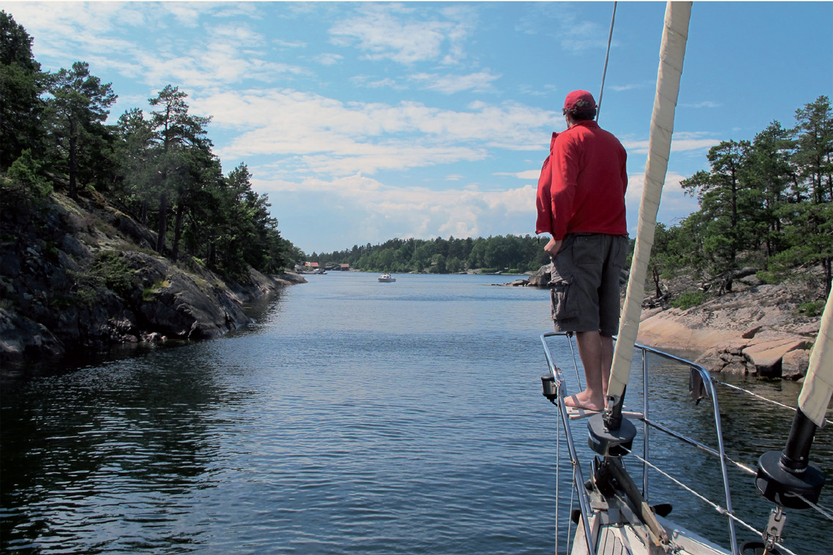
 Even the most meticulous passage plan sometimes requires modification at sea in light of developments.
22 PASSAGE PLANNING
Passage planning is the vital ingredient for a successful cruise. Before I became a sailing instructor I had no idea that it existed as a separate subject. I just did it, and that was that. The result was that it took me many years to organise my ideas so that I remembered everything I needed to consider before setting forth. These days passage planning is a legal requirement, although just how far the authorities intend to pursue the matter is yet to be tested (2014).
Ill fortune will appear to dog the skipper of a yacht on a poorly planned passage. Fair tides will elude him at headlands, and he will be unlucky with his wind shifts; when the breeze dies, the fuel on board will prove infuriatingly inadequate for the task; while upon arrival, the yacht may spend the night rolling in an open anchorage after missing the tide on the marina sill by just 20 minutes.
Even the most meticulous passage plan sometimes requires modification at sea in light of developments.
A passage plan in an area you know well might consist of no more than a glance at the tide tables and a quick mental calculation about the mileage to be made good compared with the yacht’s probable speed over the ground. On a strange coast, preparing for a similar trip could take an hour or more, with detailed study of several charts, careful appraisal of the weather, considerations about what to do in the event of failure to arrive at a particular place before the tide turns foul, and so on.
It isn’t always easy to decide how much detail to plan for, but too much rigidity should always be avoided. We are navigating on a rolling road whose movements may prove uncertain. Even motor vessels frequently have to modify their plans to accommodate developments. The chances of a sailing boat being advantageously steered to her destination on some predetermined course, minute in its accuracy, are small indeed. For this reason, time used at the planning stage is better spent on familiarisation with broad topics such as tidal stream, and on unchangeable specifics like the latest time of arrival at a lock gate, than with working out exact courses to steer, which in reality may prove impossible or inconvenient. The measure of a seaman in this context is how easily he is able to look at the overall outline of a passage, decide what he needs to know at this stage, then extract that information from the available sources.
Because of the different types of source material, some aspects of a plan can be worked up at home weeks beforehand if that appeals to you, while others are best addressed ten minutes before slipping the mooring. The subjects to be considered must inevitably vary with the circumstances. Here are some of the more important headings that can come up for consideration.
 CHARTS AND OVERALL DISTANCES
The first requirement is a passage chart. Ideally, this will cover both the departure point and the destination. This chart will form the core of the plan, and it will be used to measure off the various distances so as to see whether the trip can be made in one tide, or two, or more, in the conditions you are expecting.
Once you’ve sorted out this basic information, you’ll need to decide if the passage chart contains all the detail required for safe navigation. Often, a larger scale chart will be essential at the beginning and end of the passage, but you should also pay attention to any areas en route which are of special navigational interest. Suppose, for example, your best course takes you close inshore at a headland where the passage chart shows the presence of off-lying rocks. You are then faced with a choice: either stay well outside the dangers, or invest the price of another round of mixed drinks on the necessary chart for close-in work.
| SKIPPER’S TIPS | Pilot books |
| A good yachtsman’s pilot is written by us for us and is worth its weight in marine-grade stainless steel. For solid detail of coastal and offshore features, currents, weather, everything else you can think of and more that you can’t, the Admiralty Pilots offer the world’s finest value. Check them not only for information on harbours at the beginning and end of the passage, but also for the passage notes they may contain. | |
ALTERNATIVE DESTINATIONS
The essence of cruising is flexibility. Most of us aren’t out there to wear the hair shirt, so any destination becomes more desirable if it offers workable alternatives on either side of it. If there is doubt about whether you will reach it before a strong tide turns foul, a second choice, either at a shorter distance or a few miles to leeward, could turn a demoralising six hours spent sailing on the spot into a satisfactory arrival and a good night’s rest. If it saves you a five-mile slug closehauled in a strengthening foul tide after failing to lay your original choice of port in one, you’ll be doubly delighted.
Conversely, when things are going better than you dared to hope, with the yacht rollicking along in the sunshine, you may not want to stop at your official destination. A likely haven ten miles further on would offer the opportunity to extract full value from this rarest of days.
When your track runs in the vicinity of the coast, check for any ports of refuge if there is the slightest doubt about the weather. This does not have to be one of your viable alternatives, but you must ensure not only that it will offer berthing facilities, but that it can be entered safely with the wind in the direction you fear it may take. If you are in any doubt about this, consult your pilot book.
WAYPOINTS
If you are using GPS waypoints, now is the time to decide where they will be. When you’ve noted each one and punched them into the machine, ‘plot’ them into the chart a second time from the co-ordinates in the GPS in order to double-check them. Carelessly entered waypoints are a main source of GPS-induced shipwreck. Only a thorough inspection of the chart for an individual passage can determine where waypoints are going to be useful, but it sometimes pays to have one at your point of departure from the ‘pilotage mode’. You will certainly require a second at your destination. Others may be at headlands or offshore shoals along the general route.
Although waypoints are supposed to be positions of real navigational significance, it can be a kindness if you site a waypoint strategically to give the crew a psychological boost. It’s reassuring on a long, tedious trip if the skipper can say, ‘Things might look grisly, folks, but we’ll be at my “Point Misery” in another half hour. That’s two thirds of the distance, so it’ll be all downhill from there.’
WAYPOINT LISTS
Many natural ‘corners’ are defined by a buoy, a beacon or a light structure with their lat/ long positions given in the almanacs, cruising guides or published waypoint lists so that you can enter them directly. This can be valuable where pinpoint accuracy is desired, as it would be if you were using a waypoint in a pilotage plan too tight to plot with pencil and dividers, or to pick out a buoy from other blips on your interfaced radar screen.
Such precision is often irrelevant, however. In circumstances other than those above, I rarely take up the offer of listed mid-passage waypoints because it suits me to make my turns some distance from the charted spot. Steering directly towards an abstract position that serves your particular purposes on the day is simple. Trying to end up some chosen distance adrift from a waypoint predetermined by somebody else can be more tricky. Even an arrival waypoint is sometimes more effective if it is a mile uptide of the breakwater. You can always adjust matters later when you know you’re going to make it.
A further reason for plotting your own waypoint positions is that there is always the off-chance the book will get it wrong. While almanac compilers are among the most painstaking people on the planet, I know as the author of a successful pilot book that everyone can occasionally make an error. A notorious error printed in a favourite almanac for the Irish Sea one year could well have led to some classic navigational blunders. You therefore owe it to yourself to double-check. Besides, taking this trouble helps to develop your lat/long plotting skills.
PASSAGE PLANNING WITH CHART PLOTTERS
One problem that has become associated with chart plotters as a primary navigation tool is that in many cases they are far from ideal for passage planning. A PC with a good-sized screen running raster charts can work adequately because the charts show all they have to give. This means what you see is what you get. If an overview is required, as it always is for planning, zooming out delivers essentially what would be seen on the equivalent paper chart. The difficulty of zooming and panning a vector chart is that data appears and disappears at the behest of whoever arranged the software. Quite probably this person was not a cartographer of the calibre of those who draw Admiralty paper charts and their raster partners. Important features may therefore be missed at the planning stage, unless every inch of the route is zoomed in as far as it can go. This is rarely realistic. Indeed, it is often totally impractical because one would also be obliged to check what is happening on either side of the rhumb line. And how far out does one look? When planning with a vector plotter, therefore, it is safer to use a paper chart as well.
Routes
All GPS receivers feature a system whereby the navigator can string a series of waypoints together, forming a planned route. As the yacht travels past one waypoint, the computer automatically gives a course and distance to the next, and so on until the destination is reached.
A route can be a real winner when a large number of course alterations follow within a comparatively short time. A classic example is through the rocks of the Chenal du Four on the north west corner of France. Tides are rampant in this 12-mile passage with its half-dozen minor but vital course alterations, and sudden fog is common. Given the usual 5 knots of current and a typical 6-knot boat speed, the buoys come up very quickly indeed, so a carefully organised route plan is a source of substantial stress relief, particularly if backed up in practice by radar.
Even if you use a chart plotter with electronic charts, it is better to enter your waypoints at the planning stage in harbour than to click them in at sea where you may be distracted. Choose them carefully and be sure they relate safely to each other.
WEATHER
Whether you are thinking of a two-week cruise plan or a six-hour passage, the secret of making the most of the weather is to be thoroughly informed, but not too rigid in your planning. One of the most genuinely recreational things about going to sea is the confrontation with an elemental force that nothing that can be done or said will ever alter. If you’ve planned a ten-day cruise with a family crew on a stretch of coast 150 miles distant that turns out on the day to lie full in the eye of an established wind, you’ll either have to forget it, or square up for a 48-hour dead beat, or worse. A modern yacht will generally get you there, but the price in terms of discomfort may be higher than you care to pay. It may be a different matter if you and your mates are out for a ‘rugby club cruise’. This can be a lot of fun but isn’t everyone’s cup of tea. If you aren’t engaged in yacht delivery, it is usually wiser to have various cruise plans up your sleeve, and to study the newspaper weather maps and the radio forecasts a week or more before sailing day to avoid ending up with a ferry ride home.
In the shorter term, make sure that you have noted any impending changes in wind strength and direction, and have paid special attention to any likely alterations in visibility. Fog on passage doesn’t have to be the end of the world, so long as you have paid due thought to it and planned accordingly. The rules of thumb for fog navigation with and without electronic assistance will be found in Chapter 26.
TIDAL STREAMS
After distance, this is the most important item in a passage plan. It is more beneficial to beat with a fair tide than to reach against a foul one, particularly in areas of abnormal tidal activity, such as tidal gates (Chapter 15). There are tidal gates on both sides of the Atlantic that will reduce the progress of a vessel making less than 7 knots to a crawl, while a yacht beating to windward will make no ground at all. It is therefore vital to hit gates when they are open. It can be useful to scribe light circles ‘one hour’ in radius centred on the gate, which cut the track drawn on the chart and show the latest times the yacht can be at these points if the gate is to be reached before it closes. These marks are of great interest in light going because they can help you decide when to crank up the engine if the latest time to slip through the gate is growing critical. If you can’t bring yourself to consider motoring on passage at any price, you’ll have to look out for suitable bays in which to kedge to await the next fair tide. Personally I can never understand this point of view from those who have an auxiliary engine. I’ve done my time without one, and now that I have a diesel I’m all for extracting any benefit I can from that drogue disguised as a propeller that my boat must drag kicking and screaming through every mile she sails.
Tidal stream atlases, or the relevant section in the almanac, should have ship’s time pencilled in on each relevant page so as to minimise time spent below. Periods at the chart table can also be axed if High Water at the standard port concerned is noted alongside the tidal diamond key on the passage chart.
If the passage runs across the tide, you will help yourself if you work up in advance the sum of the probable tidal effect in each direction for the initially assumed duration of the passage. Although this information may no longer be relevant by the time you make landfall, it will give you some basic data from which to shape a course after you have been able to ascertain your boat speed in practice.
| SKIPPER’S TIPS | Dangers |
| It’s well worth familiarising yourself with these before the passage begins, but there is no need to go to the extreme of writing down where they are. After all, you’ll see them on the chart as they approach, but if you’ve spent some time considering their implications, you’ll have been able to deal with items such as clearing bearings well in advance. This may save an unseemly scrabble round the chart table later on, when it’s heeled 20° and the pencils are flying. | |
TRAFFIC SEPARATION SCHEMES (TSS)
TSSs are the passage planner’s nightmare. We all know the rules, and swingeing fines await any delinquent caught disobeying them. Avoid heavy shipping concentrations altogether if you have the choice.
TIDAL HEIGHTS
Some harbours in northern Europe are only approachable at certain states of the tide. If your destination is one of these, calculate the times when this tidal ‘window’ will be open early on in the planning procedure, so that you can work back from there. As in the case of gates for tidal stream, one or two concentric ‘latest time’ rings on the passage chart often prove helpful.
Tidal heights above areas of shoal water may also be critical. If a tidal curve is available for the area concerned, fill it in as part of the passage plan. It can then be used for reference, enabling you to work out the height of tide in a few seconds whenever you may require it.
DAYLIGHT
The benefits of a dawn landfall are considerable. You can fix your position without ambiguity on the shore lights before the sun comes up. Then you have the whole day in which to work your way into harbour without the additional stress brought on by darkness. You also benefit from being under no end-of-day pressure to find the authorities before nightfall.
If you have to enter or leave a harbour during the night hours, moon light is a tremendous help, even if the Moon herself is behind the clouds. The approximate time of moonrise and moonset can be found in the almanac. Don’t worry if the detailed corrections leave you cold. In most cases, a general idea is all you’ll need.
FUEL
Nothing is more frustrating than six hours spent going backwards past a tidal gate because the wind has dropped and you haven’t enough fuel to motor. This dismal consummation always happens at 0300, leaving the watch on deck plenty of time to consider the implications of your omission. Most modern yachts have enough fuel capacity for a full 24 hours’ running, but you should make yourself aware of what your range is at the extreme, with a sizeable margin for safety. If motoring isn’t too traumatic on your boat, a calm spell sometimes gives you the chance to put a painless 100 miles to windward into the bag. It would be a shame to miss the opportunity because you’d decided not to bother filling up.
COURSES TO STEER
These should only be planned approximately, if indeed you consider the trouble worth taking at all. Whatever you pre-compute will probably be wrong if there is any tide or current, unless you are in a motor boat. If you have worked up a rough heading, however, you can use that, see what speed you make, then determine a proper course to steer using tidal data you have already prepared.
TACTICS AND STRATEGY
Intelligent anticipation of wind shifts is one of the most important features of planning a passage. This, combined with a creative appreciation of the lee-bow effect, use of the tidal stream to avoid running dead downwind, and a careful avoidance of arriving downwind of one’s destination is a mark of a mature, well-organised skipper. Tactics are not a particularly significant part of a motor yachtsman’s life; to the sailor they are, all in all (Chapter 21).
PILOTAGE PLAN
A plan for entering a strange harbour is essential if the pilotage promises to be of any complexity. There is often time to produce this on passage, but if you are prone to seasickness it is much better done before you set off. The question of whether or not you need a written pilotage plan, and what form it should take, seems still to be a personal one. It depends, among other things, upon how pictorial a memory you have. The matter is discussed in more detail in Chapter 23.
Sometimes piloting involves literally looking over the bow for the rocks in clear water.