
Crossing the northern Atlantic from west to east is generally considered to be more pleasant than heading westwards, due to the likelihood of favourable winds for most of the passage. There are a variety of possible routes from the United States or Canada to the United Kingdom and Europe. Most cruising yachts aim to cross via Bermuda and the Azores. Others make the passage direct, usually keeping north of Bermuda and the Azores and making maximum use of the North Atlantic Current.

Plan 72 Typical routes in the middle latitudes of the North Atlantic
The various routes are discussed as separate sections but there is considerable cross-over of information between all the routes.
In the middle latitudes, weather patterns are dominated by the prevailing westerly and south-westerly winds which are created by low pressure in the north and a relatively stable mid-Atlantic high pressure system to the south. This high pressure typically encompasses Bermuda and the Azores throughout the summer, but in some years may remain further south than usual, allowing the passage of depressions also to track unusually far south. Less frequently, associated cells of high pressure form and persist further north, giving light winds and calms over large areas of the North Atlantic for weeks at a time. Short-term weather over the entire area is dominated by the west-to-east passage of Atlantic depressions as they move from North America towards Europe over the top of the Azores High. These give rise to a repeating pattern of rapidly changing conditions. Winds veer and pressure drops as the depression approaches. South-westerly winds then establish for a time, accompanied by heavy rain as the warm front passes. A sudden wind shift into the north-west often accompanied by sharp, squally showers indicates the cold front coming through. These showers clear to give blue skies and good visibility. Such Atlantic depressions are usually less intense and move more slowly in the summer months, generating less powerful winds than during the winter. The chance of encountering a gale is always greater in northern latitudes than further south, but is everywhere much reduced between mid-May and mid-August. Hurricanes rarely track beyond 40°N 60°W, but the possibility should be borne in mind and it is always worth keeping an eye on their status and track. Unfortunately, visibility off the coasts of Canada and the northern United States is at its worst in the summer, and the iceberg limit is also at its greatest extent. However, these drawbacks are far outweighed by the almost certain promise of lighter winds.

Plan 73 Prevailing winds and currents in the North Atlantic for June. Based on information from The Atlantic Pilot Atlas
Best time
Mid April to mid May
Most cruising yachts leave the Caribbean in April or May in order to be well clear of the danger zone before the start of the hurricane season in June. Departure in good time also enables yachts to reach their next cruising ground on the North American or European coasts at the best time of year. The route to Bermuda usually involves waiting for favourable winds. Winds will gradually shift from northeast 20 knots to a more favourable easterly 15 to 20 knots during this period. They may even shift south of east as progress is made northwards, with a high probability of light variables or calms later in the passage, depending on the position of the Azores High. Some motoring may be required. The passage between the Virgin Islands and Bermuda traverses the western edge of the Sargasso Sea – technically, this is not a sea at all, but the static area around which the vast North Atlantic current systems sweep. Large carpets of brown Sargasso seaweed are likely to be encountered. A north-west going current of about 0.5 knots can be expected until within 100 miles of Bermuda, after which it will vary in both speed and direction.
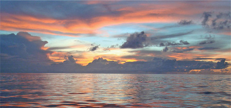
Calms are common on the route between the Caribbean and Bermuda. Photo David Ridout
Before departure, monitor the Atlantic storm tracks as low pressure areas leave the US coast. If sailing direct to the US, ensure that the storms are passing to the north of your planned route. Atlantic storms migrate north as the summer progresses.
The route lies within the hurricane belt, so aim to make a landfall before the end of June if possible. Winds in that month are likely to be south or south-westerly for much of the passage, although occasional cold fronts move eastwards off the American continent and bring strong west or northwest winds, often accompanied by driving rain. Particularly unpleasant or even dangerous seas will be produced where the wind runs against the Gulf Stream. Currents are likely to be variable until around 35°N where the full force of the Gulf Stream will be encountered. Between Bermuda and Newport this sets east or north-east at up to 1.5 knots. The width of the main stream varies from a mere 20 or 30 miles to 300 or more. The last 100 miles or so of the passage will be affected by the cold Labrador Current. The northern edge of the Gulf Stream, where it meets the cold Labrador Current flowing south-west, is typically marked by a wall of fog.
This should be another largely downwind passage, with south-easterly winds veering into the south and a 2.5- knot current following the trend of the coast. If sailing the rhumb line course in May or June there is an outside chance of encountering a hard blow, but a far greater likelihood of experiencing calms – particularly during the mid portion of the passage. Plenty of fuel should be carried. The alternative is to sail a dog-leg, shaping a course to a point near 28°N 37°W before swinging northwards, in order to avoid the edge of the central Atlantic high pressure system with its associated light winds and calms. If taking the direct route towards Beaufort, North Carolina, take into account the effects of the Gulf Stream.
The direct distance from the Virgin Islands to the Azores is about 2200 miles. The recommended route is 300 or 400 miles longer, shaping a course to pass within 200 to 300 miles of Bermuda before swinging north-eastwards. The direct, Great Circle, course passes through the large area of high pressure that dominates the central Atlantic where light and variable winds are almost guaranteed. It should only be attempted by yachts able to make good progress in very light winds or able to carry fuel for at least 1,000 miles. Even those taking the more traditional route are likely to encounter some calms and carrying plenty of fuel is advisable. In some years the passage may take a yacht with limited range under power as much as 35 days. When it is calm it is likely to be extremely hot. Water consumption will be noticeably greater than on previous passages and this should be allowed for.
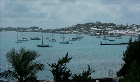
The anchorage in St George’s Harbour. The Customs House is behind the yachts on the right hand side. Photo: David Ridout
Best time
Early April to mid-May
Timing depends on your departure point from the East Coast. Storm tracks have begun to move further north by late March, reducing the possibility of northerly gales, and by leaving in May you are more likely to be clear of Bermuda before the onset of the hurricane season. The further north your departure point from the United States, the more likely the probability of head winds. At this time, south-west winds of 15 to 25 knots tend to alternate with stronger winds from the north or north-east. But there may be periods when the Azores High will establish its presence as far east as the North American coast bringing lighter easterly or south-east winds against which you can make progress. Strategies for departure usually involve waiting for favourable winds with no northerly component to cross the Gulf Stream, and then gaining easting as winds permit to approximately 68°W before turning south. The high pressure ridge at this time of year may be interrupted periodically by troughs or weak cold fronts permitting periods of sailing even along the ridge line.
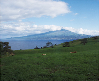
Looking across to Pico from Faial in the Azores. Photo: John Aldridge
Other times
Mid November to mid December
The traditional snowbird routes from the East Coast to the eastern Caribbean almost always involve waiting for weather. Winds and seas tend to be ramping up at this time of year. Cold fronts are becoming stronger and the gale tracks moving further south. Crossing the Gulf Stream is necessary from any point of departure and monitoring the location of the stream, eddies and forecast wind is essential. Strategies involve picking favourable conditions for crossing the Gulf Stream and a forecast for reasonably benign conditions to allow the vessel to get south of the North Atlantic gale track. Departures are risky at this time of year because of late season hurricanes and tropical depressions. Developing Atlantic storms are also frequent features.
The corridor between Bermuda and the US coast is a hurricane track, those later in the season tending to run further inshore than early-season hurricanes, which have a statistically greater chance of approaching Bermuda itself. The speed and track of hurricanes become more predictable as they develop and meteorologists are usually able to give accurate predictions for the US – Bermuda corridor. The peak of the hurricane season is usually between July to September. So, departure eastward from Bermuda should be made by mid-June, with close attention to weather forecasts.
On departure from the North American Coast, the Labrador Current will work in your favour, whereas the Gulf Stream will be working against you and it will pay to cross it as quickly as possible. Although the Routeing and Pilot Charts show the Gulf Stream in this area to run at 1 to 1.5 knots, it may eddy more strongly in some areas. When winds oppose the Gulf Stream, dangerous seas can be created. Avoid crossing the Gulf Stream in strong northerlies.
There are two choices regarding this passage. The first is to head north-east to around 39°N before turning due east for the Azores. Unless a major cell of high pressure has formed much further north than is usually the case, this should put you in the belt of the westerlies with a favourable current. The longer distance is offset by the likelihood of better winds, but there is an increased chance of gales which are common in these latitudes, particularly in May and June. Alternatively you can take a more southerly course. On this route the likelihood of calms is considerably greater and current will be much less predictable, but the chance of gales is correspondingly less. This route is likely to require long periods of motoring. The Azores are well known for the extensive calm that often surrounds them so, whichever route you choose, enough fuel should be kept in reserve to motor the last 100 or so miles.
This is a common choice for yachts leaving from the Chesapeake Bay or further north. From south of New York it should be possible to sail a Great Circle course, and enjoy favourable winds and currents most of the way. From further north the standard procedure is to head south-east to make a good offing and get clear of the Labrador Current with its attendant fogs. From around 40°N you can head direct for the Azores, though some skippers may prefer to continue a little further south (see the comments above). The first part of the passage will be within the hurricane zone, and it would be wise to be east of 55°W before mid-June.
It is often necessary to leave the Azores under engine, and if fuel is limited, the wind is most likely to be found more quickly by motoring due north. Even if leaving with a good wind, every opportunity should be taken to make northing until at least 45°N, aiming to cross it near 20°W. It may be necessary to work even further north before reaching the westerlies but, once you have found them, a direct course from this position should make the most of these favourable winds and the easterly-setting current, avoiding the southeast set towards Spain and Portugal. If at all possible, landfall should be made before the end of August. The coasts of northern Europe are notorious for the severe gales that often come through early in September.
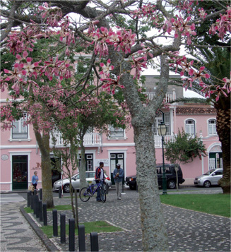
The abundance of colourful flowering plants and trees make the Azores a delightful landfall. Photo: John Aldridge
There is a good chance of this being a pleasant passage, with northerly winds and a south-going current, both of which are apt to be quite strong. As the chance of north-easterlies increases on closing the coast, it would be wise to keep well to windward of the intended destination, to avoid a last minute slog against both wind and current. If continuing direct to Gibraltar, beyond Cape St Vincent, the winds may be variable but the current will tend towards the Straits as there is a permanent surface flow into the Mediterranean caused by the high rate of evaporation from the Mediterranean basin. There are busy shipping lanes off the coasts of Spain and Portugal and through the Straits of Gibraltar. Be aware of the Traffic Separation Schemes. See Chapters 9 and 10 for more details.

Horta Marina can become very crowded at peak times. Photo: David Ridout
Any passage westward across the Atlantic in the higher latitudes involves a lot of windward sailing, adverse currents, fog, ice and a strong likelihood of frequent gales. On the other hand, a middle route via the Azores and Bermuda puts you into hurricane territory. Ideally, landfalls on the American coast south of 40°N should be made before the end of June. A possible alternative is the Viking Route (see Chapter 18).
Headwinds and an adverse current are inevitable for much of this passage. Yachts with a good range under power may consider motoring a course along the ridge of high pressure that normally lies between Bermuda and the Azores. Extensive calms and flat to glassy seas can be expected on this route, and it will be very hot. Timing and route planning for this passage are easier than they used to be due to better weather forecasting. Resist heading north of 38°N until south or south-east of your landfall to reduce the time spent in fog over the Grand Banks.
Weather in Bermuda is influenced by the position of the Azores high, the Gulf Stream, and the weather systems on the eastern seaboard of the United States. Bermuda is not in the trade wind belt. In June and July, when the majority of yachts pass through, an average of 15–20 knots from the south-west may be expected, though a sudden increase to 30 or 40 knots may accompany the passage of a frontal wave moving from the American coast. The islands lie well within the hurricane belt and passage-making yachts should endeavour to be out of the area by the end of June.
Temperatures vary from around 17°C (62°F) in February to 28°C (82°F) in August. Currents in the vicinity are unpredictable, though a northerly set is the most common. The islands lie within a few hundred miles of the eastern wall of the Gulf Stream, which frequently sets up large eddies, and though currents seldom exceed 0.5 knots, they may reverse direction within a matter of days.

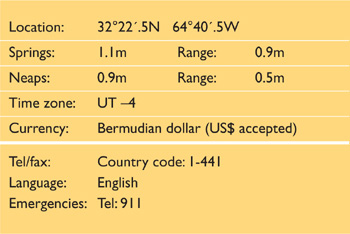
Mark Twain once famously declared ‘You can go to heaven if you want to, I’ll stay here in Bermuda.’ Bermuda was first sighted by the Spanish explorer Juan de Bermúdez in 1503. It was later the location of the shipwreck of Sir George Somers who, together with the entire crew, survived to colonise the island. It is Britain’s oldest colony and its culture is a mix of colonial heritage and African influences. It is self-governing and has its own currency, the Bermuda dollar. Its economy is closely linked to the American tourist trade, and the US dollar is interchangeable with the local currency.
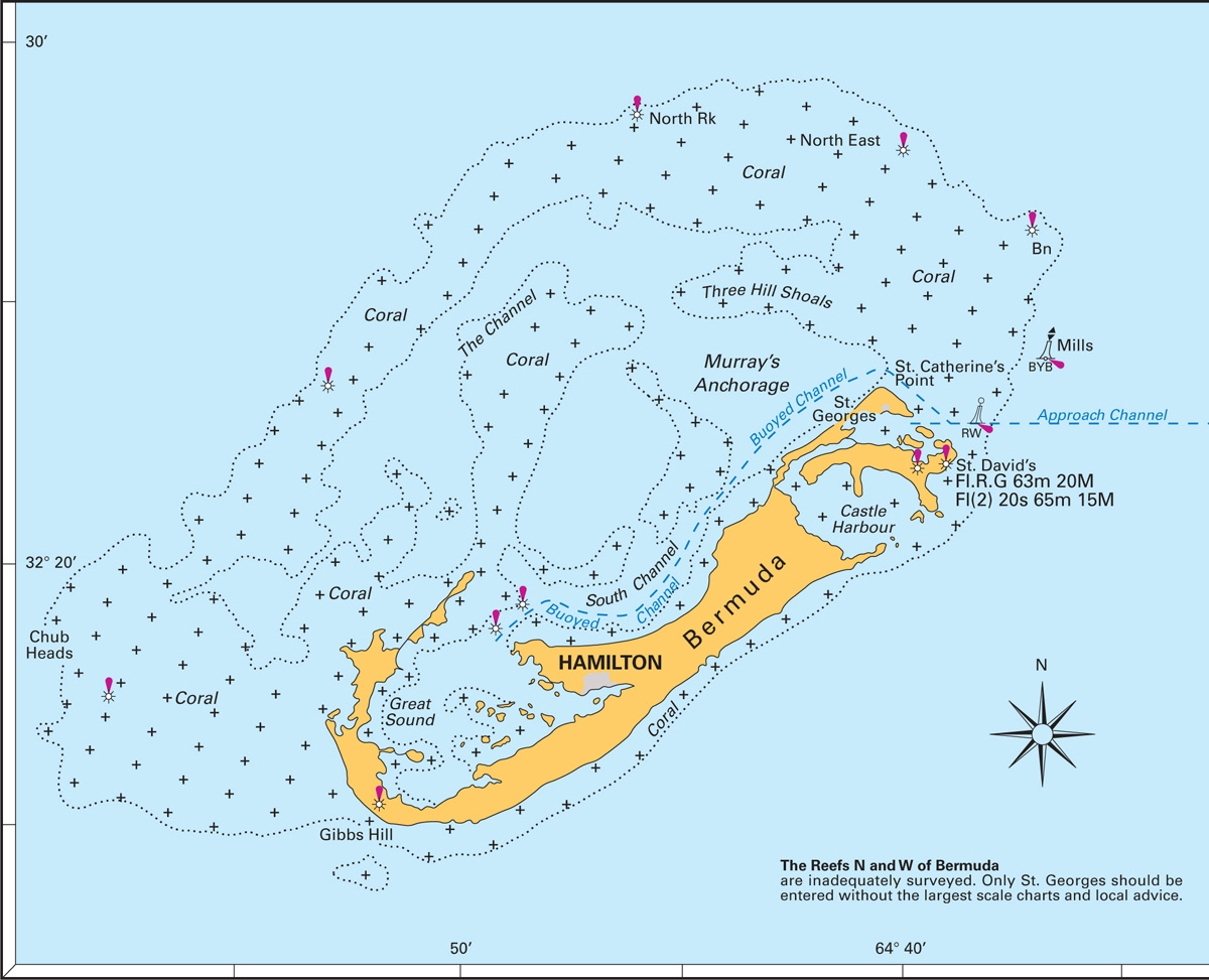
Plan 74 Bermuda
Bermuda entrance – Town Cut Channel looking west, on the approach to St George’s. Photo: David Ridout
The island actually consists of a low-lying group of around 180 small coral reefs and islets, the larger of which are linked by bridges or causeways. St George’s, the Port of Entry, is Bermuda’s second town, considerably smaller than the capital, Hamilton. But distances are such that travel is easy between the two. Bermuda is a sophisticated island with a range of shopping facilities. However, almost everything is imported, making food and other stores extremely expensive. Canned foods are available, but variety may be limited as great reliance locally is placed on chilled and frozen foods. For the yacht without refrigeration, this creates a problem, since chilling fruit or vegetables badly impairs their keeping properties. It may be possible by asking around to find some locally grown vegetables and locally laid eggs which have been neither washed nor chilled. All slipping and repair services are available though similarly costly.
There is some interesting cruising to be had around Bermuda, with many isolated and attractive anchorages, although most visiting yachts tend to stay in St George’s and explore overland. A 20-page information sheet for visiting yachts is published twice a year by the Bermuda Department of Tourism (PO Box HM 465, Hamilton HM BX, Bermuda). This gives detailed information on buoyage and navigation, clearance, facilities, and so on and will be sent free on request. Alternatively it is available on line at www.bermudatourism.com/pdf/2006yachts_info.pdf
On approach, take into account a local magnetic anomaly, which may increase the variation by up to 6°. Due to the reefs that extend up to 10 miles off the north-east, north and west coasts of Bermuda, the only safe approach is from the south or south-east of the group. Here the coast is very steep-to, with the 200m (650ft) sounding lying within one mile of the coastline in places. Yachts will be called by Bermuda Harbour Radio on VHF Channel 16 as they approach the islands. This station can often be received as far as 80 miles off. Channel 16 should be monitored throughout the approach to St George’s as the harbour will be closed during the movement of large cruise liners through the narrow cut at its entrance. St George’s harbour is situated at the extreme eastern end of the island and is approached via a well-buoyed channel, one branch of which leads north-west around the island towards Hamilton, and the other through the Town Cut Channel into the harbour. A red and white pillar buoy [Mo(A) 6s] 2.3 miles east of the island marks the entrance to the channel. The powerful St David’s Island light [F RG 63m 20M and Fl (2) 20s 65m 15M] lies about one mile to the south.
Arrival into St George’s is very straightforward and C-map accurate. Buoyage follows the IALA B system as used in the United States. Although the Town Cut is narrow, entry with a reliable engine is not difficult. If faced with beating in under sail, it might be wise to request a tow, which Bermuda Harbour Radio can arrange. In poor visibility, including heavy rain squalls, the Harbour Radio can monitor your progress on radar. The Town Cut and its approaches are generally well lit and a night approach in otherwise fair conditions should not present problems. Alternatively you can anchor off St David’s Head. Once through the cut, the harbour opens out. If entering after dark, keep watch for anchored yachts, which may be unlit, and take care not to stray south out of the dredged channel.
The VHF range from Bermuda is around 60–80 miles. Bermuda Maritime Operations Centre operates on VHF Channels 16 or 27, 2182 or 4125 kHz USB or Tel:441 297 1010, Fax: 441 297. All vessels must contact Bermuda Harbour Radio on VHF Channel 16 from 30 miles inwards and before entering the buoyed channel, with an ETA, when instructions about Immigration and berthing will be given.

Plan 75 St George’s, Bermuda
Bermuda Maritime Operations Centre (www.rccbermuda.bm/portal/server.pt) has a Yacht Pre-arrival Information Questionnaire which you should complete and return by Fax: 441 297 1530 or E-mail: dutyofficer@marops.bm
The Maritime Operations Centre acts as a combined Rescue Co-ordination Centre, Vessel Surveillance Centre and Coast Radio Station. The questionnaire enables them to respond more quickly and effectively in any emergency and also speeds up the entry procedures on arrival. If you have not completed the questionnaire there may be a lengthy process of questioning over the VHF as you approach the island.
Entry must be made at St George’s where you should go alongside the Customs dock at the eastern end of Ordnance Island. Out of hours you may be directed to anchor in Powder Hole anchorage to the north of Brooks Island. The Q flag should be flown when entering and until pratique has been granted, after which boats may proceed to Hamilton or elsewhere. Onward clearance prior to departure is also from St George’s.
Visitors are normally allowed to remain for an initial period of three weeks, but if a longer stay is desired, application must be made to the Department of Immigration. If any crew members are leaving or joining in Bermuda, the immigration authorities should be contacted well in advance, preferably several months ahead. Various forms must be completed without which it is unlikely that a single airline ticket to the island could be purchased. Firearms, including flare pistols and spear guns, must be declared and may be impounded until departure or placed under seal aboard. Medically prescribed drugs must also be declared. There are severe penalties for the possession of illegal drugs.
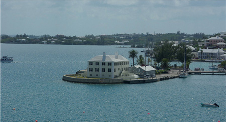
Bermuda Customs House dock on Ordnance Island. Photo: David Ridout
Further useful information can be found at www.bermudayachtservices.com/index_files/page0007.htm
The main yacht anchorage is north of the dredged channel and east of Ordnance Island in depths of 2–5m (7–17ft). Holding is good, but there are various old chains and other snags littering the bottom and a trip line may be advisable. Larger yachts will find greater depths in the southern part of the harbour, but it is a long dinghy ride ashore. Dinghies can be left at the steps inside Ordnance Island.
Bermuda Yacht Services provides a range of services for visiting yachts including marina berths. They manage the dockside moorings around St George’s. Berthing alongside a number of wharfs around the harbour is generally on a strictly ‘first come, first served’ basis. Some wharves are reserved for shipping and berthing a yacht on any of the commercial quays is prohibited.
Website: www.bermudayachtservices.com
Contact: Tel: 297 2798
E-mail: mark@bermudayachtservices.com
St George’s Dinghy & Sports Club (32°22´45N, 64°40´05W) is a small marina which welcomes visiting yachts.
Website: www.stgdsc.bm
Contact: 24 Cut Road, St George’s GE03. Tel: 297 1612.
Captain Smokes’ Marina is a small marina in St George’s at Godet & Young Ltd on McCallans’ Wharf.
Contact: Tel: 297 1940 Fax: 297 1813
E-mail: voatley@northrock.bm
There are various other marinas and yacht facilities around the island including haul-out yards and repair facilities.
There are regular buses to Hamilton, Ireland Island at the west end of Bermuda, and elsewhere. Daily air services fly to the United States, Canada and Europe.
The Azores have sometimes been regarded simply as a convenient place to break the Atlantic passage. But the islands are a pleasant and interesting cruising ground which warrants at least two or three weeks planned into your cruising schedule. Some yachts returning from an Atlantic circuit maintain that their stay in the Azores was the absolute highlight of all the island groups. Recent and ongoing harbour developments have increased the number of all-weather ports and there are also many less well-protected bays and harbours where a yacht can lie at anchor in settled conditions.
The nine islands lie in three distinct groups stretching over more than 300 miles of ocean, and show surprising diversity in terms of both landscape and populace. All the islands are of volcanic origin, and ancient caldeira craters are a common feature. Only Pico retains its original cone, with the dramatic 2,351m (7713ft) summit being visible at 50 or 60 miles in clear weather. The volcanic soil gives rise to a wonderful abundance of plants. Visitors frequently comment on the hedges of vivid blue hydrangeas and the electric blue of the morning glory, which is considered a serious weed on the islands because of the delight with which it rampages through the landscape.
The islands are a centre for whale-watching and there is an excellent whale museum on Pico which has a full-size sculpture model of the silhouette of the largest sperm whale ever caught in the Azores. There is also a viewing platform with an unobstructed view over waters where sperm whales come within a mile of the shore.
Food shopping has improved considerably in recent years, though many of the smaller towns still offer little more than the basics. Most islands have markets and the locally grown fruits and vegetables are excellent. Particularly good cheese is also produced, notably on Pico and São Jorge. A major re-stock can be achieved at Ponta Delgada, Horta, or Praia da Vitoria, where there are supermarkets and a full range of food shops.
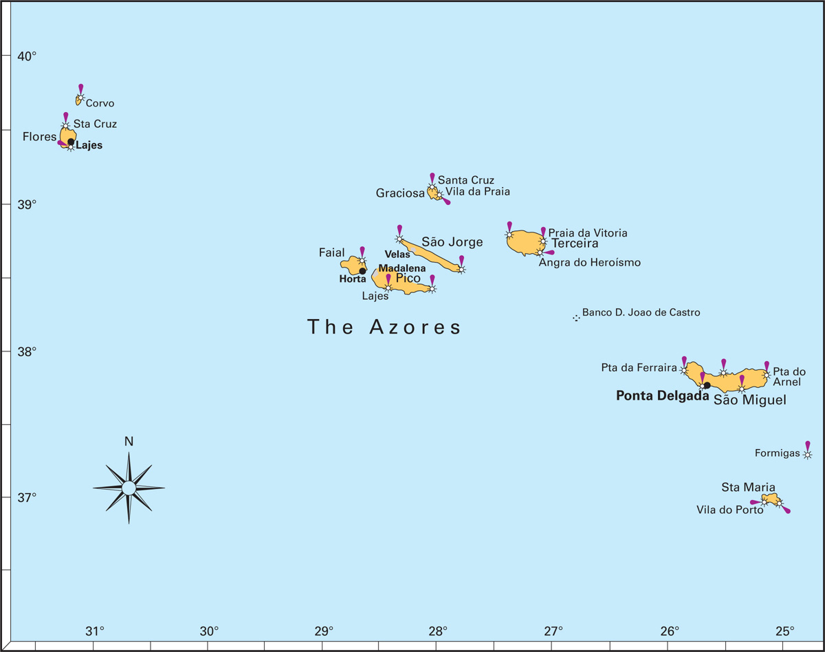
Plan 76 Ports in the Azores archipelago
Praia da Vitória outer harbour. Photo: David Ridout
Local festivals, such as the Sanjoaninas festivities at Angra de Heroísmo in Terceira during the third week of June, can lead to serious congestion in marinas and anchorages. If planning to attend it is wise to arrive early if possible. No Azorean marinas accept advance reservations.
Most Azorean marinas are the responsibility of Portos dos Açores SA. Their website (see below) carries news about the latest harbour developments as well as prices, a directory of facilities and some good photos. The marina at Praia da Vitória (Terceira) belongs to the local Câmara Municipal (town or city council).
During the sailing season, effectively from June until mid-September, the climate is dominated by the Azores High. In most years this becomes strongly established, resulting in prolonged periods of light winds or calms, but sometimes the High remains weak so that windier, more changeable weather predominates as it does during other seasons. There is some evidence that global warming may be causing more changeable and windy weather during the summer months. Winds between south-west and north are the most common throughout the year, but almost every other direction is likely to be experienced at some time. As in Atlantic Europe, south-easterly winds usually foretell an approaching front. There is a six per cent likelihood of calms between June and August, decreasing to four per cent in September.
Summer temperatures typically rise to around 23°C, though heat-waves can occasionally produce a sizzling 30°C for days at a time. However, nights can feel chilly, particularly to those who have spent the previous months in the tropics. Visibility is generally good, though southerly winds may produce hazy conditions that limit the field of view to five miles or so while still apparently giving a sharp horizon. This is particularly common around the western islands of Flores and Corvo, and can be most misleading.
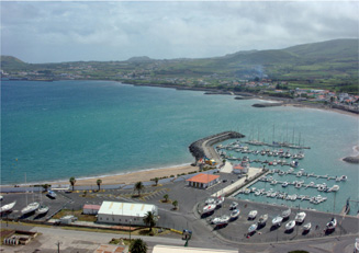
Praia da Vitória Marina. Photo: David Ridout
Ocean swell can be a factor when picking an anchorage, as it frequently runs in from the west even when winds are light. The most protected harbours are usually on the east or south of each island.
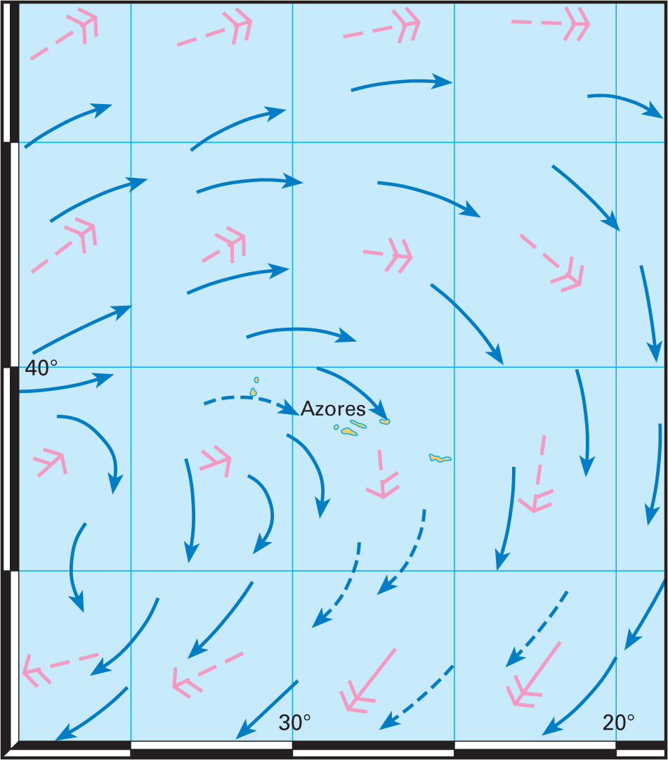
Plan 77 Prevailing winds and currents around the Azores for July. Based on information from The Atlantic Pilot Atlas
The Azores are affected by the branch of the North Atlantic Current which sets south-east towards the Iberian coast and later becomes the Canary Current. Flow in open waters seldom exceeds half a knot, but this may double around the ends of the larger islands and, when ocean and tidal currents combine, races may form. Tidal range is relatively small throughout the Azores and nowhere exceeds 1.8m (6ft). However, streams can run with surprising speed and may reach two knots in the Canal do Faial between Faial and Pico. Tides set north or north-east on the flood, south or south-west on the ebb.
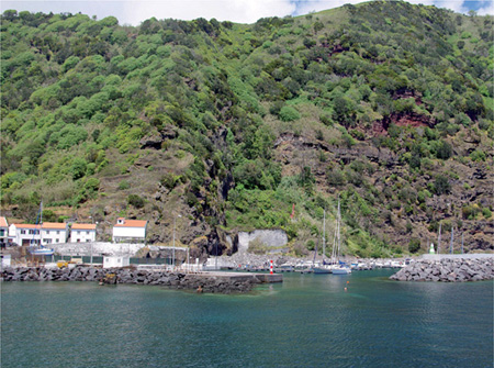
Entrance to the little harbour at São Jorges. Photo: David Ridout
Approach to the Azores is straightforward, and neither Flores nor Faial, the two most popular landfall islands for transatlantic yachts, have any serious outlying hazards. The usual course is to skirt their southern coasts, and if approaching Faial in darkness it should be noted that the Vale Formoso lighthouse at its western end is widely regarded as being considerably less powerful than stated, with a range of nearer five miles than the claimed 13 miles. Yachts approaching from Europe often make landfall on São Miguel which again is steep-to. Buoyage follows the European IALA A system, which is opposite to that found in North America and the Caribbean.
All yachts spending more than 183 days in Portuguese waters, including the Azores, are liable for a ‘long-stay’ tax. The tax is calculated using a formula based on displacement in metric tonnes, engine capacity and age. Non-payment can, in theory, lead to a fine of around 150 euros, though the tax is often poorly publicised. A certificate and receipt are issued on payment, valid for one year from the date of arrival in Portuguese waters.

As its name suggests, Flores is an island of flowers. Its steep terraces fringed with hydrangeas leave a lasting impression. It is the most westerly island in the Azores and is often the favoured landfall for yachts which have taken one of the more northerly routes across the Atlantic in the mid-latitudes.
Stretch your sea legs and explore the lakes and waterfalls on the island. Santa Cruz is the main town on the island and has a modest range of facilities including an airport and hospital. The Festival of San Joao is celebrated in Santa Cruz during the last week of June and the Festa do Emigrante is celebrated in Lajes in the middle of July. There are plans for a marina development within Lajes harbour and construction work is under way. A new slipway has already been completed. The current guess as to when the whole project will be completed is sometime during the summer of 2011.

Plan 78 Lajes Harbour, Flores, Azores
The approach is relatively straightforward, although it would be preferable to arrive in daylight. Remaining at least one mile off shore until closing the harbour entrance should keep you clear of any hazards. When approaching round the south of the island, beware the breaking rocks half a mile south of Ponta da Rocha Alta. Keep a 50m (164ft) clearance around the end of the harbour breakwater which has underwater boulders extending around it. While construction of the new marina is continuing it would be wise to enter the harbour itself with some caution. The harbour entrance is marked by a white post and light [Fl(2)R10s 9m 2M]. The light may not be working.

Flores harbour showing the marina development inside the inner breakwater, November 2009. Photo: APTO SA
VHF Channel 16 and 23.
Fly the Q flag on arrival. The Portuguese courtesy flag should also be flown, and many visiting yachtsmen like to hoist the blue, white and gold Azorean flag beneath it. Although Santa Cruz is the official Port of Entry for the island, port officials visit Porto das Lajes several times a day to check-in any visiting yachts. They may alert you to their presence by beeping their horn or flashing their lights. Formalities are usually carried out on the quayside by the Guarda Nacional Republicana (GNR), Policia Maritima and an Immigration officer but you may need to go and find the officials in their offices in town. The maritime police are next to the library.
Until the new marina is completed there is likely only to be limited space to moor alongside at the quay, and quayside mooring is only permitted when a ship is not expected. There is a 40-tonne static crane on the quayside, although if you need to haul-out you may be better doing it at one of the main facilities on Horta, Terceira or São Miguel.
On completion, the new marina will have a fully serviced pontoon with space for 10 yachts over 10m (30ft). There will be further pontoon space for 66 smaller vessels and marina offices and facilities on the quay.
Clube Naval das Lajes das Flores is the local Yacht Club which welcomes visiting yachtsmen. Tel: 292 592 542.
Anchorage inside the harbour is sheltered and usually quite comfortable, although the harbour is sometimes susceptible to swell working its way around the island. Anchor in 5–12m (17–40ft) on sand, gravel and rock. The area for anchoring is likely to be affected to some extent by the marina construction. In previous years, dinghies have been tied up to the wharf steps by the boat ramp closest to town.
A ferry service linking Flores to the other islands runs once a week during the summer months. Limited flights are available from the airport.
There is a hospital in Santa Cruz. Ask locally for medical services.

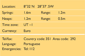
Horta is the only town of any size on Faial, with a history reaching back to the mid-15th century. The harbour is probably the best in the islands and has been a favourite with sailors since Joshua Slocum visited in 1895 – he commented then on the friendliness and hospitality of the local people, and things have changed little since then. No visit to Horta would be complete without a drink in the famous Café Sport which has been run by the Azevedo family for three generations. Neither would it be wise to tempt the fates by neglecting to add a painting, or at least the yacht’s name, to the thousands that cover the harbour and marina walls. Many famous yachts feature here.
Work has started on a new north breakwater. On completion, the ferry and cruise terminals are to be moved to a new quay off Praia da Conceição, north of the town, allowing the southern part of the harbour to be further developed for yachts and fishing vessels. Berthing for superyachts – most of which currently lie alongside the commercial breakwater – will also be upgraded.
The Gruta das Torres (Grotto of the Towers), a few kilometres from Madalena, is now open for several hours each day and is well worth a visit. Check opening times at the tourist office in Horta, then ask directions or get a taxi once in Madalena.
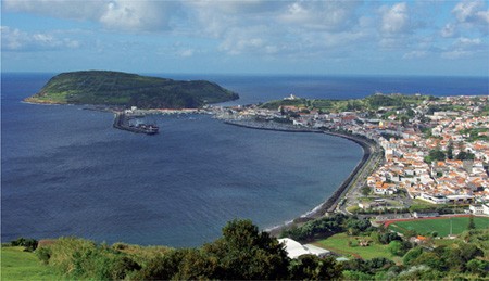
View over Horta harbour looking south. Photo: David Ridout
Horta lies near the south-east corner of the island, facing Pico across the Canal do Faial. The stated range of the light at Vale Formoso [LFl (2) 10s 113m 11M] near the western tip of the island is optimistic and may be nearer to five miles. The only other major light is at Pta da Ribeirinha [Fl (3) 20.5s 131m 12M] on the east coast north of Horta. Faial has few offlying dangers and the coast may safely be closed to within half a mile or so. If approaching from the southeast, the Baixa do Sul (7.0m (23ft) depths – also known as Chapman’s Rocks) should be avoided if any sea is running. Lights and buoyage follow the European IALA A system.
Plan 79 Horta, Faial, Azores
An experimental marine farm has been established in the Canal do Faial, centred on 38°32´.5N 28°33´.9W. Although 6m (20ft) below chart datum, vessels should give generous clearance both to it and to its associated (and apparently unlit) bright blue buoys.
If approaching from westwards, Horta harbour will not be seen until the last headland is rounded, when a course can be steered directly for the breakwater head which has good depths close in. However, avoid rounding it too tightly – the Pico ferry leaves at speed and tends to cut it fine. At night the breakwater light will probably be seen first, as the light of Boa Viagem tends to be overshadowed by town lights. The marina entrance is not lit. Visiting yachts should secure to the reception/fuel berth on the western side of the entrance until assigned a berth.
Coast Radio Station operates on VHF Channels 16, 24, 25, 26 (Autolink Channel 25, DSC Channel 70). Radionaval is now operational on DSC: MF MMSI 002040200. Harbour communications are on VHF Channel 10 and 16.
Fly the Q flag on arrival unless coming from another Azorean island. The Portuguese courtesy flag should also be flown, and many visiting yachtsmen like to hoist the blue, white and gold Azorean flag beneath it. The Azores are an autonomous region of Portugal and therefore part of the EU. In theory, this should mean fewer formalities for EU-registered yachts arriving from another EU country, but in practice this represents such a small percentage of total arrivals that it is likely all yachts will be expected to follow the same clearance procedures. It is necessary to visit the Policia Maritima and Alfandega (Customs), whose offices flank that of the berthing master on the reception quay. Report to the officers again before departure, taking the receipted marina bill.
Horta Marina is a busy but well-run marina with a good range of facilities. The majority of yachts are allotted finger pontoons, with the larger ones rafting up inside the mole. Fuel is available alongside. The boatyard has an 18-tonne travel lift; it is capable of rough but serviceable repairs to steel, aluminium and wood, but not so good for major GRP repairs.
Website: www.marinasazores.com (click on Horta Marina).
Contact: Marina da Horta, Cais de Santa Cruz, 9900-017
Horta. Tel: 391693 Mobile: 0936 6491292 Fax: 393986
E-mail: hortamarina@aptosa.com

Horta Habour looking north over the ferry berth. Photo: John Aldridge
Mid-Atlantic Yacht Services (MAYS) can be found opposite the root of the marina mole and provides a full range of services to visiting yachts.
Website: www.midatlanticyachtservices.com
Contact: Call ‘Mid Atlantic’ on VHF Channel 77
Tel: 391616 Fax: 391656 E-mail: mays@mail.telepac.pt
Anchoring in the harbour is allowed when the marina is full. There are some privately owned moorings.
There is a circular bus route around the island. The tourist office will supply a timetable on request. There are ferry services several times daily to Pico, and also to the other islands of the ‘central’ group – details are available from the tourist office. Daily flights go to Lisbon and the other islands. All United Kingdom flights are routed via Lisbon.
There is a hospital outside the town.

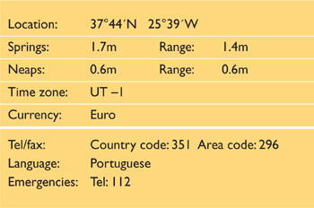

Plan 80 Ponta Delgada, São Miguel, Azores
Ponta Delgada is the largest town in the Azores, with the best shopping and provisioning in the group. It is a busy naval and commercial harbour and hosts visiting cruise ships. The island of São Miguel is outstandingly beautiful, with spectacular lakes and hot springs. Take the time to explore a little during your stay here. The new cruise ship terminal, Portas do Mar, and the adjacent marina formally opened in early July 2008, increasing marina berths in Ponta Delgada to 670 berths. Visiting yachts generally appear to be berthed in the new section. There have been problems with swell and wash entering the new marina even when the harbour appears calm, but a breakwater pontoon has now been positioned off its western edge, which will hopefully cure the problem. Ponta Delgada is the obvious jumping-off point for yachts bound for the Iberian peninsula.

Ponta Delgada, Azores: looking south across the marina to the main breakwater (note rubble extension to breakwater end). Photo: Nigel Wollen.
Much of São Miguel is high and often visible from many miles away. The coastline is largely steep-to, with few offlying dangers, but many of the headlands are fringed by rocks and all should be given at least 500m (0.25 miles) clearance. If approaching from the west, Baixa da Negra lies about 0.5 miles south of the Airport Control Tower [Aero AlFlWG 10s 83m W28M/G23M] and should be given a wide berth. The island is relatively well lit, with powerful lights at Pta da Ferraria [Fl (3) 20s 106m 27M] at its western end and Pta do Arnel [Fl 5s 66m 25M] to the east. Santa Clara [LFl 5s 26m 15M] marks the headland to the west of Ponta Delgada. Banco Dom João de Castro shoal is now said to be charted at 12m (39ft).
The final approach and entrance is straightforward. The end of the breakwater is marked by a 5m (16ft) white tower with red bands [Fl R 6s 17m10M]. The old marina mole is marked with a white round tower with green bands [Fl G 3s 13m10M]. The cruise ship terminal is marked by a red and white banded pillar at its east end [Fl(2) R 5s 3M], and a green and white banded pillar at its west end [Fl(3) G 15s 3m 3M]. The new floating breakwater pontoon is marked at its southern end by a south cardinal pillar [Q(6)Fl 15s 3M].
Rubble fringing the end of the old marina mole may be marked by some unlit, small, green conical buoys. The swimming area opposite the new marina area is cordoned off by a string of unlit, small red buoys.
Coast Radio Station operates on VHF Channels 16, 24, 25, 26 (Autolink Channel 23), The Maritime Rescue Coordination Centre: Tel: 281777 (Emergency), Tel: 205227 (Operations), Fax: 205239, E-mail: mrcc.delgada@mail.telepac.pt gives weather bulletins and navigational warnings on Channel 11 at 0830, 2000. The marina monitors VHF Channels 16 and 09.
The Azores are an autonomous region of Portugal and therefore part of the EU. In theory this should mean fewer formalities for EU-registered yachts arriving from another EU country, but in practice it is likely that all yachts will be expected to follow the same clearance procedures. Fly the Q flag on arrival unless coming from another Azorean island. The Portuguese courtesy flag should also be flown, and many visiting yachtsmen like to hoist the blue, white and gold Azorean flag beneath it. All but the largest yachts are required to go to the reception berth at the entrance to the old marina basin in order to visit the marina office, Customs and Immigration. The entrance to the old marina is considerably narrower than it was previously. All officials have offices in the marina area. The skipper should visit the Policia Maritima bearing ship’s papers, passports and insurance documents, and will be advised of the other officials to be seen. Report to the officers again before departure, taking the receipted marina bill.
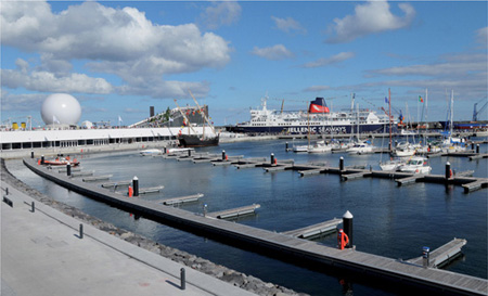
The new marina in Ponta Delgada in 2008. Photo: L M Correia
Anchoring anywhere inside the harbour is strictly prohibited. In the event of engine failure, contact the marina for assistance.
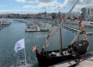
Opening celebrations for the new marina in Ponta Delgada in 2008. Photo: L M Correia
Marina de Ponta Delgada is a recently expanded marina with a good range of facilities including a 25-tonne travel lift. For information about the marina including a plan, prices and facilities go to www.marinasazores.com and click on Ponta Delgada.
Contact: Marina de Ponta Delgada, Av Infante D Henrique, Apartado 113, 9500 Ponta Delgada.
Tel: 281510 Fax: 281 311 E-mail: marinapdl@apsm.pt
All boatyard and repair facilities are to remain around the old marina, so skippers of yachts needing such services should ask to be berthed there if possible.
Clube Naval de Ponta Delgada (CNPD) is the yacht club situated next to the marina. It is very welcoming and helpful to visiting yachts.
Contact: Tel: 23005 Fax: 26383 E-mail: info@cnpdl.pt
There is a good bus network, obtain a timetable from the tourist office. Daily flights go to Lisbon and the other islands and there are international flights from Ponta Delgada to London Gatwick one or two days a week.
A hospital is situated near the harbour, plus there are several medical centres.