SEQUOIA AND KINGS CANYON IN-PARK LODGING
The Best of Sequoia and Kings Canyon
Plunging waterfalls, stark granite, alpine lakes, pristine meadows, giant sequoia trees, and raging rivers—you’ll find them all in the national parks of Yosemite, Sequoia, and Kings Canyon.
From Yosemite Valley’s famous waterfalls, which are among the tallest in the world, to the towering granite domes and glistening meadows of Tioga Pass, Yosemite is a place that can only be described in superlatives. At 1,169 square miles and 750,000 acres, the park is nearly the size of Rhode Island and is one of the most popular national parks in the United States, visited by about 4 million people each year.
Set aside as a national park in 1890, Yosemite is a place that is synonymous with scenery. The seven-mile-long Yosemite Valley, with its 3,000-foot granite walls and leaping waterfalls, is known the world over as an incomparable natural wonder. It is estimated that more than half of the park’s visitors see only Yosemite Valley when they travel to Yosemite, even though the Valley makes up less than 1 percent of the park.
Beyond the Valley lies the pristine high country of Tioga Pass Road and Tuolumne Meadows’ subalpine expanse, bordered by precipitous mountain summits and granite domes. To the northwest lies Hetch Hetchy, a reservoir in a valley considered a twin of Yosemite Valley. To the south is Glacier Point with its picture-postcard vistas, and the marvels of the Mariposa Grove of Giant Sequoias—the largest living trees on earth.
Just 75 miles south of Yosemite are two national parks that hold the greatest concentration of these botanical wonders—but with about half the visitors. Sequoia and Kings Canyon National Parks harbor more than 50 of the 75 world’s remaining groves of giant sequoias. Adjacent to the national parks are the lands of Giant Sequoia National Monument, which are managed by the U.S. Forest Service. This distinction is inconsequential to most visitors: Park roads such as the winding Kings Canyon Scenic Byway and the epic Generals Highway cross park and forest boundaries, and the lovely Sierra scenery knows no boundaries.
The majority of park visitors spend their time in Yosemite Valley. This is where most of the park’s lodgings and restaurants are located, where most guided tours take place, and where a wealth of organized activities happen daily: ranger walks, biking, art classes, photography seminars, and more. The Valley is also a geologic marvel: Yosemite’s world-famous waterfalls drop from the valley rim. El Capitan, the largest single piece of granite rock on earth, and Half Dome, one of the most photographed landmarks in the West, are both located here.
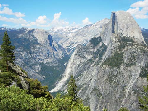
In southern Yosemite, near the hamlet of Wawona, are two of Yosemite’s premier attractions: the Mariposa Grove of Giant Sequoias and Glacier Point. The Mariposa Grove boasts several hundred giant trees. Glacier Point is a drive-to overlook that offers one of the best views in the West, encompassing all the major granite landmarks of Yosemite Valley and the surrounding high country. History lovers will enjoy Wawona, with its historic buildings at the Pioneer Yosemite History Center and 19th-century Wawona Hotel.
The Tuolumne Meadows region is ideal for hikers and backpackers. At an elevation of 8,600 feet, Tuolumne Meadows is one of the park’s most photographed regions. Its wide, grassy expanse is bound by high granite domes and peaks. Trails lead to alpine lakes set below the spires of Cathedral Peak and Unicorn Peak, to roaring waterfalls on the Tuolumne River, and to the summits of lofty granite domes with commanding vistas of the high country. Visitor services are few and far between here, but hikers, campers, and nature lovers will be in their element.
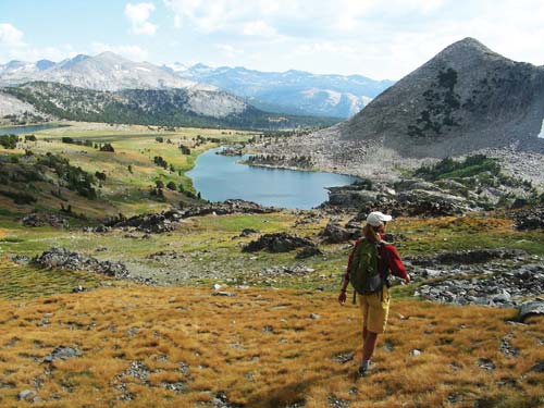
The Tioga Pass area offers hikers stellar High Sierra scenery.
Hetch Hetchy, a granite-walled valley similar in appearance to Yosemite Valley, was flooded in 1923 to create a water supply for San Francisco. Today it is the least visited region of the park and offers no visitor services. In the spring, Hetch Hetchy’s waterfalls spill over its massive cliffs. Wildflowers bloom April-June. Visitors make day trips here to admire the enormous O’Shaughnessy Dam or hike along the edges of its reservoir. Backpackers come to Hetch Hetchy for its access to Yosemite’s backcountry and its solitude.
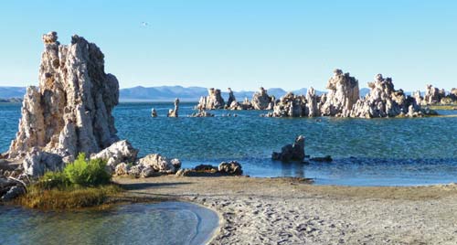
The Eastern Sierra is an outdoors lover’s playground: skiers and snowboarders swoosh down mountain slopes, hikers and mountain bikers explore miles of trails, anglers cast into crystal-clear streams and rivers, scenery enthusiasts and photographers enjoy alpine lakes backed by granite cliffs. The region hosts two good-sized mountain towns, Mammoth Lakes and June Lake, and worthwhile destinations such as Bodie State Historic Park, a historic gold rush ghost town, and Mono Lake, a 700,000-year-old saline lake.
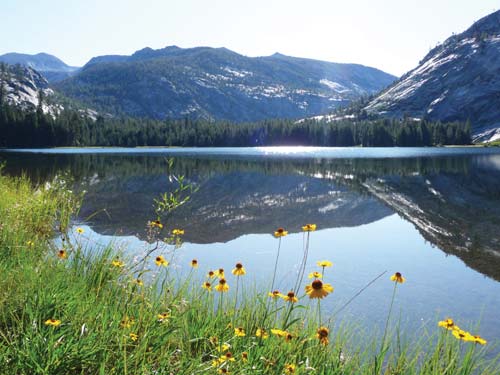
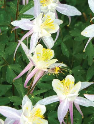
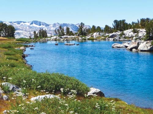
Summer wildflowers frame a granite lined lake.
South of Yosemite lie two less-visited national parks: Sequoia and Kings Canyon. Peppered with the greatest number of remaining giant sequoias—including the must-see General Grant and General Sherman—these parks offer fewer crowds, more backcountry wilderness, and granite peaks and deep canyons similar to its more famous neighbor.
Be prepared for crowds if you visit in the high season (May-Sept.). Summer weekends are the busiest days and are best avoided, especially in Yosemite Valley. But summer (June-Oct.) is when Yosemite’s high country—Glacier Point, Tuolumne Meadows, and Tioga Pass—is open and accessible, so you have the most options for hiking and sightseeing. In most years, all park roads and services are open by early June.
In Sequoia and Kings Canyon, summer temps have melted the High Sierra snows and all park facilities—including Crystal Cave—and roads are open.
Spring is a wonderful time for visiting Yosemite Valley, when its famous waterfalls are at their peak flow. First-time visitors would do well to time their initial Yosemite trip for April or May, when the Valley is at its most photogenic and the waterfalls are shimmering white-water cascades.

Vernal Fall
Autumn is also a fine time to visit Yosemite, even though most of the Valley’s famous waterfalls will have run dry. The show of fall colors on the valley floor and the chance for solitude in this well-loved park are worthy reasons to visit. Popular sites such as the Mariposa Grove are easy to visit without crowds.
Tioga Road usually closes on November 1 and doesn’t reopen until June. The road may also close for a day or two during late September and early October when brief, early-winter storms roll through.
Sequoia and Kings Canyon may still be snow-covered in April and May, though the Foothills region is warmer and more accessible. In fall, most park services begin to shorten their hours, through crowds are fewer.
Winter is the quietest season in Yosemite. The lowest visitation levels are recorded November-March, except for the holidays. Many Yosemite fans think these months are the best time of the year. Visitors can see Yosemite Valley or Wawona’s giant sequoias crowned in snow, ice-skate on an outdoor rink with Half Dome as a backdrop, and ski and snowboard at Badger Pass near Glacier Point. In winter, always carry chains for your car tires, even if you have a four-wheel-drive vehicle. Chains can be required on any park road at any time, and that’s federal law.
Glacier Point Road, Tioga Pass Road, and the Mariposa Grove Road may close as early as November 1.
In Kings Canyon, the Kings Canyon Scenic Byway closes in winter and services in Cedar Grove close for the season. Sections of Generals Highway may close for plowing; chains are required for all vehicles.

The view from Olmsted Point wows drivers on Tioga Road.
The entrance fee at Yosemite ranges $25 (Jan.-March, Nov-Dec.) to $30 (Apr.-Oct.) per vehicle (car, RV, truck, etc.). The entrance fee at Sequoia, and Kings Canyon National Parks is $20 per vehicle (car, RV, truck, etc.). The fee is good for seven days, and you must show your receipt any time you pass through one of the park entrance stations. Other fee options include:
• Yosemite Pass ($60): Provides entrance to Yosemite for one year.
• Sequoia and Kings Canyon Pass ($30): Provides entrance to both parks for one year.
• Interagency Annual Pass ($80): Provides entrance to all national parks and federal recreation sites in the United States for one year.
• Senior Pass ($10): Lifetime version of the Interagency Pass for seniors 62 and older.
If you have your heart set on climbing Half Dome, you’ll need to secure a Half Dome permit up to one year in advance. Backpackers should also secure wilderness permits far in advance.
Yosemite National Park has five entrance stations:
• Arch Rock (Hwy. 140): the main entrance to the park; provides access to Yosemite Valley from the west (San Francisco, Sacramento)
• Big Oak Flat (Hwy. 120): provides access to Yosemite Valley and Tuolumne Meadows (summer only) from the north (San Francisco, Sacramento)
• South (Hwy. 41): provides access to Wawona from the south (Fresno, LA)
• Tioga Pass (Hwy. 120): provides access to Tuolumne Meadows and the Eastern Sierra in summer only
• Hetch Hetchy: the only access to the Hetch Hetchy region of the park
Sequoia and Kings Canyon have two main entrance stations:
• Big Stump (Hwy. 180): provides access to Kings Canyon from the north
• Ash Mountain/Foothills (Hwy. 198): provides access to Sequoia National Park from the south
Show up without a lodging or camping reservation during the busy season (May-Sept.), or during the winter holidays, and you could face an ordeal.
• For Yosemite accommodations and organized activities: DNC Parks and Resorts at Yosemite (801/559-4884 or 801/559-5000, www.yosemitepark.com)
• For Yosemite campground reservations: reservations office (877/444-6777, www.recreation.gov)
• For Sequoia and Kings Canyon accommodations: DNC Parks and Resorts at Sequoia (866/807-3598, www.visitsequoia.com)
• For Sequoia and Kings Canyon campground reservations: reservations office (877/444-6777, www.recreation.gov)
The largest of Yosemite’s visitors centers is the Valley Visitor Center (shuttle stop 5, 209/372-0298, 9am-5pm in summer, bookstore open until 7pm), located in Yosemite Valley. Park in the main day-use lot in Yosemite Village.
The following first-come, first-served Yosemite campgrounds are your best bets for snagging a last-minute site. Try to arrive before noon on weekdays and by midmorning on weekends, especially in summer.
• Camp 4 (Yosemite Valley): 35 sites; open year-round.
• Tamarack Flat (Tioga Rd.): 52 sites; late May-mid-Oct.
• Yosemite Creek (Tioga Rd.): 74 sites; late June-mid-Sept.
• Tuolumne Meadows (Tioga Rd.): 304 sites; June-late Sept.
• Bridalveil Creek (Glacier Point Rd.): 110 sites; July-early Sept.
• Porcupine Flat (Tioga Rd.): 52 sites; July-Oct.
• Hodgdon Meadows (Big Oak Flat entrance): 105 sites; first-come, first-served Oct.-Apr. only
• Wawona Campground (Wawona): 93 sites; first-come, first-served Oct.-Apr. only
Most of the campgrounds in Sequoia and Kings Canyon National Parks and their surrounding parklands are first-come, first-served.
The free Yosemite Valley Shuttle (7am-10pm daily in summer, shorter winter hours) transports visitors around the valley floor year-round. Other free, seasonal park shuttles include:
• Wawona-Mariposa Grove Shuttle (spring-fall)
• Wawona-Yosemite Valley Shuttle (Memorial Day-Labor Day)
• Badger Pass (twice daily from Yosemite Valley, mid-Dec.-Mar.)
• Tuolumne Meadows Shuttle (between Tioga Pass and Olmsted Point, mid-July-early Sept.)
Sequoia National Park operates a free shuttle bus system (9am-6pm daily) from late May through September 1.
Weather, rockfalls, fire, and other natural occurrences can affect driving routes and lodging options. No matter when you go, it’s unwise to travel at any time of year without checking on current conditions: Yosemite (209/372-0200), Sequoia and Kings Canyon (559/565-334).
Take a ride on an open-air tram through Yosemite Valley. The two-hour Valley Floor Tour is educational, interesting, and fun, and you can feel good about not driving your own car. Buy tickets and start the tour at Yosemite Lodge at the Falls in Yosemite Valley. In the busy summer months, it is best to show up right after breakfast to see if you can get tickets for that day.
Afterward, rent bikes at Yosemite Lodge or Curry Village and cruise around Yosemite Valley on its 12 miles of paved bike paths. The Valley’s bike paths are so flat that the rental bikes don’t even have gears—you spend much of your time coasting. Make reservations in advance to spend the evening at the park’s Glacier Point Stargazing Tour. The tour bus leaves Yosemite Valley around 5:30pm and arrives at Glacier Point before darkness falls, so you have a chance to take in the spectacular view. After dark, enjoy a one-hour astronomy program before being chauffeured back down to the Valley.
No visit to Yosemite is complete without hitting at least one trail. Shuttle stop 6 drops you at the short, 0.25-mile trail to Lower Yosemite Fall; the falls roar in spring, but are nonexistent by midsummer. The Mist Trail to Vernal Fall won’t disappoint, though. The three-mile round-trip hike ascends a granite staircase to the top of Vernal Fall. If you want more, keep going to the top of Nevada Fall for a 7-mile round-trip hike.
In the heat of summer, head for one of Yosemite’s great swimming holes. Relax in the soft sand alongside the Merced River at Sentinel Beach or Cathedral Rock picnic areas and gaze at Yosemite Valley’s spectacular scenery. At day’s end, head over to the Ahwahnee Bar—unlike the restaurant, there’s no dress code here.

Yosemite Falls tumbles to the valley floor.
Take a drive or ride the tour bus to Glacier Point. This is world-class Sierra scenery that you’d expect to have to backpack for several days to find, but it’s completely accessible by car. Order an ice cream at the Glacier Point snack stand while you gaze at the view of Half Dome, Vernal and Nevada Falls, and the crest of Yosemite’s high country. If you start in the morning, you can ride the bus to Glacier Point and then hike back to the Valley via the Panorama Trail. Shorter hikes from Glacier Point Road lead to spectacular viewpoints at Sentinel Dome and Taft Point.
At the end of the day, head back to Yosemite Valley and attend the evening program at the Yosemite Valley Theater or Yosemite Lodge’s amphitheater.
Visit the Mariposa Grove of Giant Sequoias in Wawona, the south part of the park. Some of the best and biggest giant trees are near the parking lot, so you won’t have to walk more than a few hundred feet to get a look at them. If you want to see more, hike the entire 6-mile loop through the grove, or ride the open-air tram one-way, then disembark and walk back downhill. Afterward, stop by the historic Wawona Hotel for some refreshing libations.
Make reservations in advance for a one-way ticket on the morning tour bus from Yosemite Lodge at the Falls to Glacier Point. After the bus drops you off, hike the Panorama Trail and Mist Trail back down to Yosemite Valley. The 8.5-mile one-way hike is mostly downhill, but it’s not easy. Your knees will get a workout with 3,200 feet of descent along the way, plus one uphill stretch that gains 760 feet over 1.5 miles. The scenery makes it all worthwhile. You’ll hike past three major waterfalls—Illilouette, Nevada, and Vernal—and walk through miles of postcard-quality Sierra scenery.
Head up to Tuolumne Meadows and take the classic high-country hike to Cathedral Lakes. This 7.4-mile round-trip has a 1,000-foot elevation gain on the way to two glacial cirque lakes, which are set below 10,840-foot Cathedral Peak. Don’t forget your camera to capture the beauty of Yosemite’s high country.
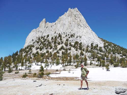
Cathedral Lakes lie in the shadow of lofty Cathedral Peak.
You will need to have secured a permit in advance for this hike. Start as early in the morning as you can because you have 17 miles and a whopping 4,800 feet of elevation gain ahead of you. Start at Happy Isles and proceed up the Mist Trail past Vernal and Nevada Falls. Above Nevada Fall, take the left fork for Half Dome. The trail is relatively easy from here (you’ve completed about half of the ascent already) until you reach the infamous steel cables that run up the back of the dome. It takes two hands and two feet to haul yourself up the cables, ascending 440 feet of nearly vertical granite. On top, you can bask in your accomplishment while taking in the commanding view.
Glacier Point Road offers a smorgasbord of short, rewarding hikes. Start with the trails to Sentinel Dome and Taft Point, both 2.2-mile round-trips that begin at a trailhead one mile before the end of the road. Then, if you still feel energetic, hike to McGurk Meadow. It’s only 1 mile to the pristine meadow, so you might as well continue another 2.5 miles to Dewey Point, a fantastic viewpoint that overlooks Yosemite Valley.
The summit of Clouds Rest beckons vista lovers. It’s 1,000 feet higher than Half Dome, with an even better view looking down into Yosemite Valley. The hike is 14 miles round-trip from the Sunrise Lakes Trailhead on Tioga Pass Road. Good news—the total elevation gain is only 2,300 feet, so it’s much easier than Half Dome. The final summit ascent travels along a series of granite “pancakes.” Be sure to stop at Sunrise Lakes for a swim on your way back to the trailhead.
North Dome is Half Dome’s neighbor, right across Tenaya Canyon. This nine-mile round-trip leads to sublime views, with the best possible perspective on Half Dome of any summit in the park, plus a chance to visit Indian Rock, the only granite arch in Yosemite.

the summit of Clouds Rest
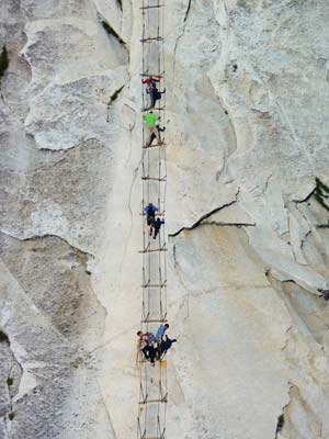
climbing the Half Dome cables
The 13,053-foot summit of Mount Dana can be reached with a rather brutal ascent that gains 3,100 feet over a mere three miles. Start at the Tioga Pass entrance station and hike southeast on the trail. You’ll climb all the way to the Dana Plateau at 11,600 feet, a good rest stop. Another mile and 1,500 feet of elevation gain await, but the hard work is completely worth it. Your reward is one of the finest views in the Sierra, encompassing Mono Lake, Ellery and Saddlebag Lakes, Tuolumne Meadows, and an untold wealth of high peaks.
People come from all over the world to get a negative-ion fix from the plentiful waterfalls in Yosemite National Park. But there’s a catch: Show up in mid- to late summer and your waterfall fantasies may be all dried up. Waterfall aficionados should time their Yosemite visit for April, May, or June, the months during which 75 percent of the high country’s snowmelt occurs, producing powerful cascades of water. Start with Yosemite Valley’s waterfalls, which are easily seen by walking, driving your car, riding the free Yosemite Valley shuttle bus, riding a bike, or any combination of the above.
Bridalveil Fall in its 620 feet of cascading glory is an obvious must-see, but don’t miss some of the lesser-known falls nearby. At the overlook for Bridalveil Fall, turn directly around and you’ll see Ribbon Fall pouring off the north rim of the Valley. Also look for Sentinel Fall on the south canyon wall, roughly across from Yosemite Falls, just west of Sentinel Rock.
Lower Yosemite Fall is an easy walk, but waterfall lovers can’t leave Yosemite without a trip to the top of the highest waterfall in North America, 2,425-foot Upper Yosemite Fall. Start hiking at the trailhead behind Camp 4 and after 3.6 miles and 2,700 feet of elevation gain, you’re at a railed overlook that is perched alongside the brink of this behemoth.
Hike the Panorama Trail from Glacier Point down to Yosemite Valley (it’s an 8.5-mile one-way trek; you’ll need to catch the tour bus at Yosemite Lodge in the morning to deliver you to the trail’s start). Just two miles downhill from Glacier Point you’ll come to the lip of 370-foot Illilouette Fall. Keep going and an hour or so later you’ll reach the brink of Nevada Fall, then finally Vernal Fall. It is a dizzying experience to stand at the railing-lined overlooks on top of these two falls and stare down into the powerful plunge of white water below.
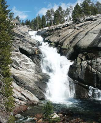
Chilnualna Falls
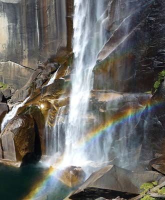
Vernal Fall
Behind Curry Village, Staircase Falls skips its way down the stair-step cliff below Glacier Point. If you have time, drive partway up Big Oak Flat Road toward Crane Flat, where Cascade Falls drops just west of the tunnels. Or visit Cascade Falls’ final drop to the valley floor near Cascades Picnic Area, 2.8 miles east of the Arch Rock entrance on Highway 140.
For waterfall fans who are unlucky enough to miss the prime falling-water season in Yosemite, there’s still hope. July and August park visitors can enjoy a waterfall-laden hike along the Tuolumne River that leads past four falls: Tuolumne, California, LeConte, and Waterwheel. The trailhead is on Tioga Pass Road near Lembert Dome and Soda Springs, and the trail is not usually accessible until July 1 each year due to snow and wet conditions. This epic hike is a whopping 16 miles round-trip, but with only 1,900 feet of elevation change. The good news is that you don’t have to hike the entire distance to enjoy some of the falls. The first one, Tuolumne Falls, is located only 4.5 miles from the trailhead.
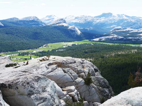
Tuolumne Meadows is bounded by high granite domes
Drive to the south part of the park to see a lesser-known waterfall. Hike the 8.0-mile round-trip trail to Chilnualna Falls, located near Wawona.
Head to Hetch Hetchy to see its spectacular free-leaping falls. Tueeulala and Wapama Falls can be seen via an easy-to-moderate 4.8-mile round-trip hike along the edge of Hetch Hetchy Reservoir. Park near the dam, walk across it, and then follow the trail through a tunnel and along the north edge of the reservoir. You’ll cross over the flow of both falls on a series of sturdy bridges.
Spend the night prior at one of the campgrounds or cabins near Grant Grove. In the morning, wake up and walk the short trail to Panoramic Point to watch the sunrise. After breakfast at the Grant Grove Restaurant, stop in at the Kings Canyon Visitor Center for maps and information.
From Grant Grove Village, drive one mile northwest on Highway 180 to the left turnoff for the General Grant Tree. Walk the 0.6-mile loop around the world’s second-largest tree and pay homage to the General and its many neighboring behemoths.
Return to Highway 180 and cruise east on the Kings Canyon Scenic Byway (road open May-Oct.), stopping at the roadside overlook at Junction View. Here you can peer down at the confluence of the Middle and South Forks of the Kings River and admire what geology has created in this magnificent canyon. Shortly past the Cedar Grove turnoff, stop and take a brief walk to Roaring River Falls, a snowmelt-fed cataract that drops through a narrow gorge into the South Fork Kings River.

Kings River
Continue to the trailhead for Zumwalt Meadow. Walk this scenic 1.8-mile loop alongside the Kings River, enjoying views of the Grand Sentinel and North Dome towering more than 3,500 feet above the valley floor. At Road’s End, take the short walk to Muir Rock, where you can sit by the river and watch the water roll by, or go for a quick dip.
Grab an early dinner at Cedar Grove Lodge and spend the night here or in one of the Cedar Grove campgrounds. Otherwise head back to Grant Grove before dark so you can enjoy this spectacular scenery all over again.
From Grant Grove, drive 1.5 miles west on Highway 180 and turn left onto the Generals Highway, heading south for Sequoia National Park. It’s a winding and scenic 26 miles (plan 45 minutes) to Lodgepole, where you can pick up maps and information. Along the way, stop off at Wuksachi Lodge, just north of Lodgepole, for breakfast or lunch in the forest-view dining room.
Once at Lodgepole Visitor Center, buy Crystal Cave tour tickets and grab some picnic supplies at the Lodgepole Center Market. Stretch your legs with a 3.6-mile round-trip hike to Tokopah Falls. You’ll have plenty of marmots for company on this forested trail through a U-shaped glacial valley.
Back on Generals Highway, continue south and park your car across the road from the Giant Forest Museum. Take a peek at the fascinating exhibits inside, then ride the shuttle bus to the General Sherman Tree. Get your picture taken at the largest tree on earth, then leave the crowds behind on the two-mile Congress Loop, which travels among hundreds of cinnamon-colored giant sequoias. Or if the shuttle bus is running along Crescent Meadow Road, ride it to the Moro Rock parking lot and climb the 390 stairs to the top of this 6,725-foot granite precipice.

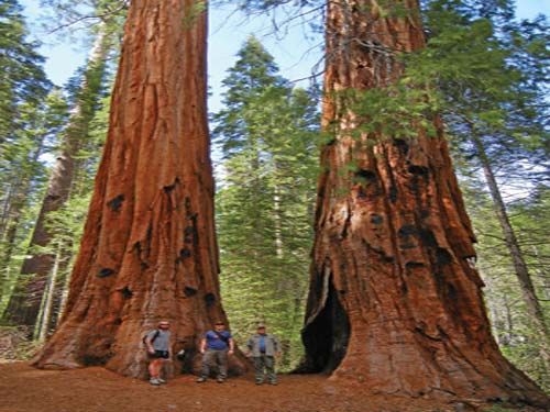
giant sequoias on the Congress Trail
The twisting, seven-mile road to Crystal Cave lies just south of Giant Forest off Generals Highway (look for the turnoff on the right). Plan to arrive prior to your scheduled tour time to make the 0.5-mile walk to the cave entrance. Formed of limestone that metamorphosed into marble, fascinating Crystal Cave lies hidden behind an impressive spiderweb gate. Beyond it, you can explore the secret underground world of Sequoia.
After the cave tour, return to Generals Highway and drive south for 8.5 miles along the road’s multiple twists and turns. Stop at Hospital Rock to picnic among the Native American pictographs. The Ash Mountain entrance lies a mere six miles west. Six more miles west on Highway 198 is the gateway town of Three Rivers, which offers overnight accommodations.
Alternatively, you could start your tour from the south, beginning at the Ash Mountain entrance. Continue north all the way to Kings Canyon, or simply stop at Lodgepole and explore from there.